We traveled a lot this winter, both near and far. The first, and most major, trip was an unforgettable journey over New Year’s to Antarctica, where we flew on a DC-3 to stand at the geographic South Pole at altitude 9,301 ft (2,835m). As part of this adventure, we also made stops in dynamic Doha, Qatar, and in South Africa at spectacular Kruger National Park and wonderful Cape Town.
In February, Jennifer made her first trip to Mexico where we spent a fabulous long weekend in Cabo San Lucas. Later that month, we caught U2’s groundbreaking show at the newly-completed Sphere in Las Vegas. We also made weekend trips closer to home to Point Ruston and Gig Harbor. And James took several business trips around the US, including to Houston, Minneapolis, and San Francisco.
Locally, we made a snowshoeing trip to Cabin Creek Sno-Park and attended our first movie premiere, for Boys in the Boat, distributed by Amazon MGM Studios. In between, we continue to enjoy our downtown lifestyle, particularly the many restaurants nearby and the ever-evolving view from our apartment to Elliott Bay and the downtown construction. We ended the winter with shiny new US passports, ready for our next ten years of travel.
Below are highlights from December 1, 2023 through Feb 26, 2024. Click any image for a larger view, or click the position to view the location on a map. And a map with our most recent log entries always is available at mvdirona.com/maps.
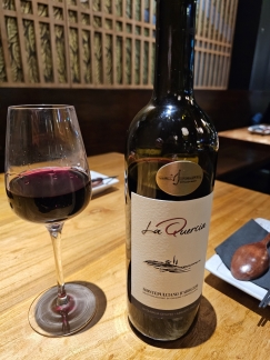 |
Shinya Shokudo
Position: 47°36.92’N, -122°20.78’W
We really like the food at Japanese Yakitori restaurant Shinya Shokudo, but the drink list is somewhat limited with only Japanese beer and sake. We stopped in this evening and were delighted to find a new choice on the menu: a tasty Montepulciano d’Abruzzo by the glass or bottle.
|
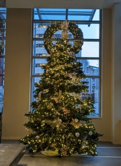 |
Holiday Tree
Position: 47°36.99’N, -122°20.57’W
The beautiful holiday tree in the lobby of our apartment building was just installed.
|
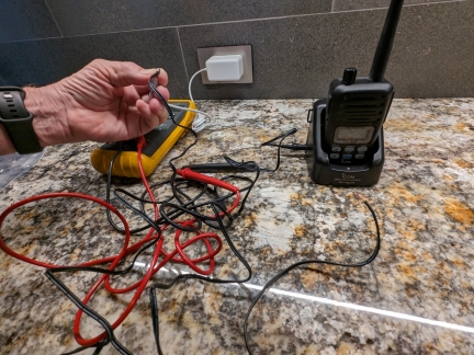 |
Failed Charger
Position: 47°36.99’N, -122°20.58’W
We don’t often have need for a voltmeter these days, but we used one today to debug a failed charger for our portable VHF radio. James determined that the power adapter wasn’t supplying power, then cut off the end and used another white power adapter from a different device to verify that the charger itself worked. We don’t have a power adapter on hand that fits the charger, and have a new one order.
|
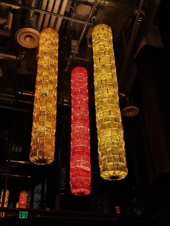 |
Lanterns
Position: 47°37.06’N, -122°20.43’W
Colorful person-height paper lanterns suspended from the ceiling at Momiji Japanese sushi restaurant near our apartment.
|
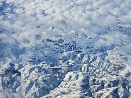 |
Nevada Mountains
Position: 40°52.25’N, -116°14.08’W
Snow-covered mountains in Nevada, viewed from James business flight to Houston.
|
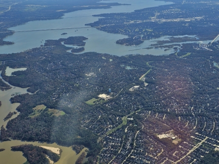 |
Lake Houston
Position: 30°5.56’N, -95°9.81’W
Lake Houston, viewed from James flight to Houston on business. The lake was created by dam 1953 and is the primary water source for the nearby city of Houston.
|
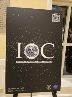 |
IOC
Position: 29°35.78’N, -95°37.34’W
The 2nd annual International Orbit Debris Conference (IOC) is being held at the hotel just outside Houston where James is staying on business. The goal of the conference is to “promote orbital debris research activities in the United States and to foster collaborations with the international community”.
|
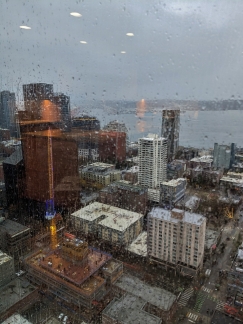 |
Atmospheric River
Position: 47°36.99’N, -122°20.58’W
Seattle is in the midst of an atmospheric river weather system, effectively a river in the sky that redistributes moisture from tropical areas. We’ve received eight inches of rain over the past 24 hours with more still falling. One person has died after being swept away in a flooded creek, and ten million people in the Pacific Northwest are under flood watch.
|
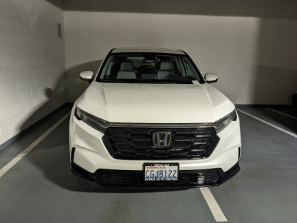 |
Honda CRV
Position: 47°36.99’N, -122°20.58’W
Our Honda Passport is in for all-day recall service at Honda of Bellevue, and they’ve given us a loaner CRV in the interim. With similar features and controls as the Passport, the CRV feels very familiar but overall seems less capable and well-appointed.
|
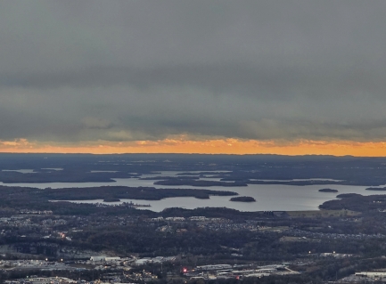 |
J Percy Priest Reservoir, Tennessee
Position: 36°13.03’N, -86°38.75’W
Sunset over J Percy Priest Reservoir, near Nashville, from James flight home to Seattle on a business trip. The lake was created in 1967 through a dam of the same name, honoring Congressman Percy Priest. The community of Old Jefferson was demolished as part of the construction, and inundated by the lake.
|
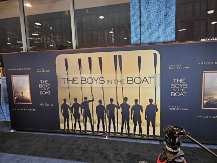 |
The Boys in the Boat
Position: 47°36.85’N, -122°20.47’W
The #1 New York Times-bestselling The Boys in the Boat by Daniel James Brown chronicles the true story of Joe Rantz and his working-class teammates on the University of Washington rowing crew who, against all odds, competed for the gold medal at the 1936 Olympics in Berlin.
The book was recently made into a movie of the same name, directed by George Clooney, who co-produced the movie with long-time collaborator Grant Heslov. Amazon MGM Studios is distributing the movie, and this week held a pre-release screening at the SIFF Theater in downtown Seattle. |
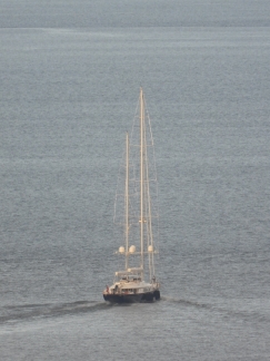 |
Tamsen
Position: 47°36.92’N, -122°20.66’W
The 171-ft (52.4 m) superyacht Tamsen, on sea trails from Elliott Bay Marina in Seattle. Launched in 2007 by Italian superyacht builder Perini Navi, the main mast stands 170 ft (51.72 m) above the waterline.
|
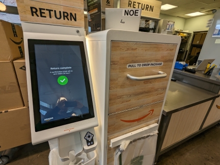 |
Amazon Self-Service Returns
Position: 47°37.10’N, -122°20.28’W
Newly-installed Amazon self-service returns machine at Whole Foods in South Lake Union. After scanning the return code, the machine prints a label to attach to a bag in which the return item is placed and then dropped into the package drawer at right. The entire process was super-efficient.
|
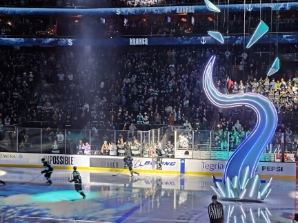 |
Seattle Kraken
Position: 47°37.33’N, -122°21.25’W
The Seattle Kraken hit the ice before the start of a game against the Tampa Bay Lightning. We normally sit on the other side of the arena, but this side has a much better view to both team benches (directly right of the Kraken entrance gate). In an exciting game, the Kraken scored two goals in the second period to match the Lightning’s two first-period goals, both teams scored a goal each in the third, and the Lightning won in overtime.
|
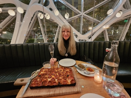 |
Willmott’s Ghost
Position: 47°36.93’N, -122°20.38’W
A delicious pizza dinner at Willmott’s Ghost in the Seattle Spheres. The restaurant is named after famed British horticulturist Ellen Willmott, who is said to have secretly planted in other’s gardens, a fitting namesake for a restaurant in the plant-filled spheres.
|
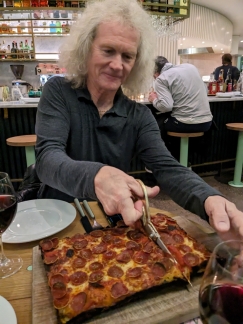 |
Cutting pizza
Position: 47°36.93’N, -122°20.38’W
At Willmot’s Ghost, patrons are given scissors to cut the unsliced pizza. It’s a little odd, but works remarkably well.
|
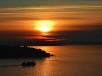 |
Sunset
Position: 47°36.92’N, -122°20.66’W
Spectacular orange sunset over Elliott Bay this evening.
|
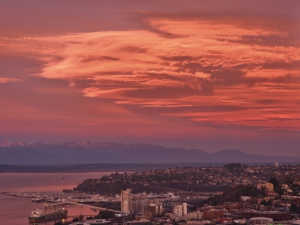 |
Sunrise
Position: 47°36.92’N, -122°20.66’W
A dramatic pink sunrise over the Olympic mountains.
|
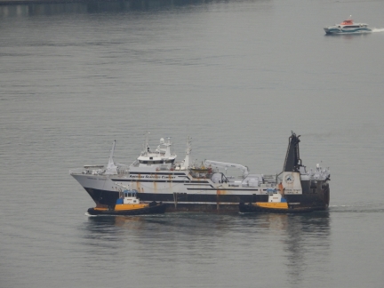 |
American Dynasty
Position: 47°36.92’N, -122°20.66’W
The Seattle-based fishing vessel American Dynasty en route to Vigor Shipyard. The vessel must be having some kind of propulsion issue to require tug assist across Elliott Bay.
|
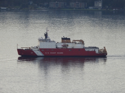 |
USCGC Healy
Position: 47°36.92’N, -122°20.66’W
The USCGC Healy arriving into Seattle. Completed in 1999, the vessel is the largest in the Coast Guard fleet and the most technically advanced icebreaker in the US. The ship can continuously break 4.5 ft (1.4 m) of ice at 3 knots or 10 ft (3.0 m) when backing and ramming. This is impressive, but is less capable than Le Commandand Charcot that we took to the North Pole earlier this year. Le Commandand Charcot has been tested at up to 5 m, and in our trip we were breaking ice as thick as 2.8m.
|
 |
Testing Starlink
Position: 47°36.99’N, -122°20.62’W
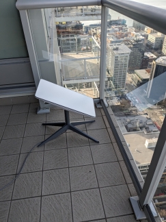
Testing our Starlink satellite dish on our apartment balcony. We’ll be taking it with us to Antarctica and recently switched to the maritime plan, required for coverage there. We also haven’t used the dish for several months, so want to update the firmware before we leave and make sure everything is working. The dish again worked surprisingly well on our balcony and, after an hour or so, offered to apply two sets of patches and now is up-to-date and running on the new plan.
|
 |
Packing
Position: 47°36.99’N, -122°20.58’W
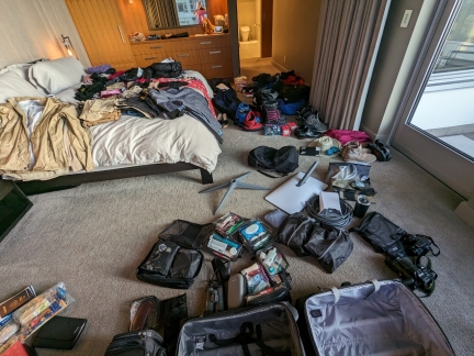
Our clothes and gear laid out to pack for our trip to Antarctica. This will be a bit of a complicated packing job as we’ll be spending three nights in Qatar, then flying to Cape Town and on to a South African game park for four nights before traveling to Antarctica for a week. For the flights to Doha and Cape Town, we’ll be checking two large LL Bean duffle bags full of our gear for Antarctica, and bringing two rolling carry-ons that will become our checked luggage for the luggage-restricted flight to Skukuza while we leave the big bags at our Cape Town hotel. For the flight to Antarctica, we can bring only the LL Bean bags and two knapsacks, and will leave the rolling carry-ons in Cape Town.
|
 |
Maiz
Position: 47°37.02’N, -122°20.59’W
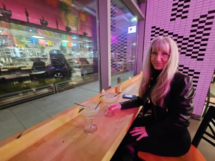
A delicious Margarita at Maiz to end a big week before we fly out to Qatar tomorrow.
|
 |
Doha, Qatar
Position: 58°38.26’N, -113°27.83’W
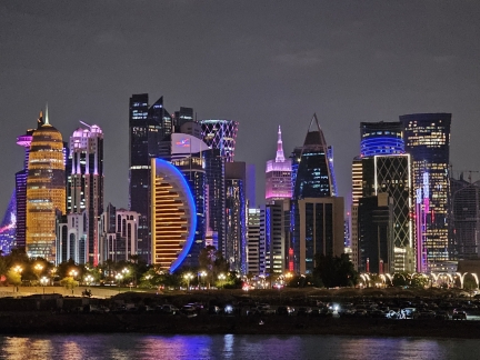
Doha, the capitol of oil-rich Qatar, is a fast-growing and dynamic city with a spectacular, constantly-evolving skyline. Our trip to the South Pole would depart from Cape Town, and our Qatar Airways flights from Seattle to Cape Town had a layover in Doha. We’d never visited Qatar before, so we stopped in Doha for three nights en route to Cape Town.
|
 |
Kruger National Park
Position: -24°58.42’S, 31°31.84’E
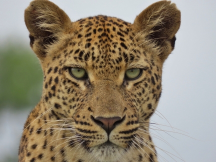
World-famous Kruger National Park is one of the largest game reserves on the African continent, encompassing nearly 4.9 million acres (2 million ha). Eight years after our visit by boat, we were planning a return trip to South Africa, this one by air to embark on a flight to to Antarctica and then on to the South Pole. This was an ideal opportunity to spend a few days at Kruger beforehand.
|
 |
South Pole and Emperors
Position: -90°00.00’S, 128°36.88’E
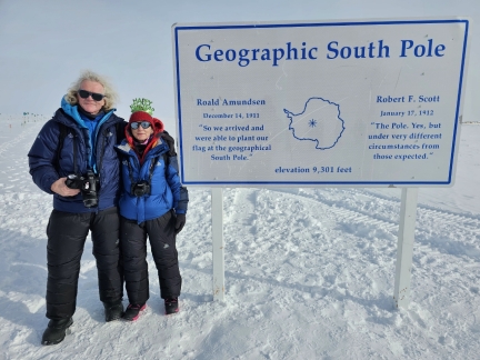
For the first half of the 20th century, the only people who had stood at the South Pole were the 1911/1912 expedition teams of Norwegian Roald Amundsen and Briton Robert F. Scott. It wasn’t until 1956 that humans again set foot at the pole, this time to establish the Amundsen-Scott South Pole Station research center that has been permanently occupied since. But the South Pole remains the realm of scientists and adventurers, with few others having the opportunity to reach it.
We made the journey on White Desert’s flagship “South Pole and Emperors” itinerary, as part of a weeklong stay at their Echo Camp. |
 |
Return to Cape Town
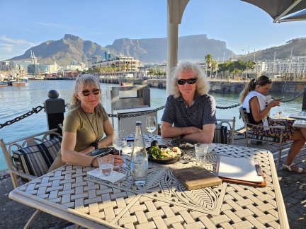
As part of our trip to the South Pole, we returned to Cape Town for the first time since 2015. Back then, we’d arrived in South Africa from Reunion after crossing the Indian Ocean in Dirona, and spent two months in country before sailing on to Barbados via St. Helena. As our plane banked over the familiar coastline, it felt strange that we’d spent so much here, in a place so far from home, and yet had never seen the airport..
|
 |
InReach MINI 2
Position: 47°18.05’N, -122°30.36’W
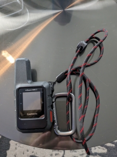
Our recently-purchase Garmin InReach MINI 2. We use our cell phones to create the personal tracks that we post to the web site. But the phone often has difficulty getting a GPS fix on cruise ships, trains, and planes, so we are hoping the InReach will do better. For cruise ships, we can just hang it outside on a balcony, and place it near a window for other forms of transport.
|
 |
Squall
Position: 47°36.92’N, -122°20.66’W
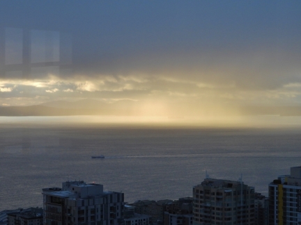
A squall in the Puget Sound, lit up in the afternoon sun. A ship passing through the squall is just barely visible in the distance.
|
 |
American Dynasty
Position: 47°36.92’N, -122°20.66’W
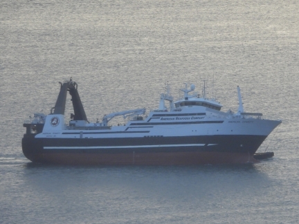
The fishing vessel American Dynasty went into Vigor yard three weeks ago under tug assist, and is returning from the yard again with tug assist but also a major list to port.
|
 |
Snow in Seattle
Position: 47°37.05’N, -122°20.47’W
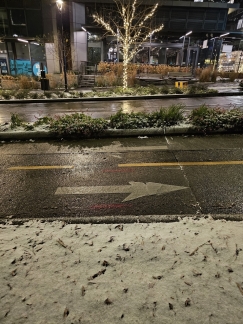
A rare snowfall in Seattle. The temperatures have been below freezing since we returned from Antarctica on Sunday.
|
 |
Hatch Cantina
Position: 47°36.87’N, -122°20.74’W
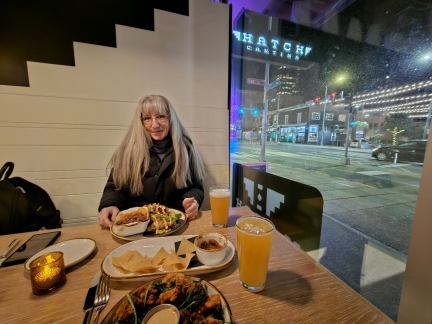
Dinner at our favorite table by the window at Hatch Cantina hear our apartment building.
|
 |
15F in Seattle
Position: 47°36.92’N, -122°20.66’W
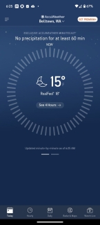
We’re seeing the lowest temperatures since 1990 as Seattle gets hit with some freezing weather. Pipes are bursting throughout the city, and the streets are icy and slippery. It’s so cold that the Mt. Baker ski resort closed temporarily due to the impact the temperature has on their equipment.
|
 |
2023 Timeline Update
Position: 47°36.92’N, -122°20.66’W
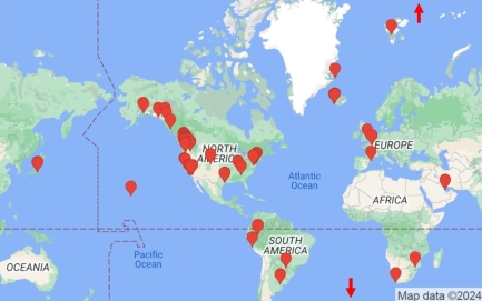
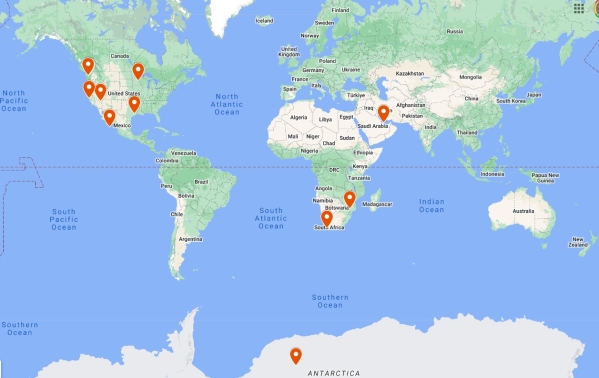
At the end of each year, we each receive a Google Maps timeline update showing all the locations we traveled to that past year. We actually were in a surprising number of places this year, including Buenos Aires, Argentina; Iguazu Falls in Argentina and Brazil; Honolulu, Hawaii; Santa Barbara, CA; Sagecliff Resort, WA; Mt. Rainier National Park, WA; Friday Harbor, WA: Vancouver, Canada; Ketchikan, Juneau and Seward in Alaska on an Inside Passage cruise; Heathrow, UK; Barcelona, Spain; Hood River, OR; Whistler, Canada; Walla Walla, WA; North Cascades National Park, WA; Paris, France; Svalbard, Norway; the North Pole; Iceland; Greenland; Victoria, Canada; Lima, Iquitos, and the Amazon River in Peru; Qatar; Cape Town and Sabi Sands Game Reserve in South Africa; and the South Pole in Antarctica. This is James’ map, which includes a business trip to Japan and many within the continental US.
|
 |
Macy’s Star
Position: 47°36.66’N, -122°20.26’W
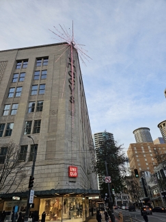
The iconic Macy’s Star, first displayed in 1957, on the Macy’s building at 4th and Pine in downtown Seattle. The 161-ft (tk m) 3,860-bulb star has been a fixture during the Seattle holiday season for more than six decades.
|
 |
Sunset
Position: 47°36.99’N, -122°20.58’W
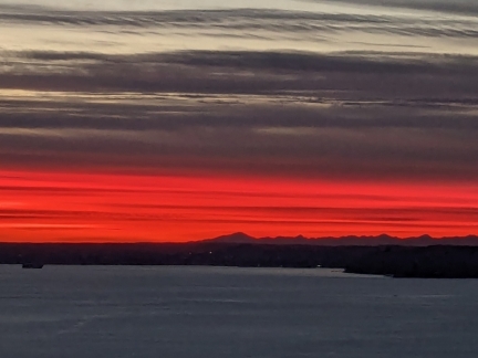
A striking pink-orange band across the sky as the sun sets over Elliott Bay in Seattle.
|
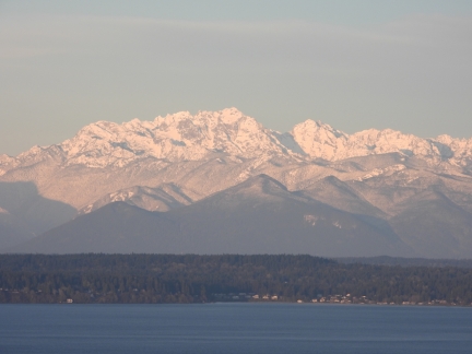 |
Olympic Mountains
Position: 47°36.92’N, -122°20.66’W
The Olympic Mountains with a thick coating of fresh snow.
|
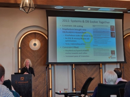 |
CIDR 2024
Position: 36°59.79’N, -121°59.06’W
James presenting the keynote, Constraint-Driven Innovation, at the Conference on Innovative Data Systems Research (CIDR) in Santa Cruz, CA.
|
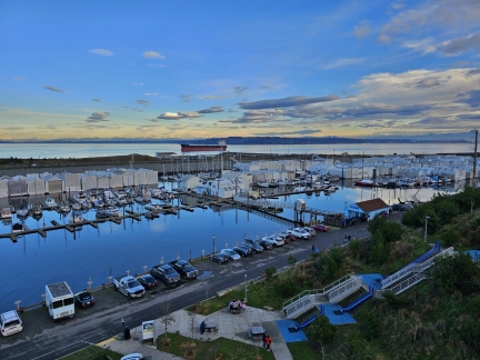 |
Point Ruston Revisited
Position: 47°18.26’N, -122°30.80’W
We enjoyed our first weekend at Point Ruston so much that we returned for another earlier this year. We love the rooms at the Point Ruston Waterfront hotel, with sweeping views to Commencement Bay, where we can get a little work done by the window and see what’s happening outside, both on land and the water. On our last trip, we explored along the waterfront towards the ferry terminal and Dune Peninsula Park. This time we walked up into the town of Ruston to check out a local pub and got some great views across Commencement Bay from the Wilson Way Pedestrian Bridge that connects Dune Peninsula Park and Point Defiance. And we discovered some more appealing public art in the Point Ruston area.
|
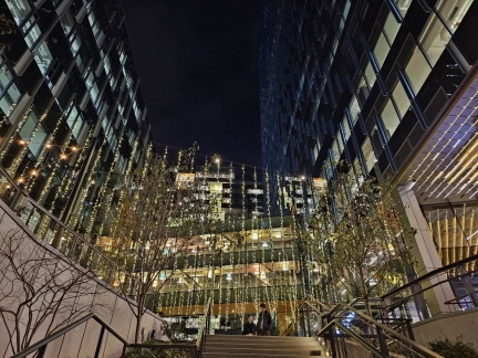 |
Holiday Lights, Amazon SLU
Position: 47°36.92’N, -122°20.26’W
Holiday light display at the Amazon South Lake Union (SLU) campus.
|
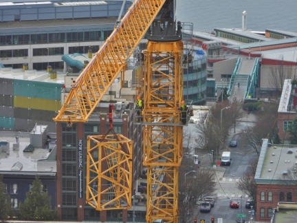 |
Tower Crane Disassembly
Position: 47°36.92’N, -122°20.66’W
Workers removing a section of the tower crane at The Confidential apartment building under construction at 4th & Bell, 2 blocks west of our building. The crane will be completely disassembled this weekend. How innovative that the crane can lift itself upward unassisted and then self-disassemble down to within reach of ground cranes that will remove what’s left.
|
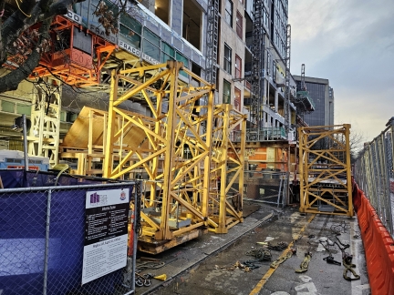 |
Tower Crane Sections
Position: 47°36.93’N, -122°20.65’W
Several removed sections of the tower crane at The Confidential apartment building under construction at 4th & Bell, 2 blocks west of our building.
|
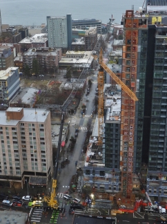 |
Tower Crane Disassembly
Position: 47°36.92’N, -122°20.66’W
The yellow and black portable crane at left was brought on-site this weekend to complete the disassembly of the tower crane at The Confidential apartment building under construction at 4th & Bell, 2 blocks west of our building. Another portable crane at bottom left will lift the sections onto a truck as they are removed.
|
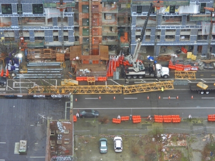 |
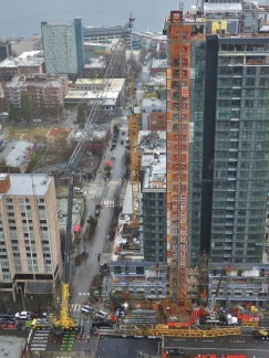
Tower Crane Boom
Position: 47°36.92’N, -122°20.66’W
The boom from the tower crane at The Confidential lying on the road after being removed from the tower crane.
|
 |
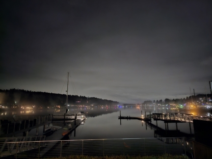
Boom Removed
Position: 47°36.92’N, -122°20.66’W
The tower crane is still partially in place, but with it much lower and boom removed, the skyline looks a lot more clear.
|
 |
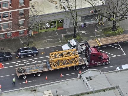
Gig Harbor
Position: 47°20.42’N, -122°35.29’W
The view from our terrace at the Waterfront Inn while we enjoy an evening drink outside after dinner. The weather is overcast and cool, and we enjoyed sitting outside to take in the scene. Gig Harbor is a wonderfully sheltered and tranquil harbor and this evening brought back great memories of the many times we’ve anchored there.
|
 |
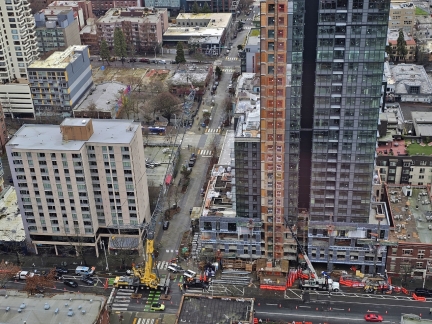
Last Crane Segment
Position: 47°36.92’N, -122°20.66’W
We arrived home from Gig Harbor in time to see a truck carrying away the last piece of the tower crane from The Confidential apartment building under construction to our west.
|
 |
Tower Crane Gone
Position: 47°36.92’N, -122°20.66’W
The tower crane now is completely gone from The Confidential apartment building under construction to our west. It’s been in visible through our windows for so many months that the sky looks a little empty without it. But the view has improved :-).
|
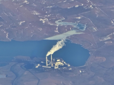 |
Milton R. Young Station
Position: 46°50.97’N, -101°20.31’W
The Milton R. Young coal-based electrical power plant in North Dakota, viewed from James flight to Minneapolis on business. The two-unit plant has a combined capacity of 705,000 kilowatts, burning coal from the nearby Center Mine and using cooling water from the artifical reservoir Lake Nelson.
|
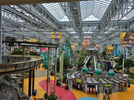 |
Mall of America
Position: 44°51.34’N, -93°14.46’W
James hotel while on business in Minneapolis is within the Mall of America. At 5,600,000 sq ft (520,000 m2) or 129 acres (52 ha), it is the largest shopping mall in the Western Hemisphere and the 12th largest in the world.
|
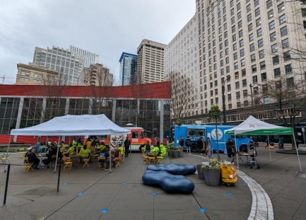 |
Food Trucks
Position: 47°36.77’N, -122°20.23’W
Food trucks at Westlake Park, sponsored by the Downtown Seattle Organization, whose mission is “To create a healthy, vibrant downtown for all”.
|
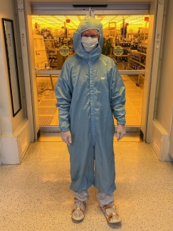 |
Bunny Suit
Position: 44°51.79’N, -93°20.51’W
James wearing a “bunny suit” on a visit to Seagate’s Normandale Minnesota hard disk drive wafer fabrication facility.
|
 |
Cabo San Lucas, Mexico
Position: 22°52.51’N, -109°51.85’W
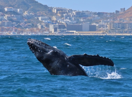
Despite all our travels, Jennifer had never been to Mexico and James had only briefly visited once, years ago for a conference in Cancun. Jennifer finally reached America’s neighbor to the south early this year on a fabulous weekend trip to Cabo San Lucas at the southern tip of Mexico’s Baja California Peninsula.
|
 |
Alfa Romeo 4C
Position: 47°36.82’N, -122°20.82’W
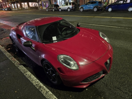
An early-model Alfa Romeo 4C parked in downtown Seattle (4C refers to the car’s straight-four engine). The vehicle was in production for only 6 years, starting in 2014.
|
 |
Seattle Boat Show
Position: 47°36.62’N, -122°20.91’W
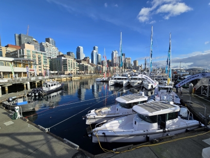
We’ve been toying with the idea of a high-speed weekend boat to more easily take advantage of the water-based attractions in the area, so made that our focus at this year’s Seattle Boat Show.
|
 |
Anthony’s Pier 66
Position: 47°36.69’N, -122°20.94’W
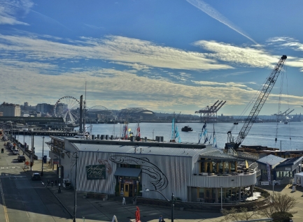
We had lunch for the very first time today upstairs at Anthony’s Pier 66. We’ve had dinner many times here but, in the past, lunch has only been available at the Bell Street Diner and Fish Bar downstairs. The two downstairs restaurants are now closed during winter, and the main restaurant is open for lunch. This is great news for us, as we love the sweeping view of Elliott Bay from upstairs.
|
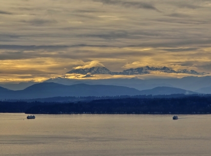 |
Puget Sound
Position: 47°36.99’N, -122°20.59’W
Two Washington State ferries crossing Puget Sound in the late afternoon.
|
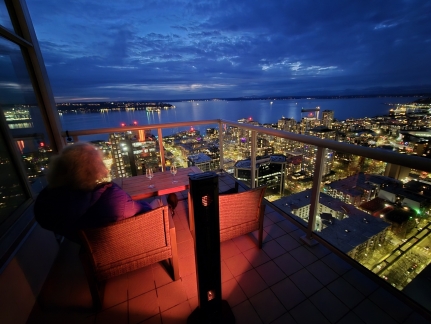 |
Dusk
Position: 47°36.99’N, -122°20.59’W
Enjoying a glass of wine at dusk from out apartment’s main balcony.
|
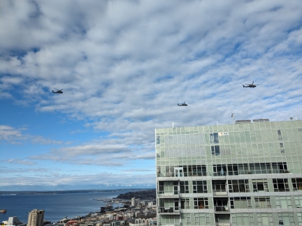 |
Military Choppers
Position: 47°36.99’N, -122°20.58’W
Four military choppers (one not visible) crossing over our apartment complex in downtown Seattle.
|
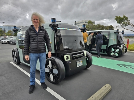 |
Zoox
Position: 37°34.28’N, -122°16.04’W
James with two Zoox vehicles during a business trip to their offices in California. This is James’ first trip on city streets in a car without driver, steering wheel, or pedals.
|
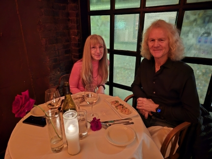 |
Il Bistro
Position: 47°36.51’N, -122°20.42’W
A special Valentine’s Day dinner at Il Bistro Italian restaurant in Pike Place market.
|
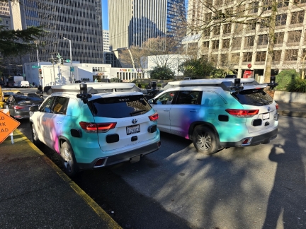 |
Zoox
Position: 47°36.52’N, -122°19.90’W
A rare sighting of two Zoox test cars together in the wild at 6th & Seneca in downtown Seattle.
|
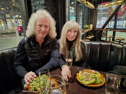 |
Butcher’s Table
Position: 47°37.06’N, -122°20.28’W
Finishing of the week with a relaxing and delicious meal in our favorite table at The Butcher’s Table near our Seattle apartment.
|
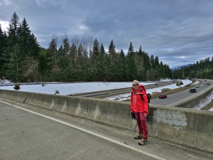 |
Crossing I-90
Position: 47°17.86’N, -121°17.28’W
Crossing I-90 from the parking lot to snowshoe at Cabin Creek Sno-Park just east of Snoqualmie Pass.
|
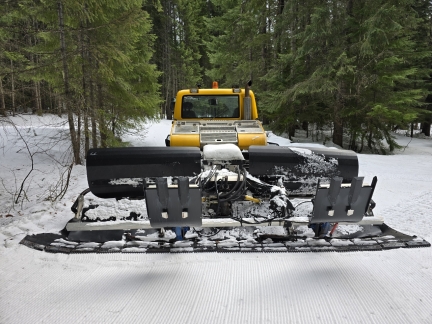 |
Grooming Equipment
Position: 47°18.03’N, -121°17.28’W
Cabin Creek Sno-Park consist of 21 miles (33.7 km) of groomed cross-country ski trails. The grooming equipment has a plow in front and behind drags mats to cut the grooves and a hydraulically-deployed form to cut the track.
|
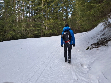 |
Groomed Trail
Position: 47°18.10’N, -121°17.22’W
Following National Forest Development Road 4822 up towards Amabilis Mountain, keeping to the edge of the groomed road and particularly avoiding the ski track cut to our left. Our plan is to walk up part way, and then “off-road” in snowshoes to reach higher elevations at the switchbacks.
|
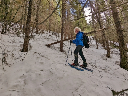 |
Offroading
Position: 47°18.23’N, -121°17.08’W
We donned our snowshoes to “offroad” between the switchbacks along National Forest Development Road 4822. This was great fun, and our MSR Lightning Ascent snowshoes continue to impress us with their traction.
|
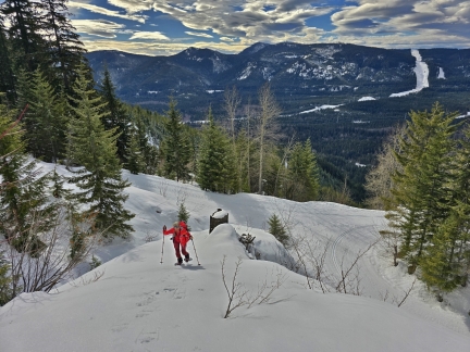 |
Climbing
Position: 47°17.47’N, -121°16.43’W
After returning to the road for a bit, we hiked up another steep section near a clearing, looking for a good view spot for a snack.
|
 |
Snack
Position: 47°17.48’N, -121°16.43’W
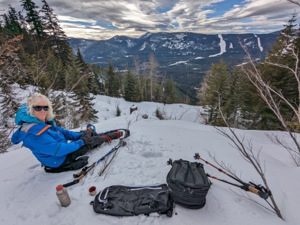
Enjoying the view from a bluff above National Forest Development Road 4822. The road extends all the way to Amabilis Mountain, and we camped not far from here back in June of 2022. Even in June, much of the road was still covered with snow and impassible near the top. Right now, in February, the road is closed completely from I-90 on up.
|
 |
Willmotts’s Ghost
Position: 47°36.94’N, -122°20.38’W
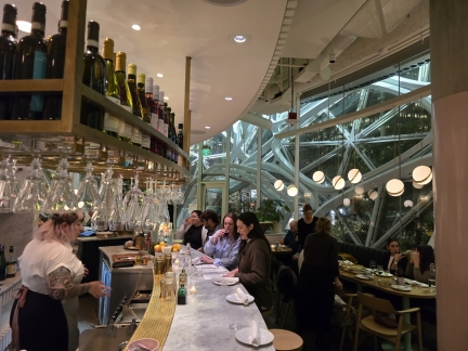
At Willmott’s Ghost in the Seattle Spheres for a delicious pizza dinner over a glass of Italian wine.
|
 |
Moonlight
Position: 47°36.99’N, -122°20.58’W
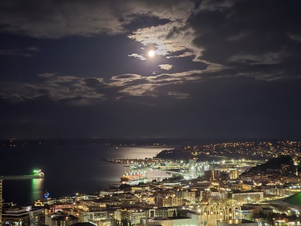
The moon, two days off full, lighting up Elliott Bay early this morning.
|
 |
Barolo
Position: 47°36.81’N, -122°20.32’W
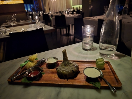
An exceptionally tender and delicious artichoke appetizer before our meal at Barolo Italian restaurant in Seattle.
|
 |
U2 at the Sphere
Position: 36°7.28’N, -115°9.72’W
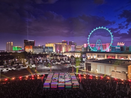
Completed in September, 2023 at a cost of $2.3 billion, the Sphere in Las Vegas is 366 feet (111 m) tall and 516 feet (157 m) wide. The exterior is covered with 1.2 million hockey puck-sized LED lights that are programmed with an ever-changing array of spectacular images. The interior features a 16K 160,000-square-foot (15,000 m2), wrap-around LED display, the highest resolution and largest screen in the world. The venue opened with a 40-show residency by Irish rock band U2. We’re longtime U2 fans and it was a real treat to see them in concert for the first time.
|
 |
Passport Renewal
Position: 47°36.99’N, -122°20.58’W
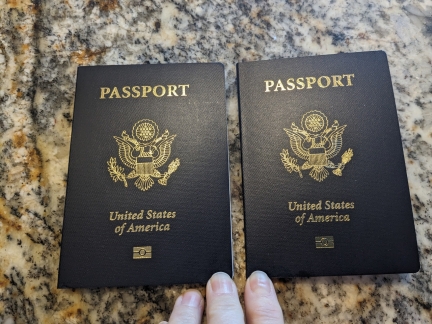
Our two shiny new US passports just arrived today, less than three weeks after we sent them in for renewal with expedited service. It sure seems a long time ago since we last renewed them in 2015 in Australia.
We’re fortunate that the processing times have improved dramatically in the past few months. A flood of applicants drove last year’s processing times up to seven to nine weeks for expedited and ten to thirteen for standard processing. Being without our passports for several months would be pretty inconvenient. |

|
Click the travel log icon on the left to see these locations on a map. And a map of our most recent log entries always is available at mvdirona.com/maps. |
If your comment doesn't show up right away, send us email and we'll dredge it out of the spam filter.