The Reykjanes Peninsula, also known as the Southern Peninsula, juts into the North Atlantic Ocean from Iceland’s southwest corner. Lying directly over the Mid Atlantic Ridge, one of the larges tectonic plate boundaries in the world, the area is prone to earthquakes and volcanic activity. Recently, much of the peninsula is under volcano watch after thousands of earthquakes hit the area and a major eruption appears imminent.
The peninsula also is rich in geothermal activity. 90% of Iceland’s homes are heated with geothermal energy, and the country’s largest plant, Svartsengi, is located in the Reykjanes Peninsula. Here also is the country most well-known tourist attraction, the Blue Lagoon spa, along with several geothermal fields accessible to the public. The combination of these geothermal fields and a rather barren landscape, the result of past volcanic activity, gives the area a Mars-like feeling. And where exposed to the fierce North Atlantic weather, the shoreline is dramatic, with steep cliffs and windswept rock formations.
After spending a day exploring Reykjavik, we toured the Reykjanes Peninsula the next morning before our afternoon flight home. To maximize our time, we booked a private tour with Snaeland Travel, who picked us up from our hotel and dropped us off at the airport.

Our first stop was the mineral lake Kleifarvatn, the largest lake in Iceland and fed entirely from porous lava rock rather than rivers. The black-sand rimmed lake used to be much larger, but earthquakes in 2000 drained 20% of its surface area. Kleifarvatn lies within the 115 sq mile (300 sq km) Reykjanesfolkvangur Reserve, that protects the complex lava formations produced from the Reykjanes ridge volcanoes. The reserve is about a half-hour drive south of Reykjavik.


Further south in the Reykjanesfolkvangur Reserve is the Seltun geothermal area, with walkways through bubbling hot springs and steaming volcanic vents.
Reykjanesfolkvangur Reserve meets the sea with the sheer Krysuvikurberg sea cliffs that in the summer are packed with thousands of breeding sea birds. The dirt road there leads through the barren volcanic landscape that epitomizes the reserve.
Turning west, we followed the coast to down Hopsnes Penninsula towards the town of Grindavik. The town was recently evacuated due to the risk of volcanic eruption and news photos show the road we took down to Grindavik packed with departing vehicles heading east from town.

We made a brief detour north from Grindavik to the Blue Lagoon spa, Iceland’s most famous tourist attraction. The immensely popular spa has two hotels on-site, but the majority of visitors make day-trips there from Reykjavik or the surrounding area. The heated spa waters, fed by the nearby Svartsengi geothermal plant, are rich in silica mud, mineral salts and cyan-colored algae that soften and exfoliate the skin. The milky-blue waters of the spa contrast with the stark black lava fields surrounding the pools. We only had time for a brief walk through the complex, but next year will spend a night there when we visit Iceland as part of our cruise to Greenland. Hopefully the spa will have re-opened by then as the facility currently is closed due to the risk of a volcanic eruption.
From the Blue Lagoon, we returned south to the coast to the viewing platform at Brimketill, where marine erosion has carved out an unusual circular pool in the rocky lava. The seas were so calm today that barely a ripple disturbed the surface, and the pool looked inviting. But most of the time fierce North Atlantic Ocean waves pummel the shore and would sweep an unsuspecting bather into the sea. Evidence of how rough the seas can get in the area was abundant in the seaweed that had been thrown high up into piles on the walkway and surrounding rocks.


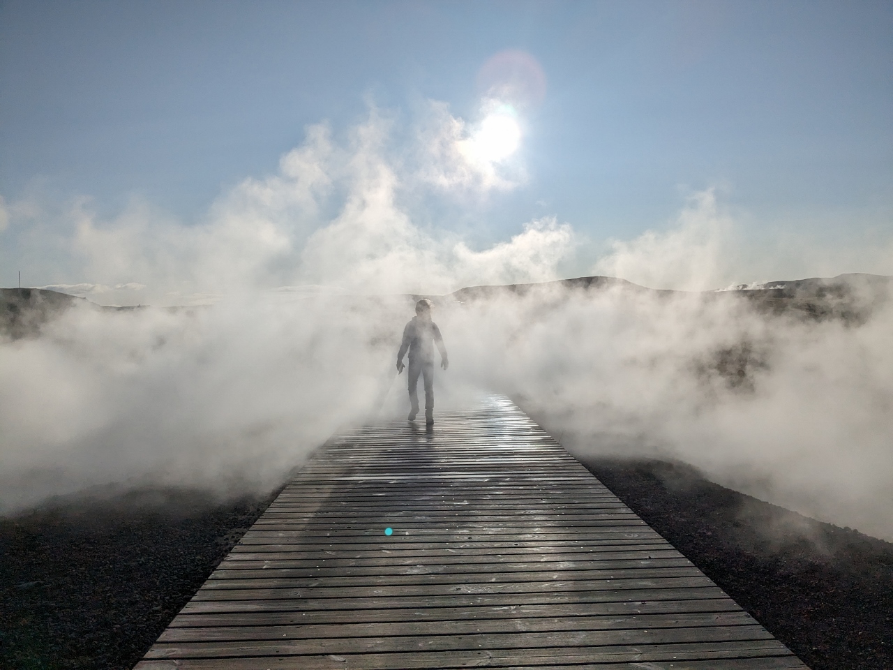
Continuing west along the coast, we stopped at the Gunnuhver Hot Springs, Iceland where the steam cloud the springs produce is visible for miles and two power plants take advantage of the high levels of geothermal activity in the area.


From Gunnuhver Hot Springs, we could see the hilltop Reykjanes Lighthouse, our next stop. The lighthouse was constructed in 1907 to replace a previous one that stood closer to the sea and was in danger of falling in due to the earthquakes. From the base of the new lighthouse, we had sweeping views west to sea and inland to the geothermal activity around Gunnuhver Hot Springs.


Near the water’s edge at Valahnukamol, we climbed a section of the cliff for a great view down to the dramatic sea shore. Standing at the cliff’s edge is a statue of an Auk, in memory of this now-extinct flightless bird. We also followed a path around remnants of the original lighthouse to a beach full of thousands of boulders, worn smooth in the fierce North Atlantic storms.
Our final stop of the day was the Bridge Between Continents. This footbridge spans the Mid Atlantic Ridge, connecting North American and Eurasian tectonic plates. It is the divergence of these plates that allow heat and magma to travel closer to the earth´s surface, producing the geothermal and volcanic activity the area is known for.
On the way to the airport, we passed the striking sculpture Spell by Steinunn Þórarinsdóttir, a memorial to the area’s sailors. The sculpture shows a rusting statue of a person facing three stainless steel waves, as a depiction of the permanence of the sea against the frailty of humans. At the airport we spent some time in Icelandair’s excellent Saga lounge before boarding our flight. We got more views to spectacular Greenland from the air as our flight passed over the southern portion of the country.


We had a fabulous day on the Reykjanes Penninsula. But impressive as the sights were, we only saw a tiny portion of the country and few of its top attractions. We’ll be spending three nights in Iceland next spring before our cruise to Greenland aboard Le Commandant Charcot, and are excited to see more of this beautiful and rugged country.
Our route through the Reykjanes Penninsula is shown on the interactive map below. Click here for a full-page map.
If your comment doesn't show up right away, send us email and we'll dredge it out of the spam filter.