With generally clear skies, warm weather, and wildflowers in bloom, August is an excellent month to hike in the Cascade Mountains. And hike we did. Early in the month, we returned to Mt. Rainier for three fabulous days of summer hiking. The trails were bursting in color during the short wildflower season and “The Mountain” dominated the clear sky every day. We also hiked popular trials closer to Seattle, including Mt. Si near North Bend and Granite Mountain Lookout a little farther east, both with excellent Cascade Mountains views.
In between our hiking, we made several more camping trips and found more excellent campsites with wonderful views. And we tested out some new camping gear, including a privacy tent, camp shower and grill pan.
This month we also celebrated two birthdays: Spitfire the wonder cat turned an amazing nineteen years old, and James, well, he got a little older than that. In between James made several business trips, we attended a pre-season Seahawks game, and continued to enjoy the downtown lifestyle. We also watched with interest the progress of various construction projects taking place in the area and the activity in Elliott Bay and the Port of Seattle.
Below are highlights from August 1st through 31st, 2022. Click any image for a larger view, or click the position to view the location on a map. And a map with our most recent log entries always is available at mvdirona.com/maps.
 |
Position: 47°36.98’N, -122°20.62’W
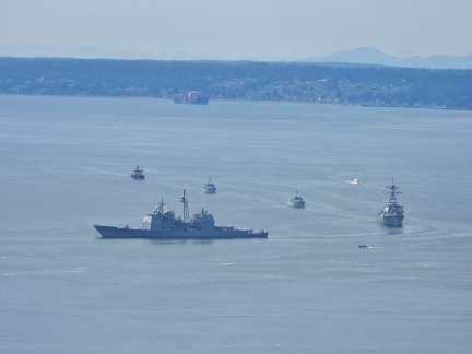
Navy ships on parade through Elliott Bay as they arrive into the area for Seafair Fleet Week. Leading the group is the 567-ft (173 m) guided missile cruise USS Lake Champlain. Seafair is Seattle’s annual summer festival that is anchored by the Seafair Cup hydroplane races on Lake Washington.
|
 |
Leschi
Position: 47°36.98’N, -122°20.62’W
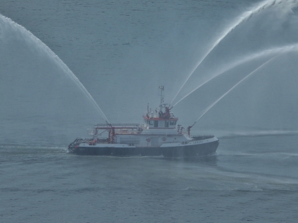
The Seattle fire boat Leschi leading the navy ships on parade through Elliott Bay.
|
 |
USS Lake Champlain
Position: 47°36.98’N, -122°20.62’W
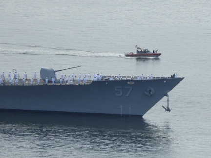
Sailors lining the deck on the USS Lake Champlain as it parades through Elliott Bay.
|
 |
Happy 19th Birthday Spitfire
Position: 47°36.98’N, -122°20.62’W
Spitfire the wonder kitty is an amazing nineteen years old today. Here he is with a birthday card from the pet supplies retailer Chewy.
|
 |
Mt. Hood
Position: 45°29.00’N, -121°29.99’W
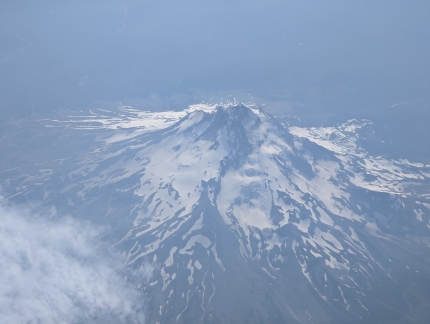
View down to 11,249-ft (3,428m) Mt. Hood from James’ flight to San Diego.
|
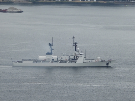 |
P 627
Position: 47°36.92’N, -122°20.66’W
Members of the Sri Lankan navy training on the offshore patrol vessel P 627 in Elliott Bay. The ship, formerly the United States Coast Guard Cutter Douglas Munro, was transferred to the Sri Lankan navy in October of 2021.
|
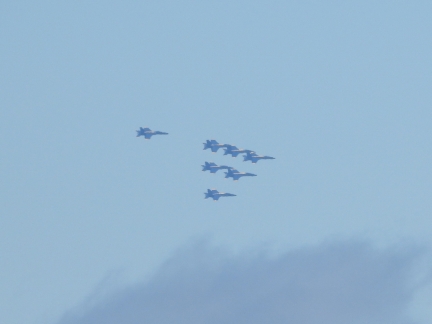 |
Blue Angels
Position: 47°36.92’N, -122°20.66’W
The US Navy Blue Angels flight demonstration squad practicing over Seattle for their upcoming show as part of the Seafair weekend.
|
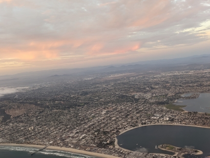 |
San Diego
Position: 32°45.96’N, -117°15.55’W
View to portions of Pacific Beach, left, and Mission Bay, shortly after takeoff on James flight home from San Diego.
|
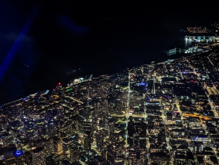 |
Seattle
Position: 47°37.99’N, -122°18.97’W
View to downtown Seattle as James flight from San Diego arrives. Our twin-towered condominium complex is just left of the brightly lit intersection at center and the Space Needle is slightly up and right from that intersection (click image for a larger view).
|
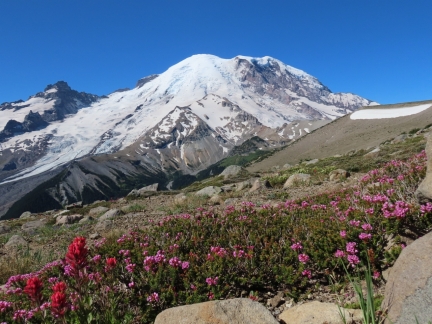 |
Burroughs Mountain Trail
Position: 46°54.58’N, -121°40.41’W
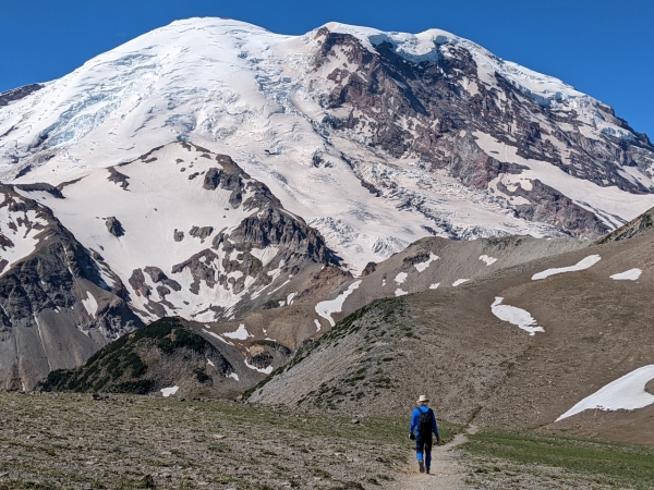
The summer season at Mt. Rainier lasts only a few months, generally between June and September. With snow still on the ground in June and frost starting in September, the wildflower season is short. But in late July and early August, the mountain bursts in such color that conservationist John Muir described the area as “.. the most luxuriant and the most extravagantly beautiful of all the alpine gardens I ever beheld in all my mountain-top wanderings.”
|
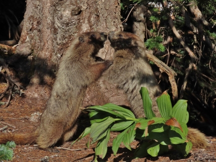 |
Skyline Trail
Position: 46°47.58’N, -121°43.01’W
On our second day of summer hiking at Mt. Rainier, we walked the Skyline Trail from the Paradise area, following roughly the same route that we’d snowshoed earlier in the year. We had another clear day, and the mountain views were spectacular, both to Mt. Rainier and south along the Cascade Range. The scenery had changed so much in the summer that it felt like a completely different place than the winter.
|
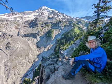 |
Mildred Point
Position: 46°48.09’N, -121°46.83’W
For our third and final day of summer hiking at Mt. Rainier, we walked to Mildred Point via Comet Falls. The hike gave us yet another perspective to Mt. Rainier, this time from the southwest.
|
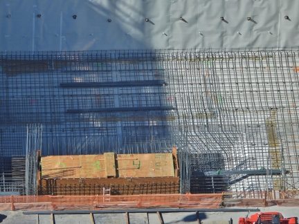 |
Rebar
Position: 47°36.92’N, -122°20.66’W
A complex web of rebar installed at the Fouth & Bell construction site around the elevator shaft. They are getting ready to pour the foundation floor and have the rebar in for the central elevator shafts.
|
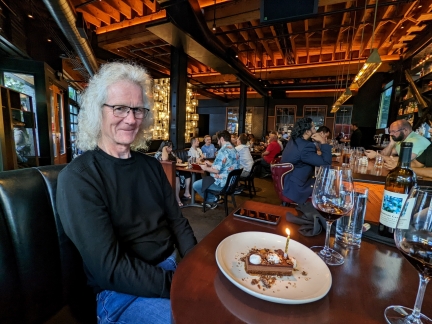 |
Happy Birthday James
Position: 47°37.05’N, -122°20.31’W
Celebrating James’ birthday at one of our favorite Seattle restaurants, Butchers Table.
|
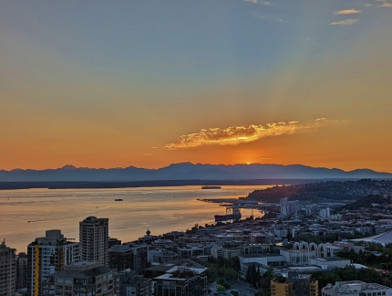 |
Sunset
Position: 47°36.98’N, -122°20.62’W
Sunset over Elliott Bay.
|
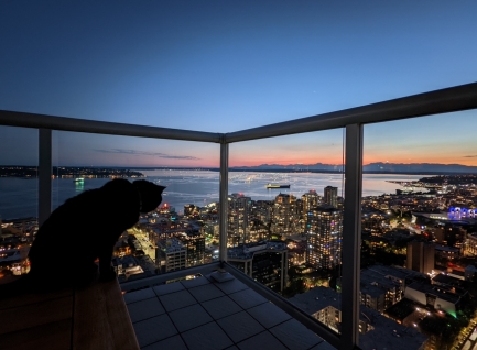 |
Spitfire
Position: 47°36.99’N, -122°20.77’W
Spitfire taking in the view to Elliott Bay from the coffee table on our main deck.
|
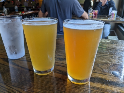 |
Buckley’s
Position: 47°36.88’N, -122°20.82’W
Frosty pints at Buckley’s pub in our Belltown neighborhood.
|
 |
Seattle
Position: 47°36.89’N, -122°20.70’W
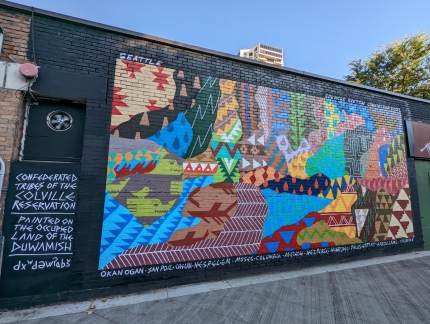
The recently-painted mural Seattle by Spencer Keaton Cunningham, a member of the Confederated Tribes of the Colville Reservation (member tribes listed beneath the mural). The wording at left states the mural is “painted on the occupied land of the Duwamish”. The name Seattle is an Anglicization of the name of the Duwamish Chief Si’ahl (1780-1866).
|
 |
Rebar
Position: 47°36.90’N, -122°20.67’W
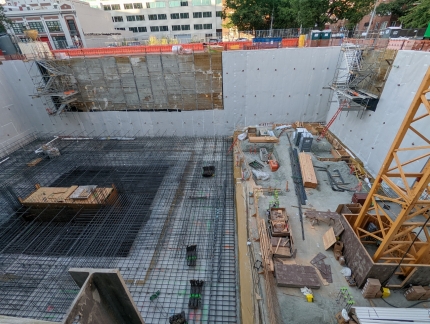
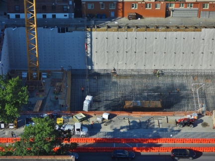
At the Fourth & Bell construction site they are almost ready pour the cement for the foundation floor and the thick floor under the elevator shafts.
|
 |
Dirt Removal
Position: 47°37.00’N, -122°20.70’W
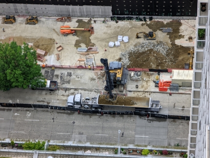
An interesting piece of construction gear at the 6th & Bell site towards Lake Union. Rather than using a shovel on the the end of an excavator arm this shovel raises and lowers on a vertical track (click image for a larger view).
|
 |
Toilet Delivery
Position: 47°36.92’N, -122°20.66’W
The tower crane at the 4th & Bell construction site lowering two outhouses.
|
 |
Demolition
Position: 47°36.92’N, -122°20.66’W
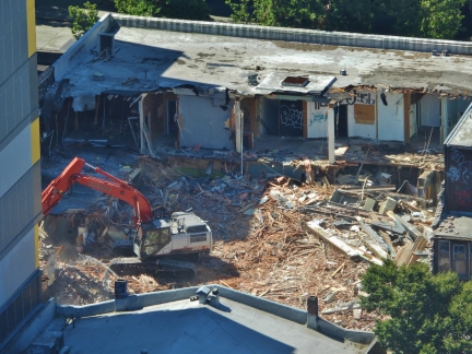
Excavators at work clearing the burned building at 2nd & Bell.
|
 |
Tavolata
Position: 47°36.86’N, -122°20.80’W
Dinner streetside at our favorite table at Tavolata Italian restaurant in Belltown.
|
 |
Downtown Sailing Series
Position: 47°36.92’N, -122°20.66’W
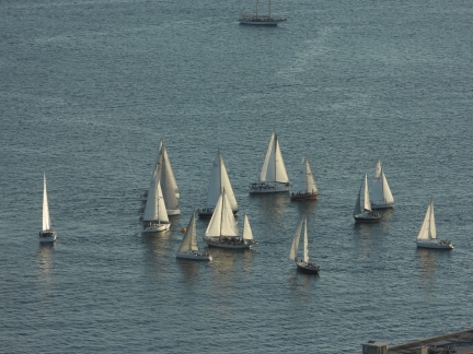
Participants on the final event of the 2022 Downtown Sailing Series rounding the mark near Pier 66.
|
 |
Mt. Si
Position: 47°30.42’N, -121°44.34’W
The trail to the summit of Mt. Si in North Bend ascends 3,100 feet (945 m) over a distance of just under 4 miles (6.4 km). Despite the steepness, it is one of the most popular trails in Washington state, with about 100,000 climbers annually. Part of the draw is its proximity to major urban centers, but much is for the fabulous views from the top.
|
 |
Fire Bell No. 4
Position: 47°36.95’N, -122°20.68’W
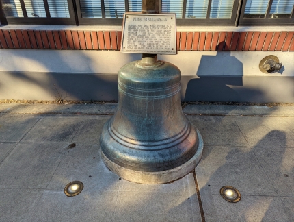
Historic Fie Bell No. 4, dating from 1887, outside the Fire Station 2 in Belltown.
|
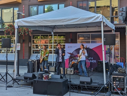 |
Downtown Summer Sounds
Position: 47°36.85’N, -122°20.73’W
A band playing on Bell Street as part of the Downtown Summer Sounds concert series. As part of the 4-decade-old program, 38 performances were held at various locations throughout the city.
|
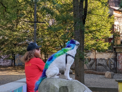 |
Mohawk
Position: 47°36.85’N, -122°20.72’W
A dog sporting an eye-catching Mohawk at the Downtown Summer Sounds concert in Belltown.
|
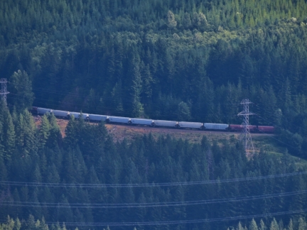 |
Borup Loop
Position: 47°16.34’N, -121°26.04’W
The Borup Loop carries trains between Borup and the Stampede Pass Tunnel en route through the Cascade Mountains. Between Borup at 2,270ft (691 m) and the west entrance of the Stampede Pass Tuneel at 2,900 ft (883 m), the elevation difference is 630 ft (192m) over a distance of 2.3 miles (3.7 km). Clearly visible in the satellite imagery as it crisscrosses Sunday Creek, the Borup Loop is not actually a loop at all, but an elongated ‘S’ curve formed from back-to-back horseshoes.
|
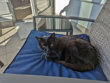 |
Spitfire
Position: 47°36.99’N, -122°20.61’W
Spitfire looking a tad guilty for stealing one of our deck chairs we’d just set up for a sunset drink outside. Guilty or not, he didn’t give up the seat.
|
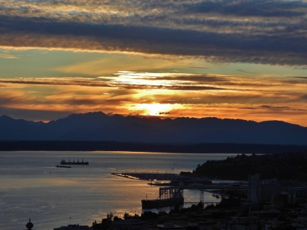 |
Sunset
Position: 47°36.99’N, -122°20.61’W
Beautiful orange sunset over Elliott Bay, viewed from our apartment deck.
|
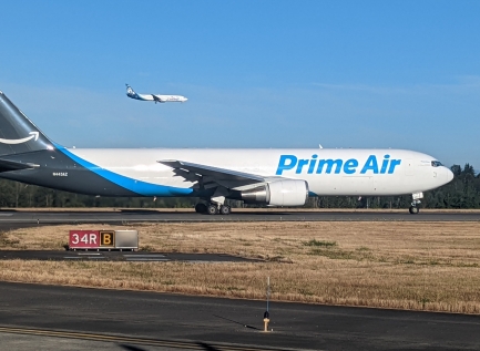 |
Prime Air
Position: 47°26.26’N, -122°19.22’W
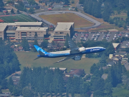
A Prime Air flight taking off from Seattle, viewed from the taxiway on James’ flight to Spokane for business. The Prime Air shipping fleet currently comprises nearly 100 aircraft.
|
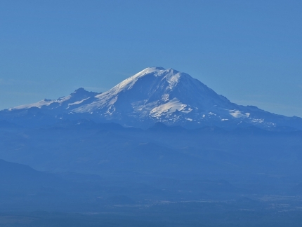 |
Mt. Rainier
Position: 47°31.57’N, -122°7.80’W
Mt. Rainier (14,411 ft; 4,392 m), with Little Tahoma Peak (11,138 ft; 3,395 m) to the left, viewed from James’ flight to Spokane.
|
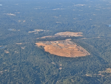 |
Bio Energy
Position: 47°31.35’N, -122°5.82’W
The King County Cedar Hills landfill gas–to–energy facility. Doing business as Bio Energy Washington, the site generates renewable energy from landfill gas produced by decomposing organic material at the Cedar Hills Regional Landfill.
|
 |
Mt Si
Position: 47°31.35’N, -122°5.82’W
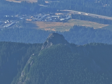
The Haystack atop Mt Si, where we hiked to last week, viewed from James’ flight to Spokane.
|
 |
Cascade Mountains
Position: 47°31.35’N, -122°5.82’W
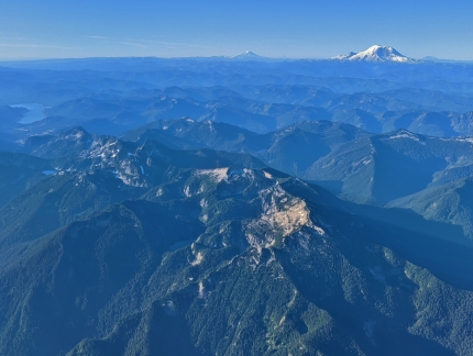
Looking south down the Cascade Mountains to Mt. Rainier, with Mt. Hood in the distance.
|
 |
Spokane Airport
Position: 47°39.02’N, -117°45.45’W
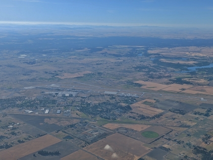
View to the Spokane Airport as James’ flight descends into the area.
|
 |
Spokane River
Position: 47°44.35’N, -117°31.48’W
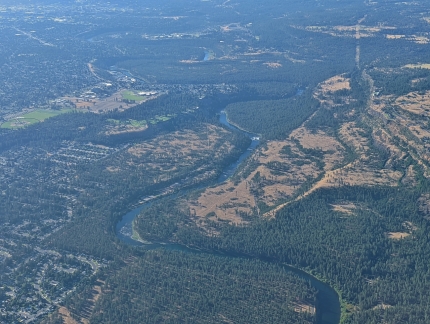
The Spokane River winds south through the city of Spokane and into the Columbia River.
|
 |
Ground Power
Position: 47°37.40’N, -117°32.28’W
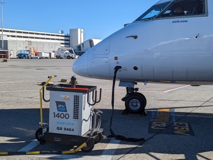
The plane James flew into Spokane on hooked up to ground power via a TW GSE 1400 solid-state 28 VDC ground power unit.
|
 |
Ferrari & Porsche
Position: 47°37.07’N, -122°20.46’W
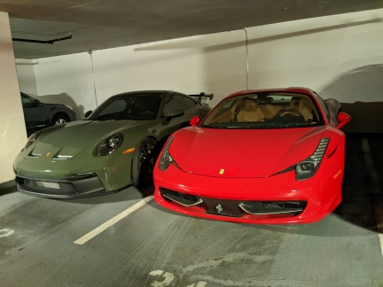
Somebody likes nice cars. This Ferrari and Porsche are parked side-by-side in adjacent spots in our apartment building.
|
 |
Lumen Field
Position: 47°35.71’N, -122°19.88’W
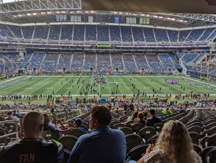
At Lumen Field to watch the Seahawks second pre-season game, this one against the Chicago Bears.
|
 |
Roster
Position: 47°35.71’N, -122°19.88’W
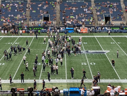
NFL rules allow for 90 players per team at the start of the preseason. The limit drops by five players following each of the first two preseason games, and after the third game the roster limit is 53 for the start of the regular season. The current limit at preseason game two is 85, and there’s a lot of players on the field.
|
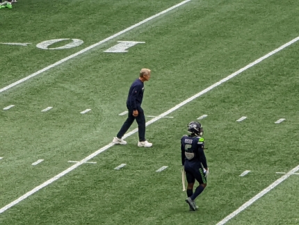 |
Coach Carroll
Position: 47°35.71’N, -122°19.89’W
Seahawks head coach Pete Carroll often works directly with players on the field before the game. Most NFL head coaches take a more hands-off approach, leaving this sort of work to their assistant coaches.
|
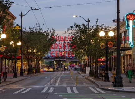 |
Pike Place Market
Position: 47°36.27’N, -122°20.07’W
Walking home from the Seahawks game we passed the famous Pike Place Market sign.
|
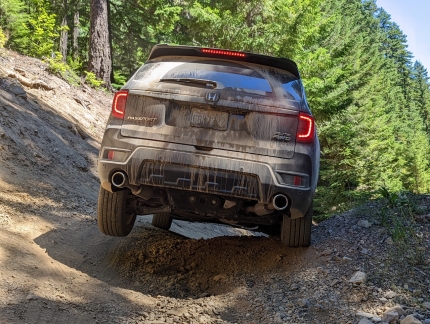 |
Offroading
Position: 47°13.18’N, -121°16.22’W
Over the course of the summer, we’d become progressively more daring on the terrain we would tackle in our little SUV. Jennifer often was out of the vehicle to direct us through areas with deep ruts and large rocks, to ensure our front bumper or spoiler didn’t catch. The most challenging conditions we’ve taken on so far was while returning home from a late-summer camping trip. Our maps showed a direct route to the highway, but we soon encountered a small hill partially blocking the road. Many, many vehicles had crossed before us, so we decided to give it a try with Jennifer out of the car guiding.
|
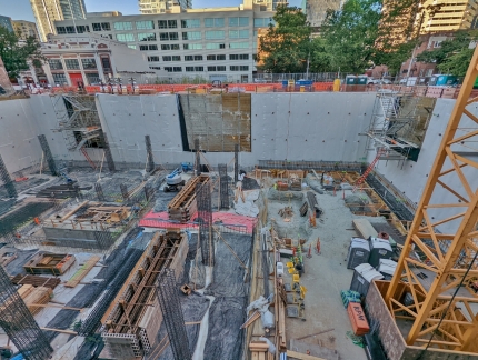 |
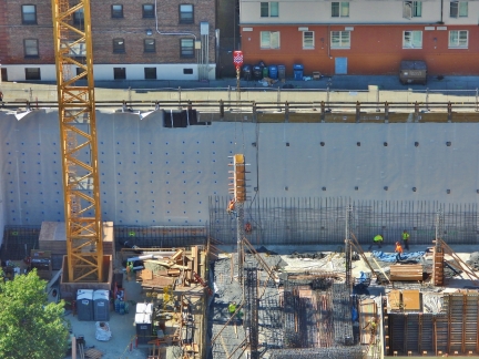
Foundation
Position: 47°36.91’N, -122°20.67’W
The bottom layer of foundation has been poured over the rebar at the Fourth & Bell construction site.
|
 |
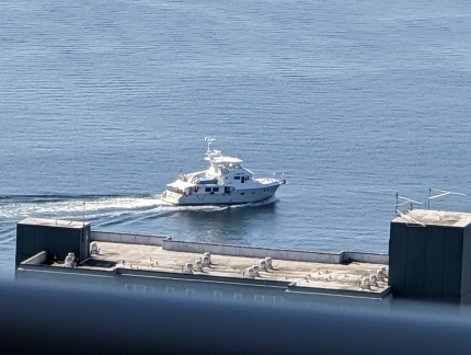
Form
Position: 47°36.92’N, -122°20.66’W
A worker at the Fourth & Bell construction site clinging to the top of a rebar tower and guiding a crane-suspended cement form into place. The form will be slid down to the bottom of the tower for the cement to be poured into.
|
 |
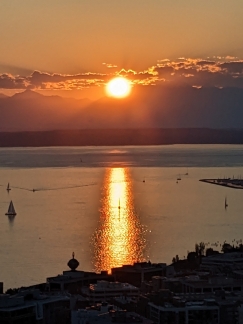
Lucky Penny
Position: 47°37.00’N, -122°20.66’W
Nordhavn 64 Lucky Penny departing Bell Harbor Marina, our old home port.
|
 |
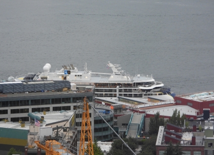
Sunset
Position: 47°37.01’N, -122°20.70’W
Spectacular orange sunset over Elliott Bay.
|
 |
Nat Geo Resolution
Position: 47°36.92’N, -122°20.66’W
The National Geographic Resolution moored at pier 66 in Seattle. We’ll be taking her sistership, the Endurance, on a cruise to the Antarctic later this year.
|
 |
Camp Grill
Position: 47°16.12’N, -121°21.79’W
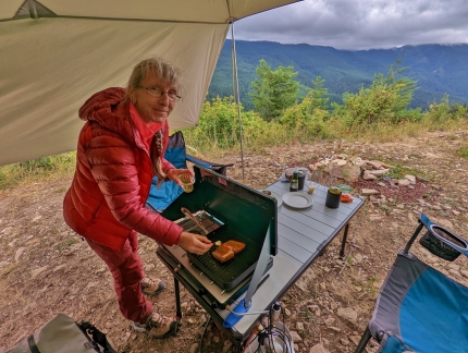
We’d been really wanting to grill at camp, but an entire barbecue is more extra gear than we want to carry. So we instead tried an All-Clad non-stick grill pan. In a first test on our apartment stove top, the grill pan distributed heat well and reached an impressive 346°F (174°C) . The next test would be to see how it did on the our camp stove, with only 10,000 BTU per burner.
|
 |
Crew
Position: 47°36.92’N, -122°20.66’W
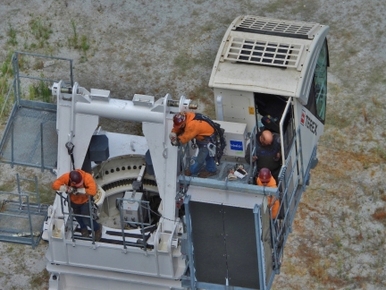
Looking down from our balcony to the crew ready to install a section of the tower crane at the 6th & Bell construction site.
|
 |
Mobile Crane
Position: 47°36.92’N, -122°20.66’W
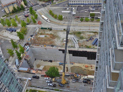
A mobile crane lifting a piece of the tower crane towards the waiting crew.
|
 |
Boom
Position: 47°36.92’N, -122°20.66’W
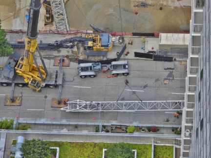
A section of the tower crane boom being lifted into place. We really enjoyed watching the progress.
|
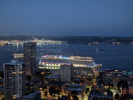 |
Norwegian Encore
Position: 47°36.92’N, -122°20.59’W
The Norwegian Encore arriving into Pier 66 between Alaska cruises. We’ll be taking that ship on a Caribbean cruise in late November.
|
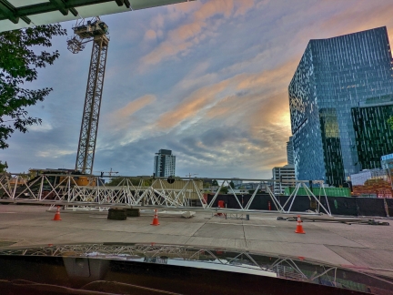 |
Boom Parts
Position: 47°37.00’N, -122°20.49’W
More boom parts for the tower crane at the 6th & Bell construction site, viewed as we depart early in the morning to hike Granite Mountain. Likely the tower crane will be complete by the time we get back home later today.
|
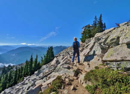 |
Granite Mountain Lookout
Position: 47°25.05’N, -121°28.87’W
The hike to Granite Mountain Lookout is not far at just under four miles (6.2 km) one-way. But with an altitude gain of 3,738 ft (1,139 m), a maximum grade of 39%, and an average grade of 18%, the hike is considered challenging. The trail is very popular though, with wonderful scenery along the way. And the summit has sweeping views, particularly northeast to the dramatic peaks of the Alpine Lakes Wilderness and south across the Cascade Range to Mt. Rainier and beyond.
|
 |
Momiji
Position: 47°37.06’N, -122°20.38’W
A delicious sushi dinner on the terrace at Momiji near our apartment building.
|
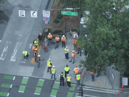 |
Morning Briefing
Position: 47°36.92’N, -122°20.66’W
Morning safety briefing for the crew at the 4th & Bell construction site.
|
 |
Demolition
Position: 47°36.92’N, -122°20.66’W
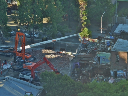
Excavators continuing the demolition of the burned building at 2nd & Bell.
|
 |
DOL
Position: 47°37.34’N, -122°21.62’W
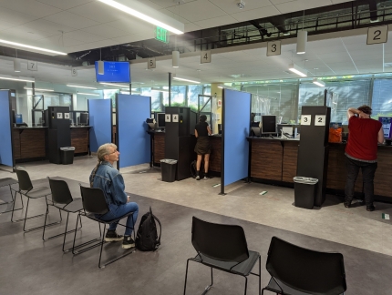
At the Department of Licensing to get an Enhanced Driver’s License (EDL) that is acceptable instead of a passport for air travel within the US. A residential address is required to obtain the EDL, along with several pieces of supporting documentation. That was difficult to do when we lived aboard, so we’ve not gotten one until now.
As we entered the building, someone greeted us at the door and asked if we were the Hamiltons. That’s pretty white glove for the driver’s license office :-). But we were just the last appointments of the day and they were expecting us before they locked the door. |
 |
Hilltop Ale House
Position: 47°38.28’N, -122°21.43’W
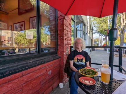
An enjoyable dinner on the terrace at Hilltop Ale House in Queen Anne. We really like this neighborhood pub and stop by whenever we’re even vaguely in the area.
|
 |
Dusk
Position: 47°36.92’N, -122°20.66’W
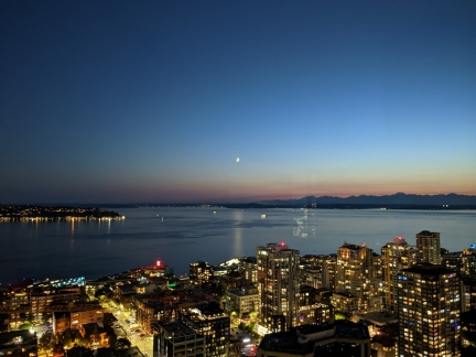
Dusk looking over Elliott Bay.
|
 |
Click the travel log icon on the left to see these locations on a map. And a map of our most recent log entries always is available at mvdirona.com/maps. |
If your comment doesn't show up right away, send us email and we'll dredge it out of the spam filter.