The trail to the summit of Mt. Si in North Bend ascends 3,100 feet (945 m) over a distance of just under 4 miles (6.4 km). Despite the steepness, it is one of the most popular trails in Washington state, with about 100,000 climbers annually. Part of the draw is its proximity to major urban centers, but much is for the fabulous views from the top.
The trail starts in an old-growth forest, following many switchbacks, before clearing the treeline for sweeping views. The true summit of Mt. Si is known as the Haystack and requires a hand-over-foot scramble to reach, but the views from there are even better.
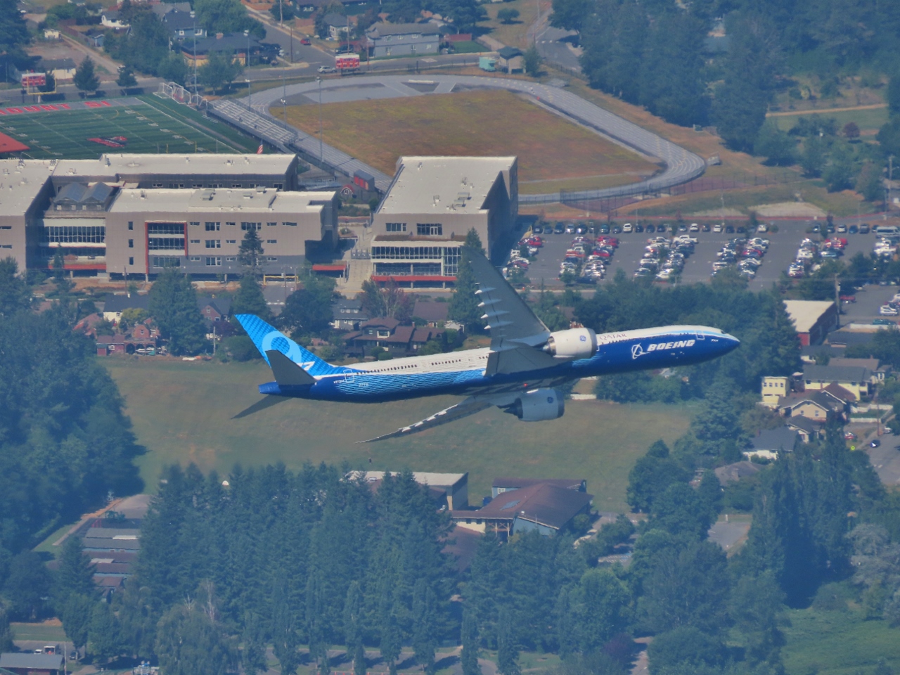
We ascended to the Haystack on a wonderfully clear day and really enjoyed the hike and the views. We also were lucky to be on the Haystack during a Boeing 777 flyover, pictured. It’s pretty rare to be standing on a mountain looking down at a jet plane.
Below are highlights from August 12, 2022. Click any image for a larger view, or click the position to view the location on a map. And a map with our most recent log entries always is available at mvdirona.com/maps.
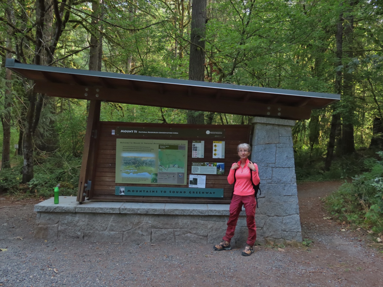 |
Mt. Si Trailhead
Position: 47°29.26’N, -121°43.40’W
At the trailhead to climb 4,167 ft (1,270 m) Mt. Si, shortly past 8am.
|
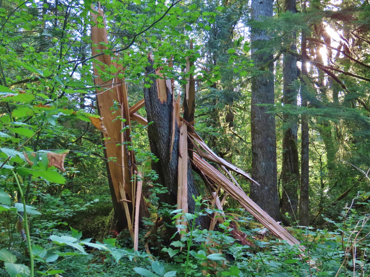 |
Shattered Tree
Position: 47°29.28’N, -121°43.39’W
What looks like a couple of fairly healthy tree just blew alongside the trail up Mt. Si.
|
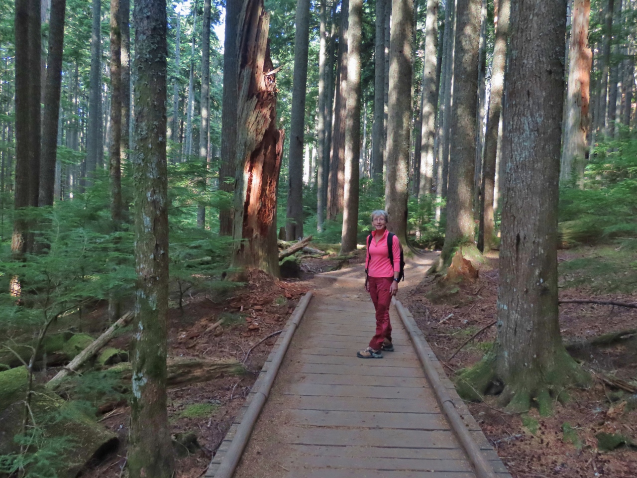 |
Snag Flat
Position: 47°29.81’N, -121°43.88’W
Walking along a boardwalk through Snag Flat, an old-growth forest that somehow has survived the past logging and mining in the area.
|
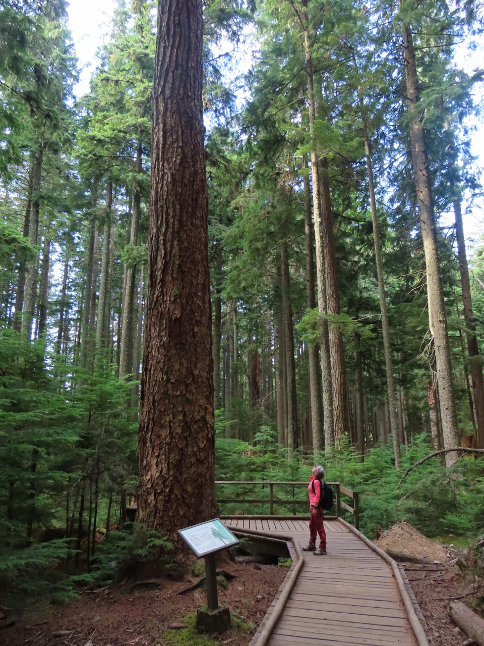 |
Douglas Fir
Position: 47°29.82’N, -121°43.91’W
This 350-year-old Douglas Fir in Snag Flat stands 175-ft (53 m) high.
|
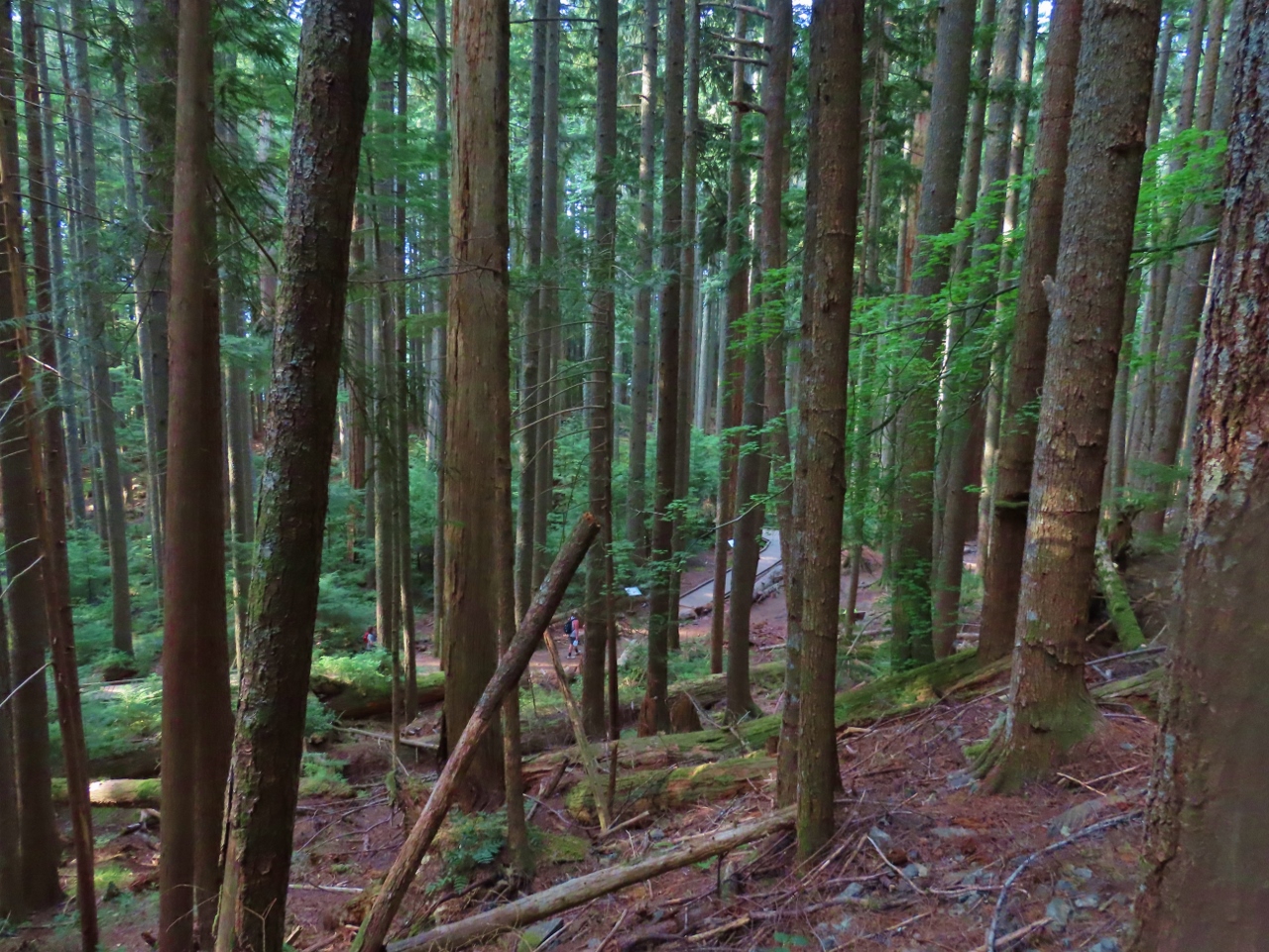 |
Switchbacks
Position: 47°29.80’N, -121°44.03’W
The trail up to Mt. Si ascends 3,100 feet (945 m) over a distance of just under 4 miles (6.4 km), with lots of switchbacks along the way. This is the view looking back down to hikers below us passing through Snag Flags.
|
 |
Overlook
Position: 47°30.30’N, -121°44.38’W
The sweeping view northwest from an overlook near the top of Mt. Si.
|
 |
Haystack
Position: 47°30.37’N, -121°44.36’W
Looking up to the Haystack, the true summit of Mt. Si.
|
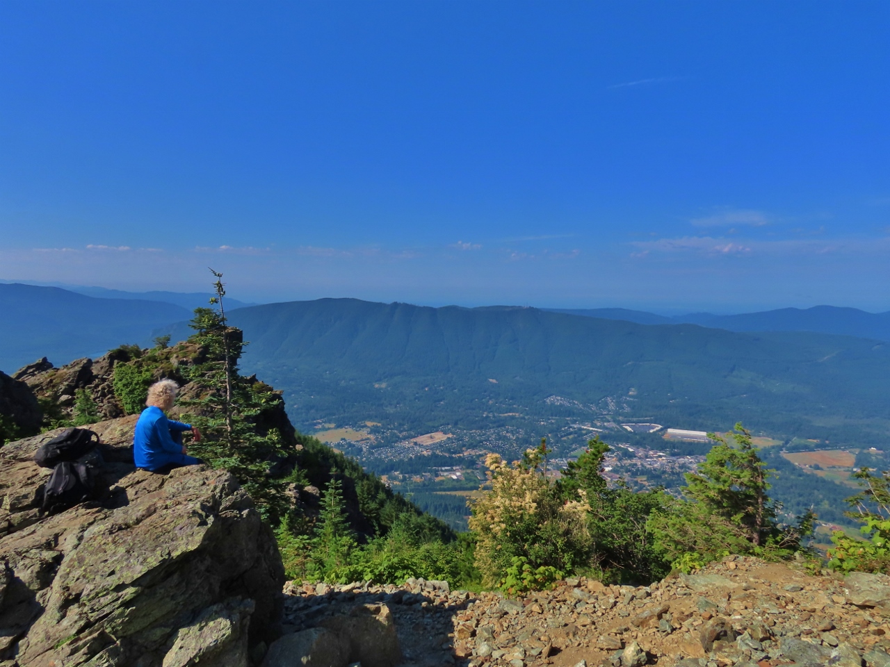 |
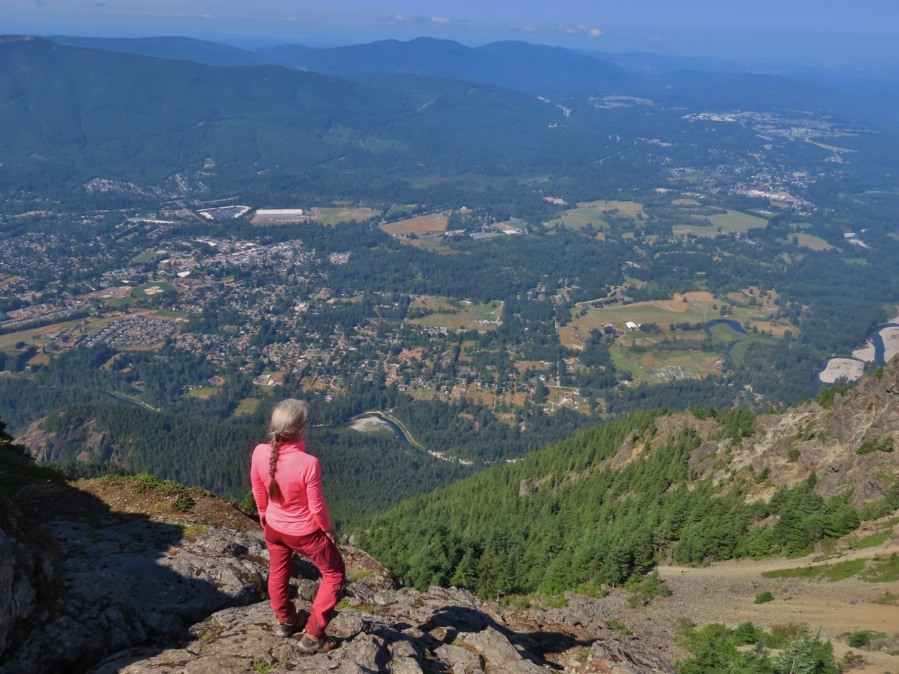
Snack
Position: 47°30.37’N, -121°44.36’W
James taking in the view west from the overlook while we have a break and a snack before tackling the Haystack.
|
 |
Canada Jay
Position: 47°30.37’N, -121°44.36’W
A Canada Jay looking for a handout. The birds are known as “camp robbers” due to their tendency to get comfortable around humans and steal food.
|
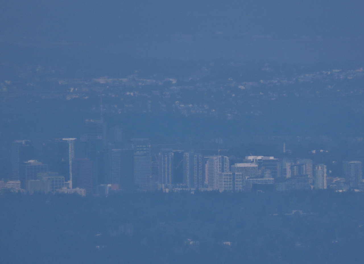 |
Bellevue
Position: 47°30.37’N, -121°44.36’W
The sky is a little hazy today, and we can just see the city of Bellevue, in Seattle’s Eastside suburbs, about 23 miles (37 km) away.
|
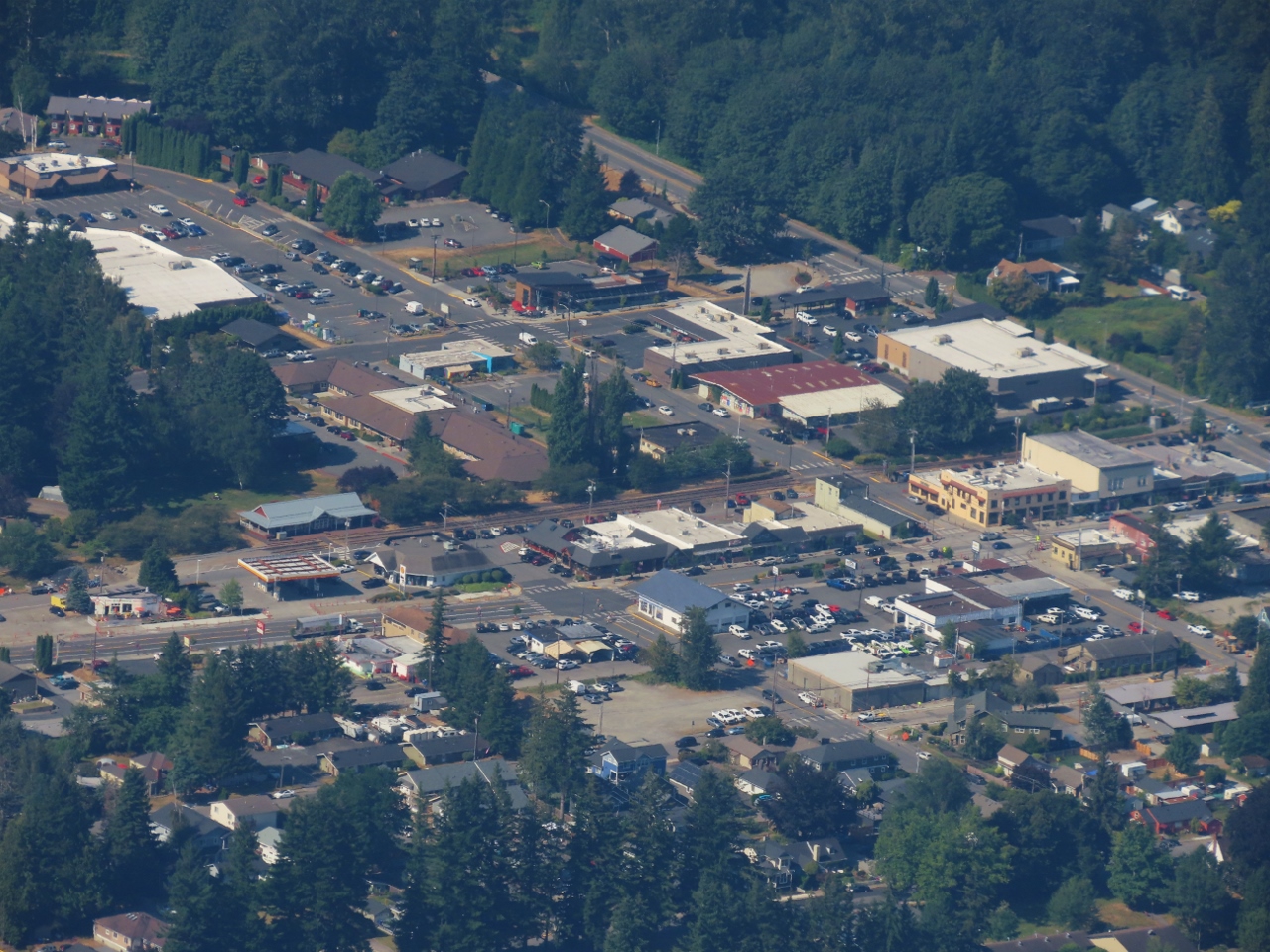 |
North Bend
Position: 47°30.37’N, -121°44.36’W
View down to North Bend from the overlook at Mt. Si. The North Bend Bar & Grill, where we often have lunch when in the area, is roughly at center and Rio Bravo, where we had lunch a couple of weeks ago, is the leftmost white building just down the street (click image for a larger view).
|
 |
Atop Haystack
Position: 47°30.42’N, -121°44.34’W
Reaching the top of the Haystack required a bit of a scramble up a steep slope with no obvious route up. But the view definitely was worth it.
|
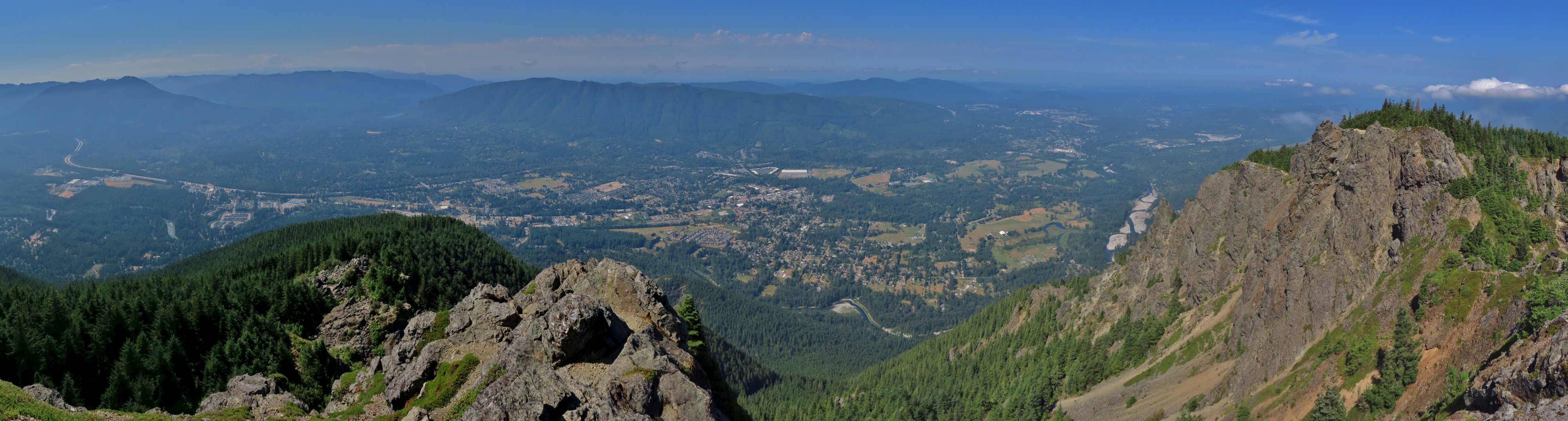 |
Haystack View
Position: 47°30.42’N, -121°44.34’W
The panoramic view west from atop the Haystack on Mt. Si.
|
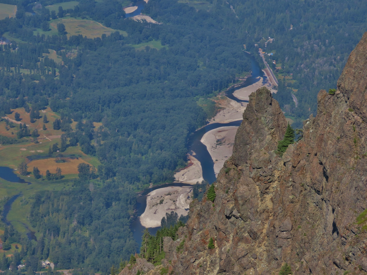 |
Snoqualmie River
Position: 47°30.42’N, -121°44.34’W
The Snoqualmie River, viewed from the Haystack atop Mt. Si.
|
|
|
Boeing 777 Flyover
Position: 47°30.42’N, -121°44.34’W
A Boeing 777 performing a flyover of the Eastside as part of the Boeing Classic PGA golf tournament taking place at the Club at Snoqualmie Ridge. It’s pretty rare to be standing on a mountain looking down at a jet plane.
|
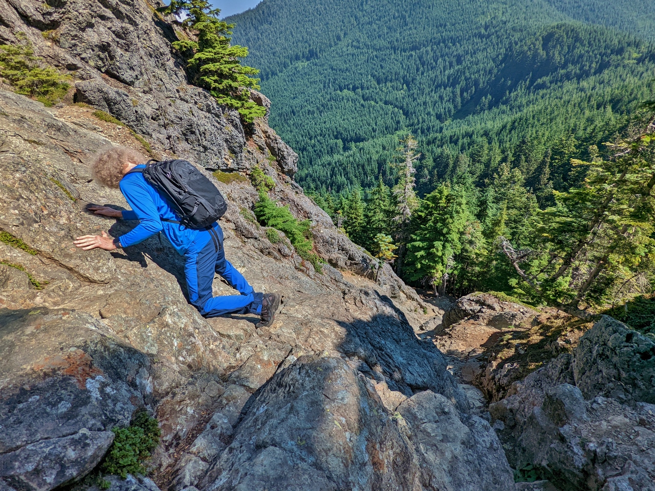 |
Descending
Position: 47°30.43’N, -121°44.33’W
Working our way back down the north side of the Haystack at Mt. Si. The going is quite steep with no obvious path, so we had to carefully find our own way.
|
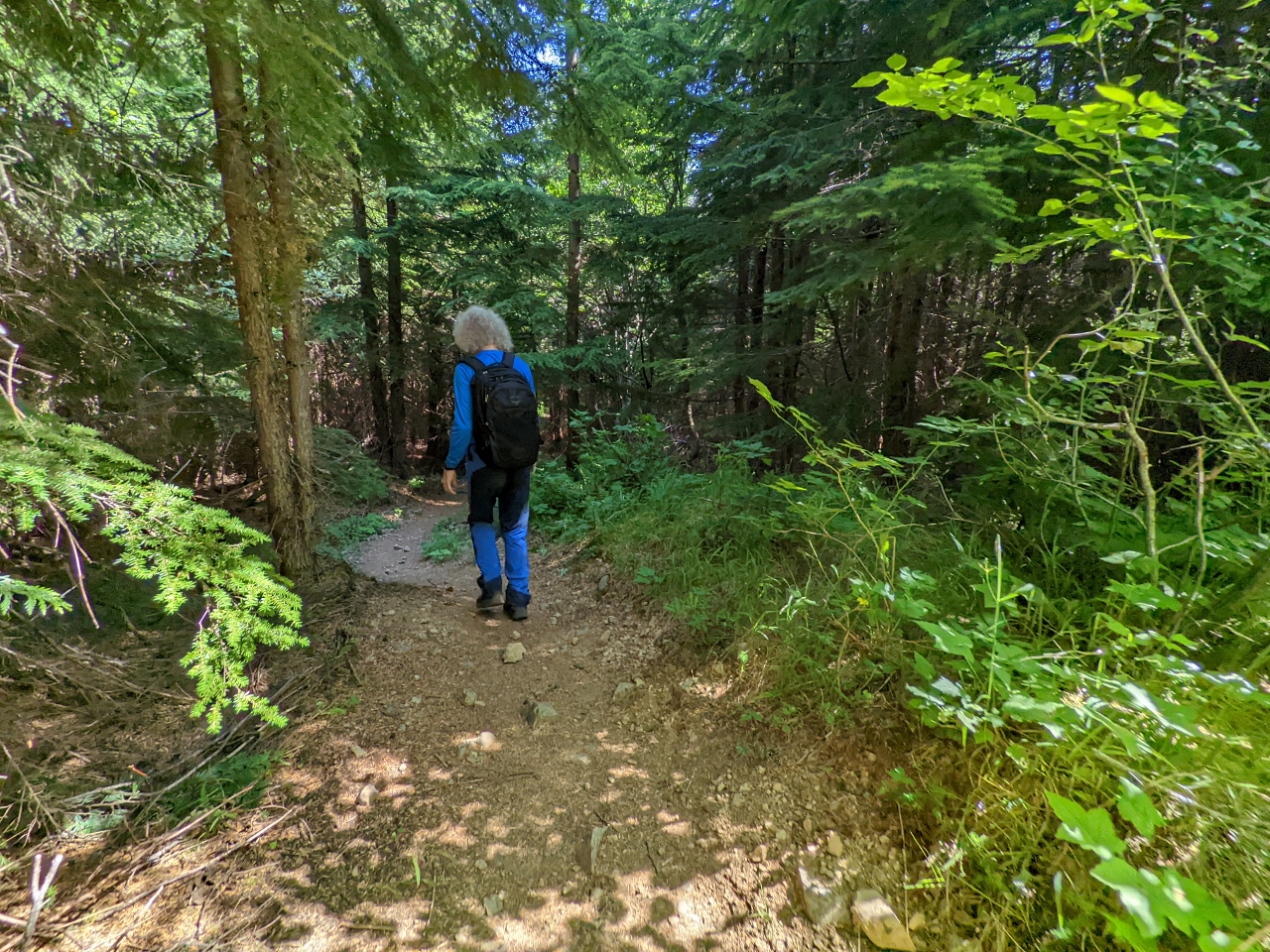 |
Mt. Teneriffe Trail
Position: 47°30.45’N, -121°43.96’W
We descended back to the parking lot on the Mt. Teneriffe Trail to make a loop. We passed or saw several dozen people on the trail up to Mt. Si, but only a few people in this much less busy trail.
|
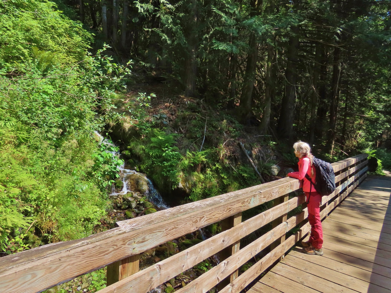 |
Bridge
Position: 47°29.79’N, -121°43.04’W
Taking in the view to a waterfall from a footbridge along the Mt. Teneriffe Trail.
|
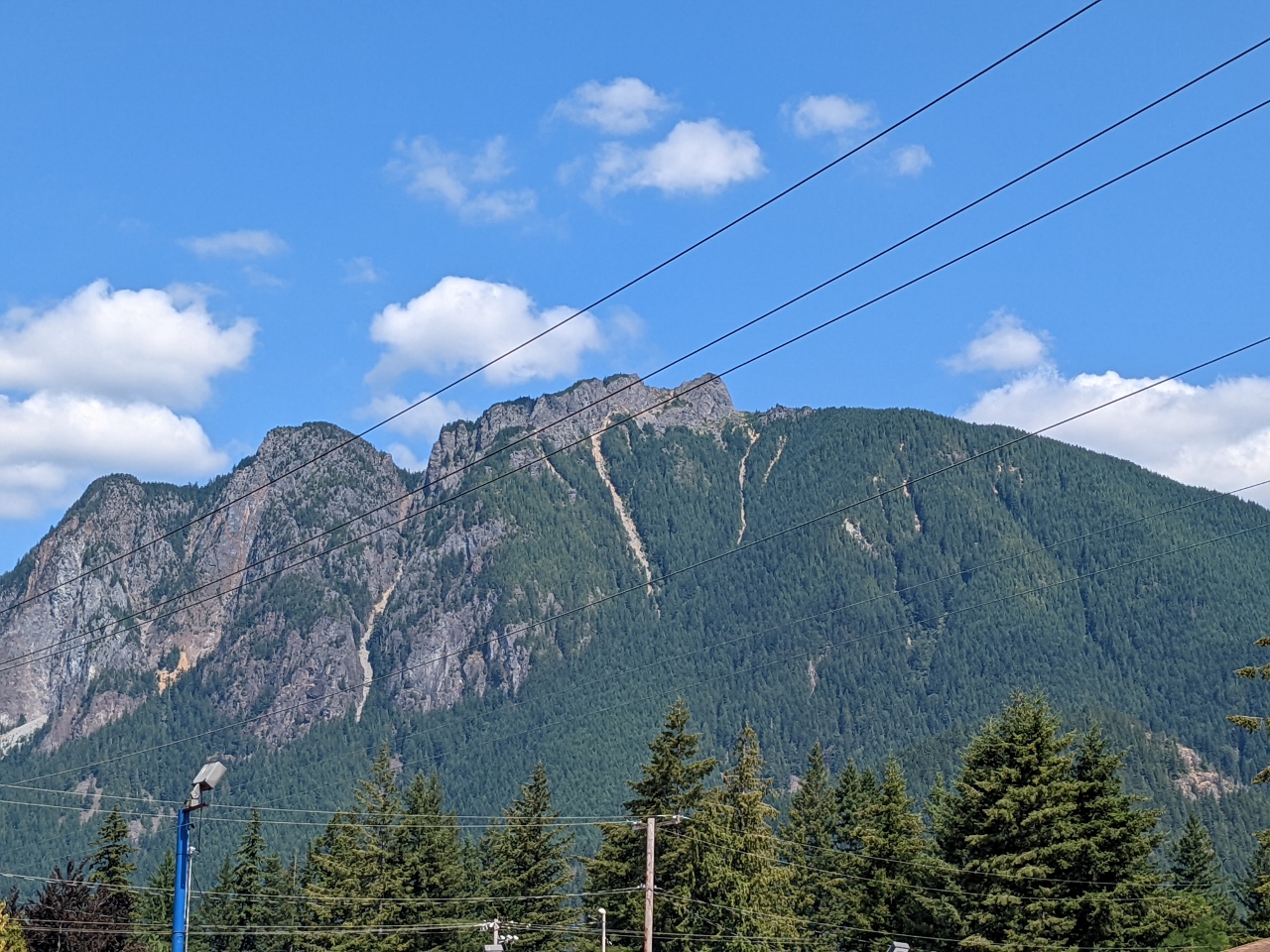 |
Mt. Si from North Bend
Position: 47°29.65’N, -121°47.09’W
The view to the summit of Mt. Si from the North Bend Bar & Grill, where we stopped for lunch. It was fun to see the summit from here now that we’ve actually climbed it.
|
 |
Click the travel log icon on the left to see these locations on a map. And a map of our most recent log entries always is available at mvdirona.com/maps. |
If your comment doesn't show up right away, send us email and we'll dredge it out of the spam filter.