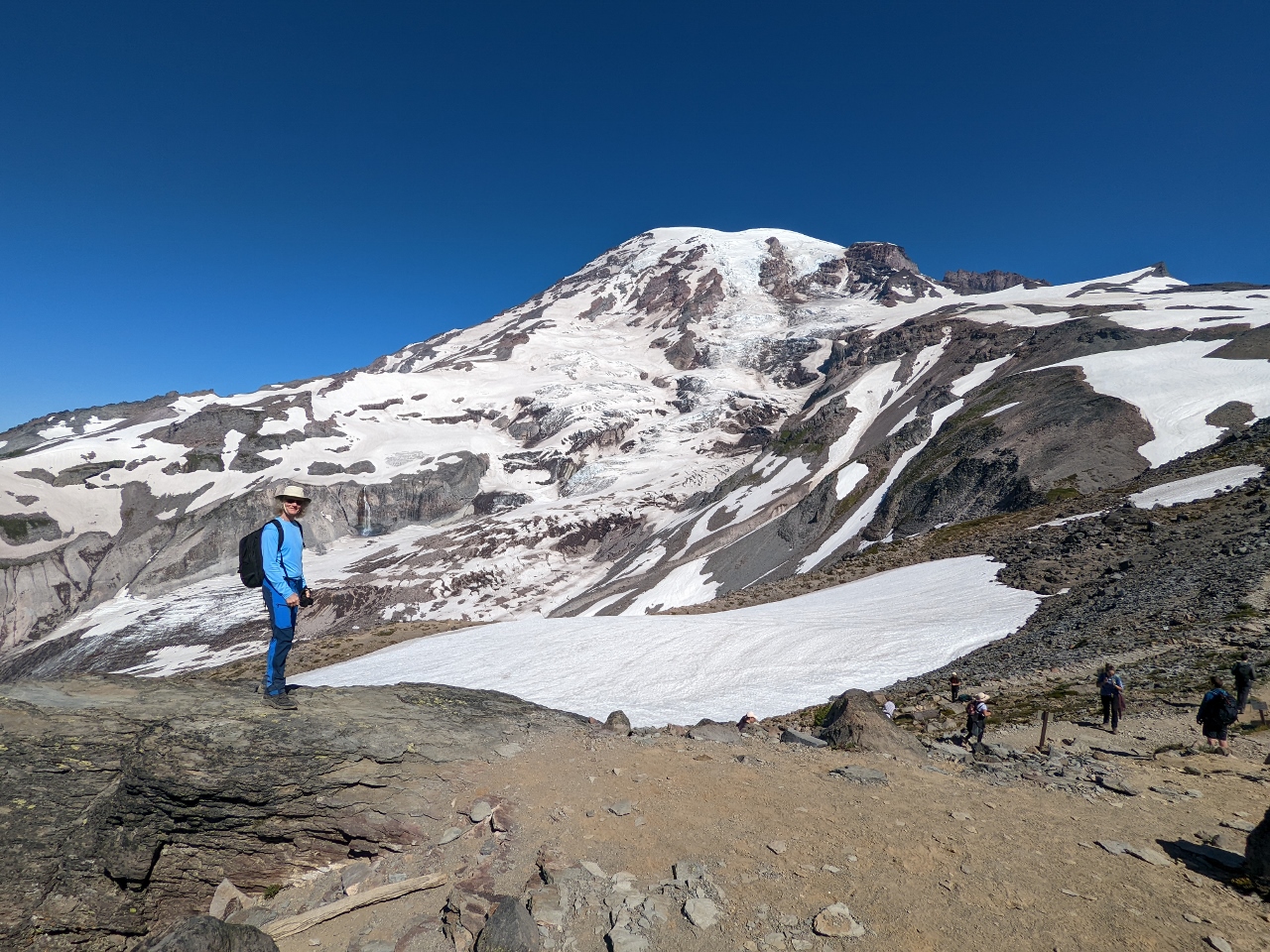
On our second day of summer hiking at Mt. Rainier, we walked the Skyline Trail from the Paradise area, following roughly the same route that we’d snowshoed earlier in the year. We had another clear day, and the mountain views were spectacular, both to Mt. Rainier and south along the Cascade Range. The scenery had changed so much in the summer that it felt like a completely different place than the winter.
Besides abundant greenery, colorful wildflowers, and much less snow (although still some), another notable addition in the summer is wildlife. Hoary marmots, pictured above, were everywhere along the trail, along with cheeky chipmunks and birds looking for a handout.
Another difference is that summer is much more crowded than winter. Most of the park’s 2 million annual visitors come in July and August. We arrived at Paradise shortly past 7:00 am to be sure of getting a parking spot and saw relatively few people. But by the time we departed at 1pm, the crowds were thick at Paradise, with a long queue to reach parking lot, and the line of cars at the Nisqually entrance extended 2.5 miles (4 km) outside the park.
Below are highlights from August 6, 2022. Click any image for a larger view, or click the position to view the location on a map. And a map with our most recent log entries always is available at mvdirona.com/maps.
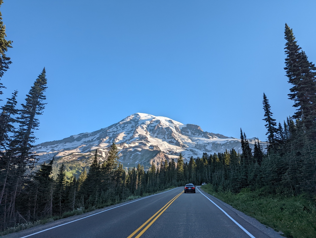 |
Paradise Road
Position: 46°46.92’N, -121°44.70’W
Heading up Paradise Road shortly past 7am to hike the Paradise area before the crowds arrive. The mountain is out and it looks like we’re going to have another wonderfully clear day.
|
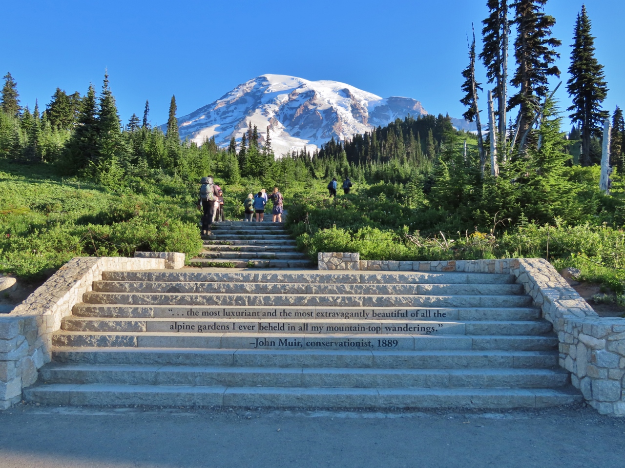 |
John Muir Quote
Position: 46°47.18’N, -121°44.18’W
These stairs at Paradise carry a 1889 quote from conservationist John Muir describing the area as “.. the most luxuriant and the most extravagantly beautiful of all the alpine gardens I ever beheld in all my mountain-top wanderings.” The stairs were buried under snow the last time we were here to snowshoe.
|
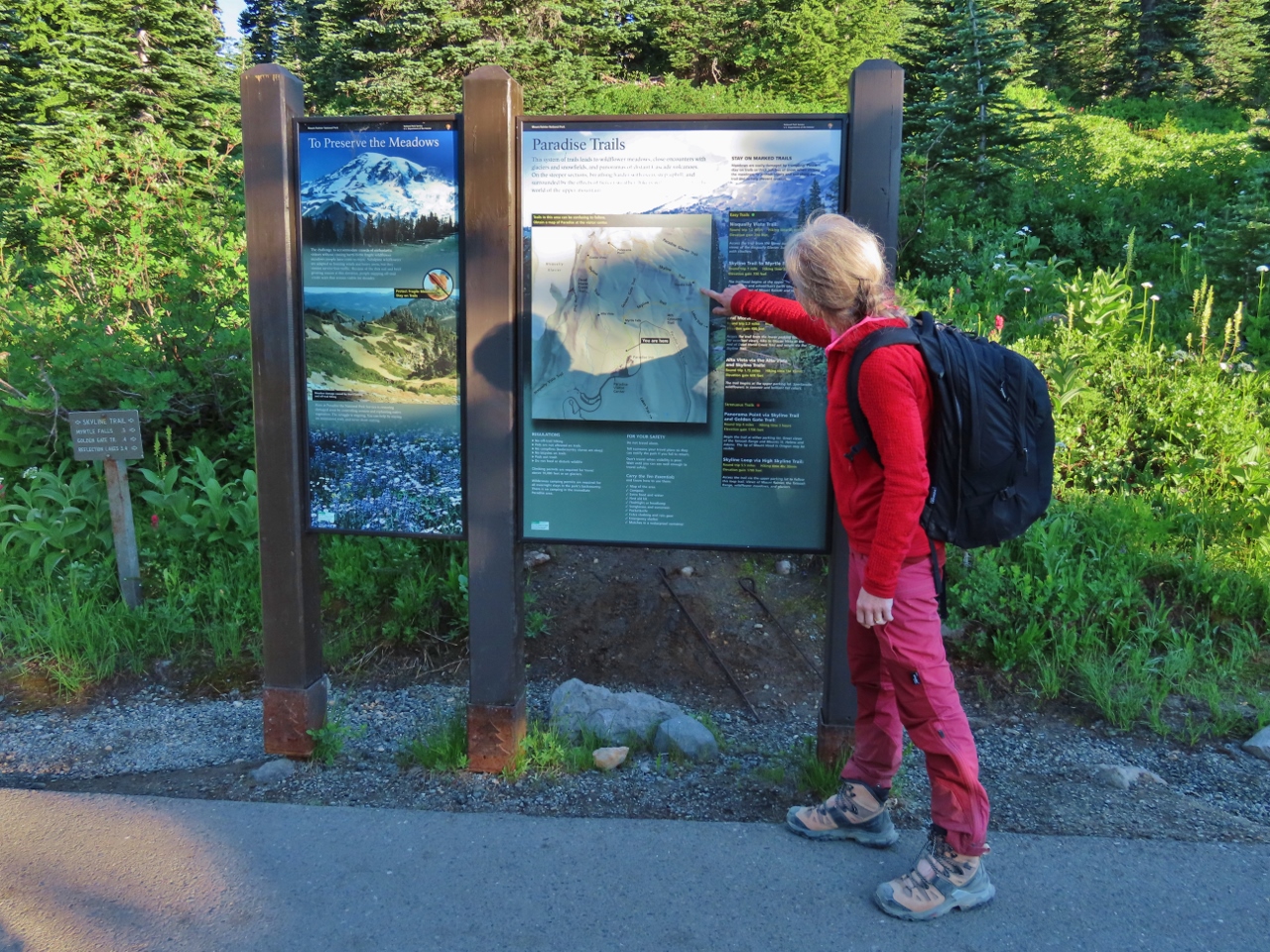 |
Trail Map
Position: 46°47.26’N, -121°44.04’W
Jennifer pointing to the route of the Skyline Trail that we’ll be walking today.
|
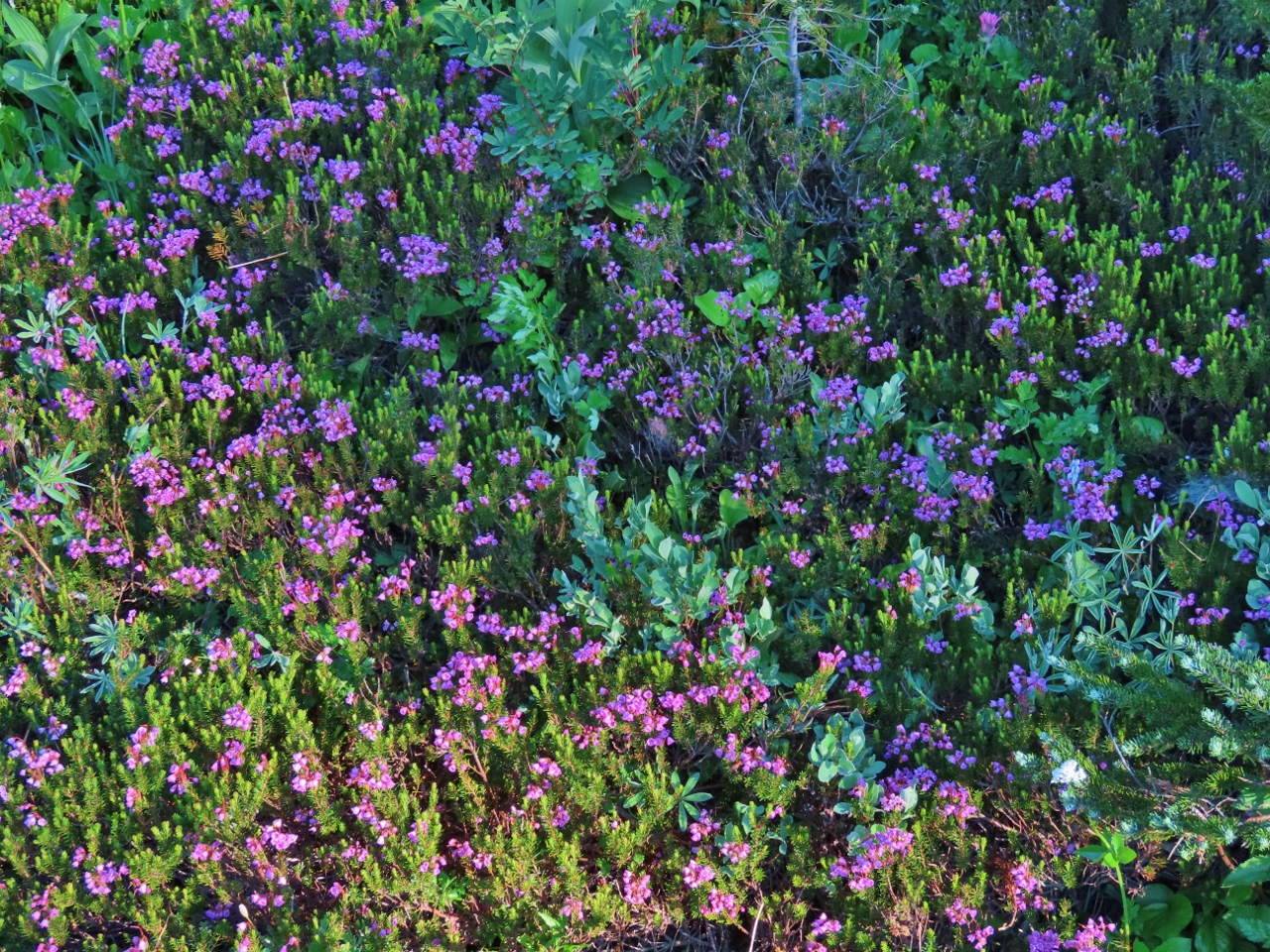 |
Pink Mountain Heater
Position: 46°47.29’N, -121°44.00’W
A field of pink mountain heather along the Skyline Trail.
|
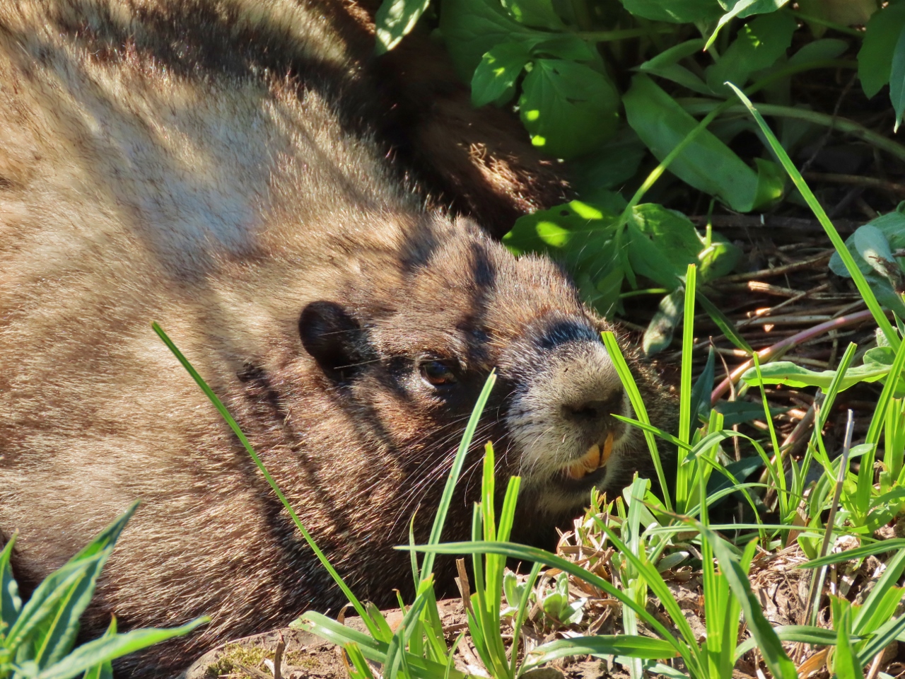 |
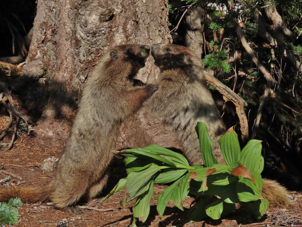
Marmot
Position: 46°47.36’N, -121°43.96’W
This hoary marmot lying in the grass right beside the trail seemed pretty unconcerned about our passing by. The animals have thick layers of fat that allow them to hibernate for eight to nine months each year.
|
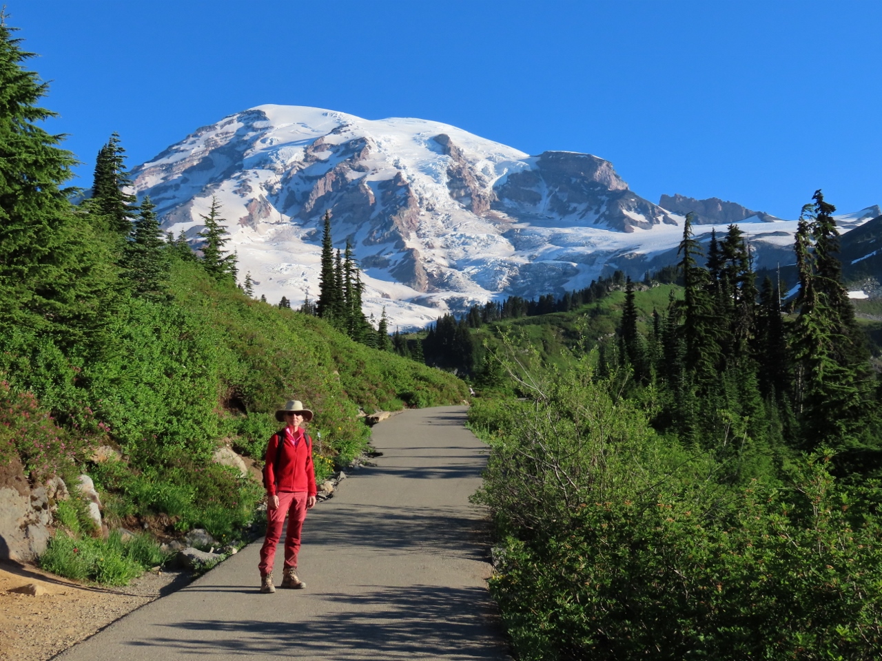 |
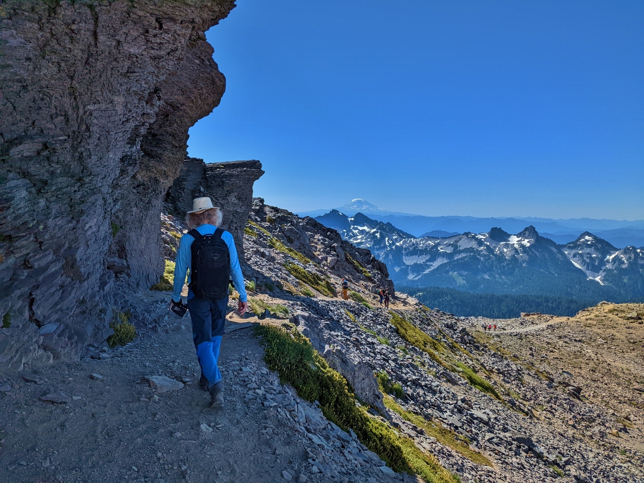
Skyline Trail
Position: 46°47.42’N, -121°43.97’W
Jennifer and Mt Rainier as we set off on the Skyline Trail. This early in the morning, at 7:30am, few people are out on the trails with us.
|
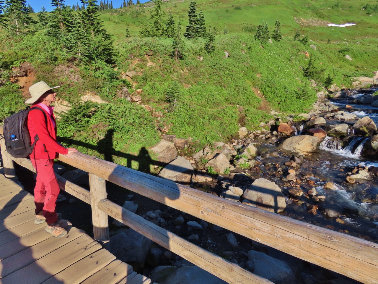 |
Edith Creek
Position: 46°47.49’N, -121°43.96’W
Enjoying the view from the bridge over Edith Creek along the Skyline Trail.
|
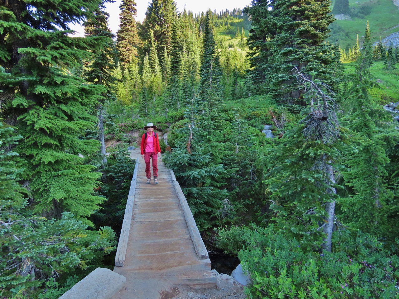 |
Paradise River
Position: 46°47.53’N, -121°43.39’W
Crossing a small footbridge over the Paradise River.
|
 |
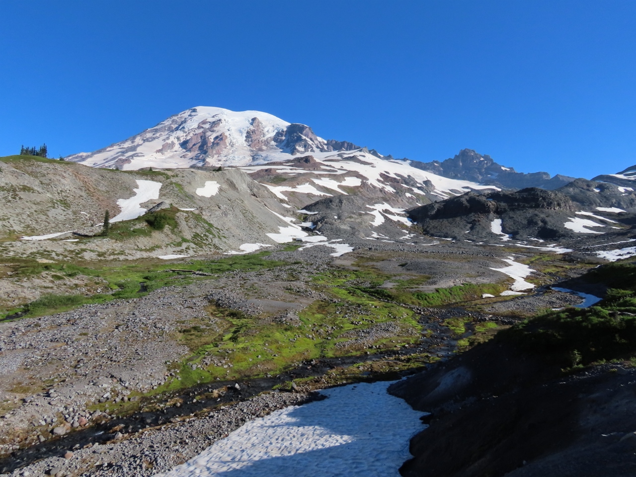
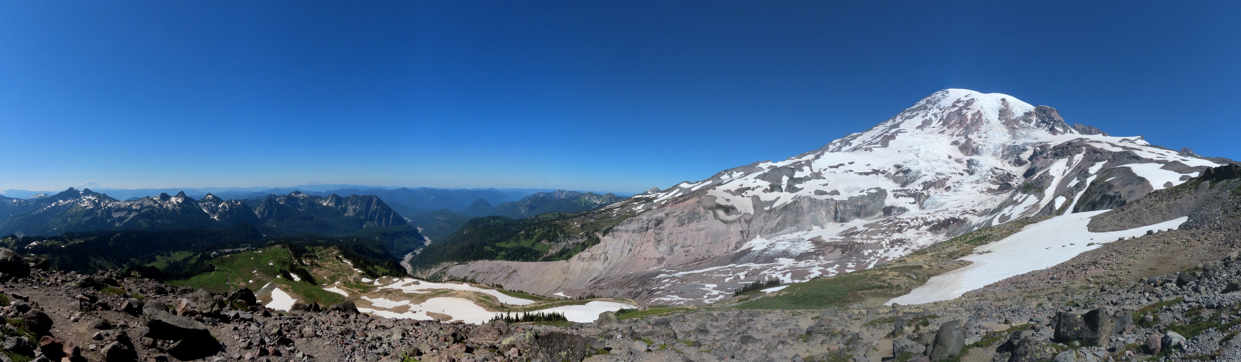
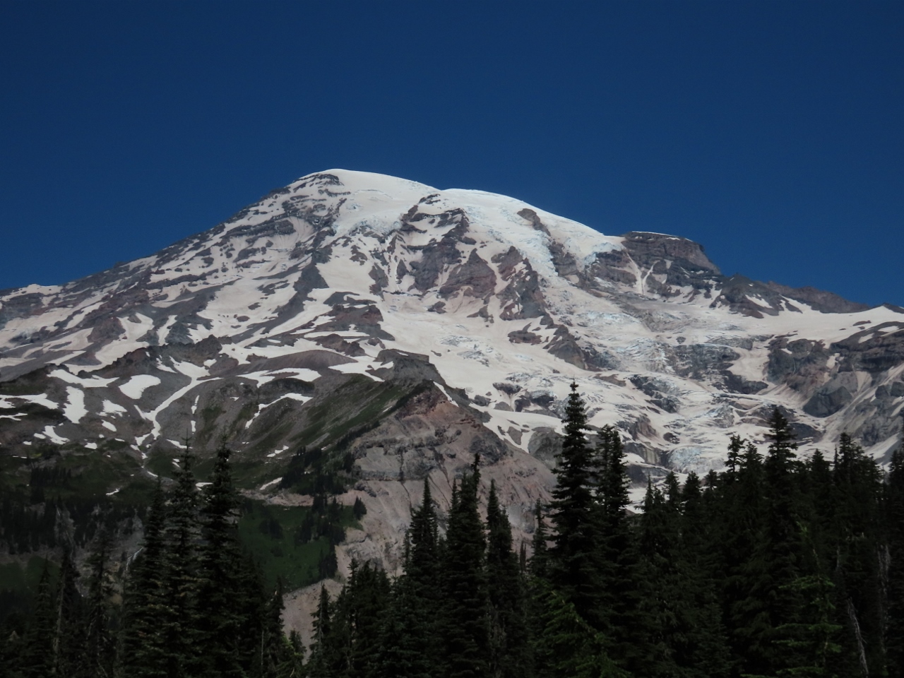
Mazama Ridge
Position: 46°47.39’N, -121°43.07’W
Another fabulous view of Mt. Rainier, this one from Mazama Ridge. The scene is quite different from the winter view we had from here on our snowshoeing trip earlier in the year.
|
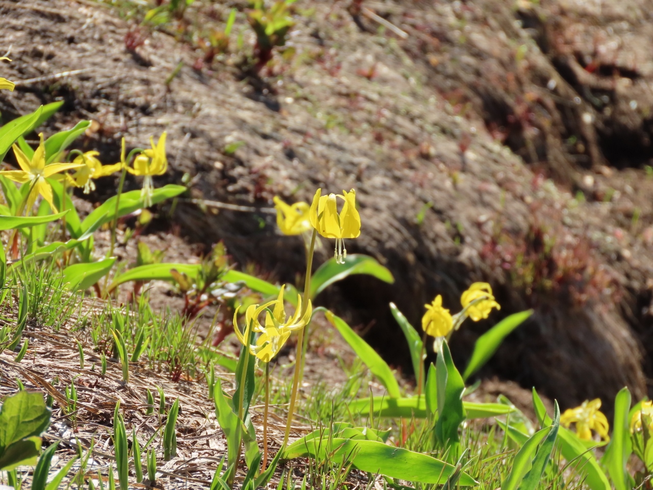 |
Glacier Lily
Position: 46°47.50’N, -121°43.01’W
Delicate-looking glacier lilies alongside the Skyline Trail. John Muir was right—the wildflowers really are special up here.
|
|
|
Marmots
Position: 46°47.58’N, -121°43.01’W
This pair of marmots popped out a trail-side hole and played out a mating ritual for quite some time.
|
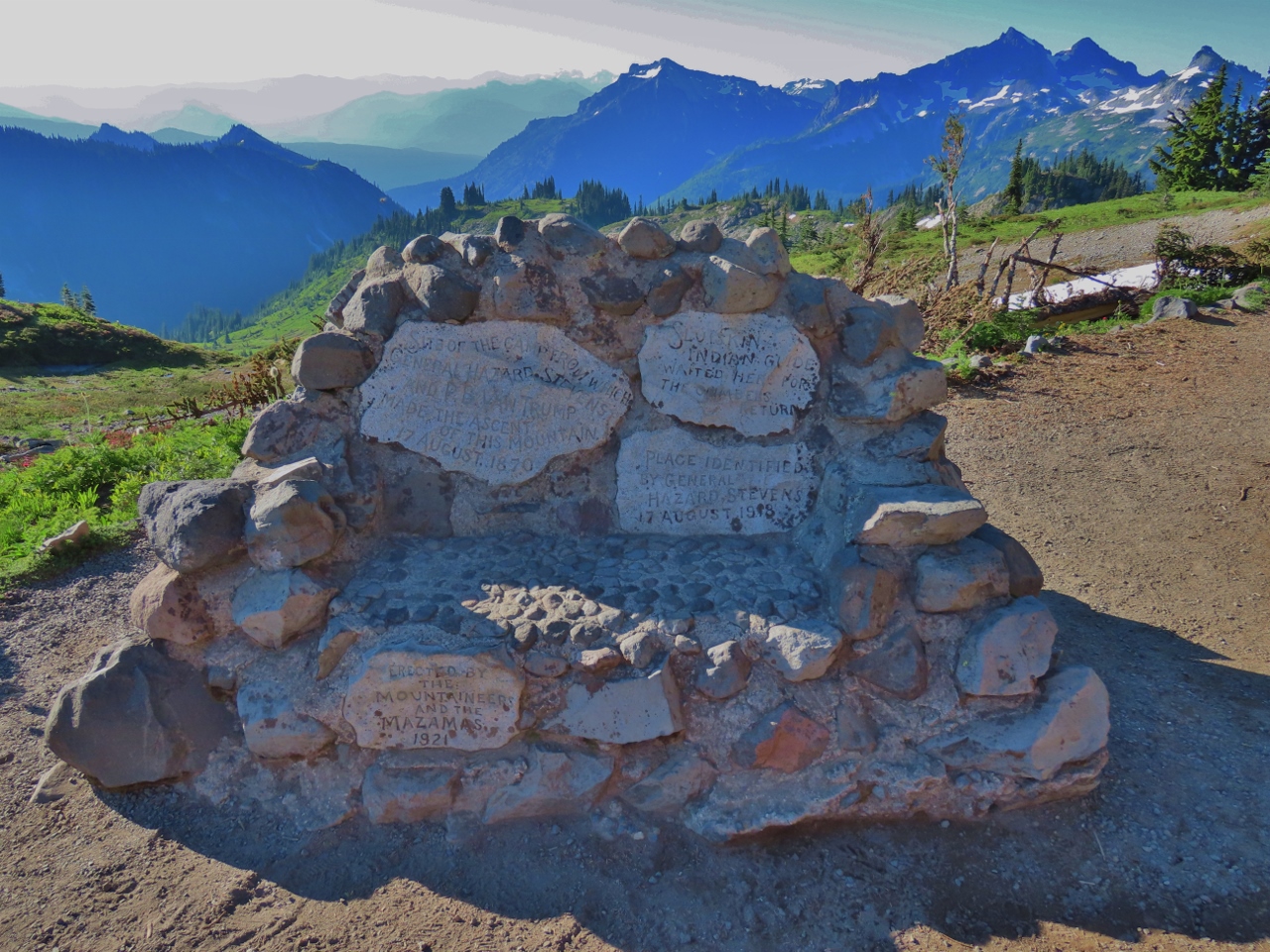 |
Monument
Position: 46°47.66’N, -121°42.94’W
Memorial to Stevens-Van Trump, who made the first documented ascent of Mt. Rainier in 1870. The monument was erected in 1921 by the Mountaineers and the Mazamas mountaineering organizations at the site of the camp from which he made the climb. We walked right over top of the snow-buried monument when we were last here snowshoeing.
|
 |
Paradise River Valley
Position: 46°47.68’N, -121°42.94’W
Looking across the Paradise River Valley to Mt. Rainier shortly before the trail descends and crosses the river.
|
 |
Viewpoint
Position: 46°47.71’N, -121°43.15’W
Enjoying the view after ascending back out of the Paradise River Valley.
|
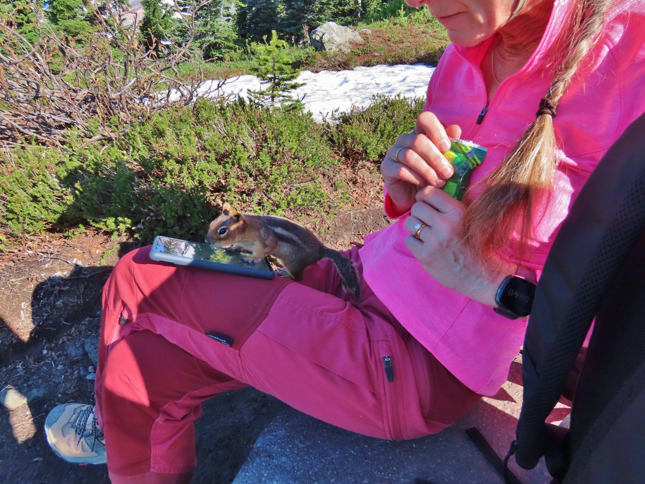 |
Chipmunk
Position: 46°47.71’N, -121°43.15’W
This cheeky chipmunk was looking for a handout. It didn’t get one, but only because we carefully guarded our food.
|
 |
Bear Grass
Position: 46°47.87’N, -121°43.33’W
A snowfield along the Skyline Trial, with bear grass blooming at left. Bears will eat the fleshy leaves in the spring, giving the flower its name.
|
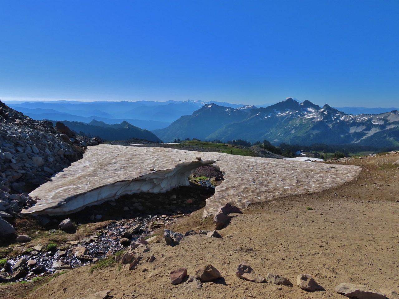 |
Snow Bridge
Position: 46°47.93’N, -121°43.36’W
A delicate snow bridge along the Skyline Trail. With the current warm weather, this won’t last much longer.
|
 |
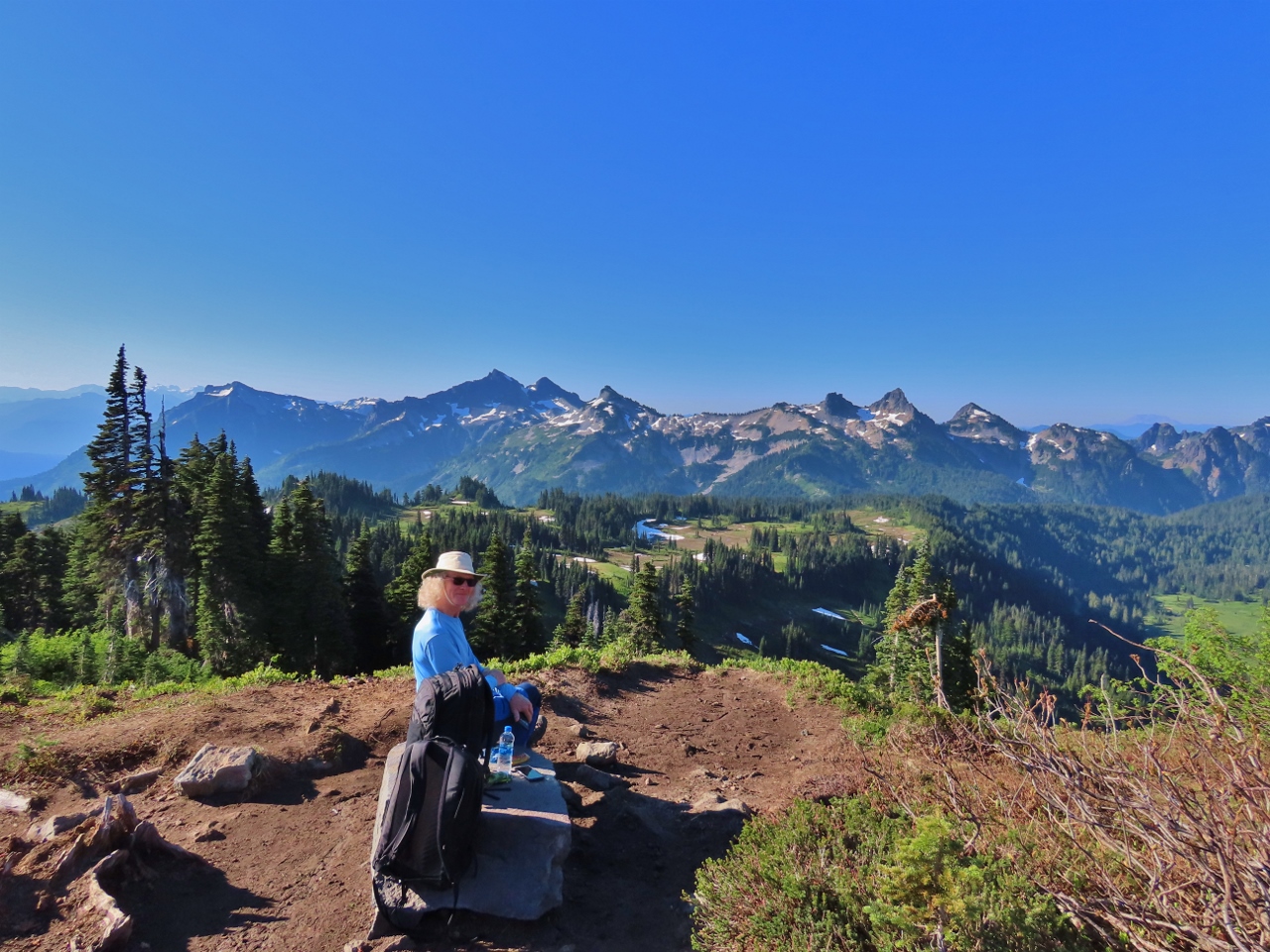
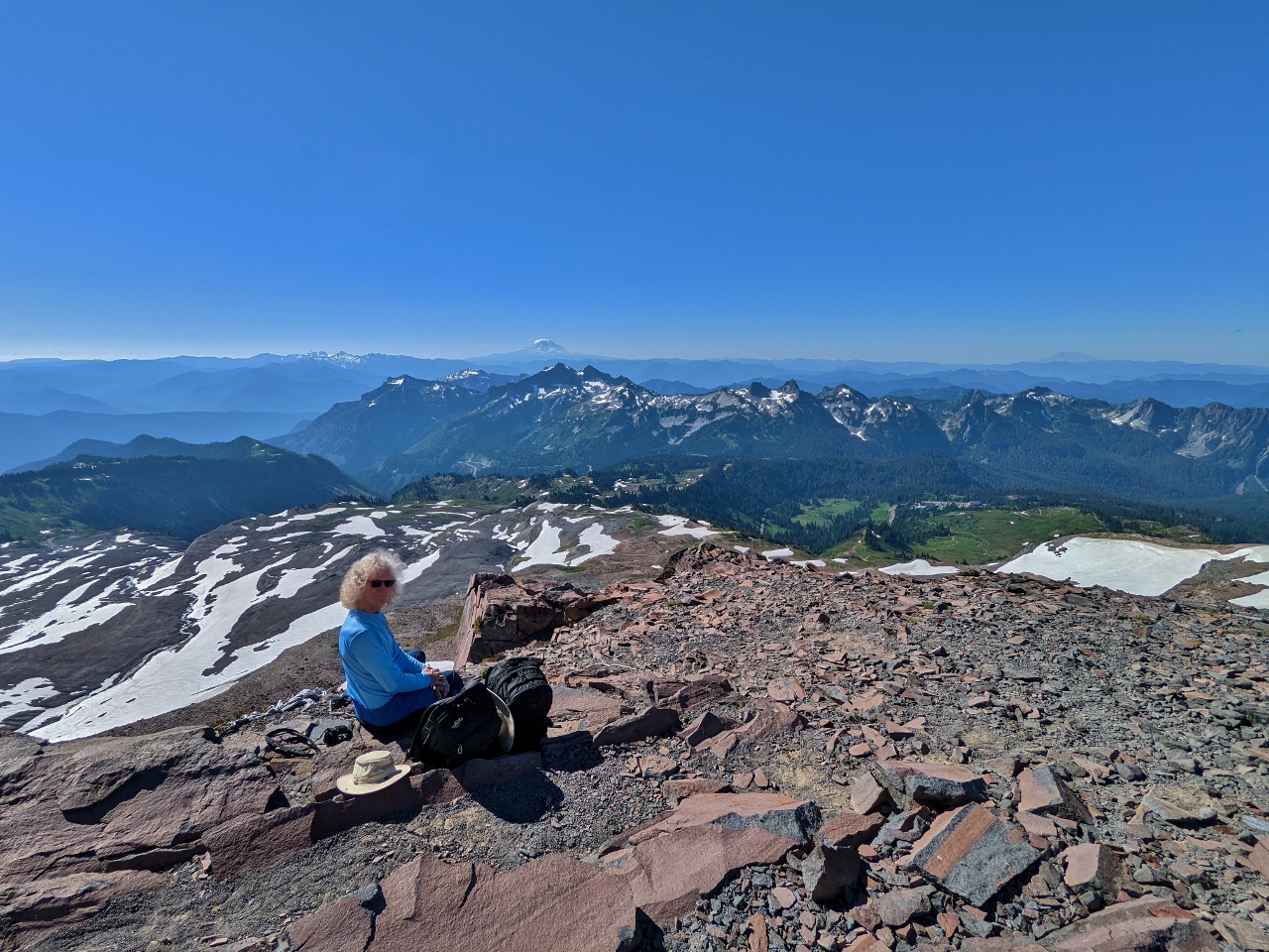
McClure Rock
Position: 46°48.53’N, -121°43.35’W
Taking a break at 7,359 ft (2,243 m) McClure Rock with Mt. Rainier visible behind. This is the highest point in our hike today.
|
 |
McClure Rock View
Position: 46°48.51’N, -121°43.37’W
The expansive view south from McClure Rock. 11,250-ft (3,429 m) Mt Hood is visible in the distance at center, with 8,363-ft (2,549 m) Mt. St. Helens at right (click image for a larger view).
|
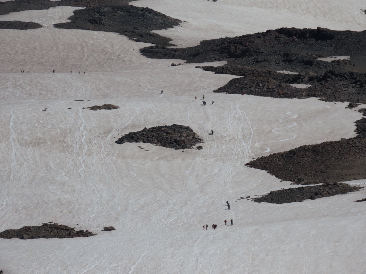 |
Camp Muir Hikers
Position: 46°48.53’N, -121°43.35’W
A steady column of climbers heading up to Camp Muir. At elevation 10,187 feet (3,104 m), Camp Muir is the highest you can go in the park without a permit and is used as a staging point for climbers attempting the summit of Mt. Rainier via the Gibraltar Route on the mountain’s southern face. The camp is named after naturalist John Muir, who in 1888 was part of the group that made the sixth recorded ascent of the mountain.
The hike to Camp Muir has an elevation gain of 4,788 ft (1,459 m) over a distance of 4 miles (6.4 km), with a return hike typically taking 7-8 hours. It is considered a reasonably challenging route partly due to the changeability of the weather at the mountain, with frequent whiteouts, and also due to the high elevation, both in gain and actual altitude. |
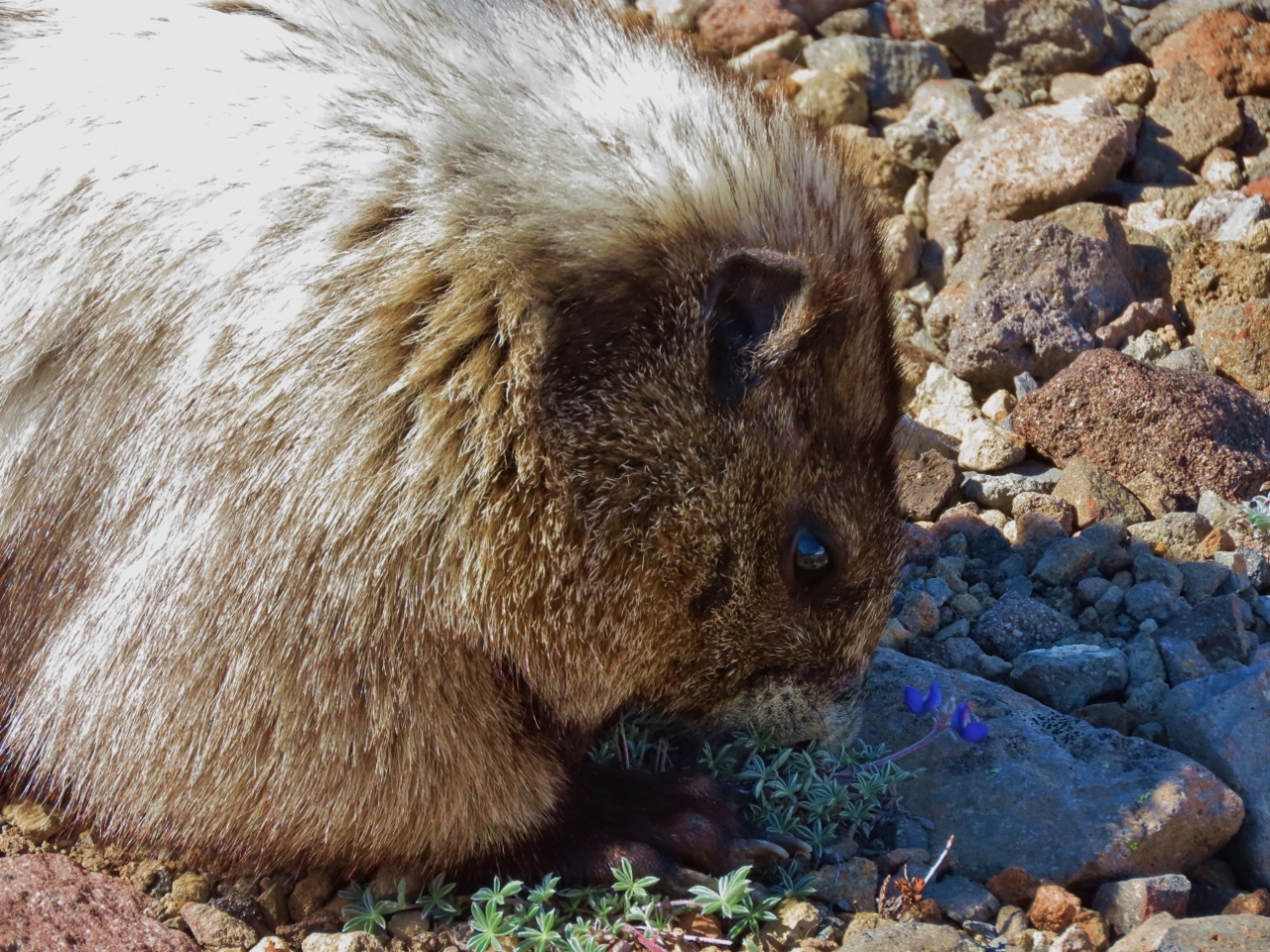 |
Mowing
Position: 46°48.31’N, -121°43.71’W
A hoary marmot mowing down the wildflowers at a rapid pace. Building up all that fat takes a lot of food.
|
 |
Panorama Point
Position: 46°48.16’N, -121°43.78’W
View to Mt. Rainier from Panorama Point. By 10:30am, its starting to get quite busy up here.
|
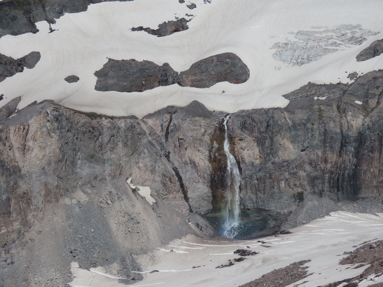 |
Waterfall
Position: 46°48.16’N, -121°43.78’W
Glacial-fed waterfall on the flank of Mt. Rainier, viewed from Paradise Point.
|
 |
Descending
Position: 46°47.96’N, -121°44.09’W
Descending from Panorama Point on the Skyline Trail with 11,250-ft (3,429 m) Mt Hood is visible in the distance. In the winter, this section of the trail is rerouted due to avalanche risk, so we’ve not walked here before.
|
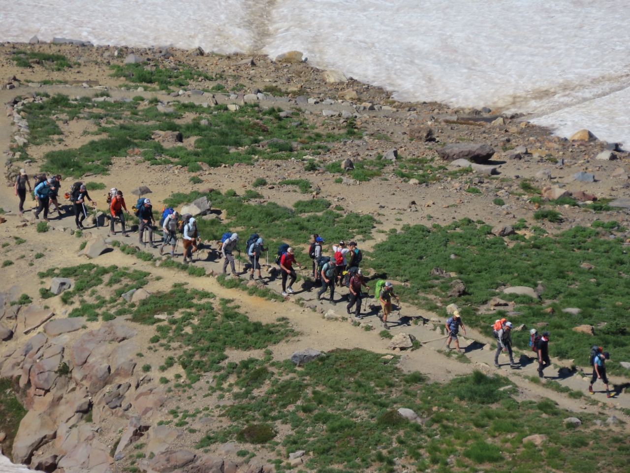 |
Climbers
Position: 46°47.74’N, -121°44.15’W
A steady stream of climbers heading up to Camp Muir. It’s getting late to make the 7-8-hour hike in one day, so likely they will be camping there overnight.
|
 |
West View
Position: 46°47.65’N, -121°44.17’W
The view west from Skyline Trail as we descend from Panorama Point (click image for a larger view).
|
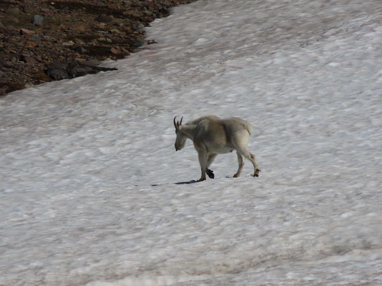 |
Crossing Snow
Position: 46°47.65’N, -121°44.17’W
A mountain goat crossing a snow bank with it’s tongue out (click image for a larger view).
|
 |
Mt. Hood
Position: 46°47.65’N, -121°44.17’W
View to 11,249 ft (3,429 m) Mt. Hood from the Skyline Trail.
|
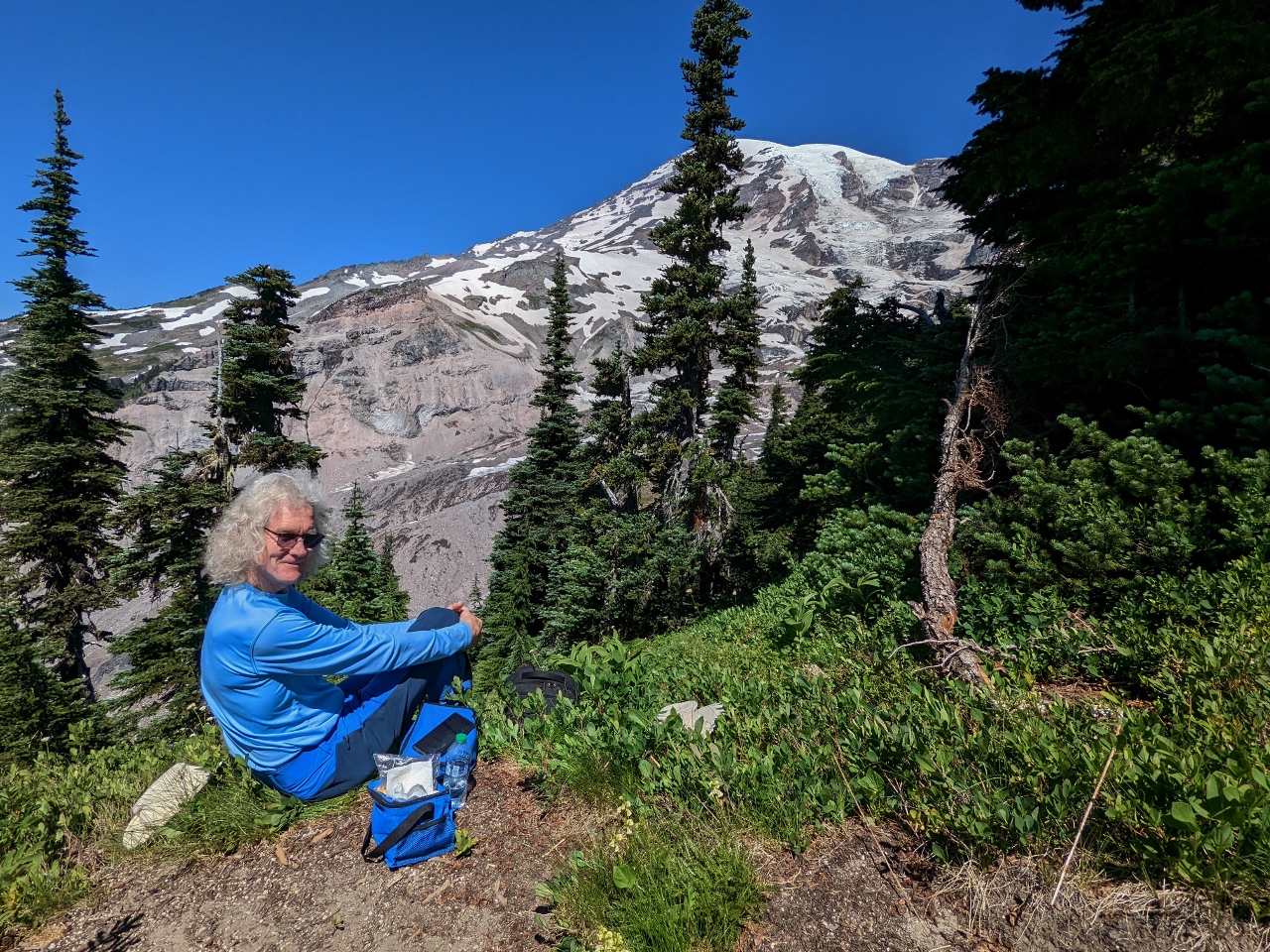 |
Lunch
Position: 46°47.93’N, -121°44.17’W
Lunch with a view to Mt. Rainier along a small spur trail off Deadhorse Creek Trail. With so many people around, finding this private and appealing spot was a bit challenging.
|
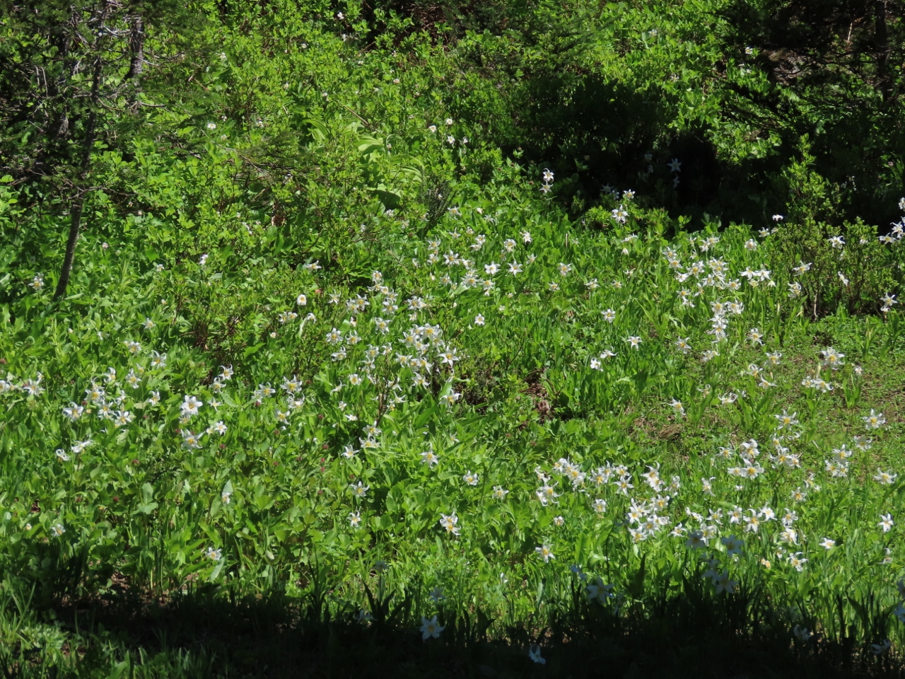 |
Avalanche Lily
Position: 46°47.18’N, -121°44.63’W
Graceful white avalanche lilies growing alongside the Nisqually Visa Trail.
|
 |
Nisqually Vista
Position: 46°47.22’N, -121°44.84’W
Another great Mt. Rainier view, this one from the Nisqually Vista on the trail of the same name.
|
 |
Nisqually River
Position: 46°47.22’N, -121°44.84’W
View to the Nisqually River from the Nisqually Vista. The river rises from Nisqually Glacier and we cross it on the Nisqually Glacier Bridge on the drive up to Paradise.
|
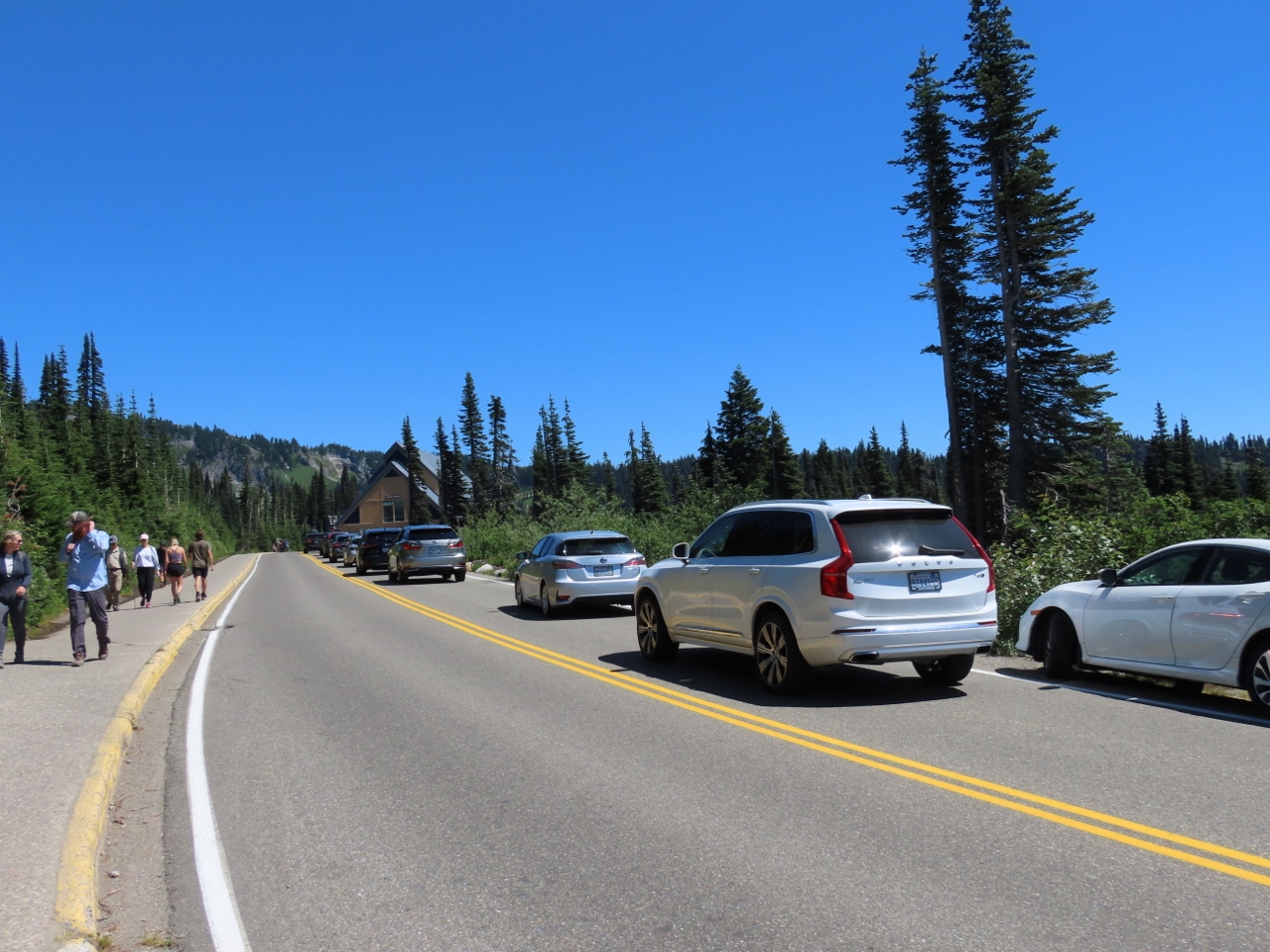 |
Traffic
Position: 46°47.10’N, -121°44.38’W
A long line of cars lined up to enter the Paradise parking lot as we walked back to our car around 1pm.
|
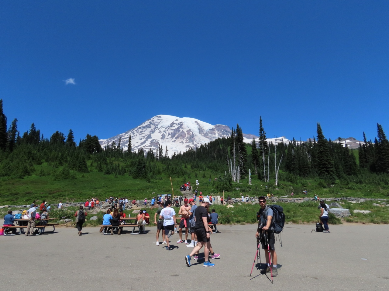 |
Crowds
Position: 46°47.16’N, -121°44.17’W
The Paradise area is super-busy at 1pm compared to the few number of people here when we arrived at 7am.
|
 |
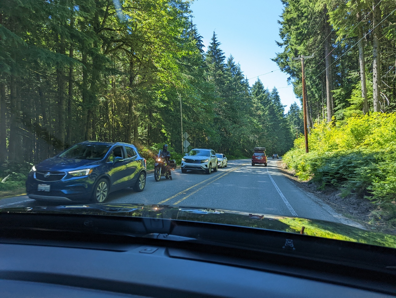
Lineup
Position: 46°44.49’N, -121°55.03’W
Line-up of cars waiting to enter Mt Rainier at the Nisqually entrance.
|
 |
Lineup Continued
Position: 46°45.03’N, -121°55.98’W
We kept thinking we’d hit the end of the line-up of cars, but it continued more than a mile down the road.
|
 |
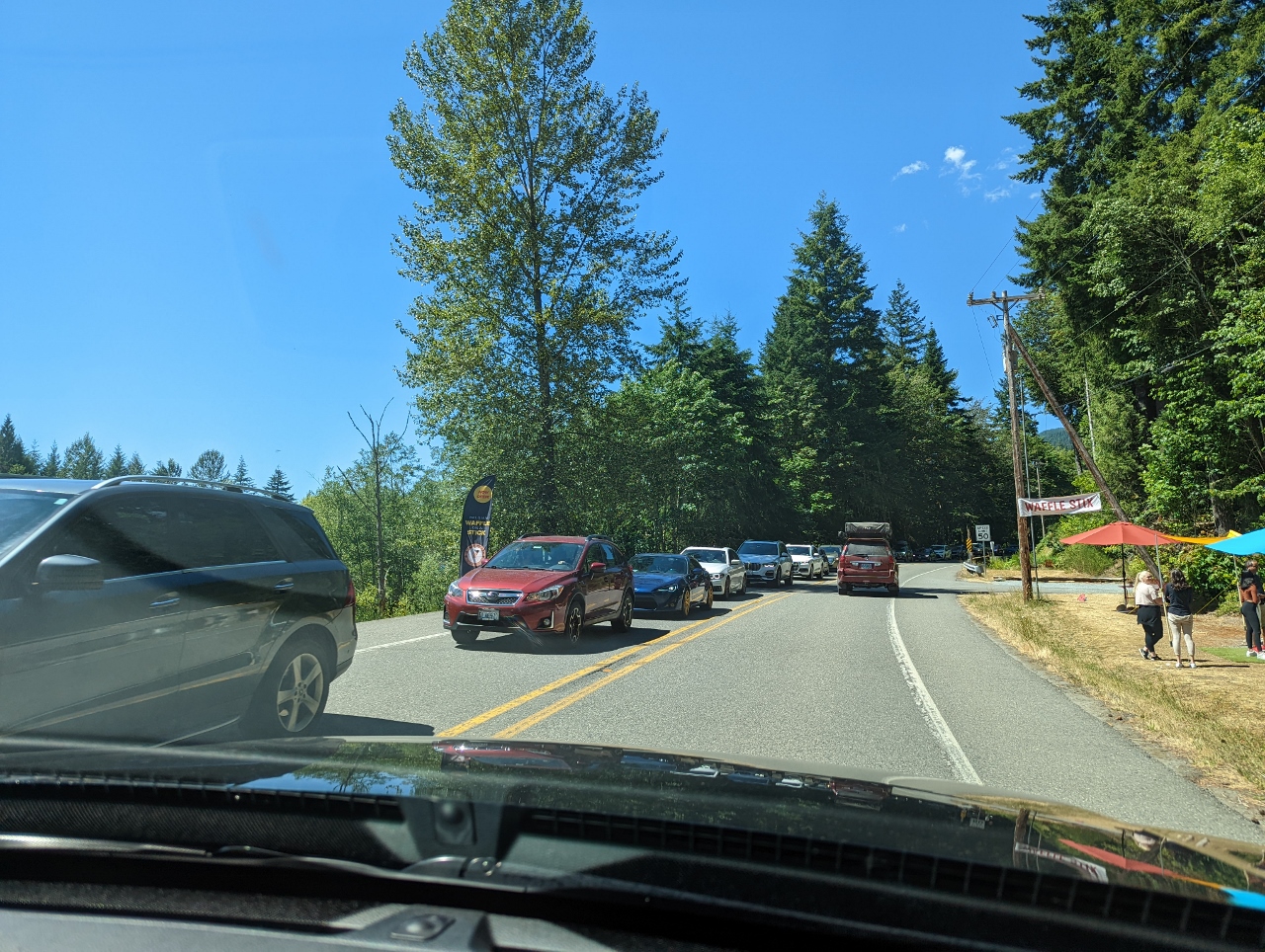
End of Line
Position: 46°45.31’N, -121°57.82’W
The line of cars to enter Mt. Rainier at 1:30pm extended 2.5 miles (4 km) from the Nisqually entrance. Coupled with the line-up to get into the Paradise parking lot, anyone trying to reach Paradise from here probably won’t get there for several hours. And even trying to reach any businesses along the highway, such as a hotel or restaurant, would take ages. Not our idea of a fun way to spend an afternoon.
|
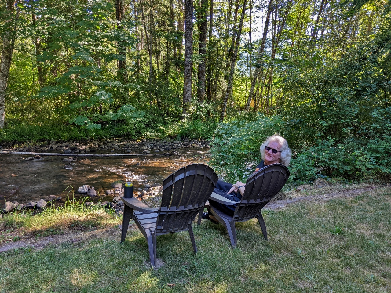 |
Big Creek
Position: 46°44.19’N, -121°59.80’W
Enjoying the view to Big Creek at our VRBO cabin in Ashford.
|
 |
Dinner
Position: 46°44.20’N, -121°59.81’W
Grilled salmon for dinner on the deck of our Ashford VRBO. The cabin is working out very well and we’re really enjoying staying here.
|
 |
Click the travel log icon on the left to see these locations on a map. And a map of our most recent log entries always is available at mvdirona.com/maps. |
If your comment doesn't show up right away, send us email and we'll dredge it out of the spam filter.