
Panorama Point, on the flank of Mt. Rainier, is 6,964 ft (2,123 m) above sea level and aptly named. Mt. Rainier fills the sky to the north, the Nisqually River descends southwest, and southward the Cascade Range extends to the horizon, with clear views to 8,363-ft (2,549 m) Mt. St. Helens in Washington and 11,250-ft (3,429 m) Mt. Hood in Oregon (pictured above). The summer views are spectacular, but the winter scenery even more so with all the mountains coated in snow.
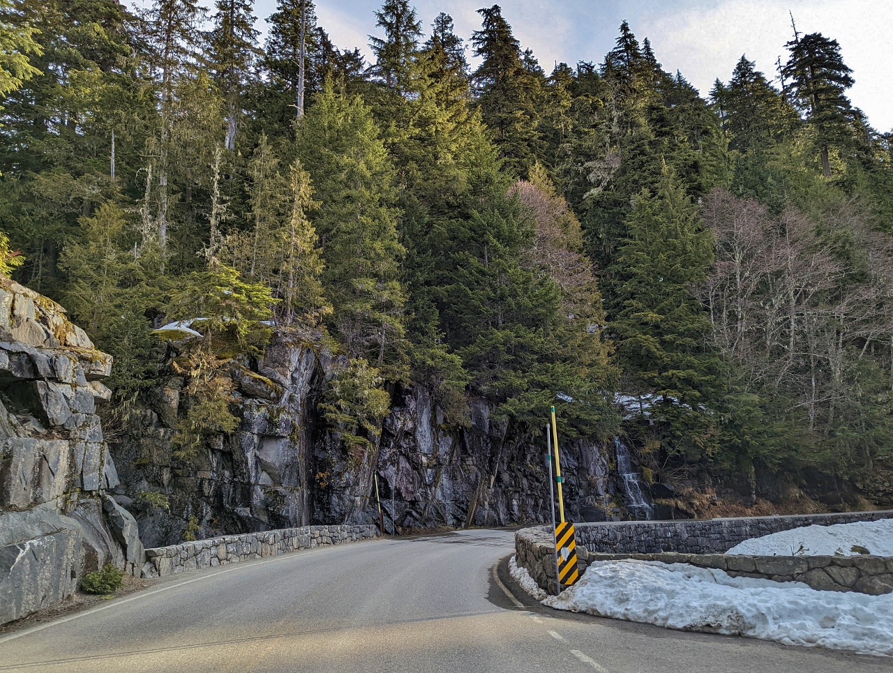
Only one road is open at Mt. Rainier in the winter, leading to Paradise Village at elevation 5,400 ft (1,645 m). We arrived in Longmire at elevation 2,799 ft (853 m) shortly before the gate opened at 9am and drove the winding rode up to Paradise. The scenery along the way was amazing, with several clear views to Mt. Rainier.
From the parking lot, we snowshoed up to Mazama Ridge at elevation 5,618 ft (1,713 m) and continued along the Skyline Trail to Panorama Point, for a total elevation gain of 1,564 ft (476 m). After a snack and a hot drink, we made a loop by returning back to the parking lot along the Skyline Trail. We were lucky to have a clear day with great views to Mt Rainier earlier in the day, as the mountain was hidden behind clouds by the time we descended.
Below are highlights from March 25th, 2022. Click any image for a larger view, or click the position to view the location on a map. And a map with our most recent log entries always is available at mvdirona.com/maps.
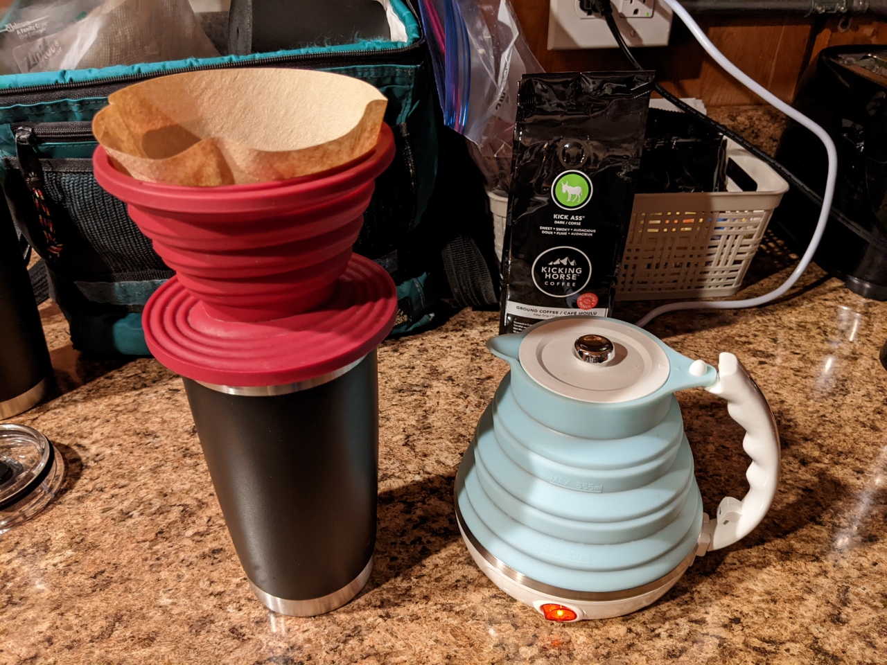 |
Travel Kettle
Position: 46°44.59’N, -121°55.46’W
Our travel kettle and coffee filter holder on the job for our morning coffee. Both are made of high-temperature silicone, collapse flat, and store together in a small black case that came with the kettle.
We initially bought them both for our road trip across the country from Charleston to Seattle. They worked out super-well on that trip and we’ve continued to use them since. We love having fresh coffee and tea on demand in our room, and the they take up such little space we can bring them even with only carry-on luggage. |
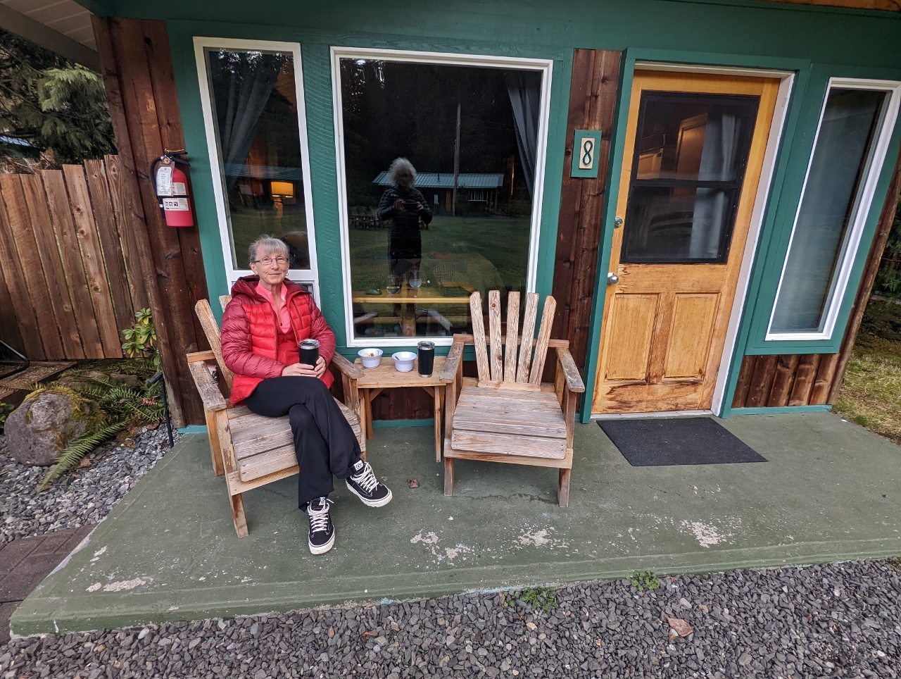 |
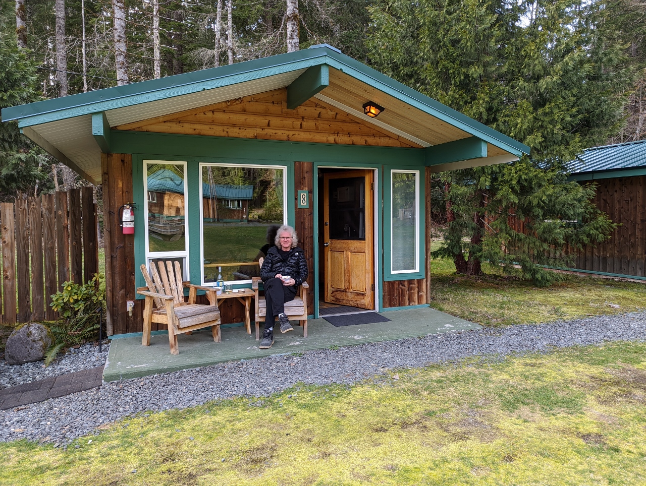
Breakfast
Position: 46°44.60’N, -121°55.45’W
Enjoying breakfast on the porch of our cabin at Stone Creek Lodge. We’ve considered cabins in the past, and thought them too rustic, but this one is working out really well.
|
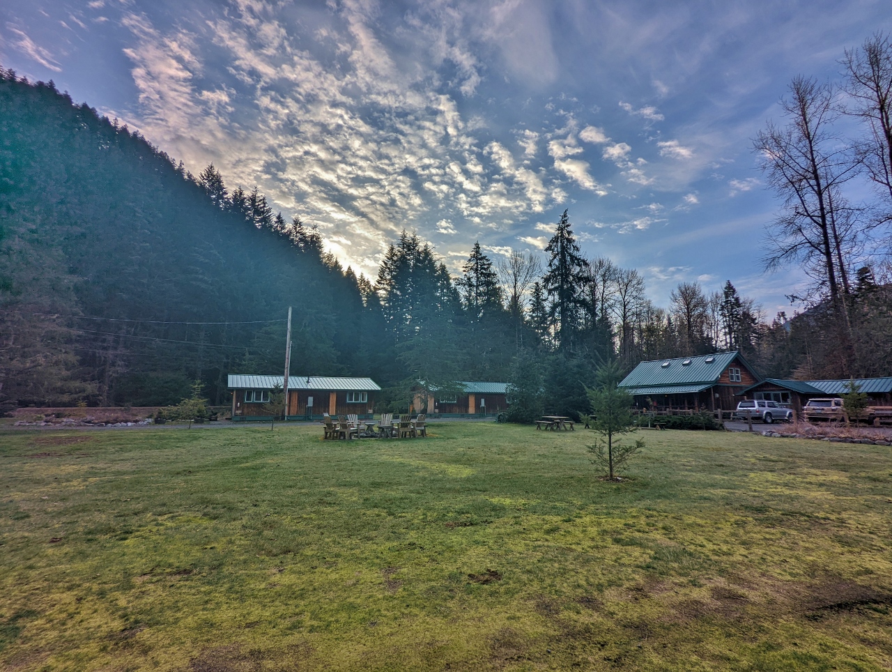 |
Sunrise
Position: 46°44.58’N, -121°55.42’W
Sunrise looking east across the park-like grounds of Stone Creek Lodge from the porch of our cabin.
|
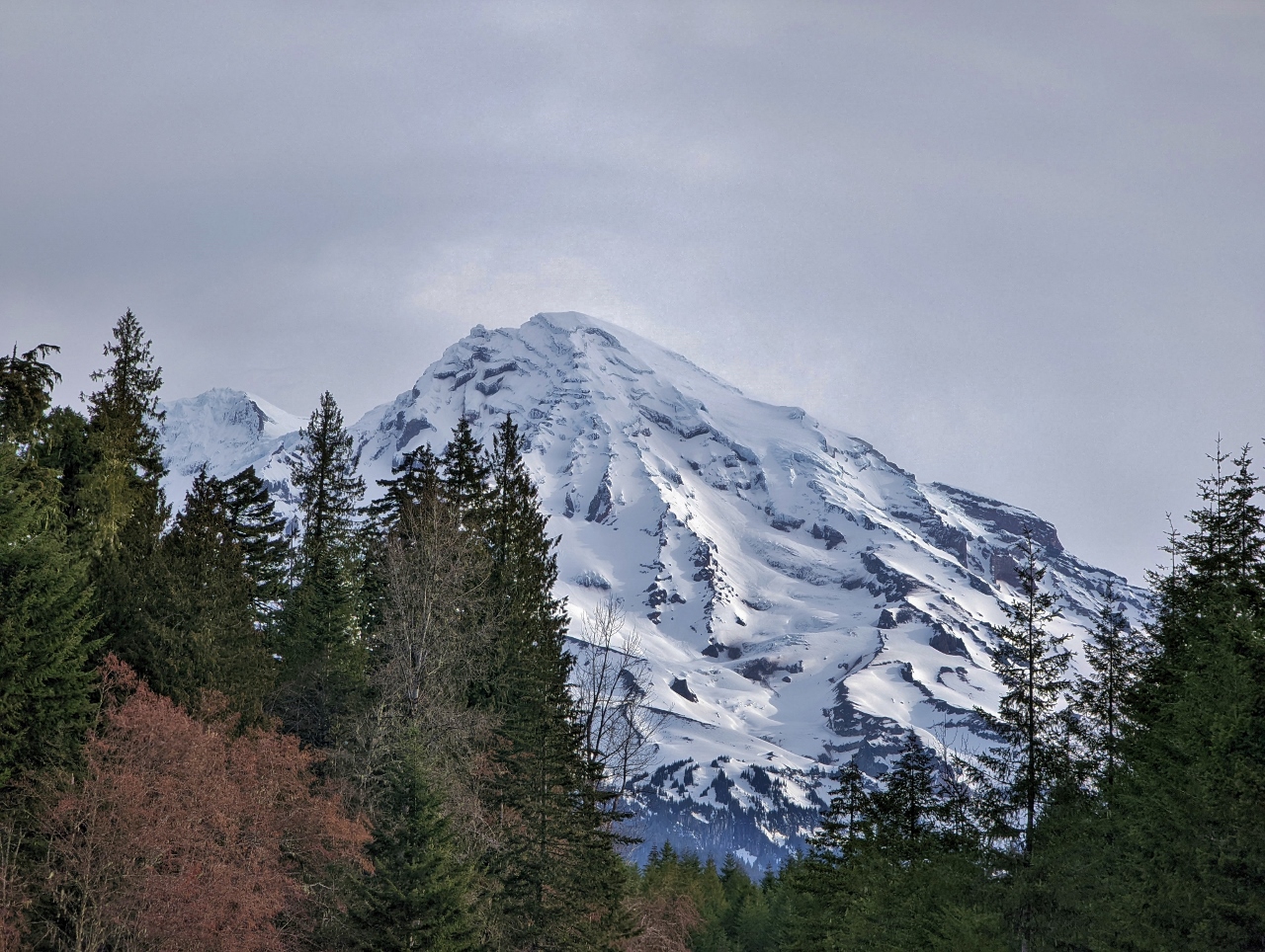 |
Is The Mountain Out?
Position: 46°44.18’N, -121°51.41’W
“Is the Mountain Out?” is a commonly-asked question locally, particularly for visitors to Mt. Rainier National Park, and that question is the first words on the park’s web cam for the mountain. Conditions can change quickly here, but so far we’re in luck with this clear view along Kautz Creek.
|
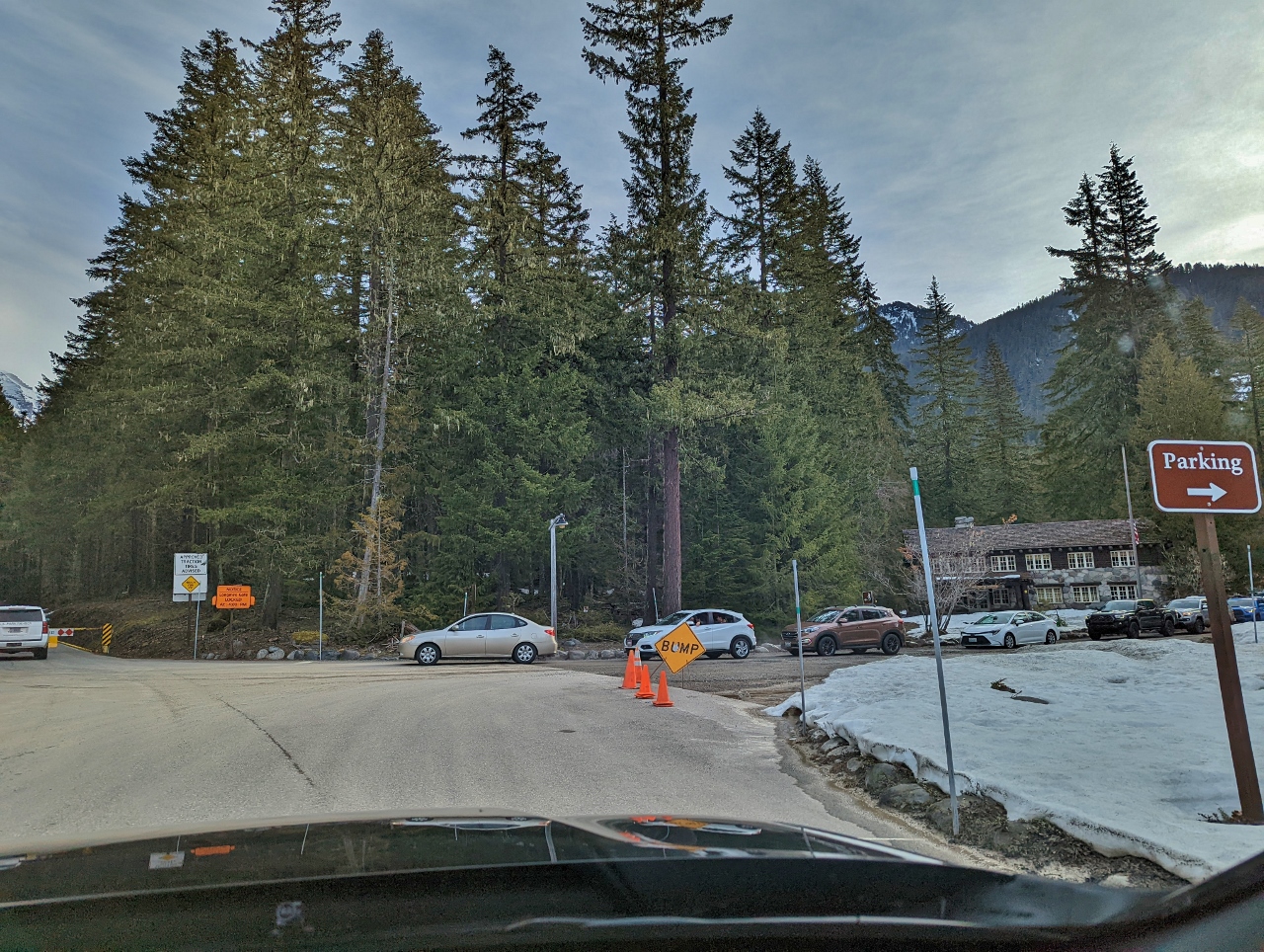 |
Queue
Position: 46°44.88’N, -121°49.08’W
The road to Paradise, at elevation 5,400 ft (1,645 m), is open in the winter daily from 9am until 4pm. Parking doesn’t seem to fill as at Olympic National Park, but there still was a queue of people waiting at the not-yet-open gate when we arrived shortly before 9am.
|
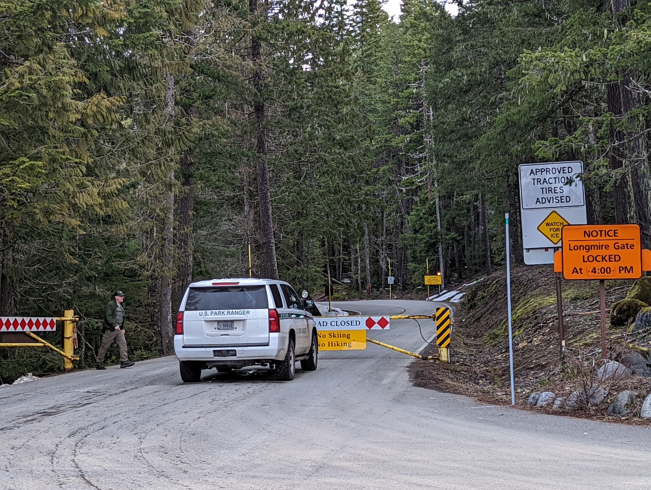 |
Opening Gate
Position: 46°45.01’N, -121°48.76’W
National Park ranger opening the gate to allow entry onto the Longmire-to-Paradise Road at 9am.
|
 |
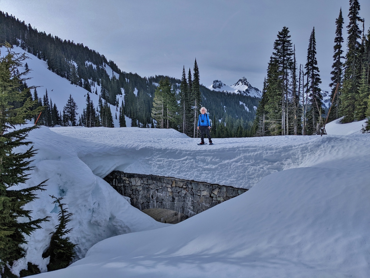
Christine Falls Bridge
Position: 46°46.75’N, -121°46.94’W
The historic, much photographed Christine Falls Bridge, built of stone in the 1928. The bridge is one of several features designed following the National Park Service rustic, a style of architecture the Park Service developed in the early 20th century to harmonize with the environment.
|
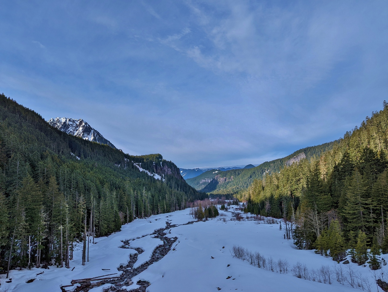 |
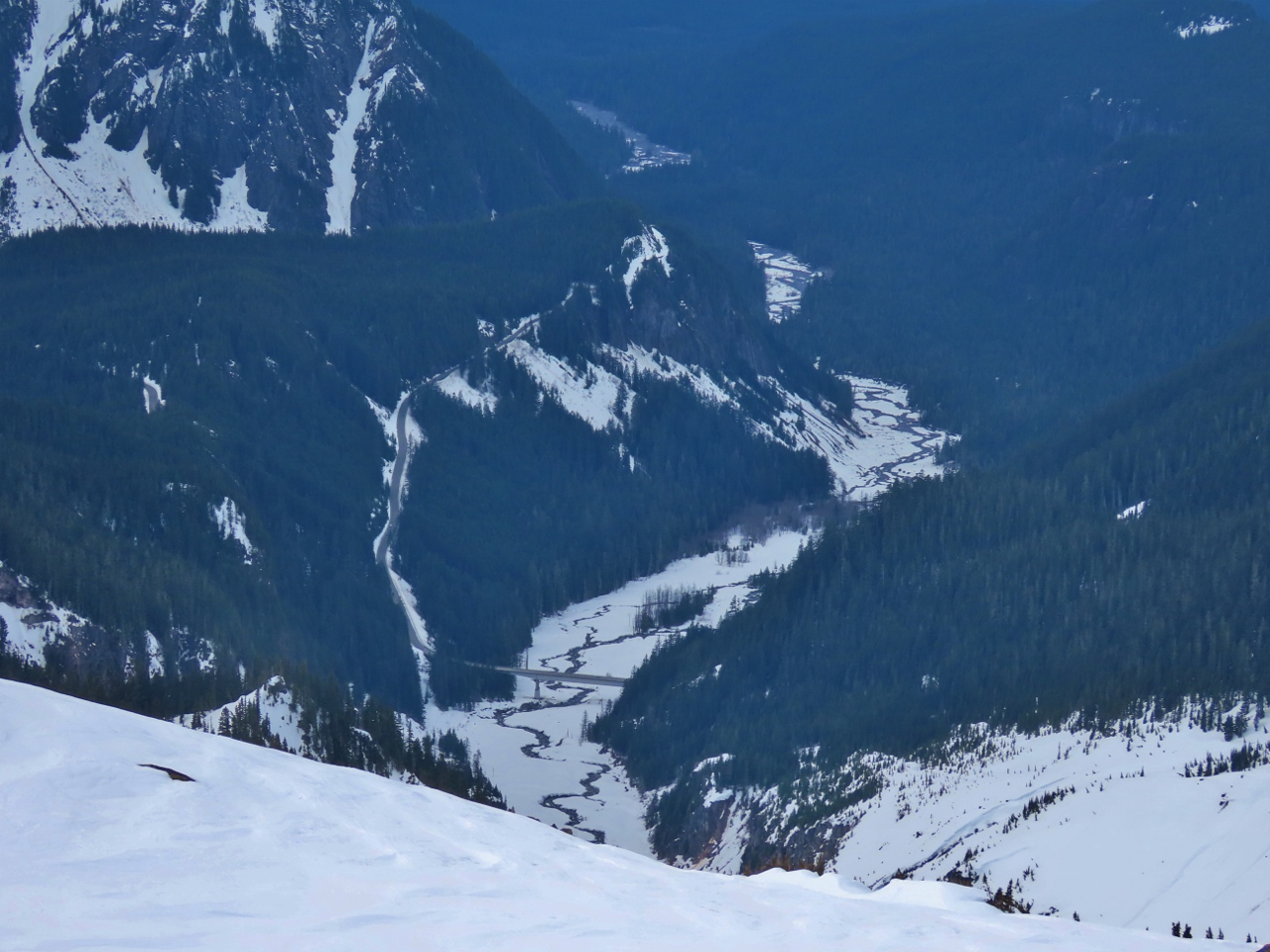
Nisqually River
Position: 46°46.91’N, -121°45.73’W
Fabulous view down the snow-covered Nisqually River Valley from the Nisqually Glacier Bridge.
|
 |
Nisqually Glacier
Position: 46°46.91’N, -121°45.73’W
The tongue of Nisqually Glacier, looking north from the bridge of the same name. The bridge, completed in 1958, is the fifth bridge at this site. The previous bridges were all damaged or destroyed by glacier floods.
|
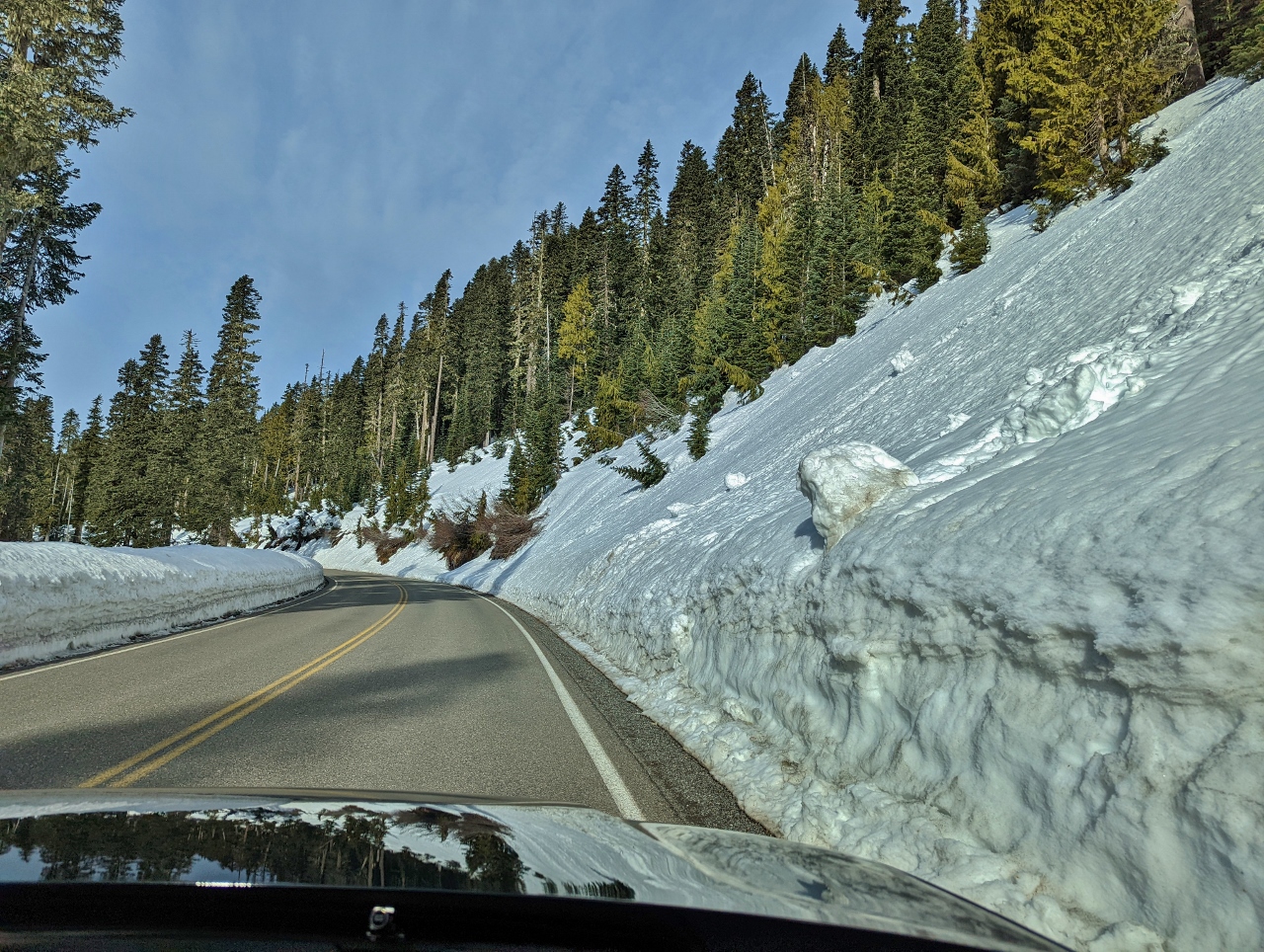 |
Snow Slide
Position: 46°46.76’N, -121°44.45’W
Evidence of a snow slides on the steep slopes above Longmire-to-Paradise Road. At one section along the road, the avalance risk is so high that signs prohibit drivers from stopping their cars.
|
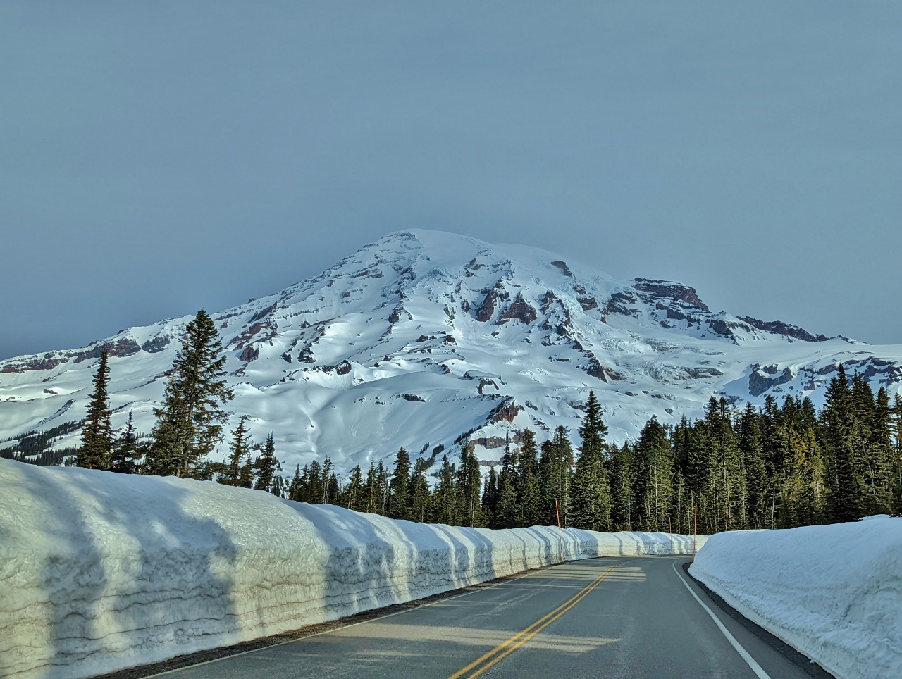 |
5,000 ft
Position: 46°47.01’N, -121°45.01’W
Mt. Rainier, looking spectacular at elevation 5,000ft (1,524m) on the Longmire-to-Paradise Road.
|
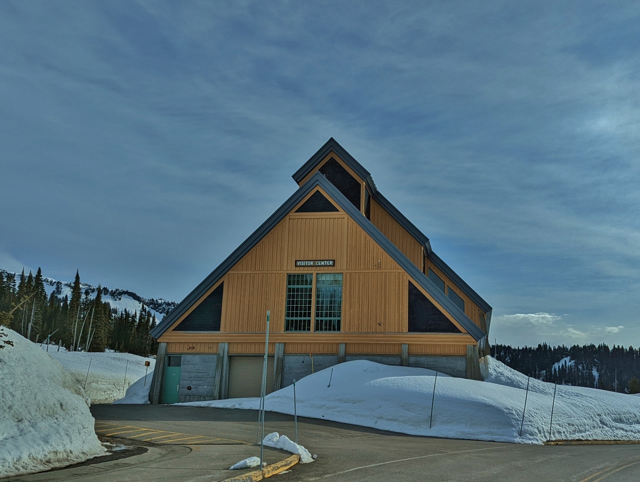 |
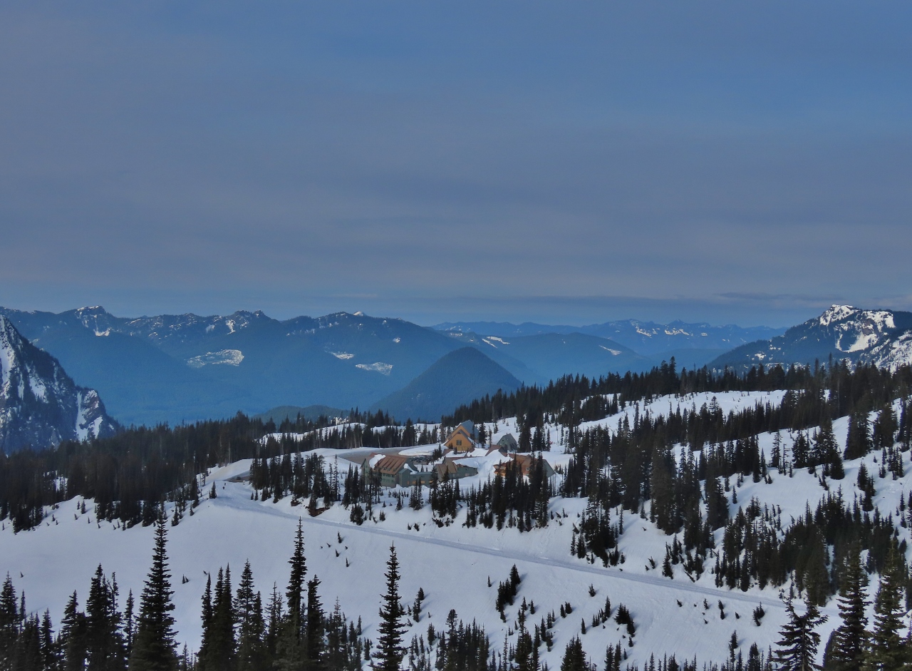
Visitor Center
Position: 46°47.11’N, -121°44.33’W
The Henry M. Jackson Memorial Visitor Center at Paradise, elevation 5,400 ft (1,645 m), named in memory of the Washington senator who was a strong advocate of public lands and also has a wilderness area in the state named after him. The name of the area comes from 19th-century explorer James Longmire’s daughter-in-law Martha, who exclaimed “Oh, what a paradise” when she first saw the beautiful wildflower meadows and mountain views.
|
 |
Trailhead
Position: 46°47.22’N, -121°44.04’W
At the trailhead for our hike up Mazama Ridge.
|
 |
Descending
Position: 46°47.27’N, -121°43.93’W
We accidentally started off on a parallel trail, so here are descending a slope to meet up with the route to Mazama Ridge.
|
 |
Valley Road
Position: 46°47.26’N, -121°43.91’W
Heading north along Valley Road towards Mazama Ridge. The road is unplowed in the winter and closed to traffic, and has great views into the Paradise River in the valley at right.
|
 |
4th Crossing
Position: 46°47.42’N, -121°43.61’W
At the 4th Crossing bridge over Paradise River. Here we’ll leave the road and head up to Mazama Ridge on the 4th Crossing trail.
|
 |
4th Crossing Trail
Position: 46°47.51’N, -121°43.42’W
View to Mt. Rainier from the the 4th Crossing Trail.
|
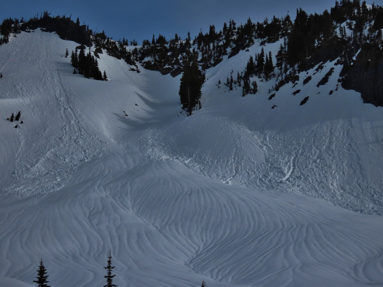 |
Avalanches
Position: 46°47.51’N, -121°43.39’W
Lots of evidence of avalanches visible to our north as we ascend the 4th Crossing Trail.
|
 |
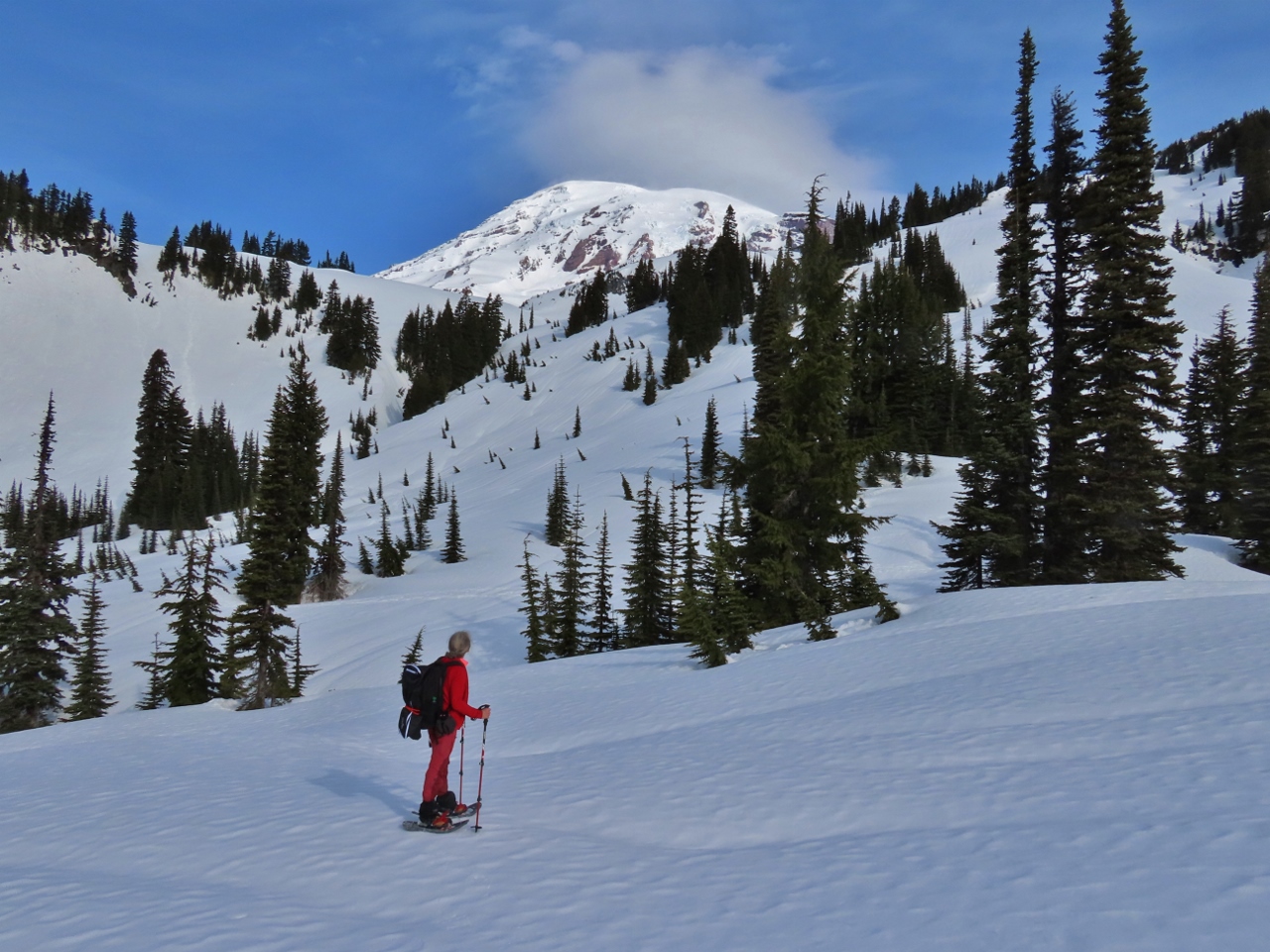
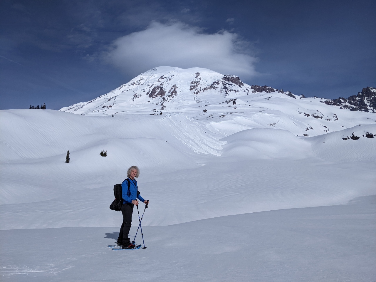
Mazama Ridge
Position: 46°47.46’N, -121°43.25’W
Fabulous view to Mt. Rainier from Mazama Ridge at elevation 5,618 ft (1,713 m). A small cloud is just starting to form around the summit, but the day remains wonderfully clear with the mountain still out.
|
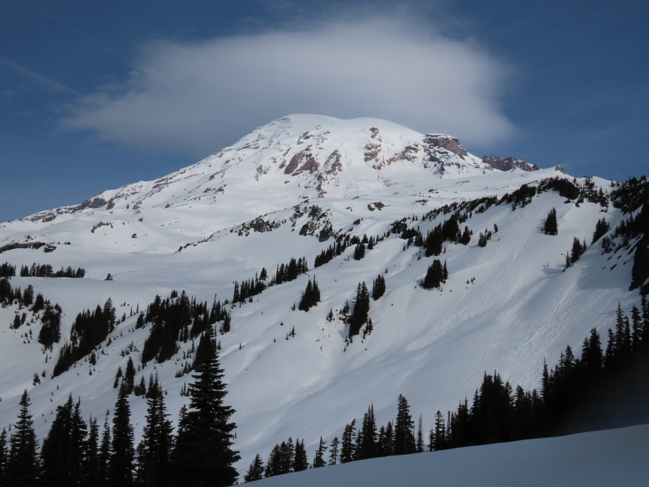 |
The Mountain
Position: 46°47.45’N, -121°43.23’W
The mountain really is spectacular in today’s clear weather.
|
 |
Paradise
Position: 46°47.44’N, -121°43.22’W
View to Paradise from Mazama Ridge. The road we walked along to the 4th Crossing Trail is visible in the foreground.
|
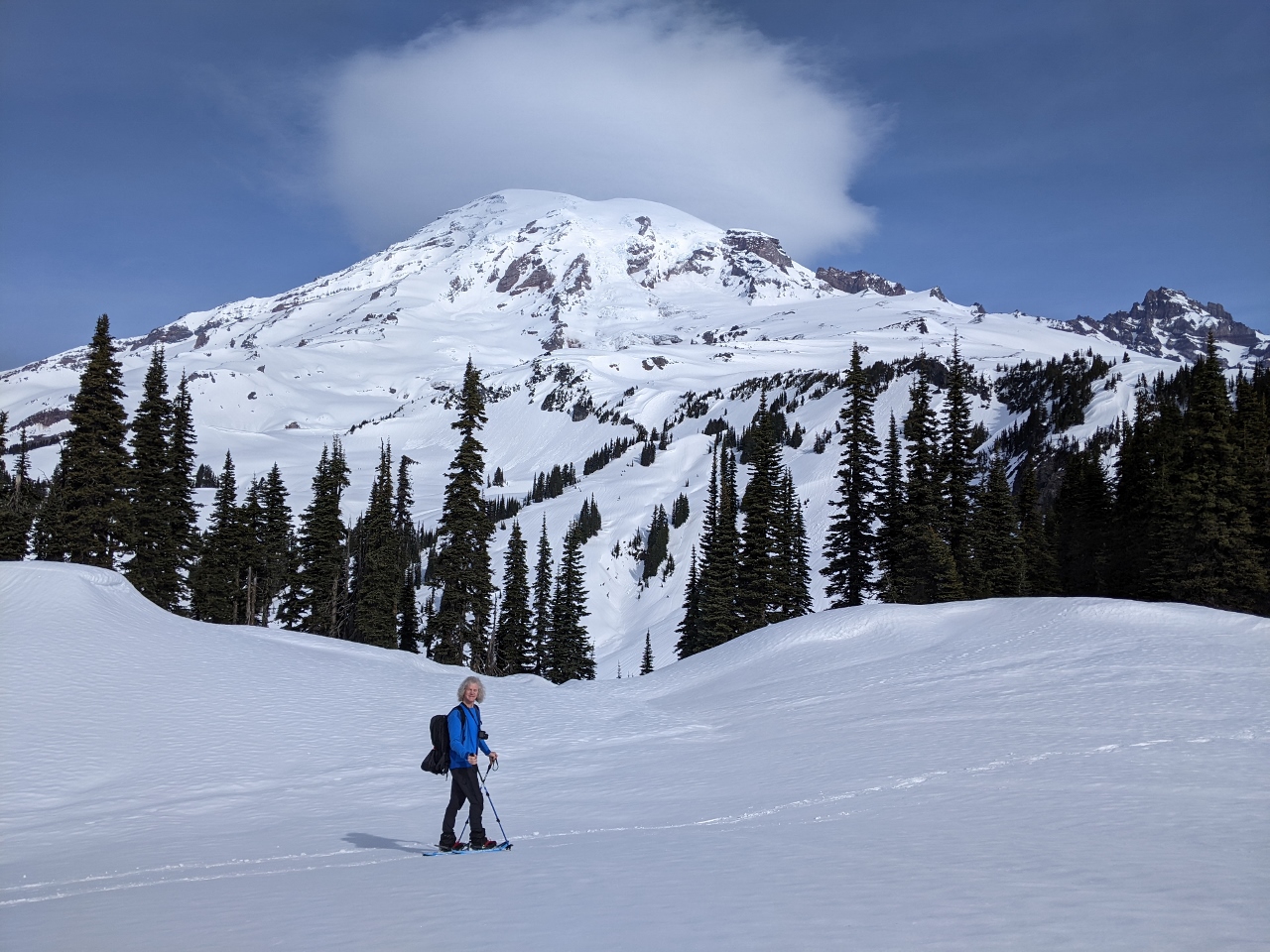 |
James and the Mountain
Position: 46°47.38’N, -121°43.18’W
We’re super-stoked to finally be at Mt. Rainier and are loving the clear weather.
|
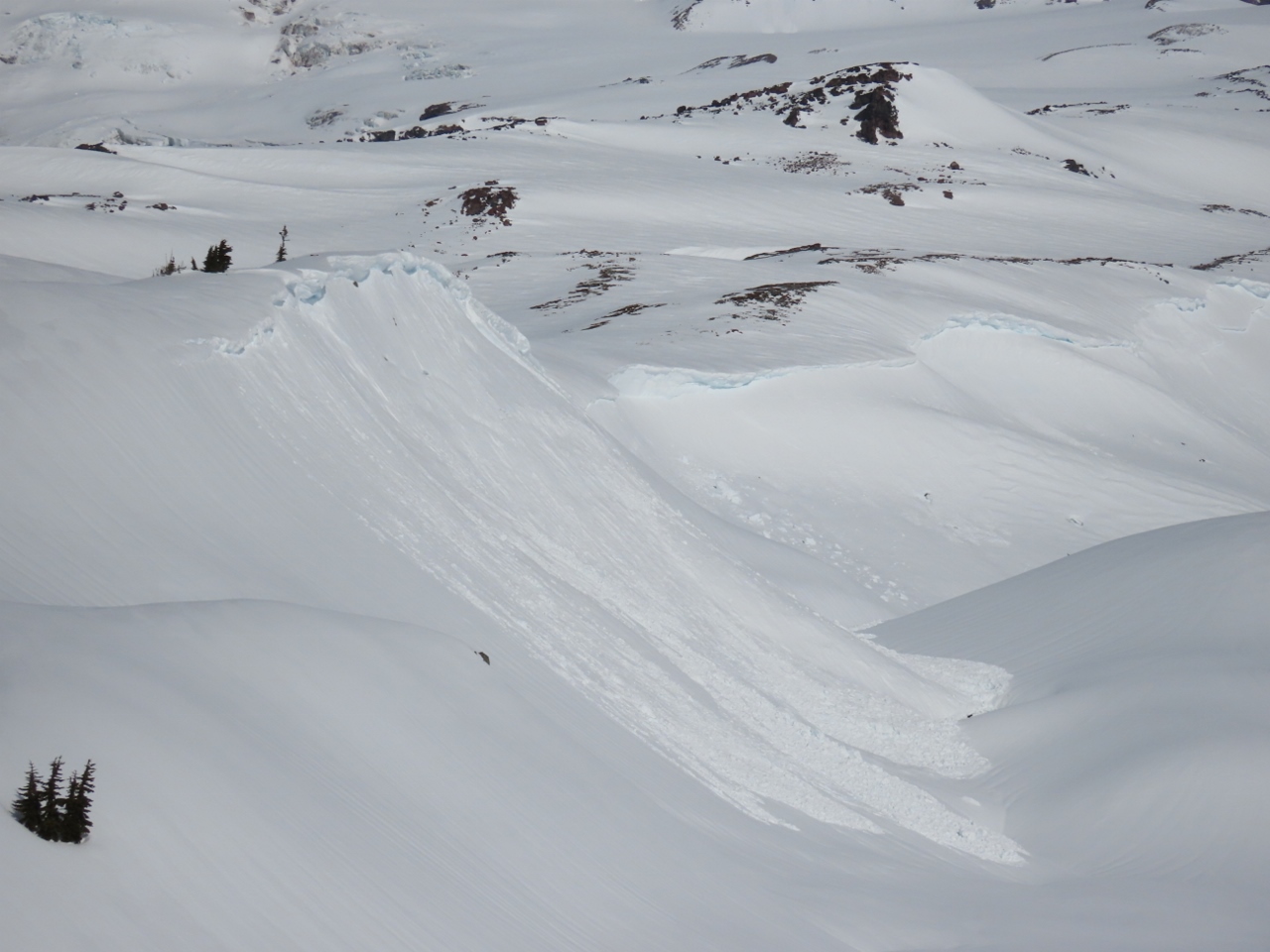 |
Recent Avalanche
Position: 46°47.60’N, -121°42.99’W
Evidence of a recent avalanche as we head north towards Mt. Rainier on the Skyline Trail. The area is full of avalanche risks, and we’re being careful where we go.
|
 |
Skyline Trail
Position: 46°47.67’N, -121°42.94’W
More great views to Mt. Rainier from the Skyline Trail. The avalanche area shown in the previous picture is visible in the background.
|
 |
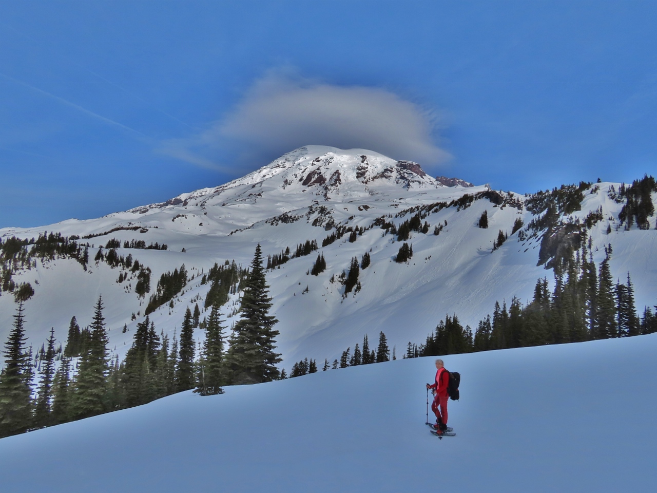
Climbing
Position: 46°47.69’N, -121°42.95’W
At altitude 5,966 ft (1,819 m) and climbing as we ascend towards Panorama Point. No recent tracks are in evidence, and the trail isn’t marked, but it’s not difficult to find our way using apps such as AllTrails that show our location on a downloadable topographic map.
|
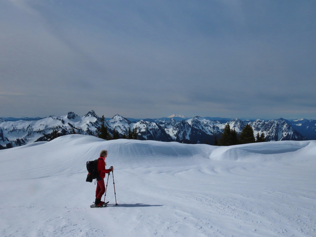 |
View South
Position: 46°47.81’N, -121°43.20’W
Enjoying the fabulous view south at altitude 6,187 ft (1,886 m). The tall mountain visible way in the distance is 8,363-ft (2,549 m) Mt. St. Helens in southern Washington state.
|
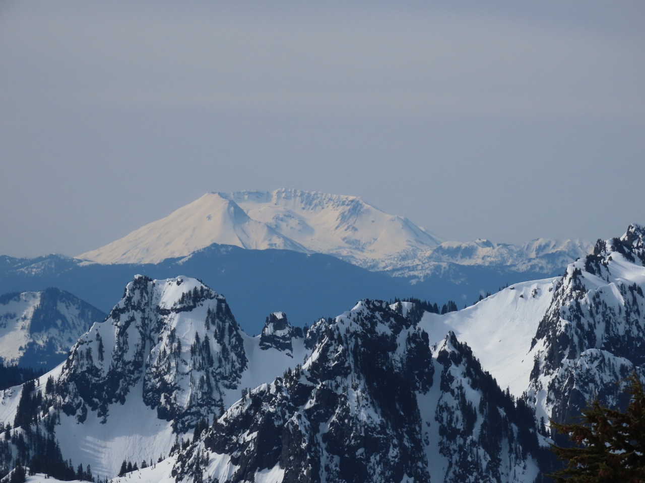 |
Mt. St. Helens
Position: 46°47.82’N, -121°43.22’W
Close-up view to snow-encrusted 8,363-ft (2,549 m) Mt. St. Helens in southern Washington state. The mountain is famous for its 1980 eruption, the deadliest and most economically destructive in U.S. history. The volcanic event killed 57 people and destroyed 200 homes, 47 bridges, 15 miles (24 km) of railways, and 185 miles (298 km) of highway.
|
 |
Final Ascent
Position: 46°47.89’N, -121°43.27’W
At altitude 6,308 ft (1,923 m), we are getting closer to 6,964 ft (2,123 m) Panorama Point.
|
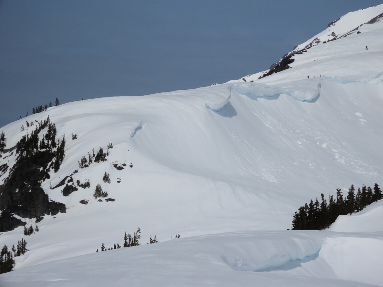 |
Cornices
Position: 46°47.91’N, -121°43.28’W
Beautiful, but dangerous, cornices on a ridge edge. These heavy wind-blown overhanging formations can easily fall and start an avalanche. Walking underneath one is never a good idea. And you can easily walk on top of one without knowing it and trigger an avalanche that carries you down the hill.
|
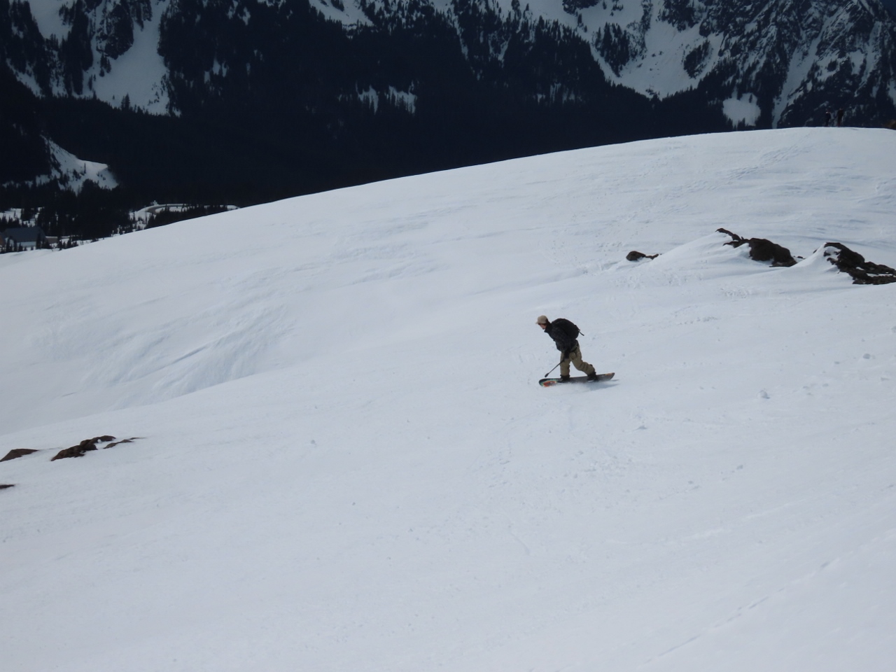 |
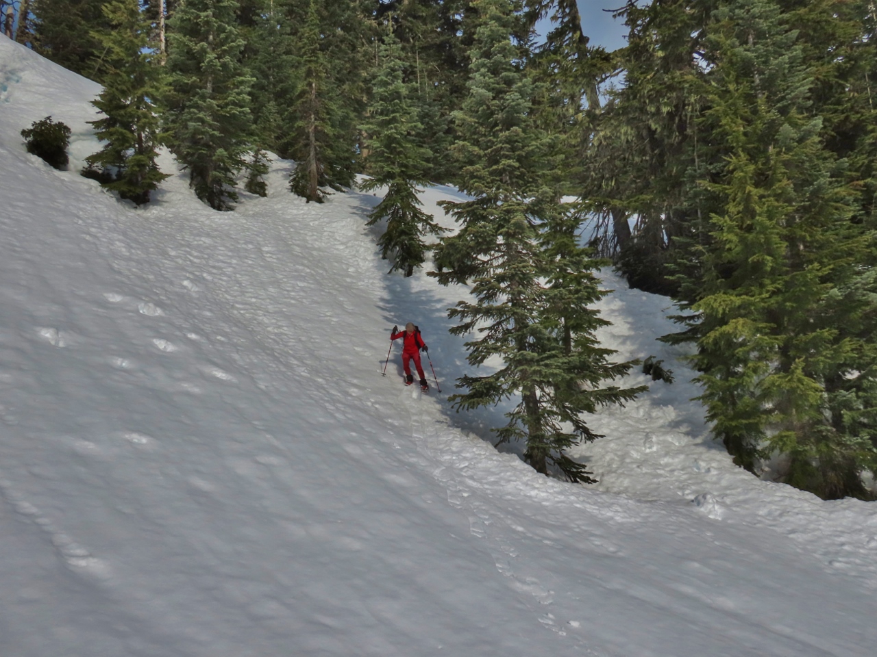
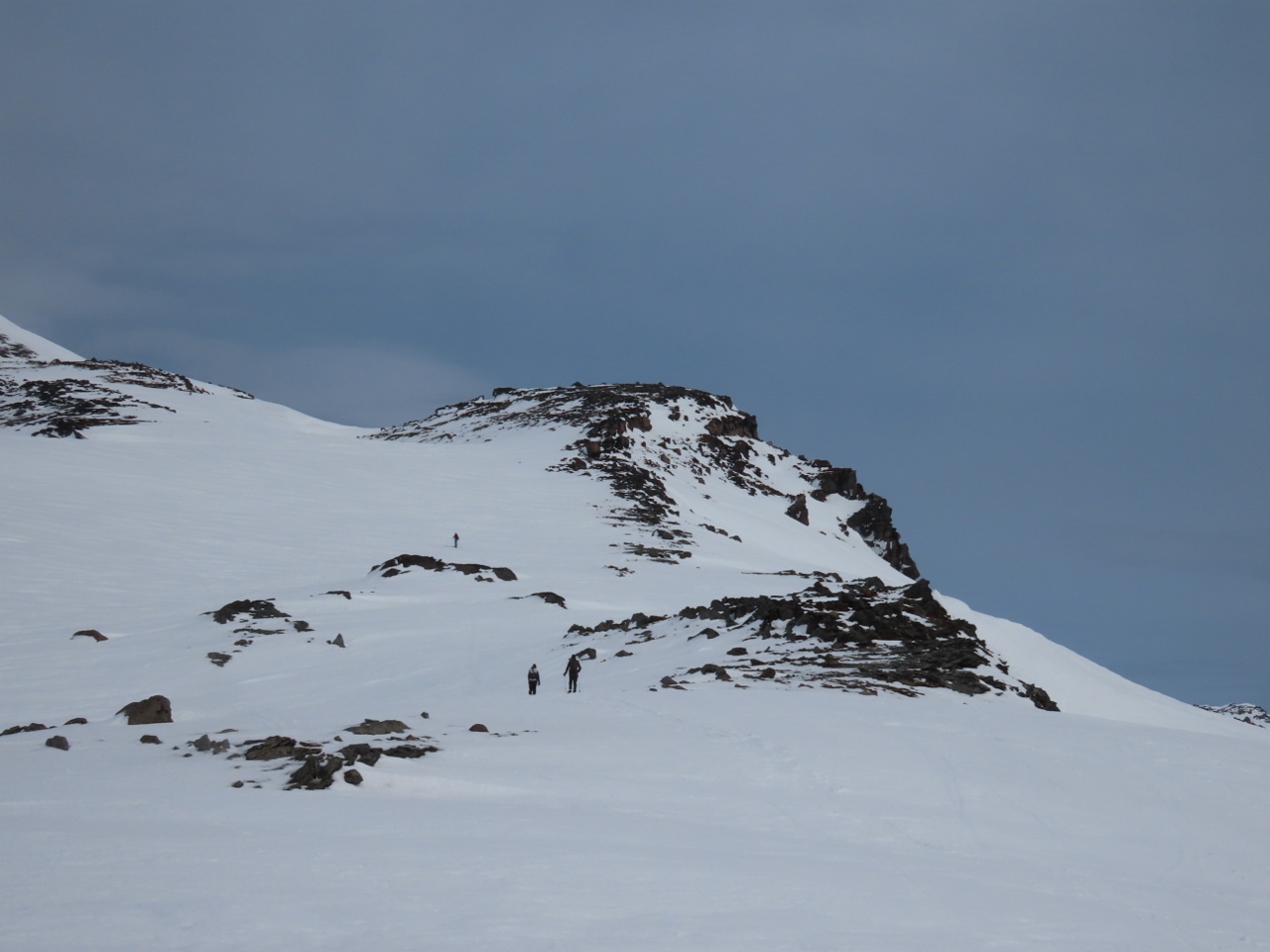
Snowboarder
Position: 46°48.28’N, -121°43.65’W
We didn’t see anyone on the Skyline Trail after leaving Mazama Ridge, but could see lots of people at Panorama Point who had climbed directly up from Paradise. Here is one of them snowboarding back down.
|
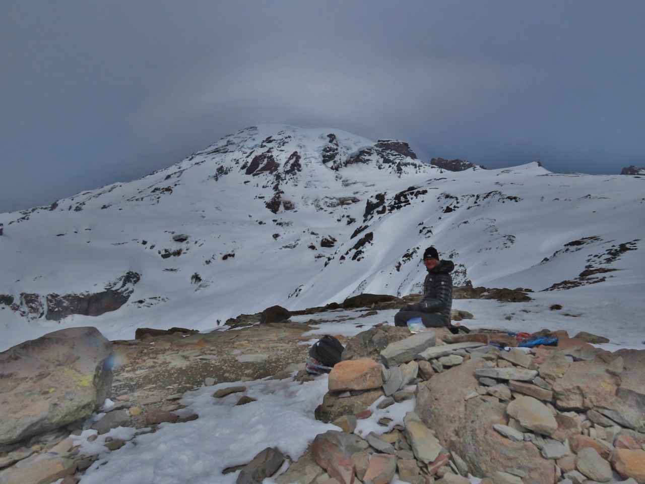 |
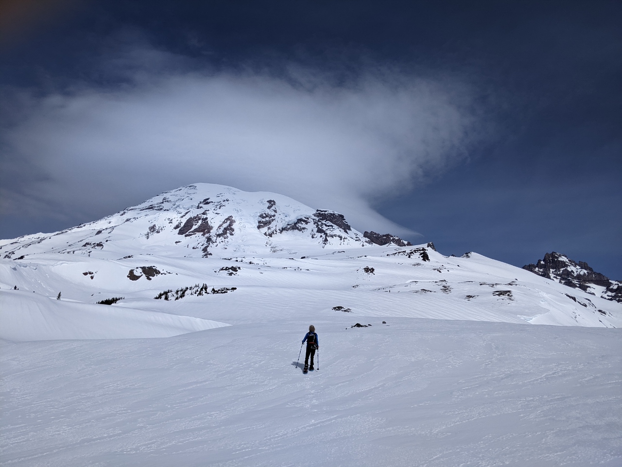
Panorama Point
Position: 46°48.30’N, -121°43.73’W
Our best view yet to Mt. Rainier from Panorama Point at altitude 6,964 ft (2,123 m). The top of the mountain looks deceptively close, but it’s another 7,500 ft (2,300m) to reach the 14,417 ft (4,394 m) summit. Most climbers take 2-3 days to reach the top, with only a 50% success rate. The most common failures are due to weather or poor climber physical condition. The climb also is a dangerous one, with an average of 2 deaths per year in the past 40 years. So as close as it looks, its still out of reach for us.
|
|
|
Windblown
Position: 46°48.30’N, -121°43.73’W
Even though we’re at such a high elevation at nearly 7,000 ft (2,133 m), the area is so wind-blown that little snow is on the ground here. And it’s really cold.
|
 |
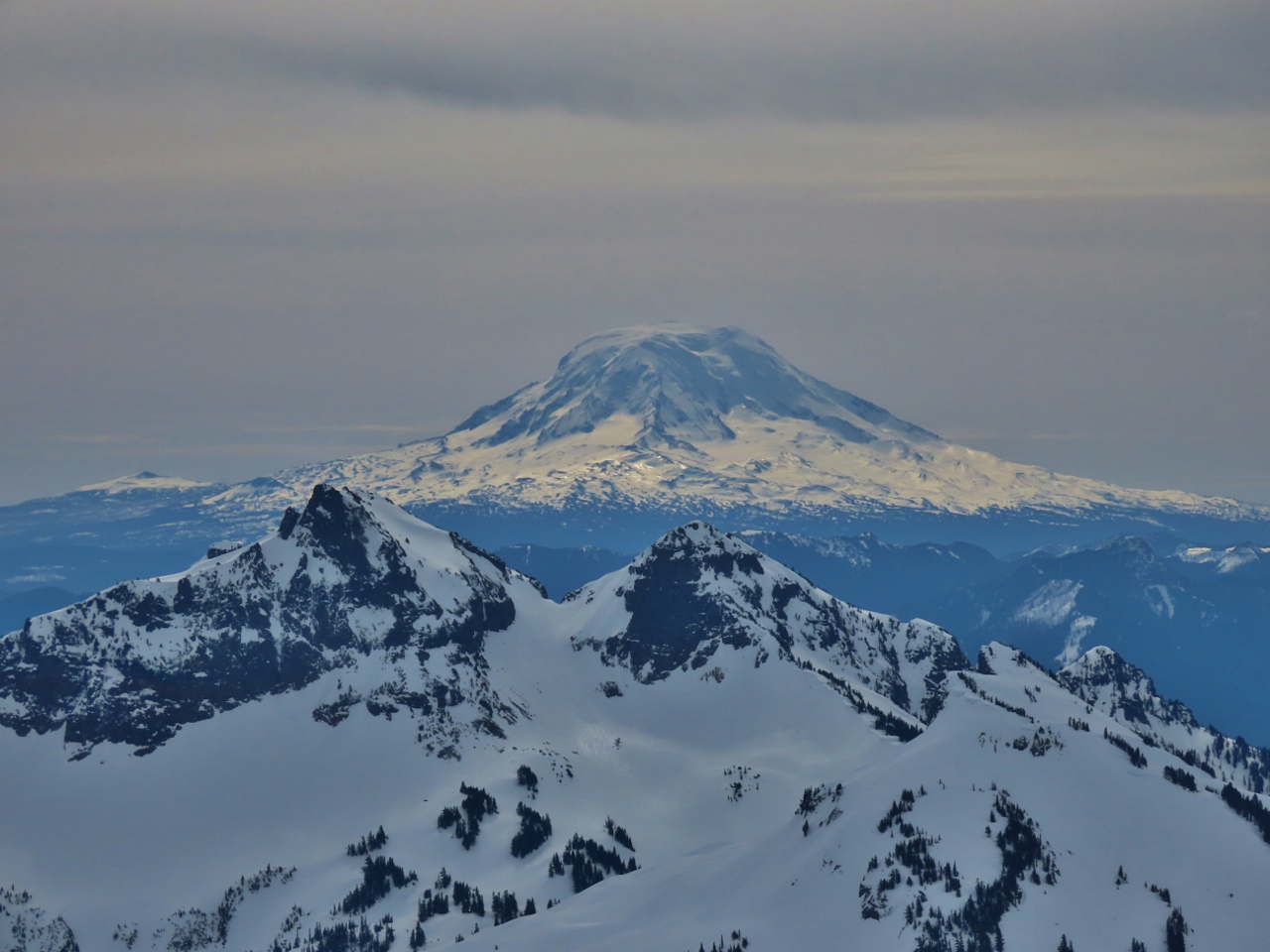
Panorama
Position: 46°48.30’N, -121°43.73’W
There’s a reason they call it Panorama Point. This is the amazing view south, with 11,250-ft (3,429 m) Mt. Hood in Oregon visible slightly left of center and 8,363-ft (2,549 m) Mt. St. Helens to the right.
|
 |
Mt Hood
Position: 46°48.30’N, -121°43.73’W
Close-up to 11,250-ft (3,429 m) Mt. Hood in Oregon from Panorama Point.
|
 |
Nisqually Glacier Bridge
Position: 46°48.30’N, -121°43.73’W
Looking 3,100-ft (945 m) down to the Nisqually Glacier Bridge, that we took photos at on our way up this morning. It’s a long way down from here.
|
 |
To Camp Muir
Position: 46°48.30’N, -121°43.73’W
Hikers continuing up from Paradise Point towards Camp Muir, named after the naturalist John Muir. In the late 1800s, as the president of the newly-formed Sierra Club, Muir advocated strongly for preserving Mt. Rainier. At elevation 10,188 ft (3,105 m), Muir is the most common base camp for those attempting to climb to the summit of 14,417 ft (4,394 m) Mt. Rainier.
|
 |
Bathrooms
Position: 46°48.19’N, -121°43.76’W
Summer bathrooms, snowed in and closed for the winter, give an idea of how busy it can get here in the peak season.
|
 |
Clouds
Position: 46°48.00’N, -121°44.03’W
As we descended along the Skyline Trial, the mountain disappeared in low clouds. We were very lucky to get the clear views that we did.
|
 |
Tour
Position: 46°47.17’N, -121°44.16’W
Back at the Paradise parking lot, several vans were here from companies such as REI, who specialize in outdoor equipment. We bought our snowshoes from them, and were at their flagship store in downtown Seattle a few weeks ago.
|
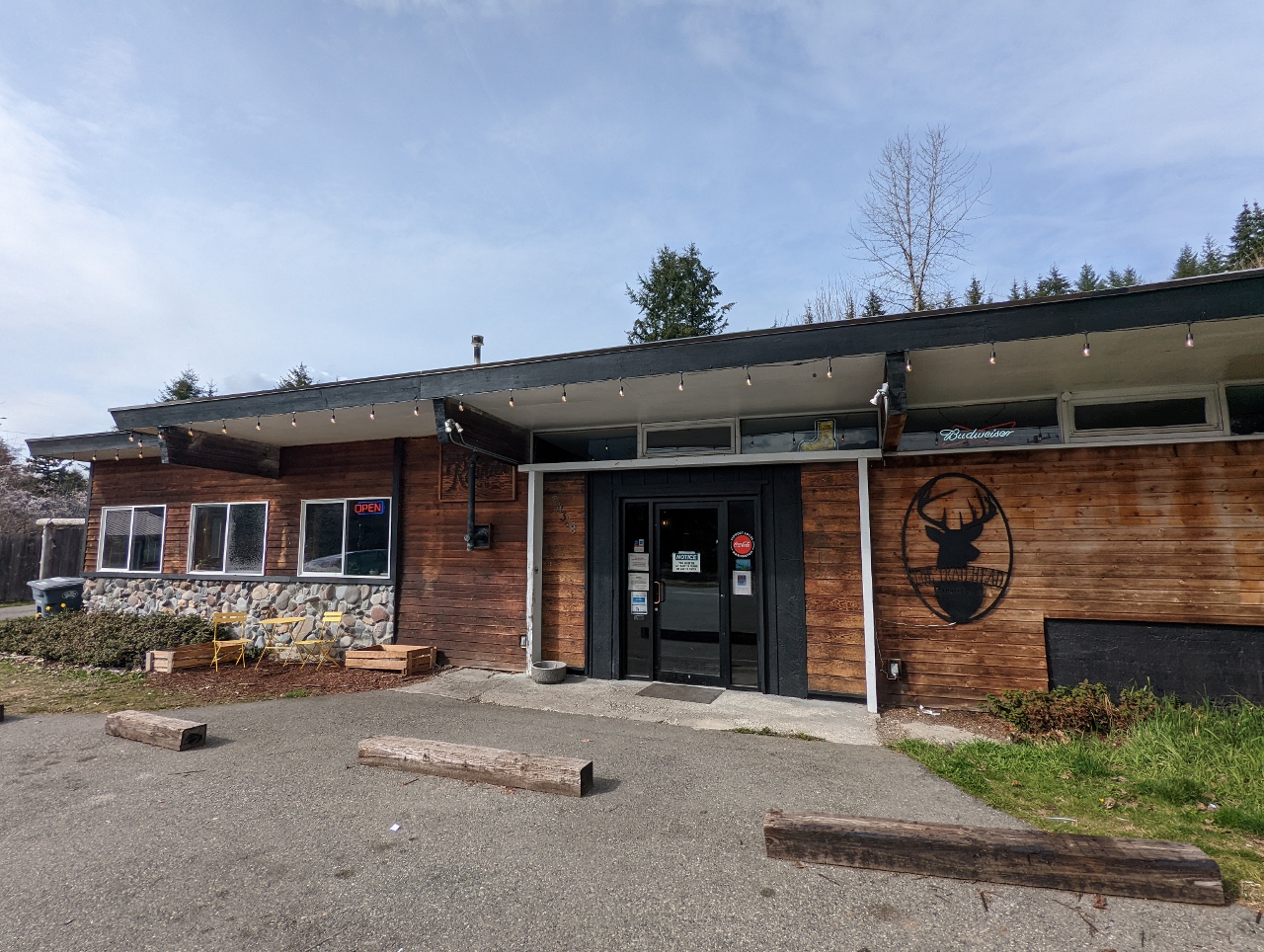 |
Trailhead Bar & Grill
Position: 46°45.56’N, -122°1.93’W
Back at the Trailhead Bar & Grill in Ashford for a delicious late lunch.
|
 |
Dinner
Position: 46°44.60’N, -121°55.45’W
Dinner on the porch of our cabin at Stone Creek Lodge. We’re really enjoying the cabin and the environment.
|
 |
Dinner Guests
Position: 46°44.58’N, -121°55.42’W
Two deer joined us for dinner at the Stone Creek Lodge near Mt. Rainier. They ordered grass, while we went for take-out Thai food.
|
 |
Click the travel log icon on the left to see these locations on a map. And a map of our most recent log entries always is available at mvdirona.com/maps. |
If your comment doesn't show up right away, send us email and we'll dredge it out of the spam filter.