Mt. Rainier is the highest mountain in Washington at 14,411 ft (4,392 m) and is clearly visible at vantages throughout the state, including Seattle. The height makes it a popular, but difficult, mountaineering location. Each year about 10,000 attempt an ascent, but only about 5,000 reach the summit. Most ascents take 2-3 days, and the failures are due mainly due to weather or the climber’s physical condition. A few don’t return from the mountain—an average of two people die every year in attempting the summit.
While the mountain is hazardous to climb, it poses a far greater risk to residents of the Puyallup River Valley. The live volcano is currently considered one of the most dangerous in the world. A high probability of an eruption combined with large amounts of glacial ice could impact 80,000 people.
Most of all, the mountain is a popular tourist destination. Mt. Rainier National Park was established in 1899 as the fourth national park in the US. It currently is one of three national parks in Washington State, with an annual visitor count of 1.5-million visitors. The majority visit during the summer months, but the park is open year-round and has wonderful winter recreation opportunities.
The winter season in Mt Rainier lasts six months, from November to May, and has among the latest-season opportunities for winter recreation in the state. We made the two-hour drive from Seattle for a three-night stay to snowshoe in the park. We were super-excited to finally be at Mt. Rainier National Park. Neither of us had ever visited and we were really looking forward to seeing the mountain up close.
Below are highlights from March 24, 2022.Click any image for a larger view, or click the position to view the location on a map. And a map with our most recent log entries always is available at mvdirona.com/maps.
 |
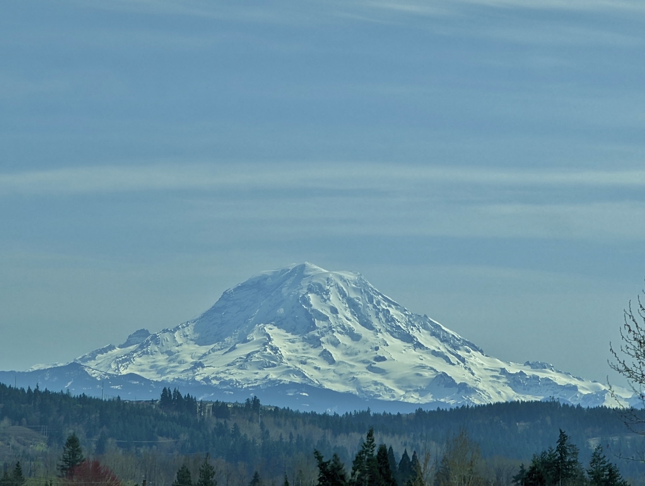
Rainier from I-90
Position: 47°35.38’N, -122°16.16’W
14,417 ft (4,394 m) Mt. Rainier just visible in the distance at left, 55 miles (88 km) away, as we cross I-90 en route to snowshoe at the mountain this weekend (click image for a larger view).
|
|
|
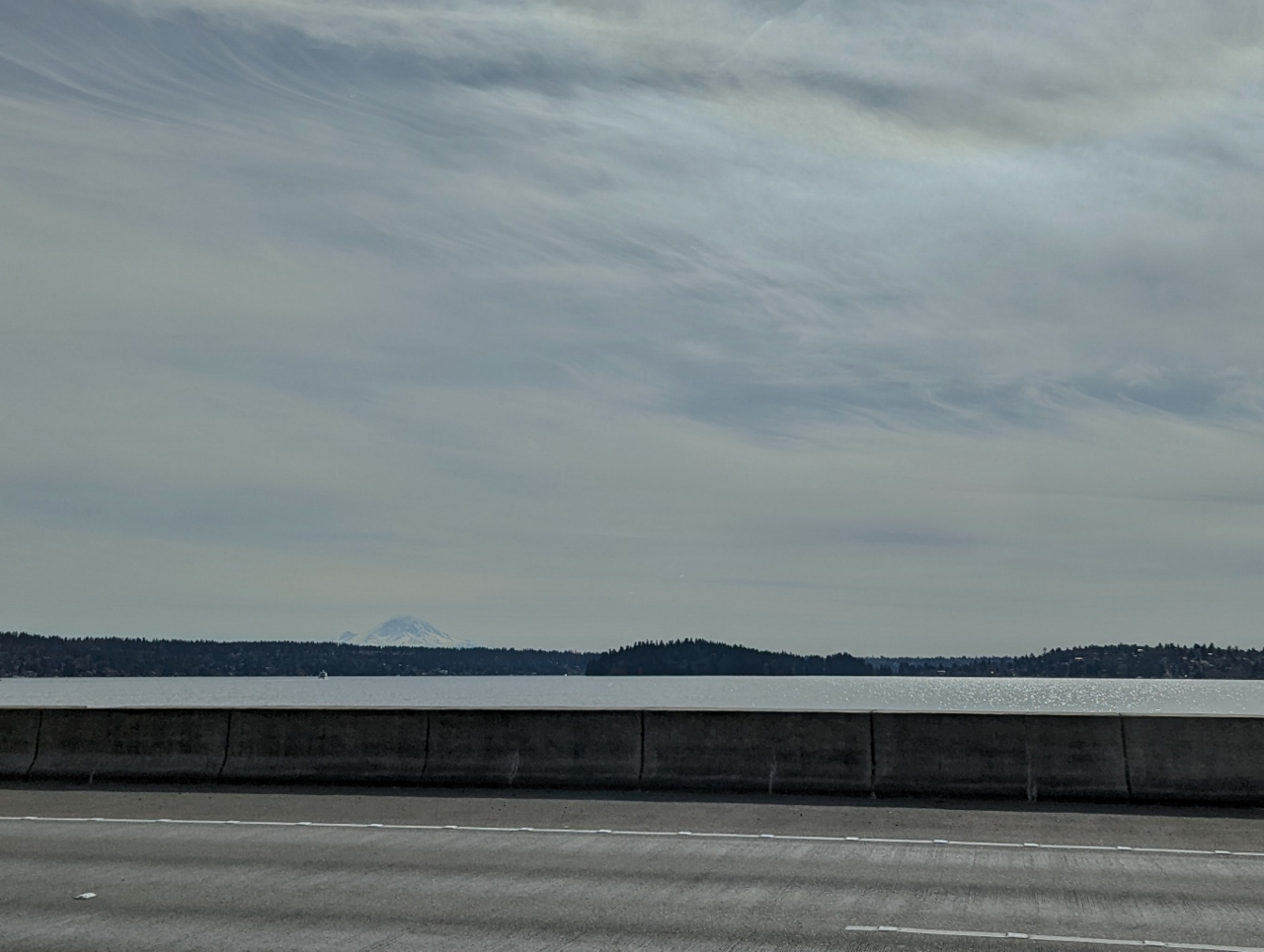
Rainier from SR 167
Position: 47°16.79’N, -122°15.51’W
We’re getting better and better views to Mt Rainier as we head towards it. Here the mountain dominates the skyline west of State Route 167, about 35 miles (56 km) away.
|
 |
Eatonville
Position: 46°52.22’N, -122°15.93’W
Passing through the town of Eatonville, about 25 miles away from Mt Rainier. The town has been a gateway for visitors to the mountain since the late 1800s, and features the mountain in its logo.
|
 |
2,500 Miles
Position: 46°46.38’N, -122°12.99’W
We just crossed 2,500 miles (4,023 km) on our new truck. That’s a lot for eight weeks when we only drive it on the weekends.
|
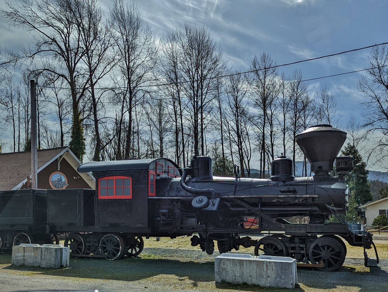 |
Railroad Museum
Position: 46°45.87’N, -122°11.63’W
Steam locomotive at the Mt. Rainier Railroad and Logging Museum in Elbe. The town’s strong railroad theme includes a hotel, the Hobo Inn, where guests stay in renovated cabooses.
|
 |
Rainier from SR 706
Position: 46°45.42’N, -122°8.22’W
Another great view to Mt. Rainier from just outside Elbe on WA state route 706. We’re only 20 miles (30 km) away now.
|
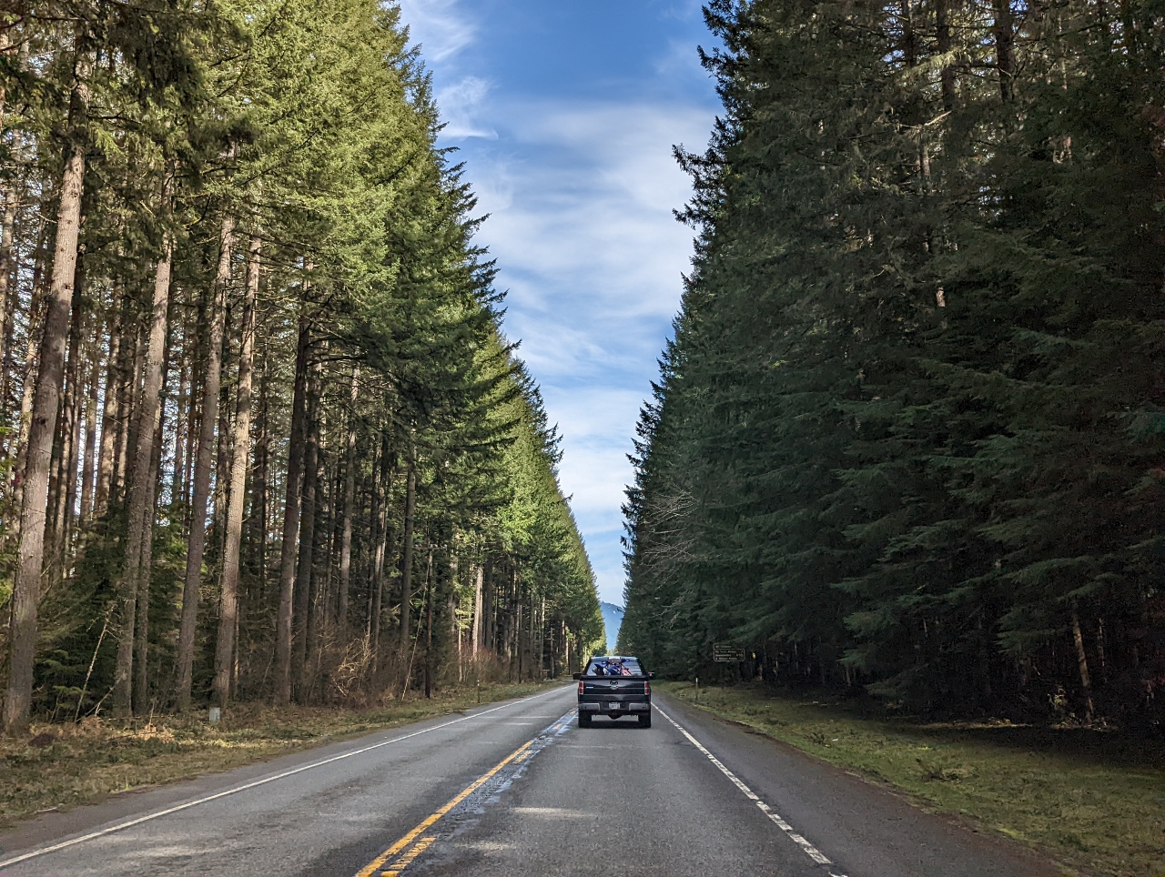 |
WA-706
Position: 46°45.24’N, -122°6.27’W
A beautiful stretch of tree-lined road along WA route 706 east of Elbe.
|
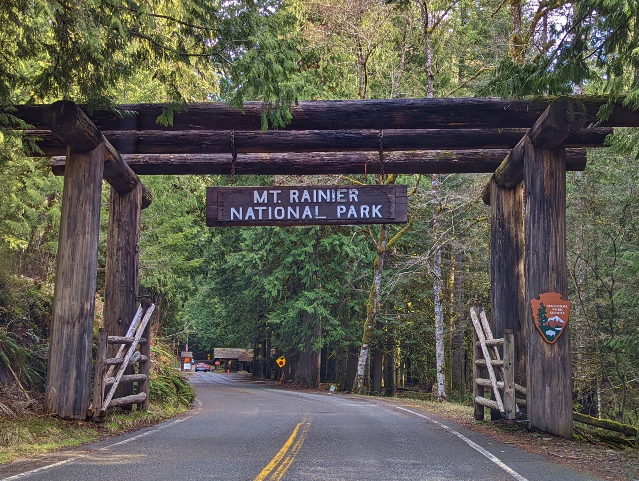 |
Park Entrance
Position: 46°44.57’N, -121°55.36’W
We’re super-excited to finally be at Mt. Rainier National Park. Neither of us has ever visited and we’re really looking forward to seeing the mountain up close.
|
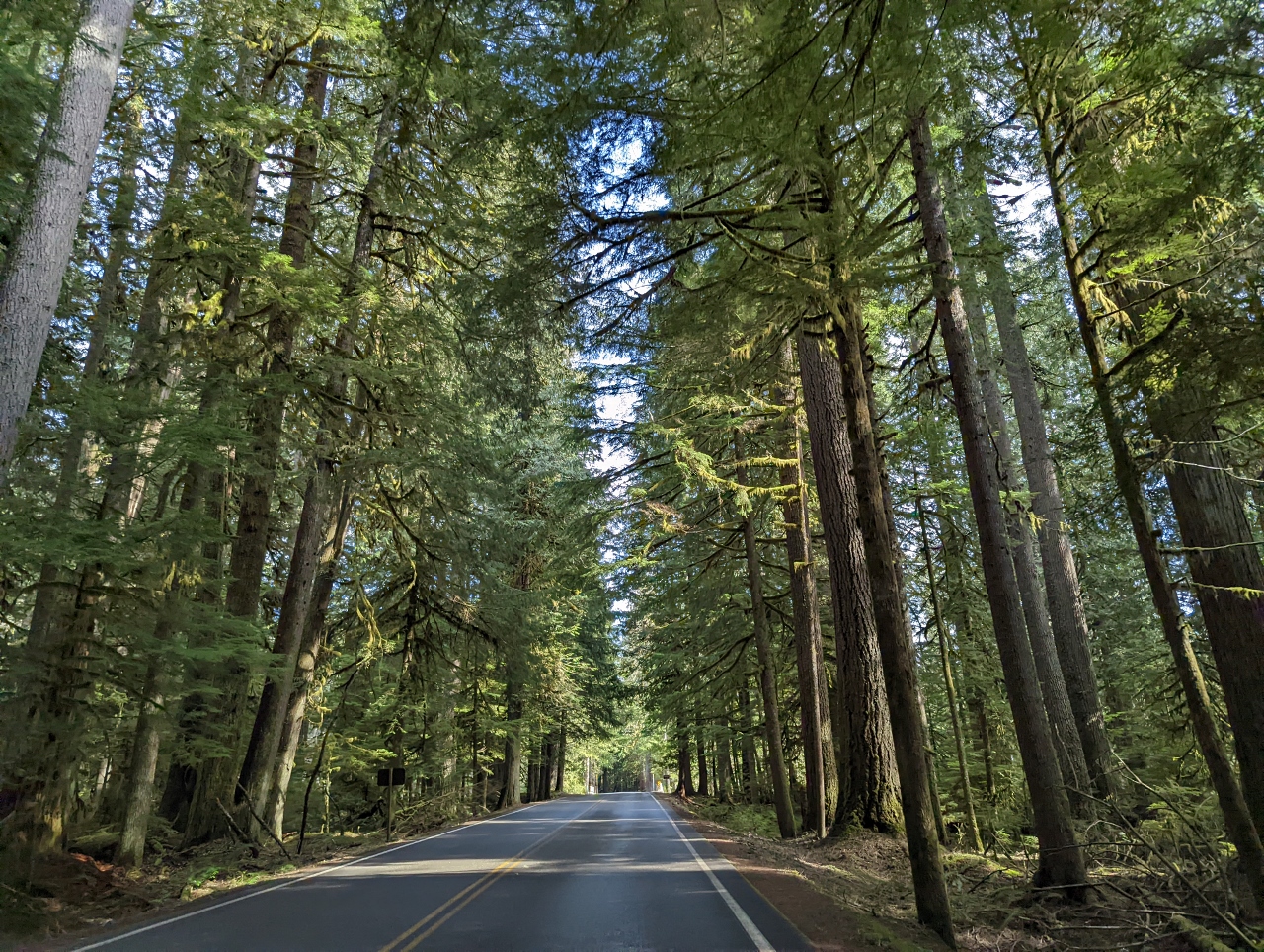 |
Paradise Road
Position: 46°44.48’N, -121°54.16’W
Thick, healthy forest on either side of Paradise Road in Mt. Rainier National Park.
|
 |
Nisqually River
Position: 46°44.93’N, -121°48.79’W
The broad Nisqually River flows from Nisqually Glacier on the flank of Mt Rainier and enters the Puget Sound near Tacoma. The river delta there, with views to the Olympic Mountains and Mt. Rainier, is one of our favourite South Sound anchorages and one of the stops on our week-long shakedown cruise shortly after taking delivery of Nordhavn 52 Dirona.
|
 |
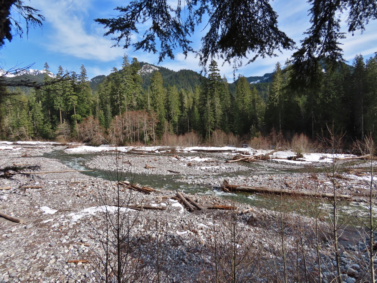
Kautz Creek
Position: 46°44.18’N, -121°51.43’W
View to Mt. Rainier over Kautz Creek, only 10 miles (15 km) away now. Today is clear and sunny, but the mountain often is invisible, shrouded in clouds. A common question in the area is “Is the mountain out?”
|
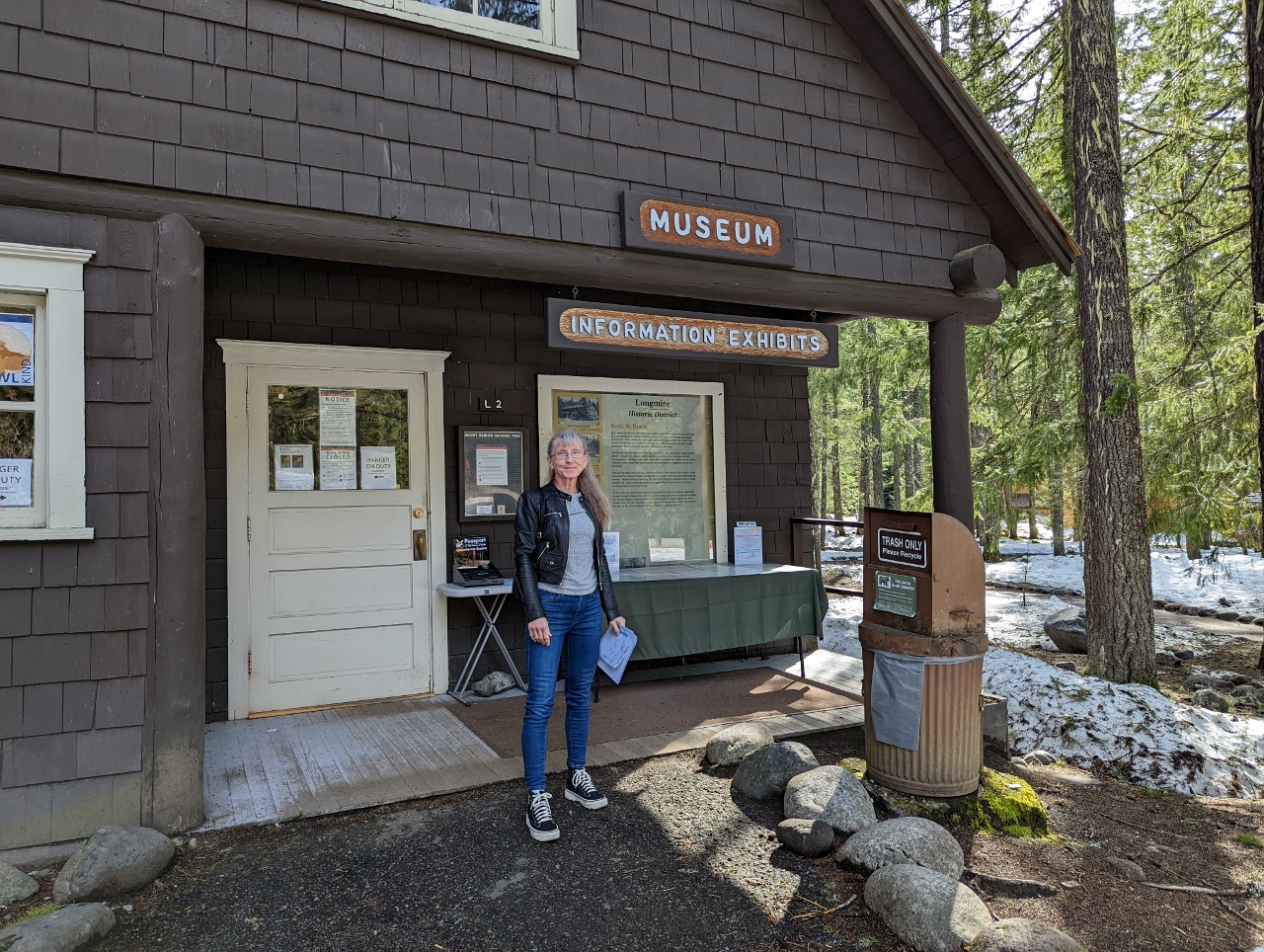 |
Longmire
Position: 46°44.99’N, -121°48.76’W
At the Longmire Museum to pickup some snowshoe trail maps. At 3:40pm, this is currently as far as we can go because the road to the top is only open between 9am and 3pm.
|
 |
729 years
Position: 46°44.99’N, -121°48.76’W
This slab on display outside the Longmire Museum is from a tree that started growing in 729 years ago in 1286. The small labels describe notable points in time since, both worldwide and with respect to the Mt Rainier area.
|
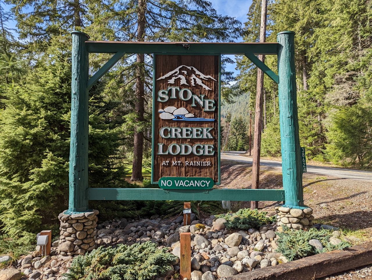 |
Stone Creek Lodge
Position: 46°44.59’N, -121°55.38’W
Our hotel for the weekend is the Stone Creek Lodge, a collection of cabins 700 yards (640 m) from the park entrance.
|
 |
Cabin
Position: 46°44.58’N, -121°55.44’W
Our cosy cabin at Stone Creek Lodge. The room is heated nice and toasty with the gas stove partially visible beyond the bed. And it has a small kitchen with a sink, fridge, microwave, toaster, coffee maker, and kettle.
|
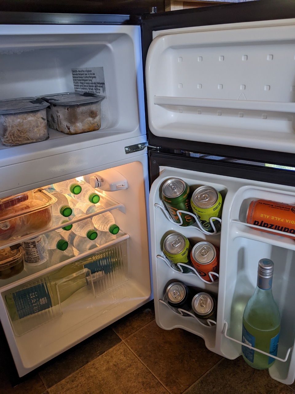 |
Fridge
Position: 46°44.59’N, -121°55.45’W
The contents of our cooler stowed in the ample space of our cabin’s fridge and freezer, ready for the weekend.
|
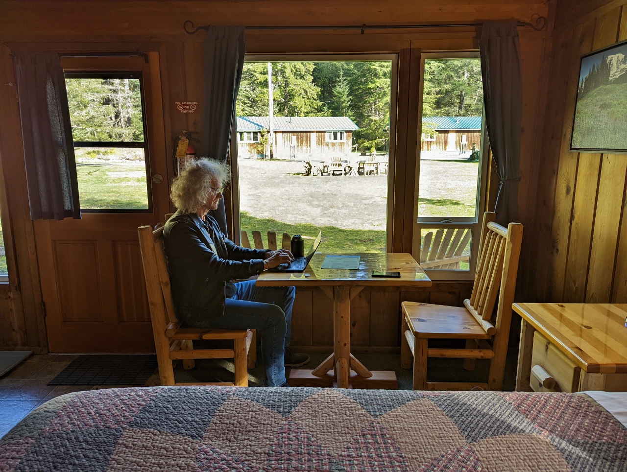 |
Office
Position: 46°44.59’N, -121°55.45’W
James getting a little work done in our cabin at Stone Creek Lodge before we head out for dinner. The cellular service isn’t great out here in the woods, but the lodge has excellent WiFi service.
|
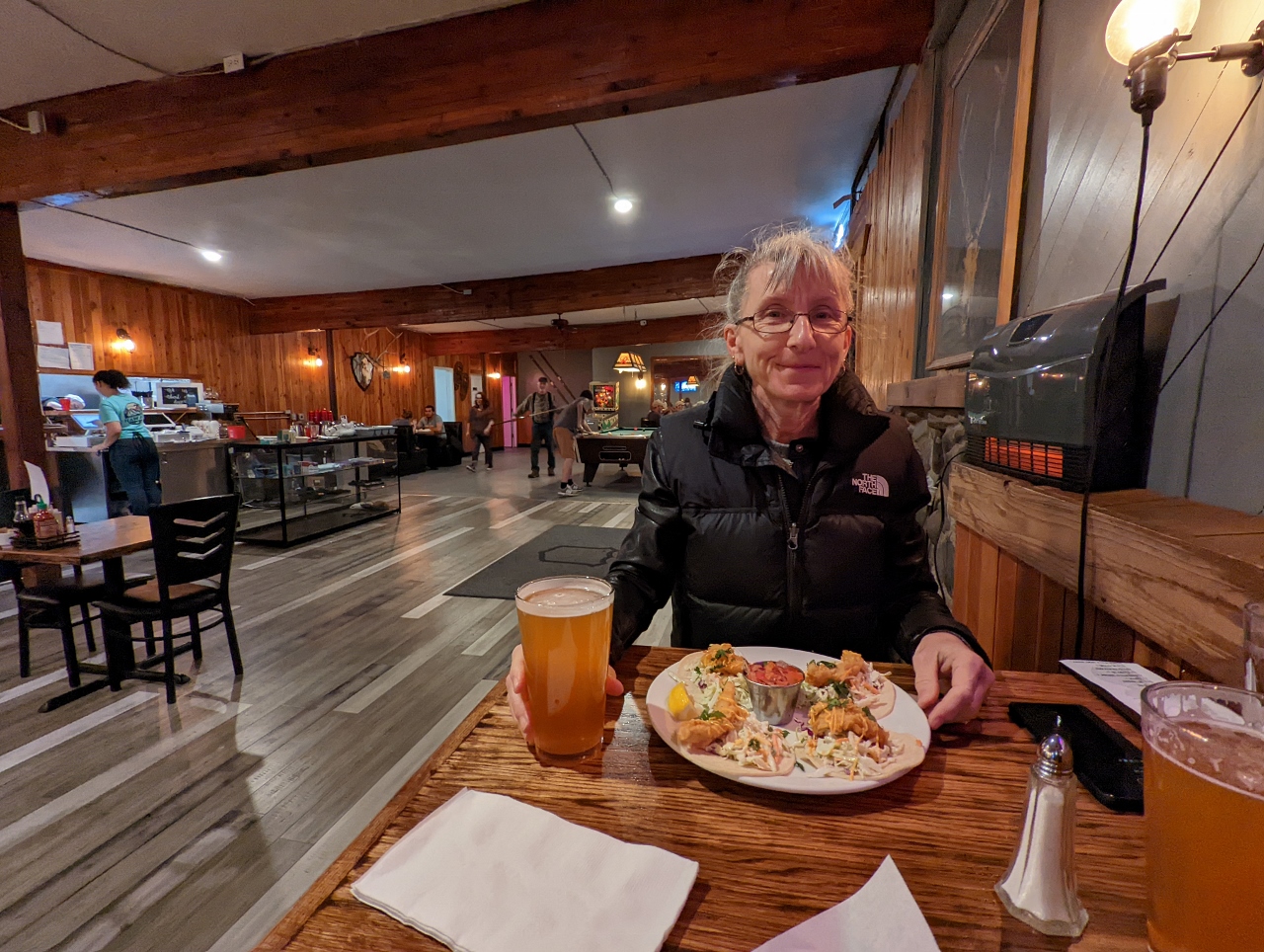 |
Trailhead Bar & Grill
Position: 46°45.57’N, -122°1.94’W
A delicious dinner at the Trailhead Bar & Grill in Ashford, just outside Mt. Rainier National Park.
|
 |
Click the travel log icon on the left to see these locations on a map. And a map of our most recent log entries always is available at mvdirona.com/maps. |
If your comment doesn't show up right away, send us email and we'll dredge it out of the spam filter.