Queen Anne Hill, at 456 feet (139 m) high, is the highest named hill in Seattle and easily visible from our apartment. Three large red-and-white broadcast towers, landmarks in the city that are visible for miles, stand atop the hill and make it even more prominent.
After an 1875 windstorm flattened many of the trees on the slope, the area became a popular home for the city’s wealthy for its sweeping city and water views. Many mansions were built there using the Queen Anne architectural style, popular in the US in the late 1800s, which became the name of the hill and the surrounding neighborhood.
Today the neighborhood has 7 of the 20 steepest streets in notoriously hilly Seattle, 120 pedestrian staircases to navigate the slopes, and many public parks, some sharing the excellent views that drew the original mansion construction. And those views continue to make Queen Ann an expensive place to buy a home, with asking prices of over $5 million not uncommon.
Queen Anne directly borders our neighborhood of Belltown, and is an easy walk from our apartment. A cold winter day with clear skies provided some excellent view opportunities, so we made a walking tour to the top. After enjoying the views en route, we had an early dinner in the wonderful neighborhood pub Hilltop Ale House, and continued back home past the broadcast towers and through Seattle Center at dusk.
Below are highlights from February 25th, 2022. Click any image for a larger view, or click the position to view the location on a map. And a map with our most recent log entries always is available at mvdirona.com/maps.
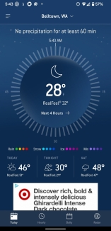 |
Brrrr
Position: 47°37.00’N, -122°20.55’W
The overnight temperatures have been below freezing for the past few days and it’s a chilly 28°F (-2.2°C) this morning.
|
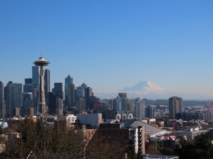 |
Kerry Park
Position: 47°37.76’N, -122°21.56’W
The amazing view from Kerry Park in Queen Anne to the Space Needle, downtown Seattle, and Mt. Rainier. The north tower of the apartment complex where we live is the tall building fully visible at the left edge of the picture.
|
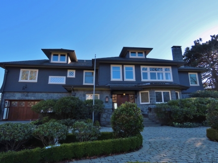 |
Highland Drive
Position: 47°37.77’N, -122°21.69’W
Queen Anne is one of the more expensive housing neighborhoods in Seattle, with some really big houses built to take advantage of the views such as this one on Highland Drive.
|
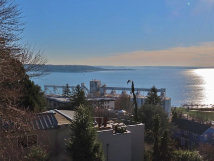 |
Marshall Park
Position: 47°37.78’N, -122°21.98’W
View to West Seattle from Marshall Park in Queen Anne.
|
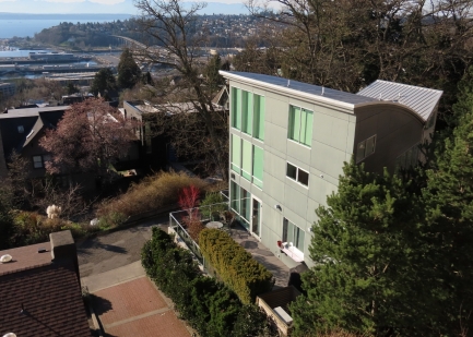 |
Modern House
Position: 47°37.80’N, -122°22.02’W
A striking, modern view home in Queen Anne just below Marshall Park.
|
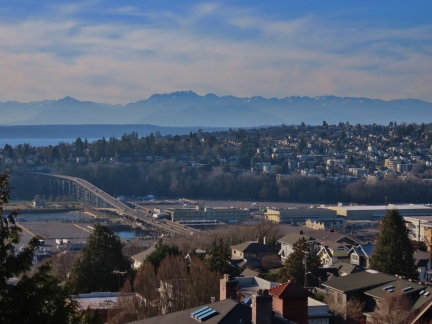 |
Magnolia Bridge
Position: 47°37.85’N, -122°22.06’W
View from 8th Ave in Queen Anne to the Magnolia Bridge, with the Olympic Mountains in the background.
|
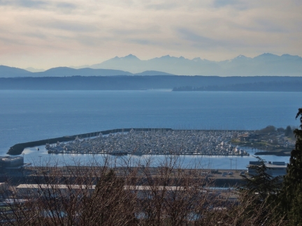 |
Elliott Bay Marina
Position: 47°37.85’N, -122°22.06’W
Elliott Bay Marina is where we kept our first boat for a decade, and currently is home to Nordhavn Northwest, the builder of our second boat.
|
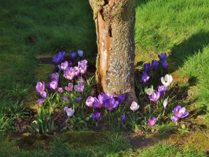 |
Crocuses
Position: 47°38.09’N, -122°21.96’W
It’s only February, but the crocuses are already in bloom. At our house in Toronto, the crocuses didn’t bloom until March or April.
|
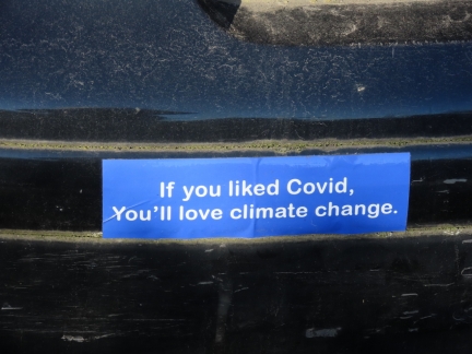 |
Bumper Sticker
Position: 47°38.20’N, -122°21.67’W
It’s not clear if this bumper sticker is a warning about climate change or a complaint about overreaching government restrictions, but it did catch our attention.
|
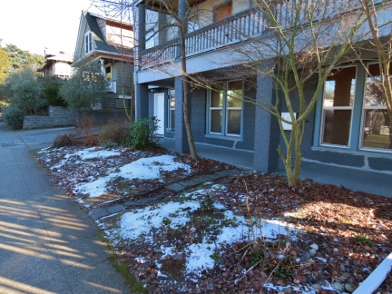 |
Snow
Position: 47°38.29’N, -122°21.66’W
We didn’t see any snow on the ground in Queen Anne, except in this yard that must see little sun.
|
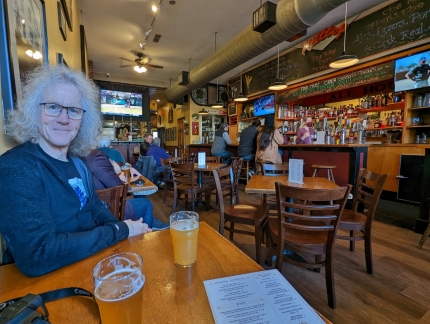 |
Hilltop Ale House
Position: 47°38.28’N, -122°21.43’W
Delicious IPAs and food, with a wonderful neighborhood pub atmosphere, at Hilltop Ale House in Queen Anne.
|
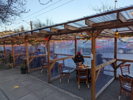 |
Paragon
Position: 47°38.28’N, -122°21.43’W
Among the few positive aspects of the pandemic is the increase in outdoor restaurant seating options. These outdoor rooms with tabletop fireplaces at Paragon in Queen Anne look fabulous—we’ll have to try them sometime.
|
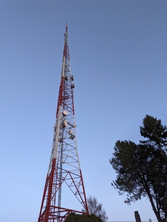 |
TV Tower
Position: 47°37.94’N, -122°21.30’W
One of three television broadcasting towers standing on Queen Anne Hill. The distinctive towers, visible for miles, are a landmark in the city.
|
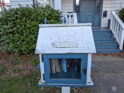 |
Free Library
Position: 47°37.94’N, -122°21.28’W
A charming free library box in Queen Anne, part of the Little Free Library non-profit organization.
|
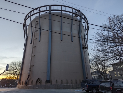 |
Water Tank
Position: 47°37.88’N, -122°21.27’W
Two-million gallon (4.5 million L) water tank outside Fire Station No. 8 in Queen Anne. The tank was built in the late 2000s to replace two century-old tanks that were at risk of collapse in one of the few cases where a designated Seattle landmark was purposely destroyed.
|
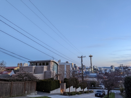 |
Dusk
Position: 47°37.74’N, -122°21.11’W
Dusk looking south from Queen Anne Hill as we return home.
|
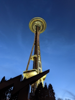 |
Space Needle
Position: 47°37.25’N, -122°20.86’W
View to the Space Needle from below as we walk through Seattle Center on our way home.
|
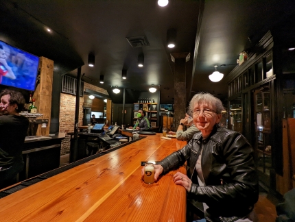 |
Zekes Pizza
Position: 47°37.09’N, -122°20.86’W
We were tempted to stop in for a quick beer at the Queen Anne Zeeks Pizza when we walked past, but opted instead to visit our neighborhood Zekes in Belltown. We go there a lot and really enjoy the pizza and the atmosphere.
|
 |
Click the travel log icon on the left to see these locations on a map. And a map of our most recent log entries always is available at mvdirona.com/maps. |

If your comment doesn't show up right away, send us email and we'll dredge it out of the spam filter.