Franklin Falls, just west of Snoqualmie Pass, gush 70 ft (21m) over a cliff into a pool below, with a narrow hiking trail that leads almost underneath. The falls are spectacular in the spring runoff, but even more so after particularly cold winter weather, when icicles encrust the cliff face. They reminded us of frozen Storsaeterfossen in Geirangerfjord, Norway that we hiked to on New Year’s Day.
We’d been wanting to see the “frozen falls” since first learning about them in a newspaper article a few weeks earlier, and set off on a cold winter morning to make the three-mile hike in. We had a great walk through a snowy forest, and the falls were truly amazing. We had come early enough that we didn’t see anyone else on the trail, and had the falls all to ourselves most of the time there.
We’d brought our new snowshoes, but didn’t need them on the densely-packed snow of the well-trod trail. The surface was frozen and slippery though, so we put on the microspikes that we purchased in Norway. We didn’t expect to wear them again in our North American hiking, but they’re very commonly worn here on winter trails and we were happy to be putting them back into use.
Leaving the falls, we took a spur trail that brought us out to a snowshoe area. We’d never been snowshoeing before and were really looking forward to trying out our new snowshoes, MSR Lightning Ascents, that we’d bought for winter hikes. We tested them climbing reasonably steep hills, had no trouble making it up or down in fairly deep snow, and were really impressed with their traction.
Below are highlights from February 26th, 2022. Click any image for a larger view, or click the position to view the location on a map. And a map with our most recent log entries always is available at mvdirona.com/maps.
 |
Traffic
Position: 47°28.40’N, -121°45.57’W
Suprisingly heavy traffic at 7:40am as we head towards Snoqualmie Pass to hike into Franklin Falls. Hopefully everyone else is heading to the ski resort, as trailhead parking is limited.
|
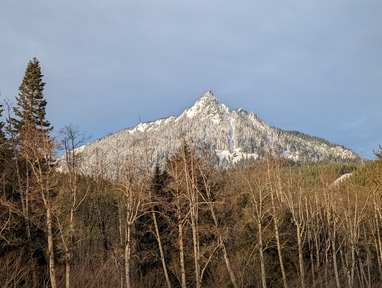 |
Kaleetan Peak
Position: 47°25.51’N, -121°36.02’W
6,259-foot (1,908m) Kaleetan Peak in the Cascade Range, viewed from I-90 as we near Snoqualmie Pass.
|
 |
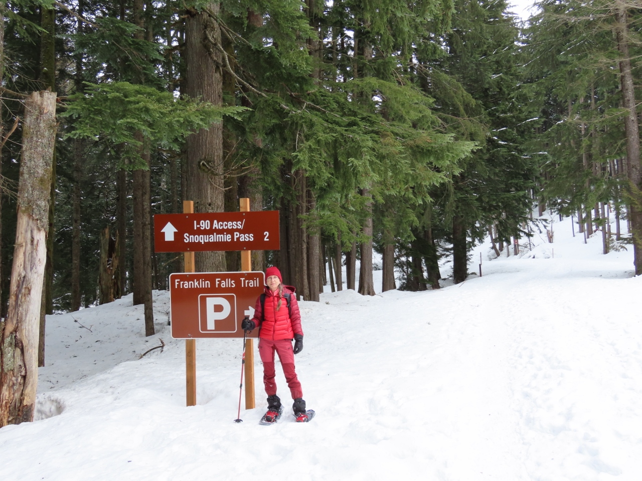
Trailhead
Position: 47°23.70’N, -121°28.46’W
The summer trailhead for the hike to Franklin Falls is about three miles down the road. But the road is closed to all but local traffic in the winter, so we’ll need to walk from here.
|
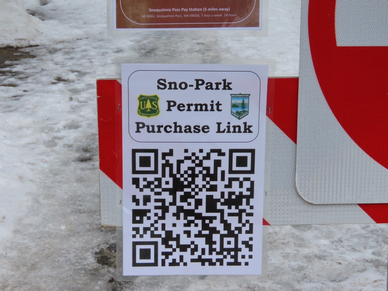 |
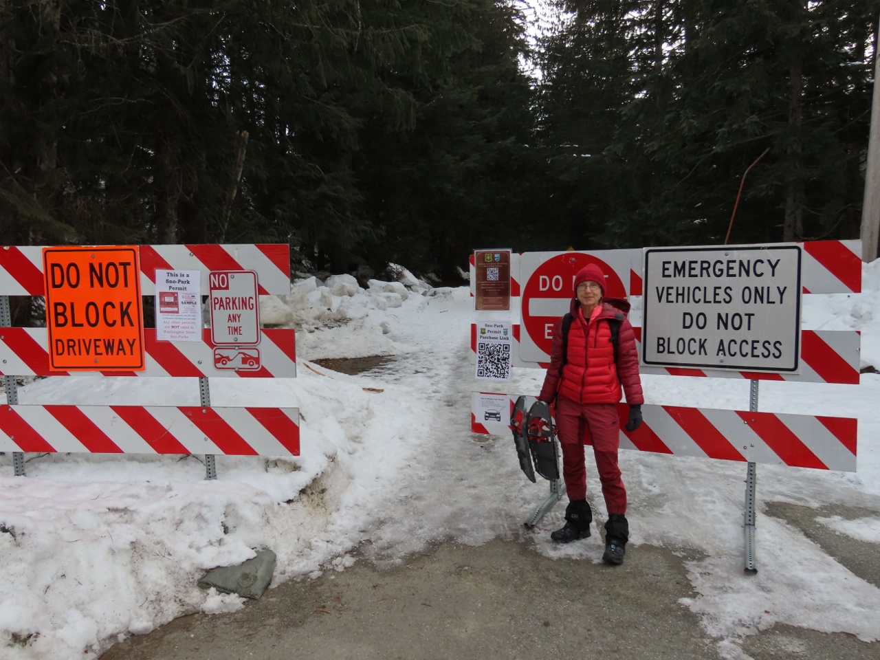
Asahel Curtis Sno-Park
Position: 47°23.72’N, -121°28.37’W
Washington State maintains a number of winter recreation Sno-Parks that require a special permit to park in. The permits are relatively expensive at $25 for a day pass and up to $120 for an annual pass. We just went with a day pass as we’re not likely to use that many Sno-Parks this season.
|
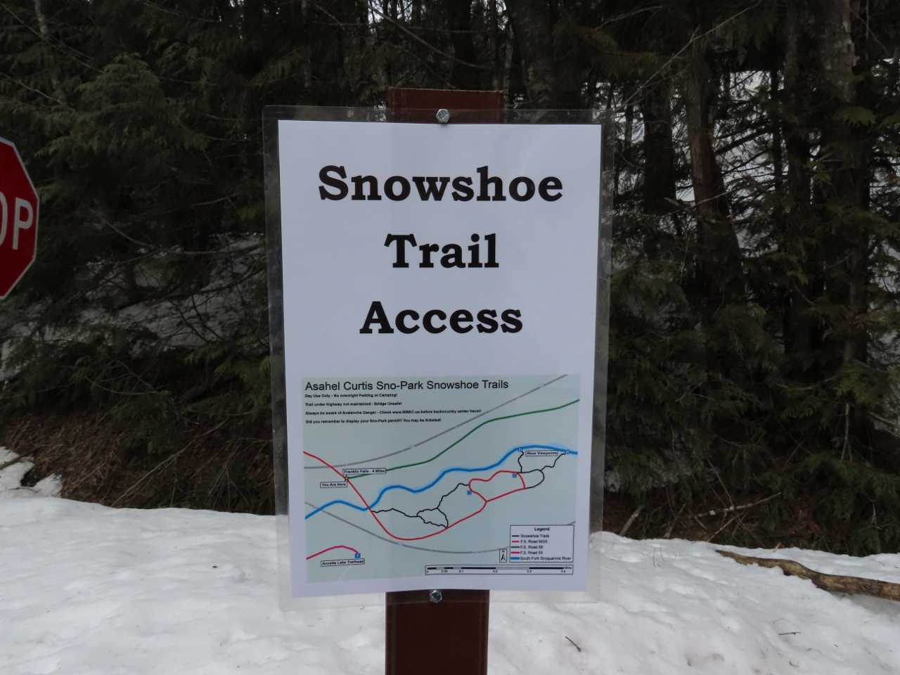 |
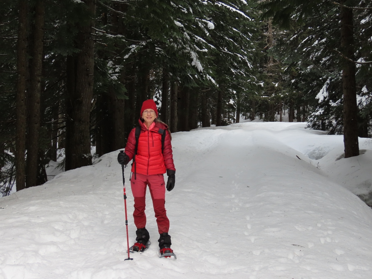
Showshoe Trails
Position: 47°23.71’N, -121°28.43’W
Besides the winter trail to Franklin Falls, the Asahel Curtis Sno-Park also provides access to several miles of snowshoe trails.
|
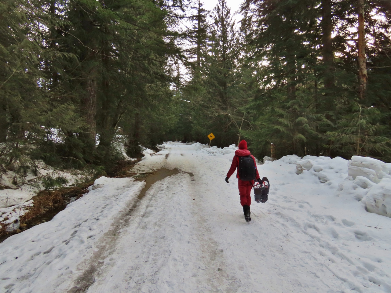 |
Walking
Position: 47°23.71’N, -121°28.44’W
We were expecting to need snowshoes to reach the falls, but the road was well-plowed and walking was pretty easy just in our boots.
|
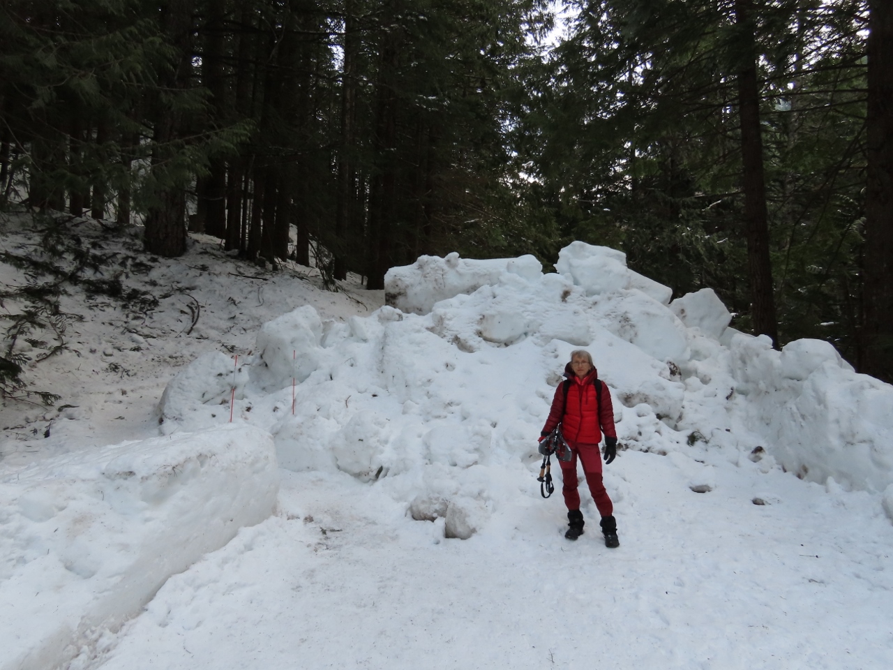 |
End of Plow
Position: 47°24.24’N, -121°26.70’W
We reached the end of the plowed area about 1.5 miles in.
|
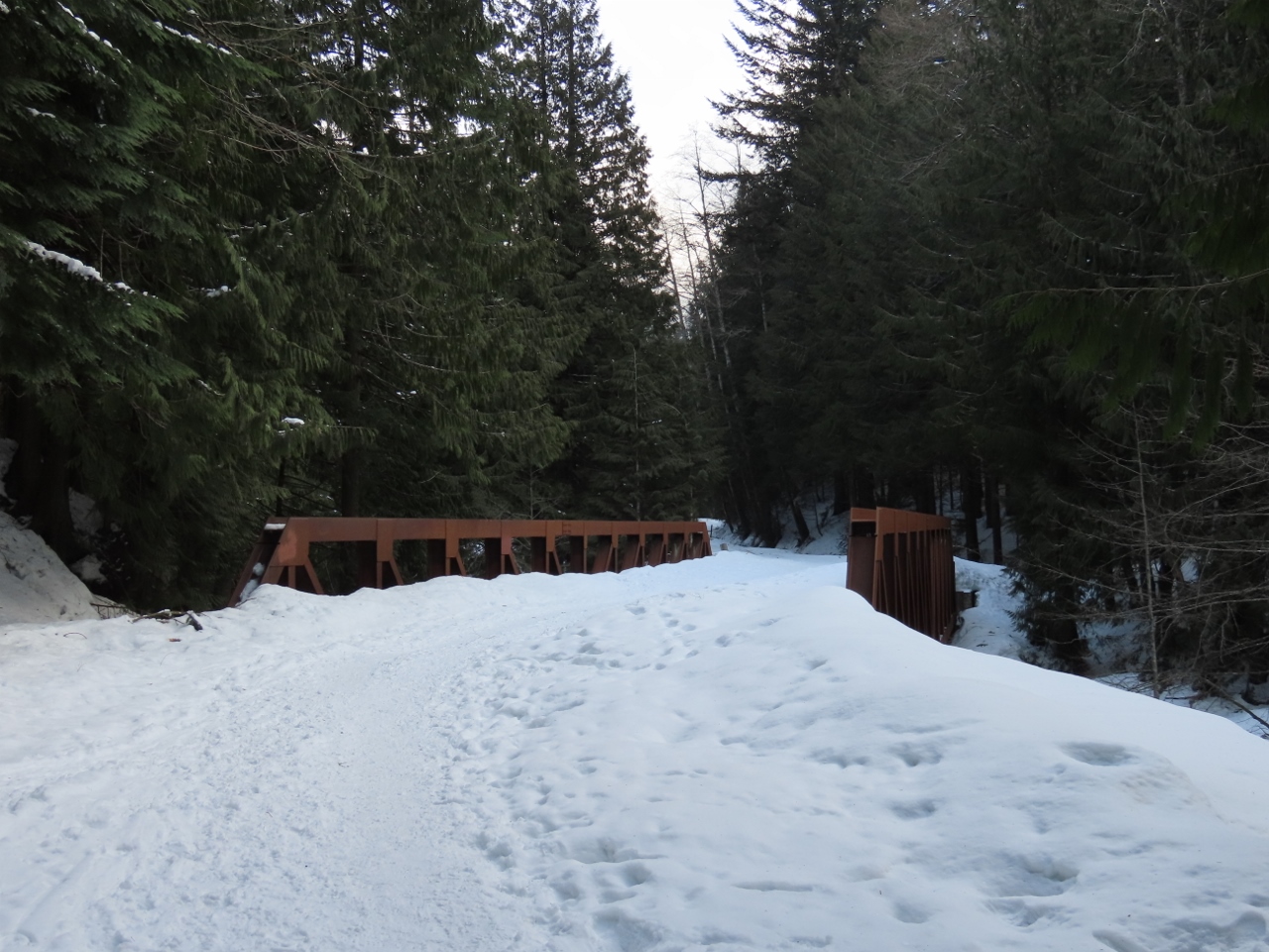 |
Road Bridge
Position: 47°24.31’N, -121°26.65’W
Lots of footprints heading to the bridge that carries the road over the South Fork Snoqualmie River. The path beyond the plowed section was snow-covered, but very compact and easy to walk on in just our hiking boots.
|
 |
South Fork Snoqualmie River
Position: 47°24.45’N, -121°26.56’W
Snowy scene looking south along the South Fork Snoqualmie River from the road bridge.
|
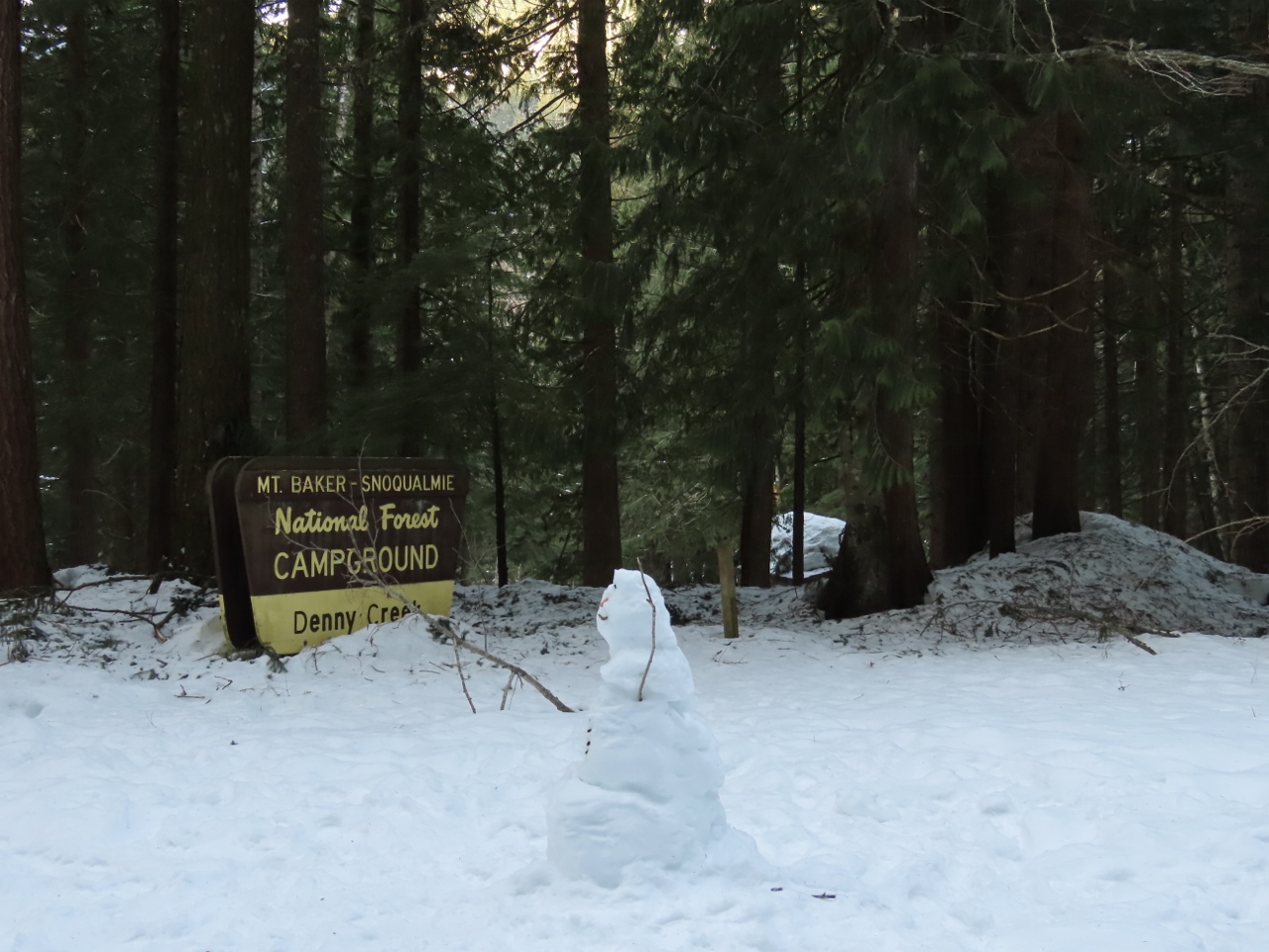 |
Snowman
Position: 47°24.55’N, -121°26.52’W
Snowman at the Denny Creek Campground sign.
|
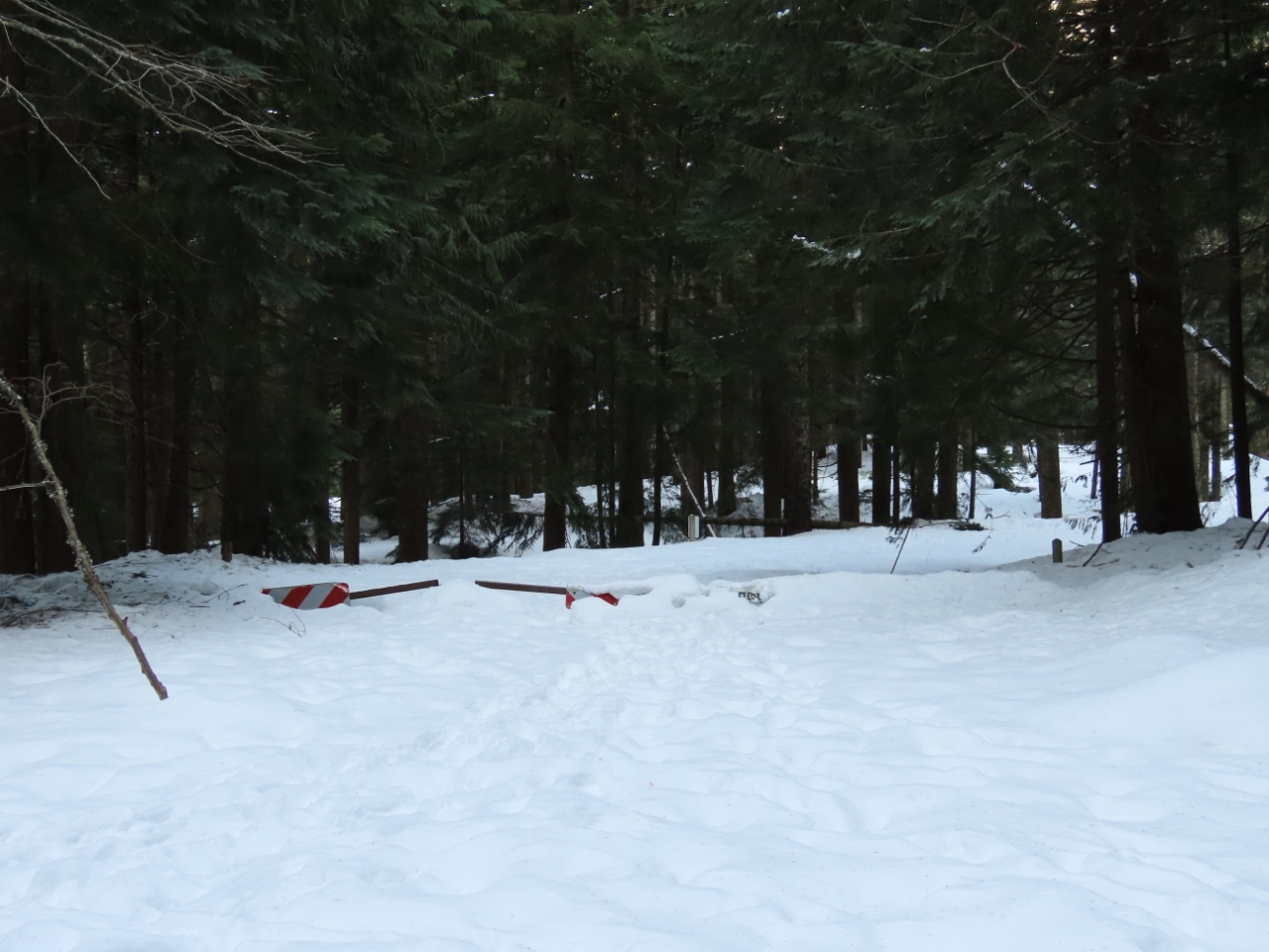 |
Road Barrier
Position: 47°24.60’N, -121°26.51’W
We didn’t realize how deep the snow was until we noticed this nearly-buried road barrier.
|
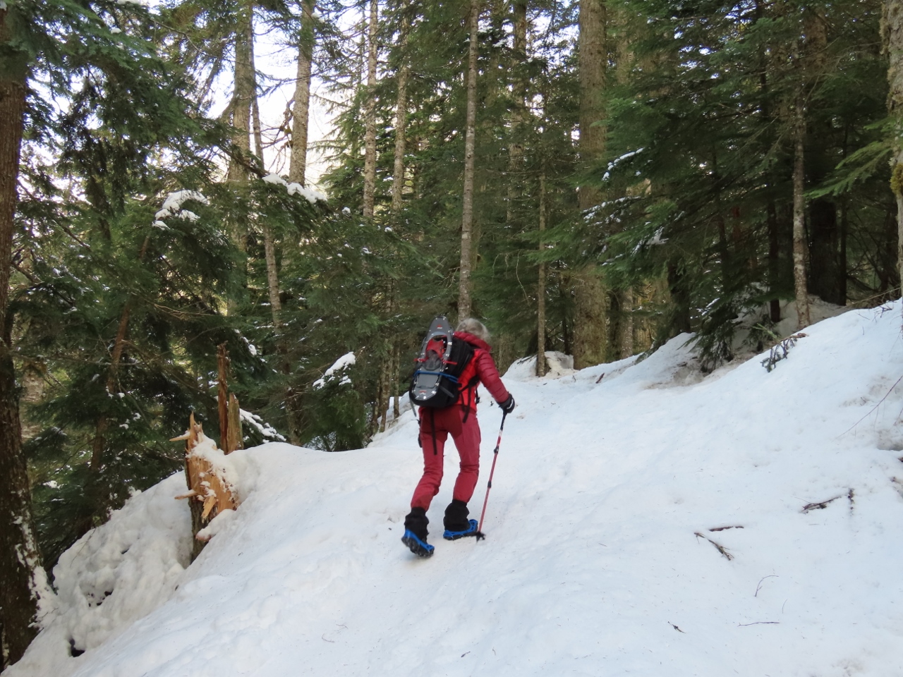 |
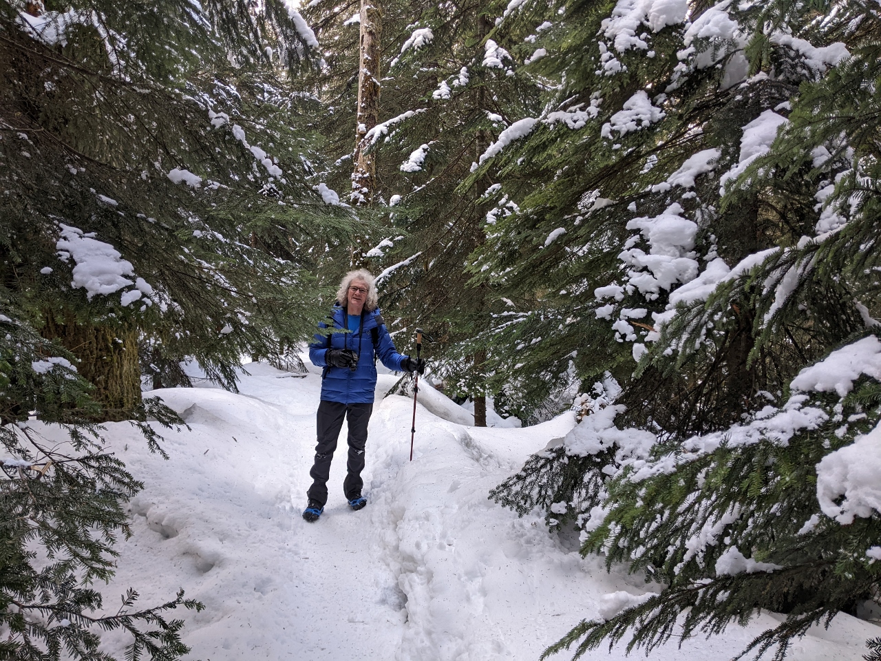
Microspikes
Position: 47°24.96’N, -121°26.45’W
When we left the road for the actual trail to Franklin Falls, the snow was still well-packed but the surface was quite slippery. Snowshoes seemed like overkill, but we did want some traction, so we put on the microspikes that we purchased in Norway (we later upgraded to Kahootla Exospikes). We didn’t expect to wear them again in our North American hiking, but they’re very commonly worn here on winter trails and we’re happy to be putting them back into use.
|
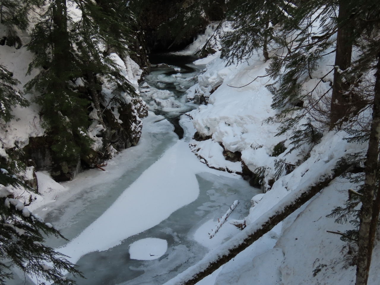 |
Denny Creek
Position: 47°25.06’N, -121°26.42’W
The near-frozen surface of Denny Creek with snow all around makes for a beautiful winter scene.
|
 |
Hiking
Position: 47°25.09’N, -121°26.35’W
It was wonderful to be out in the snow-covered woods and we really enjoyed the hike. Even if we didn’t have the falls as an attraction, this would have been more than enough fun.
|
 |
Footbridge
Position: 47°25.17’N, -121°26.27’W
Crossing a small snow-covered footbridge.
|
 |
Slippery
Position: 47°25.45’N, -121°26.02’W
Descending the final section of the trail to Franklin Falls. With all the spray in the air re-freezing on the path, this section was super-slippery and we really needed the microspikes.
|
|
|
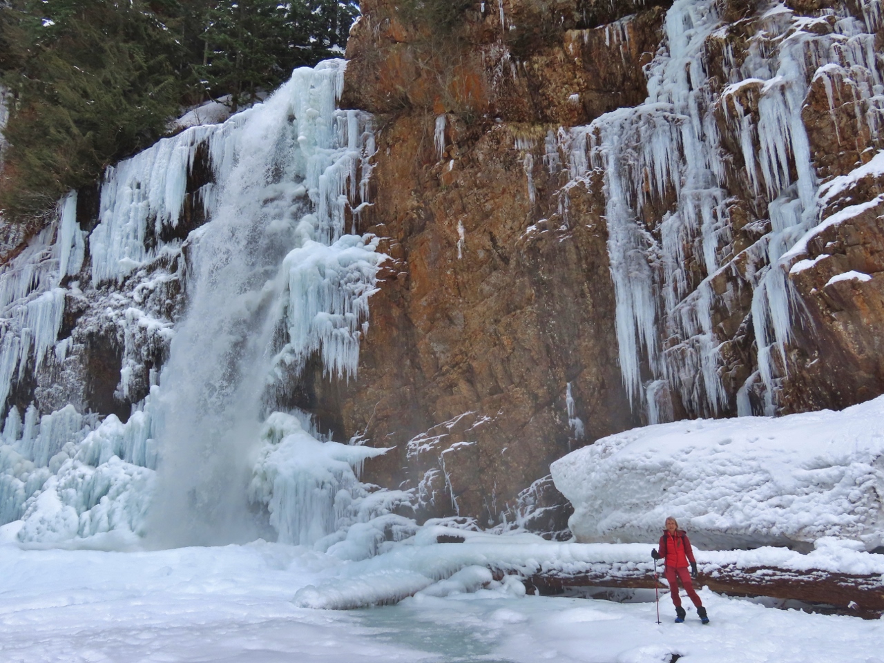
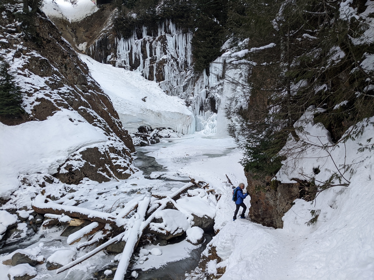
Franklin Falls
Position: 47°25.47’N, -121°25.99’W
Franklin Falls don’t always freeze, but when they do the scene is spectacular. One of the reasons we’d come today is that we’d experienced a week of below-freezing temperatures in Seattle so were confident the falls would be frozen as well.
|
 |
Snack
Position: 47°25.47’N, -121°25.99’W
The temperature is well below freezing here and a snack at the falls with some warm tea was a welcome break.
|
 |
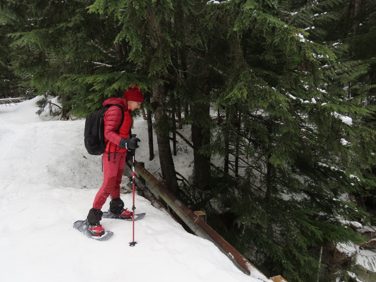
Snowshoes
Position: 47°25.34’N, -121°26.03’W
Leaving the falls, we took a spur trail that brought us out to the snowshoe area. We’d never been snowshoeing before and were really looking forward to trying out our new snowshoes.
|
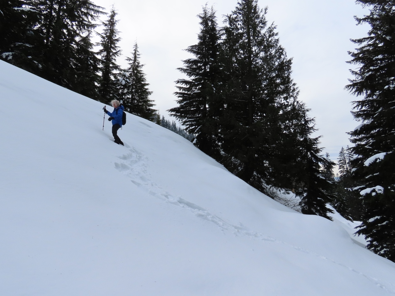 |
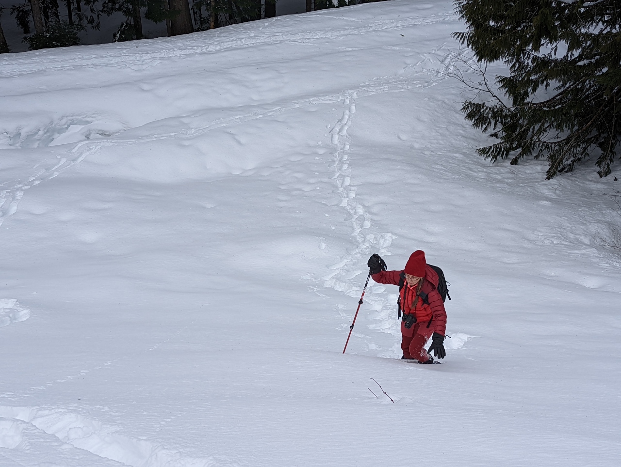
Climbing
Position: 47°25.32’N, -121°26.02’W
We bought snowshoes, MSR Lighting Ascents, for winter hikes and here are testing them climbing a reasonably steep hill. We had no trouble making it up in fairly deep snow, and are really impressed with their traction.
|
 |
Steep
Position: 47°25.32’N, -121°26.01’W
Jennifer climbing up behind James. At this point, we’d only received one one of the two pairs of trekking poles we’d ordered, so are using one each.
|
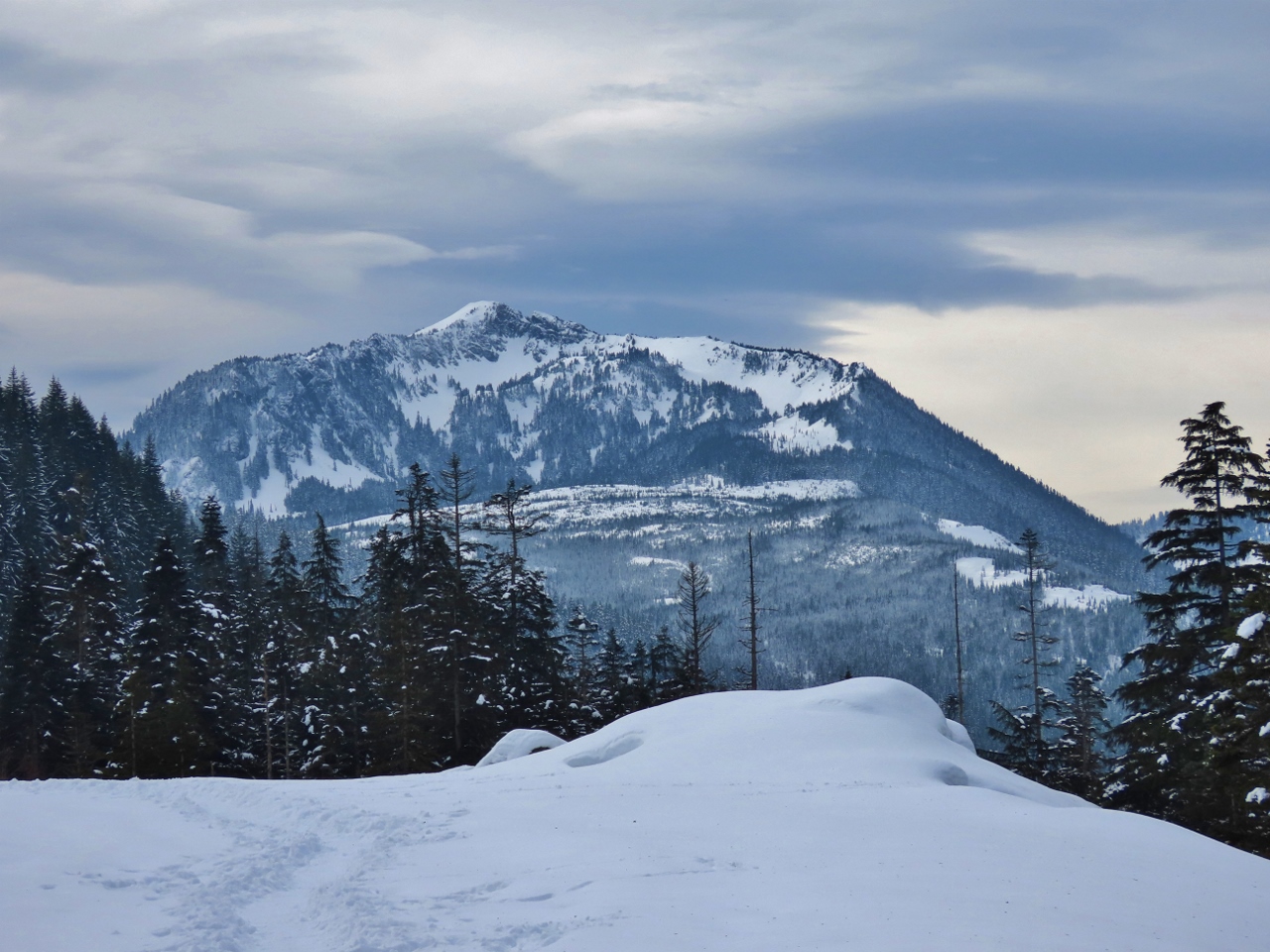 |
Mountain Views
Position: 47°25.32’N, -121°26.01’W
We’d climbed up to Forest Service Road 58 which had wonderful mountain views from a bend in the route.
|
 |
Sliver
Position: 47°25.24’N, -121°26.03’W
As we started to descend through the woods from the Forest Service Road, Jennifer developed a stabbing pain in her foot. It was sufficiently painful that we had to stop and investigate. We found a fairly large metal sliver that fortunately was easy to remove. We’re not sure how it got there.
|
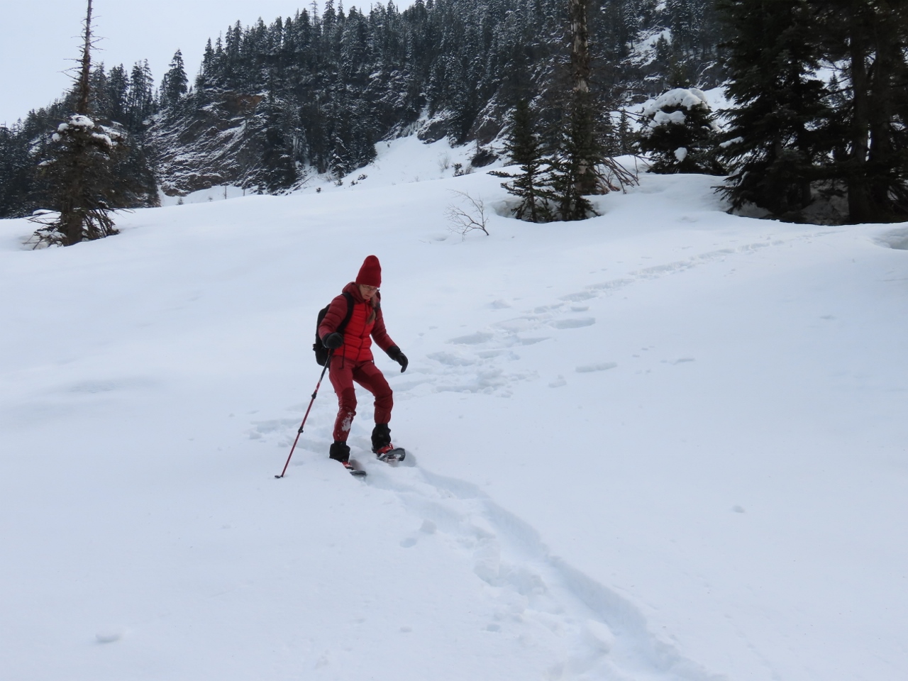 |
Downhill
Position: 47°25.24’N, -121°26.05’W
Continuing our descent from the Forest Service Road. The snowshoes did equally well going down a steep hill. We’re really happy with them.
|
 |
Cable Warning
Position: 47°25.02’N, -121°26.20’W
We always giggle whenever we see a cable warning. It reminds us of the time we were gardening in our Bellevue backyard in the late 1990s and James hit a large cable with a shovel. It was only buried a couple of inches deep in our yard, so we presumed it was likely a discarded cable. We later found our phone was down, as was most of the neighborhood.
|
 |
Summer Trailhead
Position: 47°24.88’N, -121°26.34’W
At the summer parking lot for the trail to Franklin Falls.
|
 |
Snow Depth
Position: 47°24.78’N, -121°26.55’W
The snow is much deeper than it seems. Here we are standing on a bridge looking down to the car barrier.
|
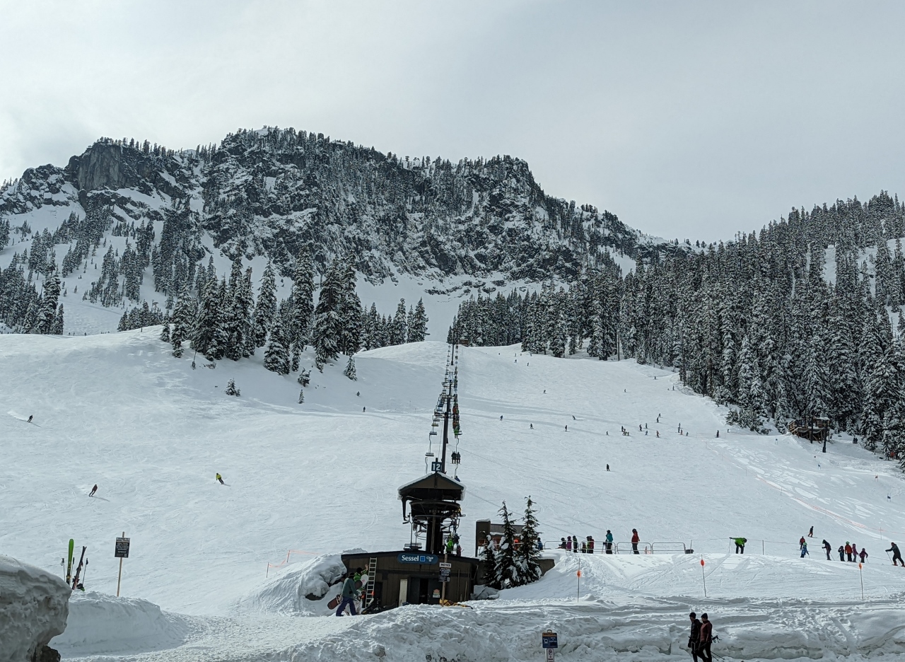 |
Alpental
Position: 47°26.73’N, -121°25.54’W
We checked out the Aplental base area at Snoqualmie Pass while we were in the area. Some of the steepest runs in the state are here, where Olympic gold medalist alpine ski racer Debbie Armstrong trained.
|
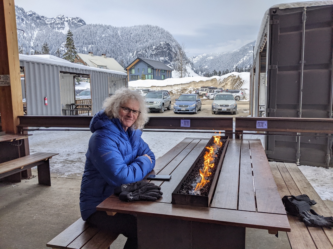 |
The Commonwealth
Position: 47°25.28’N, -121°24.73’W
Another great lunch at the Commonwealth pub within the Snoqualmie Pass ski area after a great day hiking and snowshoeing.
|
 |
Click the travel log icon on the left to see these locations on a map. And a map of our most recent log entries always is available at mvdirona.com/maps. |
If your comment doesn't show up right away, send us email and we'll dredge it out of the spam filter.