
Snoqualmie Pass carries Interstate 90 throught the Cascade Mountains between Seattle and Spokane. At 3,015 feet (919 m), it is the lowest of Washington State’s three major year-round east-west mountain passes, but the closest to Seattle at a mere 52 miles (80 km) to the east.
This makes the Summit at Snoqualmie resort an easy and popular day trip for winter sports enthusiasts from the Seattle metropolitan area. Activities include snowboarding, alpine and cross-country skiing, and winter tubing. The resort also includes some of the steepest runs in the state, and is where Olympic gold medalist alpine ski racer Debbie Armstrong trained.
We made our first day trip in our new car to Snoqualmie Pass on a cold January day. The climate was amazingly different from Seattle for such a short distance away. In our one-hour drive, the temperature fell 30 degrees F (10 degrees C) to 20°F (-6.6°C) at the summit, with piles of snow everywhere. Snowboarders and skiers were arriving in droves as we toured the area. Both sides of the road were packed with cars and a large parking lot was filling up quickly in the brief time we stopped.
Below are highlights from Jan 28th, 2022. Click any image for a larger view, or click the position to view the location on a map. And a live map of our current route and most recent log entries always is available at mvdirona.com/maps.
 |
Fog
Position: 47°37.00’N, -122°20.55’W
Sunrise as fog spills from Elliott Bay into the city.
|
 |
Olallie State Park
Position: 47°26.15’N, -121°39.36’W
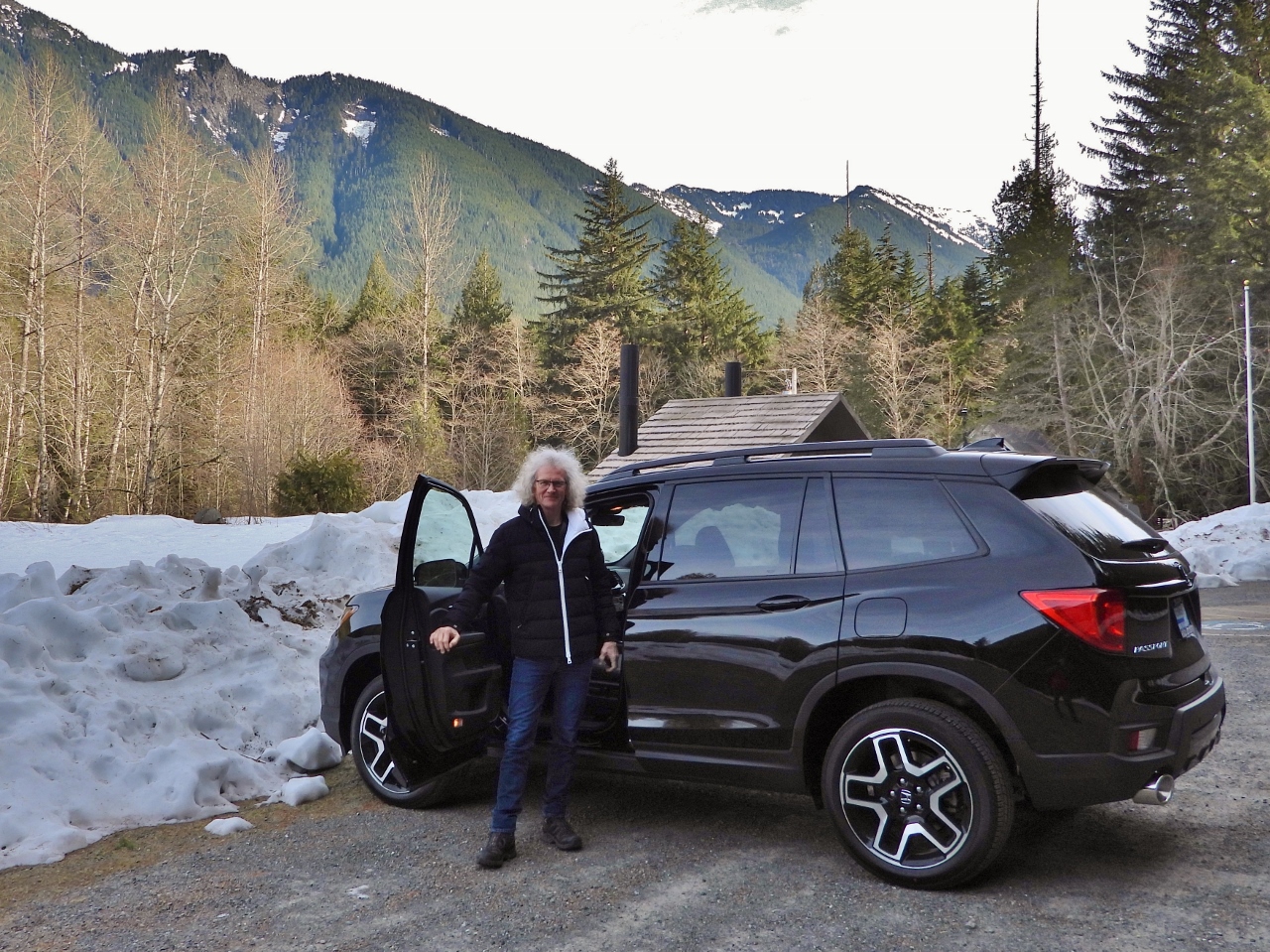
At Olallie State Park, about 40 miles (65km) west of Seattle, en route to Snoqualmie Pass for a drive in our new Honda Passport. We were planning to walk the short trail to Weeks Falls, but the snow is deep enough on the trail that we elected to just continue our trip up to the pass.
|
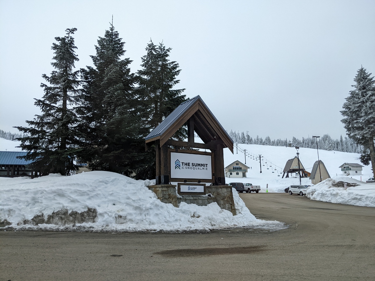 |
The Summit at Snoqualmie
Position: 47°25.70’N, -121°25.28’W
The Summit at Snoqualmie is a winter resort in the Cascade Mountains at Snoqualmie Pass about 52 miles (80 km) east of Seattle. Popular activities there include snowboarding, alpine and cross-country skiing, and winter tubing.
|
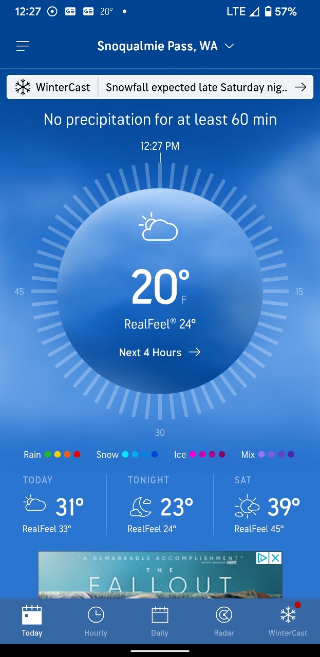 |
20F
Position: 47°25.28’N, -121°24.75’W
The elevation of Snoqualmie Pass is 3,015 ft (918 m), and it’s a chilly 20°F (-6.6°C) here. That’s 30 degrees F (10 degrees C) colder than Seattle.
|
|
|
Chair Lift
Position: 47°24.57’N, -121°24.65’W
One of the 19 chair lifts at the Summit at Snoqualmie resort.
|
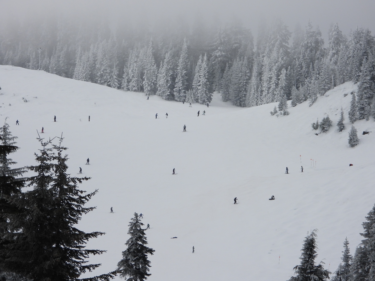 |
Slope
Position: 47°24.56’N, -121°24.67’W
Skiiers and snowboarders on Summit Central, one of four base areas at Snoqualmie. Some of the steepest runs in the state are at the Alpental base area, where Olympic gold medalist alpine ski racer Debbie Armstrong trained.
|
 |
Snow Thrower
Position: 47°24.57’N, -121°24.65’W
Snow throwers parked at Snoqualmie Pass. They get a lot of use up here.
|
 |
Snowmobiles
Position: 47°24.53’N, -121°24.70’W
The Summit at Snoqualmie resort crew get around on snowmobile.
|
 |
Snow Bank
Position: 47°24.16’N, -121°24.43’W
Walls of snow on either side of the road. The climate is amazingly different from Seattle for such a short distance away.
|
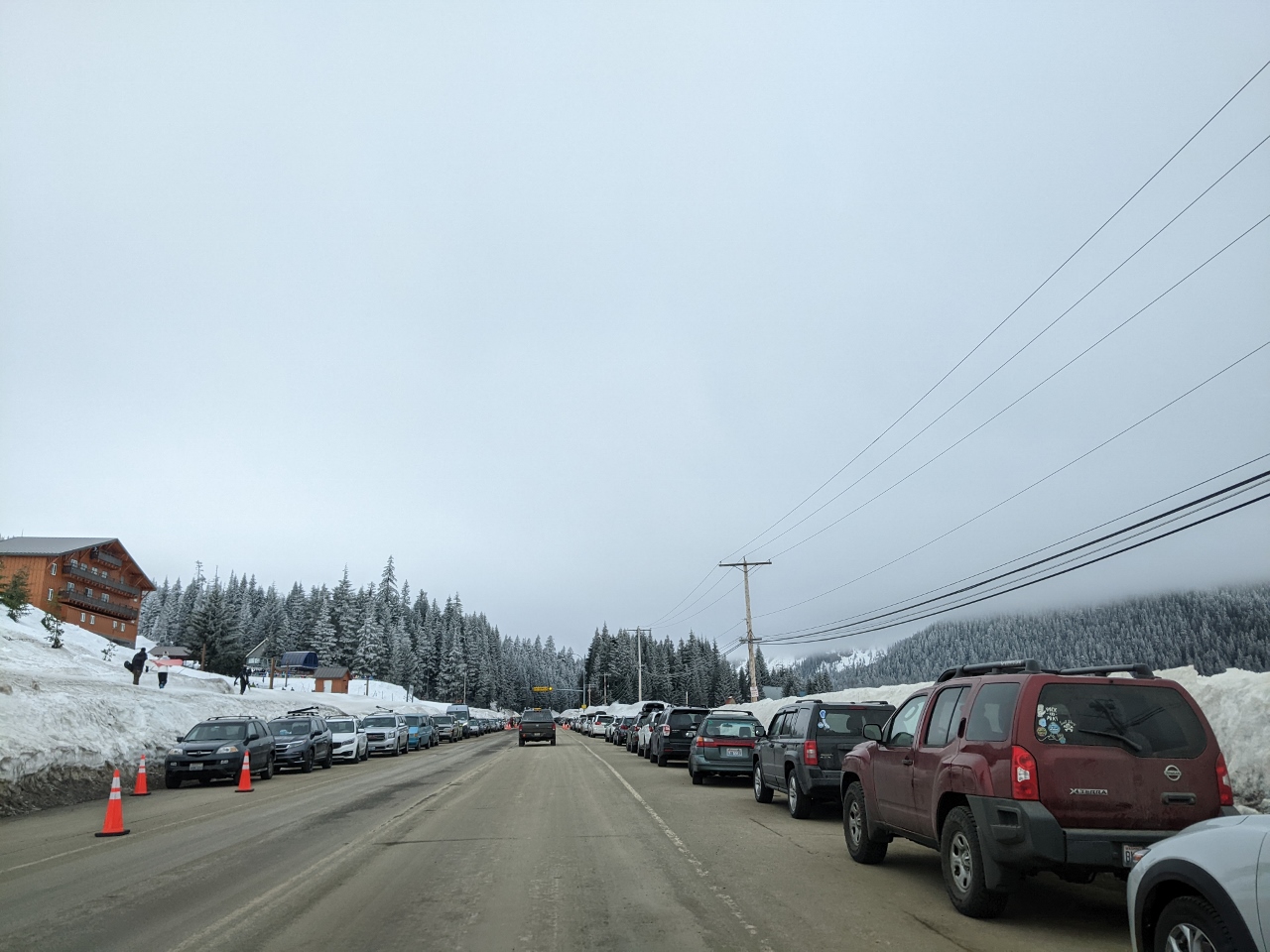 |
Parking
Position: 47°24.16’N, -121°24.43’W
The Summit at Snoqualmie is an easy drive from Seattle and very popular for quick day trips. Both sides of the road were packed with cars and a large parking lot was filling up quickly in the brief time we stopped.
|
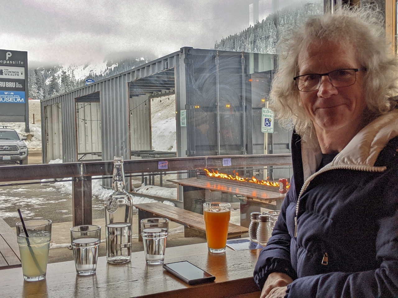 |
The Commonwealth
Position: 47°25.28’N, -121°24.75’W
A great lunch at The Commonwealth at Snoqualmie Pass overlooking their patio. The flames on the table just outside the window are built-in propane heaters, and beyond are shipping containers converted into more outdoor seating.
|
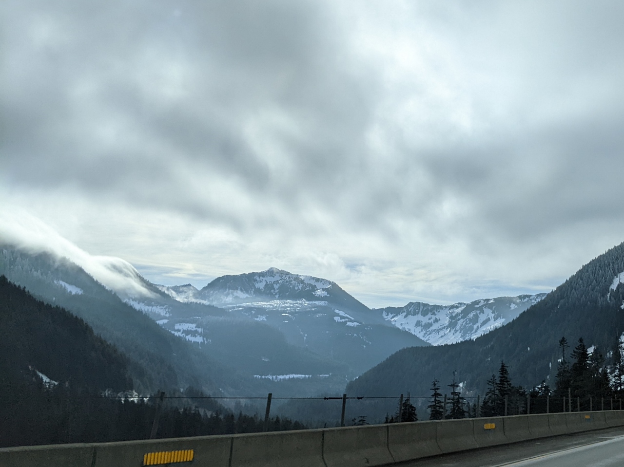 |
Cascade Range
Position: 47°25.70’N, -121°25.12’W
View to the Cascade Range as we return west to Seattle.
|
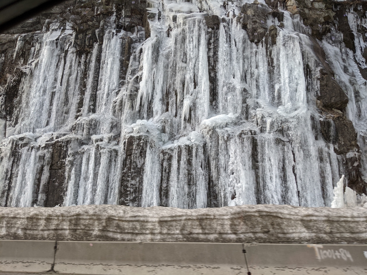 |
Icicles
Position: 47°25.32’N, -121°26.42’W
These icicles alongside I-90 reminded us of our winter hike from Farsund, Norway along Boensbakken, an old 1904 highway hung off a cliff edge.
|
 |
Click the travel log icon on the left to see these locations on a map, with the complete log of our cruise.
On the map page, clicking on a camera or text icon will display a picture and/or log entry for that location, and clicking on the smaller icons along the route will display latitude, longitude and other navigation data for that location. And a map with our most recent log entries always is available at mvdirona.com/maps. |
If your comment doesn't show up right away, send us email and we'll dredge it out of the spam filter.