The US Naval Undersea Museum in Keyport contains over 39,000 artifacts related to undersea weapons, submarine technology, diving and salvage artifacts, and undersea vehicle technology. In addition to extensive indoor displays, the museum’s several large outdoor exhibits include the sail of the USS Sturgeon, the lead ship in the Sturgeon-class of 37 fast-attack submarines used heavily during the Cold War to seek and destroy enemy submarines and support surveillance, reconnaissance and ground warfare operations.
We visited the museum on a loop trip by car to the Kitsap Peninsula that took us past many of our old boating destinations. After heading south from Seattle, we crossed the Tacoma Narrows bridge and stopped for lunch in Gig Harbor. We brought our boat many times to sheltered and scenic Gig Harbor in the 2000s, and Tides Tavern overlooking the bay was always a popular stop for us. It was fun to be back after more than a decade, and we were particularly pleased to find Tides Tavern still going strong.
We visited the museum after lunch, then drove north through Nordic-themed Pouslbo, another popular boating destination that we’ve visited many times. We then completed the loop by continuing north to Kingston and taking the ferry from Kitsap Peninsula to Edmonds on the Seattle side of Puget Sound.
Below are highlights from January 29th, 2022. Click any image for a larger view, or click the position to view the location on a map. And a map with our most recent log entries always is available at mvdirona.com/maps.
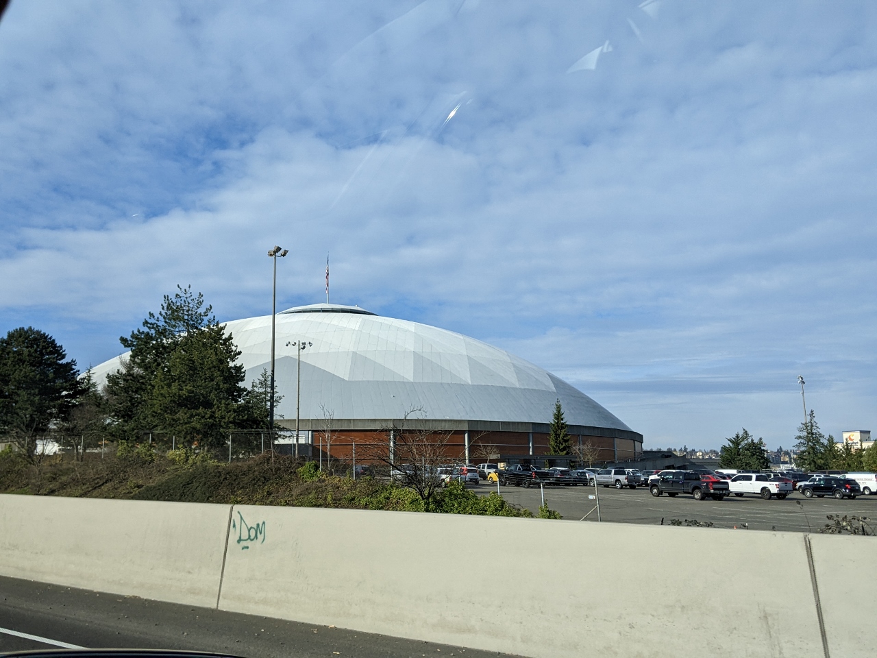 |
Tacoma Dome
Position: 47°14.34’N, -122°24.69’W
Passing the Tacoma Dome on a day trip to Gig Harbor and the Kitsap Peninsula. The building opened in 1983 and has hosted a variety of events, such as music concerts, rodeo, wrestling, monster trucks and a variety of professional and amateur sporting events including being the home arena for Seattle SuperSonics basketball team in the 1994-1995 season while Seattle Center was being renovated.
|
 |
Tacoma Narrows Bridge
Position: 47°15.48’N, -122°31.05’W
About to cross the Tacoma Narrows Bridge. The first of the twin suspension bridges was completed in 1950, and the second in 2007. These replaced the original bridge of the same name that was built in 1940. Nicknamed “Galloping Gertie”, the deck of the original pitched in high winds and collapsed into the Puget Sound four months after opening. The first and second bridges were the third-largest suspension bridges in the world when completed, after the Golden Gate and George Washington bridges.
|
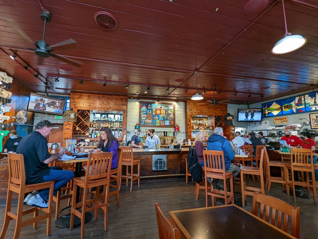 |
Tides Tavern
Position: 47°19.76’N, -122°34.71’W
Lunch at Tides Tavern in Gig Harbor. We brought our boat to sheltered Gig Harbor a lot in the 2000s, and Tides Tavern was always a popular stop for us. It was fun to be back after more than a decade.
|
 |
The Landing
Position: 47°19.78’N, -122°34.71’W
The Landing sculpture at Gig Harbor’s Maritime Pier depicts the captain’s gig (small boat) of famed explorer Charles Wilkes, who sought shelter in the harbor during a mapping expedition of the Oregon Territory and thus named the harbor.
|
 |
Mussel Beach
Position: 47°20.02’N, -122°35.30’W
The sculpture Mussel Beach along the Gig Harbor waterfront, with commercial fishing boats visible behind. The artwork reflects the abundant sea life in the harbor and Puget Sound in general.
|
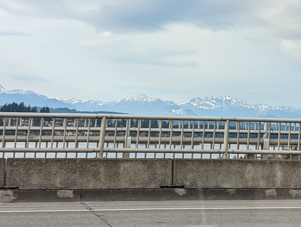 |
Dyes Inlet
Position: 47°34.71’N, -122°37.95’W
Looking west across Dyes Inlet to the Olympic Mountains from the Warren Avenue Bridge. We’ve crossed under this bridge many times en route to Oyster Bay and Silverdale, but rarely, if ever, traveled over it by car.
|
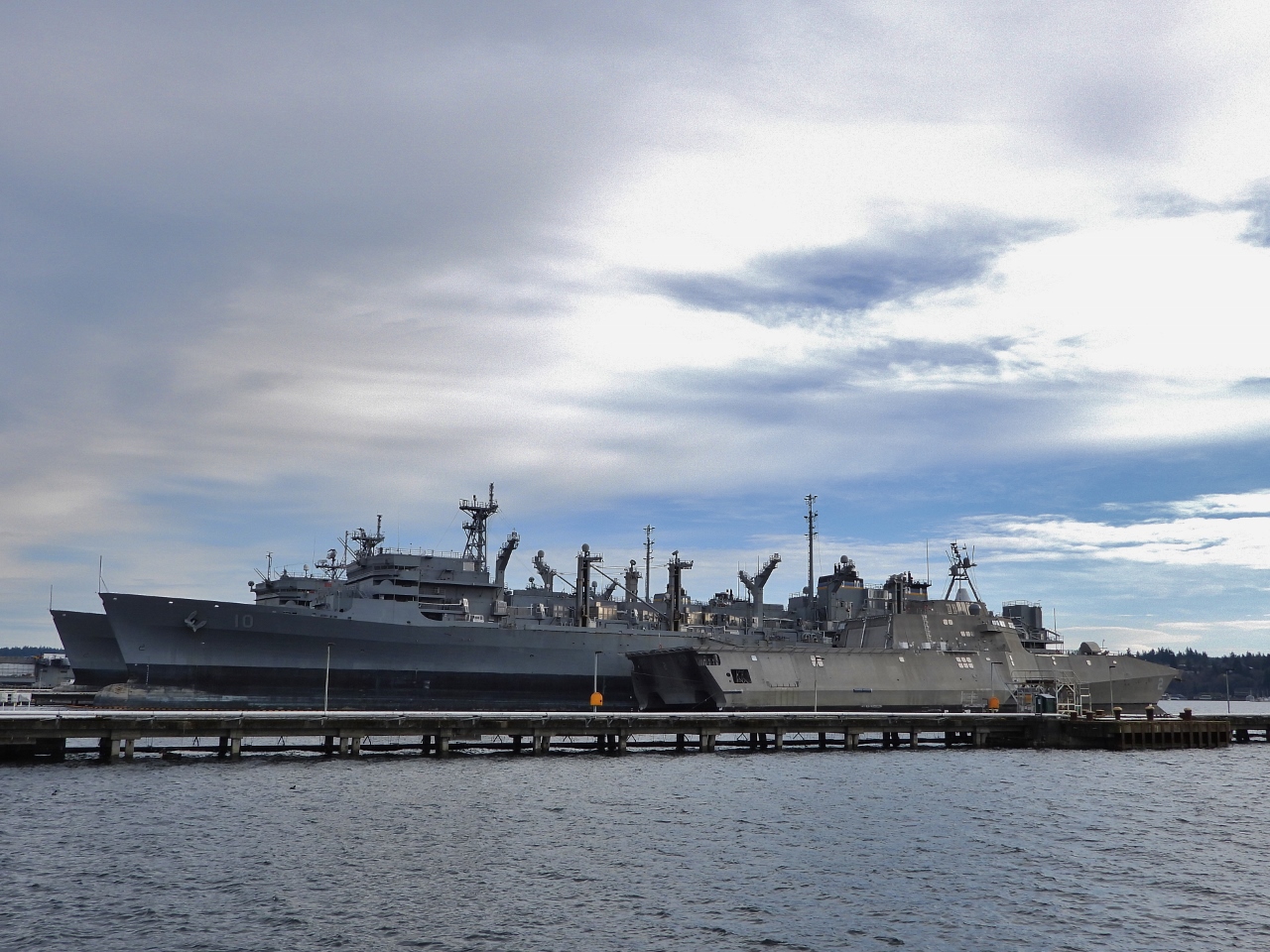 |
USS Independence
Position: 47°33.24’N, -122°39.45’W
The USS Independence, foreground, in dry dock at the US Naval Inactive Ship Maintenance Facility in Bremerton. Launched in 2008, the 418 ft (127 m) ship is the first of the Independence-class near-shore combat ships, capable of speeds over 44 knots. The ship was quietly decommissioned in 2021 “due to public health safety and restrictions”, with 13 in the class remaining active and 5 still under construction.
|
 |
Silverdale
Position: 47°39.21’N, -122°39.92’W
Fabulous view to the Olympic Mountains as we pass through Silverdale on WA State Route 303.
|
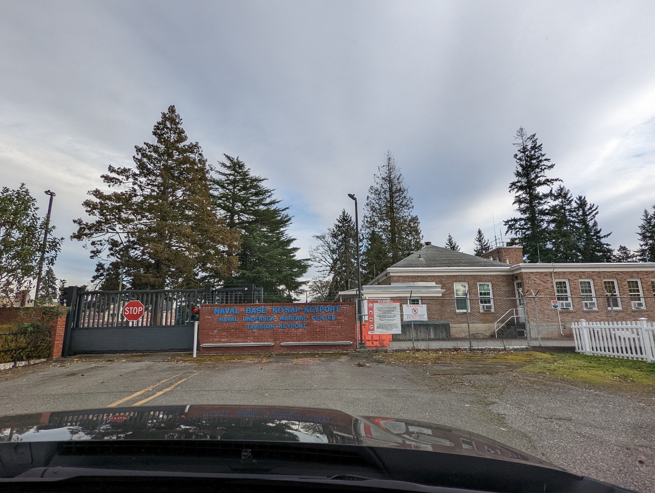 |
Position: 47°42.15’N, -122°37.38’W
We took a detour into Keyport, and reached the end of road at the Naval Undersea Warfare Center. For 100 years, the facility has supported fleet readiness for submarines, torpedoes, land attack systems and training systems to sustain and maintain American’s undersea warfare systems. The narrow waterway on the opposite side of the base leads to Poulsbo, a very popular boating destination that we’ve anchored at many times.
|
 |
Position: 47°42.00’N, -122°37.48’W
At the US Naval Undersea Museum, founded in 1979 as part of the Naval Undersea Warfare Center Division Keyport. The museum contains over 39,000 artifacts related to undersea weapons, submarine technology, diving and salvage artifacts, and undersea vehicle technology.
|
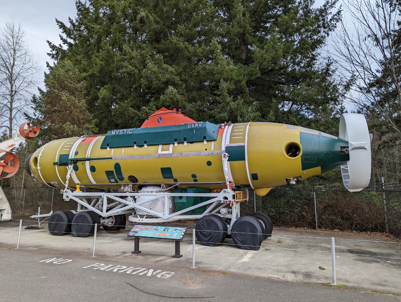 |
Mystic DSRV
Position: 47°41.99’N, -122°37.44’W
The Deep Submarine Rescue Vehicle (DSRV) Mystic at the US Naval Undersea Museum. In service from 1970 to 2006, the Mystic provided rapid-response rescue capability for submarine accidents. The vessel was built as part of the DSRV program following the disastrous sinking and loss of all 129 men aboard the nuclear submarine USS Thresher off Cape Cod, Massachusetts during deep-diving tests.
The DSRVs can descend to 5,000 feet, well beyond a submarine’s collapse depth, and could deploy by air, land or sea to reach a disabled submarine anywhere in the world in 72 hours. They have been tested, but never used in a real rescue operation, as no American submarine has sunk since the program began. The vessels were replaced by the remotely operated Submarine Rescue Diving Recompression System (SRDRS). |
|
|
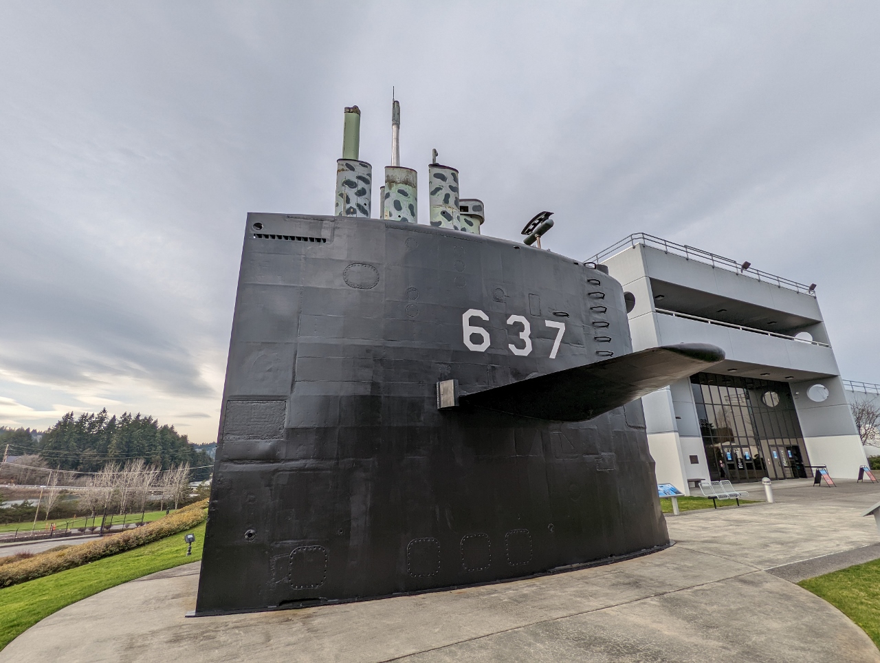
USS Sturgeon
Position: 47°41.99’N, -122°37.47’W
The sail of the USS Sturgeon, the lead ship in the Sturgeon-class of 37 fast-attack submarines used heavily during the Cold War to to seek and destroy enemy submarines and support surveillance, reconnaissance and ground warfare operations. The Sturgeon‘s sail was permanently installed at the US Naval Undersea Museum after the ship was decommissioned in 1994.
|
 |
Trident Missile
Position: 47°42.01’N, -122°37.50’W
Model of the USS Lafayette, a Lafayette-class ballistic missile submarine, with a true-to-scale 34-foot (10.3m) Trident I missile standing on the stern (click image for a larger view). In the background is an original of just the top portion of the missile, showing how big they are. The Lafayette could carry 16 of huge missiles, standing vertically in the ship.
|
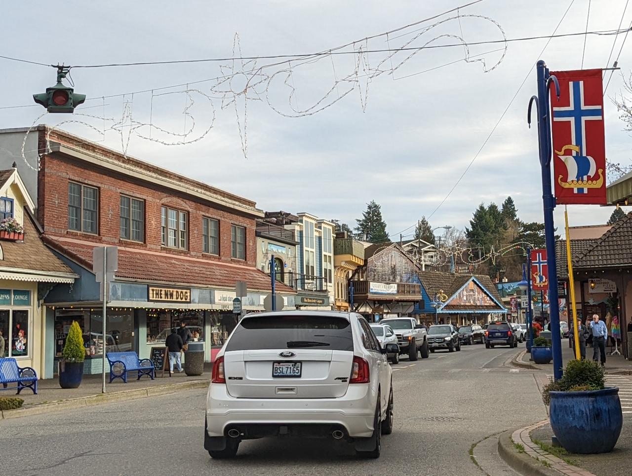 |
Poulsbo
Position: 47°44.20’N, -122°38.95’W
Driving through downtown Poulsbo, known at “Little Norway” for its Scandinavian theme celebrating the Norwegians who founded the town in the 1880s.
|
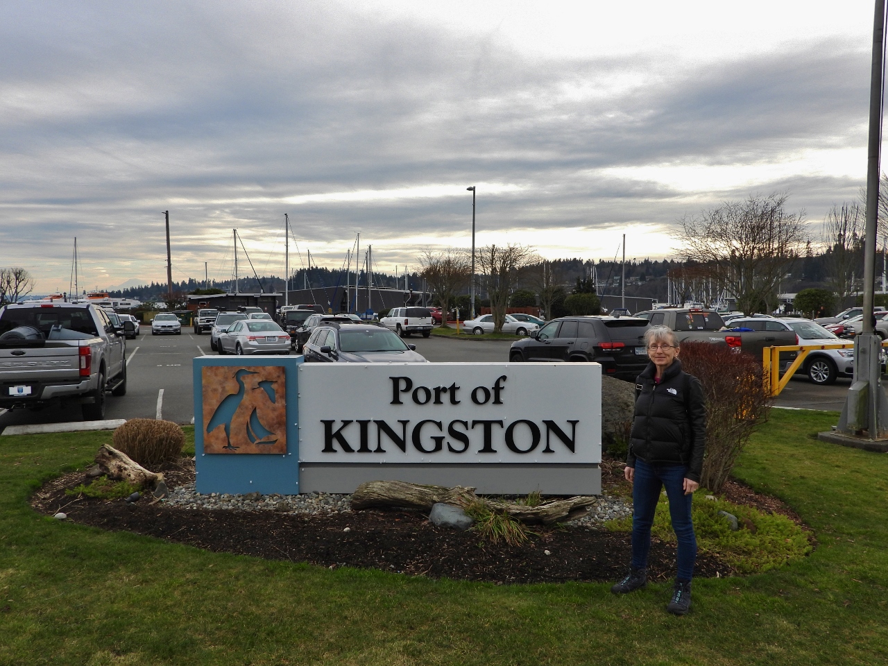 |
Kingston
Position: 47°47.83’N, -122°29.90’W
At the Port of Kingston to take the ferry east across Puget Sound from Kitsap Penninsula to Edmonds, about 18 miles (29 km) north of Seattle.
|
 |
Roofnest
Position: 47°47.81’N, -122°29.74’W
This Roofnest tent on a truck in the ferry line caught our interest. The tents pops up on the roof of a vehicle to provide an easy camping spot without needing a campsite, a flat surface or having to pitch a tent pole.
|
 |
Upper Deck
Position: 47°47.74’N, -122°29.75’W
Heading onto the upper car deck of the ferry from Kingston.
|
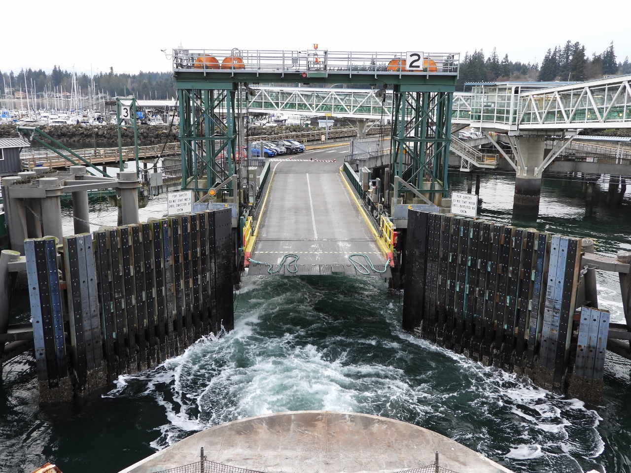 |
Departing Kingston
Position: 47°47.67’N, -122°29.64’W
Departing the ferry dock at Kingston en route to Edmonds.
|
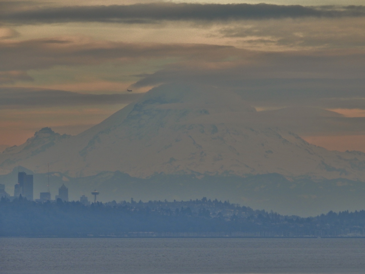 |
Mt Rainier
Position: 47°47.67’N, -122°29.64’W
View south to 14,417 ft (4,394 m) iconic Mt Rainier on the ferry en route from Kingston to Edmonds.
|
 |
Chilly
Position: 47°48.50’N, -122°26.22’W
It’s a chilly ride at the front of the ferry in late January.
|
 |
Oscar Dyson
Position: 47°48.50’N, -122°26.22’W
The 208.6 ft (63.6 m) NOAA research ship Oscar Dyson operating in the Puget Sound. Delivered in 2004, the ship was designed with an ice-strengthened welded-steel hull for operation in Alaskan waters.
|
 |
Edmonds
Position: 47°48.99’N, -122°24.60’W
Approaching the Edmonds ferry dock.
|
 |
First Fueling
Position: 47°47.66’N, -122°22.37’W
Taking on our first load of fuel in our new Honda Passport. Refueling is a lot faster, easier, and cheaper than taking on over a thousand gallons on Dirona :).
|
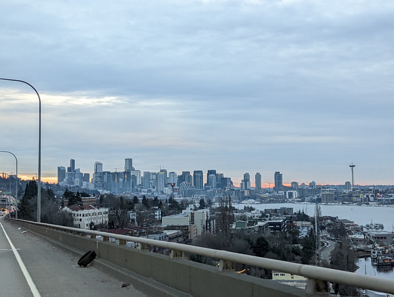 |
Seattle Skyline
Position: 47°39.11’N, -122°19.36’W
The Seattle skyline viewed from Interstate 5 as we return south to Seattle. Our apartment building is visible to the right of center, the leftmost of the three tallest buildings before the Space Needle.
|
 |
Click the travel log icon on the left to see these locations on a map. And a map of our most recent log entries always is available at mvdirona.com/maps. |
If your comment doesn't show up right away, send us email and we'll dredge it out of the spam filter.