Twin Falls is a popular and easy hike about a 45-minute drive east of downtown Seattle along I-90. The 2.6-mile (4 km) round-trip route, with an elevation gain of 500 ft (152 m), follows a well-maintained path alongside the Upper Snoqualmie River. Several viewpoints to the falls are en route, and the hike ends at the Big Bridge, a pedestrian bridge straddling the upper and lower falls.
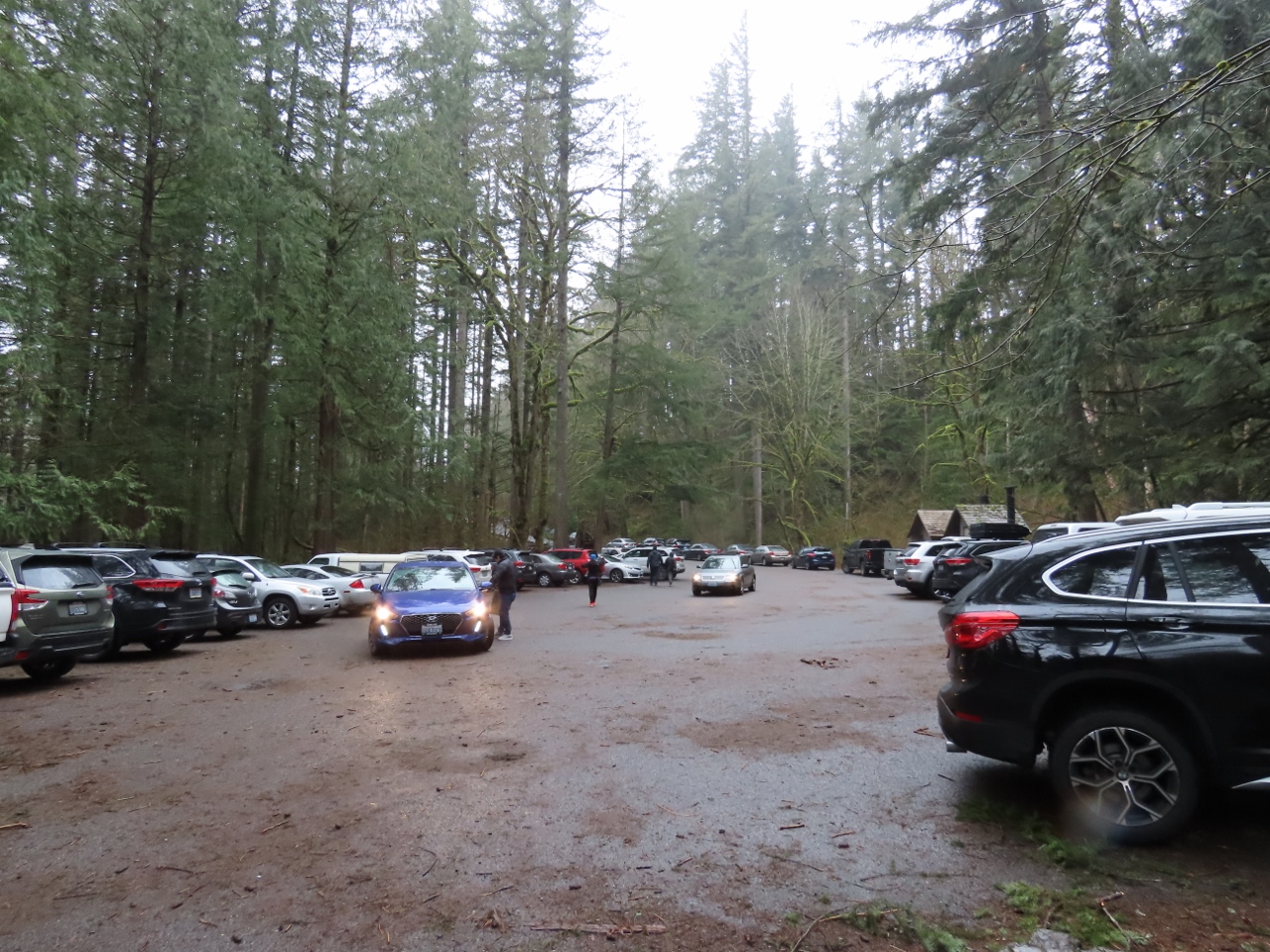
We normally arrive at a trailhead quite early in the morning to get a parking spot. But on a rainy Saturday, we experimented with arriving around noon to learn how crowded it was, anticipating that the rain might keep people away. Although that may have been true, the parking lot still was packed and we only got a spot because someone had just left.
After our hike, we had a great lunch in nearby North Bend then returned home via through the rural areas of Carnation and Duvall and across the north end of Lake Washington. We lived in the area for fifteen years before we departed Seattle on our trip around the world, but we didn’t travel much by road, and are enjoying exploring a lot more of the state than we ever had before.
Below are highlights from February 19th, 2022. Click any image for a larger view, or click the position to view the location on a map. And a map with our most recent log entries always is available at mvdirona.com/maps.
 |
Crowds
Position: 47°27.19’N, -121°42.33’W
The rain might have kept some people away, but enough were here around noon that any empty spots quickly were taken.
|
 |
Trailhead
Position: 47°27.14’N, -121°42.27’W
At the trailhead for the easy and popular hike to Twin Falls, a 2.6-mile (4 km) round-trip with an elevation gain of 500 ft (152 m).
|
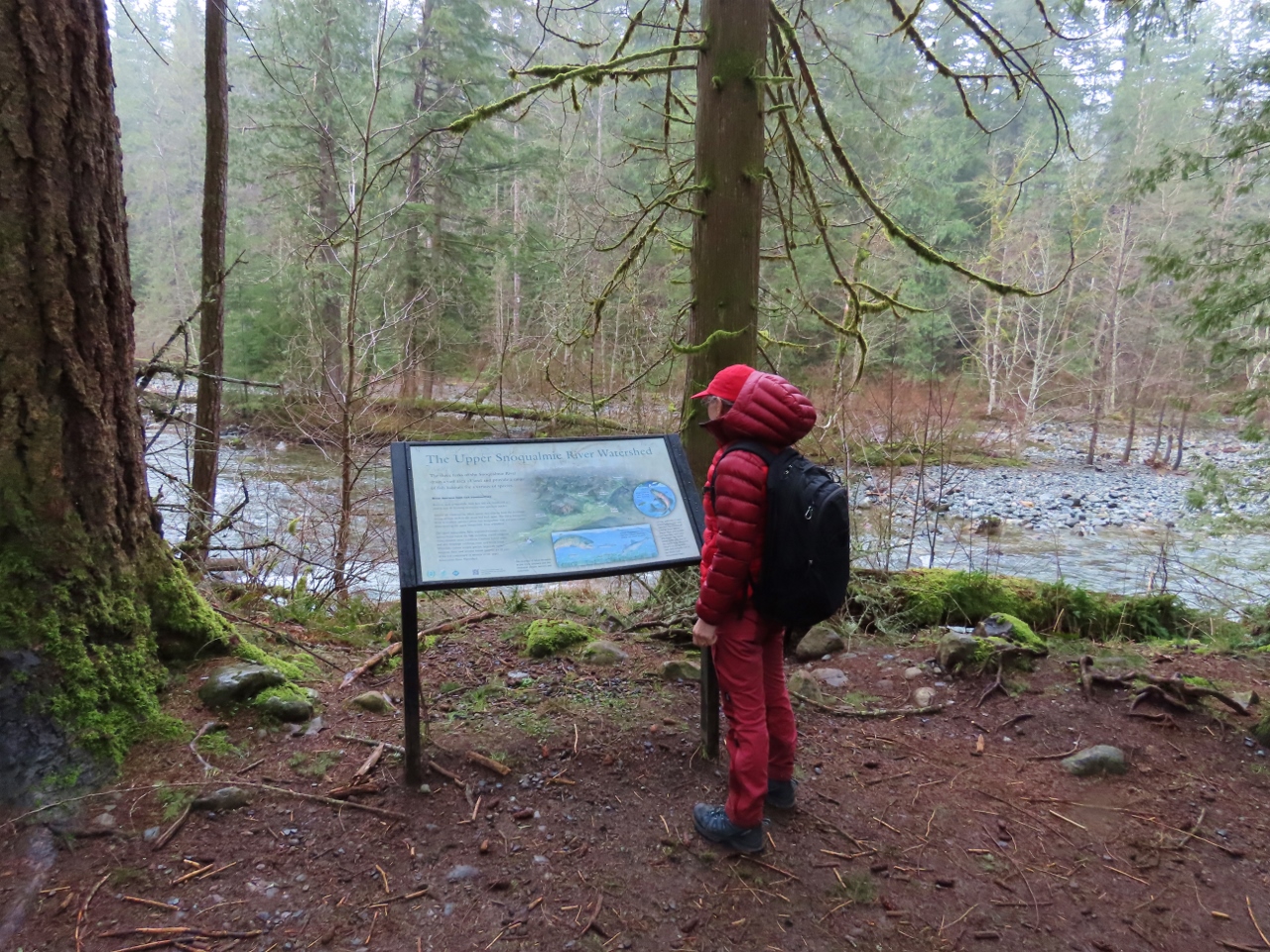 |
Snoqualmie River
Position: 47°27.16’N, -121°42.33’W
Reading an interpretive sign describing the Upper Snoqualmie River watershed alongside the river.
|
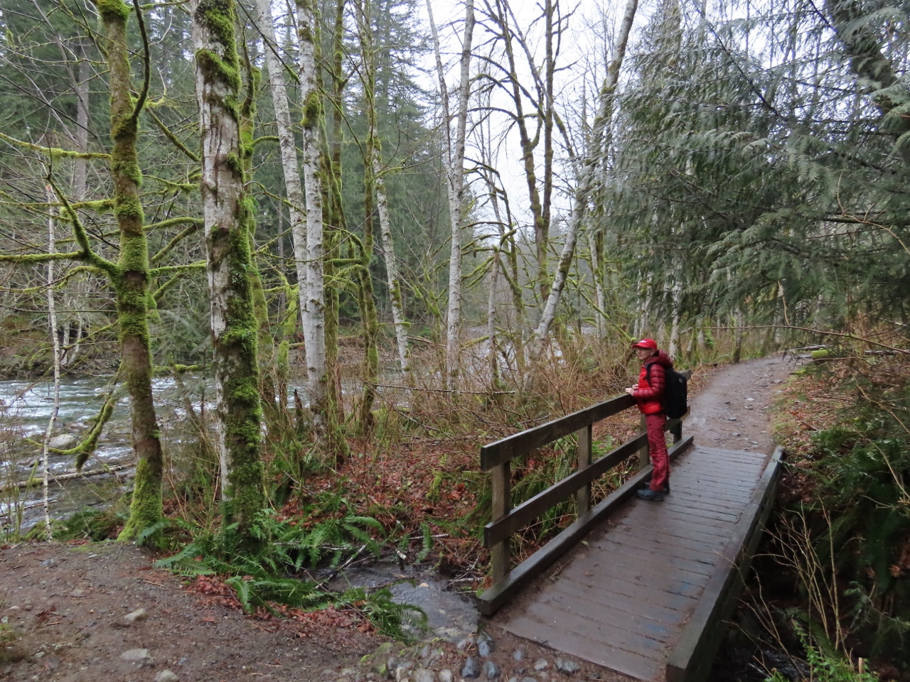 |
Bridge
Position: 47°27.09’N, -121°42.22’W
Enjoying the view to the Snoqualmie River from a small footbridge along the trail. Although rain is falling, we are reasonably sheltered under the forest canopy.
|
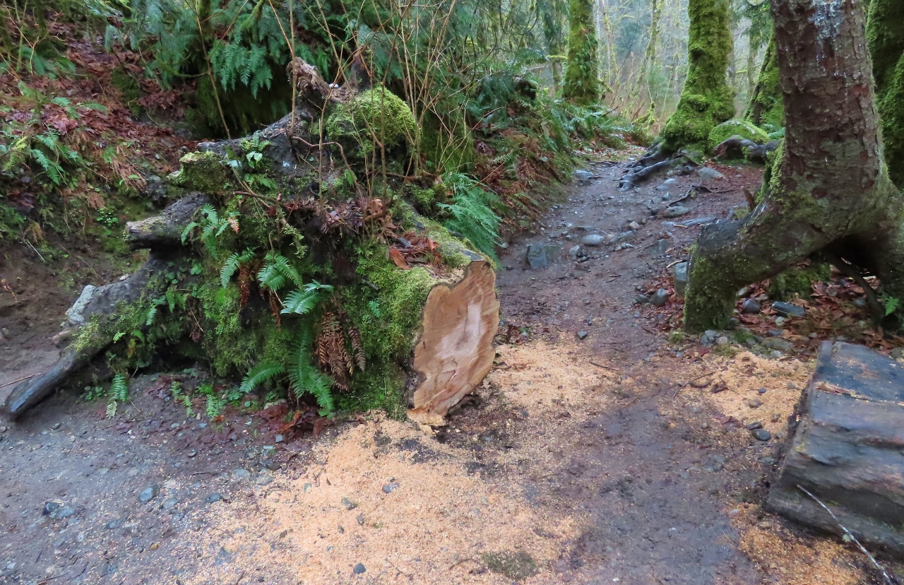 |
Fallen Tree
Position: 47°27.01’N, -121°42.20’W
Fresh sawdust from a recently-cleared trail blockage.
|
 |
WTA Crew
Position: 47°26.98’N, -121°42.19’W
Washington Trails Association (WTA) volunteers maintaining the Twin Falls trail. Flooding regular damages the trial, and it was completely destroyed during record floods in 2006 when the water gauge upstream recorded 9,000 cubic feet per second (255 meters per second). The flow today seems strong, but it’s only about 250 cfs (7 mps).
|
 |
The Benches
Position: 47°26.82’N, -121°42.13’W
A first glimpse to the lower falls from The Benches, a rest stop along the trail.
|
|
|
Lower Falls
Position: 47°26.75’N, -121°41.96’W
A small spur path leads off the main trail to the river’s edge for great views to the lower falls. The Big Bridge footbridge crossing above the falls is just visible in the distance (click image for larger view).
|
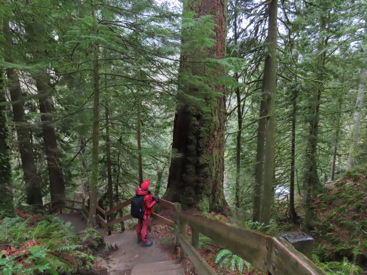 |
Old Growth
Position: 47°26.78’N, -121°41.89’W
An old-growth tree along the staircase down to the Lower Falls viewpoint.
|
 |
Lower Falls Viewpoint
Position: 47°26.76’N, -121°41.89’W
Great view to the lower falls from the viewpoint at the bottom of the 104-step staircase.
|
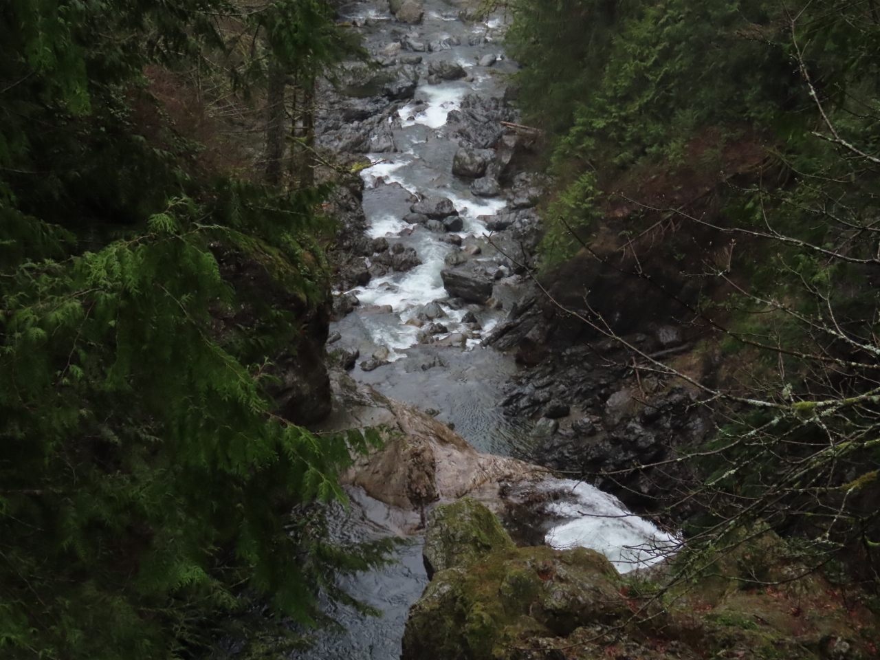 |
Big Bridge
Position: 47°26.73’N, -121°41.84’W
Looking downstream from the Big Bridge above the lower falls.
|
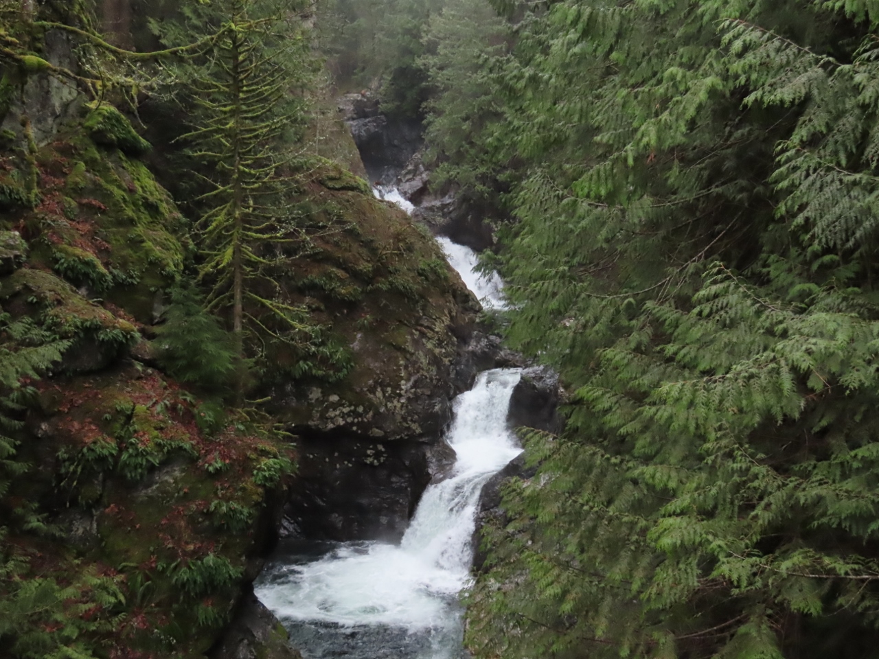 |
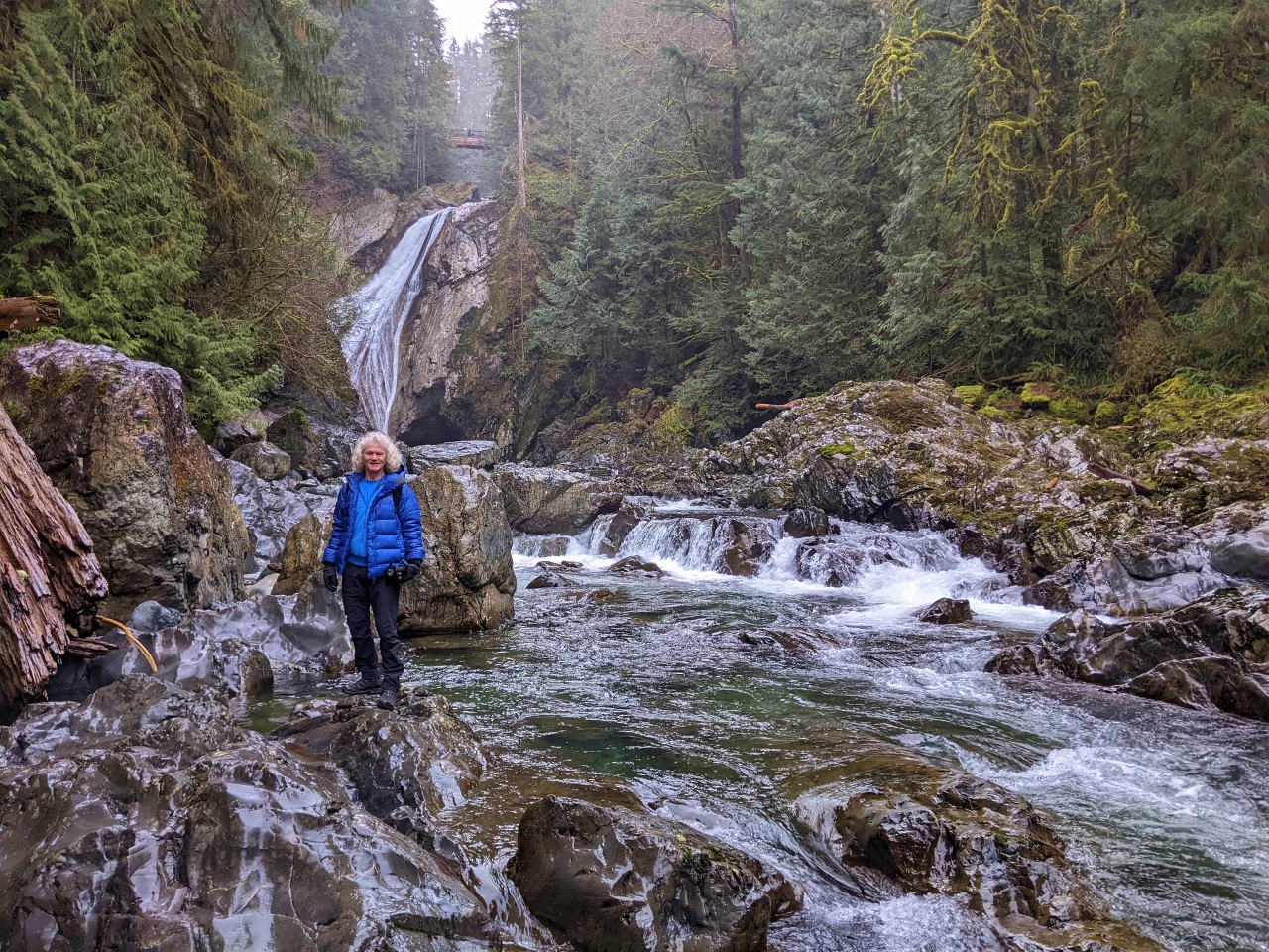
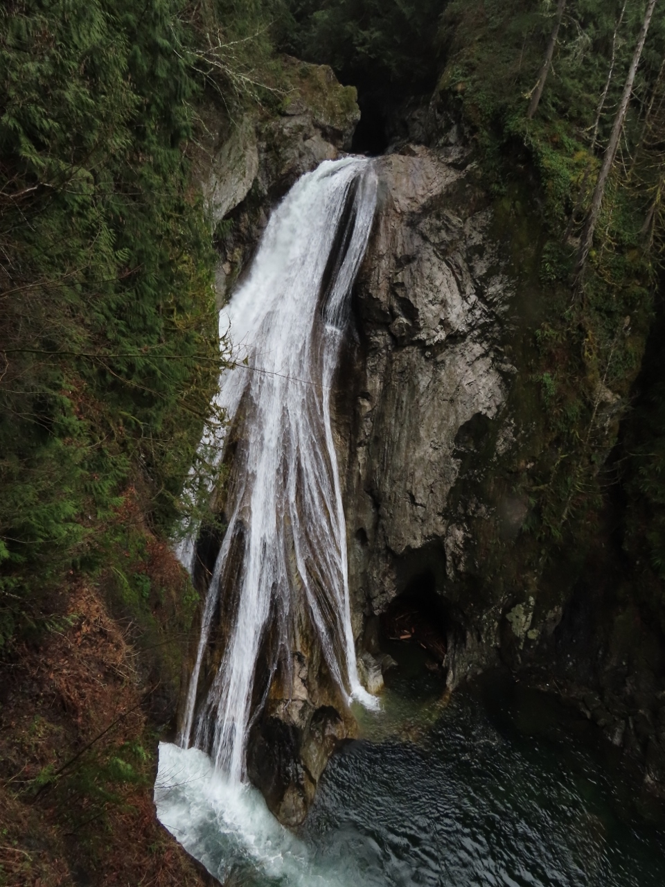
Upper Falls
Position: 47°26.72’N, -121°41.85’W
The cascading upper falls, along with the lower falls, are collectively called the “Twin Falls”.
|
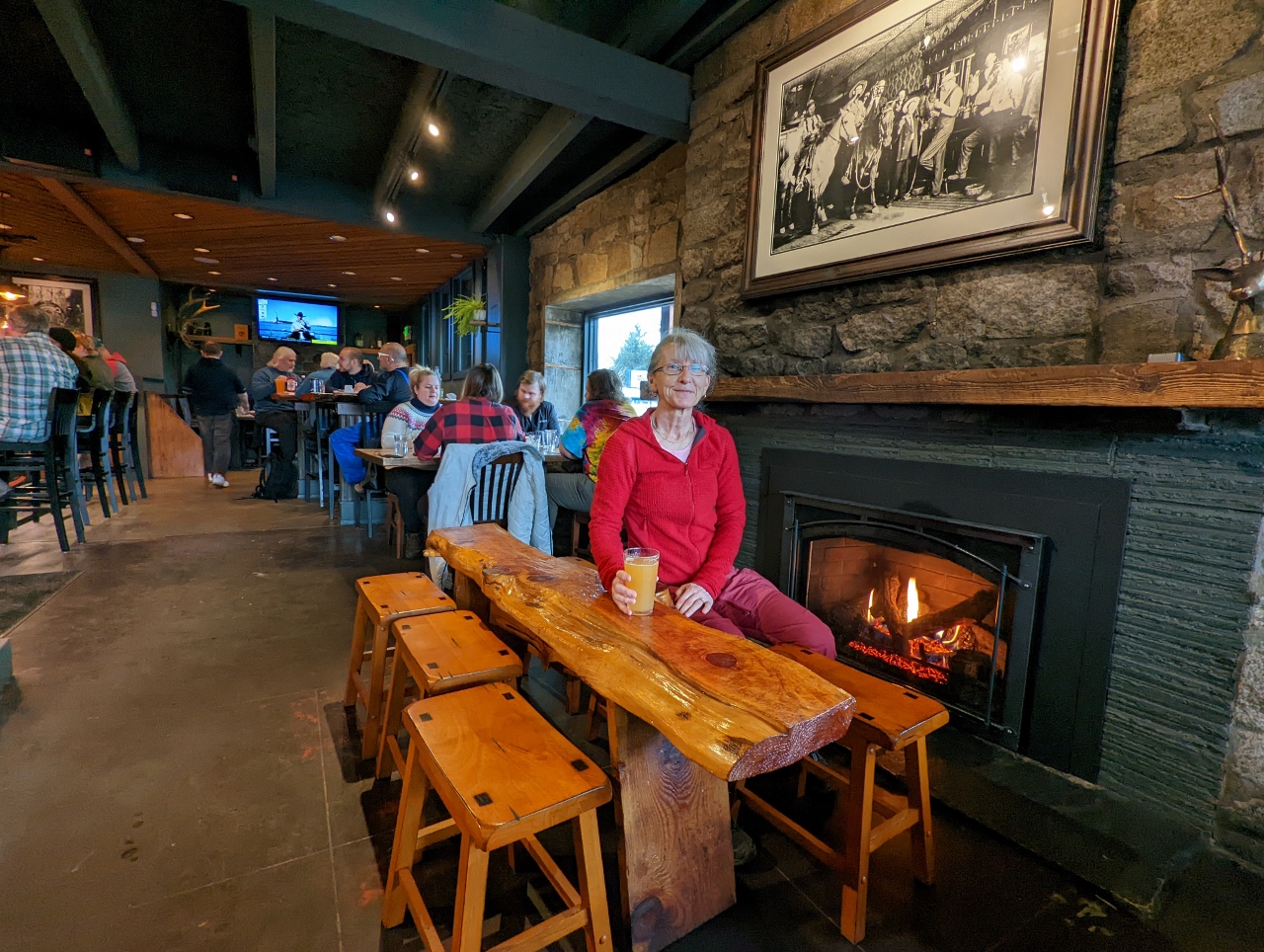 |
North Bend Bar and Grill
Position: 47°29.66’N, -121°47.09’W
A delicious lunch at the North Bend Bar and Grill. The restaurant was completely packed with skiers and snowboarders from nearby Snoqualmie Pass when we arrived. But tables were just starting to open up, so it’s good thing we had a late lunch at 1:30. The historic picture above Jennifer’s head shows three men on horseback enjoying a beer inside a bar, fortunately no longer the practice (click image for a larger view).
|
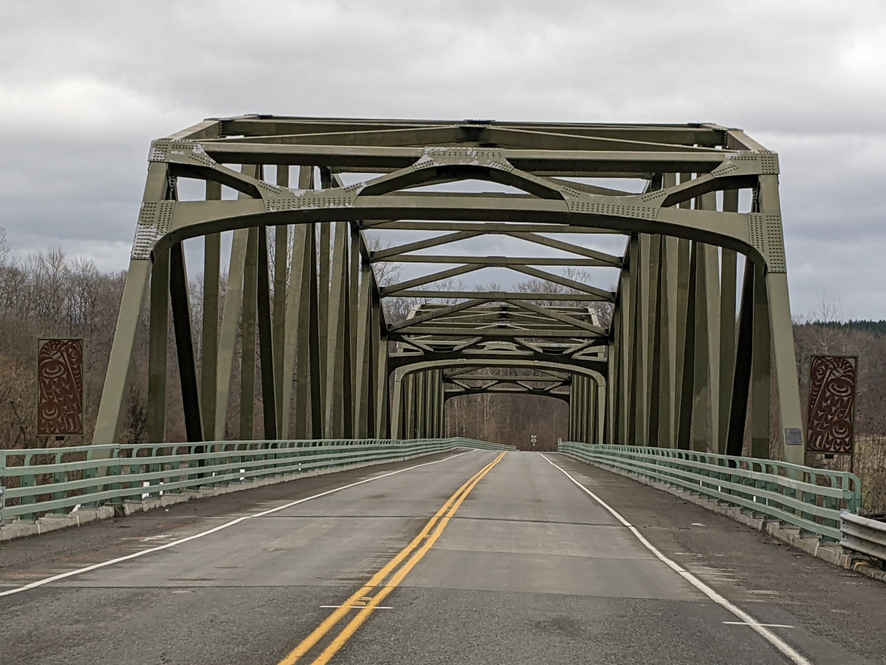 |
Tolt River Bridge
Position: 47°38.27’N, -121°55.84’W
Crossing the Tolt River Bridge near the town of Carnation. The first bridge built here in 1922 was rehabilitated 1968 and replaced 2008. The native art panels on either side of the bridge are by local artist David Franklin, who has created many striking works of public art in the region.
|
 |
Duvall
Position: 47°44.25’N, -121°59.23’W
Passing through the town of Duvall, settled by loggers Francis and James Duvall in 1871.
|
 |
Lake Washington
Position: 47°45.51’N, -122°15.60’W
A brief glimpse to the northern end of Lake Washington at Kenmore, the headquarters of seaplane operator Kenmore Air.
|
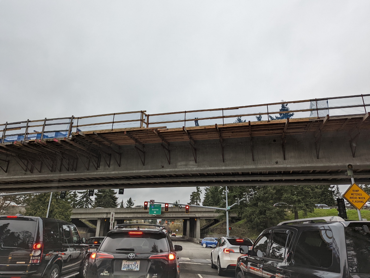 |
Light Rail
Position: 47°45.35’N, -122°19.37’W
Northgate Station is currently the northernmost limit of the region’s light rail system. We’re about to pass under the half-complete 8.5-mile (13.5 km) link to Lynnwood that will open in 2023.
|
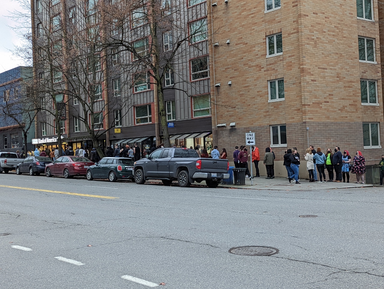 |
The Crocodile
Position: 47°36.95’N, -122°20.87’W
A queue around the block for entering The Crocodile, a live-music venue near our apartment. The club, opened in 1991, has long been a fixture in the Seattle music scene. It was named one of the top clubs in the US by Rolling Stone magazine and has hosted bands such as Nirvana, Soundgarden, Pearl Jam and Alice in Chains. The venue recently re-opened in December of 2021 at a new location a few blocks from the original.
|
 |
Click the travel log icon on the left to see these locations on a map. And a map of our most recent log entries always is available at mvdirona.com/maps. |
If your comment doesn't show up right away, send us email and we'll dredge it out of the spam filter.