
The summer season at Mt. Rainier lasts only a few months, generally between June and September. With snow still on the ground in June and frost starting in September, the wildflower season is short. But in late July and early August, the mountain bursts in such color that conservationist John Muir described the area as “.. the most luxuriant and the most extravagantly beautiful of all the alpine gardens I ever beheld in all my mountain-top wanderings.”
On our previous snowshoeing trip to Mt. Rainier, only the Paradise section of the park was open. We returned in the summer on a four-night trip to see the wildflowers and explore the areas that were closed in the winter.
On our first day in the park, we crossed from the west to the east side of the park along Stevens Canyon Road, closed in the winter. The views to Mt. Rainier en route were exceptional, and we also walked a short trail for a look down into dramatic Box Canyon.
We spent most of the day in the Sunrise area of the park, northeast of Mt. Rainier. We’d not seen the mountain much from this side and enjoyed the different perspective. On the Burroughs Mountain Trail, we traversed a series of three mountains, each bringing us progressively closer to Mt. Rainier, with exceptional views along the way. The weather clear and warm, and we had a fabulous time.
Below are highlights from Aug 4th and 5th, 2022. Click any image for a larger view, or click the position to view the location on a map. And a map with our most recent log entries always is available at mvdirona.com/maps.
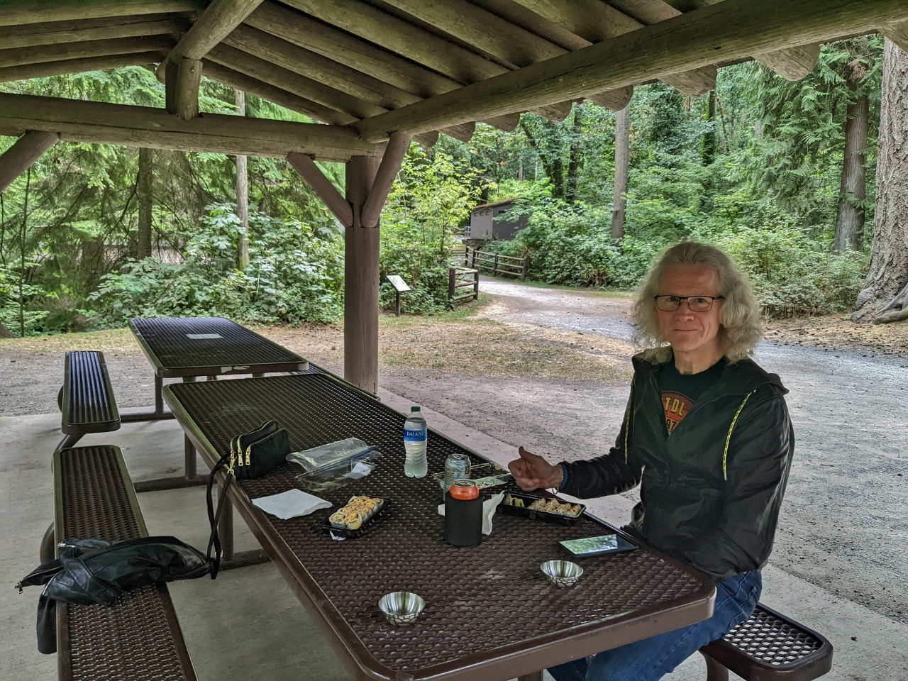 |
Sushi in the Park
Position: 47°10.31’N, -122°16.79’W
We picked up some sushi in Seattle and had a wonderful picnic lunch at Wildwood Park in Puyallup on our way to Mt. Rainier.
|
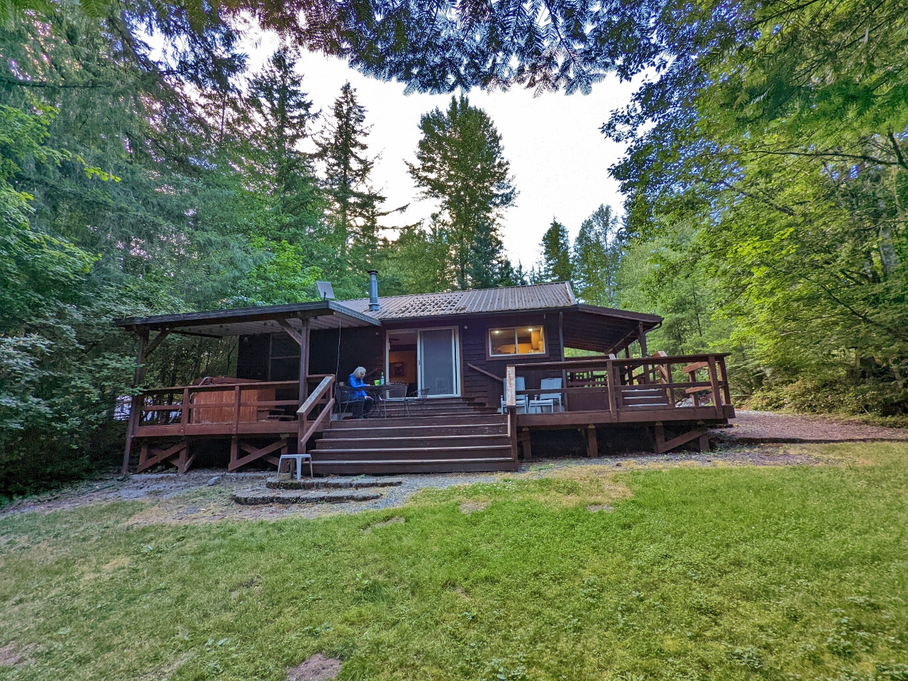 |
Cabin
Position: 46°44.20’N, -121°59.82’W
For the next four nights we’ll be staying at this VRBO cabin in Ashford while we hike in Mt. Rainier.
|
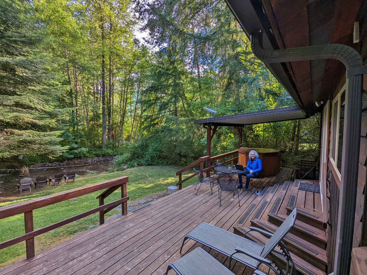 |
Back Deck
Position: 46°44.20’N, -121°59.81’W
The cabin backs on to Big Creek and is wonderfully private.
|
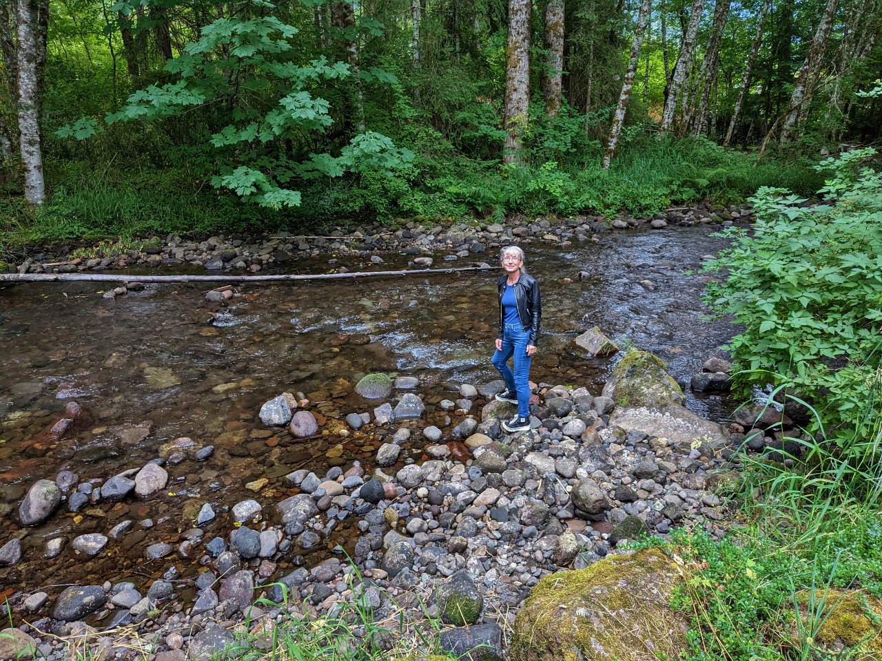 |
Big Creek
Position: 46°44.20’N, -121°59.81’W
Jennifer checking out Big Creek behind our cabin.
|
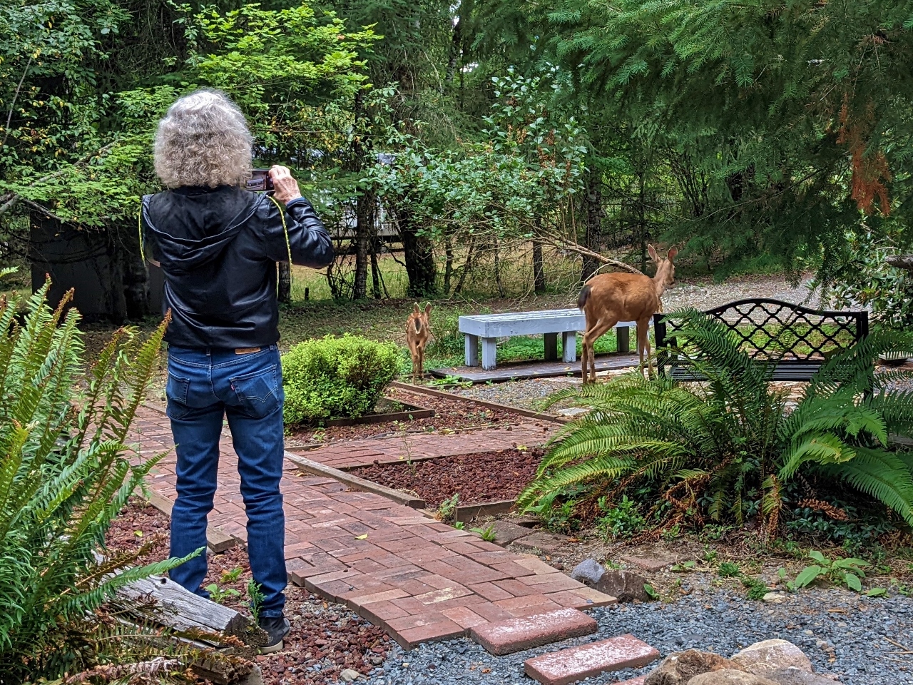 |
Deer
Position: 46°44.20’N, -121°59.81’W
Several deer wandered through the lot. This mother and fawn very much liked the plants in the front yard of the cabin.
|
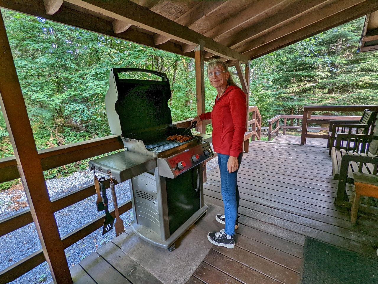 |
Barbecuing
Position: 46°44.20’N, -121°59.79’W
We’ve not cooked on a real barbecue since moving off Dirona. This huge free-standing model at the cabin is triple the size of the one we had on the boat.
|
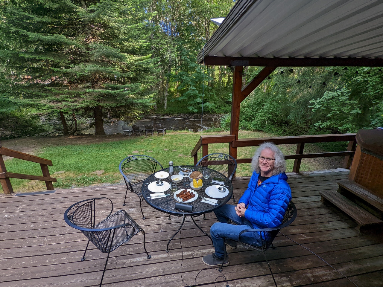 |
Dinner
Position: 46°44.20’N, -121°59.81’W
Grilled Moroccan-spiced chicken on the deck of our VRBO cabin in Ashford, with a view to Big Creek.
|
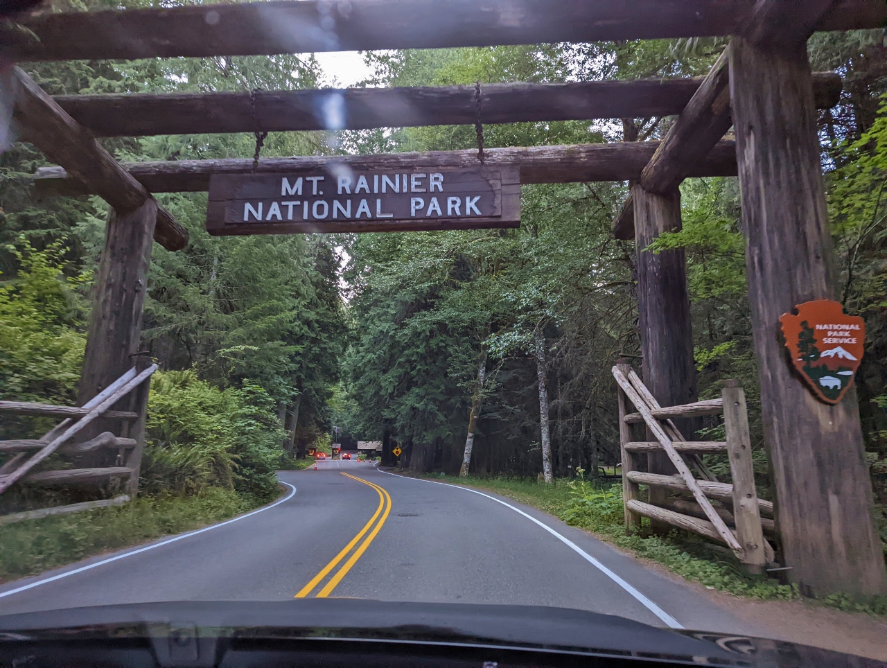 |
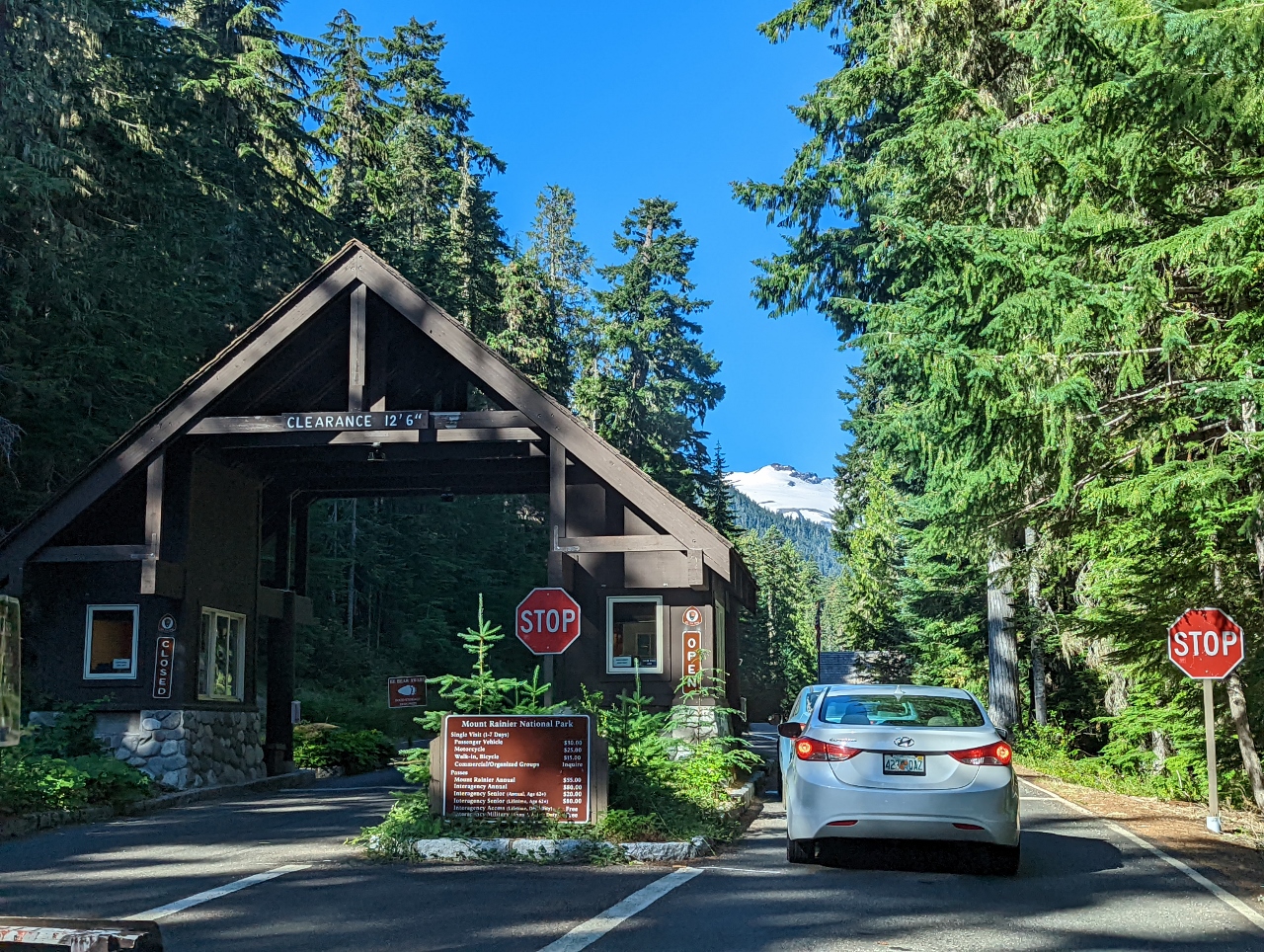
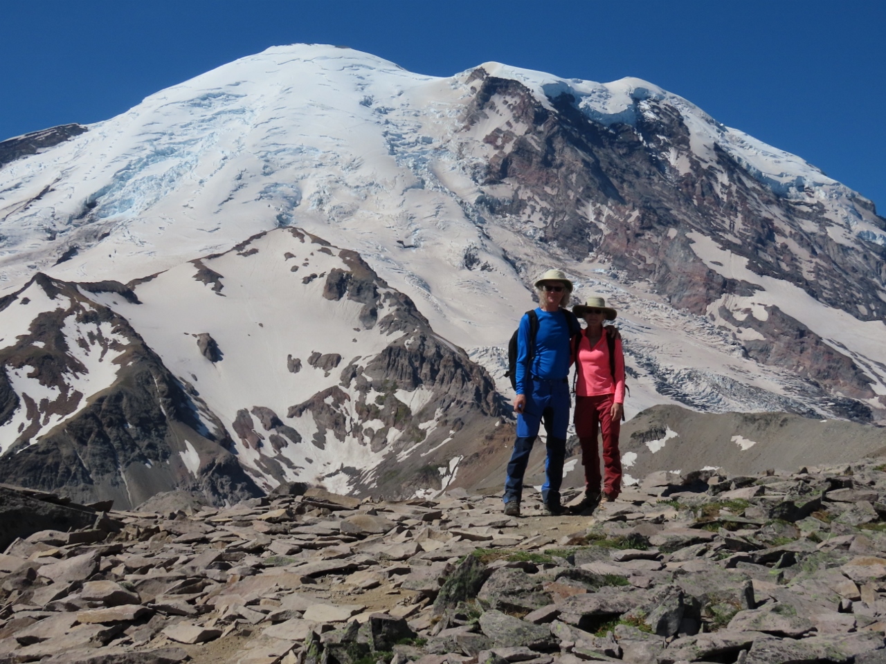
Mt Rainier NP
Position: 46°44.55’N, -121°55.30’W
At the Nisqually entrance to Mt Rainier National for a day of summer hiking.
|
 |
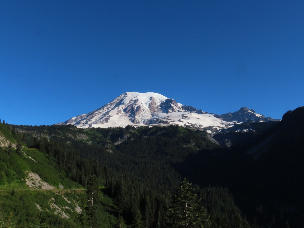
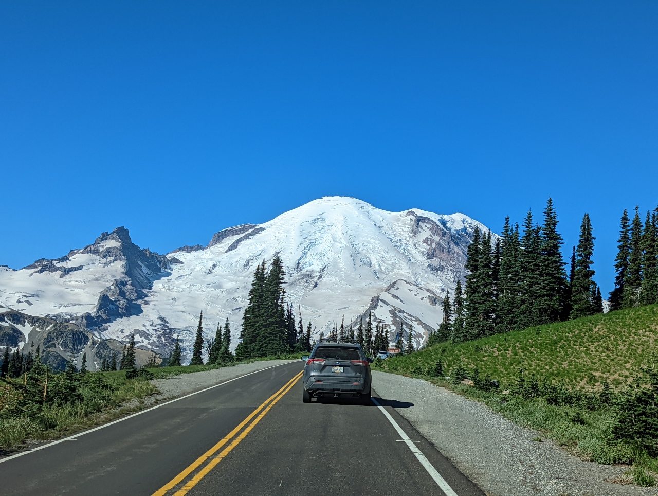
Is the Mountain Out?
Position: 46°46.54’N, -121°46.08’W
Yes, it most certainly is in this view from Paradise Valley Road. On clear days, Mr. Rainier dominates the skyline south of Seattle. Despite the many mountains in the area, when someone asks “Is the Mountain Out,” they can only be referring to Rainier.
|
 |
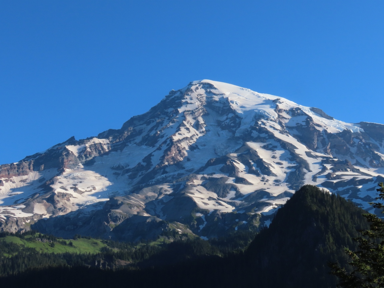
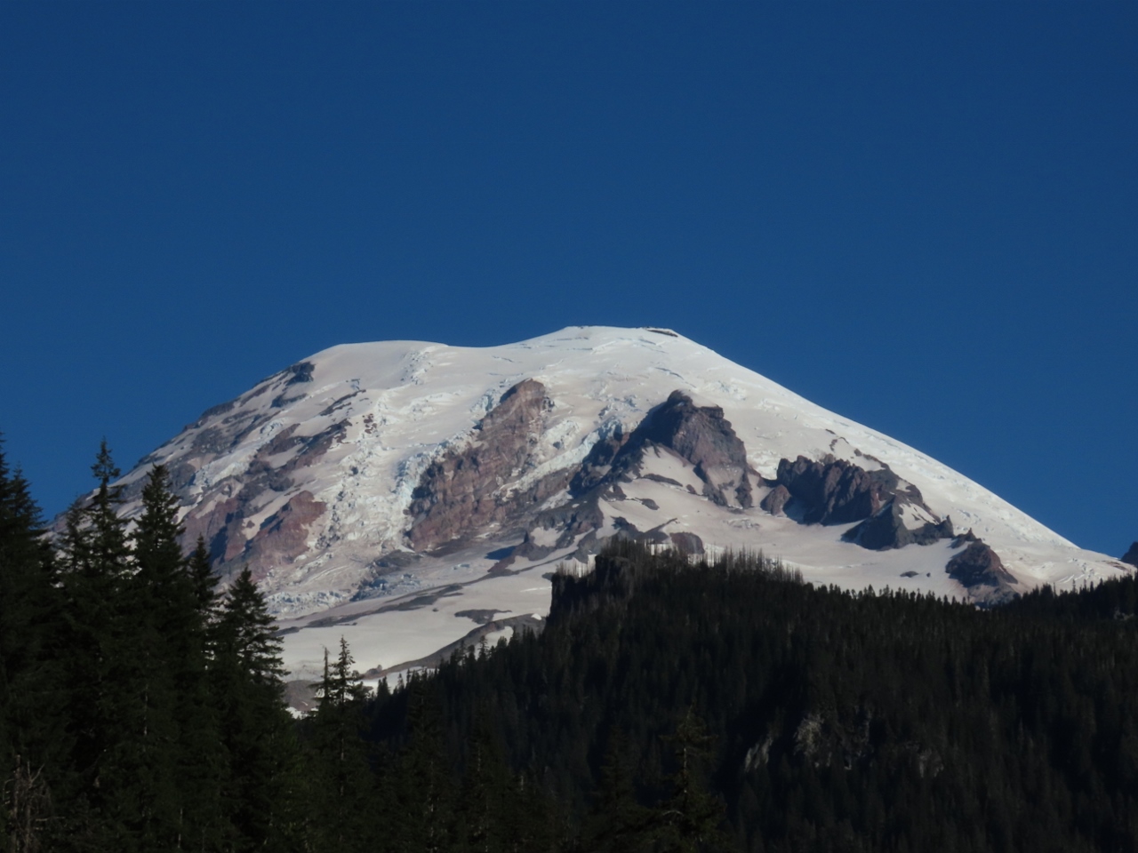
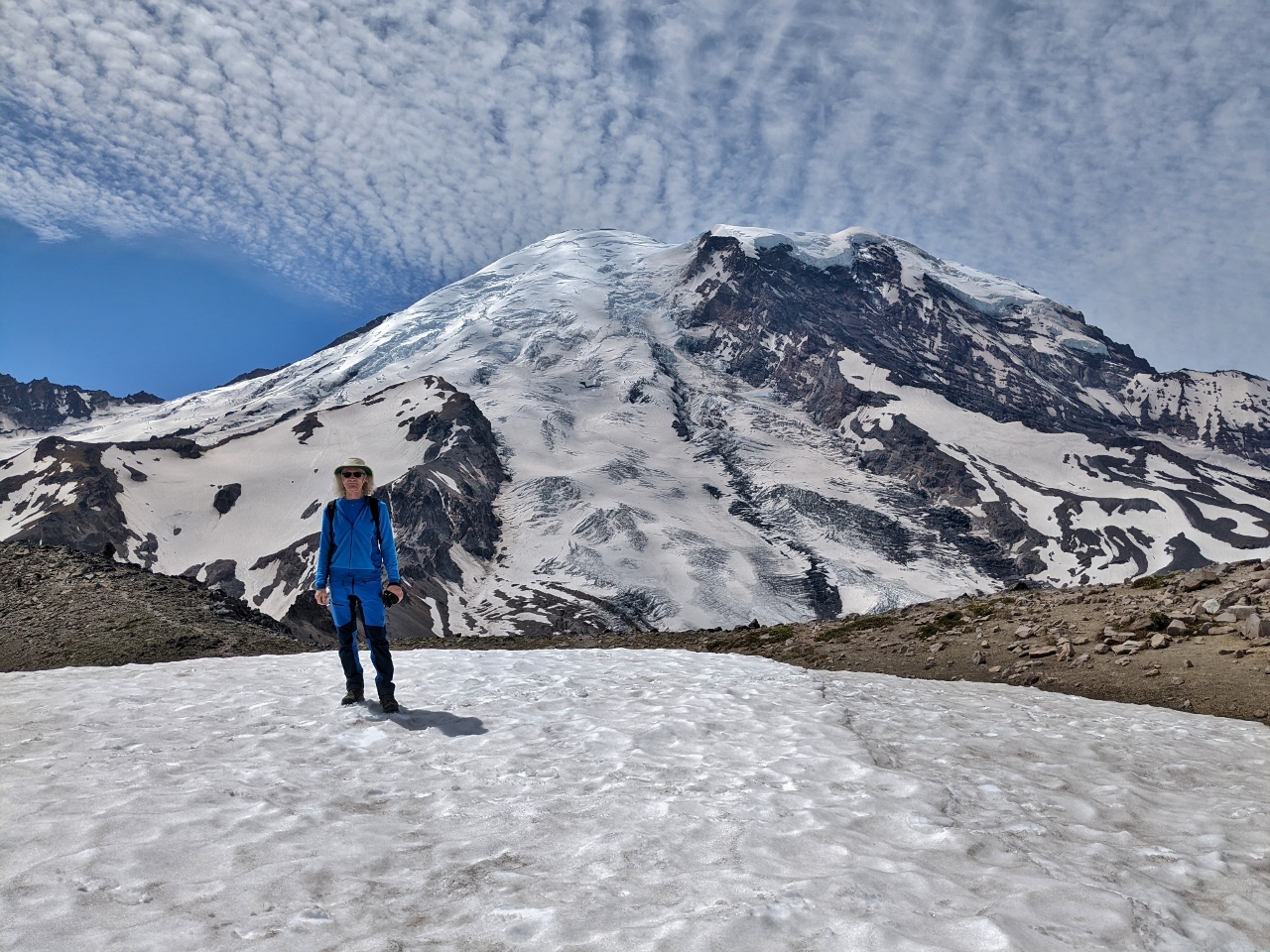
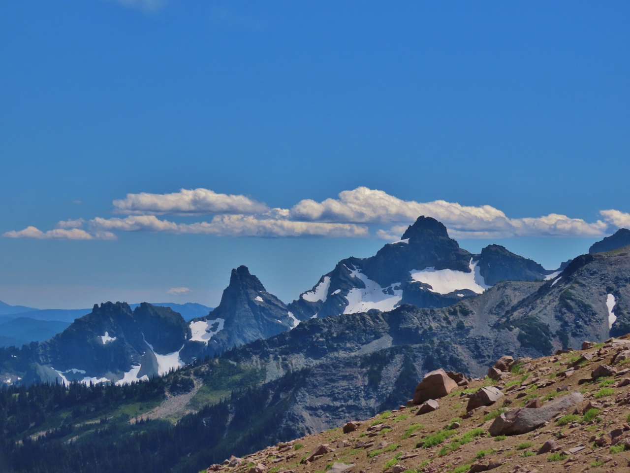
Stevens Canyon
Position: 46°46.22’N, -121°42.85’W
View to Mount Rainier from Stevens Canyon. When we were here earlier in the year to snowshoe, most of the park roads were closed for the season. This time, we’ll visit some of the places that are only accessible in the summer, starting with the scenic drive along Stevens Canyon Road.
|
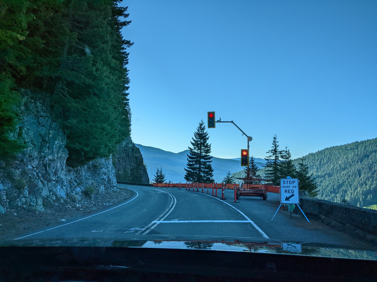 |
Construction
Position: 46°45.82’N, -121°39.96’W
Stevens Canyon Road was the last major road built in Rainier National Park. It connects the Paradise area with State Route 123 near the eastern edge of the park and is the only east-west route in the park. Construction began in the 1930s, was suspended during World War II, and the road was finally completed in 1957. The road is only open in the summer and early fall, and right now is only open Friday through Sunday while a major rehabilitation project in underway. Here the road is down to a single lane due to the work being done.
|
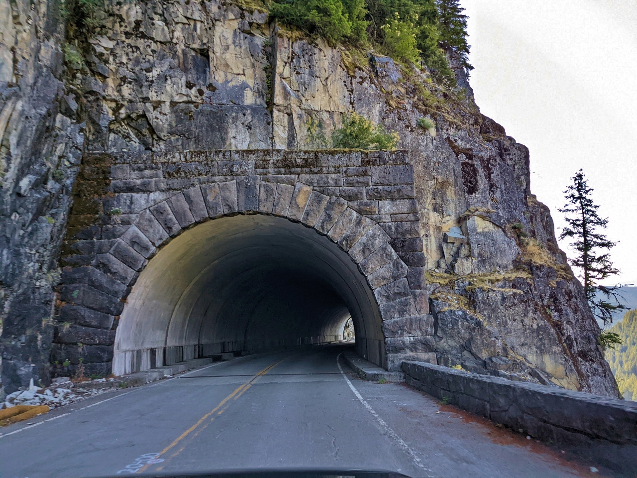 |
Stevens Canyon Tunnel
Position: 46°45.80’N, -121°39.88’W
Approaching Stevens Canyon Tunnel, completed in 1937.
|
 |
Box Canyon Trailhead
Position: 46°45.94’N, -121°38.10’W
Another great view to Rainier, this one from the Box Canyon trailhead.
|
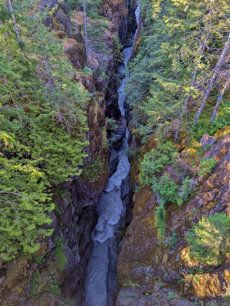 |
Box Canyon
Position: 46°45.93’N, -121°38.14’W
A short walk from the trailhead brought us to a pedestrian bridge over Box Canyon. This is the view from the bridge to the Muddy Fork of the Cowlitz River, flowing 115 ft (35 m) below us through dramatic Box Canyon.
|
 |
White River Entrance
Position: 46°54.25’N, -121°32.92’W
The White River Entrance at the northeast corner of Mt. Rainier National Park, with the mountain partially visible in the distance. The road here is closed in mid-October until late June or early July due to snowfall.
|
 |
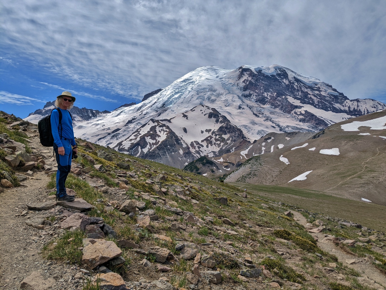
Sunrise Park Road
Position: 46°54.94’N, -121°37.26’W
One of many amazing views to Mt. Rainier from Sunrise Park Road. We’ve not seen the mountain much from this side and enjoyed the different perspective.
|
 |
Sunrise
Position: 46°54.82’N, -121°37.91’W
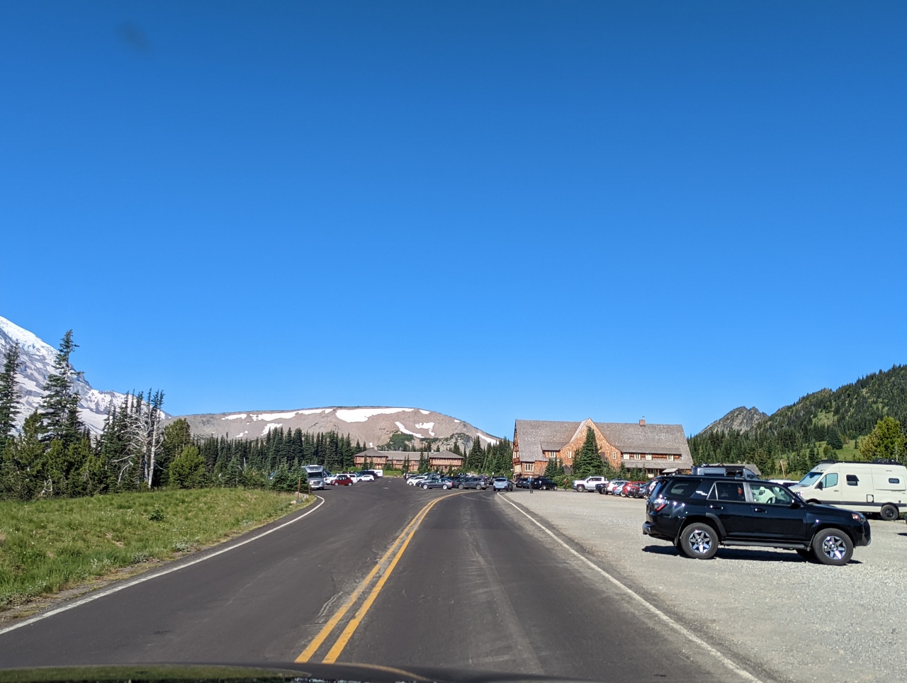
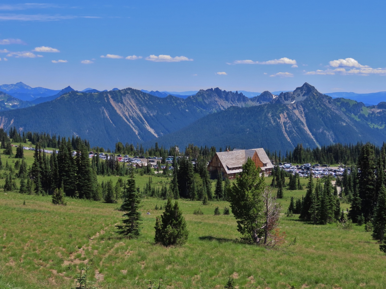
Mt. Rainier is very popular in the summer. At just past 9am, the Sunrise parking lot is already half-full.
|
 |
Dwarf Lupine
Position: 46°54.79’N, -121°39.23’W
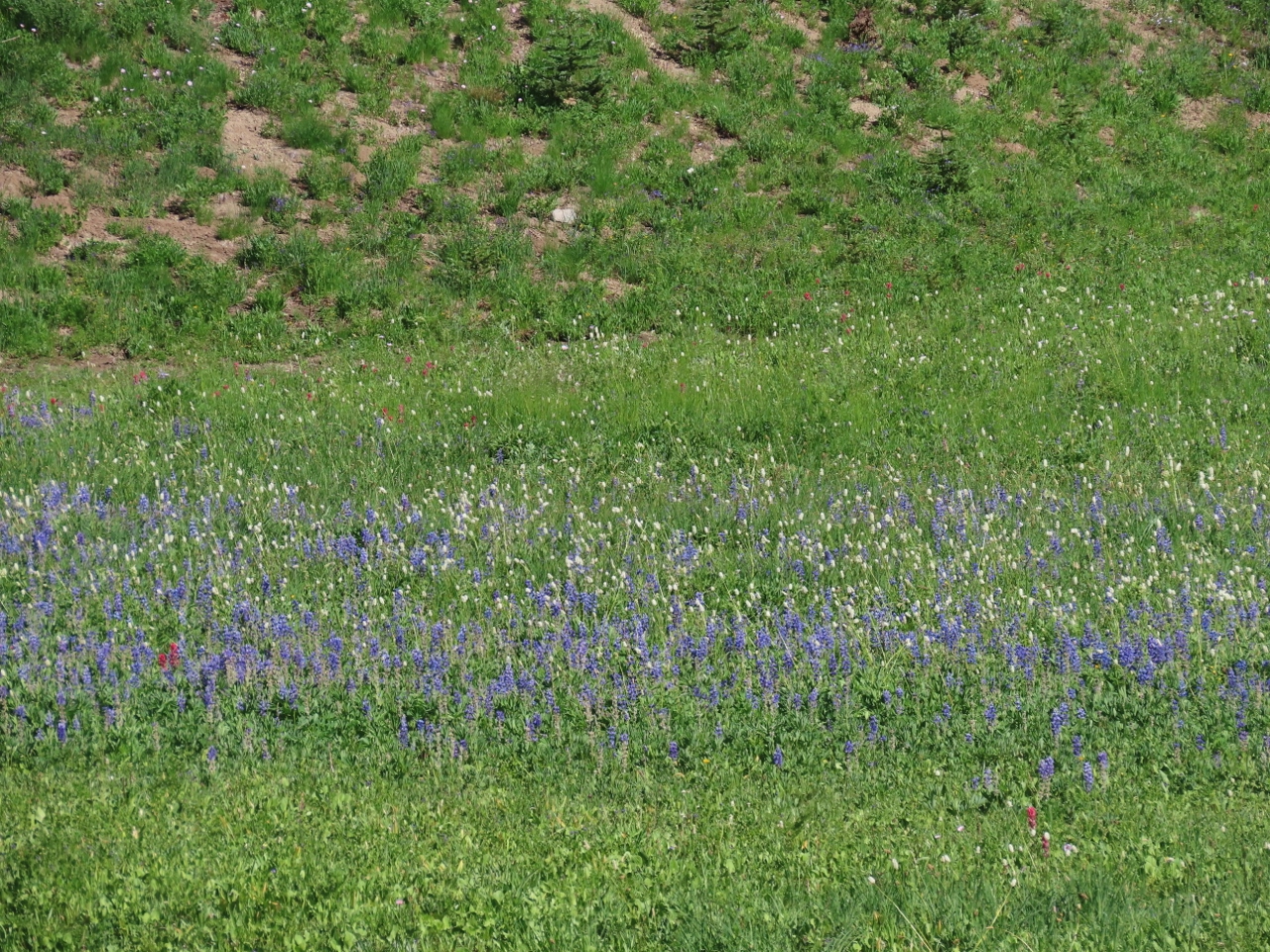
Dwarf Lupine growing in a meadow along the Burroughs Mountain Trail. Mt Rainier is snow-covered most of the year, and bursts with color as the wildflowers bloom in late July and early August. One of the reasons we came this time of year was to enjoy the wildflower display.
|
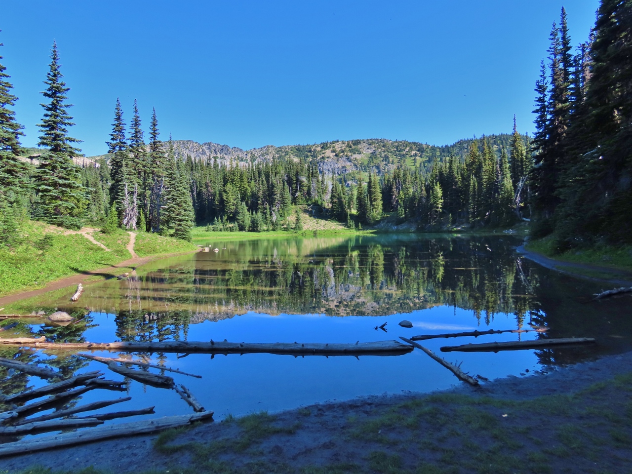 |
Shadow Lake
Position: 46°54.64’N, -121°39.43’W
Looking north across tranquil Shadow Lake along the the Burroughs Mountain Trail in Mt Rainier National Park.
|
 |
Glacier Overlook
Position: 46°54.53’N, -121°39.62’W
A great view to Mt Rainier at the Glacier Overlook along the Burroughs Mountain Trail. 11,138 ft (3,395 m) Little Tahoma is the peak just to the left.
|
 |
White River
Position: 46°54.51’N, -121°39.94’W
The Inter Fork of the White River rises from Inter Glacier along the eastern flank of Mt. Rainier.
|
 |
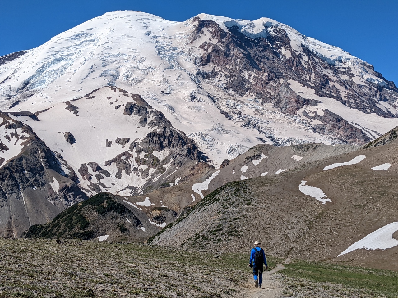
Snowfield
Position: 46°54.52’N, -121°40.30’W
Crossing the first of several small snowfields as we hike the Burroughs Mountain Trail, with a turquoise-colored glacial-fed lake visible in the valley below.
|
|
|
Pink Mountain Heather
Position: 46°54.58’N, -121°40.41’W
Pink Mountain Heather, with Scarlet Paintbrush at left, and Mt. Rainier in the background with Little Tahoma at left.
|
 |
Goats
Position: 46°54.60’N, -121°40.42’W
A herd of mountain goats alongside the Burroughs Mountain Trail in Mt. Rainier National Park. Their hooves have a hard outer ring with a spongy center that helps them “stick” to rocks and be nimble climbers.
|
 |
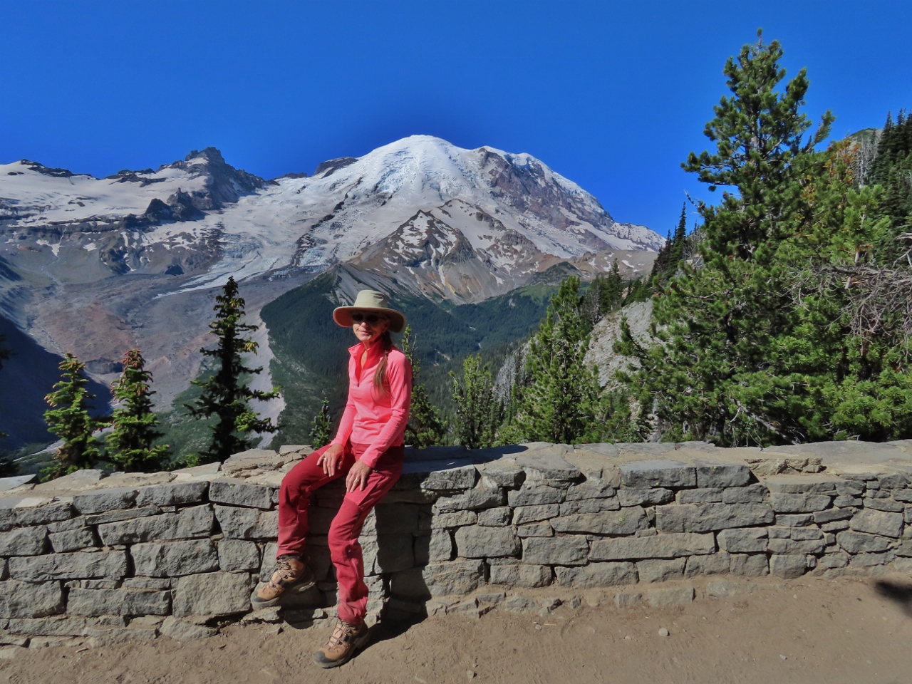
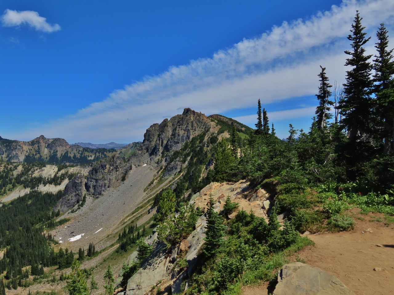
1st Burroughs Mountain
Position: 46°54.60’N, -121°40.59’W
The Borroughs Mountain Trial passes three Burroughs Mountains, the 1st is 7,159 feet (2,182 m) high, the 2nd is 7,402 feet (2,256 m) and the 3rd is 7,828 feet (2,385 m). Here we are walking alongside the summit of 1st Burroughs Mountain (out of the picture at right) at altitude 7,095 ft (2,163 m).
|
 |
Spreading Phlox
Position: 46°54.62’N, -121°40.69’W
We passed many displays of spreading phlox on the trail.
|
 |
Trail Junction
Position: 46°54.62’N, -121°40.69’W
At the junction with the Glacier Basin Trail. We’ve come 2.2 miles (3.5 km) from Sunrise, and are just over a half-mile (0.8 km) away from 2nd Burroughs Mountain.
|
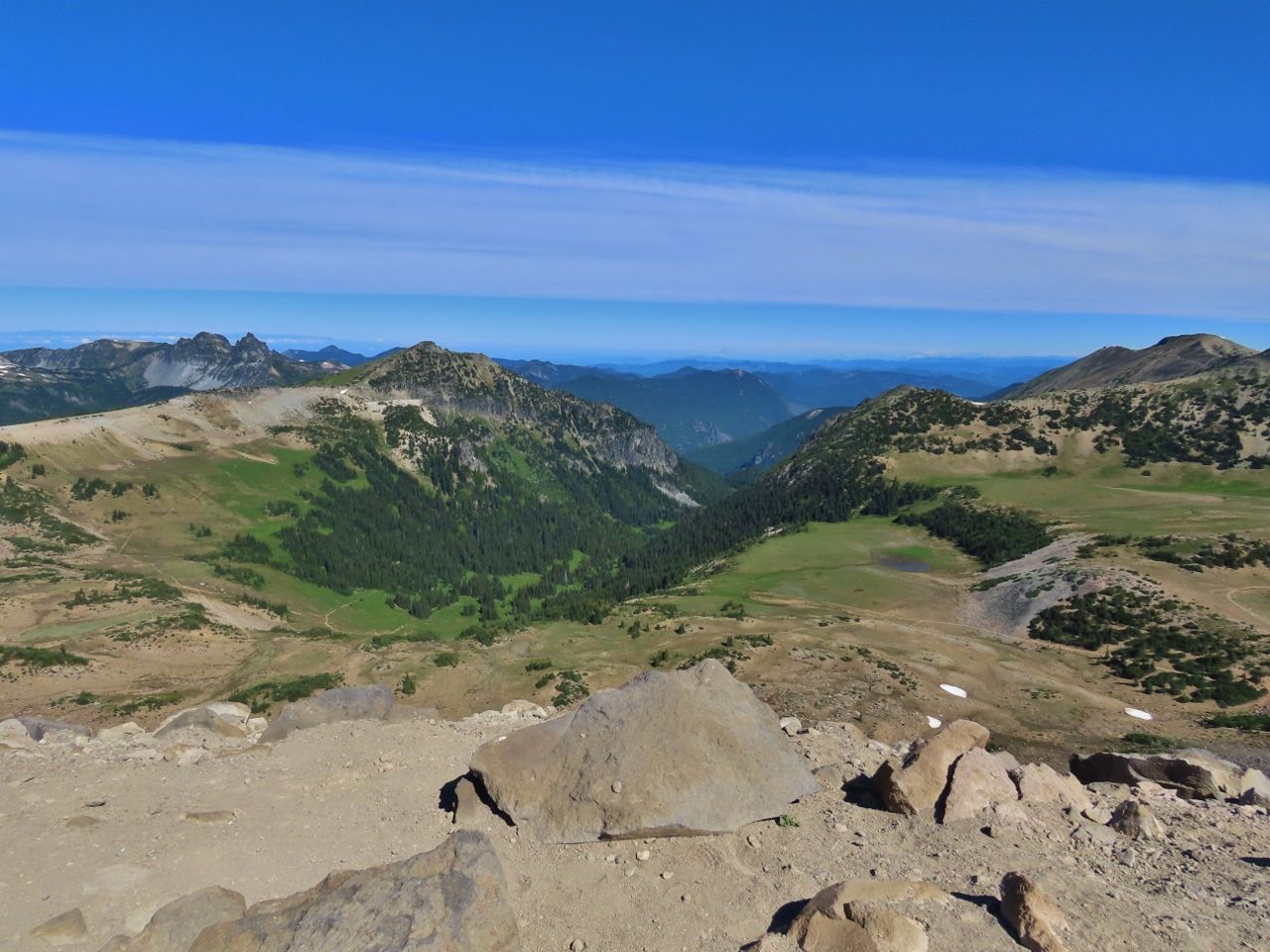 |
View North
Position: 46°54.62’N, -121°40.69’W
The view north from the trail between 1st and 2nd Burroughs mountains is fabulous on this clear day, but it’s hard to compete with “The Mountain”.
|
 |
Trail to 2nd Burroughs
Position: 46°54.63’N, -121°40.77’W
Walking towards 7,402 feet (2,256 m) 2nd Burroughs Mountain, foreground, with Mt. Rainier in the background.
|
 |
Emmons Glacier
Position: 46°54.61’N, -121°41.01’W
Emmons Glacier on the northeast flank of Mt. Rainier has the largest surface area of any glacier in the contiguous United States at 4.3 sq mi (11 km2).
|
 |
2nd Burroughs
Position: 46°54.42’N, -121°41.34’W
The fabulous view to Mt. Rainier from 7,402 feet (2,256 m) 2nd Burroughs Mountain. We’re getting closer and closer.
|
 |
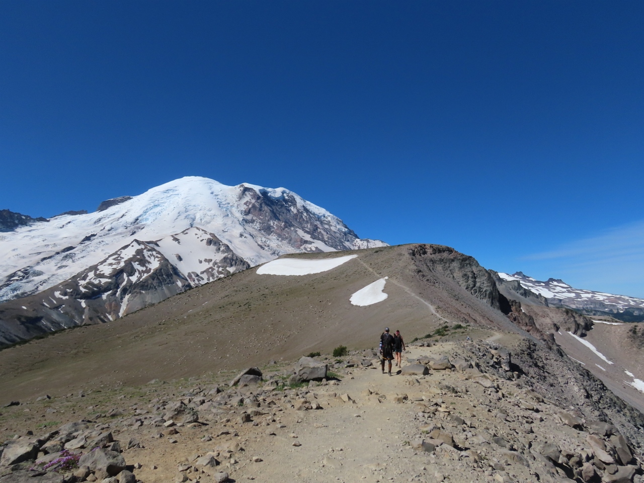
Trail to 3rd Burroughs
Position: 46°54.34’N, -121°41.59’W
The spectacular view to Mt Rainier as we descend from 2nd Burroughs on the final section of the Burroughs Mountain Trail. We have to give up some of our altitude and descend 400 ft (121 km) into a valley between the 2nd and 3rd Burroughs mountains. Then we will ascend 800 feet (242 m) to reach the 7,828-ft (2,385 m) summit of 3rd Burroughs, just out of the picture at right.
|
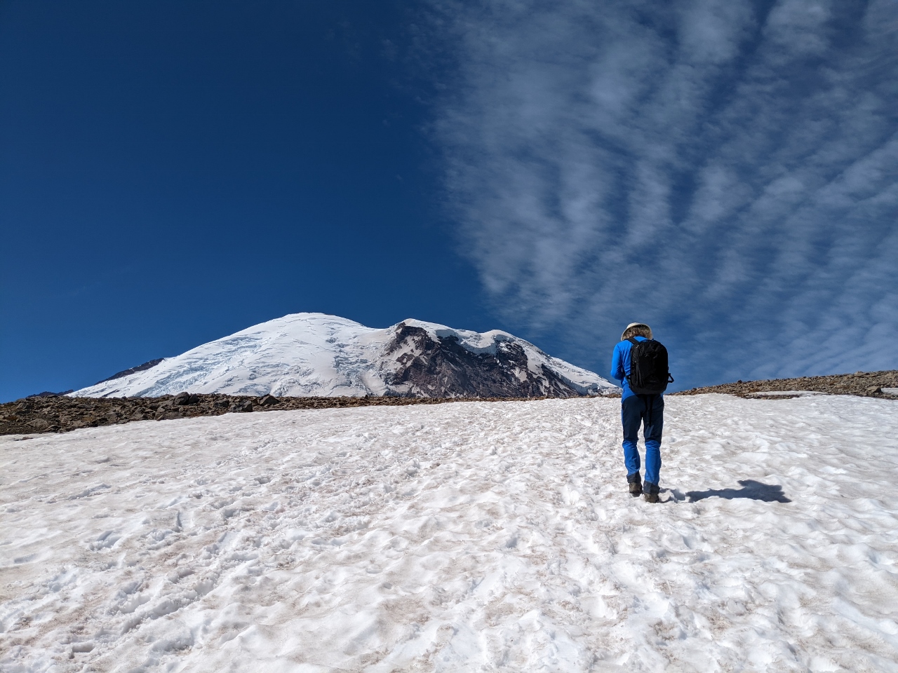 |
Snow Bank
Position: 46°54.08’N, -121°42.62’W
Climbing another snowfield on the ascent to 3rd Burroughs. The snow was fairly soft and slushy and not that slippery to walk on.
|
 |
View East
Position: 46°54.09’N, -121°42.60’W
The view east to 2nd Burroughs from the snowfield we are climbing.
|
 |
3rd Burroughs
Position: 46°54.08’N, -121°42.82’W
The spectacular view to Mt. Rainier from 7,828-ft (2,385 m) 3rd Burroughs Mountain.
|
 |
Lunch
Position: 46°54.08’N, -121°42.83’W
Lunch with an amazing view to Mt. Rainier. We feel so close to the mountain and it looks so easy to reach the summit from here, but that’s another 6,500 ft (1,980 m) up.
|
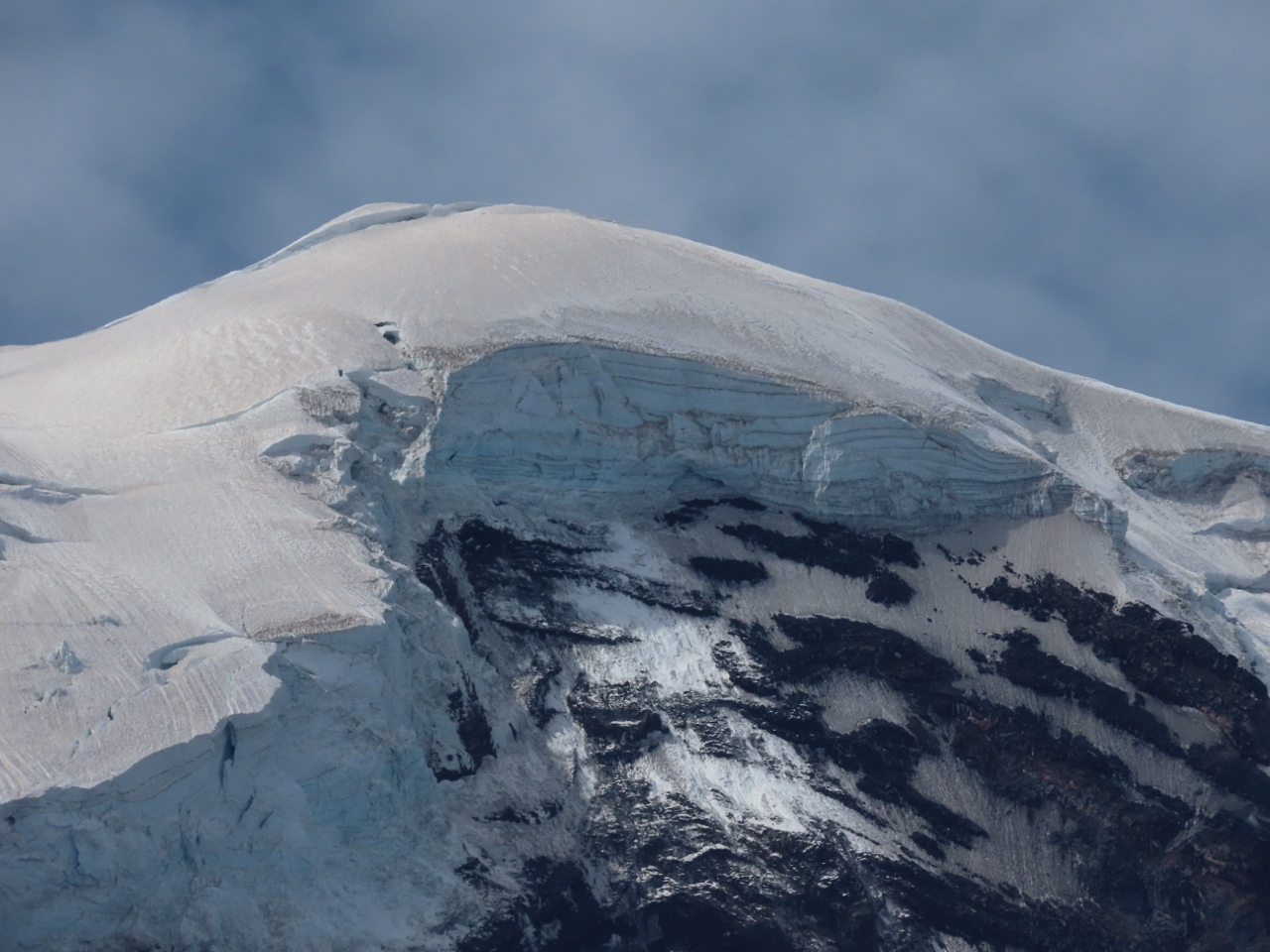 |
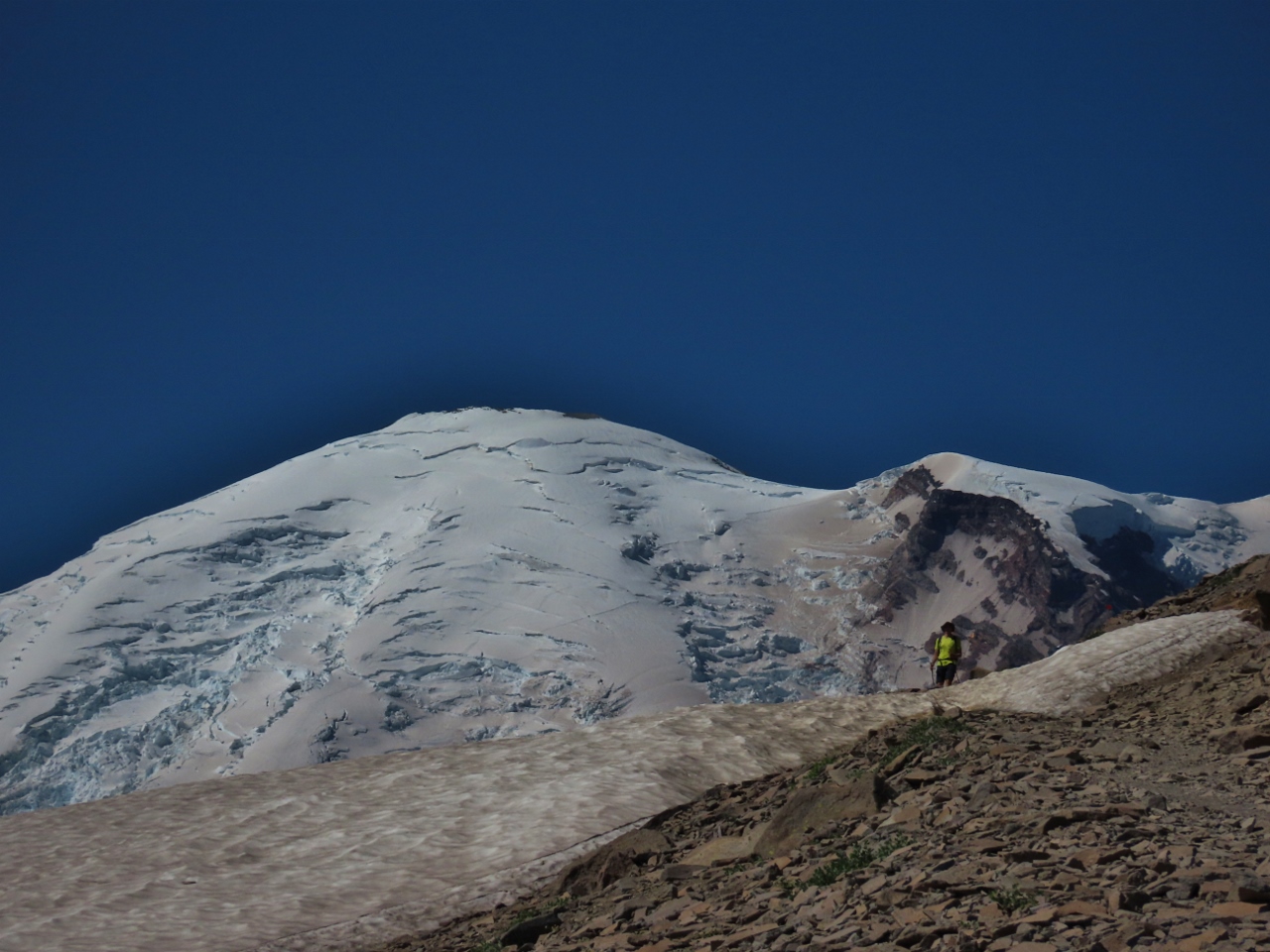
Winthrop Glacier
Position: 46°54.08’N, -121°42.82’W
The side of Winthrop Glacier on the north flank of Mt. Rainier. The glacier starts at Columbia Crest, at the summit of Mt. Rainier, and covers 3.5 sq mi (9.1 sq km) with a volume of 18.5 billion cu ft (523 million cu m).
|
 |
Last Look
Position: 46°54.20’N, -121°42.81’W
A final picture of Mt Rainier from 3rd Burroughs Mountain before we return back to Sunrise. We’re lucky to have such warm and sunny weather.
|
 |
Returning
Position: 46°54.46’N, -121°41.42’W
Looking back to Mt. Rainier and 3rd Burroughs Mountain (partly visible at right) as we ascend back up to 2nd Burroughs from the valley between them.
|
 |
Horned Lark
Position: 46°54.37’N, -121°41.39’W
A horned lark at the top of 2nd Burroughs Mountain.
|
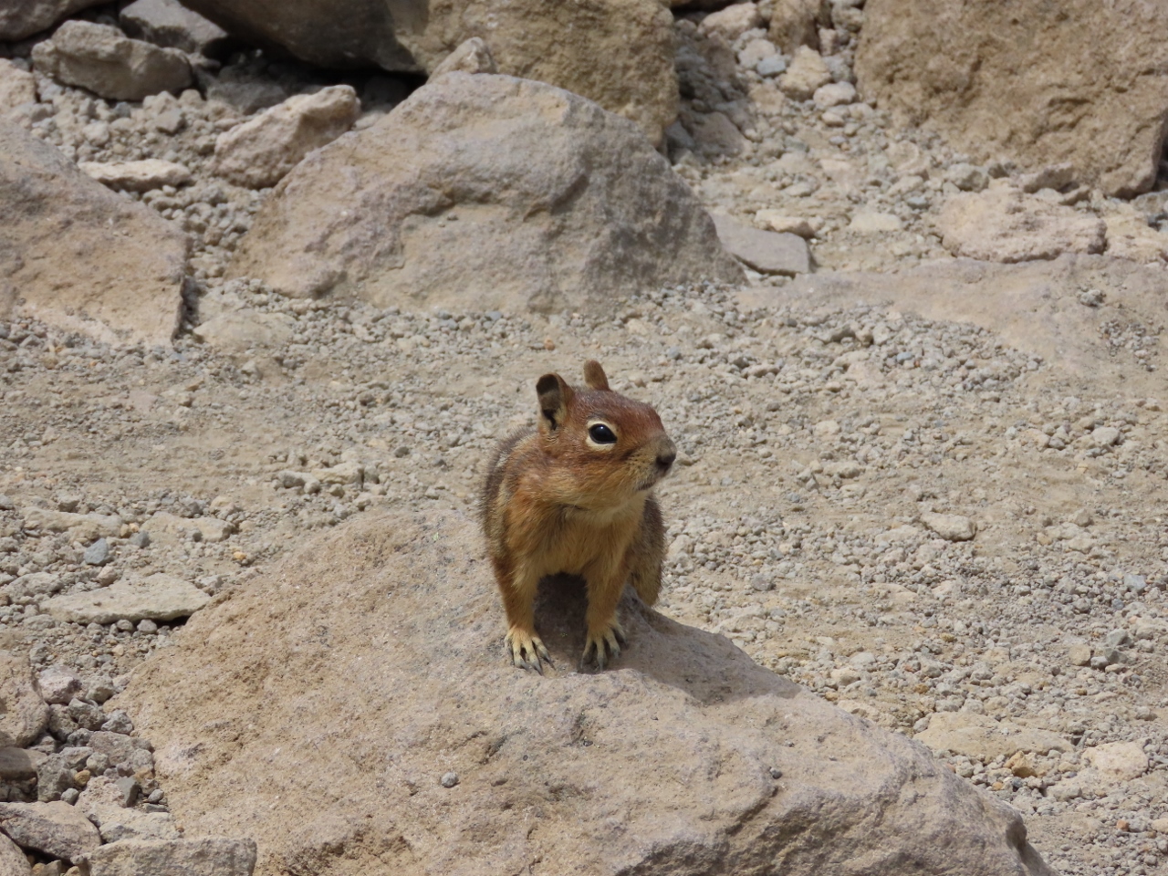 |
Chipmunk
Position: 46°54.37’N, -121°41.39’W
An expectant chipmunk at 2nd Burroughs Mountain. This is a popular stop to either turnaround or rest before tackling 3rd Burroughs, and the foraging likely is quite good.
|
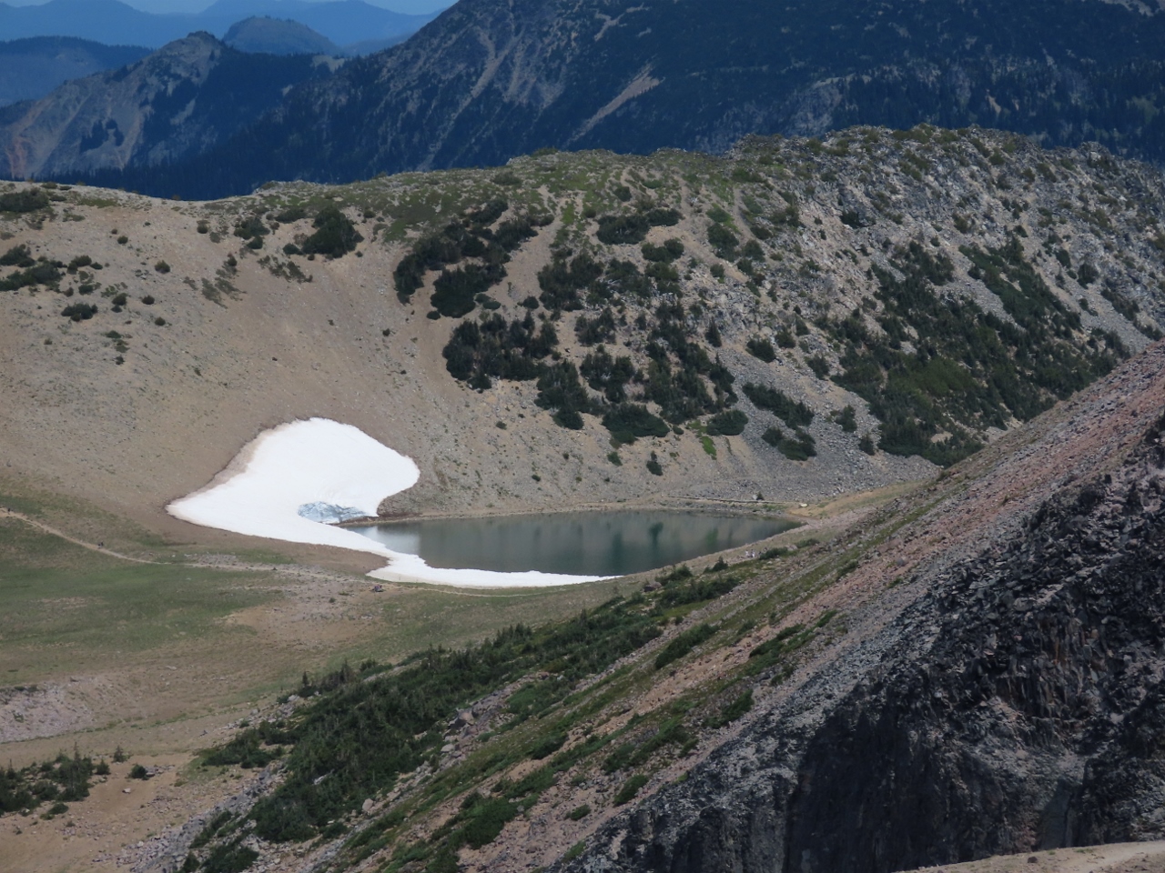 |
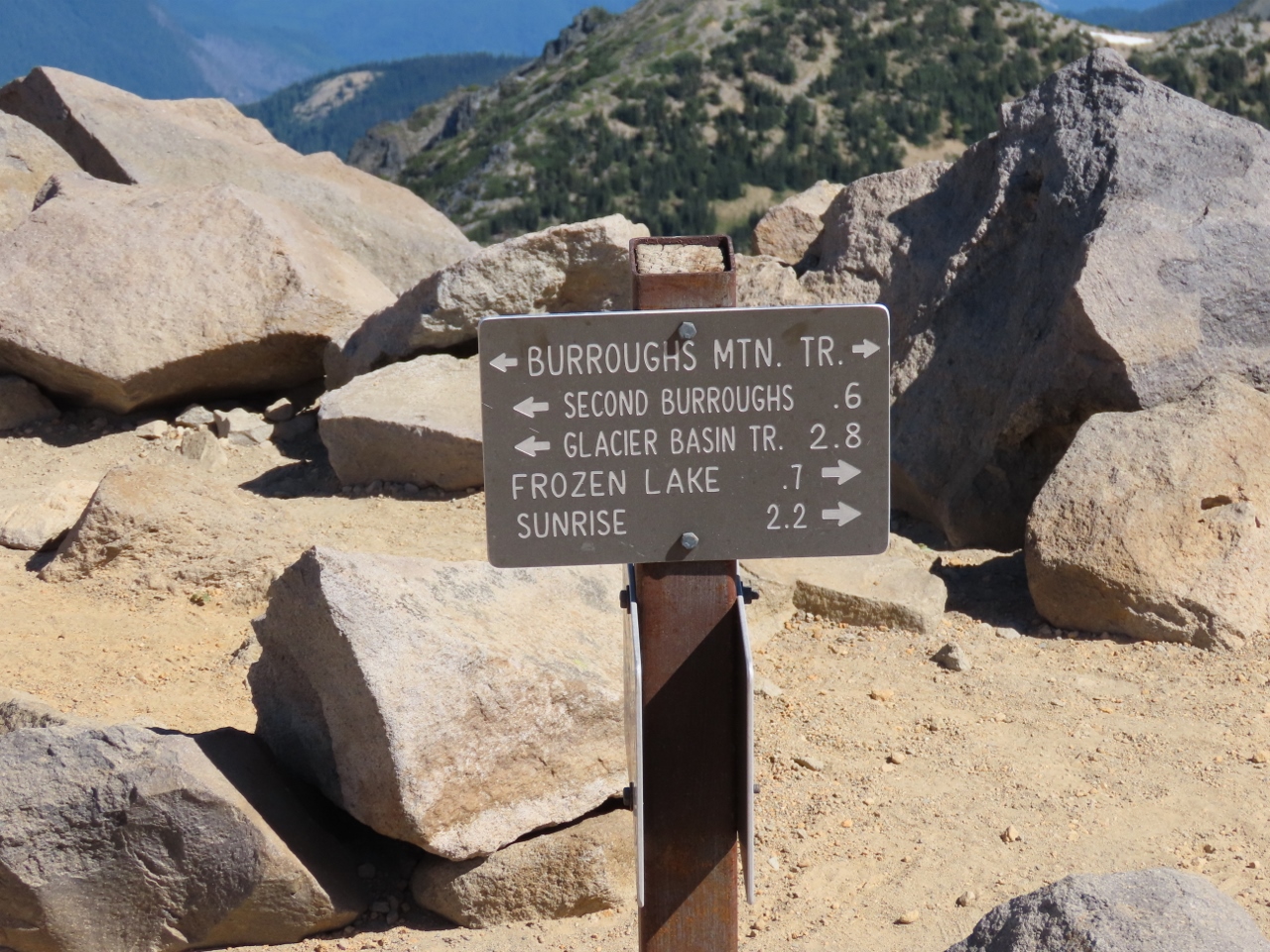
Frozen Lake
Position: 46°54.49’N, -121°41.26’W
View to Frozen Lake northeast of 1st Burroughs Mountain. We arrived at 1st Burroughs Mountain on the Sunrise Rim trail, and will return to Sunrise on the Sourdough Ridge trail past Frozen Lake.
|
 |
Little Tahoma
Position: 46°55.10’N, -121°39.87’W
11,138 ft (3,395 m) Little Tahoma, a satellite peak of Mt. Rainier a little to its east.
|
 |
Antler Peak
Position: 46°55.13’N, -121°39.00’W
7,017 ft (2,139 m) Antler Peak, viewed from the Sourdough Ridge Trail back to Sunrise.
|
 |
Crowds
Position: 46°55.10’N, -121°38.79’W
The parking lot at Sunrise was full by the time we returned at 2pm, with cars parking along the road.
|
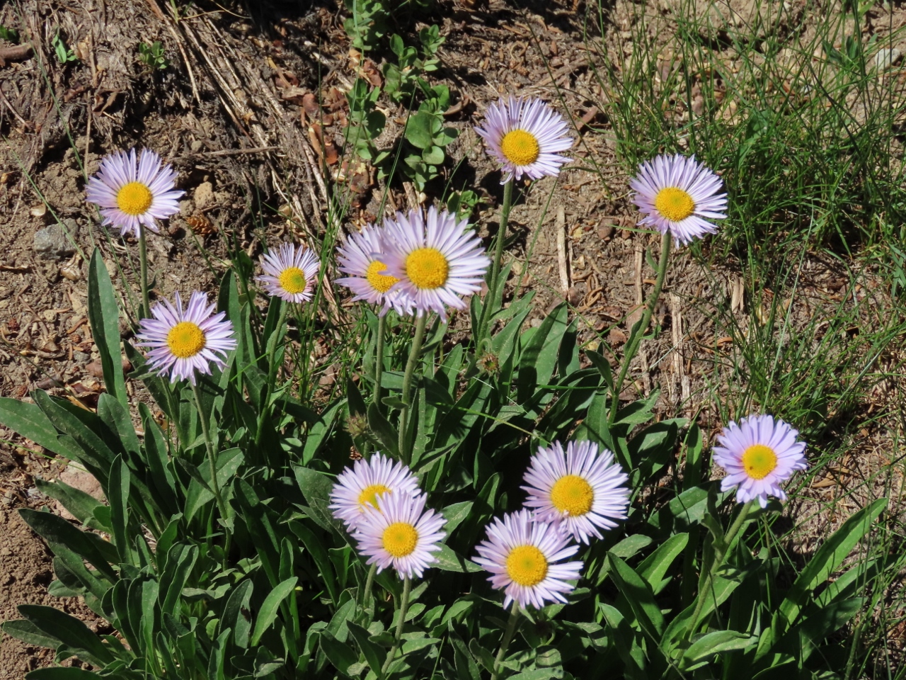 |
Silver Forest Trail
Position: 46°54.74’N, -121°38.49’W
Subalpine Daisy along the Silver Forest Trail. After returning to the Sunrise parking lot, we dropped of some of gear at the car for an easy walk to see some more wildflowers.
|
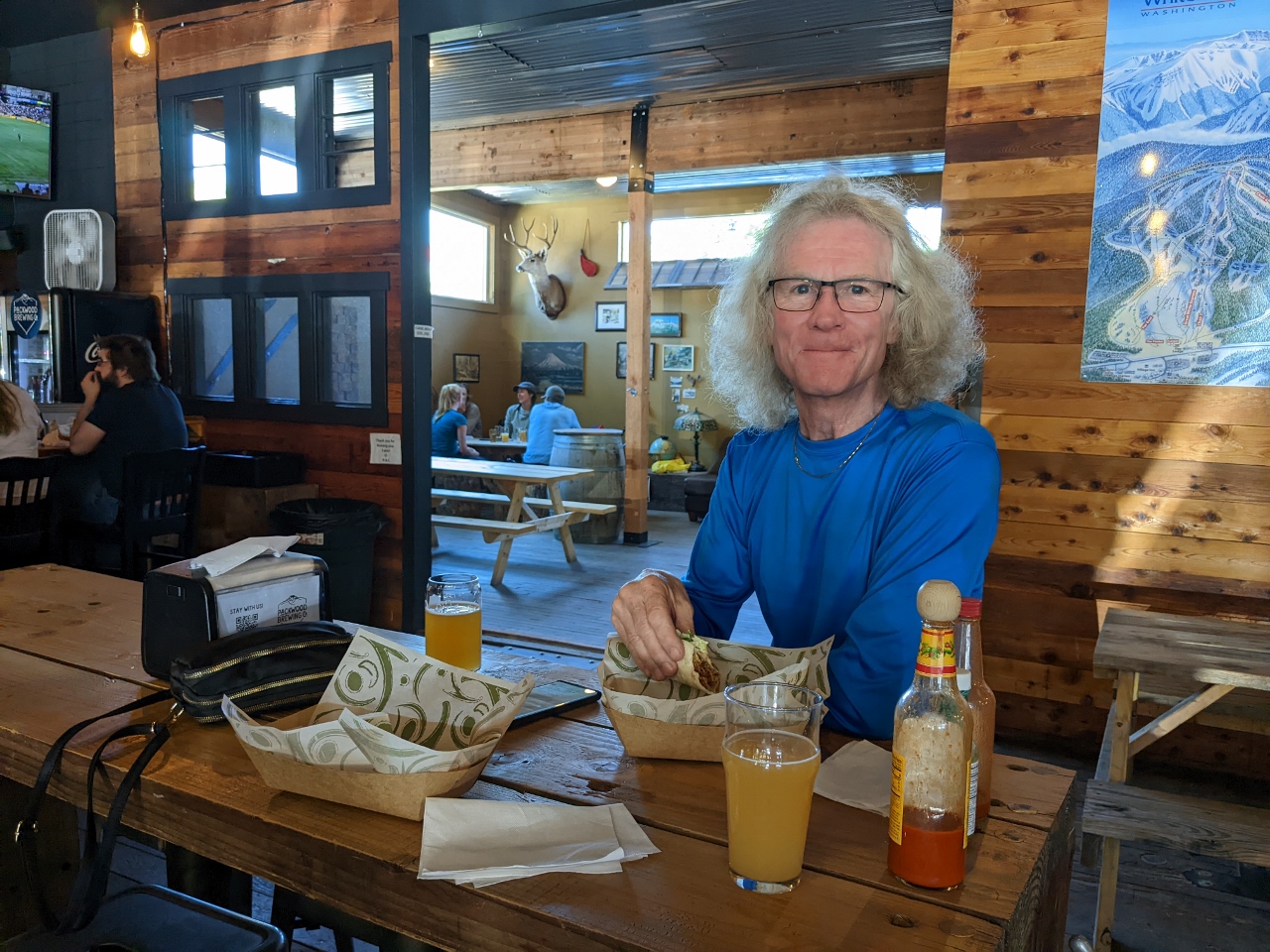 |
Packwood Brewing Co
Position: 46°36.34’N, -121°40.28’W
An early dinner at Packwood Brewing Company in Packwood on our way back to our Ashford cabin. We really enjoyed the meal and the ambiance, and are looking forward to returning.
|
 |
Click the travel log icon on the left to see these locations on a map. And a map of our most recent log entries always is available at mvdirona.com/maps. |
If your comment doesn't show up right away, send us email and we'll dredge it out of the spam filter.