Over the course of the summer, we’d become progressively more daring on the terrain we would tackle in our little SUV. Jennifer often was out of the vehicle to direct us through areas with deep ruts and large rocks, to ensure our front bumper or spoiler didn’t catch. The most challenging conditions we’ve taken on so far was while returning home from a late-summer camping trip. Our maps showed a direct route to the highway, but we soon encountered a small hill partially blocking the road. Many, many vehicles had crossed before us, so we decided to give it a try with Jennifer out of the car guiding.
The hill, pictured above, was getting pretty close to the limit for our vehicle. We made it over though, and figured the worse was behind us. But the next challenge was that the road was partially washed out a short distance beyond, and we had to go right up against a tree to stay on the road. Then, after all the work of getting over the hill and past the partial washout, we hit a total washout where the road was completely gone. Some 4x4s had made it up a very steep hill into the woods to the north, but that was definitely beyond the capability of our vehicle.
Below are highlights from August 19th through 21st, 2022. Click any image for a larger view, or click the position to view the location on a map. And a map with our most recent log entries always is available at mvdirona.com/maps.
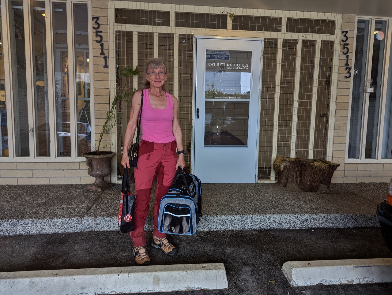 |
Cat Sitting Hotels
Position: 47°33.66’N, -122°22.62’W
At Cat Sitting Hotels in West Seattle to drop off Spitfire while we head out for a two-night camping trip. We normally use Wagly in Bellevue, but they didn’t have capacity so we needed to try a different company.
|
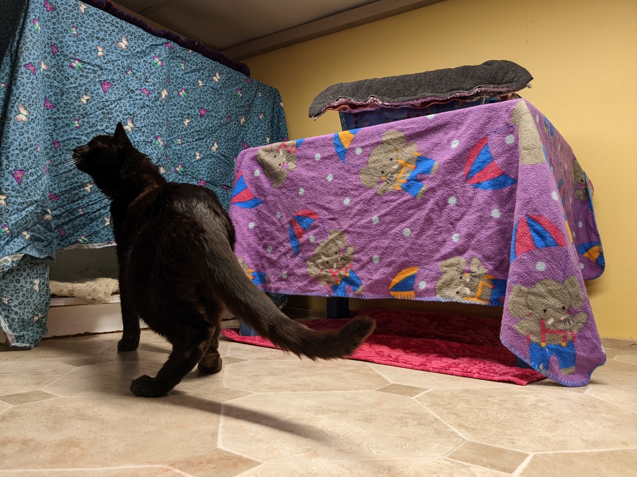 |
Spitfire
Position: 47°33.65’N, -122°22.62’W
Spitfire checking out his weekend digs at Cat Sitting Hotels. They took great care of him and made sure his enclosure had plenty of places to tuck away, but he could also see out when he wanted.
|
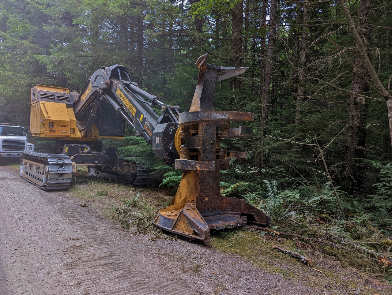 |
Logging Equipment
Position: 47°7.75’N, -121°33.85’W
The area we’re driving through on NF-7010 off Highway 410 is being actively logged. We passed several large logging machines along the way.
|
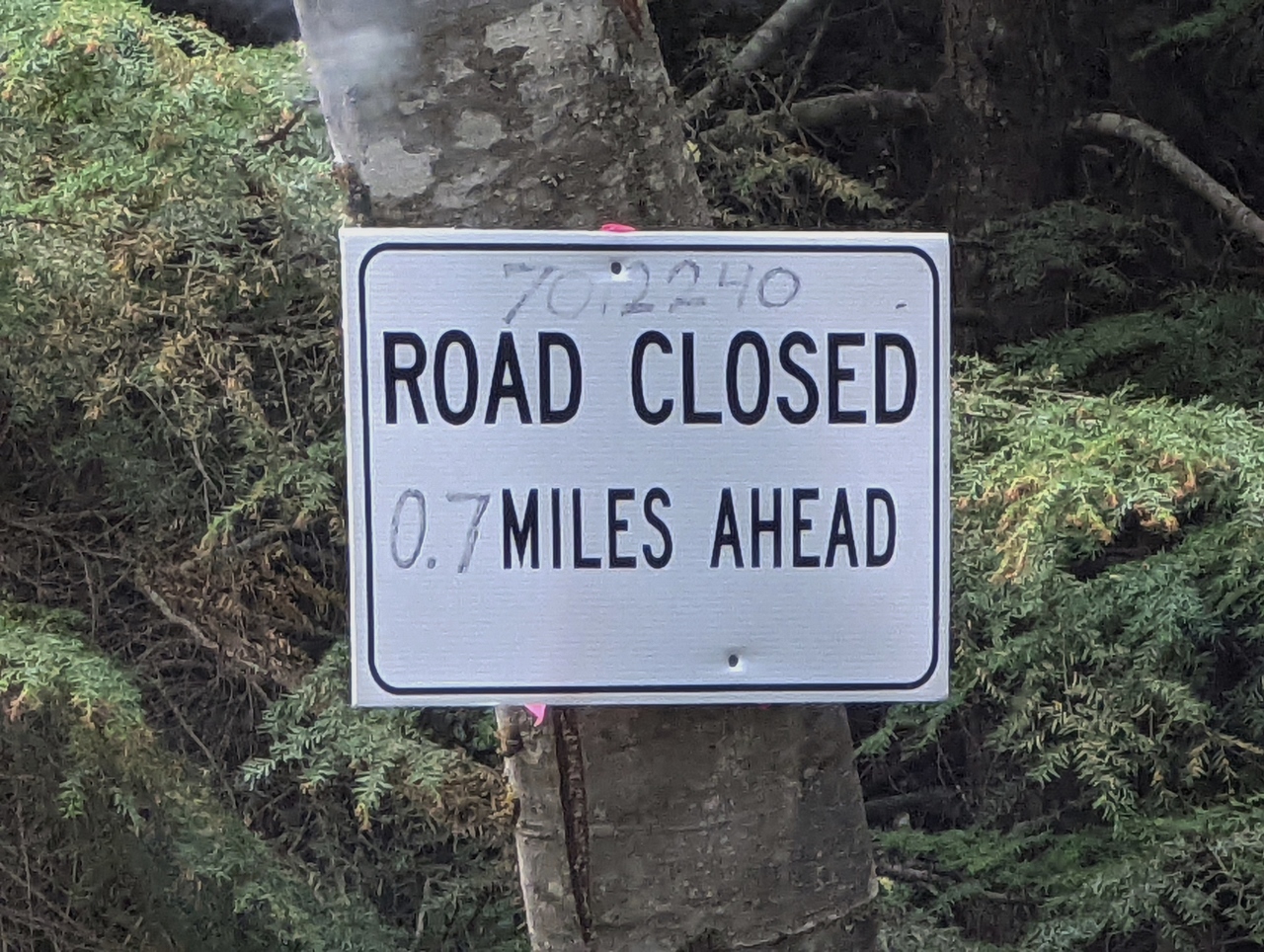 |
Road Closed
Position: 47°7.75’N, -121°33.85’W
A few of the spur roads off NF-7010 were closed due to the active logging.
|
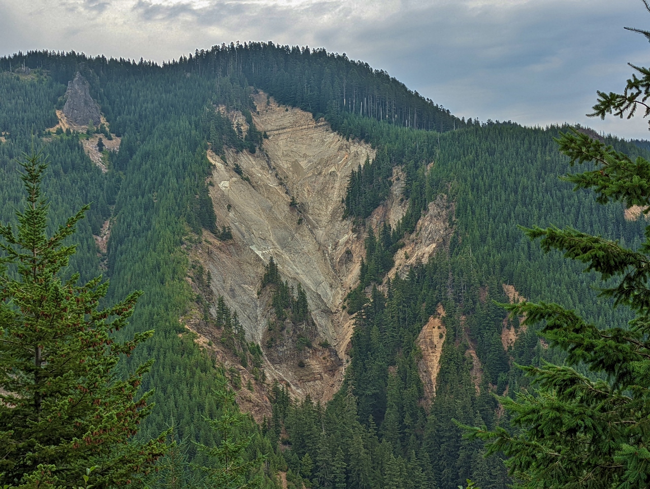 |
Landslide
Position: 47°8.62’N, -121°32.57’W
A major landslide across the valley, viewed looking east from NF-7012. The creek below at the bottom is called Slide Creek, so this probably is a common occurrence.
|
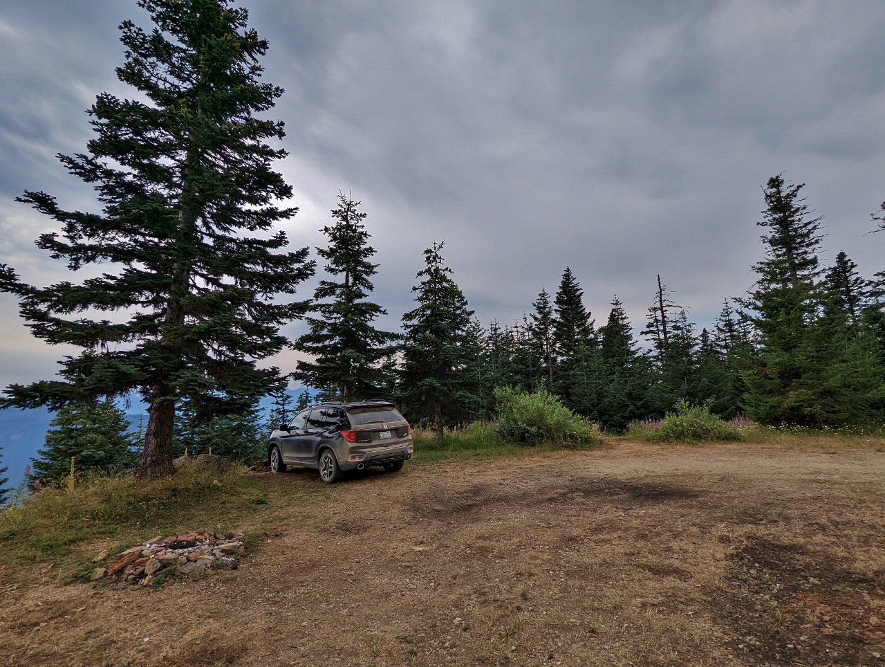 |
Large Campsite
Position: 47°8.60’N, -121°33.13’W
Checking out a large camping area at the end of NF-7012-375 with a partial view to Mt. Rainier through the trees. We’d seen better ones on the way up, so didn’t stop here.
|
 |
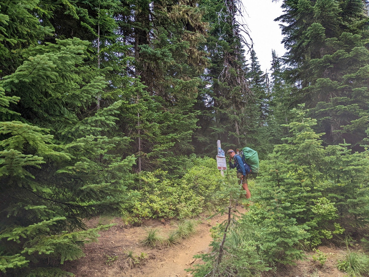
Guiding
Position: 47°8.78’N, -121°33.12’W
Jennifer guiding James across deep ruts and holes along NF-7012-390 to make sure our front bumper or spoiler didn’t catch. We had to do this a lot today as the roads were in pretty rough shape and barely passable with the low ground clearance of our SUV.
|
 |
Campsite
Position: 47°8.10’N, -121°33.50’W
We didn’t find any sites we liked better, so returned back down along NF-7012 to a spot we’d seen earlier with a great view to Mt. Rainier. The only reason we didn’t take it right away is we didn’t feel quite ready to stop and wanted to explore the area a bit more. The site was a little uneven, so we’ve leveled the vehicle with orange Tri-Lynx levelers.
|
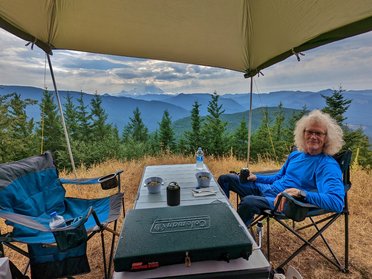 |
Lunch
Position: 47°8.10’N, -121°33.50’W
Lunch with a view to Mt. Rainier from our campsite along NF-7012.
|
 |
Mt. Rainier
Position: 47°8.10’N, -121°33.50’W
Even slightly obscured by clouds, Mt. Rainier is a dramatic sight.
|
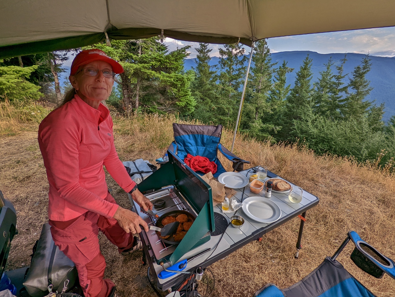 |
Crab Cakes
Position: 47°8.10’N, -121°33.50’W
Making crab cakes for dinner. Our Coleman Classic camp stove and the rest of our cooking gear is working out really well.
|
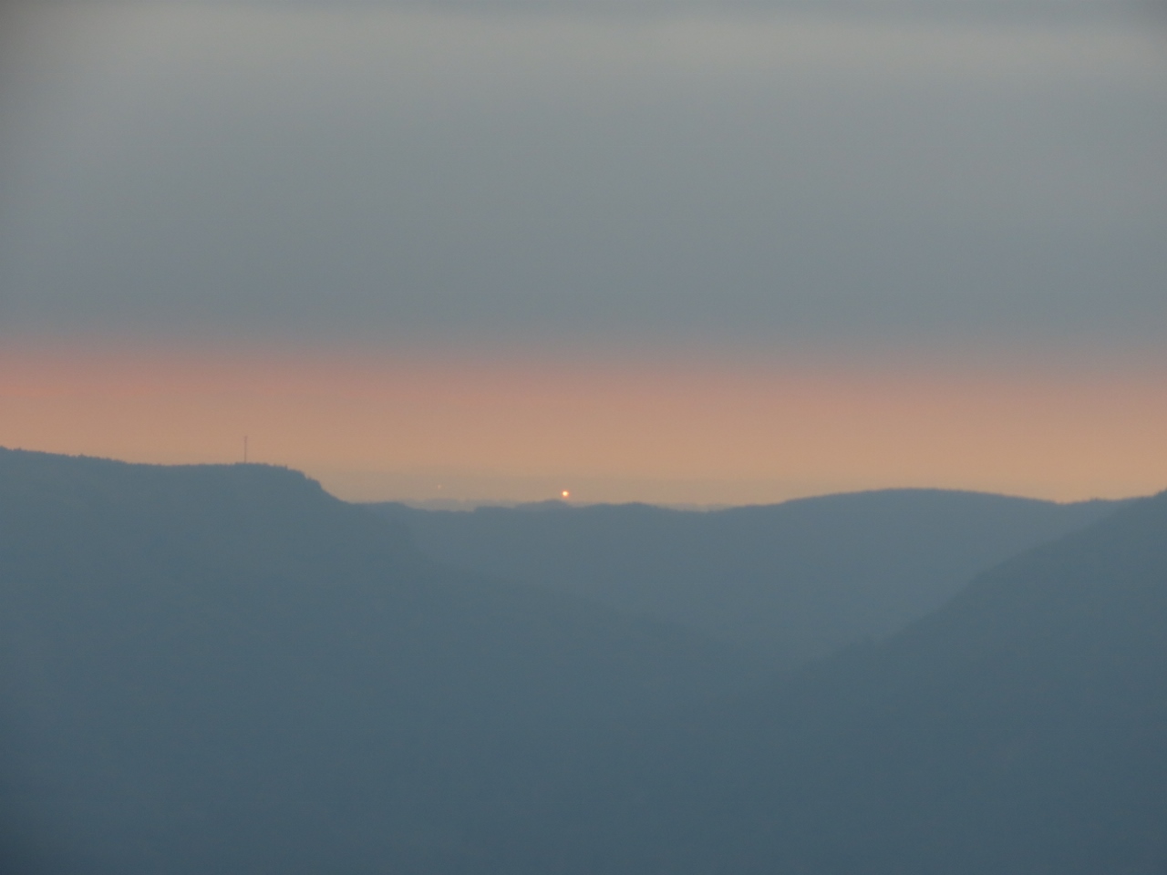 |
Dusk
Position: 47°8.10’N, -121°33.50’W
Dusk looking northwest from our campsite along NF-7012.
|
 |
Evening
Position: 47°8.09’N, -121°33.50’W
Enjoying the evening view in the warm glow of our propane heater. The day was quite warm, but it cools off quickly in the evening at altitude 3,237 ft (987 m).
|
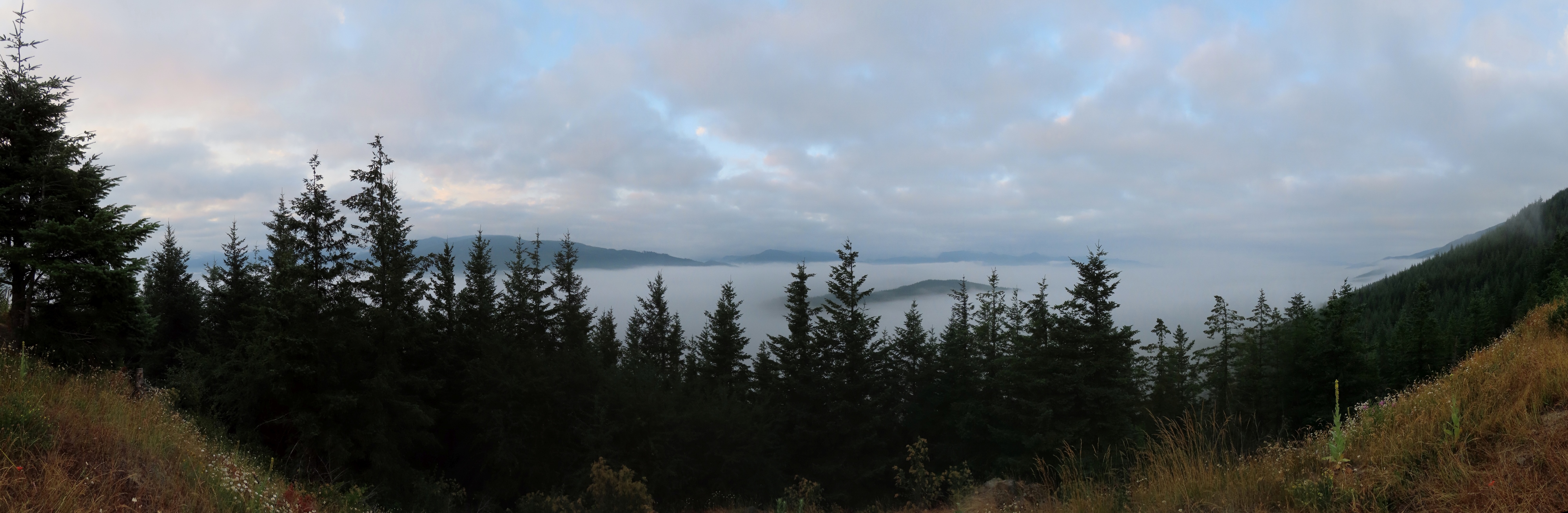 |
White River Valley
Position: 47°8.10’N, -121°33.50’W
Clouds have filled in the White River Valley this morning, but we get an interesting view above them.
|
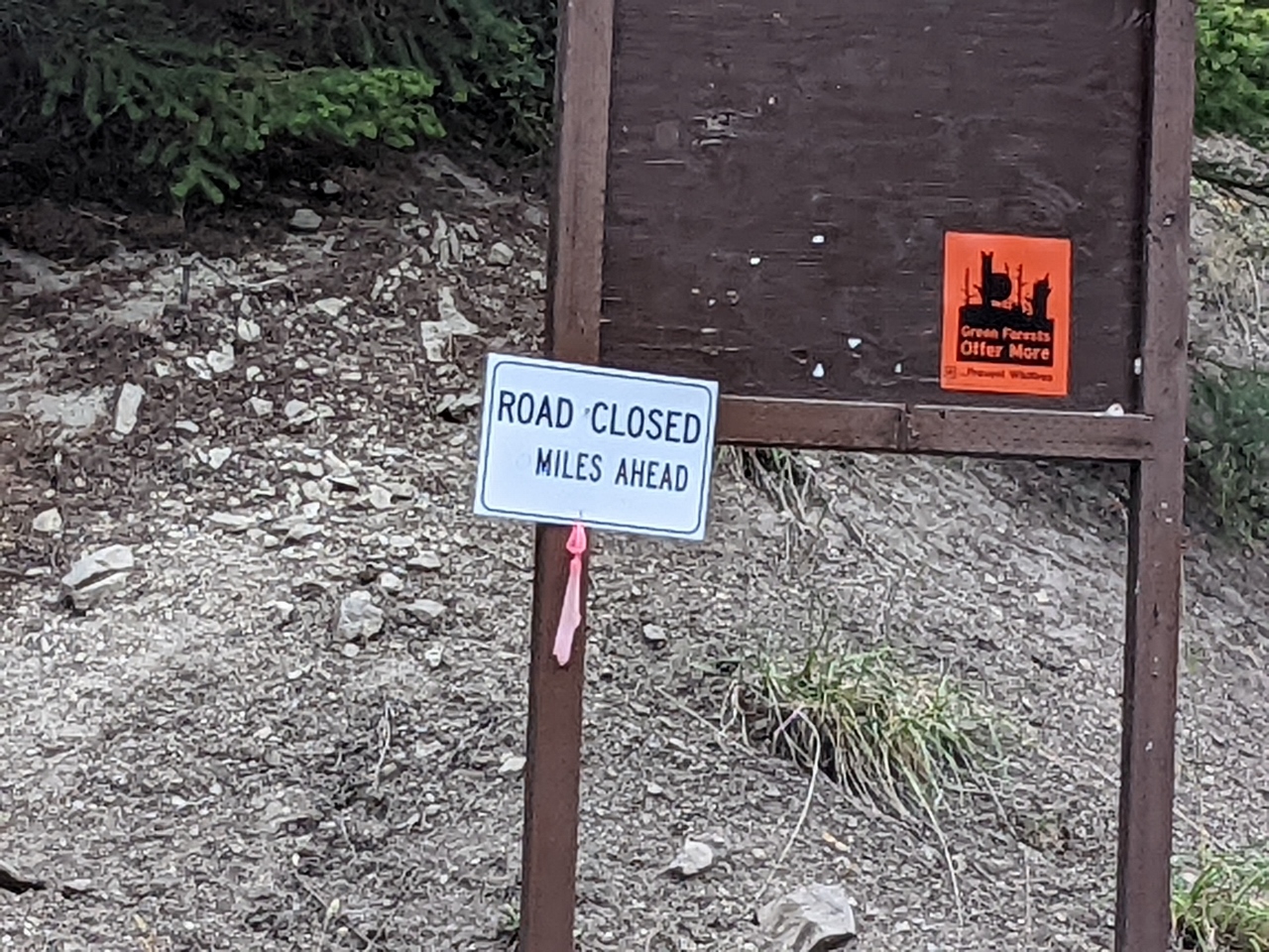 |
Road Closed
Position: 47°8.14’N, -121°34.17’W
A logger stopped by our campsite on Saturday morning and told us we were behind a locked gate that wouldn’t open again until Monday. He let us out, but we were lucky he’d come by otherwise we would have been stuck when we tried to leave on Sunday. The sign pictured was the only warning to us. It’s not clear how to avoid this other than keeping out of active logging areas with only one exit.
|
 |
PCT Hiker
Position: 47°8.00’N, -121°19.87’W
A hiker along the Pacific Crest Trail as we explore along Blowout Creek Road near Green Pass.
|
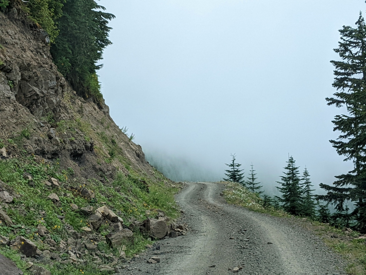 |
Clouds
Position: 47°8.32’N, -121°20.64’W
Ascending into the clouds at altitude 4,734 ft (1,443 m) along Blowout Creek Road near the junction with Forest Road 7038. The road looks a bit like it’s heading off a cliff ahead.
|
 |
Potential Campsite
Position: 47°8.33’N, -121°21.52’W
Looking down to a couple of potential campsites along a spur road off Forest Road 7038. It felt a little too early to stop though, so we’ll keep them in mind for another time.
|
 |
Big Rock
Position: 47°11.31’N, -121°21.68’W
Driving around a large boulder along Forest Road 5200-2 alongside Tahoma Creek. There sure are a lot of ways to damage a vehicle out on these forest roads.
|
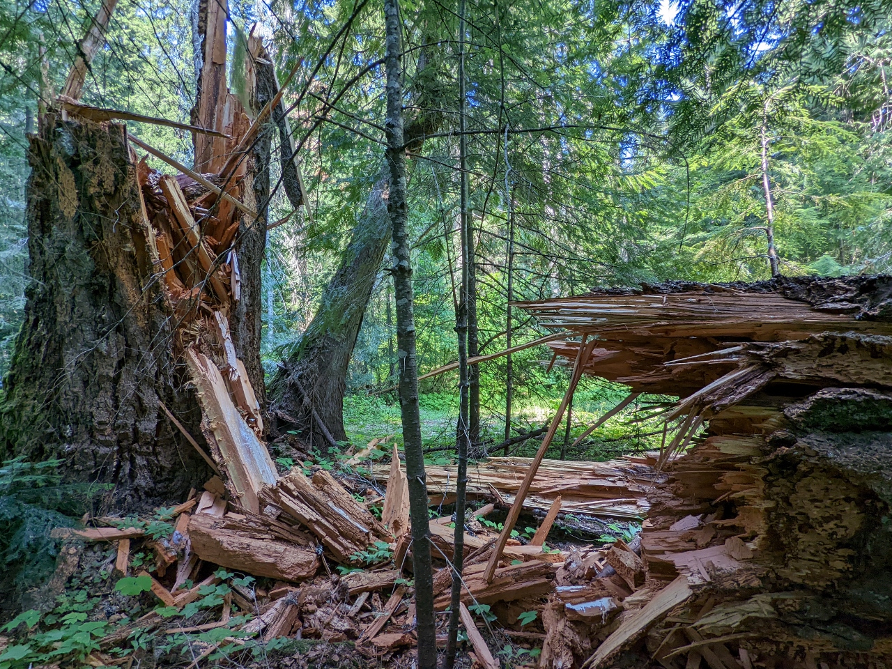 |
Tree Splintered
Position: 47°12.95’N, -121°17.19’W
A large tree that had splintered apart along Forest Road 41 by Cabin Creek.
|
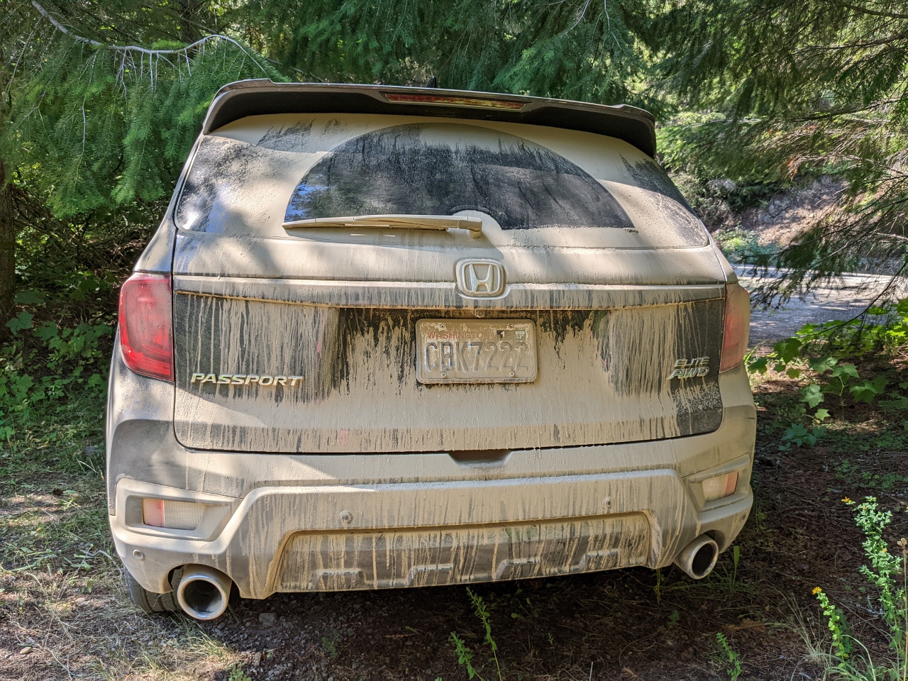 |
Dusty
Position: 47°13.01’N, -121°17.08’W
We eventually found a wonderful single-car spot tucked off Forest Road 41 with a view to Cabin Creek. Our poor car is very dusty after the day’s driving.
|
 |
Lunch
Position: 47°13.00’N, -121°17.07’W
Lunch with a view to Cabin Creek. We normally prefer higher-altitude campsites with a mountain view, but this one along the creek was too beautiful to skip.
|
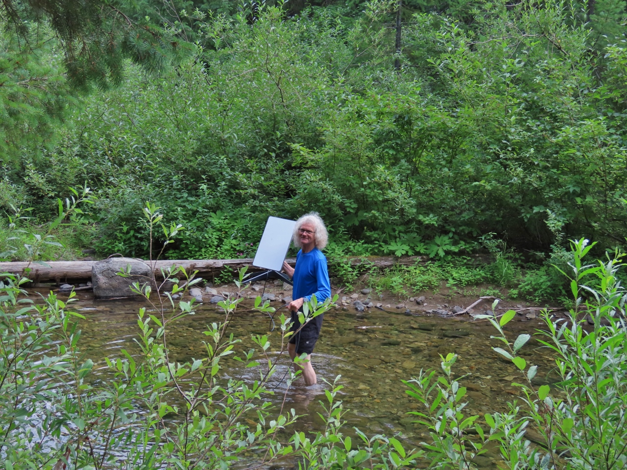 |
Wading
Position: 47°13.00’N, -121°17.07’W
Another advantage of the higher-altitude view campsites is they often lack thick tree cover and we usually have no trouble getting our Starlink satellite dish to hook up. But here in the woods we’ve tried all candidate spots around the truck or on the access road and can’t get the clear view to overhead satellites that Starlink needs. James decided to walk across the creek and try there, and it just barely worked.
|
 |
Connectivity
Position: 47°13.00’N, -121°17.07’W
The Starlink cord trailing away from the WiFi router inside our car across the creek to the satellite dish perched on a log on the other side (click image for a larger view). It’s perhaps a bit odd to have the satellite base station on the other side of the stream, but it got us connected.
|
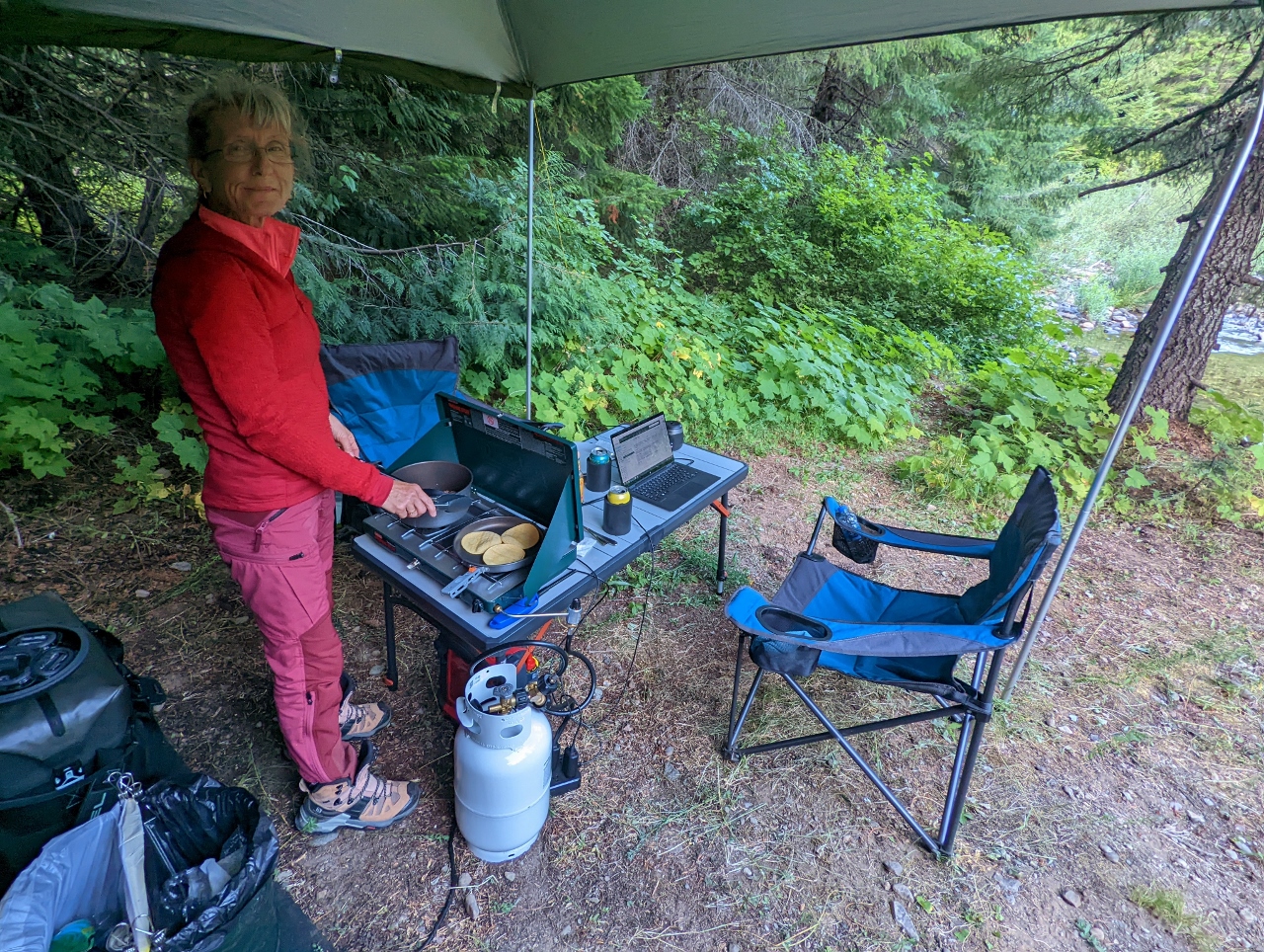 |
Making Dinner
Position: 47°13.00’N, -121°17.07’W
Making dinner at Cabin Creek.
|
 |
Pork Tacos
Position: 47°13.01’N, -121°17.08’W
Delicious pulled pork tacos for dinner, with fresh cilantro, onion and lime, at our lovely spot along Cabin Creek.
|
 |
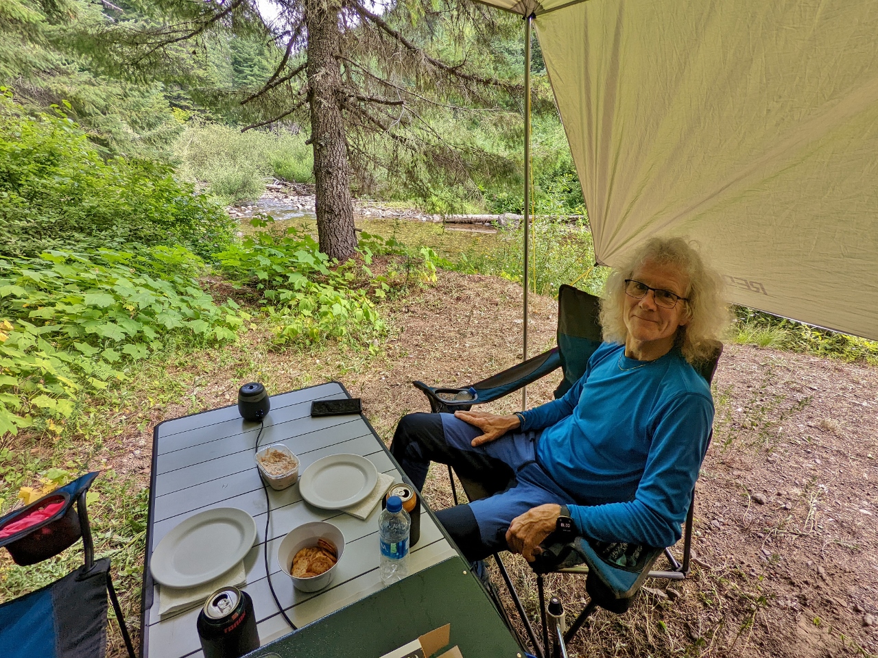
The Office
Position: 47°13.01’N, -121°17.08’W
Getting a little work done in the morning at our outdoor office along Cabin Creek.
|
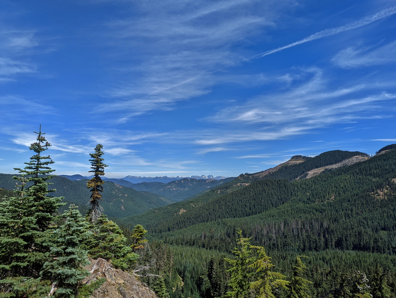 |
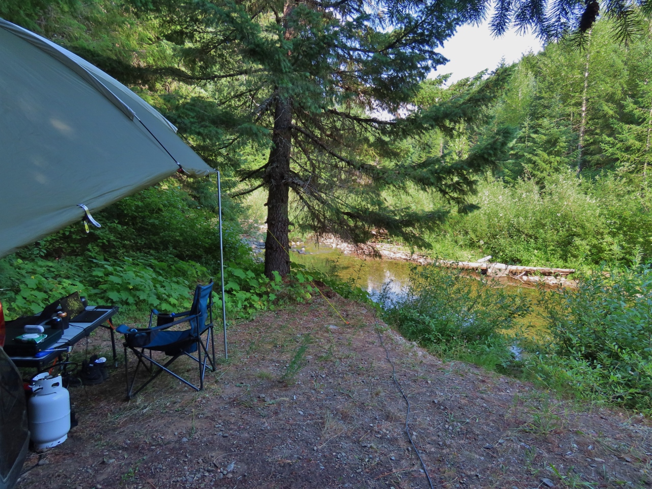
NF 4110-129
Position: 47°9.56’N, -121°15.81’W
Out exploring before returning home, we found this campsite along Forest Road 4110-129 with a great view north to the Cascade Mountains and the distinctive peaks of the Alpine Lakes Wilderness.
|
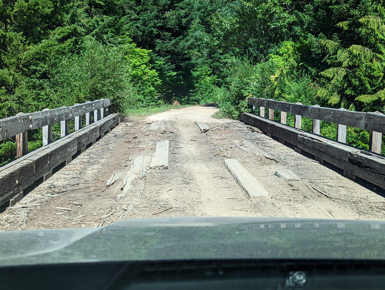 |
Cabin Creek Bridge
Position: 47°13.02’N, -121°16.50’W
The bridge across Cabin Creek is looking pretty tired. Here we are re-crossing after exploring Forest Road 4110.
|
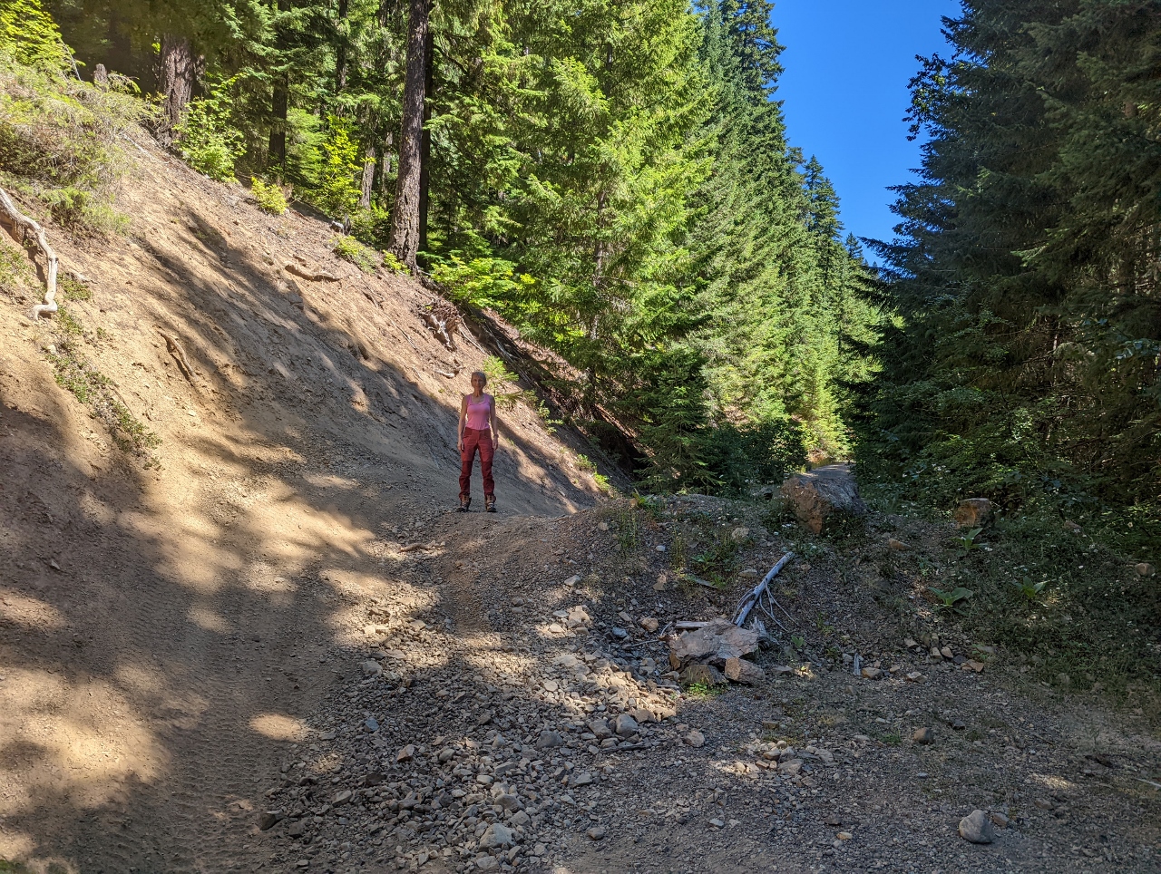 |
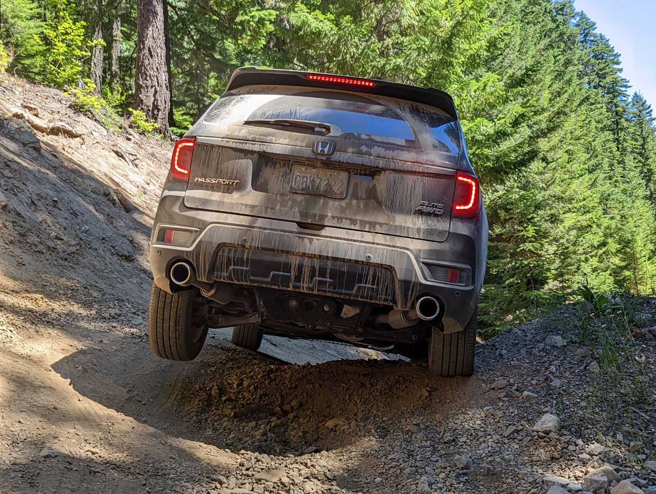
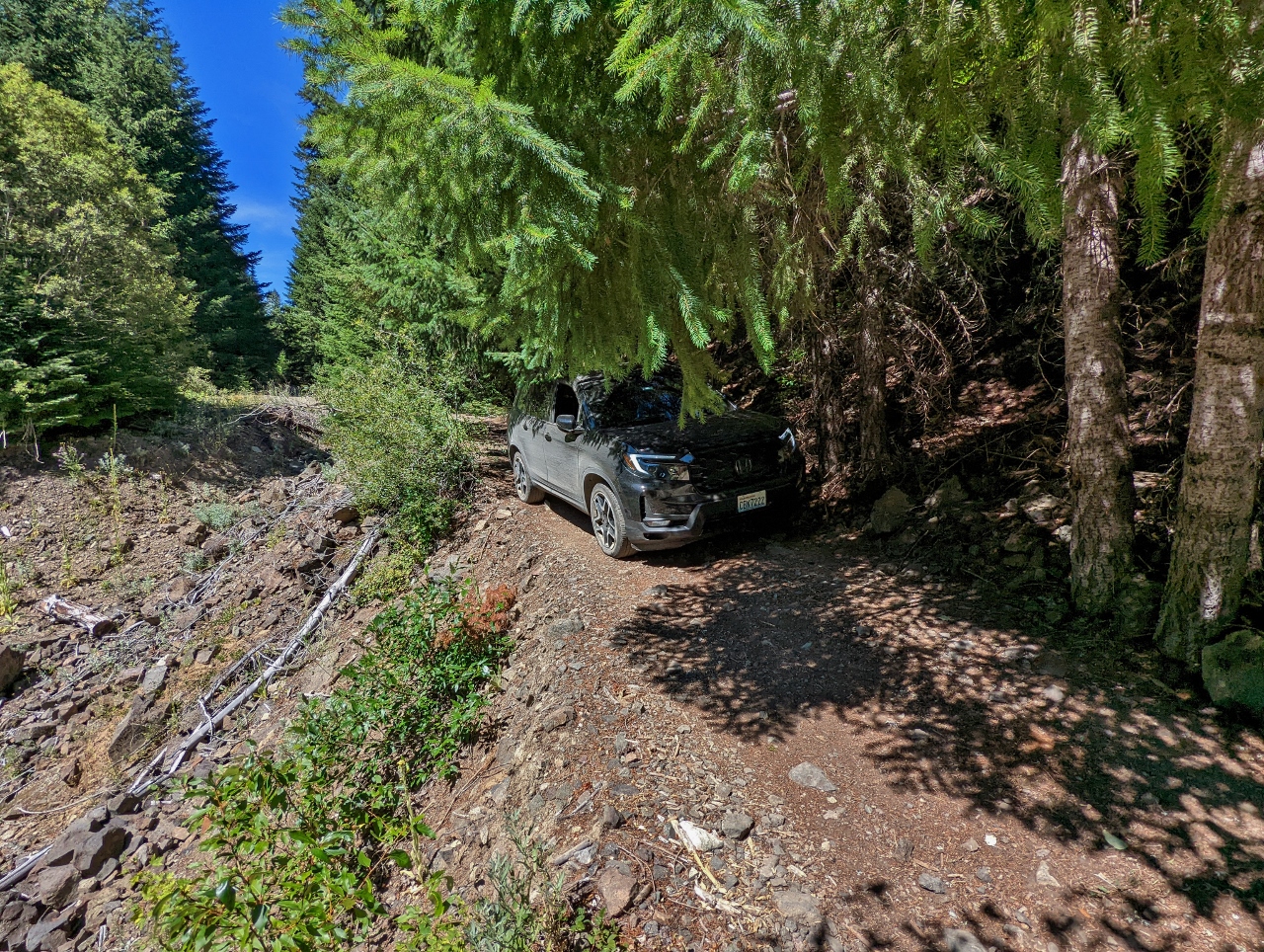
Hill
Position: 47°13.18’N, -121°16.23’W
Our maps indicated we could reach I-90 traveling east along Forest Road 41, but we soon came to this small hill partially blocking the road. Many, many vehicles had crossed before us, so we decided to give it a try with Jennifer out of the car guiding.
|
 |
Ascending
Position: 47°13.18’N, -121°16.23’W
Here we are approaching the midway point of the hill where the big risk is getting top-centered as we crest the hill. We’re about as far over to the passenger side as we can get before that happens.
|
 |
Narrow
Position: 47°13.18’N, -121°16.23’W
We don’t have much room on the driver’s side either with the steeply sloped wall.
|
|
|
Three Wheels
Position: 47°13.18’N, -121°16.22’W
We’re getting pretty close to the limit for our little SUV on this one.
|
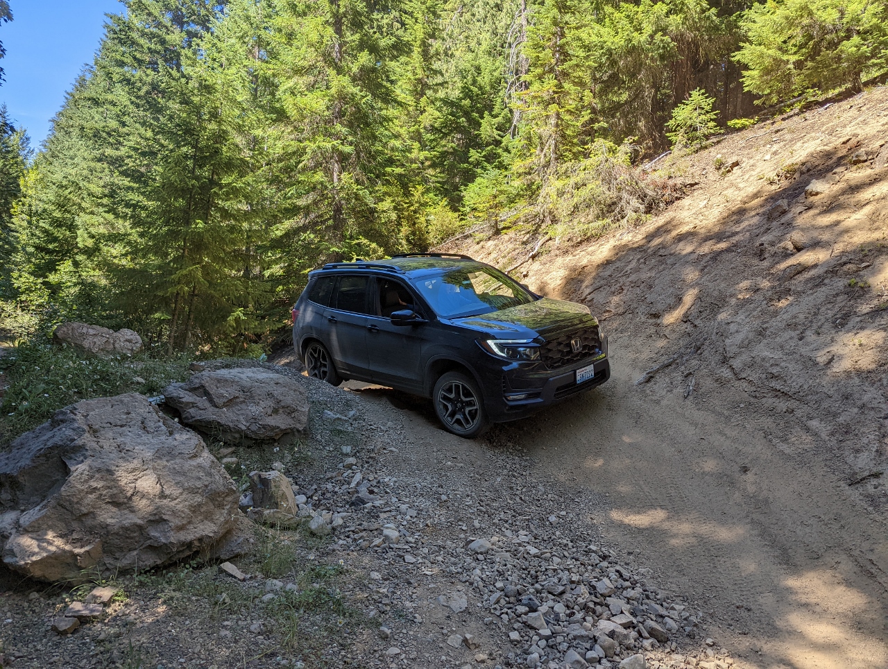 |
Turn
Position: 47°13.18’N, -121°16.22’W
Once over hill, we need to make a sharp turn to the passenger side to avoid contacting the dirt wall with the corner of the front spoiler on the driver’s side.
|
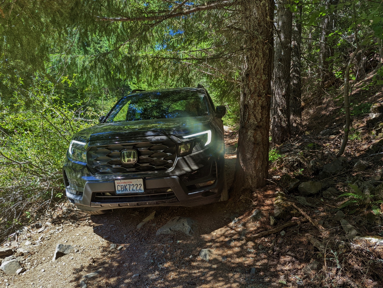 |
Tree
Position: 47°13.16’N, -121°15.87’W
We made it over the hill, but the next challenge was that Forest Road 41 was partially washed out a short distance beyond. We had to go right up against this tree to stay on the road.
|
 |
Washout
Position: 47°13.16’N, -121°15.86’W
View to what is left of Forest Road 41 on the passenger side of the car as we pass the tree. We’re right on the edge.
|
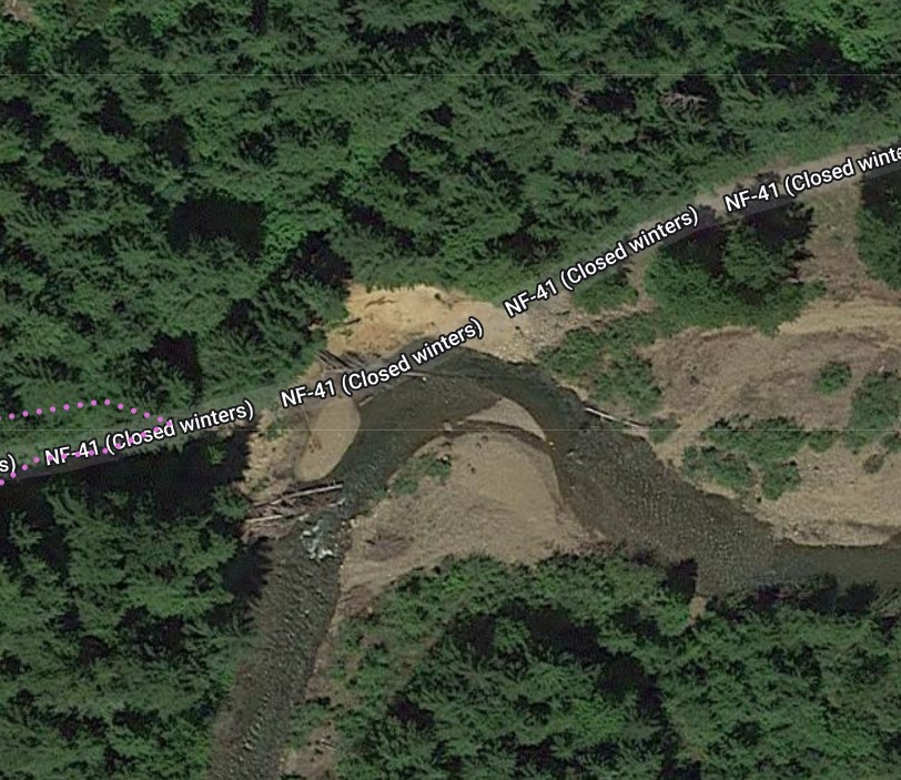 |
End of the Road
Position: 47°13.18’N, -121°15.07’W
After all the work of getting over the hill and past the partial washout, we hit a total washout where the road was completely gone. Some 4x4s had made it up a very steep hill into the woods to the north, but that was definitely beyond the capability of our vehicle. So we reluctantly turned around to face everything we’d just gone through all over again. We were so bummed we forgot to take a picture, but this screenshot from the satellite imagery makes it pretty clear.
|
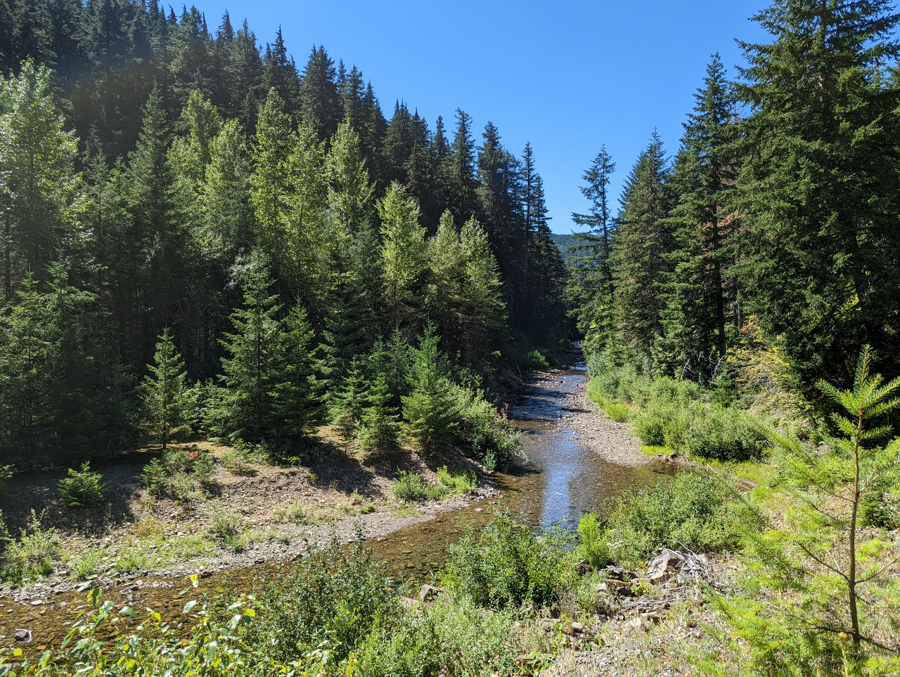 |
Cabin Creek
Position: 47°13.15’N, -121°15.76’W
View to Cabin Creek as we return back out. The water level looks quite low.
|
 |
Checking Clearance
Position: 47°13.18’N, -121°16.23’W
James checking for clearance at the driver’s side as we return back over the hill. With care, we made it back out through both hazards.
|
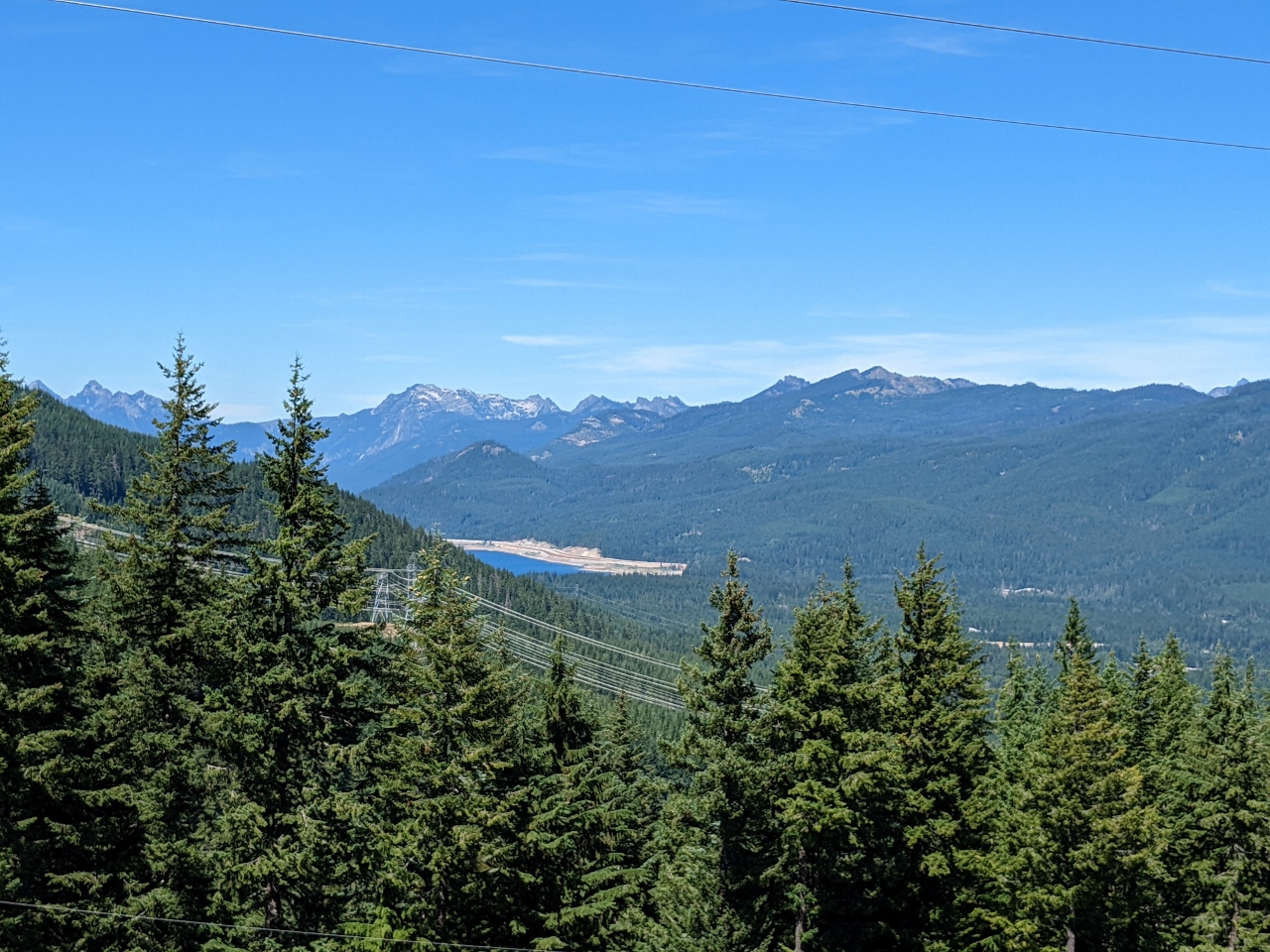 |
Keechelus Lake
Position: 47°16.49’N, -121°19.36’W
View to Keechelus Lake and the Cascade Mountains beyond as we descend on Forest Road 41 towards I-90. We’re about to cross over the Stampede Pass railway tunnel that trains enter after ascending the Borup Loop.
|
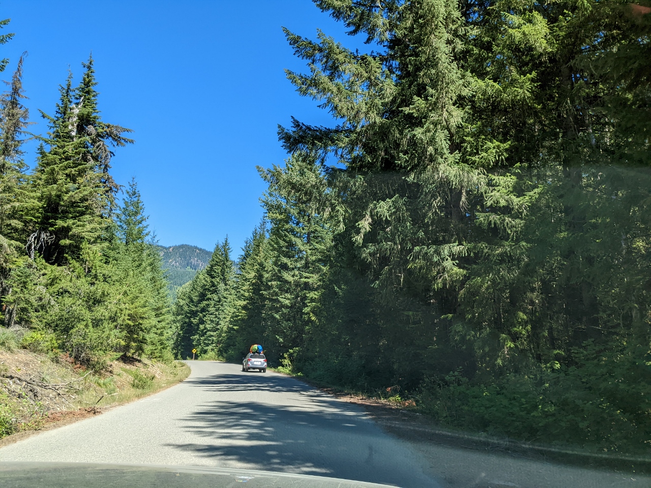 |
Paved Road
Position: 47°18.27’N, -121°19.10’W
After the challenge of getting over the hill and through the road washout, and back again, we enjoyed being back on a paved road.
|
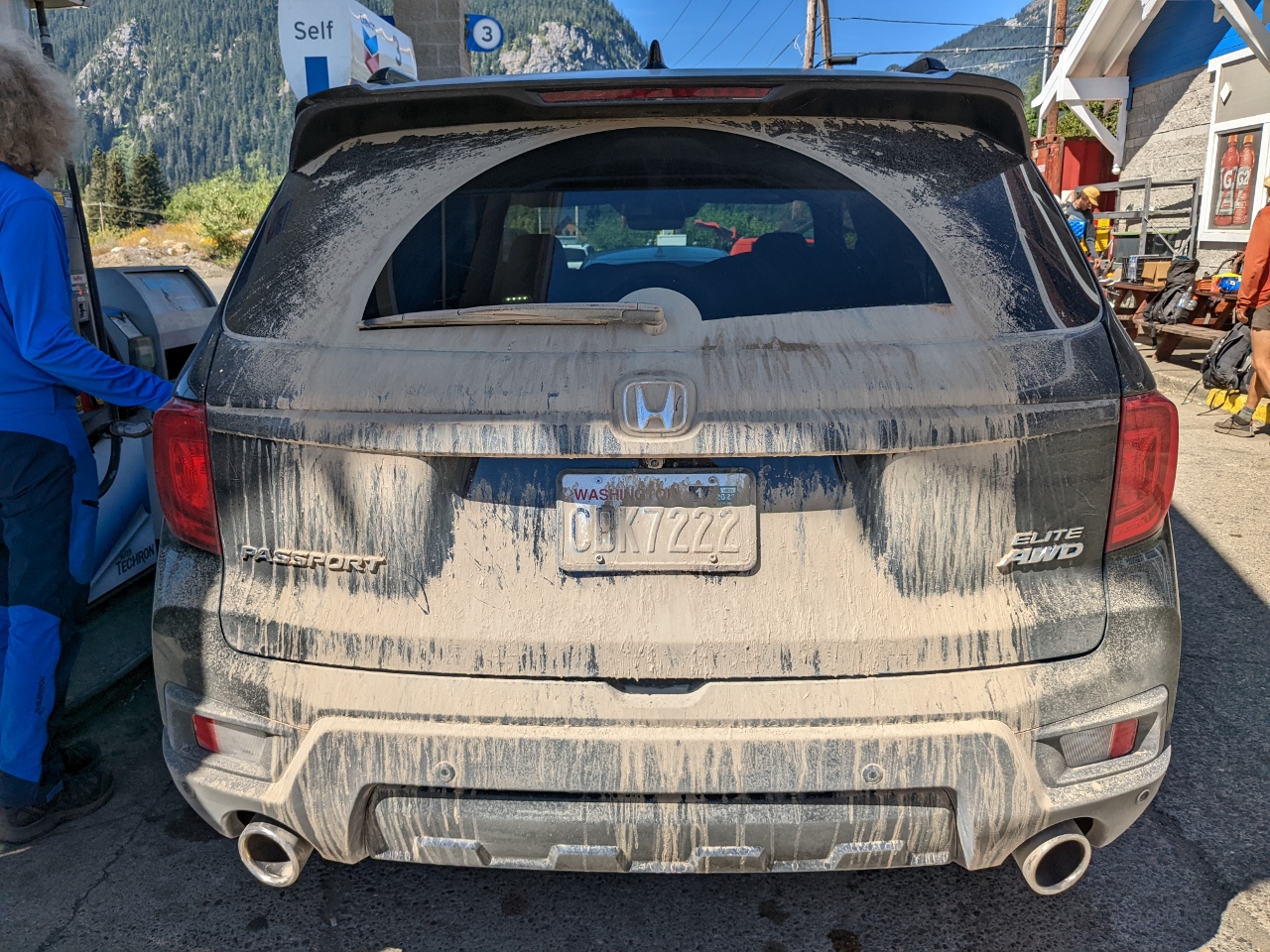 |
Dust
Position: 47°25.38’N, -121°24.74’W
A view to the rear of our incredibly dusty car as we stop for gas in Snoqualmie Pass. The last time we stopped here for fuel was in the winter, when a huge pile of snow slid off the roof right where we’d just driven.
|
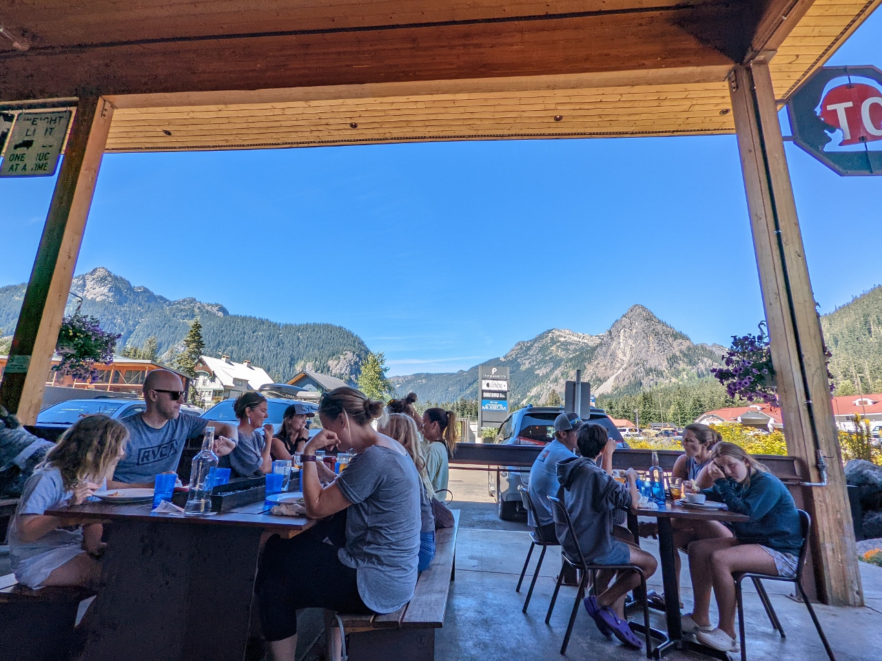 |
The Commonwealth
Position: 47°25.28’N, -121°24.73’W
Another great lunch at The Commonwealth at Snoqualmie Pass.
|
 |
Hydroplane
Position: 47°25.77’N, -121°25.35’W
One of several small hydroplanes being towed west along I-90 as we return home from the Commonwealth.
|
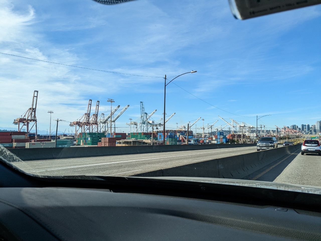 |
Port of Seattle
Position: 47°34.44’N, -122°20.37’W
Passing the Port of Seattle as we arrive into the city from the south after picking up Spitfire at Cat Sitting Hotels in West Seattle.
|
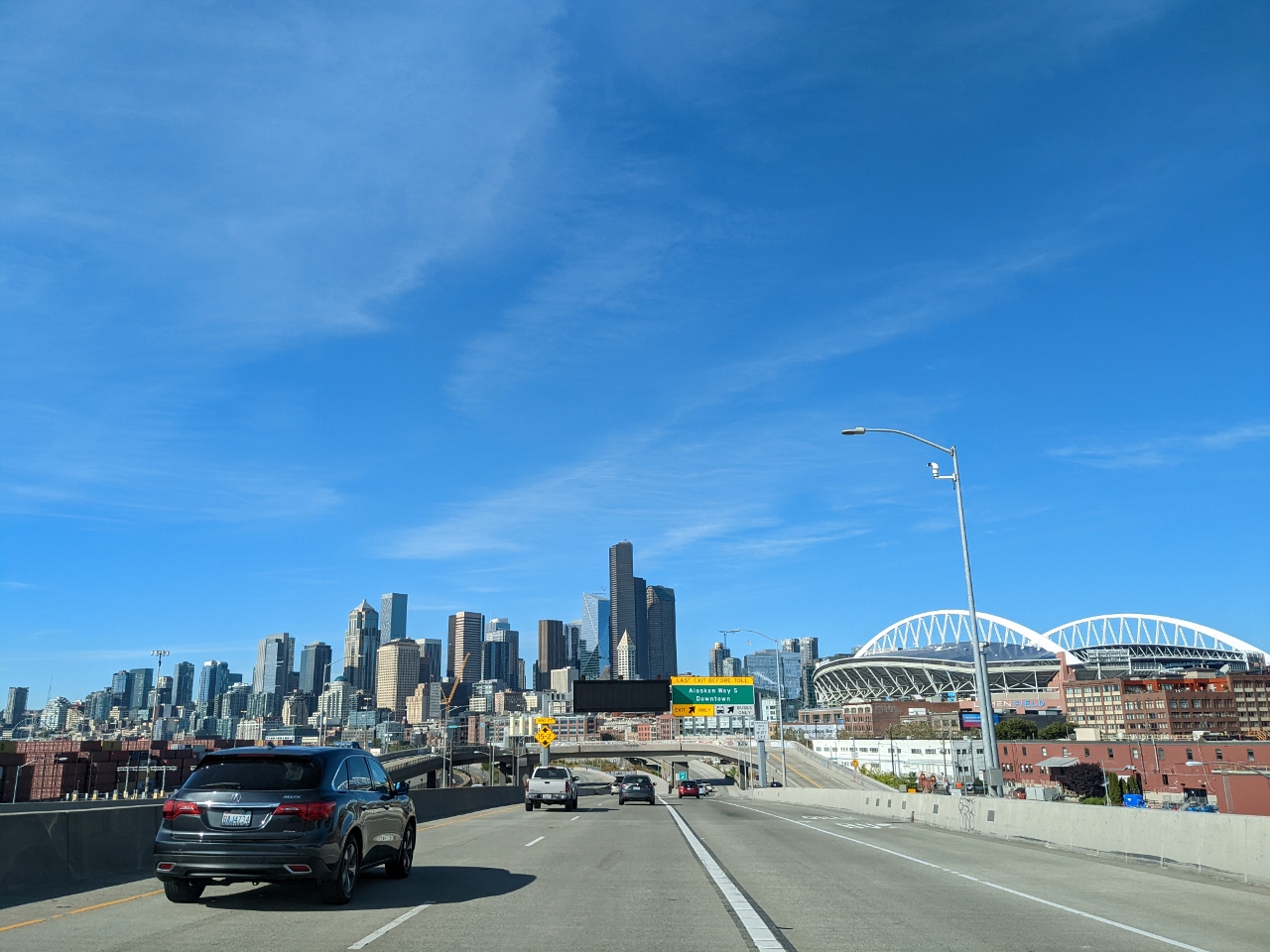 |
Seattle Skyline
Position: 47°35.43’N, -122°20.22’W
The striking Seattle skyline with Lumen Field, home of the Seattle Seahawks, at right.
|
 |
Click the travel log icon on the left to see these locations on a map. And a map of our most recent log entries always is available at mvdirona.com/maps. |
If your comment doesn't show up right away, send us email and we'll dredge it out of the spam filter.