
In September, we went on our longest wilderness camping trip to date, of three nights over the Labor Day weekend. Since we had a more time than usual, we ranged a little farther near Mt. Rainier. We started out at Elbe Hills State Forest, one of two state forests in the area. Unfortunately the State Forest seems to be discouraging wilderness camping in a big way, with gates, large ditches and other obstructions preventing access to every possible campsite we’d pre-scouted online. So we gave up on the state forests and decided to head farther south into Gifford Pinchot National Forest.
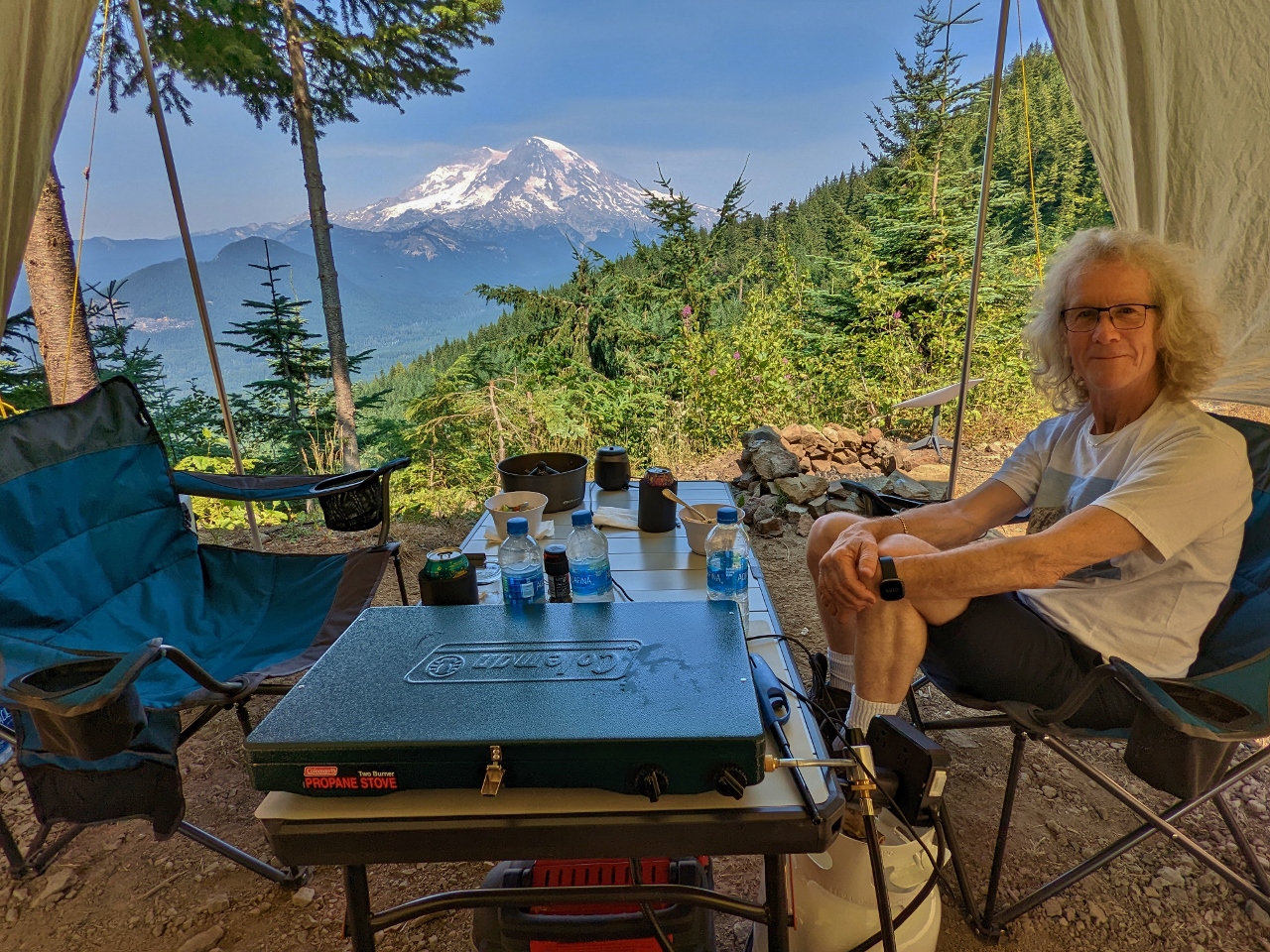
We initially weren’t having much luck there either. But after three hours of driving and exploring, we finally found a wonderfully private campsite with a spectacular view to Mt. Rainier, pictured above. We spent the first of three nights there, exploring the area on foot and enjoying that fabulous view to “The Mountain”. We continue to keep finding “the best spot ever”, and this one will be hard to top.
Below are highlights from September 2, 2022. Click any image for a larger view, or click the position to view the location on a map. And a map with our most recent log entries always is available at mvdirona.com/maps.
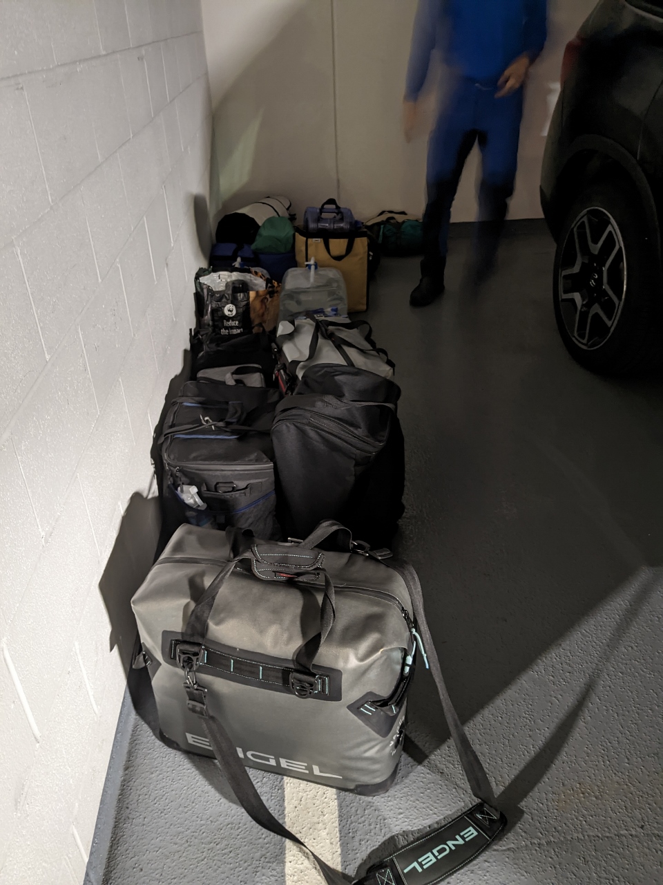 |
Loading Truck
Position: 47°37.07’N, -122°20.59’W
Loading up our truck with gear for a three-night camping trip on Labor Day Weekend. We bring down an Engel cooler and two LL Bean duffels from the apartment, and keep the rest of our camping gear stowed in a storage locker next to our parking spot.
|
 |
Elbe Hills
Position: 46°49.70’N, -122°11.62’W
Since we have a three-night trip, we’re going to explore farther south than usual. Here we are looking for campsites in Elbe Hills State Forest, one of two state forests in the area directly west of Mt. Rainier.
|
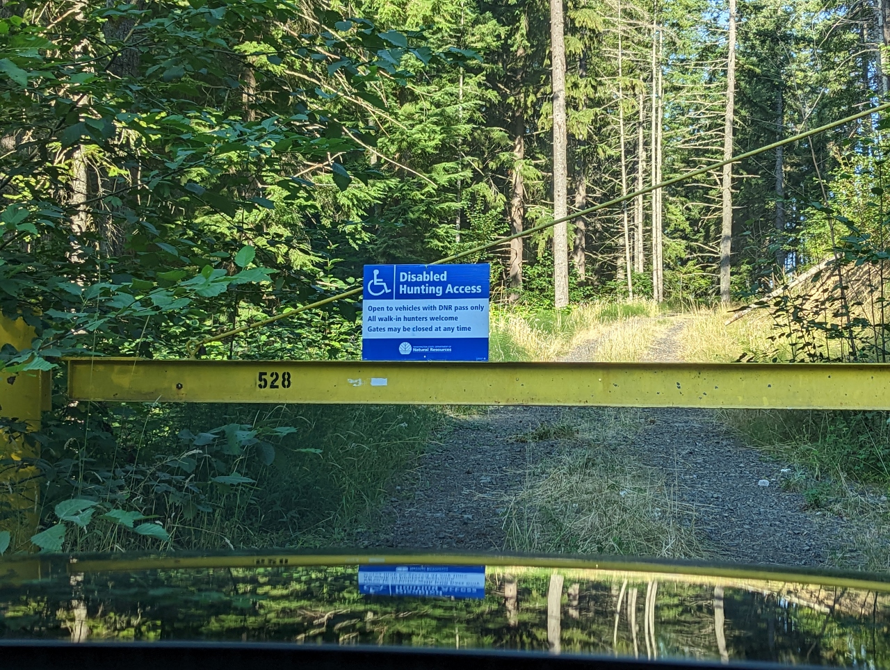 |
Gate
Position: 46°49.58’N, -122°11.23’W
Most of the potential campsites we’d pre-scouted online were behind locked gates or road obstructions.
|
 |
Turner Scott Rd
Position: 46°47.69’N, -122°8.44’W
A fabulous view to The Mountain from Turner Scott Rd in Elbe Hills State Forest. Unfortunately large ditches have been cut into the roads leading to several possible campsites in the area. The State Forest seems to be discouraging wilderness camping in a big way.
|
 |
Eatonville National Road
Position: 46°47.22’N, -122°7.84’W
Attractive woods on either side of Eatonville National Road in Elbe Hills State Forest.
|
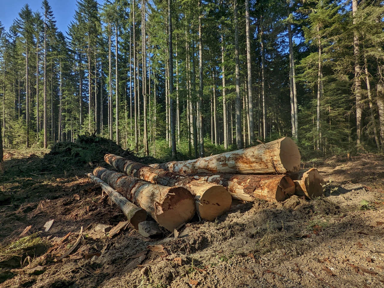 |
Logging
Position: 46°47.10’N, -122°6.95’W
Freshly cut trees from current logging in Elbe Hills State Forest.
|
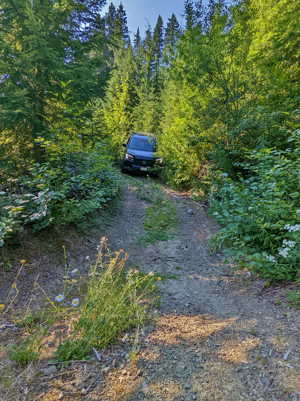 |
NF 8412
Position: 46°42.65’N, -121°55.76’W
We gave up on the state forests and decided to head farther south into Gifford Pinchot National Forest. Here we are returning back along Forest Road 8412. We explored as far as we could looking for a campsite, but the road was too overgrown to reach a couple of potential spots we’d pre-scouted online.
|
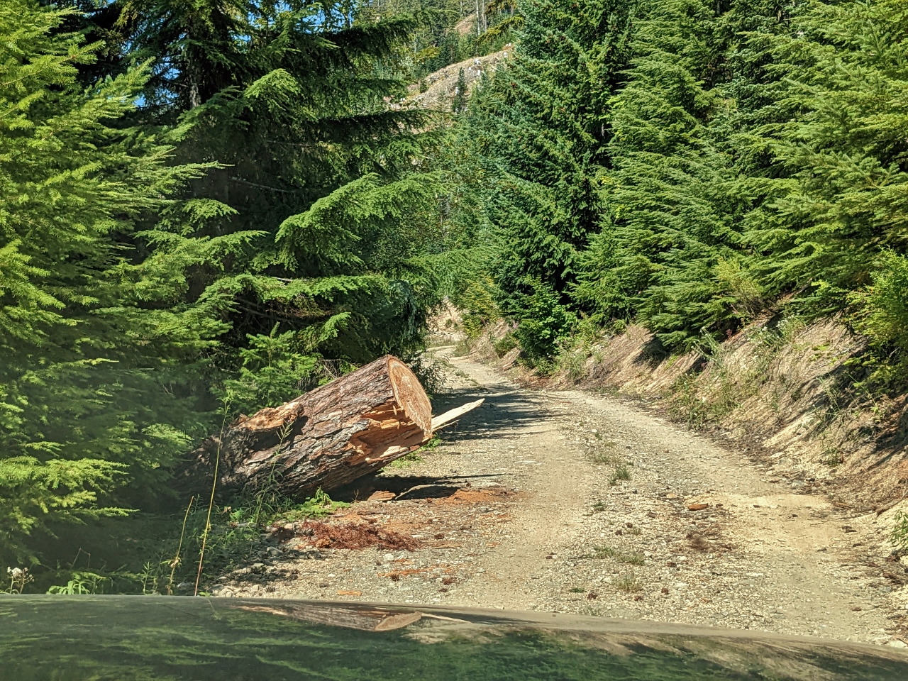 |
Fallen Tree
Position: 46°42.50’N, -121°56.22’W
A recently-fallen large tree along Forest Road 8410. We carry a couple of small handsaws to cut debris away from the road if we become blocked, but clearing a tree this size would require a chainsaw and that’s more than we bring along with us.
|
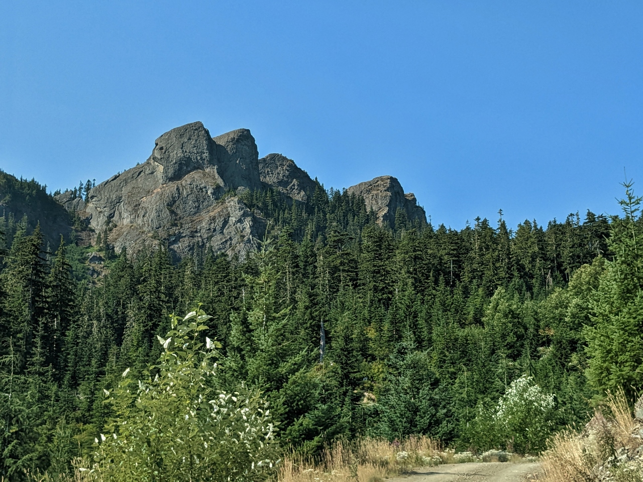 |
Outcropping
Position: 46°42.51’N, -121°56.43’W
5,000-ft (1,500 m) rock outcroppings, viewed as we head west along Forest Road 8410.
|
 |
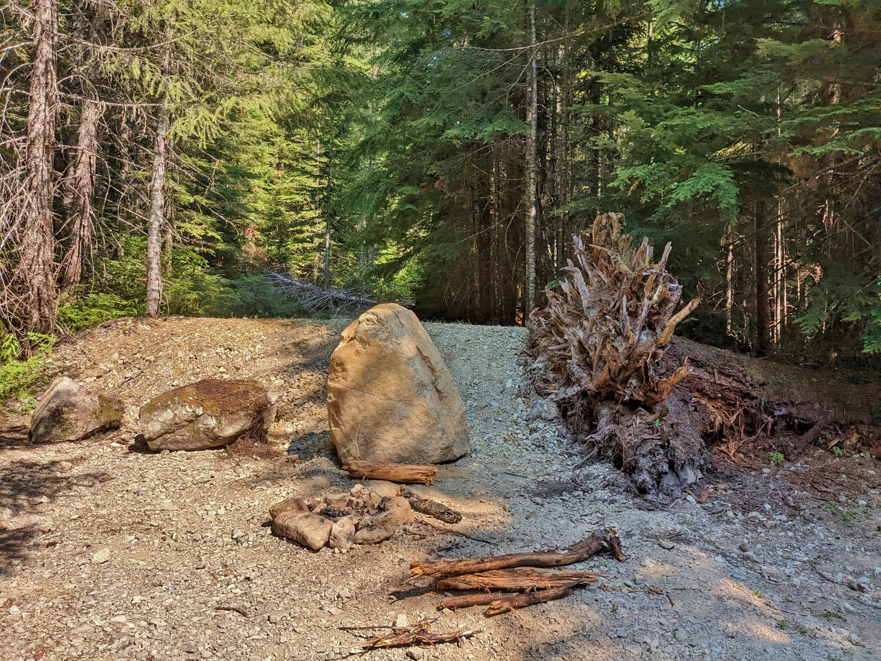
Potential Camp
Position: 46°42.84’N, -121°57.68’W
A potential camp along Forest Road 8410, with a partial view to Mt Rainier through the trees if you are standing up. It didn’t appeal to us enough, so we continued a short distance to the end of the road. There was a campsite there, but trees blocked any view.
|
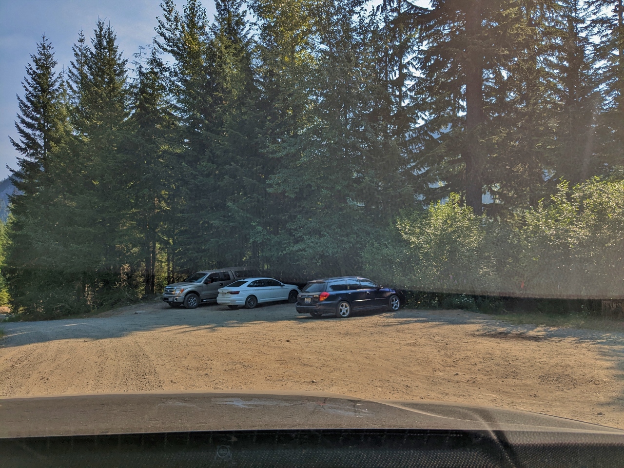 |
Trailhead
Position: 46°42.30’N, -121°55.91’W
A few cars parked at the Teeley Creek trailhead as we return back out along Forest Road 8410. Although camping near a trailhead is convenient for hiking, we don’t like the increased car traffic this brings.
|
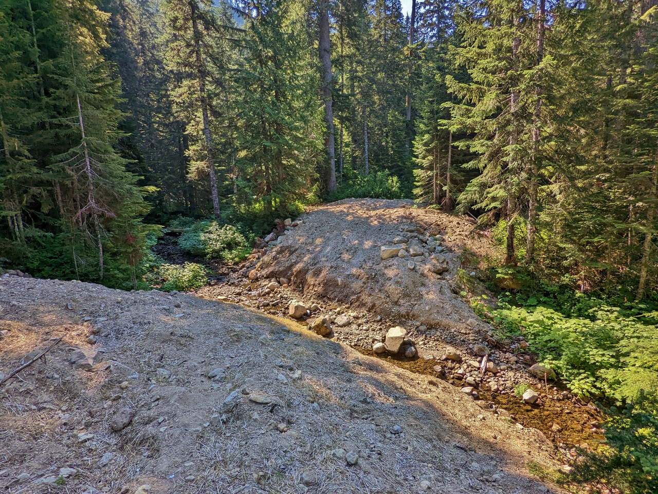 |
Mesatchee Creek
Position: 46°41.86’N, -121°53.92’W
Large berms on either side of Mesatchee Creek prevent any further progress along Forest Road 8415.
|
 |
NF 8514
Position: 46°42.84’N, -121°53.41’W
A nice view to Mt. Rainier as we return along NF 8514. And a campsite is just off the road on the left, but trees block the view.
|
 |
Cora Lake Road
Position: 46°41.77’N, -121°53.21’W
On the satellite imagery we could see what looked like an excellent view campsite at the end of Cora Lake Road, but the way was blocked for vehicle access. Someone had camped just this side of the blockage, but there wasn’t any view. We don’t absolutely have to have a view, but most of the reason we’re out camping is to enjoy natural beauty, so we’re fairly picky about where we stop for the night.
|
 |
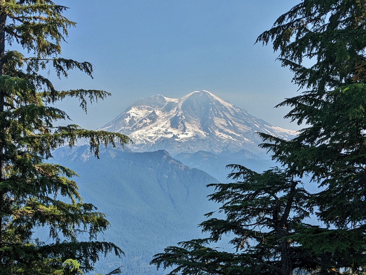
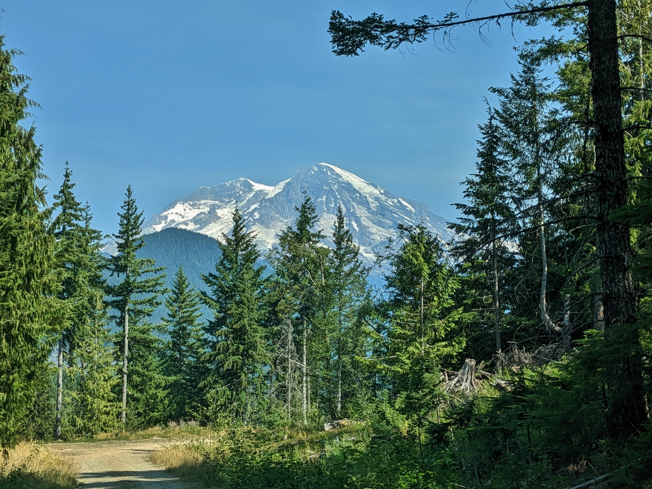
The View
Position: 46°41.71’N, -121°52.52’W
After three hours of driving and exploring, we finally found a wonderfully private campsite along Forest Road 8430 with a spectacular view to Mt. Rainier (14,417 ft; 4,394 m).
|
 |
Dusty
Position: 46°41.71’N, -121°52.52’W
Our little SUV is very dirty from all that driving on the dusty roads. But we aren’t bothered. We carry a bottle of cleaner with some rags, and can clean it up pretty quickly before setting up camp.
|
 |
Campsite
Position: 46°41.70’N, -121°52.52’W
Our spectacular campsite with its clear view to Mt. Rainier.
|
 |
Fattoush Salad
Position: 46°41.71’N, -121°52.52’W
Mixing a Fattoush Salad for lunch at camp. We prepared all the ingredients at home and just do the final stages at camp.
|
 |
Lunch
Position: 46°41.71’N, -121°52.52’W
Lunch with that amazing view to Mt. Rainier.
|
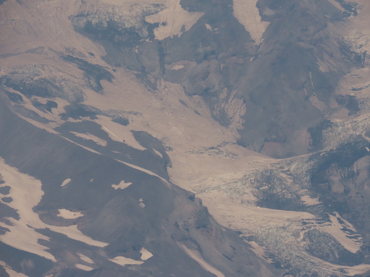 |
Van Trump Glacier
Position: 46°41.71’N, -121°52.52’W
Van Trump Glacier along the southern flank of Mt. Rainier is actually a collection of several glaciers. We also viewed the group on our recent hike to Mildred Point in Mt Rainier National Park.
|
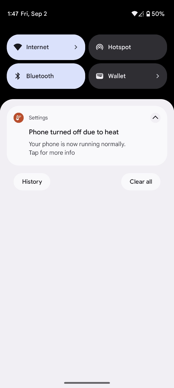 |
Hot
Position: 46°41.71’N, -121°52.52’W
The temperature is so high today, even up in the mountains, that our phones go into thermal shutdown if left out in the sun.
|
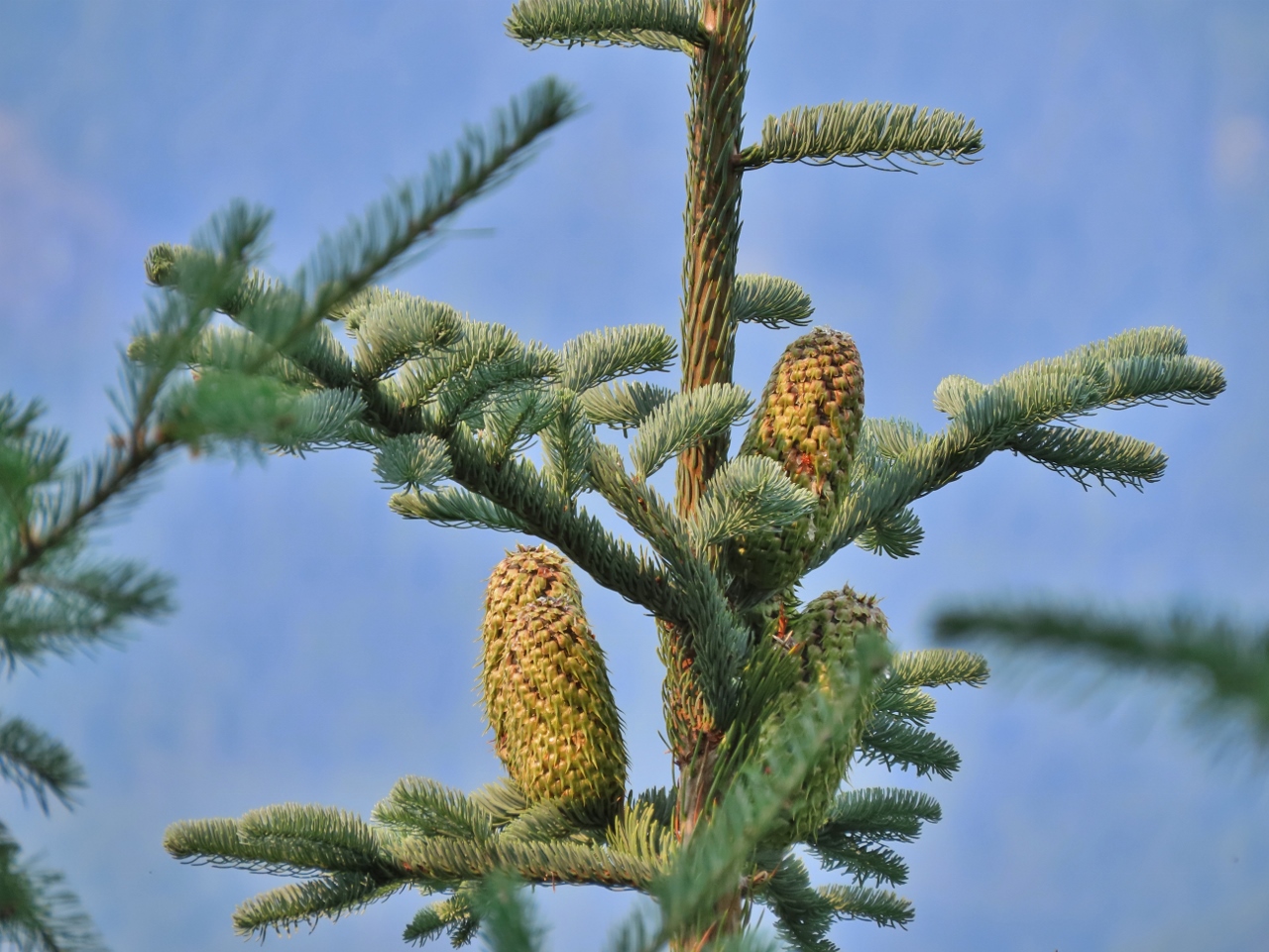 |
Noble Fir Cones
Position: 46°41.71’N, -121°52.52’W
Several large noble fir trees are growing near our campsite. The trees can grow up to 200 feet (60 m) high, and their distinctive cones are quite large at 4-7 inches (10-18 cm) long.
|
 |
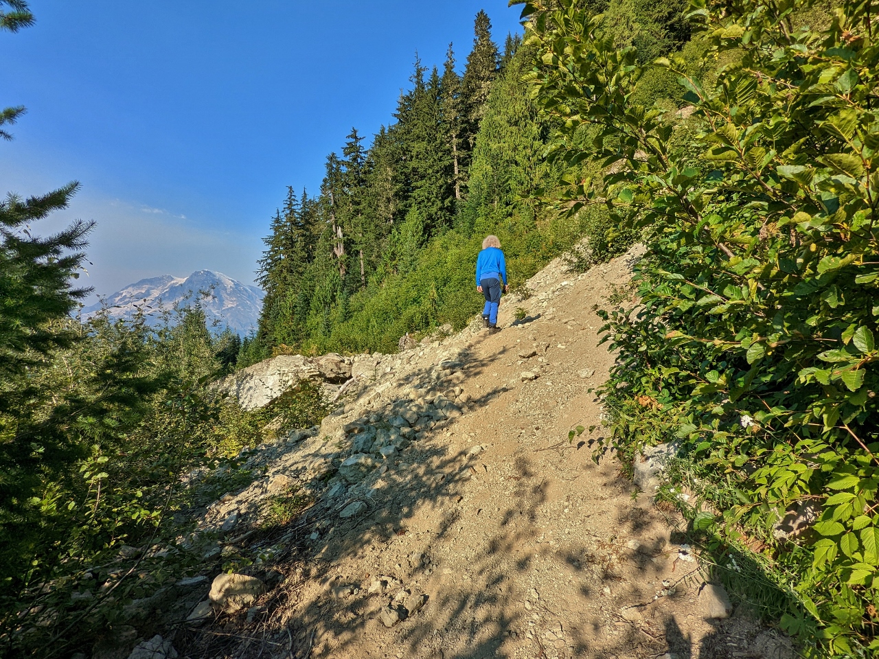
Afternoon Walk
Position: 46°41.42’N, -121°52.75’W
Looking back to Mt. Rainier on a short afternoon walk along Forest Road 8430.
|
 |
Rockslide
Position: 46°41.41’N, -121°52.76’W
A big rockslide across Forest Road 8430. Some 4x4s have crossed it, but the terrain is much to difficult for our little SUV. The road also is quite overgrown even before reaching the slide.
|
 |
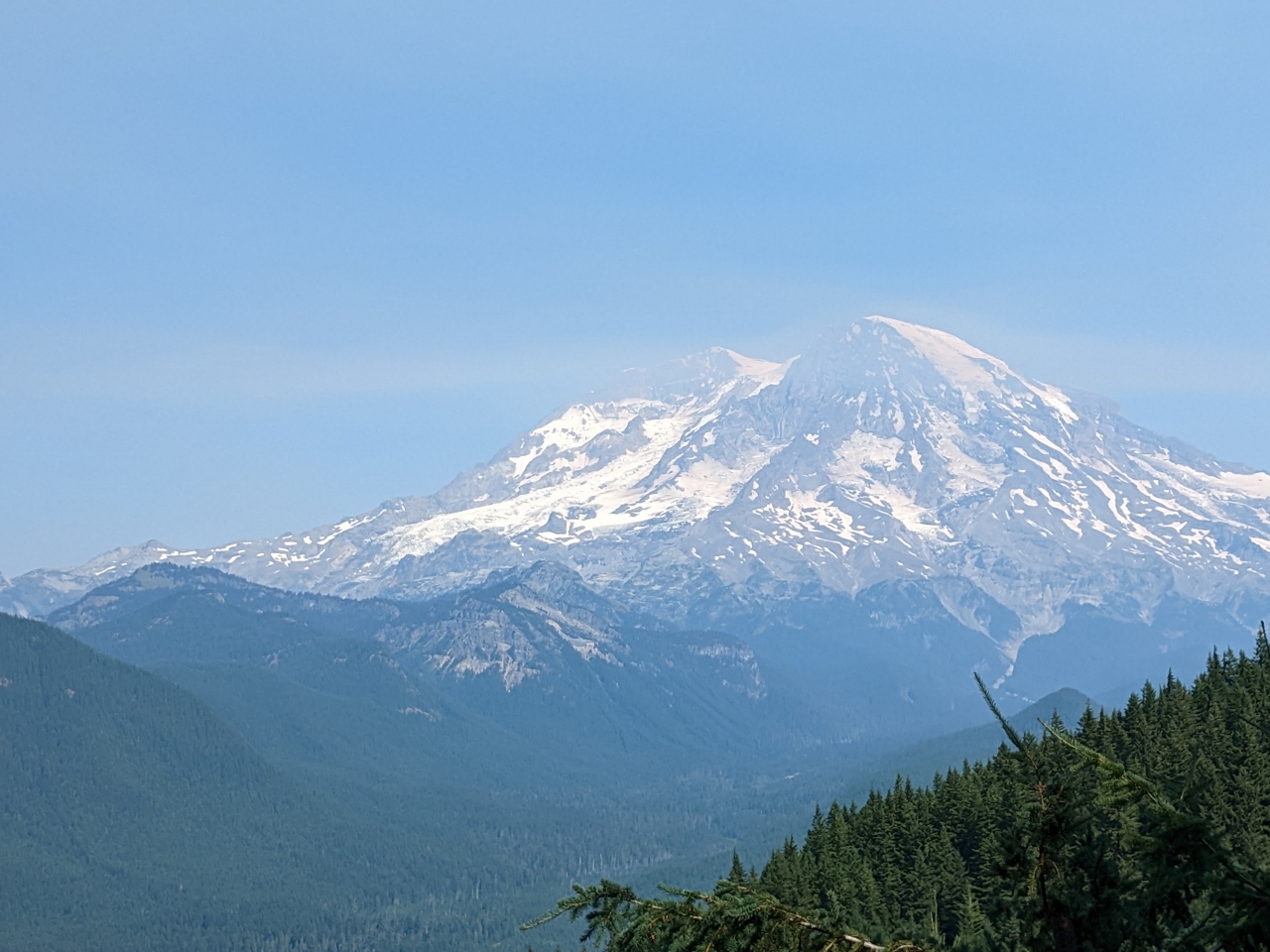
Tahoma Glacier
Position: 46°41.71’N, -121°52.52’W
Tahoma Glacier flowing west from the summit of Mt. Rainer, with St. Andrews Rock (10,992 ft; 3,550m) on the left.
|
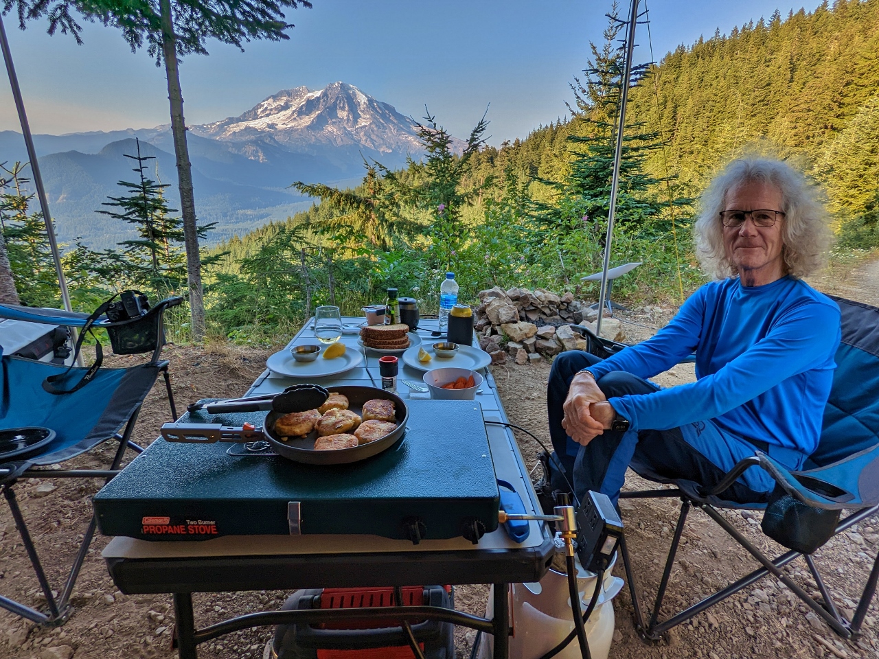 |
Crab Cakes
Position: 46°41.71’N, -121°52.52’W
Making crab cakes for dinner. It would be hard to find a galley with a better view.
|
 |
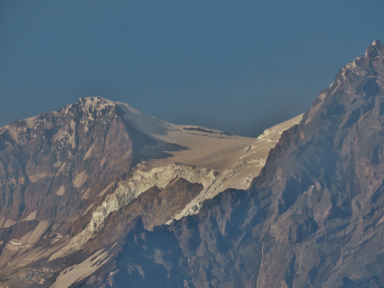
Camp Muir
Position: 46°41.71’N, -121°52.52’W
While eating dinner, we realized we could actually just barely see Camp Muir from our campsite. It’s at the top of the snowfield on the right (clock image for a larger view).
At elevation 10,187 feet (3,104 m), Camp Muir is the highest you can go in Mt. Rainier National Park without a permit and is used as a staging point for climbers attempting the summit of Mt. Rainier via the Gibraltar Route on the mountain’s southern face. The camp is named after naturalist John Muir, who in 1888 was part of the group that made the sixth recorded ascent of the mountain. |
 |
Sunset
Position: 46°41.71’N, -121°52.52’W
Mt. Rainier lit pink in the setting sun.
|
|
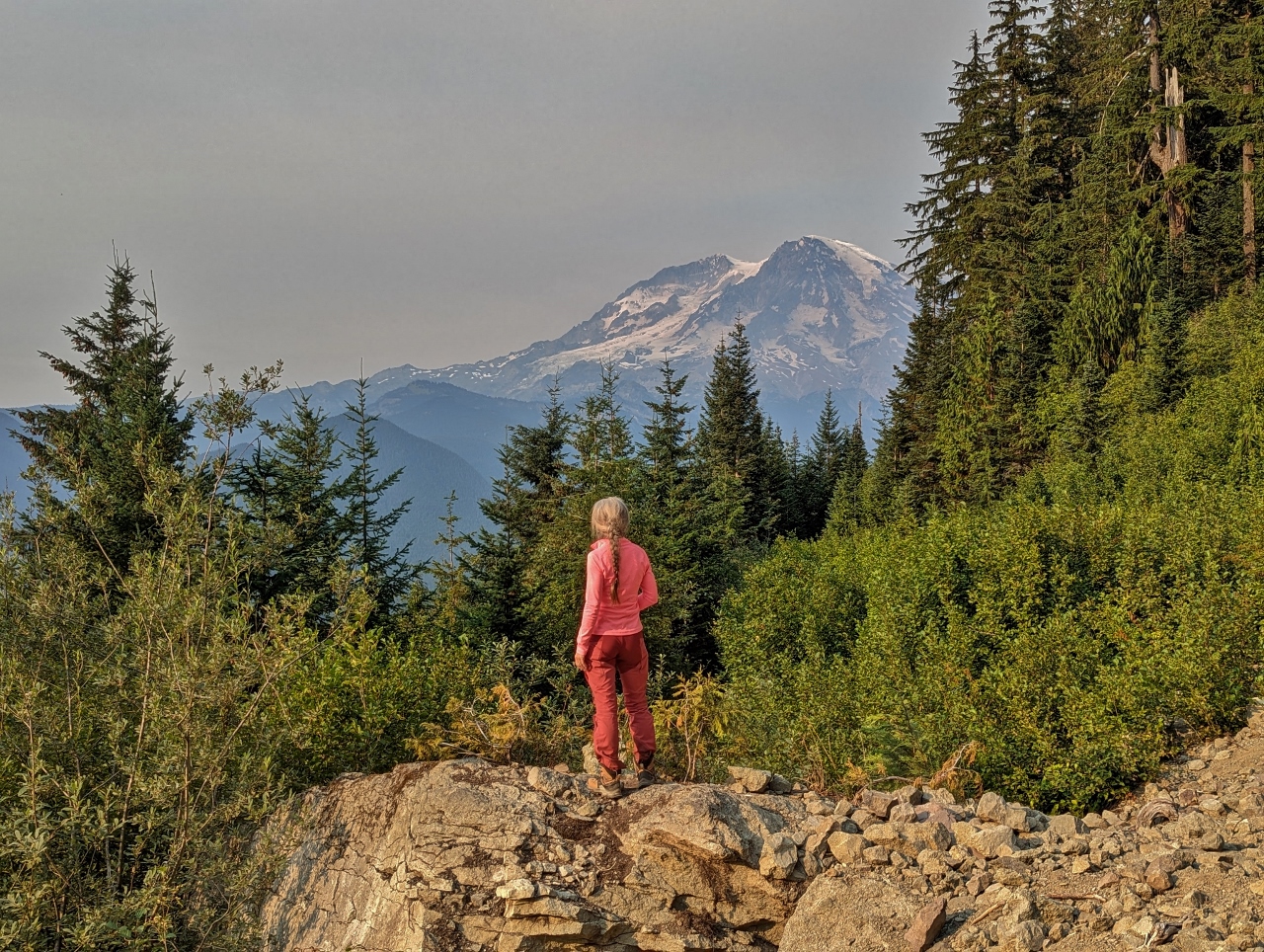
|
Evening
Position: 46°41.69’N, -121°52.53’W
Enjoying the final views to Mt. Rainier as the sun sets. We continue to keep finding “the best spot ever”, and this one will be hard to top.
|
 |
Click the travel log icon on the left to see these locations on a map. And a map of our most recent log entries always is available at mvdirona.com/maps. |
Great post! I loved reading about the Fattoush Salad and those crab cakes. Pretty spectacular views as well. Thank you for all the great info.
Thanks for the feedback.