MV Dirona travel digest for Spring 2022

|
Click the travel log icon on the left to see these locations on a map,
with the complete log of our cruise. On the map page, clicking on a camera or text icon will display a picture and/or log entry for that location, and clicking on the smaller icons along the route will display latitude, longitude and other navigation data for that location. And a live map of our current route and most recent log entries always is available at //mvdirona.com/maps/LocationCurrent.html. |
 |
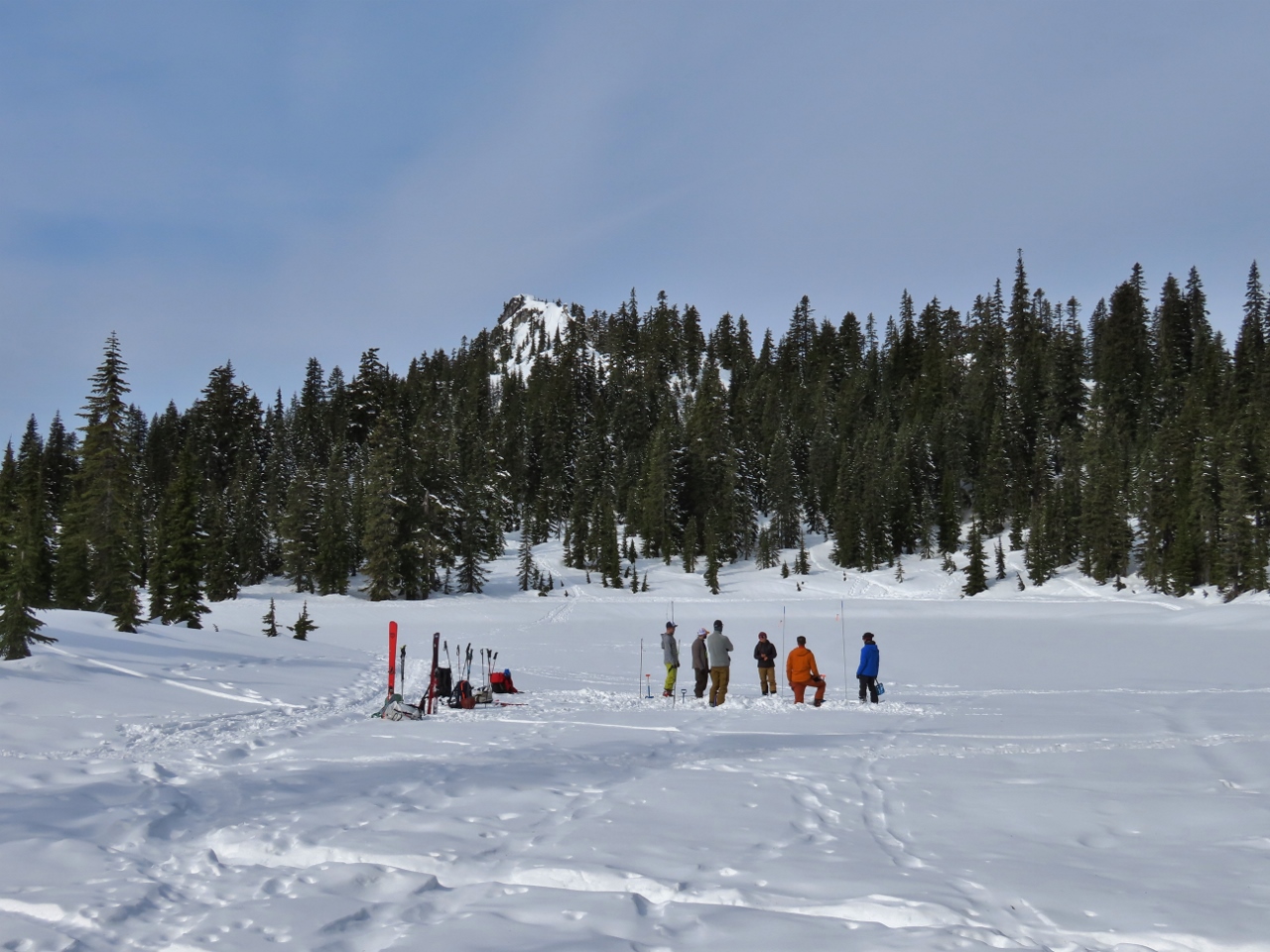
3/3/2022: Spitfire
Position: 47°37.00'N, -122°20.58'W
Spitfire decided James needed another 13 pounds to lift.
|
 |
3/3/2022: Sesame Asian Slaw
Position: 47°37.00'N, -122°20.58'W
The ingredients for a delicious Sesame Asian Slaw for lunch. Slaw, as it turns out, is a distinct dish from coleslaw. The latter derives from the Dutch word koolsla ("cabbage salad"), a combination of the words kool ("cabbage") and sla ("salad"). Slaw, on the other hand might include cabbage, but doesn't need to. And coleslaw, at least in the US, typically has a mayonnaise-based dressing, whereas slaw often has a vinaigrette-style dressing.
|
 |
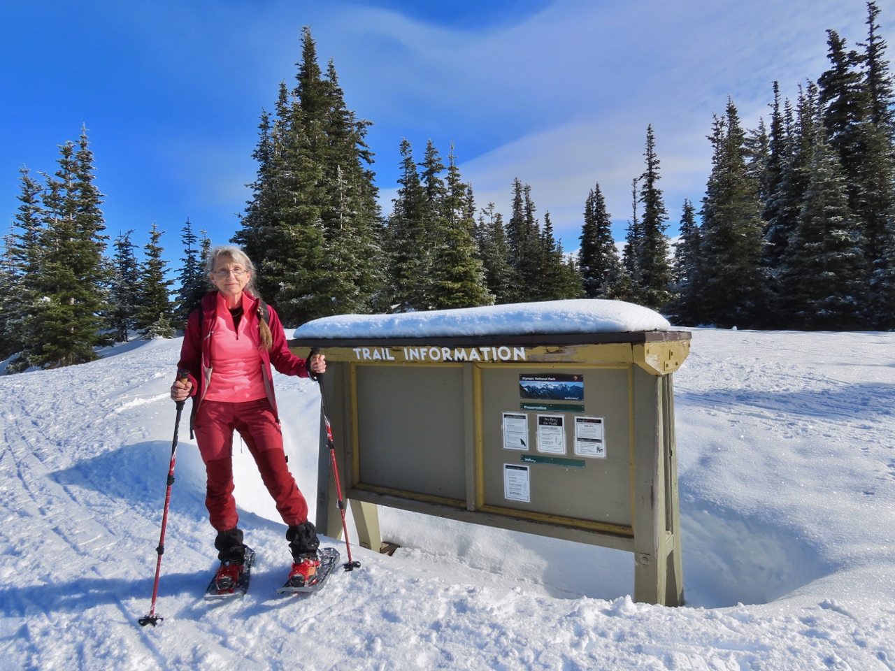
3/3/2022: License Plates
Position: 47°34.75'N, -122°9.78'W
Jason Kim, our salesperson at Honda of Bellevue, installing the new license plates on our Honda Passport.
|
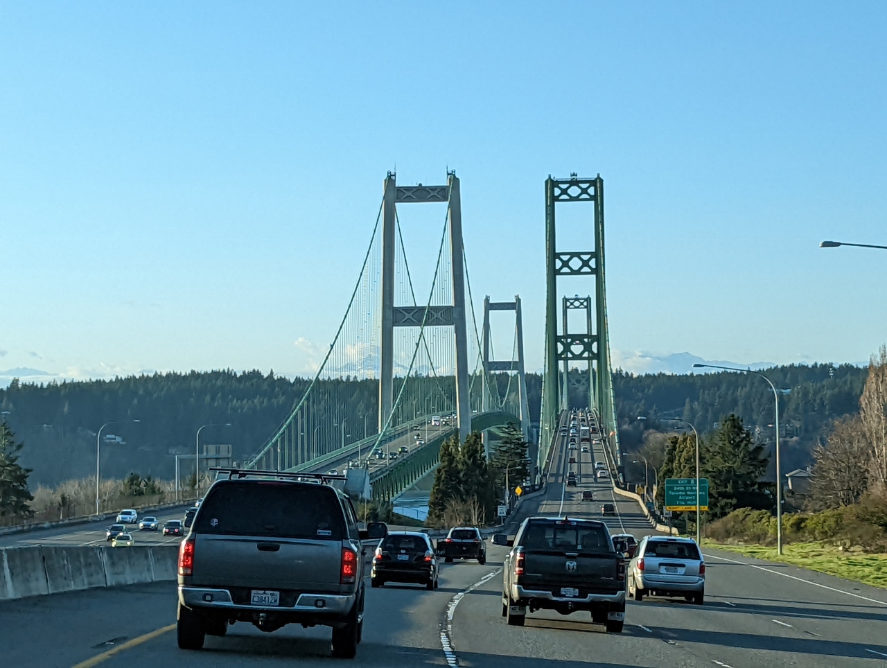 |
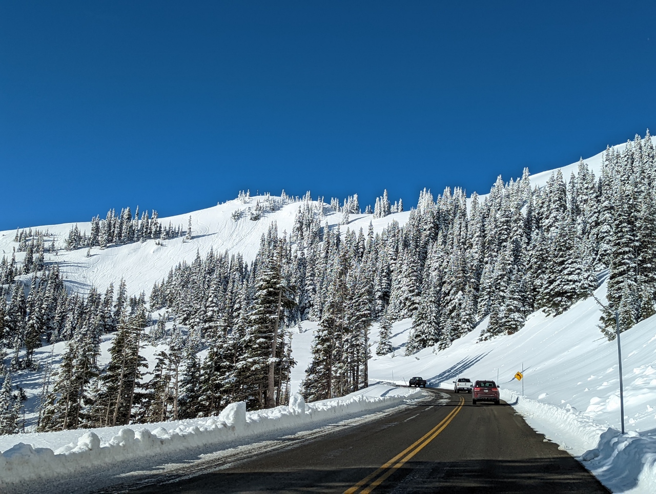
3/4/2022: Rush Hour
Position: 47°15.53'N, -122°31.93'W
Heading over the Tacoma Narrows bridge on a Friday at rush hour for a weekend trip to Port Angeles and Olympic National Park for some snowshoeing. We've just cleared the worst of the traffic it shouldn't be too bad from here on.
|
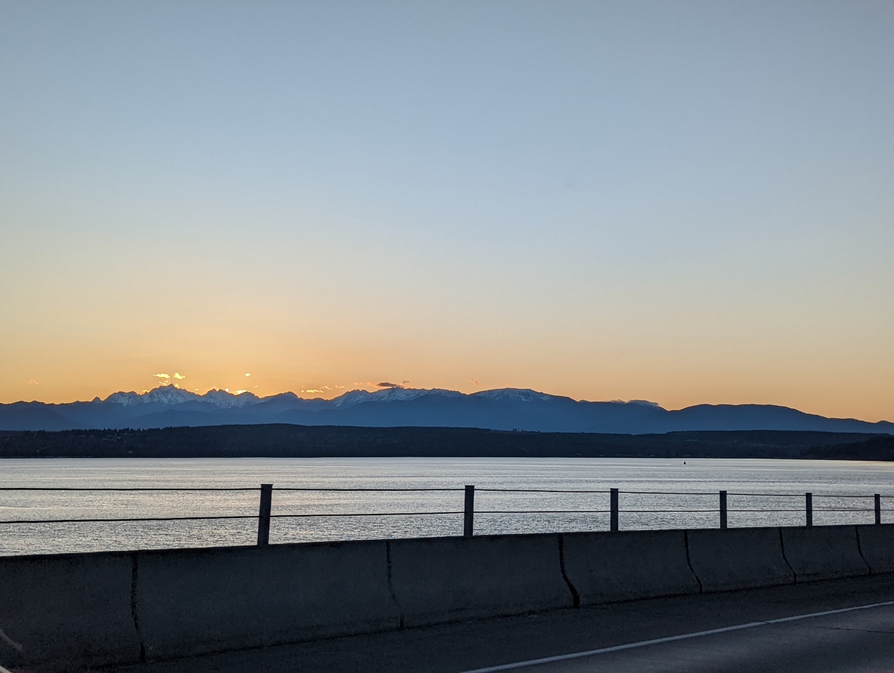 |
3/4/2022: Sunset
Position: 47°51.08'N, -122°36.59'W
Sunset as we cross the Hood Canal Bridge with the Olympic Mountains in the background.
|
 |
3/4/2022: Dusk
Position: 48°3.02'N, -122°55.59'W
Dusk heading towards the Olympic Mountains at Millar Penninsula between Port Townsend and Port Angeles.
|
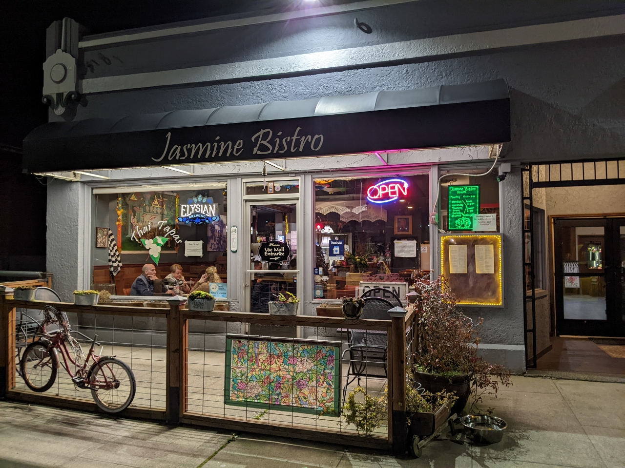 |
3/4/2022: Jasmine Bistro
Position: 48°7.18'N, -123°25.83'W
Delicious take-out Thai dinner from Jasmine Bistro near our hotel in Port Angeles.
|
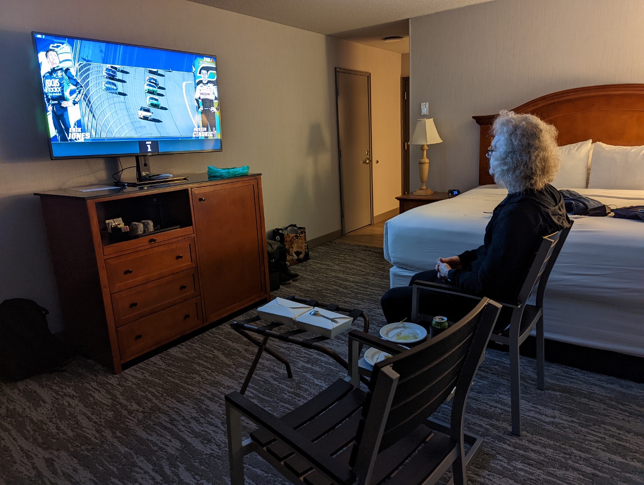 |
3/4/2022: Nascar
Position: 48°7.13'N, -123°25.66'W
Enjoying a NASCAR race over dinner in our hotel, using the patio furniture as a make-shift dining area.
|
 |
3/5/2022: Dawn
Position: 48°7.14'N, -123°25.68'W
Dawn looking over the harbor at Port Angeles from our hotel room patio. The weather is predicted to be sunny all weekend and we're really looking forward to taking the snowshoe trails at Hurricane Ridge in Olympic National Park.
|
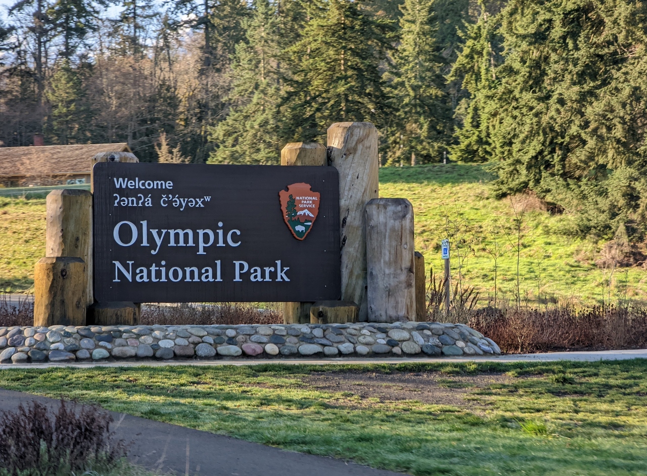 |
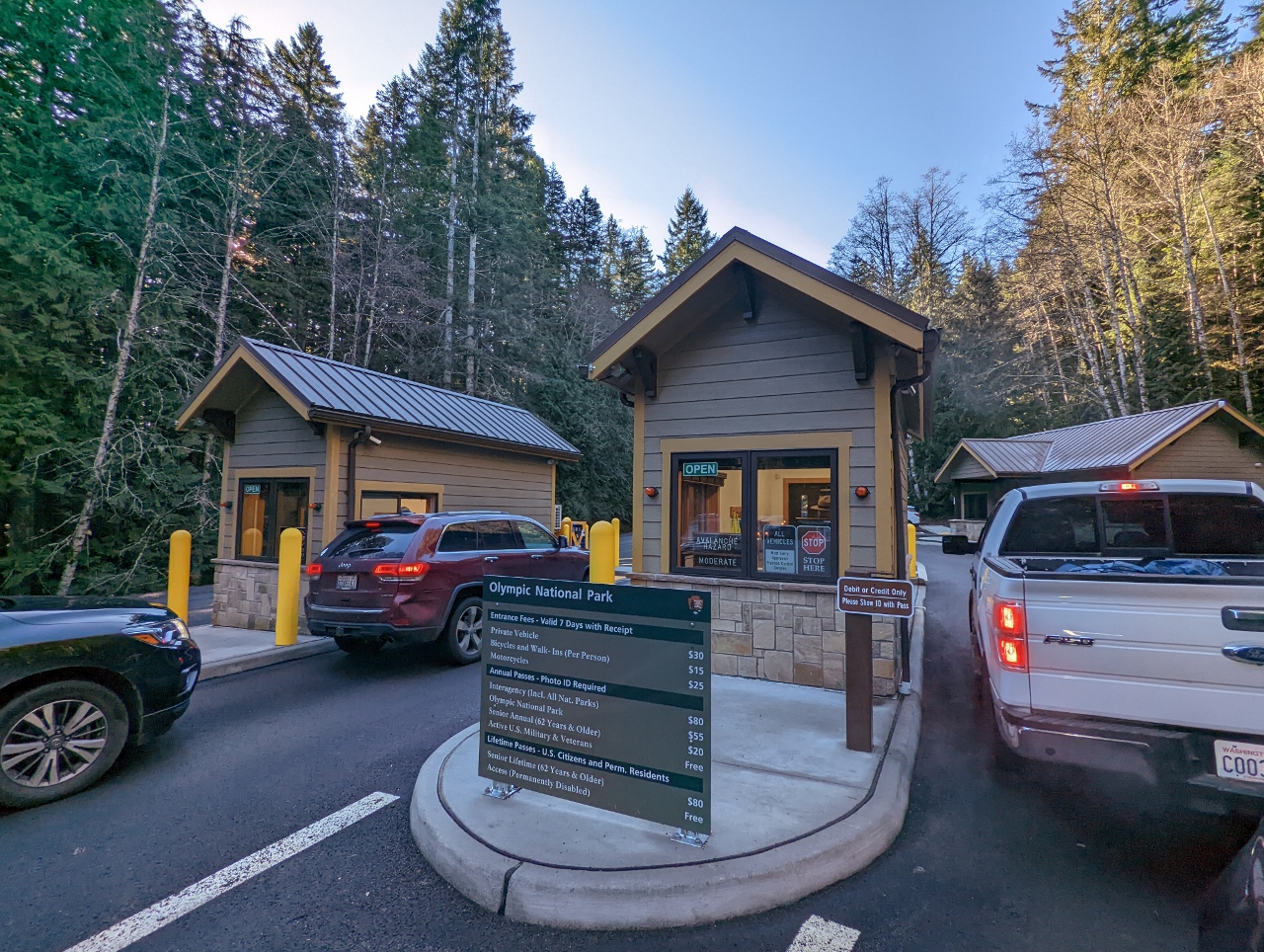
3/5/2022: Olympic National Park
Position: 48°6.20'N, -123°25.57'W
Entering Olympic National Park, with the main visitor center partly visible behind. This is where we stopped by a month ago to hike Mt. Storm King.
|
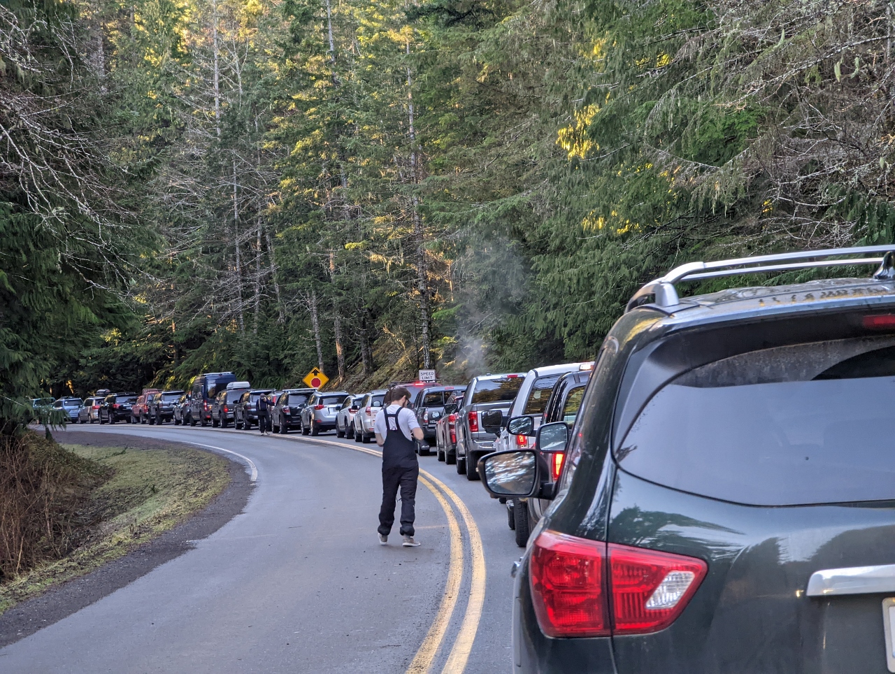 |
3/5/2022: Queue
Position: 48°2.50'N, -123°25.47'W
During the winter, the road up to 5,242-ft (1,597m) Hurricane Ridge typically is only open Friday through Sunday and holidays between 9am and 4pm and winter storms can close or delay opening of the road. But one constant is the limited parking space available at the top, with room for only 200 cars in the plowed section. So people arrive early and wait in order to be sure of getting in.
This is the queue at 8:40am, shortly after we arrived. We can't see the park gate, so don't know how many cars are ahead of us or if we'll even get in. But we were underway 20 minutes later and got in easily. |
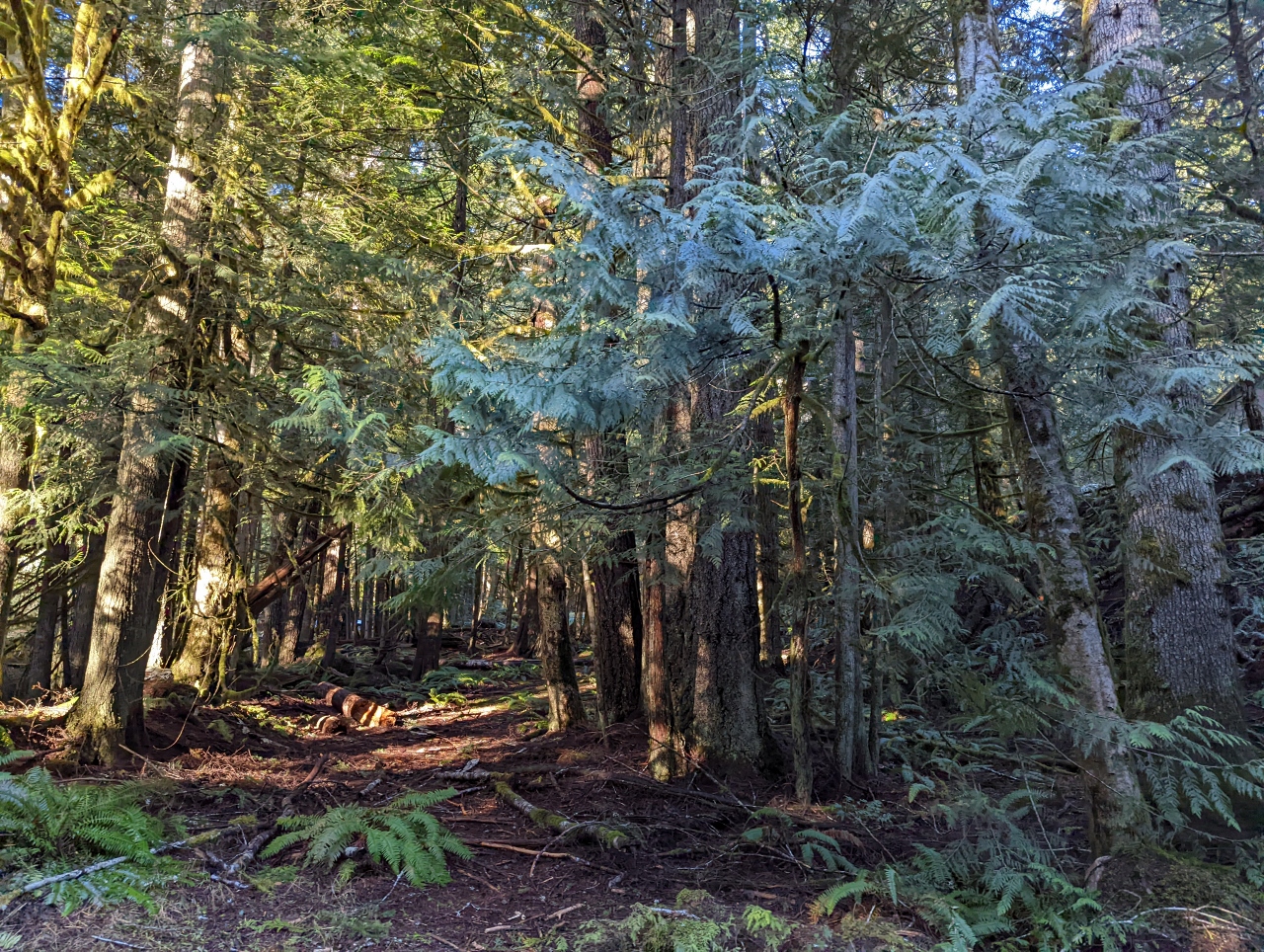 |
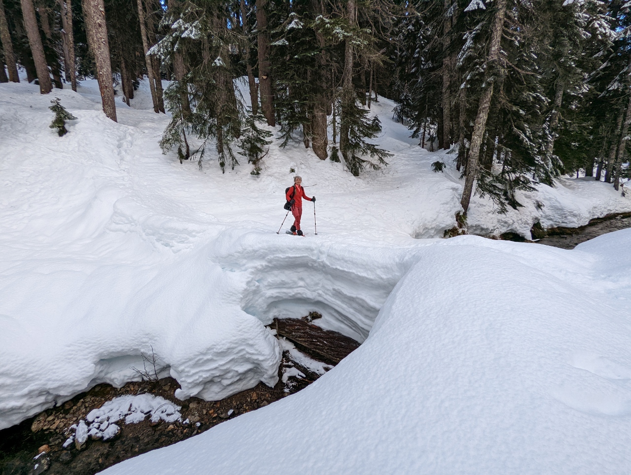
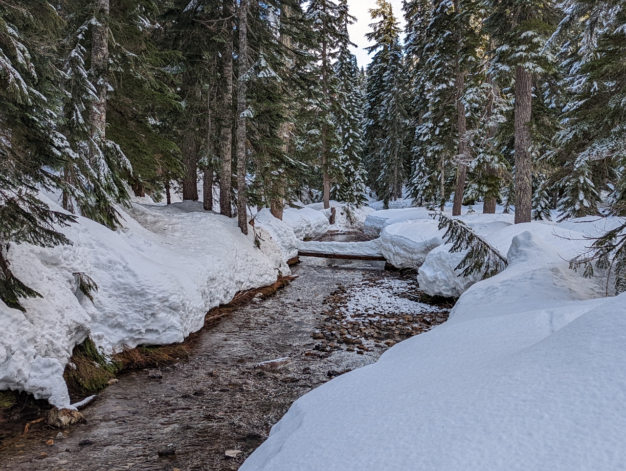
3/5/2022: Rainforest
Position: 48°2.31'N, -123°25.79'W
While waiting for the park to open, we enjoyed the views into the vibrant and healthy rainforest beside the road.
|
 |
3/5/2022: Gate
Position: 48°2.26'N, -123°25.82'W
The park gates, at altitude 1751ft (534m), opened precisely at 9am as scheduled. It turns out we were only a short distance from the gate with about 50 cars ahead of us. After the early arrivals, it took until 11:15am for the 200-car parking lot at the top to fill. Then cars were metered in as others departed, and the line-up didn't drain until 1:30pm.
|
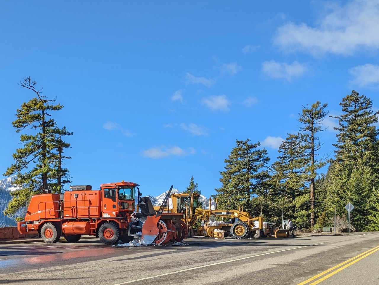 |
3/5/2022: Snow Plows
Position: 47°59.58'N, -123°24.08'W
Snow removal equipment along the road to Hurricane Ridge at altitude 2,450 ft (747 m). Conditions can change quickly here and all cars entering during the winter are required to carry chains.
|
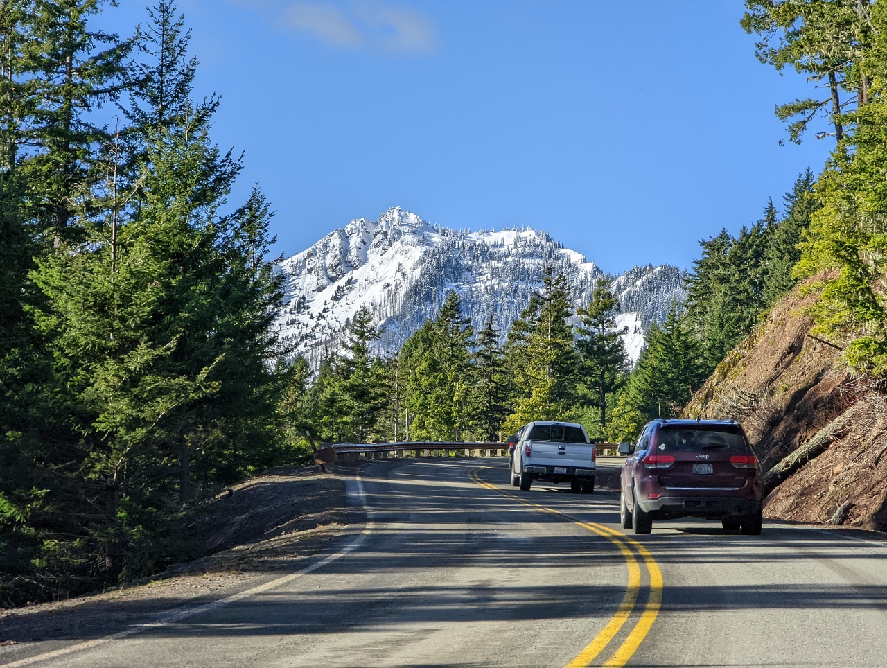 |
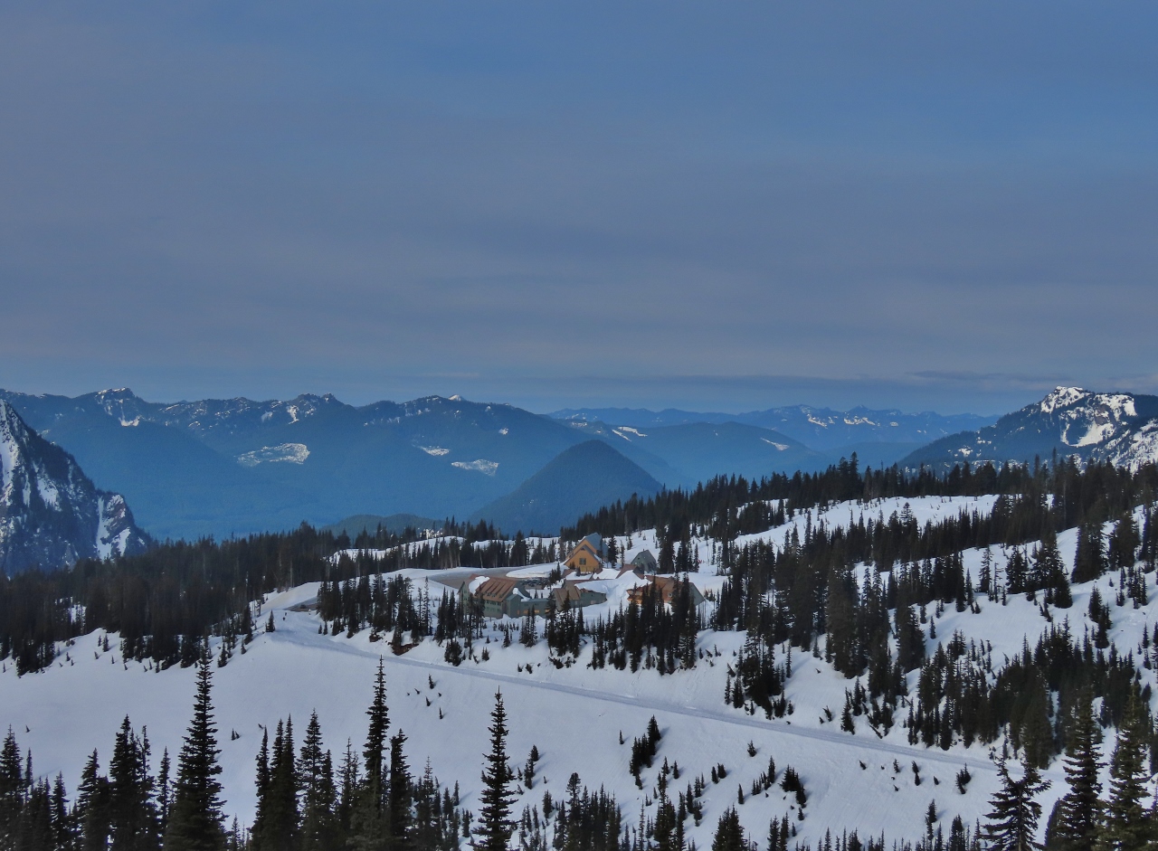
3/5/2022: Hurricane Ridge
Position: 47°59.50'N, -123°24.44'W
A first glimpse to our destination, 5,242-ft (1,597m) Hurricane Ridge from 2,940ft (896m). We're over halfway there by altitude and climbing quickly.
|
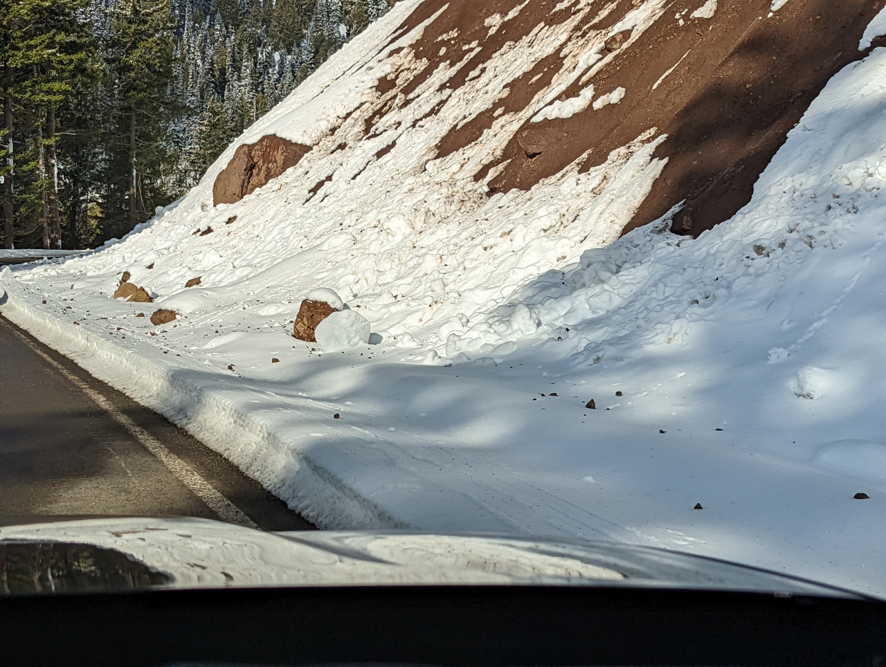 |
3/5/2022: Slides
Position: 47°59.07'N, -123°27.39'W
Evidence of small rock and snow slides as we pass through the snow line at altitude 3,786ft (1,154m). We saw several quite large rocks on the side of the road that would have done some serious damage if they'd hit a vehicle.
|
 |
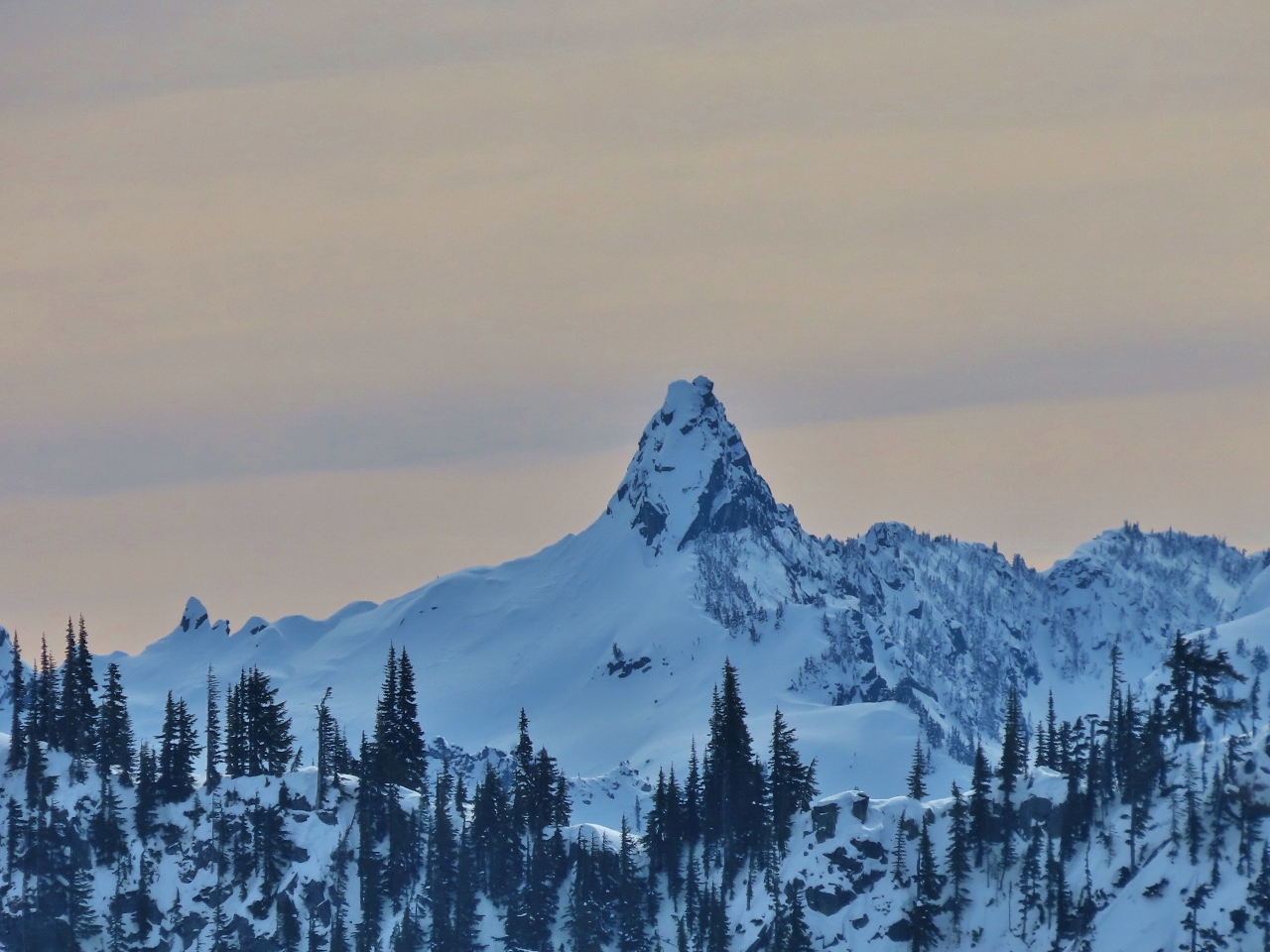
3/5/2022: Klahhane Ridge
Position: 47°59.07'N, -123°27.39'W
6,080 ft (1,853 m) Klahhane Ridge towers above the road up to Hurricane Ridge.
|
 |
3/5/2022: Snow
Position: 47°58.38'N, -123°28.80'W
We're well above the snow line now at altitude 4,877ft (1,486 m) and the winter scenery is spectacular.
|
 |
3/5/2022: Mount Olympus
Position: 47°58.20'N, -123°29.16'W
View to 7,980 ft (2,432 m) Mount Olympus, the highest and most prominent peak in Olympic National Park. The scenery is so amazing that even if we just drove up and down, and skipped the hike, we would have been happy.
|
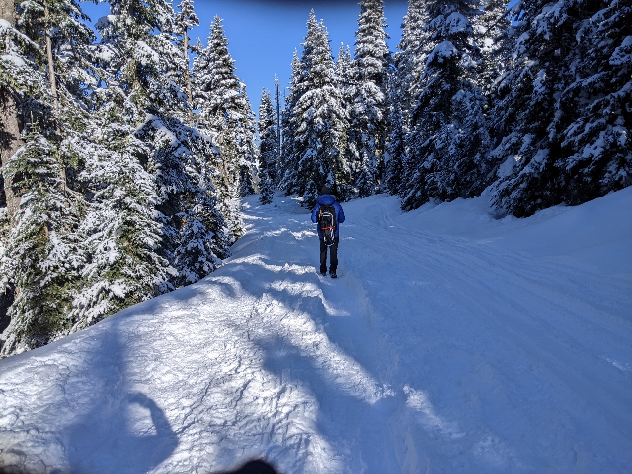 |
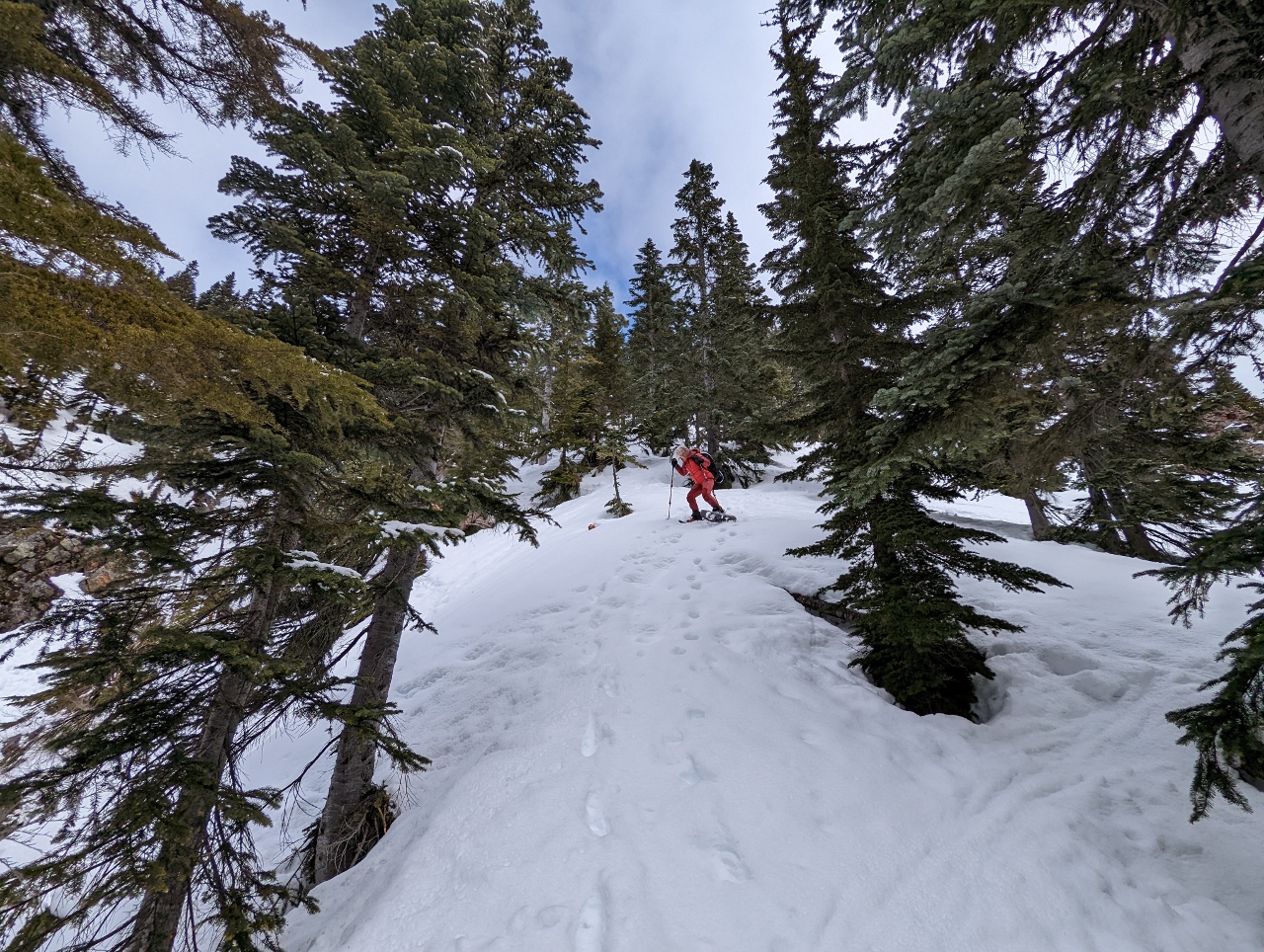
3/5/2022: Walking
Position: 47°58.25'N, -123°30.06'W
In the summer, a 1.5-mile road leads from the Hurricane Ridge visitor center to the Hurricane Hill trailhead. But this road is not plowed in the winter, and instead is part of the snowshoe trail. The snow was fairly well-packed for the first section, so we initially walked with our snowshoes attached to our packs.
|
 |
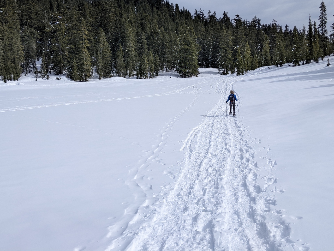
3/5/2022: Snowshoeing
Position: 47°58.29'N, -123°30.18'W
We donned our snowshoes about 10 minutes in to walk through the powder. This is the first of many spectacular views from the trail to Hurricane Hill in Olympic National Park. Port Angeles with the Strait of Juan de Fuca beyond, is just visible in the distance slightly right of center.
|
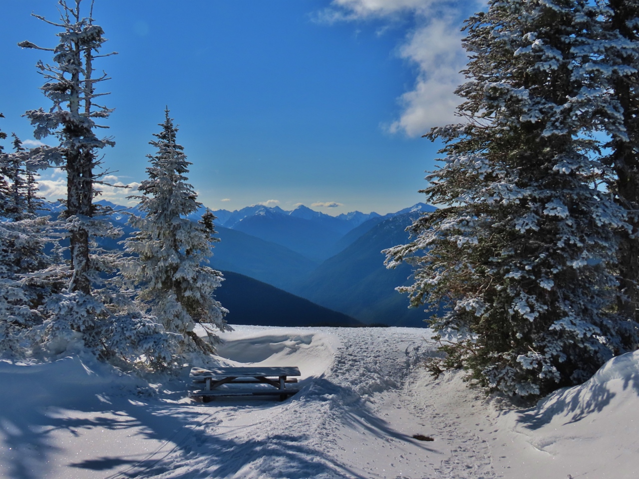 |
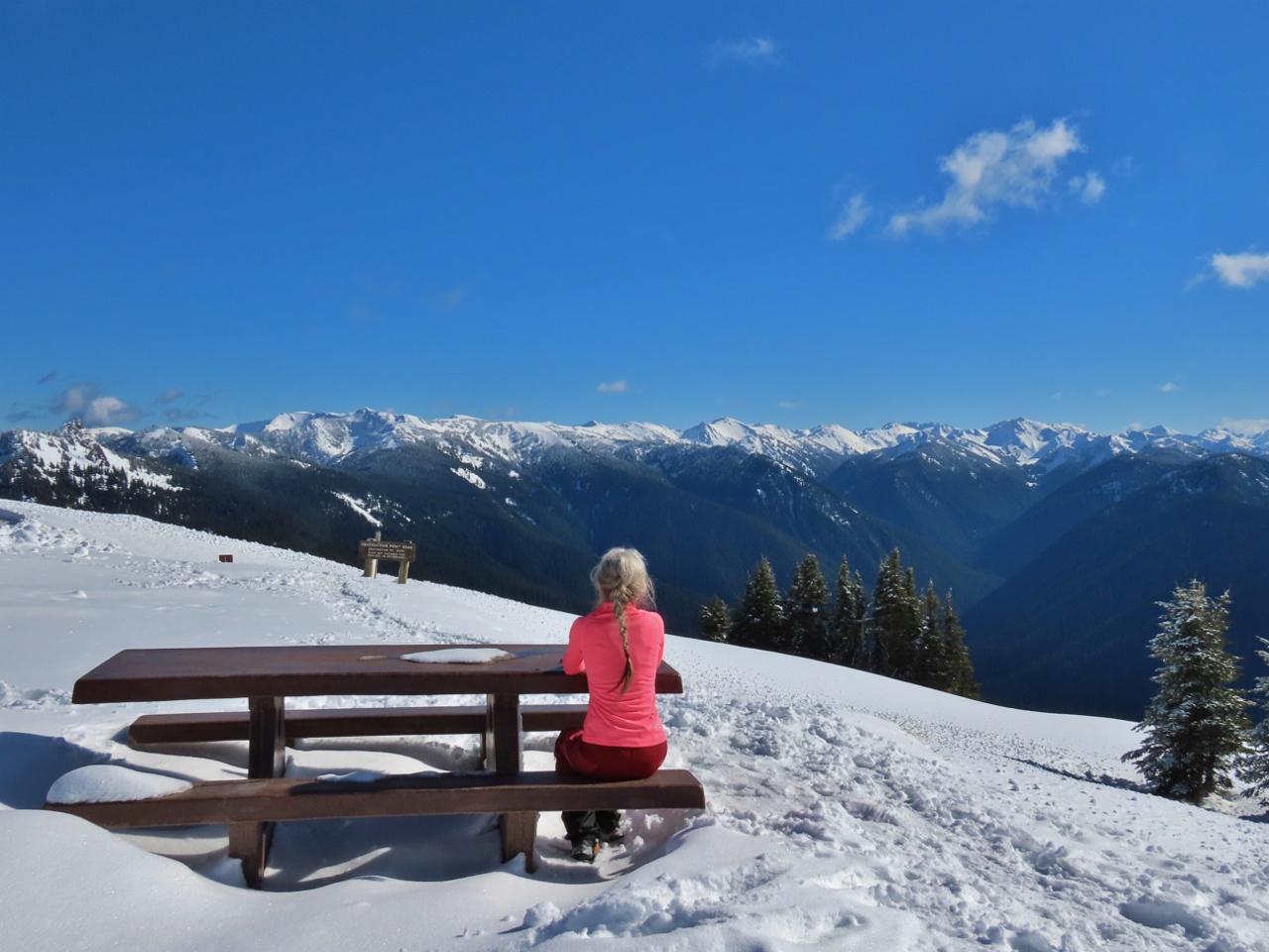
3/5/2022: Bailey Range
Position: 47°58.37'N, -123°30.60'W
A picnic table along the road to the Hurricane Hill trailhead with a fabulous view to the Bailey Range in Olympic National Park.
|
 |
3/5/2022: Trailhead
Position: 47°58.50'N, -123°31.05'W
Deep snow at the summer trailhead for the hike to Hurricane Hill. We're getting pretty warm from the exertion and have exchanged our warm winter coats for a light shell.
|
 |
3/5/2022: Hikers
Position: 47°58.63'N, -123°31.06'W
Most people on the trail were snowshoeing or skiing, but a few were hiking just in boots with microspikes.
|
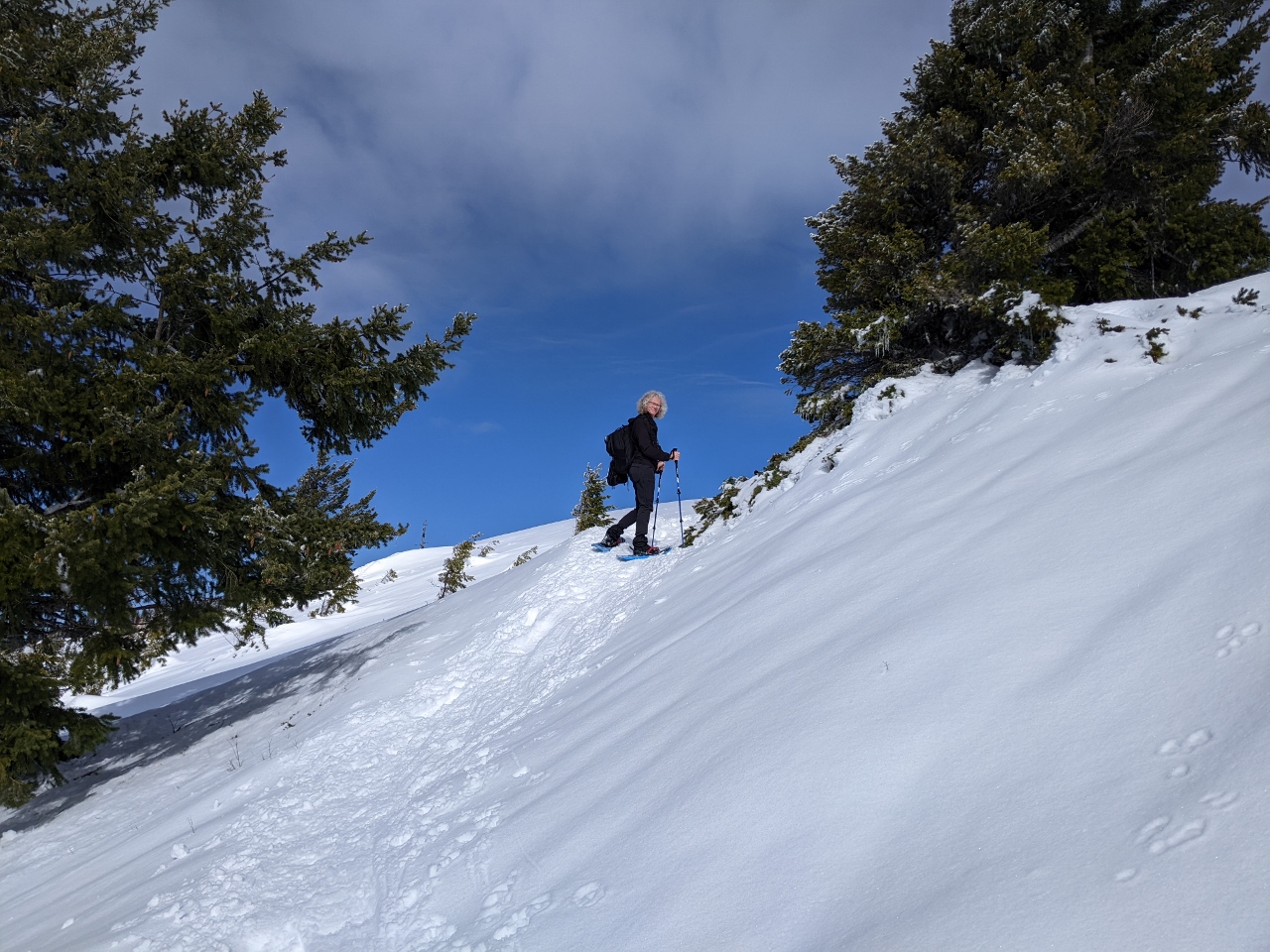 |
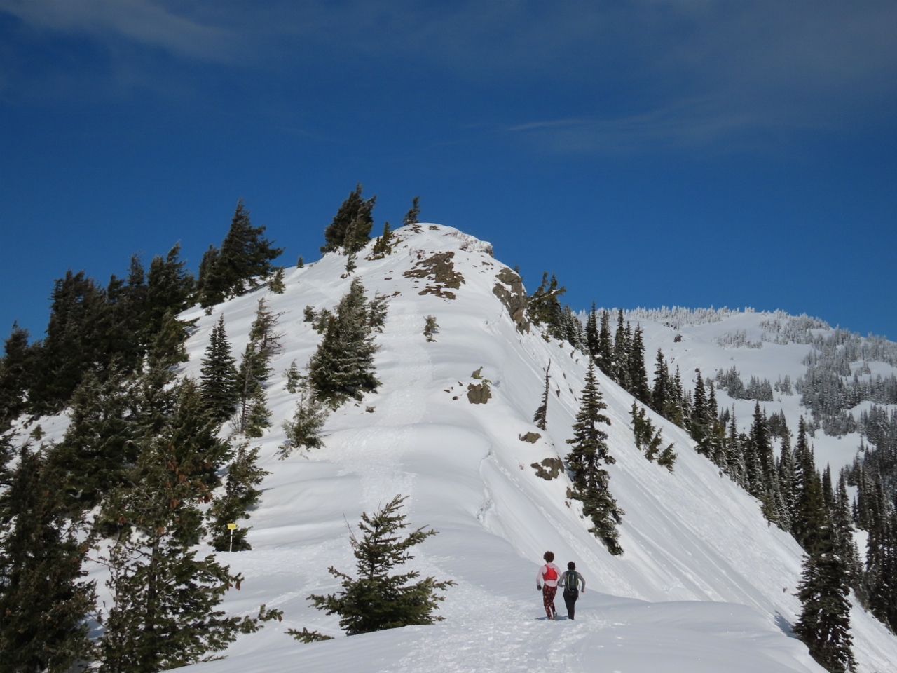
3/5/2022: Detour
Position: 47°58.75'N, -123°31.17'W
The summer trail to Hurricane Hill runs below this ridge, but the winter path leads up and along the ridge to avoid an avalanche risk area.
|
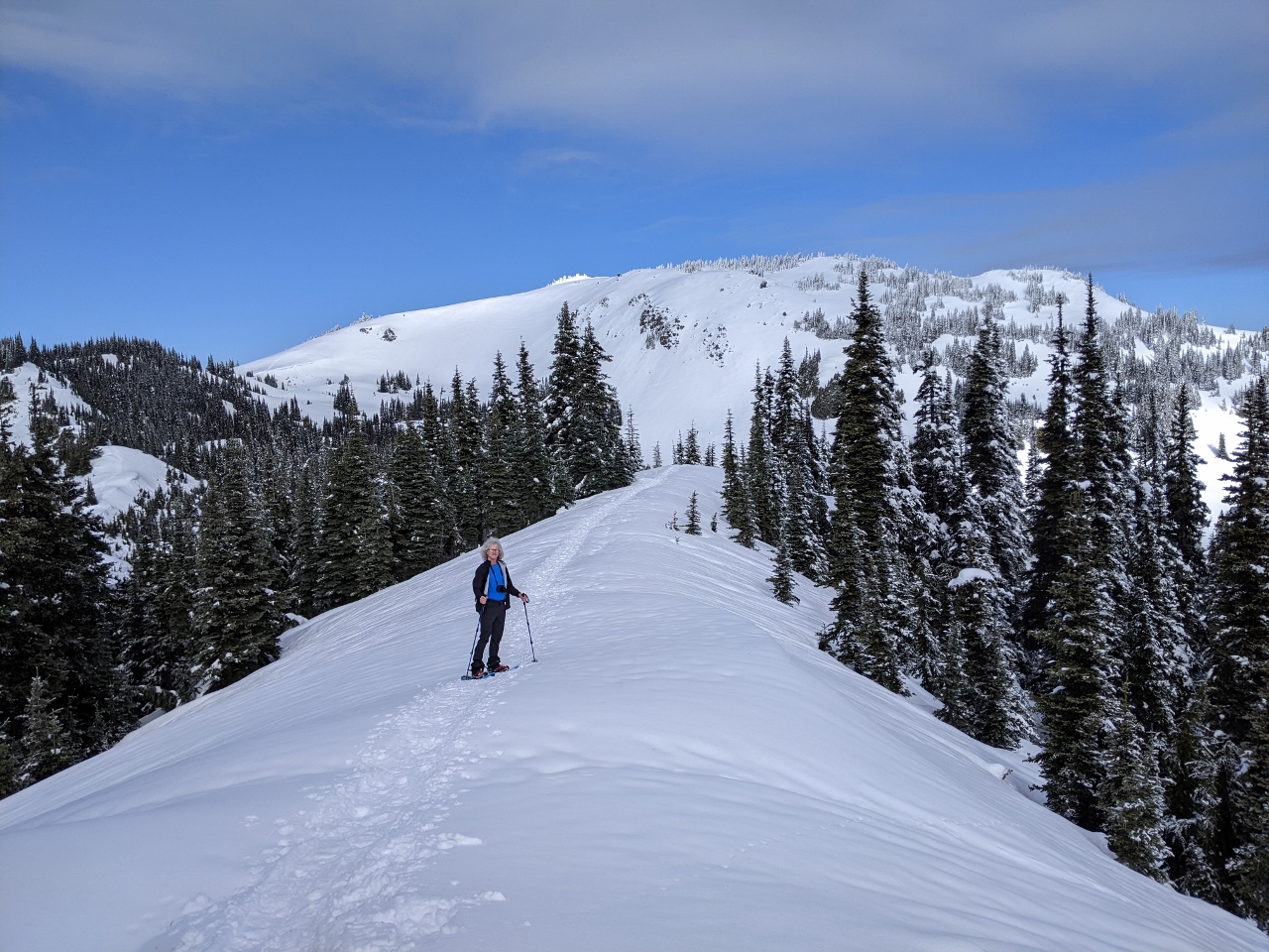 |
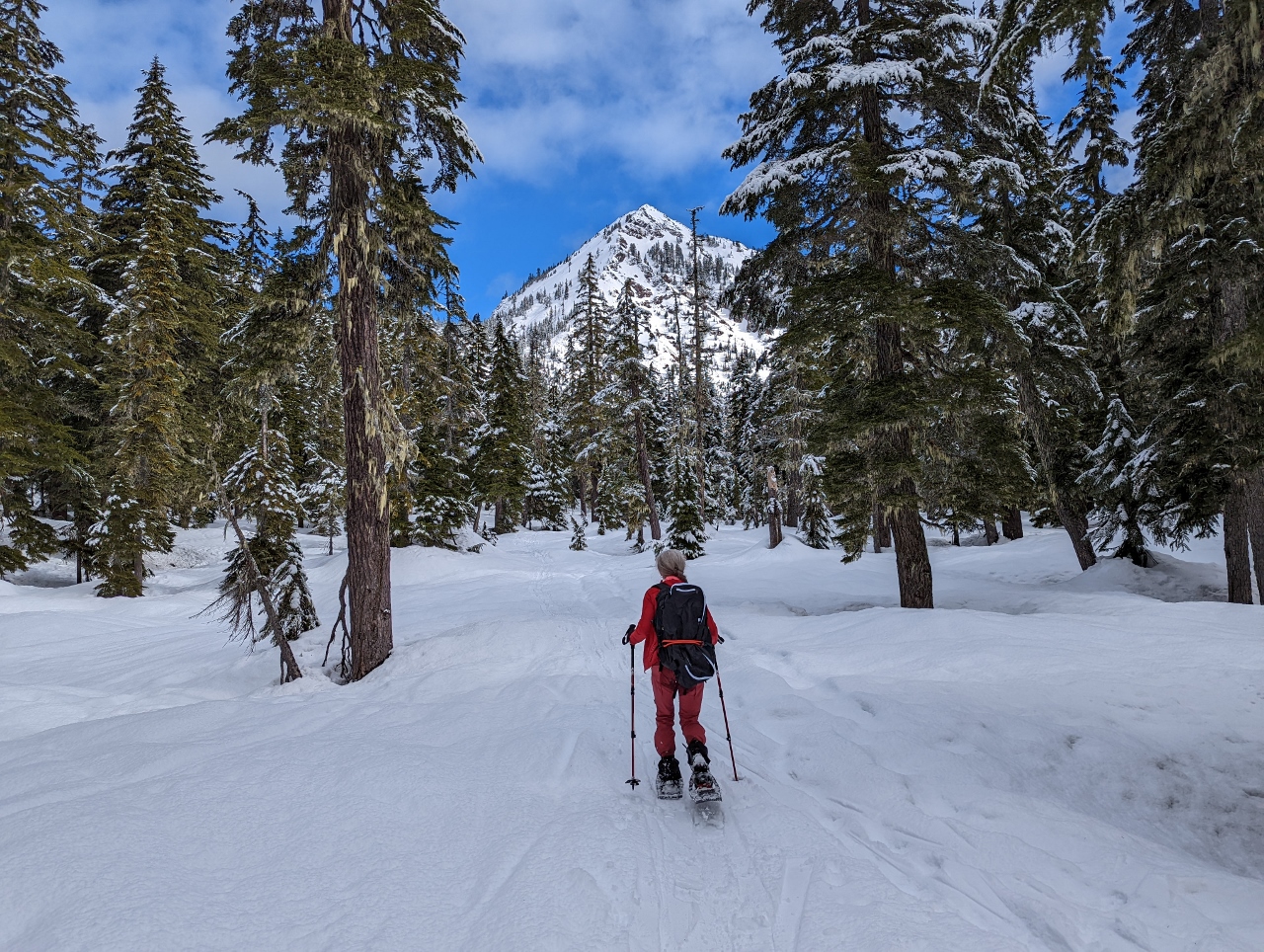
3/5/2022: Detour Ridge
Position: 47°58.80'N, -123°31.21'W
Looking northwest along the detour ridge, with our destination of 5,765-ft (1,757m) Hurricane Hill in the background.
|
 |
3/5/2022: Mt. Angeles
Position: 47°58.98'N, -123°31.61'W
Looking northeast to 6,454 ft (1,967 m) Mount Angeles, thick with snow.
|
 |
3/5/2022: Final Ascent
Position: 47°59.07'N, -123°31.78'W
At the base of Hurricane Hill at altitude 5,309ft (1618 m) with a 400-ft climb ahead of us to reach the top.
|
 |
3/5/2022: Partway Up
Position: 47°59.25'N, -123°31.89'W
Looking back southeast to the trail we just walked from partway up Hurricane Hill with the Bailey Range visible in the distance.
|
 |
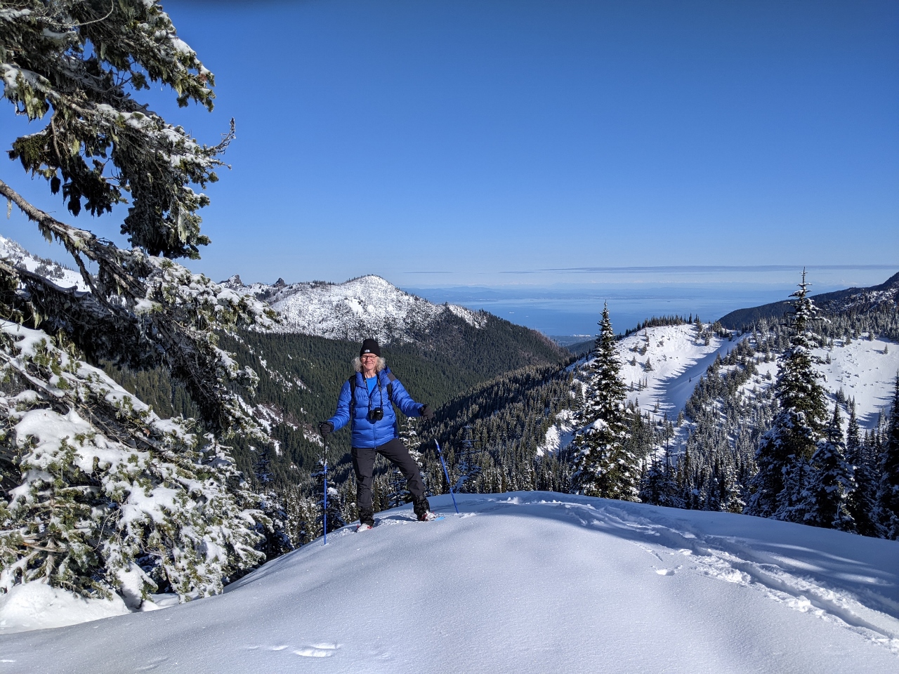
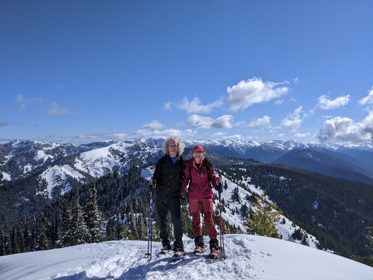
3/5/2022: Hurricane Hill
Position: 47°59.42'N, -123°31.74'W
The spectacular view looking east from atop 5,309ft (1618 m) Hurricane Hill.
|
 |
3/5/2022: Snow Sculptures
Position: 47°59.41'N, -123°31.74'W
Strong winds at the top of Hurricane Hill produces fabulous snow patterns, such as these horizontal formations on the trees.
|
 |
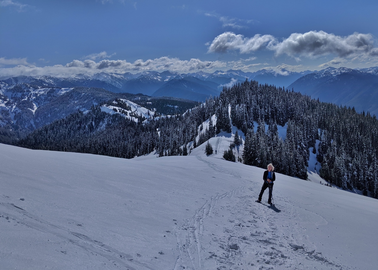
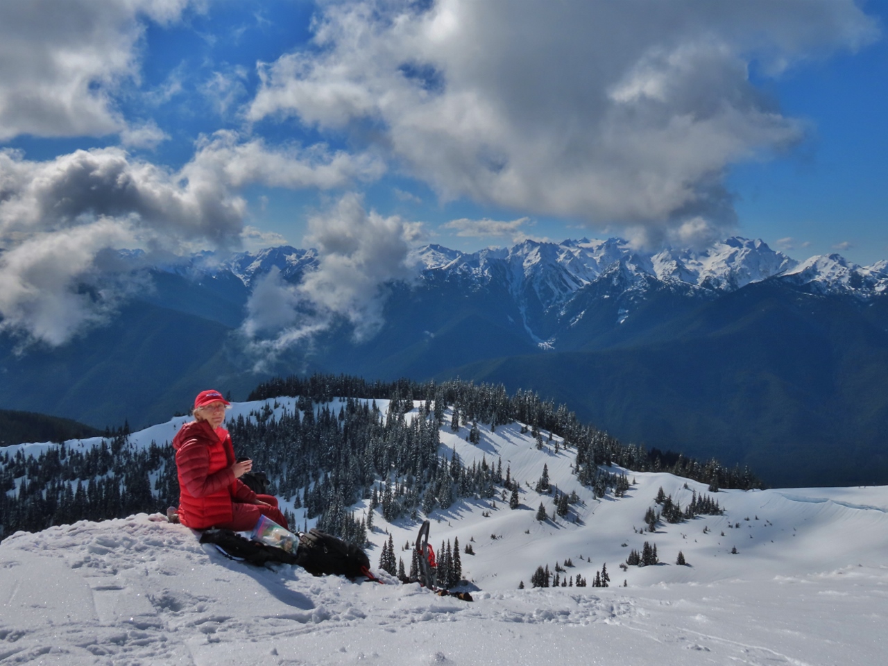
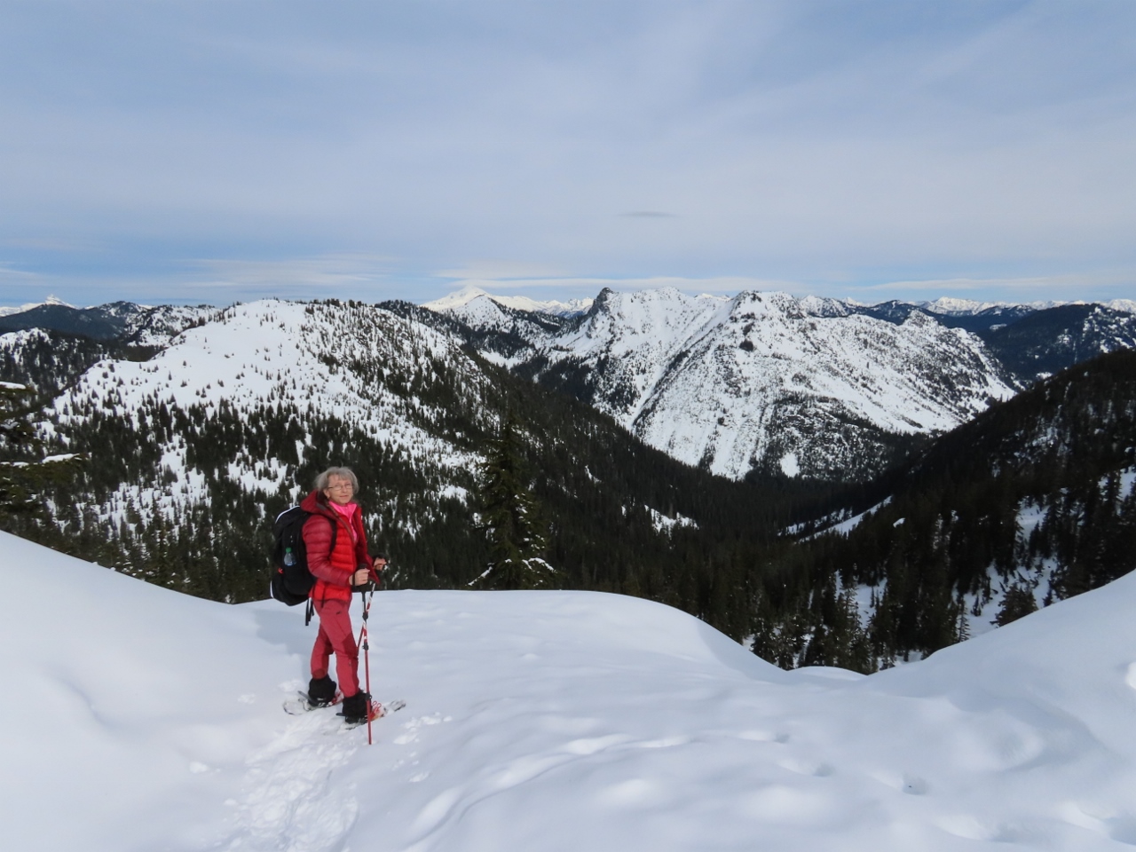
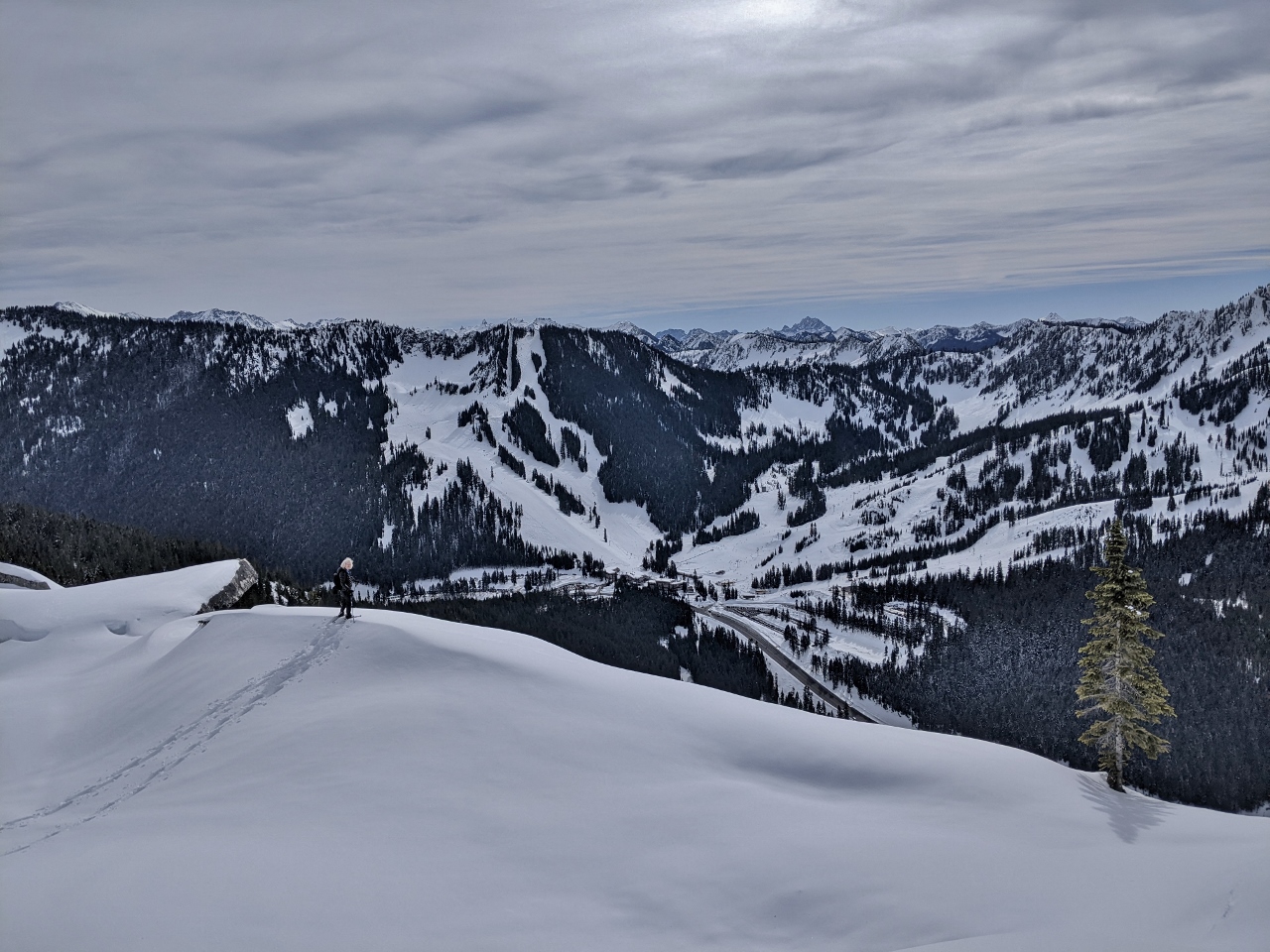
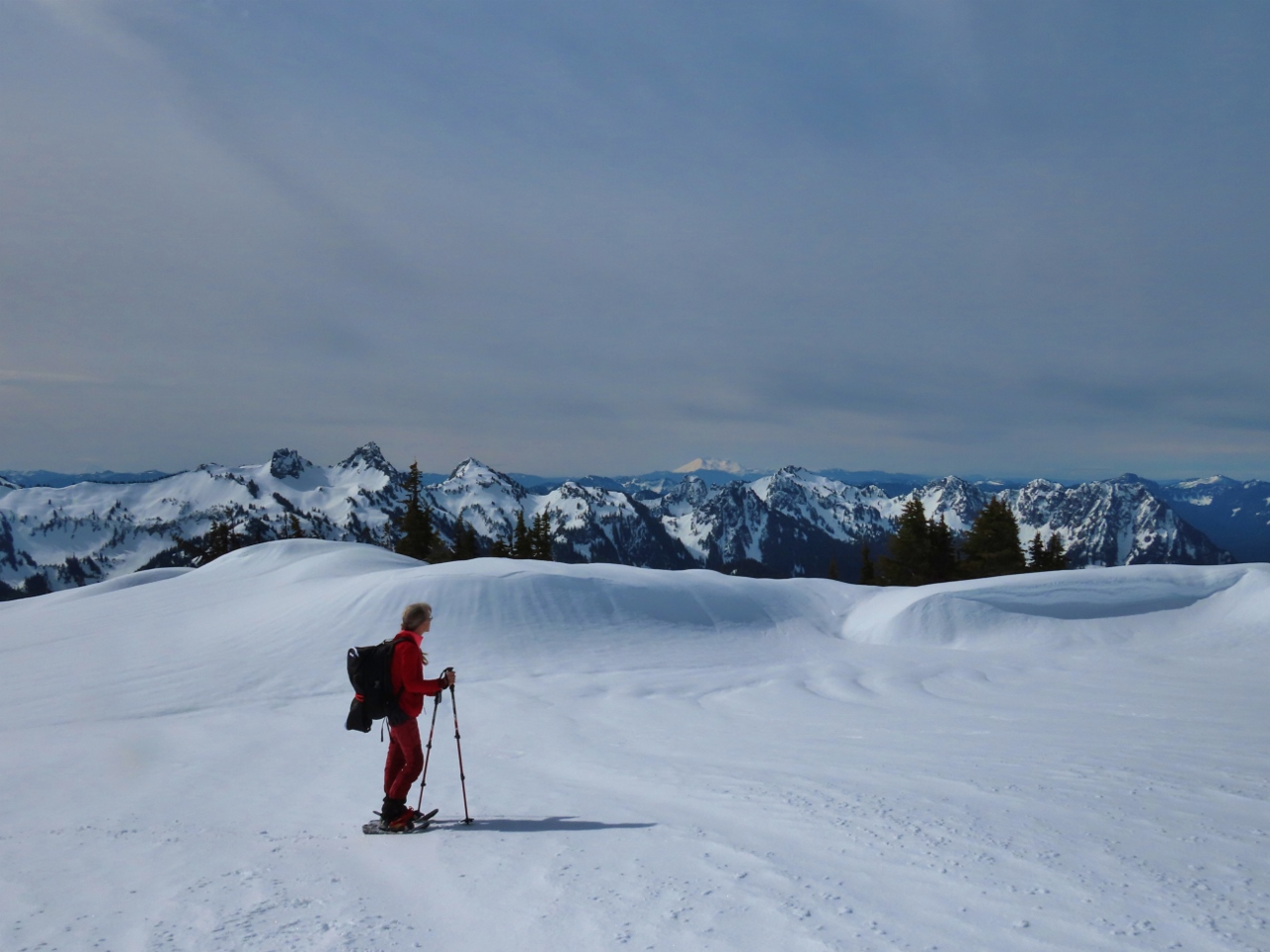
3/5/2022: Panorama
Position: 47°59.42'N, -123°31.74'W
Panoramic view from 5,309ft (1618 m) Hurricane Hill. Port Angeles and the Strait of Juan de Fuca are visible at the left to the north, Mt. Angeles is slightly left of center to the east, and the Bailey range is southwest on the right (click image for a larger view).
|
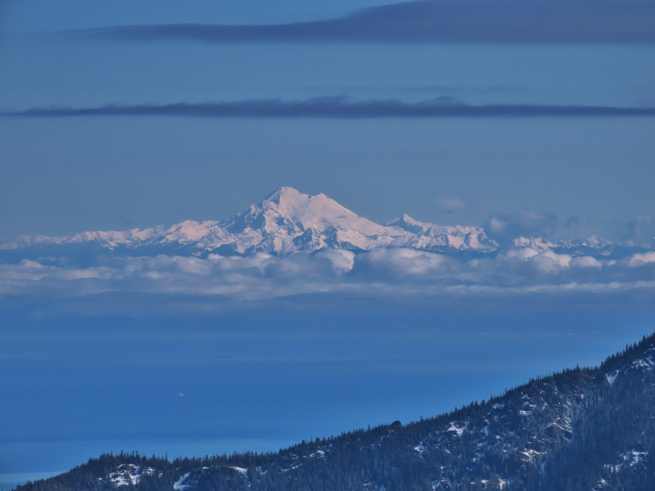 |
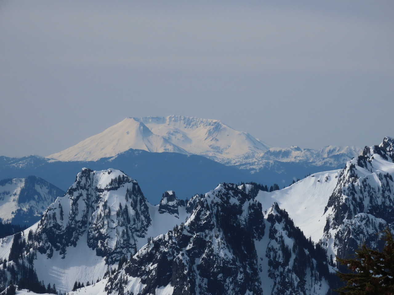
3/5/2022: Mt. Baker
Position: 47°59.38'N, -123°31.79'W
Great view to snow-covered Mount Baker from atop Hurricane Hill in Olympic National Park.
|
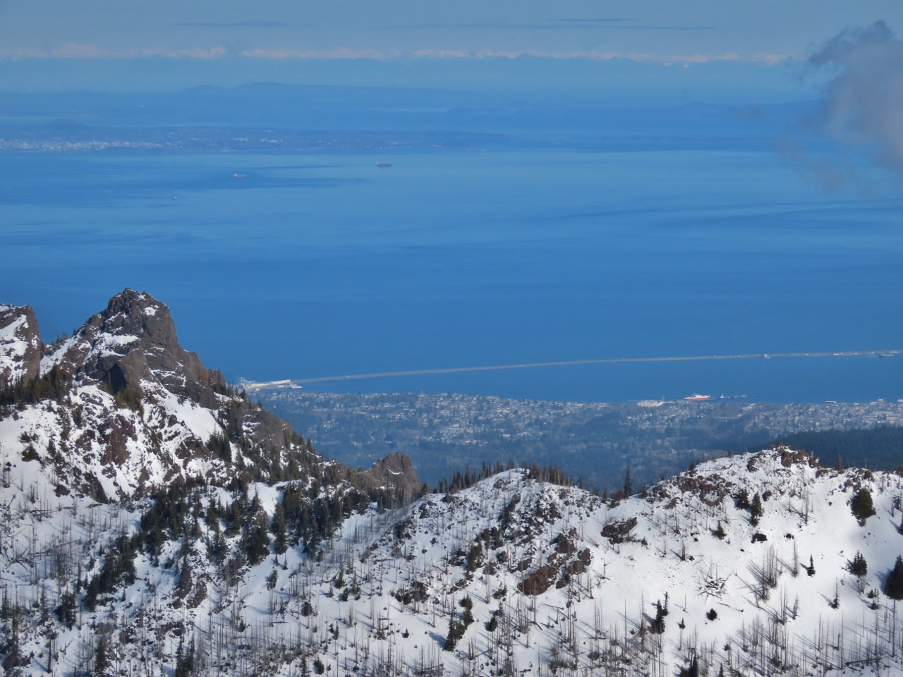 |
3/5/2022: Port Angeles
Position: 47°59.42'N, -123°31.74'W
Port Angeles and the Strait of Juan de Fuca, with Victoria, Canada visible in the distance.
|
 |
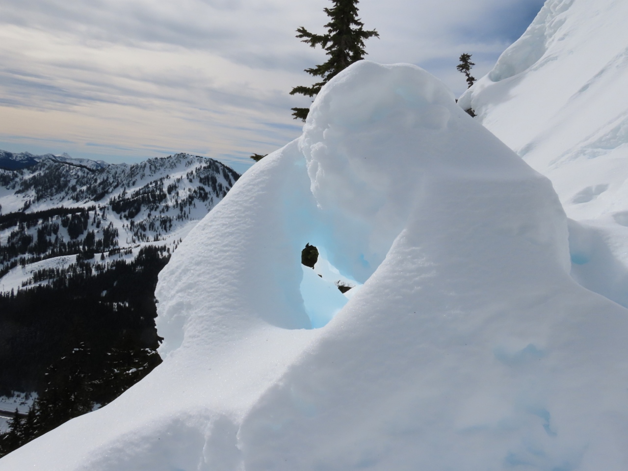
3/5/2022: Cornices
Position: 47°59.42'N, -123°31.74'W
Cornices (drifts of wind-blown snow that hang off one side of a ridge) along a ridge, with evidence below of sluffs, small loose snow avalanches. Sluffs are among the least dangerous types of avalanches, and often indicate stability in the snow below, but they do kill people on occasion, typically by carrying them off a cliff or burying them in a gully.
|
 |
3/5/2022: Snack
Position: 47°59.35'N, -123°31.62'W
Enjoying a snack with a hot cup of tea and a view to the Bailey Range from atop Hurricane Hill.
|
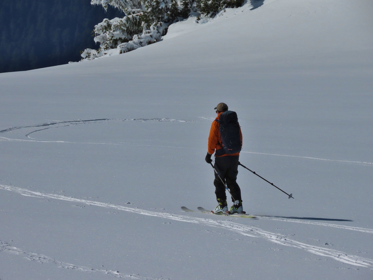 |
3/5/2022: Skier
Position: 47°59.37'N, -123°31.65'W
Besides snowshowers and the occasional hiker, a larger number of people climb to the top and ski down. They attach high-friction ski skins to the skis for the way up, and remove the skins to ski down.
|
 |
3/5/2022: Descent
Position: 47°59.01'N, -123°31.69'W
Back down on the detour ridge after a reluctant descent from Hurricane Hill, with the Bailey Range behind us. The scenery is so amazing it was hard to tear ourselves away.
|
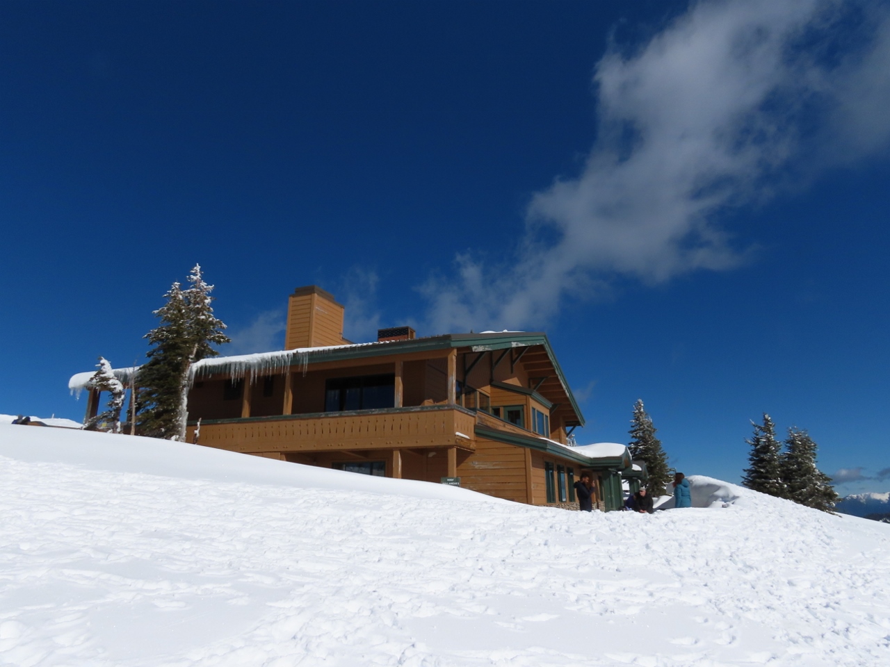 |
3/5/2022: Visitors Center
Position: 47°58.19'N, -123°30.03'W
The Hurricane Ridge Visitor Center rents snowshoes and downhill ski equipment. The area just outside is a popular place for beginners to try out snowshoes.
|
 |
3/5/2022: Buckhorn Wilderness
Position: 47°58.18'N, -123°29.88'W
Taking in the view to the mountains of the Buckhorn Wilderness, at 44,319-acre (17,935 ha) the largest of the five Congress-established wilderness areas at the eastern edge of Olympic National Park.
|
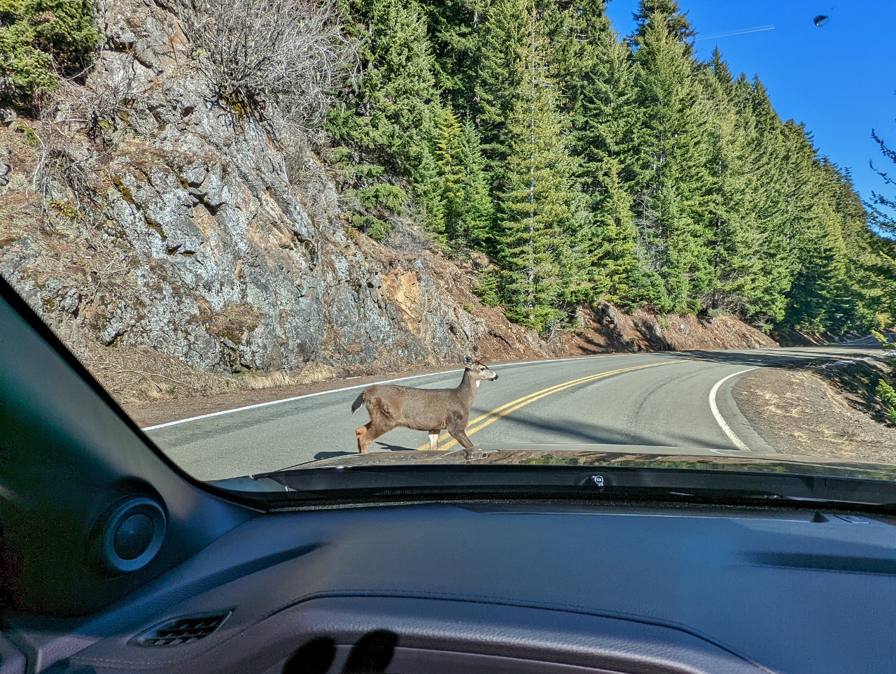 |
3/5/2022: Deer Crossing
Position: 47°59.25'N, -123°25.75'W
Several deer at the side of the road decided it was a great time to cross as we approached. Apparently deer know they have the right of way in the park.
|
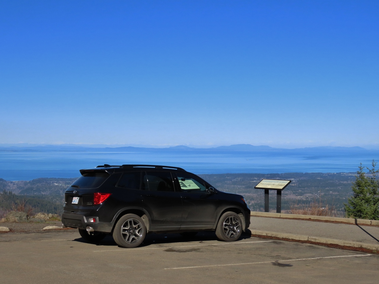 |
3/5/2022: Morse Creek Overlook
Position: 48°0.77'N, -123°22.27'W
Our Honda Passport parked at the Morse Creek Overlook at altitude 2,533ft (772m) on Hurricane Ridge Road. Visible beyond is the Strait of Juan de Fuca and the Washington State mainland.
|
 |
3/5/2022: Victoria
Position: 48°0.28'N, -123°22.51'W
View from the Morse Creek Overlook to Victoria, Canada with the mountains of Vancouver Island behind.
|
 |
3/5/2022: Blue Mountain
Position: 48°0.77'N, -123°22.28'W
A short trail led from the Morse Creek Overlook parking lot to a viewpoint over Morse Creek to 6,007-ft (1,831) Blue Mountain.
|
 |
3/5/2022: Next Door Gastropub
Position: 48°7.16'N, -123°26.05'W
A delicious late lunch at Next Door Gastropub in Port Angeles.
|
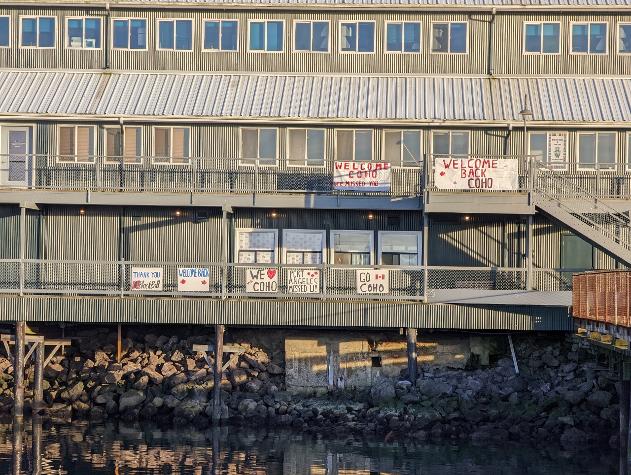 |
3/5/2022: Welcome Coho
Position: 48°7.26'N, -123°25.89'W
The vehicle and passenger ferry Coho has been running between Port Angeles and Victoria, Canada several times a day since its launch in 1959, and is a fixture in both cities. With the Canadian-US border closed during the pandemic, the Coho was out of service for 19 months, and recently started up again in November when Canadian entry restrictions eased. Signs near the Coho dock show how happy people were to see the ship back in service.
|
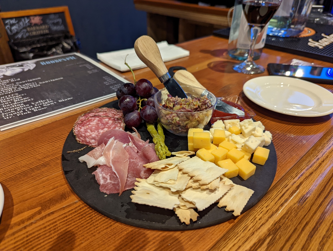 |
3/5/2022: The Roosevelt
Position: 48°7.24'N, -123°25.82'W
A charcuterie plate for a light dinner at The Roosevelt in the Port Angeles Wharf.
|
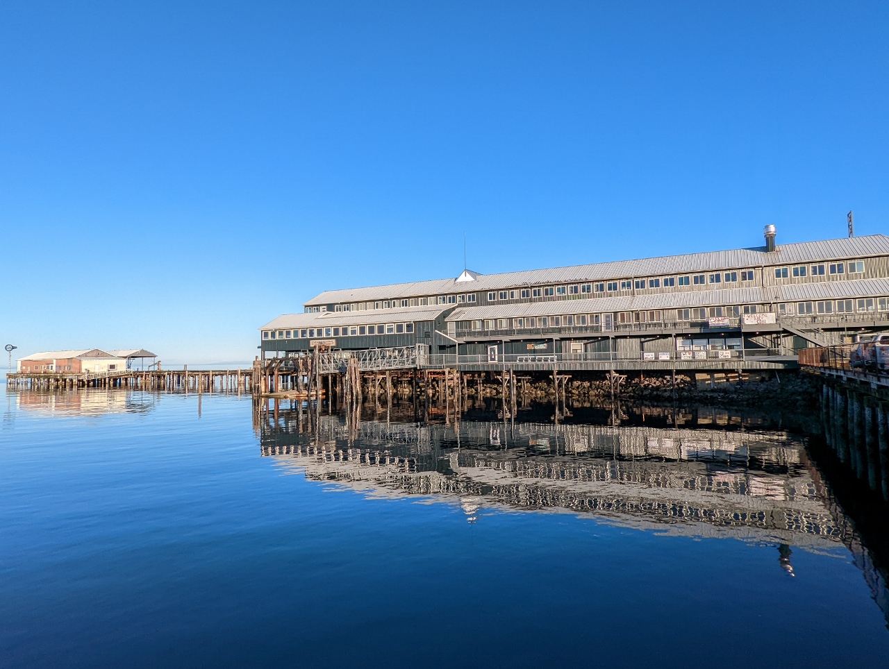 |
3/5/2022: Port Angeles Wharf
Position: 48°7.26'N, -123°25.89'W
Wonderfully calm and clear evening at the Port Angeles Wharf.
|
 |
3/6/2022: PowerPort Cube
Position: 48°7.13'N, -123°25.66'W
We bought this Anker PowerPort Cube initially to plug into a European adapter in hotel rooms and increase the number of available North American sockets, and to give us an extension when the socket is in an inconvenient place. But we find we use it a lot in North America for much the same reason. Here we're charging a FitBit watch, a camera battery, a portable battery to power our phones and a laptop.
|
 |
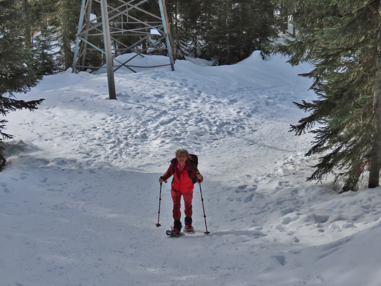
3/6/2022: Slides
Position: 47°58.69'N, -123°28.39'W
Heading back up to Hurricane Ridge for some more snowshowing. Yesterday the slopes were completely snow-covered, but many small slides since then have revealed dirt below.
|
 |
3/6/2022: Visitor Center
Position: 47°58.23'N, -123°29.57'W
The view back down to the Hurricane Ridge Visitor Center from partway up to the start of the Kahhane Ridge trail.
|
 |
3/6/2022: Getting Ready
Position: 47°58.30'N, -123°29.50'W
We just walked up the road to reach the Kahhane Ridge trailhead, and then donned our snowshoes at the start of the ridge.
|
 |
3/6/2022: Kahhane Ridge
Position: 47°58.30'N, -123°29.50'W
The showshoe trail, known as the Sunrise Ridge Route, runs about 2 miles (3.2 km) along the Kahhane Ridge towards 6,454 ft (1,967 m) Mt. Angeles, visible in the distance.
|
 |
3/6/2022: Hurricane Ridge
Position: 47°58.75'N, -123°28.89'W
Enjoying the view to Hurricane Ridge from Kahhane Ridge at altitude 5,374 ft (1638m).
|
 |
3/6/2022: Powder
Position: 47°58.80'N, -123°28.86'W
We've not seen anyone on the trail so far, compared to dozens yesterday on the Hurricane Hill trail. While plenty of tracks are visible, there also lots of fresh powder en route.
|
 |
3/6/2022: Getting Closer
Position: 47°58.82'N, -123°28.80'W
Getting closer to Mt. Angeles, about a mile down the trail, at altitude 5,443ft (1,659 m). Unfortunately, we've got a big hill in front of us to descend.
|
 |
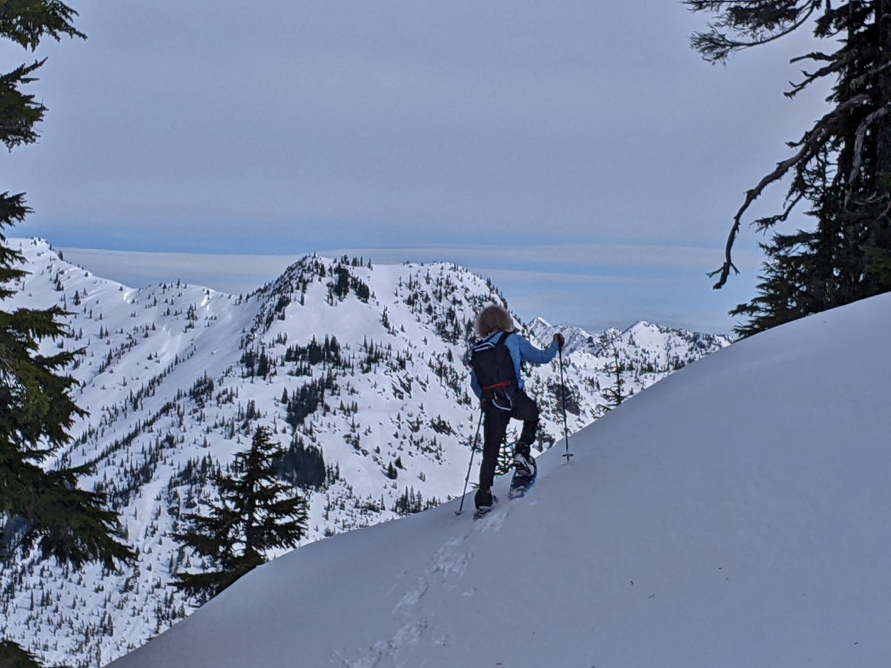
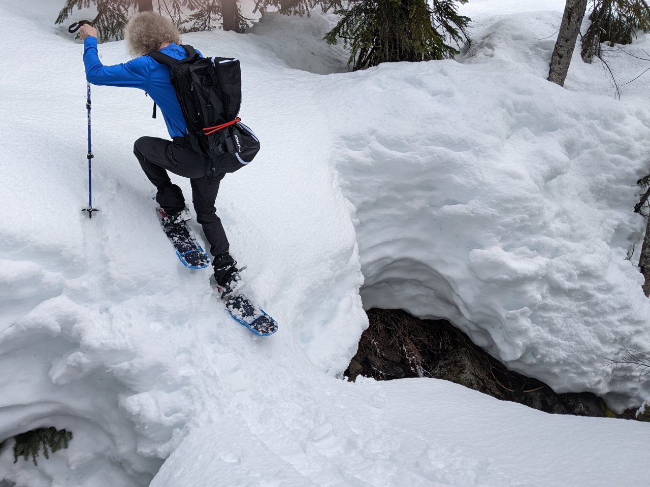
3/6/2022: Steep
Position: 47°58.87'N, -123°28.72'W
Working down a very steep slope. Our snowshoes, MSR Lighting Ascents have excellent grip and are doing really well in the steep terrain. We're super happy with them.
|
 |
3/6/2022: And Back Up
Position: 47°59.00'N, -123°28.45'W
Working back up the next ridge. We're going to be very tired by the end of this day.
|
 |
3/6/2022: Heel Lift
Position: 47°59.04'N, -123°28.41'W
Our snowshoes heel lefts that can easily be popped up or down with the tip of our pole. The heel lift reduces fatigue and increases traction when going up steep slopes. You can see how aggressively the forward crampon digs in with the heel lift engaged.
|
 |
3/6/2022: Mt. Angeles
Position: 47°59.04'N, -123°28.40'W
6,454 ft (1,967 m) Mt. Angeles rising above us.
|
 |
3/6/2022: Victoria
Position: 47°59.05'N, -123°28.39'W
View from the trail to Victoria, Canada, about 30 miles (48 km) away. We're really enjoying the clear weather.
|
 |
3/6/2022: Tracks
Position: 47°59.12'N, -123°28.26'W
Once we descended the big hill, there were a lot fewer tracks on the route. It's just spectacularly beautiful out here.
|
 |
3/6/2022: Paw Prints
Position: 47°59.37'N, -123°28.22'W
Prints, possibly from a bobcat, in the snow near the base of Mt Angeles.
|
 |
3/6/2022: Snack
Position: 47°59.39'N, -123°28.21'W
Enjoying a snack with a view to the Bailey Range before turning around to head back. The ridgeline we followed is visible at left and the big hill we descended is slightly to the right of center.
|
 |
3/6/2022: Ski Tracks
Position: 47°59.08'N, -123°28.32'W
Ski tracks on the big hill that we descended, with a few hikers/snowshoers visible at the top (click image for a larger view).
|
 |
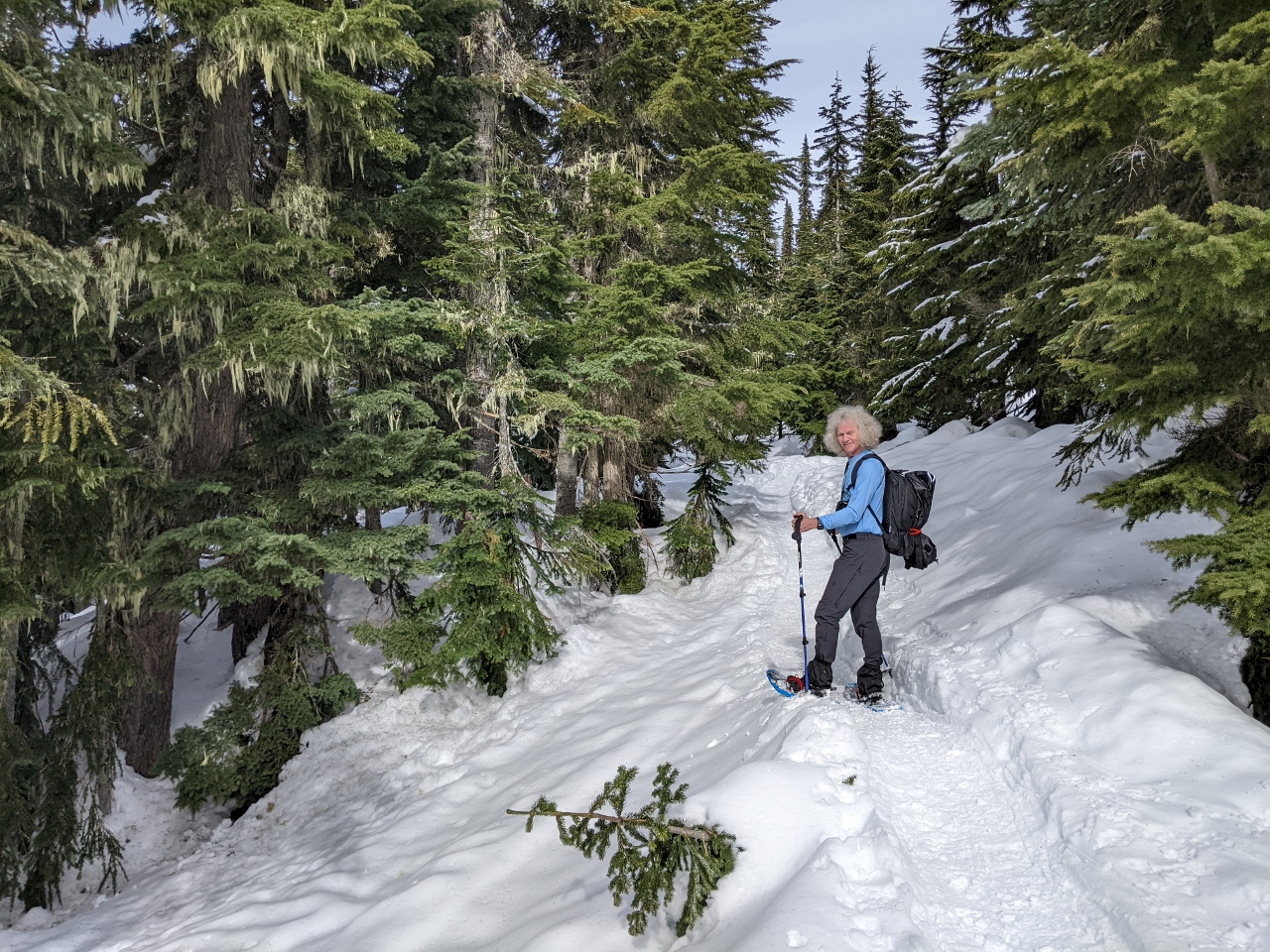
3/6/2022: Woods
Position: 47°58.95'N, -123°28.60'W
Walking through the woods in the sunshine. Snowshoeing has really opened up some amazing winter hiking opportunities.
|
 |
3/6/2022: Climbing
Position: 47°58.91'N, -123°28.67'W
Starting the big climb back up the hill. We were super-tired by the time we reached the top. It looks like a gentle slope, but the last half is sufficiently steep that it's quite heavy going.
|
 |
3/6/2022: Steepest
Position: 47°58.86'N, -123°28.72'W
James tackling the steepest section of the hill just short of the top. The snowshoes have amazing traction—we'd have trouble just hiking up such steep slopes bare of snow. Man, this was tiring, but totally worth it with these views.
|
 |
3/6/2022: Bailey Range
Position: 47°58.86'N, -123°28.75'W
The return trip provided us with frequent impressive view to the Bailey Range.
|
 |
3/6/2022: Mt Appleton
Position: 47°58.84'N, -123°28.77'W
We believe that is 6,000ft (1829m) Mt. Appleton to Jennifer's right, looking west from Kahhane Ridge.
|
 |
3/6/2022: Below Ridge
Position: 47°58.62'N, -123°28.98'W
Walking a steep slope below the top of the ridge, with Mt. Angeles just visible in the background.
|
 |
3/6/2022: Road
Position: 47°58.43'N, -123°29.44'W
We're nearly back to the trailhead, with Hurricane Ridge Road visible below.
|
 |
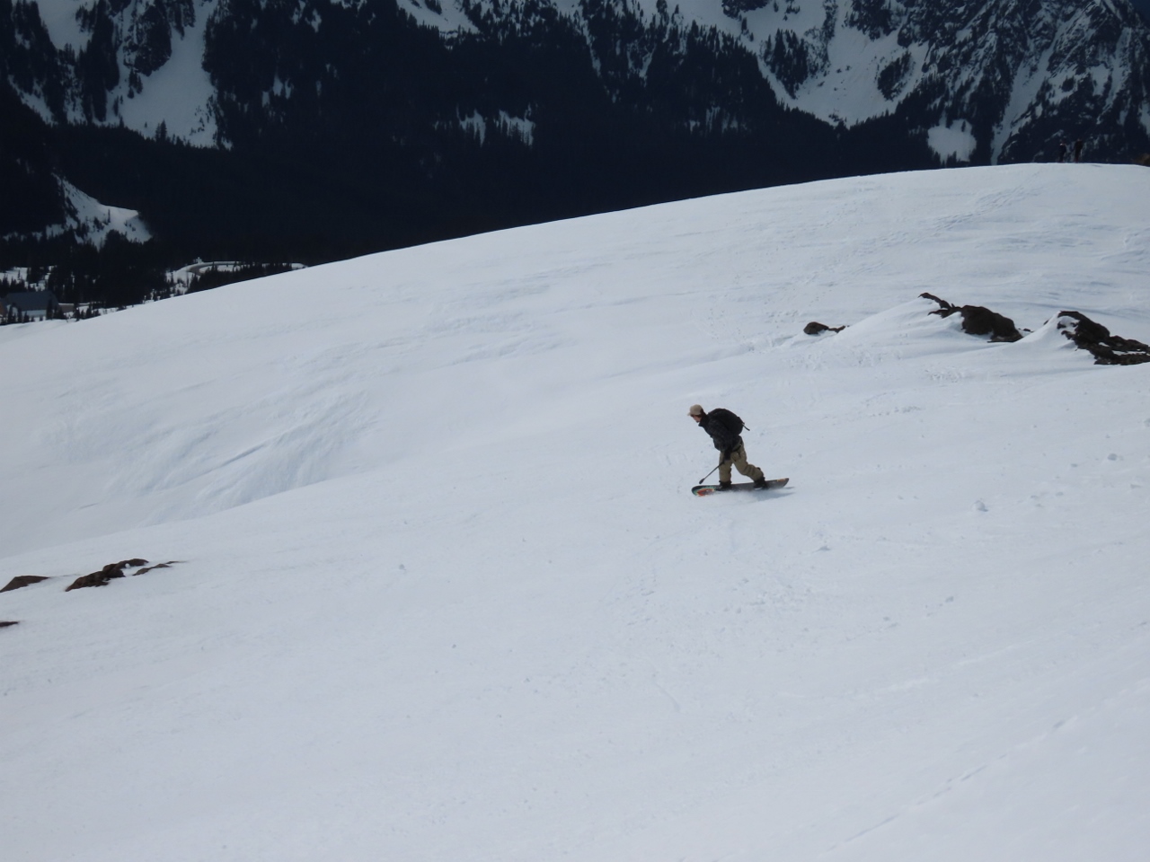
3/6/2022: Tow Rope
Position: 47°58.34'N, -123°29.52'W
Snowboarder riding a tow rope up in the ski area just between the parking lot and the trailhead.
|
 |
3/6/2022: Snow Tubing
Position: 47°58.26'N, -123°29.51'W
Snow tubing is popular at Hurricane Ridge.
|
 |
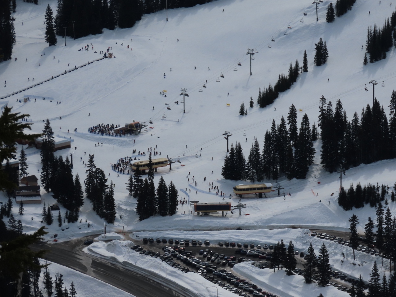
3/6/2022: Skiing
Position: 47°58.22'N, -123°29.55'W
In the center of the shot, a skier coming down the hill with the tow rope visible at left. The trailhead for our hike was at the top of the rope.
|
 |
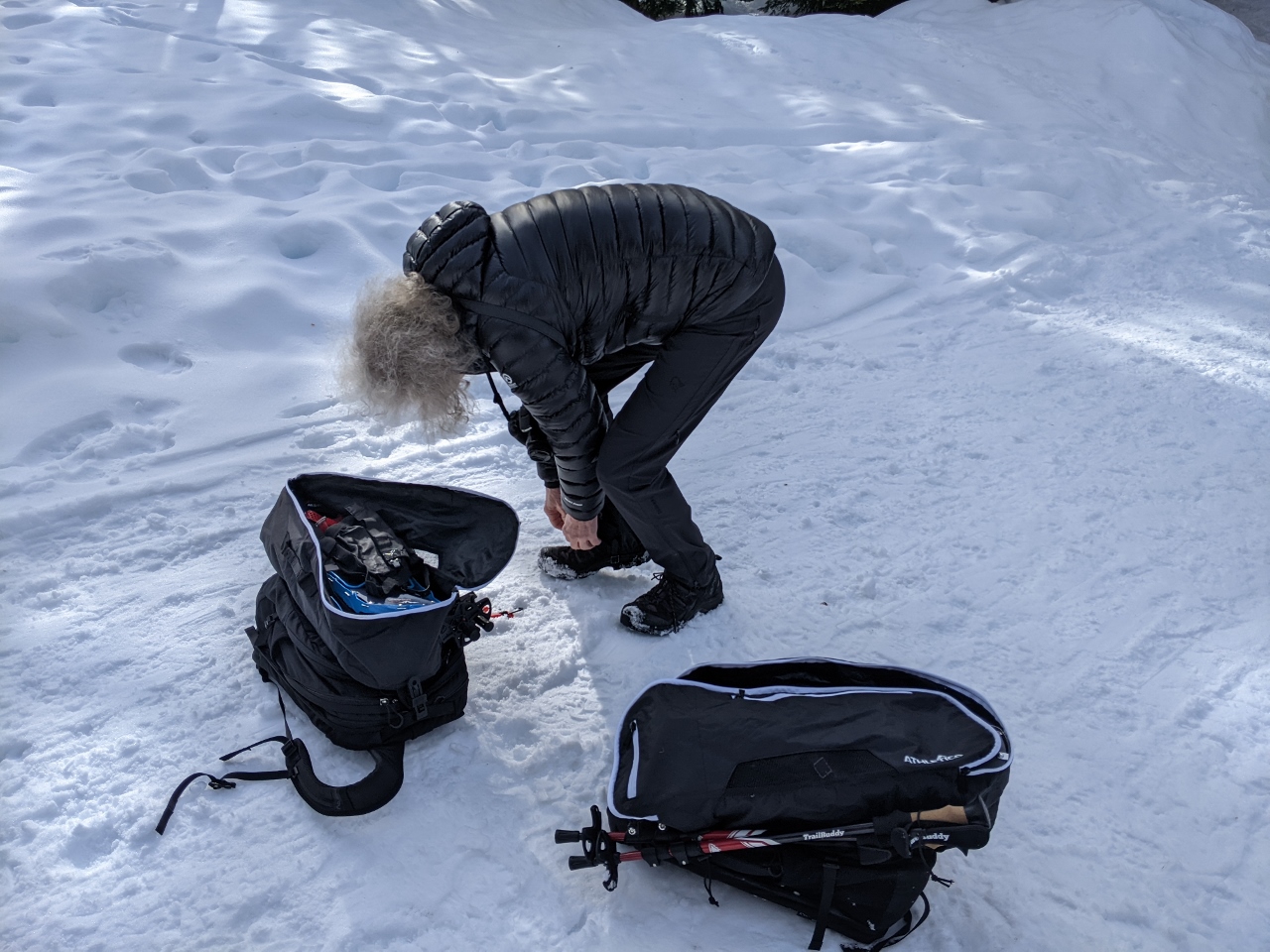
3/6/2022: Stowing Gear
Position: 47°58.21'N, -123°29.69'W
We bought a couple of Athletico snowshoe bags to stow our gear and are quite happy with them. They have several pockets for keeping things organized, elastic tiedowns to secure our poles, and they keep the sharp snowshoes from damaging anything.
|
 |
3/6/2022: Microspikes
Position: 47°58.21'N, -123°29.69'W
Putting on microspikes to walk the icy parking lot back to the car.
|
 |
3/6/2022: Pacific Fleet
Position: 48°7.27'N, -123°26.05'W
Mural depicting the Pacific Fleet at Port Angeles. The fleet exercised there annually from 1895 to 1935 and one year had 70 ships in the harbor.
|
 |
3/6/2022: Events Hall
Position: 48°7.25'N, -123°26.03'W
The striking Field Arts & Events Hall in Port Angeles, scheduled to open in 2023.
|
 |
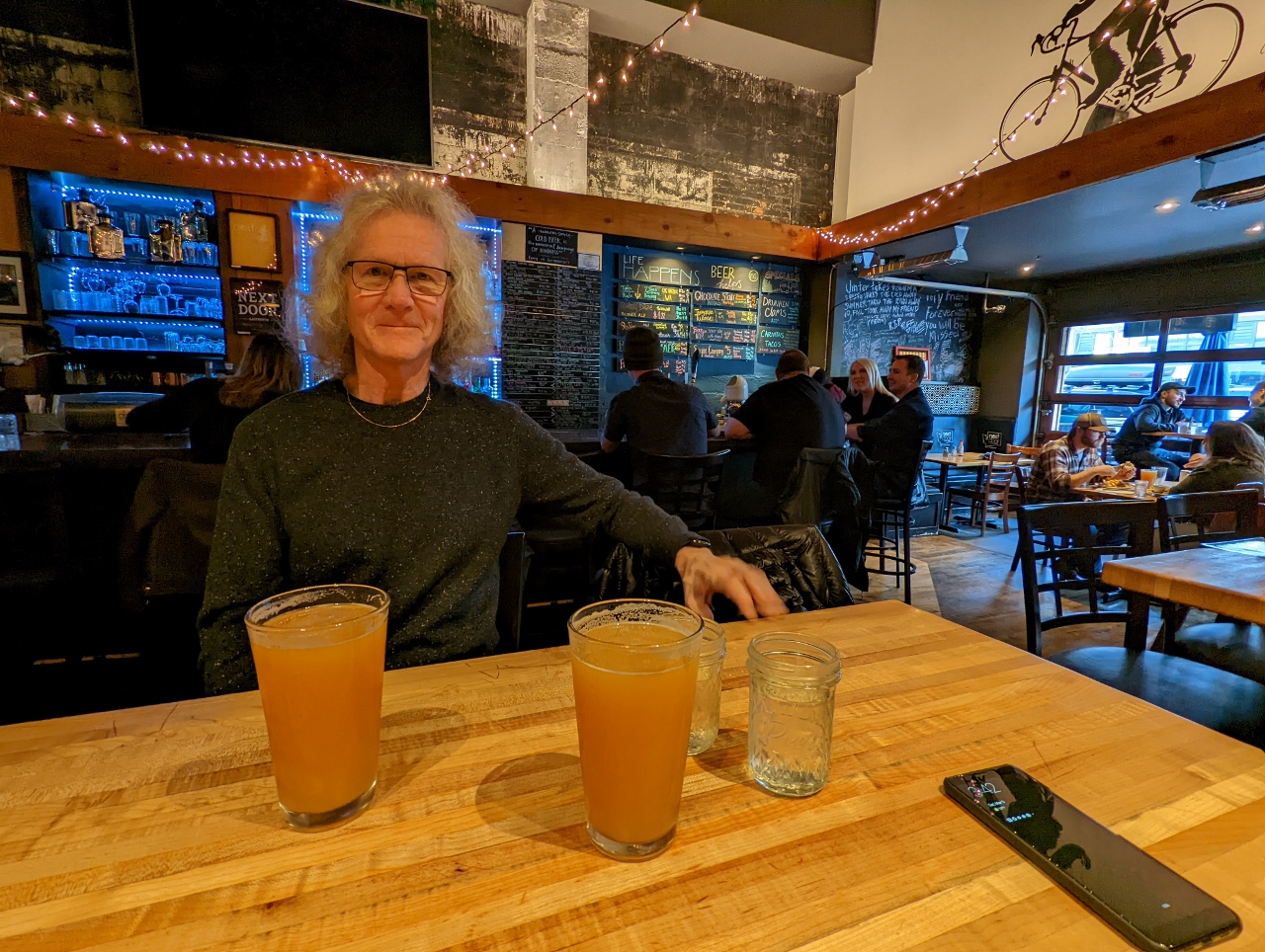
3/6/2022: Barhop Brewing
Position: 48°7.27'N, -123°26.00'W
An excellent dinner at Barhop Brewing and Artisan Pizza. Thanks for the recommendation John Worl!
|
 |
3/6/2022: Coho
Position: 48°7.27'N, -123°26.00'W
The Coho arrived into Port Angeles while we were having dinner at Barhop Brewing. Here they have attached a bow line and are completey a pivot before backing into the berth.
|
 |
3/6/2022: Bathroom Sign
Position: 48°7.26'N, -123°26.00'W
We got a giggle out of the bathroom sign at Barhop Brewing.
|
 |
3/6/2022: Dusk
Position: 48°7.27'N, -123°26.00'W
Dusk looking into Port Angeles Harbor from Barhop Brewing, ending a fabulous weekend of snowshoeing in Olympic National Park.
|
 |
3/7/2022: Breakfast
Position: 48°7.13'N, -123°25.68'W
Breakfast in our hotel room at the Red Lion Inn in Port Angeles with a view to the harbour.
|
 |
3/7/2022: Coho
Position: 48°7.13'N, -123°25.68'W
The Coho departing at 8:20am on the first run of the day to Victoria.
|
 |
3/7/2022: New Boots
Position: 48°7.13'N, -123°25.67'W
Jennifer's new hiking boots, Salomon Quests, arrived last week and this was our first chance to try them out. We're both now on our third pair each of Salomon hiking boots. They are super-comfortable, very light, and have excellent grip.
|
 |
3/7/2022: Packed
Position: 48°7.13'N, -123°25.67'W
Our gear all packed up and ready to go in two LL Bean Rolling Duffles plus our Engel soft-sided cooler. We're finding the duffles very useful for road trips, allowing us to easily transport a huge amount of gear between our car and our apartment or hotel room. And even on quick day trips, we use one to carry all our snowshoe gear and packs.
|
 |
3/7/2022: Hour Wait
Position: 47°58.98'N, -122°53.13'W
We were debating whether to take a ferry back to Seattle, or to drive around through Tacoma. Surprisingly, driving the whole way only takes an extra 15 minutes over the ferry, but that's assuming you just drive onto the ferry with no delays. The road sign ahead indicates a one-hour wait for the ferry, so we opted to drive around instead.
|
 |
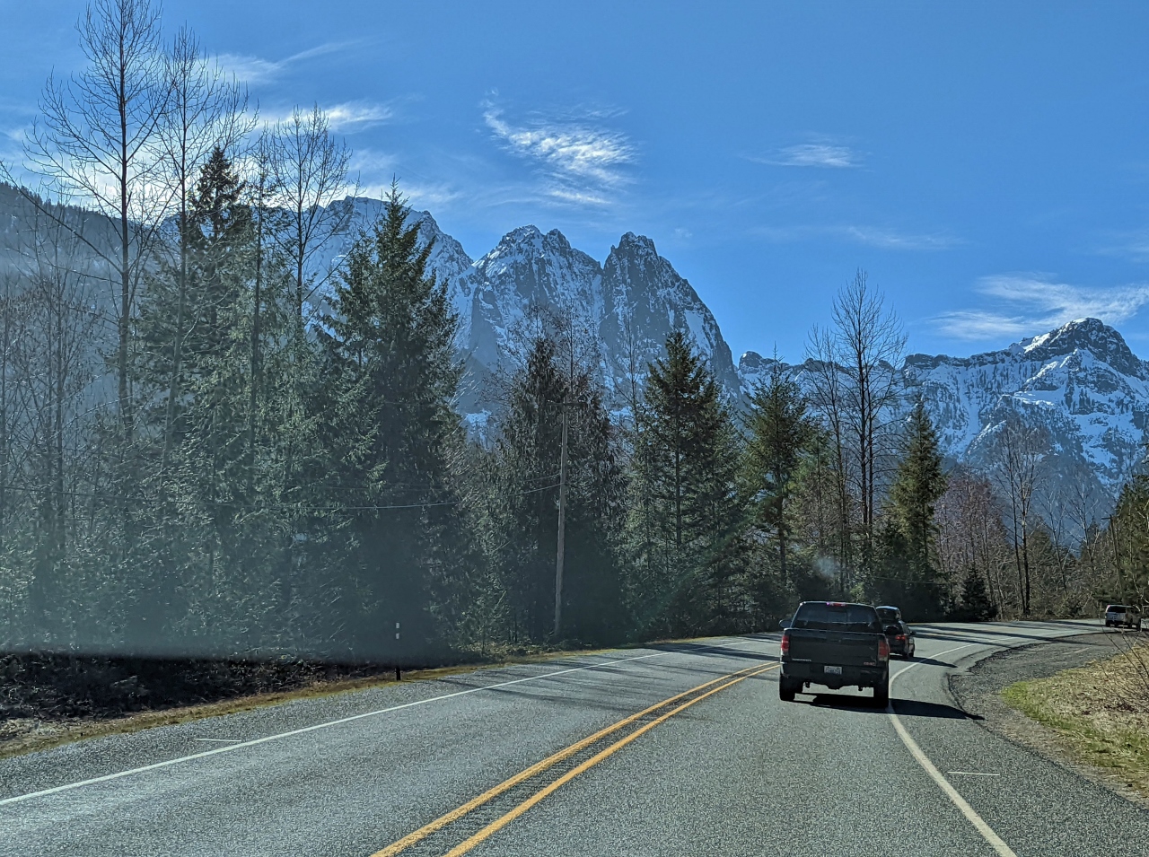
3/7/2022: Tacoma Narrows Bridge
Position: 47°16.47'N, -122°33.54'W
We've driven over the Tacoma Narrows Bridge a few times recently, but always westbound. This is our first time heading east on the bridge since returning to Seattle.
|
 |
3/7/2022: Taqueria la Michoacana
Position: 47°13.40'N, -122°27.07'W
Delicious street tacos at Taqueria la Michoacana in Tacoma, one of perhaps a half-dozen taquerias within a few blocks of each other.
|
 |
3/7/2022: Road
Position: 47°18.07'N, -122°10.42'W
Taking the scenic route along SE Lake Holm Road near Auburn. We just crossed over, and are running adjacent to, the Green River. The waterway was made infamous by serial killer Gary Leon Ridgway. Known as the Green River Killer because his first five victims were found there, Ridgway was convicted of 49 murders taking place in the 1980s and 1990s, and is believed to have killed at least 71. His arrest and trial were international news when we lived in Seattle in the early 2000s.
|
 |
3/7/2022: Ten Trails
Position: 47°18.65'N, -122°2.43'W
From rural country roads, we passed through the modern buildings and wide streets of Ten Trails, a new planned community in Black Diamond, WA.
|
 |
3/7/2022: Ravensdale
Position: 47°21.47'N, -121°58.44'W
The Ravensdale Market has been a grocery store and ad-hoc community center for the small town of Ravensdale for over a century.
|
 |
3/7/2022: Flooding
Position: 47°22.45'N, -121°58.53'W
Several rivers in King County have entered flood stage due to recent steady, heavy rainfall. This fence is almost underwater in sections.
|
 |
3/7/2022: Cedar River
Position: 47°22.49'N, -121°58.28'W
Crossing over the 45 mile (72 km) Cedar River. The river originates in the Cascade Range and flows west into the southern end of Lake Washington.
|
 |
3/7/2022: Issaquah
Position: 47°31.84'N, -122°2.19'W
Passing along Front Street in Issaquah, headquarters of the multinational retail company Costco. The city is very close to the main Microsoft campus, where we worked in the 1990s, and many of our co-workers lived here in Issaquah.
|
 |
3/7/2022: Lake Sammamish
Position: 47°38.08'N, -122°4.32'W
One of dozens of waterfront homes along Lake Sammamish. The "No Trail Access" sign refers to the East Lake Sammamish Trail, a rail-to-trail completed in 2006 along the former route of the BNSF railway. The railway right-of-way ran through dozens of waterfront properties whose owners delayed construction for a decade through legal battles, eventually backing down after losing a federal lawsuit.
|
 |
3/7/2022: Wagly
Position: 47°36.27'N, -122°7.95'W
At Wagly Pet Campus in Bellevue to pickup Spitfire where we board him when we are out of town. We really like the care and attention he receives there, and their convenient operating hours. And with Spitfire's advanced age of nearly 19 years, we particularly appreciate that they are a full-service veterinary hospital should anything go wrong. The only downside is that the location is a bit out of our way from downtown Seattle.
|
 |
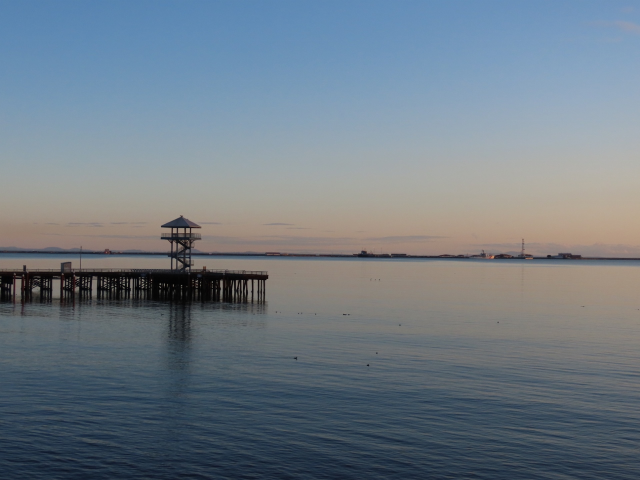
3/7/2022: Ovation of the Seas
Position: 47°37.00'N, -122°20.69'W
Our "pet cruise ship", Ovation of the Seas, back in Seattle for another quick fueling and provisioning stop after about a month away.
|
 |
3/9/2022: The Brothers
Position: 47°37.00'N, -122°20.55'W
The double summit of The Brothers mountains in Olympic National Park, viewed from our apartment. The southern (left) peak is 6,842 feet (2,085 m) Mt Edward and the northern peak is 192 feet (59 m) lower. Surveyor George Davidson named these mountains in 1856 after the two brothers of his future wife, Ellinor Fauntleroy. Davidson had already named his brig, R.H. Fauntleroy, after his future father-in-law, and continued this theme to name several area features after his family-to-be, including Fauntleroy Cove south of Seattle.
|
 |
3/9/2022: Chair
Position: 34°1.70'N, -118°23.23'W
This is a picture from James' hotel room on his last business trip to Los Angeles. We were thinking of entering it into the world's ugliest chair competition.
|
 |
3/9/2022: Culver Studios
Position: 34°1.40'N, -118°23.49'W
The iconic, over a century-old Culver Studios is home to Amazon Studios. James is there for a few days on business.
|
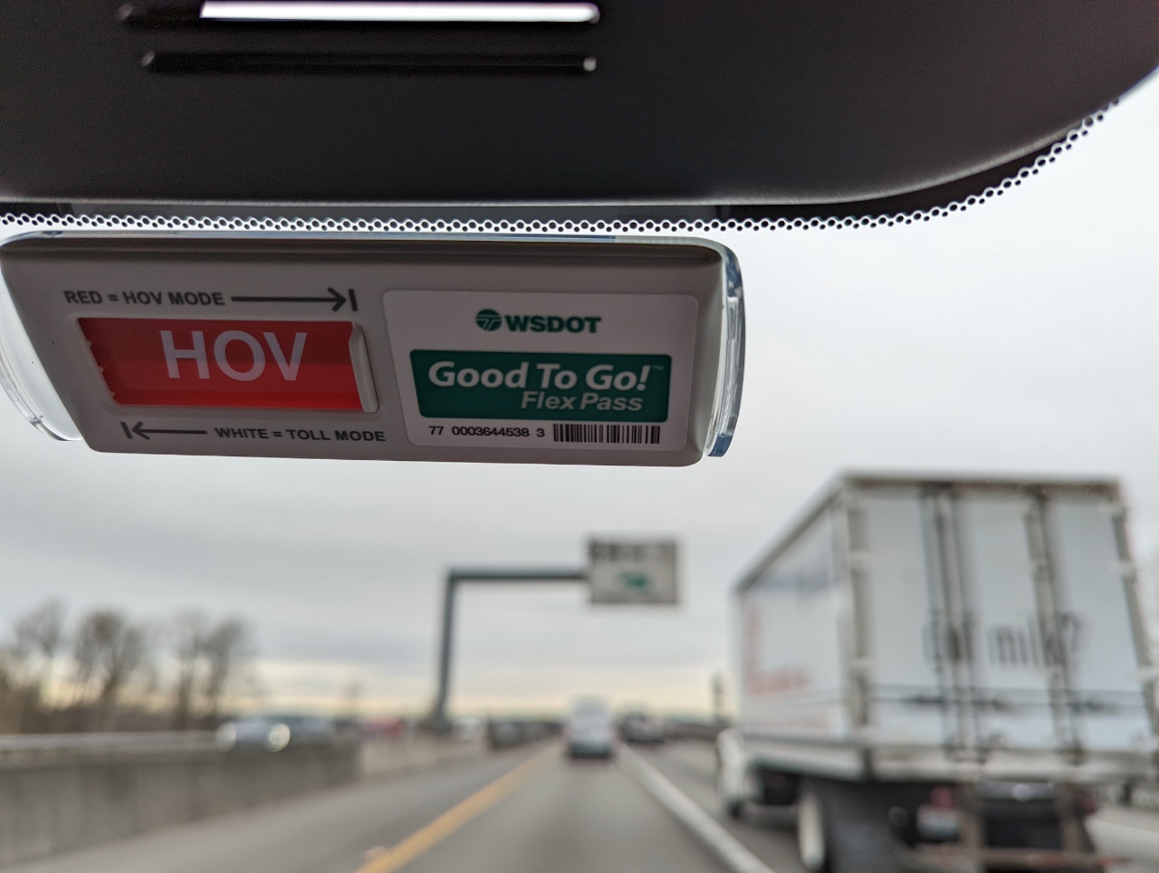 |
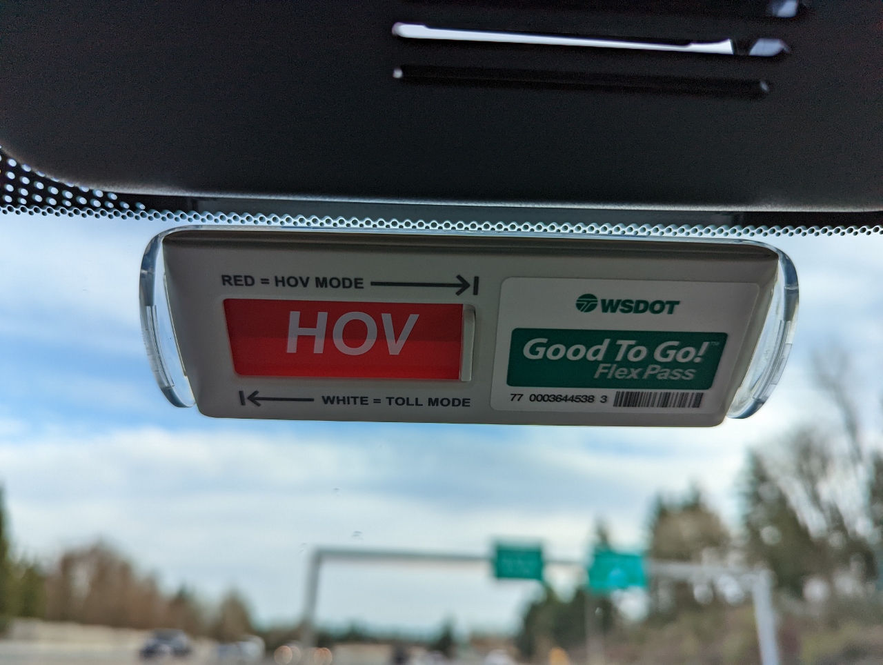
3/11/2022: Flex Pass
Position: 47°23.86'N, -122°13.80'W
On the road with our new Flex Pass for the Washington State toll roads. The pass allows for reduced charges on basic toll roads, such as the Tacoma Narrows Bridge, and free use of high-occupancy vehicle (HOV) toll lanes when eligible (2 or 3 people in the car depending on the road and time of day). The left side of the pass has a slider that is normally left in standard toll mode (white), but can be set to HOV (red) to indicate HOV eligibility.
Right now we're traveling in the SR 167 high-occupancy toll lanes and are HOV-eligible so we've slid it over to red. This indicates to the toll-recording equipment that we are claiming HOV status and shouldn't be charged the toll. This also is visible to any law enforcement we might pass, who can issue a ticket if the vehicle is not in fact HOV-eligible. |
 |
3/11/2022: Skookum Falls
Position: 47°3.18'N, -121°34.29'W
250ft (76 m) Skookum Falls, seen from the viewpoint off Highway 410.
|
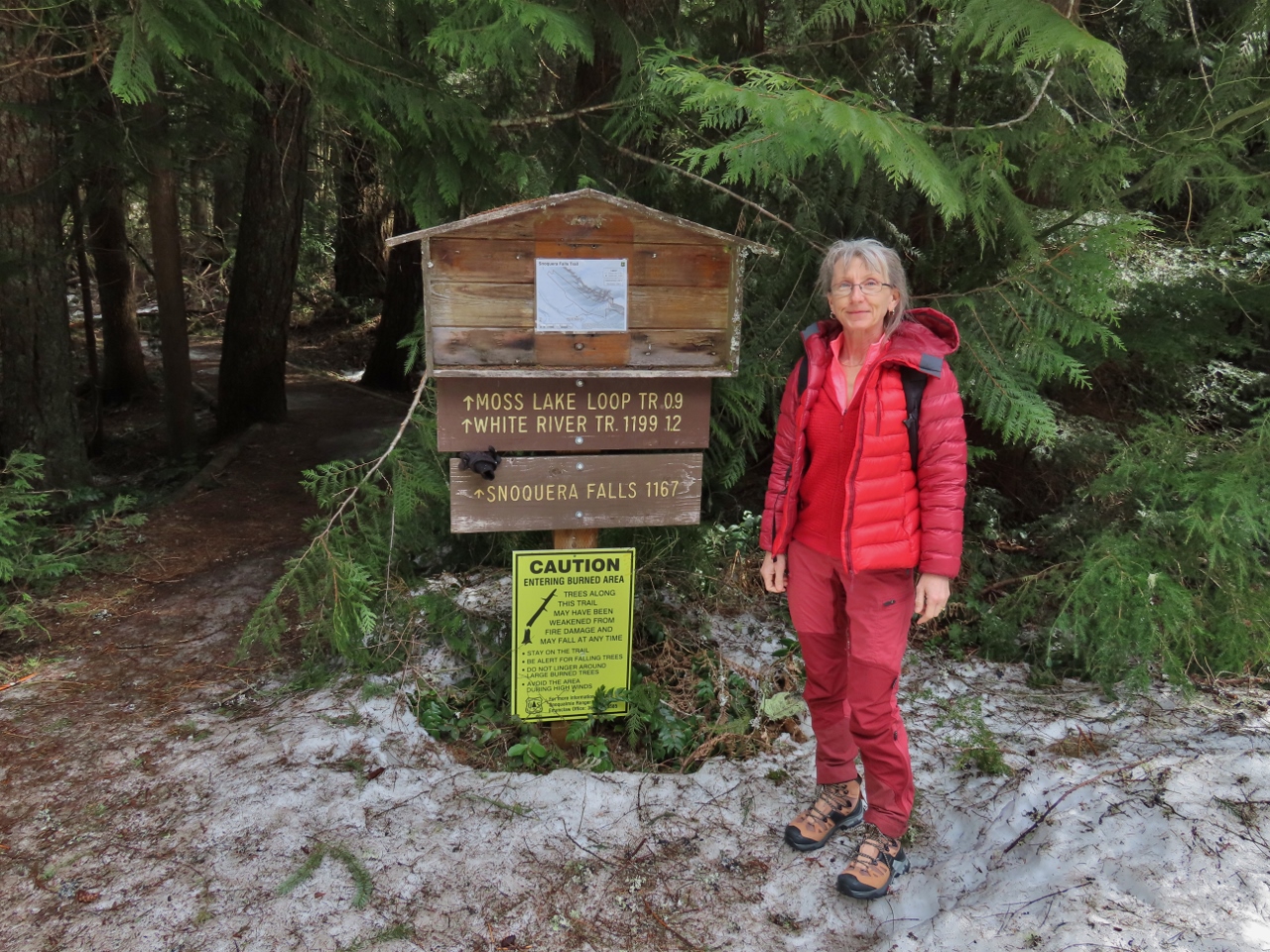 |
3/11/2022: Trailhead
Position: 47°2.18'N, -121°33.51'W
At the trailhead for a short hike to Snoquera Falls in Mt. Baker Snoqualmie National Forest. A bit of snow is at the trailhead, but the trail itself was mostly bare and easy walking.
|
 |
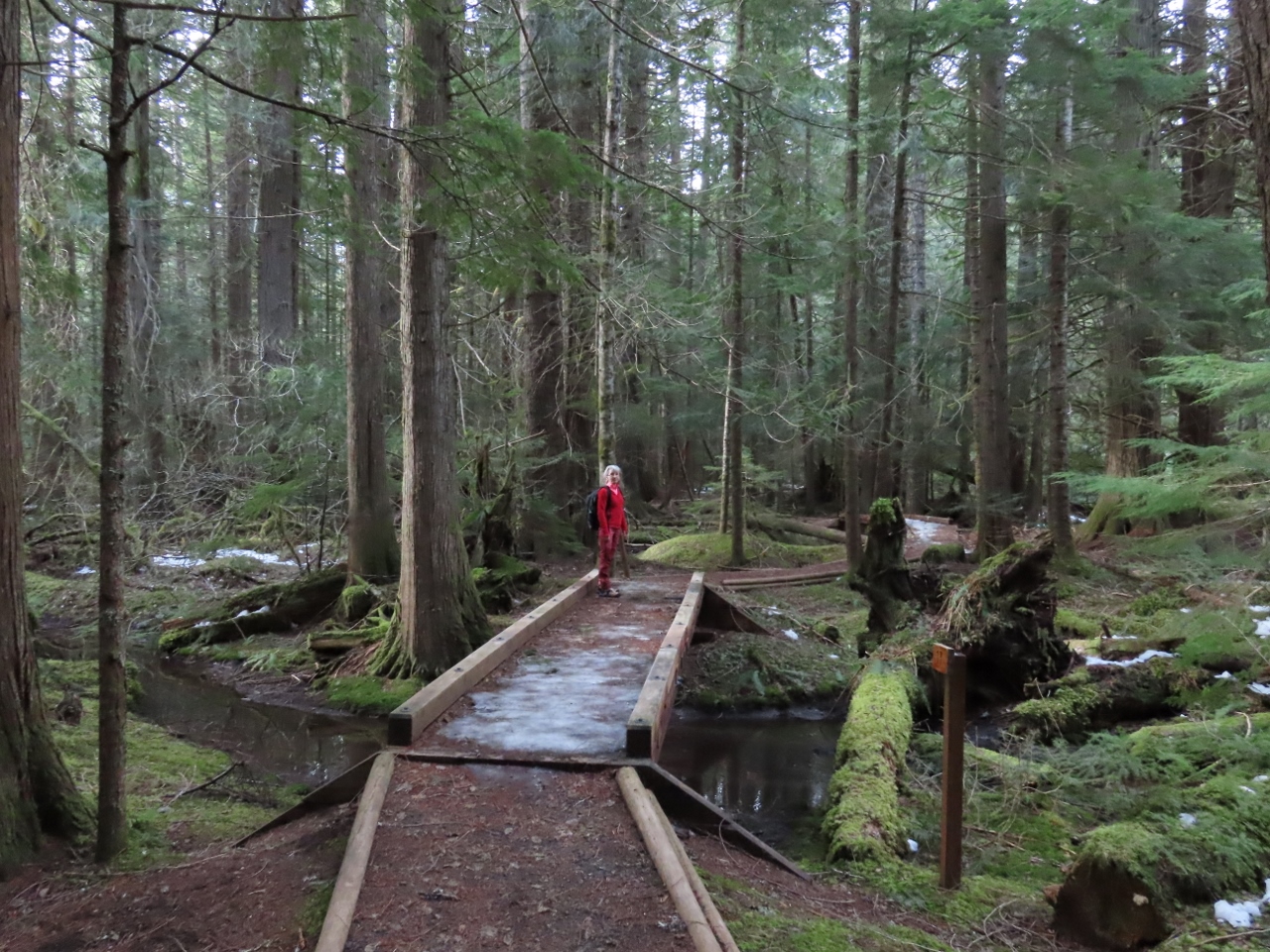
3/11/2022: Snoquera Creek
Position: 47°2.19'N, -121°33.50'W
Footbridge crossing Snoquera Creek that flows from Snoquera Falls. We really enjoyed the walk through the wonderfully green and healthy forest.
|
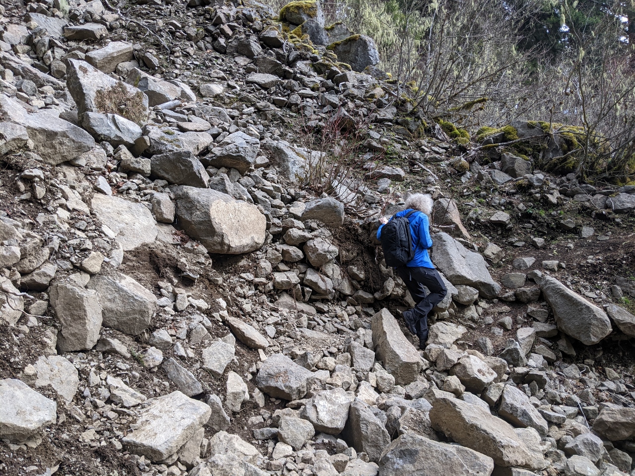 |
3/11/2022: Rockslide
Position: 47°2.56'N, -121°33.67'W
Passing through a fairly large rockslide on the trail to Snoquera Falls. The slide looks recent, but actually occurred in 2008.
|
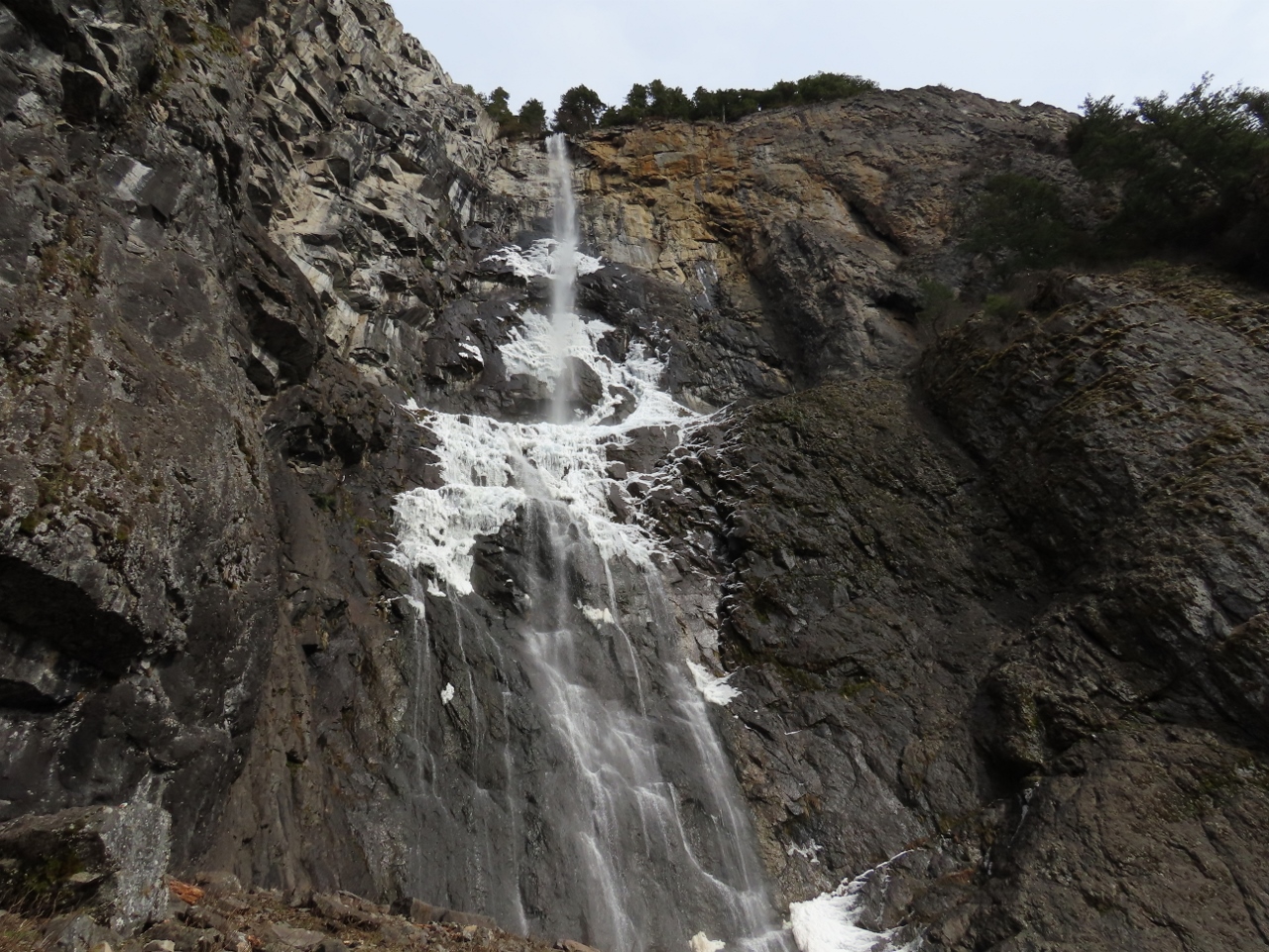 |
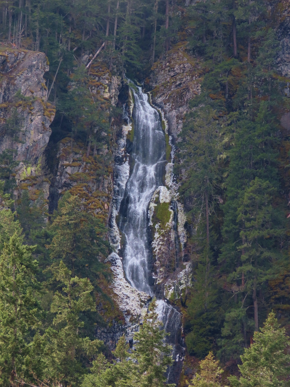
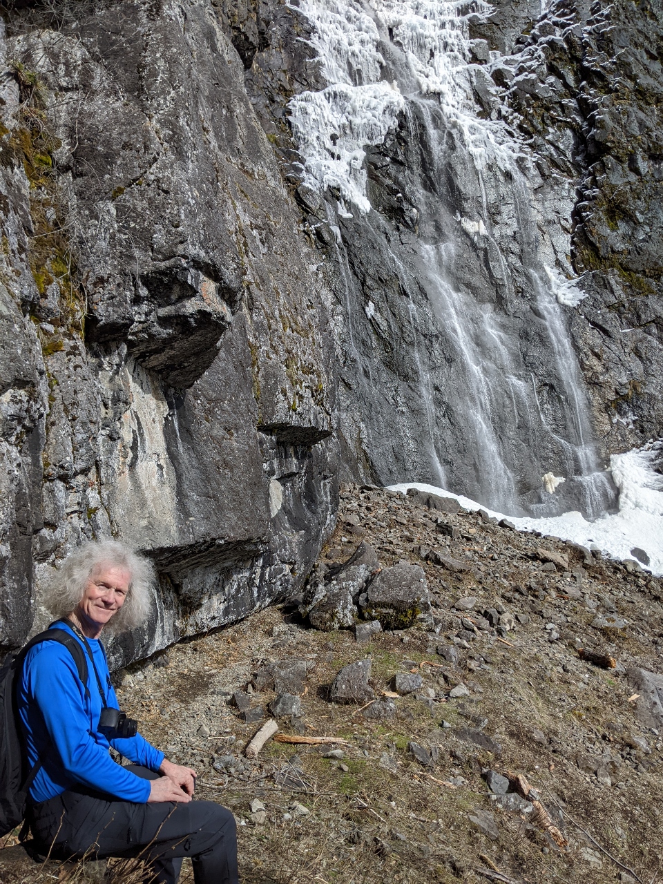
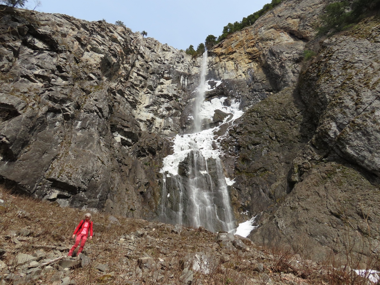
3/11/2022: Snoquera Falls
Position: 47°2.37'N, -121°33.22'W
Snoquera Falls cascading 400 ft (122 m) over the cliff. The falls were partially frozen, but melting. While we were there, chunks of snow and ice continuously came loose and fell from the wall. We were careful not to get too close directly underneath.
|
 |
3/11/2022: Break
Position: 47°2.39'N, -121°33.16'W
Taking a break with a view to the Snoquera Falls.
|
 |
3/11/2022: Descending
Position: 47°2.40'N, -121°33.21'W
Jennifer descending the slope below Snoquera Falls.
|
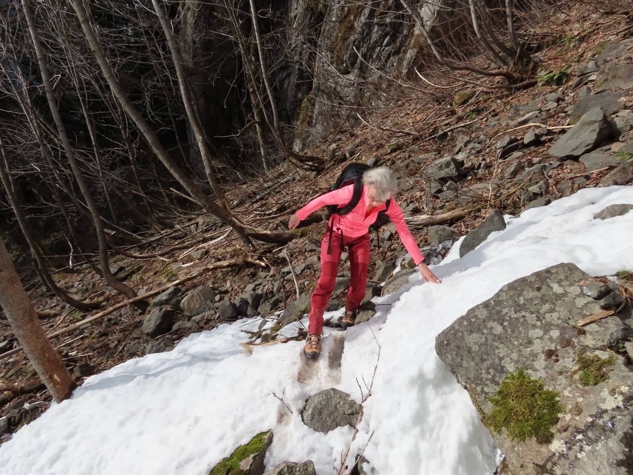 |
3/11/2022: Crossing Creek
Position: 47°2.39'N, -121°33.20'W
Carefully crossing over the snow around Snoquera Creek to continue on a loop route back to the trailhead.
|
 |
3/11/2022: Ice
Position: 47°1.96'N, -121°33.43'W
Crossing another bridge over Snoquera Creek. The bridge we'd passed earlier was fine, but this one was coated in ice and super-slippery.
|
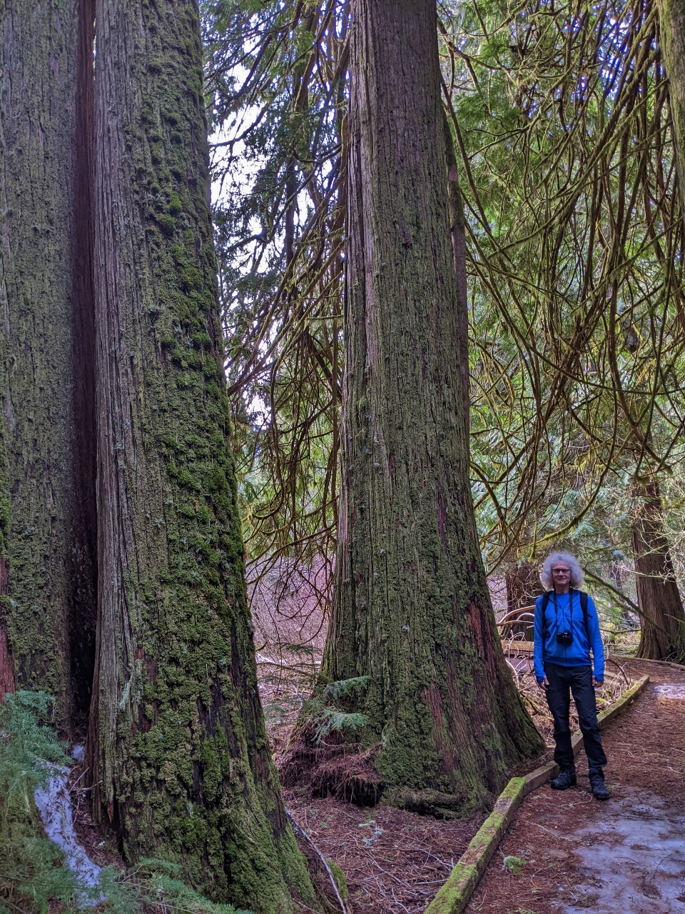 |
3/11/2022: Old Growth
Position: 47°2.13'N, -121°33.45'W
Fabulous old-growth trees along the trail.
|
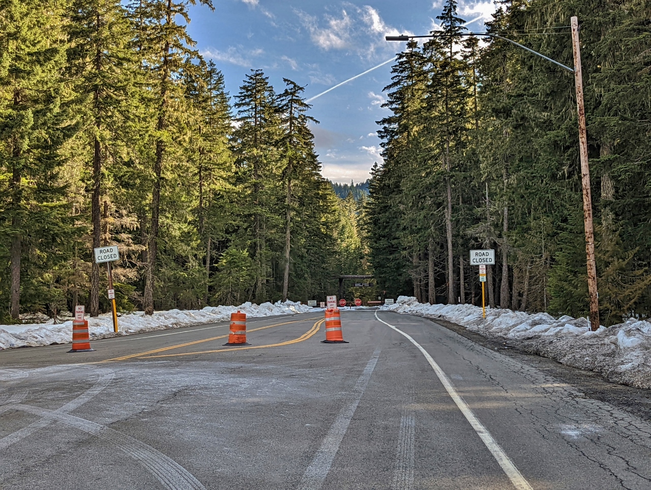 |
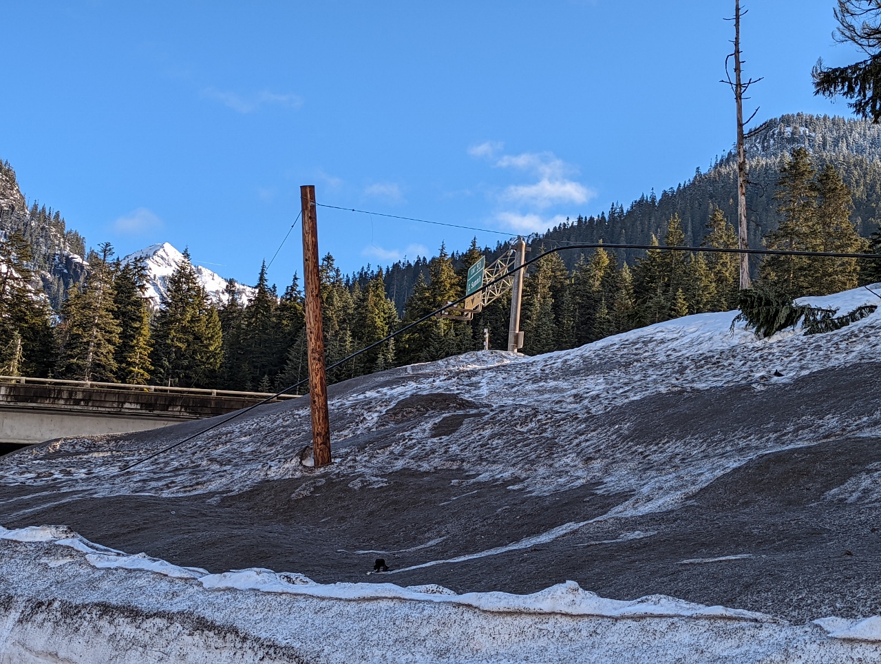
3/11/2022: Road Closed
Position: 46°58.79'N, -121°32.17'W
In the winter, the last turn open on Highway 410 is up to Crystal Mountain ski area. You can see the road dead-ends just ahead. In the summer, you can drive all the way around Mt. Rainier. And weplan to.
|
 |
3/11/2022: Parking
Position: 46°56.92'N, -121°28.43'W
The parking lot at Crystal Mountain Resort is pretty full for a Friday.
|
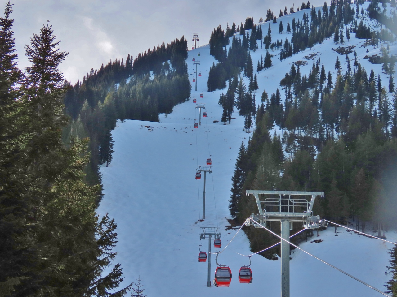 |
3/11/2022: Gondola
Position: 46°56.20'N, -121°28.47'W
The Mt. Rainier Gondola rises 2,400 vertical feet (731 m) is popular year-round for its excellent views to Mt. Rainier. And at the top is the Summit House Restaurant, Washington’s highest-elevation restaurant at 6,872 feet (2,095m).
|
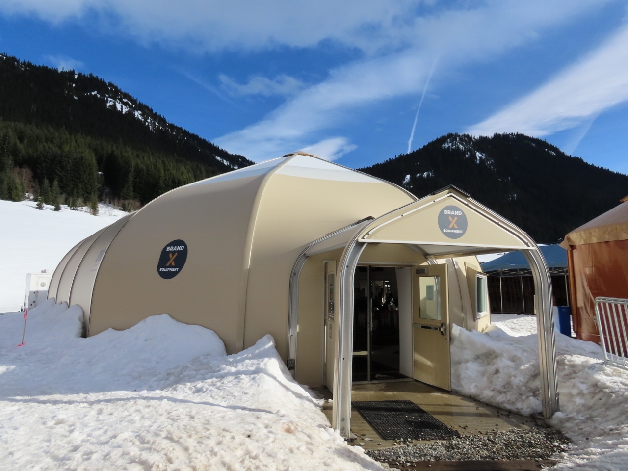 |
3/11/2022: Brand X Equipment
Position: 46°56.20'N, -121°28.47'W
The Brand X Equipment Pro Shop at Crystal Mountain, housed in a tension fabric building.
|
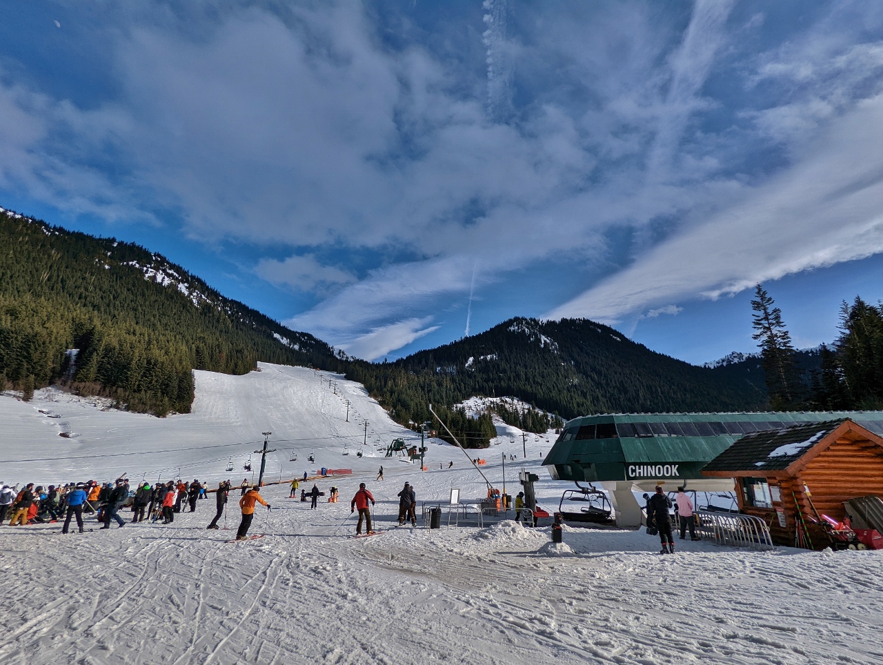 |
3/11/2022: End of Day
Position: 46°56.10'N, -121°28.50'W
It's close to the end of the day at Crystal and traffic on the slopes is beginning to thin.
|
 |
3/11/2022: White River
Position: 47°4.71'N, -121°35.08'W
Crossing over the White River en route to the Sun Top Sno-Park.
|
 |
3/11/2022: Sun Top Sno-Park
Position: 47°4.56'N, -121°35.19'W
End of the road at the Sun Top Sno-Park. The forest service roads beyond are closed for the winter. The Department of Transit plows small sections of roads throughout the state to create Sno-Parks that provide parking for winter activities such as snowshoeing, cross-country skiing and snowmobiling. We parked at one, Asahel Curtis, when we hiked to Franklin Falls and first tried our snowshoes.
|
 |
3/12/2022: Toll Mode
Position: 47°38.66'N, -122°16.78'W
This morning we're traveling across the Evergreen Point Floating Bridge toll bridge, with our Flex Pass in toll mode, en route to Steven's Pass. The bridge, officially called the Governor Albert D. Rosellini Bridge and unofficially the 520 Bridge, carries highway 520 across Lake Washington between Seattle and Bellevue. With a floating span of 7,710-ft (2,350 m), it's the longest floating bridge in the world.
The bridge was completed in 2016 at a cost of $4.56 billion, replacing another floating bridge that opened in 1963. The old bridge had structural issues, and didn't meet more recently-introduced earthquakes standards. Construction of the new bridge began in 2011, before we departed Seattle on our trip around the world. Although the new bridge opened for traffic in 2016, construction is still ongoing around the on-ramps on the Seattle side at Montlake. |
 |
3/12/2022: HOV Mode
Position: 47°39.87'N, -122°11.22'W
We're now driving north in the express toll lanes on I-405 and have switched our Flex Pass to HOV mode. It's a weekend, so the lanes are free for everyone, but we're having fun with our new pass. :)
|
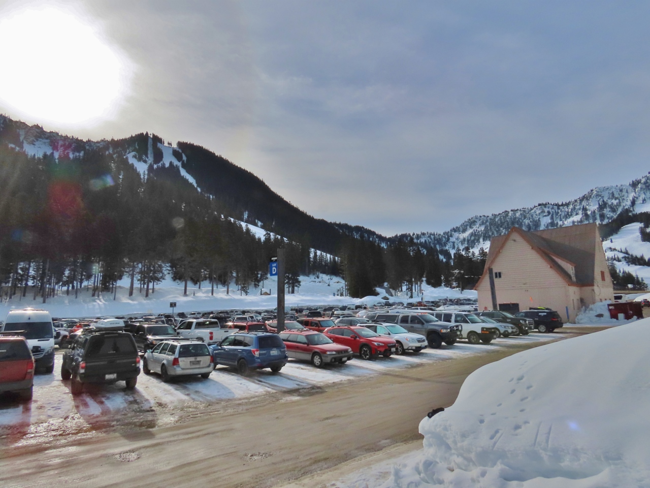 |
3/12/2022: Parking
Position: 47°44.85'N, -121°5.27'W
The parking lot at Steven's Pass is almost full at 9:30 am. We had no trouble getting a spot, but that won't the case in another hour.
|
 |
3/12/2022: Gearing Up
Position: 47°44.85'N, -121°5.41'W
Donning our snowshoes for the hike up to Skyline Lake.
|
 |
3/12/2022: Skyline Lake Trail
Position: 47°44.85'N, -121°5.40'W
Starting up the Skyline Lake Trail at altitude 4,100 ft (1,250m). We usually take a picture of the trailhead sign, but its probably buried under the snow.
|
 |
3/12/2022: Hogsback Express
Position: 47°45.02'N, -121°5.42'W
The view down the Steven's Pass ski area from altitude 4,329 ft (1,320 m) on the trail the Skyline Lake. The lift in the center is the 4-person 4,251ft (1,296m) high-speed Hogsback Express that rises a vertical distance of 1007 ft (307m) in just under five minutes at a speed of 16 ft/sec (5m/sec). To the left is the shorter and tamer Daisy lift that rises a vertical distance of 311 ft (95 m) at a speed of 7.5 ft/sec (2.3 m/sec).
|
 |
3/12/2022: Trail
Position: 47°45.30'N, -121°5.68'W
On the well-trod trail to Skyline Lake. The temperature is just above freezing and we've gotten so warm on the hike that we've shed our gloves and two jackets, and are down to just a single core layer.
|
 |
3/12/2022: Skyline Lake
Position: 47°45.33'N, -121°5.70'W
We arrived at Skyline Lake at altitude 4,995ft (1523m) in just over an hour with an altitude gain of 895ft (273m). The group visible in the foreground is an avalanche safety class. They were being trained to find skiers or snowshoers buried in an avalanche. Backcountry snowsporters are encouraged to carry a location beacon to help find them in the case of an avalanche.
|
 |
3/12/2022: Powder
Position: 47°45.53'N, -121°6.01'W
We continued past Skyline Lake for some mountain views. Here James is working through some deep powder off the trail to get a view to the north.
|
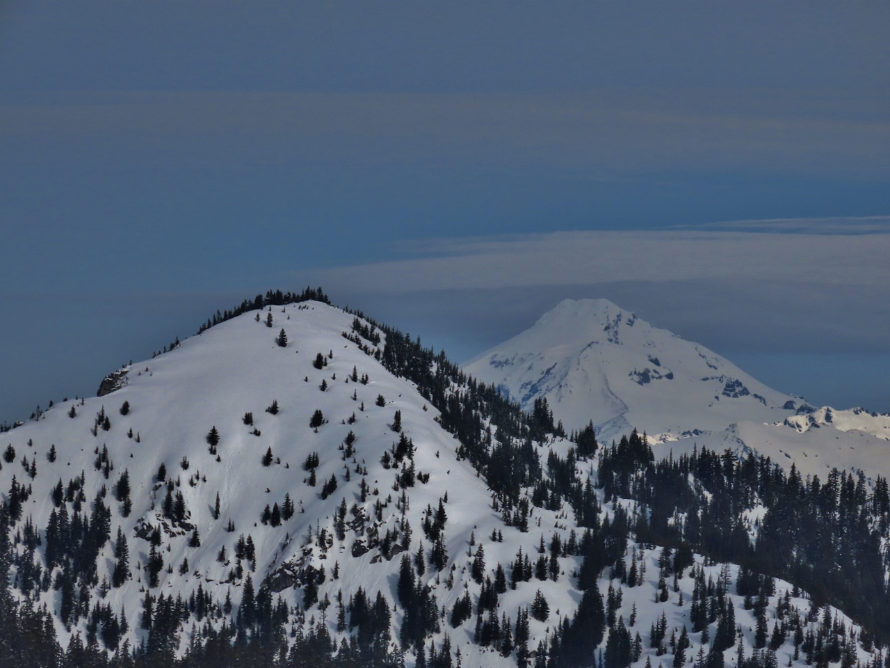 |
3/12/2022: Glacier Peak
Position: 47°45.50'N, -121°6.01'W
Great view north to 10,525-ft (3,207-m) snow-encrusted Glacier Peak, with 5741-ft (1,750m) Mount McCausland in the foreground. On clear days, we can see Glacier Peak from our Seattle apartment.
|
 |
3/12/2022: Mt Daniel
Position: 47°45.48'N, -121°6.05'W
The craggy quintuple peaks of 7,960+ ft (2,430+ m) Mt Daniel, looking southwest from above Skyline Lake.
|
 |
3/12/2022: Lichtenberg Mountain
Position: 47°45.46'N, -121°6.04'W
The dramatic tooth of 5,844-ft (1781 m) Lichtenberg Mountain pierces the sky to our north.
|
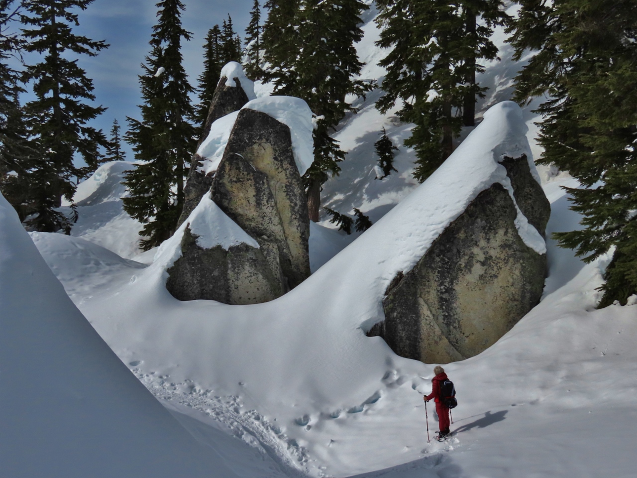 |
3/12/2022: Rock Garden
Position: 47°45.43'N, -121°6.10'W
A rock garden of massive house-sized rocks, covered with snow, on Skyline Ridge above Skyline Lake.
|
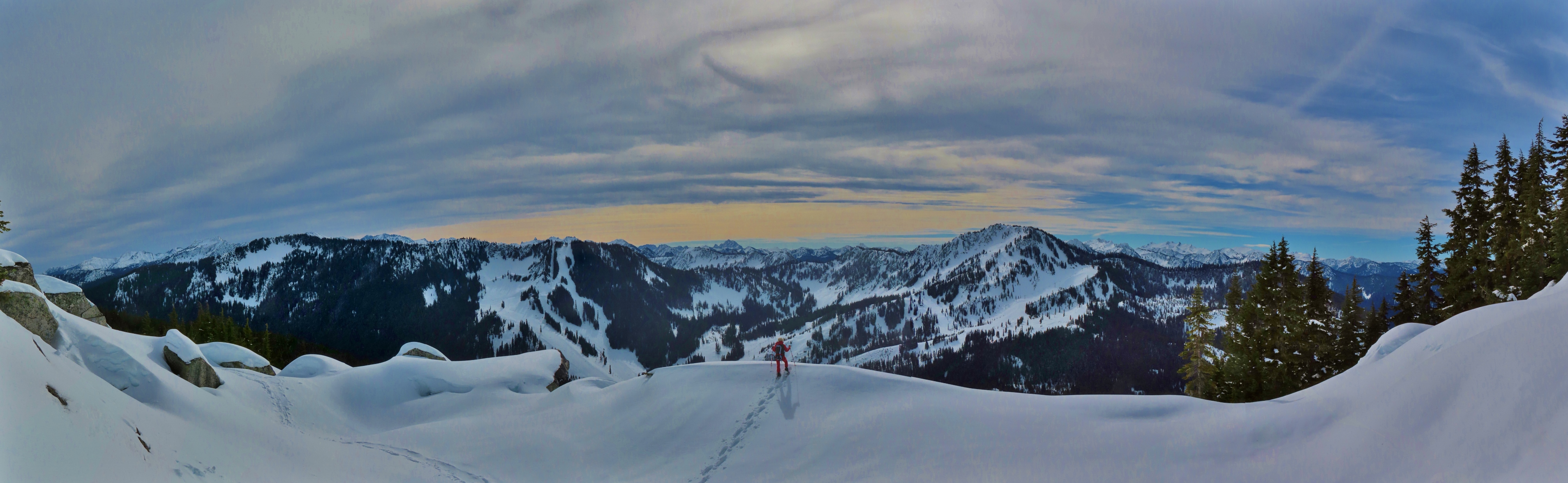 |
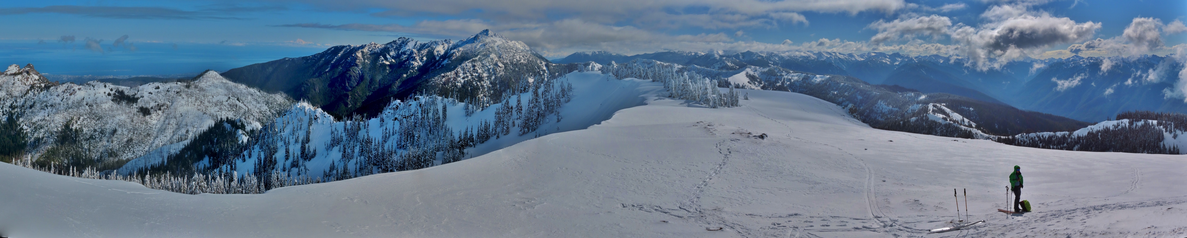
3/12/2022: Panorama
Position: 47°45.42'N, -121°6.14'W
The amazing view west towards the Steven's Pass ski area from elevation 5,323 ft (1622m) on Skyline Ridge. The closest mountains are 5,858-ft (1,785m) Big Chief on the left and 5,853-ft (1,784 m) Cowboy on the right (click image for a larger view).
|
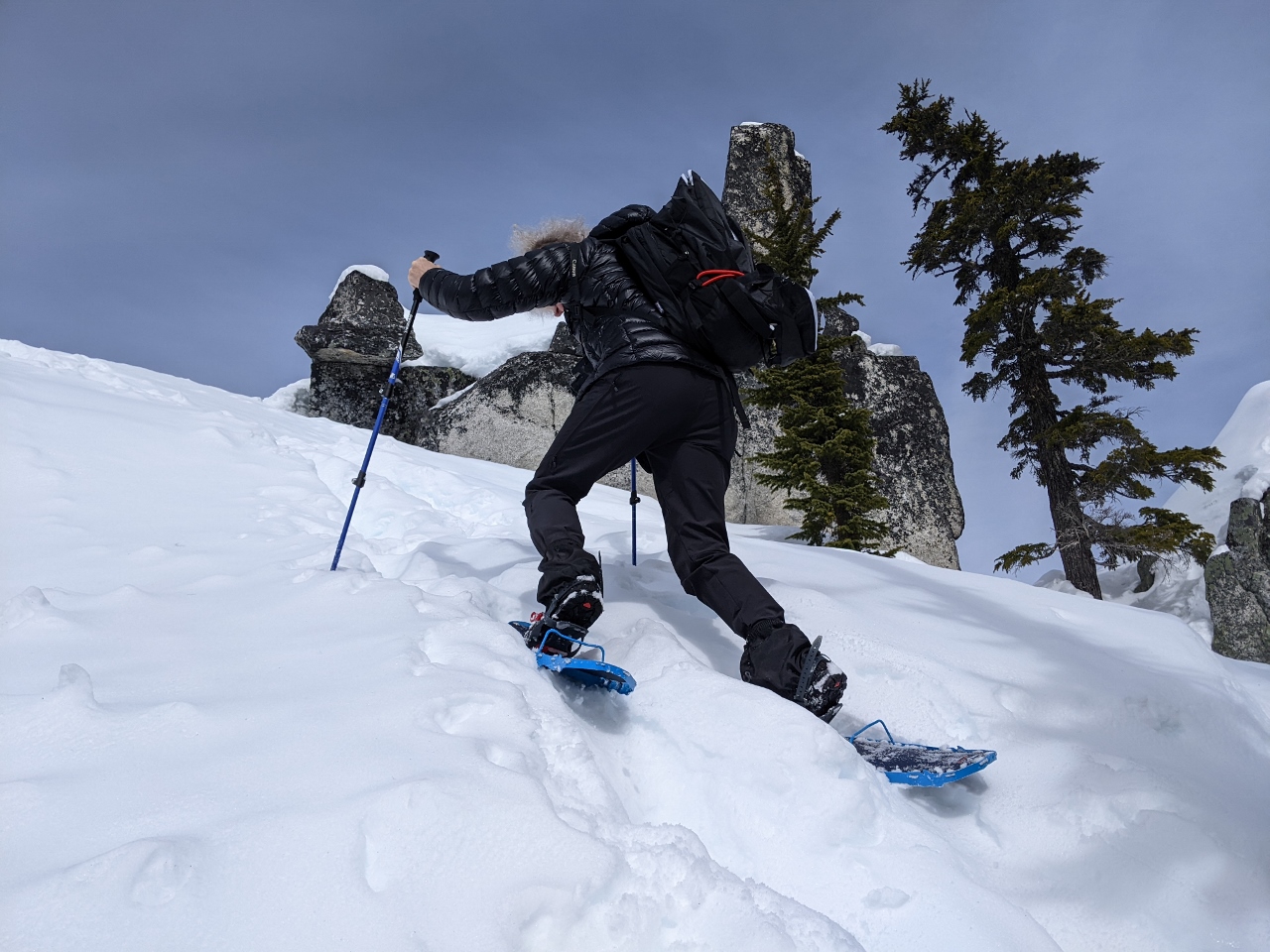 |
3/12/2022: Steep Climb
Position: 47°45.41'N, -121°6.20'W
Looking for a little more elevation, we made the steep climb to an pinnacle above the ridge. Here James is climbing a particularly steep section. Our MSR Lightning Ascent snowshoes are remarkably capable. We are able to climb terrain so steep that we'd have difficulty wearing just boots on bare ground.
|
 |
3/12/2022: View North
Position: 47°45.41'N, -121°6.20'W
Jennifer enjoying the wonderful view north from the pinnacle we climbed. In the far distance are Mount McCausland with Glacier Peak visible behind.
|
 |
3/12/2022: Glacier to Cowboy
Position: 47°45.41'N, -121°6.20'W
Panoramic view from Glacier Peak at left (north), through to Cowboy Peak and the Steven's Pass Resort at right (southwest), from the pinnacle of Skyline Ridge (click image for a larger view).
|
 |
3/12/2022: Queues
Position: 47°45.41'N, -121°6.21'W
Close-up to the queues of people waiting for the various lifts at the Steven's Pass Resort.
|
 |
3/12/2022: Snack
Position: 47°45.42'N, -121°6.21'W
Enjoying a snack with a view to the Steven's Pass Resort and the mountains beyond.
|
 |
3/12/2022: Snow Sculpture
Position: 47°45.42'N, -121°6.21'W
Fantastic wind-carved natural snow sculpture on the pinnacle atop Skyline Ridge.
|
 |
3/12/2022: Snow Fence
Position: 47°45.41'N, -121°6.21'W
A man-made snow fence below us on the ridge above Skyline Lake.
|
 |
3/12/2022: Descending
Position: 47°45.42'N, -121°6.21'W
Descending from the pinnacle of Skyline Ridge. We don't use trekking poles when hiking, but are finding them invaluable when snowshoeing, particularly on steep slopes.
|
 |
3/12/2022: One More View
Position: 47°45.40'N, -121°6.17'W
A last view from Skyline Ridge before we descend back to the parking lot.
|
 |
3/12/2022: Path
Position: 47°45.39'N, -121°5.92'W
Following a well-trod path along the edge of Skyline Lake as we return back to the truck.
|
 |
3/12/2022: Bull's Tooth
Position: 47°44.73'N, -121°5.39'W
After dropping of our gear at the truck, we walked into the Steven's Pass Resort for lunch at Bull's Tooth Pub. But it was way too crowded for our taste, so we kept the line moving.
|
 |
3/12/2022: Smokey's
Position: 47°42.72'N, -121°21.58'W
After giving up on crowded Bull's Tooth, we had an excellent meal at Smokey's Restaurant and Brewery about 20 minutes west of Steven's Pass. And we didn't have to wait for a table.
|
 |
3/12/2022: Mountains
Position: 47°48.15'N, -121°30.97'W
Great view to 5,979 ft (1,822 m) Mount Index, left, and 5,452 ft (1,661 m) Mount Persis as we return west to Seattle. We've driven this road a couple of times heading east, but both times looped back another way. This is our first time heading west and the scenery is impressive.
|
 |
3/13/2022: Breakfast Bowl
Position: 47°36.99'N, -122°20.57'W
A delicious Cinnamon Quinoa breakfast bowl to start the day.
|
 |
3/13/2022: Less Snow
Position: 47°24.56'N, -121°26.36'W
The weather has warmed up considerably since our late-January trip up to Snoqualmie Pass and there's much less snow on the mountains and beside the road at altitude 2,406ft (733m).
|
 |
3/13/2022: Wires Buried
Position: 47°25.57'N, -121°24.94'W
At 2,908 ft (886 m) there is still plenty of snow to keep these power lines buried at left.
|
 |
3/13/2022: Bathrooms
Position: 47°25.65'N, -121°24.83'W
We're snowshoeing into Commonwealth Basin today from a summer trailhead for the Pacific Crest Trail. The summer bathrooms at the trailhead are closed for the winter and buried in snow, as is the entire parking lot and short entry road. We instead parked near the ski resort and walked a short distance over the snow to reach the trailhead.
|
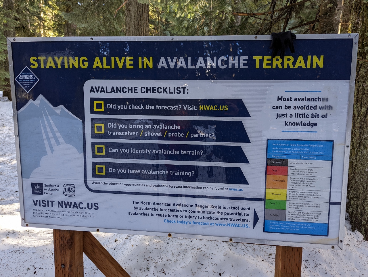 |
3/13/2022: Avalanche Warning
Position: 47°25.65'N, -121°24.80'W
Sign warning of backcountry avalanche risks. The Northwest Avalanche Center produces daily forecast on avalanche risks and dangers, and today the forecast for the Snoqualmie Pass area is moderate.
|
 |
3/13/2022: Alpine Lakes
Position: 47°26.04'N, -121°24.46'W
We're just crossing into the the southern boundary of the Alpine Lakes Wilderness Area that encompasses over 400,000-acres (160,000 ha) roughly between Snoqualmie Pass and Steven's Pass. Alpine Lakes contains some of the most rugged and beautiful topography in the Cascade Mountains, with steep mountains and over 700 lakes. With 47 trailheads and 615 miles (990 km) of trails, the area is very popular in the summer, particularly the Enchantment Lakes region where a lottery system is in place to obtain an overnight camping permit.
|
 |
3/13/2022: Crossing Bridge
Position: 47°26.19'N, -121°24.14'W
Crossing over Commonwealth Creek on a bridge buried deep in snow.
|
 |
3/13/2022: Commonwealth Creek
Position: 47°26.20'N, -121°24.15'W
The beautiful winter scene looking south along Commonwealth Creek from the bridge we just crossed.
|
 |
3/13/2022: Red Mountain
Position: 47°26.67'N, -121°23.95'W
Heading north through Commonwealth Basin with 5,807-ft (1,770 m) Red Mountain visible in the distance.
|
 |
3/13/2022: Snow Bridge
Position: 47°26.95'N, -121°23.86'W
We'd followed an ad-hoc trail north along the west side of Commonwealth Creek, but wanted to make a loop and return along the Commonwealth Basin Trail along the east side. Here James is crossing a snow bridge across the creek and climbing up the other shore to reach the trail.
|
 |
3/13/2022: Woods
Position: 47°26.96'N, -121°23.85'W
Heading through the woods towards the Commonwealth Basin Trail east side of Commonwealth Creek.
|
 |
3/13/2022: Commonwealth Basin Trail
Position: 47°27.13'N, -121°23.69'W
Climbing up the flank of Red Mountain along the Commonwealth Basin Trail.
|
 |
3/13/2022: Snack
Position: 47°27.19'N, -121°23.63'W
Enjoying a snack with a view at altitude 4,620ft (1,408m), partway up Red Mountain, after a climb of 1,600 ft (488 m) from the trailhead. The Snoqualmie Pass Ski resort is the white patch in the distance slightly above center.
|
 |
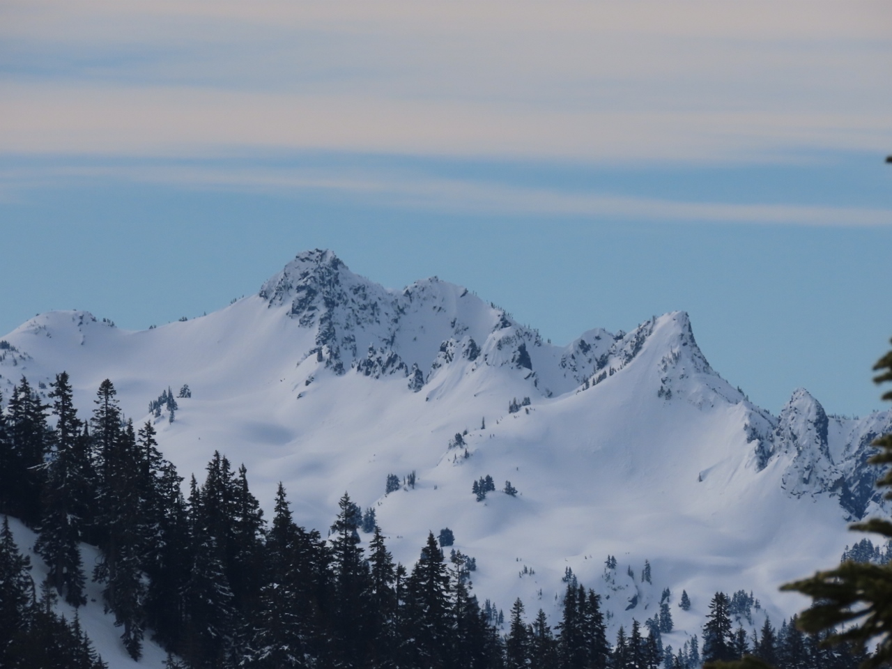
3/13/2022: Granite Mountain
Position: 47°27.19'N, -121°23.63'W
Close-up to 5,600-ft (1,706m) Granite Mountain standing above the Summit at Snoqualmie ski area, viewed from our snack stop along the flank of Red Mountain.
|
 |
3/13/2022: Descending
Position: 47°27.17'N, -121°23.65'W
Descending the steep slope of Red Mountain on our way back to the truck. We're loving being able to navigate such steep and interesting terrain in the winter.
|
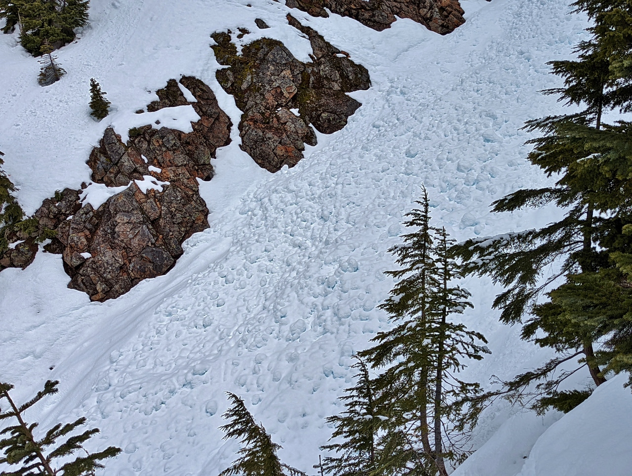 |
3/13/2022: Avalanche
Position: 47°27.17'N, -121°23.66'W
Evidence of a recent avalanche in the drainage from Red Pond to our west as we descend Red Mountain.
|
 |
3/13/2022: Falls
Position: 47°26.29'N, -121°23.95'W
Beautiful partially frozen falls flowing into Commonwealth Creek just off the trail.
|
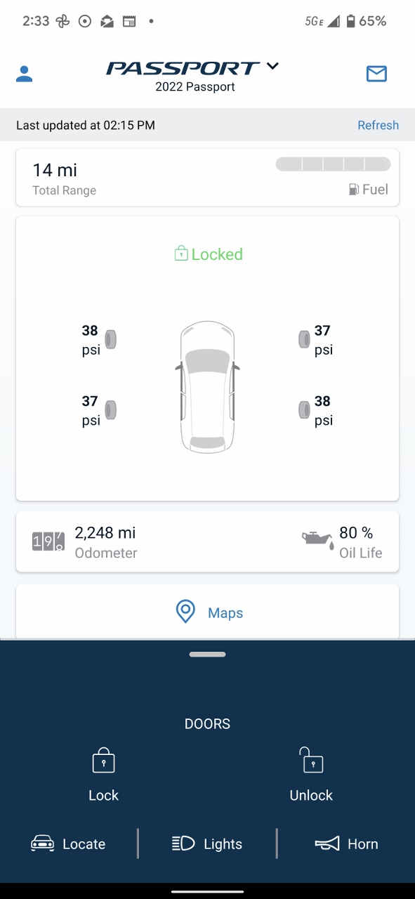 |
3/13/2022: Low Fuel
Position: 47°29.66'N, -121°47.10'W
We've loving the remote telemetry available for our new truck. Here the HondaLink app indicates the doors are locked, the odometer reads 2,248 miles (3,617 km), and we have 14 miles (22 km) of range left on a near-empty tank. That's by far the lowest we've ever let the fuel get. Fortunately we're in North Bend and about to fuel.
|
 |
3/14/2022: Peanut Soba Noodles
Position: 47°36.99'N, -122°20.57'W
Quick and delicious Peanut Soba Noodles for lunch today.
|
 |
3/14/2022: N41-11
Position: 26°45.99'N, -80°3.11'W
Pierce and Janet Guyer went us this picture of their Nordhavn 41-11 being offloaded in Palm Beach today. We met Pierce and Janet in Charleston last year, where they took this picture on our first evening at the dock after our 2021 Atlantic crossing. The N41 is a great boat and is breaking sales records for Nordhavn.
|
 |
3/16/2022: Barriers
Position: 47°36.99'N, -122°20.57'W
A truck delivering road barriers to the empty lot two blocks south of our apartment complex. A new 29-story apartment building will be constructed there and barriers will be used to block off part of 4th Avenue for construction logistics.
|
 |
3/16/2022: Fatoush Salad
Position: 47°36.99'N, -122°20.57'W
Ingredients for a crisp and tasty Fatoush Salad for lunch today.
|
 |
3/16/2022: Daffodils
Position: 47°36.94'N, -122°20.60'W
Daffodils in bloom along Bell Street as we walk out for dinner.
|
 |
3/16/2022: Lola
Position: 47°36.80'N, -122°20.40'W
Steaming hot chicken and salmon kebabs at Lola Mediterranean restaurant a few blocks from our apartment. It was our first time in and had a great meal.
|
 |
3/17/2022: Sunrise
Position: 47°36.99'N, -122°20.57'W
The 3rd & Lenora office building ablaze in the morning sun.
|
 |
3/17/2022: CMA CGM Tigris
Position: 47°36.99'N, -122°20.57'W
The container ship CMA CGM Tigris approaching the Port of Seattle with three tugboats assisting.
|
 |
3/17/2022: Wild Ginger
Position: 47°37.06'N, -122°20.35'W
Siam lettuce cups and Mongolian beef street-side at our favorite table at Wild Ginger. The Asian restaurant is very close to home, and even closer to James' office, and we eat here often.
|
 |
3/17/2022: Nearly Touching
Position: 47°37.05'N, -122°20.34'W
Our our way home from Wild Ginger, this car caught our attention nearly touching the bucket of the front-end loader behind it. We're not sure which vehicle arrived last, but they're either very skilled or equally lucky.
|
 |
3/19/2022: Sealskinz Socks
Position: 47°36.99'N, -122°20.57'W
We're long-time wearers of Sealskinz waterproof gloves, and just got a pair of their socks on the recommendation of blog reader Eric Meslow. We're looking forward to trying them out on our next snowshoe adventure.
|
 |
3/19/2022: Center Sound Series
Position: 47°36.99'N, -122°20.57'W
The second of three races in the Corinthian Yacht Club's Center Sound Series heading south off Elliott Bay Marina.
|
 |
3/19/2022: Traffic
Position: 47°37.47'N, -122°20.00'W
Merging onto Interstate 5 north en route to the Washington Arboretum at 2pm on a Saturday. No matter the time of day, this segment of I-5 always seems to be busy.
|
 |
3/19/2022: Arboreteum
Position: 47°38.20'N, -122°17.94'W
Driving through the Washington Arboretum, a 230-acre (93 ha) public park jointly managed by the University of Washington and the City of Seattle. Features include one of the oldest and authentic Japanese gardens in North America, and a wide variety of flowering plants and trees that make the garden attractive year-round.
|
 |
3/19/2022: Madison Park
Position: 47°38.22'N, -122°16.58'W
Looking northwest to the 520 floating bridge from the public dock in Madison Park on the west side of Lake Washington.
|
 |
3/19/2022: 39th Ave
Position: 47°37.43'N, -122°16.99'W
One of many striking waterfront homes on 39th Ave along the west shore of Lake Washington.
|
 |
3/19/2022: Lake Washington Blvd
Position: 47°34.88'N, -122°17.11'W
Driving along tranquil, tree-lined Lake Washington Blvd south of I-90 on the west side of Lake Washington.
|
 |
3/19/2022: Cherry Blossoms
Position: 47°33.47'N, -122°15.78'W
Cherry trees in bloom at the Ferdinand Street Boat Launch park along the west shores of Lake Washington.
|
 |
3/19/2022: Vietnamese
Position: 47°35.97'N, -122°18.94'W
Bilingual English and Vietnamese street signs in Seattle's Little Saigon district. Seattle also has bilingual signs in the Chinatown and Japantown neighbourhoods.
|
 |
3/19/2022: 6th Ave
Position: 47°36.83'N, -122°20.24'W
We love the stretch of 6th Avenue as we head home, with the Space Needle prominent in the distance. Our apartment complex is the two tall buildings in the distance on the left with balconies.
|
 |
3/19/2022: Daffodils
Position: 47°37.21'N, -122°20.97'W
Daffodils in bloom at Seattle Center as we head to a Seattle Kraken hockey game.
|
 |
3/19/2022: Empty
Position: 47°37.34'N, -122°21.25'W
We arrived at Climate Pledge Arena at 5:30pm, just as the doors opened for a 7pm start, and the arena is pretty empty right now. It's our first Kraken Game since the Omnicron spike, and we arrived early for a tour of the facility.
|
 |
3/19/2022: Detroit Redwings
Position: 47°37.29'N, -122°21.26'W
The Detroit Red Wings playing soccer to warm-up prior to the game.
|
 |
3/19/2022: Root Sports
Position: 47°37.30'N, -122°21.26'W
The Root Sports network mobile production truck parked underneath Climate Pledge Arena.
|
 |
3/19/2022: Kitchen
Position: 47°37.28'N, -122°21.24'W
The kitchen at Climate Pledge Arena is the largest in the city of Seattle.
|
 |
3/19/2022: Studio
Position: 47°37.30'N, -122°21.22'W
Climate Pledge Arena was built not just for hockey, but to be a premiere concert location. In addition to sizable and comfortable apartment-like dressing rooms, the entertainer's area also features a recording studio.
|
 |
3/19/2022: Movable Seating
Position: 47°37.31'N, -122°21.21'W
Reconfigurable seating at Climate Pledge Arena by Seda of Slovakia. This allows the seats to be backed away, making room for a large stage.
|
 |
3/19/2022: Red Wings Sticks
Position: 47°37.31'N, -122°21.21'W
Red Wings' sticks lined up at the entrance to their locker room.
|
 |
3/19/2022: Visitor Bench
Position: 47°37.31'N, -122°21.21'W
Looking down the visitor bench onto the ice surface. At 6pm there's still not many people here yet.
|
 |
3/19/2022: Kraken Sticks
Position: 47°37.32'N, -122°21.24'W
A cartful of Kraken sticks being readied for the game.
|
 |
3/19/2022: Kraken Locker Room
Position: 47°37.32'N, -122°21.24'W
View into the Seattle Kraken locker room.
|
 |
3/19/2022: Sticks and Spares
Position: 47°37.32'N, -122°21.24'W
Sticks, with a spare parts/repair kit hanging on the wall at left, ready for the Kraken game in just under an hour.
|
 |
3/19/2022: Puck Art
Position: 47°37.32'N, -122°21.24'W
Before each game, Seattle Kraken locker room attendants, notably Jesse Potts, create art from the practice pucks. When the players come out for practice, they knock the stack onto the ice for use during the practice session. Tonight the Kraken are celebrating female impact and influence on hockey in "Women of Hockey" night, and the puck art forms a 'W'.
|
 |
3/19/2022: Seattle Storm Locker Room
Position: 47°37.30'N, -122°21.27'W
The locker room for the four-time WNBA (Women's National Basketball Association) champions Seattle Storm.
|
 |
3/19/2022: Alex Nedeljkovic
Position: 47°37.32'N, -122°21.24'W
Goalie Alex Nedeljkovic leading the Detroit Red Wings onto the ice for practice.
|
 |
3/19/2022: Red Wings Practice
Position: 47°37.32'N, -122°21.24'W
The Red Wings lining up to take practice shots on goal.
|
 |
3/19/2022: Rinkside
Position: 47°37.32'N, -122°21.24'W
We really enjoyed our tour of the facility and being so close to the teams and the ice. We usually sit mid-way up the lower section for the best view, but will have to try a rinkside seat sometime. It's a totally different perspective.
|
 |
3/19/2022: Jakub Vrana
Position: 47°37.32'N, -122°21.24'W
Goalie Alex Nedeljkovic defending a practice shot from Jakub Vrana. After joining the Red Wings in 2021, Vrana became the 26th player in franchise history to score more than three goals in a game and the second to record a hat trick within his first four games with the franchise.
|
 |
3/19/2022: Half and Half
Position: 47°37.33'N, -122°21.24'W
Our friend Sean Boyle, who grew up near Detroit and now lives in Seattle, sporting a "mixed-feelings" jersey, half Kraken and half Red Wings.
|
 |
3/19/2022: Howe
Position: 47°37.33'N, -122°21.24'W
The back of Sean's jersey features half-and-half of number 9 Gordie Howe, who played for the Detroit Red Wings for 25 years. Howe is widely considered one of the greatest players of all time, scoring 801 goals, 1049 assists, and 1850 total points.
|
 |
3/19/2022: Kraken Tail
Position: 47°37.32'N, -122°21.25'W
A Kraken tail being lowered to the ice as part of the pre-game festivities.
|
 |
3/19/2022: Philipp Grubauer
Position: 47°37.32'N, -122°21.25'W
Goalie Philipp Grubauer leading the Kraken onto the ice right before the game.
|
 |
3/19/2022: Fight
Position: 47°37.33'N, -122°21.24'W
Fights aren't nearly as common as they used to be in the NHL, but they still do happen.
|
 |
3/19/2022: Face Off
Position: 47°37.32'N, -122°21.24'W
Detroit gets the puck after a faceoff in the Kraken end. It was looking like a sure loss, with the score 2-0 for Detroit at the end of the second period. But the Kraken came alive in the final period. They rapidly scored four times to take an exciting win.
|
 |
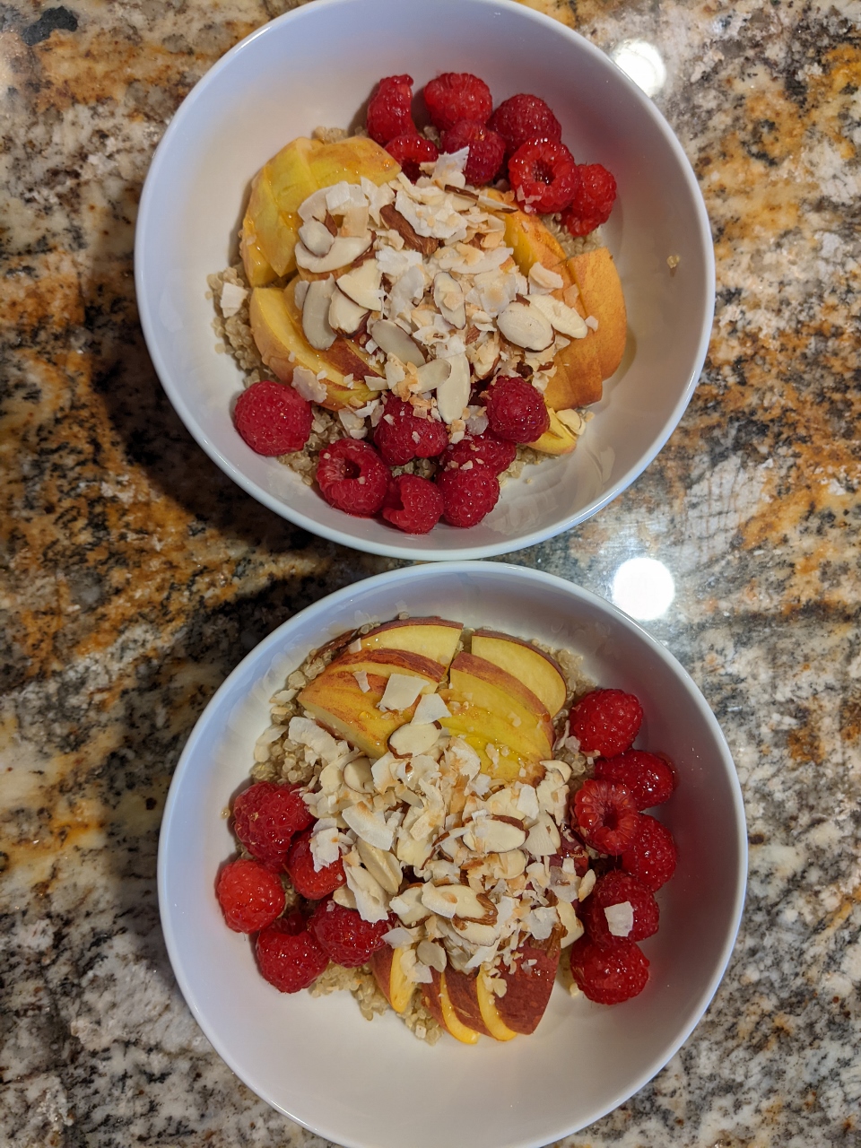
3/20/2022: Nutty Cinnamon Quinoa
Position: 47°36.99'N, -122°20.57'W
Warm and Nutty Cinnamon Quinoa for breakfast, made with blueberries, almonds and black quinoa.
|
 |
3/20/2022: Lake Mardee Road
Position: 47°23.78'N, -121°23.62'W
Recent snow on Lake Mardee Road, running parallel to I-90 just beyond Snoqualmie Pass as we approach the trailhead for the Gold Creek Pond snowshoe trails.
|
 |
3/20/2022: Gold Creek Sno-Park
Position: 47°23.39'N, -121°22.82'W
At the trailhead for Gold Creek Pond, one of three distinct winter recreation areas at the Gold Creek Sno-Park. This is one of over 120 public winter recreation areas kept open by Washington State. The snow on the trail was fairly well-packed and we walked the initial part.
|
 |
3/20/2022: Channel
Position: 47°23.87'N, -121°22.76'W
Enjoying the winter scene at a small channel off the southeast corner of Gold Creek Pond.
|
 |
3/20/2022: Gold Creek Trail
Position: 47°23.86'N, -121°22.81'W
Heading north along the east side of Gold Creek Pond. Buried in the snow is a fully-paved path, suitable for wheelchairs, that encircles the pond.
|
 |
3/20/2022: Gold Creek Pond
Position: 47°23.91'N, -121°22.60'W
Looking across Gold Creek Pond to a bridge on the east side over a small creek estuary.
|
 |
3/20/2022: Forest Road 142
Position: 47°24.03'N, -121°22.43'W
We left the Gold Creek Pond loop for Forest Road 142 to continue further north to Heli's Pond. Ours were the first tracks in the recent snow.
|
 |
3/20/2022: Gold Creek Valley
Position: 47°24.55'N, -121°22.12'W
Signpost for the Gold Creek Valley Natural Area at Heli's Pond.
|
 |
3/20/2022: Heli's Pond
Position: 47°24.55'N, -121°22.15'W
Looking across Heli's Pond to a bridge at the south end. The bridge is closed for maintenance, and piled high with snow.
|
 |
3/20/2022: Rampart Ridge
Position: 47°24.82'N, -121°21.68'W
Climbing up the reasonably steep grade at the base of 5,870 ft (1,790 m) Rampart Ridge, visible in the distance.
|
 |
3/20/2022: Snack
Position: 47°24.82'N, -121°21.65'W
Enjoying a snack with some hot tea at the base of Rampart Ridge.
|
 |
3/20/2022: Snow Bridge
Position: 47°24.98'N, -121°21.68'W
James carefully shuffling his feet to keep his weight widely-distributed as he crosses a snow bridge spanning a small creek.
|
 |
3/20/2022: Gold Creek
Position: 47°24.98'N, -121°21.68'W
Beautiful winter scene at Gold Creek west of Rampart Ridge. Our initial plan was to cross the creek and return along the east side, but it was too wide and swift-flowing to fjord.
|
 |
3/20/2022: Recrossing
Position: 47°24.85'N, -121°21.78'W
The creek we'd crossed earlier flowed into Gold Creek, and we couldn't find any reasonable crossing points above the creek. The creek is small and narrow though, and easily crossed. The difficulty was getting back up the steep slope on the other side. Here James is hauling himself back up the other side using overhanging tree branches. We probably wouldn't win any points for artistic impression, but we did get across.
|
 |
3/20/2022: Hidden Bridge
Position: 47°24.57'N, -121°22.22'W
Arriving back at Heli's Pond, we continued south along the east side. The summer bridge at right is closed for maintenance, but the snow is so deep you can hardly see the yellow sign closing it. We, and most others, crossed the creek using the snow bridge to the left of the summer bridge.
|
 |
3/20/2022: Deep Snow
Position: 47°24.09'N, -121°22.40'W
Several feet of snow covered this bridge across a creek entering the north end of Gold Creek Pond.
|
 |
3/20/2022: Sledders
Position: 47°23.40'N, -121°22.78'W
Gold Creek Pond is popular with snowshoers due to the easy grade, but people are enjoying the snow in a number of ways, such as these sledders.
|
 |
3/20/2022: Parking
Position: 47°23.38'N, -121°22.82'W
When we arrived at 9:30 this morning there were perhaps a half-dozen cars parked along the road. When we returned back out at 1:30pm all the visible parking was taken in both directions.
|
 |
3/20/2022: Hopping
Position: 47°29.66'N, -121°47.09'W
Back at the North Bend Bar and Grill for a late lunch. Even at 2pm, the place was hopping and the kitchen looked to be running at near capacity.
|
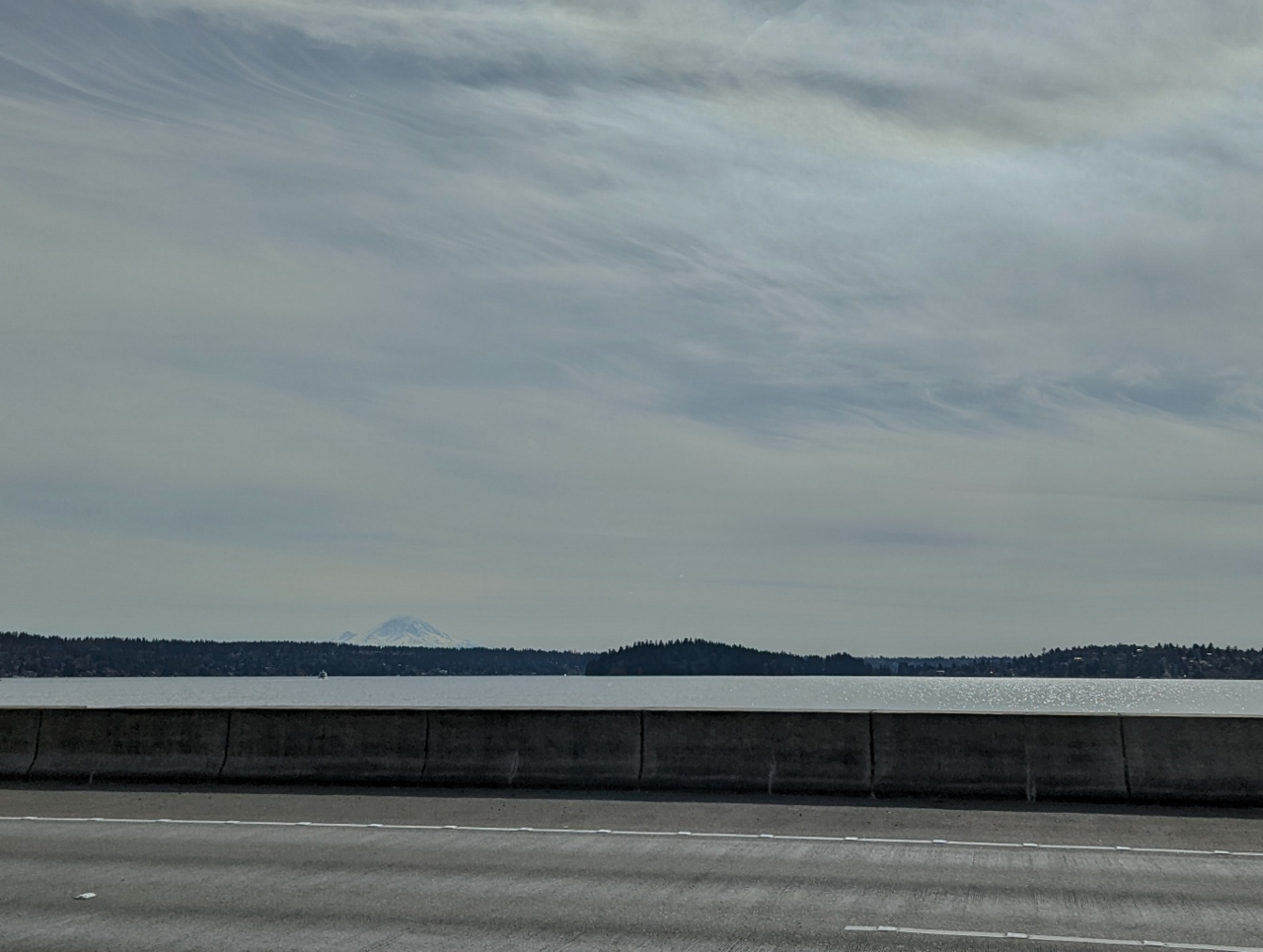 |
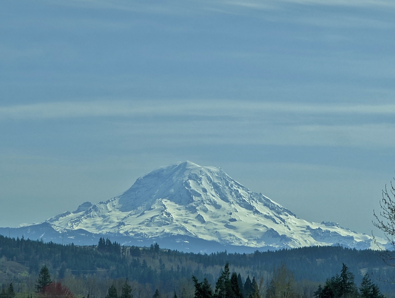
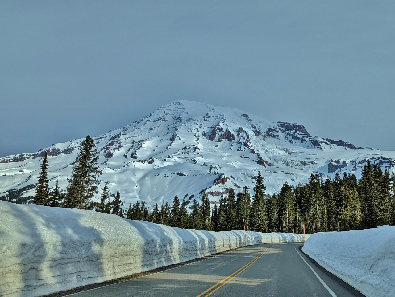
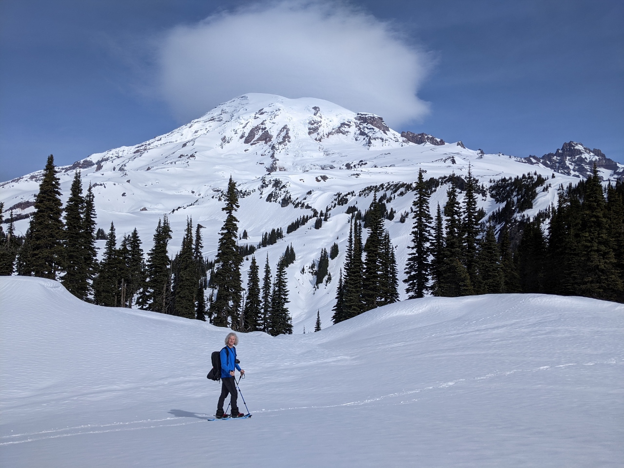
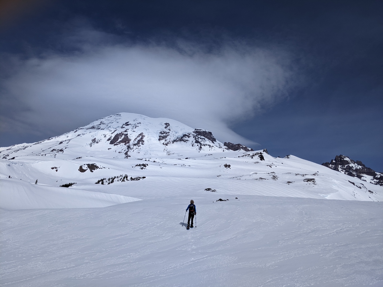
3/24/2022: Rainier from I-90
Position: 47°35.38'N, -122°16.16'W
14,417 ft (4,394 m) Mt. Rainier just visible in the distance at left, 55 miles (88 km) away, as we cross I-90 en route to snowshoe at the mountain this weekend (click image for a larger view).
|
 |
3/24/2022: Rainier from SR 167
Position: 47°16.79'N, -122°15.51'W
We're getting better and better views to Mt Rainier as we head towards it. Here the mountain dominates the skyline west of State Route 167, about 35 miles (56 km) away.
|
 |
3/24/2022: Eatonville
Position: 46°52.22'N, -122°15.93'W
Passing through the town of Eatonville, about 25 miles away from Mt Rainier. The town has been a gateway for visitors to the mountain since the late 1800s, and features the mountain in its logo.
|
 |
3/24/2022: 2,500 Miles
Position: 46°46.38'N, -122°12.99'W
We just crossed 2,500 miles (4,023 km) on our new truck. That's a lot for eight weeks when we only drive it on the weekends.
|
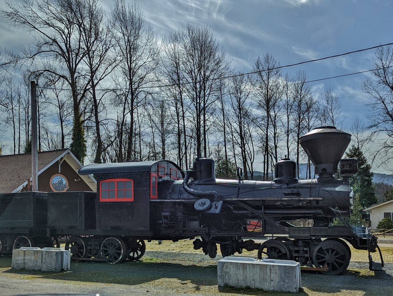 |
3/24/2022: Railroad Museum
Position: 46°45.87'N, -122°11.63'W
Steam locomotive at the Mt. Rainier Railroad and Logging Museum in Elbe. The town's strong railroad theme includes a hotel, the Hobo Inn, where guests stay in renovated cabooses.
|
 |
3/24/2022: Rainier from SR 706
Position: 46°45.42'N, -122°8.22'W
Another great view to Mt. Rainier from just outside Elbe on WA state route 706. We're only 20 miles (30 km) away now.
|
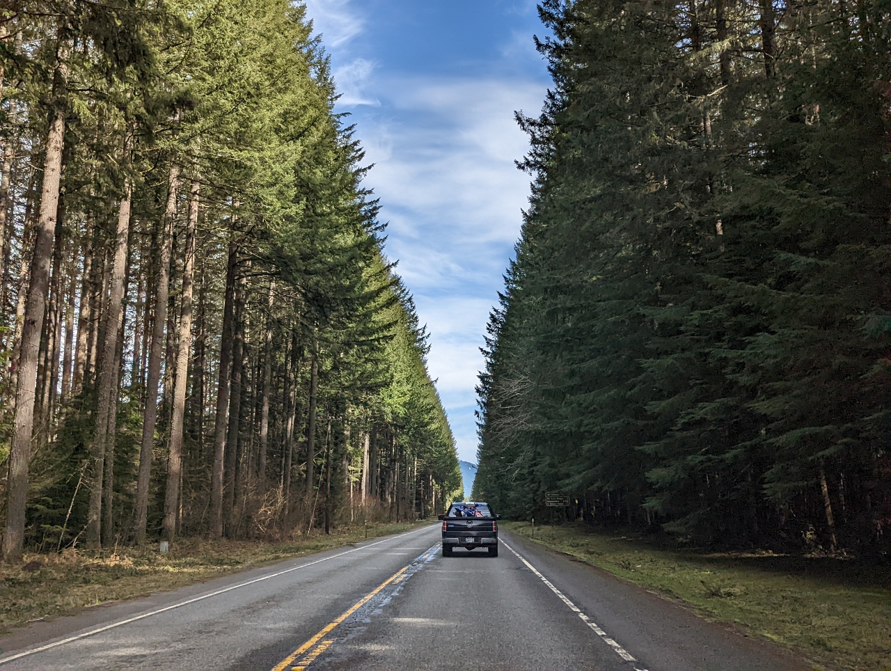 |
3/24/2022: WA-706
Position: 46°45.24'N, -122°6.27'W
A beautiful stretch of tree-lined road along WA route 706 east of Elbe.
|
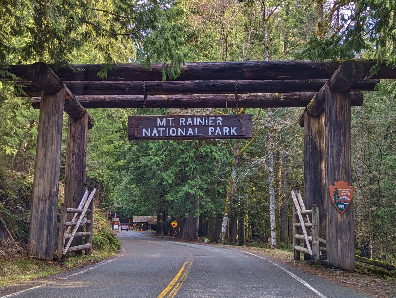 |
3/24/2022: Park Entrance
Position: 46°44.57'N, -121°55.36'W
We're super-excited to finally be at Mt. Rainier National Park. Neither of us has ever visited and we're really looking forward to seeing the mountain up close.
|
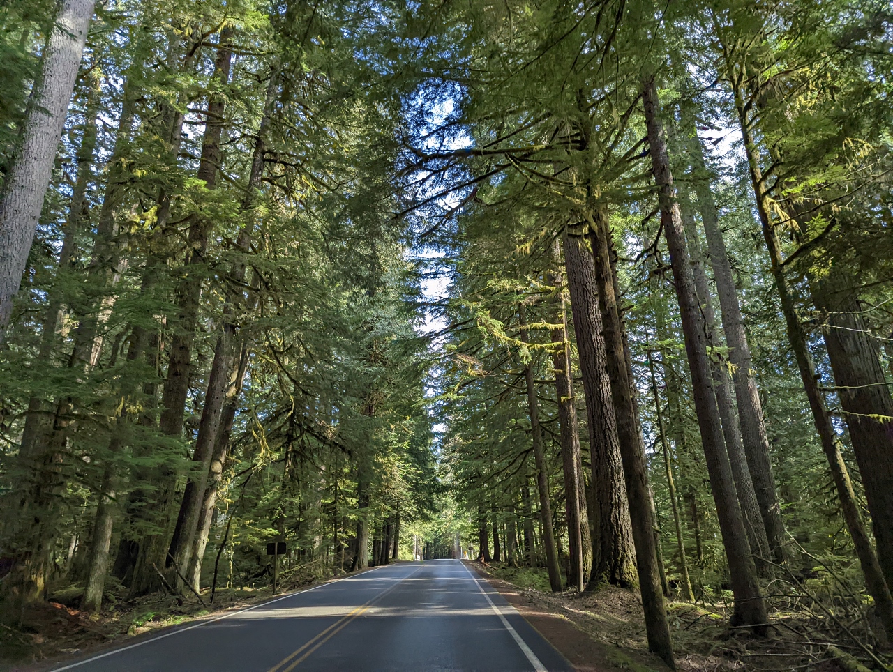 |
3/24/2022: Paradise Road
Position: 46°44.48'N, -121°54.16'W
Thick, healthy forest on either side of Paradise Road in Mt. Rainier National Park.
|
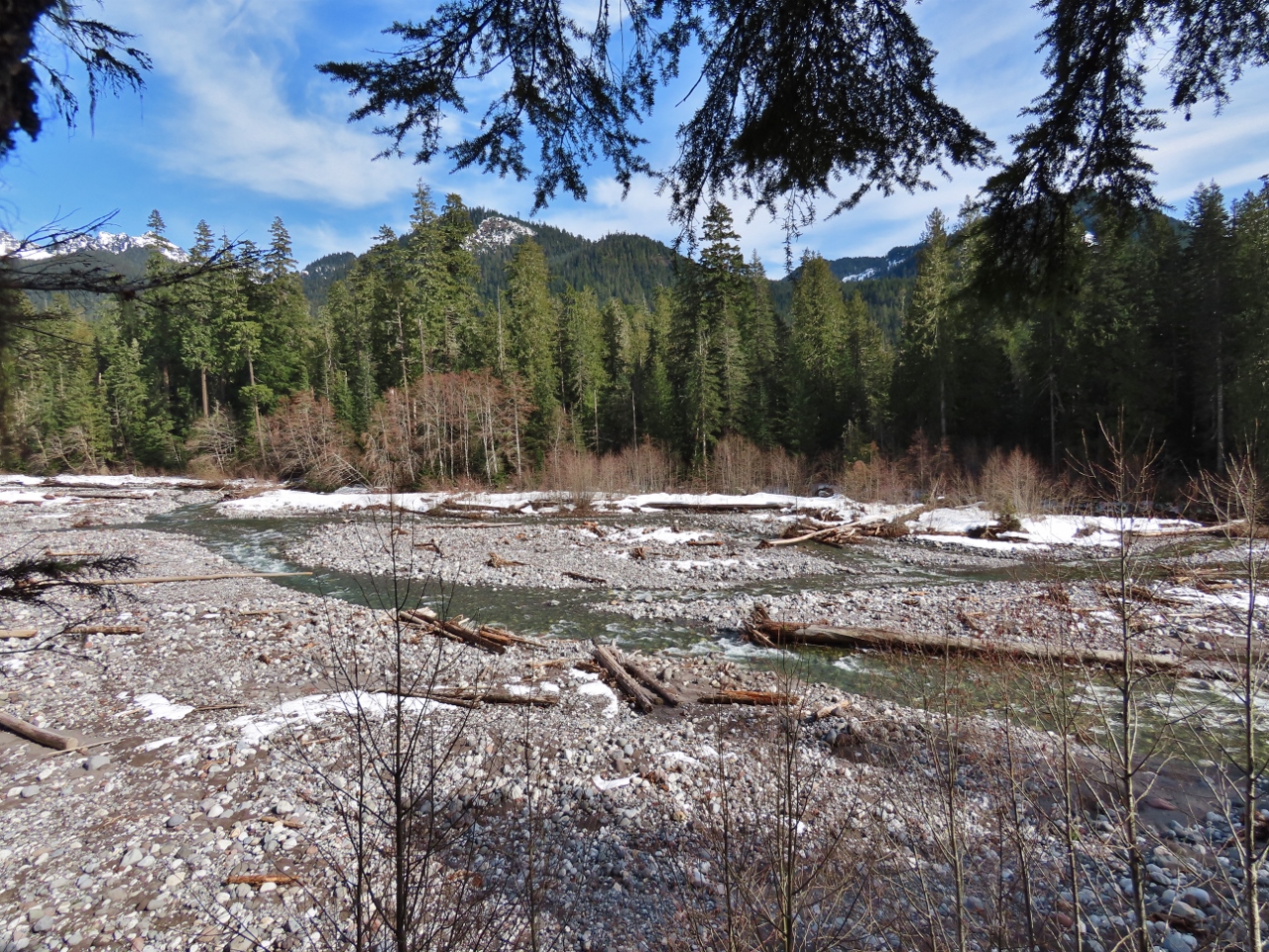 |
3/24/2022: Nisqually River
Position: 46°44.93'N, -121°48.79'W
The broad Nisqually River flows from Nisqually Glacier on the flank of Mt Rainier and enters the Puget Sound near Tacoma. The river delta there, with views to the Olympic Mountains and Mt. Rainier, is one of our favourite South Sound anchorages and one of the stops on our week-long shakedown cruise shortly after taking delivery of Nordhavn 52 Dirona.
|
 |
3/24/2022: Kautz Creek
Position: 46°44.18'N, -121°51.43'W
View to Mt. Rainier over Kautz Creek, only 10 miles (15 km) away now. Today is clear and sunny, but the mountain often is invisible, shrouded in clouds. A common question in the area is "Is the mountain out?"
|
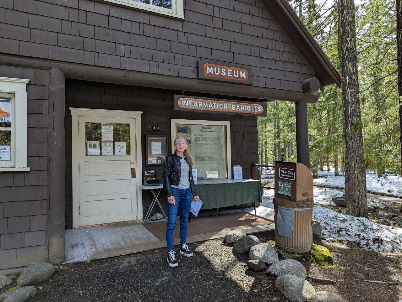 |
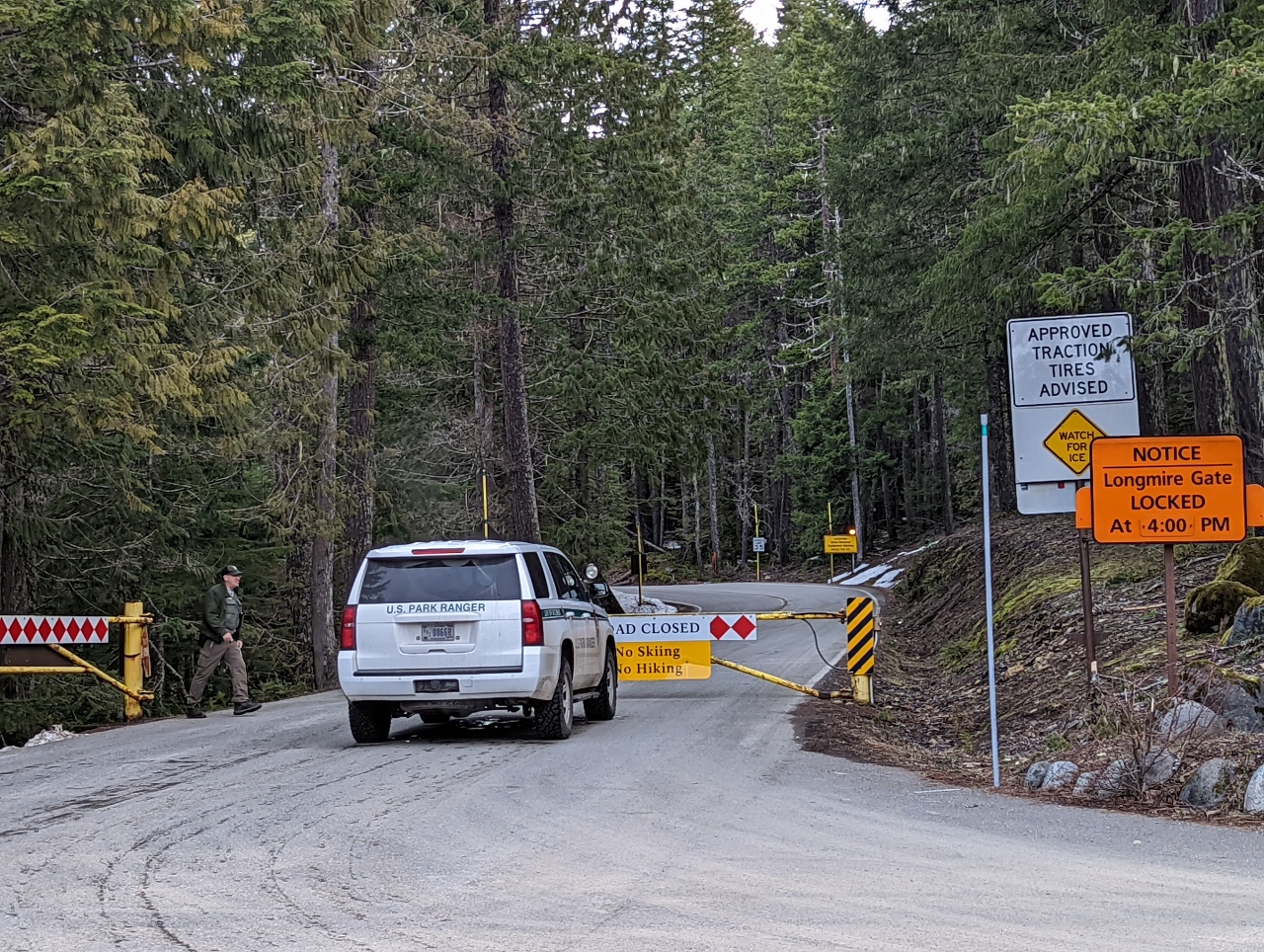
3/24/2022: Longmire
Position: 46°44.99'N, -121°48.76'W
At the Longmire Museum to pickup some snowshoe trail maps. At 3:40pm, this is currently as far as we can go because the road to the top is only open between 9am and 3pm.
|
 |
3/24/2022: 729 years
Position: 46°44.99'N, -121°48.76'W
This slab on display outside the Longmire Museum is from a tree that started growing in 729 years ago in 1286. The small labels describe notable points in time since, both worldwide and with respect to the Mt Rainier area.
|
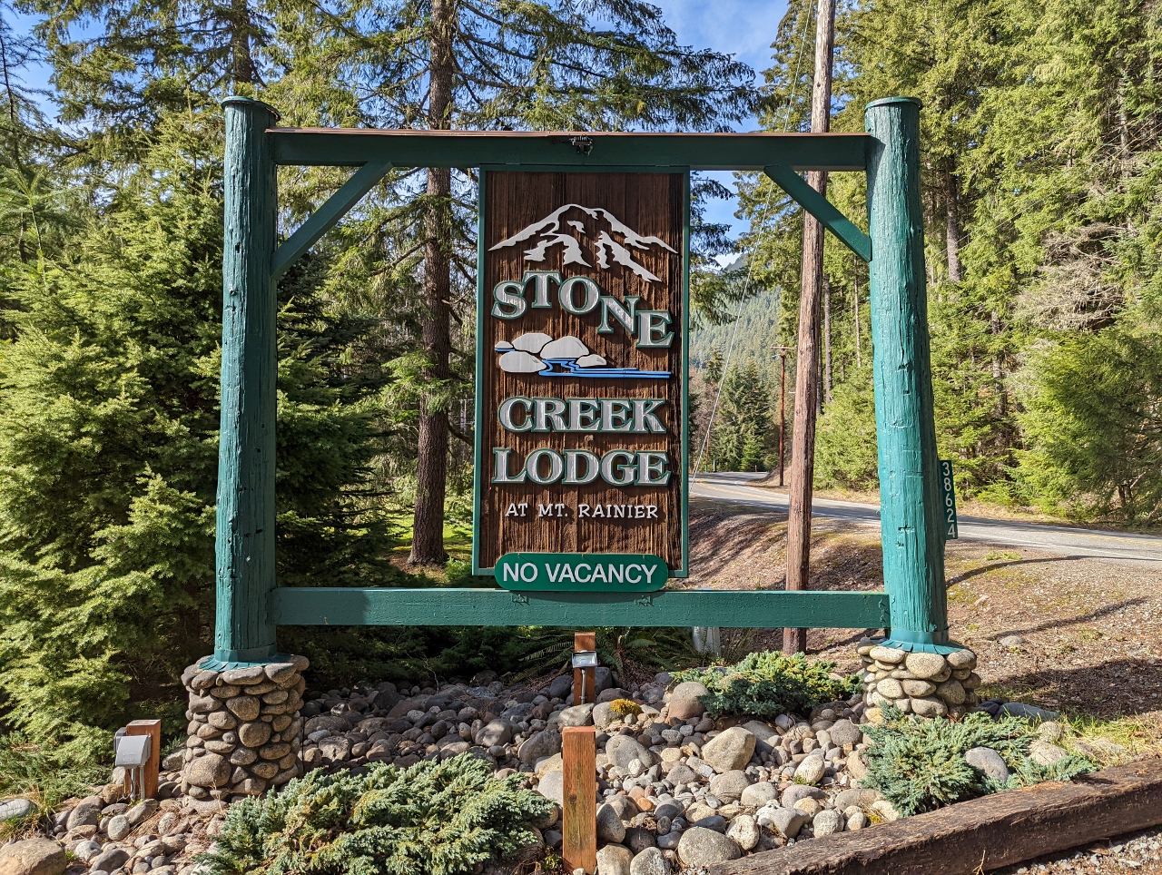 |
3/24/2022: Stone Creek Lodge
Position: 46°44.59'N, -121°55.38'W
Our hotel for the weekend is the Stone Creek Lodge, a collection of cabins 700 yards (640 m) from the park entrance.
|
 |
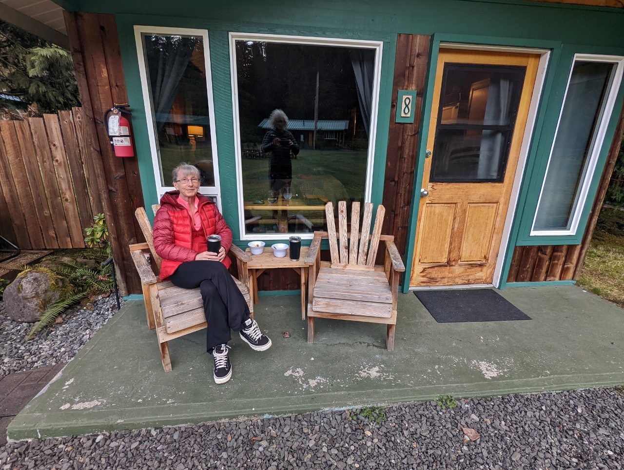
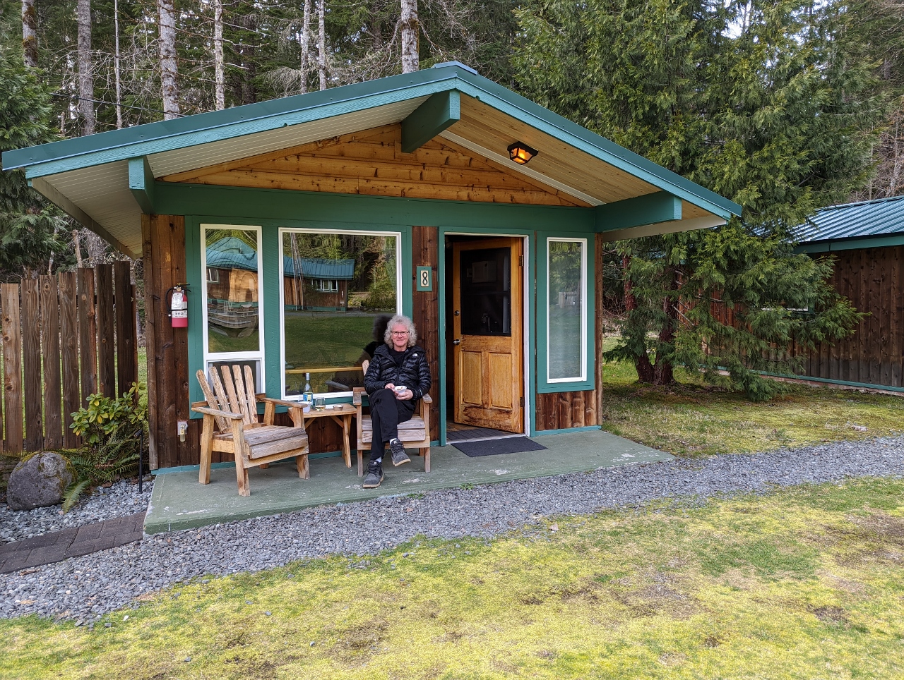
3/24/2022: Cabin
Position: 46°44.58'N, -121°55.44'W
Our cosy cabin at Stone Creek Lodge. The room is heated nice and toasty with the gas stove partially visible beyond the bed. And it has a small kitchen with a sink, fridge, microwave, toaster, coffee maker, and kettle.
|
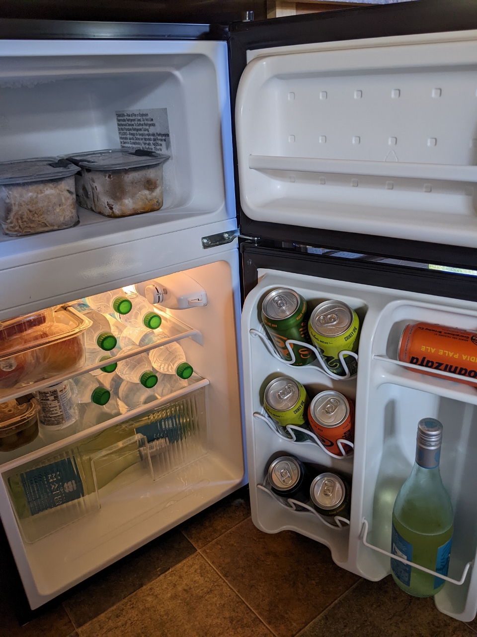 |
3/24/2022: Fridge
Position: 46°44.59'N, -121°55.45'W
The contents of our cooler stowed in the ample space of our cabin's fridge and freezer, ready for the weekend.
|
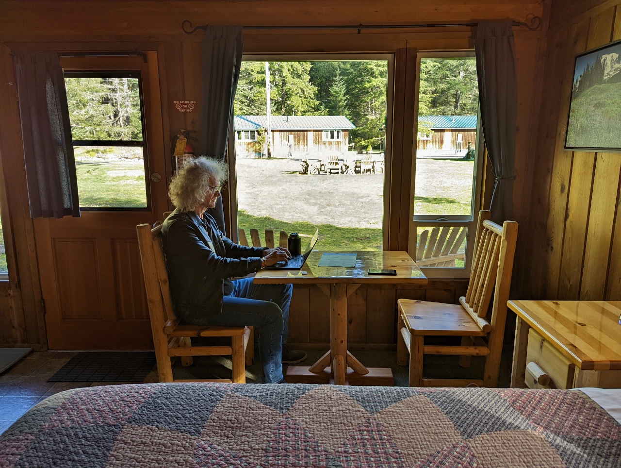 |
3/24/2022: Office
Position: 46°44.59'N, -121°55.45'W
James getting a little work done in our cabin at Stone Creek Lodge before we head out for dinner. The cellular service isn't great out here in the woods, but the lodge has excellent WiFi service.
|
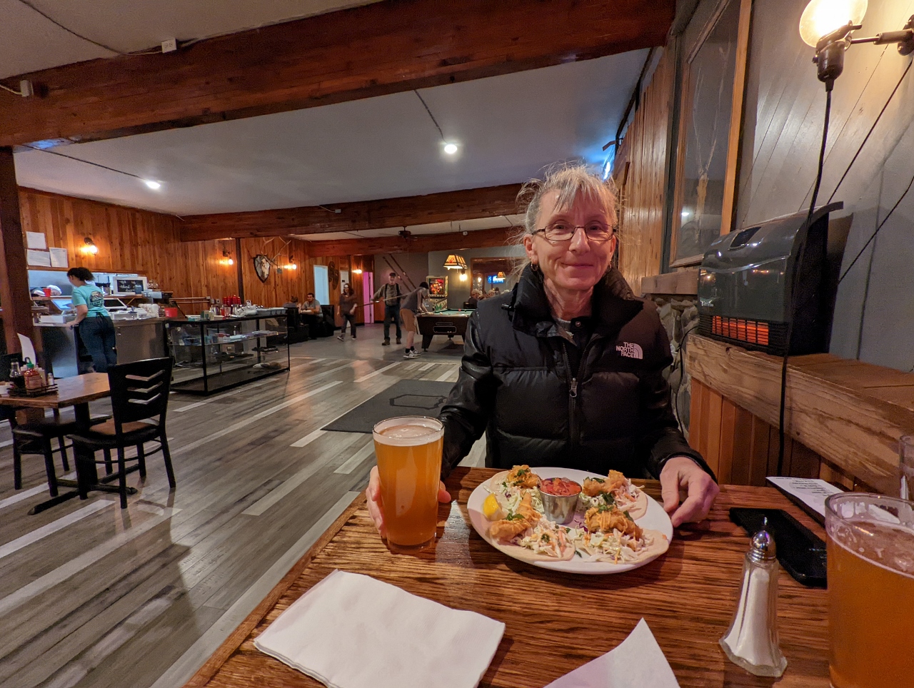 |
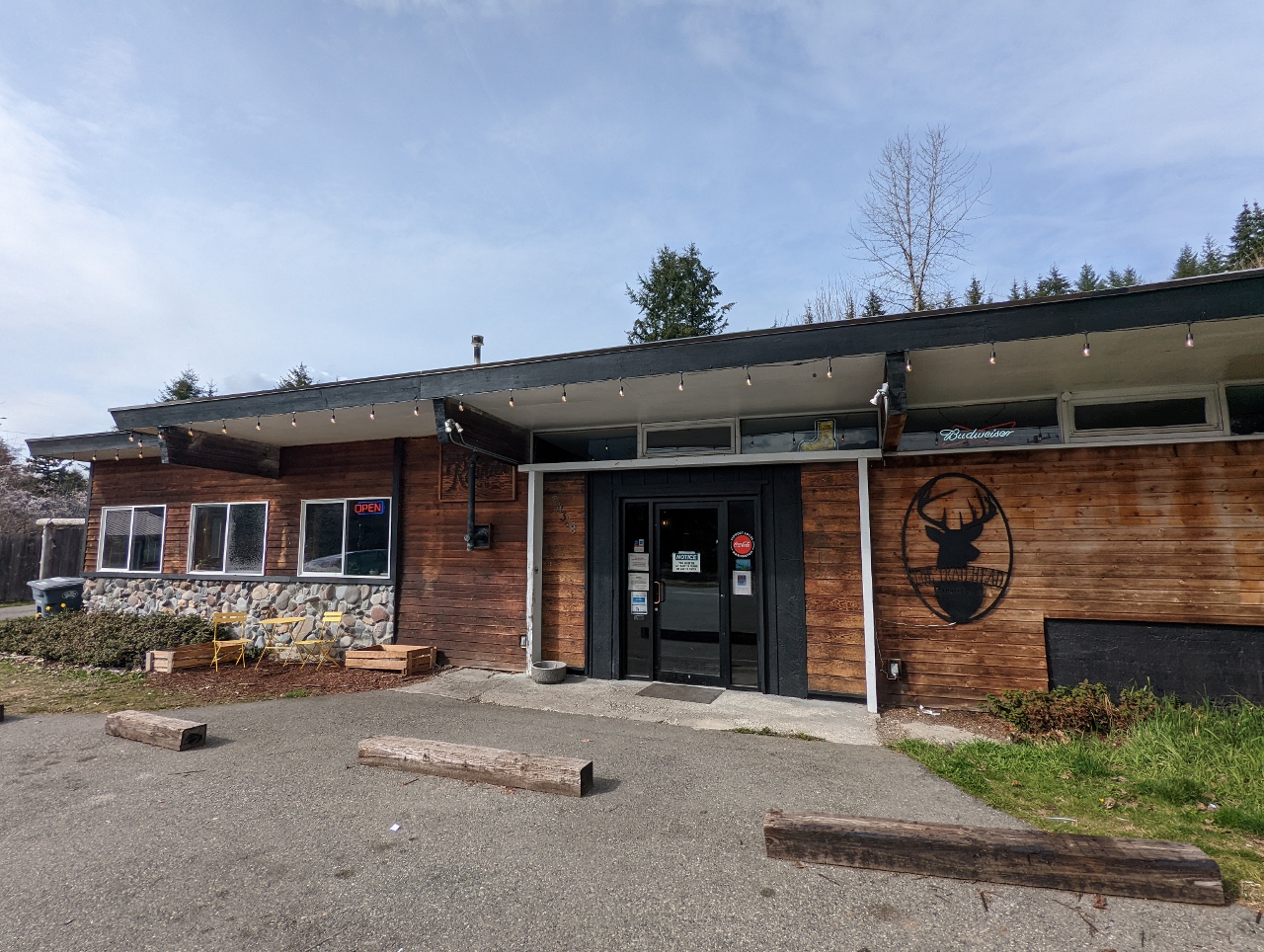
3/24/2022: Trailhead Bar & Grill
Position: 46°45.57'N, -122°1.94'W
A delicious dinner at the Trailhead Bar & Grill in Ashford, just outside Mt. Rainier National Park.
|
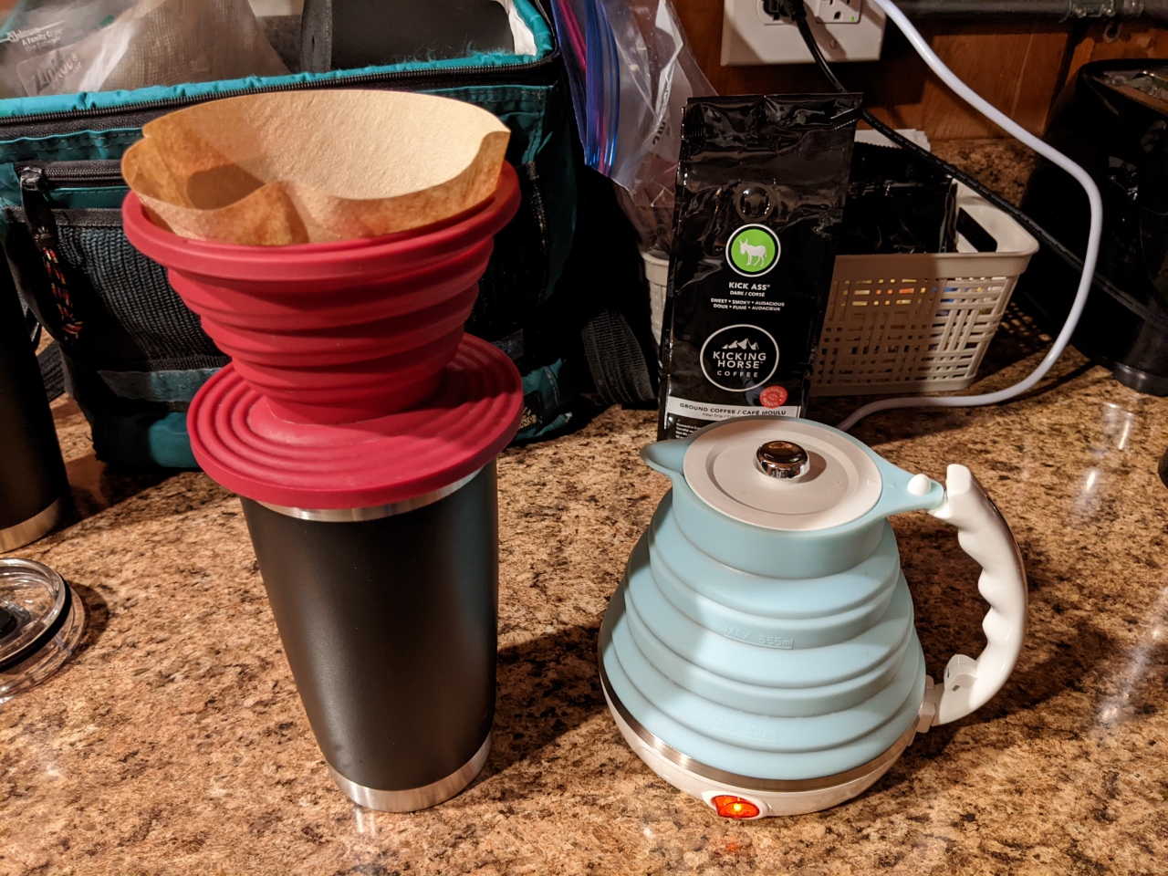 |
3/25/2022: Travel Kettle
Position: 46°44.59'N, -121°55.46'W
Our travel kettle and coffee filter holder on the job for our morning coffee. Both are made of high-temperature silicone, collapse flat, and store together in a small black case that came with the kettle.
We initially bought them both for our road trip across the country from Charleston to Seattle. They worked out super-well on that trip and we've continued to use them since. We love having fresh coffee and tea on demand in our room, and the they take up such little space we can bring them even with only carry-on luggage. |
 |
3/25/2022: Breakfast
Position: 46°44.60'N, -121°55.45'W
Enjoying breakfast on the porch of our cabin at Stone Creek Lodge. We've considered cabins in the past, and thought them too rustic, but this one is working out really well.
|
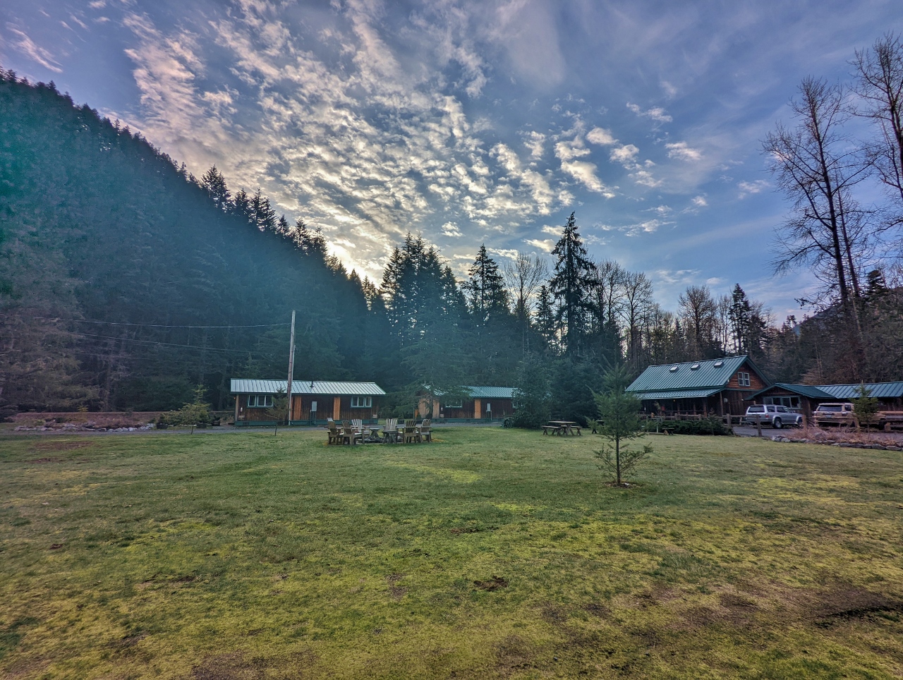 |
3/25/2022: Sunrise
Position: 46°44.58'N, -121°55.42'W
Sunrise looking east across the park-like grounds of Stone Creek Lodge from the porch of our cabin.
|
 |
3/25/2022: Is The Mountain Out?
Position: 46°44.18'N, -121°51.41'W
"Is the Mountain Out?" is a commonly-asked question locally, particularly for visitors to Mt. Rainier National Park, and that question is the first words on the park's web cam for the mountain. Conditions can change quickly here, but so far we're in luck with this clear view along Kautz Creek.
|
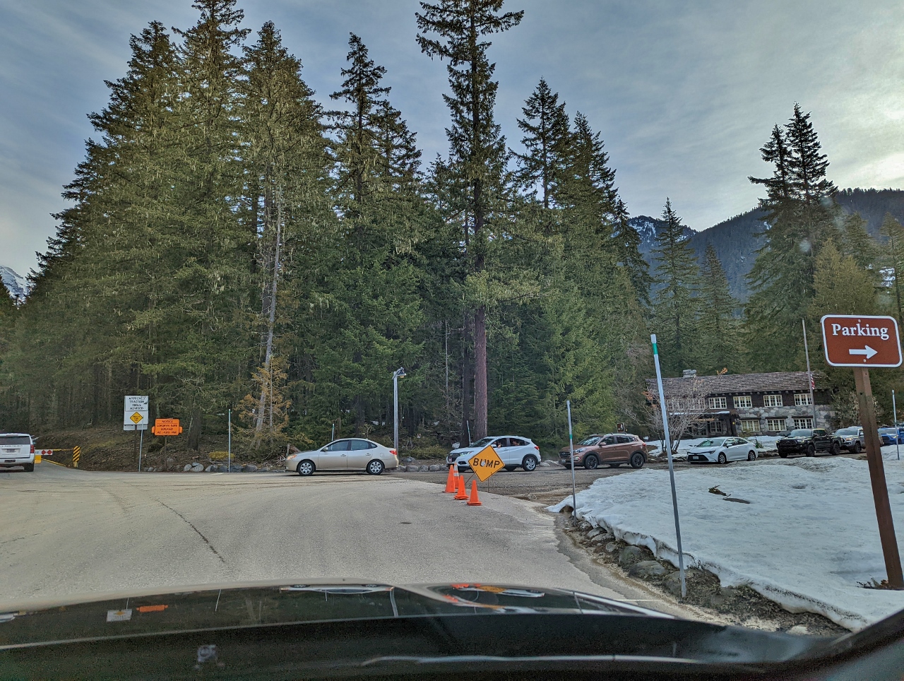 |
3/25/2022: Queue
Position: 46°44.88'N, -121°49.08'W
The road to Paradise, at elevation 5,400 ft (1,645 m), is open in the winter daily from 9am until 4pm. Parking doesn't seem to fill as at Olympic National Park, but there still was a queue of people waiting at the not-yet-open gate when we arrived shortly before 9am.
|
 |
3/25/2022: Opening Gate
Position: 46°45.01'N, -121°48.76'W
National Park ranger opening the gate to allow entry onto the Longmire-to-Paradise Road at 9am.
|
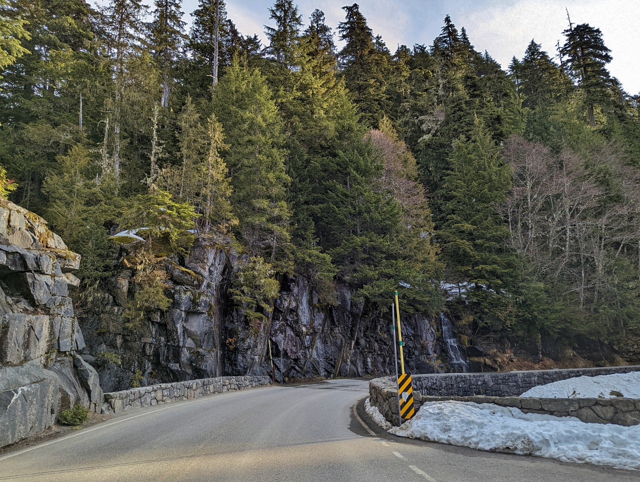 |
3/25/2022: Christine Falls Bridge
Position: 46°46.75'N, -121°46.94'W
The historic, much photographed Christine Falls Bridge, built of stone in the 1928. The bridge is one of several features designed following the National Park Service rustic, a style of architecture the Park Service developed in the early 20th century to harmonize with the environment.
|
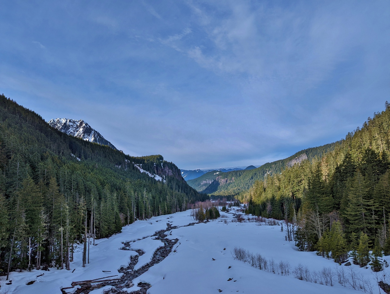 |
3/25/2022: Nisqually River
Position: 46°46.91'N, -121°45.73'W
Fabulous view down the snow-covered Nisqually River Valley from the Nisqually Glacier Bridge.
|
 |
3/25/2022: Nisqually Glacier
Position: 46°46.91'N, -121°45.73'W
The tongue of Nisqually Glacier, looking north from the bridge of the same name. The bridge, completed in 1958, is the fifth bridge at this site. The previous bridges were all damaged or destroyed by glacier floods.
|
 |
3/25/2022: Snow Slide
Position: 46°46.76'N, -121°44.45'W
Evidence of a snow slides on the steep slopes above Longmire-to-Paradise Road. At one section along the road, the avalance risk is so high that signs prohibit drivers from stopping their cars.
|
 |
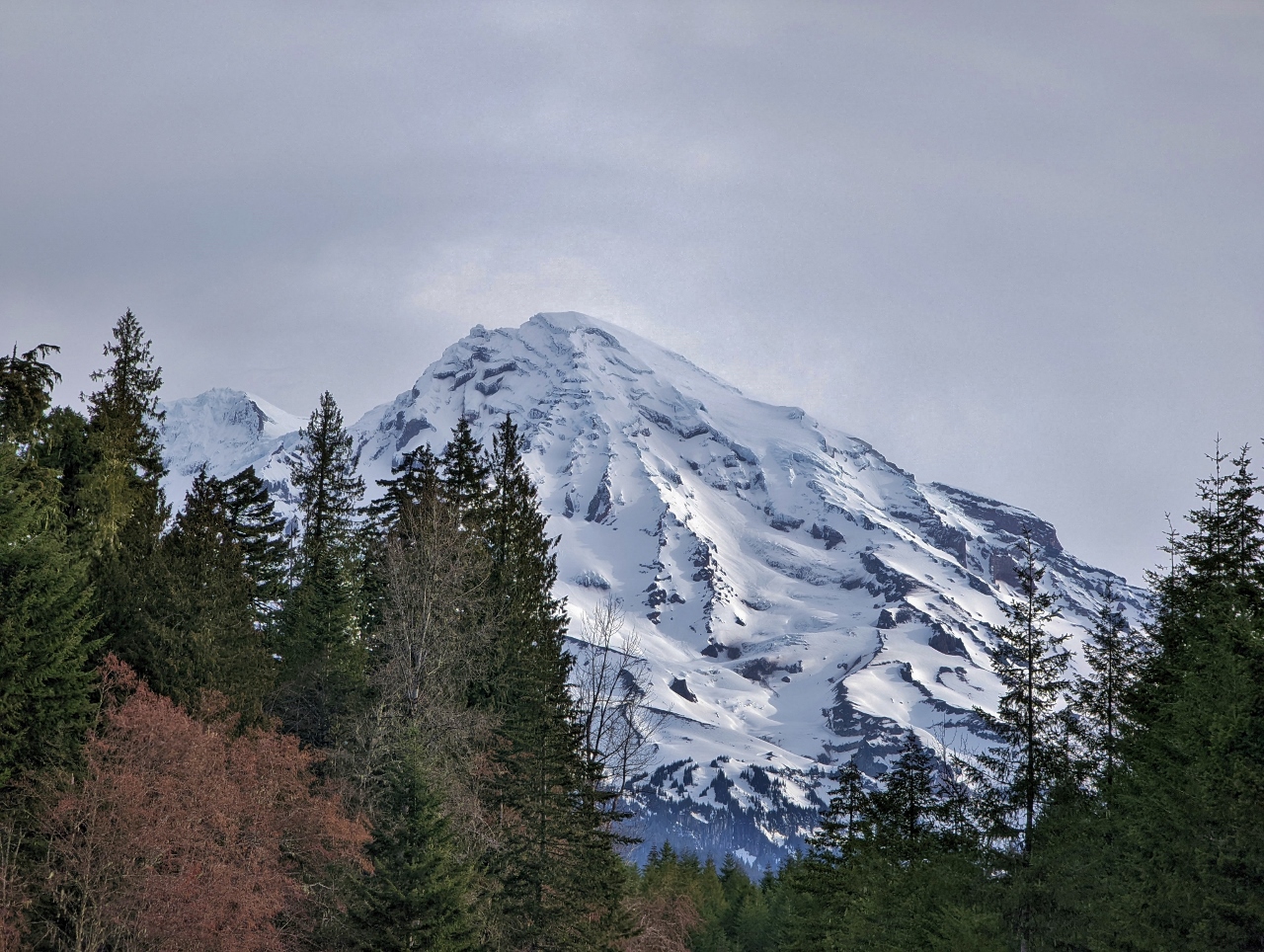
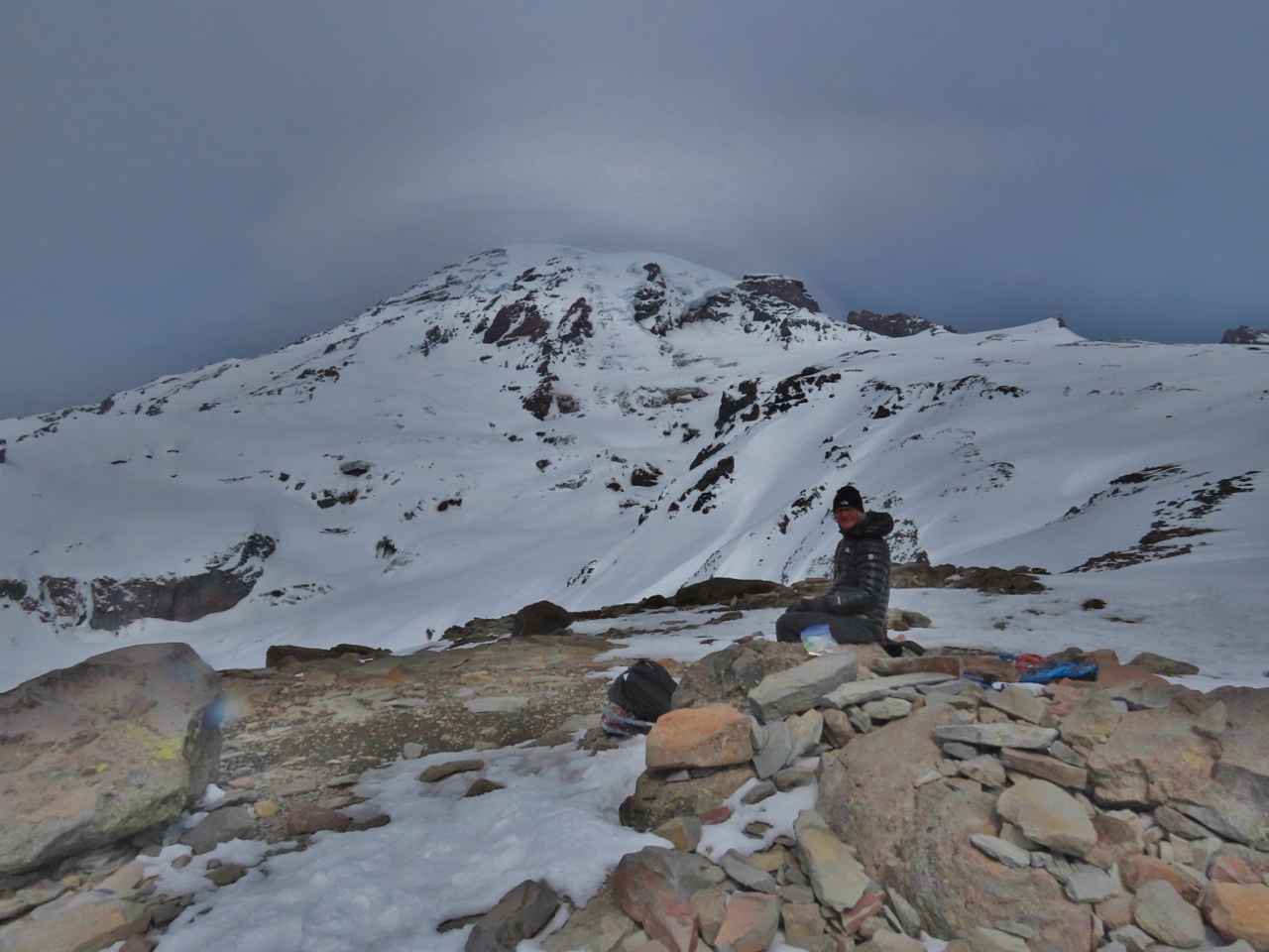
3/25/2022: 5,000 ft
Position: 46°47.01'N, -121°45.01'W
Mt. Rainier, looking spectacular at elevation 5,000ft (1,524m) on the Longmire-to-Paradise Road.
|
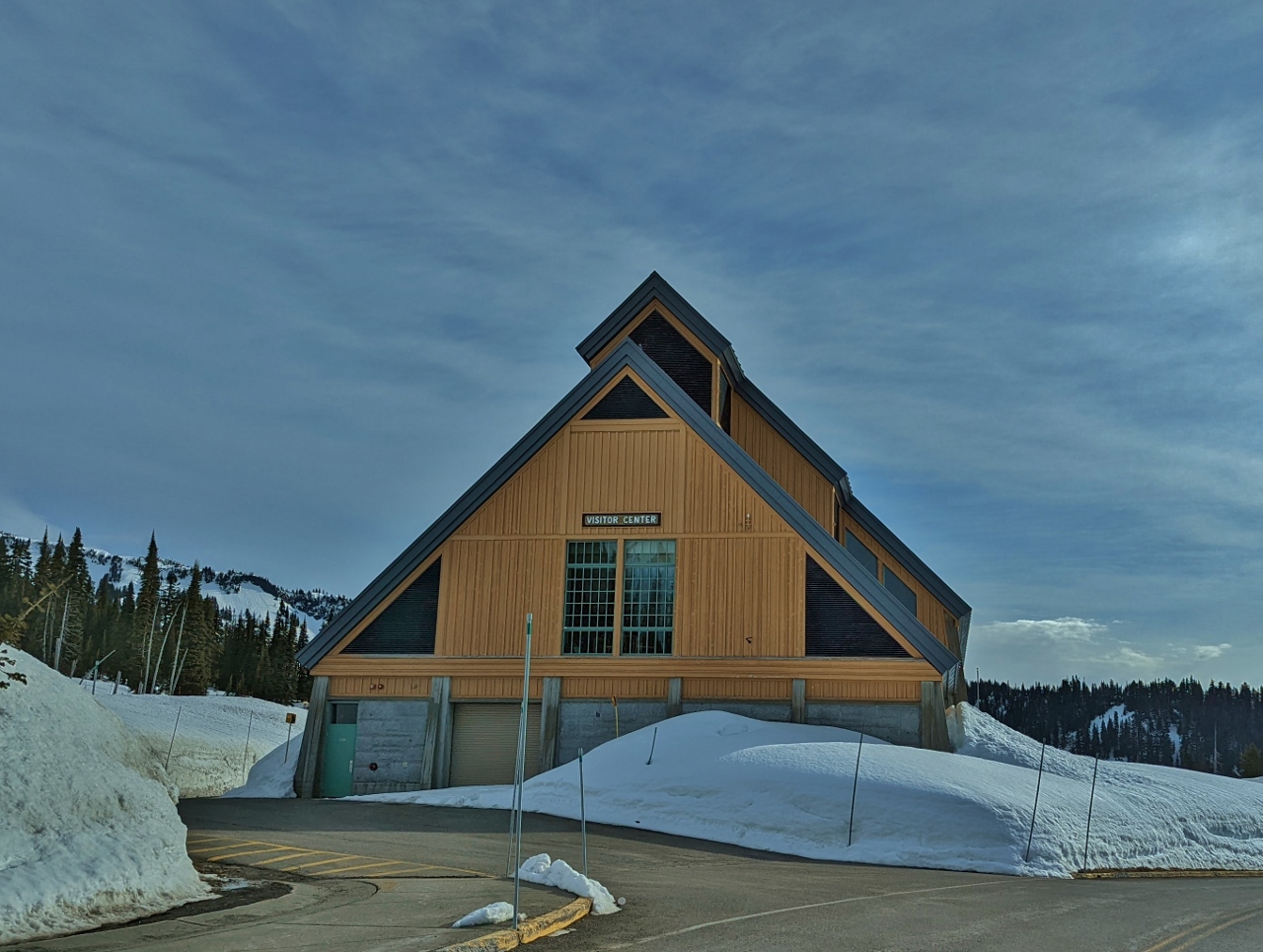 |
3/25/2022: Visitor Center
Position: 46°47.11'N, -121°44.33'W
The Henry M. Jackson Memorial Visitor Center at Paradise, elevation 5,400 ft (1,645 m), named in memory of the Washington senator who was a strong advocate of public lands and also has a wilderness area in the state named after him. The name of the area comes from 19th-century explorer James Longmire's daughter-in-law Martha, who exclaimed "Oh, what a paradise" when she first saw the beautiful wildflower meadows and mountain views.
|
 |
3/25/2022: Trailhead
Position: 46°47.22'N, -121°44.04'W
At the trailhead for our hike up Mazama Ridge.
|
 |
3/25/2022: Descending
Position: 46°47.27'N, -121°43.93'W
We accidentally started off on a parallel trail, so here are descending a slope to meet up with the route to Mazama Ridge.
|
 |
3/25/2022: Valley Road
Position: 46°47.26'N, -121°43.91'W
Heading north along Valley Road towards Mazama Ridge. The road is unplowed in the winter and closed to traffic, and has great views into the Paradise River in the valley at right.
|
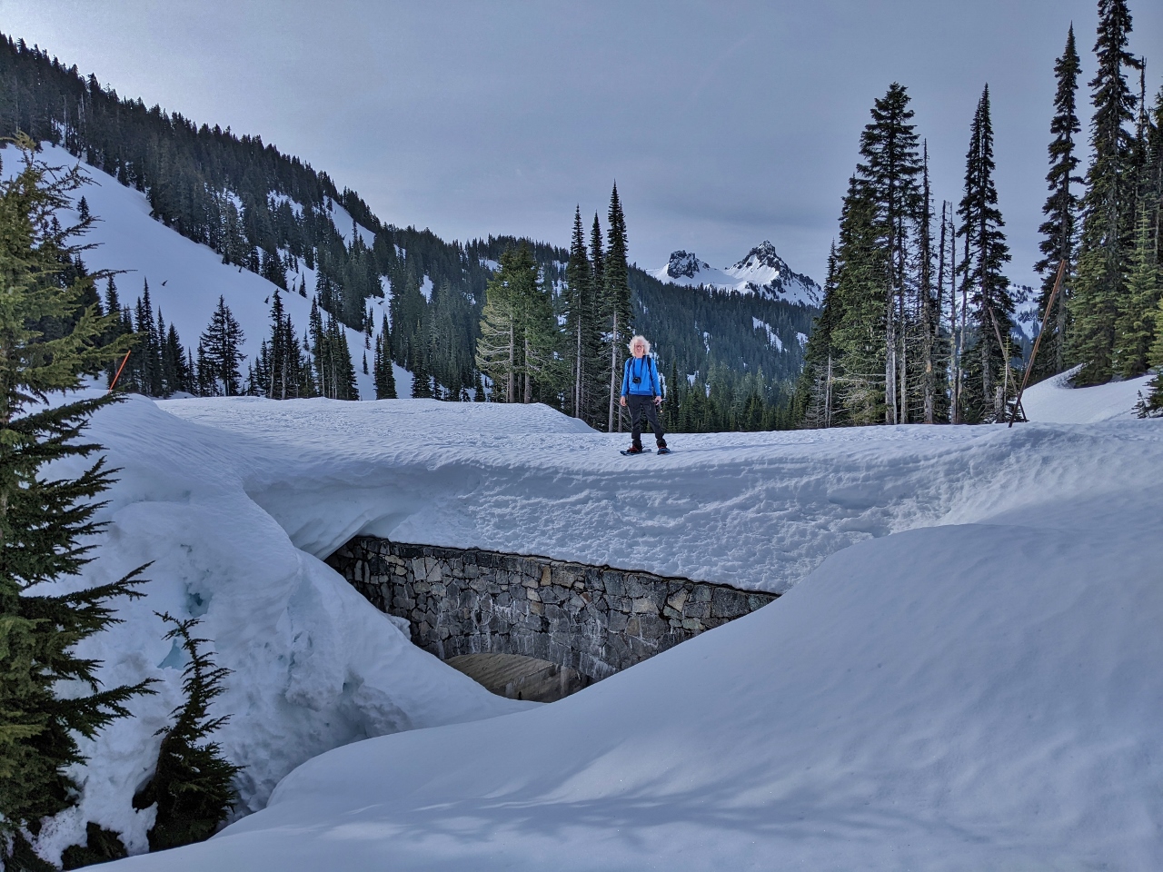 |
3/25/2022: 4th Crossing
Position: 46°47.42'N, -121°43.61'W
At the 4th Crossing bridge over Paradise River. Here we'll leave the road and head up to Mazama Ridge on the 4th Crossing trail.
|
 |
3/25/2022: 4th Crossing Trail
Position: 46°47.51'N, -121°43.42'W
View to Mt. Rainier from the the 4th Crossing Trail.
|
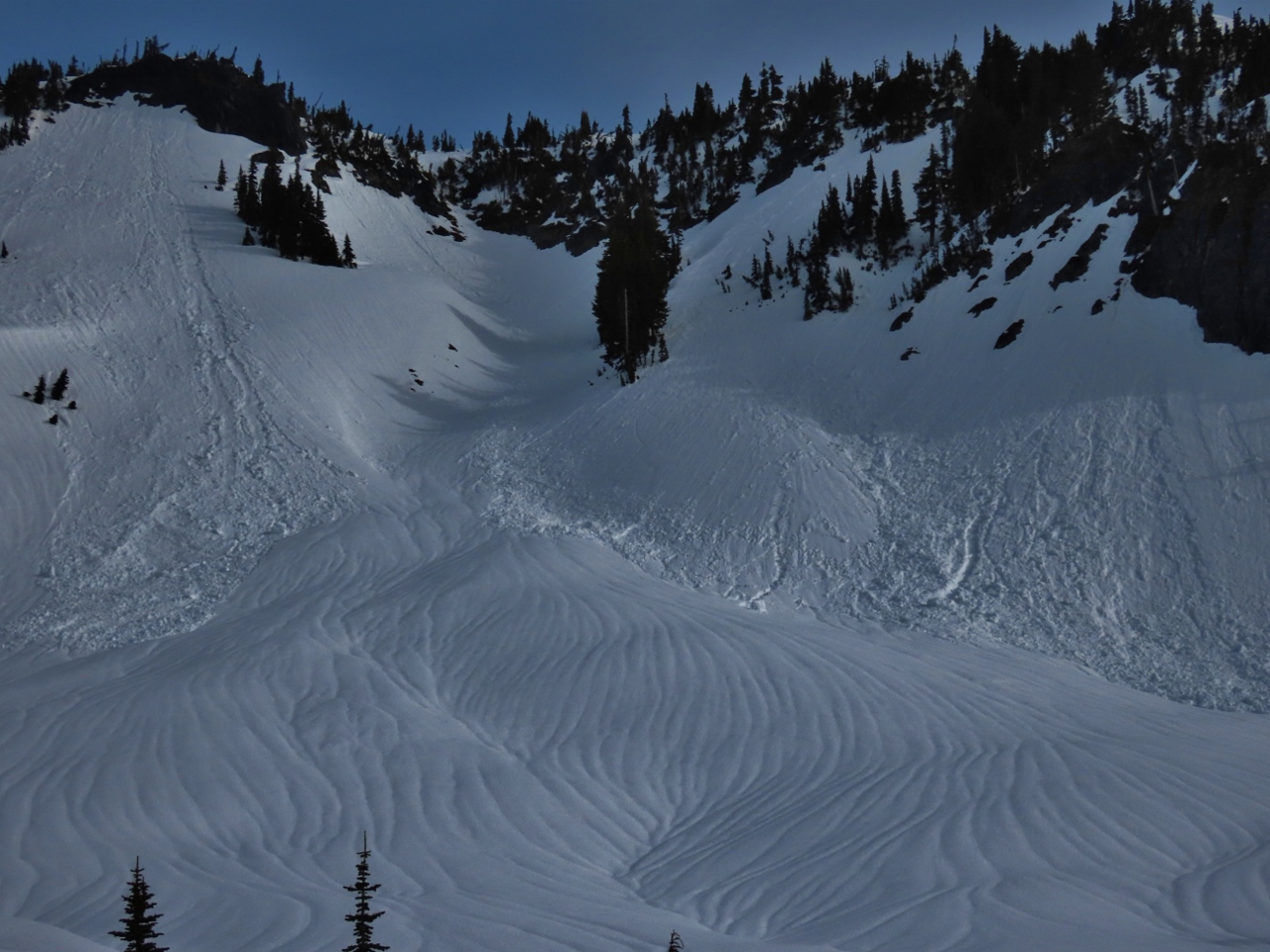 |
3/25/2022: Avalanches
Position: 46°47.51'N, -121°43.39'W
Lots of evidence of avalanches visible to our north as we ascend the 4th Crossing Trail.
|
 |
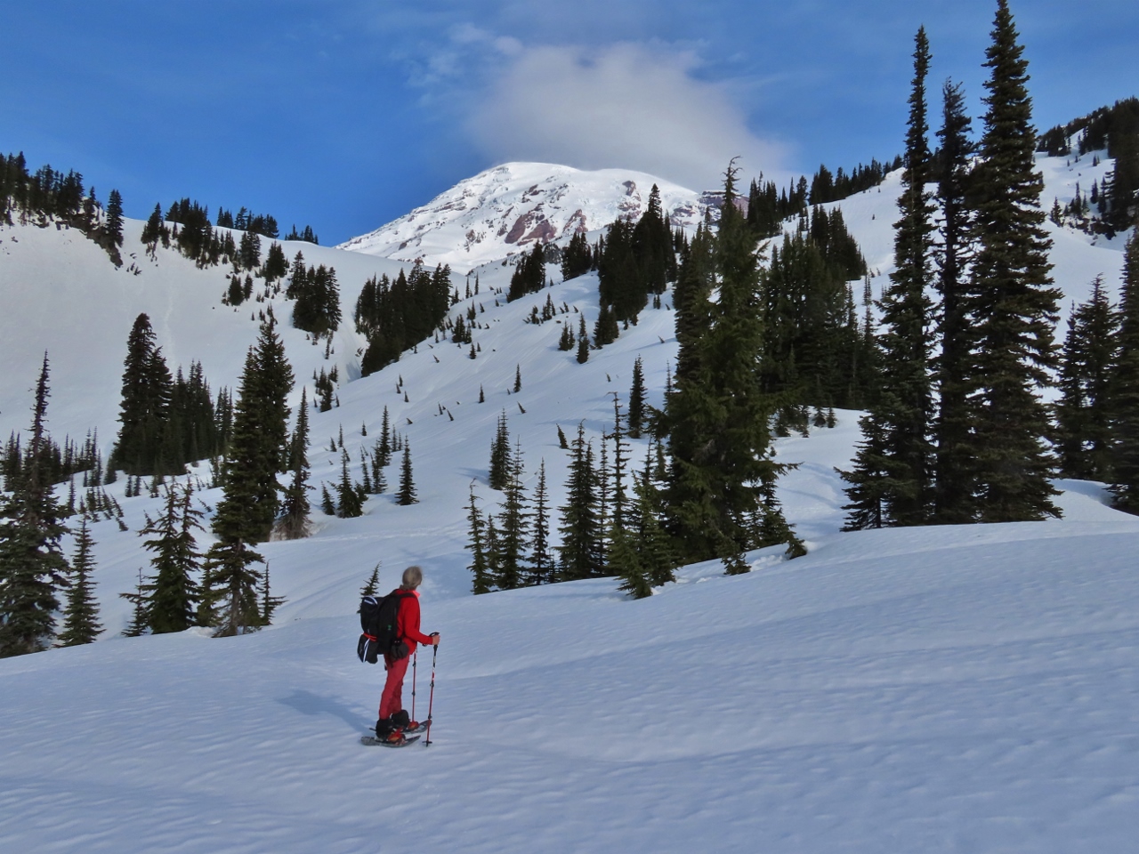
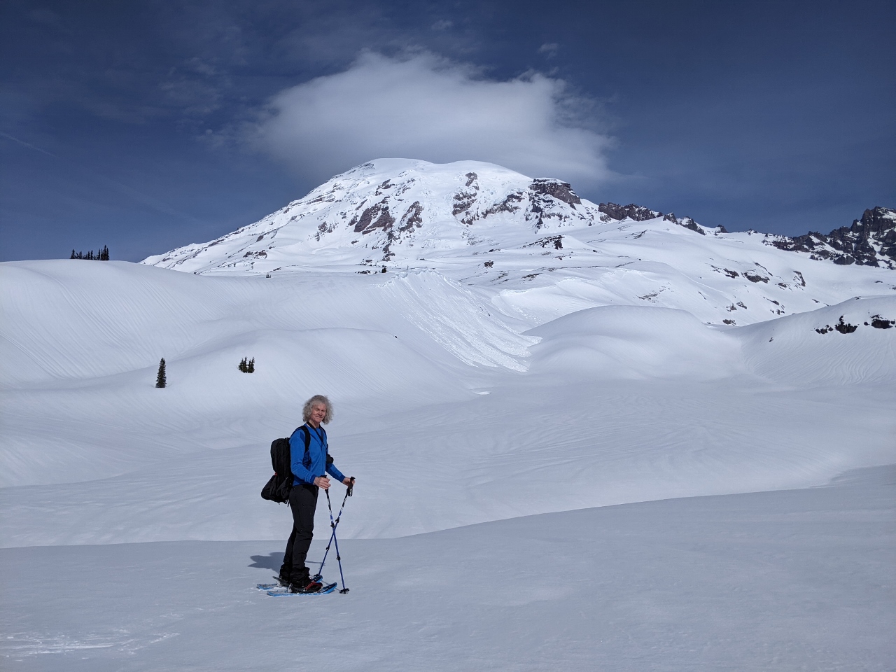
3/25/2022: Mazama Ridge
Position: 46°47.46'N, -121°43.25'W
Fabulous view to Mt. Rainier from Mazama Ridge at elevation 5,618 ft (1,713 m). A small cloud is just starting to form around the summit, but the day remains wonderfully clear with the mountain still out.
|
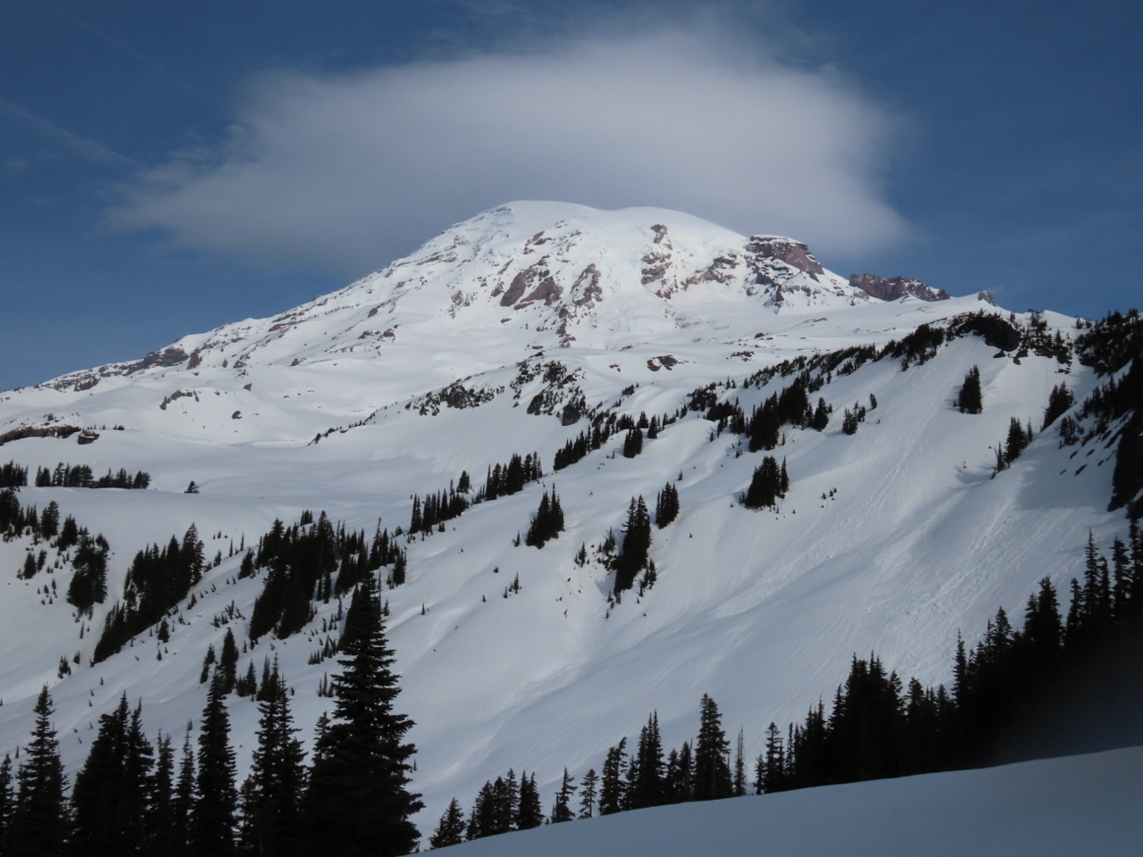 |
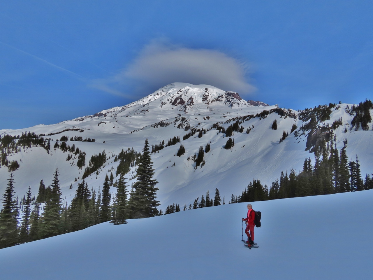
3/25/2022: The Mountain
Position: 46°47.45'N, -121°43.23'W
The mountain really is spectacular in today's clear weather.
|
 |
3/25/2022: Paradise
Position: 46°47.44'N, -121°43.22'W
View to Paradise from Mazama Ridge. The road we walked along to the 4th Crossing Trail is visible in the foreground.
|
 |
3/25/2022: James and the Mountain
Position: 46°47.38'N, -121°43.18'W
We're super-stoked to finally be at Mt. Rainier and are loving the clear weather.
|
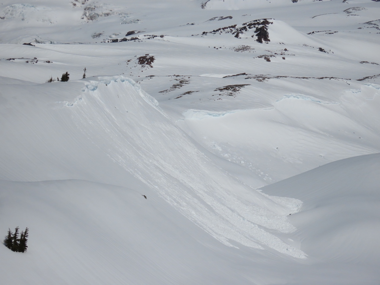 |
3/25/2022: Recent Avalanche
Position: 46°47.60'N, -121°42.99'W
Evidence of a recent avalanche as we head north towards Mt. Rainier on the Skyline Trail. The area is full of avalanche risks, and we're being careful where we go.
|
 |
3/25/2022: Skyline Trail
Position: 46°47.67'N, -121°42.94'W
More great views to Mt. Rainier from the Skyline Trail. The avalanche area shown in the previous picture is visible in the background.
|
 |
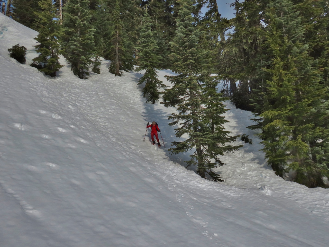
3/25/2022: Climbing
Position: 46°47.69'N, -121°42.95'W
At altitude 5,966 ft (1,819 m) and climbing as we ascend towards Panorama Point. No recent tracks are in evidence, and the trail isn't marked, but it's not difficult to find our way using apps such as AllTrails that show our location on a downloadable topographic map.
|
 |
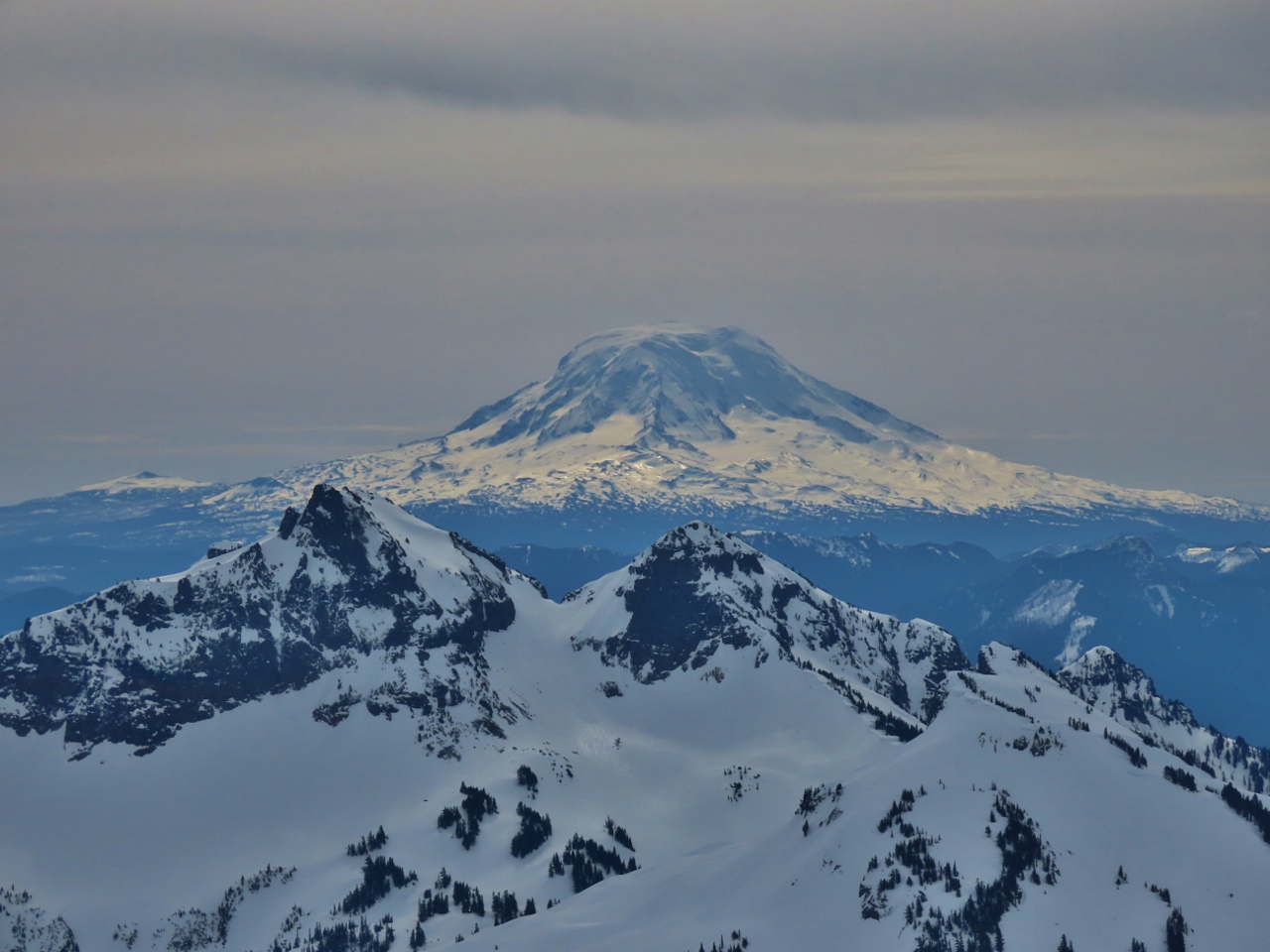
3/25/2022: View South
Position: 46°47.81'N, -121°43.20'W
Enjoying the fabulous view south at altitude 6,187 ft (1,886 m). The tall mountain visible way in the distance is 8,363-ft (2,549 m) Mt. St. Helens in southern Washington state.
|
 |
3/25/2022: Mt. St. Helens
Position: 46°47.82'N, -121°43.22'W
Close-up view to snow-encrusted 8,363-ft (2,549 m) Mt. St. Helens in southern Washington state. The mountain is famous for its 1980 eruption, the deadliest and most economically destructive in U.S. history. The volcanic event killed 57 people and destroyed 200 homes, 47 bridges, 15 miles (24 km) of railways, and 185 miles (298 km) of highway.
|
 |
3/25/2022: Final Ascent
Position: 46°47.89'N, -121°43.27'W
At altitude 6,308 ft (1,923 m), we are getting closer to 6,964 ft (2,123 m) Panorama Point.
|
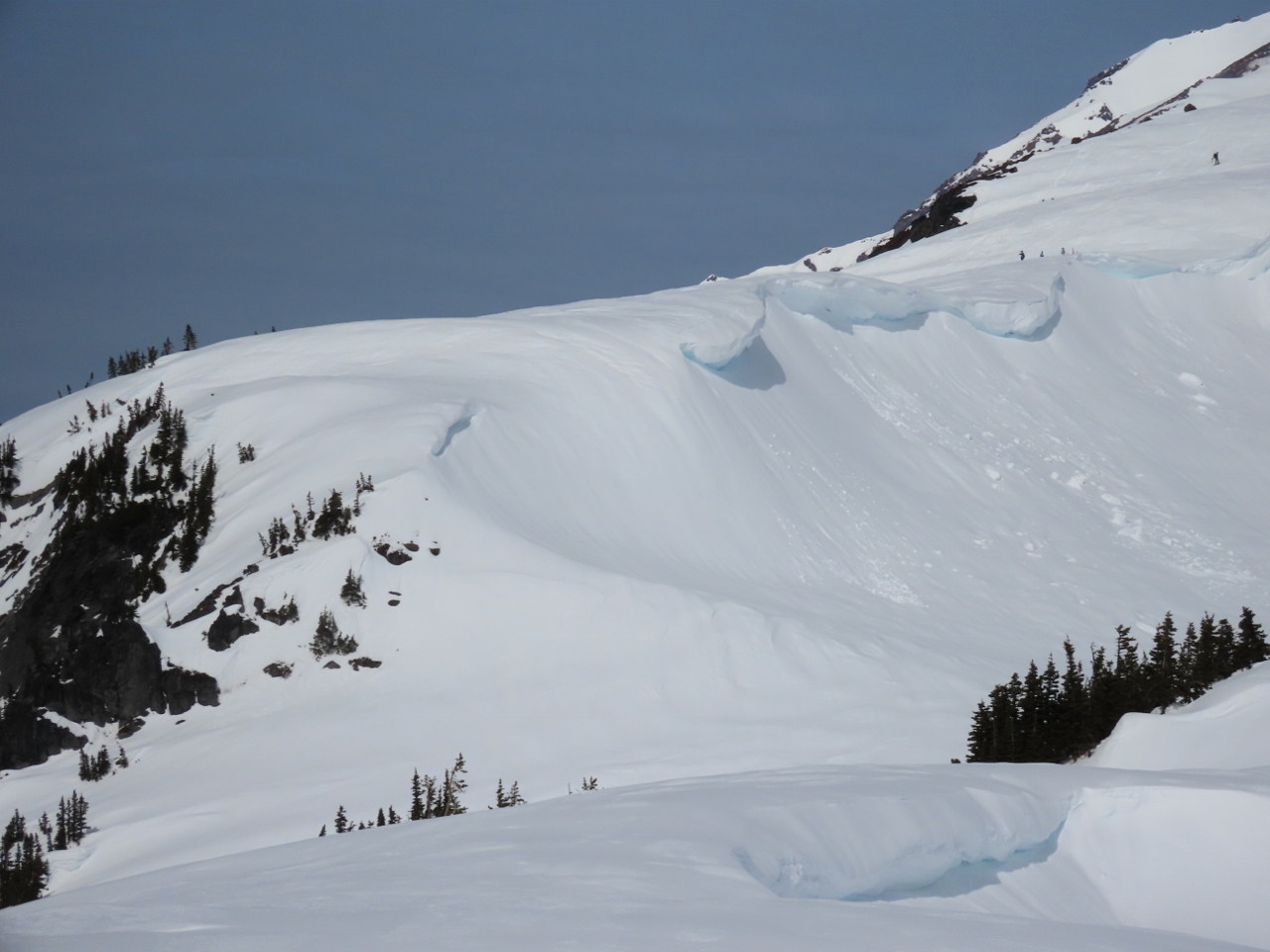 |
3/25/2022: Cornices
Position: 46°47.91'N, -121°43.28'W
Beautiful, but dangerous, cornices on a ridge edge. These heavy wind-blown overhanging formations can easily fall and start an avalanche. Walking underneath one is never a good idea. And you can easily walk on top of one without knowing it and trigger an avalanche that carries you down the hill.
|
 |
3/25/2022: Snowboarder
Position: 46°48.28'N, -121°43.65'W
We didn't see anyone on the Skyline Trail after leaving Mazama Ridge, but could see lots of people at Panorama Point who had climbed directly up from Paradise. Here is one of them snowboarding back down.
|
 |
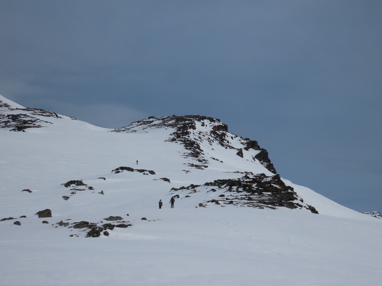
3/25/2022: Panorama Point
Position: 46°48.30'N, -121°43.73'W
Our best view yet to Mt. Rainier from Panorama Point at altitude 6,964 ft (2,123 m). The top of the mountain looks deceptively close, but it's another 7,500 ft (2,300m) to reach the 14,417 ft (4,394 m) summit. Most climbers take 2-3 days to reach the top, with only a 50% success rate. The most common failures are due to weather or poor climber physical condition. The climb also is a dangerous one, with an average of 2 deaths per year in the past 40 years. So as close as it looks, its still out of reach for us.
|
 |
3/25/2022: Windblown
Position: 46°48.30'N, -121°43.73'W
Even though we're at such a high elevation at nearly 7,000 ft (2,133 m), the area is so wind-blown that little snow is on the ground here. And it's really cold.
|
 |
3/25/2022: Panorama
Position: 46°48.30'N, -121°43.73'W
There's a reason they call it Panorama Point. This is the amazing view south, with 11,250-ft (3,429 m) Mt. Hood in Oregon visible slightly left of center and 8,363-ft (2,549 m) Mt. St. Helens to the right.
|
 |
3/25/2022: Mt Hood
Position: 46°48.30'N, -121°43.73'W
Close-up to 11,250-ft (3,429 m) Mt. Hood in Oregon from Panorama Point.
|
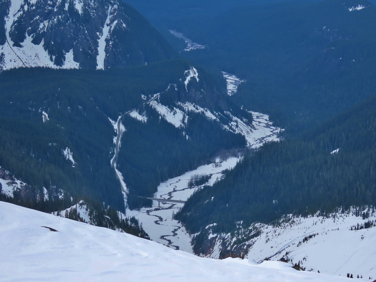 |
3/25/2022: Nisqually Glacier Bridge
Position: 46°48.30'N, -121°43.73'W
Looking 3,100-ft (945 m) down to the Nisqually Glacier Bridge, that we took photos at on our way up this morning. It's a long way down from here.
|
 |
3/25/2022: To Camp Muir
Position: 46°48.30'N, -121°43.73'W
Hikers continuing up from Paradise Point towards Camp Muir, named after the naturalist John Muir. In the late 1800s, as the president of the newly-formed Sierra Club, Muir advocated strongly for preserving Mt. Rainier. At elevation 10,188 ft (3,105 m), Muir is the most common base camp for those attempting to climb to the summit of 14,417 ft (4,394 m) Mt. Rainier.
|
 |
3/25/2022: Bathrooms
Position: 46°48.19'N, -121°43.76'W
Summer bathrooms, snowed in and closed for the winter, give an idea of how busy it can get here in the peak season.
|
 |
3/25/2022: Clouds
Position: 46°48.00'N, -121°44.03'W
As we descended along the Skyline Trial, the mountain disappeared in low clouds. We were very lucky to get the clear views that we did.
|
 |
3/25/2022: Tour
Position: 46°47.17'N, -121°44.16'W
Back at the Paradise parking lot, several vans were here from companies such as REI, who specialize in outdoor equipment. We bought our snowshoes from them, and were at their flagship store in downtown Seattle a few weeks ago.
|
 |
3/25/2022: Trailhead Bar & Grill
Position: 46°45.56'N, -122°1.93'W
Back at the Trailhead Bar & Grill in Ashford for a delicious late lunch.
|
 |
3/25/2022: Dinner
Position: 46°44.60'N, -121°55.45'W
Dinner on the porch of our cabin at Stone Creek Lodge. We're really enjoying the cabin and the environment.
|
 |
3/25/2022: Dinner Guests
Position: 46°44.58'N, -121°55.42'W
Two deer joined us for dinner at the Stone Creek Lodge near Mt. Rainier. They ordered grass, while we went for take-out Thai food.
|
 |
3/26/2022: Cutting Board
Position: 46°44.59'N, -121°55.43'W
A couple of new additions to our mobile galley: a small cutting board and a folding knife. Both are working out well and are nice to have. The folding knife is much easier to clean than the utility knife we'd been using up until now.
|
 |
3/26/2022: Trailhead
Position: 46°47.12'N, -121°44.03'W
At the trailhead for a snowshoe hike down to Inspiration Saddle and across Mazama Ridge.
|
 |
3/26/2022: Lower Lakes Trail
Position: 46°46.90'N, -121°44.06'W
Descending along the Lower Lakes trail from Paradise. The trail is considered an intermediate level route for snowshoers, and is marked with orange poles visible on the trail below James.
|
 |
3/26/2022: Ruby Falls
Position: 46°46.71'N, -121°44.34'W
Ruby Falls gushing along the Paradise River. We're crossing the river on Stevens Canyon Road, closed for the winter.
|
 |
3/26/2022: Trail Junction
Position: 46°46.51'N, -121°44.32'W
At a winter trail junction. From here we'll be heading on the unmarked winter trail to Mazama Ridge. We could also have continued to descend on a marked trail to Reflection Lakes.
|
 |
3/26/2022: Mazama Ridge Trail
Position: 46°46.90'N, -121°43.41'W
Heading towards clouds at altitude 5,536 ft (1,688 m) on Mazama Ridge.
|
 |
3/26/2022: Clouds
Position: 46°46.89'N, -121°43.42'W
We can barely see the pair of skiers a short distance ahead of us on Mazama Ridge as the cloud level falls. Even the tracks we're following are getting hard to discern.
|
 |
3/26/2022: 4th Crossing
Position: 46°47.48'N, -121°43.29'W
Enjoying a snack and a hot drink with a view to the 4th Crossing trail that we walked up yesterday. We'll descend down it to return to the Paradise parking lot.
|
 |
3/26/2022: Paradise River
Position: 46°46.51'N, -121°44.79'W
We stopped off at Narada Falls on our way back down from Paradise in the truck. This is the Paradise River just above the falls.
|
 |
3/26/2022: Narada Falls
Position: 46°46.52'N, -121°44.74'W
Narada Falls gushing 188 ft (tk m) over a cliff into a pool directly below us. The best view to the falls is where two people are standing in the distance after a short walk through the snow (click image for a larger view).
|
 |
3/26/2022: Rockslide
Position: 46°46.50'N, -121°44.83'W
A very recent rockslide on the Longmire-to-Paradise Road a short distance from Narada Falls. It wasn't there when we came up earlier this morning.
|
 |
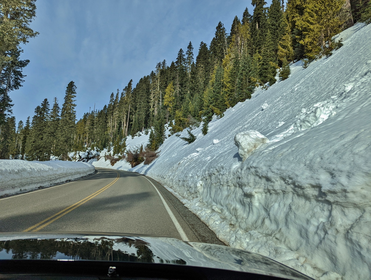
3/26/2022: Snow Equipment
Position: 46°46.42'N, -121°45.07'W
Snow removal equipment parked alongside Longmire-to-Paradise Road.
|
 |
3/26/2022: Trailhead Bar & Grill
Position: 46°45.57'N, -122°1.94'W
Another good meal at the Trailhead Bar & Grill in Ashford.
|
 |
3/26/2022: Hot Tub
Position: 46°44.60'N, -121°55.44'W
Enjoying a soak before dinner at the Stone Creek Lodge with our cabin visible behind us.
|
 |
3/27/2022: Hobo Inn
Position: 46°45.94'N, -122°11.67'W
Passing the Hobo Inn, where guests stay in renovated cabooses, at railroad-themed Elbe, WA on our way home from Mt. Rainier.
|
 |
3/27/2022: Alder Lake
Position: 46°48.02'N, -122°16.50'W
A tranquil and misty morning at Alder Lake in Elbe, WA.
|
 |
3/27/2022: Lake Youngs
Position: 47°25.38'N, -122°12.68'W
The distinctive shape of Lake Youngs is used as a visual checkpoint for pilots flying into nearby Renton Airport. James took this picture on his flight south to the MARS conference near Santa Barbara, CA.
|
 |
3/27/2022: Mt. Rainier
Position: 46°47.08'N, -122°1.85'W
James back at Mt. Rainier, this time flying over, about six hours after we left the area this morning by car.
|
 |
3/27/2022: Applegate
Position: 42°23.64'N, -123°25.55'W
Passing over Applegate, OR en route to the MARS conference near Santa Barbara, CA, with Applegate Lake in the distance. In 2001, the Applegate Valley wine area became the 6th official Oregon wine appellation.
|
 |
3/27/2022: Ovation of the Seas
Position: 47°37.00'N, -122°20.69'W
Our "pet cruise ship", Ovation of the Seas, performing a pirouette off Pier 66. The ship arrived this morning and moored bow to the city, then turned around later in the day, presumably to allow shore-side access to the other side of the boat.
|
 |
3/28/2022: Shatner and Bezos
Position: 34°26.25'N, -119°15.32'W
William Shatner, who portrayed Captain Kirk in the original Star Trek TV series on stage at the MARS conference with Amazon founder Jeff Bezos and Jeff's brother Mark (not pictured) discussing their recent space flights. Bezos was a big Star Trek fan as a kid and in a moving moment told Shatner "when I was young, you gave me the gift of space and I'm happy to return the favor".
|
 |
3/29/2022: Jet Pack Human Flight
Position: 34°26.21'N, -119°15.58'W
Richard Browning demonstrating the Daedalus Flight Pack he invented that can achieve altitudes of 2,000 ft (610 m). The company Browning founded, Gravity Industries, has research contracts with military customers, demonstrates all over the globe, and has plans to commercialize jet pack flight. UK-based Great North Air Ambulance Service currently is training a medic with the jet pack to allow them to reach remote accident victims in 90 seconds instead of up to 30 minutes.
|
 |
3/29/2022: α-WaLTR
Position: 34°26.38'N, -119°15.45'W
Associate Professor Kiju Lee leads the Adaptive Robotics and Technology (ART) Lab at Texas A&M University. One of their more interesting projects is the DARPA-funded adaptive Wheel-and-Leg Transformable Robot project α-WaLTR. This project tackles the problem that wheeled vehicles can only climb small stairs (relative to wheel size), while legged vehicles are capable of handling much larger stairs, but are less efficient and usually slower.
In this innovative design, a wheeled robot operates at fast and efficient speeds and when it encounters an obstacle the wheels passively open up into legged appendages. These appendages have far larger radius than the original wheels, giving them more climbing ability and much higher traction. |
 |
3/29/2022: Zoox
Position: 34°26.38'N, -119°15.45'W
Zoox demonstrated their innovative "built for riders not drivers" vehicle that will form the basis of the Zoox driverless metro taxi service. The car has numerous innovative features including being bidirectional and supporting 4 wheel steering, and it's optimized to support driverless operation with sensor packages on each of the vehicles 4 corners.
Late last year James got an opportunity to enjoy a 20 min drive through San Francisco in an early Zoox test vehicle operating driverless. It's impressive how far driverless operation has come in such a short period of time. |
 |
3/29/2022: Agility Robotics
Position: 34°26.35'N, -119°15.49'W
The Albany, Oregon-based Agility Robotics design team posing with Digit, their bipedal robot. Digit is targeting repetitive human work that can be more cost effectively and safely done by a robot. Rather than redesigning the workspace to fit the robot, they produce a robot that is able to work safely around people and can take on process paths designed for humans.
James spent more than an hour with the team and they demonstrated Digit walking across a golf course down into a sand trap and then back up the steep, poor-traction edge back onto the green. They showed how stable it was to external forces and how good its balance was when jumping. This is pre-production work, but it is already quite impressive. Here's a video of Digit at work: https://www.youtube.com/shorts/ikaSYti1KOQ. |
 |
3/29/2022: BioSuit
Position: 34°26.32'N, -119°15.50'W
Dava Newman, Director of the MIT Media Lab, demonstrated BioSuit at the MARS conference. Shown at right, BioSuit is a lightweight, easy-to-work-in, skin-tight, pressurized space suit. To the left of BioSuit is an Apollo program space suit that is both cumbersome to work in and weighs in at 180 lbs (82 kg) (on earth).
|
 |
3/29/2022: Robotic Dolphin
Position: 34°26.27'N, -119°15.35'W
Edge Innovations CEO Walt Conti demonstrated a robotic dolphin at the MARS conference. Conti has done amazing special-effects work over the years in many well known movies including The Perfect Storm, The Deep Blue Sea, Anaconda, The Abyss, and Star Trek IV: The Voyage Home so it's no surprise that he and the team have produced an amazingly life-like robotic dolphin. But seeing this creation swimming in a pool and interacting with guests along the pool edge is way beyond a special effect. If it weren't for the power cord trailing behind the dolphin, it's hard to tell it's a robot even when standing only a foot away. Amazing work.
|
 |
3/29/2022: Dr. MegaVolt
Position: 34°26.30'N, -119°15.37'W
"Dr. MegaVolt" Austin Richards and "Mistress MegaVolt" Victoria Charters on stage in thin metal mesh suits at the MARS conference. Richards, who holds a Ph.D. in particle physics, designed the 8.5-ft (2.6m) Tesla Coil that is delivering a one million volt arc to Charters.
|
 |
3/30/2022: Seattle
Position: 47°37.19'N, -122°23.06'W
James flying over downtown Seattle on his return from the MARS conference near Santa Barbara. The Space Needle is slightly right of center, and our two-tower apartment complex is near the right edge. The southern end of Lake Union is at left, with Lake Washington and the 520 Bridge in the background.
|
 |
3/30/2022: CMA CGM Tigris
Position: 47°37.00'N, -122°20.69'W
The container ship CMA CGM Tigris billowing smoke as the engine is started prior to getting underway for Vancouver from its anchorage in Yukon Harbor.
|
 |
3/30/2022: Pink Magnolia
Position: 47°37.13'N, -122°20.49'W
Striking petals of a pink magnolia flowering in Denny Park as we walked home from dinner.
|
 |
3/31/2022: Bicycle Lane
Position: 47°37.00'N, -122°20.69'W
Bicycle lanes made from orange barriers set out beside an empty lot at Fourth and Bell, a couple of blocks north of our apartment building. Most construction projects in downtown Seattle are allocated a lane for loading and unloading, reducing the lanes available for regular traffic. In this case, a bicycle lane was adjacent to the site, so a temporary one was created. The signs for the lane say bicycles only, but the bicyclists mostly seem to use the road and pedestrians use the bicycle path.
|
 |
4/1/2022: Murphy's
Position: 47°36.99'N, -122°20.57'W
Enjoying one of our last few cans of Murphy's Stout, imported from Europe.
|
 |
4/3/2022: Fireboat 2
Position: 47°37.00'N, -122°20.69'W
Seattle Fire Department's Fireboat 2 doing donuts off Pier 69. They test their fireboats fairly frequently in Elliott Bay.
|
 |
4/4/2022: High Winds
Position: 47°37.00'N, -122°20.69'W
The winds were gusting to 35 knots today as this fish boat stood off Pier 91. Likely the skipper was waiting for conditions to settle before docking. The seas are a lot rougher than they appear, with waves crashing over Elliott Bay Marina's substantial breakwater.
|
 |
4/4/2022: Wind Damage
Position: 47°37.00'N, -122°20.69'W
Several pink tarps protecting weather-sensitive equipment at this building under construction were destroyed in today's 35-knot gusts. This building design is interesting in that one entire exposed face of the building is solar panels rather than windows.
|
 |
4/5/2022: Excavator Delivery
Position: 47°37.00'N, -122°20.69'W
The first of two large excavators being delivered to the construction site at Fourth and Bell.
|
 |
4/5/2022: Day's Work
Position: 47°37.00'N, -122°20.69'W
By the end of the day, two excavators had arrived at the Fourth and Bell construction site and they'd made significant progress on removing the concrete top surface. It's interesting watching the excavators work. They carefully sort metal, pictured in the bin in the foreground, so it can be sent to recycling. Concrete and asphalt are also sorted separately so they too can be recycled properly.
|
 |
4/6/2022: Stretching
Position: 47°37.00'N, -122°20.69'W
Workers at a nearby construction site stretching before starting the job. It looks a little unusual for a construction site, but more and more employers are recognizing that encouraging a little time to stretch prior to physical work can greatly reduce the worker injury rate.
|
 |
4/6/2022: Victoria Clipper
Position: 47°37.00'N, -122°20.69'W
The Victoria Clipper out on a test run in Elliott Bay before its initial run to Victoria, Canada on April 15th. Except for a brief unsuccessful attempt to restart in the the fall of 2021, the fast ferry service has been suspended for over two years since Canada closed the border to tourists in 2020 due to the pandemic.
|
 |
4/6/2022: Standing Pipe
Position: 47°37.00'N, -122°20.69'W
A large standpipe in the construction site at Fourth and Bell that needs to be carefully worked around during site preparation. One of the challenges of downtown construction is avoiding existing plumbing, power and communications connections.
|
 |
4/7/2022: 72 Degrees
Position: 47°37.00'N, -122°20.69'W
The temperature is an amazing 72°F (22.2°C) in Seattle right now, with a high of 73 (22.8°C), when the average temperature for April 7th is 56.7°F (13.7 °C). While not a record, it is the fourth highest ever recorded for this day. The highest was 78°F (25.5°C) in 2016.
|
 |
4/7/2022: Thomas Street Warehouse
Position: 47°37.24'N, -122°20.36'W
The deck at Thomas Street Warehouse is packed with people enjoying today's unusually warm weather.
|
 |
4/8/2022: Next Layer
Position: 47°37.00'N, -122°20.69'W
The construction crew has removed the upper layer of concrete, with a little still visible at right, and most of it has been removed for recycling. They're now working on the next layer down.
|
 |
4/8/2022: Mud
Position: 47°37.00'N, -122°20.69'W
Our "pet cruise ship", Ovation of the Seas, is back for another quick stop at Pier 66. The bow thrusters are churning up lots of mud as the ship docks in today's high winds.
|
 |
4/9/2022: 38 F
Position: 47°37.00'N, -122°20.69'W
Two days ago, the Belltown temperature was a near-record high of 73°F (22.8°C). This morning it's swung the other way to 38°F (3.3°C), not far off the record low of 30°F (-1.1°C) set in 1920.
|
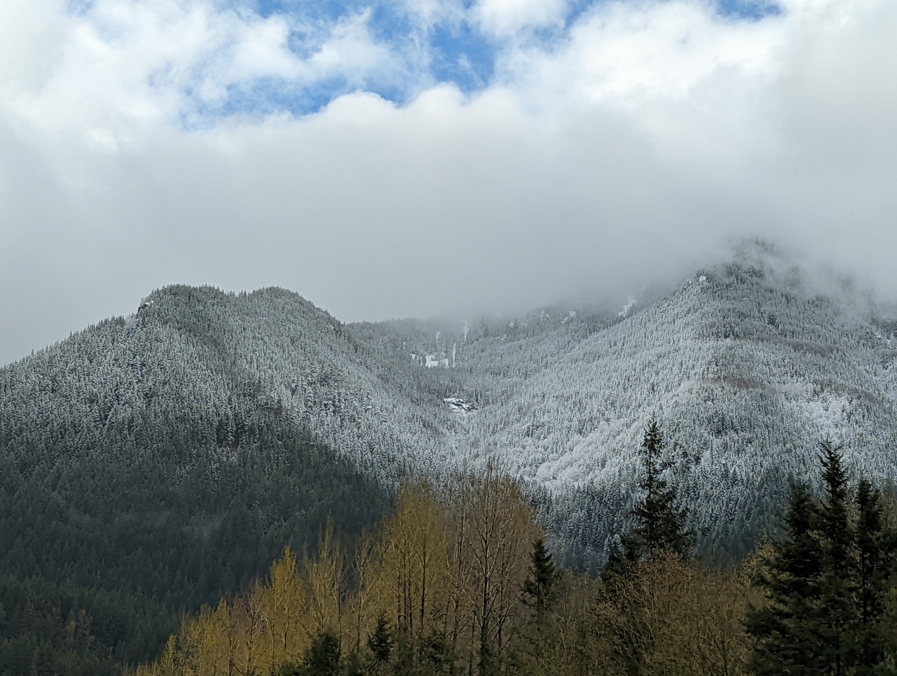 |
4/9/2022: Fresh Snow
Position: 47°27.83'N, -121°42.75'W
A late-season fresh dusting of snows on the trees east of North Bend as we drive east on I-90 at altitude 607 ft (185 m) to snowshoe at Snoqualmie Pass.
|
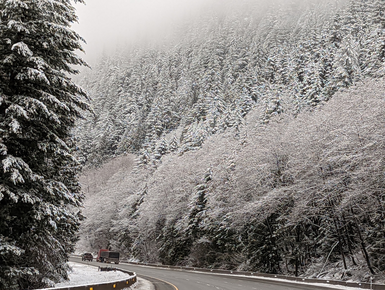 |
4/9/2022: Snow-Covered Trees
Position: 47°23.86'N, -121°26.87'W
As we near Snoqualmie Pass at altitude 2,165 ft (660 m) the trees are covered with fresh snow, making a beautiful winter scene.
|
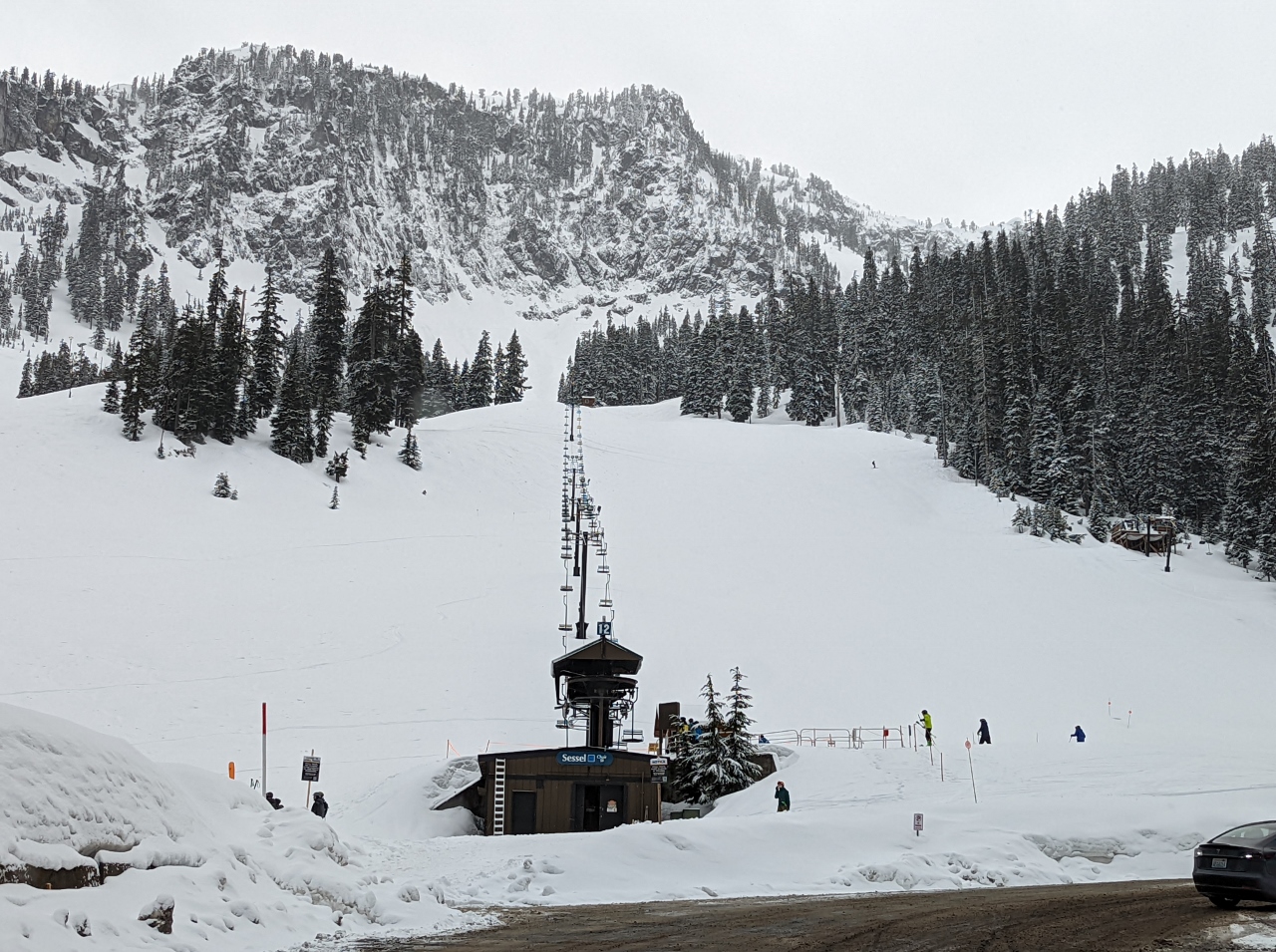 |
4/9/2022: Alpental
Position: 47°26.75'N, -121°25.45'W
The Alpental ski base at Snoqualmie Pass received several inches of fresh snow last night.
|
 |
4/9/2022: Trailhead
Position: 47°26.89'N, -121°25.89'W
Geared up and ready to snowshoe about 3 miles (4.8 km) up to Snow Lake north of the Alpental ski base.
|
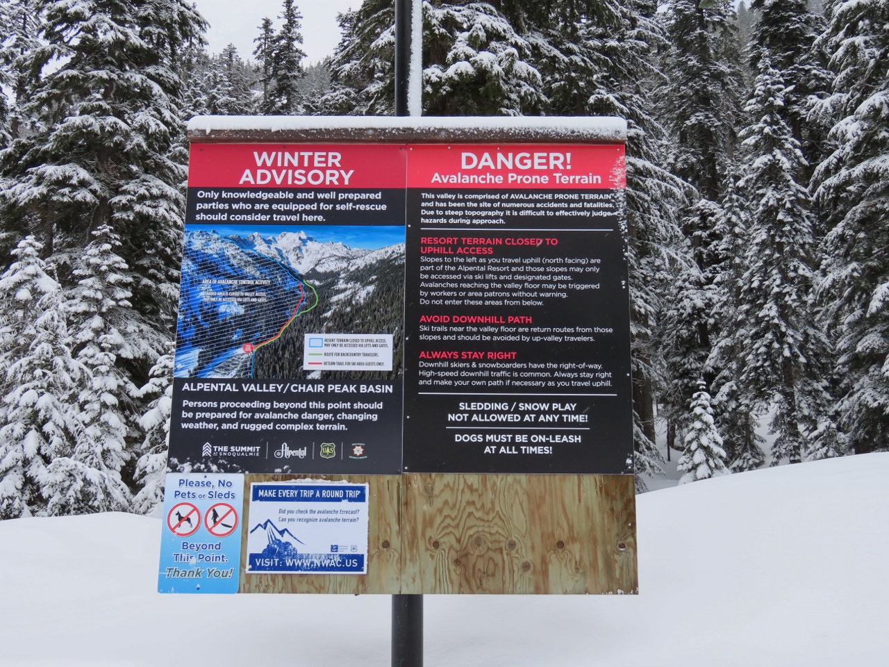 |
4/9/2022: Avalanche Advisory
Position: 47°26.86'N, -121°25.86'W
Avalanche advisory sign at the trailhead to Snow Lake. We'll be heading into the backcountry on this hike, but the avalanche risk today is low.
|
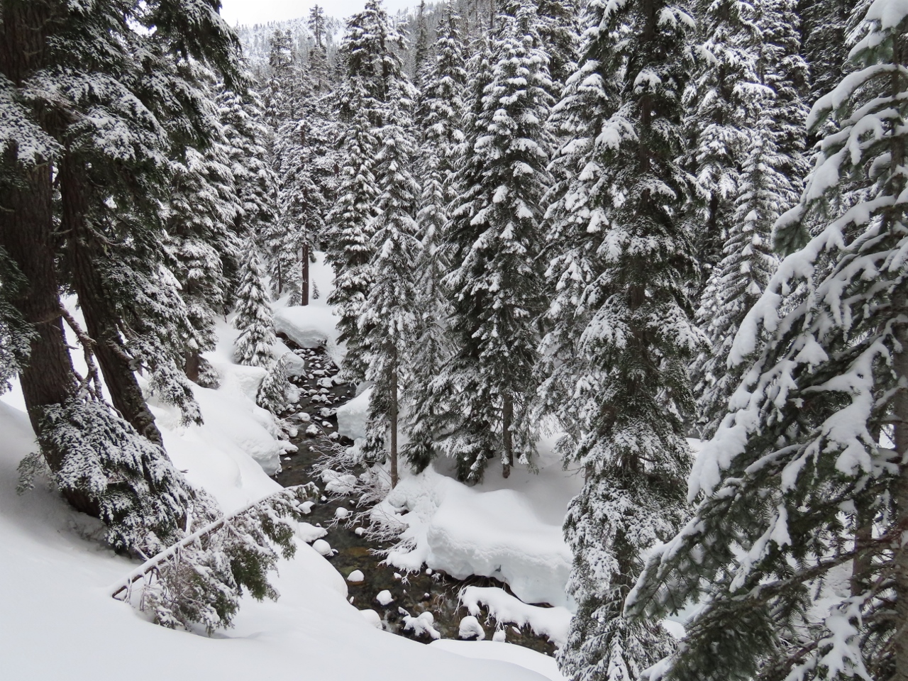 |
4/9/2022: South Fork
Position: 47°26.97'N, -121°25.96'W
Fabulous winter scene looking north along the Snoqualmie River South Fork.
|
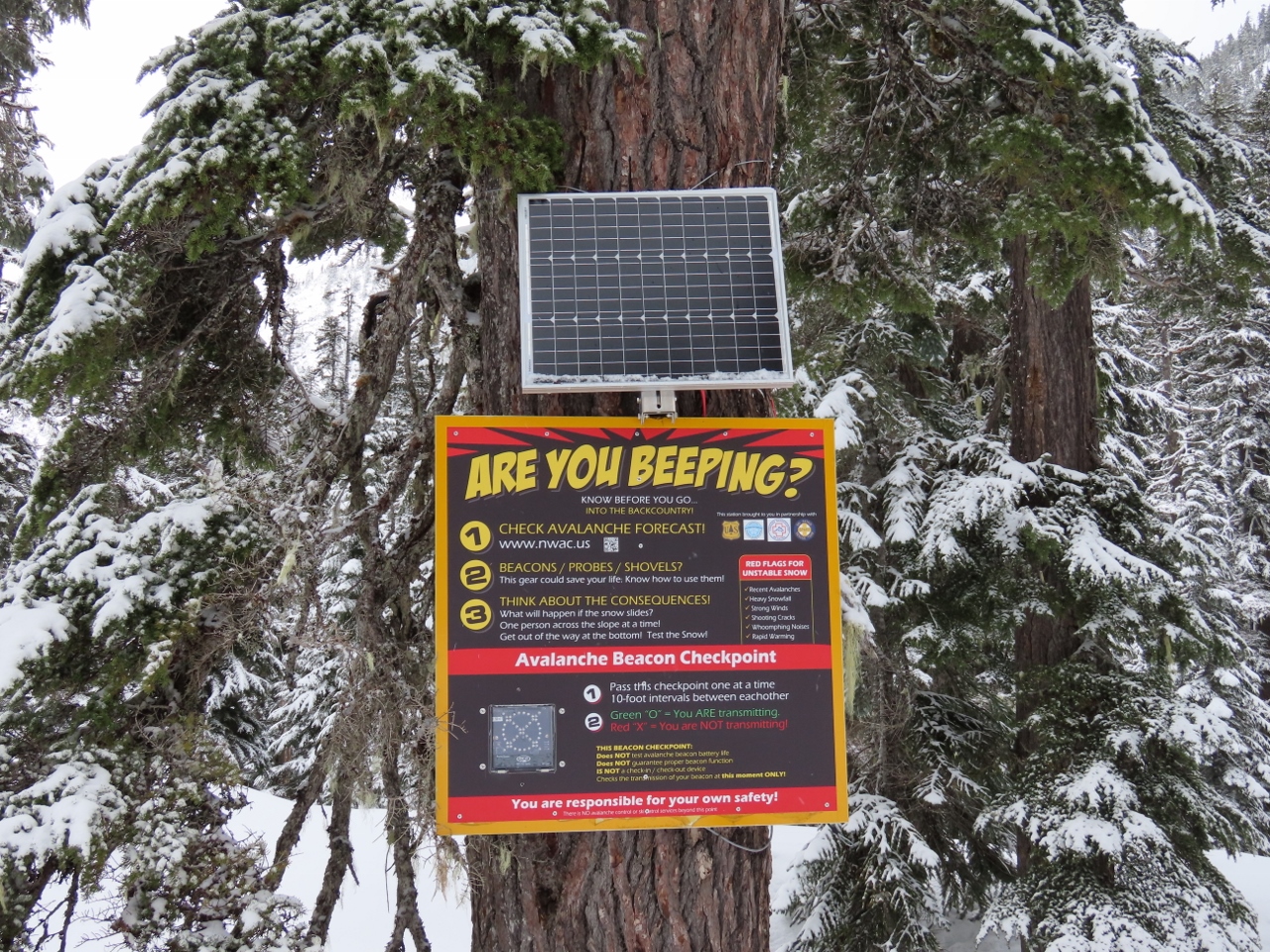 |
4/9/2022: Beacon Checkpoint
Position: 47°27.01'N, -121°26.04'W
The trail we're on leads to a popular back-country ski area in territory that can be avalanche-prone. For those carrying a search-and-rescue beacon, this checkpoint will confirm that their beacon is transmitting properly.
|
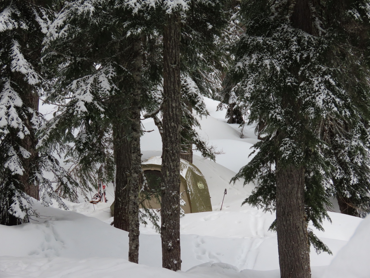 |
4/9/2022: Winter Camp
Position: 47°27.03'N, -121°26.12'W
A snug winter campsite along the Snoqualmie River South Fork. These people have come up with a fairly innovative way to maximize their ski time. They pitched a tent just outside of the Alpental property. In the mornings they can ski down to the lift and in the evenings they can ski down to their tent.
|
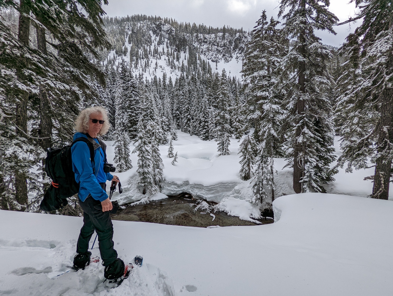 |
4/9/2022: Snoqualmie Mountain
Position: 47°27.11'N, -121°26.31'W
Looking east across the Snoqualmie River South Fork to Snoqualmie Mountain in the distance.
|
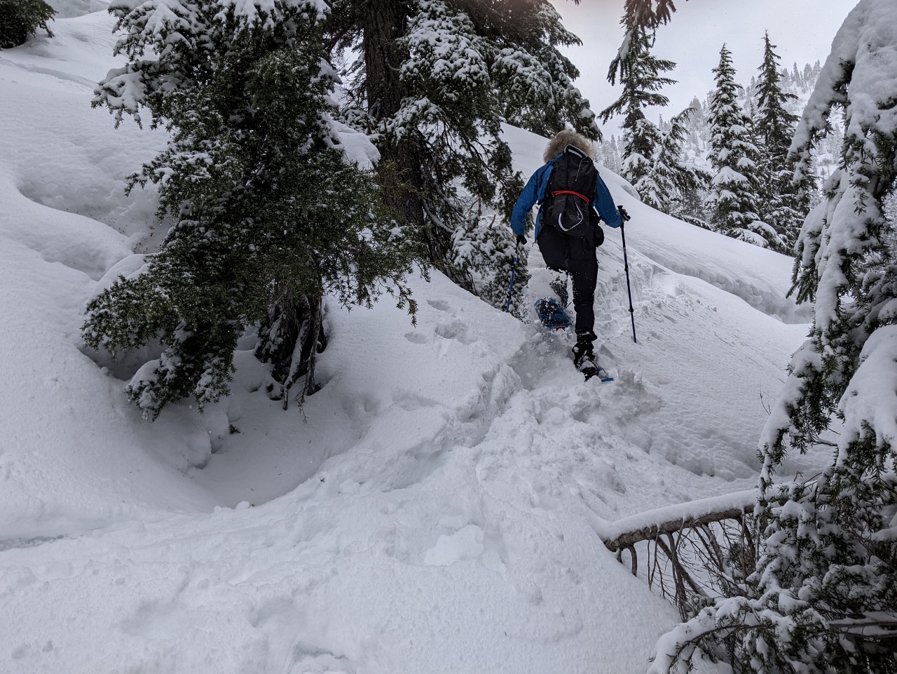 |
4/9/2022: Steep
Position: 47°27.26'N, -121°26.74'W
Most of the route so far has been at a fairly easy grade, but it got a lot steeper as we reached the slope below Chair Peak.
|
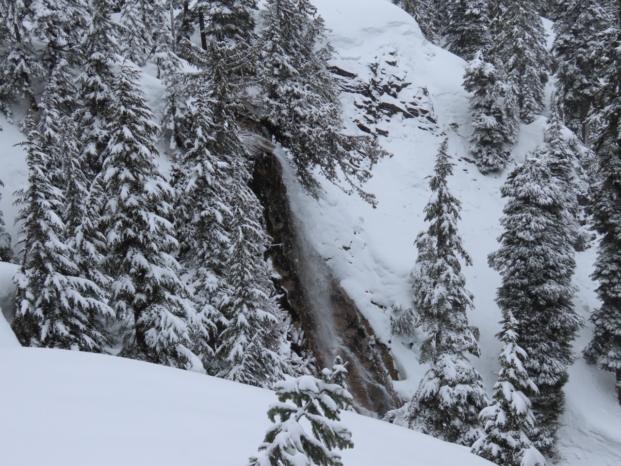 |
4/9/2022: Waterfall
Position: 47°27.25'N, -121°26.74'W
Waterfall along the Snoqualmie River South Fork.
|
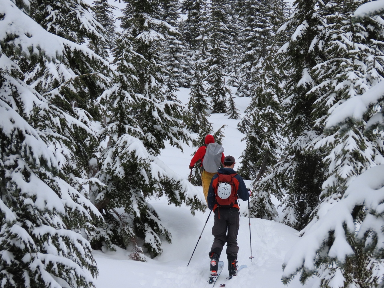 |
4/9/2022: Skiers
Position: 47°27.24'N, -121°26.86'W
Few people were snowshoeing today, but dozens of skiers were taking advantage of what may be the last big snowfall of the season.
|
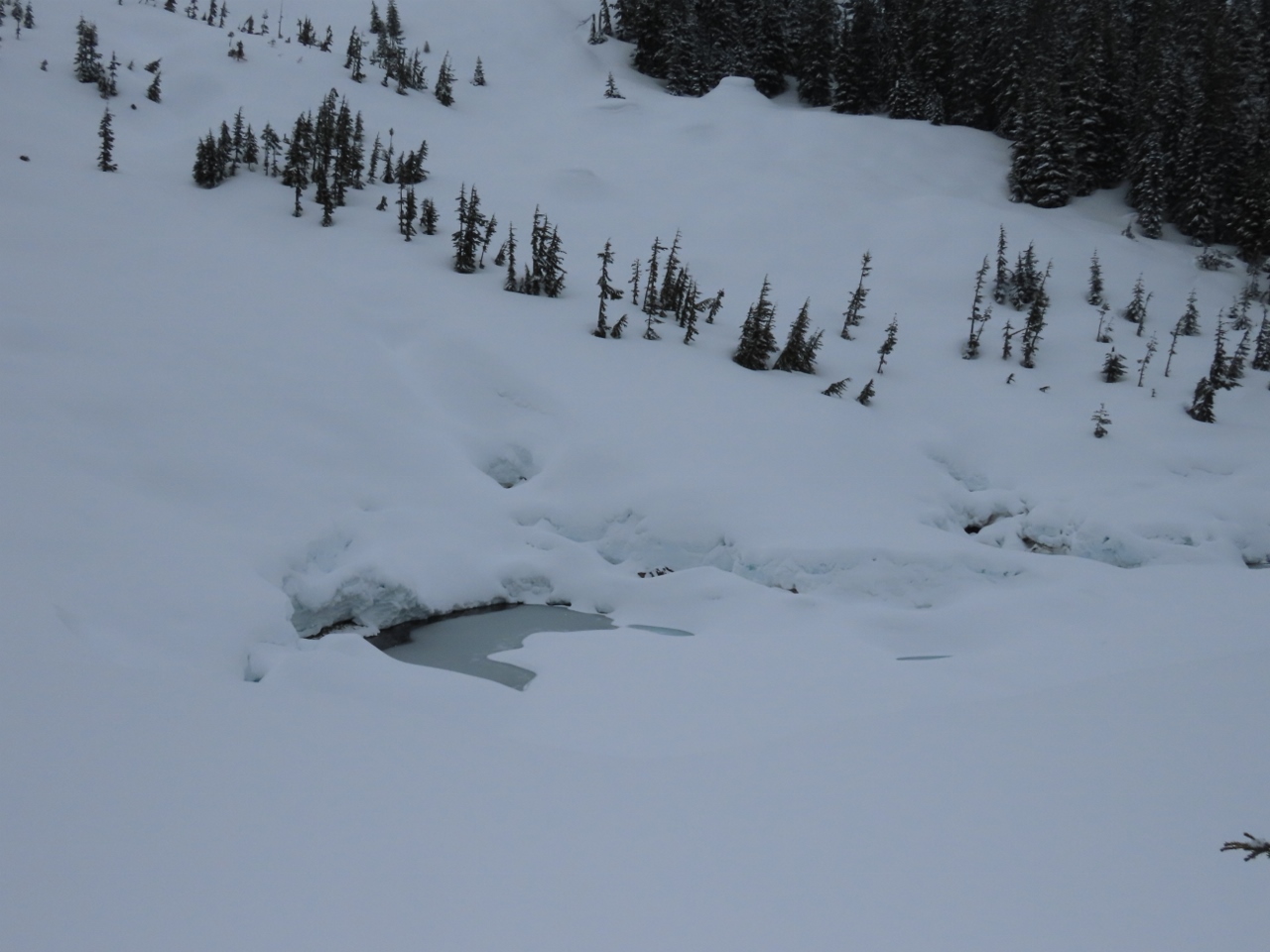 |
4/9/2022: Source Lake
Position: 47°27.27'N, -121°27.07'W
Source Lake, the source of Snoqualmie River South Fork, nearly buried in snow.
|
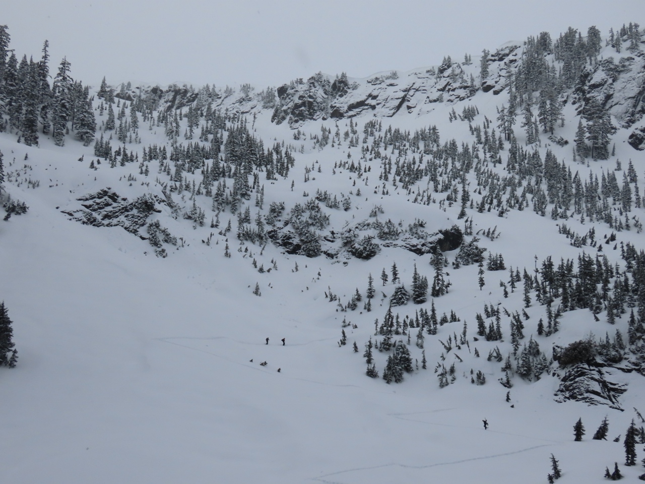 |
4/9/2022: Zig-Zag Trail
Position: 47°27.29'N, -121°27.10'W
Skiers climbing the zig-zag trail that leads up the slope below Chair Peak to Snow Lake (click image for a larger view).
|
 |
4/9/2022: Avalanche
Position: 47°27.32'N, -121°27.17'W
The remains of a micro-avalanche west of the trail.
|
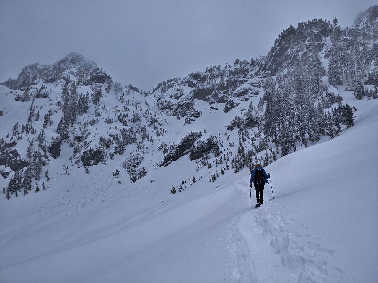 |
4/9/2022: Climbing
Position: 47°27.39'N, -121°27.24'W
Making our way up the zig-zag trail towards Snow Lake. The going was fairly steep, but we enjoyed the climb.
|
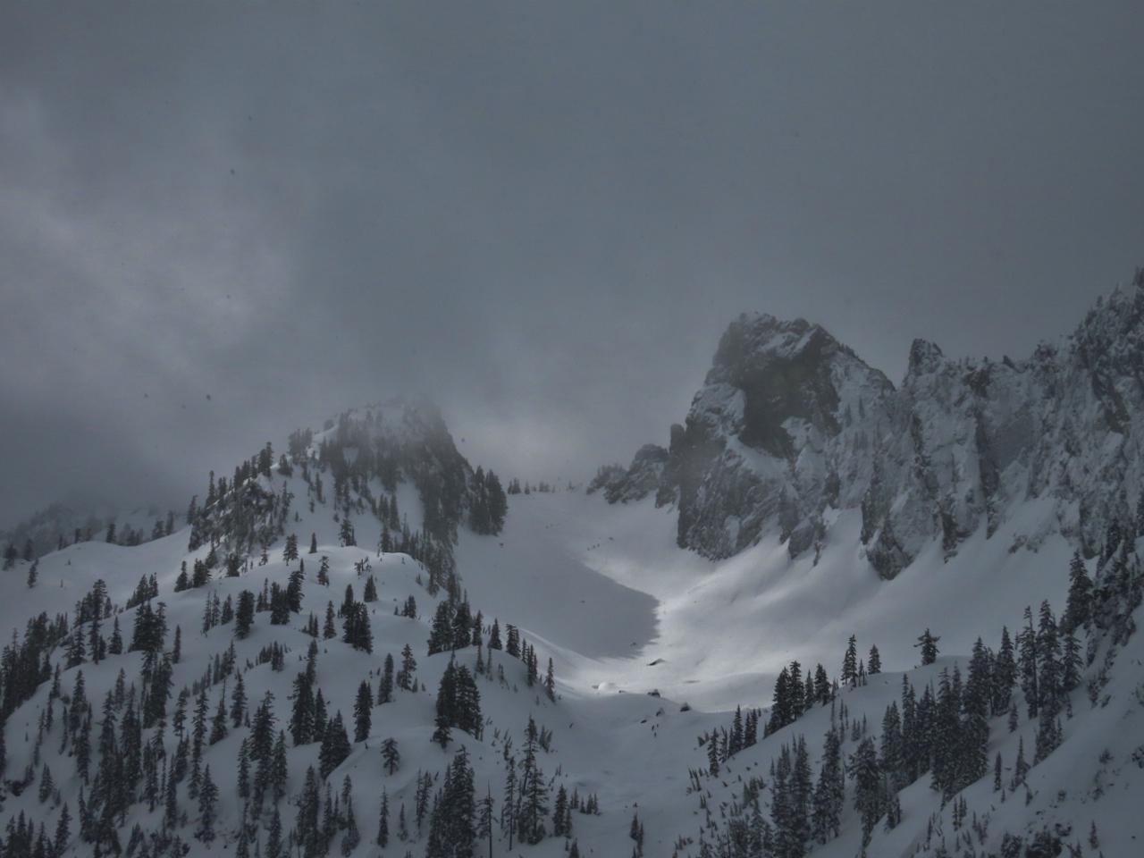 |
4/9/2022: Chair Peak
Position: 47°27.49'N, -121°27.35'W
6,238-ft (1,901 m) Chair Peak, right of center, viewed from the trail up to Snow Lake. Even though the visibility was a bit poor, we still got some great mountain views.
|
 |
4/9/2022: Snow Lake
Position: 47°27.62'N, -121°27.06'W
Enjoying a hot drink and a snack at altitude 4,480 ft (1,366 m), with a view to snow-covered Snow Lake. We saw several skiers cross the frozen lake.
|
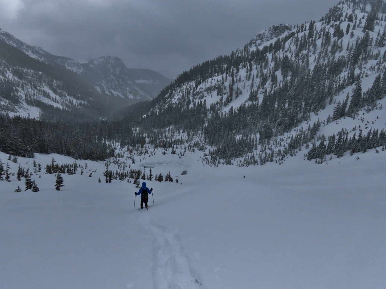 |
4/9/2022: Snoqualmie Pass
Position: 47°27.45'N, -121°27.36'W
Descending back down the zig-zag trail towards Source Lake, with Snoqualmie Pass in the distance.
|
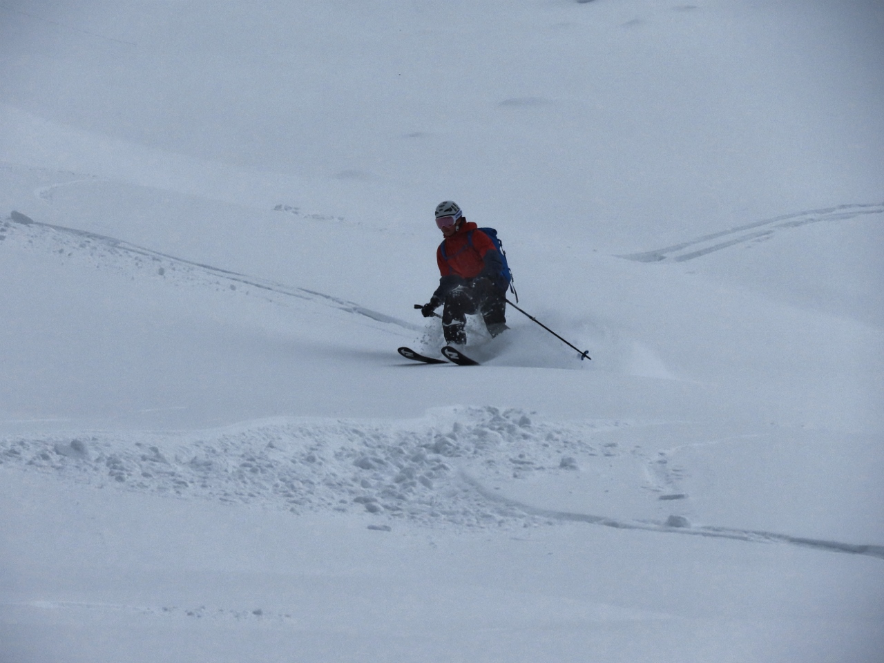 |
4/9/2022: Skier
Position: 47°27.34'N, -121°27.23'W
One of many skiers we watched heading down-slope.
|
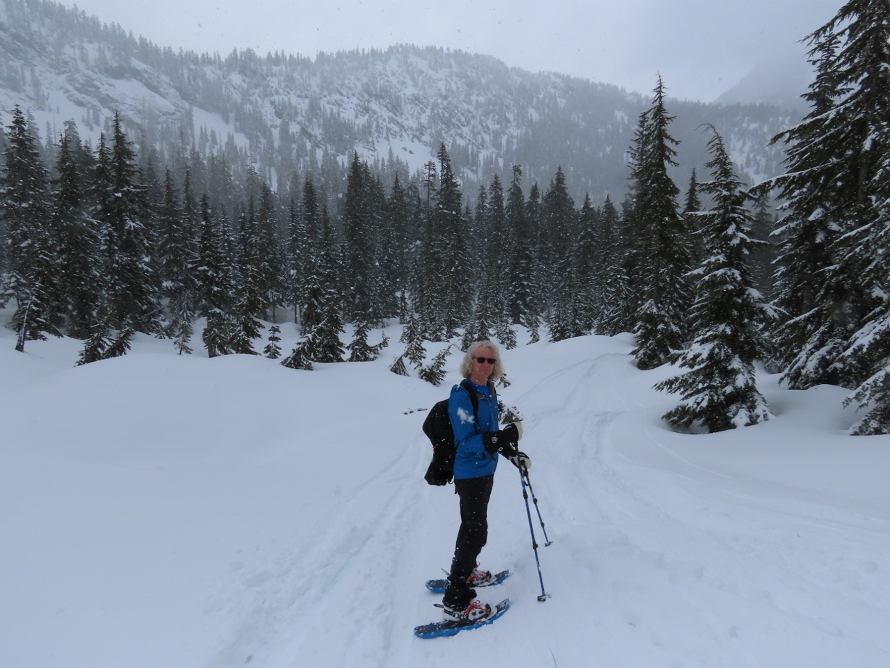 |
4/9/2022: Snowing
Position: 47°27.27'N, -121°27.07'W
A light snow started falling as we descended. It feels like the start of winter, not the end.
|
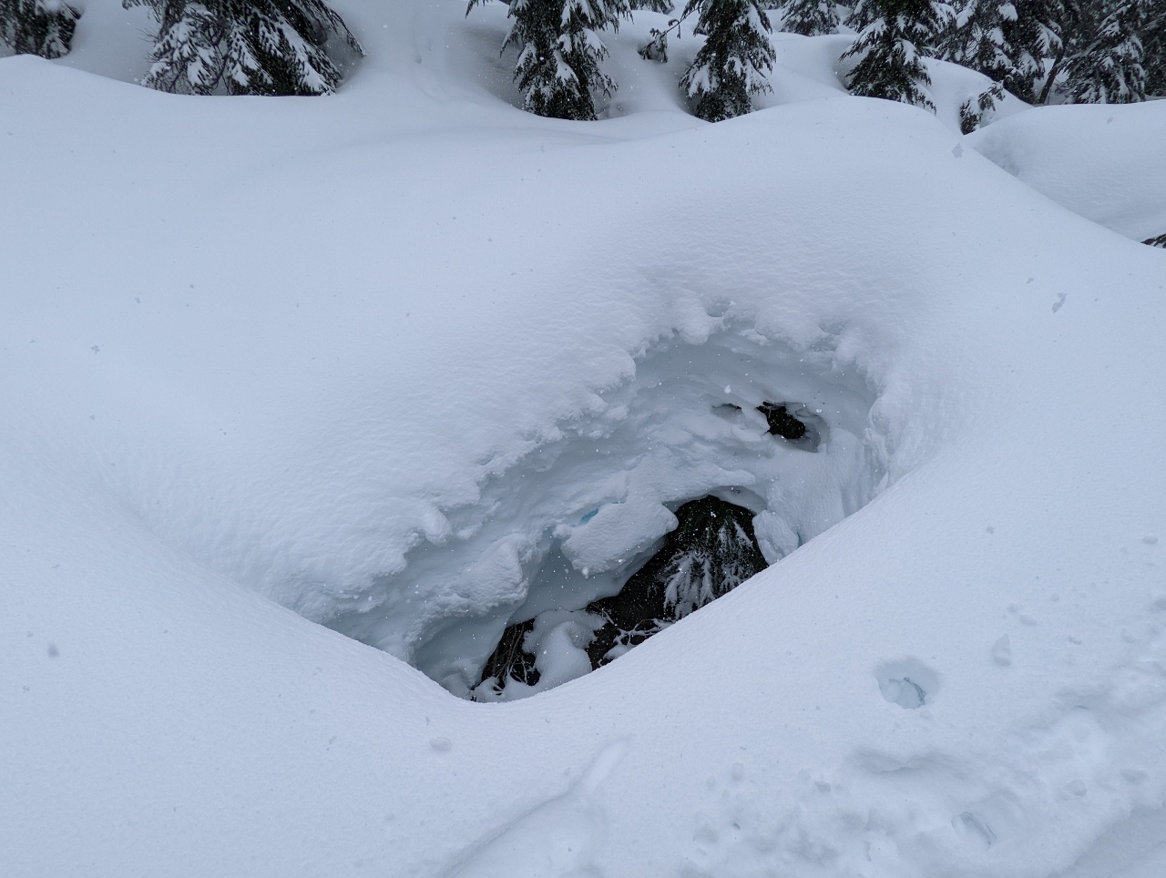 |
4/9/2022: Hole
Position: 47°27.24'N, -121°26.84'W
A big hole in the snow above the Snoqualmie River South Fork.
|
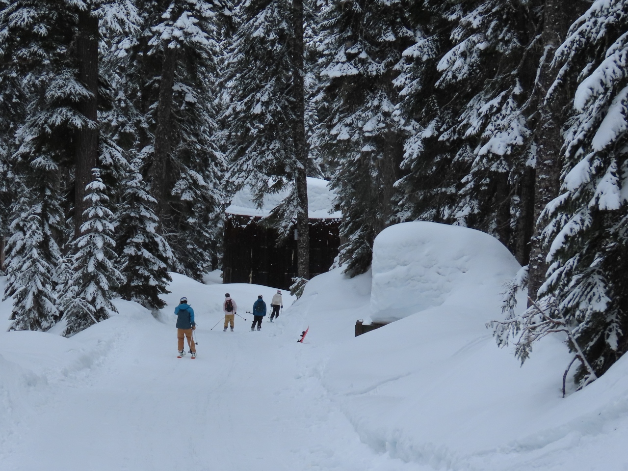 |
4/9/2022: Ski Trail
Position: 47°27.03'N, -121°26.10'W
Walking along the ski trail return route that leads to the Alpental upper parking lot and nearby chair lifts. We didn't see any skiers when we walked up a few hours earlier shortly after 9am, but many passed us on the descent.
|
 |
4/9/2022: Explosives
Position: 47°27.01'N, -121°26.06'W
Storage for explosives used for avalanche control at the Alpental ski resort.
|
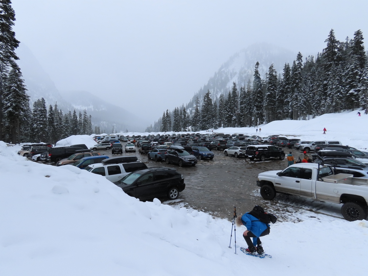 |
4/9/2022: Parking Lot
Position: 47°26.97'N, -121°25.98'W
The Alpental upper parking lot still had plenty of space when we arrived at 9am, but it was filling fast. The lot was full three hours later when we returned from our hike.
|
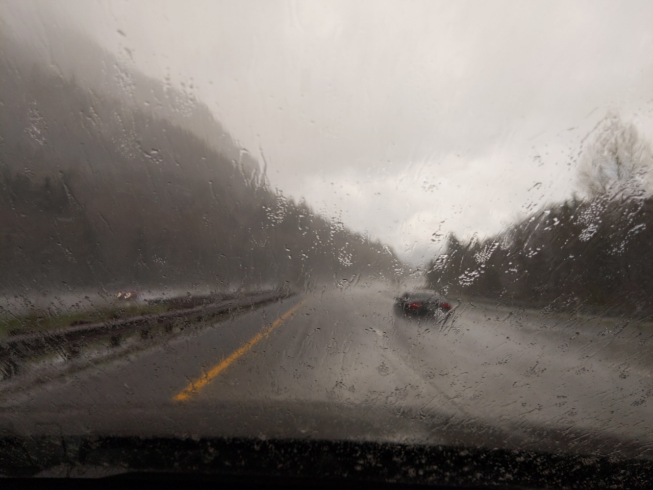 |
4/9/2022: Wet Snow
Position: 47°26.59'N, -121°40.14'W
Wet snow falling at altitude 1,074 ft (328 m) as we near North Bend. That means more snow up in the mountains.
|
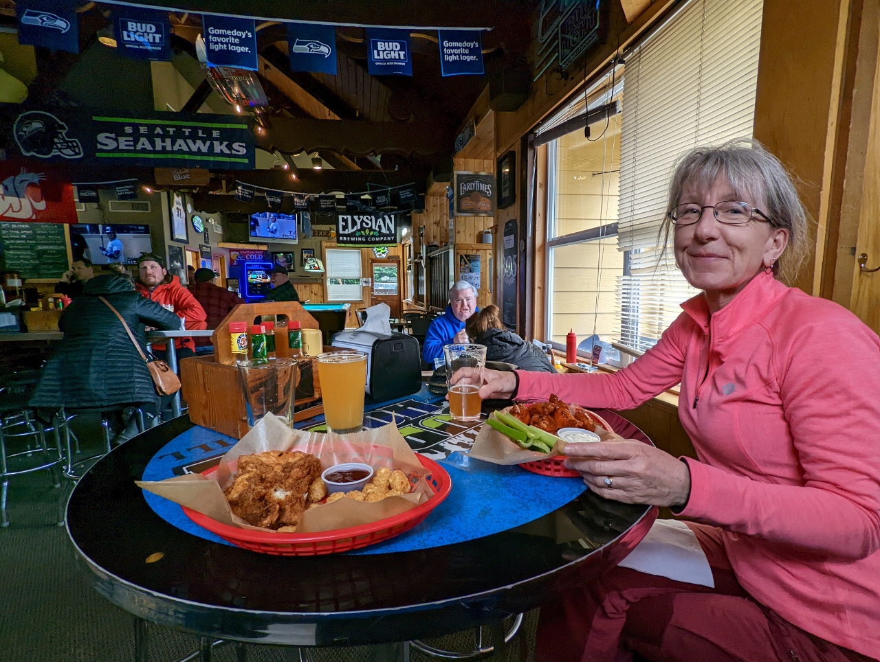 |
4/9/2022: Pour House
Position: 47°29.79'N, -121°47.31'W
An enjoyable lunch at the Pour House Bar & Grill in North Bend.
|
 |
4/9/2022: Seattle Fire Boats
Position: 47°37.00'N, -122°20.69'W
Two Seattle Fire Boats practicing in Elliott Bay.
|
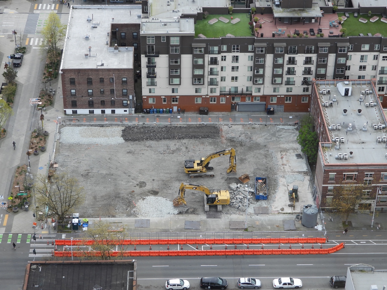 |
4/9/2022: Fourth and Bell
Position: 47°37.00'N, -122°20.69'W
The concrete slab from the original structure at Fourth and Bell has now mostly been removed. On the near-side edge of the site, a ramp has been constructed to allow vehicle access from road grade. The gravel pad at the back of the site will support a wheeled hydraulic excavator.
|
 |
4/9/2022: Thai Ginger
Position: 47°37.06'N, -122°20.35'W
A great meal along the window at our favourite table at Thai Ginger near our apartment. James' office building is just out of the picture behind Jennifer.
|
 |
4/9/2022: Rain
Position: 47°37.06'N, -122°20.35'W
As we finished our meal at Thai Ginger, an unusually heavy rain started falling, with drops so large you could see them bounce off the pavement. The restaurant manager poured us each a little more wine, insisting we couldn't go out in that.
|
 |
4/10/2022: Rain
Position: 47°27.64'N, -121°42.27'W
Rain is falling at altitude 628 ft (192 m) on I-90 en route to Snoqualmie Pass, with a fresh dusting visible from overnight. As we climb towards the pass, the rain should switch to a late-season snow.
|
 |
4/10/2022: Snow
Position: 47°26.31'N, -121°39.05'W
Heavy snow falling on I-90 at altitude 1,250 ft (381 m). Snowpack usually peaks around Snoqualmie Pass by April 1, so mid-April isn't unusually late for snowfall. But it is a lot more fresh snow than has fallen for the past few weeks.
|
 |
4/10/2022: Slid Off
Position: 47°25.53'N, -121°36.23'W
By altitude 1,384 ft (422 m), the snow was starting to build up and several cars had slid off the road.
|
 |
4/10/2022: Chaining Up
Position: 47°24.74'N, -121°34.97'W
Multiple vehicles, including several highway trucks, stopped along the side of the road to install chains. In the current conditions, traction tires are advised and oversized vehicles aren't allowed, but chains aren't required.
|
 |
4/10/2022: Police
Position: 47°24.02'N, -121°33.28'W
Several police cars at another accident near Snoqualmie Pass. With traction tires and AWD, we weren't having any trouble in the snow, and neither were most of the other vehicles travelling with us.
|
 |
4/10/2022: Truck Stopped
Position: 47°25.56'N, -121°25.74'W
Near the Snoqualmie Pass ski area, the truck visible in the distance has stopped right in the middle of I-90 while the driver installs chains.
|
 |
4/10/2022: Alpental Parking Full
Position: 47°25.63'N, -121°25.05'W
We were surprised to see the Alpental parking lots were already full given we were arriving at about the same time as yesterday. Likely not all lots have been plowed and they're operating at reduced capacity.
|
 |
4/10/2022: Snow From Roof
Position: 47°25.38'N, -121°24.75'W
Just after we pulled into this gas station, a huge pile of snow slid off the roof and landed right behind us, covering our tracks leading in.
|
 |
4/10/2022: Deep Snow
Position: 47°23.84'N, -121°23.69'W
Deep snow at the Gold Creek Sno Park. This is the same area where we snowshoed a few weeks ago, but this time we're heading on a different hike to towards the Kendall Peak Lakes. The snowshoe season for this hike typically extends to early March, but it's still viable with the late-season snow.
|
 |
4/10/2022: Snowmobiles
Position: 47°23.84'N, -121°23.69'W
Snowmobilers unloading their vehicles at the Gold Creek Sno Park.
|
 |
4/10/2022: Coal Creek
Position: 47°23.90'N, -121°23.66'W
Fluffy, fresh snow along Coal Creek at the Gold Creek Sno Park. A Coal Creek also is in Bellevue, on Seattle's Eastside, but that one originates in the more western Cougar Mountain area.
|
 |
4/10/2022: NF 2235
Position: 47°23.92'N, -121°23.64'W
A beautiful winter scene on the trail following National Forest Road 2235 to the Kendall Peak Lakes. We're among the first ones here with only two sets of snowshoe prints ahead of us.
|
 |
4/10/2022: Another Snowshoer
Position: 47°23.93'N, -121°23.62'W
We're catching up to the other two snowshoers who came ahead of us.
|
 |
4/10/2022: Branches
Position: 47°23.95'N, -121°23.62'W
The weight of the fresh snow causes frequent dumps from the tree branches.
|
 |
4/10/2022: Sinking In
Position: 47°24.18'N, -121°23.58'W
We passed the other two snowshoers, stopped on the trail, and continued on through unbroken snow. Even wearing snowshoes, we sank a long way into the light powder.
|
 |
4/10/2022: Blazing Trail
Position: 47°24.22'N, -121°23.63'W
Blazing a trail through the fresh snow, with more snow falling. Cutting a fresh trail in the snow is considerably more tiring than following an existing path to we frequently swapped places whenever the leader got tired.
|
 |
4/10/2022: Passing
Position: 47°24.68'N, -121°23.77'W
One of the two snowshoers we'd passed earlier caught up to us, thanking us for breaking the path. We'd enjoyed walking through the fresh snow, but were happy to take a break and follow his trail for a bit.
|
 |
4/10/2022: Ski Area
Position: 47°24.76'N, -121°23.69'W
View to the Snoqualmie Pass ski area from the trail to Kendall Peak Lakes. The parking lot, at the bottom of the picture, looks packed.
|
 |
4/10/2022: Stopping Point
Position: 47°24.79'N, -121°23.70'W
The Kendall Peak Lakes were another couple of hours hike, farther than we felt like going, so we turned around partway up.
|
 |
4/10/2022: Snack
Position: 47°25.14'N, -121°24.01'W
We followed the National Forest 020 spur road to an open area with a view and stopped there for a snack and a hot drink after making a small clearing to sit in. We didn't get much of a view with snow still falling, but we enjoyed our little spot.
|
 |
4/10/2022: NF 020
Position: 47°24.98'N, -121°23.99'W
Looking east down our path along National Forest Road 020 back towards the main trail.
|
 |
4/10/2022: Road Conditions
Position: 47°25.49'N, -121°24.67'W
A lot more snow had fallen since we'd arrived for the hike, and road conditions looked a little dicey. We were expecting that chains might be required at this point, but the guidance hadn't changed from this morning's "traction tires advised". This is the lowest of the Washington mountain pass traction requirements. The next level up is "traction tires required", then "chains required" (except for 4WD/AWD vehicles), and finally "chains required for all vehicles".
Our Honda Passport has traction tires and AWD, so we only are required to put on chains for that final level, but must be carrying them in the third level. Given the conditions now, the roads must be pretty bad when chains are required for all vehicles. |
 |
4/10/2022: Multi-Car Accident
Position: 47°25.76'N, -121°25.42'W
A multi-car accident a short distance west of the Snoqualmie Pass ski area. Several of the vehicles looked badly damaged, but no-one was obviously hurt. The accident had just happened and we felt lucky to have missed that one.
|
 |
4/10/2022: Snowplow
Position: 47°25.52'N, -121°26.04'W
Snowplow heading eastbound in the westbound I-90 lanes. With the amount of snow still falling, conditions won't improve up here anytime soon. But they gradually improved as we descended, and we were back in rain for our traditional post-snowshoe lunch at the North Bend Bar and Grill.
|
 |
4/11/2022: Drunken Noodles
Position: 47°36.99'N, -122°20.57'W
A bowl of tasty Thai Drunken Noodles for lunch.
|
 |
4/11/2022: Tacqueria Cantina
Position: 47°36.95'N, -122°21.02'W
Another delicious meal over margaritas at Tacqueria Cantina in Belltown.
|
 |
4/12/2022: Tulips
Position: 47°36.91'N, -122°20.61'W
Tulips in bloom along Bell Street as we walk out for dinner.
|
 |
4/13/2022: Hydraulic Excavator
Position: 47°37.00'N, -122°20.69'W
Hydraulic excavator at work at the Fourth and Bell construction site. Hydraulic excavation combines high-pressure water with a large truck-sized vacuum cleaner to cut away soil without risk of damaging existing pipes and electrical connections in the area. It's far more expensive than conventional excavation, so only used when critical infrastructure is directly in the path of the dig.
|
 |
4/13/2022: HVAC Closet
Position: 47°36.99'N, -122°20.57'W
Today our building's central HVAC was being serviced and the 40th floor mechanical closet was open while it was being worked on. This building's heating and cooling system uses high-efficiency Mitsubishi inverter technology.
|
 |
4/13/2022: List
Position: 47°36.79'N, -122°20.76'W
A good meal at List, another restaurant near our apartment that we're visiting for the first time.
|
 |
4/14/2022: Honda Update
Position: 47°37.07'N, -122°20.59'W
Not only do our computers and phones need software updates, but now our car does too. Our car has its own cellular connection that transmits data back to Honda and allows them to offer services like remote door lock and reporting. From the Honda app on our phone, we can see the fuel level, tire pressure, and when the next oil change is needed, and we can even lock and unlock the doors.
|
 |
4/14/2022: Barolo
Position: 47°36.87'N, -122°20.25'W
A great meal at Barolo Ristorante. We'd gone for happy hour, but the bar was packed and we opted for dinner at a table instead.
|
 |
4/15/2022: Coast Guard
Position: 47°37.00'N, -122°20.69'W
A Coast Guard Response Boat Medium speeding across Elliott Bay. Those boats never seem to go anywhere at a relaxed pace.
|
 |
4/15/2022: Fuel Prices
Position: 47°37.10'N, -122°8.60'W
The price of fuel continues to escalate quickly, driven by the conflict in the Ukraine and high overall inflation rates. This Bellevue station is charging $4.99/gallon ($1.10/L).
|
 |
4/15/2022: Accident
Position: 47°41.52'N, -122°10.90'W
Traffic is backed up in the distance due to a big accident in the southbound I-405 lanes. We're heading north to Bellingham to snowshoe on Mt. Baker this weekend.
|
 |
4/15/2022: No Cruising
Position: 47°54.23'N, -122°14.68'W
Passing through a "No Cruising" area on Evergreen Way south of Everett. We're a long way from the water :-), but this actually is a rule against driving in the same direction through an intersection more than twice in a two-hour period. Presumably this law targets prostitution or drug distribution.
|
 |
4/15/2022: Amazon Containers
Position: 48°0.45'N, -122°12.85'W
Nearly 150 Amazon shipping containers stacked 5-high at Port Gardner in Everett.
|
 |
4/15/2022: Traffic
Position: 48°0.76'N, -122°11.34'W
Heavy traffic as we cross the Snohomish River. It took a good 20 minutes to proceed perhaps a mile. Heading north of Seattle late in the day on Friday is never pleasant.
|
 |
4/15/2022: Glacier Peak
Position: 48°0.80'N, -122°11.32'W
A great view across the Snohomish River to 10,525+ ft (3,207+ m) Glacier Peak, just south of Mt. Baker.
|
 |
4/15/2022: Snohomish River Bridge
Position: 48°0.89'N, -122°11.28'W
The complexity of trusses in the Snohomish River Bridge. The bridge was completed in 1954 to connect Everett with Marysville and has a clearance of 38ft (11.6m) when down and 78ft (23.8m) when raised.
|
 |
4/15/2022: Boundary Bay Brewery
Position: 48°44.85'N, -122°28.86'W
A great meal at the Boundary Bay Brewery in Bellingham. The city has a wide variety of appealing restaurants.
|
 |
4/15/2022: Magnolia
Position: 48°44.60'N, -122°27.94'W
A Magnolia tree in spectacular bloom outside our Bellinhgam hotel.
|
 |
4/15/2022: Mushrooms
Position: 48°44.60'N, -122°27.94'W
You don't often see mushrooms growing on a car :-).
|
 |
4/15/2022: Tasting Flight
Position: 48°44.60'N, -122°27.97'W
We stopped in for a pint at our Bellingham hotel's bar and couldn't decide what we wanted, so the bar tender made us an impromptu tasting flight.
|
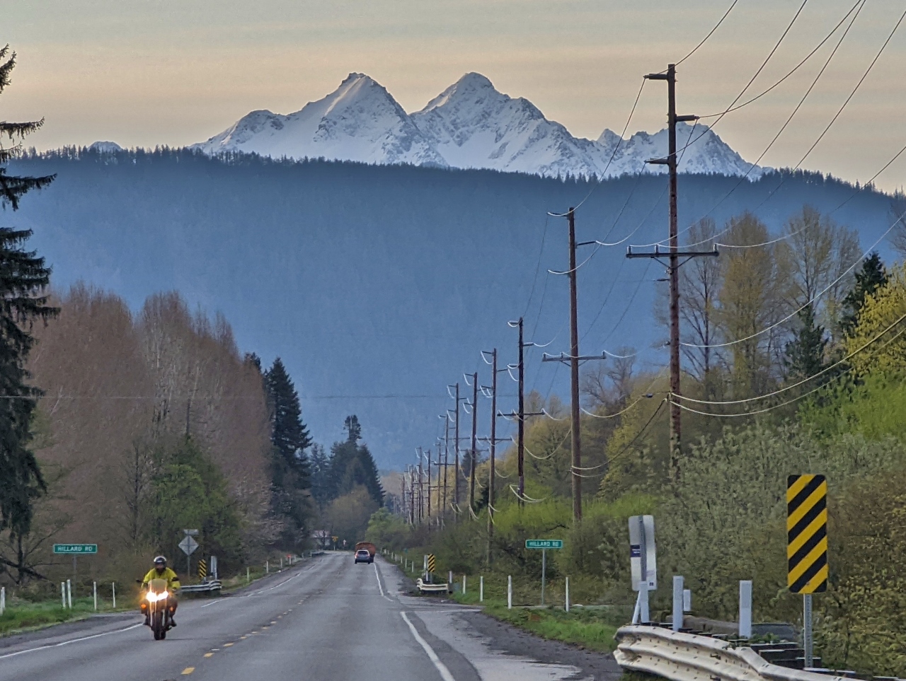 |
4/16/2022: Twin Sisters
Position: 48°50.45'N, -122°15.56'W
Spectacular view to double-peaked Twin Sister Mountain viewed from Mt Baker Highway en route to snowshoe at the namesake mountain. From left to right are 6,641 ft (2,024 m) North Twin, 6,696 ft (2,040 m) South Twin, 6,602 ft (2,012 m) Little Sister and 6,480 ft (1,975 m) Hayden Peak. We're on the road from Bellingham shortly before 7 am to arrive at the parking lot before 8 am to be sure of a parking spot.
|
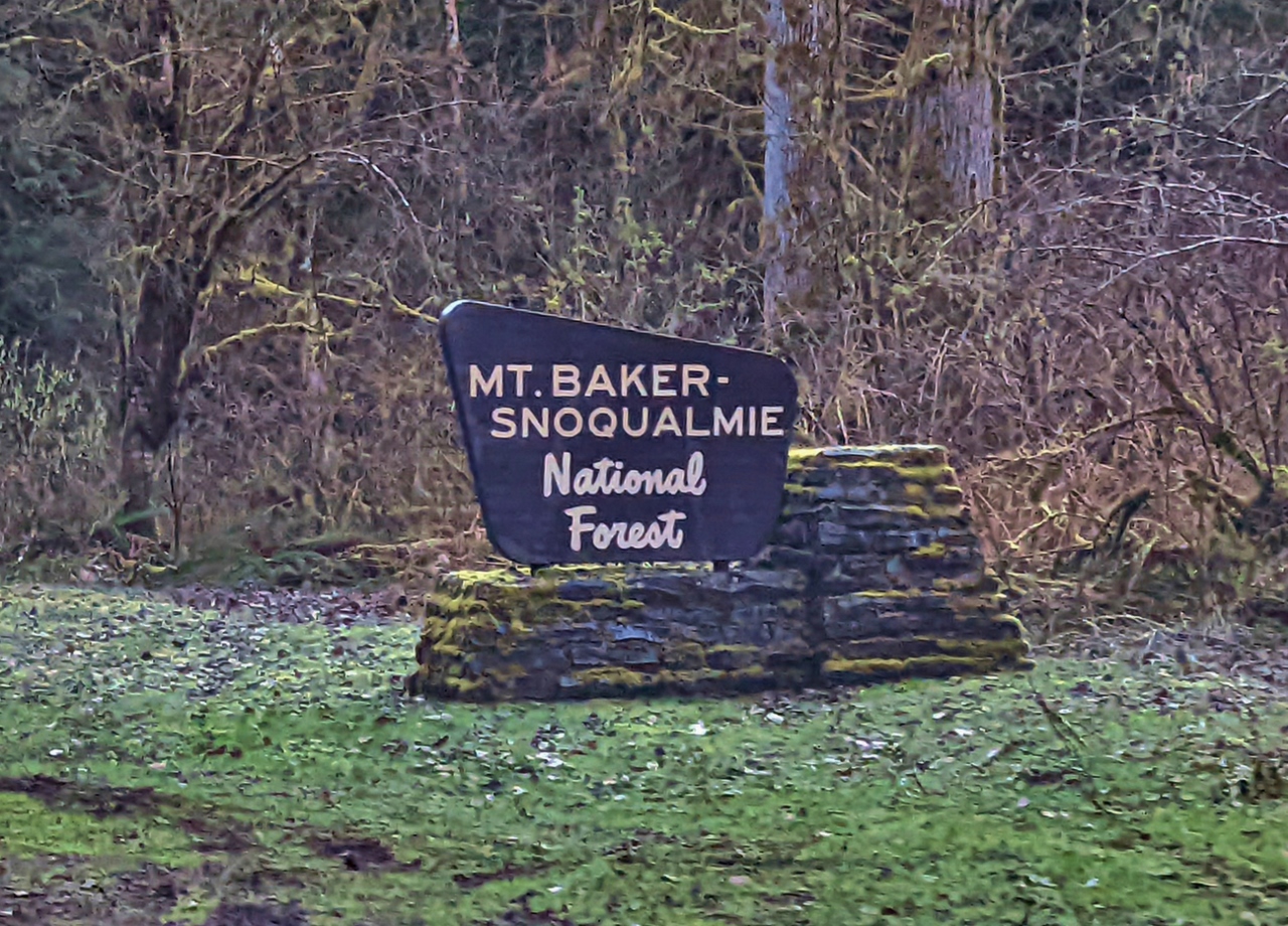 |
4/16/2022: MBS National Forest
Position: 48°53.45'N, -121°55.31'W
Entering the northern reaches of Mount Baker Snoqualmie National Forest. We've driven through and hiked in this forest a lot at various places in the state. The protected area extends more than 140 miles (230 km) through the Cascade Range from the Canadian border south to Mt Rainier National park.
|
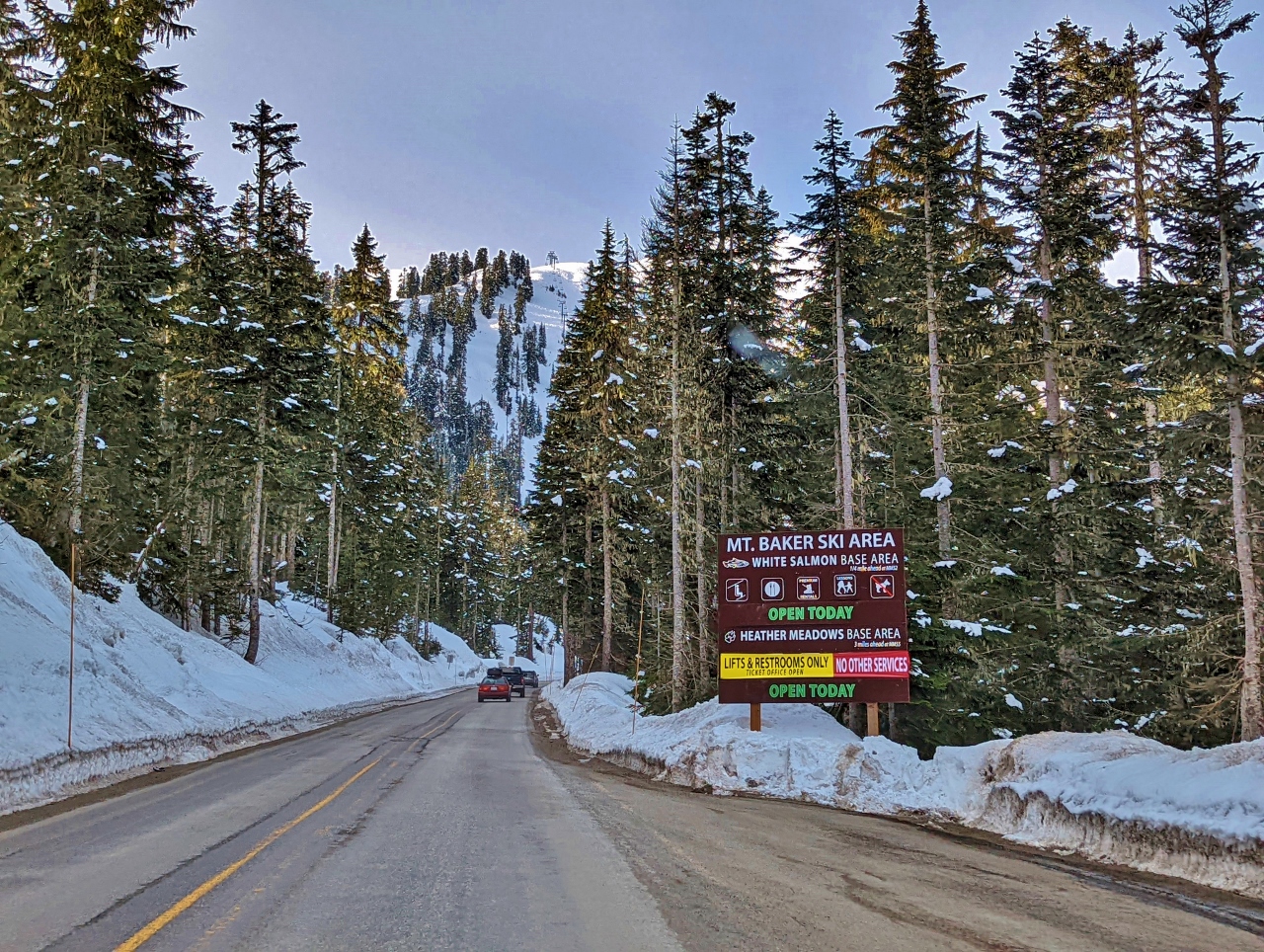 |
4/16/2022: Mt. Baker Ski Area
Position: 48°51.95'N, -121°39.30'W
Entering the Mt. Baker Ski Area. The season is nearly over and only the White Salmon base area is fully open. Heather Meadows, where we'll be parking, has no services open except for lifts and restrooms.
|
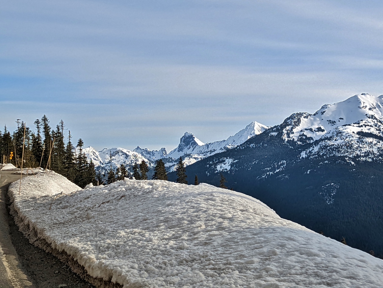 |
4/16/2022: Border Peaks
Position: 48°51.54'N, -121°39.53'W
7,993 ft (2,436 m) American Border Peak, at center holding little snow on the sheer face, with sister peak 7,517 ft (2,291 m) Canadian Border Peak across the border to the left. The snow-covered mountain to the right of American Border Peak is 7,861 ft (2,396 m) Mt Larrabee.
|
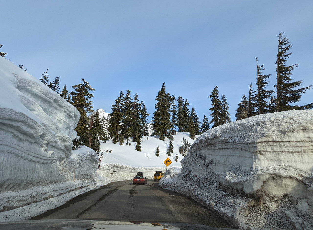 |
4/16/2022: Snow Walls
Position: 48°51.74'N, -121°40.33'W
Driving between high walls of plowed snow as we near Heather Meadows.
|
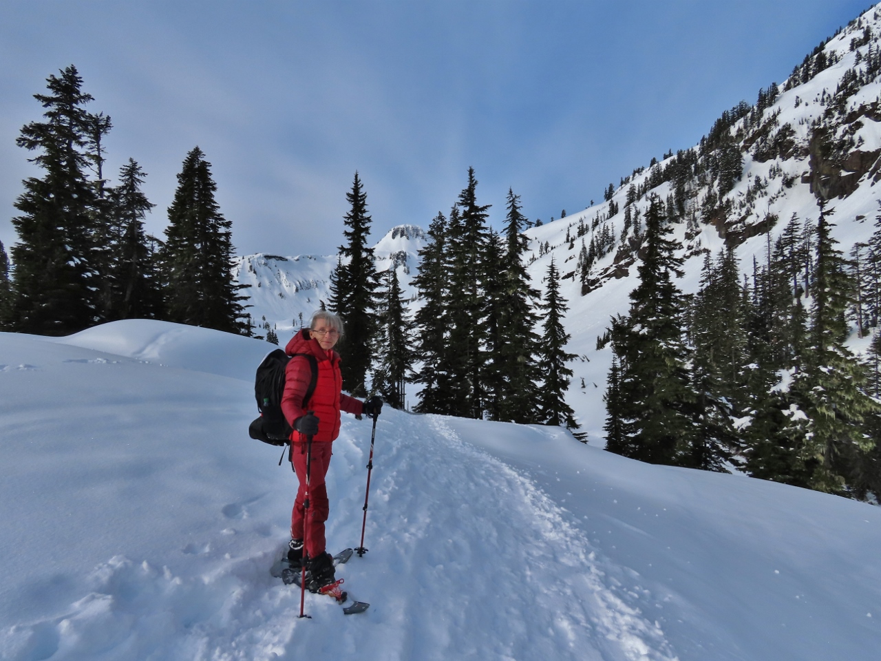 |
4/16/2022: Trailhead
Position: 48°51.68'N, -121°40.96'W
All geared up and ready to snowshoe towards Table Mountain from the Mt. Baker ski area at altitude 4,183 ft (1,275 m).
|
 |
4/16/2022: Bagley Lakes
Position: 48°51.62'N, -121°41.02'W
Walking alongside the snow-covered Bagly Lakes with 5,742 ft (1,750 m) Table Mountain visible in the distance.
|
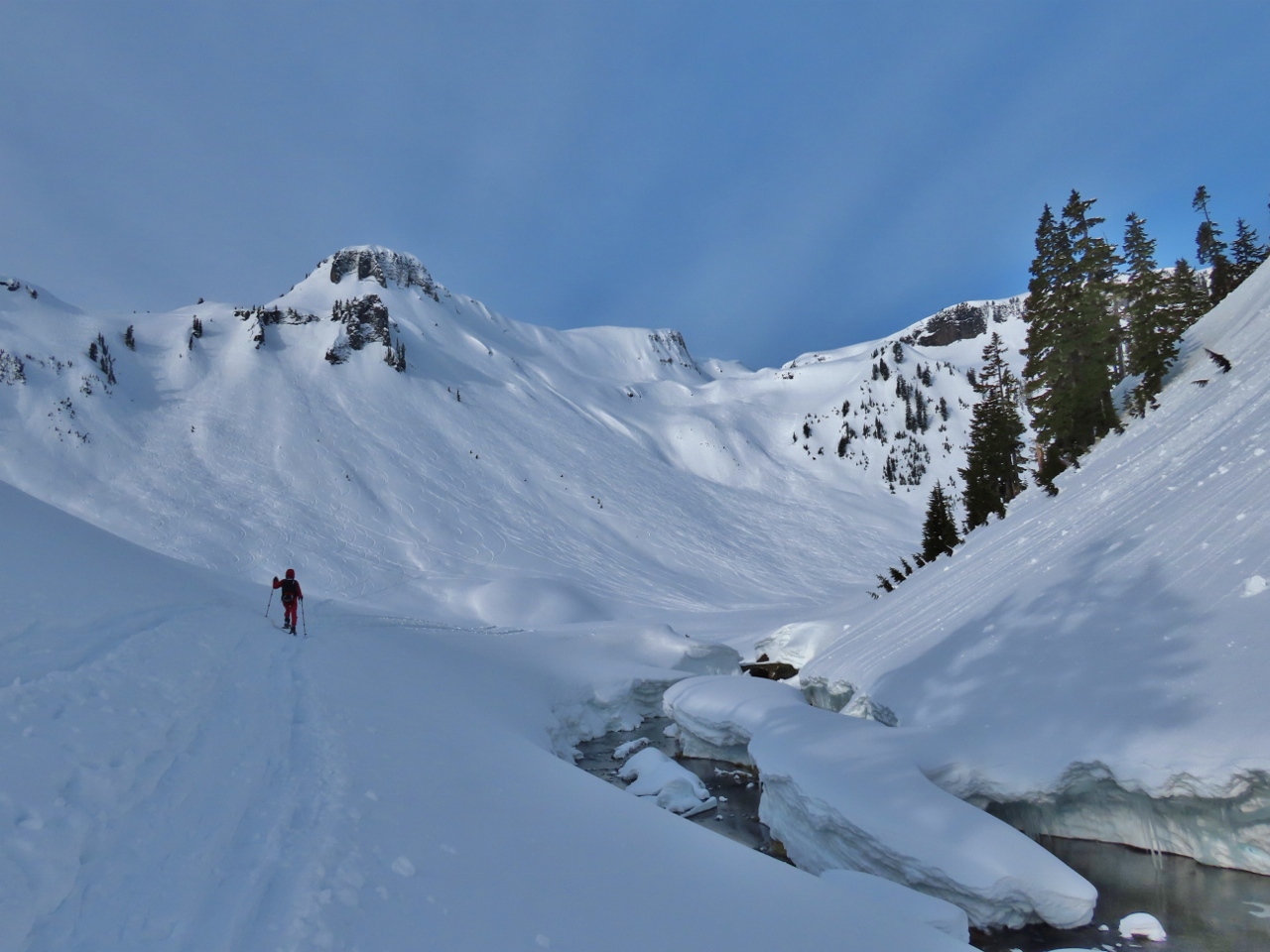 |
4/16/2022: Table Mountain
Position: 48°51.33'N, -121°41.31'W
5,742 ft (1,750 m) Table Mountain prominent ahead as we pass alongside Bagley Creek.
|
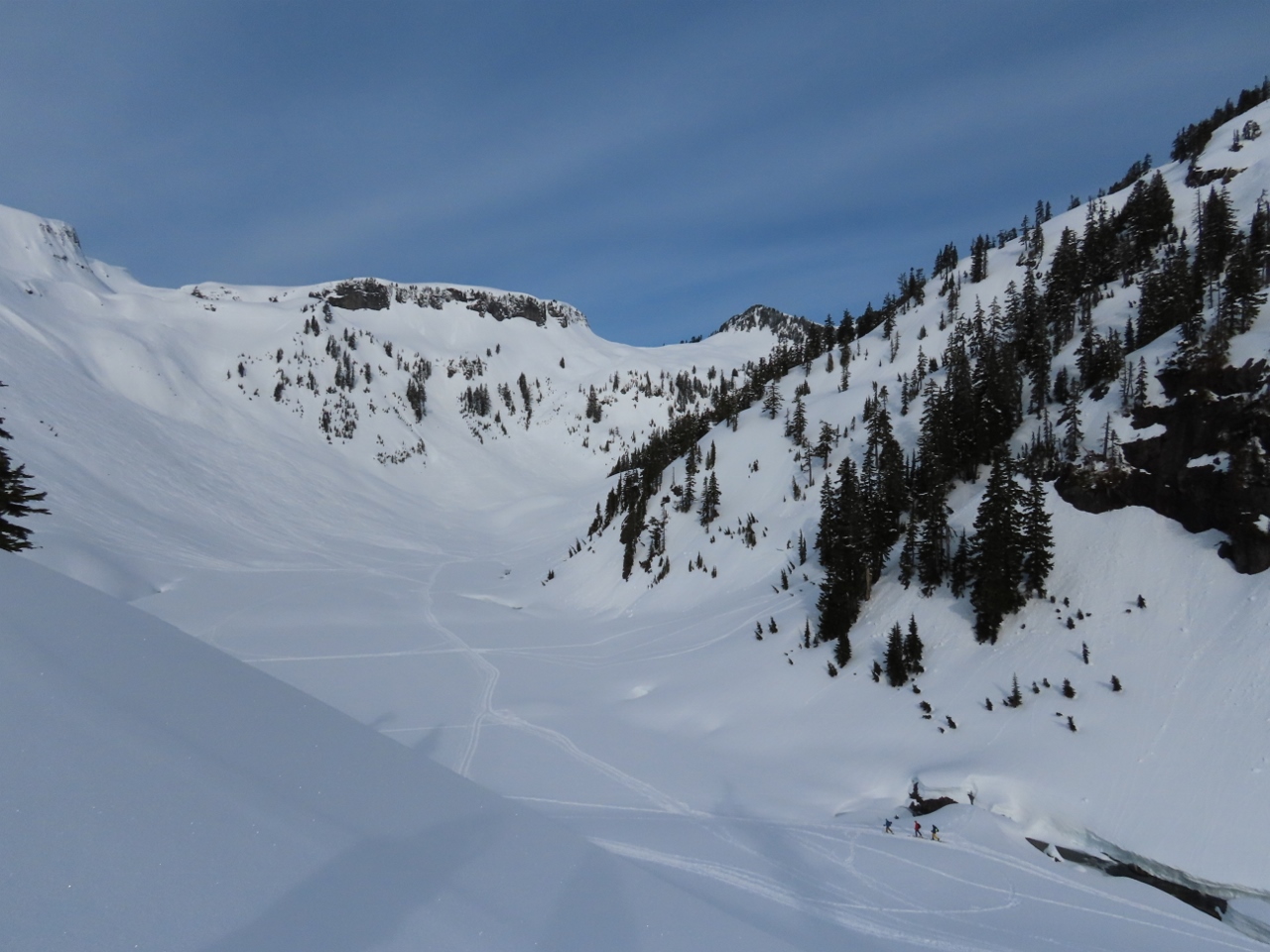 |
4/16/2022: Backcountry Skiers
Position: 48°51.27'N, -121°41.33'W
Backcountry skiers, at bottom right, heading across the larger of the Bagley Lakes to ascend the slopes east of Mazama Dome (click image for a larger view).
|
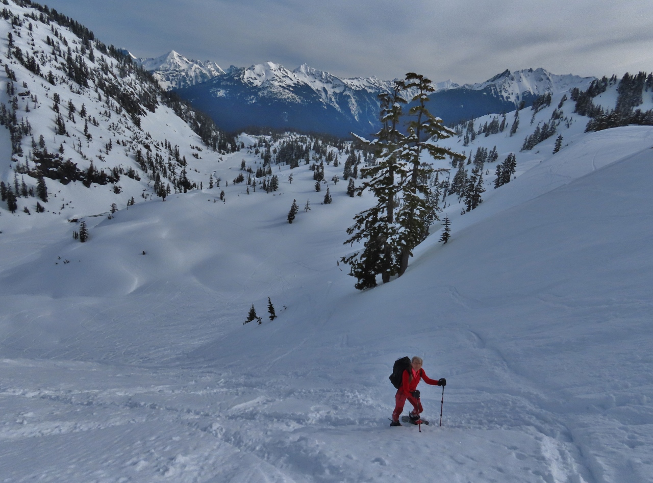 |
4/16/2022: Climbing
Position: 48°50.98'N, -121°41.42'W
Looking back northeast as we ascend the lower flank of Table Mountain. The lot where we parked is slightly left of center where the trees end in the distance, below the treed slope at left. Prominent in the background is 7,861 ft (2,396 m) Mt Larrabee that we saw as we neared the parking lot.
|
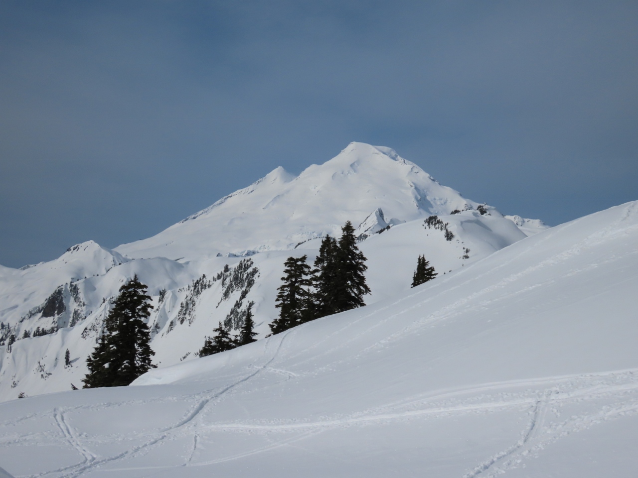 |
4/16/2022: Mt. Baker
Position: 48°50.84'N, -121°41.58'W
We gained 600 ft (182 m) altitude on the steep climb up the lower flank of Table Mountain. But the reward when we reached the top was this fabulous view to 10,786 ft (3,288 m) Mt Baker.
|
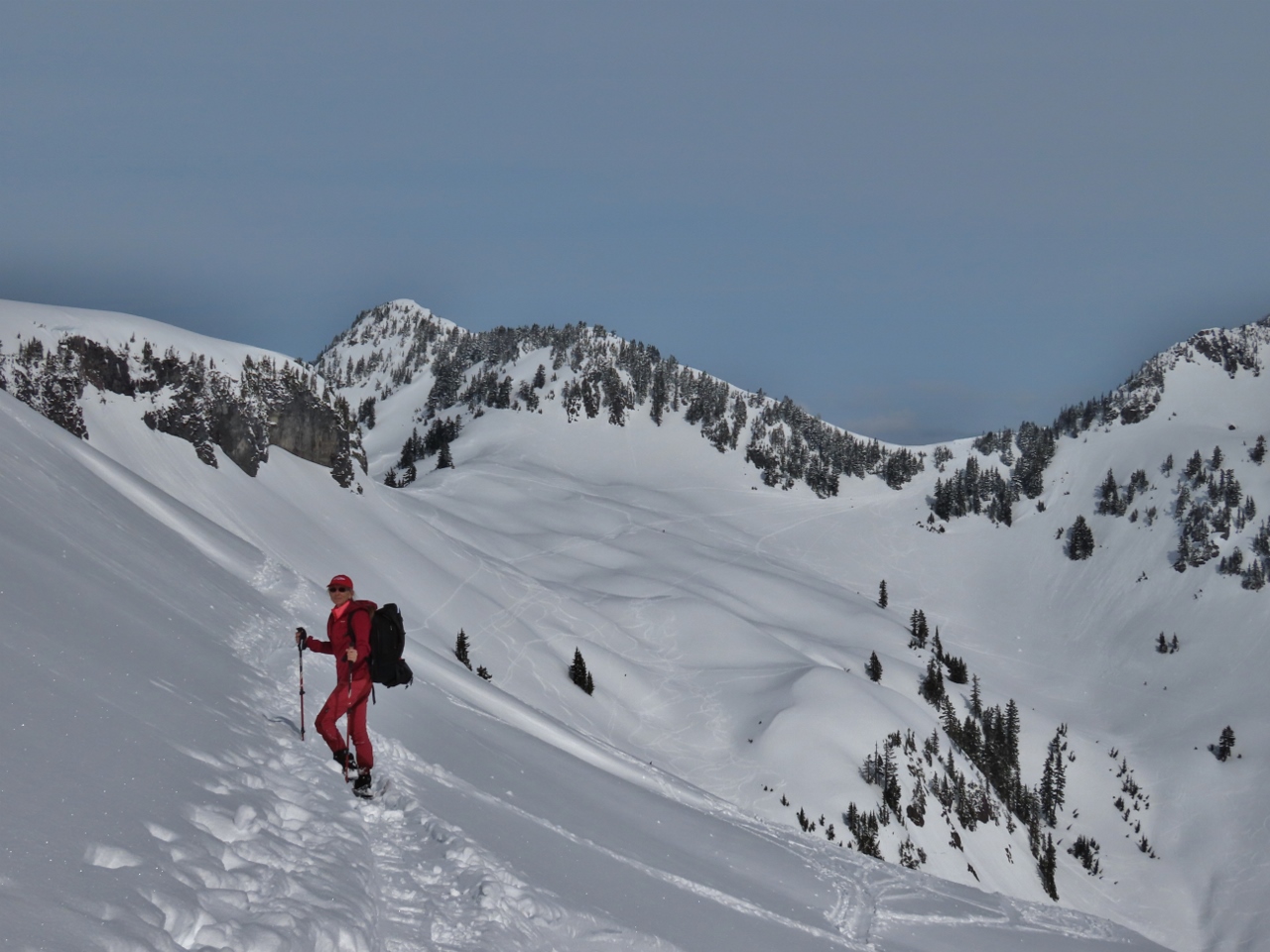 |
4/16/2022: Trail
Position: 48°50.91'N, -121°41.81'W
We followed a trail in the snow around a steep outcropping at the east end of Table Mountain in the hopes of reaching the long, flat ridge that ran below the peak. But the route became too steep around the other side. The conical peak in the distance directly above Jennifer is 5,797 ft Mazama Dome.
|
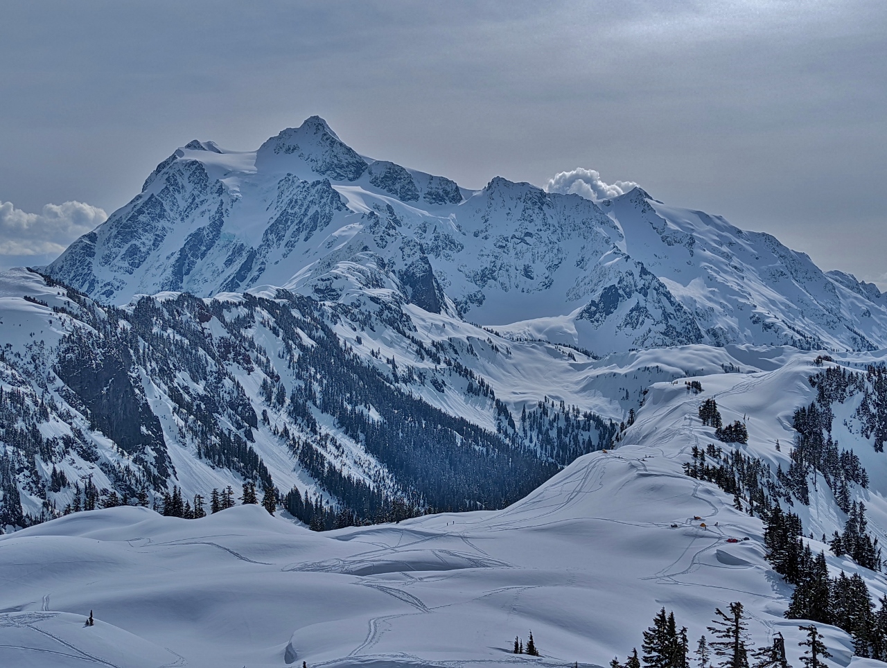 |
4/16/2022: Mt Shukskan
Position: 48°50.89'N, -121°41.87'W
Instead of going around the steep outcropping, we tried climbing it. Partway up, this is the amazing view to our southeast of 9,134-ft (2,784 m) Mt Shukskan.
|
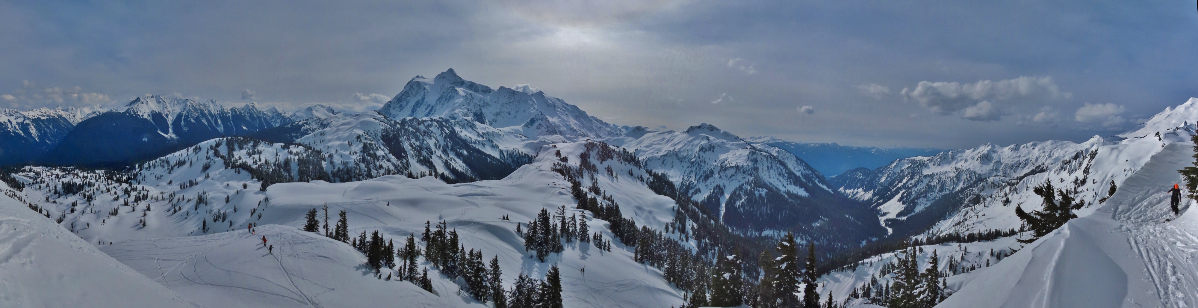 |
4/16/2022: View South
Position: 48°50.89'N, -121°41.87'W
Panoramic view looking south from partway up the outcropping. 9,134-ft (2,784 m) Mt Shukskan is roughly at center and 10,786 ft (3,288 m) Mt Baker is partially visible at the far right (click image for a larger view).
|
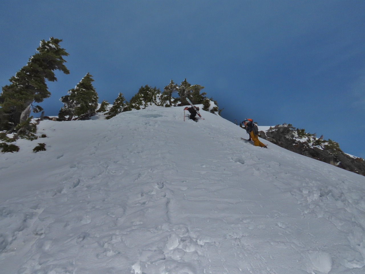 |
4/16/2022: Limit
Position: 48°50.89'N, -121°41.90'W
We continued climbing the outcropping, behind some backcountry skiers visible above us. The route was very steep.
|
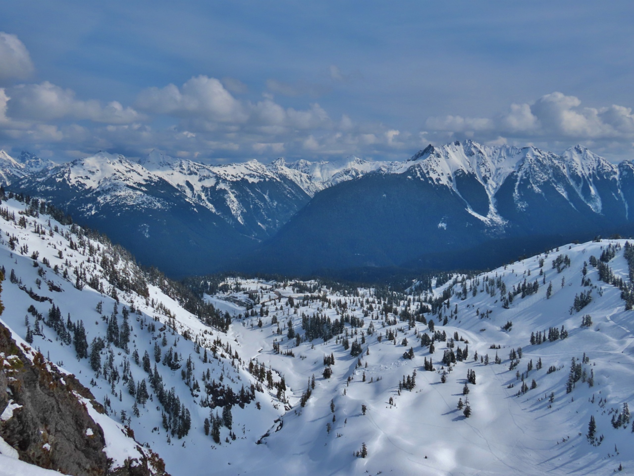 |
4/16/2022: View East
Position: 48°50.91'N, -121°41.91'W
The view east from near the top of the outcropping. The parking lot we started off from is at the far end of the valley, slightly left of center (click image for a larger view).
|
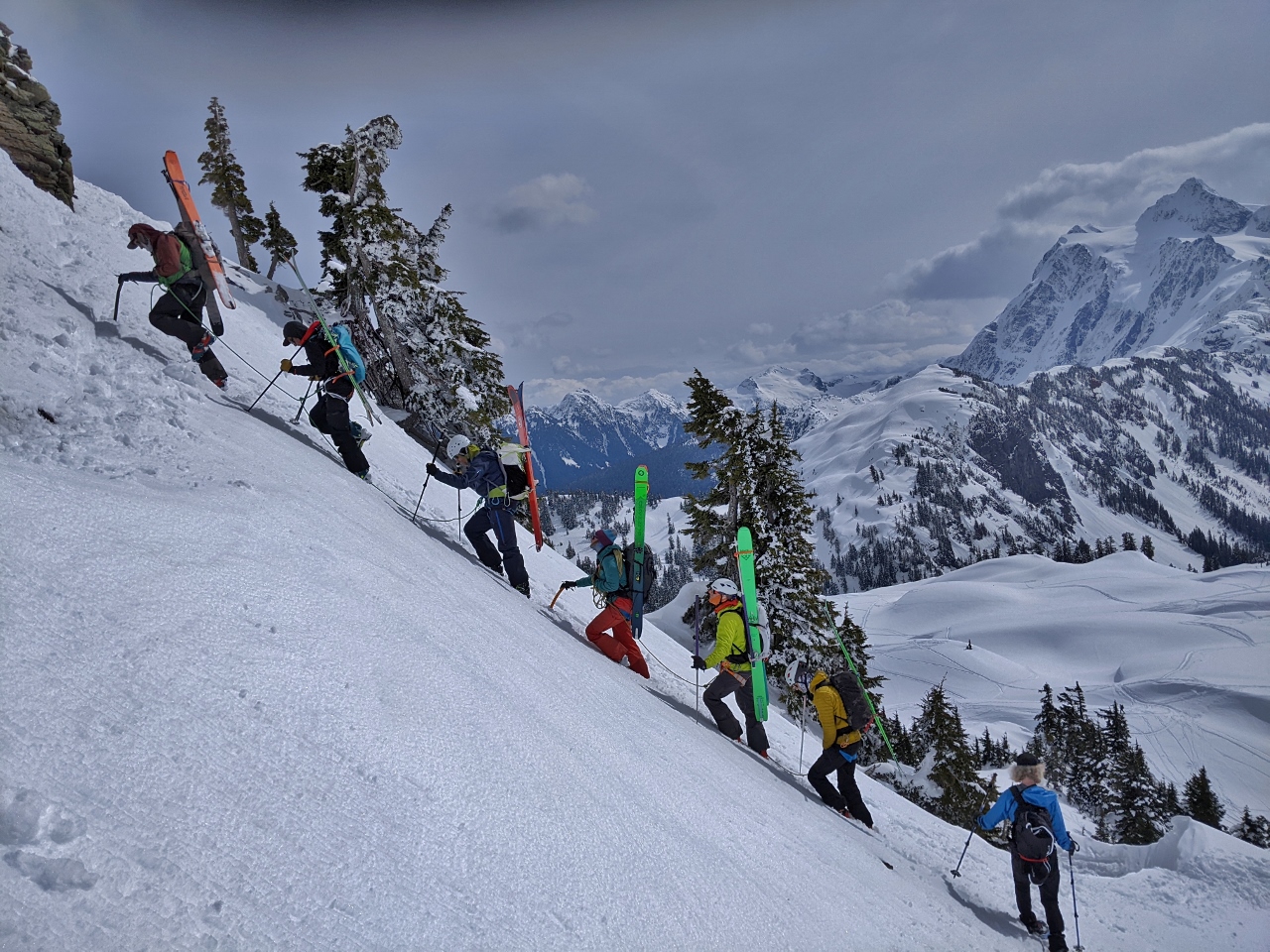 |
4/16/2022: Roped Climbers
Position: 48°50.89'N, -121°41.90'W
We didn't feel comfortable going any further on the outcropping and retraced our steps back down. James is descending at bottom right, while a group of roped backcountry skiers are ascending. It's really steep here.
|
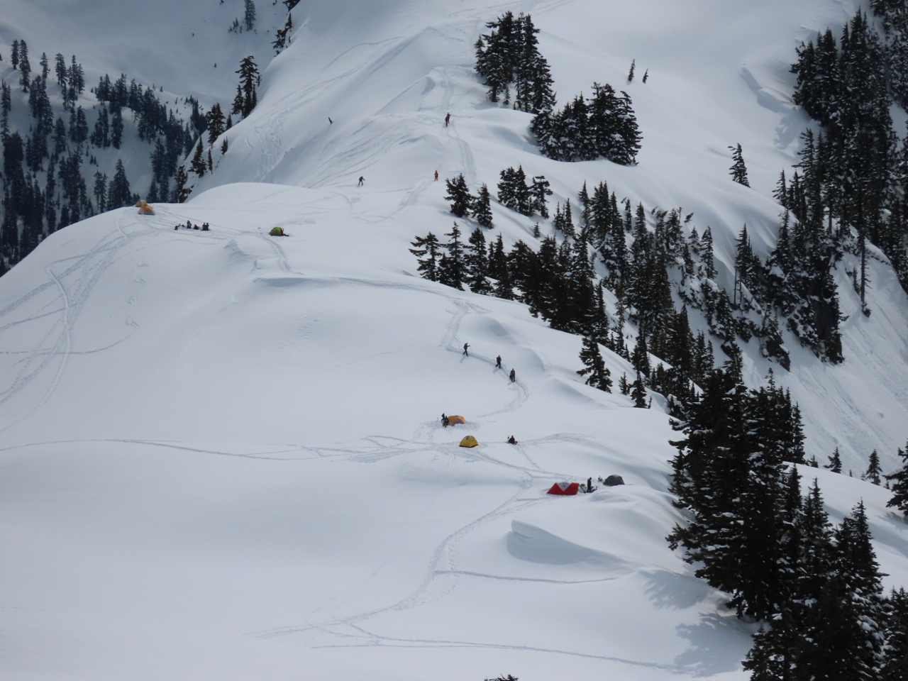 |
4/16/2022: Campers
Position: 48°50.89'N, -121°41.87'W
About a half-dozen tents were set up in the Artist Point area. In the summer, you can drive up to where they are camped.
|
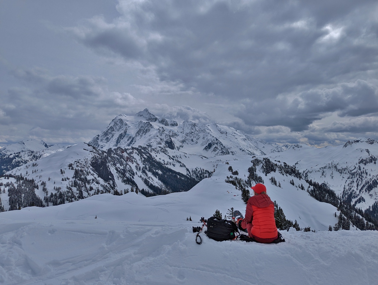 |
4/16/2022: Snack
Position: 48°50.89'N, -121°41.87'W
Enjoying a snack and a hot drink with a view to 9,134-ft (2,784 m) Mt Shukskan.
|
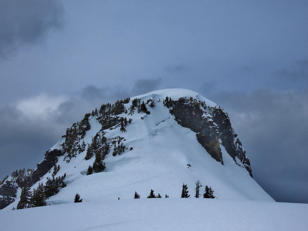 |
4/16/2022: Outcropping
Position: 48°50.88'N, -121°41.62'W
Looking back to the outcropping that we attempted to first go around to the right and then to climb.
|
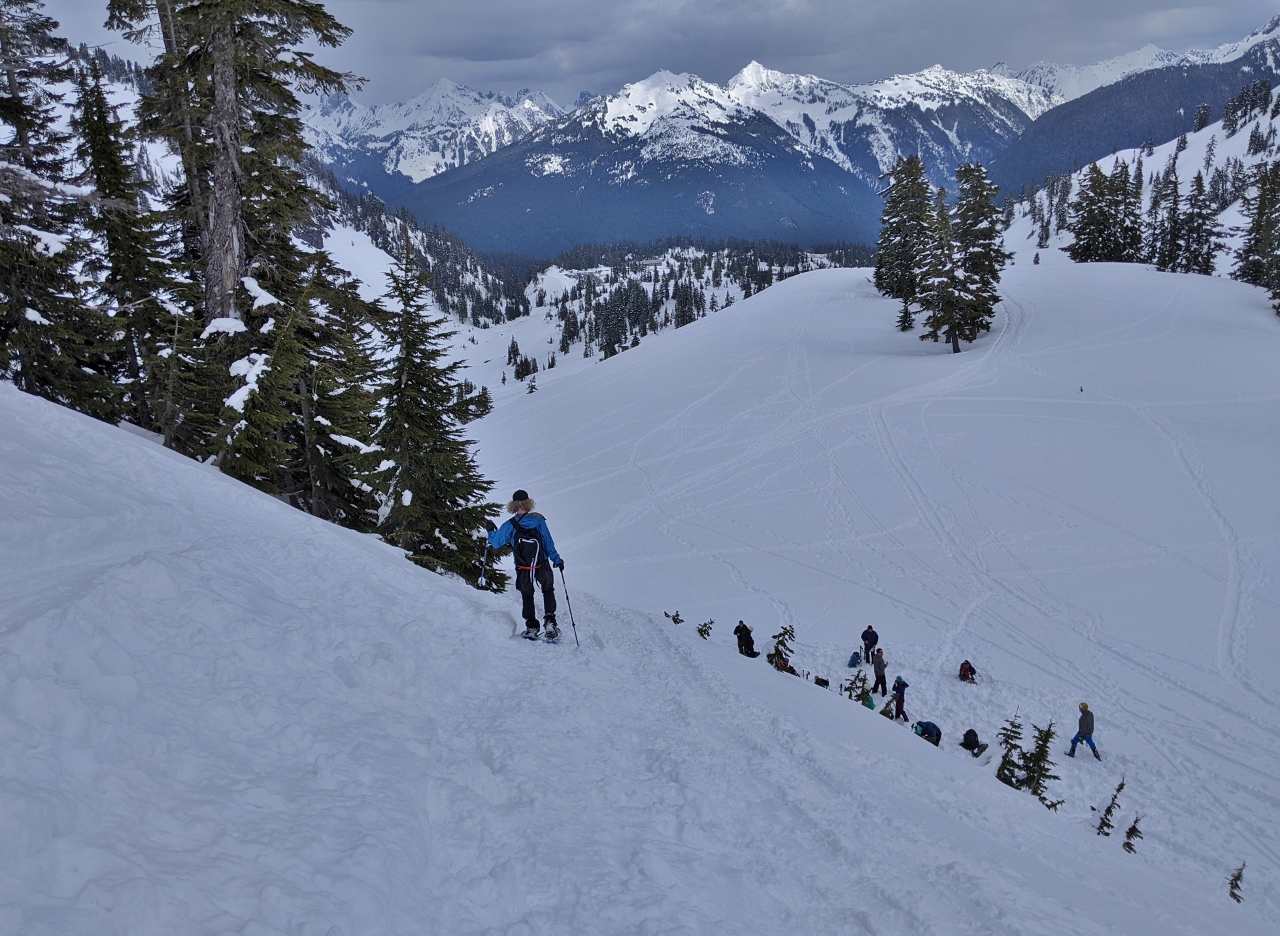 |
4/16/2022: Descending
Position: 48°50.93'N, -121°41.33'W
Descending back towards the car. The lakes we walked alongside initially are just visible in the background directly above James.
|
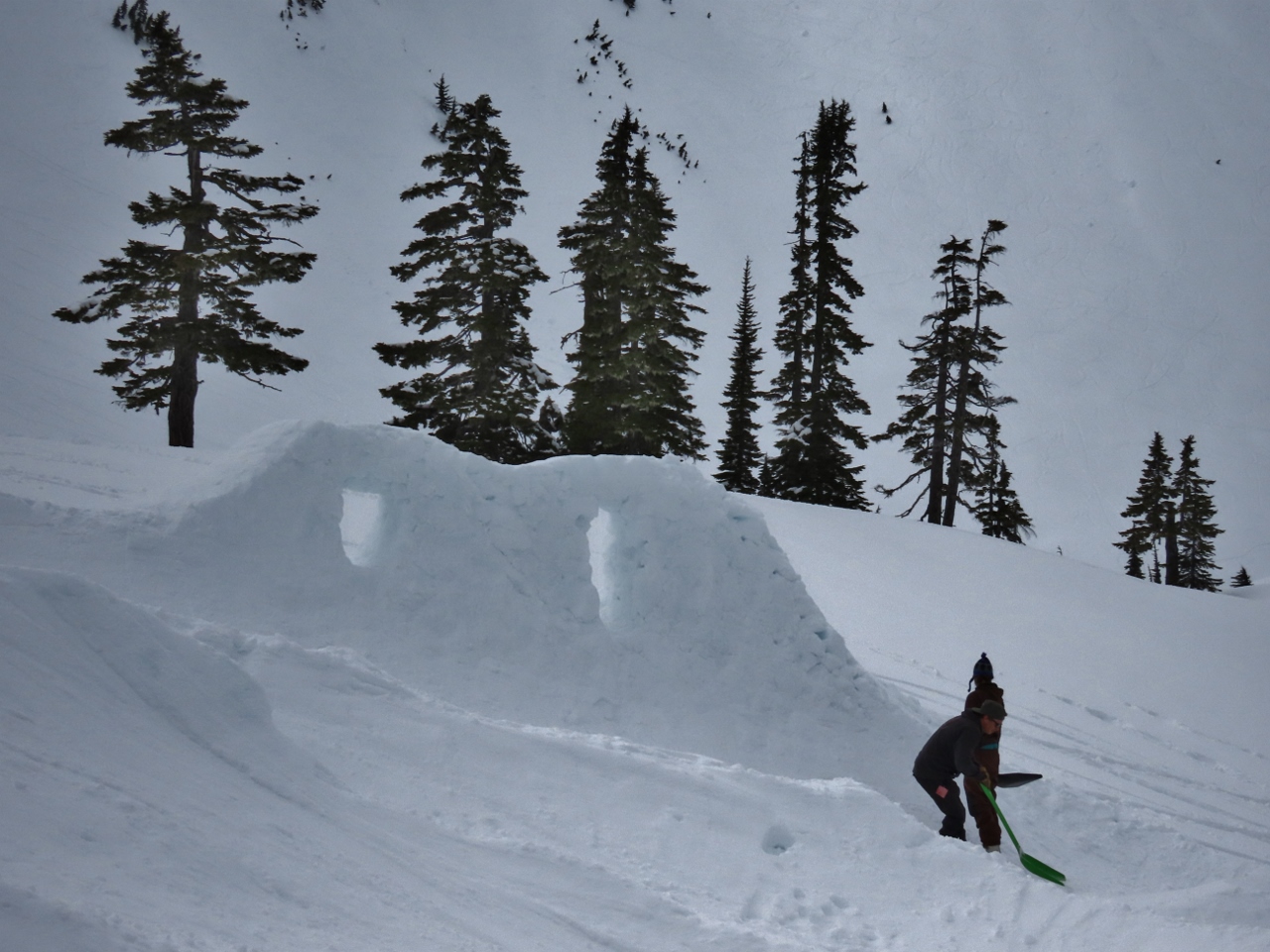 |
4/16/2022: Building Jumps
Position: 48°51.29'N, -121°41.16'W
We could see snow-formed jumps in the distance, and went over the check them out. A group of people were working on them, with many people arriving with snowboards.
|
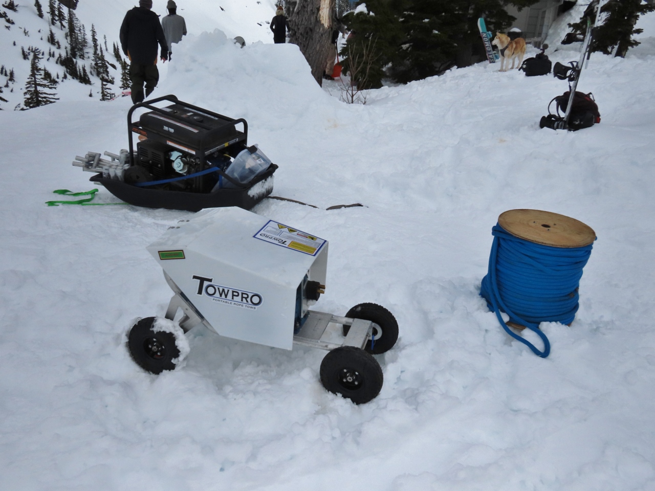 |
4/16/2022: Tow Pro
Position: 48°51.23'N, -121°41.13'W
A portable tow rope at the snow jumps.
|
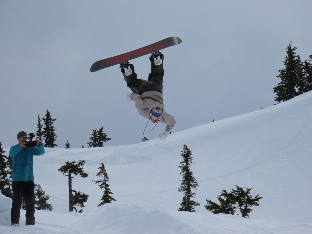 |
4/16/2022: Jumper
Position: 48°51.31'N, -121°41.19'W
About a half-hour after we arrived, snowboarders started taking to the course, practicing for the main event the next day. Some of them were quite good.
|
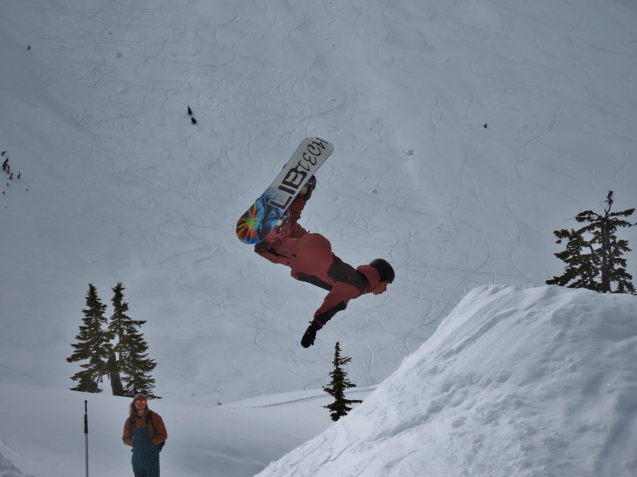 |
4/16/2022: Flip
Position: 48°51.31'N, -121°41.19'W
Another snowboarder nailing a flip in the middle of a complex run.
|
 |
4/16/2022: White Salmon Ski Area
Position: 48°51.90'N, -121°40.02'W
As we rounded a bend in the road, we got a great view to 9,134-ft (2,784 m) Mt Shukskan soaring above the Mt Baker White Salmon Ski Area.
|
 |
4/16/2022: North Fork Brewery
Position: 48°53.43'N, -122°9.09'W
Delicious pizza and craft beer at North Fork Brewery after a great day spent snowshoeing at Mt. Baker.
|
 |
4/17/2022: Snowing
Position: 48°54.16'N, -121°41.75'W
Snow was falling as we drove up to Mt. Baker from Bellingham for our second day of snowshoeing. The trees looked beautiful with a fresh coating of powder.
|
 |
4/17/2022: Heather Meadows Closed
Position: 48°51.82'N, -121°39.36'W
Only the White Salmon base area was open at Mt. Baker today. Heather Meadows was closed. This was surprising given the fresh snow.
|
 |
4/17/2022: Parking Lot
Position: 48°51.73'N, -121°40.94'W
Heather Meadows was closed, but the parking lot still was open. While there were a lot less cars than yesterday, a fair number of people were arriving, and several cars had been there all night.
|
 |
4/17/2022: En Route
Position: 48°51.41'N, -121°40.99'W
En route for a hike to Kulshan Ridge. The weather is very overcast today, with poor visibility. The fresh snow has almost covered up the trails from yesterday and we're the first ones out.
|
 |
4/17/2022: Campers
Position: 48°50.96'N, -121°41.20'W
The tent campers we saw yesterday returning back to the parking lot. We could barely see them in the thick fog.
|
 |
4/17/2022: Climbing
Position: 48°50.92'N, -121°41.31'W
Heading up the steep slope we descended yesterday. Our MSR Lightning Ascent snowshoes continue to impress us for their grip and capability.
|
 |
4/17/2022: Kulshan Ridge
Position: 48°50.58'N, -121°41.21'W
Hiking along Kulshan Ridge with Artist Point visible behind. In the summer, you can drive to Artist Point for wonderful views, but that won't be possible for quite a few more weeks.
|
 |
4/17/2022: Clearing
Position: 48°50.56'N, -121°41.21'W
The clouds started to clear as we reached the end of Kulshan Ridge and we started getting some nice views to 9,134-ft (2,784 m) Mt Shukskan.
|
 |
4/17/2022: Backcountry Skiers
Position: 48°50.56'N, -121°41.21'W
Backcountry skiers, at center of picture, hiking up a slope way in the distance across the valley from Kulshan Ridge (click image for a larger view). If we looked carefully, we could see small dots of people in the distance in almost every direction.
|
 |
4/17/2022: Huntoon Point
Position: 48°50.56'N, -121°41.21'W
Enjoying a snack and a hot tea with the view at 5,247ft (1,599m) Huntoon Point.
|
 |
4/17/2022: Table Mountain
Position: 48°50.57'N, -121°41.16'W
The long flat extent of 5,742 ft (1,750 m) Table Mountain. We were hiking around the southeast (right) end yesterday.
|
 |
4/17/2022: Steep
Position: 48°50.68'N, -121°41.34'W
Backcountry skiers working their way down a steep slope. They eventually reached a slightly less steep section and could ski the rest of the way.
|
 |
4/17/2022: Descending
Position: 48°50.71'N, -121°41.26'W
Descending from Artist Point through dozens of ski tracks.
|
 |
4/17/2022: Clouds Lifted
Position: 48°50.77'N, -121°41.25'W
The clouds really lifted as we descended and we got a great view to 9,134-ft (2,784 m) Mt Shukskan.
|
 |
4/17/2022: Outcropping
Position: 48°51.33'N, -121°40.97'W
The outcropping at the end of Table Mountain that we hiked around yesterday.
|
 |
4/17/2022: Heather Meadows
Position: 48°51.73'N, -121°40.83'W
The Heather Meadows base area at Mt Baker, closed today and possibly for the season.
|
 |
4/17/2022: Whirlpool
Position: 48°44.57'N, -122°27.97'W
Enjoying a soak in the whirlpool at our Bellingham hotel after a great day snowshoeing at Mt. Baker.
|
 |
4/17/2022: Black Sheep
Position: 48°45.05'N, -122°28.85'W
Delicious tacos and margaritas on the heated deck at Black Sheep in Bellingham.
|
 |
4/18/2022: Sonos Roam
Position: 48°44.56'N, -122°27.98'W
The latest addition to our travel kit is a Sonos Roam. The pint-sized indoor/outdoor speaker has impressive sound quality, has good battery life, is super-easy to set up, and works well with Alexa and Spotify. We're loving being able to play our music wherever we go.
|
 |
4/19/2022: Crane
Position: 47°37.00'N, -122°20.69'W
The hydraulic excavator has finished work at the Fourth and Bell construction site and its gravel pad removed. The latest gear to arrive is a small tracked crane at upper left.
|
 |
4/19/2022: American Constellation
Position: 47°37.00'N, -122°20.69'W
The pocket cruise ship American Constellation departing Seattle for a cruise of the Puget Sound.
|
 |
4/19/2022: Doc Maynard
Position: 47°37.00'N, -122°20.69'W
Several Seattle Fire Department boats approaching the West Seattle water taxi Doc Maynard. The ship isn't on its designated route, so this likely is a training exercise.
|
 |
4/19/2022: Stakes
Position: 47°36.90'N, -122°20.66'W
Orange stakes at the west end of the Fourth and Bell construction site. Behind each stack is a removable panel protecting the area where the hydraulic excavator was working.
|
 |
4/19/2022: Tavolata
Position: 47°36.87'N, -122°20.79'W
An excellent meal at our favorite table at Tavolata Italian restaurant on 2nd Ave. near our apartment.
|
 |
4/20/2022: Drilling Rig
Position: 47°37.00'N, -122°20.69'W
A Leibher 24-270 drilling rig is the latest gear onsite at the Fourth and Bell construction site. The rig supports Kelley drilling for the installation of large pipes; auger drilling using a helical-shaped screw to extract material from the ground; full displacement drilling using an auger and replacing the extracted material with cement as the drill is extracted; and double-rotary drilling where a casing and auger drill are advanced together and removed simultaneously as concrete is pumped in.
|
 |
4/20/2022: Rachel Carson
Position: 47°37.00'N, -122°20.69'W
The University of Washington's School of Oceanography research vessel Rachel Carson in Elliott Bay. The ship was originally built as a fisheries research vessel in Macduff, Scotland and was acquired by the U of W in 2017.
|
 |
4/20/2022: Helicoptors
Position: 47°37.00'N, -122°20.69'W
Two military helicopters and three US Marine Corps Bell Boeing V-22 Osprey streaking across the sky above Puget Sound. The distinctive Osprey, designed to combine the functionality of a helicopter with the range and speed of an aircraft, can take-off and land vertically or horizontally.
|
 |
4/21/2022: Carnival Splendor
Position: 47°37.00'N, -122°20.69'W
The cruise ship Carnival Splendor approaching the berth at Pier 91 near Elliott Bay Marina.
|
 |
4/21/2022: Crane
Position: 47°37.00'N, -122°20.69'W
The latest equipment to arrive at the Fourth and Bell construction site is a Mantis 8012 telescopic boom crawler, at bottom left. The boom can extend from 39-90ft (12-27 m), has a 360° lift capability of 40 tons, and requires only 13 inches (33 cm) of ground clearance. The Leibher 24-270 drilling rig that arrived earlier is at upper left.
|
 |
4/21/2022: Drill
Position: 47°37.00'N, -122°20.69'W
Auger attachment on the Leibher 24-270 drilling rig at the Fourth and Bell construction site. In this particular application, they are using Kelley drilling with an auger to remove material, then filling the hole with cement and finally inserting reinforcing steel cable into the center of the cement.
|
 |
4/22/2022: Victoria Clipper
Position: 47°37.00'N, -122°20.69'W
The Victoria Clipper, a week into the reactivation of the run between Seattle and Victoria, Canada. Except for a brief unsuccessful attempt to restart in the the fall of 2021, the fast ferry service has been suspended for over two years since Canada closed the border to tourists in 2020 due to the pandemic.
|
 |
4/22/2022: Cement Trucks
Position: 47°37.00'N, -122°20.69'W
Cement trucks at the Fourth and Bell construction site. Closest to the cement trucks is Leibher 24-270 drilling rig, fitted with a rotary BAT 270 that supports Kelley drilling with an auger. The rig has completed drilling a hole where a steel piling has been inserted and now the hole is being filled with cement.
|
 |
4/22/2022: Road Blocked
Position: 47°36.95'N, -122°20.43'W
Many of the downtown Seattle roads are blocked today for President Biden's visit. Here this city block is closed by a police SUV at one end and a city bus at the other.
|
 |
4/22/2022: Motorcycle Police
Position: 47°36.95'N, -122°20.43'W
Dozens of motorcycle police are at the ready for President Biden's visit to Seattle.
|
 |
4/22/2022: Road Barrier
Position: 47°36.88'N, -122°20.27'W
Besides using vehicles to block the street for President Biden's visit, the police also are using the effective-looking portable wheeled barriers.
|
 |
4/22/2022: Escalator Service
Position: 47°36.95'N, -122°20.40'W
The escalator in James' office building open to replace the yellow edge around each step.
|
 |
4/23/2022: Norwegian Bliss
Position: 47°36.99'N, -122°20.59'W
The cruise ship Norwegian Bliss arriving into Pier 66 at the Port of Seattle, producing more visible smoke than we normally see from these ships. They're usually pretty careful with their visible emissions around ports.
|
 |
4/23/2022: Apple-Cinnamon Quinoa
Position: 47°36.99'N, -122°20.58'W
Tasty apple-cinnamon quinoa for breakfast this morning.
|
 |
4/23/2022: Jet Skis
Position: 47°37.00'N, -122°20.69'W
A group of jet skis roaring around Elliott Bay near West Seattle. The vessels are banned in San Juan County, a group of 172 islands near the Canadian border, due to noise pollution issues.
|
 |
4/23/2022: Coast Guard
Position: 47°37.00'N, -122°20.69'W
Two Coast Guard vessels, at right a Metal Shark Response Boat Small, exercising on Elliott Bay.
|
 |
4/23/2022: Measuring
Position: 47°37.14'N, -122°20.62'W
Measuring the interior of our Honda Passport for an air mattress. We've decided to try wilderness camping, where we'll setup the vehicle to sleep in rather than use a tent.
|
 |
4/23/2022: Camp Furniture
Position: 47°37.20'N, -122°19.77'W
At REI checking out the camp furniture. We are starting from scratch with camping, so we need pretty much one of everything.
|
 |
4/23/2022: Camp Stove
Position: 47°37.22'N, -122°19.76'W
This Selkirk 540 gas camp stove at REI gets good reviews.
|
 |
4/23/2022: Appetizer
Position: 47°36.88'N, -122°20.88'W
James didn't feel like eating a lot for dinner, so ordered the chicken strips appetizer. The serving was enough for two, and even sharing we would have had trouble finishing it.
|
 |
4/23/2022: Steal Piles
Position: 47°36.89'N, -122°20.83'W
Steel piles ready to install at the Fourth and Bell construction site.
|
 |
4/23/2022: Piles Installed
Position: 47°36.90'N, -122°20.67'W
Steel piles installed at the west end of Fourth and Bell construction site. These piles have to be placed very precisely because they are going in right beside plumbing and wiring at the previous site of the hydraulic excavation.
|
 |
4/23/2022: DashMart
Position: 47°36.94'N, -122°20.68'W
A local DashMart near our apartment building. This is a "dark store" for the DoorDash delivery service only, and is not open to the public.
|
 |
4/23/2022: Sunset
Position: 47°37.02'N, -122°20.70'W
Fabulous sunset over Elliott Bay and the Olympic Mountains. The sunset is getting muhc more north in the sky now as summer approaches.
|
 |
4/24/2022: Punta del Este
Position: 47°37.00'N, -122°20.69'W
Punta del Este in Seattle on leg 7 of the Clipper Around the World race. Also visible are the masts of WTC Logistics and UNICEF. The race started in the UK in September of 2019, but was suspended in the Philippines during leg 5 due to the pandemic. In March of 2022 the race was resumed, skipping the Chinese ports that remain closed, and will end in the UK in July of this year.
|
 |
4/24/2022: Equipment
Position: 47°37.00'N, -122°20.69'W
The current complement of equipment at the Fourth and Bell construction site is three excavators, a drill rig and a small tracked crane.
|
 |
4/24/2022: Starlink Shipment
Position: 47°36.99'N, -122°20.58'W
We're replacing boat exploration with SUV exploration and camping. But many of the places we want to go are outside of cellular connectivity. James really needs to be connected for work, so we've purchased a Starlink satellite system. Starlink is a game-changing satellite service with a moderate cost of $600 for the antenna and $135 a month for unlimited data anywhere in the US.
|
 |
4/24/2022: Starlink Contents
Position: 47°36.99'N, -122°20.58'W
The contents of the Starlink package are pretty simple: a router at left, an antenna and stand at right and a cable between them. Starlink calls their antenna "Dishy McFlatface." Dishy arrives in the space-saving stow mode, as shown, with the face partially vertical
|
 |
4/24/2022: Testing Starlink
Position: 47°37.00'N, -122°20.57'W
Setting up the Starlink satellite system in our apartment to test it. The antenna needs a clear view of the sky so we're not super-hopeful it will work in this location, but we might as well give it a try.
|
 |
4/24/2022: Dishy McFlatface
Position: 47°37.11'N, -122°20.79'W
When powered up, the antenna rotates from stow mode to a horizontal position to search for satellites.
|
 |
4/24/2022: Northeast Swivel
Position: 47°37.00'N, -122°20.59'W
After several minutes, the antenna rotated from horizontal to angled, facing northeast.
|
 |
4/24/2022: Online
Position: 47°37.00'N, -122°20.57'W
Amazingly, Starlink actually was able to connect on the deck of our apartment and over next 24 hours or so downloaded all the firmware updates.
|
 |
4/24/2022: 121 Mbps
Position: 47°37.07'N, -122°20.98'W
Pretty impressive satellite connectivity speed on Starlink at 121 megabits per second (15.1 megabytes per second).
|
 |
4/24/2022: Working on Starlink
Position: 47°37.02'N, -122°20.81'W
A successful test with James working entirely on Starlink for connectivity.
|
 |
4/24/2022: Video on Starlink
Position: 47°37.03'N, -122°20.72'W
We even were able to watch a video over Starlink. We're really impressed with its speed and ease-of-use.
|
 |
4/24/2022: Drone
Position: 47°37.03'N, -122°20.72'W
A fairly large drone flying near our apartment. Drones are illegal in all Seattle parks and we've not seen many in the sky above us, probably because we're more than 450 feet (137 m) up.
|
 |
4/25/2022: Norwegian Jewel
Position: 47°37.00'N, -122°20.69'W
The Norwegian Jewel arriving into Pier 66. We love having the cruise ships back running again.
|
 |
4/25/2022: Line Handlers
Position: 47°37.00'N, -122°20.69'W
A crowd of line handlers at the ready on Norwegian Jewel as the ship approaches the dock at Pier 66.
|
 |
4/25/2022: Fourth and Bell
Position: 47°36.92'N, -122°20.66'W
More steel piles installed at the Fourth and Bell construction site, these ones on the east side closest to our apartment.
|
 |
4/26/2022: Spare Cat
Position: 47°36.99'N, -122°20.58'W
Spitfire loves to investigate new spaces and whenever we opened a locker or storage area on the boat he was inside so fast that we've begun to joke about having spare cats—every dark corner seemed to have a large black cat inside. (Blog reader Steven Coleman started the joke in noticing Spitfire pictured with the spares in the post Managing Spares.)
We find the occasional spare cat in our apartment too. Spitfire is almost 19, but still loves to explore. |
 |
4/26/2022: Ovation of the Seas
Position: 47°37.00'N, -122°20.69'W
Our "pet cruise ship", Ovation of the Seas, in the foreground at Pier 91, with Carnival Splendor arriving behind. Ovation of the Seas will be back to work on the Alaska run on May 5th and won't be making any more impromptu visits to Seattle. The ship will do the Alaska run this summer and Australia/New Zealand this winter. We'll miss having it around in the winter.
|
 |
4/27/2022: Kitty Central
Position: 47°31.97'N, -122°17.74'W
Kitty Central "Mobile Edition" back in use as we head to Government Camp, Oregon. The cabin we've rented there allows pets, so we've brought Spitfire along with us. He's not been on a road trip since we returned to Seattle last summer, but settled into the routine right away.
|
 |
4/27/2022: Tacos Guaymas
Position: 47°13.34'N, -122°28.39'W
Delicious street tacos at Tacos Guaymas in Tacoma en route to Government Camp, Oregon.
|
 |
4/27/2022: Bento
Position: 46°13.10'N, -122°53.47'W
Spitfire eating lunch from his Go Pet Bento travel food bowls as we drive south towards Government Camp, Oregon. We bought the stacking food bowls for the road trip across the US, and they worked out super-well to allow us to easily feed him underway and move any uneaten food between the vehicle and the hotel.
|
 |
4/27/2022: Somarakis
Position: 45°59.17'N, -122°49.84'W
The large blue building in the foreground is the Somarakis manufacturing plant at Kalama, WA. Somarakis makes liquid ring vacuum pumps, where a ring of liquid forms the compression chamber seal, that are shipped around the world. In the background is with Temco grain export terminal. Located along the Columbia River, the Temco terminal exports about 250 million bushels of grain per year, where a typical grain ship carries about 2.2 million bushels.
|
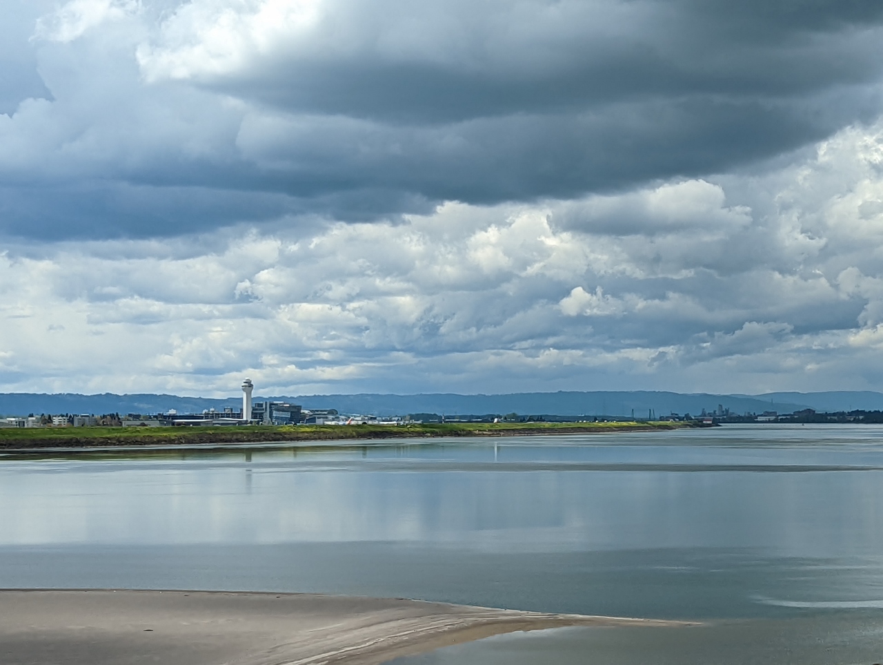 |
4/27/2022: Columbia River
Position: 45°34.84'N, -122°32.64'W
Crossing the Columbia River from Washington State into Oregon.
|
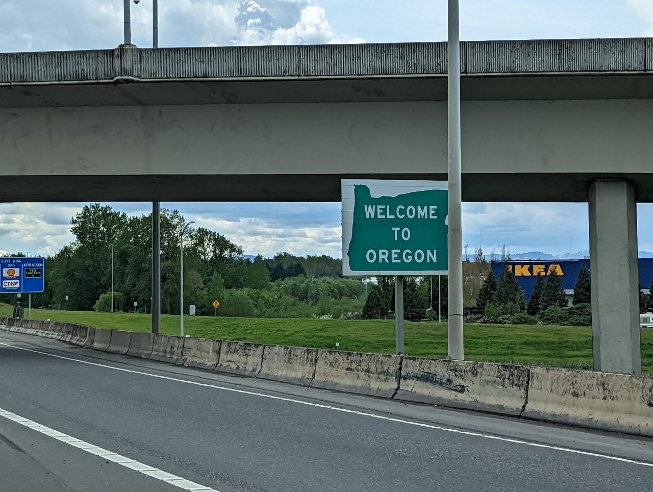 |
4/27/2022: Oregon
Position: 45°34.84'N, -122°32.64'W
We're back in Oregon for the first time since arriving back in Seattle last summer.
|
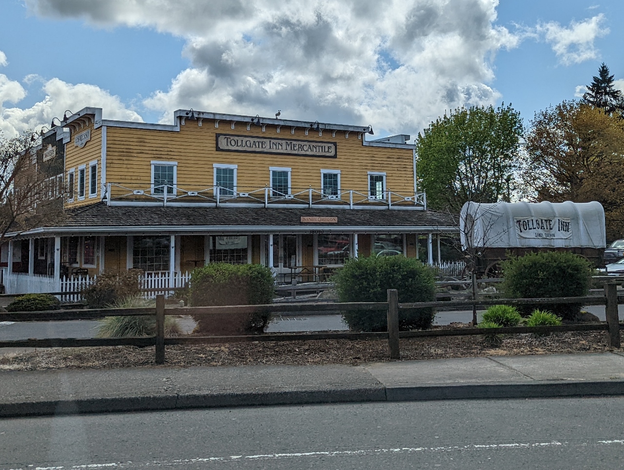 |
4/27/2022: Tollgate Inn
Position: 45°23.87'N, -122°16.31'W
Passing the Tollgate Inn in Sandy, Oregon along US Route 26. We're following the route of Barlow Road, a toll road that was the last overland segment of the Oregon Trail before reaching the Willamette Valley. Prior to the construction of Barlow Road in 1846, pioneers had to disassemble their wagons to build rafts with them in order to float down the Columbia River, a perilous journey with long delays. The Barlow Road was itself difficult, but so much faster and safer than the river option that in the first year over a thousand emigrants in 150 wagons traveled the road and paid the $5 toll (about a week's wages or $150 in today's money).
|
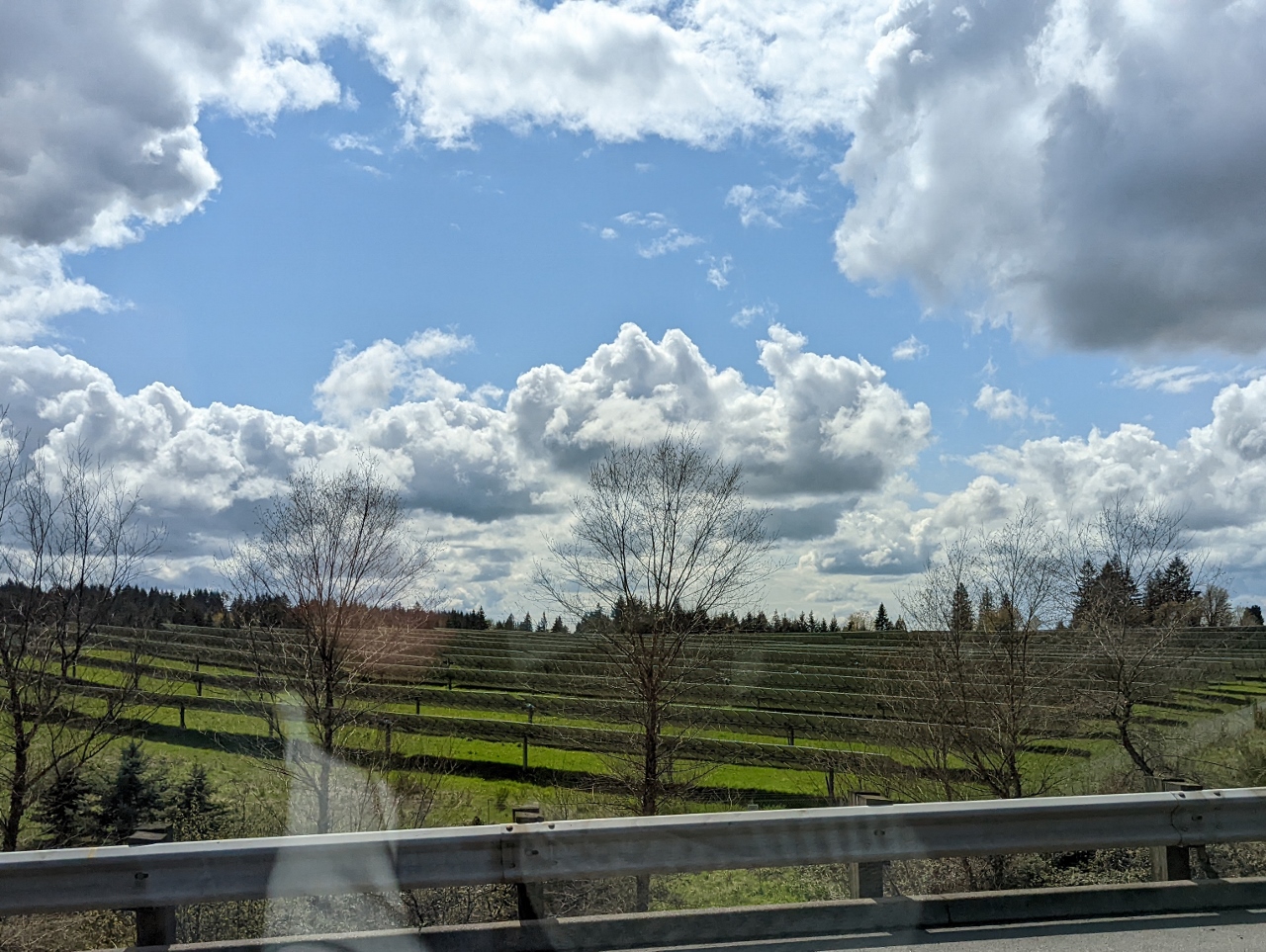 |
4/27/2022: Firwood Solar Farm
Position: 45°22.94'N, -122°13.77'W
The Firwood solar farm just outside Sandy, Oregon produces 15.2 MWdc of renewable energy.
|
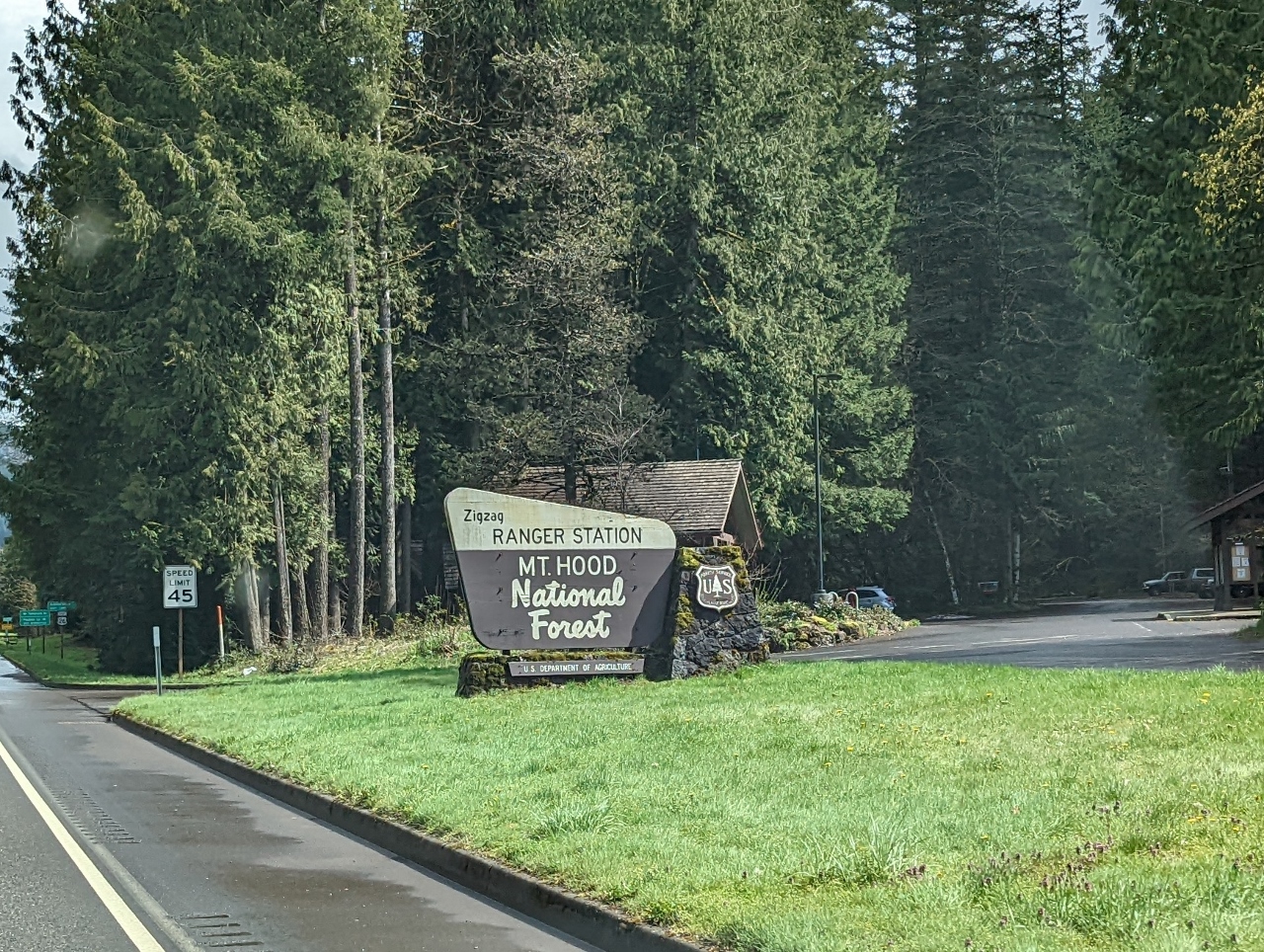 |
4/27/2022: Mt. Hood NF
Position: 45°20.63'N, -121°56.57'W
Entering Mount Hood National Forest.
|
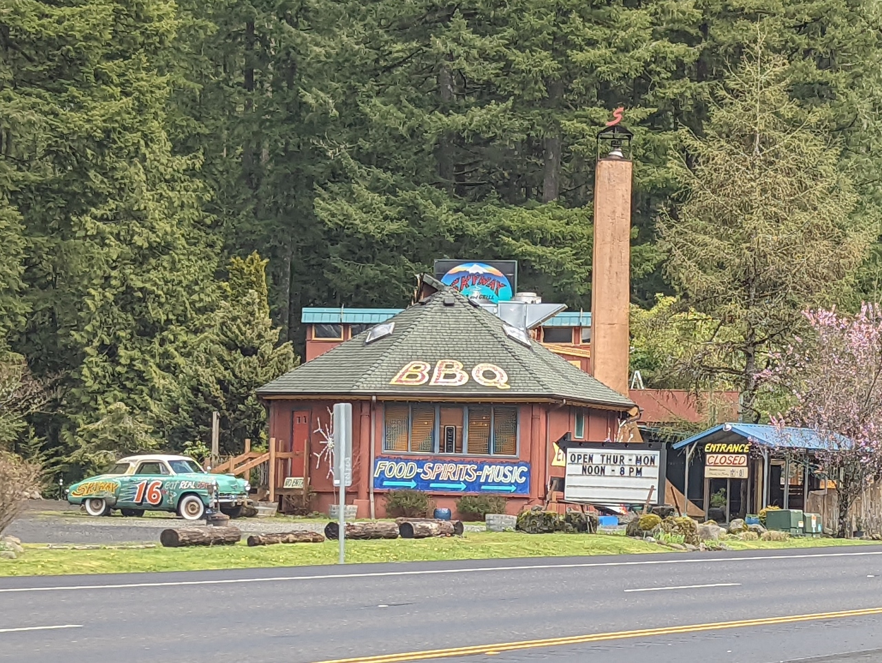 |
4/27/2022: Skyway Restaurant
Position: 45°20.63'N, -121°56.57'W
Since the 1970s, the Skyway Restaurant has been serving the after-ski crowd heading back to Portland from Mt. Hood.
|
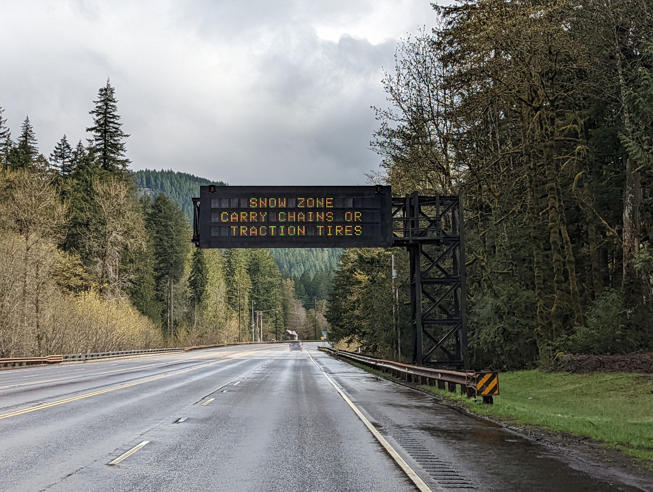 |
4/27/2022: Snow Zone
Position: 45°20.15'N, -121°55.26'W
There's no snow here at 1,429 ft (436 m), but we're entering a snow zone as we ascend towards Mt. Hood.
|
 |
4/27/2022: Trees
Position: 45°19.27'N, -121°54.28'W
Beautiful tree-lined stretch of road along US Route 26.
|
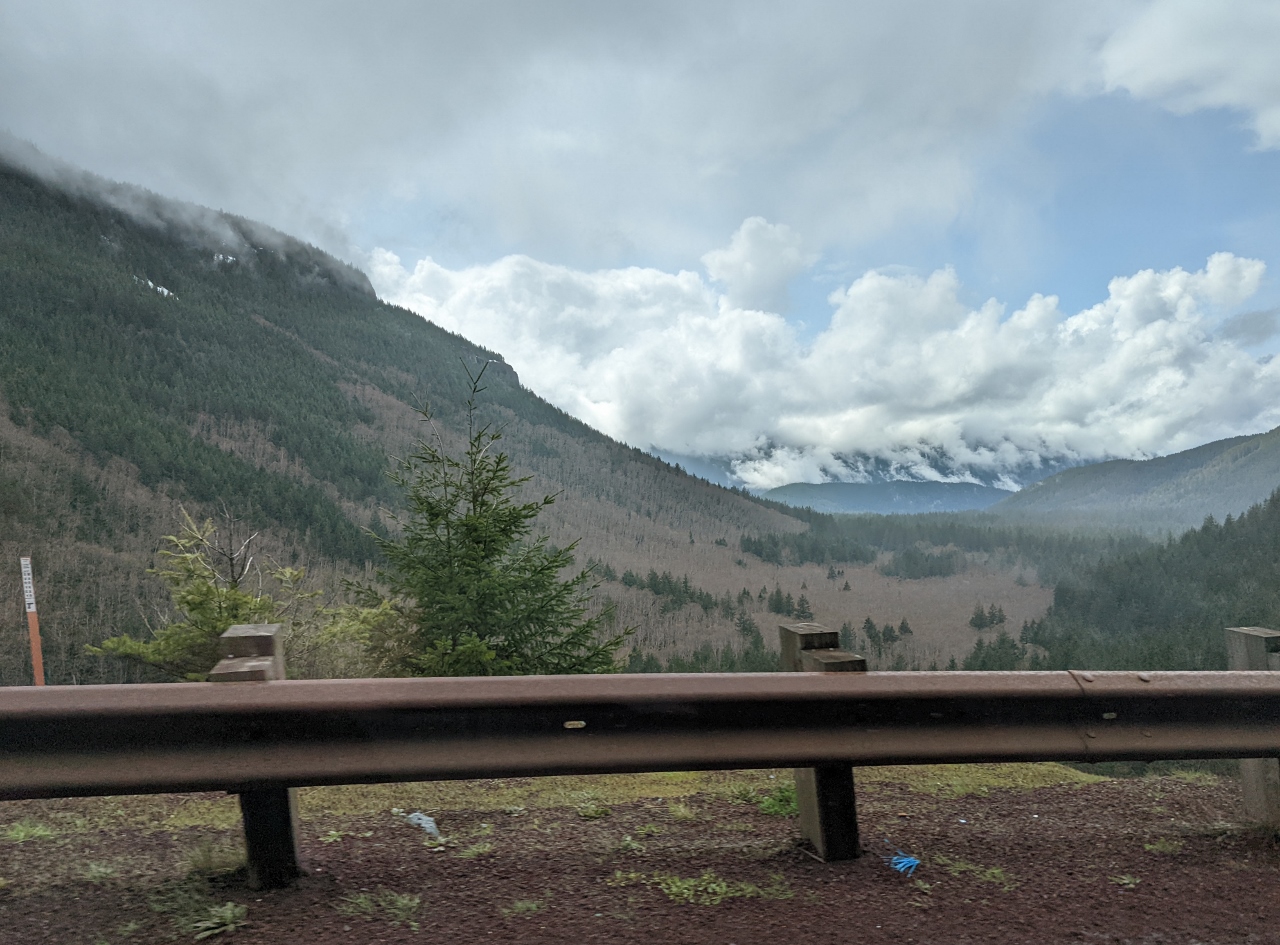 |
4/27/2022: Wind Creek Basin
Position: 45°18.37'N, -121°49.52'W
View to the Wind Creek Basin from the Rockwood Viewpoint at altitude 2,643 ft (806 m) on US Route 26 near Government Camp.
|
 |
4/27/2022: Snow
Position: 45°18.67'N, -121°48.13'W
Snow still on the ground at altitude 3,052 ft (930 m) on Mt. Hood.
|
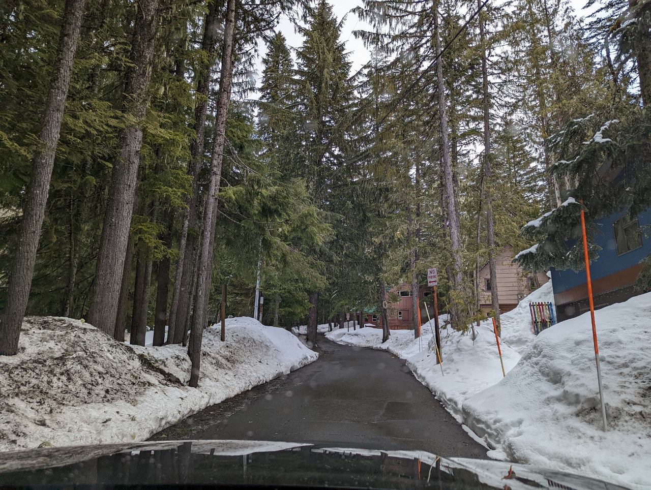 |
4/27/2022: E Wyeast Trail
Position: 45°18.26'N, -121°45.41'W
Heading up E Wyeast Trail towards our cabin at Government Camp, the main settlement at Mt. Hood. The town was so named when a government convey of munitions destined for Oregon forts camped here along the Barlow Road in 1849.
|
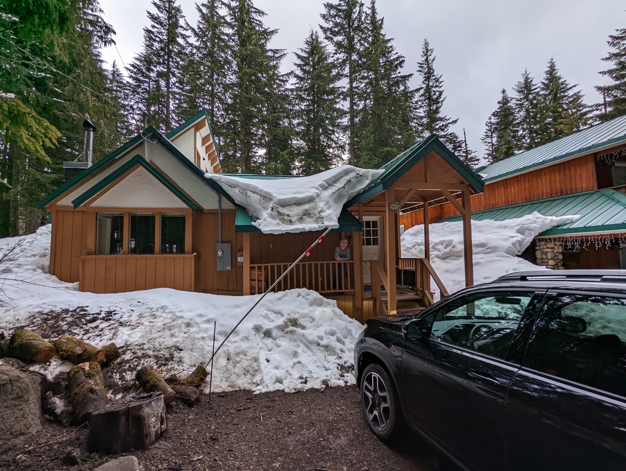 |
4/27/2022: Tom Creek Haus
Position: 45°18.35'N, -121°45.32'W
Jennifer on the porch of our cabin, Tom Creek Haus, at Government Camp. The is our first time renting through VRBO (Vacation Rental By Owner). We quite enjoyed the cabin we stayed in at Stone Creek Lodge near Mt. Rainier, so are trying something similar in renting a much larger, stand-alone cabin.
|
 |
4/27/2022: Spitfire
Position: 45°18.34'N, -121°45.32'W
Spitfire making an exploratory pass through our cabin at Government Camp. At this house, he's not allowed on the furniture, and it looks like he knows it. He fairly quickly got used to the rules. In the hotels we stayed in on our road trip across the US, it usually took him under an hour to get comfortable and relax. But the cabin was so much bigger that he didn't really seem at home until a couple of days in.
|
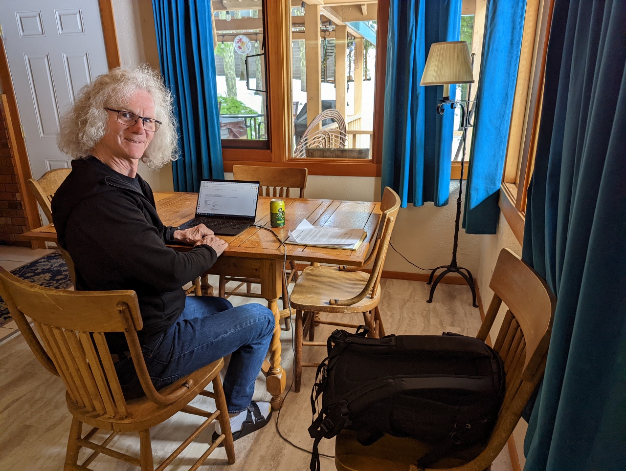 |
4/27/2022: Office
Position: 45°18.34'N, -121°45.31'W
James getting a little work done in our cabin at Government Camp.
|
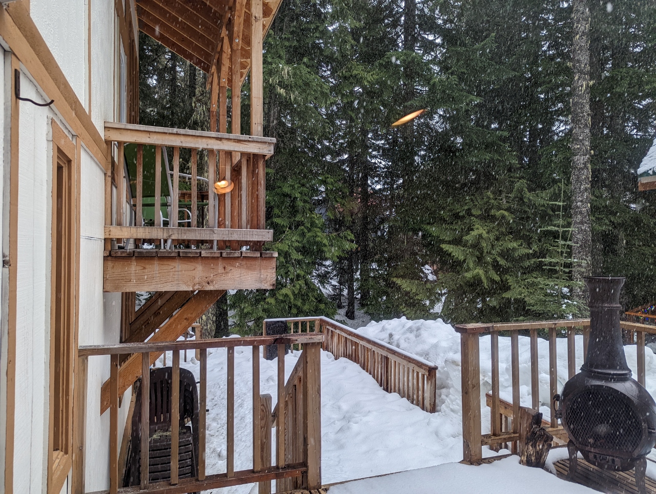 |
4/27/2022: Snowing
Position: 45°18.34'N, -121°45.31'W
It's late April and snow is falling, with plenty still built up on the deck of our cabin at Government Camp.
|
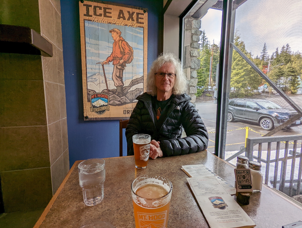 |
4/27/2022: Mt. Hood Brewing
Position: 45°18.20'N, -121°45.97'W
An enjoyable dinner at Mt. Hood Brewing company in front of the poster for Ice Axe IPA that we are drinking, with our Honda Passport visible out the window.
|
 |
4/27/2022: Hot Tub
Position: 45°18.33'N, -121°45.30'W
A relaxing soak in the hot tub in our cabin at Government Camp with snow piled high behind.
|
 |
4/28/2022: Kitty Central
Position: 45°18.34'N, -121°45.32'W
"Kitty Central" setup in the dining room of our cabin at Government Camp. Spitfire has been spending most of his time either underneath the master bed or tucked in his carry case while he gets used to the new digs.
|
 |
4/28/2022: Master Bedroom
Position: 45°18.34'N, -121°45.32'W
We loved the light-filled master suite in our cabin at Government camp. The second-floor addition has views over Tom Creek and a small balcony at right.
|
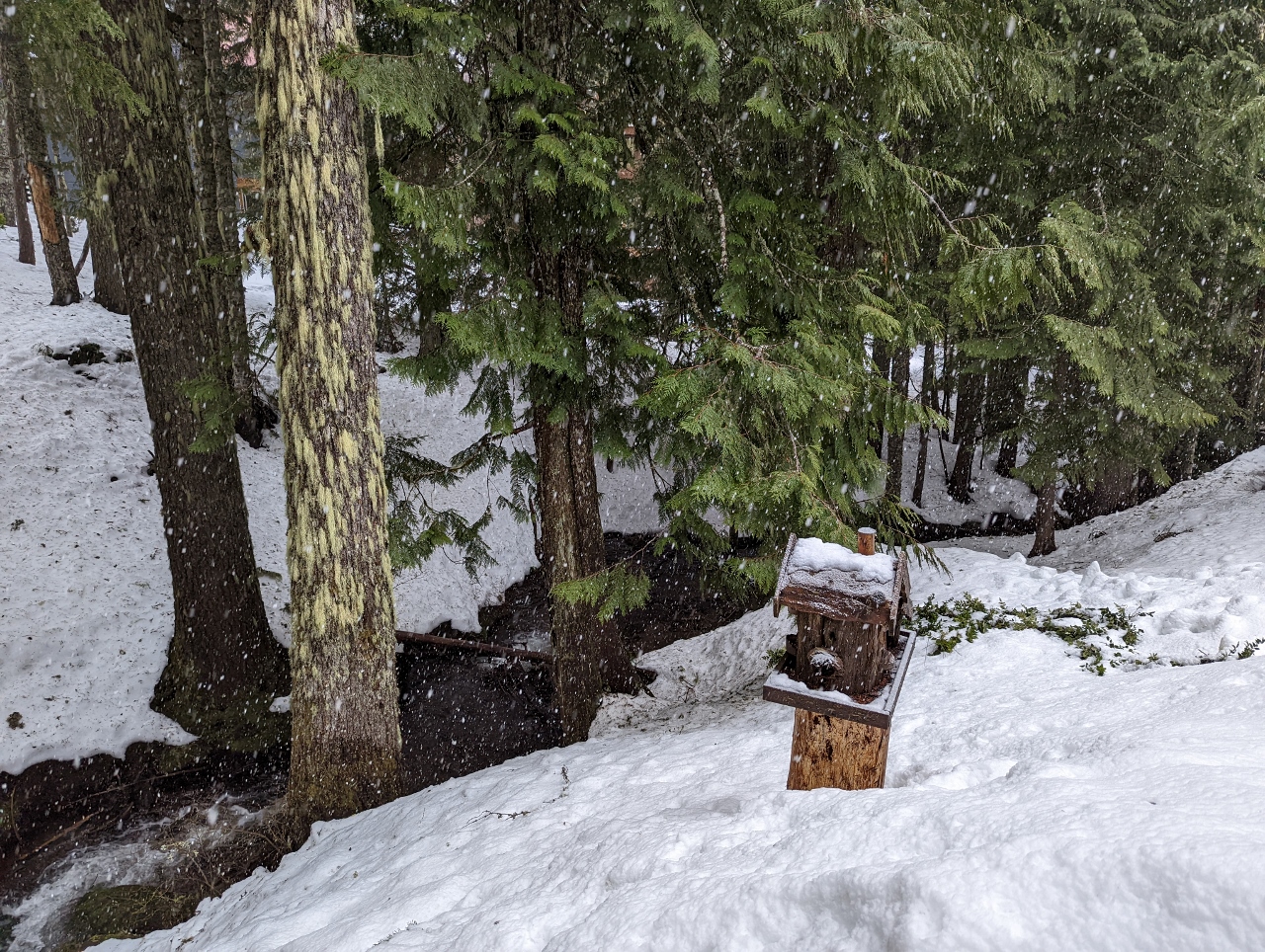 |
4/28/2022: Tom Creek
Position: 45°18.34'N, -121°45.32'W
Tom Creek, the namesake for our cabin at Government House, viewed from the balcony off the master.
|
 |
4/28/2022: Overcast
Position: 45°18.36'N, -121°42.21'W
Overcast conditions as we ascend Timberline Highway up to the Timberline Ski Area at Mt. Hood. We're not holding much hope for good mountain views today.
|
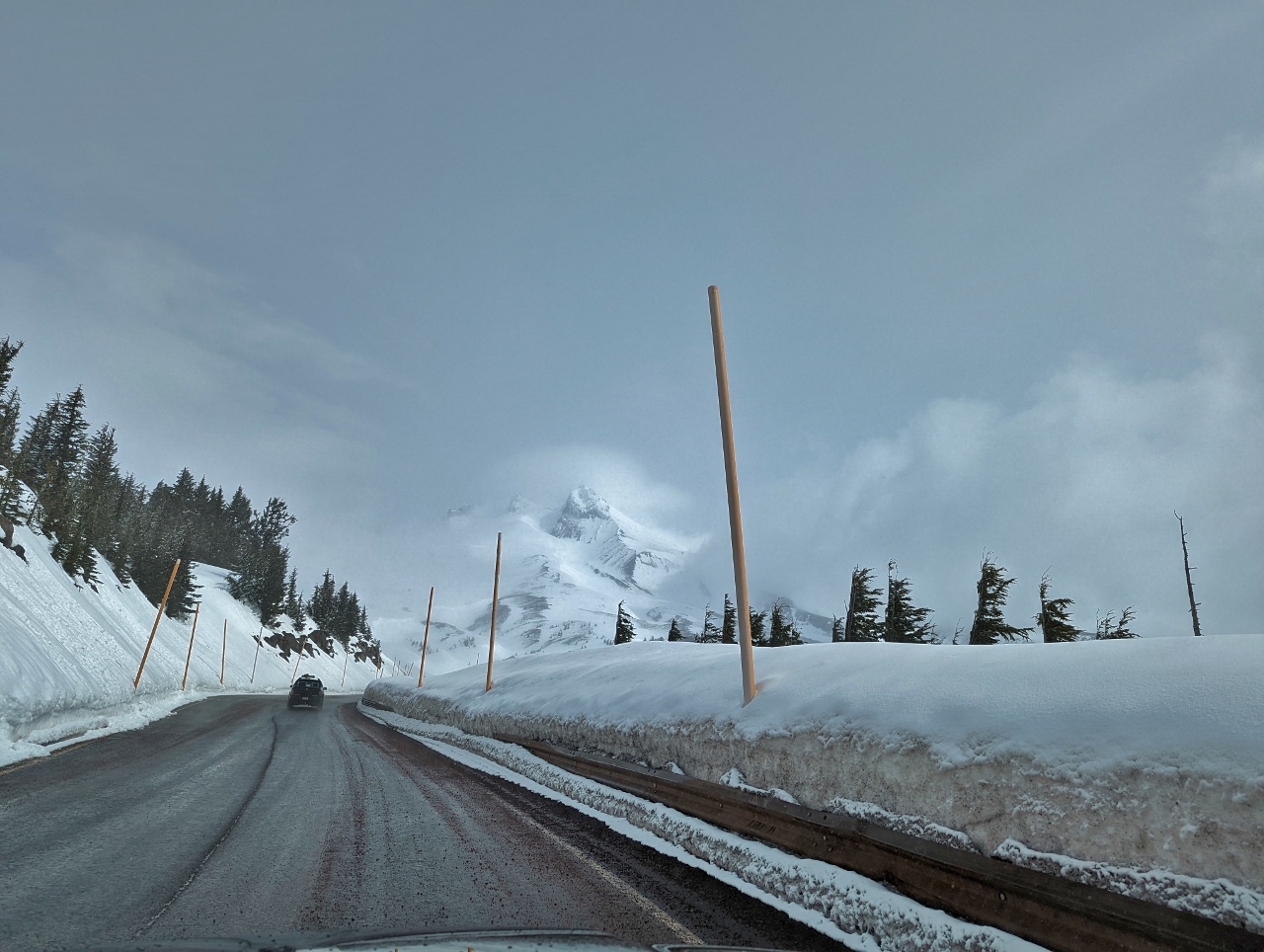 |
4/28/2022: Mt Hood View
Position: 45°19.51'N, -121°42.49'W
As we rounded a bend near the Timberline Ski Area, 11,249 ft (3,429 m) Mt. Hood suddenly appeared dead ahead. We were pretty excited to see it.
|
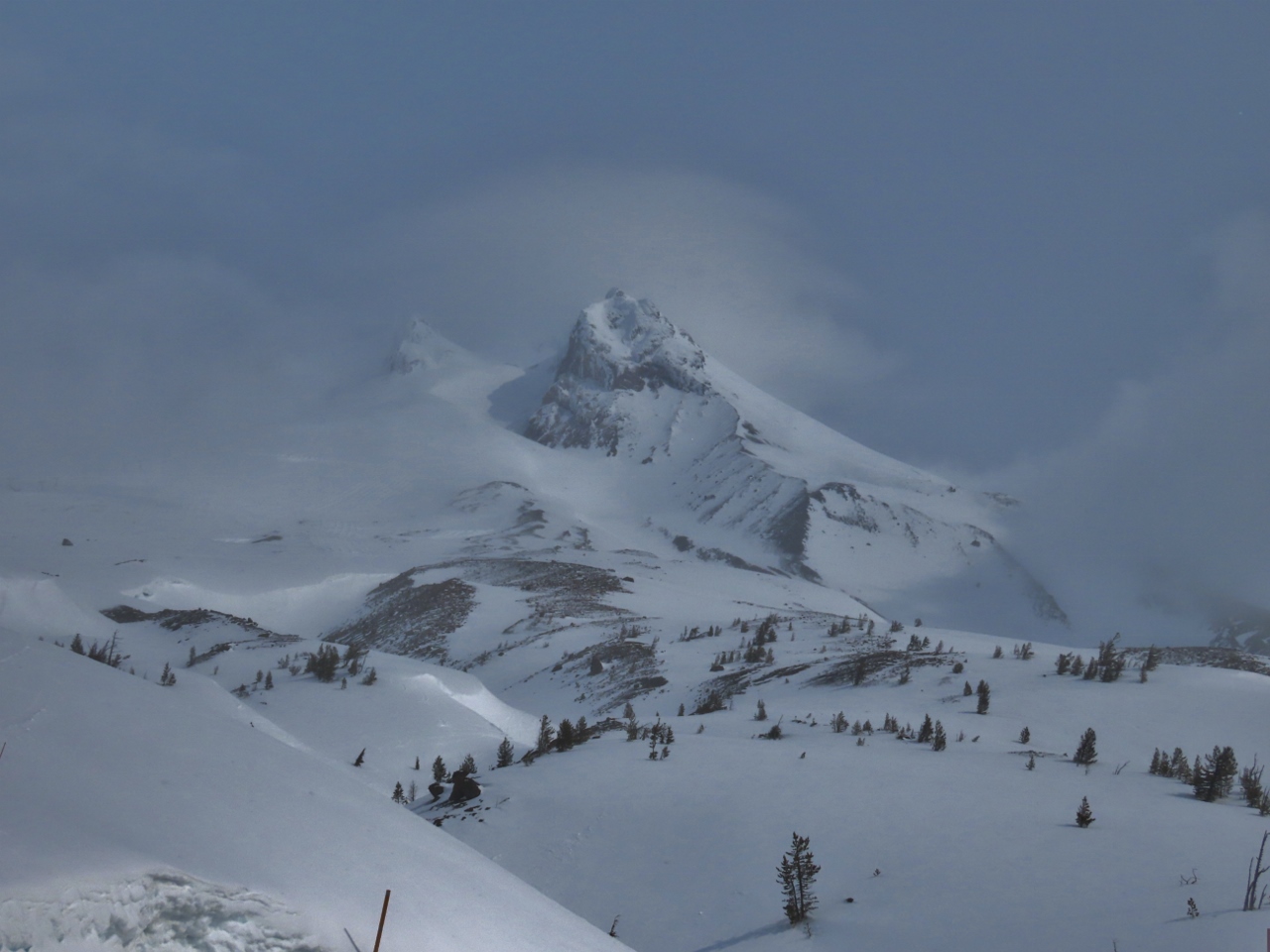 |
4/28/2022: Mt Hood
Position: 45°19.89'N, -121°42.44'W
Another great view to 11,249 ft (3,429 m) Mt. Hood, this one from the parking lot before our hike. We feel super-lucky to get a mountain view given how overcast conditions are today.
|
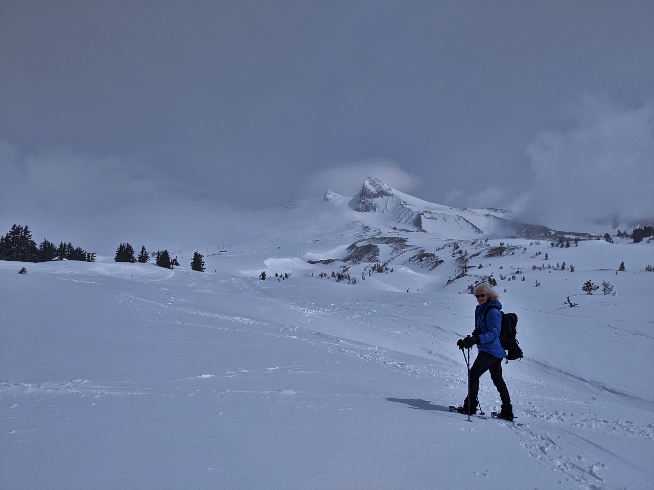 |
4/28/2022: En Route
Position: 45°19.91'N, -121°42.49'W
Geared up and heading up to Slicox Hut, the small speck in the distance at roughly center of the picture above the snow cliffs.
|
 |
4/28/2022: Climbers Trail
Position: 45°20.62'N, -121°42.51'W
The Timberline Ski area has a designated climbers trail for backcountry skiers and snowshoers, separating them from the downhill runs.
|
 |
4/28/2022: Silcox Hut
Position: 45°20.64'N, -121°42.52'W
From altitude 5,807 ft (1,770 m) at the parking lot, we walked a mile (1.6km) in about an hour to reach Silcox Hut at 6,799 ft (2,073 m). Parked outside is one of Timberline's many Snowcats. Silcox Hut was built in 1939, one of many thousand public works project completed under the New Deal Agency that supplied paid jobs to the unemployed after the Great Depression. The hut initially was the upper terminal of the original Magic Mile chairlift and a warming hut for climbers. Today it can be rented out to groups for overnight lodging and is a popular wedding venue.
|
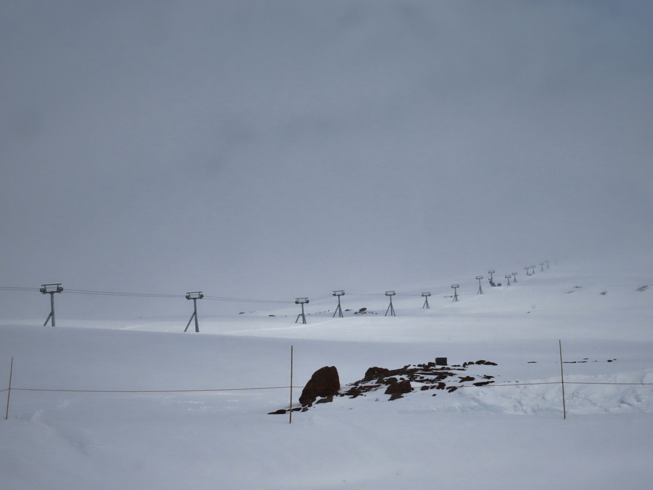 |
4/28/2022: Palmer Express
Position: 45°20.66'N, -121°42.57'W
The Palmer Express chairlift, leading to the topmost section of the Timberline ski area at Mt. Hood at elevation 8,540ft (2,602m). Timberline has the longest ski season in North America, operating from October through August in ideal years. The winter vertical drop is 4,540 feet (1,383m) from top of Palmer to bottom of Summit Pass, and in the summer it's 2,616 feet (797m) from top of Palmer to the bottom of the Magic Mile where the Silcox hut is.
The Palmer Express chairlift operates only in the summer. The winters are so harsh here, with winds over 100 mph (160 kph), that the lift cannot feasibly be de-iced and operated. So in the winter, people instead take the Palmer Snowcat to the top. |
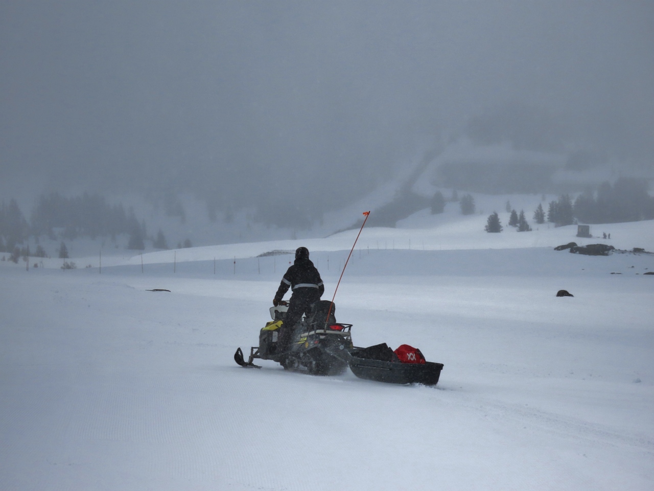 |
4/28/2022: Snowmobile
Position: 45°20.66'N, -121°42.55'W
Snowmobile transporting gear from Silcox Hut.
|
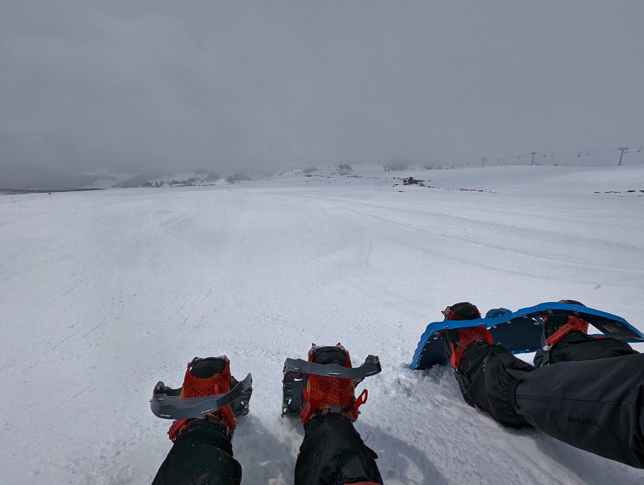 |
4/28/2022: Snack
Position: 45°20.66'N, -121°42.55'W
Enjoying a snack and a hot drink in front of Silcox Hut on Mt. Hood.
|
 |
4/28/2022: Visibility
Position: 45°20.66'N, -121°42.55'W
We're lucky we got any view of Mt. Hood today. While we were having our snack, visibility went to near zero. This is the same view as the picture before with our snowshoes.
|
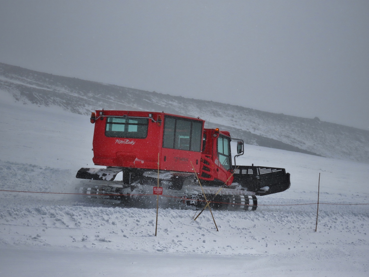 |
4/28/2022: Snowcat
Position: 45°20.66'N, -121°42.55'W
The snowcat at Silcox Hut heading back down to the lodge. This is how guests at the hut are transported back and forth.
|
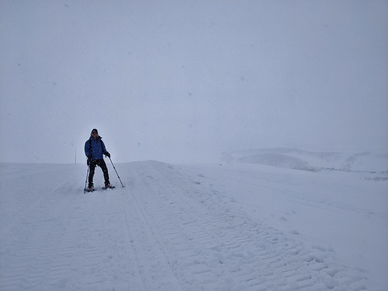 |
4/28/2022: Descending
Position: 45°20.15'N, -121°42.56'W
Descending from Silcox Hut. It's snowing, which is fun, but not great for visibility.
|
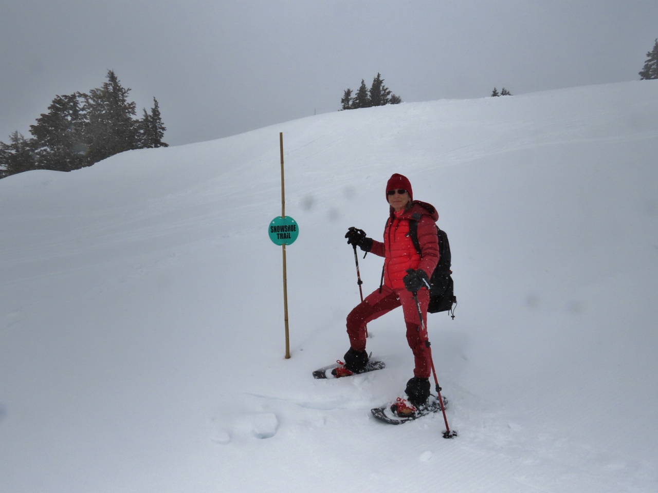 |
4/28/2022: Snowshoe Trail
Position: 45°20.07'N, -121°42.53'W
Timberline has a small marked showshoe trail near the lodge that we've just reached as we return back down from Silcox Hut.
|
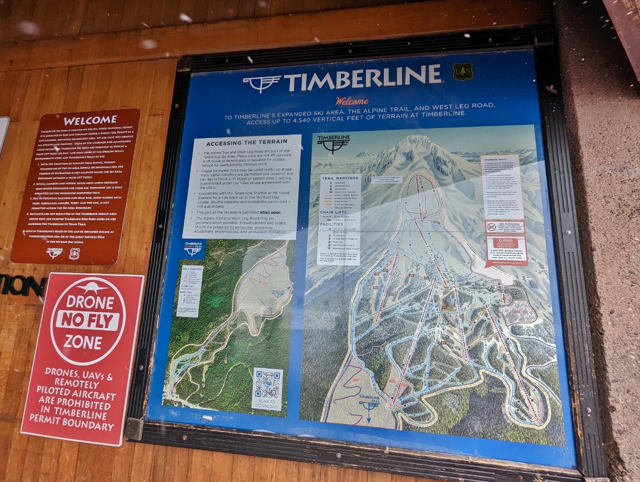 |
4/28/2022: Timberline Ski Runs
Position: 45°19.82'N, -121°42.56'W
A diagram of the Timberline ski runs. We hiked from the parking lot at right, directly below the closed area, to the Silcox Hut, below the topmost loop. The red line running through the topmost loop is the Palmer Express chairlift route (click image for a larger view).
|
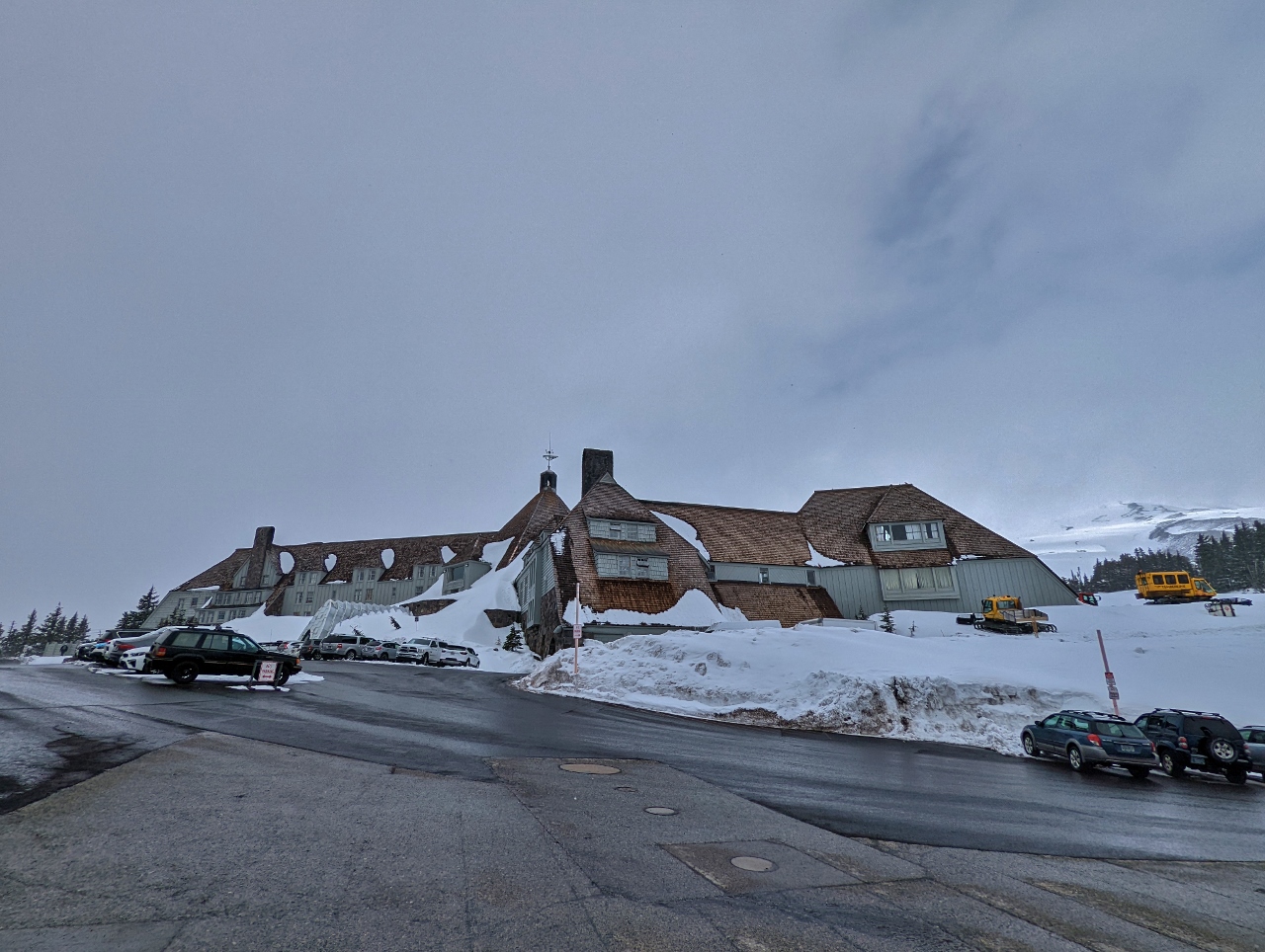 |
4/28/2022: Timberline Lodge
Position: 45°19.83'N, -121°42.63'W
The Timberline Lodge was another New Deal project, built and furnished by local artisans between 1936 and 1938. The lodge is in the National Register of Historic places and served as the exterior of the Overlook Hotel in Stanley Kubrick's film adaptation of the Stephen King's horror novel The Shining. In the book, room 217 was considered the most haunted. The hotel owners, concerned that nobody would want to stay in that room once it was featured in a horror movie, requested that Kubrick instead use the fictional room number 237. Kubrick complied, but ironically, room 217 is the most requested room in the hotel.
|
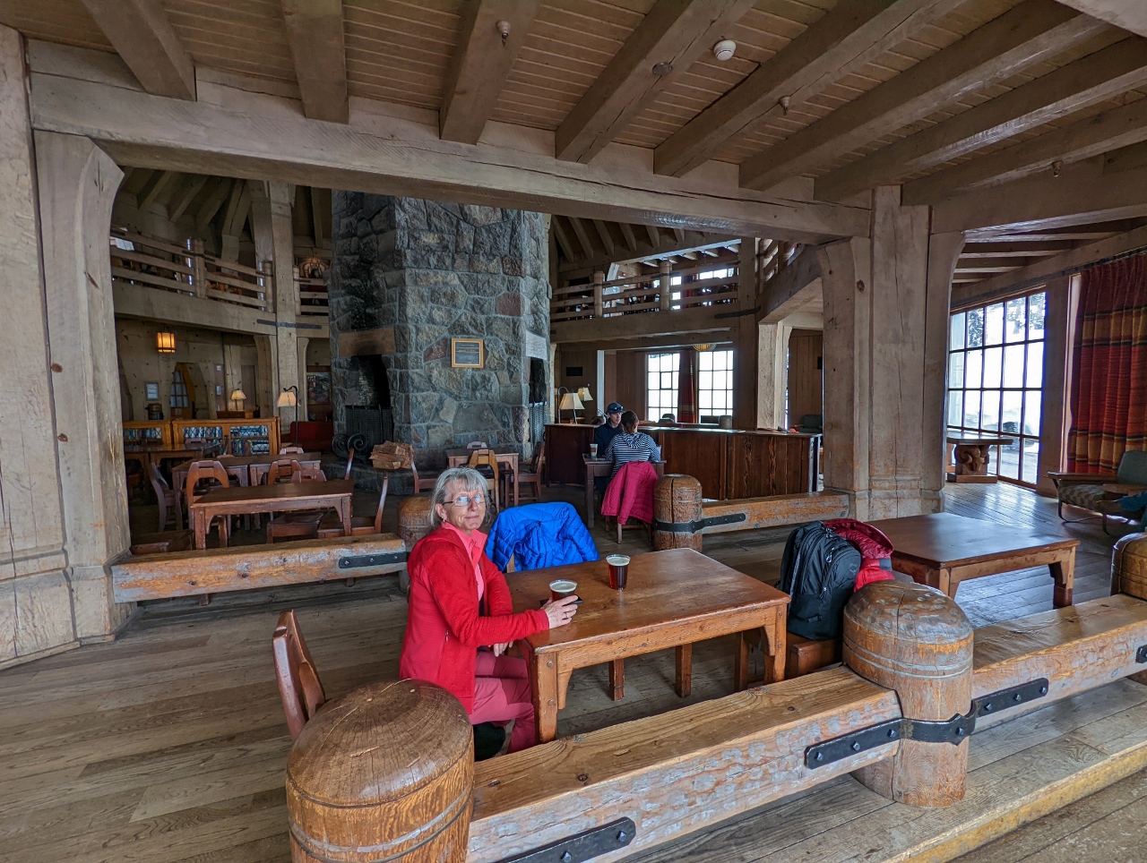 |
4/28/2022: Head House
Position: 45°19.87'N, -121°42.67'W
Enjoying a pint of Mt. Hood Brewing company beer amid the beautiful interior of the Head House at Timberline Lodge, with the lodge's massive chimney in the background at center.
|
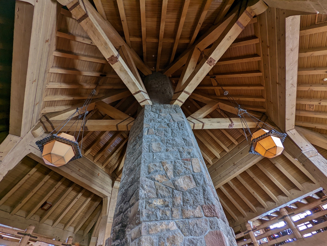 |
4/28/2022: Chimney
Position: 45°19.86'N, -121°42.66'W
Looking up along the chimney in the Head House at Timberline Lodge to the striking wood-beamed ceiling. The chimney stands 90 ft (27 m) tall and is 14 ft (4 m) in diameter.
|
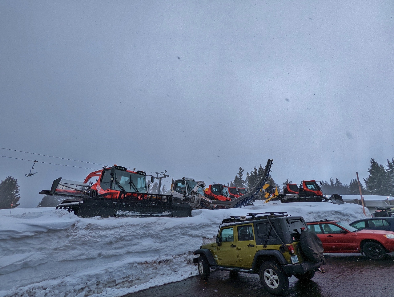 |
4/28/2022: Snow Equipment
Position: 45°19.67'N, -121°42.66'W
A wide variety of snow grooming equipment just outside Timberline Lodge. The chair lift visible in the background, Molly's, is one of seven in the ski area.
|
 |
4/28/2022: Glacier Public House
Position: 45°18.24'N, -121°45.21'W
Government Camp has several good casual restaurants. We stopped for lunch here at Glacier Public House.
|
 |
4/28/2022: Lunch
Position: 45°18.28'N, -121°45.20'W
Sharing a yummy salad at Glacier Public House. When we were boating, we always liked to see the boat from a restaurant. Now we enjoy seeing our Honda :-).
|
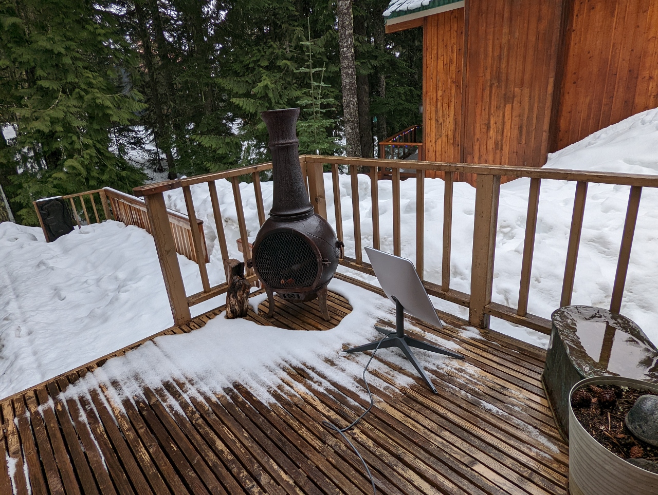 |
4/28/2022: Starlink
Position: 45°18.34'N, -121°45.32'W
Testing our Starlink satellite dish on the deck of our cabin in Government Camp. It was unable to reliably connect with so many trees blocking the view to the satellites.
|
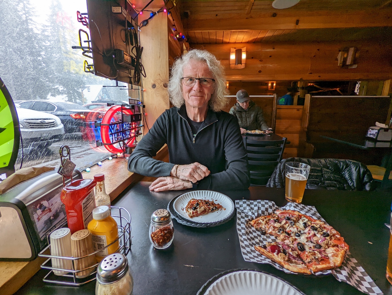 |
4/28/2022: The Ratskeller
Position: 45°18.25'N, -121°45.37'W
A delicious pizza for dinner at The Ratskeller Alpine Bar and Pizzeria in Government Camp.
|
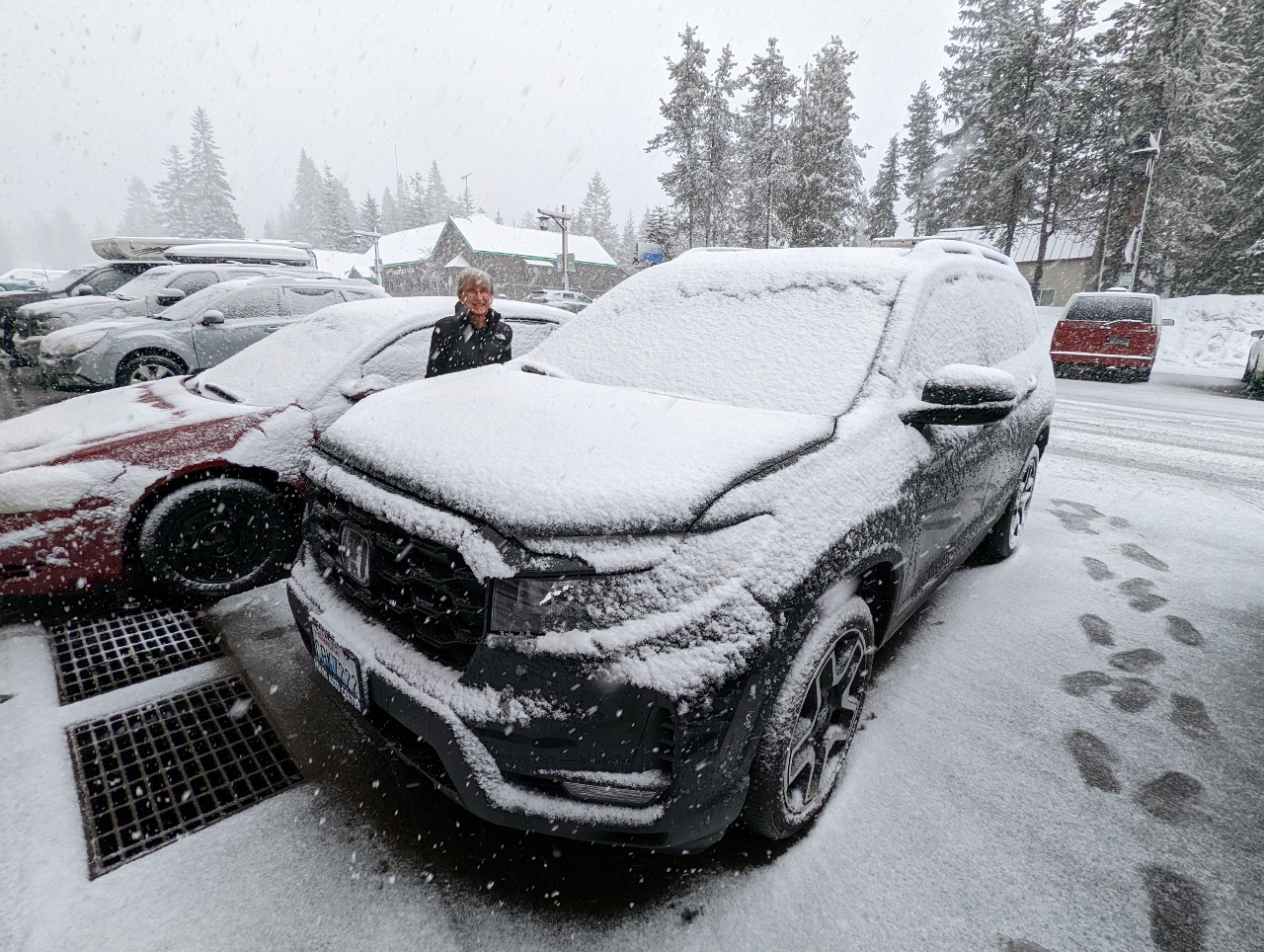 |
4/28/2022: Snow
Position: 45°18.25'N, -121°45.38'W
Snow started falling partway through our dinner and our car was covered in snow when we returned to it.
|
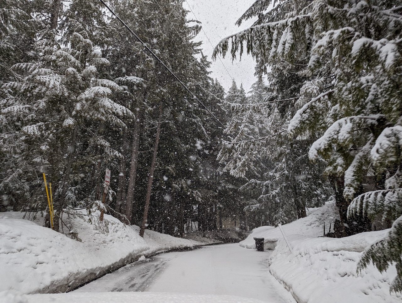 |
4/28/2022: E Wyeast Trail
Position: 45°18.25'N, -121°45.41'W
Heading along E Wyeast Trail back to our cabin at Government Camp. In the height of winter, chains are required for vehicles to drive this road.
|
 |
4/29/2022: Starlink Position 2
Position: 45°18.34'N, -121°45.32'W
We tried another position for our Starlink antenna, but still couldn't reliably connect due to interference from the trees.
|
 |
4/29/2022: Starlink Position 3
Position: 45°18.34'N, -121°45.32'W
We moved the Starlink antenna to the front yard, but the trees still got in the way. We're learning the Starlink isn't invincible, but we've found it quite tolerant of blockage and overall an amazing value.
|
 |
4/29/2022: Mt. Hood Brewing Co
Position: 45°18.20'N, -121°45.97'W
Back at Mt. Hood Brewing Company, this time for lunch. We're at the same table, but to mix it up a bit, we did swap seats :-).
|
 |
4/29/2022: Route 35
Position: 45°17.40'N, -121°40.25'W
On Oregon Route 35 heading towards Mt. Hood Meadows ski area on a driving exploration of the area, with Mt. Hood partially visible ahead.
|
 |
4/29/2022: White River
Position: 45°18.24'N, -121°40.24'W
Crossing over the snow-edged White River. Oregon Trail pioneers following the Barlow Road had to fjord this river.
|
 |
4/29/2022: Snow
Position: 45°19.49'N, -121°39.48'W
Snow falling, with another partial view to Mt. Hood, as we near Mt. Hood Meadows.
|
 |
4/29/2022: Mt. Hood Meadows
Position: 45°19.88'N, -121°39.81'W
At Mt. Hood Meadows, the second ski area on Mt. Hood. The ski runs here have a maximum elevation of 7,300 ft (2,225 m) and will soon close for the end of the winter season. Timberline, where we hiked yesterday, has a maximum elevation of 8,540 ft (2,600m) and will keep running through August. This is the longest ski season in North America.
|
 |
4/29/2022: Hospital
Position: 45°19.89'N, -121°39.92'W
It's surprising there are enough ski accidents in the area to support an on-site hospital.
|
 |
4/29/2022: Back to Timberline
Position: 45°19.53'N, -121°42.67'W
Heading back up to Timberline ski area with a partial view to Mt. Hood.
|
 |
4/29/2022: Ram's Head Bar
Position: 45°19.88'N, -121°42.67'W
We'd returned to Timberline to have a drink at the second-floor Ram's Head Bar in Timberline Lodge, since it was closed when we were there yesterday. James is visible in silhouette just to the left of the chimney along the second floor railing.
|
 |
4/29/2022: Lounge
Position: 45°19.88'N, -121°42.67'W
Looking down to the lounge area around the chimney at Timberline Lodge. Yesterday we sat at the table at upper left.
|
 |
4/29/2022: Overcast
Position: 45°19.88'N, -121°42.67'W
One of the draw of Ram's Head Bar is a great view to Mt. Hood. But it's not too great right now with overcast conditions.
|
 |
4/29/2022: Snowcat
Position: 45°19.88'N, -121°42.67'W
We can't see the mountain right now, but there's still interesting things to see out the window at Ram's Head Bar. Here a snowcat is heading up with a load of passengers, while a skier is heading downhill.
|
 |
4/29/2022: Skiers
Position: 45°19.88'N, -121°42.67'W
A couple of skiers passing the window outside Ram's Head Bar in Timberline Lodge.
|
 |
4/29/2022: Clearing
Position: 45°19.87'N, -121°42.67'W
The sky is starting to clear and everyone in the bar is getting excited about a good view.
|
 |
4/29/2022: Mt. Hood
Position: 45°19.88'N, -121°42.67'W
After nearly an hour, the skies suddenly cleared to reveal spectacular 11,250-ft (3,429 m) Mt. Hood. Everyone in the bar cheered. The Palmer Express chairlift, starting at altitude 6,799 ft (2,073 m), is visible at upper left.
|
 |
4/29/2022: Window Brace
Position: 45°19.88'N, -121°42.67'W
The winds can blow so strongly up here that the large panes have metal braces to prevent them from blowing in.
|
 |
4/29/2022: Barlow Room
Position: 45°19.89'N, -121°42.67'W
An historic ping-pong table in the Barlow Room at Timberline Lodge.
|
 |
4/29/2022: Tucker Sno-Cat
Position: 45°19.85'N, -121°42.66'W
One of several varieties of tracked vehicles made by Tucker Sno-Cat corporation of Medford Oregon, established in the early 1900s. The bright orange Tucker Sno-Cats are common in ski areas, but have also been in used in Arctic and Antarctic expeditions. While the typical truck-sized snow vehicle, or snowcat, has two sets of tracks, most Tucker Sno-Cats have four independent tracks. A few early models, such as the smaller Tucker Kitten, did use dual tracks.
|
 |
4/29/2022: Snowcat & Mt. Hood
Position: 45°19.82'N, -121°42.63'W
A traditional two-track snowcat beneath Mt. Hood.
|
 |
4/29/2022: John Deere
Position: 45°19.73'N, -121°42.56'W
Dirona had a John Deere engine and we still love seeing a John Deere in the wild.
|
 |
4/29/2022: Summit Pass
Position: 45°18.16'N, -121°44.78'W
The chairlift for Summit Pass, the lower ski area at Timberline. The beginner-level property was recently acquired by the Timberline Lodge, who plan to build a gondola directly from here to their main ski area.
|
 |
4/29/2022: Starlink Position 4
Position: 45°18.34'N, -121°45.32'W
Trying out another position for the Starlink antenna, but we can't escape the obstruction of the trees. The Starlink has been amazing at hooking up in difficult and highly obstructed locations. But this is the fourth attempt at Government Camp and the antenna has met its match. The gaps in the trees just aren't big enough for it to hook up more than briefly.
|
 |
4/29/2022: Spitfire
Position: 45°18.33'N, -121°45.30'W
Spitfire is getting more comfortable in our cabin at Government Camp, enough to take a brief walk outside.
|
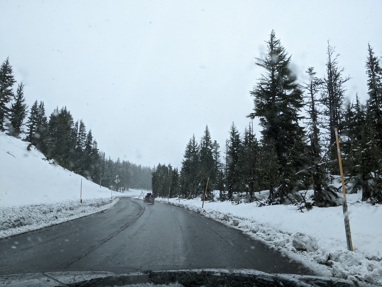 |
4/30/2022: Snowing
Position: 45°19.50'N, -121°39.49'W
Fresh snow falling at elevation 5,170 ft (1,576 m) as we near Mt Hood Meadows to snowshoe.
|
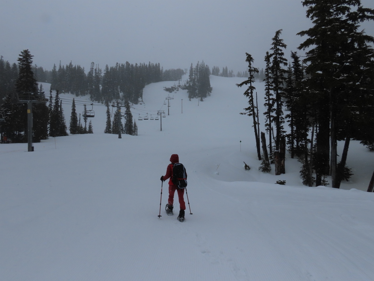 |
4/30/2022: Mt Hood Meadows
Position: 45°19.93'N, -121°39.87'W
It's 10 am, but things are pretty quiet at Mt Hood Meadows as we head out on their snowshoe trail to visit Umbrella Falls.
|
 |
4/30/2022: Forest
Position: 45°19.97'N, -121°39.69'W
The earlier overcast conditions are lifting and the days is starting to get a little brighter as we head through the forest.
|
 |
4/30/2022: Big Umbrella Loop
Position: 45°19.98'N, -121°39.69'W
We don't often walk marked snowshoe trails, and here are at the intersection of the Big Umbrella Loop towards Umbrella Falls, and an extended route, also to the falls. We took the longer route.
|
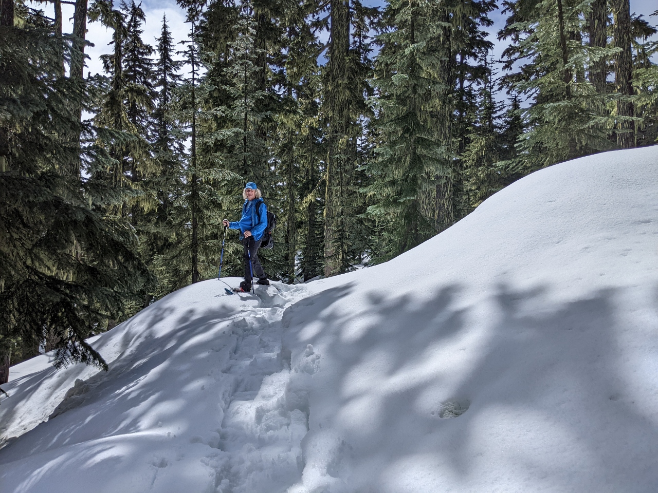 |
4/30/2022: Sunshine
Position: 45°19.29'N, -121°38.98'W
The sun broke through the clouds as we hiked the snowshoe trail at Mt Hood Meadows.
|
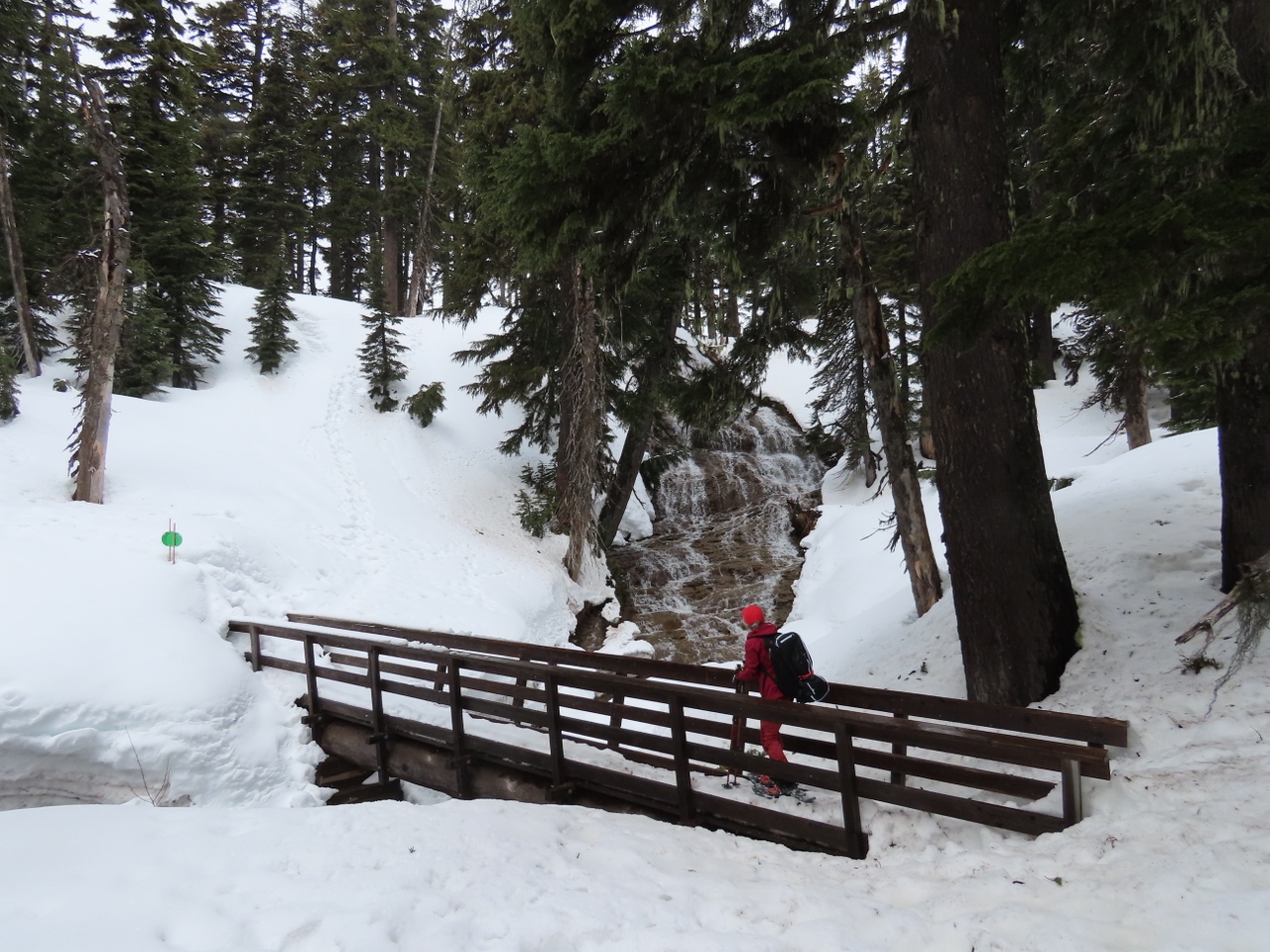 |
4/30/2022: Umbrella Falls
Position: 45°19.72'N, -121°39.61'W
Umbrella Falls veil 59 ft (18m) down a sloping wall near the headwaters of the East Fork of the Hood River. The hike to the falls is popular in summer too.
|
 |
4/30/2022: Parking
Position: 45°19.82'N, -121°39.65'W
The parking lot at Mt. Hood Meadows filled in a lot in the two hours we were out hiking.
|
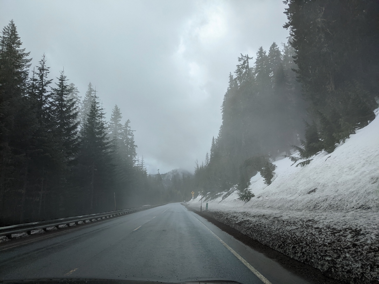 |
4/30/2022: Steam Fog
Position: 45°18.67'N, -121°39.71'W
Heading into steam fog on our way back to Government Camp. As cold air drifts across the warmer road, the sudden cooling causes water vapor in the air above the road to condense.
|
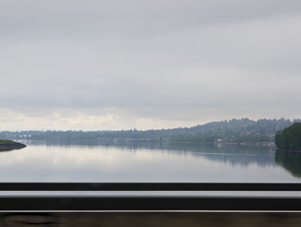 |
5/1/2022: Columbia River
Position: 45°34.54'N, -122°32.73'W
Crossing the Columbia River on the return trip to Seattle from Government Camp.
|
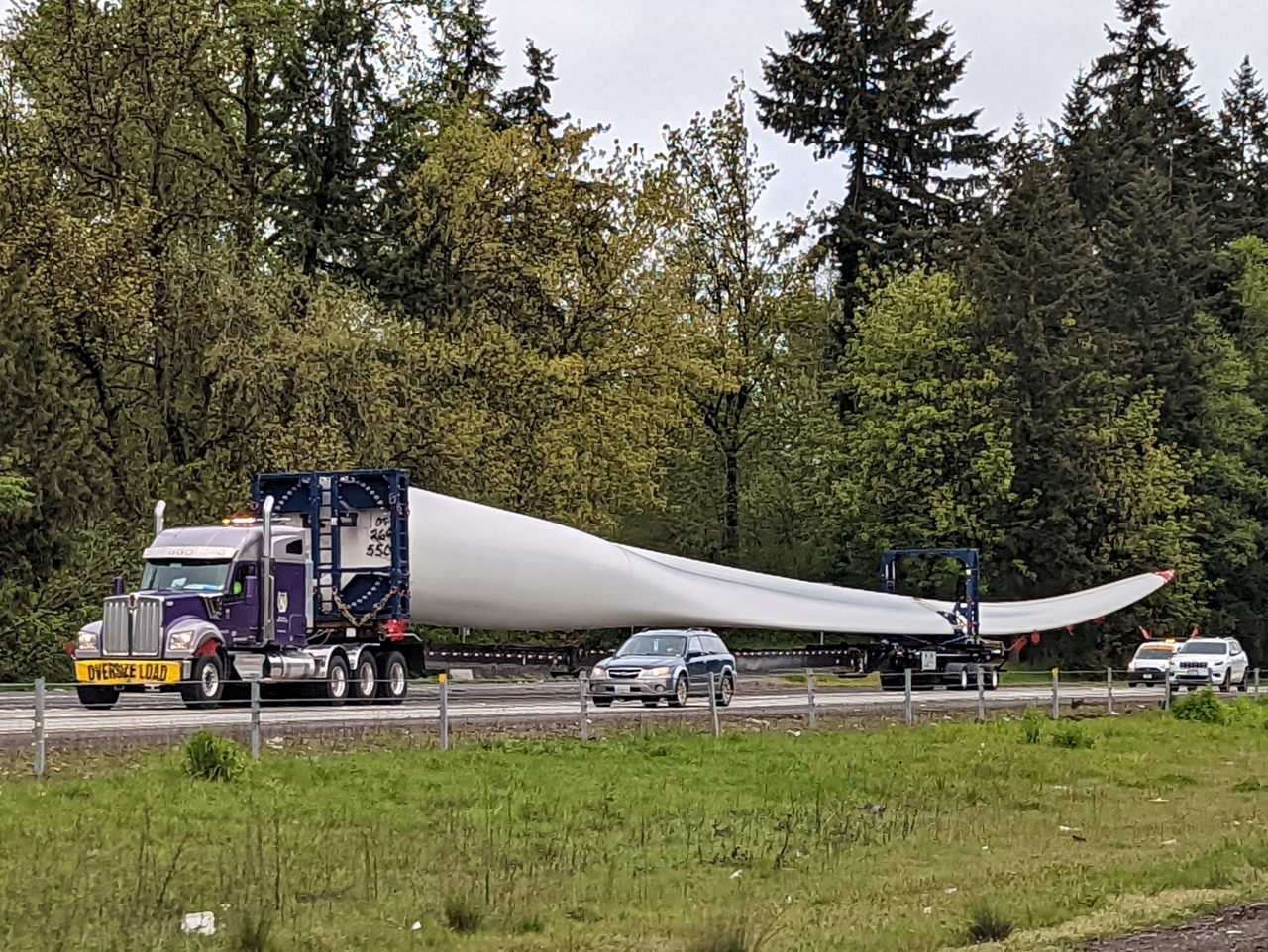 |
5/1/2022: Blade
Position: 45°47.25'N, -122°40.44'W
One of several massive wind turbine blades being transported south along I-5.
|
 |
5/1/2022: Gospodor Monument Park
Position: 46°27.23'N, -122°53.18'W
Statues in the now-defunct Gospodor Monument Park near Toledo, WA. Dominic Gospodor commissioned the controversial artworks on his land in 2002, but allocated no funds in his estate to maintain them when he died in 2010. Local residents and country officials did not support the monuments because they caused major traffic backups as people slowed down to look and take pictures.
|