
West Seattle is a group of Seattle neighborhoods known for their many public beaches and parks, several with wonderful view east to downtown or west to the Olympic Mountains. The Duwamish River separates the two parts of city, and also is home to the Port of Seattle and several parks. A passenger-only ferry runs between the two, but the primary road connection is the West Seattle Bridge, completed in 1984 to replace a previous opening bridge that was struck by a ship in 1978, leaving it open and inoperable.
On a sunny winter Saturday, we took a drive to West Seattle, taking in the views to port operations and downtown Seattle in several Port of Seattle parks along the way. Reaching West Seattle isn’t as direct as it used to be, with the bridge currently closed for a two-year repair project to address cracks in the structure. From West Seattle, we continued south to historic Fauntleroy and checked out the waterfront houses crowding the shore south of Three Tree Point.
Below are highlights from Feb 20th, 2022. Click any image for a larger view, or click the position to view the location on a map. And a map with our most recent log entries always is available at mvdirona.com/maps.
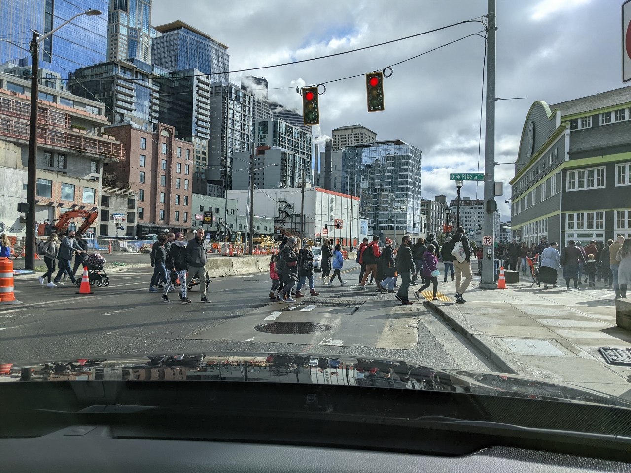 |
Pedestrians
Position: 47°36.69’N, -122°20.94’W
Pedestrians crossing Alaska Boulevard as we head out for a late morning Saturday drive to West Seattle. The temperature is barely above freezing, but a bit of winter sunny weather always brings Seattleites out in droves.
|
 |
Jack Perry Memorial Park
Position: 47°35.31’N, -122°20.55’W
Our first stop was Jack Perry Memorial Park, named after a Port of Seattle employee who died on the job. The small shoreline public access point is squeezed in between the port and the USCG Sector Puget Sound properties, with great views to both. Here we are looking across the east Duwamish waterway to the recently-arrived Mearsk Boston container ship at Terminal 18.
|
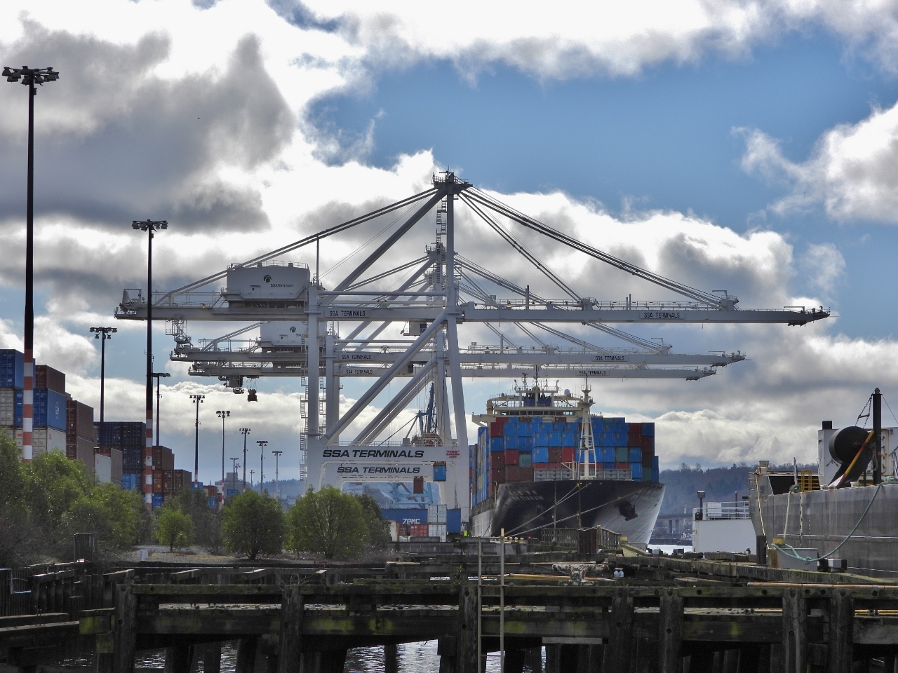 |
Tianjin
Position: 47°35.29’N, -122°20.55’W
The container ship SK Tianjin at Terminal 30, viewed from Jack Perry Memorial Park.
|
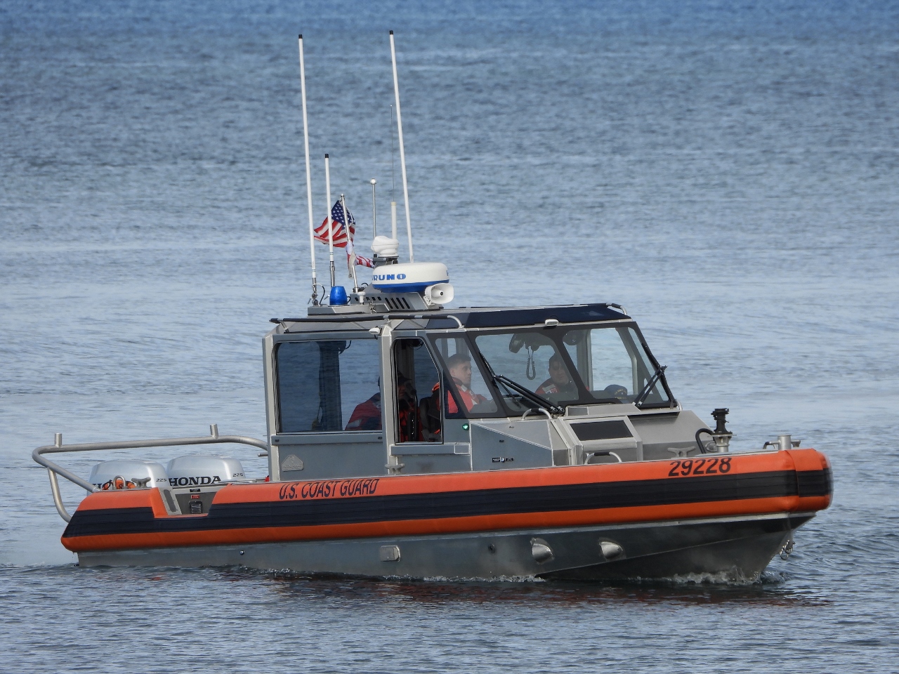 |
Metal Shark
Position: 47°35.29’N, -122°20.55’W
After touring the Metal Shark factory, we love spotting one of their boats. This is a Metal Shark Response Boat—Small (RBS) heading to the docks at nearby USCG Sector Puget Sound. A real trademark of the Metal Shark boats is excellent visibility via large windows that can be opened for comfort or sealed up tight in inclement conditions.
|
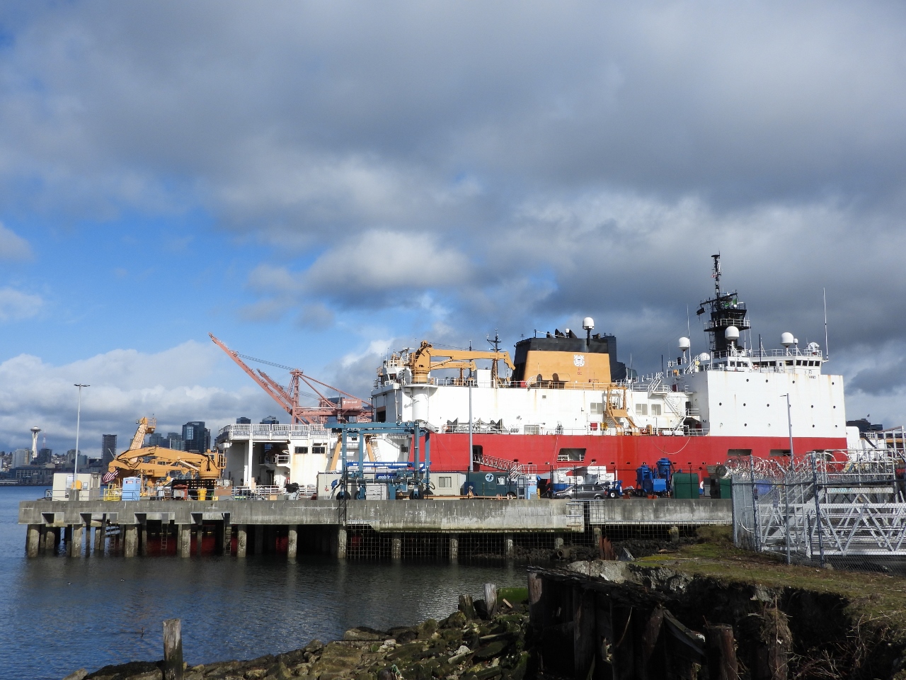 |
USCGC Healy
Position: 47°35.31’N, -122°20.55’W
The USCGC Healy at its home port of USCG Sector Puget Sound. The 420-foot (128m) ship is the largest in the Coast Guard fleet, and is one of only two ice breakers. It is designed to break 4.5 feet of ice continuously at three knots and can operate in temperatures as low as -50°F (045°C). For comparison purposes, Dirona is only able to break 2-inch ice at a half-knot :-). The Healy was built in the 1980s and the other ice breaker, Polar Star, was built in the 1970s. Both are scheduled for replacement over the next decade.
|
 |
Rubble
Position: 47°35.34’N, -122°20.57’W
Jack Perry Memorial Park isn’t as developed as some of the ports other waterfront parks. Many of the views require walking along the edge of the fence at the USCG property, but it’s still a pretty cool place to visit.
|
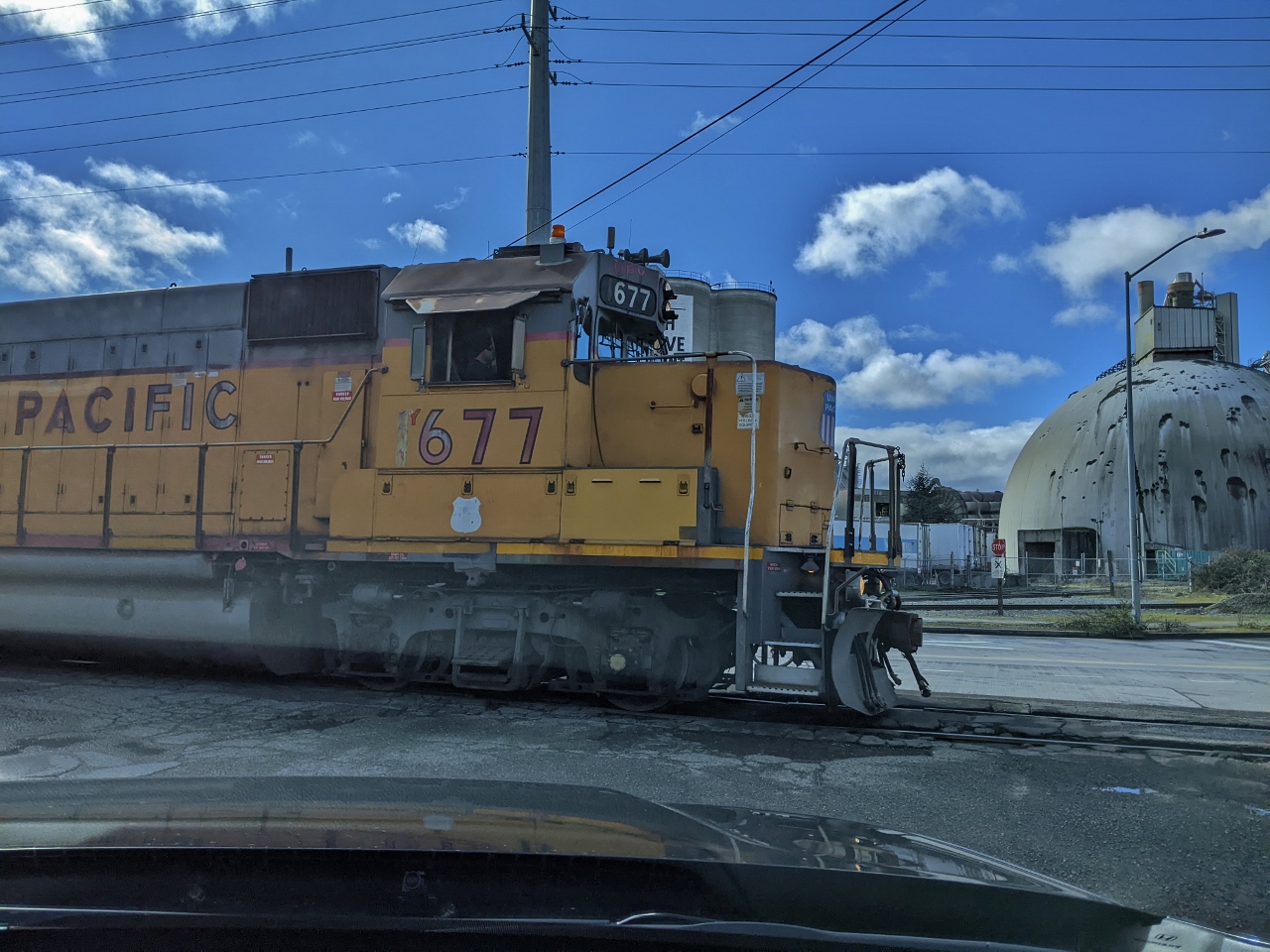 |
Train
Position: 47°34.19’N, -122°20.39’W
We had to wait a short time for a train departing the Port of Seattle to pass before we could continue south.
|
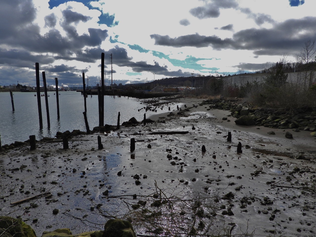 |
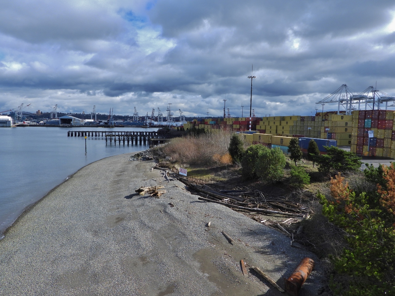
Terminal 105 Park
Position: 47°34.08’N, -122°21.01’W
Our next stop was the small Terminal 105 Park in West Seattle, a restored habitat within the Port of Seattle along the west short of the Duwamish River. This is looking south from the park across the river estuary at low tide.
|
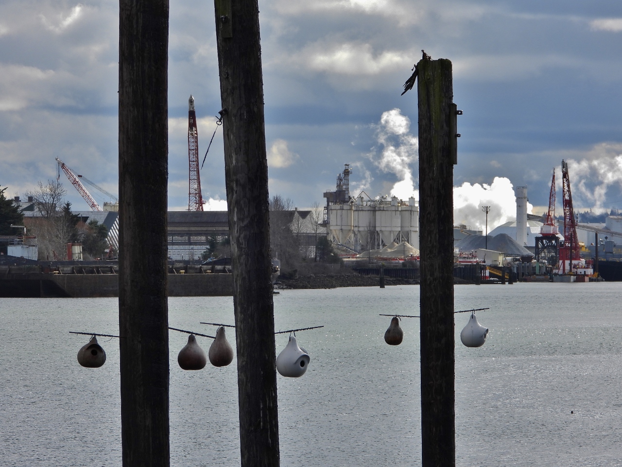 |
Bird Nests
Position: 47°34.08’N, -122°21.01’W
Bird nests on posts with the Port of Seattle Terminal 106 visible in the background.
|
 |
Harbor Island Marina
Position: 47°34.07’N, -122°21.19’W
The aluminum trawler Baltic Sea moored at Harbor Island Marina across the Duwamish River from Terminal 105 Park.
|
 |
Languages
Position: 47°34.08’N, -122°21.11’W
The fishing pier at Terminal 105 Park had several signs warning of toxic chemical levels for seafood caught here. The languages used give an indication of the varied ethnicity of the people commonly fishing here: English, Spanish, Korean, Chinese, Vietnamese, Russian, Laotian, Cambodian and Somali.
|
|
|
Jack Block Park
Position: 47°35.09’N, -122°22.08’W
A short distance from Terminal 105 Park is Jack Block Park. Here Jennifer is taking in the wonderful view to the Seattle skyline from park viewing platform. This is a wonderful little park that we’re surprised we hadn’t found before.
|
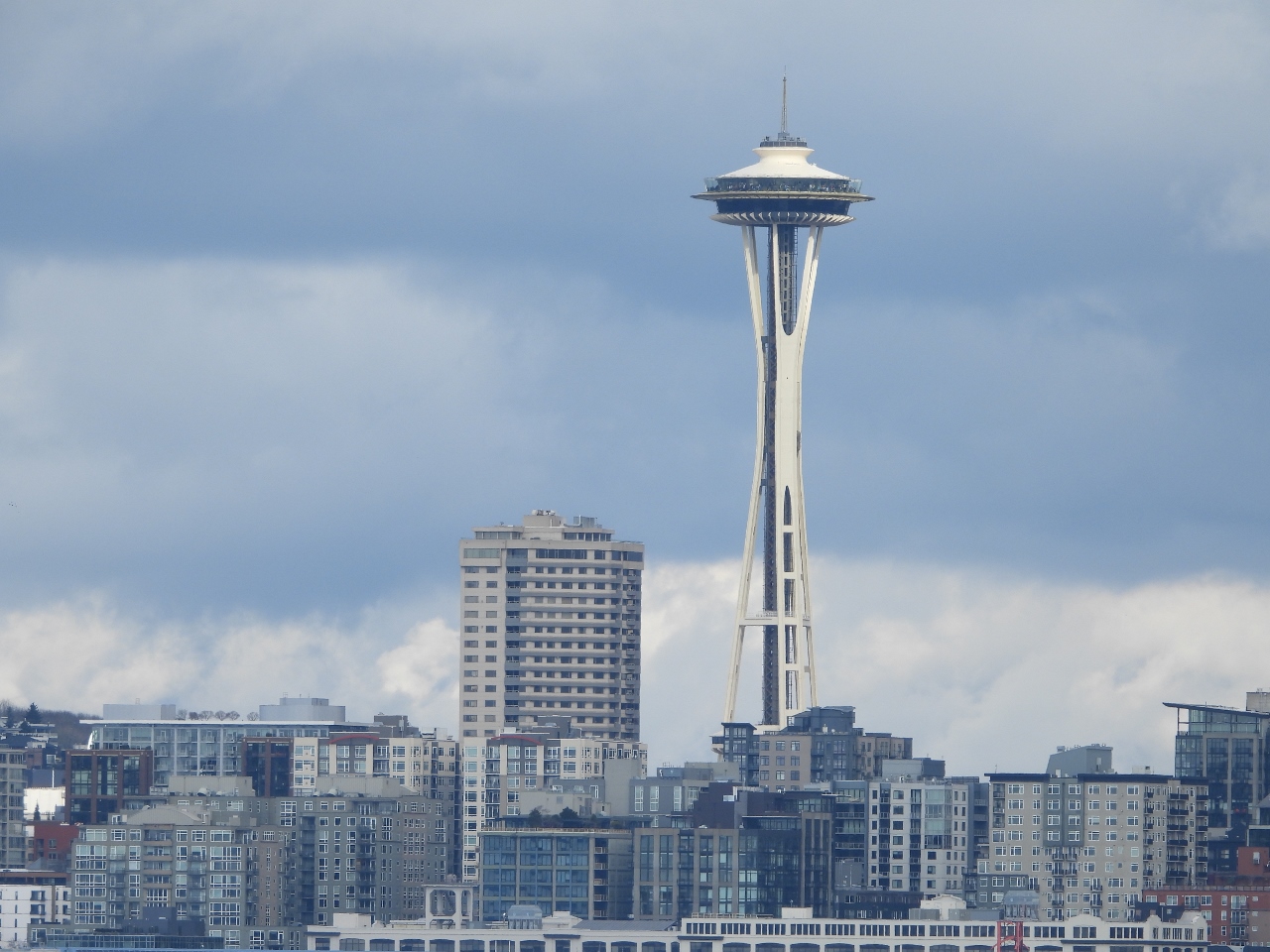 |
Space Needle
Position: 47°35.09’N, -122°22.08’W
The Seattle Space Needle, viewed from Jack Block Park.
|
 |
Beach
Position: 47°35.07’N, -122°22.10’W
Pocket beach at Jack Block Park, at the north end of Terminal 5 in the Port of Seattle.
|
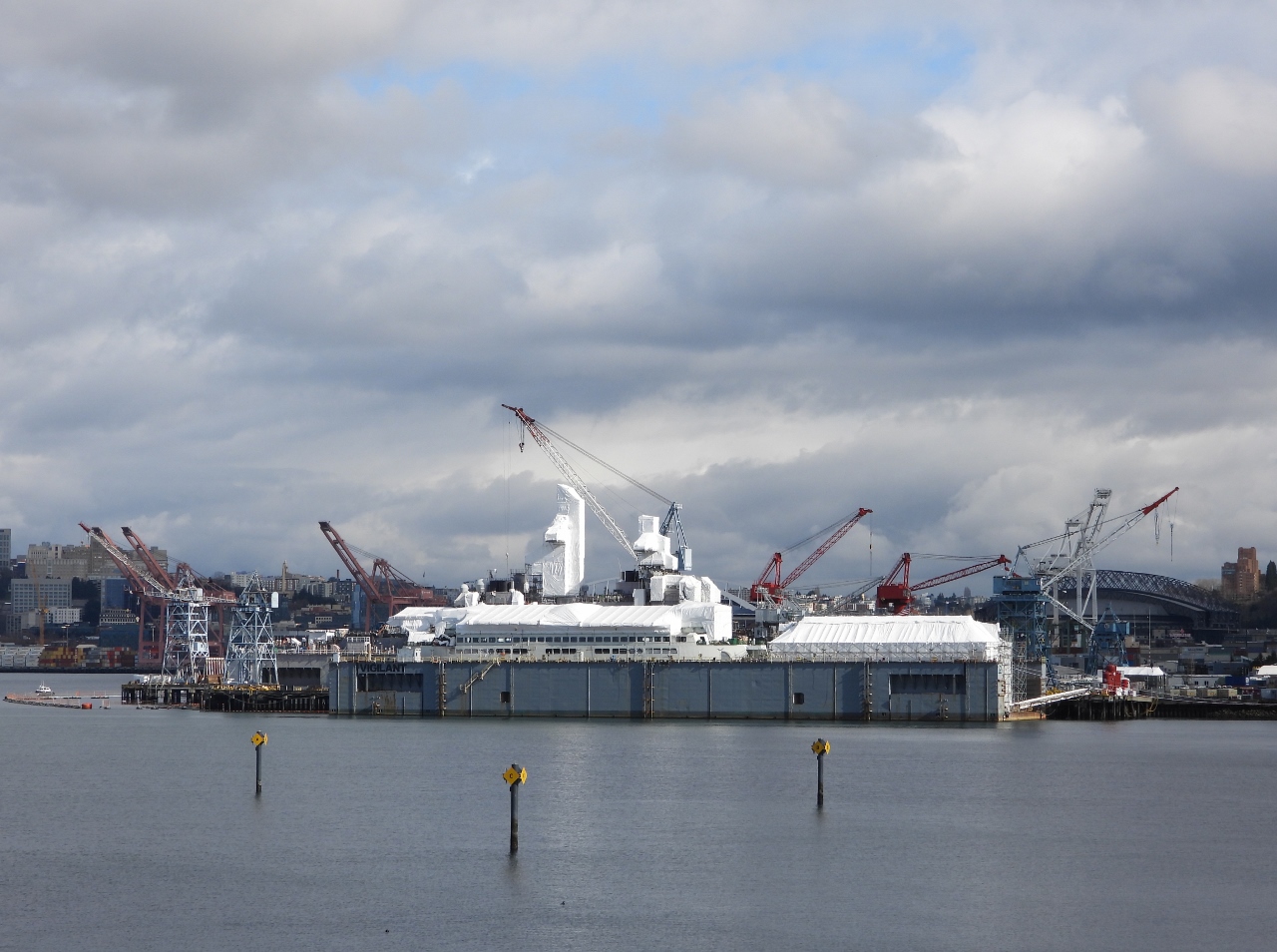 |
Vigor Industrial
Position: 47°35.07’N, -122°22.10’W
The 27-acre property of Vigor Industrial within the Port of Seattle, viewed from Jack Block Park. Vigor has three dry docks ranging in capacity from 528-640 ft (160m-195m) and 12 cranes with up to 150-tonne capacity. They build and maintains large commercial vessels and marine infrastructure such as dams, and handles maintenance and repair for the Navy and Coast Guard in Seattle, Bremerton, and Everett. Vigor built the 362-ft (110 m) Washington State ferry Chimacum that we rode from Seattle to Bremerton a few weeks ago.
|
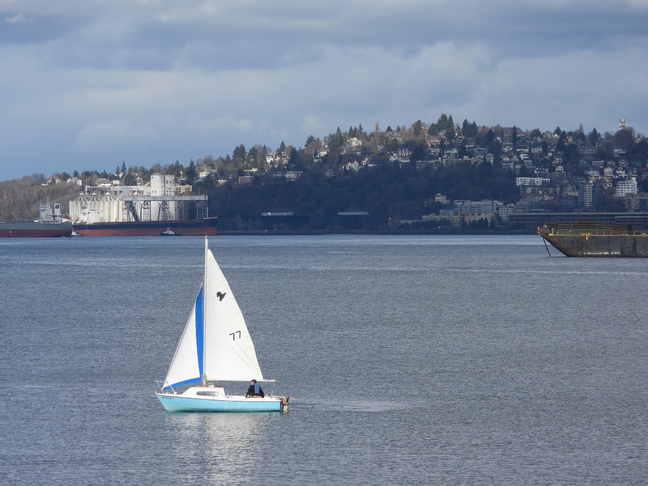 |
Day Sail
Position: 47°34.96’N, -122°22.31’W
A day sailor enjoying the sunny weather off Jack Block Park.
|
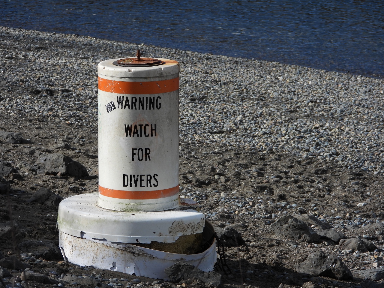 |
Buoy
Position: 47°34.96’N, -122°22.28’W
This buoy likely washed up from the popular scuba diving area at nearby Seacrest Park. That is where we first dove when taking our PADI course back in the late 1990s.
|
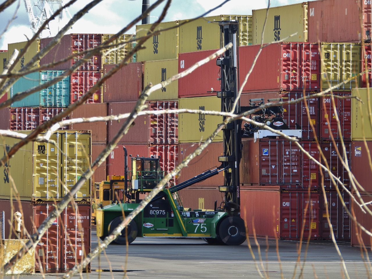 |
Top Loader
Position: 47°35.09’N, -122°22.07’W
Port of Seattle top loader lifting a shipping container into place at Terminal 5. The containers are stacked five-high throughout the port, higher than we’ve ever seen, due to the logistics backlog.
|
 |
Train Yard
Position: 47°35.09’N, -122°22.08’W
Four train segments ready for loading of unloading at Terminal 5.
|
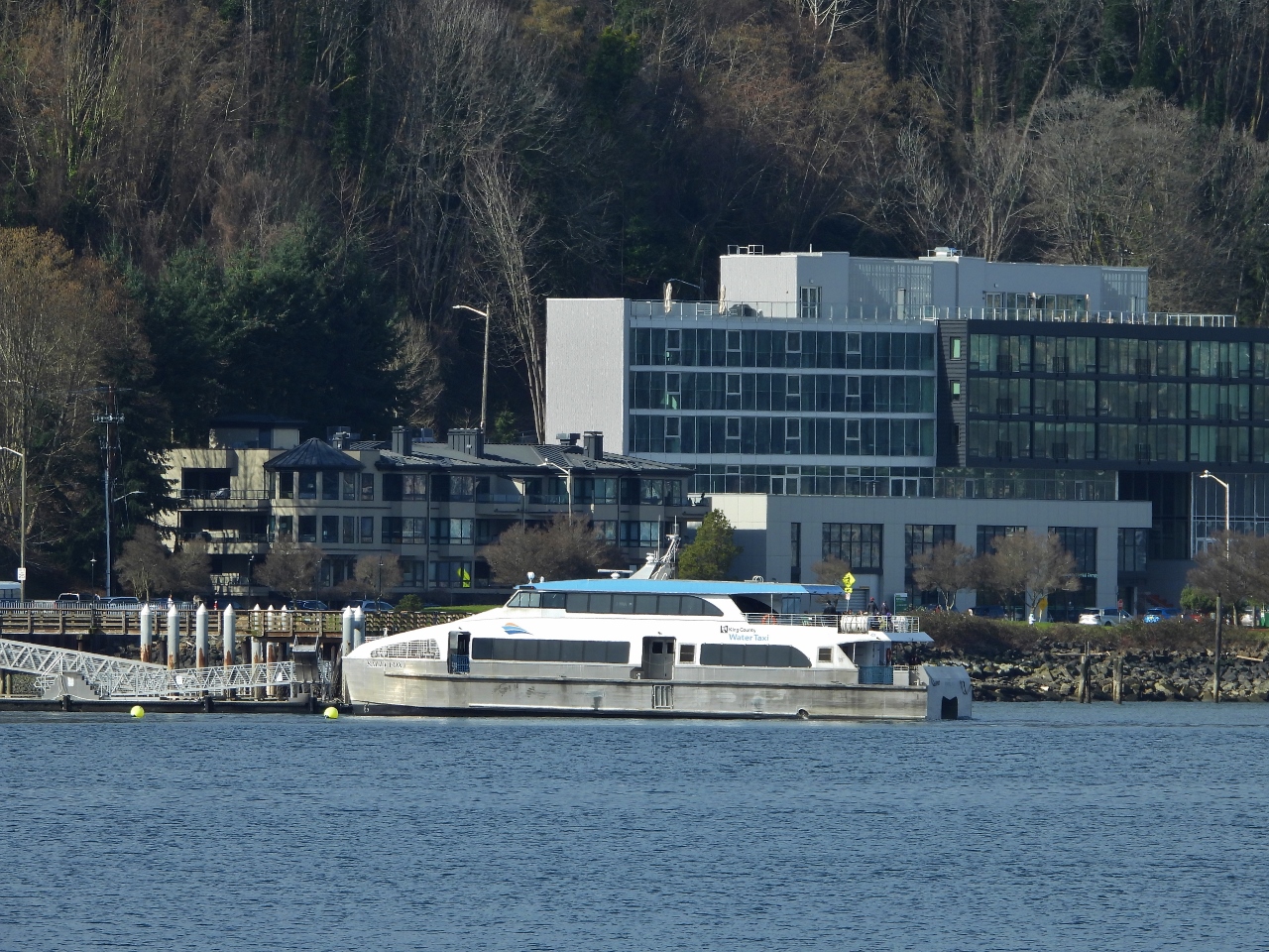 |
Sally Fox
Position: 47°35.09’N, -122°22.08’W
The King County ferry Sally Fox, getting underway from West Seattle. The ship is named for Vashon Island resident Sally Fox, who was a strong advocate for a passenger-only ferry service. The ferry is especially important now, with the West Seattle bridge closed since March of 2020 for a two-year repair project to address cracks in the structure.
|
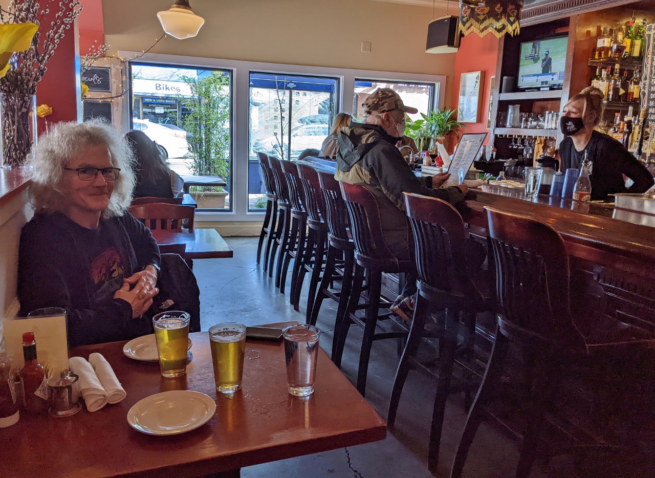 |
Circa Grill
Position: 47°34.85’N, -122°23.21’W
A great lunch at Circa Grill and Alehouse in West Seattle.
|
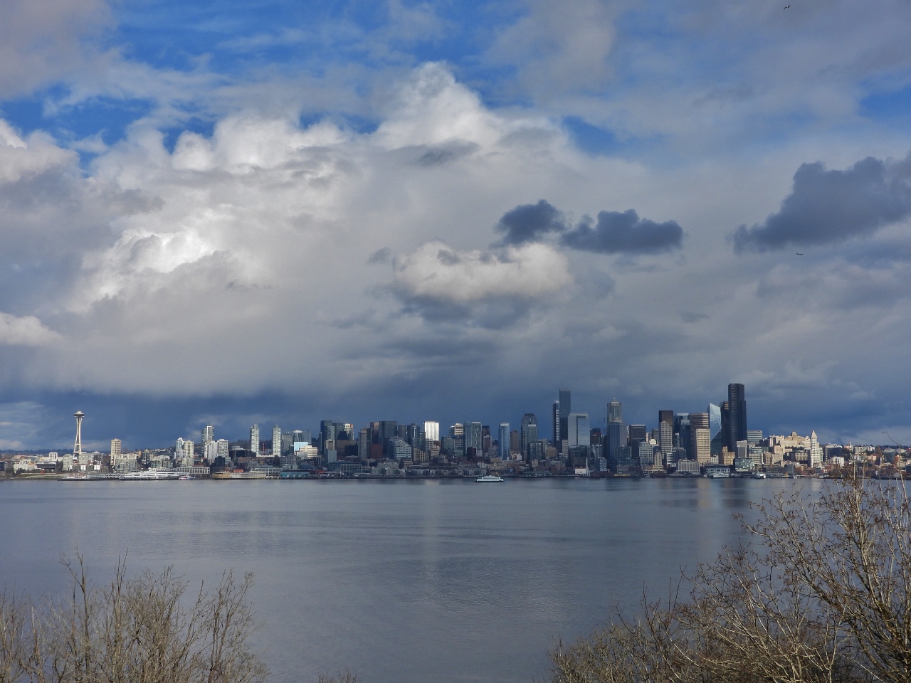 |
Hamilton Viewpoint Park
Position: 47°35.64’N, -122°23.17’W
How could we not stop at Hamilton Viewpoint Park, even if it didn’t have a spectacular view to the Seattle skyline? The twin towers of our condominium complex, Insignia, are visible in the left third of the picture.
|
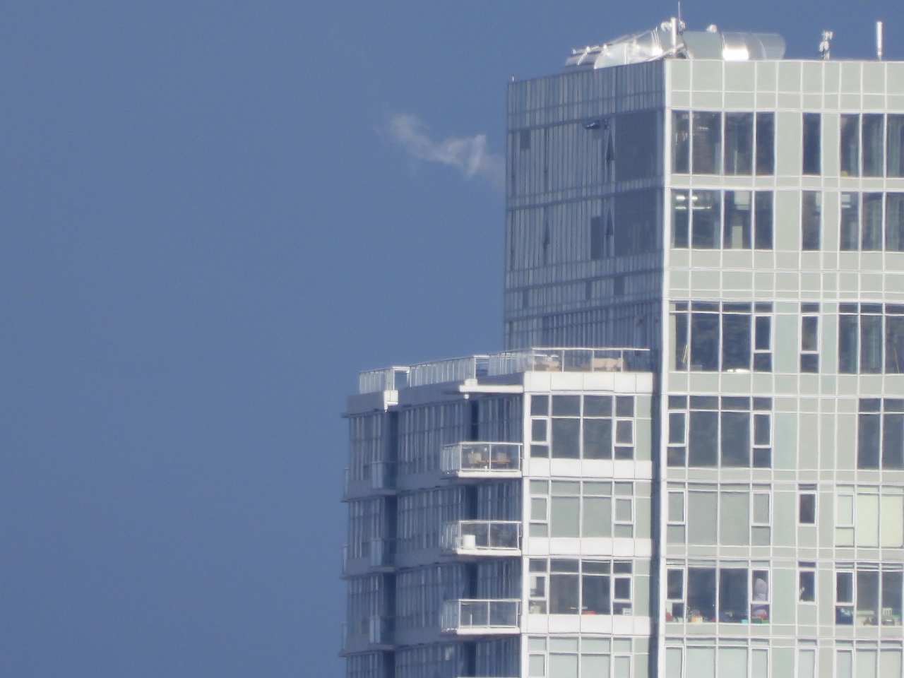 |
Home
Position: 47°35.64’N, -122°23.17’W
A close-up to our home from Hamilton Viewpoint Park in West Seattle. Our apartment is the unit with the balcony closest to the center of the picture.
|
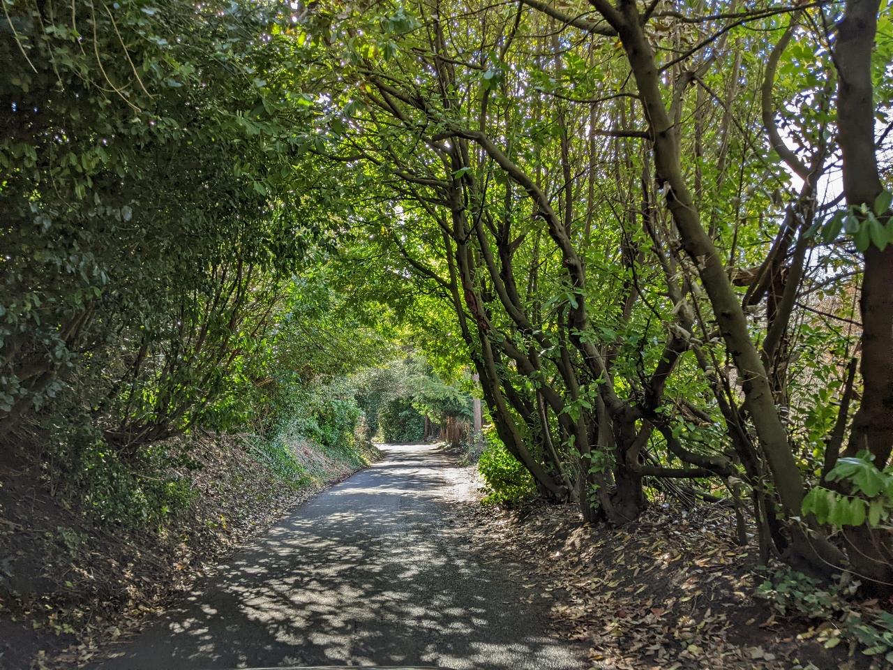 |
Bonair Drive
Position: 47°35.27’N, -122°23.57’W
Taking narrow and wooded Bonair Drive back down to sea level.
|
 |
Alki Beach
Position: 47°34.99’N, -122°24.09’W
Alki Beach is always busy at the least hint of sun. On a sunny summer weekend it can get really packed.
|
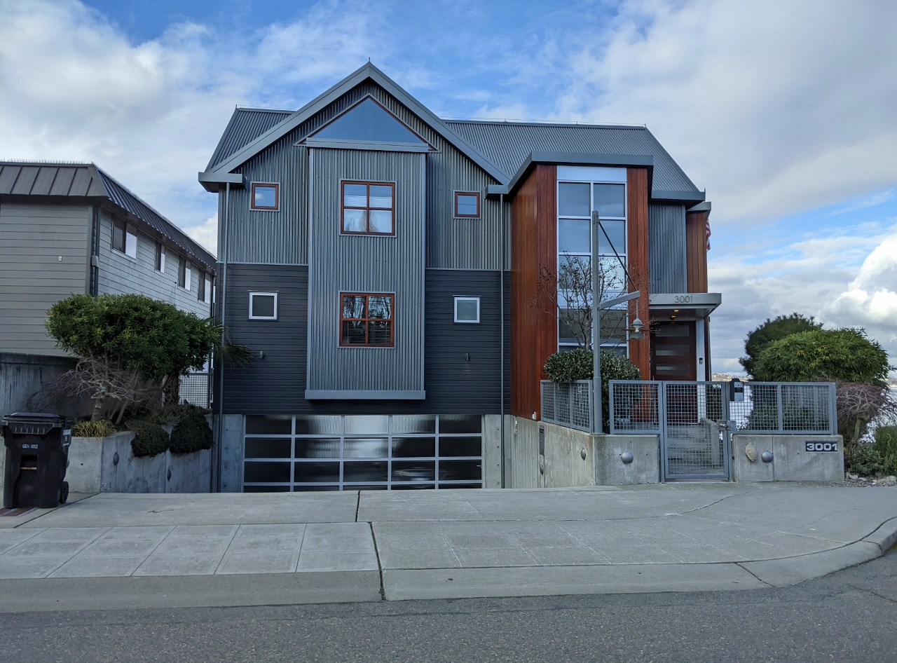 |
Alki Point
Position: 47°34.66’N, -122°24.95’W
One of many beautiful modern homes in the Alki Beach area, this one right on the beach.
|
 |
Alki Point Lighthouse
Position: 47°34.53’N, -122°25.15’W
The still-operational Alki Point Lighthouse was constructed in 1913 and automated in 1984. The original lightkeeper’s quarters now serve as the residence for the 13th District Commander, the most senior Coast Guard officer in the Pacific Northwest.
|
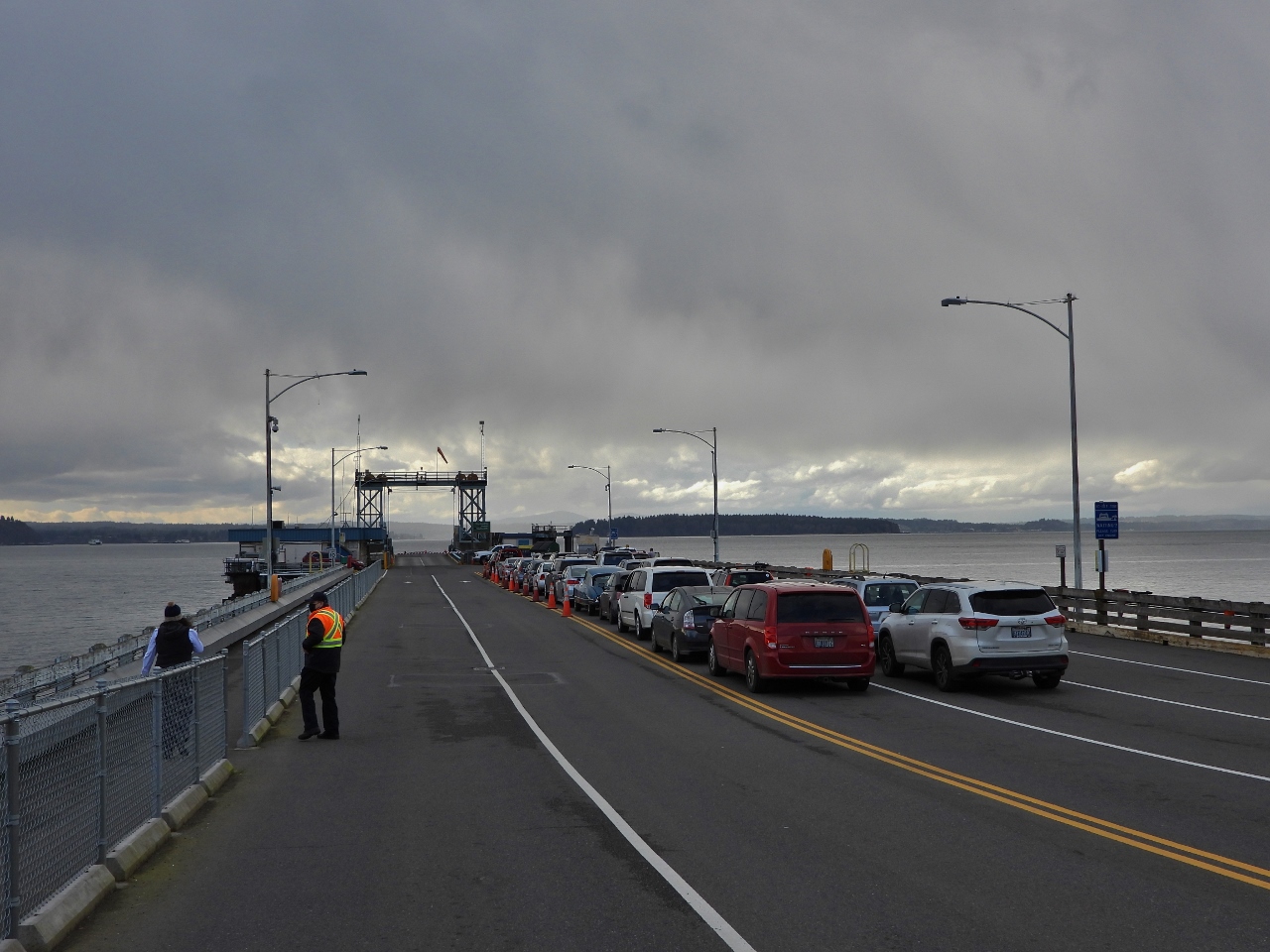 |
Fauntleroy
Position: 47°31.53’N, -122°23.57’W
Cars in line for the ferry from Fauntleroy to Southworth on Kitsap Peninsula and Vashon Island.
|
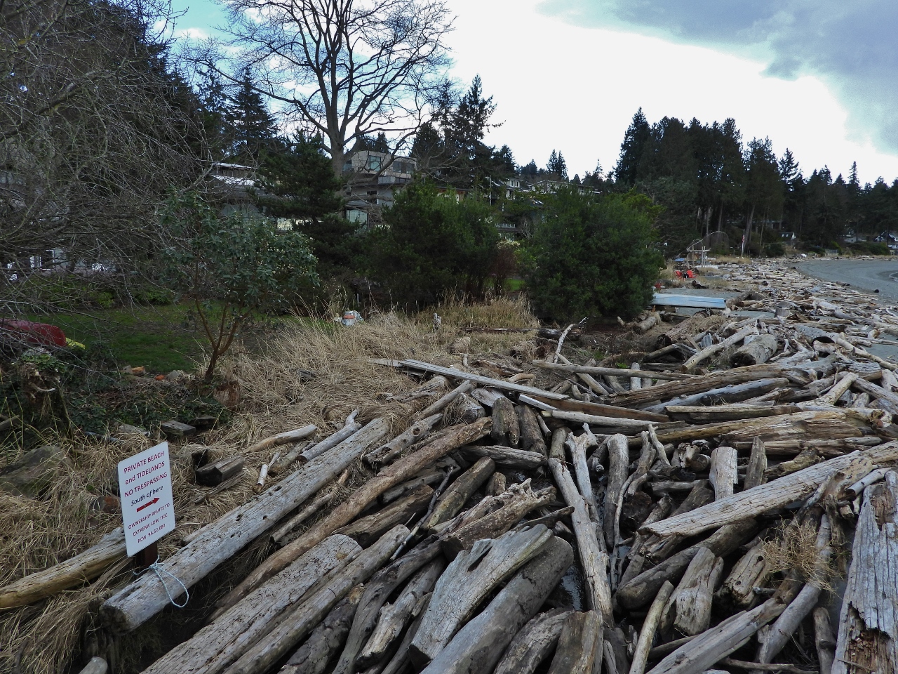 |
Driftwood
Position: 47°31.38’N, -122°23.60’W
Piles of driftwood thrown high on this beach near the Fauntleroy Ferry terminal indicate this area sees some reasonably large storm waves. The “No Trespassing” sign visible at left states that the beach and tidelands are privately owned to the extreme low tide level. Fortunately there is a tiny park with public access on the other side of the terminal.
|
 |
R.H. Fauntleroy
Position: 47°31.39’N, -122°23.65’W
Rock carving of the brig R.H. Fauntleroy at a small public beach at Fauntleroy Cove. Geographer George Davidson anchored here in 1857 in the brig he’d named for his future father-in-law Robert Henry Fauntleroy. Davidson continued this theme and named several area features after his family-to-be.
|
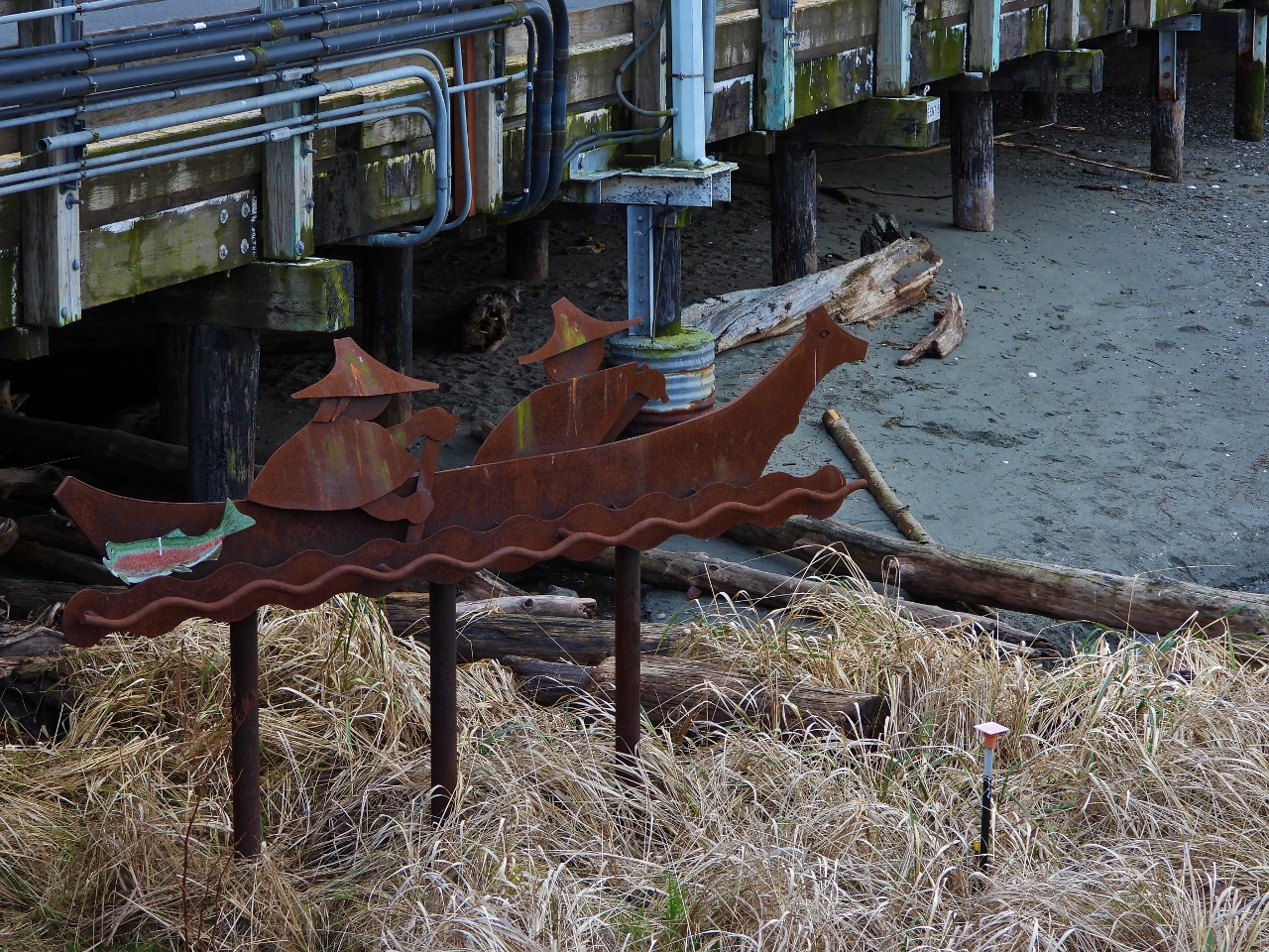 |
Sealing Canoe
Position: 47°31.39’N, -122°23.65’W
Northwest sculptor Tom Jay created this steel and copper sculpture at Fauntleroy Cove of a Nootka sealing canoe.
|
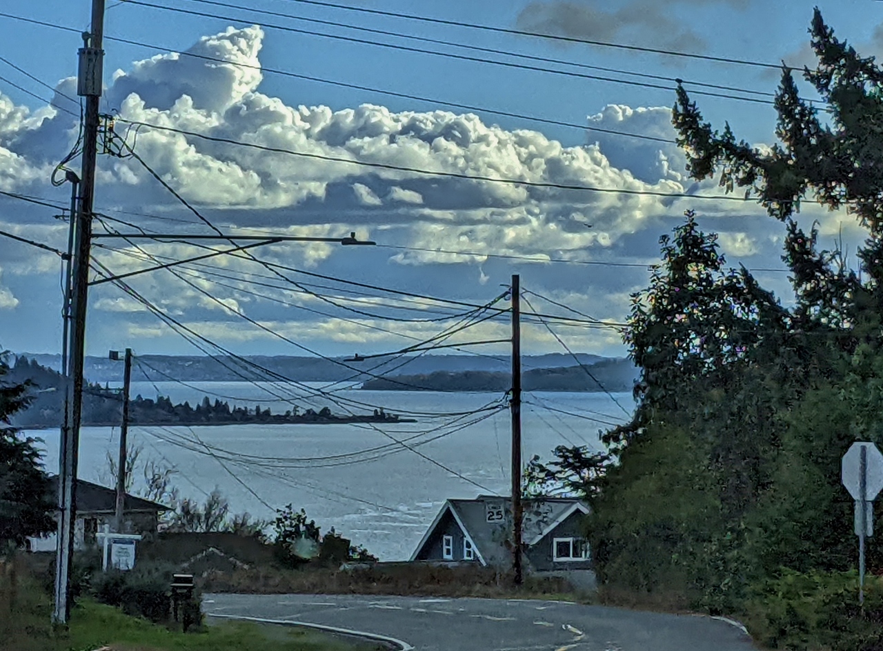 |
Three Tree Point
Position: 47°30.69’N, -122°23.40’W
View to Three Tree Point through a maze of wires as we descend along Marine View Drive. The point is a popular scuba-diving area—we dove here by car in the late 1990s.
|
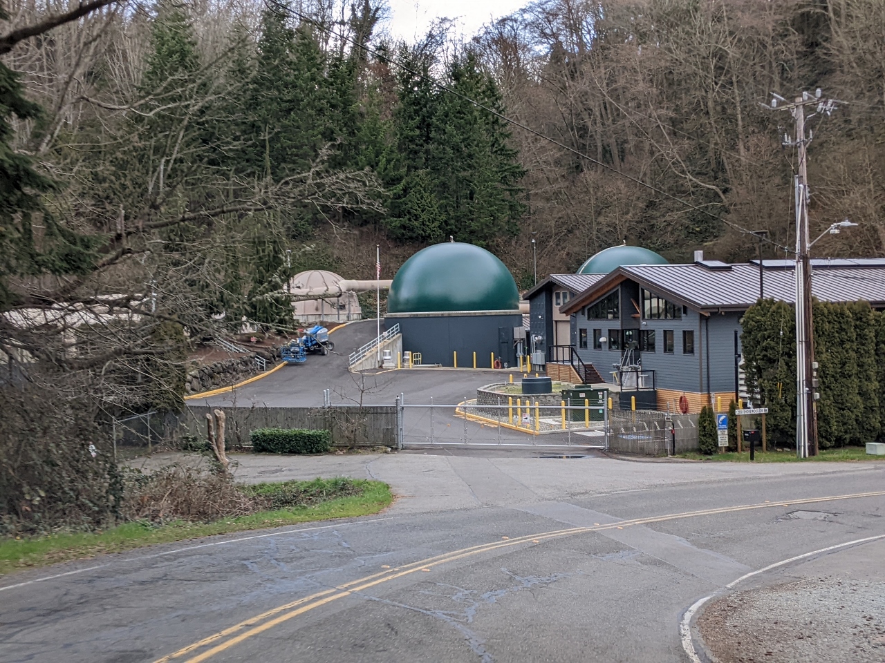 |
Treatment Plant
Position: 47°29.52’N, -122°21.81’W
The distinctive green bioreactors of Salmon Creek Treatment Plant has a capacity of 15 million gallons (68 million L), but typically treats a half to two-thirds that amount.
|
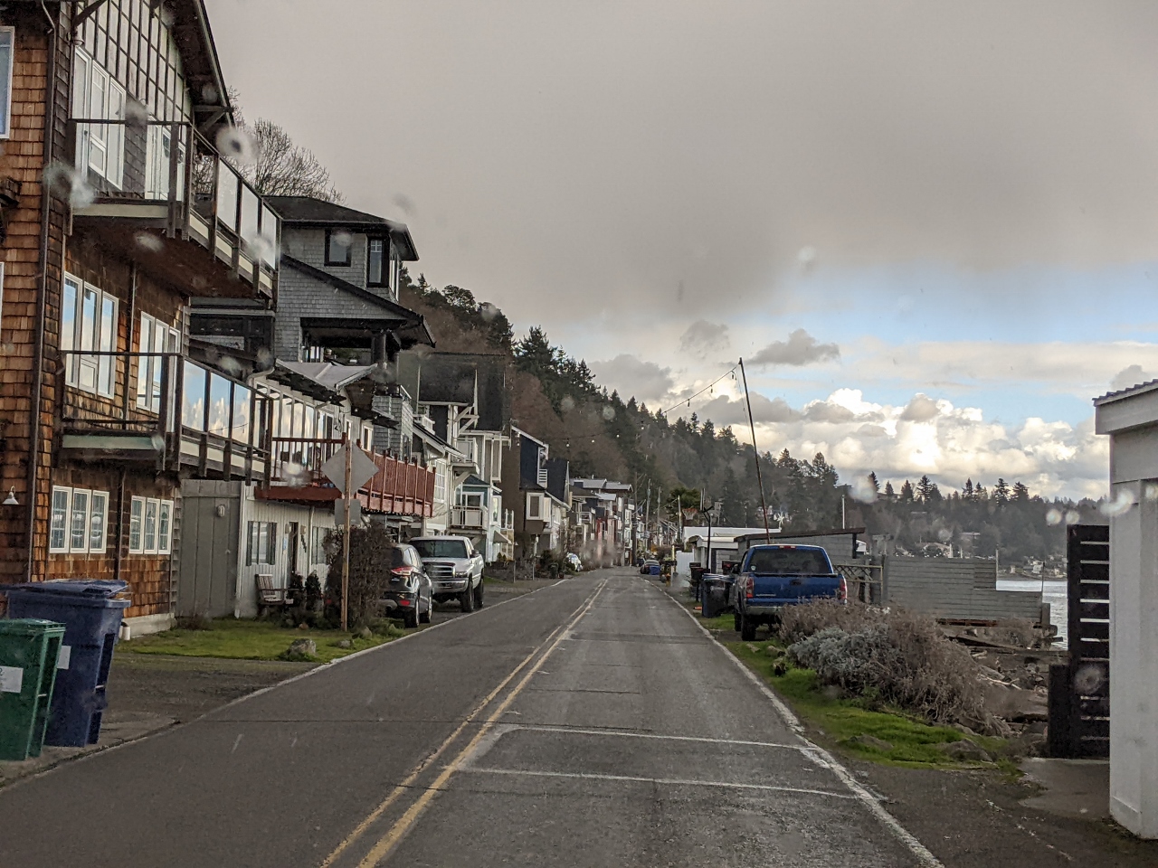 |
172nd Street
Position: 47°26.99’N, -122°22.60’W
When boating in the area, we frequently passed this distinctive community of waterfront houses crowded beneath a cliff south of Three Tree Point. Waterfront property is very popular.
|
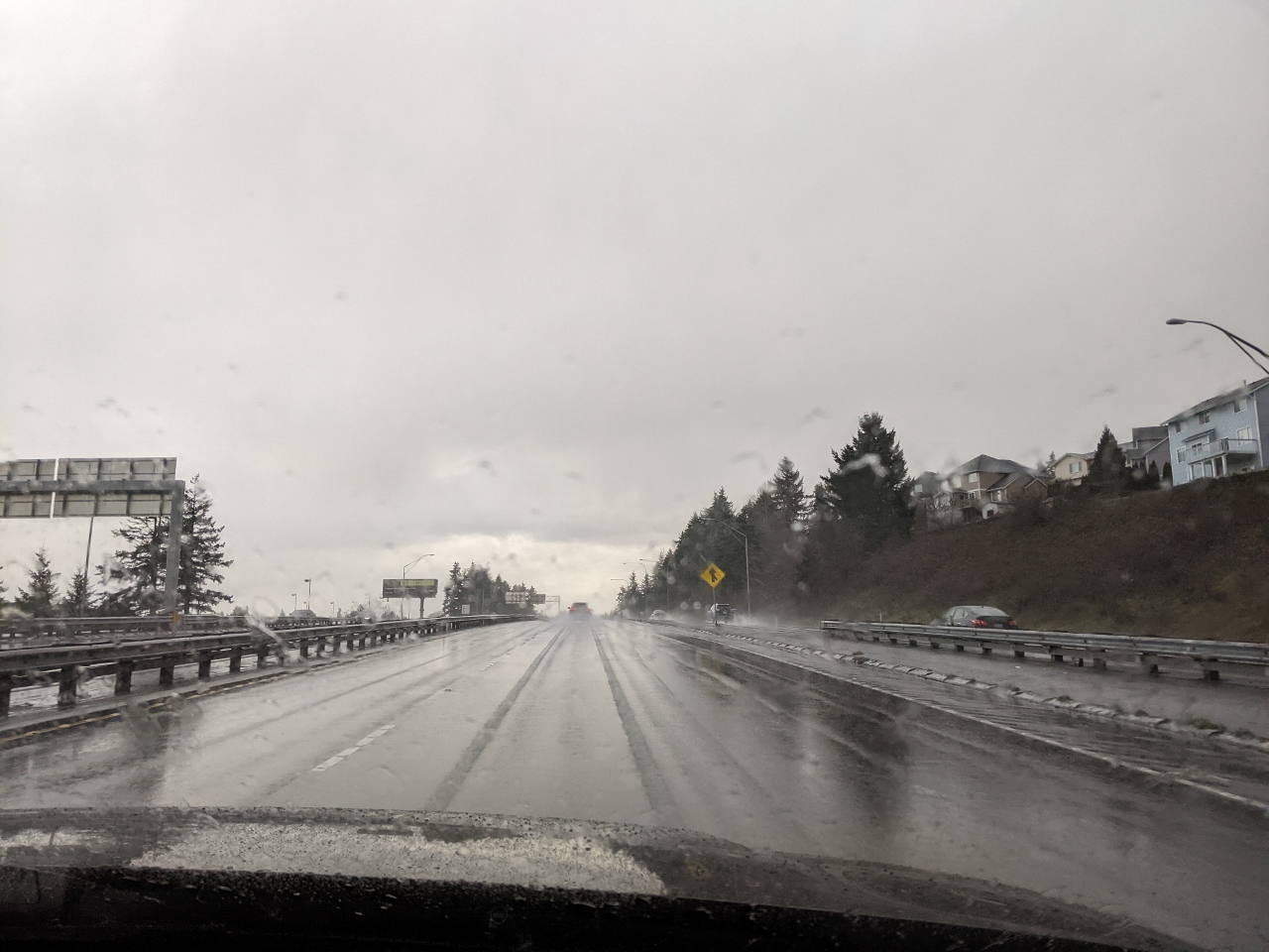 |
Rain
Position: 47°28.15’N, -122°19.91’W
The day’s nice weather ended just after we decided to return home.
|
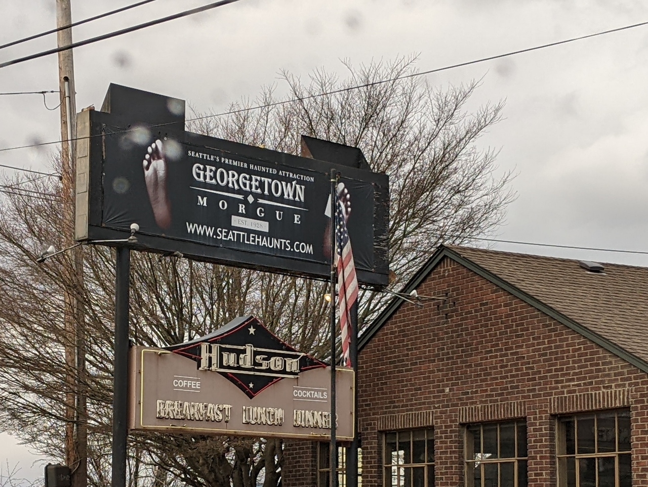 |
Georgetown Morgue
Position: 47°32.90’N, -122°20.05’W
The Georgetown Morgue is a haunted house attraction built into an old morgue in Seattle’s Georgetown neighborhood.
|
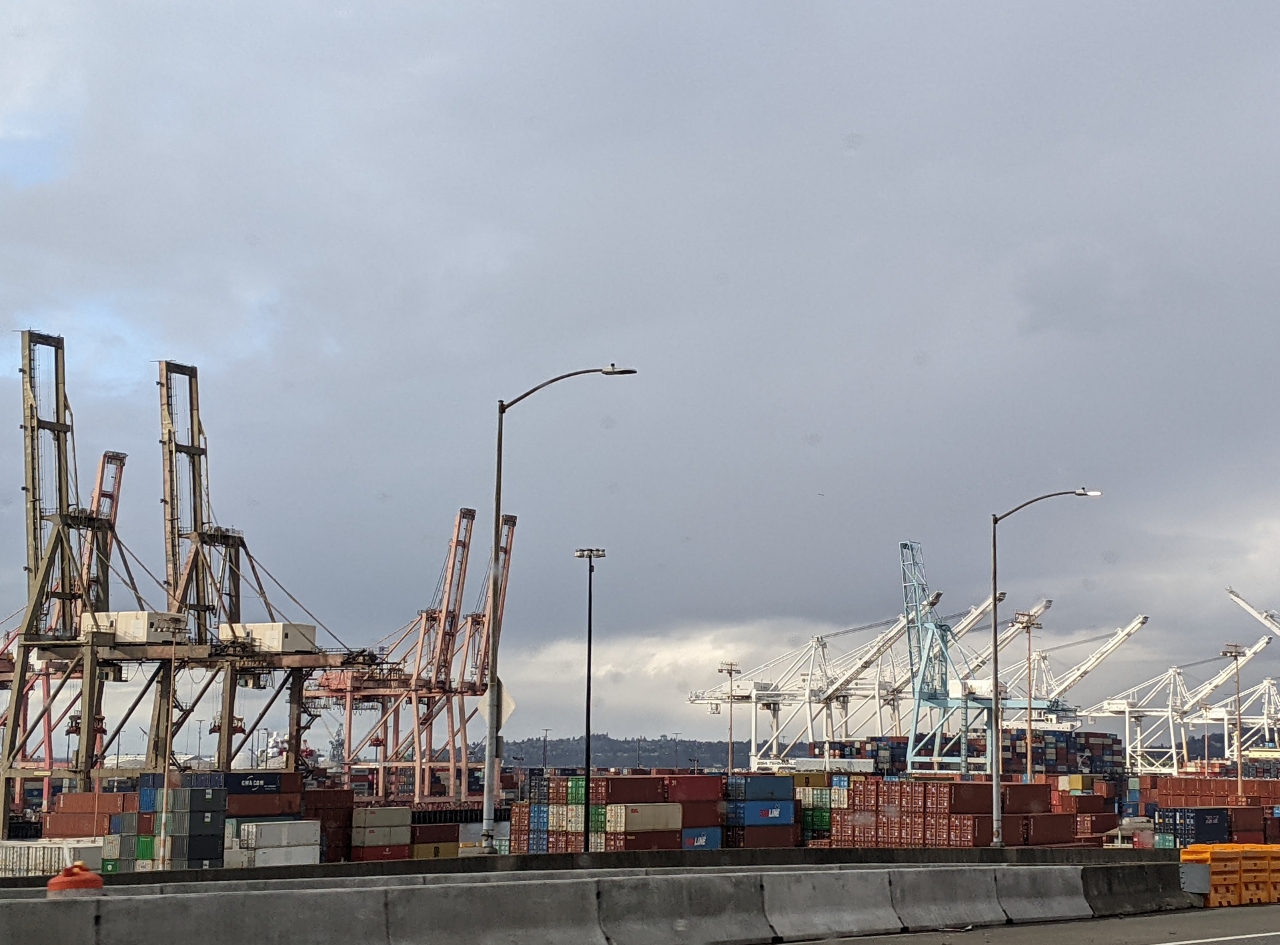 |
Port of Seattle
Position: 47°34.11’N, -122°20.36’W
Another view to the Port of Seattle from the elevated road on Washington State Route 99.
|
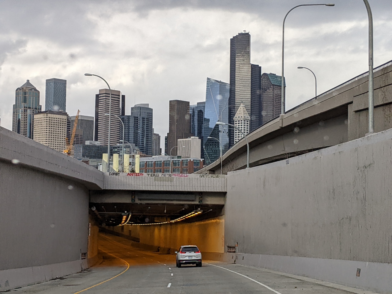 |
SR 99 Tunnel
Position: 47°34.95’N, -122°20.36’W
Our first time driving through the new SR 99 tunnel, completed in 2019. The double-decker tunnel replaced the Alaskan Way Viaduct that deemed at risk of collapsing in the next major earthquake. The six-year construction project began in 2013, using what was then the largest diameter tunnel-boring machine in the world at 57.5-foot-diameter (17.5 m). Norway seems able to crank out tunnels like this in mere weeks.
|
 |
1,207 Miles
Position: 47°37.00’N, -122°20.55’W
We’ve already put 1,207 miles on our new car in less than a month. That doesn’t seem like much, except we only use it on weekends.
|
 |
Click the travel log icon on the left to see these locations on a map. And a map of our most recent log entries always is available at mvdirona.com/maps. |
If your comment doesn't show up right away, send us email and we'll dredge it out of the spam filter.