Santa Barbara, CA is a popular tourism destination, with the Pacific Ocean on one side and the steeply rising Santa Ynez Mountains on the other. The city has excellent restaurants and accommodations, wonderful hiking in the mountains, and water activities in the offshore Channel Islands.
Those are sufficient enough attractions for us to go, but our main reason for visiting was a long-overdue gathering of the Hamilton clan. It’s been ages since we all were together, and we spent had a wonderful few days there, enjoying hiking and meals in the wonderfully warm climate.
Below are highlights from February 27th through March 2nd, 2022. Click any image for a larger view, or click the position to view the location on a map. And a map with our most recent log entries always is available at mvdirona.com/maps.
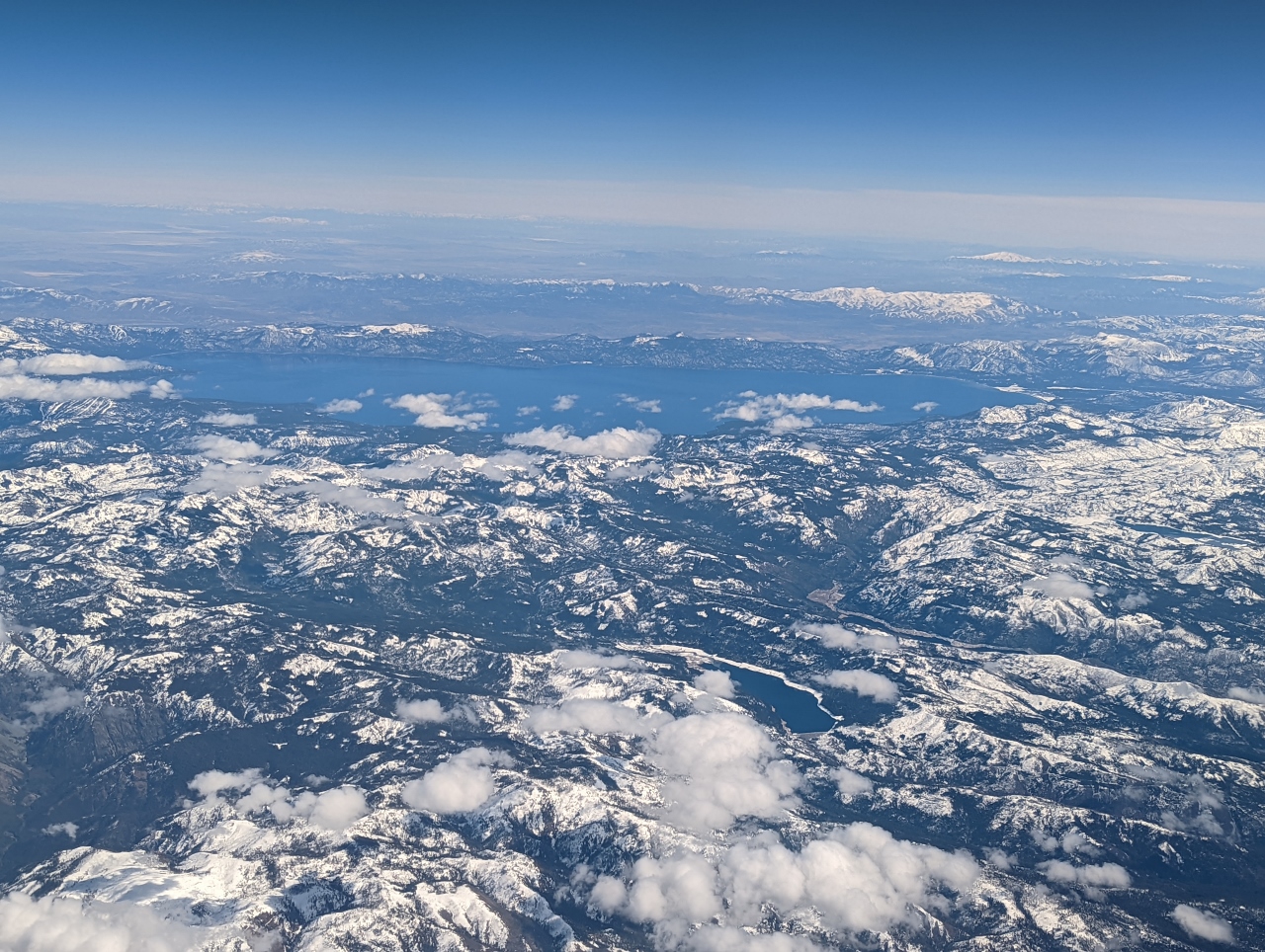 |
Cascades
Position: 43°33.66’N, -121°28.49’W
Flying over the Cascade Range near Crescent, WA en route to Santa Barbara
|
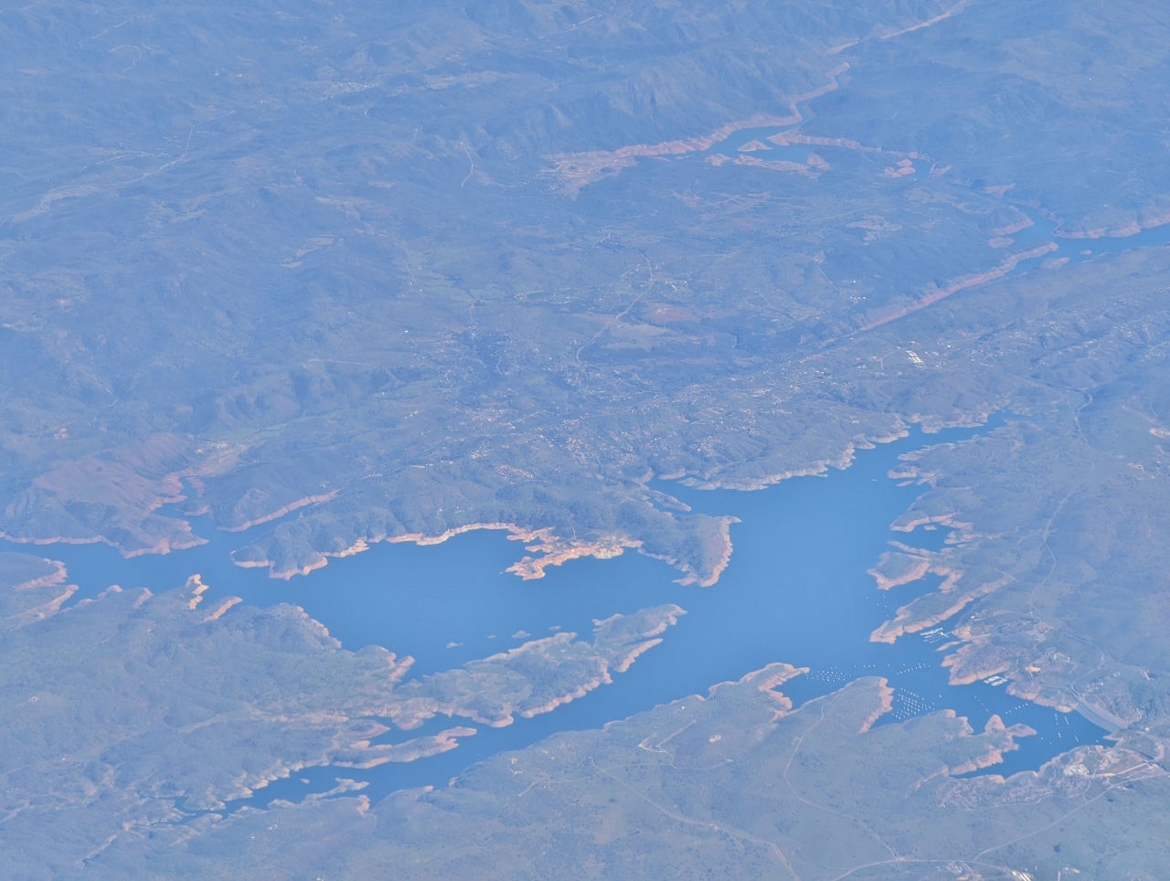 |
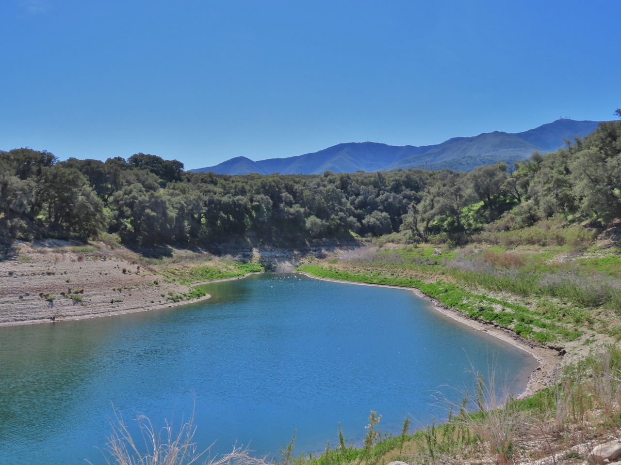
Don Pedro Lake
Position: 37°47.74’N, -120°40.33’W
Don Pedro Reservoir in the foothills of the Sierra Nevada mountain range. The reservoir, created in 1923 with the Don Pedro Dam, is the 7th largest in California with a capacity for 2,030,000 acre-ft (2.50 km3).
|
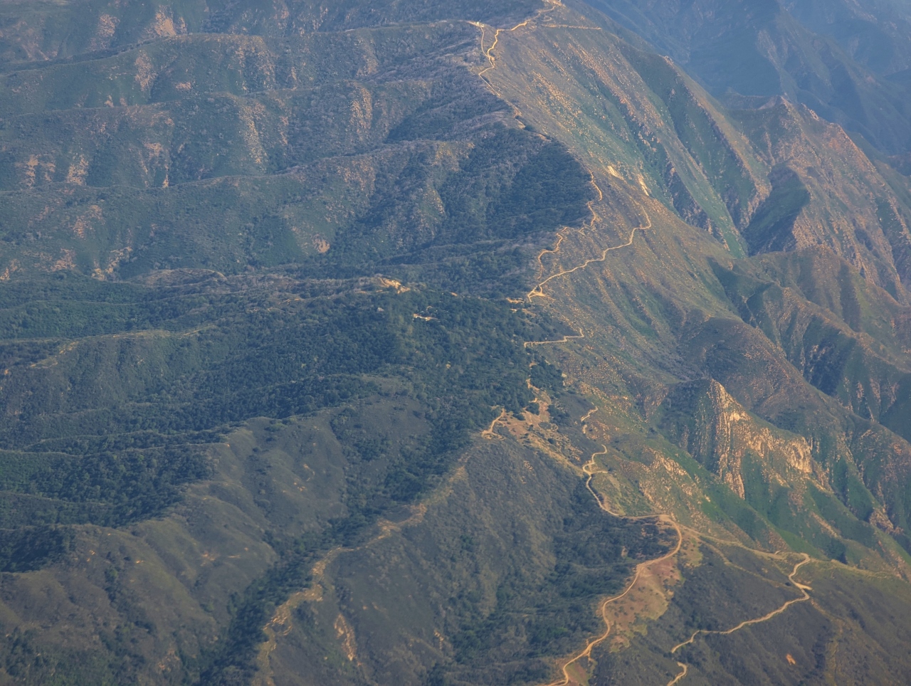 |
Santa Ynez Mountains
Position: 34°37.48’N, -120°6.23’W
The steeply-sloped Santa Ynez Mountains just outside Santa Barbara. The highest peak in the range is Divide Peak at 4,707 ft (1,435 m).
|
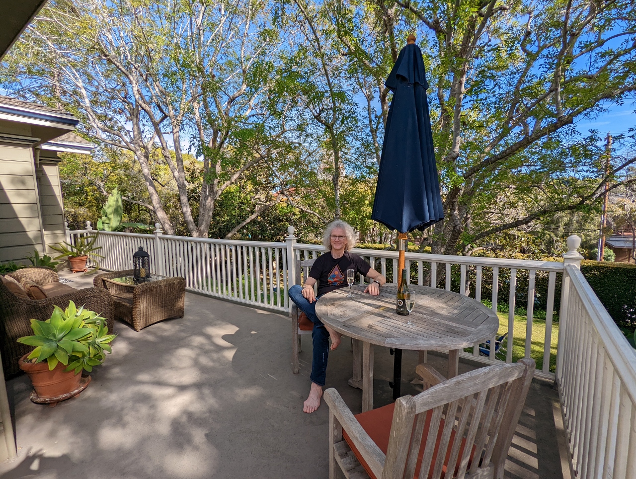 |
Simpson House Inn
Position: 34°25.73’N, -119°42.48’W
The fabulous wrap-around deck in our room at the Simpson House Inn in Santa Barbara. And there’s even more deck behind the camera.
|
|
|
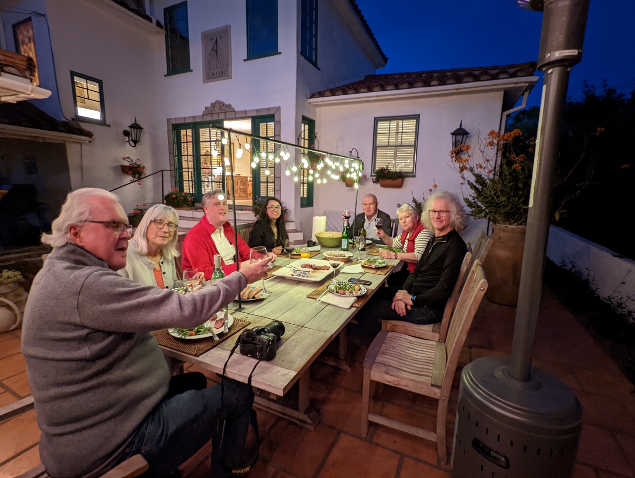
Hamiltons
Position: 34°26.03’N, -119°43.23’W
A long-overdue gathering of the Hamilton clan at a rented house in Santa Barbara. Clockwise from left is James’ uncle Neil and his wife Jackie, James’ cousin Ian and his wife Uzma, and James’ uncle Gord and his wife Karen. Neil and Jackie, who visited with us a few months back, live in Victoria, Canada and the rest are from Ottawa. It’s been ages since we all gathered together, and we had a wonderful evening.
|
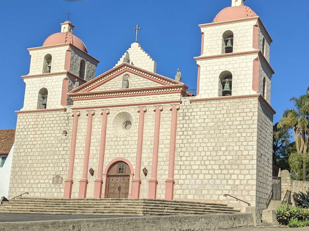 |
Old Mission
Position: 34°26.30’N, -119°42.76’W
The capilla (chapel) of the Old Mission Santa Barbara, founded in 1786.
|
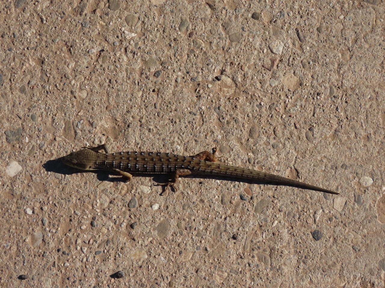 |
Western Fence Lizard
Position: 34°27.88’N, -119°42.77’W
The Western Fence Lizard also is known as “Blue Belly” for its distinctive blue markings.
|
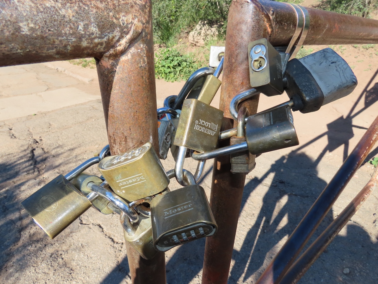 |
Locks
Position: 34°27.90’N, -119°42.75’W
A multitude of interconnected padlocks on the gate before the service road leading to the Inspiration Point trailhead in Los Padres National Forest,
|
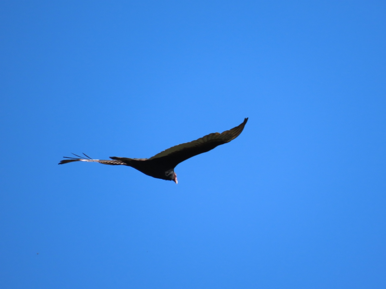 |
Turkey Vulture
Position: 34°27.91’N, -119°42.73’W
Turkey Vulture scanning for a meal above Los Padres National Forest.
|
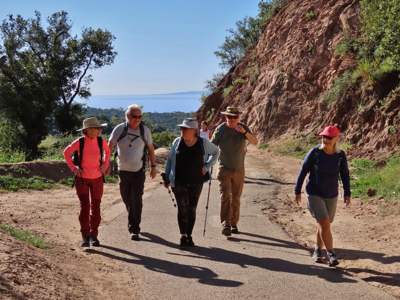 |
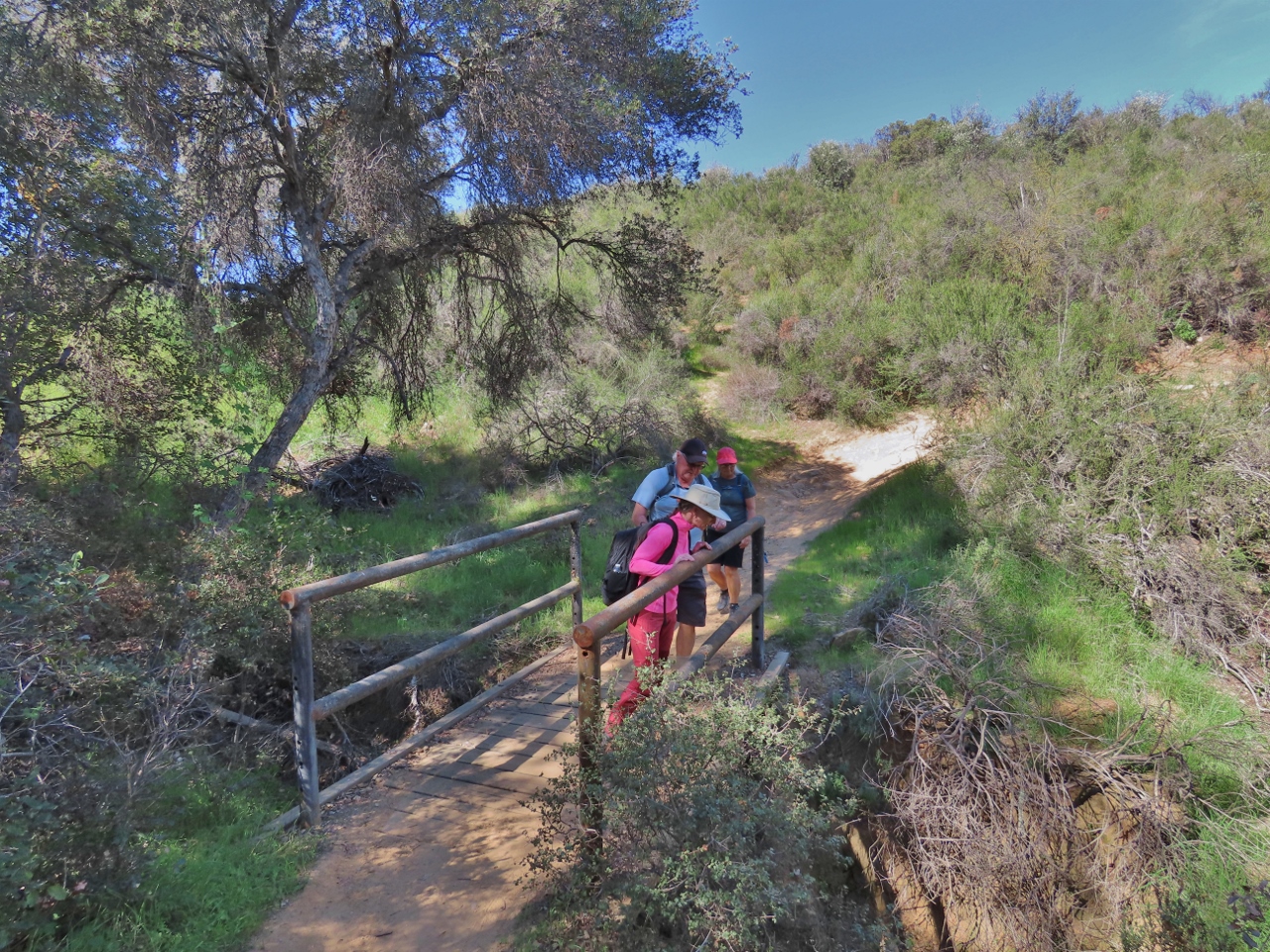
Tunnel Trail
Position: 34°27.94’N, -119°42.67’W
The Hamiltons walking up the Tunnel Trail to Inspiration Point near Santa Barbara, with the Pacific Ocean visible in the distance.
|
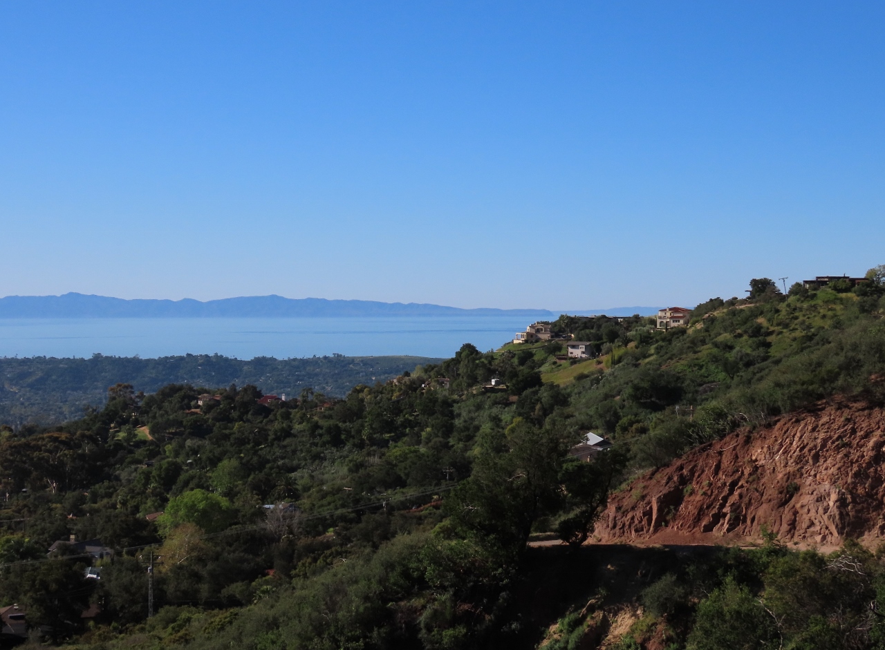 |
Mission Canyon
Position: 34°28.01’N, -119°42.68’W
Wonderful view west across Mission Canyon from the Tunnel Trail at elevation 971 ft (296 m).
|
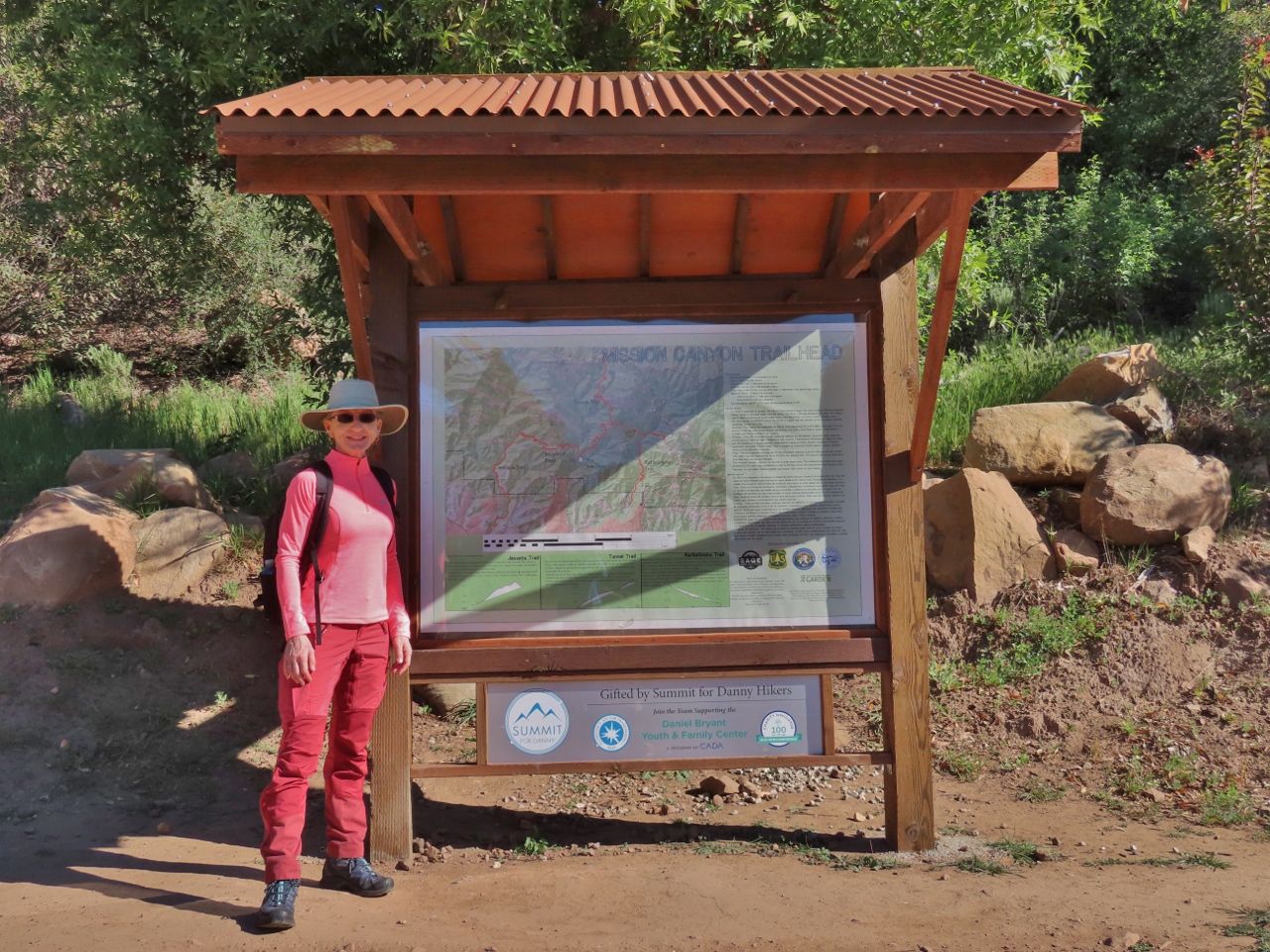 |
Trailhead
Position: 34°28.24’N, -119°42.41’W
The junction of the Tunnel and Jesusita trails as elevation 1,133 ft (345 m).
|
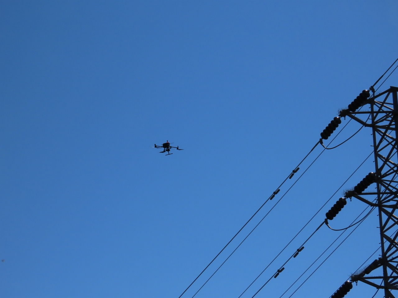 |
Drone
Position: 34°28.37’N, -119°42.71’W
This drone was holding place above some high-tension power lines for quite some time. This seems a common and efficient way to inspect the lines, as we saw in the Belden Powerhouse in Feather River Canyon, CA.
|
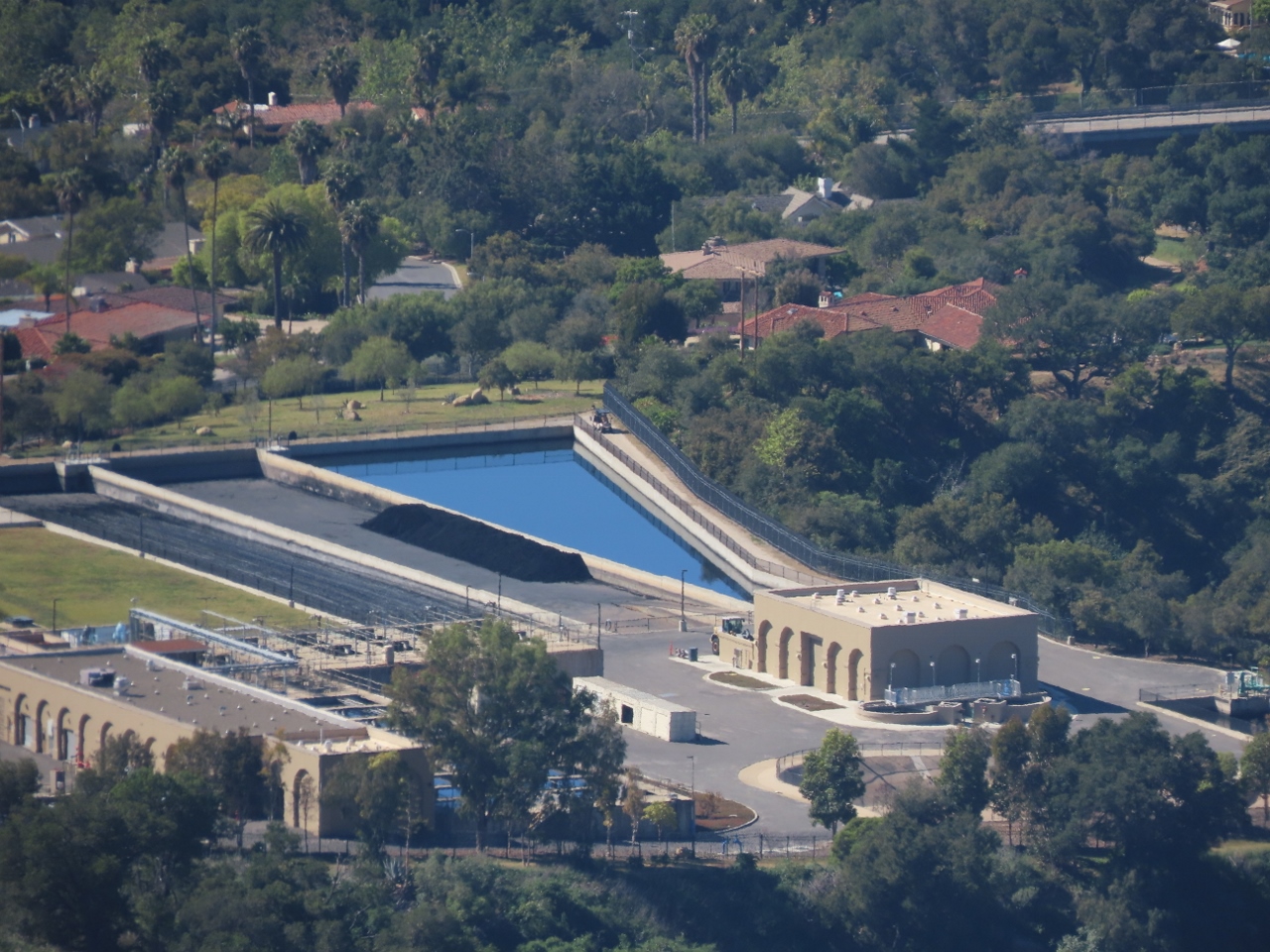 |
Cater Water Treatment Plant
Position: 34°28.33’N, -119°42.85’W
The Cater Water Treatment Plant viewed from the trail to Inspiration Point. Until recently, the facility provided most of the drinking water for Santa Barbara. In 2017, a desalination plant came online that produces about 30% of the supply.
|
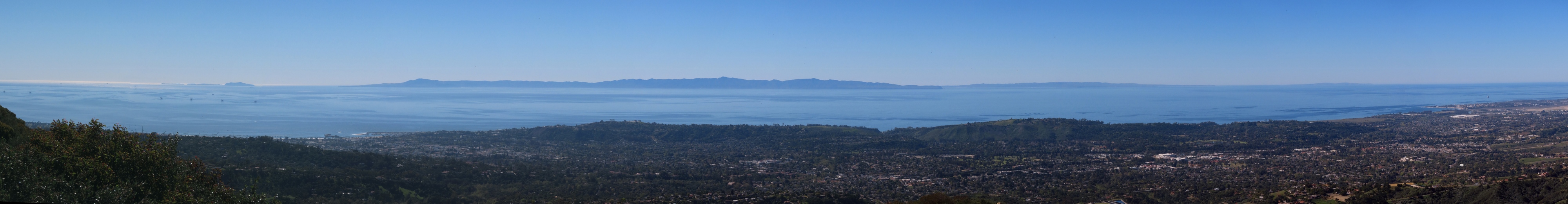 |
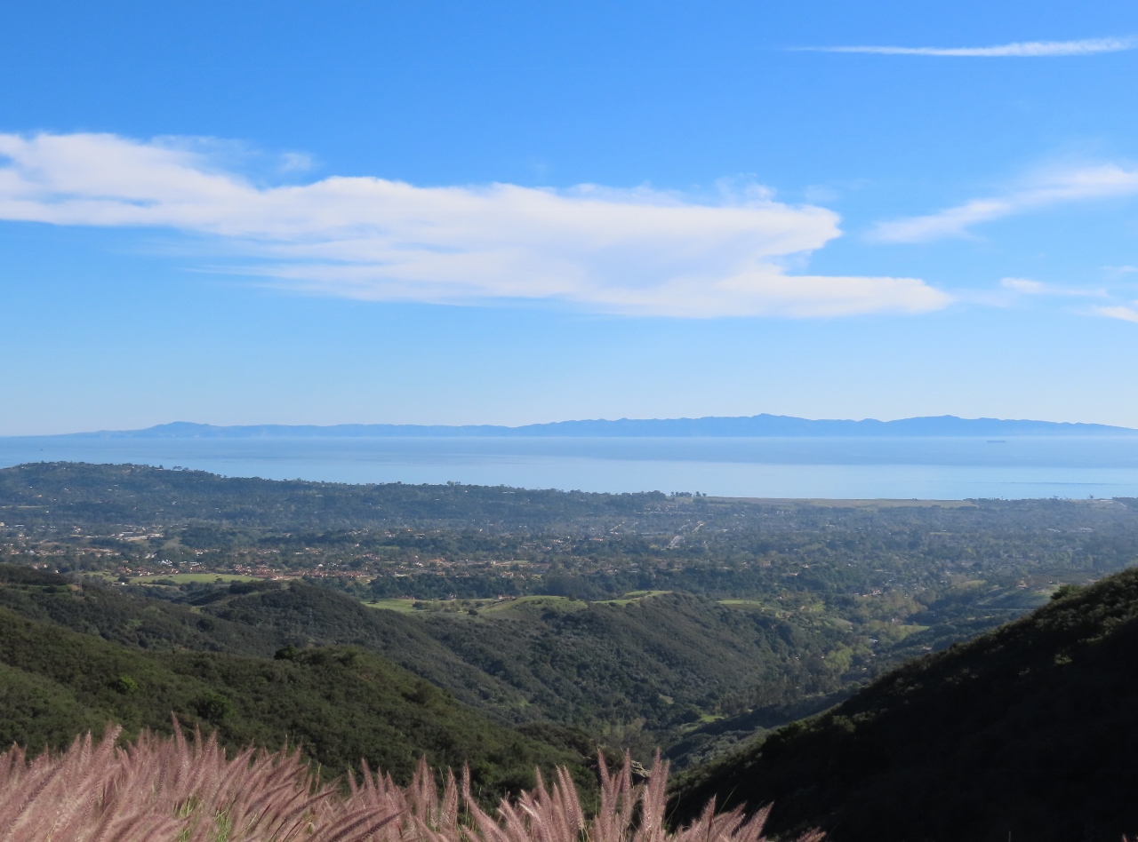
Inspiration Point
Position: 34°28.33’N, -119°42.85’W
Sweeping view across Santa Barbara to the Pacific Ocean from Inspiration Point at altitude 1713ft, 522m. The large island visible in the distance is Santa Cruz Island, part of California’s Channel Islands (click image for a larger view).
|
 |
Oil Rigs
Position: 34°28.32’N, -119°42.86’W
One of several oil/gas rigs along the Santa Barbara coast. Offshore drilling began in California in 1896 and currently provides about 16% of California’s petroleum production.
|
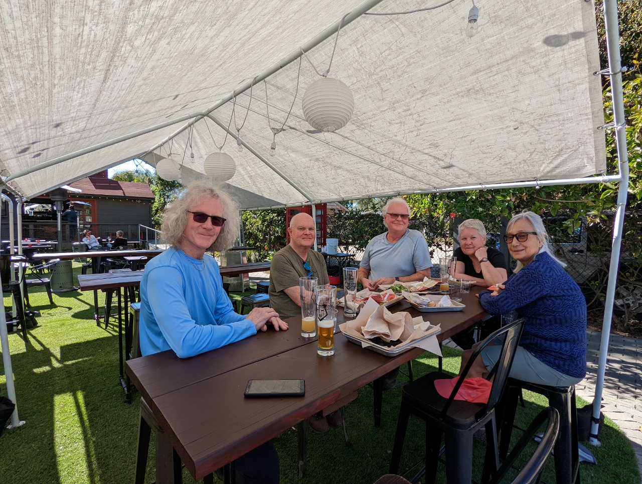 |
Brass Bear
Position: 34°24.86’N, -119°41.30’W
A delicious meal on the patio at Brass Bear Brewing and Bistro in Santa Barbara.
|
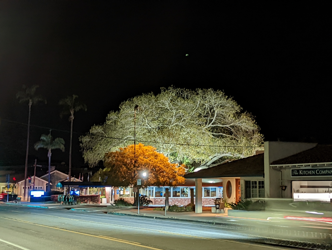 |
Tree
Position: 34°25.73’N, -119°42.70’W
A huge Morton Bay Fig Tree in Santa Barbara, lit up wonderfully at night. The building in the foreground is a restaurant that is built around the tree.
|
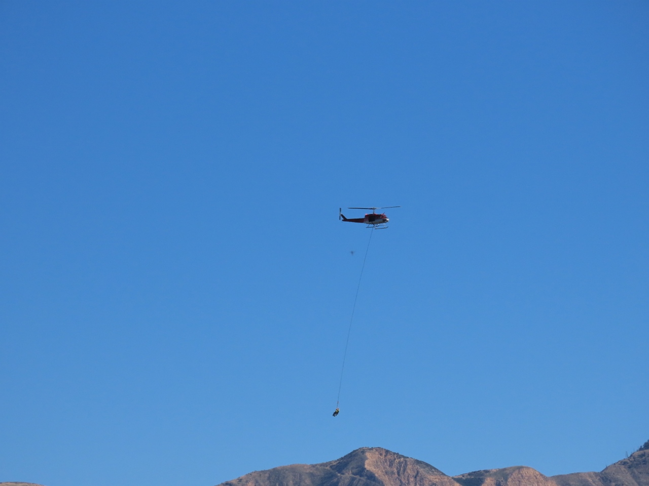 |
Helicopter
Position: 34°31.63’N, -119°50.16’W
Helicopter crossing Cold Spring Canyon with two people suspended far below. It’s a bit edgy for a tourist ride, so probably they are inspecting or installing something in a remote location.
|
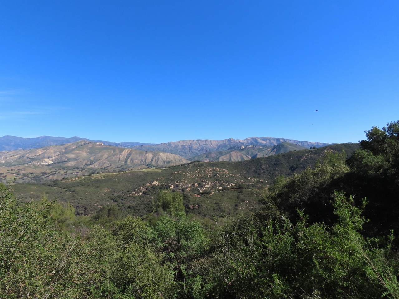 |
Cold Spring Canyon
Position: 34°31.63’N, -119°50.16’W
Great view across Cold Spring Canyon to the mountains of Los Padres National Forest en route to a hike around Lake Cachuma.
|
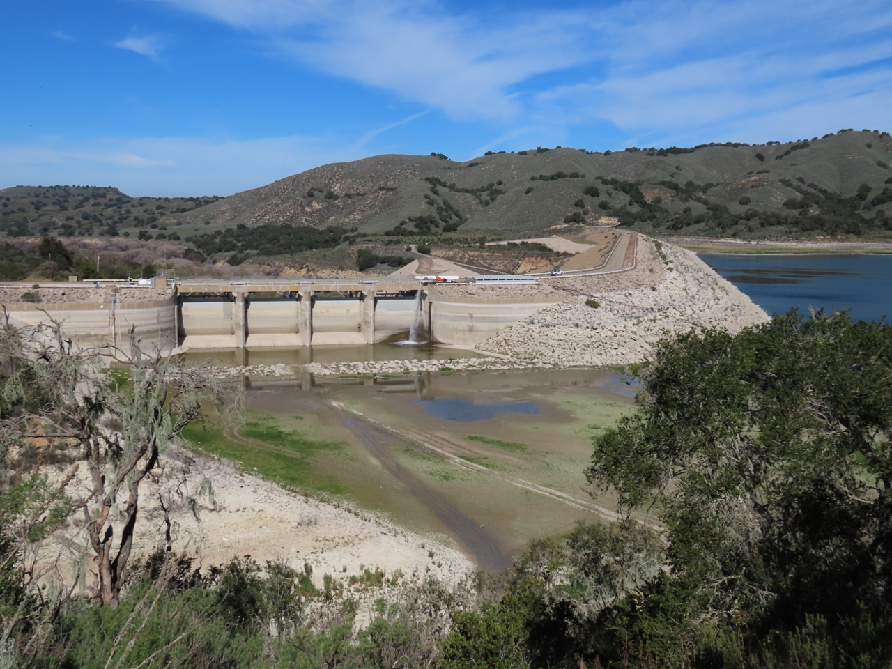 |
Bradbury Dam
Position: 34°34.85’N, -119°58.72’W
Bradbury Dam across the Santa Ynez River was completed in 1953 and forms Lake Cachuma, a popular recreation area. With recent dry weather, the lake is at 50% capacity and 40 ft below spilling level.
|
 |
Saltwater Creek
Position: 34°34.82’N, -119°58.40’W
The view west from the Sweetwater Trail alongside Lake Cachuma across the mouth of Saltwater Creek where it enters the lake. In the background are the Santa Ynez Mountains that we saw on our flight into Santa Barbara.
|
 |
Bridge
Position: 34°34.62’N, -119°58.44’W
Looking for flow from the bridge over Saltwater Creek. It’s pretty dry right now.
|
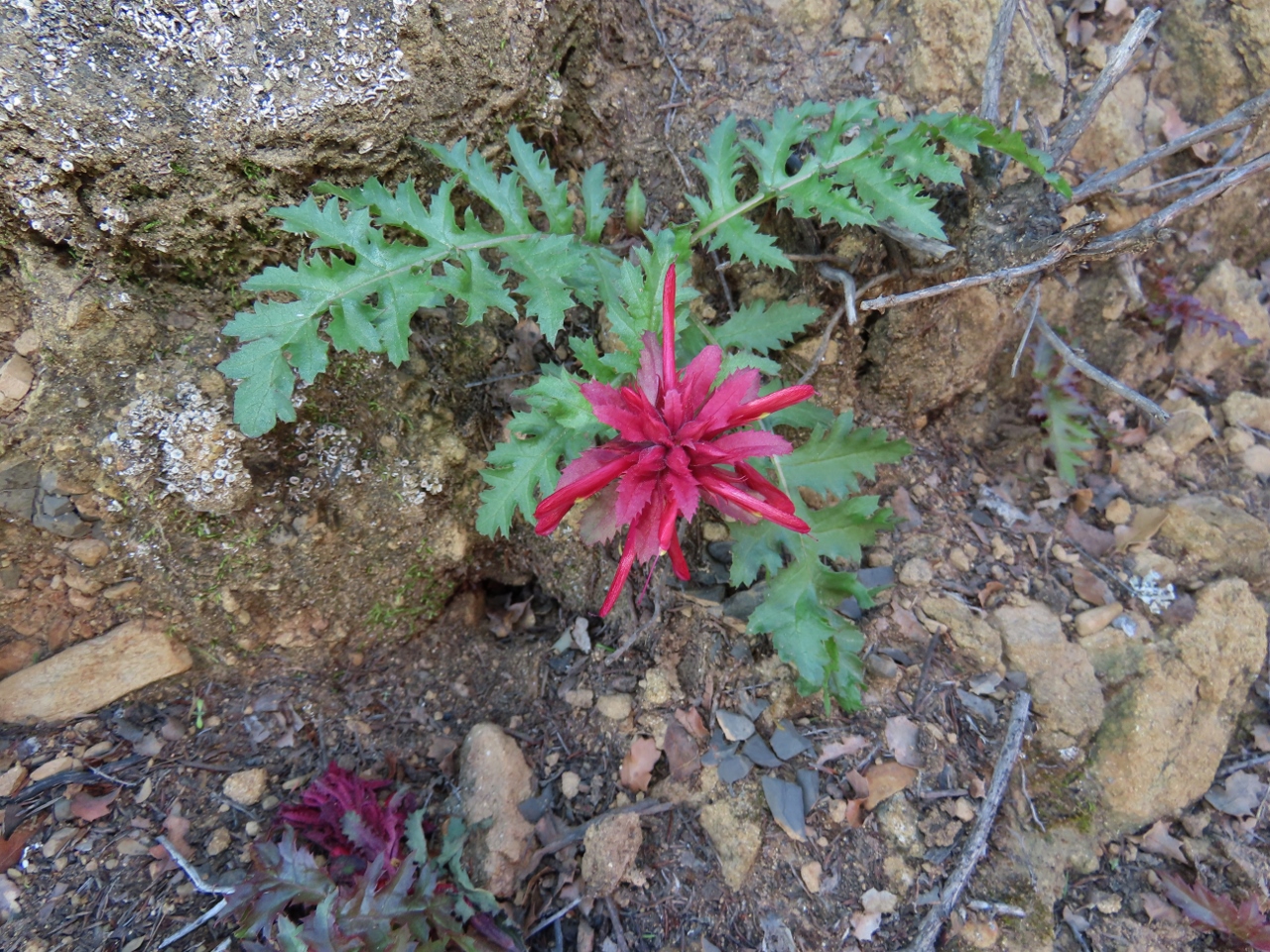 |
Indian Warrior
Position: 34°34.55’N, -119°58.13’W
The bright pink petals of an Indian Warrior, a plant native to California and Oregon.
|
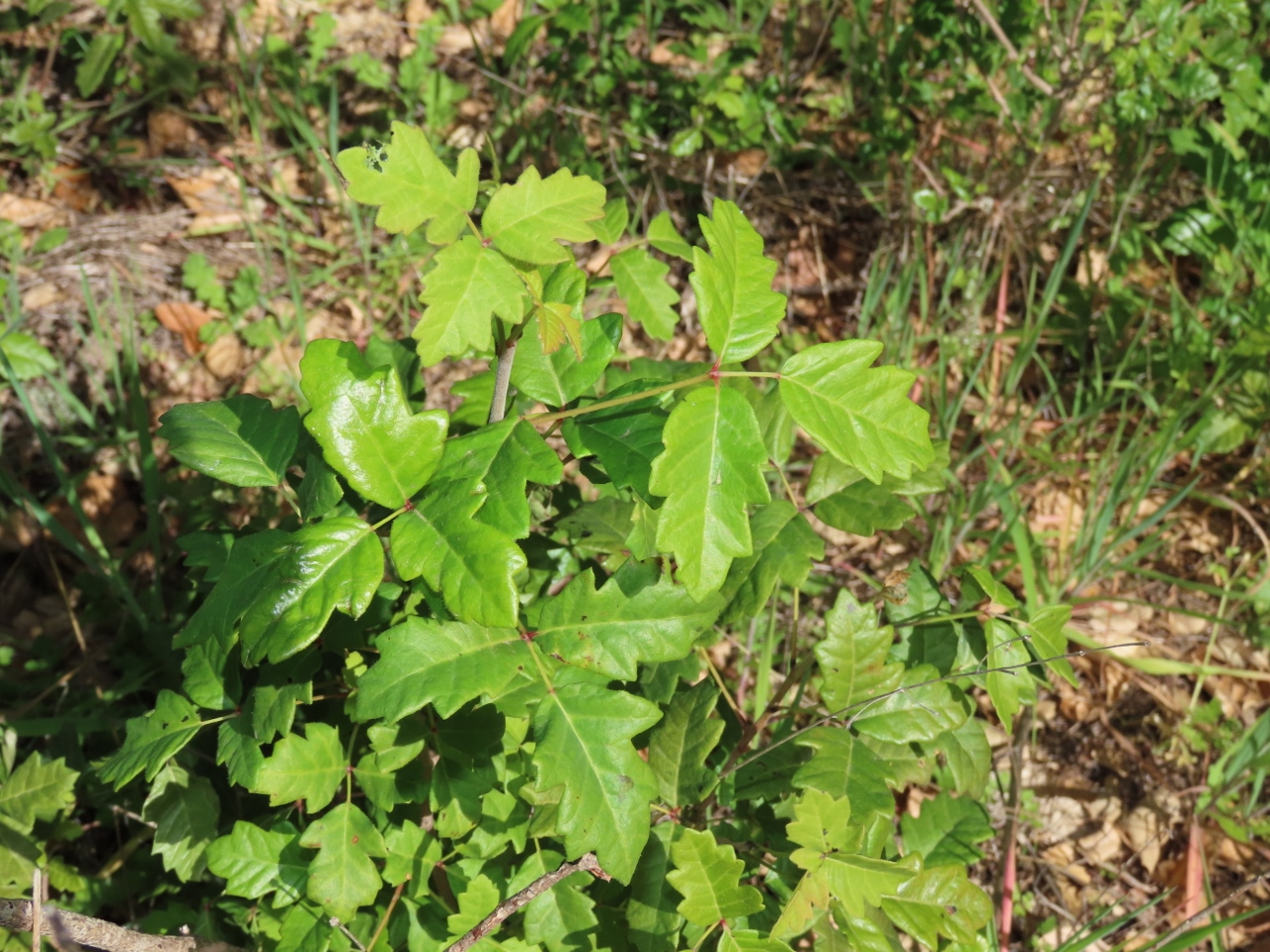 |
Poison Oak
Position: 34°34.65’N, -119°57.90’W
We saw a warning at the trailhead warning of Poison Oak and Jackie found some (from a distance) off the trail.
|
 |
Dock
Position: 34°34.53’N, -119°57.83’W
A very high-and-dry dock on Lake Cachuma. The Santa Ynez River that feeds it can flow a torrent in the winter and dry up completely in the summer. But we’re still in the rainy season right now, so this scene doesn’t bode well for the summer.
|
 |
San Marcos Pass
Position: 34°29.73’N, -119°48.04’W
The view to Santa Barbara and the Pacific Ocean from the San Marcos Pass at elevation 1,398 ft (426 m).
|
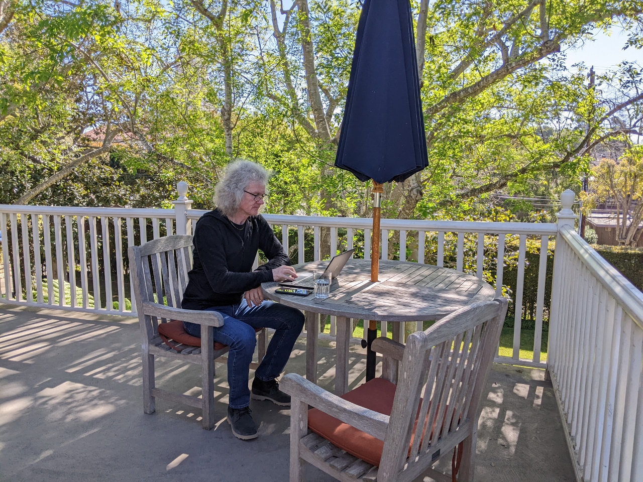 |
The Office
Position: 34°25.74’N, -119°42.48’W
James getting a little work done from the wonderful deck off our room at the Simpson House Inn in Santa Barbara.
|
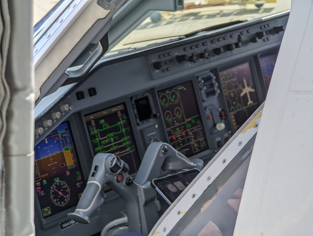 |
Cockpit
Position: 34°25.50’N, -119°50.20’W
View through the open window to the cockpit of the Embraer ERJ 175 that we’ll be taking back from Santa Barbara back to Seattle.
|
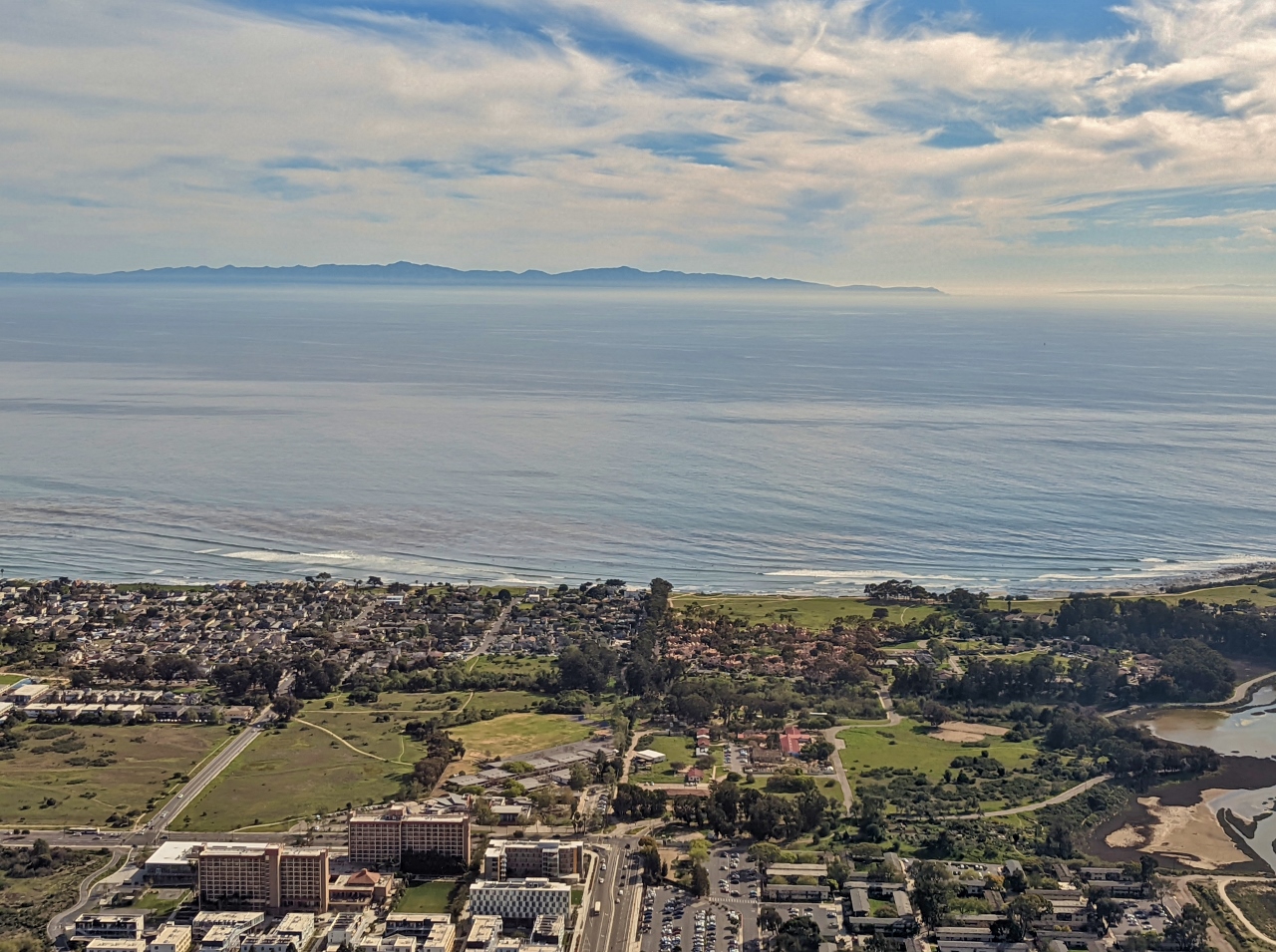 |
Taking Off
Position: 34°25.63’N, -119°52.06’W
A final view to Santa Barbara after take-off. We really enjoyed our brief time in the city and likely would return to explore more of the area.
|
 |
Click the travel log icon on the left to see these locations on a map. And a map of our most recent log entries always is available at mvdirona.com/maps. |
If your comment doesn't show up right away, send us email and we'll dredge it out of the spam filter.