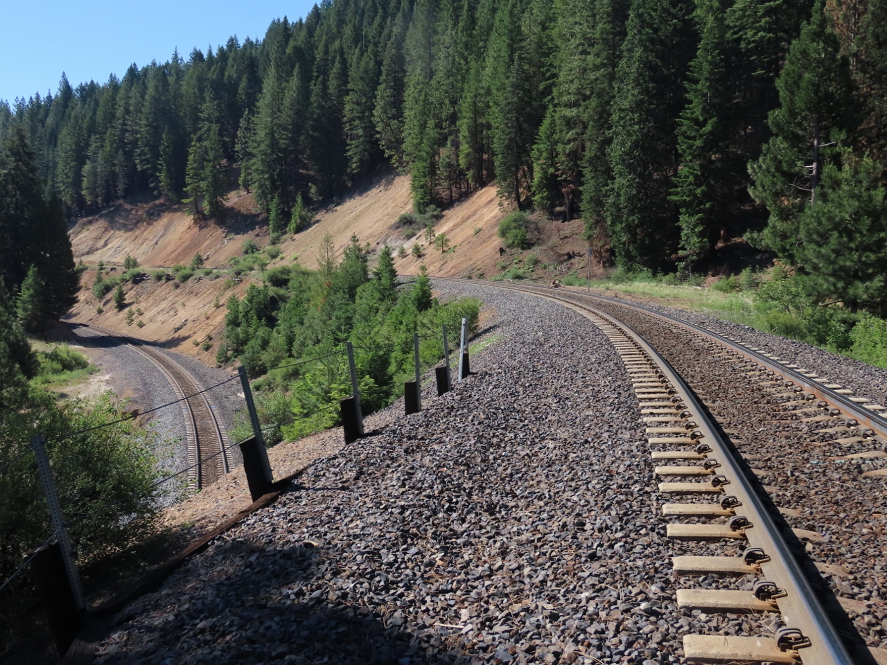
For our route from Reno to the Pacific Coast, we took the lesser-traveled Highway 70 along the historic Feather River Canyon route of the Union Pacific Railroad. This trip includes unique and dramatic early 20th-century railway architecture, such as the Williams Loop, where the track loops back over itself in a 1-mile descending turn, and the Pulga bridges, pictured above, where a 680-ft road bridge passes over a railway bridge 220ft below. The route also passes through the “Stairway of Power”, where water flowing through the Feather River is used over and over by successive power stations until it flows undiminished further downstream.
Longtime blog reader Jacques Vuye suggested the trip, and we really enjoyed it. This was the latest of several excellent railroad-related and other attractions he has recommended as we travel the world, particularly Flamsbana in Norway and the West Coast Wilderness Railway in Tasmania.
The 346-mile (556-km) drive from Reno, NV to Fort Bragg, CA via the Feather River Canyon brought our total trip mileage to 4,133 miles (6,651 km) across 12 states (South Carolina, Georgia, Florida, Alabama, Mississippi, Louisiana, Texas, New Mexico, Arizona, Utah, Nevada, and California).
Below are highlights from June 29th, 2021. Click any image for a larger view, or click the position to view the location on a map. And a live map of our current route and most recent log entries always is available at mvdirona.com/maps.
 |
California
Position: 39°41.75’N, -120°1.47’W
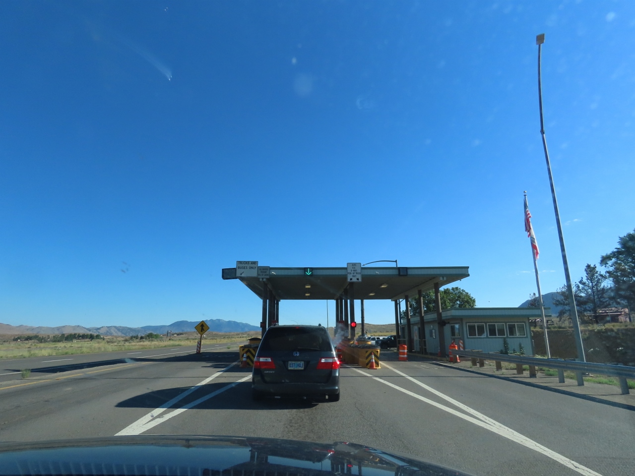
Agriculture inspection station shortly after we leave Nevada for California, the 12th state on our trip (the others are South Carolina, Georgia, Florida, Alabama, Mississippi, Louisiana, Texas, New Mexico, Arizona, Utah, and Nevada).
|
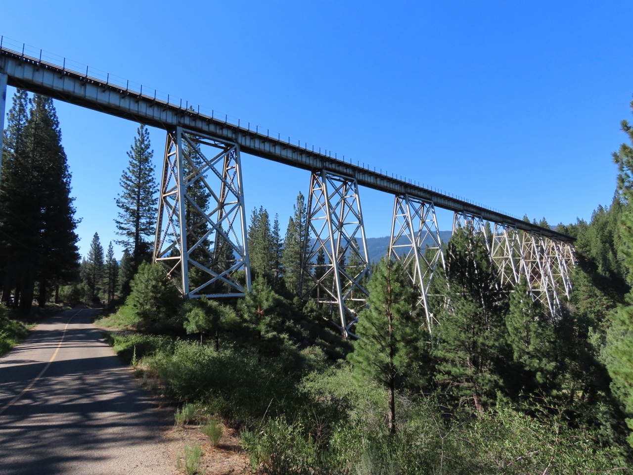 |
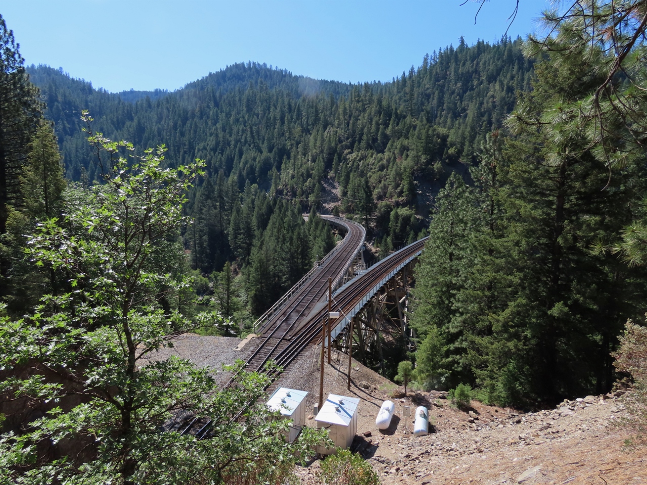
Clio Trestle
Position: 39°45.70’N, -120°33.83’W
At the first attraction en the Feather River Canyon route, the Clio Trestle across Willow Creek. Completed in 1909, the tremendous viaduct is 172 feet (52 m) high and 1,005 feet (306 m) long.
|
 |
Williams Loop
Position: 39°54.68’N, -120°48.61’W
The Williams Loop is one of the most unique attractions along the historic Feather River Canyon route of the Union Pacific Railroad. An eastbound train will approach towards the camera on the upper track at right, then make a slow right turn in a 1-mile descending loop, and pass underneath on the lower tracks at the left. Longer trains will pass underneath themselves as they transit the loop. We waited a bit in the hopes of seeing a train pass through, but no luck.
|
 |
Keddie Wye
Position: 40°1.19’N, -120°57.58’W
The Keddie Wye was completed in 1931 to allow Western Pacific trains to divert from the San Francisco route for Bieber, California.
|
 |
Howell’s Bridge
Position: 40°0.81’N, -121°11.90’W
Historic Howell’s Bridge, completed in 1934.
|
 |
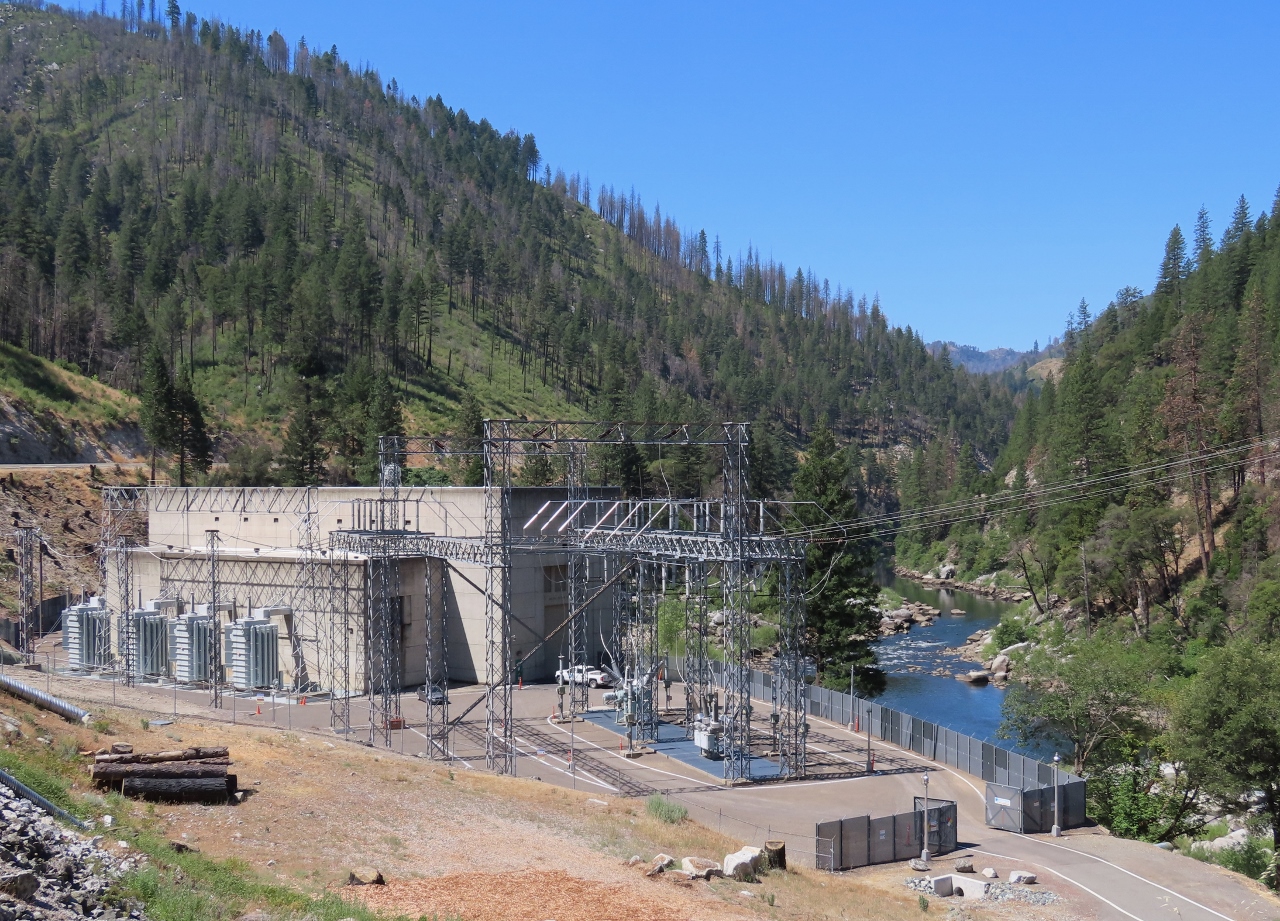
Belden Powerhouse
Position: 40°0.46’N, -121°14.98’W
The Belden Powerhouse, completed in 1969, is part of Upper North Fork Feather River Project. The hydroelectric scheme includes three dams and five powerhouses with a total capacity 362.3 megawatts.
|
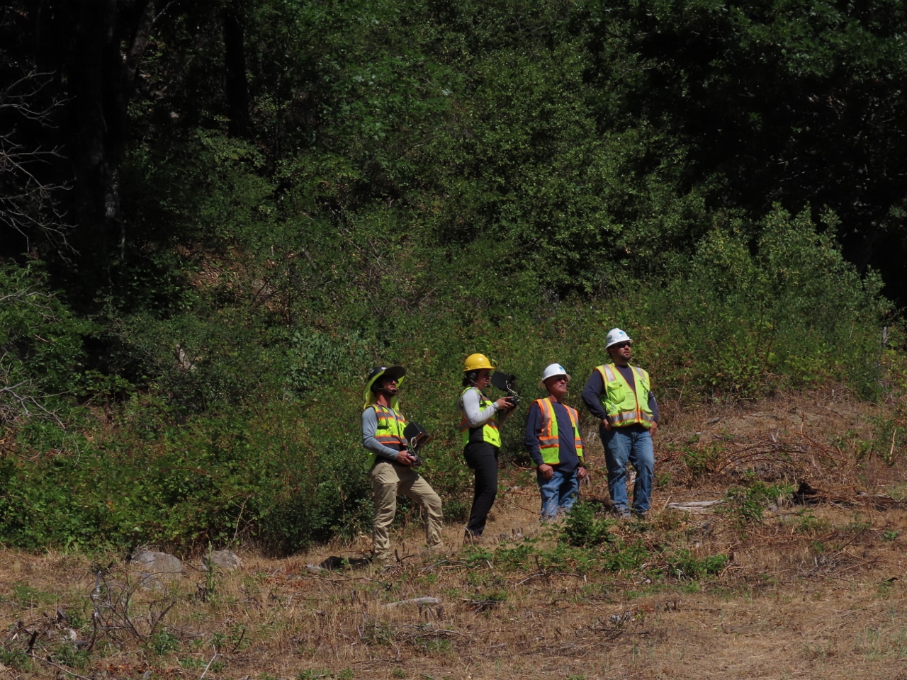 |
Drone Inspection
Position: 40°0.46’N, -121°14.98’W
A crew using a drone to inspect the transformers at the Belden Powerhouse.
|
 |
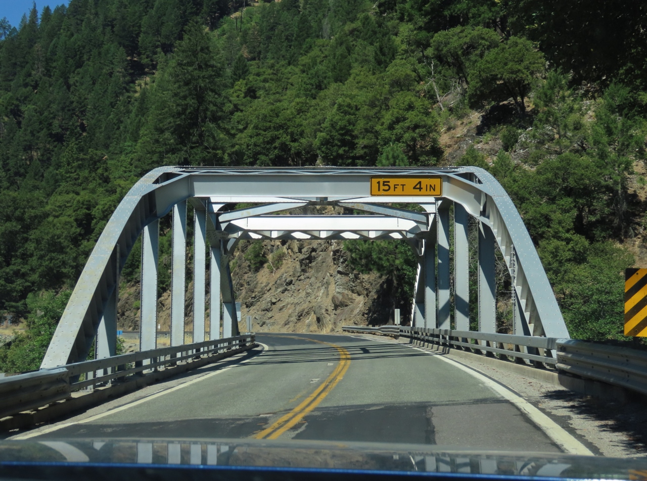
Tobin Twin Bridges
Position: 39°56.28’N, -121°18.92’W
The famous Tobin Twin Bridges, where a railroad bridge crosses over the top of a highway bridge. Locals say it is good luck to have train pass over top as you drive along the road.
|
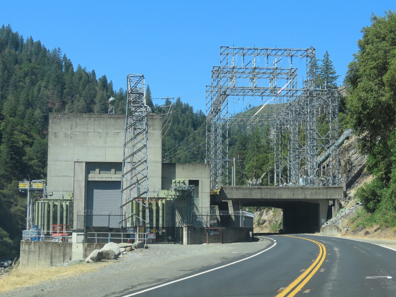 |
Rock Creek Powerhouse
Position: 39°54.41’N, -121°20.22’W
The Rock Creek Powerhouse, completed in 1949, spans the highway. It is one of many that make up the “Stairway of Power” where water flowing through the Feather River is used over and over by successive power stations until it flows undiminished further downstream.
|
 |
Cresta Powerhouse
Position: 39°49.64’N, -121°24.31’W
The Cresta Powerhouse, part of the “Stairway of Power” below the Rock Creek Powerhouse.
|
|
|
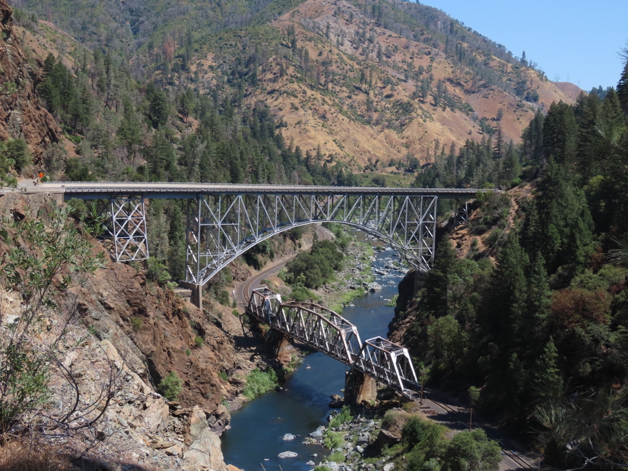
Pulga Bridges
Position: 39°47.83’N, -121°27.11’W
The spectacular Pulga Bridges along the Feather River, where a 680-ft road bridge passes over a railway bridge 220ft below.
|
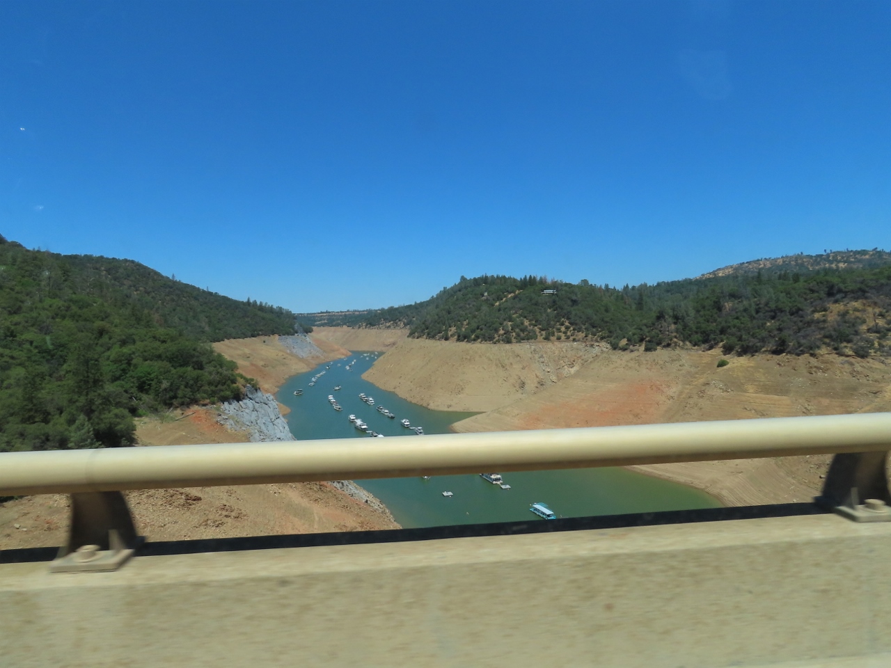 |
Houseboats
Position: 39°41.87’N, -121°31.84’W
Masses of houseboats moored on Lake Oroville.
|
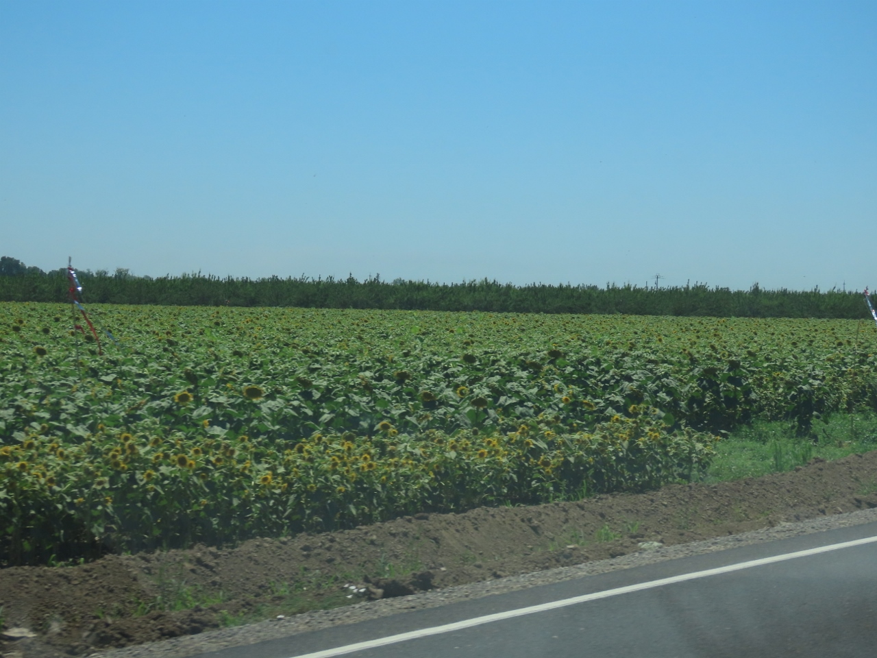 |
Sunflowers
Position: 39°19.85’N, -122°2.09’W
A field of sunflowers, one of many crops growing in this part of California.
|
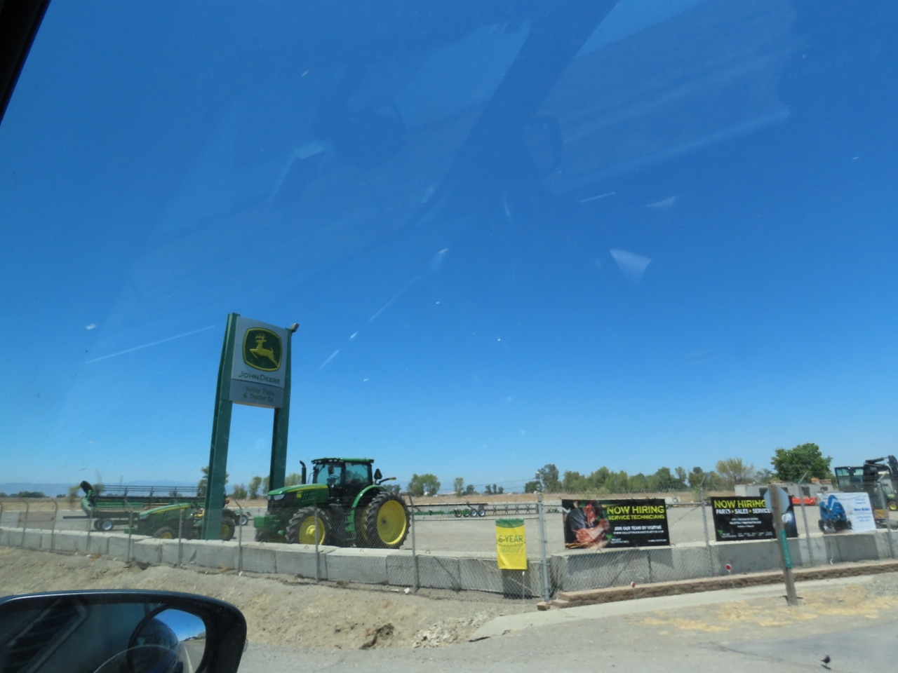 |
John Deere
Position: 39°12.68’N, -122°0.99’W
We’re always happy to see the familiar yellow and green of John Deere, the engine that powers Dirona. Here is some John Deere farm equipment at a dealership in Colusa, CA.
|
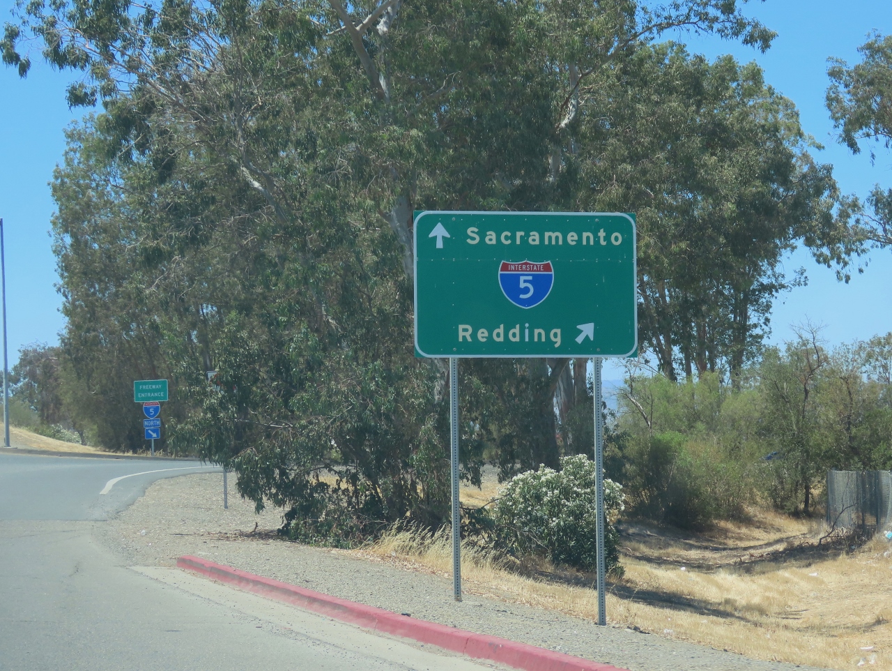 |
I-5
Position: 39°10.31’N, -122°7.96’W
I-5 is a familiar sight—the interstate runs through Seattle between the Canadian and Mexican borders. If we take it south from here in Williams, CA, we’ll reach Sacrament. We’ll instead be heading west towards the Pacific Coast.
|
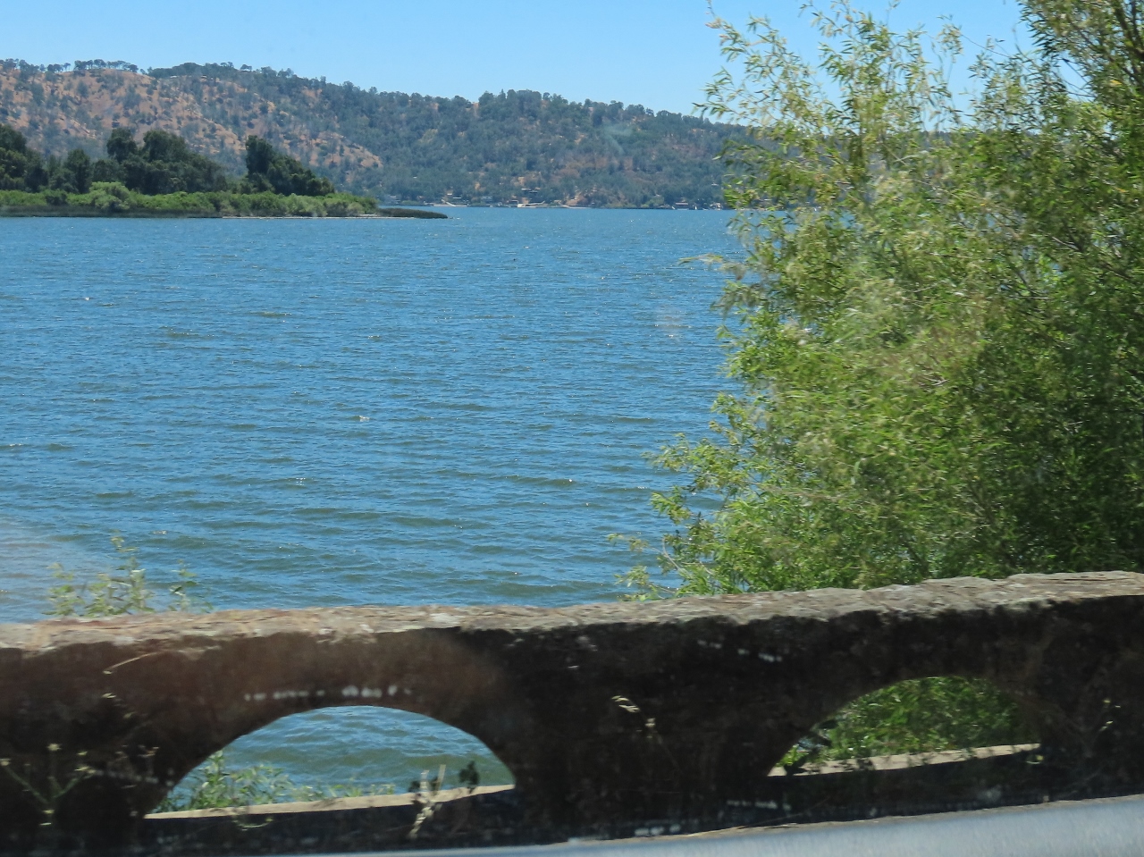 |
Clear Lake
Position: 39°1.46’N, -122°39.45’W
Passing Clear Lake, CA. The 68 sq mi (180 km2) is the largest in California and also is the oldest in North America at 2.5 million years old.
|
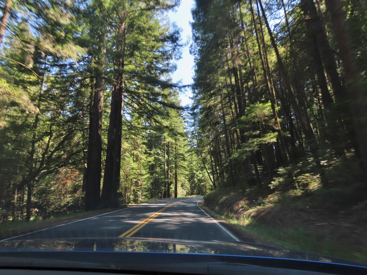 |
Jackson Demonstration State Forest
Position: 39°20.90’N, -123°32.00’W
Passing through redwoods in Jackson Demonstration State Forest, the largest of California’s ten demonstration forests. These forests are open to the public, but also used to study effects of forest management techniques.
|
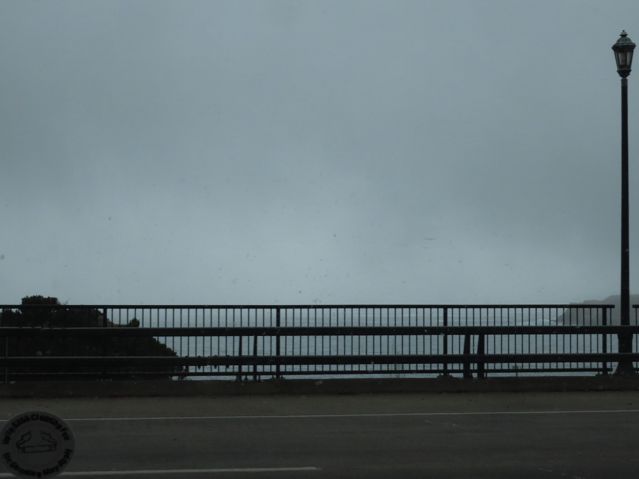 |
Pacific Coast
Position: 39°25.63’N, -123°48.42’W
We finally reached the Pacific Coast today, at Fort Bragg. Conditions are foggy as we cross over Noyo Bay.
|
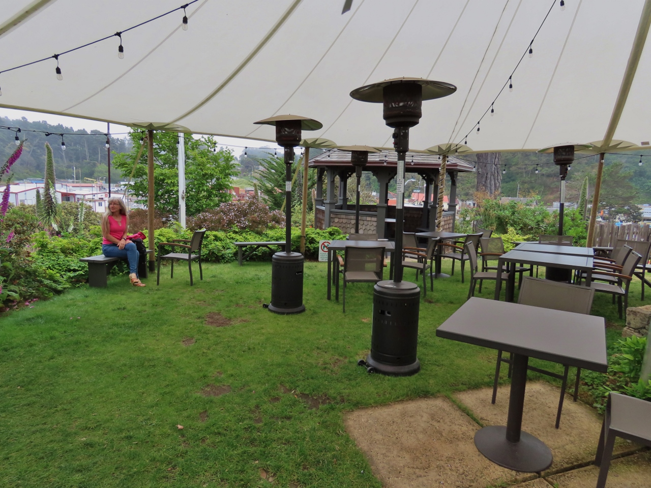 |
Noyo Harbor Inn
Position: 39°25.48’N, -123°48.18’W
The beautiful gardens at the Noyo Harbor Inn where we’re spending the night along the Noyo River in Fort Bragg.
|
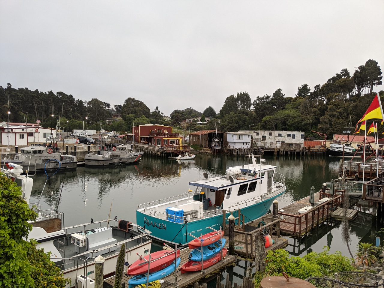 |
Noyo River
Position: 39°25.45’N, -123°48.17’W
View to the Noyo River from the Noyo Harbor Inn. Noyo is an active fishing community, with the two 47 ft lifeboats of the Coast Guard Noyo River station visible at left.
|
 |
Silver’s at the Wharf
Position: 39°25.60’N, -123°48.29’W
A delicious meal at Silver’s at the Wharf in along California’s Noyo River, with the entrance to Noyo Harbor and the sea visible in the background. We loved the table, with its view to the vessel traffic along the river.
|
 |
Click the travel log icon on the left to see these locations on a map, with the complete log of our cruise.
On the map page, clicking on a camera or text icon will display a picture and/or log entry for that location, and clicking on the smaller icons along the route will display latitude, longitude and other navigation data for that location. And a live map of our current route and most recent log entries always is available at mvdirona.com/maps. |
If your comment doesn't show up right away, send us email and we'll dredge it out of the spam filter.