Posts In The “Alaska” Category
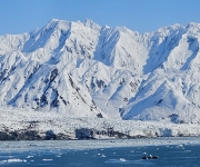
One of the reasons we booked a cruise to Alaska from Vancouver, rather than from our home of Seattle, was to travel one-way through the Inside Passage all the way up, and to visit Hubbard Glacier and Seward. Ships departing from Seattle run mostly offshore, west of Vancouver Island, and generally only visit Southeast Alaska…
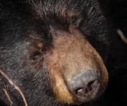
The 125-mile (201 km) Seward Highway, between Anchorage and Seward, is considered one of the most scenic routes in the state of Alaska. Named a National Forest Scenic Byway in 1989, the 2.5-hour journey from Seward passes through the Kenai Mountains and between Turnagain Arm and the Chugach Mountains, with numerous lakes and other attractions…
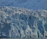
Hubbard Glacier, at the head of Yakutat Bay, is the largest tidewater glacier in North America at 76 miles (122km) long and 7 miles (11km) wide. The terminal face is 600 feet (182m) high, with 250 feet (76m) hidden below the waterline. The 350 feet (106m) visible above the waterline is actively calving, filling the…
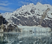
Dramatic Glacier Bay National Park was the only overlap between our Norwegian Jewel cruise and our 2010 Southeast Alaska trip on Dirona. But we could return here every year and never tire of the amazing scenery. On another unusually clear day for early in the season, we cruised slowly up Glacier Bay under a bright…
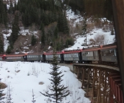
During the Klondike Gold Rush of 1896 through 1899, roughly 100,000 prospectors poured into the Yukon in northwestern Canada, in the hopes of striking it rich. The main routes to the Yukon gold fields were from the southeast Alaska towns of Skagway or Dyea, across White Pass or Chilkoot Pass respectively. No roads or railways…
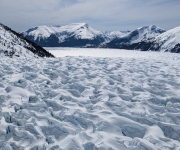
Alaska’s capital, Juneau, is the only mainland US capital city with no road connections. The only way in or out is by air or sea. And despite having a population of only 32,000, it’s the second largest city in the US by area, after Sitka, also in Alaska. We arrived by boat, as do the…
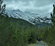
On our Norwegian Encore Caribbean cruise, we didn’t take any excursions, opting instead to visit each port on foot on our own. The Jewel offered some more interesting trips, so we booked one for each port. In Ketchikan, we took an off-road UTV safari through Tongass National Forest in a Yamaha Wolverine X2. Although we…
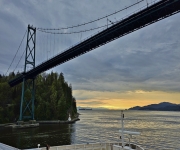
After our second night at the Vancouver Pan Pacific hotel, we woke up to find the Norwegian Jewel, the ship we’d be taking to Alaska, docked just outside our room. We boarded later that day and spent the afternoon exploring the ship, then had a wonderful time watching from our balcony at the bow as…
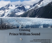
Last week we gave a presentation on our trip to Prince William Sound to the Seattle Sail and Power Squadron. They meet on the third floor of the Queen City Yacht Club, with a wonderful view across Portage Bay. We had a great time socializing with the group and touring the grounds. For our talk,…
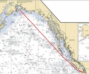
One of the reasons we made the offshore run from Seattle to Prince William Sound was to gain experience. A gale in the Gulf of Alaska wasn’t exactly the sort of experience we were hoping for. But we did learn that the boat, and our rough-water preparations, could take the conditions. The full log of…
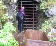
In the early 1900s, nearly 25,000 ounces of gold were extracted from Granite Mine, making it one of the more productive in Prince William Sound. From our anchorage in Bettles Bay (Bing/Google map), we ran the dinghy north to five miles north to Hobo Bay to hike to the mine ruins. The trail led for…
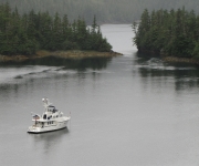
Disk Cove (Bing/Google map) is a sheltered, nearly landlocked cove with mountains all around. We were out in the dinghy soon after we’d anchored yesterday. Several hills around the cove looked easy to climb, and would have good views. A ten-minute, easy climb from a creek along the east shore brought us to a meadow…
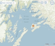
View live updates at mvdirona.com/maps We arrived last night in Prince William Sound after seven days at sea. We had a couple of nice days en route, but those were bookended by three days of poor weather at the start, and two days through a gale warning in the Gulf of Alaska at the end….
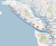
View live updates at mvdirona.com/maps We are en route to Prince William Sound, returning at the end of August. Earlier this year, we did a minor refit, including installing a KVH TracPhone V7 satellite phone and internet system, and upgrading our TracVision M5 satellite TV system to a TracVision M7. Now that we have offshore…
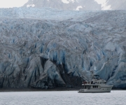
After a day at Margerie Glacier, we returned down Tarr Inlet to overnight at Reid Inlet. The anchorage there is close to where Tarr and John Hopkins Inlets join Glacier Bay, and is convenient for visiting the glaciers at their heads. Reid Glacier in Reid Harbor also is one of the few shore-accessible glaciers in…
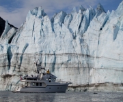
When we awoke at Russell Island after our first day in Glacier Bay, AIS showed the pocket cruise ship Safari Explorer anchored out of sight at the north end of the island. They left about 5:30am, heading up Tarr Inlet to Margerie Glacier, and we did the same about 15 minutes later. We were a…
Glacier Bay has long been high on our list of places to visit. And after nearly a week cruising southeast Alaska, the first day of our permit to enter finally had arrived. We’d technically been in the park for two nights already, as Dundas Bay is inside Glacier Bay National Park, but doesn’t require a…
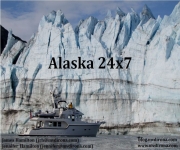
Last weekend we presented at the Seattle Boat Show on our 24×7 run to Alaska. The slides are posted at Hamilton_SBS11_Alaska24x7.pdf. A couple of questions we were asked that weren’t covered in the presentation were on seasickness and how Spitfire did on the trip. Seasickness generally isn’t a problem for James, but I will get…