On our Norwegian Encore Caribbean cruise, we didn’t take any excursions, opting instead to visit each port on foot on our own. The Jewel offered some more interesting trips, so we booked one for each port. In Ketchikan, we took an off-road UTV safari through Tongass National Forest in a Yamaha Wolverine X2. Although we would have preferred to explore on our own, we had a great time in the UTV tour. The scenery was spectacular, and we found the vehicle surprisingly capable.
We returned back to Ward Cove and the Norwegian Jewel with 90 minutes to spare before we needed to be back aboard, just enough time for a quick visit to Ketchikan. One of the popular Ketchikan tourist activities is to do a pub crawl. The town supports over a dozen bars, a lot for a population of less than 10,000 people. But that is down from the town’s logging heyday, when over fifty bars operated here. We decided we had to try at least one of them, and stopped for a pint at the historic Arctic Bar. The pub has been in operation for 85 years and is the oldest establishment in Ketchikan.
Back on board the Jewel, we had a delicious meal at Le Bistro French restaurant, caught an acrobatic show, then watched a spectacular sunset from the Jewel’s deck 13 forward viewing lounge as we passed through high-current Snow Passage between Sumner and Clarence straits.
Below are highlights from May 3th, 2023. Click any image for a larger view, or click the position to view the location on a map. And a map with our most recent log entries always is available at mvdirona.com/maps.
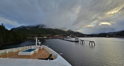 |
Ketchikan Arrival
Position: 55°24.05’N, -131°43.85’W
The Norwegian Jewel arriving into Ward Cove, about 7 miles (11 km) north of Ketchikan.
|
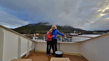 |
Forward Deck
Position: 55°24.18’N, -131°43.81’W
Watching the arrival into Ward Cove from our forward deck.
|
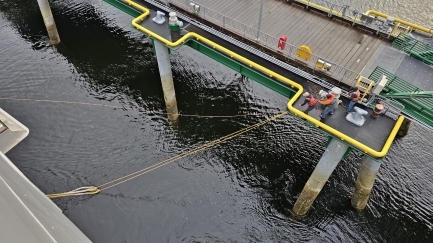 |
Messenger Line
Position: 55°24.25’N, -131°43.78’W
Shore workers pull in a lightweight messenger line thrown from the Norwegian Jewel. A midweight line attached to the messenger is just about to come over the yellow railing. This midweight line in turn is attached to the two heavy mooring lines that they will put on this mooring point. When they are done they will be using twelve lines on six mooring points.
|
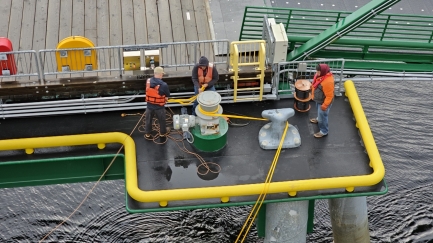 |
Winch
Position: 55°24.25’N, -131°43.79’W
The lightweight messenger line, with a monkey fist on the end for more accurate throwing, is on the ground while the shore workers wind the midweight line onto a winch to pull in the heavy mooring lines to shore.
|
 |
Mooring Lines
Position: 55°24.25’N, -131°43.79’W
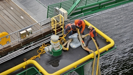
After winching the Norwegian Jewel‘s heavy mooring lines to their station, shore workers lift them onto a bollard.
|
 |
Inflatables
Position: 55°24.26’N, -131°43.78’W
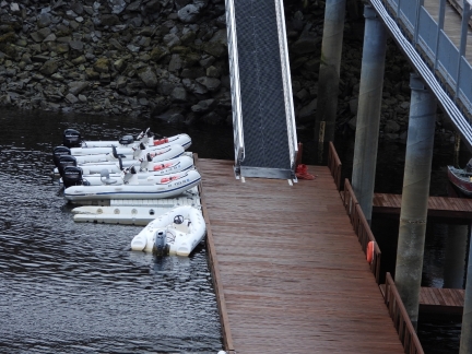
Several rigid hull inflatable boats moored at Ward Cove. One of the available excursions on the Norwegian Jewel is to a self-drive, group tour of the surrounding waterways.
|
 |
The Mill at Ward Cove
Position: 55°24.38’N, -131°43.73’W
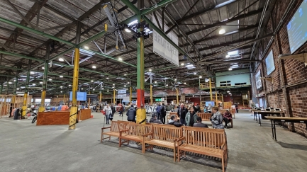
The Mill at Ward Cove cruise ship terminal is built on the site of the former Ketchikan Pulp Company, and one of the old mill buildings, pictured, houses the passenger Welcome Center. Ketchikan Pulp Company operated from 1953 to 1997, and was subsequently declared a Superfund site due to the high levels of industrial pollution. After remediation, Norwegian Cruise Lines in 2019 jointly developed a two-berth floating cruise dock here and the first ship, the Norwegian Encore, arrived in 2021.
|
 |
Harbor Tug
Position: 55°24.39’N, -131°43.75’W
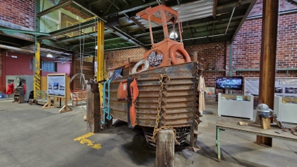
Old Ketchikan Pulp Company harbor tug on display in The Mill at Ward Cove.
|
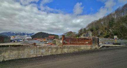 |
Ketchikan Pulp Company
Position: 55°24.50’N, -131°43.57’W
Looking across ruins of the former Ketchikan Pulp Company to the Norwegian Jewel as we depart for a shore excursion.
|
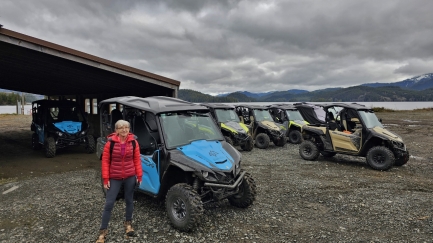 |
Ketchikan Adventurevue
Position: 55°28.06’N, -131°31.99’W
At Ketchikan Adventurevue for an off-road UTV safari through Tongass National Forest.
|
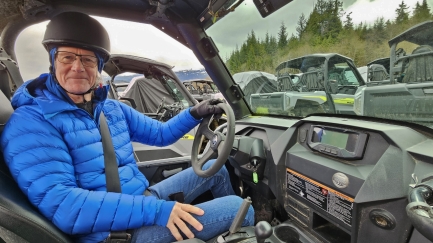 |
Wolverine X2
Position: 55°28.07’N, -131°31.98’W
Ready to go in a Yamaha Wolverine X2 UTV. With a 847cc parallel-twin, liquid cooled, 4-stroke, DOHC, 4-valve engine and weighing only 1,676 lbs (760 kg), the vehicle really steps out.
|
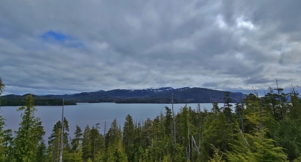 |
George Inlet
Position: 55°26.88’N, -131°31.34’W
The view east across George Inlet, northeast of Ketchikan, in Tongass National Forest.
|
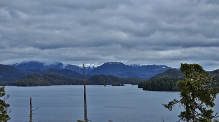 |
Bull Island
Position: 55°26.88’N, -131°31.34’W
Looking north to Bull Island, with snow-dusted mountains beyond, at the head of George Inlet in Tongass National Forest.
|
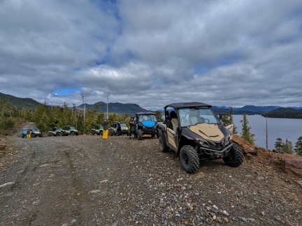 |
Safari Group
Position: 55°26.88’N, -131°31.36’W
Our small group of UTVs parked at a viewpoint above George Inlet. Although we would have preferred to explore on our own, we had a great time in the UTV tour and found the Yamaha Wolverine X2 surprisingly capable.
|
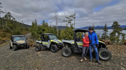 |
With our Wolverine
Position: 55°26.88’N, -131°31.36’W
Posing for a photo with our Wolverine.
|
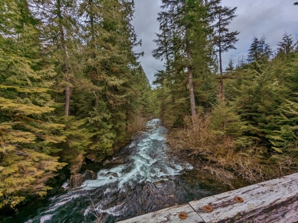 |
Mahoney Lake River
Position: 55°25.52’N, -131°30.89’W
Crossing over the lake that drains Mahoney Lake, our ultimate destination, into George Inlet. The route we’re traveling is along old logging roads.
|
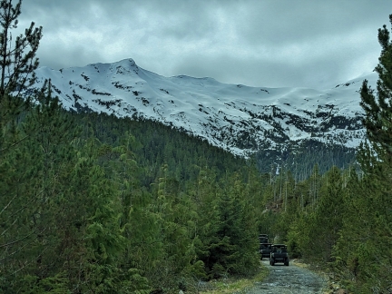 |
Achilles Mountain
Position: 55°25.52’N, -131°30.89’W
3,015-ft (981 m) Achilles Mountain burst into view as we rounded a corner. In addition to having fun driving the UTV, the scenery has been amazing.
|
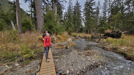 |
Boardwalk
Position: 55°25.12’N, -131°32.07’W
Walking a boardwalk to Mahoney Lake.
|
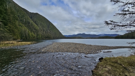 |
Mahoney Lake
Position: 55°25.14’N, -131°31.96’W
The view east across Mahoney Lake. The road we drove in on, and the river we crossed, is at the far side.
|
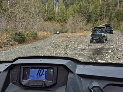 |
Turning Around
Position: 55°25.51’N, -131°30.87’W
Following a loop in the road to turn around and head back to Ketchikan Adventurevue base. One of the rules for the UTV tour is that we couldn’t go in reverse.
|
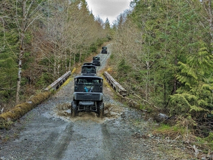 |
Mud Puddles
Position: 55°27.05’N, -131°31.94’W
The road is full of big muddy potholes arguably making the drive more fun. We expected to be rather muddy when we returned, but managed to stay clean. We had a great time on the UTV tour. Here’s a quick video highlight: https://youtu.be/PnyEjstWJ0c.
|
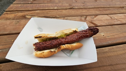 |
Reindeer Link
Position: 55°28.07’N, -131°31.99’W
A reindeer link on a bun for lunch back at Ketchikan Adventurevue base. It was quite tasty.
|
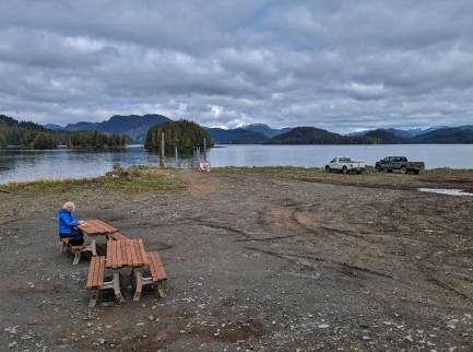 |
Picnic Tables
Position: 55°28.07’N, -131°31.99’W
Enjoying our lunch at Ketchikan Adventurevue base with a view to George Inlet.
|
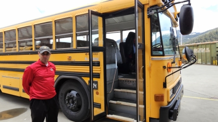 |
Bus to Ketchikan
Position: 55°24.38’N, -131°43.73’W
We returned back to Ward Cove and the Norwegian Jewel with 90 minutes to spare before we needed to be back aboard. We wanted to see Ketchikan, about a 15-minute drive away, and took one of the buses into town for a quick look.
|
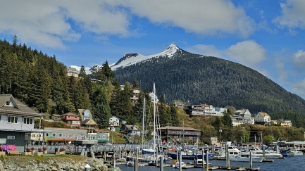 |
Deer Mountain
Position: 55°20.64’N, -131°39.32’W
3,002-ft (915 m) Deer Mountian rising above Ketchikan, still with snow on top in May.
|
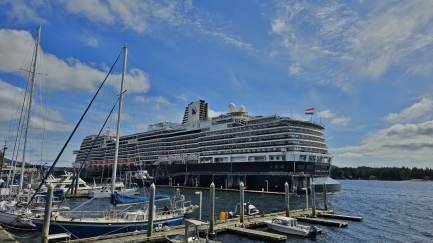 |
Koningsdam
Position: 55°20.65’N, -131°39.23’W
The cruise ship Koningsdam moored in downtown Ketchikan. We’re told that Norwegian built the dock at Ward Cove to avoid difficulties of getting dock space here.
|
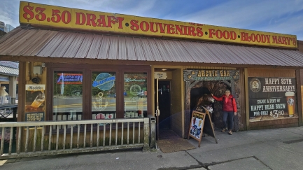 |
Arctic Bar
Position: 55°20.60’N, -131°39.02’W
Arctic Bar, “Home of the Happy Bear”, has been in operation for 85 years and is the oldest establishment in Ketchikan.
|
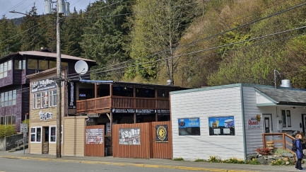 |
Asylum
Position: 55°20.60’N, -131°39.02’W
Asylum Bar, across the road from Artic Bar. Ketchikan supports a dozen or two bars, a lot for a town of less than 10,000 people. But this is down from the town’s logging heyday, when the mill was operating, and over fifty bars operated here. One of the popular Ketchikan tourist activities is to do a pub crawl.
|
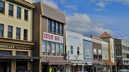 |
Totem Bar
Position: 55°20.54’N, -131°38.90’W
Totem Bar, along Ketchikan’s Front St., is only three minutes away from Artic Bar.
|
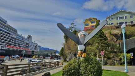 |
Thundering Wings
Position: 55°20.55’N, -131°38.92’W
Thundering Wings eagle carving in Eagle Park by Tlingit master carver Nathan Jackson of Ketchikan, who in 2021 was named a United States artist fellow.
|
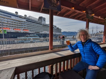 |
Beer
Position: 55°20.59’N, -131°39.03’W
Sharing a pint on the outside deck at Arctic Bar. We didn’t have time to do a pub crawl, but did want to at least have a drink in one of the bars.
|
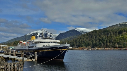 |
Malaspina
Position: 55°24.32’N, -131°43.79’W
The recently-retired Alaska state ferry Malaspina moored at Ward Cove. The passenger and vehicle ferry vessel was launched in 1963 and initially ran the Inside Passage route between Washington state and Alaska panhandle communities. More recently, it operated as a day boat in the upper Lynn Canal.
|
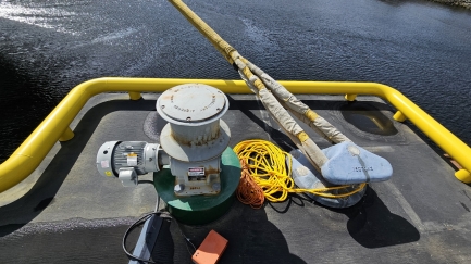 |
Winch and Lines
Position: 55°24.29’N, -131°43.79’W
The tightly-pulled mooring line, with the medium-weight and messenger lines coiled beside it next to the winch on the Ward Cove dock.
|
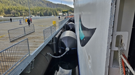 |
Fenders
Position: 55°24.22’N, -131°43.79’W
The well-fendered dock at Ward Cove. You can see how tightly the Jewel is moored, squeezing the fenders up against the dock.
|
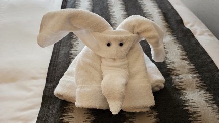 |
Elephant
Position: 55°24.19’N, -131°43.68’W
We returned to our room to find an elephant on our bed. It’s amazing the steward could create an elephant out of bath towels. Throughout the trip we learned that elephants aren’t his only creation.
|
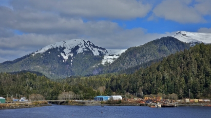 |
Brown Mountain
Position: 55°24.27’N, -131°43.80’W
Looking northeast across Ward Cove to 2,979 ft (907 m) Brown Mountain, left, and 2,941 ft (896 m) Diana Mountain.
|
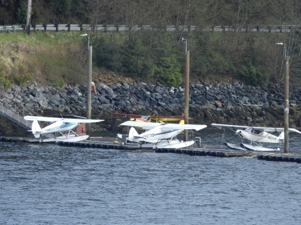 |
Floatplanes
Position: 55°24.27’N, -131°43.80’W
Floatplanes, a popular form of transport in Alaska, moored at Ward Cove.
|
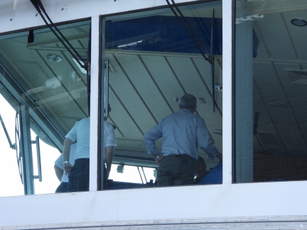 |
Bridge
Position: 55°24.27’N, -131°43.80’W
View to the bridge of the Norwegian Jewel, with the pilot at right, as the ship is about to get underway.
|
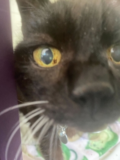 |
Spitfire
Position: 47°36.28’N, -122°7.96’W
A close-up of Spitfire at “The Resort”, Wagly Pet Campus, where he stays when we are away.
|
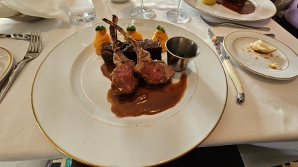 |
Le Bistro
Position: 55°41.41’N, -132°37.03’W
A delicious meal at Le Bistro French restaurant while underway on the Norwegian Jewel.
|
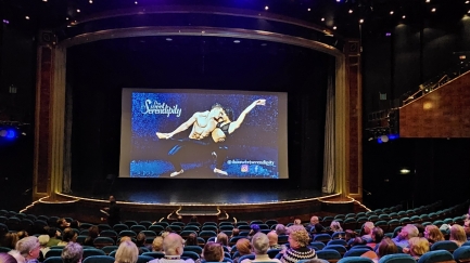 |
Duo Sweet Serendipity
Position: 55°33.81’N, -132°12.58’W
After dinner, we watched the aerialist team Duo Sweet Serendipity perform in the Norwegian Jewel‘s Stardust Theater. They put on an impressive and entertaining performance.
|
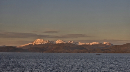 |
Clarence Strait
Position: 55°33.81’N, -132°12.58’W
Beautiful mountain scenery as the Norwegian Jewel travels north through Clarence Strait on the east side of Prince of Whales Island.
|
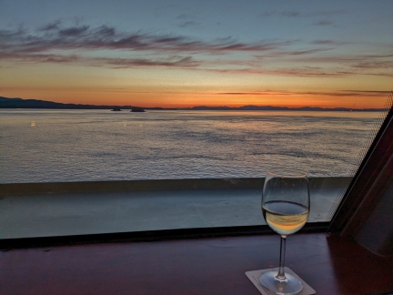 |
Spinnaker Lounge
Position: 56°13.63’N, -132°54.66’W
With the Norwegian Jewel underway, our forward balcony was a little too cold and windy to take in the views. We instead found a great spot at the front of Spinnaker Lounge on deck 13.
|
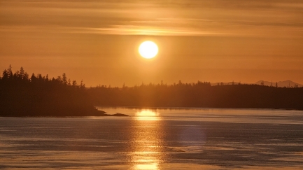 |
Sunset
Position: 56°16.14’N, -132°56.89’W
Fabulous sunset as we enter Snow Passage between Sumner and Clarence straits.
|
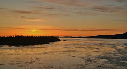 |
Current
Position: 56°16.34’N, -132°57.01’W
Active water in Snow Passage as the Norwegian Jewel passes through. Today the current is flooding at about 2.6 knots, but on ebb it can exceed 4 knots.
|
 |
Click the travel log icon on the left to see these locations on a map. And a map of our most recent log entries always is available at mvdirona.com/maps. |

If your comment doesn't show up right away, send us email and we'll dredge it out of the spam filter.