Prior to our Caribbean cruise on the Norwegian Encore, we had close to zero interest in cruising in general and none on the really big ships. But while sitting on our balcony watching the Encore depart from Pier 66 below us, in one of James’ spur-of-the-moment suggestions, he said “I’m not interested in big boat cruising but would be interested in spending time on a big boat. Why don’t we book a cruise to Alaska on the Encore, take only the first couple of days of the trip over the weekend, and then fly home? That would give us just enough time to learn about the ship and then get off and fly home.”
We thought a big boat could be super interesting for a day or two. We tried to book the trip sailing out of Seattle, but by the time James could get a Monday or Friday without meetings the Encore had shifted over to the Caribbean. Sailing out of Miami would be more of a hassle, but we figured it was fine and still worth doing. That discussion was the origin of our week-long cruise aboard the Norwegian Encore to the Caribbean.
James was working the week we were out on the Encore, so we didn’t do most of the excursions. But we did explore ashore wherever we docked, spent time on the ship’s water slides and drove a couple of dozen laps at the Encore Speedway, the largest go-cart track at sea. And we had the evenings to enjoy the ship.
We found the higher-end restaurants were actually remarkably good. We also attended two comedy shows and two musicals as after-dinner events, and all was surprisingly high-quality and very entertaining. On another evening, we spent time in the deck 19 hot tub while the ship was underway at night. By the time we were done, we actually were busy every night.
You can’t make a big boat small, but you can make a portion of the big boat small. Norwegian did this with the Haven, a ship-within-a-ship concept that NCL pioneered in 2005 and many other cruise lines have since duplicated. Haven guests have exclusive access to restaurants, bars, lounges and public spaces in the Haven area, and priority access to restaurants, shows and other attractions on the rest of the ship. It’s a way of making a mega-ship feel less busy and more intimate.
We really liked the Haven concept, where we could enjoy everything a big ship has to offer and escape the crowds and noise at will. Overall we viewed the big ship cruise experiment as a great success, and are looking forward to trying other ships in different destinations.
On the way back from Miami, we went to Las Vegas to attend the annual AWS re:Invent conference. We’d regularly gone while we were cruising around the world in Dirona, but hadn’t been there for two years.
Below are highlights of the cruise from November 20 through Dec 2, 2022. Click any image for a larger view, or click the position to view the location on a map. And a map with our most recent log entries always is available at mvdirona.com/maps.
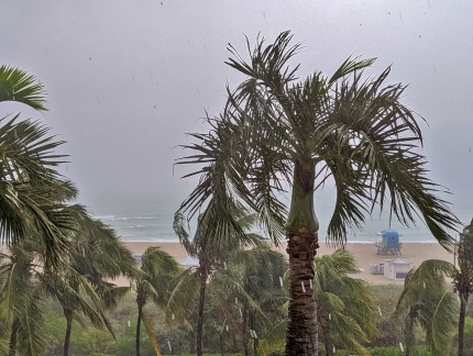 |
South Pointe Beach
Position: 25°46.18’N, -80°7.92’W
A blustery and wet morning looking across South Pointe Beach from our Miami hotel room at the Hilton Bentley.
|
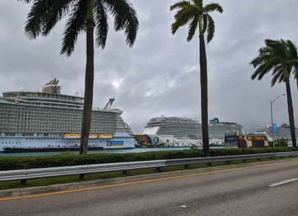 |
Cruise Terminal
Position: 25°46.54’N, -80°9.55’W
Passing the Miami Cruise Terminal on the MacArther Causeway en route to the Norwegian Encore, at center, for our Caribbean cruise. The ship on the left is Oasis of the Seas, the first of the Oasis class ships that are the largest passenger ships in the world, and at right is MSC Seashore.
|
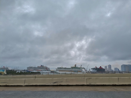 |
Carnival
Position: 25°47.23’N, -80°10.90’W
Four more cruise ships visible in the Miami Cruise Terminal as we cross the MacArthur Causeway ICW bridge. At left are two owned by Carnival, with a Royal Caribbean and a Virgin cruise ship to the right.
|
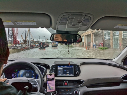 |
Flooding
Position: 25°47.20’N, -80°11.31’W
Flooding on NE 13th street due to the recent heavy rains.
|
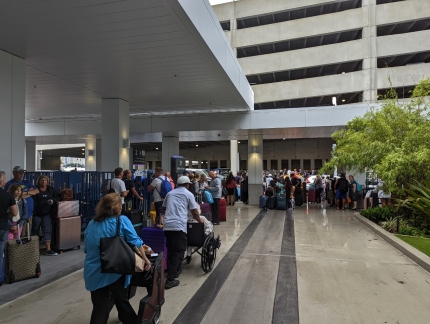 |
Crowds
Position: 25°46.41’N, -80°9.85’W
A crowded Norwegian Cruise lines terminal as passengers disembark from the recently-arrived Norwegian Encore.
|
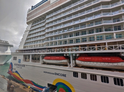 |
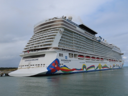
Norwegian Encore
Position: 25°46.43’N, -80°9.82’W
The Norwegian Encore, our home for the next week while on a Caribbean cruise. We’re super-excited and are really looking forward to getting on board and exploring the ship. We’ve never pictured ourselves as even vaguely interested in cruising on large ships, but it will be an interesting experiment and fun to see the details behind a boat big enough to carry more than 4,000 guests.
|
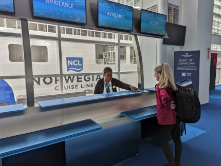 |
Checking In
Position: 25°46.39’N, -80°9.83’W
Checking in at the NCL (Norwegian Cruise Lines) desk and picking up our keycards, with the Encore visible out the window.
|
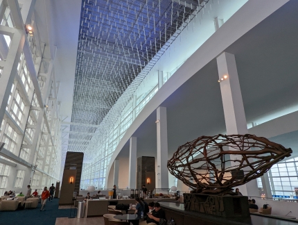 |
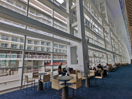
Atrium
Position: 25°46.43’N, -80°9.82’W
The airy and light-filled atrium of the NCL cruise terminal.
|
 |
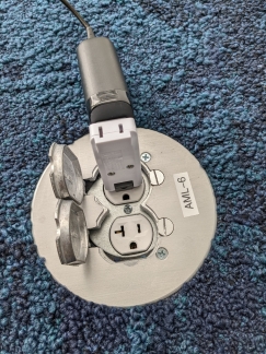
The Office
Position: 25°46.43’N, -80°9.82’W
Getting a little work done at the NCL cruise terminal while waiting to board the Encore, filling the window beyond.
|
 |
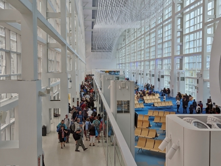
Power Adapter
Position: 25°46.43’N, -80°9.81’W
Our laptop power adapters won’t fit into the floor outlet, but our swiveling wall adapters do. We primarily bought the adapters to fold our laptop power adapters down to better secure the in airplane outlets, but we’re finding other uses for them as well.
|
 |
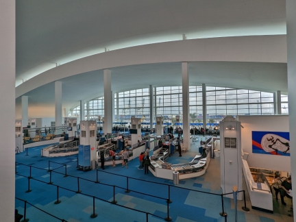
Disembarking
Position: 25°46.43’N, -80°9.82’W
The end of the queue of passengers disembarking from the Encore shortly before 10:00am. This process started at 7:30am and most people are off the ship by 10:00am. That’s pretty efficient for nearly 4,000 people, but the lines were truly massive.
|
 |
Security Checkin
Position: 25°46.42’N, -80°9.82’W
Looking down the the main security checkin at the NCL terminal. All luggage is scanned for prohibited items, including weapons, explosives and anything with a heating element that could start a fire such as a kettle.
|
 |
Waiting Area
Position: 25°46.42’N, -80°9.82’W
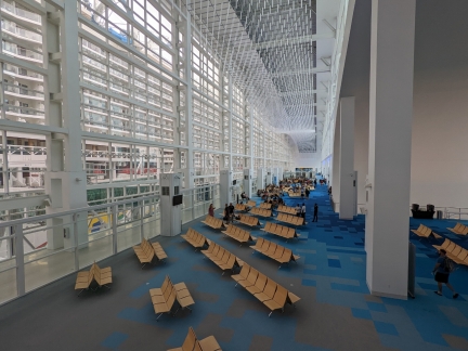
The main waiting area in the NCL terminal is mostly empty now at 10:00am, but will fill up as we get close to boarding at noon.
|
 |
Window Cleaning
Position: 25°46.42’N, -80°9.80’W
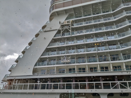
A window cleaner at work on deck 10 of the Encore. The balcony of our stateroom at the aft corner of deck 11 is partially visible one deck up.
|
 |
Loading
Position: 25°46.43’N, -80°9.81’W
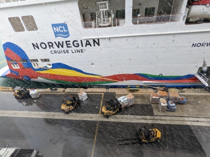
The Norwegian Encore pier is a hive of activity with a steady stream of forklifts delivery fresh produce to the ship.
|
 |
Squall
Position: 25°46.43’N, -80°9.82’W
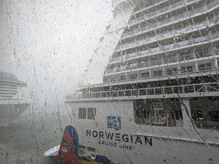
Rain has been falling all morning, but occasionally a more intense squall comes through strong enough to halt the loading activity below and reduce visibility to near zero.
|
 |
Boarding
Position: 25°46.87’N, -80°9.69’W
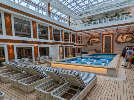
Passing through the Haven Courtyard as we board the Encore. The Haven is a ship-within-a-ship concept that NCL pioneered in 2005 and many other cruise lines have since duplicated. Haven guests have exclusive access to restaurants, bars, lounges and public spaces in the Haven area, and priority access to restaurants, shows and other attractions on the rest of the ship. It’s a way of making a mega-ship feel less busy and more intimate.
|
 |
Horizon Lounge
Position: 25°46.42’N, -80°9.70’W
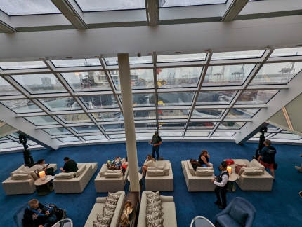
Looking down from the upper floor of the Haven Lounge to the main lounge area during our boarding orientation. This is about as busy as it ever got in the Haven the entire time we were on board.
|
 |
American Diner
Position: 25°42.29’N, -80°9.54’W
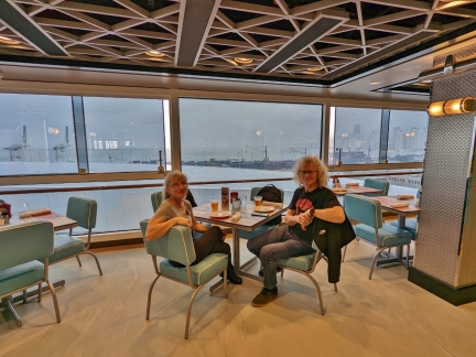
Enjoying the first of many good meals on board the Norwegian Encore, this one a casual lunch at American Diner on deck 17, with a view to the Port of Miami.
|
 |
Classic Cars
Position: 25°46.17’N, -80°9.47’W
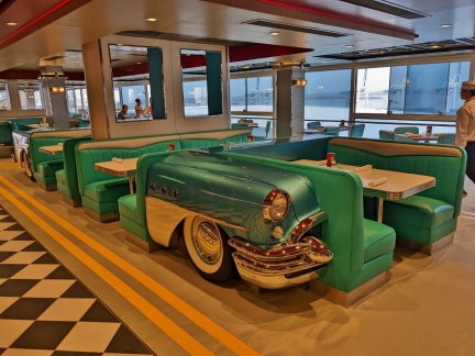
The booths at American Diner are built in the shape of classic American cars.
|
 |
Heatstrip
Position: 25°46.42’N, -80°9.77’W
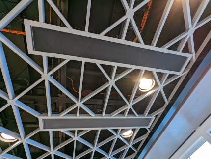
Heatstrip patio heaters in the ceiling of American Diner, the same brand we used on our aft deck on Dirona.
|
 |
Room Available
Position: 25°46.44’N, -80°9.78’W
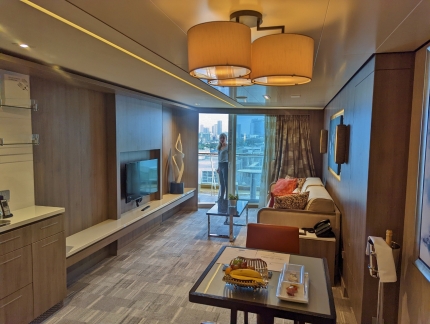
We boarded the Encore at 11:30am and cabin was available just before 1:00 pm. This is looking from the doorway through the main living to the Jennifer on the balcony.
|
 |
Balcony
Position: 25°46.45’N, -80°9.81’W
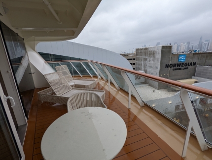
We picked this room specifically for its aft-facing corner balcony. This gave us a view both behind and beside the ship.
|
 |
Bedroom
Position: 25°46.45’N, -80°9.81’W
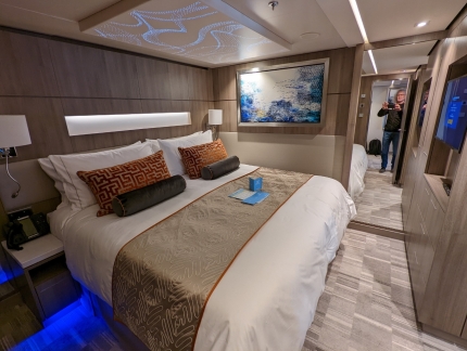
The bedroom of our cabin on the Encore was spacious and comfortable, with plenty of built-in storage for clothes. We’re once again travelling light with only carry-on baggage, so won’t come close to using it up.
|
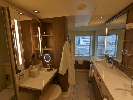 |
Bathroom
Position: 25°46.45’N, -80°9.81’W
The bathroom in our suite has a large window that overlooks our balcony.
|
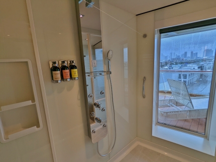 |
Shower
Position: 25°46.45’N, -80°9.81’W
Even the shower has a nice view. We enjoyed taking a shower at sea with the ship’s wake visible trailing behind us.
|
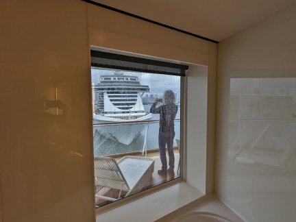 |
Bathtub View
Position: 25°46.50’N, -80°10.15’W
The view from the bathroom past the bathtub, with James on the balcony taking pictures.
|
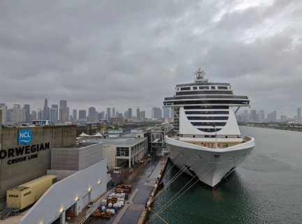 |
Position: 25°46.45’N, -80°9.81’W
The MSC Seashore moored directly behind us at the Miami Cruise Terminal.
|
 |
Bridge
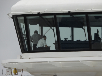
Position: 25°46.43’N, -80°9.82’W
Officers on the bridge of the MSC Seashore moored behind the Encore. Most of the ships will be departing within the next three to four hours.
|
 |
Osceola
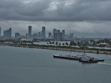
Position: 25°46.43’N, -80°9.82’W
The tug Osceola transporting a fuel barge through the main channel at the Miami Cruise Terminal.
|
 |
District Brewhouse
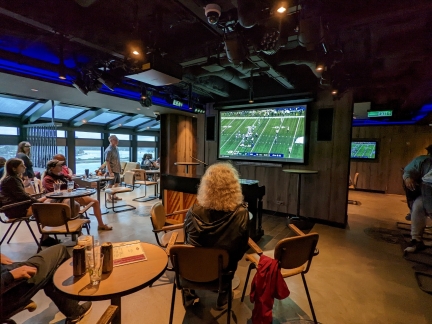
Position: 25°46.86’N, -80°10.28’W
Watching a Sunday NFL game at The District Brewhouse bar on deck 8 of the Norwegian Encore. The bar serves 50 different bottled beers plus 22 on tap, our kind of venue. Our plan while on board is to mostly spend our time exploring and enjoying the ship, with some time spent walking ashore at the ports we visit.
|
 |
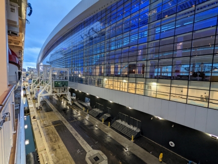
Lifeboats
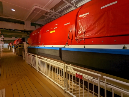
Position: 25°46.43’N, -80°9.82’W
On deck 7, looking past a few of the Norwegian Encore‘s many lifeboats.
|
 |
Ramp Detached
Position: 25°46.43’N, -80°9.82’W
The boarding ramp detached at 5:15pm for a 5:30pm departure.
|
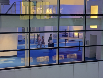 |
Latecomers
Position: 25°46.43’N, -80°9.82’W
A family arrived into the terminal with their luggage shortly after the ramp was detached. Hopefully they were able to board another way.
|
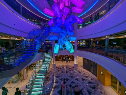 |
Center Atrium
Position: 25°46.43’N, -80°9.78’W
The sculpture hanging in the three-floor central atrium on the Norwegian Encore changed colors throughout the cruise.
|
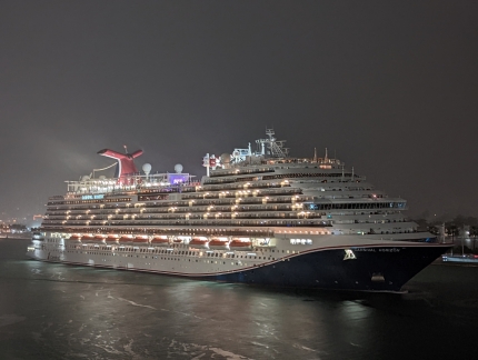 |
Carnival Horizon
Position: 25°46.45’N, -80°9.81’W
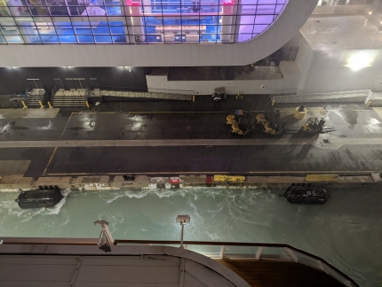
The Carnival Horizon departing at 6pm.
|
 |
Rainjacket
Position: 25°46.45’N, -80°9.81’W
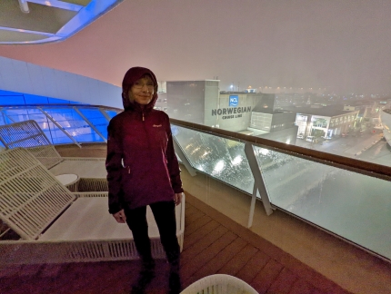
The rain hasn’t relented much all day, but we’re having a great time watching the port activity from our balcony and keeping dry with rainjackets.
|
 |
Easing Off
Position: 25°46.45’N, -80°9.81’W
The Norwegian Encore easing off the dock as we get underway.
|
 |
Mud
Position: 25°46.85’N, -80°10.00’W
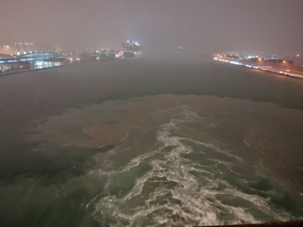
Mud churning up behind the ship as we transit the main channel at the Miami Cruise Terminal.
|
 |
NCL Terminal
Position: 25°46.55’N, -80°9.79’W
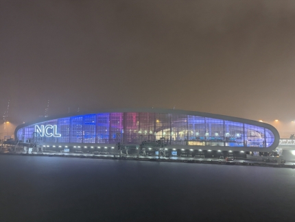
A last look at the striking NCL terminal building as we depart.
|
 |
Ferry
Position: 25°46.29’N, -80°9.18’W
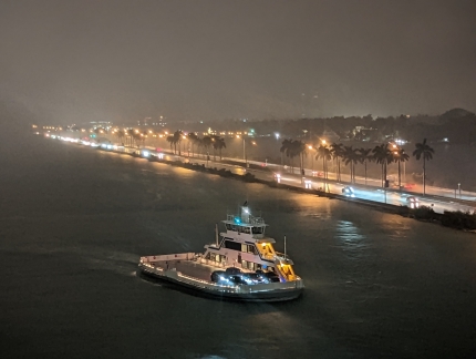
Several ferries swooped around the ship as we moved through the channel.
|
 |
Palazzo Della Luna
Position: 25°46.00’N, -80°8.52’W
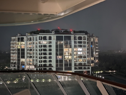
Passing close by the Palazzo Della Luna condominium building as we head to sea.
|
 |
Breakwater
Position: 25°45.68’N, -80°7.70’W
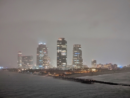
Passing alongside the breakwater at the end of the main channel as we enter the Atlantic Ocean. Our hotel last night, the Hilton Bentley, overlooks South Pointe Beach at far right.
|
 |
Pilot Boat
Position: 25°47.12’N, -80°4.16’W
Looking down from the Haven Restaurant to the pilot boat picking up our Miami pilot.
|
 |
Weather
Position: 26°0.65’N, -79°34.16’W
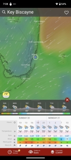
The weather is not looking great for the next day or so, and we’re heading right in to the wind and waves. Dirona would be moving quite a bit in these conditions, but we hardly notice it on board the Norwegian Encore.
|
 |
Social Comedy Club
Position: 25°45.62’N, -80°7.56’W
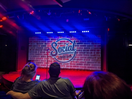
We finished our first day on board the Norwegian Encore taking in an entertaining show at the Social Comedy Club.
|
 |
Great Stirrup Cay
Position: 25°51.61’N, -77°54.89’W
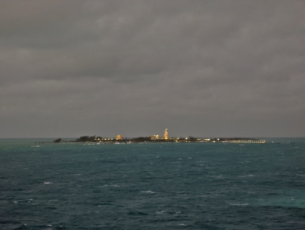
Great Stirrup Cay, a private island in the Bahamas owned by Norwegian Cruise Line, was supposed to be our first stop of the cruise. But the island has no dock and conditions were too rough to transfer passengers by lifeboat, so we’ll be skipping and spending another day at sea.
|
 |
Wonder of the Seas
Position: 25°51.61’N, -77°54.89’W
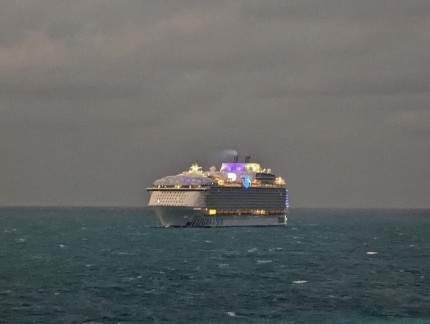
The Royal Caribbean cruise ship Wonder of the Seas behind us off Stirrup Cay.
|
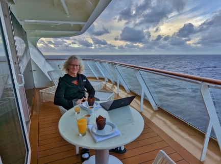 |
Breakfast
Position: 25°49.83’N, -77°39.26’W
Breakfast underway on our balcony aboard the Norwegian Encore. We slept well and are really enjoying our time on the ship. It’s been six years since we were in the Caribbean and it’s great to be here and at sea again.
|
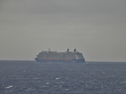 |
Celebrity Reflection
Position: 25°45.82’N, -77°21.43’W
Celebrity Reflection underway off the Abaco Island in the Bahamas. There are a lot of cruise ships in the area.
|
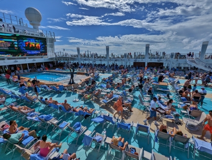 |
Empty Chairs
Position: 25°30.03’N, -76°16.36’W
Mostly empty chairs at the main sun deck on deck 16 the Norwegian Encore as we explore the ship a bit. Normally on a sea day this area would be much more crowded, but many passengers are staying in their rooms due to the roughness. We’ve noticed a bit of boat motion as we walk around, but it’s not bothersome at all.
|
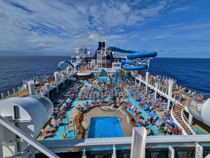 |
Aqua Park
Position: 25°29.73’N, -76°15.80’W
Looking aft from deck 17 on the Norwegian Encore across the deck 16 pool deck to the Aqua Park. The park has water slides extending off either side and a children’s play area beneath the right slide. It’s a pretty wild-looking ship.
|
 |
Netting
Position: 25°29.63’N, -76°15.60’W
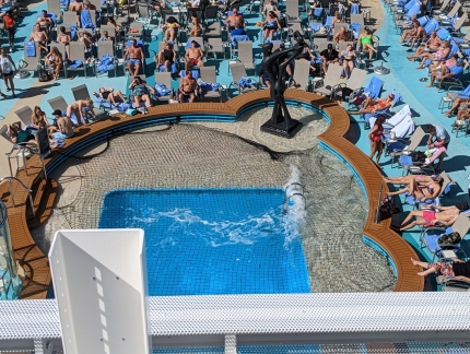
One of the pools on the sun deck is closed with netting due to the rough conditions.
|
 |
Surge
Position: 25°29.31’N, -76°14.95’W
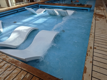
Visible surge in the Haven Courtyard pool due to boat motion.
|
 |
Haven Lounge
Position: 25°29.31’N, -76°14.95’W
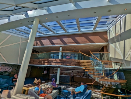
The Haven Lounge at the front of the ship had a few people in it, but plenty of empty seats.
|
 |
Haven Courtyard
Position: 25°29.31’N, -76°14.95’W
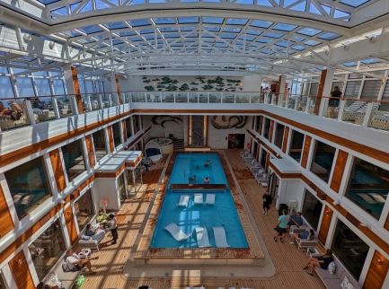
Looking forward across the Haven Courtyard from the deck 19 balcony.
|
 |
Lunch
Position: 25°22.00’N, -76°0.87’W
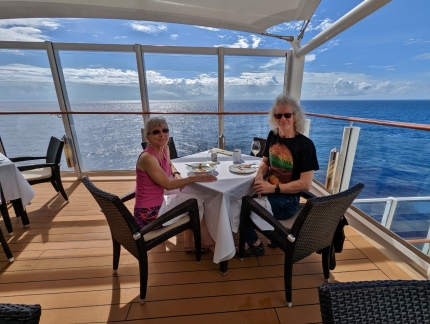
A delicious lunch on the terrace at the Haven Restaurant with a view to sea. We had dinner in the restaurant last night and were really impressed with the food quality.
|
 |
More People
Position: 25°15.23’N, -75°48.29’W
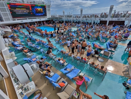
Conditions are starting to settle down a bit and the deck 16 sun deck is getting busier. We’re not very interested in sunning by the pool, but this is getting to be about as busy as we could stand if we were.
|
 |
Encore Speedway
Position: 25°14.81’N, -75°47.54’W
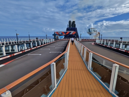
The 11,500-ft (3,505 m) Encore Speedway is the largest go-cart track at sea with enough room for ten drivers at a time in electric cars that can reach speeds of up to 30 mph (48 kph). The track is built over two decks, 18 and 19, and extends over the edge of the ship in 4 places, one almost 13 feet out. The concept was met with doubt from the cruise industry, but has been wildly successful since Norwegian unveiled the first go-kart tracks at sea aboard the Norwegian Joy and Norwegian Bliss in 2017 and 2018.
|
 |
Speedway Barrier
Position: 25°14.81’N, -75°47.54’W
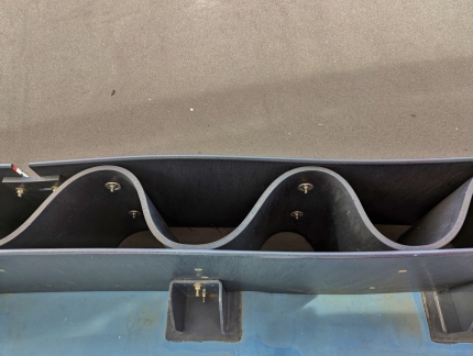
Looking down into the barrier of the Encore Speedway. The barrier design has some features in common with a NASCAR SAFER Barrier where a smooth outer surface avoids catching the car causing spinning or flipping with an energy absorption layer behind it.
|
 |
Laser Tag
Position: 25°14.02’N, -75°46.09’W
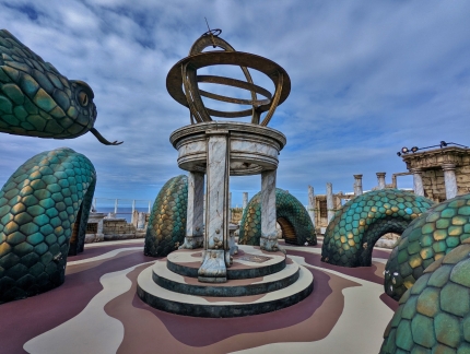
The laser tag area at the aft of the ship on deck 18 wasn’t open for tag yet, so we were able to walk around.
|
 |
Stern
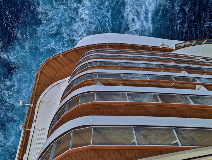
Position: 25°13.74’N, -75°45.59’W
Looking down the stern to the water from the back of the laser tag area on deck 18. Our balcony is barely visible just over halfway down.
|
 |
The Cellars
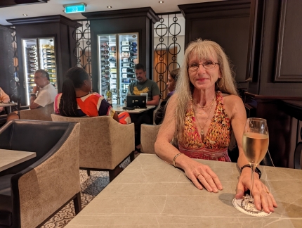
Position: 25°7.43’N, -75°34.29’W
A glass of sparkling wine before dinner at the Cellars Wine Bar on deck 8. We later had an excellent meal on the terrace at adjacent Onda restaurant.
|
 |
Alex Yosi
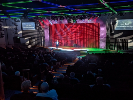
Position: -1°32.82’S, 106°43.46’E
After dinner, we stopped by the theater to check out the show playing there. The Southern Swing singer Alex Yosi was not really to our taste, but was quite popular with many on board. It’s kind of amazing to have an 800-person theater in the middle of a ship.
|
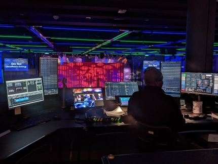 |
Soundboard
Position: -1°32.82’S, 106°43.46’E
One of two soundboard technicians managing the Alex Yosi show.
|
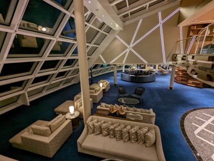 |
Empty Lounge
Position: -1°32.82’S, 106°43.46’E
We returned to the front of the ship to explore the Haven area some more. At 8pm, the lounge was completely empty.
|
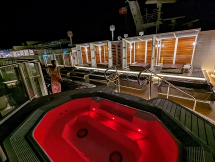 |
Haven Sun Deck
Position: 24°11.56’N, -73°51.12’W
Checking out the Haven Sun Deck on deck 19. It’s pretty quiet up here too, partly because it’s still quite windy.
|
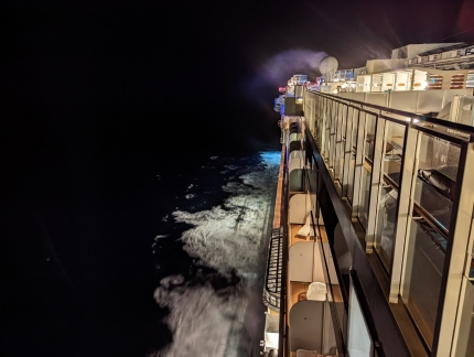 |
Sun Deck View Aft
Position: 24°11.70’N, -73°51.36’W
Looking aft from the Haven Sun Deck down the starboard side of the Norwegian Encore. The engine smoke is visible billowing away in the distance beyond one of the satellite dishes.
|
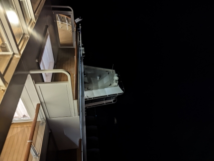 |
Bridge Wing
Position: -1°32.82’S, 106°43.46’E
The deck 14 bridge wings on the Norwegian Encore, viewed from the deck 19 sun deck.
|
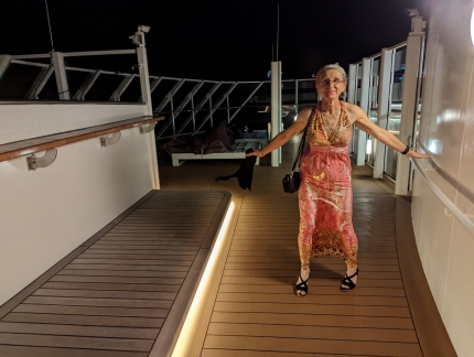 |
Windy
Position: 24°11.45’N, -73°50.88’W
Jennifer’s dress is turning into a bit of a sail in the windy conditions at the front of deck 19.
|
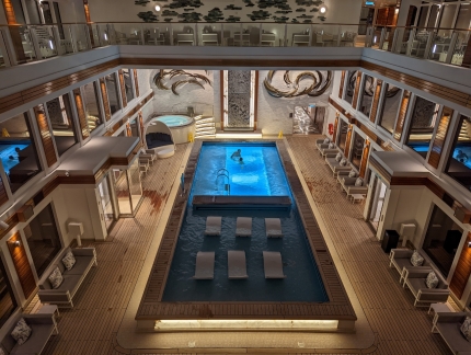 |
Settling
Position: 24°10.83’N, -73°49.66’W
Conditions have settled considerably and the Haven Courtyard pool on the Norwegian Encore is looking a lot calmer in the evening compared to the surge we saw earlier today.
|
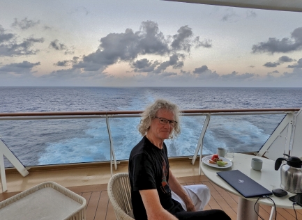 |
Breakfast
Position: 22°43.78’N, -71°0.60’W
Breakfast on our balcony at the stern of the Norwegian Encore. We’re really enjoying being at sea again and watching the wake trail behind us into the distance.
|
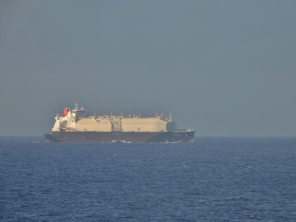 |
Nohshu Maru
Position: 22°37.43’N, -70°48.35’W
The 976-ft (297.5 m) LNG tanker Nohshu Maru, owned by Tokyo-based O.S.K. Lines, passing behind us.
|
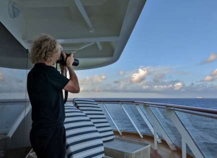 |
Coolpix P1000
Position: 22°37.43’N, -70°48.35’W
When we travel, we normally just bring our portable Canon PowerShot SX70. But for this trip we also brought our larger and heavier Nikon Coolpix P1000. The long lens is ideal for taking pictures from our cabin balcony, and we carry the smaller and lighter Canon for taking pictures outside the room.
|
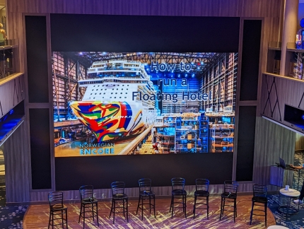 |
Floating Hotel Presentation
Position: 22°27.71’N, -70°26.96’W
We’re quite impressed with how well NCL so smoothly operates such a huge vessel and today we attended a presentation to learn more about the ship. The Encore is essentially a floating resort for more than 4,000 guests. The ship is nearly a quarter mile long, cost USD $1 billion, is powered by 103,000 HP and has a crew of 2,100 people, and yet can cruise the seas at over 22 knots.
|
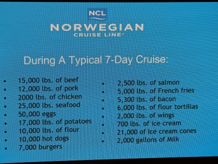 |
Shopping List
Position: 22°27.71’N, -70°26.96’W
The weekly food consumption on board the Encore is staggering. This is their weekly “shopping list” that needs to be replenished in Miami before the start of each cruise. And we thought getting several months of supplies stowed on board Dirona was a big job.
|
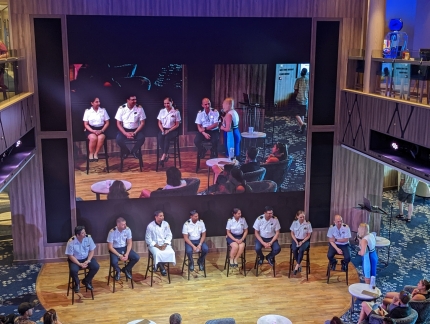 |
Officers
Position: 22°27.71’N, -70°26.96’W
For the final section of the presentation, ship’s officers representing a range of hotel groups from Beverages to Housekeeping came on stage to answer questions from the audience. We were particularly interested in learning about their backgrounds and responsibilities as part of their introduction.
|
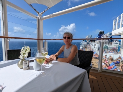 |
Lunch
Position: 22°14.29’N, -69°55.99’W
We frequently had lunch on the terrace at the Haven restaurant. The food is excellent and the outdoor seating on deck 18 is hard to beat.
|
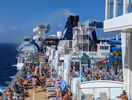 |
Pool Deck
Position: 22°14.29’N, -69°55.99’W
The pool deck is much busier than yesterday now that sea conditions are more settled.
|
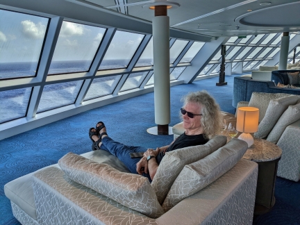 |
Haven Lounge
Position: 21°47.34’N, -69°11.90’W
We’re really liking the Haven concept, where we can enjoy everything a big ship has to offer and escape the crowds and noise at will. Here we are taking in the view forward from the near-empty Haven Lounge on deck 17.
|
 |
Ocean Blue
Position: 21°2.84’N, -67°48.53’W
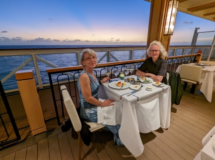
An excellent seafood dinner at Ocean Blue on The Waterfront. In the past decade, Norwegian redesigned their promenade decks to introduce “The Waterfront,” a unique quarter-mile outdoor walking path with comfortable seating and wind breaks. Most of the popular restaurants have terraces for outdoor dining, and several of the bars have outside seating as well. We love being outdoors whatever the temperature, and ate most of our meals outside while on board the Encore.
|
 |
The Cavern Club
Position: 20°47.26’N, -67°27.82’W
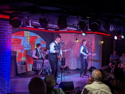
The Cavern Club on the Norwegian Encore is a replica of Beatles’ home club in Liverpool, where they played 275 times. Several nights during the cruise, a Beatles tribute band played songs from a specific Beatles era. Here they are playing songs from the early period of 1962 to 1965. The band was rather good, and we enjoyed their show.
|
 |
Evening Soak
Position: 20°1.46’N, -66°16.09’W
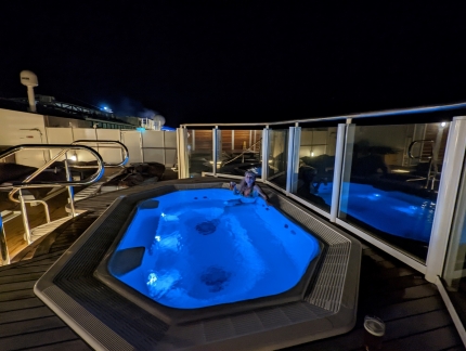
An evening soak at the Haven sun deck. The hot tubs around the main pool deck were packed when we walked by, but we didn’t see another guest the entire time we were in the Haven tub.
|
 |
Daybed
Position: 19°53.95’N, -66°7.30’W
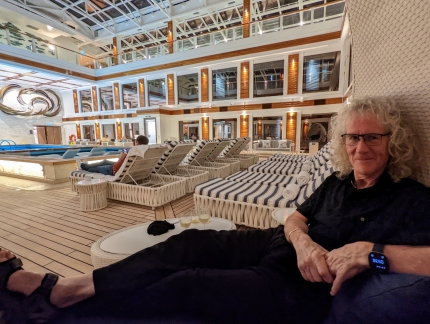
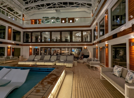
The wicker-enclosed multi-person daybeds in the Haven Courtyard looked cozy, and we’d been wanted to try them out. So we settled into one with a glass of wine after our hot tub soak.
|
 |
Haven Courtyard
Position: 19°53.95’N, -66°7.30’W
Looking aft across the Haven Courtyard on the Norwegian Encore, with James just visible in the daybed at right. The courtyard is usually pretty quiet, but even more so later in the evening, particularly compared to the rest of the ship.
|
 |
Land Ho
Position: 18°21.28’N, -65°8.64’W
Our first view of the Virgin Islands since early 2016. The Norwegian Encore‘s course is very close to Dirona‘s through the area en route from St. Lucia to Florida. Back then, we passed close enough to take a photo of three large cruise ships moored at Charlotte Amalie, our current destination.
|
 |
Rainbow
Position: 18°16.49’N, -64°59.59’W
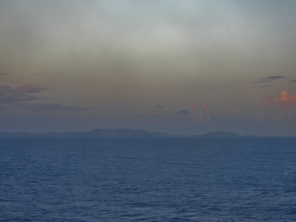
A rainbow to the right of Water Island, with the island of St. Thomas, USVI in the distance.
|
 |
Epic Curacao
Position: 18°16.75’N, -64°57.28’W
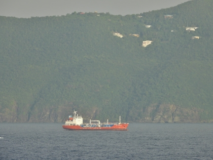
The inter-island LPG tanker Epic Curacao underway from St. Thomas, USVI.
|
 |
Flamingo Point
Position: 18°16.80’N, -64°57.10’W
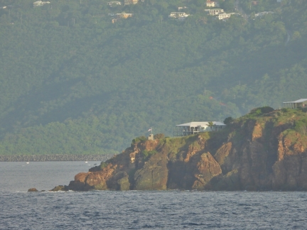
This house perched on Flamingo Point on the southern tip of Water Island has a wonderful view and is available to rent for USD $3,000 per week.
|
 |
Rupert Rock
Position: 18°19.52’N, -64°55.66’W
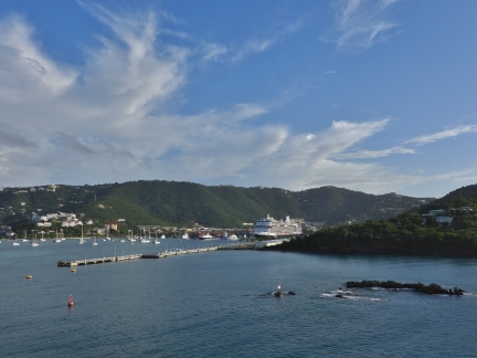
Looking across Rupert Rock, right, off St. Thomas. The Nieuw Statendam is moored on the Charlotte Amalie cruise ship pier at center, with the island of St. Thomas rising behind.
|
 |
Fort Willoughby
Position: 18°19.69’N, -64°55.71’W
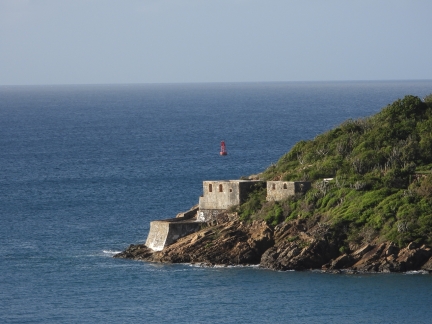
Looking back to sea past Fort Willoughby on the southern end of Hassel Island. Originally called Prince Frederik’s Battery, the fortification was built by the Danish in the late 18th century.
|
 |
Buoys
Position: 18°19.69’N, -64°55.71’W
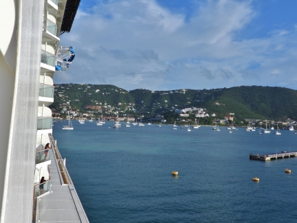
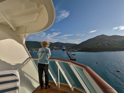
Looking down the starboard side of the Norwegian Encore as the ship nears the buoys off the end of the cruise ship pier. We’re really enjoying the corner balcony with a view to starboard and to stern.
|
 |
Watching Landing
Position: 18°19.77’N, -64°55.69’W
Watching the landing at Charlotte Amalie from our balcony on the Norwegian Encore.
|
 |
Mud
Position: 18°19.82’N, -64°55.68’W
Mud churning up behind the Norwegian Encore as the ship turns to back on to the cruise ship pier.
|
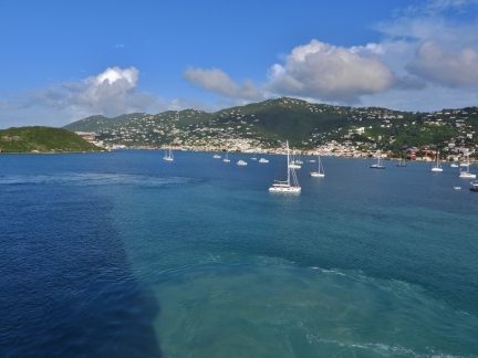 |
Harbor of Charlotte Amalie
Position: 18°19.82’N, -64°55.62’W
Looking from the stern to the pleasure craft moored in the Harbor of Charlotte Amalia as the captain of the Norwegian Encore brings the stern around to back on to the pier. Maneuvering space is quite limited here and it must feel a little unnerving to be in one of those small boats as the large ship swings to close by. We couldn’t see any obvious buoys or markers to keep anchored vessels out of the turning area for the cruise ships. We guess a 170,000 gross ton ship is self enforcing :-).
|
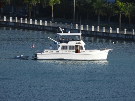 |
Pasion
Position: 18°19.82’N, -64°55.62’W
Most of the vessels at anchor in Charlotte Amalie were sailboats, with a few power catamarans and one trawler, Pasion.
|
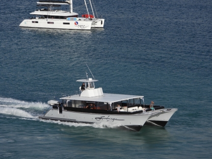 |
Tour Boats
Position: 18°19.89’N, -64°55.64’W
As we docked, tour boats were arriving in the area to pickup passengers for shore excursions.
|
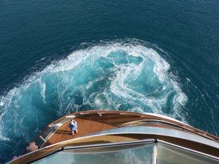 |
Wash
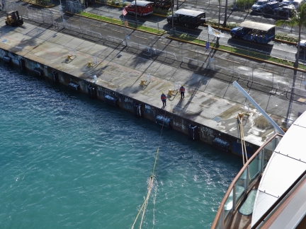
Position: 18°19.91’N, -64°55.49’W
The wash behind the Norwegian Encore as the ship backs onto the pier at Charlotte Amalie.
|
 |
Messenger Line
Position: 18°19.91’N, -64°55.47’W
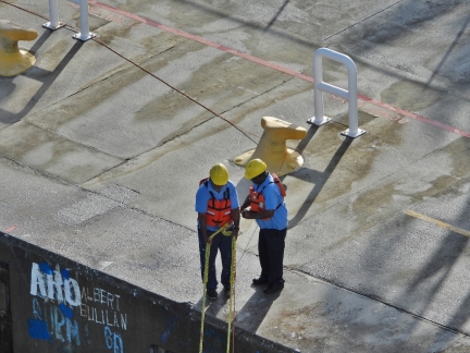
In the messenger lines procedures we’ve watched previously, the ship’s crew sends a light messenger line to shore, the shore workers tie a medium-weight line to the end, the messenger line is pulled back to the ship, the heavy ship’s line is attached to the end of the medium line, and the shore workers pull the medium line back to shore along with the ship’s heavy line. This process is then repeated for each line.
The Norwegian Encore uses a much more efficient process where short 10-ft pigtail lines are permanently attached to the heavy ship’s lines, both made from floating material, and the messenger line is always held on shore and on the boat. Each pigtail is attached midway along the messenger lie, pulled to shore, released, and the messenger line mid-point pulled back to the ship, attached to the next line, then pulled back to shore. Rinse and Repeat. This is much more efficient by skipping an entire back-and-forth of the messenger and medium lines for each ship’s line pulled ashore. In the picture, the short yellow pigtail line is just about to come out of the water with the heavy ship’s line trailing behind it. The orange light messenger line is attached to the forklift at upper left and trails to the yellow pigtail line and then back to the ship just to the right of the heavier lines. |
 |
Detaching Line
Position: 18°19.91’N, -64°55.47’W
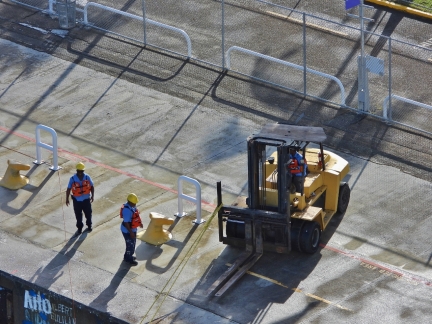
The shore crew detaching the orange light messenger line from the yellow medium pigtail line. The messenger line, visible heading into the water to the right of the medium line and trailing away at upper left, will be partially pulled back to the ship for the next set of lines while the shore crew pulls the current ship’s line ashore and onto a bollard.
|
 |
Forklift
Position: 18°19.91’N, -64°55.47’W
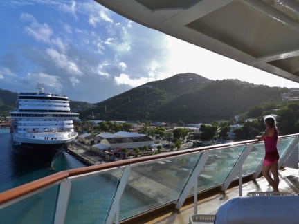
A forklift pulling the medium yellow pigtail line, attached to the ship’s line, ashore to place on a bollard while the Norwegian Encore crew pulls the mid-point of the the orange messenger line, visible at far left, back to the ship to attach the next line.
|
 |
Watching Docking
Position: 18°19.94’N, -64°55.42’W
We really enjoyed watching the ship dock from our balcony and stayed out until the last line was in place.
|
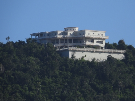 |
Villa
Position: 18°19.94’N, -64°55.42’W
Several huge villas are in the hills above Charlotte Amalie.
|
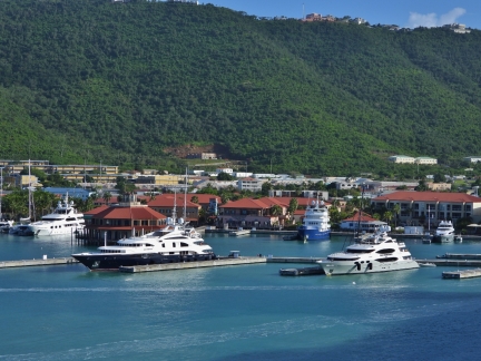 |
Superyachts
Position: 18°19.94’N, -64°55.42’W
A lightly-loaded superyacht dock at St. Thomas.
|
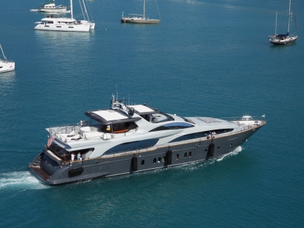 |
Tail Lights
Position: 18°19.94’N, -64°55.42’W
The 115-ft (35 m) Azumit yacht Tail Lights arriving into Charlotte Amalie. The vessel has a crew of 6 and charters for USD $80,000 per week, plus expenses.
|
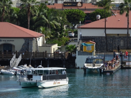 |
Excursions
Position: 18°19.95’N, -64°55.42’W
Passengers from the Nieuw Statendam lining up for a shore excursion.
|
 |
Squall
Position: 18°19.93’N, -64°55.43’W
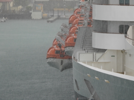
A brief squall passed through the area as the crew of the Nieuw Statendam were starting lifeboat drills.
|
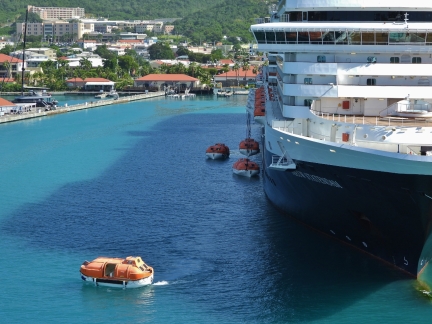 |
Lifeboat Drill
Position: 18°19.94’N, -64°55.42’W
Lifeboats from the Nieuw Statendam in the water for a drill at Charlotte Amalie, USVI.
|
 |
Movie
Position: 18°19.86’N, -64°55.55’W
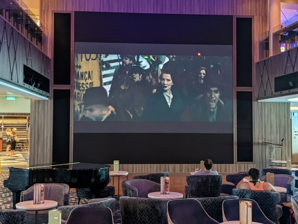
A movie playing at the deck 6 atrium on board the Encore as we pass by on our way ashore. We’re still not really used the size of the ship and it seems amazing to have a near drive-in-sized movie screen inside the middle of a boat.
|
 |
Ashore
Position: 18°19.87’N, -64°55.50’W
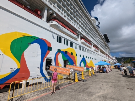
Ashore at Charlotte Amalie, our first time off the Encore since departing Miami three days ago. We’ve been finding the ship surprisingly enjoyable, and haven’t been in any rush to disembark.
|
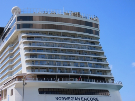 |
Our Balcony
Position: 18°19.96’N, -64°55.36’W
Looking up to the balcony of our cabin from shore. It’s in the middle vertically of the seven decks with balconies, and at far right.
|
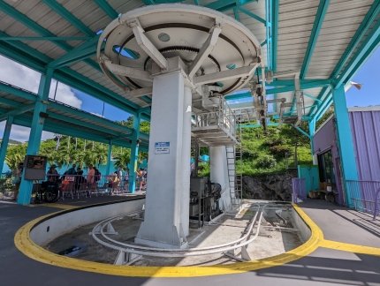 |
Gondola
Position: 18°20.04’N, -64°55.12’W
At the bottom of the Skyride gondola to Paradise Point.
|
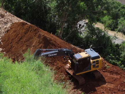 |
Deere
Position: 18°19.93’N, -64°54.99’W
We’re always happy to see a John Deere in the wild, this one at work on the road up to Paradise Point.
|
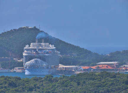 |
Wonder of the Seas
Position: 18°19.87’N, -64°54.92’W
A view to Wonder of the Seas in Crown Bay, where deeper draft vessels must moor. Completed in 2022, it’s the largest cruise ship in the world by tonnage at 236,857 GT.
|
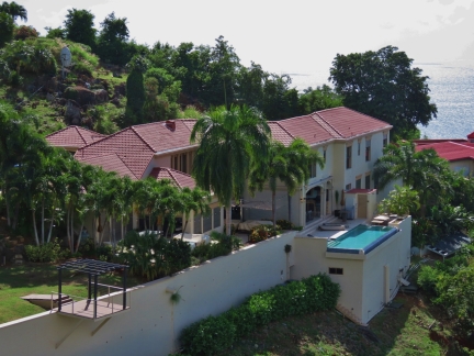 |
Infinity Pool
Position: 18°19.87’N, -64°54.92’W
Infinity pool outside a villa in the hills above Charlotte Amalie, taken from the gondola to Paradise Point.
|
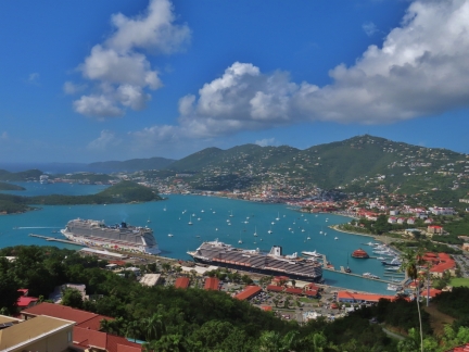 |
Paradise Point View
Position: 18°19.82’N, -64°54.87’W
The spectacular view across the Harbor of Charlotte Amalie from Paradise Point.
|
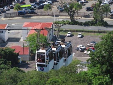 |
Gondolas
Position: 18°19.82’N, -64°54.85’W
The Skyride to Paradise Point runs a triple set of gondolas each way.
|
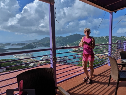 |
Bushwacker
Position: 18°19.82’N, -64°54.87’W
Enjoying a signature Bushwacker cocktail, and the view, at the Paradise Point restaurant. Invented in St. Thomas in 1975, the ingredients in a Bushwacker include Baileys Irish Cream, vodka, rum, Kahlua and Amaretto. It’s quite tasty.
|
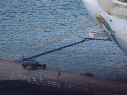 |
Genie
Position: 18°19.82’N, -64°54.87’W
The long arm of a Genie extended out to the bow of the Norwegian Encore. The crew was constantly doing maintenance whenever we were in port.
|
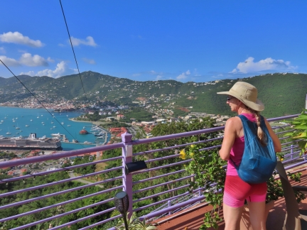 |
Nano Daypack
Position: 18°19.85’N, -64°54.86’W
A couple of years back we bought a Sea to Summit Ultra-Sil Nano Daypack and always carry it with us. We haven’t used it a lot, but the compact size is ideal for this trip. We’re traveling light with carry-on bags only, so don’t have space for a separate lightweight pack.
|
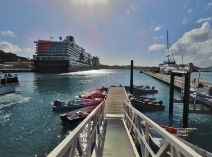 |
Dinghy Dock
Position: 18°20.11’N, -64°55.16’W
The dinghy dock at Charlotte Amalie with the Nieuw Statendam and the Norwegian Encore moored beyond. We’re quite happy being here on the Encore and are somewhat surprised that sights like this don’t make us wistful for Dirona.
|
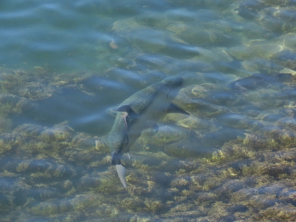 |
Big Fish
Position: 18°20.12’N, -64°55.19’W
A surprisingly large fish swimming along shore in the harbor of Charlotte Amalie.
|
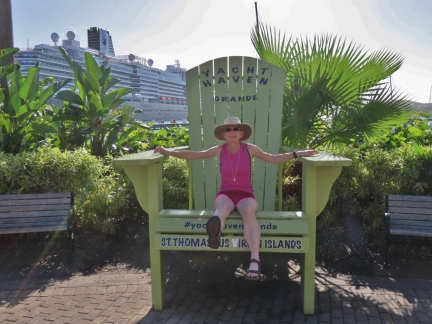 |
Yacht Haven
Position: 18°20.15’N, -64°55.20’W
Jennifer in the big chair outside the Yacht Haven Grande marina at Charlotte Amalie.
|
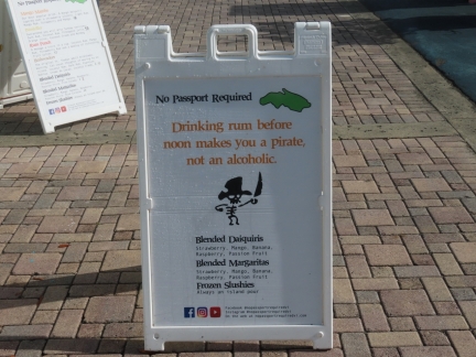 |
No Passport Required
Position: 18°20.10’N, -64°55.16’W
We got a laugh from the sign at the No Passport Required rum stand: “Drinking rum before noon makes you a pirate, not an alcoholic.”
|
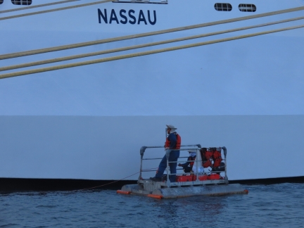 |
Painting
Position: 18°19.97’N, -64°55.34’W
Norwegian Encore crew members out in a skiff to touch up the paint on the stern.
|
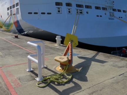 |
Pigtails
Position: 18°19.93’N, -64°55.40’W
A pair of the yellow pigtails that are permanently attached to the heavy ship’s lines to pull them ashore by messenger line.
|
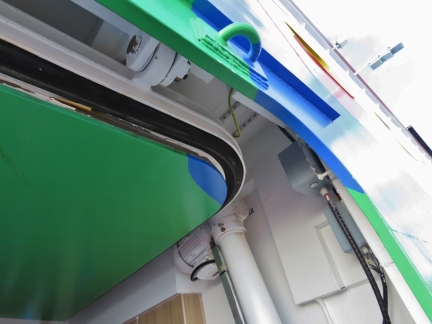 |
Hatch Seal
Position: 18°19.87’N, -64°55.50’W
The heavy-duty seal in the Norwegian Encore hatch is compressed closed by the ship hydraulics. Being only 10-ft above the water, these will take the full impact of wave action in storms and need to seal well.
|
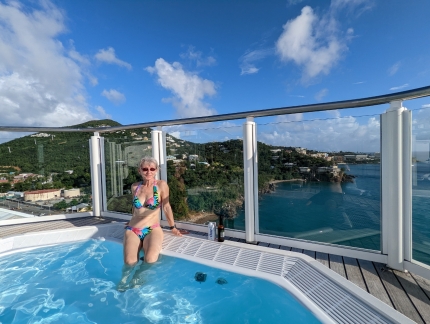 |
Hot Tub
Position: 18°19.85’N, -64°55.54’W
Enjoying a soak in one of the hot tubs on the Haven sun deck, with a view across the southeast St. Thomas shoreline. These tubs are great in that they overhang the edge of the ship and you can see all the way down the side both forward and aft, with the bridge wing forward and three floors below.
|
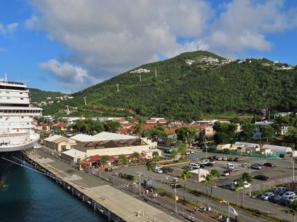 |
Paradise Point
Position: 18°19.86’N, -64°55.55’W
Looking from the Haven sun deck to the Skyride gondola, beyond the buildings in the distance, with Paradise Point just beneath the summit at upper right.
|
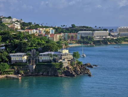 |
Waterfront Estate
Position: 18°19.86’N, -64°55.54’W
The Waterfront Estate, perched off the point just south of the cruise ship pier, is a 9-acre (3.6 ha) compound with 4 separate villas that recently was listed for USD $24 million. The colorful buildings ringing the cove beyond are part of the Marriott’s Frenchman’s Cove resort.
|
 |
Bridge
Position: 18°19.94’N, -64°55.43’W
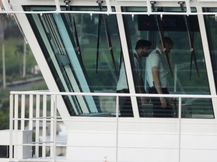
Officers in the bridge wing of the Nieuw Statendam preparing to get underway.
|
 |
Departing
Position: 18°19.94’N, -64°55.43’W
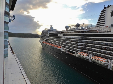
The Nieuw Statendam easing off the pier behind us.
|
 |
Observation Crew
Position: 18°19.94’N, -64°55.43’W
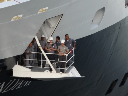
Crew keeping an eye on the surroundings from a pop-out platform low in the bow of the Nieuw Statendam.
|
 |
Close Quarters
Position: 18°19.94’N, -64°55.43’W
There’s not much space between the two ships as the Nieuw Statendam departs.
|
 |
Passengers
Position: 18°19.94’N, -64°55.43’W
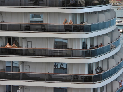
Passengers on both ships were watching as the Nieuw Statendam departed alongside the Norwegian Encore. Those rear corner balconies on the Nieuw Statendam look very nice.
|
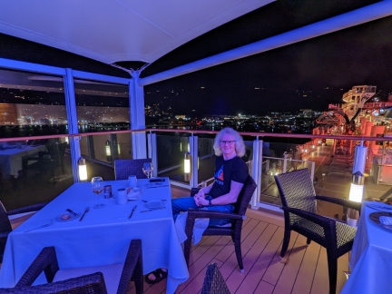 |
Haven Restaurant
Position: 18°19.89’N, -64°55.51’W
Another excellent meal on the terrace of the Haven Restaurant, with the lights of Charlotte Amalie visible beyond.
|
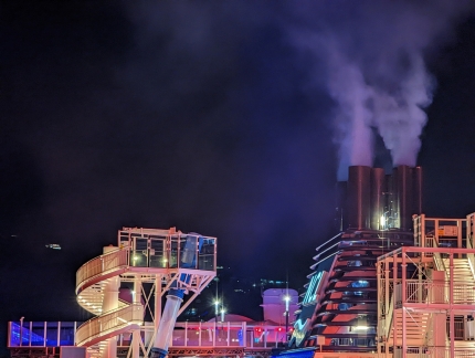 |
Exhaust
Position: 18°19.89’N, -64°55.51’W
Exhaust pouring out of the Norwegian Encore smokestacks as the engines are spun up for departure.
|
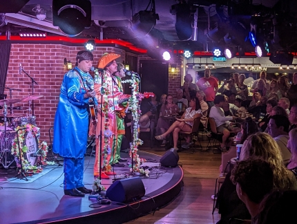 |
Cavern Club
Position: 18°11.74’N, -64°52.57’W
Tonight the Cavern Club Beatles tribute band was playing songs from their middle era, including Sgt. Pepper’s Lonely Hearts Club Band.
|
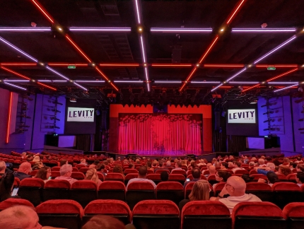 |
Levity Live
Position: 18°11.24’N, -64°51.68’W
After listening to a few songs in the Cavern Club, we finished the evening with a Levity Live comedy show in the Norwegian Encore‘s main theater. We didn’t really take the cruise for the shows, and weren’t that interested in attending them. But we often go since we are around, and it’s surprising how much we enjoy them.
|
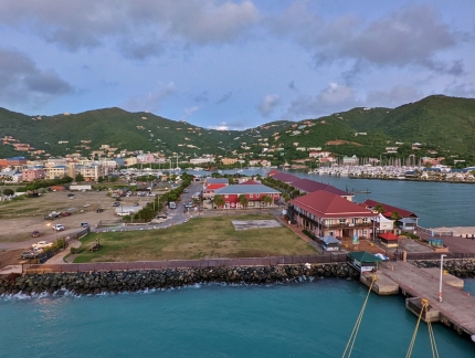 |
Road Town
Position: 18°25.32’N, -64°36.79’W
The Norwegian Encore arrived into Road Town, Tortola, BVI while we were sleeping and this was our view when we got up this morning.
|
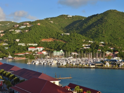 |
The Moorings
Position: 18°25.32’N, -64°36.79’W
The Moorings yacht charter company’s large British Virgin Islands fleet.
|
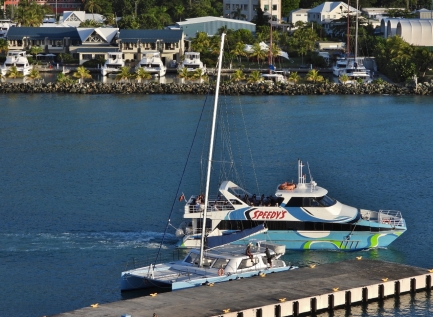 |
Speedy’s
Position: 18°25.32’N, -64°36.79’W
The Speedy’s Sprinter fast ferry departing Road Town.
|
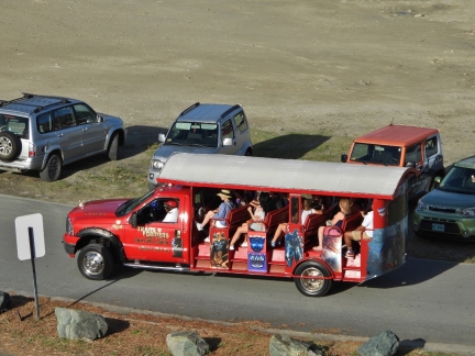 |
Excursion
Position: 18°25.33’N, -64°36.81’W
A group from the Norwegian Encore heading out on a tour of the island in an open-air safari bus. The mass excursions aren’t that attractive for us but, so far, we’re neither bored nor feeling anyway constrained by the population pressure of this crazy big boat. So far, we really haven’t noticed it.
|
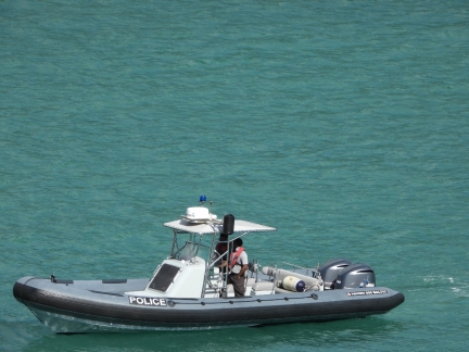 |
Police
Position: 18°25.33’N, -64°36.80’W
A capable-looking police RIB.
|
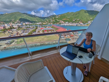 |
The Office
Position: 18°25.32’N, -64°36.81’W
Getting a little work done on the balcony of our cabin before heading ashore.
|
 |
Three Ships
Position: 18°25.29’N, -64°36.74’W
Two other ships are in Road Town today, the AIDA luna, at left, and the AIDA diva, anchored off in the distance.
|
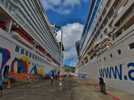 |
Wall of Ships
Position: 18°25.29’N, -64°36.74’W
The two cruise ships tower over the Tortola pier.
|
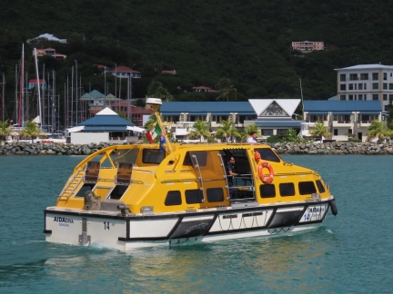 |
Lifeboat
Position: 18°25.42’N, -64°36.88’W
A lifeboat from the AIDA diva transferring passengers between ship and shore. It’s amazing that two mega-ships are at dock and one more of similar size is at anchor.
|
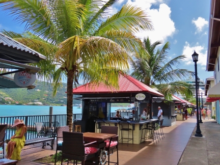 |
Tortola Pier Park
Position: 18°25.41’N, -64°36.93’W
Tortola Pier Park has several appealing-looking bars and restaurants.
|
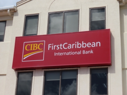 |
CIBC
Position: 18°25.31’N, -64°37.11’W
We were surprised to see the familiar logo of the Canadian Imperial Bank of Commerce (CIBC) used by the First Caribbean International Bank. It turns out CIBC in 2006 purchased a majority share in the Caribbean bank.
|
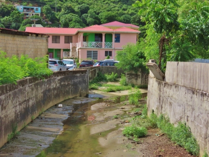 |
Drainage Channel
Position: 18°25.49’N, -64°37.33’W
This large drainage channel through Road Town gives an indication of how heavy the rains can fall here.
|
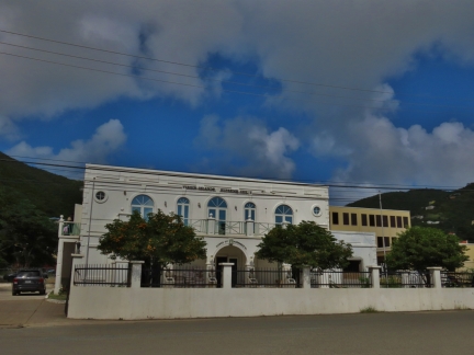 |
Supreme Court
Position: 18°25.52’N, -64°37.32’W
The Virgin Islands Supreme Court building in Road Town.
|
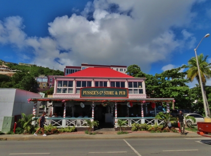 |
Pusser’s Pub
Position: 18°25.19’N, -64°37.07’W
In 1979, Charles Tobias obtained the rights and blending information for the rum produced in past centuries by the British Admiralty, including the right to use the Royal Navy’s White Ensign on the label, and began bottling and selling it on Tortola. The rum can be purchased and consumed here in Pusser’s Pub and Store, and at a few other locations in the BVI, plus one in Munich. The term Pusser is a centuries-old navy seamen’s mispronunciation of Purser, the officer responsible for doling out the Navy’s rum rations and stores.
|
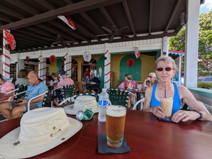 |
Painkiller
Position: 18°25.19’N, -64°37.08’W
Enjoying a Painkiller, the official drink of the BVI, invented 40 years ago using Pusser’s Rum. It was tasty, but potent. James played it safe and stuck with beer.
|
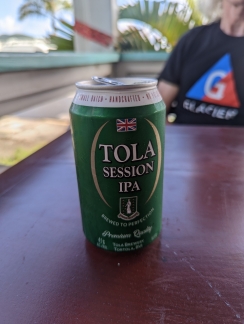 |
Tola IPA
Position: 18°25.20’N, -64°37.08’W
James opted instead for a locally-brewed Tola IPA. It was also quite tasty, but less potent than the Painkiller.
|
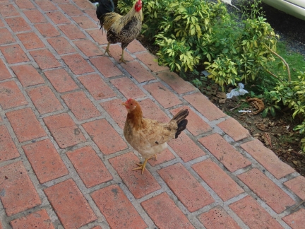 |
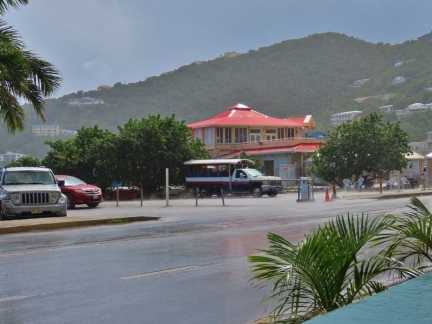
Chickens
Position: 18°25.20’N, -64°37.08’W
A few chickens wandered through Pusser’s while we had lunch there. That doesn’t happen very often in Seattle.
|
 |
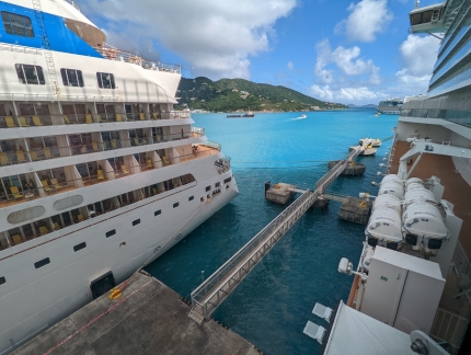
Squall
Position: 18°25.20’N, -64°37.08’W
A brief squall came through town while we were having lunch.
|
 |
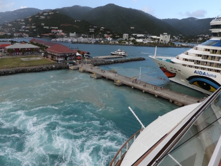
Pier Extension
Position: 18°25.28’N, -64°36.71’W
Looking down the extension to the Tortola pier that allows larger ships to tie off.
|
 |
Departing
Position: 18°25.34’N, -64°36.76’W
Mud churned up as the Norwegian Encore departs Tortola.
|
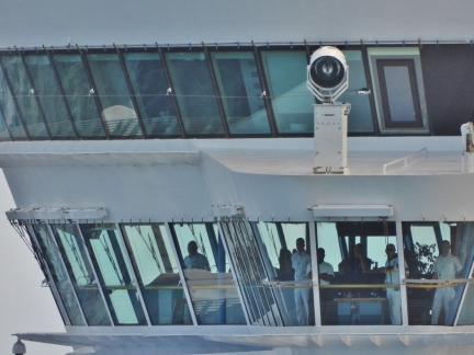 |
Bridge
Position: 18°25.34’N, -64°36.76’W
Officers on the bridge of the anchored AIDA diva as the Norwegian Encore passes close by. They have raised anchor and are getting ready to move onto the Tortola pier.
|
 |
AIDA diva
Position: 18°25.34’N, -64°36.76’W
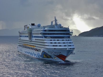
The AIDA diva turning in place before proceeding to the berth our ship just vacated.
|
 |
Dream Star
Position: 18°25.34’N, -64°36.76’W
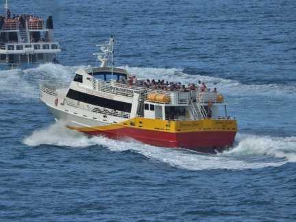
The BVI ferry Dream Star underway behind another ferry behind Norwegian Encore.
|
 |
Los Lobos
Position: 18°24.11’N, -64°31.00’W
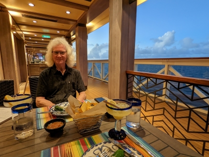
A delicious Mexican dinner at Los Lobos on The Waterfront as the Norwegian Encore is underway for the Dominican Republic.
|
 |
Dusk
Position: 18°42.51’N, -64°54.20’W
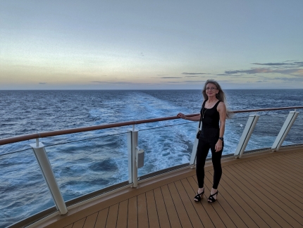
Taking in the view to the stern from The Waterfront outdoor walkway.
|
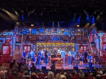 |
Choir of Man
Position: 18°50.01’N, -65°26.08’W
The stage for the British musical The Choir of Man. The singers were very talented and, as with all the other shows we’ve attended on board the Norwegian Encore, we found it quite entertaining.
|
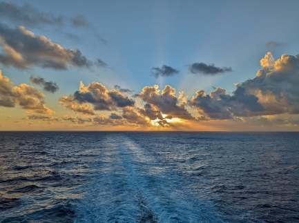 |
Sunrise
Position: 19°26.30’N, -68°41.18’W
Sunrise at sea a few hours out of the Dominican Republic. Having an aft balcony is working out really well. We’re protected from most winds and we love watching the wake trailing behind the ship.
|
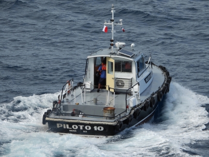 |
Piloto 10
Position: 19°52.07’N, -70°42.58’W
The pilot boat Piloto 10 moving away after dropping off the Norwegian Encore‘s pilot for entering Amber Cove in the Dominican Republic.
|
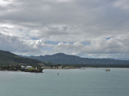 |
Dominican Republic
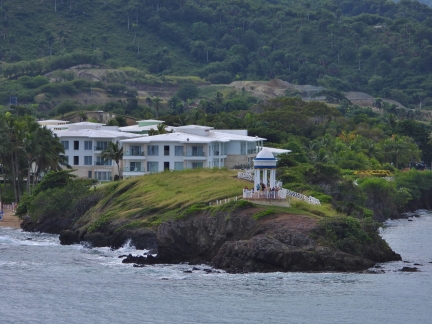
Position: 19°50.54’N, -70°46.15’W
A first view to the Dominican Republic, at Amber Cove, as the Norwegian Encore backs onto the pier.
|
 |
Punta de la Guardia
Position: 19°50.33’N, -70°46.36’W
Guests of the Senator Puerto Plata resort watching from Punta de la Guardia as our ship arrives.
|
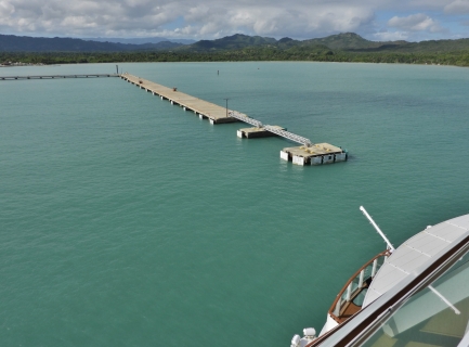 |
Backing
Position: 19°50.15’N, -70°46.44’W
The Norwegian Encore backing down to the pier at Amber Cove.
|
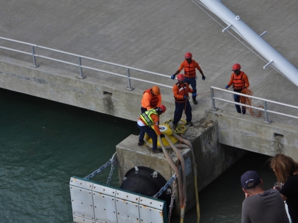 |
Docking
Position: 19°50.06’N, -70°46.52’W
Shore workers draping the heavy ship’s lines over bollard number 9.
|
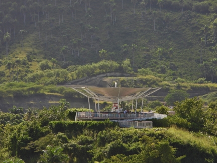 |
Sky Bar
Position: 19°50.06’N, -70°46.52’W
The roof of the bar Puerto Plata looks like a satellite dish.
|
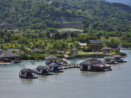 |
Cabanas
Position: 19°50.06’N, -70°46.52’W
Cabanas in Amber Cove available to rent for the day.
|
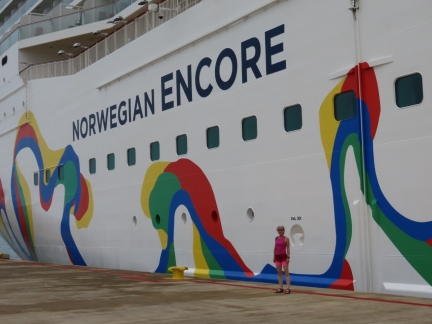 |
Ashore
Position: 19°50.08’N, -70°46.52’W
Ashore next to the Norwegian Encore at Amber Cove.
|
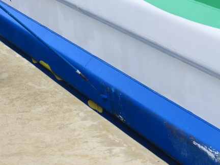 |
Painting
Position: 19°50.08’N, -70°46.52’W
Crew members touching up the paint on the Norwegian Encore.
|
 |
Norwegian Encore
Position: 19°49.93’N, -70°46.51’W
Looking back to the Encore as we head ashore to explore Amber Cove.
|
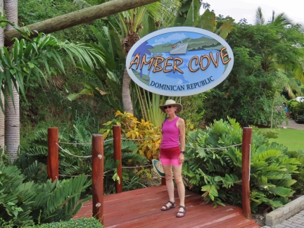 |
Amber Cove
Position: 19°49.90’N, -70°46.46’W
Amber Cove is an isolated cruise terminal owned by Carnival Cruise Lines that opened in 2019 and is mainly designed as a transportation hub for cruise ship passengers. We initially were scheduled to land a little to the south at Puerto Plata, the third-largest city in the Dominican Republic, which would have been more interesting.
|
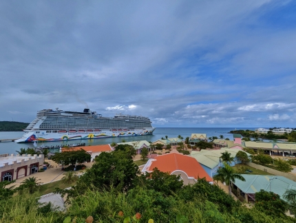 |
View from Sky Bar
Position: 19°49.89’N, -70°46.49’W
Looking down to Amber Cove from the Sky Bar we saw earlier that looks like a satellite dish.
|
 |
Water Slide
Position: 19°49.84’N, -70°46.44’W
Amber Cove has a small adventure park, with a zip line and a water slide.
|
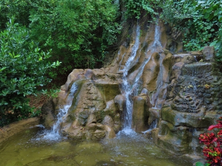 |
Waterfall
Position: 19°49.91’N, -70°46.44’W
One of two man-made waterfalls at Amber Cove.
|
 |
Orchid
Position: 19°49.91’N, -70°46.44’W
Beautiful orchid growing near the waterfalls in Amber Cover.
|
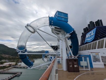 |
Ocean Loops
Position: 19°49.88’N, -70°46.52’W
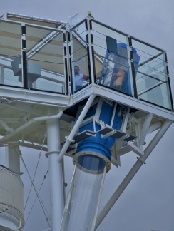
Back on board the lightly-loaded Encore, we spent some time in the Aqua Park on deck 18. This is the double-lopped Ocean Loops slide with clear sections that extend over the edge of the deck. The circular stairs to the starting point are partially visible behind the support post in the foreground.
|
 |
Ready to Launch
Position: 19°49.86’N, -70°46.53’W
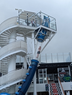
The attendant at the top of the Ocean Loops slide preparing James for the ride.
|
 |
Free Fall
Position: 19°49.86’N, -70°46.53’W
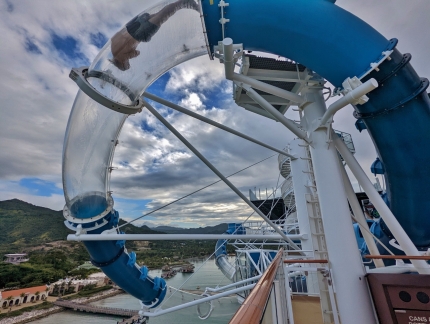
James free-falling through the first clear section of the Ocean Loops slide.
|
 |
Loop
Position: 19°49.86’N, -70°46.53’W
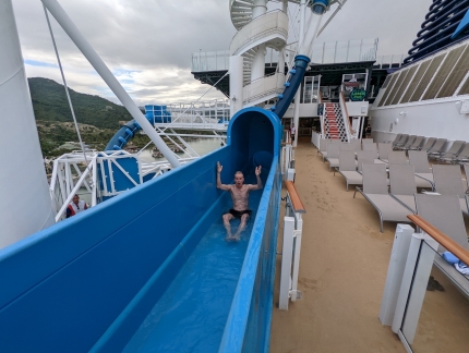
Passing through the first loop of the Ocean Loops slide, extended over the edge of the deck.
|
 |
Wild!
Position: 19°49.86’N, -70°46.53’W
What a ride! James rode a couple of more times, but Jennifer was too light for the 120-lb (54 kg) minimum weight of the Ocean Loops slide. Several times during the cruise we saw people get stuck in the slide and have to be extracted through side doors. So we switched to the Aqua Racer slide, where we rode down separately and together on single- and double-person inflatable tubes.
|
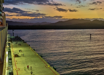 |
Dusk
Position: 19°49.86’N, -70°46.53’W
Dusk as the last few passengers return back to the Norwegian Encore from shore excursions.
|
 |
Departing
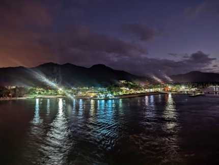
Position: 19°50.27’N, -70°46.36’W
A last view to Amber Cove as we depart for Miami.
|
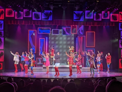 |
Kinky Boots
Position: 19°53.93’N, -70°46.69’W
The final show we watched on the Norwegian Encore was the Broadway musical Kinky Boots, a six-time Tony Award winner. We’re generally not big fans of musicals, but really enjoyed the show, more than any others we’d attended on board. The talented cast put on an exceptional performance.
|
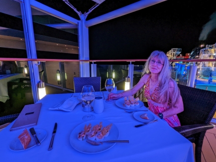 |
Haven Restaurant
Position: 20°10.14’N, -71°35.97’W
Lobster deviled eggs to start a late dinner on the terrace at the Haven Restaurant after taking in the Kinky Boots show.
|
 |
H2Glow Party
Position: 20°13.22’N, -71°50.64’W
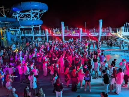
After dinner, we watched a bit of the H2Glow Dance Party taking place poolside on deck 16 of the Norwegian Encore. Passengers are encouraged to wear white or neon colors and are given glow-in-the-dark jewelry and light sabers.
|
 |
Carnival Ship
Position: 20°17.47’N, -72°11.70’W
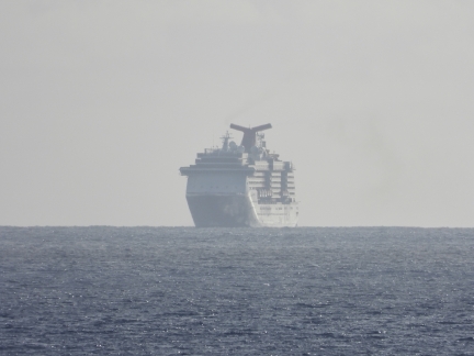
A Carnival Cruise Line ship, with their trademark whale-tail funnel, visible in the distance behind the Norwegian Encore early this morning as we’re underway for Miami.
|
 |
Mechanical Systems
Position: 59°1.40’N, -137°0.33’W
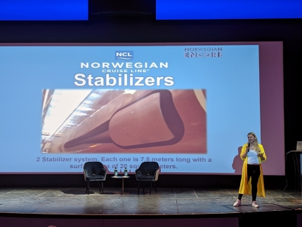
This morning we attended a super-interesting talk on the Norwegian Encore‘s mechanical systems. This is a picture of the ship’s retractable stabilizers, built by Italian company Fincantieri. The fins are 24 feet (7.5 m) long, with a surface area of 215 square feet (20 sq m). They would certainly have been deployed on our first couple of days at sea, making the ride a lot smoother in the beam seas.
|
 |
Captain and Chief Engineer
Position: 59°1.40’N, -137°0.33’W
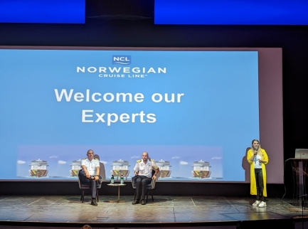
The captain and chief engineer came on the stage to answer audience questions in the last portion of the mechanical systems presentation. As expected, both have long careers at sea and are very knowledgeable of the ship’s systems. And the entertaining chief engineer could easily have a second career as a comic.
|
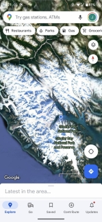 |
Glacier Bay
Position: 20°17.47’N, -72°11.70’W
Our phones’ location determination has been really messed up on this trip, often placing us in Glacier Bay, Alaska and sometimes in the South China Sea. Google location services uses WiFi and mobile networks to improve location accuracy and we’d likely be better off disabling this and relying purely on the GPS location when on a cruise.
|
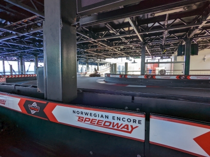 |
Encore Speedway
Position: 21°55.89’N, -77°9.79’W
This afternoon we checked out the multi-deck Encore Speedway. This is looking from our car in the ‘pit area’ to the ramp leading up to the track’s upper level.
|
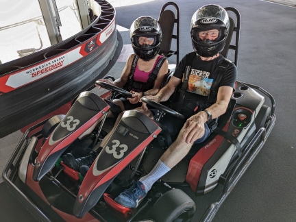 |
Two-Seater
Position: 21°44.85’N, -76°50.65’W
The Encore Speedway runs either single or double go-carts depending on the time of day, and were running two-seaters when we arrived. It was a ton of fun and we immediately went back for another ride after we finished this one.
|
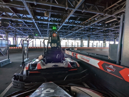 |
One-Seater
Position: 21°55.89’N, -77°9.79’W
After our second two-seater go-kart ride, the speedway switched over to the single-seat cars. Here we are ready to go, each in our own car. It was pretty wild to be driving on a go-kart track on the top of a ship. In the two-seater car, we went from last to first both times. But on the single-seater racing, James started and stayed out front but only managed the third-best time.
|
 |
Grandeur of the Seas
Position: 22°23.08’N, -77°44.22’W
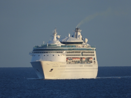
Royal Caribbean’s Grandeur of the Seas overtaking the Norwegian Encore just north of Cuba.
|
 |
Oasis of the Seas
Position: 25°46.45’N, -80°9.74’W
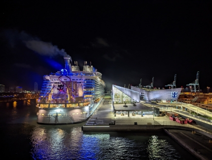
The view aft to Oasis of the Seas at 5am this morning shortly after the Norwegian Encore arrived back into the Miami Cruise Terminal.
|
 |
Port of Miami
Position: 25°46.45’N, -80°9.74’W
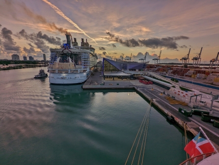
Sunrise over the Port of Miami as we prepare to disembark.
|
 |
Disembarking
Position: 25°46.45’N, -80°9.74’W
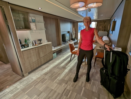
All packed up and ready to depart our cabin for the final time. We had a fabulous week on the Norwegian Encore, much more so than we anticipated, and would love to stay longer.
|
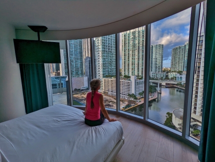 |
Kimpton EPIC
Position: 25°46.22’N, -80°11.43’W
Taking in the view west from our room at the Kimpton EPIC overlooking the Miami River in the city’s Brickell district.
|
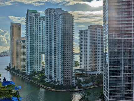 |
Burlingame Island
Position: 25°46.20’N, -80°11.41’W
Looking southeast across the mouth of the Miami River to the condominium towers on Burlingame Island. The island was created from multiple dredgings of the the Miami River and wasn’t developed until after 1972 when a bridge was built connecting it to the mainland. Visible in the distance are few Port of Miami cranes, and we could almost see the the Norwegian Encore.
|
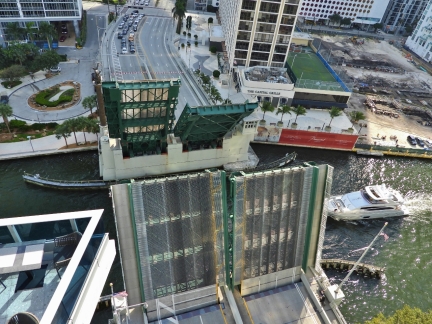 |
Brickell Ave. Bridge
Position: 25°46.09’N, -80°11.39’W
Boat traffic is heavy on the Miami River. Most fit under the bridge’s 23-ft (7 m) clearance, but several times during our stay the bridge opened for taller vessels. Even on a Sunday, traffic immediately backs up in both directions and during rush hour the bridge opens on a 30-minute schedule.
|
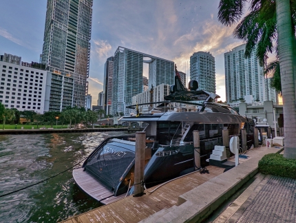 |
Convict
Position: 25°46.21’N, -80°11.36’W
Convict, one of many multi-million dollar yachts moored in Miami. A sistership of the 100-ft (30m) Riva Corsaro was listed recently for USD $9.2M.
|
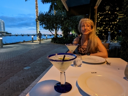 |
Cantina La Veinte
Position: 25°46.09’N, -80°11.28’W
A wonderful meal at Cantina La Veinte with the bridge to Burlingame Island visible in the distance.
|
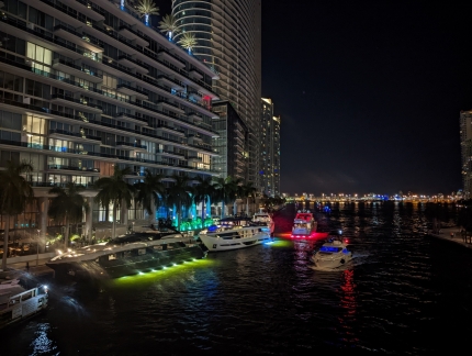 |
Evening
Position: 25°46.19’N, -80°11.39’W
Colorfully-lit boats plying the Miami River as we return to our hotel room from dinner. The boat traffic hardly slows down at night.
|
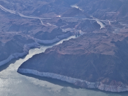 |
Hoover Dam
Position: 36°4.38’N, -114°42.22’W
The Hoover Dam on the Colorado River, viewed as our flight approaches Las Vegas from Miami. The Lake Mead water levels looks unusually low.
|
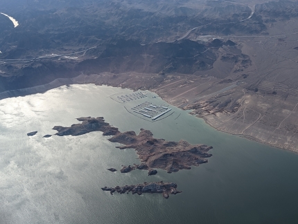 |
Lake Mead
Position: 36°4.38’N, -114°42.22’W
Looking across Big Boulder Island in Lake Mead to the Lake Mead Marina, left, and the Las Vegas Boat Harbor.
|
 |
Google Henderson
Position: -115°0.65’S, 36°3.48’E
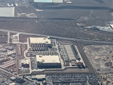
The Google Henderson data center complex in Nevada. Construction of the $1.2B facility started in July of 2019 and second building became operational in February of 2021. James thought the parking for the facility looked unusually tight at the bottom of the picture, but that’s the B&R Auto Wrecking yard.
|
 |
Palazzo
Position: 36°7.48’N, -115°10.04’W
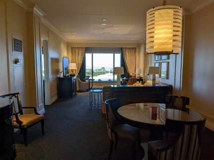
Our room at the Palazzo in Las Vegas while we attend the reInvent conference.
|
 |
Cooler
Position: 36°7.49’N, -115°10.04’W
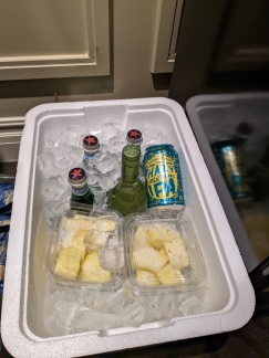
The rooms at the Palazzo are spacious and quite nice, but don’t include a guest fridge. We like to have fresh fruit, cold drinking water and some beer and wine on hand, so bought a disposable cooler at the local Walgreens store.
|
 |
Animazing Gallery
Position: 36°7.37’N, -115°10.15’W
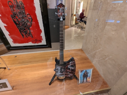
Kiss guitarist Gene Simmons is one of the artists whose work, at upper left, is featured at the Animazing Gallery in our Las Vegas hotel complex.
|
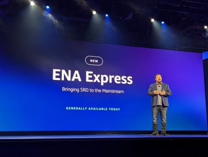 |
Peter DeSantis
Position: 36°7.26’N, -115°9.95’W
Monday Night Live with Peter DeSantis, Senior Vice President of AWS Utility Computing, the first of five keynotes at AWS re:Invent 2022. Peter did a great job of digging into the details behind AWS technology.
|
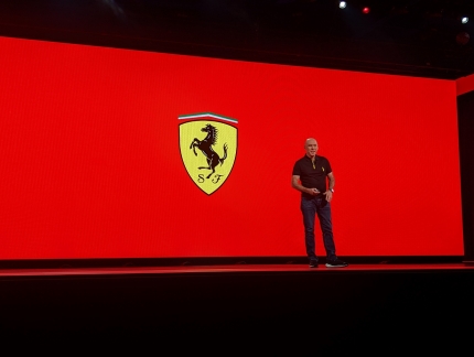 |
Jock Clear
Position: 36°7.26’N, -115°9.95’W
Jock Clear, Driver Coach for Charles Leclerc, on stage during Monday Night Live at AWS re:Invent. AWS sponsors the Ferrari Forumula 1 team.
|
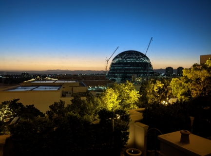 |
MSG Sphere
Position: 36°7.44’N, -115°9.99’W
The MSG Sphere entertainment complex under construction, viewed from our Las Vegas hotel room. The sphere is being built by Madison Square Garden (MSG) Entertainment Group.
|
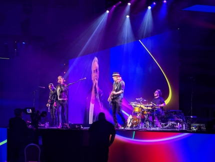 |
Rock Band
Position: 36°7.23’N, -115°10.08’W
The AWS conferences are always a little more edgy than a typical tech conference. Here an excellent rock cover band is playing live and loud at 8:00am Tuesday morning shortly before AWS CEO Adam Selipsky’s AWS re:Invent keynote. And Selipsky was introduced to the sound of the band playing the opening section of the Guns N’ Roses song “Sweet Child O’ Mine”.
|
 |
Full House
Position: 36°7.26’N, -115°9.95’W
A packed house for AWS CEO Adam Selipsky’s keynote at the re:Invent conference.
|
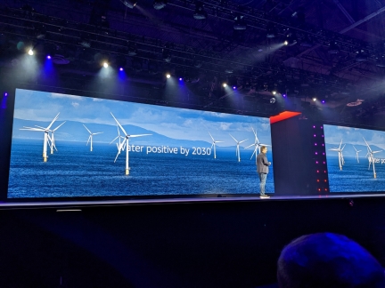 |
Adam Selipsky
Position: 36°7.26’N, -115°9.95’W
The AWS AWS re:Invent keynotes always include many announcements. One that CEO Adam Selipsky’s announced was a pledge to be water positive by 2030.
|
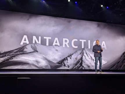 |
Antarctica
Position: 36°7.26’N, -115°9.95’W
AWS CEO Adam Selipsky compared the Scott and Amundsen Antarctic expeditions as part of a discussion on extreme workloads. This was particularly interesting to us because we’ll be Antarctic cruise in a couple of weeks.
|
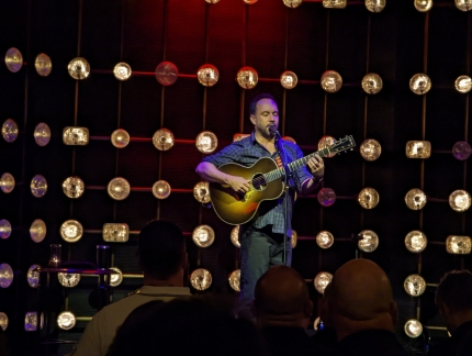 |
Dave Mathews
Position: 36°6.64’N, -115°10.41’W
Dave Mathews on stage at evening customer event at AWS re:Invent. Mathews is well known as an excellent musician, but he also has an great sense of humor, and it was enjoyable show.
|
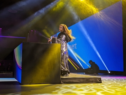 |
DJ
Position: 36°7.36’N, -115°10.02’W
A DJ warming up the crowd before the Wednesday morning AWS re:Invent keynote.
|
 |
Swami Sivasubramanian
Position: 36°7.26’N, -115°9.95’W
Swami Sivasubramanian, Vice President, Data and Machine Learning, on stage for the AWS re:Invent keynote covering AWS data services. Swami leads the AWS machine learning, data, and analytics teams.
|
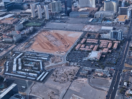 |
Las Vegas Grand Prix
Position: 36°6.56’N, -115°9.12’W
Construction underway for the inaugural Las Vegas Grand Prix to be held November of 2023, viewed from our flight home to Seattle.
|
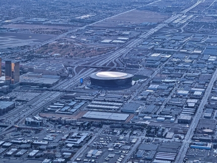 |
Allegiant Stadium
Position: 36°6.56’N, -115°9.12’W
Allegiant Stadum, home of the Los Angeles Raiders NFL team and the University of Nevada, Las Vegas Rebels college football team. Completed in 2020 at a cost of nearly US$2 billion, the stadium is the second most expensive in the world after US$5.5 billion SoFi stadium on Los Angeles.
|
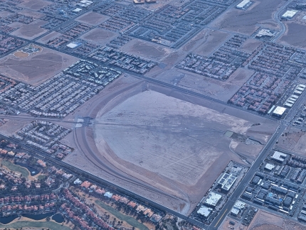 |
Detention Basin
Position: 36°7.14’N, -115°13.68’W
One of 83 water detention basins designed to help prevent flooding in Las Vegas during heavy rains.
|
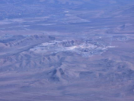 |
Gypsum Resources Materials
Position: 36°3.69’N, -115°18.70’W
The Gypsum Resources Materials quarry just west of Las Vegas.
|
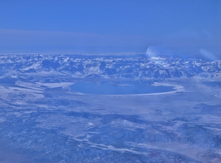 |
Mono Lake
Position: 38°18.85’N, -118°6.35’W
Looking across the state border to Alkaline Mono Lake in California. The lake has no outlet and hence builds up high levels of salt deposits.
|
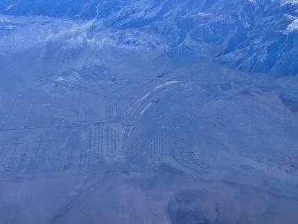 |
Hawthorne Army Depot
Position: 38°40.21’N, -118°29.72’W
The US Army depot at Hawthorne, Nevada is the world’s largest weapons depot with 600,000 square feet (56,000 m2) of storage across 2,427 bunkers.
|
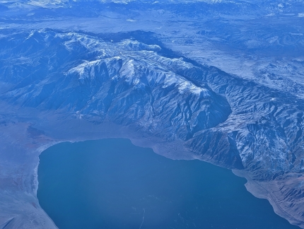 |
Walker Lake
Position: 38°40.21’N, -118°29.72’W
Like Mono Lake, Walker Lake in Nevada also has no outlet. Upstream diversions of its source, Walker River, have resulted in increased salt levels, destroying the fish population.
|
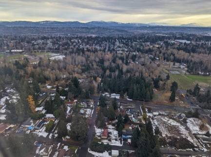 |
Snow
Position: 47°29.08’N, -122°19.05’W
We returned from the Caribbean and Las Vegas to winter in Seattle, with a dusting of snow on the ground.
|
 |
Click the travel log icon on the left to see these locations on a map. And a map of our most recent log entries always is available at mvdirona.com/maps. |

Greetings and Merry Christmas! We always enjoy your writings, but we especially enjoyed your write up about your time on the Norwegian Encore. Thank you for sharing.
Thanks for the feedback and all the best from us in Antarctica.