
Sognefjord is the longest and deepest fjord in Norway, extending 110 nautical miles from the sea with depths reaching 4,291 feet (1,308 metres), and is second longest in the world. The fjord is a popular tourism destination for its impressive natural beauty. Notable is the branch Naeroyfjord, pictured above, that was named a UNESCO World Heritage site in 2005 for being among the most scenically outstanding in the world. Of Sognefjord’s many waterfalls, a standout is Kjelsfossen, one of the highest waterfalls in Norway and the 18th tallest in the world, with a total fall height of 2,477 ft (755 m). Sognefjord also is home to Flamsbana, the Flam Railway, considered one of the world’s most scenic railway trips.

We first cruised Sognefjord on our 2018 visit of Norway, shown in purple on the map below. That year we arrived in early May, with snow still on the mountain tops. So much so, that one of the hikes we wanted to do wasn’t yet accessible due to deep snow. On that trip, we made a reasonably quick pass through, stopping only in Indrefjord, Flam and Fjaerlandsfjord over nine nights.
When we returned to Sogneford this year in November, shown in blue on the map below, winter had nearly begun. Snow wasn’t yet deep on the mountains, but was starting to build up, and we made our first snow hike of the season. In the fourth stage of our detailed exploration of the Norwegian coast, we continued north from the Bergen area to spend three weeks cruising the length of Sognefjord. We visited every major branch en-route, skipping only those we’d already visited in 2018. Over those 3 weeks, we made 11 stops and traveled 289 miles, but only covered 10 miles point-to-point.

Below are highlights from October 24th through November 11th, 2020. Click any image for a larger view, or click the position to view the location on a map. And a live map of our current route and most recent log entries always is available at mvdirona.com/maps.
 |
Finnafjorden
Position: 61°2.37’N, 6°17.59’E
Spectacular Finnafjorden (“the hidden fjord”) is a branch of Sognefjord, Norway’s longest and deepest fjord. While Finnafjorden is one of the shortest arms of Sognefjord, what it lacks in length it makes up for in amazing scenery. Particularly impressive is nearly landlocked Finnabotn, where 4,000-ft (1,200 m) mountains encircle the bay, giving the feel of a mountain lake. The area has excellent hiking opportunities, and in past years was the striking venue for an annual blues festival.
|
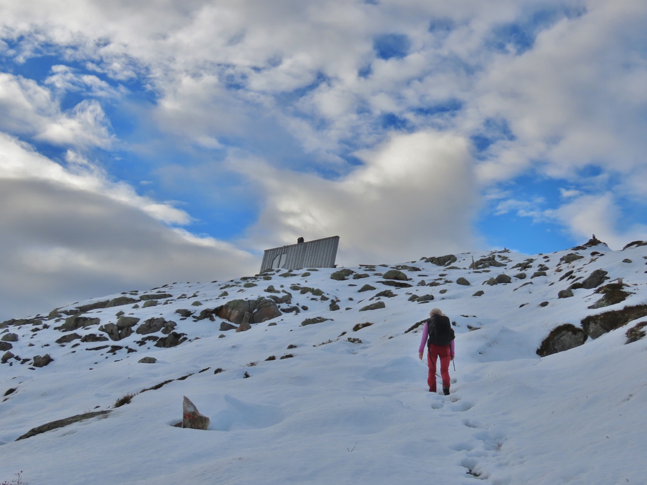 |
Balestrand
Position: 61°11.75’N, 6°29.10’E
From Finnafjorden we continued our detailed exploration of Sognefjord and travelled a short 15 miles miles to Balestrand. We anchored there for three nights, exploring the area by tender and hiking up through snow to the day cabin at the top of 3188-ft (972m) Raudmelen.
|
 |
Flam
Position: 60°51.78’N, 7°6.80’E
We first stopped in Flam, near the head of Sognefjord, in the spring of 2018 with snow still on the ground in the surrounding mountains. We returned in late fall of 2020 to snow on the peaks, but this time it was the first snows of the winter. On both visits, we took a ride on the famous Flamsbana scenic railway to view the mountain snow. And while we were out of season each trip, Flam was notably quieter on our most recent. Few visitors were there during the pandemic, and with the train carriage almost to ourselves, we took our only public transport ride of 2020 after leaving Antwerp in March.
|
 |
Laerdalsfjorden
Position: 61°6.34’N, 7°29.16’E
Laerdalsfjorden is a short branch of Sognefjord just east of Flam. It was the inspiration for Kjempeviseslatten, the most famous work of Harald Saeverud, one of the most significant Norwegian composers of the mid-1900s. Laerdal also is the terminus and namesake of the Laerdalstunnelen, the longest road tunnel in the world at 15.23 miles (24.51 km). We passed through the tunnel recently on our road trip from Bergen to Sweden.
|
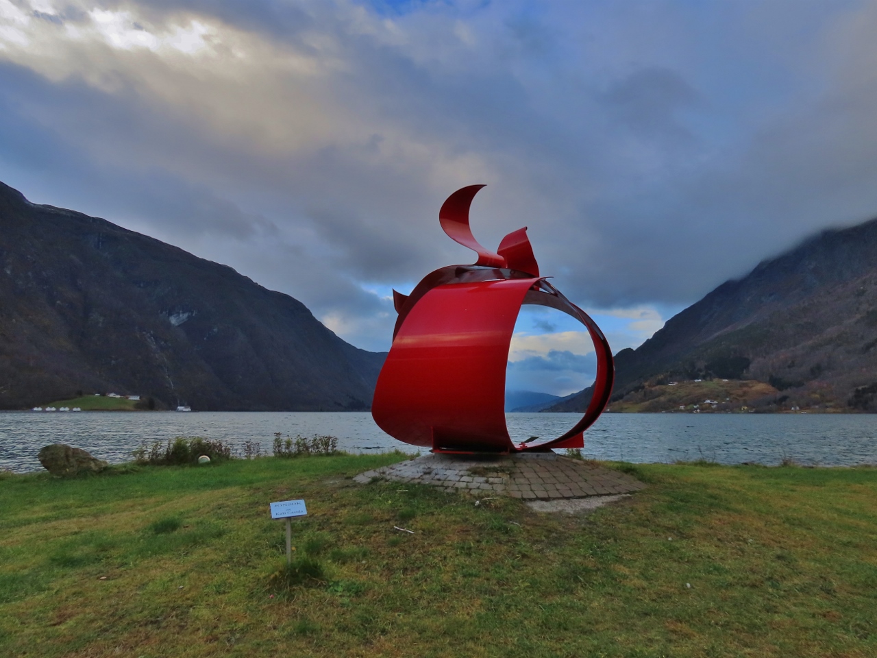 |
Skjolden
Position: 61°29.52’N, 7°35.77’E
At the extreme head of 110-nm Sognefjord, the longest and deepest fjord in Norway, stands the dramatic metal sculpture Jonsok in the town of Skjolden. Created by Wisconsin artist Kati Casida, the sculpture symbolizes the bond between Norwegians and their family members who emigrated to America.
|
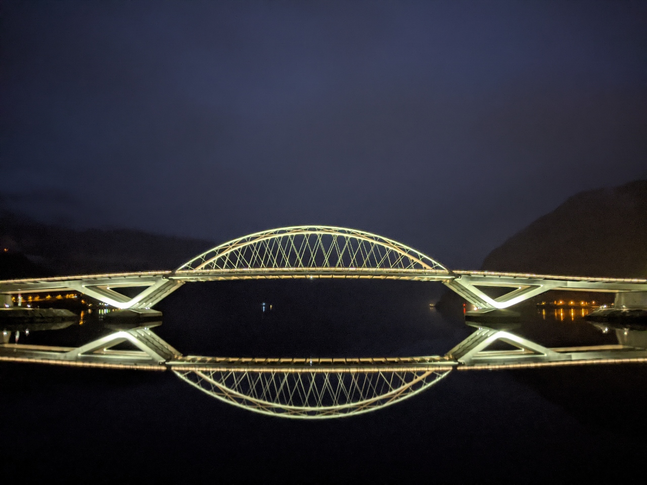 |
Sogndalsfjorden
Position: 61°14.08’N, 7°7.37’E
With the short daylight hours of the Norwegian winter, we were underway in the dark for much of the time, particularly when making trips in longer waterways such as 110-nm Sognefjord, Norway’s longest fjord. This is more difficult than during the day, but can also be more enjoyable with beautiful night views.
|
 |
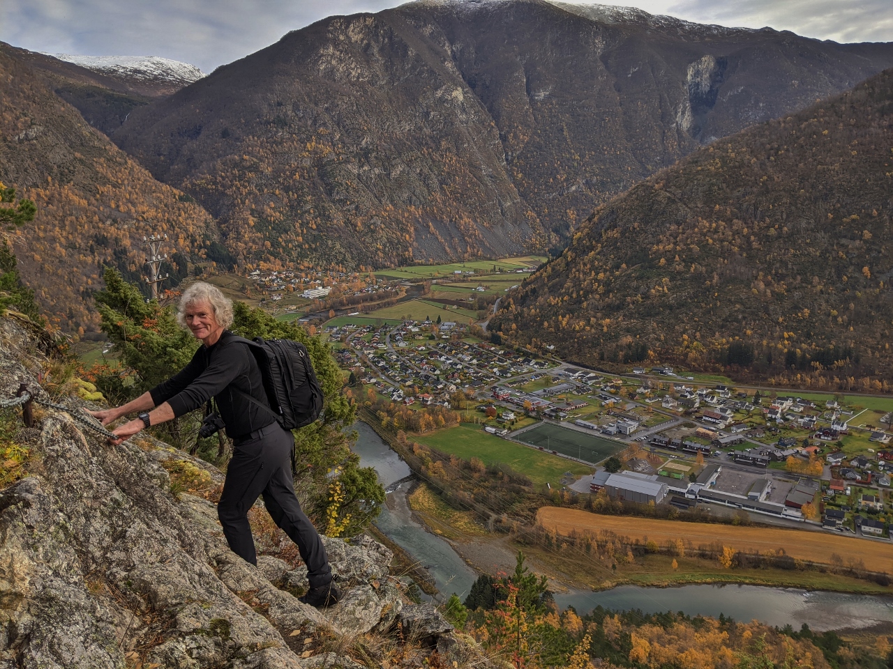
Hoyanger
Position: 61°13.24’N, 6°3.71’E
Hoyanger, at the end of Hoyangsfjorden in Sognefjord, has several good hiking trails. Notable among them is Trappene (The Stairs), where 1,268 steps follow a hydropower penstock up to a height of 1,200 ft (360m) with wonderful views, and a tunnel, en route. With the run only 1,300 ft (400m), the grade is an incredibly steep 78%, but the views and the uniqueness of climbing beside the penstock are worth the effort.
|
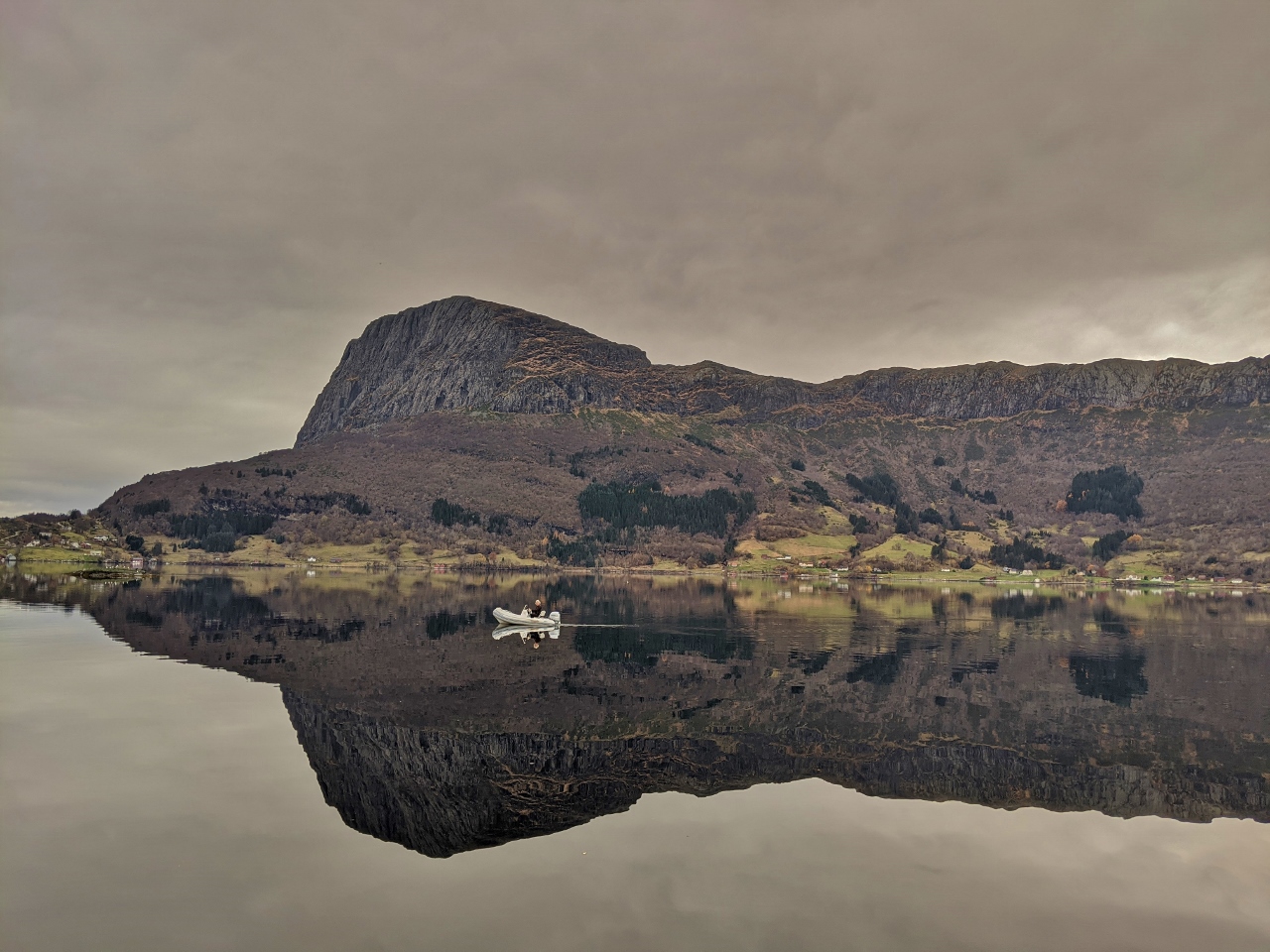 |
Lifjell
Position: 61°8.88’N, 5°12.87’E
In 1936, Lifjorden was the site of Norway’s first fatal civil aviation accident. Classified as a “controlled flight into terrain”, the crew of the seaplane Havorn didn’t realize they were off course in a thick fog and flew the aircraft directly into the 2,513-ft (776m) cliff Risnesnipa, pictured at left above, killing all seven on board. A memorial near the crash site commemorates the tragedy and also marks the trailhead to the accident site high up the cliff. Other trails lead up to the top of the steep-edged Lifjell massif that includes Risnesnipa, 2,329-ft (710m) Gygrekjeften, and 1,893-ft (577m) Hogeheia. The area is known for its excellent view hikes.
|
 |
Click the travel log icon on the left to see these locations on a map, with the complete log of our cruise.
On the map page, clicking on a camera or text icon will display a picture and/or log entry for that location, and clicking on the smaller icons along the route will display latitude, longitude and other navigation data for that location. And a live map of our current route and most recent log entries always is available at mvdirona.com/maps. |
If your comment doesn't show up right away, send us email and we'll dredge it out of the spam filter.