
At the extreme head of 110-nm Sognefjord, the longest and deepest fjord in Norway, stands the dramatic metal sculpture Jonsok in the town of Skjolden. Created by Wisconsin artist Kati Casida, the sculpture symbolizes the bond between Norwegians and their family members who emigrated to America.
We continued our detailed exploration of Sognefjord, and the southern Norwegian coast, with a two-night stop at Skjolden where we enjoyed the evening lights, checked out Jonsok, and made a short hike ashore for the views from Sengaberget.
Below are highlights from November 2nd and 4rd, 2020. Click any image for a larger view, or click the position to view the location on a map. And a live map of our current route and most recent log entries always is available at mvdirona.com/maps.
 |
Ferries
Position: 61°8.02’N, 7°23.19’E
The two ferries on the Mannheller-Fodnes run. Norway has an amazing number of ferries.
|
 |
Fodnes
Position: 61°8.75’N, 7°22.17’E
Looking towards the mouth of Ardalsfjorden, an arm of Sognefjord, across the lighthouse at Fodness.
|
 |
Ornes Boatyard
Position: 61°17.17’N, 7°19.38’E
The Ornes Boatyard specializes in aluminum and traditional wood boat construction and repair.
|
 |
Tree
Position: 61°25.30’N, 7°28.20’E
A large tree in the water in near the head of Sognefjord. We’ve seen relatively little debris in the water in all our world travels, and nothing even remotely close to what we’d see in our home waters of the Pacific Northwest where we’ve sometimes had to literally push logs out of the way. But, this is a big one.
|
 |
Skjolden
Position: 61°29.54’N, 7°35.45’E
Approaching the town of Skjolden, at the extreme end of Sognefjord, with the waterfall 590ft (180m) waterfall Asafossen prominent in the background.
|
 |
Skjolden Anchorage
Position: 61°29.55’N, 7°35.55’E
Our anchorage at Skjolden in 129 ft (39 m) on 325 ft (99 m) of rode.
|
 |
Dusk
Position: 61°29.54’N, 7°35.56’E
The town of Skjolden, at the head of Sognefjord, aglow at dusk. We’re really enjoying the winter lights as the Norwegian days get shorter.
|
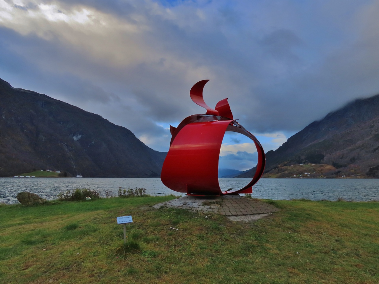 |
Jonsok
Position: 61°29.52’N, 7°35.77’E
The metal sculpture Jonsok by Wisconsin artist Kati Casida at Skjolden symbolizes the bond between Norwegians and their family members who emigrated to America. The sculpture stands at the extreme head of 110-nm Sognefjord, the longest, and deepest, fjord in Norway.
|
 |
Sengaberget
Position: 61°29.47’N, 7°36.00’E
Signpost for the Sengaberget (“View Point”) trail in Skjolden, our first November hike in Norway.
|
 |
Pelton Wheel
Position: 61°29.47’N, 7°36.00’E
Nearly every Norwegian fjord town seems to have a Pelton Wheel displayed out front. Designed in the late 19th-century, the wheel was commonly used in Norway to generate hydro power.
|
 |
Skjolden
Position: 61°29.61’N, 7°36.74’E
View from the Sengaberget trail to Skjolden along the river Eidselvi at the head of Sognefjord. Dirona is visible at anchor on the right.
|
 |
Trail
Position: 61°29.57’N, 7°36.87’E
Descending on a spur trail back to Skjolden from the Sengaberget view point.
|
 |
Eidsvatnet
Position: 61°29.50’N, 7°36.98’E
Stopping to enjoy the view of the lake Eidsvatnet on the return back to Skjolden.
|
 |
Shopping
Position: 61°29.44’N, 7°36.02’E
Almost every Norwegian town seems to have a compact and well-stocked grocery store, and we often stop in to keep our provisions topped up. We always carry with us a LOQI tote bag that we picked up in Delft, NL. The lightweight bag stows away compactly in a matching zippered case, yet has a large carrying capacity and is surprisingly strong.
|
 |
Snow
Position: 61°29.46’N, 7°35.96’E
A picture in Skjolden of a Norwegian road in wintertime. Those snow banks are amazingly high. Fortunately this is a ways inland from where we are.
|
 |
Lunch
Position: 61°29.57’N, 7°35.60’E
It was just warm enough, at 50°F (10°C) and light wind, to have lunch outside
|
 |
Sunset
Position: 61°29.56’N, 7°35.57’E
Sunset from the anchorage off Skjolden at the head of Sognefjord.
|
 |
Click the travel log icon on the left to see these locations on a map, with the complete log of our cruise.
On the map page, clicking on a camera or text icon will display a picture and/or log entry for that location, and clicking on the smaller icons along the route will display latitude, longitude and other navigation data for that location. And a live map of our current route and most recent log entries always is available at mvdirona.com/maps. |
If your comment doesn't show up right away, send us email and we'll dredge it out of the spam filter.