Our initial plan for cruising Norway was to run straight north to Tromsø with few diversions en route, and to tour the Norwegian fjords on our return trip south. But we decided to take a few days to explore 110-mile Sognefjord, the longest fjord in Norway. This time of year the mountains would still have snow, and much would have melted when we returned to the area in August. After a night at Rutledal at the mouth we travelled further up Sognefjord and spent three nights in spectacular Indrefjord with waterfalls and snow-covered mountains surrounding us on all sides.
Below are trip highlights from May 2nd through 4th, 2018 at Indrefjord, Norway. Click any image for a larger view, or click the position to view the location on a map. And a live map of our current route and most recent log entries always is available at mvdirona.com/maps
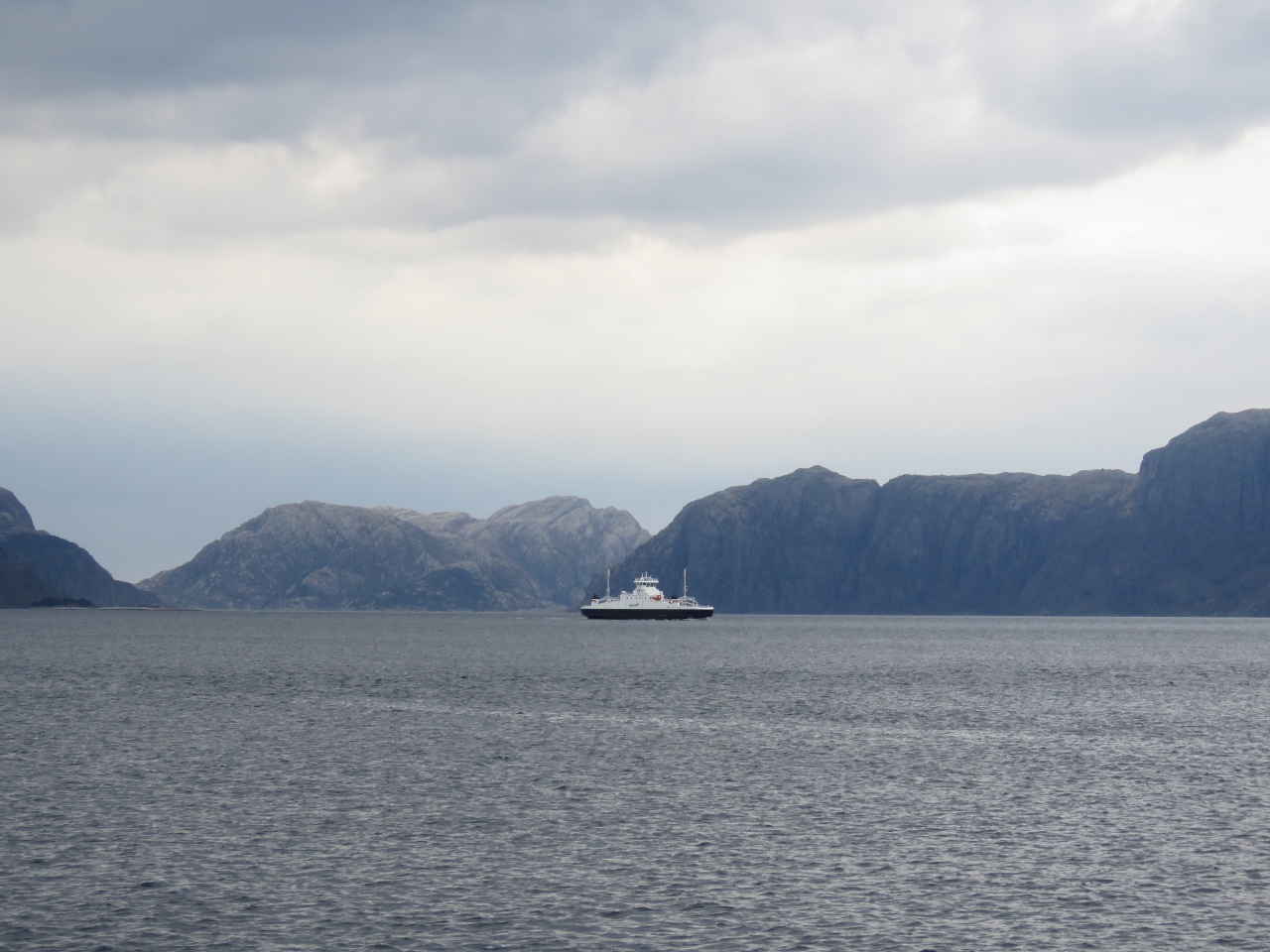 |
Ferry
Position: 5 9.54, 61 5.15
Ferry crossing from Losnegard to Rutledal as we depart the anchorage to head up Sognefjord.
|
 |
Stølsheimen
Position: 6 7.67, 61 7.38
Looking south into the mountains of the Stølsheimen Nature Preserve.
|
 |
Farm
Position: 6 17.91, 61 5.90
Norway doesn’t have much flat ground, but has a huge number of small farms. It seems that any patch of land where a tractor won’t actually tip over is deemed arable.
|
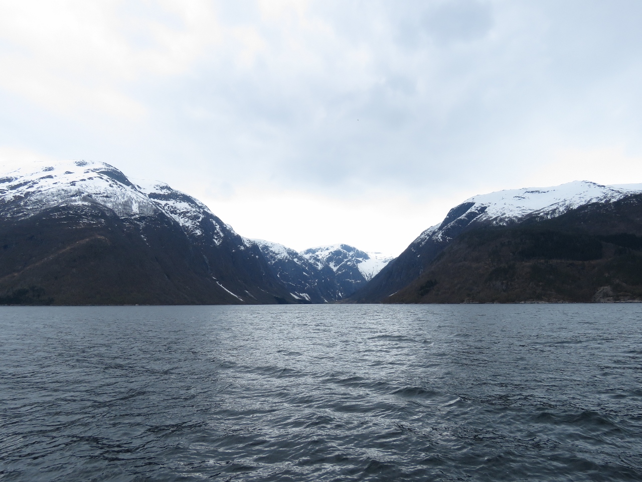 |
Finnafjorden
Position: 6 20.43, 61 5.35
Another view to the mountains of the Stølsheimen Nature Preserve down Finnafjorden.
|
 |
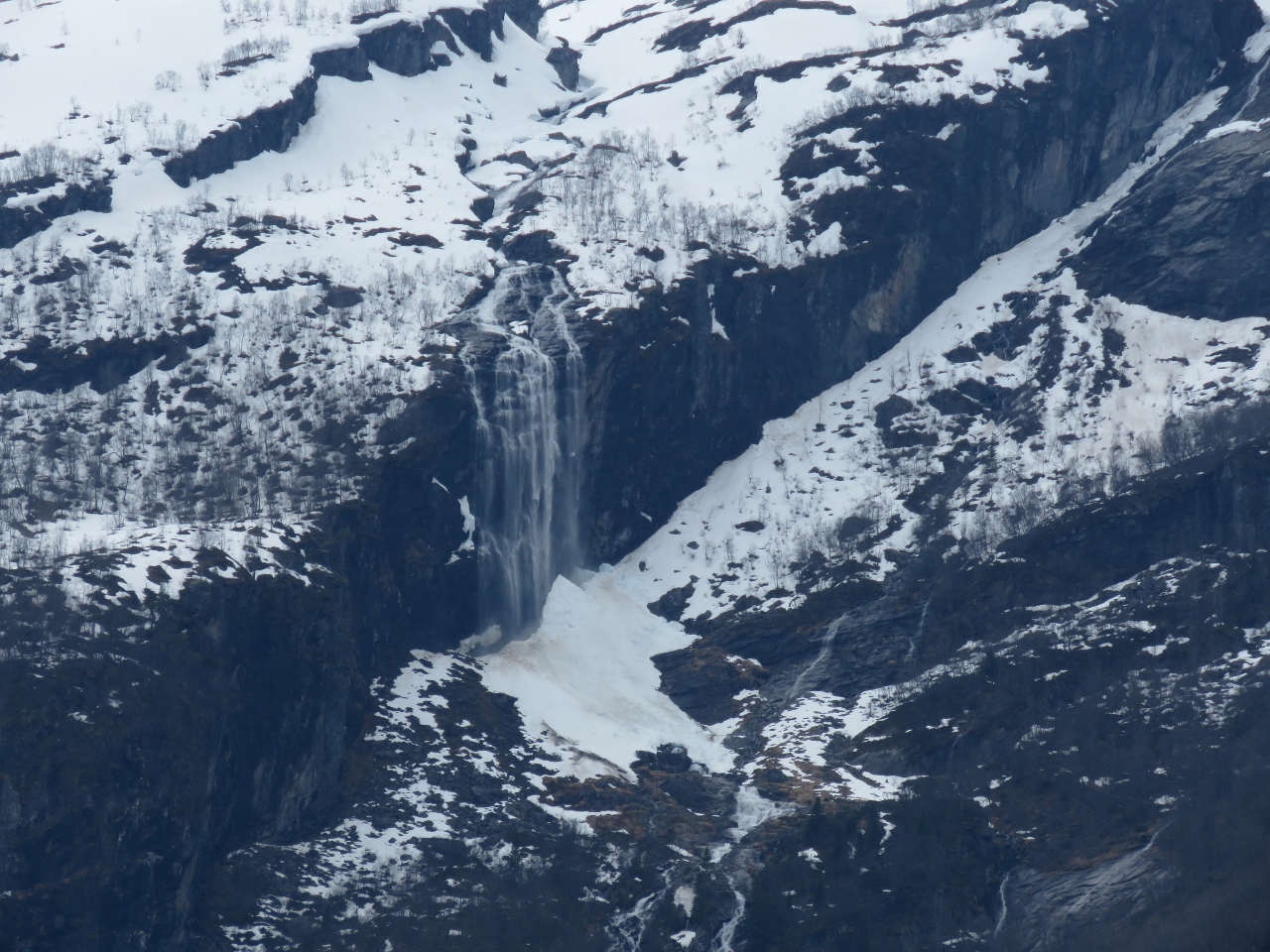
Waterfall
Position: 6 25.46, 61 4.11
Waterfall at the mouth of Arnafjorden.
|
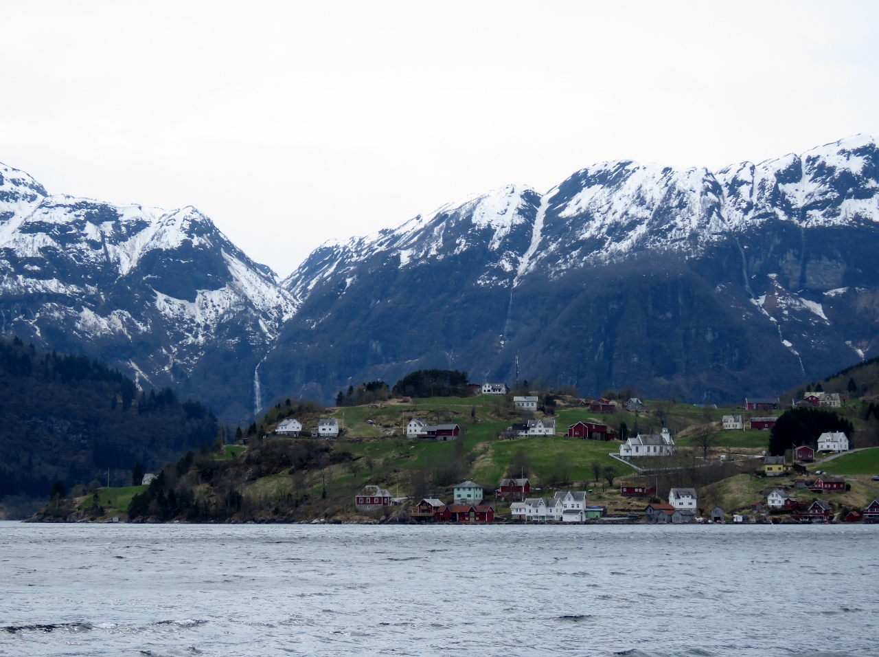 |
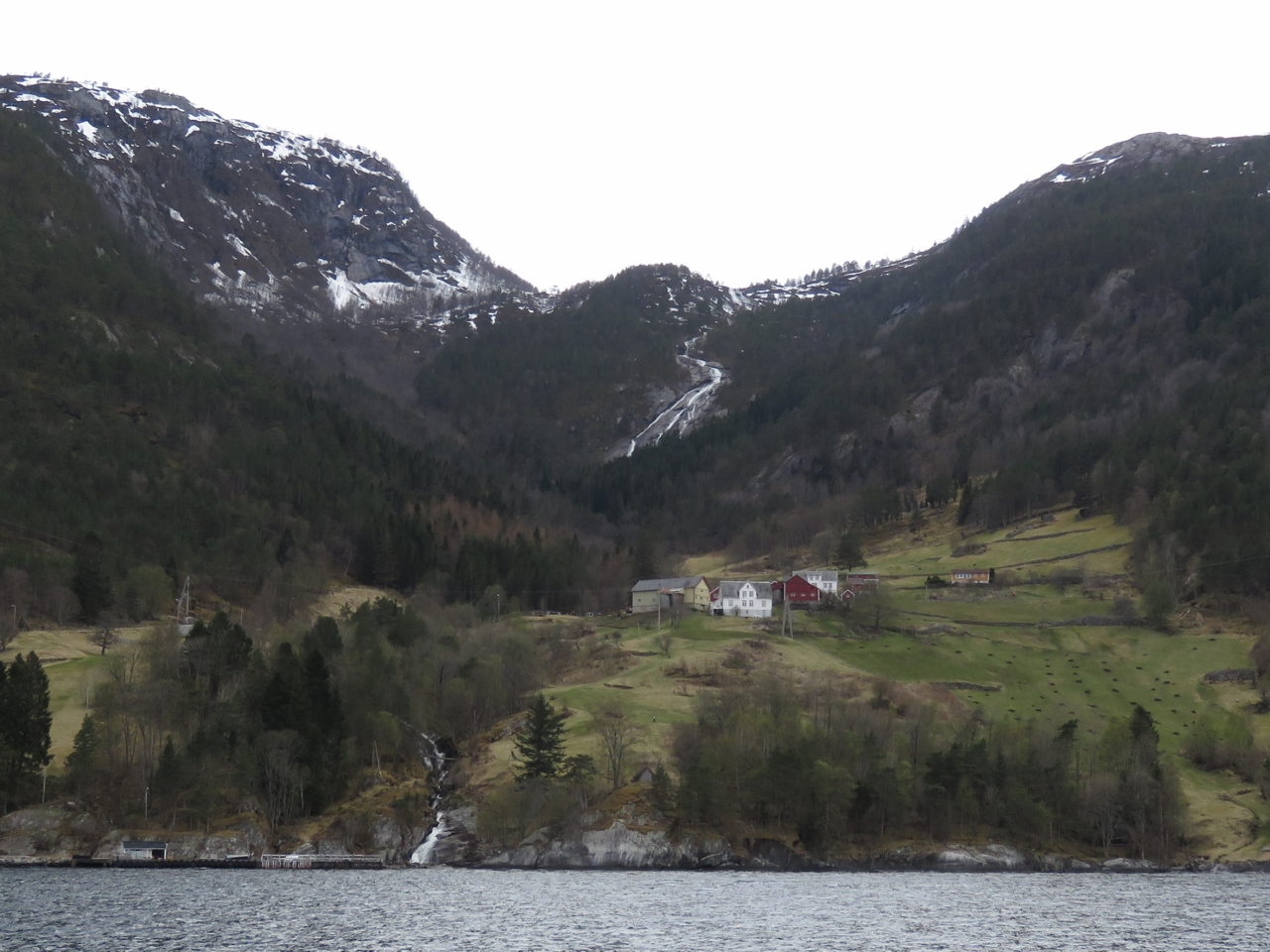
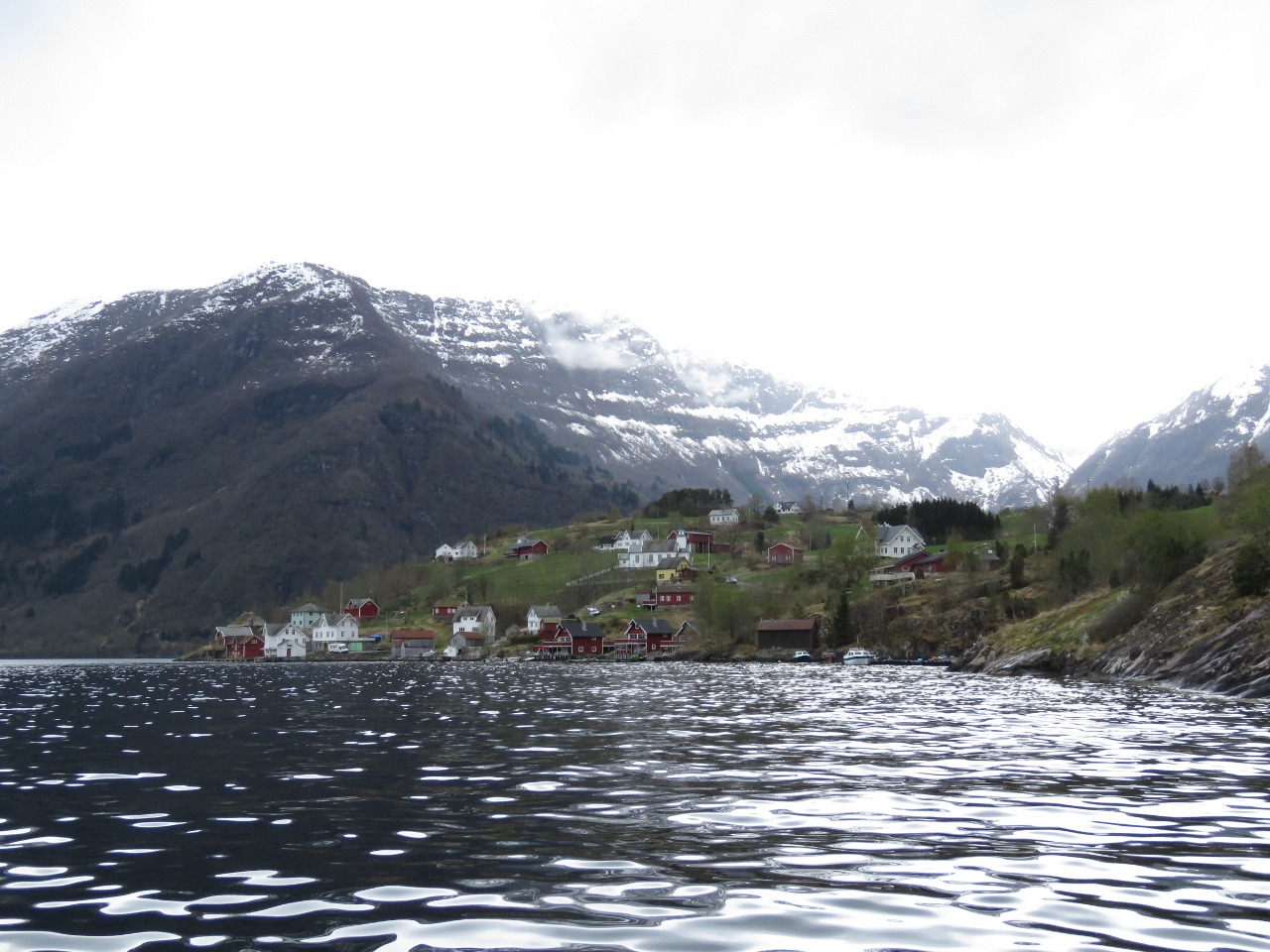
Nese
Position: 6 23.80, 61 1.77
The village of Nese at the intersection of Arnaforden and Indrefjord. Arnafjord Church in the village was built in 1880 to replace an older one that dated to the 17th century.
|
 |
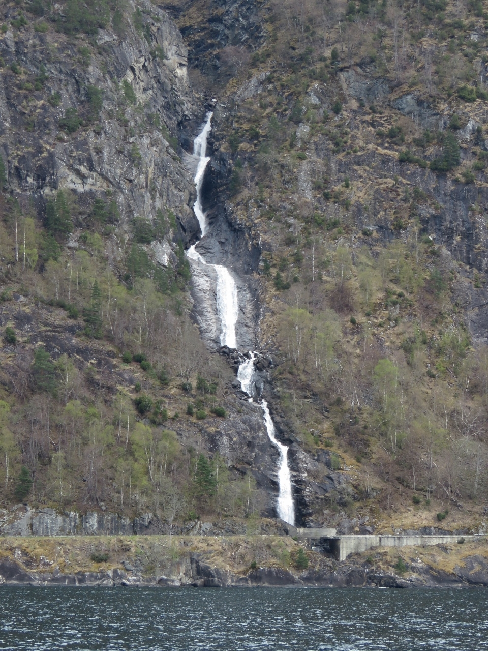
Cliff Waterfall
Position: 6 23.12, 61 0.94
A waterfall spilling over the edge of a cliff high up in the snow-covered mountains above Indrefjord.
|
 |
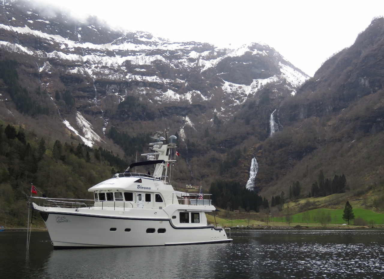
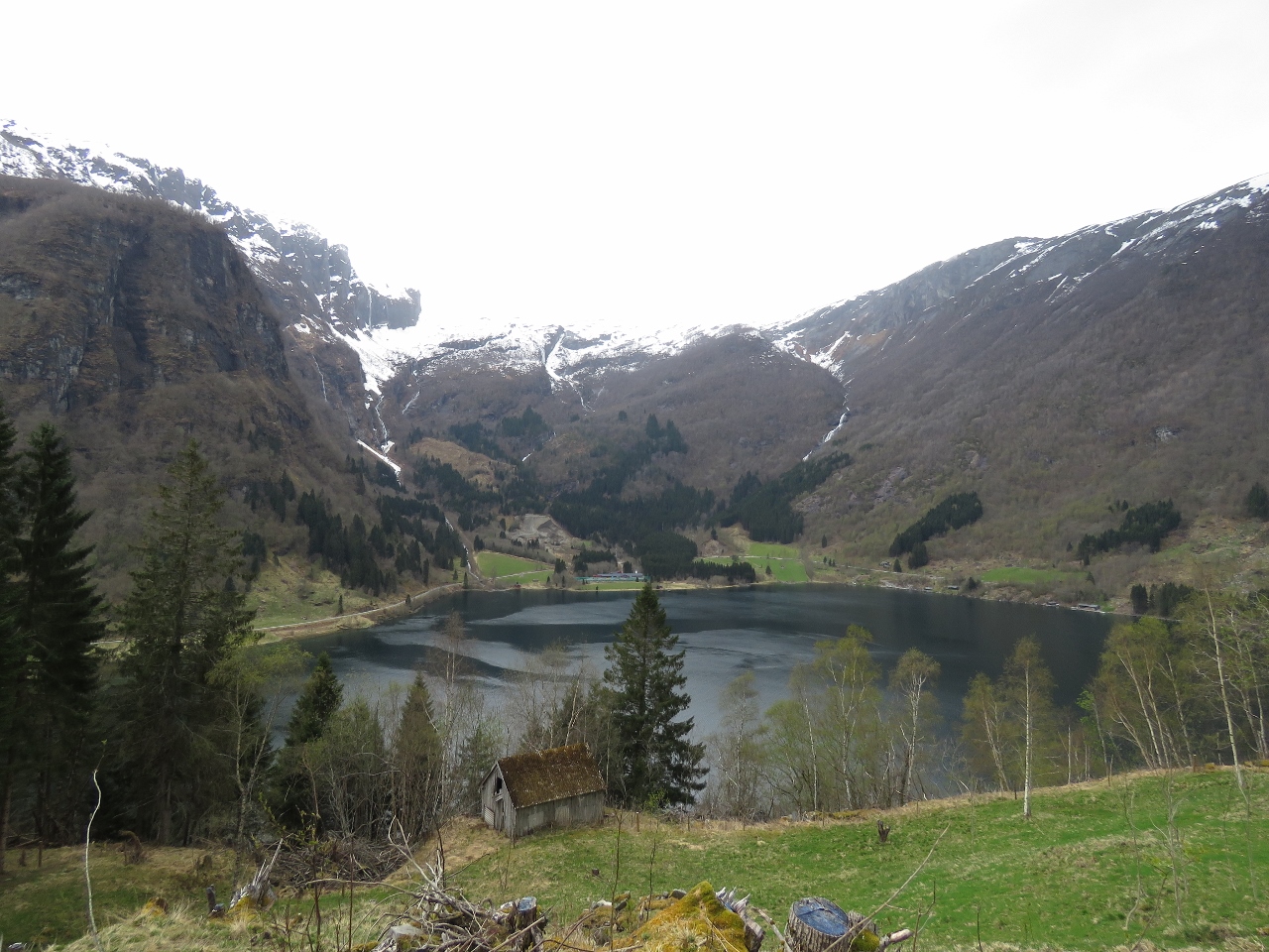
Indrefjord
Position: 6 21.85, 61 0.35
We anchored at the head of Indrefjord in 70ft with 400ft of chain out and excellent holding. This is one of several fabulous views from the boat.
|
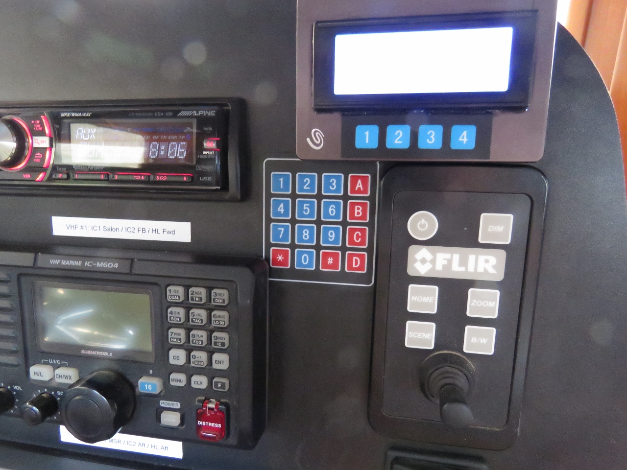 |
Keyboard
Position: 6 21.79, 61 0.37
We installed a 4×4 matrix keyboard on the dash today and wrote code to allow it to control our entertainment system (pause/play, previous song, next song, mute), HVAC, hot water heater, furnace and defrost. We can control all of these through web pages, but sometimes a hard mechanical switch on the dash is more convenient.
|
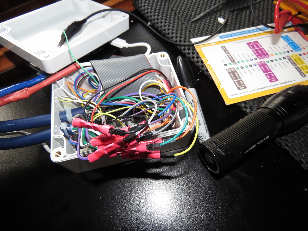 |
Raspberry Pi
Position: 6 21.79, 61 0.37
This is the fourth Raspberry Pi we’ve added to Dirona. This one controls the 4×20 LCD; a four-channel analog input, one of which is used to sense the 12-volt navigation battery state; the 1×4 matrix keyboard; and the 4×4 matrix keyboard we just installed. You can hardly see the Pi below all the connections to it.
|
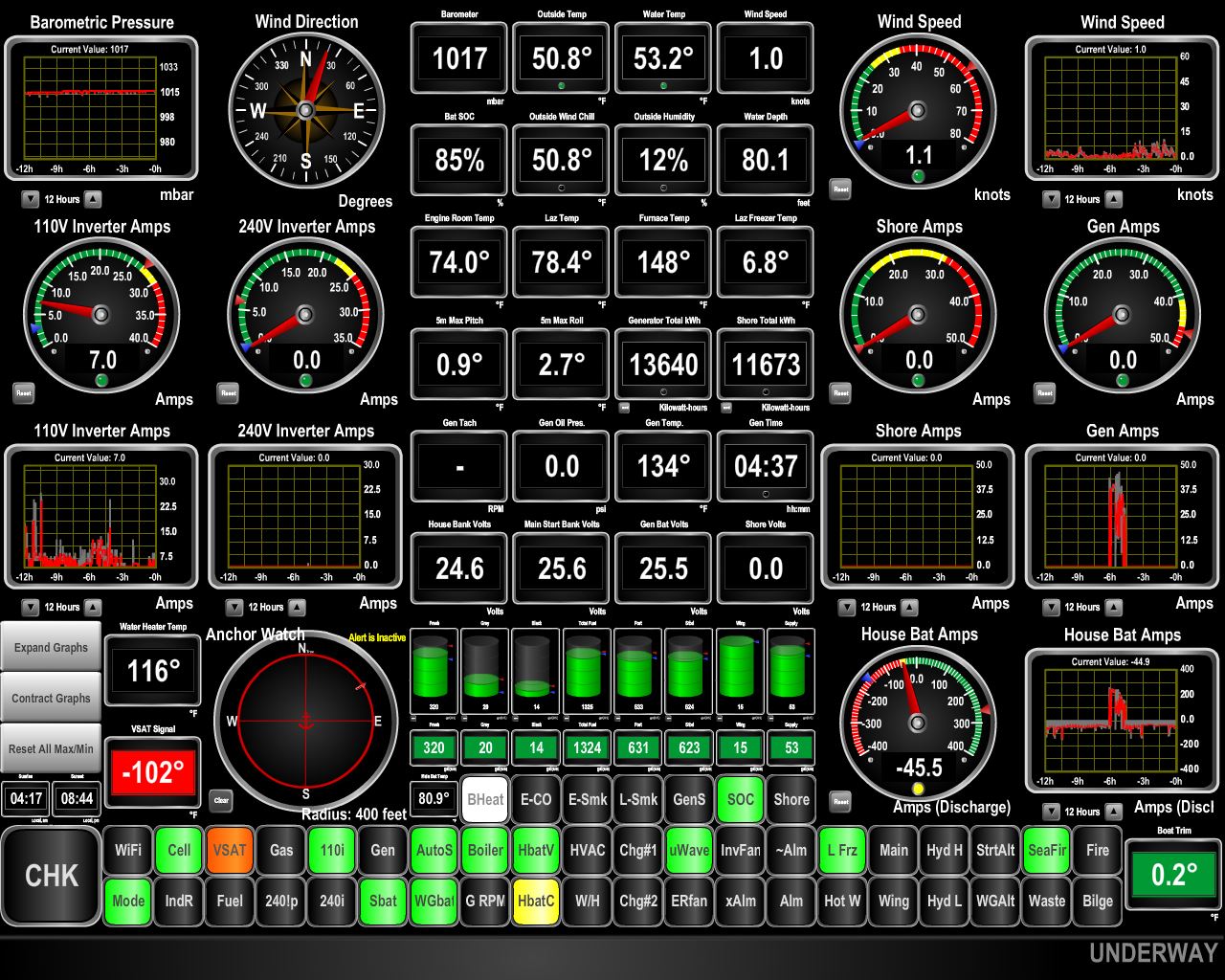 |
Cellular Data
Position: 6 21.80, 61 0.35
The orange VSAT light at the bottom left of the display shows that we have no satellite connectivity at the head of Indrefjord. We expected the steep fjords would block our view to the satellites, so this is not a surprise.
What we didn’t expect was excellent cellular connectivity. Since nearing the Norwegian coast we’ve probably not been without a solid 4G connection (the green light left of the VSAT light) for more than 10-15 minutes. And the recent EU “Roam Like at Home” rule means our UK cellular data plan works in Norway the same as in the UK, so we can defer getting a Norway SIM until we visit a city. |
 |
At Anchor
Position: 6 21.79, 61 0.33
At anchor in spectacular Indrefjord off Songefjord.
|
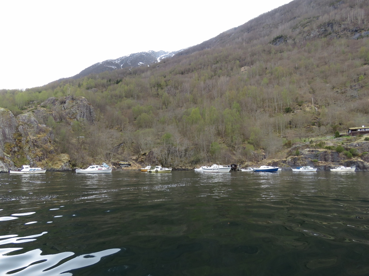 |
Boats
Position: 6 23.22, 61 1.43
This cove off the village of Nese must be the most sheltered spot in the area—nearly a dozen boats are tucked away here.
|
 |
Nese
Position: 6 23.15, 61 1.50
|
 |
Indrefjord
Position: 6 22.15, 61 0.77
Dirona is the small white dot right of center in this view to the head of Indrefjord from the village of Nese.
|
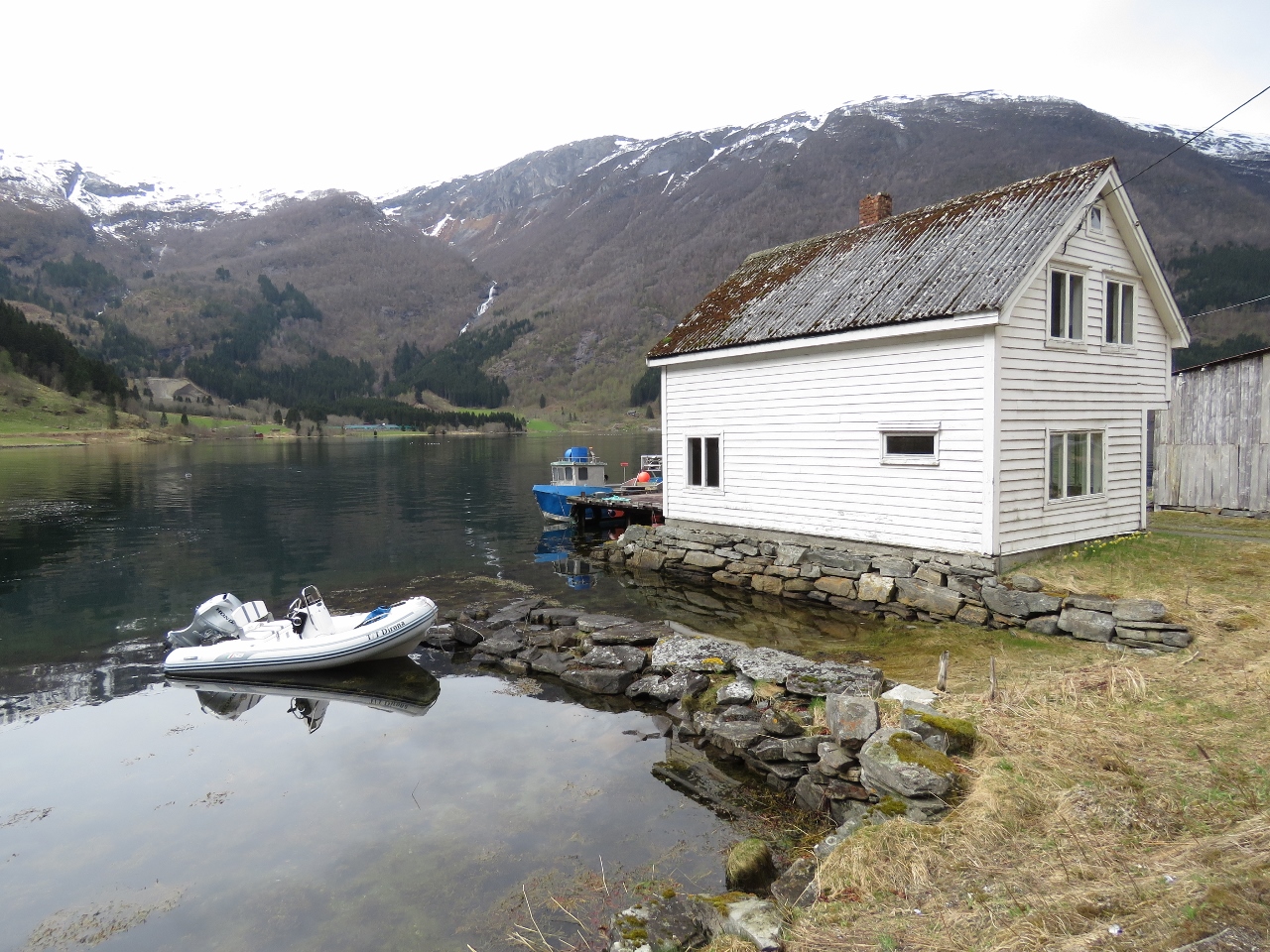 |
Tender
Position: 6 21.86, 61 0.18
The tender tied off at the village of Fretheim for a walk ashore.
|
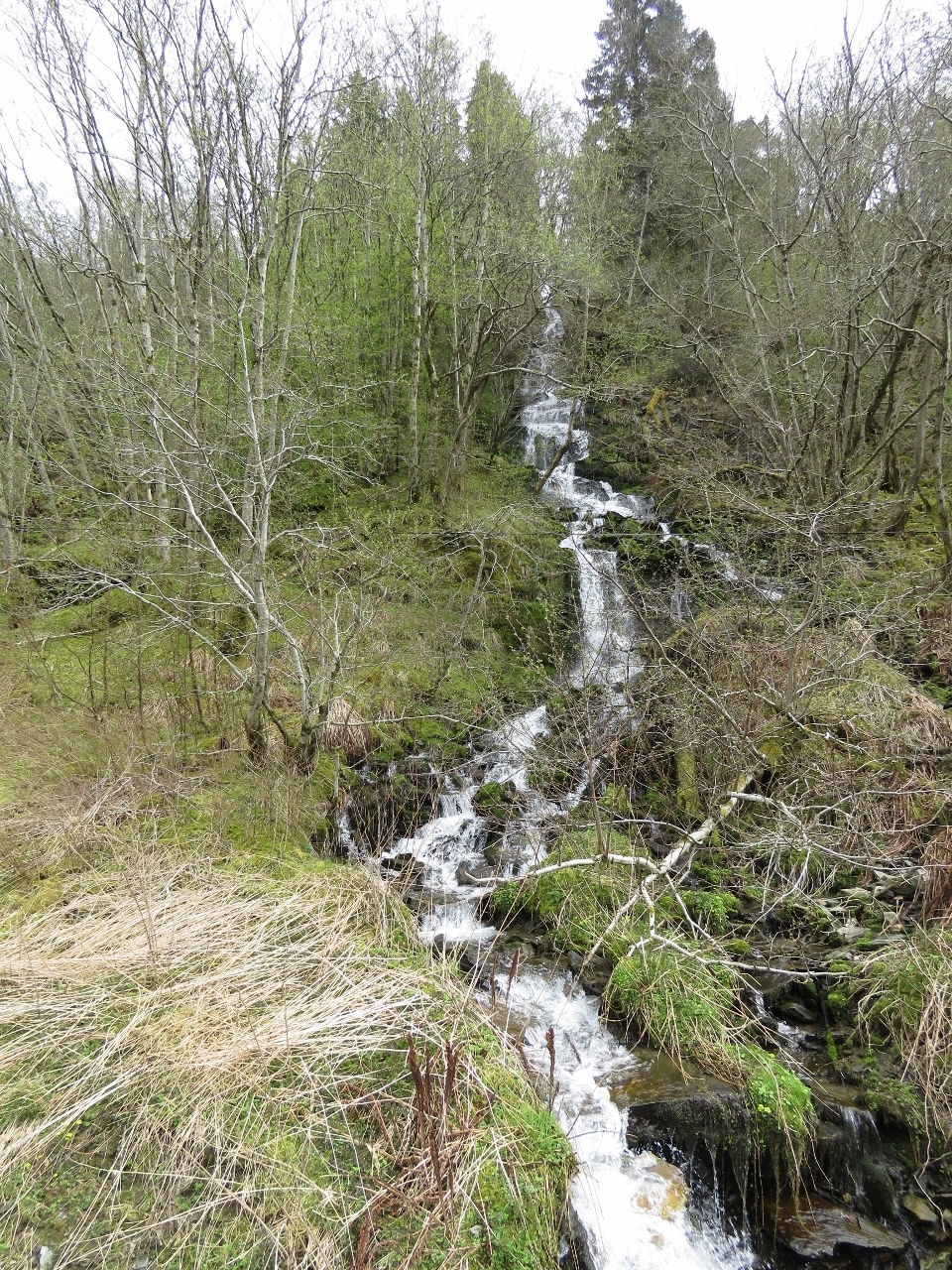 |
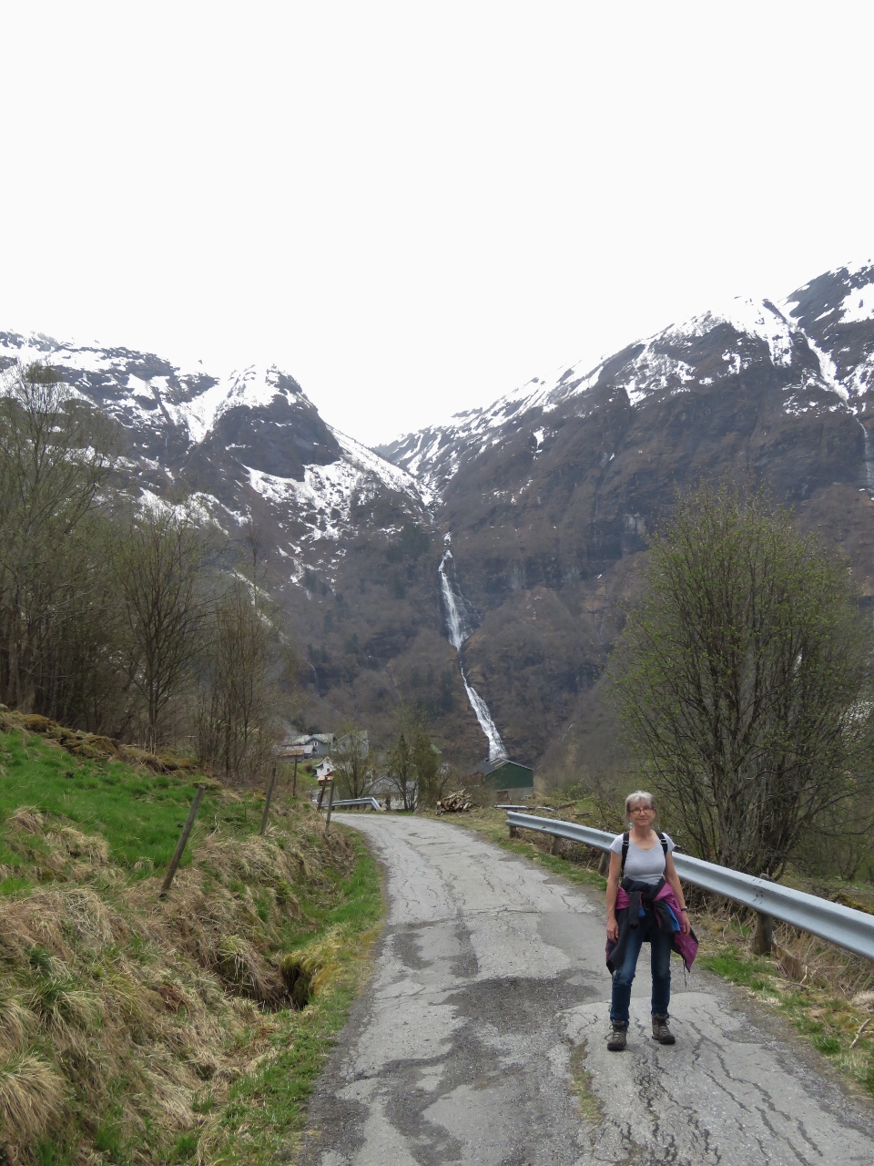
Roadside Waterfall
Position: 6 21.89, 61 0.19
A small waterfall alongside the road.
|
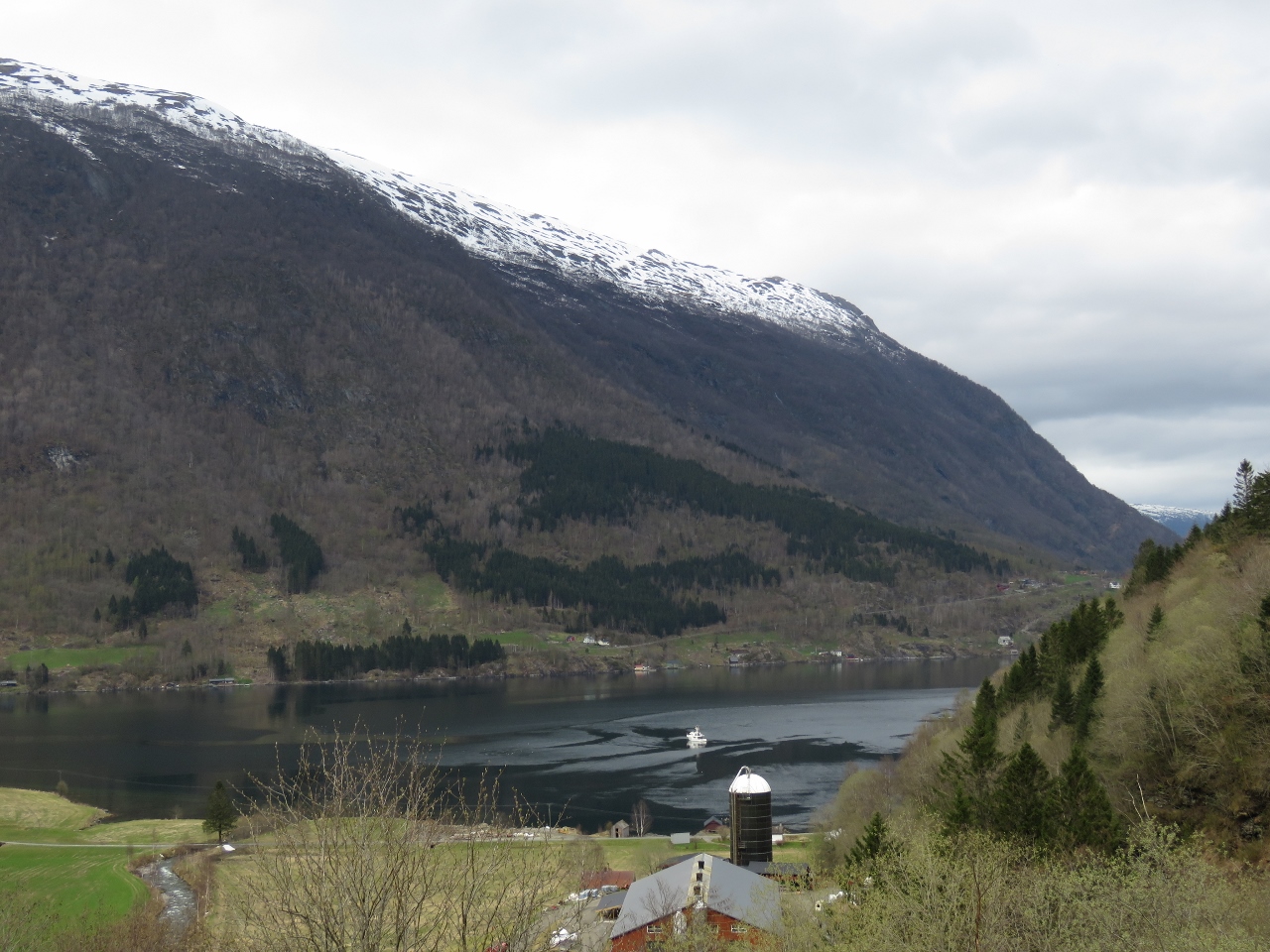 |
View
Position: 6 21.68, 60 59.84
View back to the anchorage from partway up the hill.
|
 |
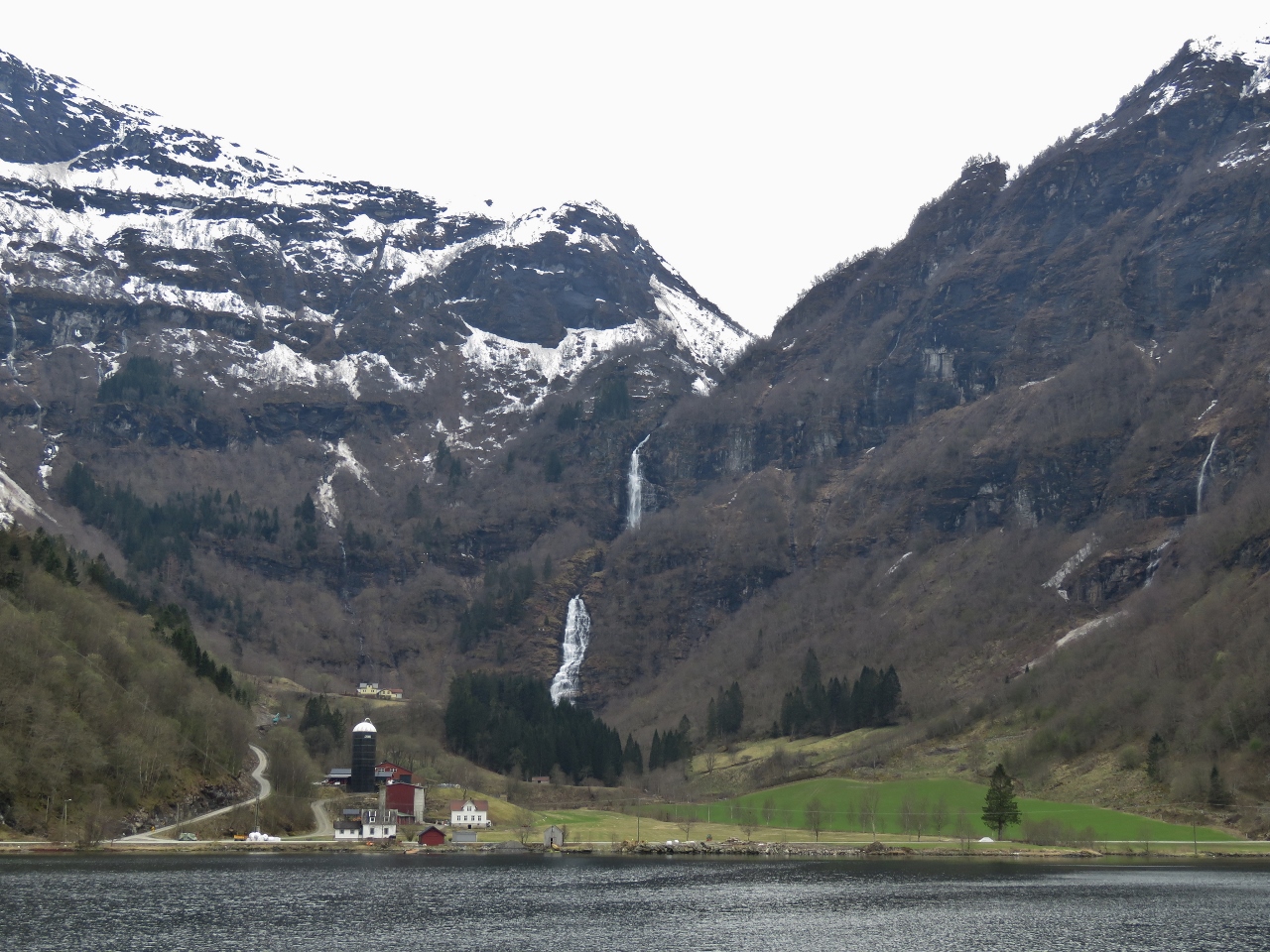
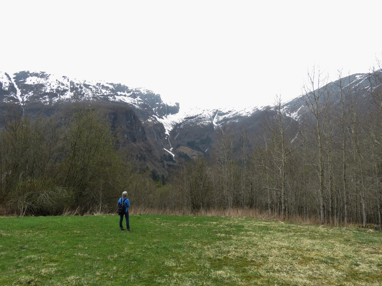
Botnafossen
Position: 6 21.65, 60 59.78
Jennifer standing at the base of Botnafossen, the spectacular double-level waterfall we can see from the anchorage.
|
 |
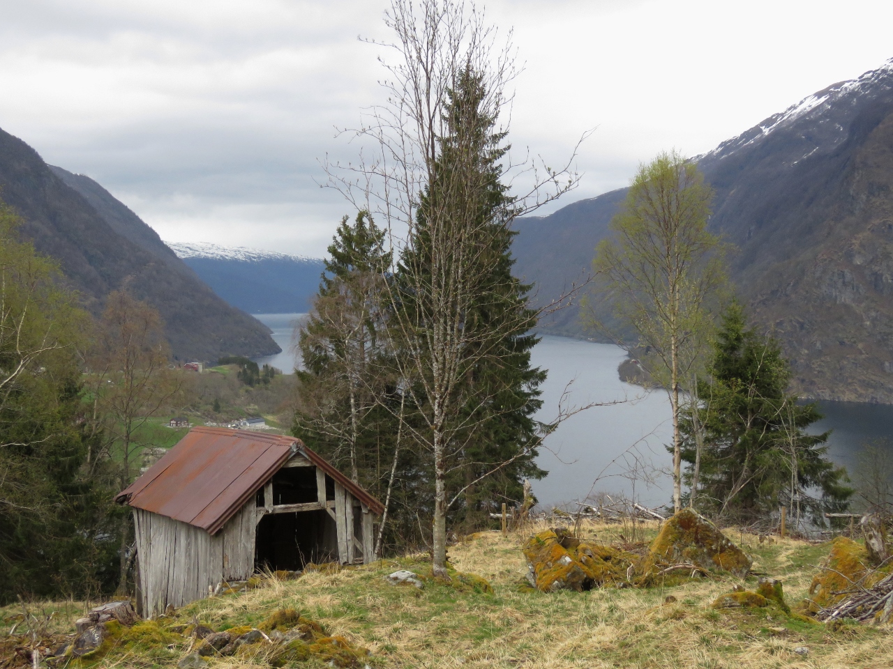
Anchorage View
Position: 6 22.21, 61 0.24
We followed a dirt road off the main paved road, looking for more views. This is looking back down to the anchorage from a meadow along the way. Dirona is just out of site behind the old building at the bottom of the photo.
|
 |
Arnaforden
Position: 6 22.38, 61 0.40
Looking up Arnaforden from another meadow along our walk. We found lots of evidence of long-time cattle-grazing the area, with several old buildings and long-felled trees along with brand-new fencing.
|
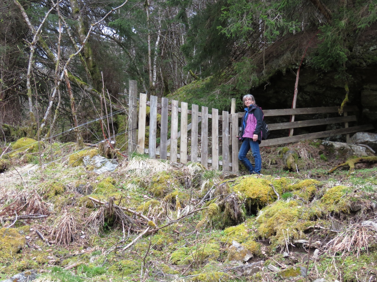 |
Gate
Position: 6 22.45, 61 0.39
We’d ended up directly above the village of Fretheim along the south shore of the anchorage, and were hoping to find a path down, but no luck. We were thinking we might have to retrace our steps when we found this gate with a path continuing beyond. We took a chance that it would bring us back to the main road, which it did.
|
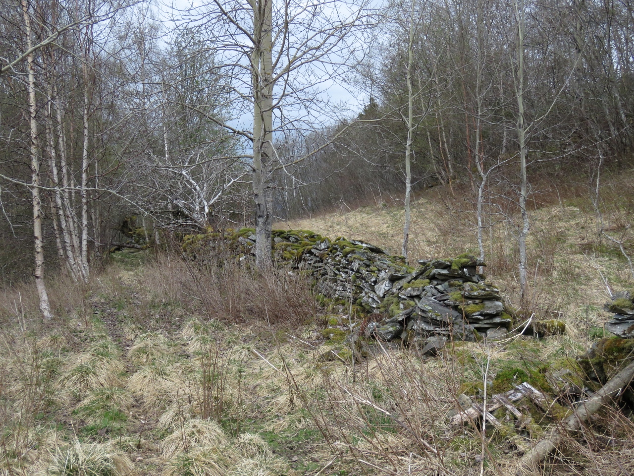 |
Stone Fence
Position: 6 22.56, 61 0.37
Old stone fence along the path.
|
 |
Meadow
Position: 6 22.56, 61 0.37
Jennifer enjoying the mountain view from a meadow along the path.
|
 |
Warm
Position: 6 22.57, 61 0.25
We eventually did find a way back to the main road. Surprisingly, the temperature was warmer up here and we were hot from hiking uphill, so we shed our three layers of coats for a bit.
|
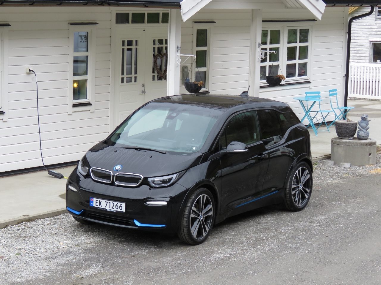 |
BMW i3
Position: 6 22.39, 61 0.12
This BMW i3 passed us on our way up the hill—it’s an appealing-looking all-electric car.
|
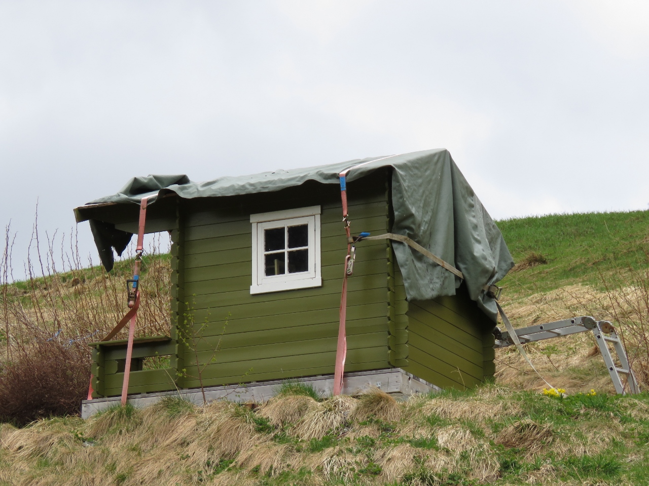 |
Tie-downs
Position: 6 22.22, 61 0.01
The tie-downs on this children’s playhouse give an idea of the winds they must get up here in the winter.
|
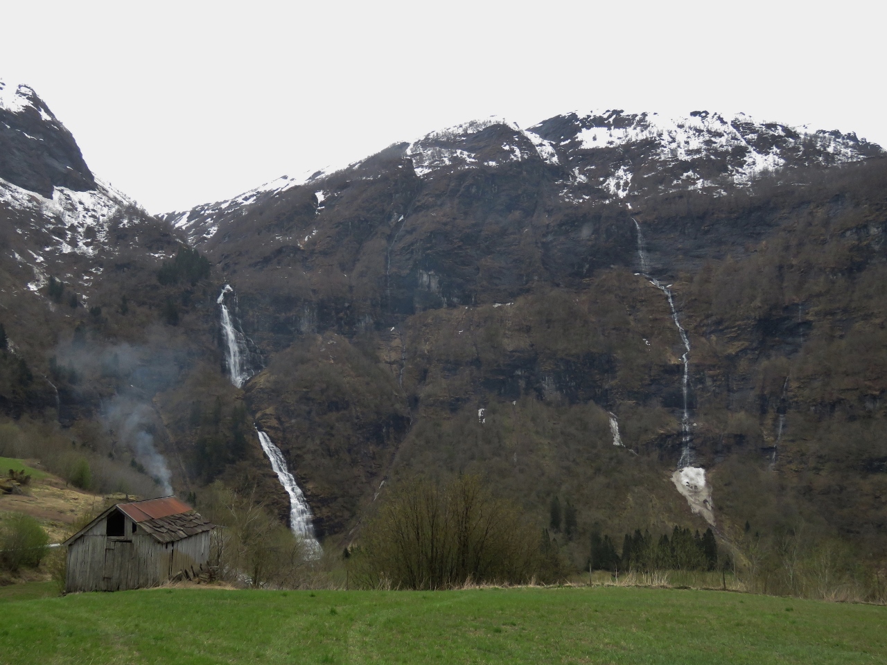 |
Waterfalls
Position: 6 22.19, 60 59.98
A final view to Botnafossen and another to the right as we descend back to Dirona.
|
 |
Click the travel log icon on the left to see these locations on a map, with the complete log of our cruise.
On the map page, clicking on a camera or text icon will display a picture and/or log entry for that location, and clicking on the smaller icons along the route will display latitude, longitude and other navigation data for that location. And a live map of our current route and most recent log entries always is available at mvdirona.com/maps. |
All those boats moored up in the cove at the village of Nese, are, barring the odd one or two, look to be by the same boat builder.
Yes, they are all very similar boats.