Some of the best places we have visited in our cruise around the world were destinations we hadn’t heard of before arriving in the area. The Great Saimaa Lake system is a beautiful example. We knew we wanted to visit Finland and were looking forward to exploring the thousands of islands that make it a world-class cruising destination. What we didn’t know about was the Great Saimaa Lake system, but the more we heard, the more excited we got.
The system is a massive inland series of 120 lakes and over 14,000 islands. The lakes are interconnected by canals and locks that allow travel over 200 nautical miles north, with a coastline of 8,000 nautical miles and 1,690 sq mi (4,377 sq km) to explore. And, if that’s not exciting enough, getting there involves a pass through Russia to navigate the eight locks in the Saimaa Canal from the Baltic Sea to reach the lake system.
But the lakes offer more than just beautiful scenery and complex coastlines. Within are several of the 27 “National Landscapes of Finland”, selected for their great symbolic value and cultural or historical significance. These include the famed Heinavesi route, a historic system of canals and locks built in the early 1900s; Punkaharju Ridge, a centuries-old travel route formed about 10,000 years ago when the continental glacier receded in eastern Finland; the Imatrankoski rapids, a tourist attraction since the late 1700s; and Olavinlinna castle, built starting in 1475 by the Swedish and now the site of the Savonlinna Opera Festival that annually draws about 60,000 visitors.
We spent a fabulous three weeks exploring the lakes and enjoying the spectacular scenery and National Landscapes, and could easily have spent the entire summer there. Finnish residents Mika Naatula and Katri Rosenberg, owners of Nordhavn 64 Sweet Hope, were the first to encourage us to visit, and gave us excellent advice on destinations within. If you are interested in cruising the Great Saimaa Lake system, or if you just want to spend some time learning about a Nordhavn, Sweet Hope is available for charter. Their boat is beautiful and it’s hard to get more knowledgeable hosts than Mika and Katri. Check out some of the itineraries at the bottom of sweethope.fi.
Below are trip highlights from May 30th through June 20th, 2019 in the Great Saimaa Lakes, Finland. Click any image for a larger view, or click the position to view the location on a map. And a live map of our current route and most recent log entries always is available at mvdirona.com/maps.
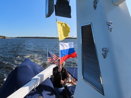 |
Dirona in Russia
Position: 60°26.98’N, 27°42.54’E
We’ve been to a lot of places over the years and seen many countries, but taking Dirona through Russia was never on our list of expected or planned trips. The administrative overhead of the trip is reduced by Russia not requiring visitors to obtain visas in order to pass through to the lake, but all the other formalities are still required. We checked out of Finland at Santio, cleared into Russia at Brusnitchnoe Lock in the Saimaa Canal, and then had a detailed Russian Border inspection at Palli Lock before leaving Russia and then clearing back into Finland again at Nuijamaa.
|
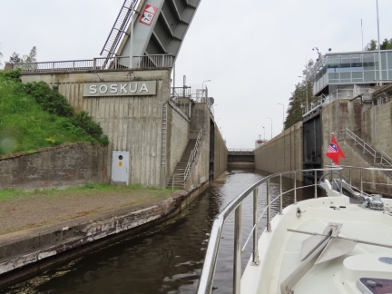 |
Saimaa Canal
Position: 61°2.26’N, 28°24.27’E
The Saimaa Canal, connecting Lake Saimaa to the Baltic Sea, has long been an important commercial transportation route. The canal was completed in 1856 while Finland was a Duchy in the Russian Empire and was wholly within Finland after the country became independent in 1917. As part of the reparations for World War II, Finland was required to cede land to the Soviet Union and the border between the countries moved about 50 miles west in the Baltic Sea area.
|
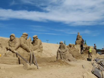 |
Lappeenranta
Position: 61°4.12’N, 28°11.06’E
Lappeenranta lies on the south end of Lake Saimaa, about 3 nautical miles from the Saimaa Canal and about 16 from the Russian border. The town was charted in 1649, when it was part of Sweden and an important port for tar. The Swedes built a fortress there in stages in the 18th century, but soon after the town was annexed to Russia, and remained under Russian control until Finland gained its independence in 1917.
|
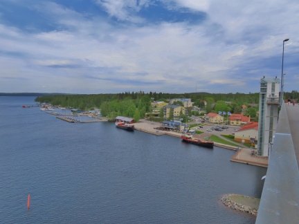 |
Puumala
Position: 61°31.14’N, 28°10.57’E
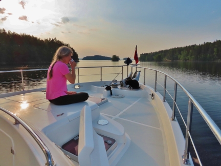
Puumala sits on a chokepoint in the Saimaa Lakes region—all vessel traffic must pass through the 1000ft (300m) Puumalansalmi channel to reach the towns and cities to the north. Spanning the gap is the 2,562ft (781m) Puumalansalmi Bridge, one of the largest highway bridges in Finland. And built into the bridge is the Saimaanmajakka observation tower, with an elevator from sea level to the top for sweeping views across the area.
|
 |
Linnansaari
Position: 62°6.23’N, 28°32.78’E
Linnansaari National Park on Lake Haukivesi encompasses 15 sq miles (38 sq km) of beautiful Saimaa Lakes scenery. Established in 1956 to protect the natural landscape of the Finnish lakeland, the park also is a habitat for the critically endangered Saimaa Ringed Seal.
|
 |
The Heinavesi Route
Position: 62°19.60’N, 28°45.73’E
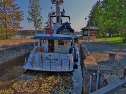
The Heinavesi route is a historic system of canals and locks built in the early 1900s in Finland’s Saimaa Lakes region. The waterway initially carried significant commercial traffic, but today is mainly used by pleasure craft and tour boats and is one of 27 “National Landscapes of Finland” selected for their great symbolic value and cultural or historical significance.
|
 |
Varistaipale and Taivallahti Canals
Position: 62°32.80’N, 28°38.38’E
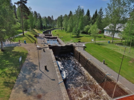
The Varistaipale and Taivallahti canals form the final two lock systems in the famed Heinavesi route and provide boat access to the monastary at Valamo. The Varistaipale Canal is notable in having a flight of four locks, the most of any Finnish canal.
|
 |
Puijo Tower
Position: 62°54.56’N, 27°39.32’E
Puijo Hill in Kuopio is only 490 feet (150m) high, but is one of the tallest in the area. Three observation towers have been built there since 1856, with the current 246-ft (75m) tower providing spectacular 360° views of the Saimaa Lake system. Ski jumping also has been popular on Puijo Hill since the late 1800s, and several World Cup ski jumping competitions have been held there.
|
 |
Savonlinna
Position: 61°51.69’N, 28°53.51’E
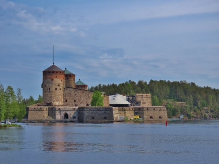
The Swedish began building Olavinlinna castle in 1475 to strengthen their eastern border with Russia, and the town of Savonlinna grew up around the fortification. Today the city of 33,000 hosts the Savonlinna Opera Festival at Olavinlinna, annually drawing about 60,0000 visitors. Savonlinna also is the home port of Finland’s largest fleet of historic steamships, operated by VIP Cruise.
|
 |
Punkaharju Ridge
Position: 61°46.82’N, 29°19.52’E
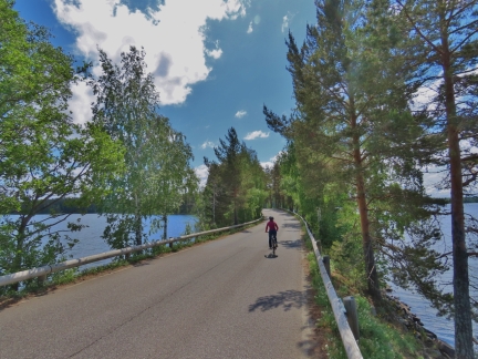
The Punkaharju Ridge near Savonlinna is a centuries-old travel route formed about 10,000 years ago when the continental glacier receded in eastern Finland. The natural beauty of the area has attracted tourists for two centuries and today the region is protected as a nature reserve and has been designated one of 27 “National Landscapes of Finland” selected for their great symbolic value and cultural or historical significance.
|
 |
Imatra
Position: 61°10.19’N, 28°46.39’E
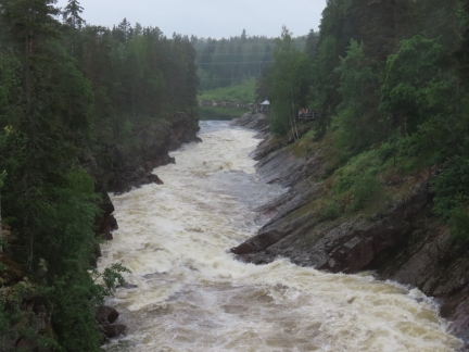
Imatrankoski, the rapids on the Vuoksi River, have been a tourist attraction since the late 1700s and are one of 27 “National Landscapes of Finland” selected for their great symbolic value and cultural or historical significance. Since 1929 the rapids have been blocked by the Imatra Hydroelectric Plant, but the dam is regularly opened in July and August as a tourist attraction. Imatra is easily visited by boat and we really wanted to see the rapids, but none of the four shows in June fit our schedule. One did coincide with our time in Punkaharju, however, and we could easily reach Imatra by train from there.
|
 |
Lake Pihlajavesi
Position: 61°46.65’N, 28°50.99’E
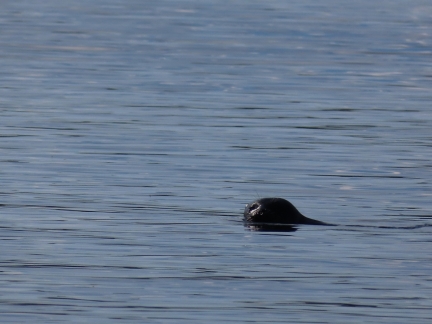
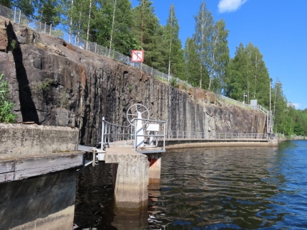
The Saimaa Ringed Seal are among the most endangered in the world, with a current population below 400 animals. They have been isolated from other Ring Seal species for nearly 10,000 years when the the land rose in the last ice age, and are one of the few living freshwater seals. Sightings are rare, but Lake Pihlajavesi is one of their primary habitats and a good place to spot one.
|
 |
Return to Lappeenranta
Position: 61°4.77’N, 28°17.13’E
From Lake Pihlajavesi we ran 71 miles back to Lappeenranta, overnighting partway along. We’d gone through almost all the gasoline we bought in Nynashamn back in April, so stopped off at Puumala to fill our gas tanks for the tender and top up our diesel.
|
 |
Saimaa Canal Exit
Position: 61°4.26’N, 28°18.23’E
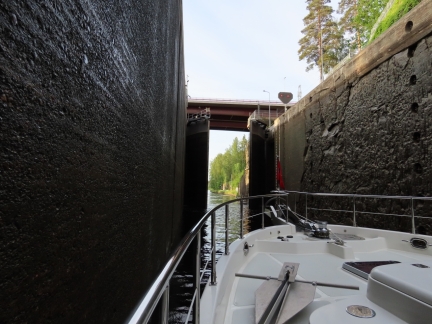
On our exit from the Saimaa Canal, we passed through all eight locks, cleared out of Finland, through Russia, and back into Finland all in one busy 15-hour run. As with our entry, the boat was searched extensively at the Russian border, but otherwise the process went smoothly. And also as on the inbound journey, we were a little apprehensive about travelling through Russia as US citizens on an American-flagged vessel, and were happy to finally reach Santio Island and clear back into Finland.
|
 |
Click the travel log icon on the left to see these locations on a map, with the complete log of our cruise.
On the map page, clicking on a camera or text icon will display a picture and/or log entry for that location, and clicking on the smaller icons along the route will display latitude, longitude and other navigation data for that location. And a live map of our current route and most recent log entries always is available at mvdirona.com/maps. |
If your comment doesn't show up right away, send us email and we'll dredge it out of the spam filter.