On our exit from the Saimaa Canal, we passed through all eight locks, cleared out of Finland, through Russia, and back into Finland all in one busy 15-hour run. As with our entry, the boat was searched extensively at the Russian border, but otherwise the process went smoothly. And also as on the inbound journey, we were a little apprehensive about travelling through Russia as US citizens on an American-flagged vessel, and were happy to finally reach Santio Island and clear back into Finland.
Below are trip highlights from June 19th, 2019 in Finland and Russia. Click any image for a larger view, or click the position to view the location on a map. And a live map of our current route and most recent log entries always is available at mvdirona.com/maps.
 |
Approaching Malkia
Position: 61°4.34’N, 28°18.13’E
Approaching Malkia lock shortly before 6am on our outbound trip through the Saimaa Canal. We plan to pass through all eight locks, including five in Russia, and clear back into Finland this evening.
|
 |
Urho Kekkonen Park
Position: 61°4.34’N, 28°18.13’E
Urho Kekkonen Puisto (park), alongside the Malkia Lock. The park was named after the eighth and longest-serving President of Finland, who served for 26 years from 1956–1982.
|
 |
Malkia Lock
Position: 61°4.26’N, 28°18.24’E
Sign on the rocks showing the two dates of construction of the Malkia Lock, the initial construction in 1927-1933 and a second from 1965-1968 when the canal was widened and deepened.
|
 |
Descending
Position: 61°4.26’N, 28°18.24’E
Descending while tied off the port side in the Malkia Lock.
|
|
|
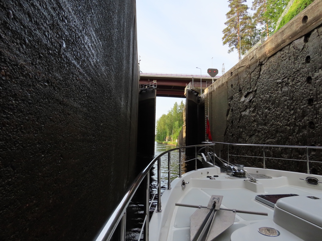
Door Opening
Position: 61°4.26’N, 28°18.23’E
The doors opening in the Malkia Lock after we’ve descended (12.39m) from the Saimaa Lake level.
|
 |
Morning Calm
Position: 61°3.89’N, 28°18.68’E
Calm waters as we proceed south from Malkia Lock.
|
 |
Mustola
Position: 61°3.75’N, 28°18.98’E
The door and bridge closing prior to our 23-foot (7.26m) descent through Mustola lock.
|
 |
Reflections
Position: 61°3.10’N, 28°22.69’E
Shoreline reflecting in the calm Saimaa Canal waters.
|
 |
Soskua
Position: 61°2.49’N, 28°23.86’E
Approaching Soskua lock, the last Finnish lock on the Saimaa Canal. The other five we’ll pass through today will be in Russia, where we’re not permitted to take pictures.
|
 |
Walkway Lifting
Position: 61°2.39’N, 28°24.03’E
The walkway lifting behind us at Soskua lock.
|
 |
Kaarnantie
Position: 61°0.87’N, 28°27.16’E
The Kaarnantie road bridge lifting in the distance as we approach.
|
 |
Original Canal
Position: 60°59.43’N, 28°29.72’E
A view to the original canal, completed in 1856. The canal was widened, deepened and straightened in the 1960s.
|
 |
Nuijamaa
Position: 60°57.77’N, 28°32.98’E
Finnish customs and immigration waiting for us to arrive at Nuijamaa to clear us out from Finland. The process went smoothly and we soon were underway for Russia.
|
 |
Leaving Finland
Position: 60°57.53’N, 28°33.58’E
Lowering our Finnish courtesy flag as we leave Finland.
|
 |
Entering Russia
Position: 60°57.48’N, 28°33.69’E
Raising a Russian courtesy flag and a quarantine flag as we enter Russian waters.
|
 |
Russian Stamps
Position: 60°54.45’N, 28°36.85’E
We cleared through the Russian immigration at Palli lock. As with our entry, the boat was searched extensively, but otherwise the process went smoothly. We now have three sets of Russian stamps in our passports, one for St. Petersburg and the other two for entering and leaving Lake Saimaa.
|
 |
Relaxing
Position: 60°28.43’N, 28°6.74’E
James and Spitfire taking a break in the off-watch berth en route through Russia.
|
 |
Leaving Russia
Position: 60°26.46’N, 27°43.42’E
Lowering our Russian courtesy flag eleven hours after raising it.
|
 |
Re-entering Finland
Position: 60°26.54’N, 27°43.28’E
Raising our Finnish courtesy flag and a quarantine flag prior to entering Finnish waters and clearing through.
|
 |
Santio Island
Position: 60°27.48’N, 27°43.14’E
When we cleared out of Finland at Santio Island three weeks ago, the docks were empty. But today they were almost full—we took the last spot.
Once boats clear in or out, they have to get underway immediately. So operators sit on the dock until they’re ready to clear, and the dock fills up quickly. We would rather get underway when we’re ready the next morning, rather than after all these other boats have been processed starting at 8am, so we cleared in and planned to continue to a nearby anchorage. |
 |
Pieni-Pisi
Position: 60°27.45’N, 27°38.24’E
Glacier-deposited boulders on the island of Pieni-Pisi, aglow in the evening sun. We were ready to stop—our total travel time for the day was just over 15 hours, plus we’d transited eight locks, cleared out and in of Finland and cleared through Russia.
|
 |
Sunset
Position: 60°27.45’N, 27°38.24’E
Sunset at Peini-Pisi island just inside the Finnish border with Russia. We don’t see many sunsets these days as we’re usually in bed before then.
|
 |
Click the travel log icon on the left to see these locations on a map, with the complete log of our cruise.
On the map page, clicking on a camera or text icon will display a picture and/or log entry for that location, and clicking on the smaller icons along the route will display latitude, longitude and other navigation data for that location. And a live map of our current route and most recent log entries always is available at mvdirona.com/maps. |
If your comment doesn't show up right away, send us email and we'll dredge it out of the spam filter.