The Saimaa Canal, connecting Lake Saimaa to the Baltic Sea, has long been an important commercial transportation route. The canal was completed in 1856 while Finland was a Duchy in the Russian Empire and was wholly within Finland after the country became independent in 1917. As part of the reparations for World War II, Finland was required to cede land to the Soviet Union and the border between the countries moved about 50 miles west in the Baltic Sea area. The southern half of the Saimaa Canal and the sea approaches to it, along with Vyborg, then Finland’s second largest city, became part of Russia. All water traffic between the Saimaa Lakes and the Baltic Sea ceased.
Traffic resumed after Finland obtained a 50-year lease on the Soviet portion of the canal in 1963, an agreement that was renewed starting in 2013. Today commercial and pleasure craft regularly make the journey through Russia and the Saimaa Canal between the Saimaa Lakes and the Baltic Sea. As far as we know, we are the first Nordhavn to make this trip, and certainly one of the very few American-flagged vessels to do so. One local told us he’d not seen a US-registered boat in the lakes in the 48 years he’d been coming to the area.
Below are trip highlights from May 31st, 2019 in the Saimaa Canal, Finland. Click any image for a larger view, or click the position to view the location on a map. And a live map of our current route and most recent log entries always is available at mvdirona.com/maps.
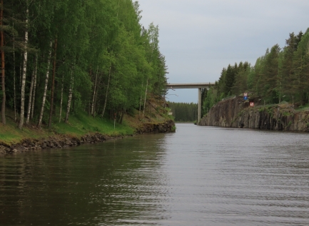 |
Scenery
Position: 60°57.82’N, 28°32.86’E
As part of the lease agreement between Finland and Russia to allow voyages through Russia to and from the Saimaa Canal, no photography is allowed in the border zone between the two Finnish borders, and cameras are required to be in their cases and stowed below decks. Now that we’ve exited the Russian border zone, we’re finally able to take some pictures of the scenic run through the Saimaa Canal.
|
 |
Bridge
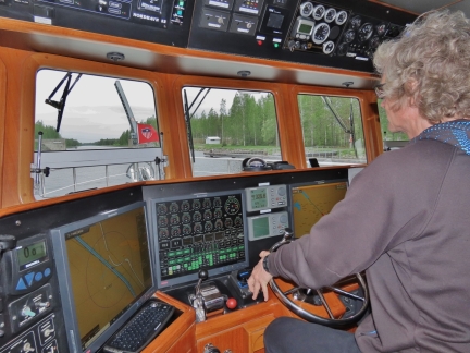
Position: 61°0.43’N, 28°27.98’E
James at the helm as we pass through the Kansola road bridge along the Saimaa Canal. All the locks and bridges opened for us without request as we neared. The only time we had to radio was at the first lock, Brusnitchnoe, to let them know we were ready to proceed after clearing Russian Customs.
|
 |
Soskua Lock
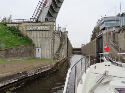
Position: 61°2.26’N, 28°24.27’E
Entering the Soskua Lock, that will bring us to 187ft (57.1m) above sea level. When we reached Nuijamaa after the first five locks in the Russian part of the canal, we’d reached 160ft (48.8m) above sea level.
|
 |
Filling
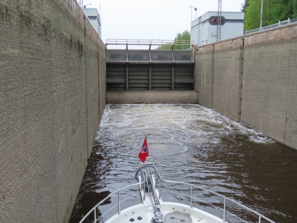
Position: 61°2.39’N, 28°24.03’E
Water upwelling into the Soskua Lock. The lockmasters are efficient and each transit typically took about 20 minutes from entry to exit.
|
 |
Russian Emperors
Position: 61°3.15’N, 28°22.44’E
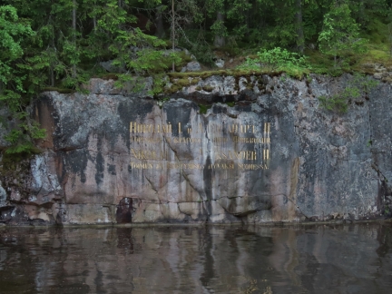
The Saimaa Canal was built between 1845 and 1856 while Finland was a Duchy in the Russian Empire. This carving in the rock names, in Finnish and Russian, the two Russian Emperors who funded the canal construction during their reign, Nikolai I and Aleksander II.
|
 |
Coal Loading
Position: 61°3.46’N, 28°20.71’E
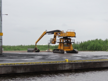
This is an interesting vehicle used to load/unload coal and to manage the stock pile. It’s a Mantsinen 80 and, like all Mantsinen material handlers, has a cab on a hydraulically-controlled arm rather than directly mounted to the vehicle. Having the cab free to move up and down ensures the operator always has good visual access even with an extremely long reach shovel arm. We estimate the reach of this materials handler at right around 25m so it can work over a very large area.
|
 |
Carelia
Position: 61°3.60’N, 28°19.37’E
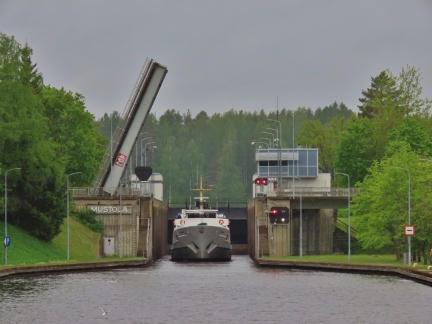
The day-cruise boat Carelia exiting Mustola lock. The vessel does visa-free cruises to Vyborg, Russia similar to the St. Petersburg trip we took, and will even arrange transit to St. Petersburg from Vyborg as part of the visa-free trip.
|
 |
Port Tie
Position: 61°3.75’N, 28°18.98’E
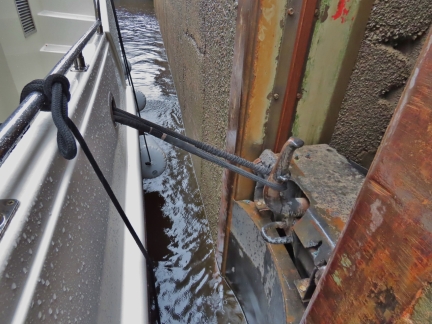
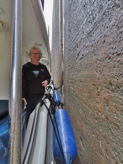
Looking aft from our port-side tie-off point in the Mustola lock. Each lock in the Saimaa Canal has only three widely-space bollards to tie to, and we can only reach one with our boat. Half of the locks have bollards on the east side and half on the west, often alternating. The Saimaa Canal Guide for Leisure Boats list the bollard side for each lock, so we know what to expect before entering.
|
 |
Starboard Tie
Position: 61°4.26’N, 28°18.24’E
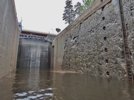
James walking to the stern as we pass through the Malkia lock, the final lock in the Saimaa Canal. This time we’re tied off on the starboard side.
|
 |
Lock Walls
Position: 61°4.26’N, 28°18.23’E
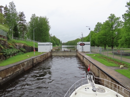
Some of the lock walls are finished with concrete, but several have large sections where the rock face blasted to make the passage forms the wall.
|
 |
Top of Malkia
Position: 61°4.26’N, 28°18.24’E
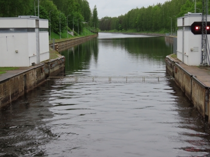
Reaching the top of the final lock in the Saimaa Canal, Malkia, at 251ft (76.75m) above sea level.
|
 |
Gate Lowering
Position: 61°4.26’N, 28°18.24’E
The gate lowering at Malkia lock. Once we’ve exited the lock, we’ll be free to enter Saimaa Lake and cruise the region for the next 2-3 weeks.
|
 |
Cement Pump
Position: 61°4.62’N, 28°17.65’E
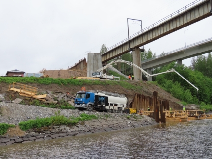
Cement pumps are common on high rise building construction sites. They are often used to pump cement up to forms and effectively cast the building upwards. Each floor as it hardens becomes the base for the for the forms that shape the floor above. Cement pumps add considerably to the efficiency of building construction but, of course, they can also be used to deliver cement over horizontal distances as well. Here a Cifa K42L is reaching out close to the end of it’s amazing 37.8m horizontal reach. That’s a lot of weight being delivered out over 30m.
|
 |
Deer
Position: 61°6.93’N, 28°8.76’E
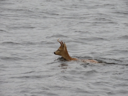
It’s not often, when running a half-mile from shore, that you have to divert to avoid running over a deer. Apparently, word is going around that the grass is excellent on the neighbouring island. :)
|
 |
Bridge Clearance
Position: 61°7.10’N, 28°7.36’E
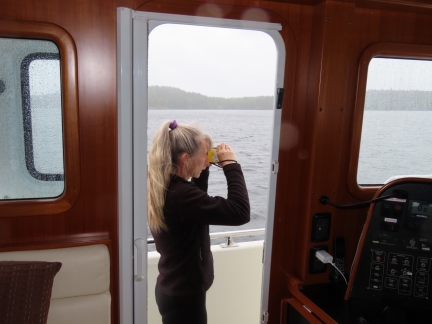
We use a Nikon Forestry Pro Laser Rangefinder to measure bridge clearance. The device is easy to use and incredibly accurate. Well before we were committed to passing under a 34ft (10.5m) bridge, the gauge measured the clearance accurately. The bridges in the Baltic are well-marked, but we’ve found several places in the world where they’re not marked at all and the gauge comes in quite handy.
|
 |
Bridge
Position: 61°7.13’N, 28°6.76’E
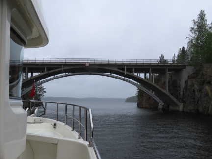
Passing under the 34ft (10.5m) bridge between the islands of Kuivaketvele and Kuivisaari. The Saimaa Lakes region is full of complex waterways winding between the myriad islands, many with fixed bridges. Several times, while studying the charts to plan a route, we found ourselves needing to plot a different route due to a low fixed bridge we couldn’t clear.
|
 |
Cable
Position: 61°5.90’N, 28°3.25’E
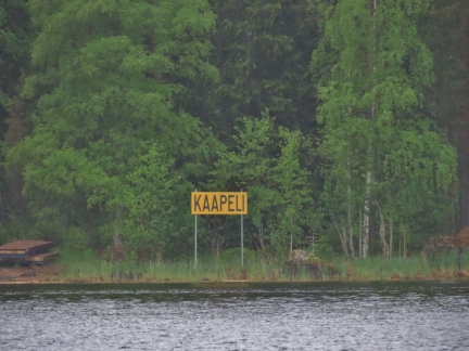
We initially were planning to anchor off Asinsaari, but a cable sign chased us off. The cable didn’t show on any of our charts, and we couldn’t see a sign for the other end, so had no idea where the cable ran.
Normally when you see a cable sign, you just need to match it up with the partner on the other side, but in this particular example there only is one sign, so it’s not safe to anchor in the area, not knowing where the cable runs. We saw several one-sided cable signs like this in the Saimaa Lakes. |
 |
Ilkka Mononen
Position: 61°5.51’N, 28°3.92’E
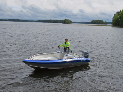
Ilkka Mononen has a cabin near our anchorage and came over to chat. He said ours is the first US-flagged boat he’s seen here in 48 years.
|
 |
Dirona
Position: 61°5.50’N, 28°3.93’E
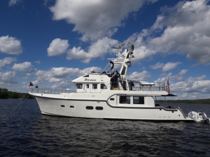
Ilkka Mononen sent us this photo he took of us while we were washing the boat. (If you’re reading this Ilkka, it was great to meet you and thank you for the picture. We tried several times to respond to your email, but saimaantukipalvelut.fi rejected them all as spam.)
|
 |
Click the travel log icon on the left to see these locations on a map, with the complete log of our cruise.
On the map page, clicking on a camera or text icon will display a picture and/or log entry for that location, and clicking on the smaller icons along the route will display latitude, longitude and other navigation data for that location. And a live map of our current route and most recent log entries always is available at mvdirona.com/maps. |

As always we So enjoy reading your blog! Adding this to our plans for next summer when we hope to make the Baltic!!
Thank you Laurie. Taking a boat through the Saimaa Canal and cruising the lakes truly is a unique experience–you’ll love it.
Jennifer
Amazing to see you made it that for up the Saimaa.
I was at a wedding in the very north end of the chain of (“a million”) lakes in 1990. Worst mosquito location ever. Far worse than anything experienced in Sweden until then.
And as you know, in WA State we are mostly blessed in having relatively few of them pesky critters.
Yes, you are right. There are places in British Columbia like the Rivers Inlet Area (https://mvdirona.com/TravelArticles/PY_JUN07_36-41_RIVERS.pdf) that definitely would give the Lake Saimaa a run for the title of most bugs :-). Fiordland in New Zealand has a pretty healthy bug population as well (https://mvdirona.com/2014/05/fiordland/).
While we were in Lake Saimaa, there weren’t that many places where the bug populations where annoying. Generally around dusk or dawn in the near shore areas can be a problem. Our trick is don’t anchor too close to shore and, this far north, event at 5am the sun is bright and strong so the bugs aren’t that bad unless you are in dense forest areas. It wasn’t too much of a problem but, you’re right, they do have bugs.
Looks like you had a great time exploring the Finnish lakes, and the canal.
You have many great pictures, with lots of information, as always.
It was an amazing trip Trond. If you could find the time to do it, you both would have fun. Passing through Russia to get there adds to the adventure.
We’re on our way out today and will check back into Finland from Russia at around 7:30pm this evening.
If I ever bring my boat to the Baltic, it is definitely on my list of places to visit. This year, we’ll probably just do southern Norway. Unfortunately my boat is out of service right now. The boat yard dropped my boat down to a concrete floor, while putting the boat on support bunks, a few weeks ago. Had it in the yard for some planned upgrades and maintenance. Hopefully it will be repaired as scheduled, in time for the summer vacation in July.
Oh, that’s terrible. We are both sorry to see your boat damaged and possibly not available for the full summer. Hopefully the fix will be done well and quickly.
Fingers krossed. In the mean time, I’ll go boating through your blog :)
Hope you have a great time.