James flew in late Friday night from San Francisco, so we decided to go directly from the airport to Mt. Rainier National Park for a scheduled weekend of snowshoeing. We stayed in a bright and spacious VRBO cabin, Trillium, with easy access to the park.
Our first day’s trip was to Reflection Lake, where we walked alone through fresh snow in the hushed and beautiful winter setting. The previous weekend the road up to Paradise didn’t open at all due to a major snowstorm, and we were the first ones out for two weeks. After reaching the lake, we off-roaded a bit up to a ridge for great views of the Tatoosh Range (pictured above).
The temperature warmed up dramatically the second day, with rain falling almost as high as Paradise at elevation 5,400 ft (1,645 m). But the rain turned to snow when we reached the top, so we were able to enjoy a snowshoe along two trails we hiked last summer, the Nisqually Vista trail and a portion of the Glacier Vista Trail.
We had a fabulous weekend snowshoeing at Mt. Rainier and the cabin was a big part of it. Trillium was clean and comfortable, very private, and well-equipped with great amenities including the hot tub and a sauna.
Below are highlights from April 7th through 10th, 2023. Click any image for a larger view, or click the position to view the location on a map. And a map with our most recent log entries always is available at mvdirona.com/maps.
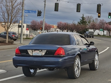 |
Wild Wheels
Position: 47°9.17’N, -122°28.08’W
Jennifer picked James up at the airport and we continued south for a weekend of snowshoeing at Mt. Rainier. On the way we passed this old police car that had been modified with incredibly large wheels and low-profile tires.
|
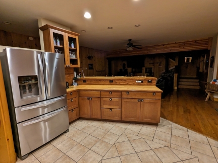 |
Trillium Kitchen
Position: 46°44.10’N, -121°59.19’W
A first look at Trillium, the Ashford VRBO cabin we’ve rented for the weekend while we snowshoe at Mt. Rainier. The kitchen was bright, spacious and well-equipped. After a big week of traveling for James, we had a late sushi dinner and a relaxing evening.
|
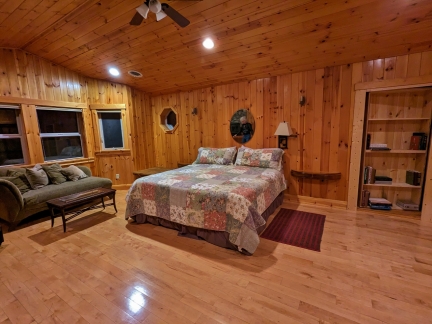 |
Trillium Master Bedroom
Position: 46°44.10’N, -121°59.19’W
We really liked the private and spacious Trillium second-floor master bedroom with its view to the tree-tops.
|
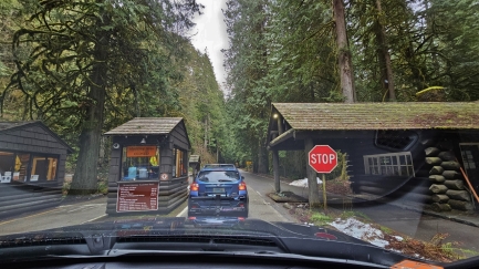 |
Entering Mt. Rainier NP
Position: 46°44.46’N, -121°55.00’W
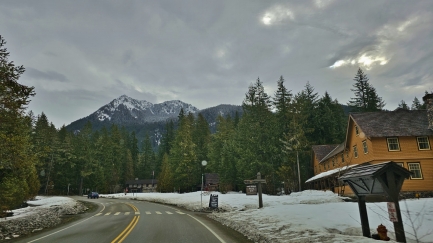
Entering Mt. Rainier National Park shortly before 9am for a day of snowshoeing.
|
 |
Longmire
Position: 46°44.97’N, -121°48.86’W
At Longmire, the visitors service center for Mt. Rainier. The road beyond to higher elevations is closed during the winter except on weekends between 9am and 4pm. It has just opened this Saturday morning, so we can head right through with no waiting.
|
 |
Tatoosh Range
Position: 46°46.26’N, -121°47.21’W
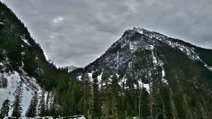
Mountains in the Tatoosh Range, a sub-range of the Cascades, viewed from the Paradise Valley Road. The Tatoosh Range includes 25 prominent named peaks with an average height of 6,420 ft (1,960 m).
|
 |
Nisqually Downriver
Position: 46°46.93’N, -121°45.75’W
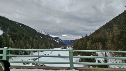
Looking south downriver as we cross the Nisqually River on the Nisqually Glacier Bridge.
|
 |
Snowplow
Position: 46°46.39’N, -121°46.41’W
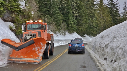
A snowplow clearing out snow that has fallen onto the road. This section of Paradise Road has a high avalanche risk and drivers are warned not to stop.
|
 |
Snow Banks
Position: 46°46.48’N, -121°45.79’W
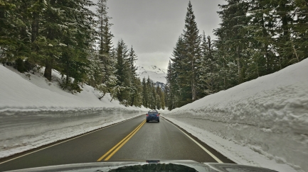
The snow banks are getting higher as we ascend towards Paradise.
|
 |
Parking Lot
Position: 46°46.50’N, -121°44.84’W
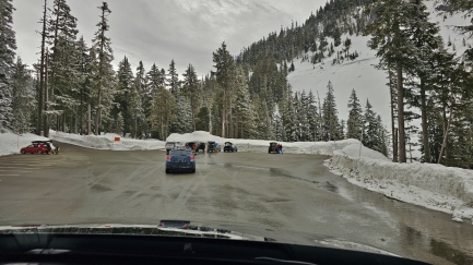
Barely a half-dozen cars at the Narada Falls parking at at 9:20 this morning. We’ll be snowshoeing from here to Reflection Lake.
|
 |
On the Trail
Position: 46°46.56’N, -121°44.72’W
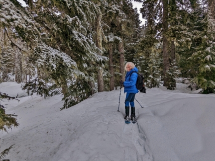
Fresh snow on the trail to Reflection Lake. Last weekend the road up to Paradise didn’t open at all due to a major snowstorm, and we’re the first ones here for two weeks. The trail has been well-trod in the past though, so the going is relatively easy.
|
 |
Stevens Canyon Road
Position: 46°46.67’N, -121°44.37’W
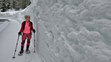
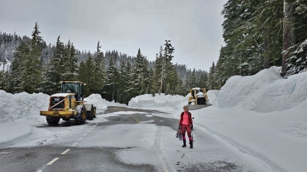
The marked trail we were following continues across Stevens Canyon Road, but we decided to take the road to Reflection Lake and trail back to make a loop of it. Stevens Canyon Road, where we drove last summer, is closed in the winter. But it is kept partially plowed, possibly for emergency access, and the snow banks are really high.
|
 |
Plows
Position: 46°46.60’N, -121°44.46’W
We reached a point where the road had so little snow, the work of these parked snowplows, that we opted to walk and carry our snowshoes.
|
 |
Mini Avalanches
Position: 46°46.38’N, -121°44.63’W
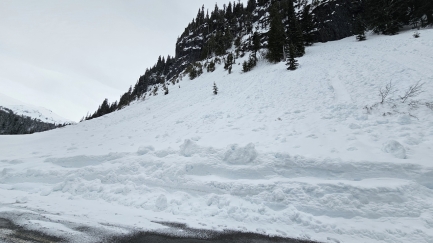
Mini avalanches streak the hillside above Stevens Canyon Road.
|
 |
View South
Position: 46°46.29’N, -121°44.63’W
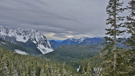
The view south from Stevens Canyon Road to the Tatoosh Range, with the Cascades in the distance.
|
 |
Walking
Position: 46°46.17’N, -121°44.49’W
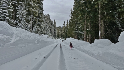
Stevens Canyon Road remained plowed for quite some distance, so we continued walking.
|
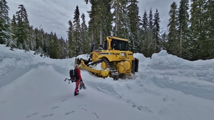 |
Final Snowplow
Position: 46°46.19’N, -121°44.39’W
At the final slowplow on Stevens Canyon Road, with Caterpillar D8T in the background. Deep snow covers the road beyond.
|
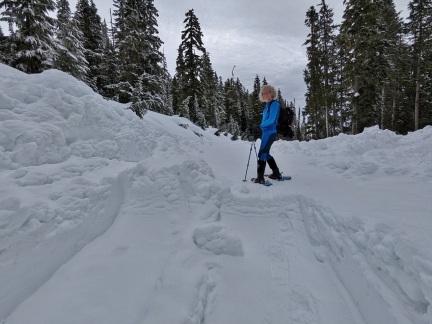 |
Snowshoes
Position: 46°46.19’N, -121°44.37’W
Re re-donned our snowshoes to walk the rest of the unplowed route down Stevens Canyon Road to Reflection Lake in Mt. Rainier.
|
 |
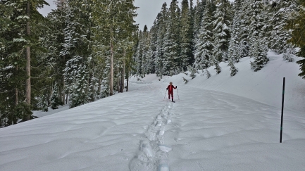
Fresh Snow
Position: 46°46.19’N, -121°44.34’W
The rest of Stevens Canyon Road beyond the plowed section was deep in snow. Evidence of past snowshoers was visible, but it had been two weeks and a major storm since anyone had walked along here, so we’d be breaking new trail.
|
 |
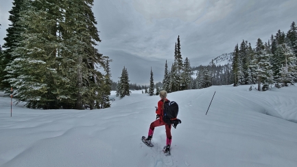
Breaking Trail
Position: 46°46.19’N, -121°44.30’W
Breaking a new trail through the snow is tiring work, so we switch places often. Here Jennifer is bringing up the rear, following the path James made. The snowy scenery is just beautiful.
|
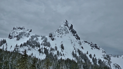 |
Unicorn Peak
Position: 46°46.19’N, -121°44.29’W
6,971 ft (2,125 m) Unicorn Peak, right, the highest in the Tatoosh Range.
|
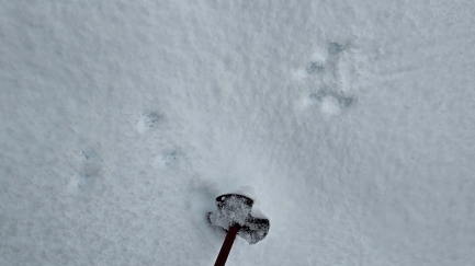 |
Snowshoe Hare
Position: 46°46.17’N, -121°44.17’W
We think a Snowshoe Hare made these tracks in the snow.
|
 |
Taking Stock
Position: 46°46.17’N, -121°44.01’W
We’ve just reached the junction at Reflection Lake with the marked snowshoe trail that leads back to the parking lot and are deciding if we want to continue around the lake or start back.
|
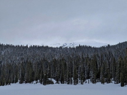 |
Mt. Rainier
Position: 46°46.09’N, -121°43.68’W
We decided to keep going around the lake. A little slice of Mt. Rainier is visible looking south across Reflection Lake, but the mountain was mostly hidden today. On a clear and still summer day, this location is famous for its view of Mt. Rainier reflected in the water, hence the name.
|
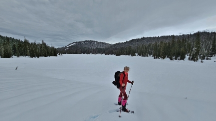 |
Reflection Lake
Position: 46°46.11’N, -121°43.63’W
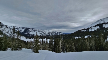
The view northwest across Reflection Lake from the southeast corner.
|
 |
Louise Lake
Position: 46°46.10’N, -121°43.39’W
Looking down into the valley containing frozen Louise Lake. We opted to turn around here and head up to the ridge north of Reflection Lake.
|
 |
Offroading
Position: 46°46.33’N, -121°43.42’W
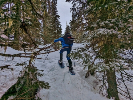
No obvious trail leads up to the ridge, so we took the clearest path we could find. The way wasn’t always very clear though.
|
 |
Deep Powder
Position: 46°46.33’N, -121°43.41’W
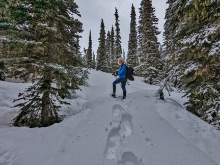
The powder is very deep, and we’re sinking in quite a bit as we ascend the ridge.
|
 |
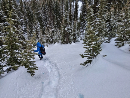
Ravine
Position: 46°46.40’N, -121°43.39’W
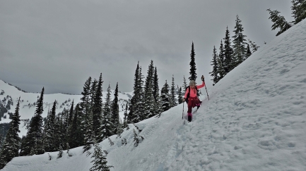
To continue higher up the ridge, we had to cross a fairly steep ravine. Here Jennifer is following the excellent path that James made.
|
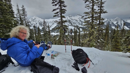 |
Tea & Snack
Position: 46°46.48’N, -121°43.35’W
Once across the ravine, we continued climbing a bit more to the top of the ridge, where we stopped for some tea and a snack with a fabulous view to the Tatoosh Range.
|
 |
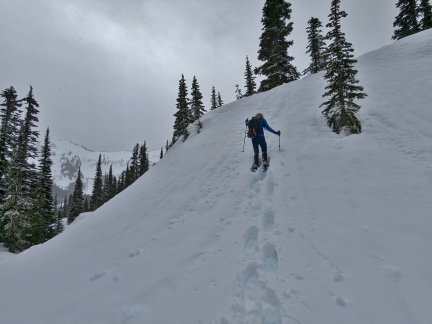
Heading Down
Position: 46°46.46’N, -121°43.36’W
Heading back down to Reflection Lake from the ridge viewpoint.
|
 |
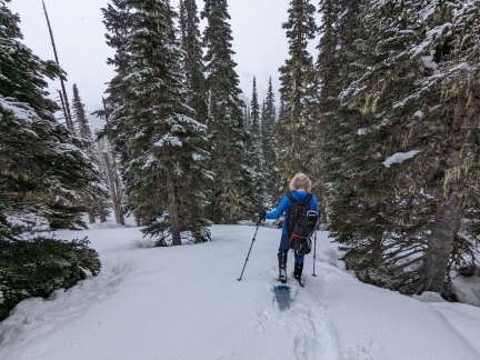
And Back Up
Position: 46°46.40’N, -121°43.40’W
And back up the ravine. We chose a slightly closer, but steeper route.
|
 |
And Back Down
Position: 46°46.32’N, -121°43.51’W
And descending again towards Reflection Lake.
|
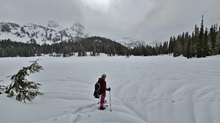 |
Reflection Lake North
Position: 46°46.25’N, -121°43.89’W
Looking south across frozen Reflection Lake to the Tatoosh Range.
|
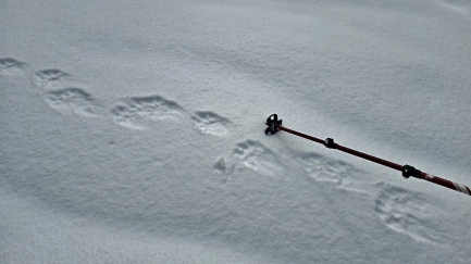 |
Wolf Prints
Position: 46°46.25’N, -121°43.89’W
These look like wolf tracks, but may be from a large dog.
|
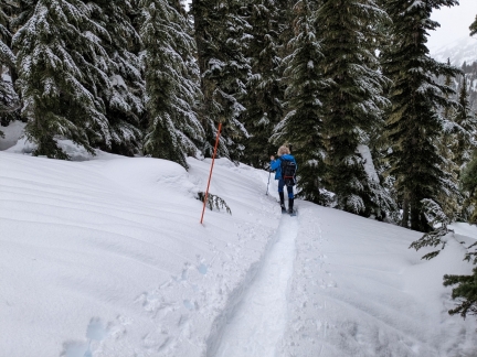 |
Marked Trail
Position: 46°46.43’N, -121°44.22’W
After the tiring work of breaking trail through the deep snow, we enjoyed the relatively easy walking on the marked and already broken trail back to the parking lot.
|
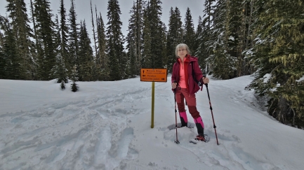 |
Intersection
Position: 46°46.49’N, -121°44.23’W
At the intersection with the Mazama Ridge trail that we followed last winter.
|
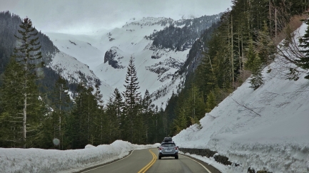 |
Nisqually Glacier
Position: 46°46.49’N, -121°46.14’W
Nisqually Glacier, viewed as we descend from Narada Falls in the truck.
|
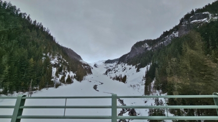 |
Nisqually River North
Position: 46°46.89’N, -121°45.71’W
Looking north upriver as we cross the Nisqually Glacier Bridge over the Nisqually River.
|
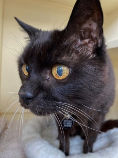 |
The Resort
Position: 47°36.28’N, -122°7.96’W
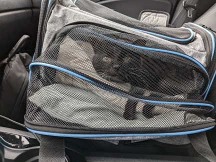
A picture from Wagly Pet Campus in Bellevue, where Spitfire is staying while we are at Mt. Rainier.
|
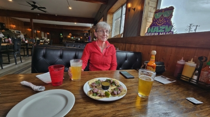 |
Trailhead Bar & Grill
Position: 46°45.57’N, -122°1.94’W
A delicious pork taco lunch at the Trailhead Bar & Grill
|
 |
Heart Rate
Position: 46°45.57’N, -122°1.94’W
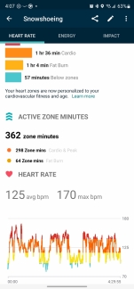
Over lunch we took a look at our cardio data tracked with our Google Pixel watches. Snowshoeing can be a real workout. James had an average heart rate of 125bpm and a maximum of 170 over the 4:29 that we were out there.
|
 |
Hot Tub
Position: 46°44.11’N, -121°59.19’W
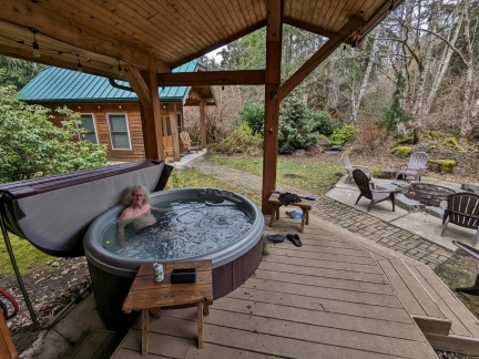
Relaxing in the hot tub at our rented VRBO cabin Trillium in Ashford.
|
 |
Swing
Position: 46°44.11’N, -121°59.18’W
|
 |
Easter Bunny
Position: 46°44.11’N, -121°59.18’W
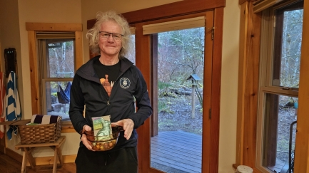
The Easter Bunny found us in Ashford WA and hid treats throughout our rented VRBO cabin. Here’s James with his haul.
|
 |
Mt. Rainier NP
Position: 46°44.48’N, -121°55.13’W
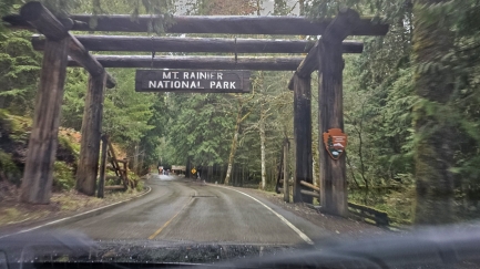
Entering Mt. Rainier NP for another day, hopefully, of snowshoeing in the Paradise area at the top of the Mt. Rainier road. The weather forecast is calling for rain at high elevations later today, even at Paradise at elevation 5,400 ft (1,645 m). We are hoping to get just above the snow line and out of the rain before that happens.
|
 |
Rain
Position: 46°46.76’N, -121°44.75’W
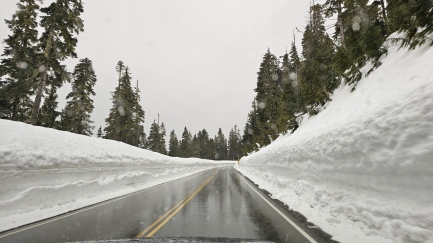
We’re seeing rain at elevation 4,957 ft (1,510 m), with only 500 feet (152 m) before we reach the top of the road at Paradise. We’re still hopeful, but it’s not looking great.
|
 |
Snow!
Position: 46°47.09’N, -121°44.40’W
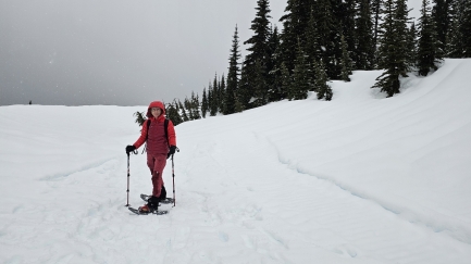
Just before we reached Paradise, the rain changed to snow, so off we went!
|
 |
Trail
Position: 46°47.10’N, -121°44.42’W
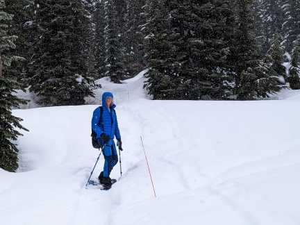
Following the marked Nisqually Vista trail that we hiked last summer.
|
 |
Nisqually River
Position: 46°47.21’N, -121°44.87’W
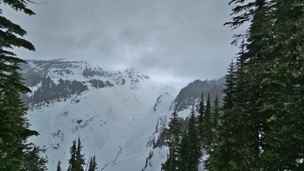
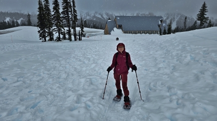
View to the snow-covered Nisqually River from the end of the Nisqually Vista trail. The river rises from Nisqually Glacier and we cross it on the Nisqually Glacier Bridge on the drive up to Paradise.
|
 |
Paradise
Position: 46°47.22’N, -121°44.19’W
After the relatively short hike to Nisqually Vista from the Paradise lower parking lot, we moved the truck to the upper lot and set off on the Glacier Vista trail.
|
 |
Footprints
Position: 46°47.22’N, -121°44.19’W
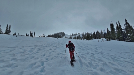
Lots of previous footprints heading up from Paradise, unlike yesterday, when we were the first people in two weeks to snowshoe through most of places we went.
|
 |
Tea
Position: 46°47.51’N, -121°44.26’W
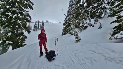
From Paradise, we climbed about about 800 ft up (245m) and stopped for a hot tea break. We decided to turn back here since we’d gotten a late start and the Packwood Brewery beckoned.
|
 |
Road Closed
Position: 46°43.96’N, -121°53.75’W
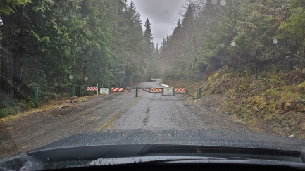
Unfortunately the road to Packwood was closed, likely for fallen trees, so no Packwood Brewery lunch for us. We instead returned to our rented cabin for lunch.
|
 |
Happy Hour
Position: 46°44.11’N, -121°59.17’W
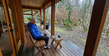
Happy Hour before dinner after a soak in the hot tub at Trillium in Ashford. We had a fabulous weekend snowshoeing at Mt. Rainier and the cabin was a big part of it. Trillium was clean and comfortable, very private, and well-equipped with great amenities including the hot tub and a sauna.
|
 |
Bookshelf Door
Position: 46°44.11’N, -121°59.18’W
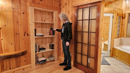
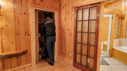
James discovered that the bookshelf in the master bedroom of our VRBO cabin in Ashwood was actually a door that opened by pulling out one of the books.
|
 |
Opening Door
Position: 46°44.11’N, -121°59.18’W
Opening the bookshelf door.
|
 |
Secret Bedroom
Position: 46°44.11’N, -121°59.18’W
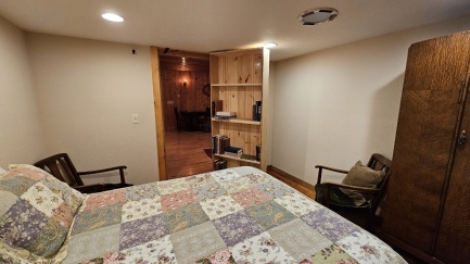
Behind the bookshelf door was a secret bedroom off the master bedroom. Perhaps this used to be an office or a nursery. But it seemed a little spooky to be hidden away like that, with no windows.
|
 |
Spitfire
Position: 47°36.27’N, -122°7.94’W
|
 |
Click the travel log icon on the left to see these locations on a map. And a map of our most recent log entries always is available at mvdirona.com/maps. |

If your comment doesn't show up right away, send us email and we'll dredge it out of the spam filter.