The summer weather in Seattle continued from September into October, with a high of 81°F (27° C) on October 15th, 20 degrees F (11 C) above the average for this time of year. The dry weather resulted in many burning forest fires and Seattle’s smoke-filled skies made the city among the worst in the nation for air pollution. We did have a small silver lining though, with some fabulous sunsets.
In the warmer weather we did a fresh hop beer tasting tour in nearby Ballard, sitting outside at every stop of the evening, and a week later we drove to Yakima in eastern Washington for the outdoor Fresh Hop Ale Festival. Fresh hop beers are made from hops that have never been dried. This was our first time trying fresh hop beers, and we really liked them. The same way fresh and dried herbs taste similar, but different, so do fresh hop beers compared to dried hop beers. In some ways the fresh hop flavors are a little more intense, but also a little less bitter.
Temperatures began to fall in later October, but with little rain, so the wildfires kept burning. During this time we made an excellent weekend trip to Point Ruston in Tacoma, the inspiration for Frank Herbert’s epic science-fiction novel Dune, and to Las Vegas for the South Point 400. It was our first live NASCAR race since attending the Daytona 500 five years ago and we had a great time. In mid-October we also watched from the waterfront as the last cruise ship of the season departed Seattle, the Norwegian Encore, a ship we would soon be boarding in Miami for a Caribbean cruise.
November brought unseasonably cold weather, with temperatures plummeting to near-freezing, and the first major storm of the season hit, resulting in the cancellation of our flight to Friday Harbor and many downed trees and power lines. We instead went by car and ferry, and had an excellent weekend exploring areas of San Juan Island we’d not previously reached when visiting by boat. Later in the month we toured Seattle’s historic Georgetown Steam Plant, built in 1906, and attended the Pacific Marine Expo, the annual commercial fishing and marine tradeshow.
Below are highlights from October 1st through November 18th, 2022. Click any image for a larger view, or click the position to view the location on a map. And a map with our most recent log entries always is available at mvdirona.com/maps.
 |
Cruise Ships
Position: 47°36.92’N, -122°20.66’W
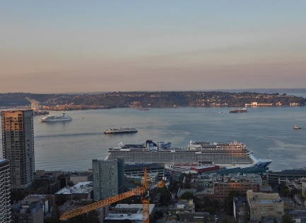
A busy day for cruise ships in Elliott Bay with the Norwegian Bliss moored at Pier 66 in the foreground, the Eurodam and Ovation of the Seas out of the picture at Pier 91, and Seabourn Odyssey anchored off in the background.
|
 |
Ballard Fresh Hop Beer Tasting Tour
Position: 47°39.95’N, -122°22.44’W
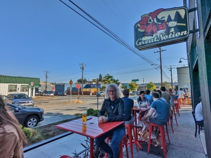
Autumn is fresh hop beer season in the Pacific Northwest. The beer must be brewed very soon after the hops are ripe, so can’t be made very far from the fields. Dozens of Pacific Northwest breweries produce fresh hop beers, many clustered together in nearby Ballard, so we went there for an evening of beer tasting. This was our first time trying fresh hop beers, and we really liked them.
|
 |
Zeeks
Position: 47°37.12’N, -122°20.86’W
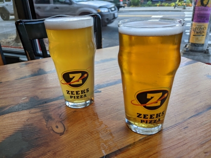
Dinner at Zeeks Pizza before heading to an NBA exhibition game at Climate Pledge Arena.
|
 |
LA Clippers
Position: 47°37.32’N, -122°21.25’W
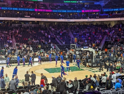
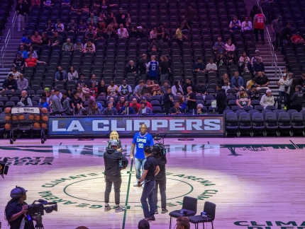
The LA Clippers practicing at Climate Pledge Arena for an NBA exhibition game.
|
 |
Home Team
Position: 47°37.32’N, -122°21.25’W
The LA Clippers are the home team, so the game is run like a game in LA, with the Clippers Dancers and the in-arena hosts on-site.
|
 |
Portland Trailblazers
Position: 47°37.32’N, -122°21.20’W
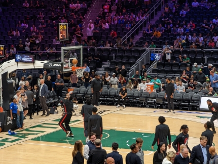
The Portland Trailblazers practicing before the exhibition game.
|
 |
Ball in Play
Position: 47°37.32’N, -122°21.25’W
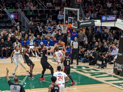
The ball in play for only the second time two NBA teams have played in Seattle since 2008, when the Seattle SuperSonics were relocated to Oklahoma. A decade later, in 2018, another exhibition game was held in Seattle between the Golden State Warriors and the Sacramento Kings. We enjoyed watching the games and would love to see an NBA team back in Seattle.
|
 |
The Glove
Position: 47°37.33’N, -122°21.25’W
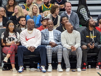
Former Seattle SuperSonics player Gary Payton, second from left, taking in the game. Payton is considered one of the greatest point guards in the game and was the only point guard to win the NBA Defensive Player of the Year award until this year. His defensive abilities earned him the nickname “The Glove”. Payton played for Seattle between 1990 and 2003, and we loved watching him play when we attended games at Key Arena.
|
 |
Fog
Position: 47°36.99’N, -122°20.58’W
The view from our apartment window on a foggy and smoky morning. Wildfires are still actively burning and creating substantial air pollution in the Puget Sound region.
|
 |
Rebar
Position: 47°36.89’N, -122°20.70’W
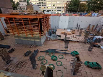
A layer of rebar being installed over the wood base, getting ready for the next cement pour at the Fourth & Bell construction site.
|
 |
CCA
Position: 47°38.76’N, -122°18.55’W
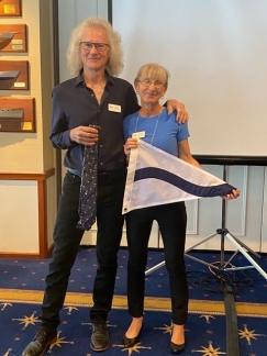
This afternoon we presented at the monthly meeting of the Pacific Northwest Chapter Cruising Club of America, and after received our burgee and tie.
|
 |
Fresh Hop Ale Festival
Position: 46°33.87’N, -120°33.52’W
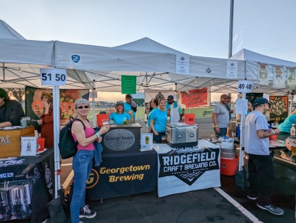
We enjoyed our Ballard fresh hop beer tasting tour so much that we decided to go all out and attend the Fresh Hop Ale Festival in Yakima, WA the following weekend. Yakima is a 2:20 drive east from Seattle on I-90, but we instead took a slightly longer route south through Mt. Rainier National Park to take the Chinook Scenic Byway. The portion of the route between Enumclaw and Naches is considered one of the most scenic in the US, and sections would soon close for the winter.
|
 |
Window Cleaners
Position: 47°36.92’N, -122°20.66’W
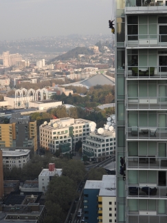
The fall window cleaning is taking place in our apartment complex. Here three cleaners are suspended high above the ground at work on the north tower.
|
 |
Sunset
Position: 47°36.92’N, -122°20.66’W
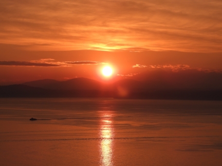
A spectacular sunset over Elliott Bay. The smoky sky does have some minor upsides.
|
 |
Pat Selinger
Position: 36°37.10’N, -121°56.32’W
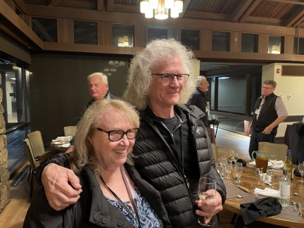
James got to catch up with his old friend Pat Selinger at the 2022 High Performance Transaction Systems (HPTS) conference.
|
 |
Bruce Lindsay
Position: 36°37.18’N, -121°56.29’W
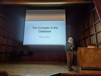
Dr. Bruce Lindsay, a friend and mentor for decades.
|
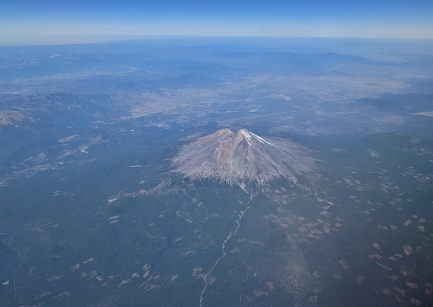 |
Mt. Shasta
Position: 41°7.74’N, -121°59.12’W
View to Mt. Shasta (14,179 ft; 4,322 m) in California from James’ flight home from a business trip.
|
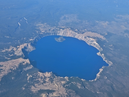 |
Crater Lake
Position: 42°22.74’N, -121°46.73’W
California’s famous Crater Lake, viewed from James’ flight home. The lake is the deepest in the US at 1,949 feet (594 m), and ninth-deepest in the world, and also is notable for it’s clear blue water. About half-million people annually visit the National Park of the same name. James has visited as a youngster, but not recently.
|
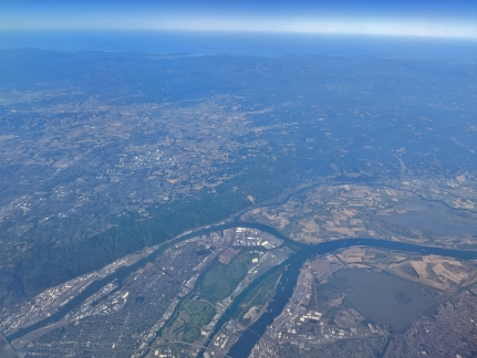 |
River Junction
Position: 45°31.65’N, -122°32.13’W
The junction of the Willamette and Columbia Rivers near Portland. The island partially visible at bottom center is Government Island, where we stopped on our Columbia River trip.
|
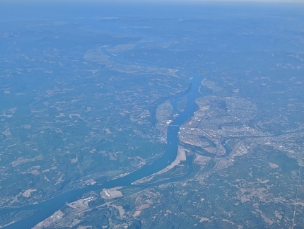 |
Lewis River
Position: 45°52.23’N, -122°37.31’W
The Lewis River, at right, joining the Columbia River near Ridgefield, WA.
|
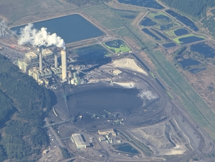 |
Centralia Power Plant
Position: 46°45.37’N, -122°33.04’W
The Centralia Big Hanaford power plant is the only coal-fired power plant in the state of Washington and its largest single source of mercury pollution. It also is responsible for a large portion of the state’s annual CO2 emissions. The plant’s two boilers came online in 1971 and have a combined capacity of 1,340 MW. As part of an ongoing plan to convert the plant to natural gas, one of the boilers was shut down in 2020, and the other will be in 2025.
|
 |
JBLM
Position: 47°5.38’N, -122°24.91’W
The runway at Joint Base Lewis-McChord south of Tacoma. The facility was created in 2010 with the merger of the United States Army’s Fort Lewis and the United States Air Force’s McChord Air Force Base and is the Army’s only power projection base on the US west coast.
|
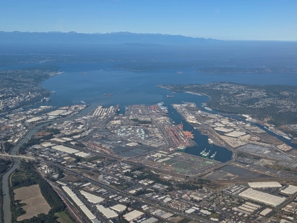 |
Tacoma
Position: 47°12.76’N, -122°20.58’W
The Port of Tacoma with the Olympic Mountains in the distance.
|
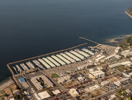 |
Des Moines
Position: 47°23.24’N, -122°19.11’W
A large number of covered slips at the Des Moines marina just south of Seattle.
|
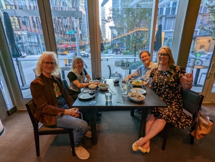 |
Heather and Paul
Position: 47°37.05’N, -122°20.35’W
Dinner at Wild Ginger with Heather Brewer and Paul Bultema, owners of Nordhavn 43 Gratitude. We met Heather after a Seahawks game a few weeks back and got together with both tonight. They purchased Gratitude, then in Florida, sight-unseen in December of 2020 and cruised from Florida to Seattle via the Panama Canal over 20 months, covering 11,000 miles in an adventure that recently was chronicled in Northwest Yachting. We really enjoyed meeting Heather and Paul, and had a great evening with them.
|
 |
South Point 400
Position: 36°16.42’N, -115°0.78’W
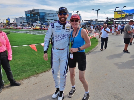
The South Point 400 NASCAR Cup Series was held at Las Vegas Motor Speedway in mid-October, near the end of the racing season. It was our first live NASCAR race since attending the Daytona 500 five years ago and we had a great time.
|
 |
Inspection
Position: 47°36.92’N, -122°20.66’W
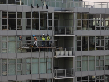
Our condo corporation was out inspecting the building facade over the past few weeks. Here a group is suspended from a platform at the top of the north tower.
|
 |
Sunset
Position: 47°36.92’N, -122°20.66’W
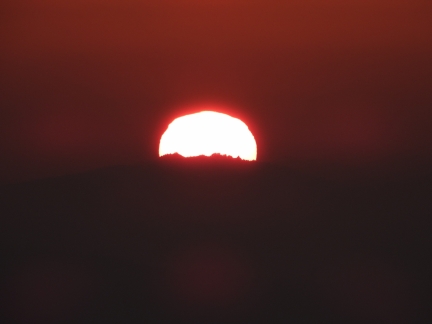
The smoke-filled skies from the wildfires are producing some spectacular sunsets.
|
 |
Dirona
Position: -76°36.46’S, 39°16.96’E
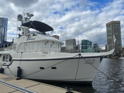
Jay Flaherty of Yacht Tech sent us this photo of Dirona moored in Baltimore for TrawlerFest, not far from where we stayed for a few weeks at Baltimore Marine Center Inner Harbor.
|
 |
Demolition
Position: 47°36.82’N, -122°20.71’W
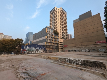
Excavators have completed the demolition of the burned building at 2nd & Bell.
|
 |
Smoke
Position: 47°36.98’N, -122°20.58’W
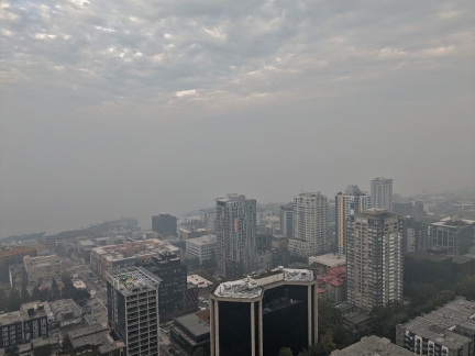
Elliott Bay obscured by smoke from the many wildfires burning in the Cascade Mountains. Seattle currently has among the worst air quality in the nation.
|
 |
Wildfires
Position: 47°36.92’N, -122°20.66’W
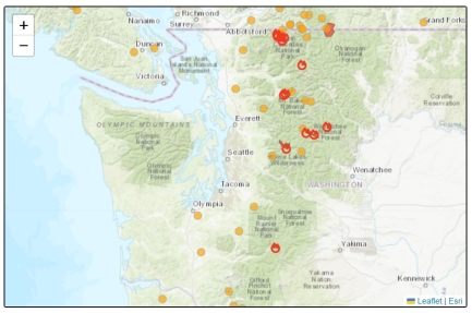
A graphic showing the many wildfires currently burning in the state. The orange circles represent fires that have started in the past three days.
|
 |
Booster Shot
Position: 47°37.45’N, -122°21.43’W
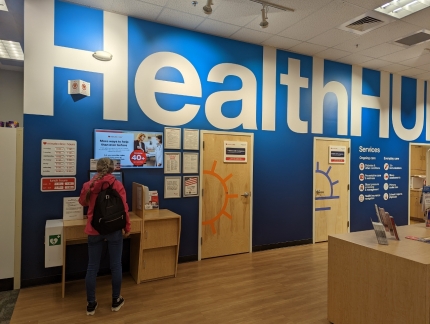
At CVS pharmacy in Queen Anne for a yet another COVID-19 booster shot.
|
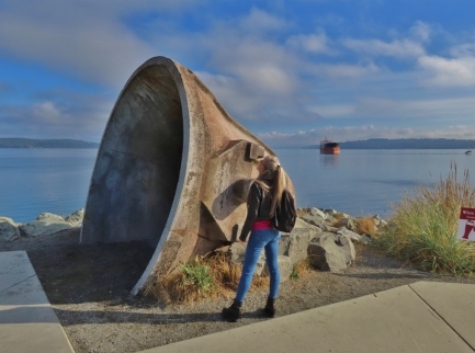 |
Point Ruston
Position: 47°18.14’N, -122°30.40’W
Point Ruston in Tacoma, the inspiration for Frank Herbert’s epic science-fiction novel Dune, was once one of the most polluted superfund sites in the world. In writing the first best-selling science-fiction novel with an environmental theme, Tacoma-born Herbert was influenced by the foul-smelling smoke that spewed from the ASARCO copper smelter at Point Ruston.
|
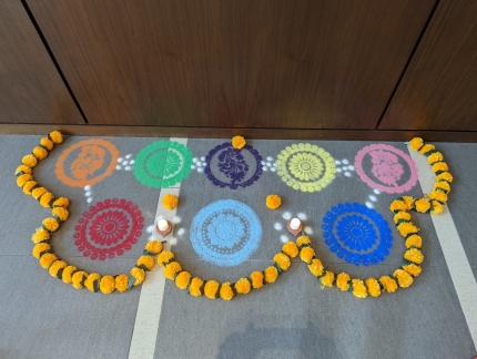 |
Diwali
Position: 47°36.99’N, -122°20.57’W
Delicate sand patterns in the lobby of our apartment building in celebration of Diwali, the Festival of Lights, one of the most important Hindu festivals.
|
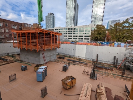 |
Garage Level
Position: 47°36.99’N, -122°20.57’W
The construction team at the Fourth & Bell construction site is pouring parking floors from the bottom of the foundation up towards ground level, and they’re getting close.
|
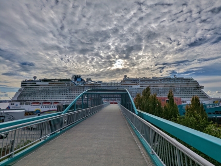 |
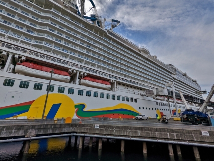
Norwegian Encore
Position: 47°36.72’N, -122°20.89’W
The Norwegian Encore is the final cruise ship departure from Seattle in the 2022 season. The ship will be repositioned to the Caribbean for the winter, where we’ll be taking it on a cruise in late November.
|
 |
Pier 66
Position: 47°36.68’N, -122°20.68’W
The Norwegian Encore is a huge ship at 1,094 ft (333 m) long and really fills the dock at Pier 66 in Seattle.
|
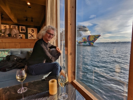 |
Edgewater
Position: 47°36.75’N, -122°21.16’W
At the bar in the Edgewater Hotel along the waterfront to watch the Norwegian Encore depart. We’re super-excited about our upcoming Caribbean cruise on the Encore.
|
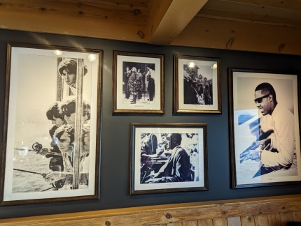 |
Celebrities
Position: 47°36.75’N, -122°21.17’W
Photographs at the Edgewater Hotel of the celebrities who have stayed here, including a famous one of the Beatles fishing from their room.
|
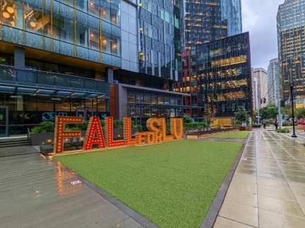 |
Fall for SLU
Position: 47°37.02’N, -122°20.43’W
Fall decorations at the Amazon SLU (South Lake Union) campus.
|
 |
Spitfire
Position: 47°36.98’N, -122°20.58’W
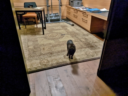
Spitfire missed James when he is at work and frequently looks from him in the den throughout the day.
|
 |
Storm
Position: 47°36.92’N, -122°20.66’W
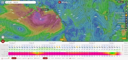
The North Pacific winter storms are starting, with gusts of 67 knots expected in the Gulf of Alaska.
|
 |
Spitfire
Position: 47°36.98’N, -122°20.58’W
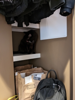
Evan at nineteen, Spitfire still loves to explore. Here he is checking out a shelf inside our hall closet.
|
 |
Ambulances
Position: 47°36.92’N, -122°20.65’W
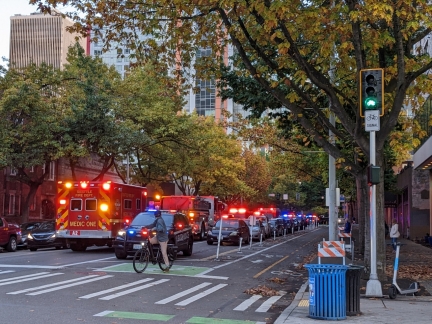
Fifth street between Bell and Blanchard was full of emergency vehicles this evening and down from three lanes to one.
|
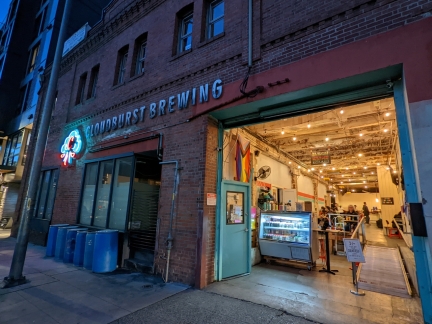 |
Cloudburst Brewing
Position: 47°36.69’N, -122°20.71’W
The vibe at Cloudburst Brewing in Belltown reminded us of our recent beer tasting trip to Ballard.
|
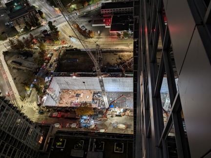 |
Overnight Cement Pour
Position: 47°36.99’N, -122°20.59’W
The construction site to our north is doing a major cement pour to fill the foundation, requiring the closure of all but one lane on 6th Avenue to make space for the equipment. To minimize traffic disruption during the week, they are pouring 24×7 over the weekend. Looking down from our balcony we could see cement trucks lined up around the perimeter of the site.
|
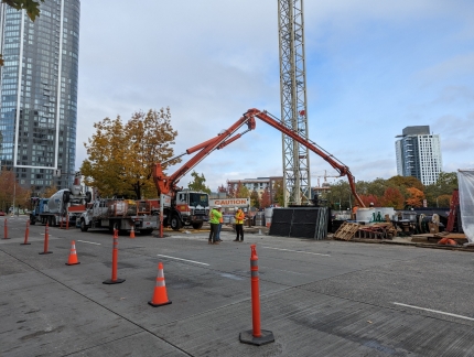 |
Cement Pour
Position: 47°36.99’N, -122°20.57’W
A closer look at the cement pour in the construction site to our north as we walk out for lunch. Here’s one of the three cement pumpers in operation today.
|
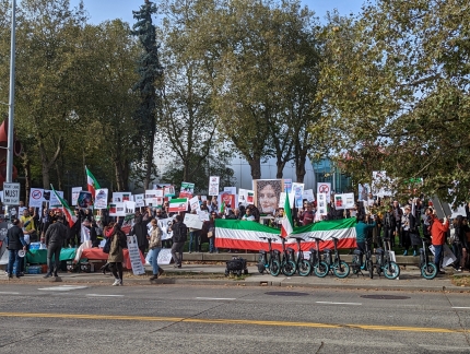 |
Mahsa Amini
Position: 47°37.19’N, -122°20.94’W
A large group outside Seattle Center protesting the death in Iranian police custody of 22-year old Mahsa Amini.
|
 |
Wing Dome
Position: 47°37.29’N, -122°21.07’W
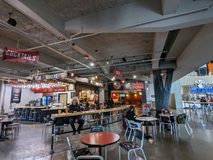
We wanted wings for lunch, so walked over to the Wing Dome in nearby Seattle Center Armory Food & Event Hall and had a good meal there. Given how close it is, it’s surprising we’ve not been here before. Normally we’d go to Buffalo Wild Wings, but the restaurant near our building recently closed.
|
 |
Dia de Muertos
Position: 47°37.29’N, -122°21.07’W
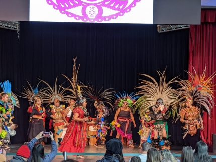
Dancers on stage as part of the Dia de Muertos (Day of the Dead) Festival in the Seattle Center Armory Food & Event Hall
|
 |
Super Puff
Position: 47°36.99’N, -122°20.58’W
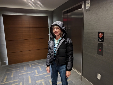
Jennifer sporting her new “Super Puff” winter jacket as we head out to a Saturday night Kraken NHL game.
|
 |
Kraken Tail
Position: 47°37.33’N, -122°21.24’W
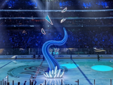
A large Kraken tail is lowered to the ice as part of the pre-game events.
|
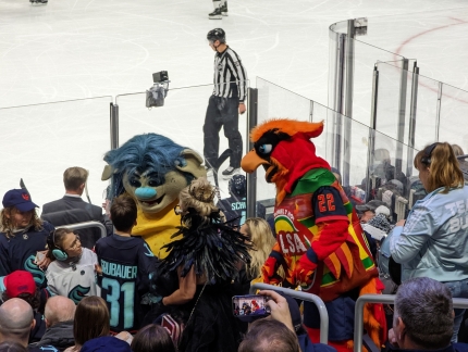 |
Buoy the Troll
Position: 47°37.33’N, -122°21.24’W
Buoy the Troll, the Seattle Kraken mascot on the left, working the crowd.
|
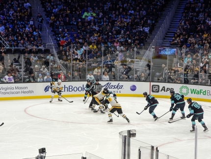 |
Game On
Position: 47°37.33’N, -122°21.24’W
The Seattle Kraken taking on the Pittsburgh Penguins. We won 3-1 in an excellent and closely-battled game.
|
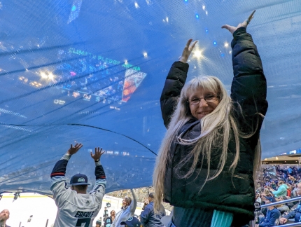 |
Banner
Position: 47°37.30’N, -122°21.24’W
Supporting a big banner that was unfurled over the crowd at the Kraken game.
|
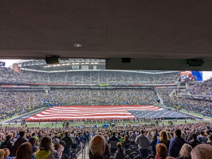 |
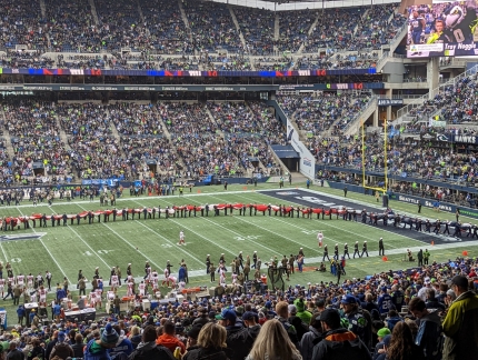
Anthem
Position: 47°35.72’N, -122°19.87’W
A huge flag covering the entire field during the singing of the national anthem before the Sunday Seahawks game.
|
 |
Removing Flag
Position: 47°35.71’N, -122°20.02’W
Just removing a flag that large is a major undertaking. We were impressed at how quickly this was done.
|
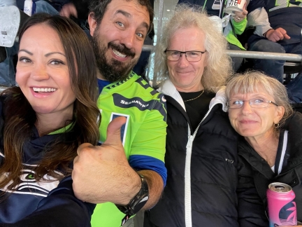 |
Peter and Kimanh
Position: 47°35.71’N, -122°20.02’W
Enjoying the game with our friends Peter DeSantis and Kimanh Moreau.
|
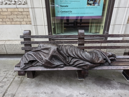 |
Homeless Jesus
Position: 47°36.67’N, -122°20.43’W
One of many Homeless Jesus statues installed around the world by sculptor Timothy Schmalz, this one outside Christ Our Hope parish on 2nd Avenue.
|
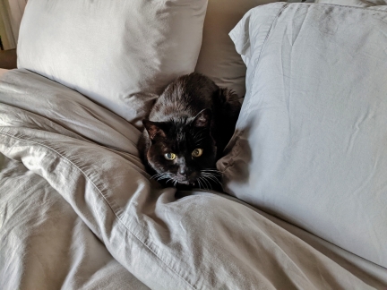 |
Spitfire
Position: 47°36.99’N, -122°20.59’W
Spitfire knows he’s not supposed to sleep on the bed if we’re not there, and he looks very guilty when caught.
|
 |
Happy Birthday
Position: 47°37.05’N, -122°20.31’W
Celebrating Jennifer’s birthday at one of favorite Seattle restaurants, The Butcher’s Table.
|
 |
Cement Pour
Position: 47°36.92’N, -122°20.66’W
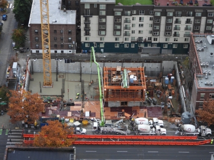
Cement trucks lined up at the Fourth & Bell construction site for another big cement pour.
|
 |
Emergency Vehicles
Position: 47°36.71’N, -122°20.19’W
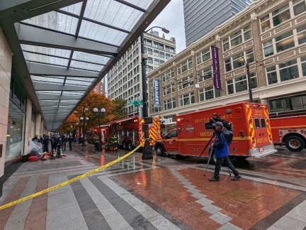
Fire trucks and ambulances blocked most of Pine St. this afternoon.
|
 |
Friday Harbor
Position: 48°30.84’N, -123°9.04’W
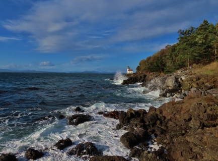
Friday Harbor is the only incorporated town in the San Juan Islands and the main transportation hub, with frequent ferry, float plane and small craft traffic. The many restaurants, bars, and other attractions, plus a wonderful waterfront setting, make the town an exceedingly popular summer tourist destination, and accommodations, flights and ferry reservations book up weeks in advance. Several times this year we’d tried to setup a trip, but failed due to unavailability of accommodations or transport, and finally made it there in early November.
|
 |
Sunset
Position: 47°36.92’N, -122°20.66’W
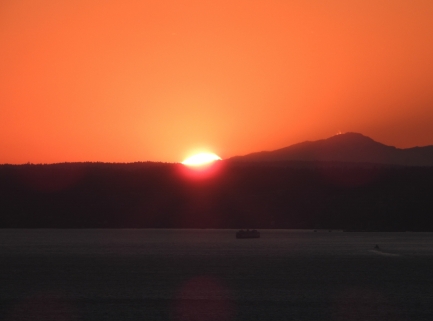
Another spectacular sunset in a smoky Seattle sky.
|
 |
Running Club
Position: 47°37.05’N, -122°20.35’W
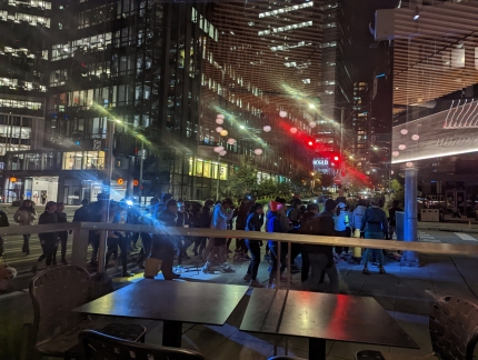
The sidewalk outside Wild Ginger restaurant suddenly got very busy this evening as a running club passed through.
|
 |
Olympic Mountains
Position: 47°36.92’N, -122°20.66’W
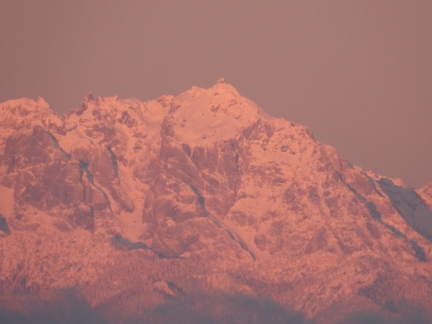
The Olympic Mountains with a fresh coat of snow from the weekend storm.
|
 |
Brrrr
Position: 47°36.92’N, -122°20.66’W
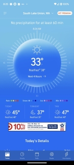
It’s an unusually cold 33°F (0.6°C) this morning. The Seattle temperature rarely falls below 40°F (4.4°C) this time of year.
|
 |
Amazon Prime
Position: 47°36.97’N, -122°20.54’W
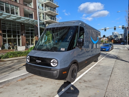
Today we received our first delivery from Amazon on an all-electric Rivian truck.
|
 |
Coffee Table
Position: 47°36.98’N, -122°20.58’W
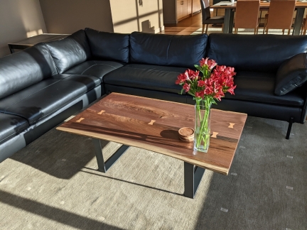
Supply chain issues made it hard to find a coffee table we liked when we moved in a year ago. So we purchased a low-cost used table, and finally replaced it today.
|
 |
Casco Antiguo
Position: 47°36.95’N, -122°20.31’W
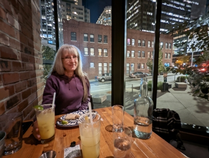
Excellent street tacos in a great corner table at Casco Antiguo. Although the restaurant is very close to our apartment, we’ve not been in before, partly because they don’t take reservations and typically are quite busy.
|
 |
Ice Breaker
Position: 47°36.92’N, -122°20.66’W
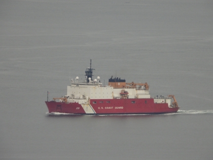
The USCG ice breaker Healey arriving into Seattle. The Healey is the Coast Guard’s most advanced ice-breaker and in 2015 was the first unaccompanied US surface vessel to reach the North Pole. The Healy is designated as a medium-class icebreaker and Coast Guard currently has ordered two out of three heavy ice breakers that are designated Polar Class 2 (PC2 ), meaning “year-round operation in moderate multi-year ice conditions”.
No ships today exist of class the highest rating, PC1 (year-round operation in all polar waters), and only one exists of class PC2, the French expedition cruise ship Le Commandant Charcot. We’ll be taking this vessel, capable of breaking 8 feet (2.4 m) of multi-year ice, on a trip to the North Pole next summer. |
 |
Georgetown Steam Plant
Position: 47°32.59’N, -122°18.97’W
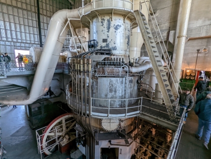
The Georgetown Steam Plant was built in 1906 along the Duwamish River to power Seattle’s streetcars. The advent of hydropower soon made the plant noncompetitive, and it was used only as an emergency backup starting in the 1920s. Decommissioned in 1977 and declared a National Historic Monument in 1984, the plant houses the only two Curtis Vertical Steam Turbines remaining the world, pictured above.
|
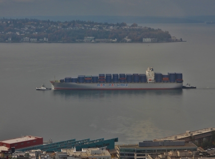 |
Wan Hai
Position: 47°36.92’N, -122°20.66’W
A Wan Hai container ship arriving into Seattle with tug assist. With 75 ships and a capacity of more than 218,600 TEUs, Taiwanese Wai Hai is one of the largest container shipping companies in the world.
|
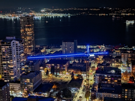 |
Crane
Position: 47°36.87’N, -122°20.57’W
The tower crane at the 4th & Bell construction site lit up for the holiday season.
|
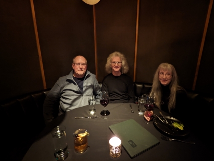 |
Peter Hayden
Position: 47°37.05’N, -122°20.30’W
A great discussion over an excellent meal at Butcher’s Table with Peter Hayden, owner of Nordhavn 68 Tanglewood.
|
 |
Flying Locksmiths
Position: 47°36.99’N, -122°20.44’W
The Flying Locksmiths’ van caught our attention as we walked home.
|
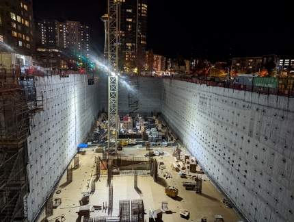 |
6th and Bell
Position: 47°37.07’N, -122°20.59’W
Looking down into the 6th & Bell construction site north of our apartment building. They are making progress on the lower-level parking area.
|
 |
Pacific Marine Expo
Position: 47°35.57’N, -122°19.94’W
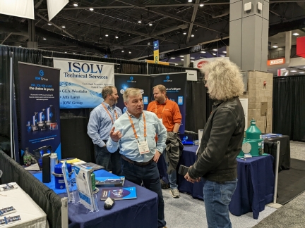
On a mid-November Friday evening, we attended the final few hours of the annual Pacific Marine Expo in Seattle. We always enjoy checking out the engines and equipment, reconnecting with people know from the industry, and learning about any new technology in the works. This year was no exception, and we spent time at the Cascade Engine and Northern Lights booths among others. We also enjoyed chatting again with Solvi Olafsson, pictured, who we’d met recently during our Ballard beer tasting tour outside his shop where his company ISolv specializes in centrifugal fuel and oil filtration systems.
|
 |
Click the travel log icon on the left to see these locations on a map. And a map of our most recent log entries always is available at mvdirona.com/maps. |

If your comment doesn't show up right away, send us email and we'll dredge it out of the spam filter.