Keechelus Ridge rises 5,000 feet (1,525 m) above I-90 east of Snoqualmie Pass, separating Keechelus Lake directly west of the freeway from Kachless Lake to the east. National Forest roads crisscross the ridge, many with great views westward to Keechelus Lake, the Yakima River headwaters and the Cascade Mountain Range. And several good wilderness campsites are in the area.
After the success of our first wilderness camping trip at the Beckler River near Stevens Pass, we decided to explore closer to home near Snoqualmie Pass. We were looking for higher-altitude campsites with a view, so started near Stampede Pass off I-90, east of Snoqualmie Pass and just south of Keechelus Lake. We enjoyed off-roading through the area, and found a few potential campsites, but none that really attracted us. Part of the problem was that even in early June, snow blocked many of the roads at altitudes as low as 3,097 ft (944 m), and fallen trees blocked several others.
We opted to cross the road to the north side of I-90, in the hopes that the more south-facing slopes would have more sun and less snow. We were in luck, and found a great site along Keechelus Ridge with a fabulous westward view. Despite being along the side of a road, the location was wonderfully private. We saw only one other vehicle the entire time we were there.
Below are highlights from June 4th and 5th, 2022. Click any image for a larger view, or click the position to view the location on a map. And a map with our most recent log entries always is available at mvdirona.com/maps.
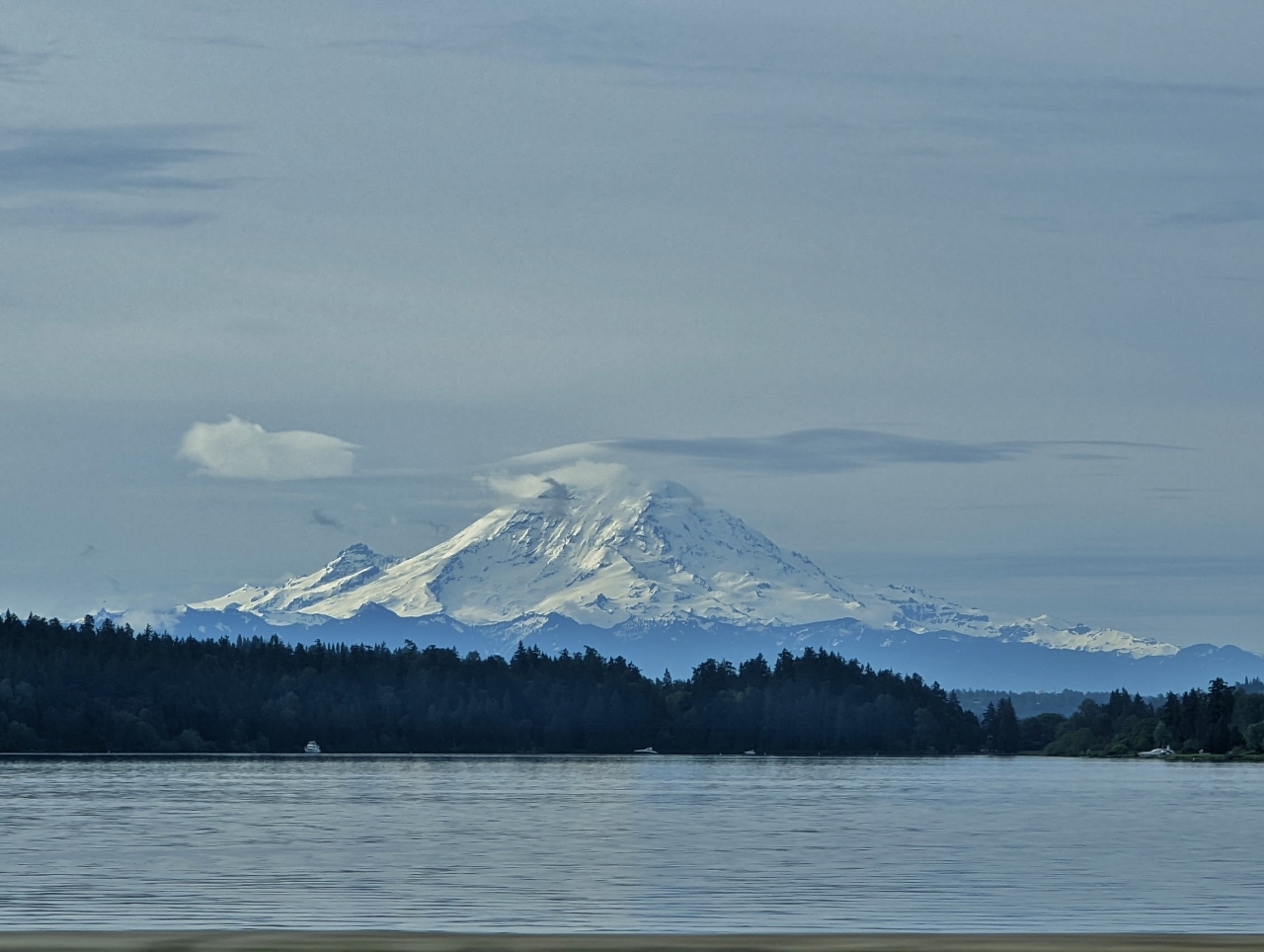 |
Mt. Rainier
Position: 47°35.40’N, -122°18.45’W
Great view to Mt. Rainier as we head east across I-90 to go wilderness camping.
|
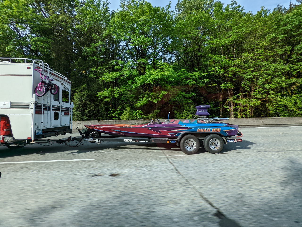 |
Boogie Man
Position: 47°31.35’N, -121°56.15’W
Outboard race boat Boogie Man being towed along I-90.
|
 |
Green
Position: 47°27.90’N, -121°43.02’W
Bright green leaves pack the trees alongside I-90.
|
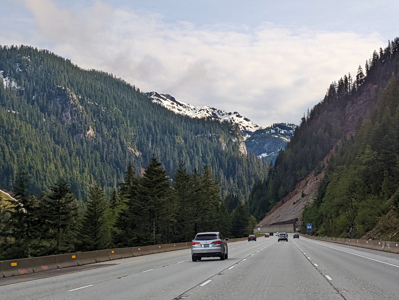 |
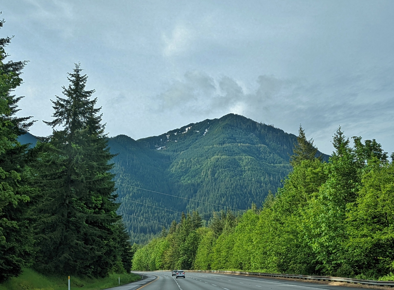
Snoqualmie Pass
Position: 47°24.48’N, -121°26.41’W
By early June, only a small bit of snow remains on the hills in the distance as we approach Snoqualmie Pass.
|
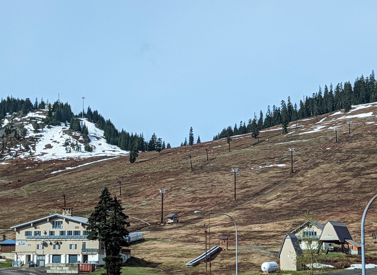 |
Summit at Snoqualmie
Position: 47°25.64’N, -121°25.00’W
Patches of snow still remain at the Summit at Snoqualmie, but the ski resort is long closed for the season.
|
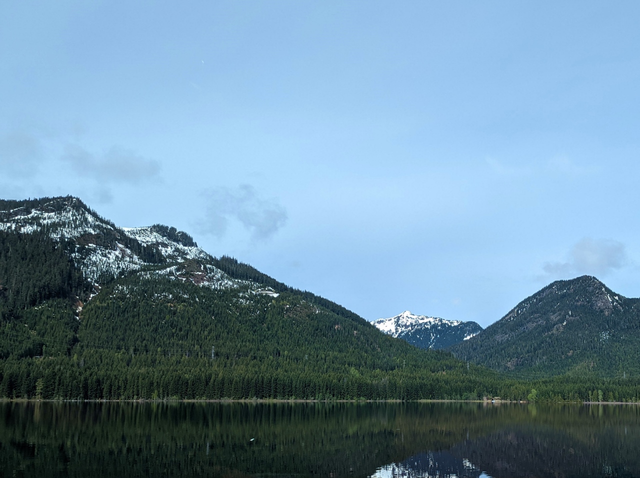 |
Keechelus Lake
Position: 47°22.66’N, -121°22.64’W
Reflections in the still waters of 4.2-mile (6.8 km) Keechelus Lake looking west from I-90. Prominent in the distance at right is 5,605 ft (1,710 m) Silver Peak in the Cascade Range.
|
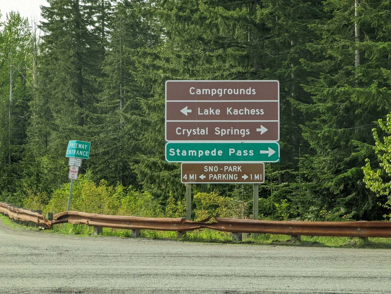 |
Sign Board
Position: 47°18.57’N, -121°18.75’W
Sign board at the I-90 exit just south of Keechelus Lake. We’ll be heading right (west) towards Stampede Pass through Okanogan-Wenatchee and Mt. Baker-Snoqualmie National Forests.
|
 |
Stampede Pass Road
Position: 47°17.68’N, -121°19.56’W
A truck coming the other way as we ascend Stampede Pass Road. At altitude 2,427 ft (740 m), some snow still is on the ground beside the road in early June.
|
 |
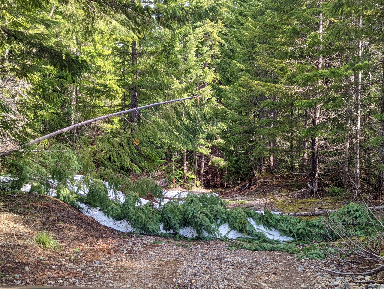
Snow
Position: 47°17.24’N, -121°19.92’W
At altitude 3,097 ft (944 m) snow covered most of the Stampede Pass Road. We could pass along the edge here, but the snow was deeper farther along, so we turned around to avoid getting stuck.
|
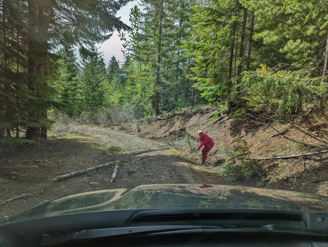 |
Downed Trees
Position: 47°17.01’N, -121°19.10’W
Jennifer moving some downed trees from a side road so we can proceed from Stampede Pass Road down to NF-420.
|
 |
Road Blocked
Position: 47°17.18’N, -121°19.07’W
The side road was blocked farther along by more downed trees that were too large to move.
|
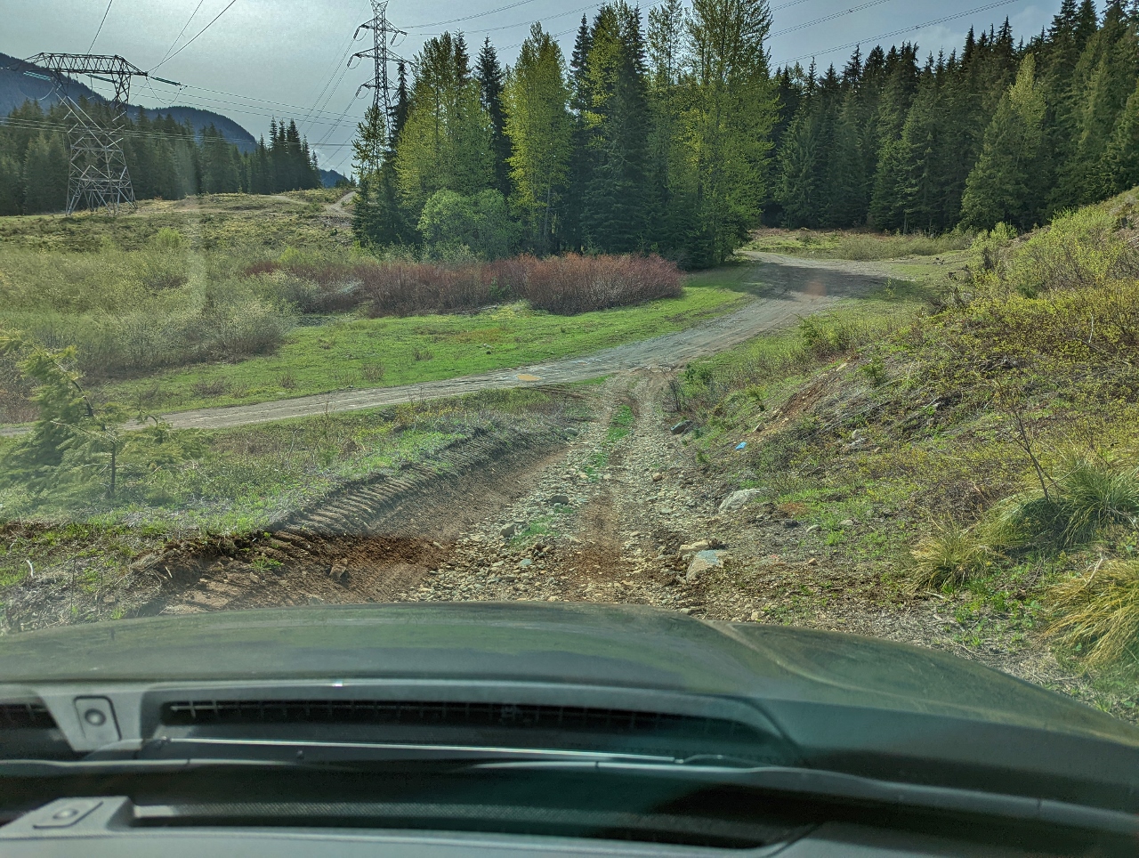 |
Shortcut
Position: 47°17.15’N, -121°19.02’W
With the side road blocked, we gingerly worked down a steep, rocky and rut-filled road to reach NF-420, visible ahead.
|
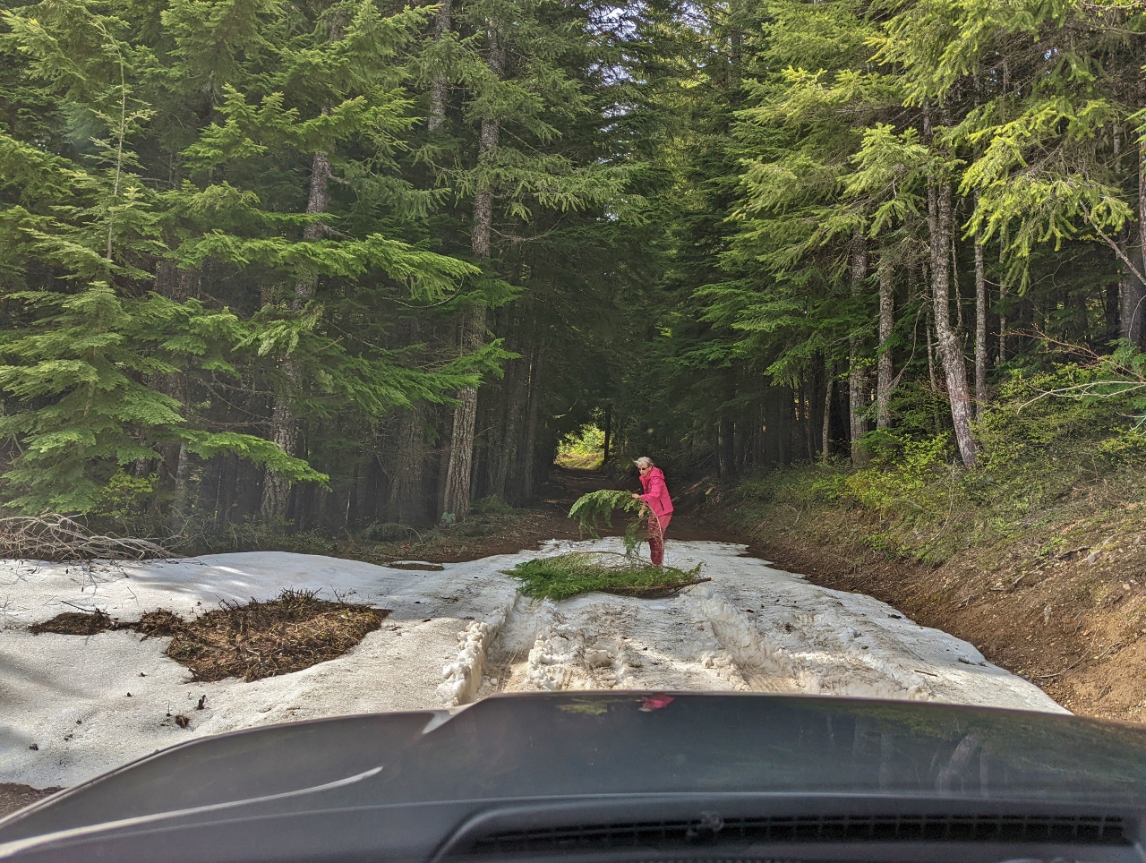 |
Traction Branches
Position: 47°16.83’N, -121°18.95’W
We do have AWD, but even at a relatively low elevation of 2,610 ft (796 m), the snow was deep enough along NF-420 that we were having difficulty with traction. It was only a small patch, so we placed fallen boughs over the snow to give us sufficient traction to pass through.
|
 |
Meany Lodge
Position: 47°16.71’N, -121°18.93’W
This time it wasn’t nature that blocked our progress, but a private property gate. The century-old Meany Lodge beyond the gate is the Mountaineer’s oldest winter sports lodge. The nonprofit organization’s mission is “To enrich the community by helping people explore, conserve, learn about, and enjoy the lands and waters of the Pacific Northwest and beyond.”
|
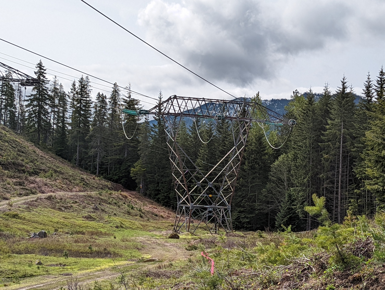 |
Power Lines
Position: 47°16.68’N, -121°18.57’W
Three sets of 500 kV power lines pass through the area, carrying power about 75 miles (120km) from the Bonneville Power authority’s substations of Schultz near Ellensburg WA to Raver, in Maple Valley about 20 miles (32 km) southwest of Seattle. The Schultz substation is in turn fed from the Columbia substation along the Columbia River in eastern Washington.
Air generally is a poor conductor of electricity, but can with sufficient voltage. At 500 kV, the voltage of the lines is high enough that the surrounding air does conduct and a loud buzzing sound is produced as the current passing through heats the air. |
 |
Palouse to Cascades Trail
Position: 47°17.98’N, -121°19.59’W
Cyclists on the Palouse to Cascades State Park Trail, a 250-mile (402 km) rail trail that extends from Cedar Falls in the Cascade Mountains east to the Columbia River in central Washington state.
|
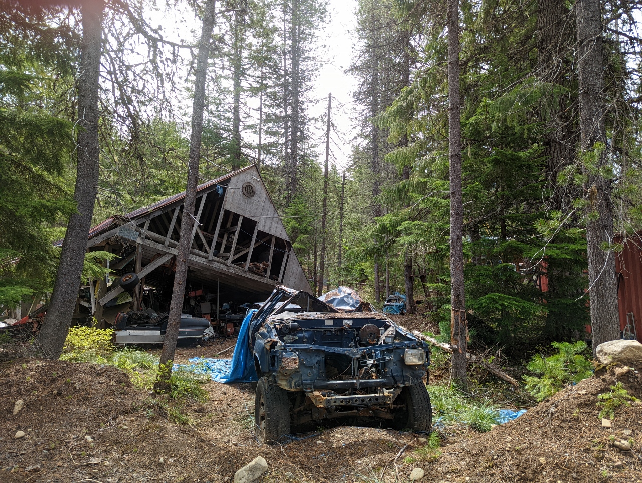 |
Mess
Position: 47°18.22’N, -121°19.36’W
Collapsed building and abandoned vehicles in a small pocket of private property within Okanogan-Wenatchee National Forest as we leave the Stampede Pass area. With snow and other obstruction blocking further exploration, we’re going to try our luck on the other side of I-90 towards Kachees Lake. We’re hoping that the slopes there will have less snow with their more western exposure.
|
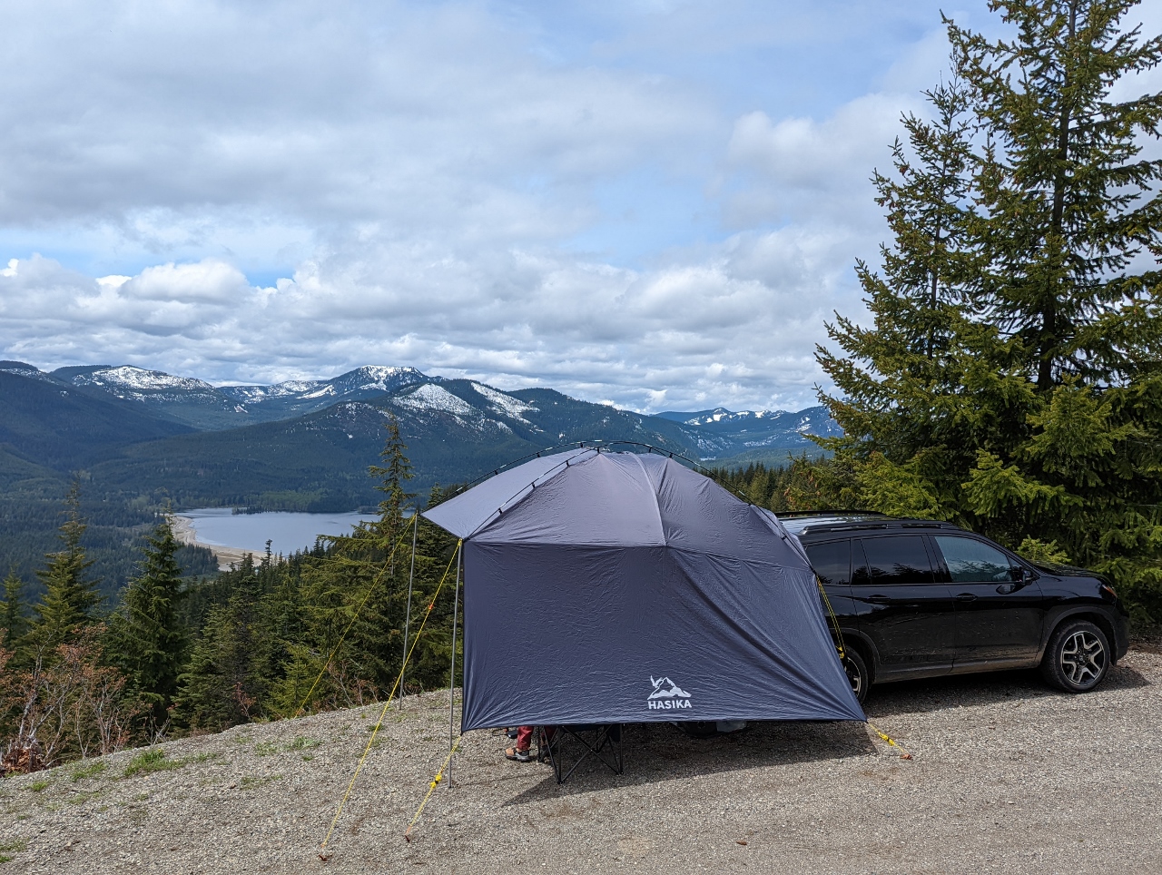 |
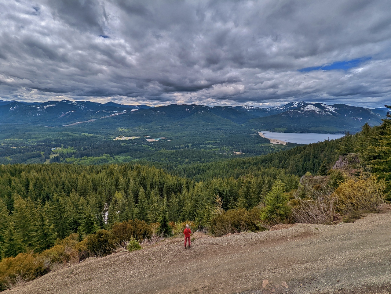
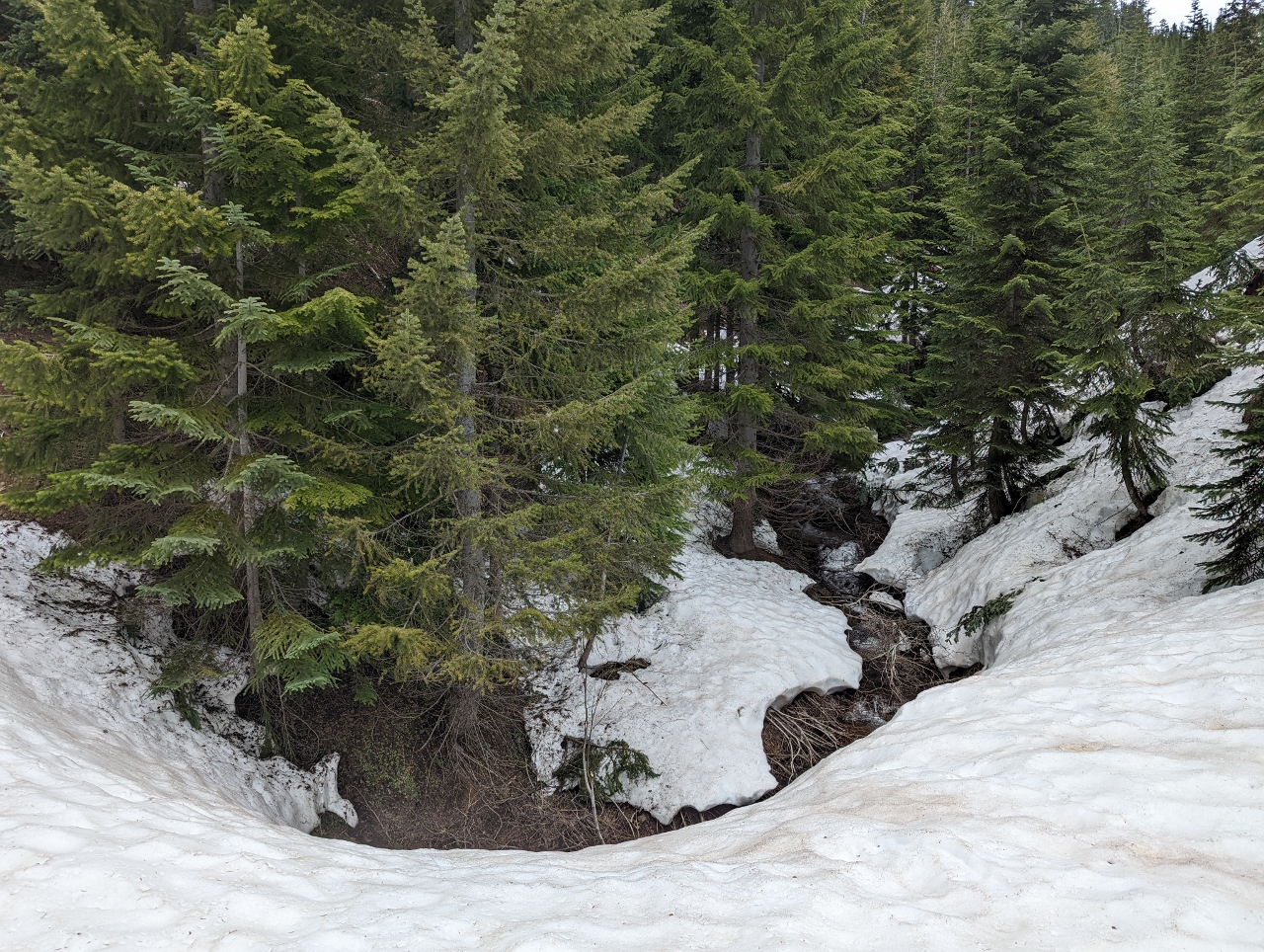
Keechelus Ridge
Position: 47°19.89’N, -121°18.35’W
Heading up National Forest Development Road 4934 along Keechelus Ridge, we were able to reach a much higher altitude of 3,847 ft (1,173 m) before snow blocked the road. Just before that point, we found a great spot along the side of the road with a view to Keechelus Lake.
|
 |
Keechelus Lake
Position: 47°19.88’N, -121°18.35’W
View to the southern end of Keechelus Lake and the Cascade Mountains beyond from our campsite.
|
 |
Edge of Road
Position: 47°19.88’N, -121°18.35’W
The spot we’re in along NF-4934 is a little narrow, but we have just enough room to setup our camp without blocking the road. And it was wonderfully private—we saw only one other vehicle the entire time we were here.
|
|
|
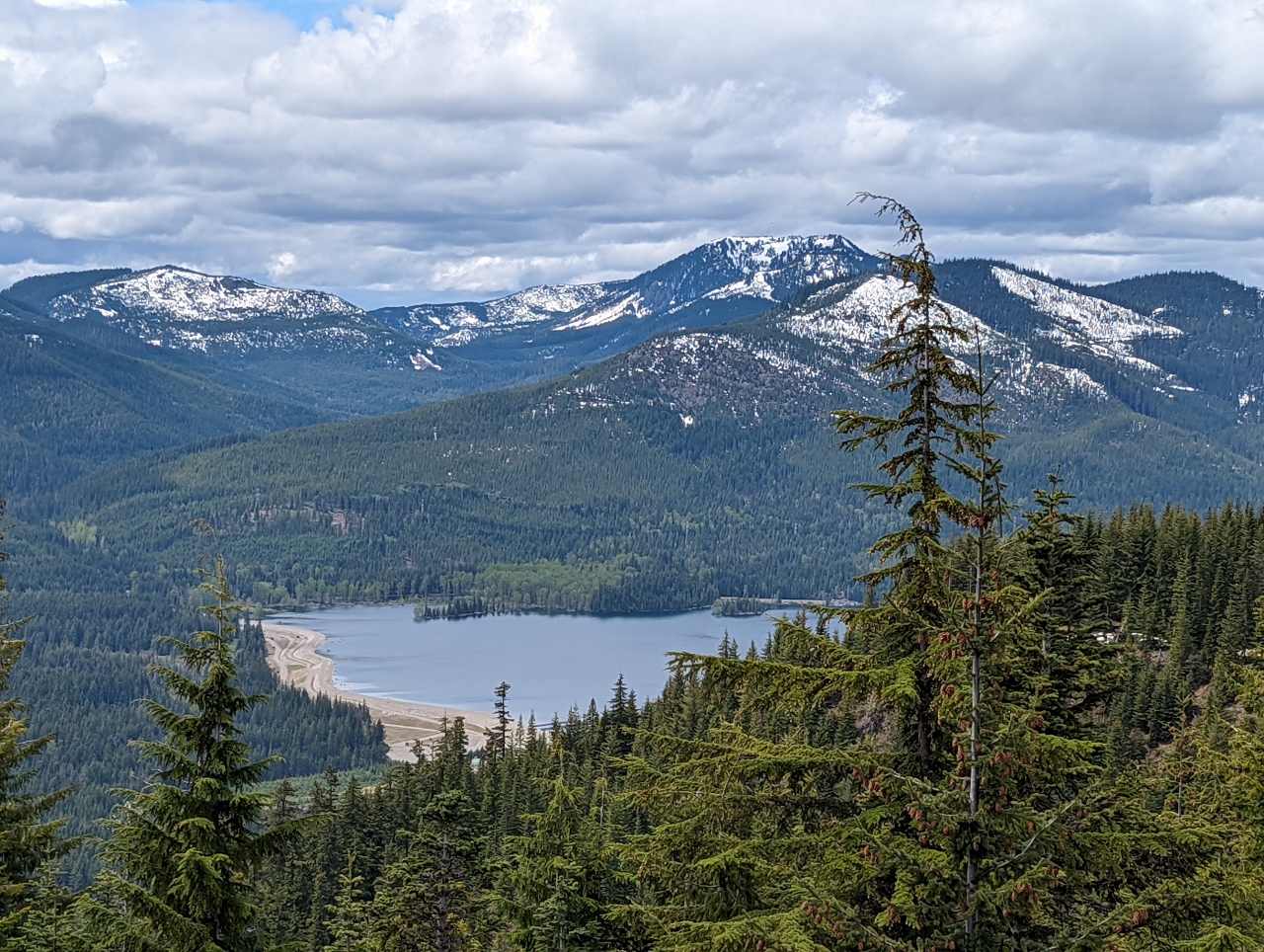
Yakima River
Position: 47°19.82’N, -121°18.27’W
After setting up camp, we took a walk along NF-4934. This is the view to the headwaters of the Yakima River, the longest entirely within Washington state. The river flows 214 miles (344 km) from Keechelus Lake at right to the Columbia River in eastern Washington. The area we were driving through earlier today is on the left with the power line corridor visible at upper left (click image for a larger view).
|
 |
Snow on Road
Position: 47°19.97’N, -121°18.22’W
Lots of snow at altitude 3,866 ft (1,179 m) on National Forest Development Road 4934 just above our campsite.
|
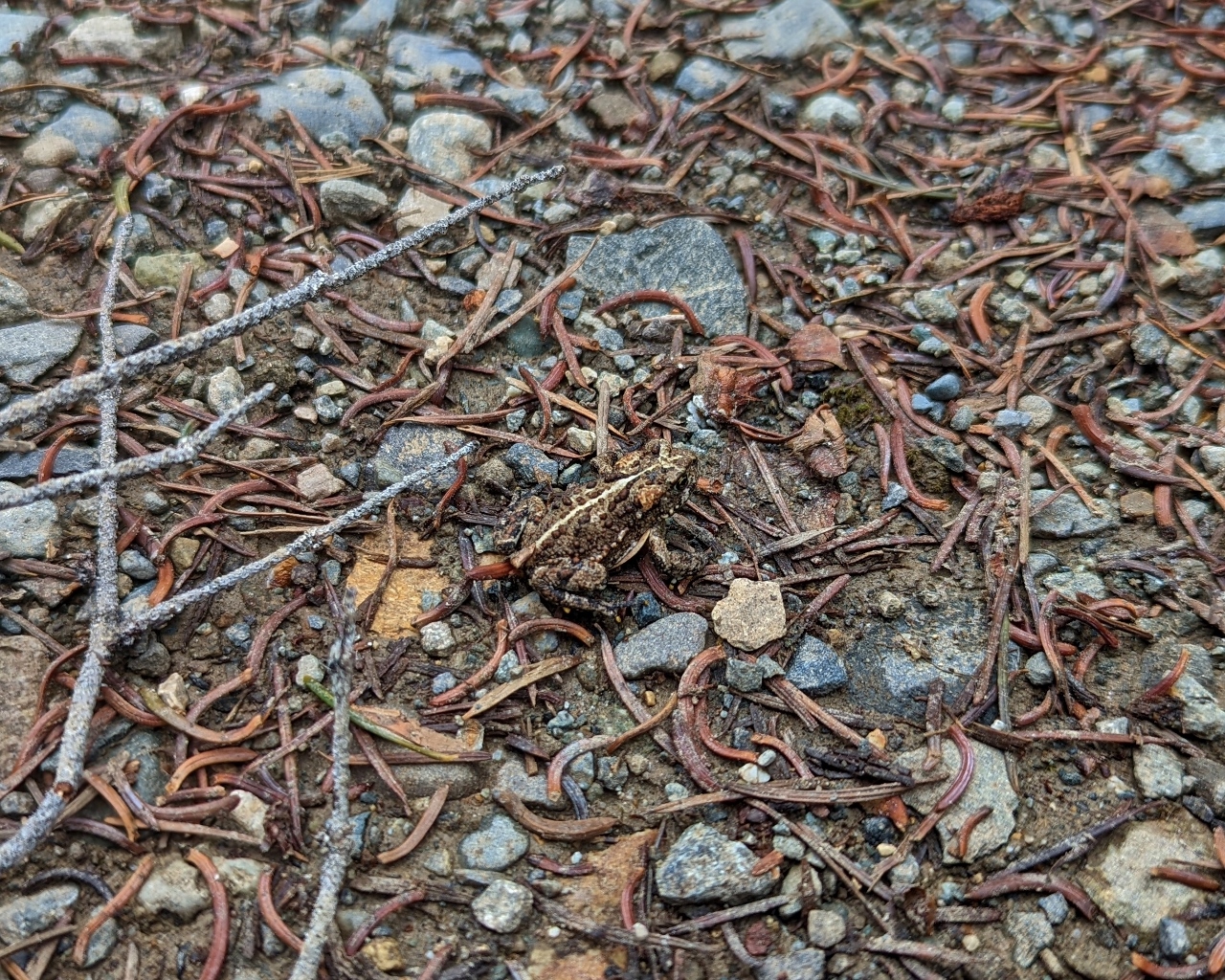 |
Frog
Position: 47°19.93’N, -121°18.27’W
This little frog is so well-camouflaged it is barely visible on the ground right in front of us (click image for a larger view).
|
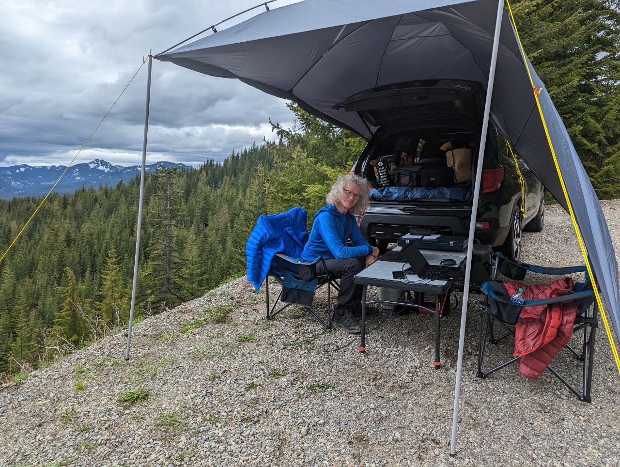 |
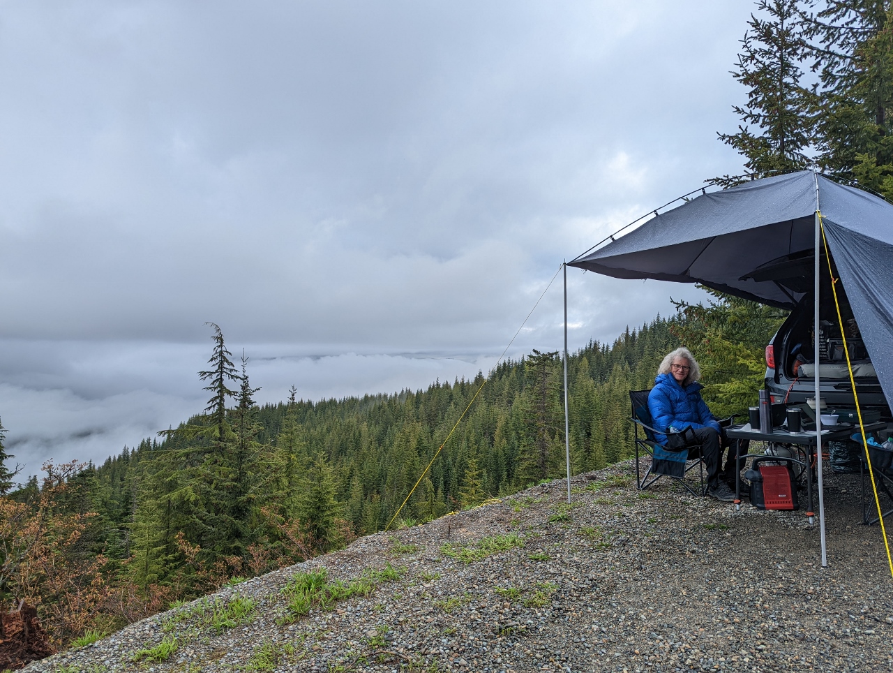
Office
Position: 47°19.88’N, -121°18.35’W
Getting a little work done at our campsite along Keechelus Ridge. We had good cell connectivity here, so didn’t need to use Starlink.
|
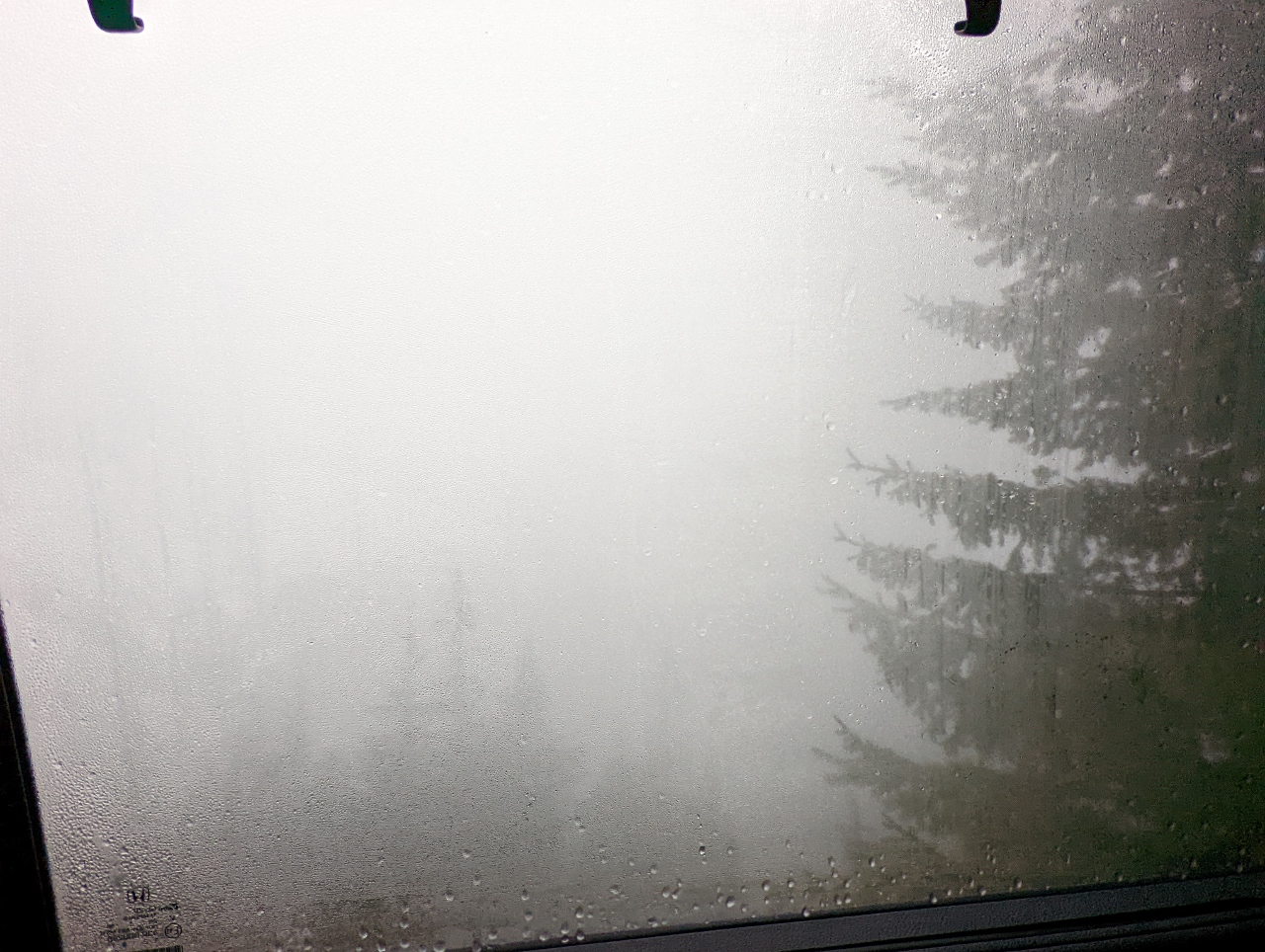 |
Fog
Position: 47°19.89’N, -121°18.36’W
Not much visibility in a heavy fog when we wake up at our Keechelus Ridge campsite.
|
 |
Low Clouds
Position: 47°19.88’N, -121°18.35’W
The thick morning fog at Keechelus Ridge gave way to just low clouds about an hour after we got up. We enjoy the different scenery as the weather changes. The small red box under the table is a Mr. Heater Buddy 4,000-9,000-BTU propane heater that keeps us warm in the colder weather.
|
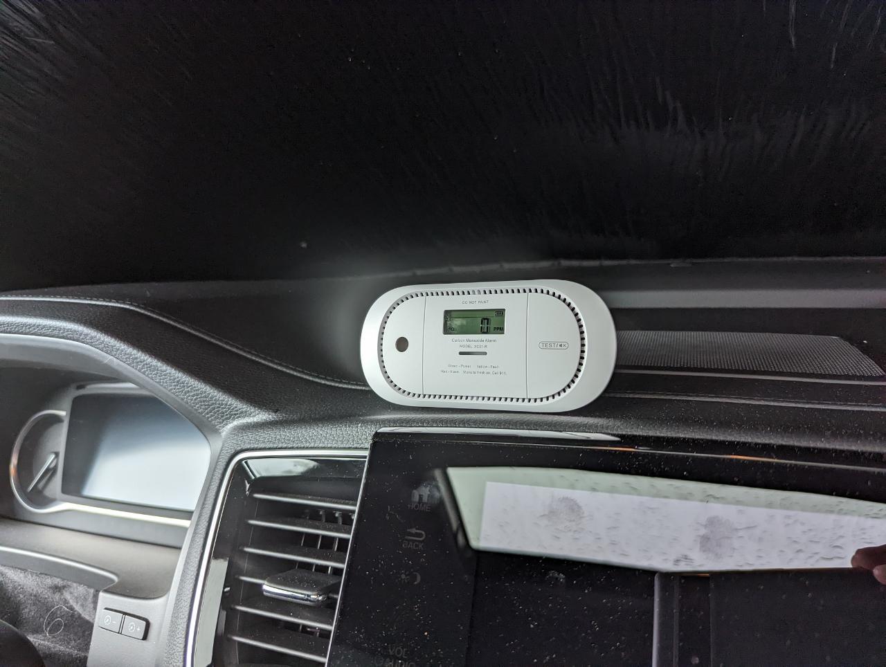 |
CO Alarm
Position: 47°19.89’N, -121°18.35’W
We keep a small carbon monoxide monitor in the car when we’re sleeping and put it on our camp table if we’re running the car to charge the Ecoflow. We’re not likely to have problems, but this is an easy way to be safer.
|
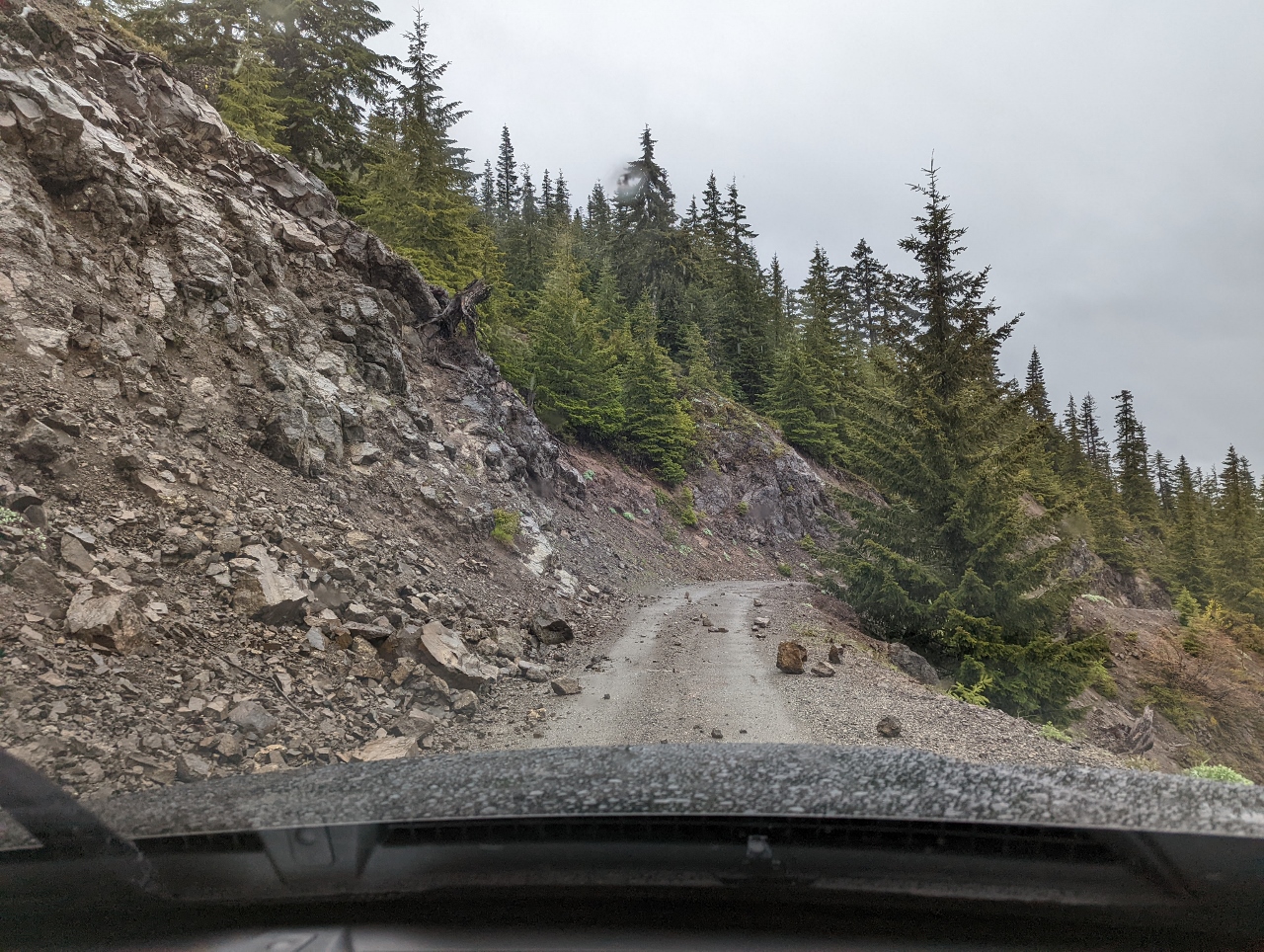 |
Rockslide
Position: 47°19.86’N, -121°18.32’W
Passing a recent rockslide on National Forest Development Road 4934 as we depart our campsite on Keechelus Ridge. Those big rocks could do some major damage if they hit the car.
|
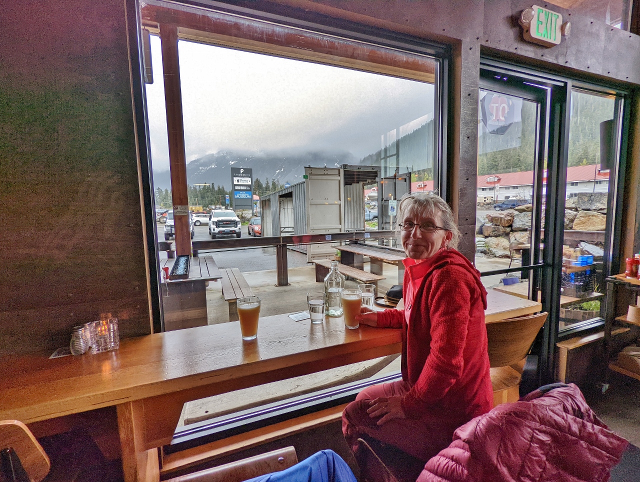 |
The Commonwealth
Position: 47°25.27’N, -121°24.74’W
A delicious lunch at our favorite table in the Commonwealth at Snoqualmie Pass.
|
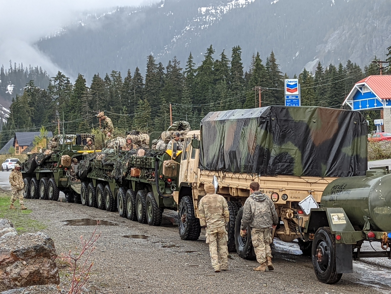 |
Army Convoy
Position: 47°25.30’N, -121°24.74’W
A large army convoy parked along the road at Snoqualmie Pass. The army maintains a 327,000-acre (510 sq mi; 1,323 sq km) facility, Yakima Training Center, just east of Ellensburg and regularly runs convoys between there and Joint Base Lewis-McChord.
|
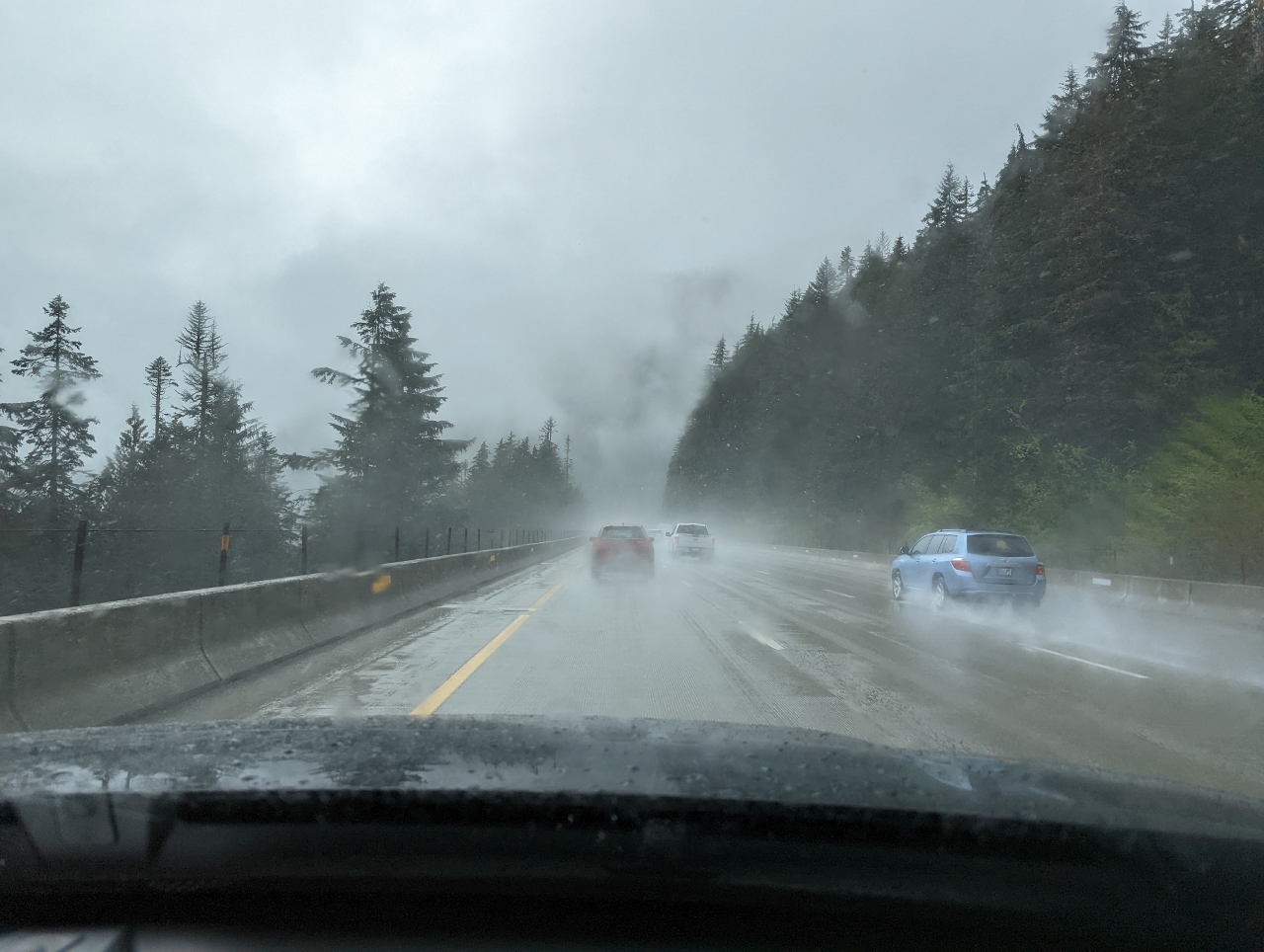 |
Rain
Position: 47°25.62’N, -121°25.84’W
Heavy rain as we descend from Snoqualmie Pass on our way home.
|
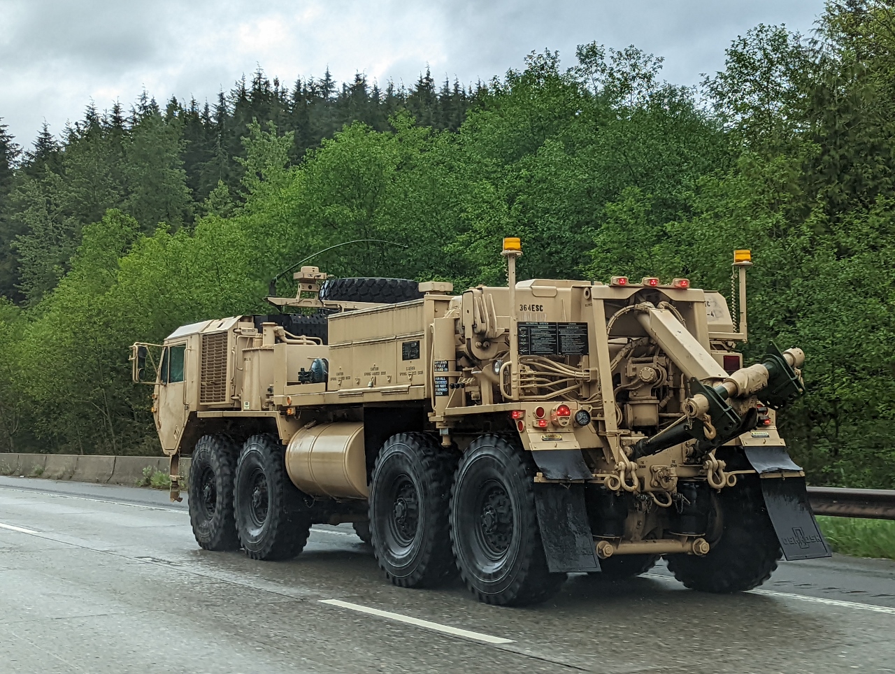 |
364ESC
Position: 47°25.92’N, -121°38.28’W
One of several more army trucks we passed on the way home. The designation 364ESC at upper left on the back refers to the 364th Expeditionary Sustainment Command of the US Army Reserve. The 364th ESC, headquartered in Marysville, WA, commands more than 40 Army Reserve units across seven states.
|
 |
Click the travel log icon on the left to see these locations on a map. And a map of our most recent log entries always is available at mvdirona.com/maps. |
If your comment doesn't show up right away, send us email and we'll dredge it out of the spam filter.