The desert resort city of Palm Springs, California is known for its mid-century modern architecture and extensive cultural and recreational opportunities. The city has much public art, and an excellent museum focusing on natural science, contemporary art and performing art.
For recreation, Joshua Tree National Park is within an hour’s drive. And the city is nestled beneath the San Jacinto Mountains, where the many hiking routes include the famous Cactus to Clouds trial. The elevation gain of roughly 10,300 feet (3,100 m) is one of the largest of any day hikes in the United States, and the trail was rated the hardest in the world by Backbacker Magazine. The 21-mile (33.8 km) trail typically takes 13-16 hours to complete one-way and is considered a day trip because because hikers can return back down via the Palm Springs Aerial Tramway, a vastly more popular option for reaching the top as well.
After three days at Joshua Tree National Park, we spent two days in Palm Springs. We checked out some of the local public art and enjoyed several good meals at some of the many downtown restaurants. We didn’t have the time, or possibly the energy :-), to tackle the Cacuts to Clouds trial, but we did spend a great day riding the tramway and hiking in San Jacinto State Park.
Below are highlights from May 30th and 31st, 2022. Click any image for a larger view, or click the position to view the location on a map. And a map with our most recent log entries always is available at mvdirona.com/maps.
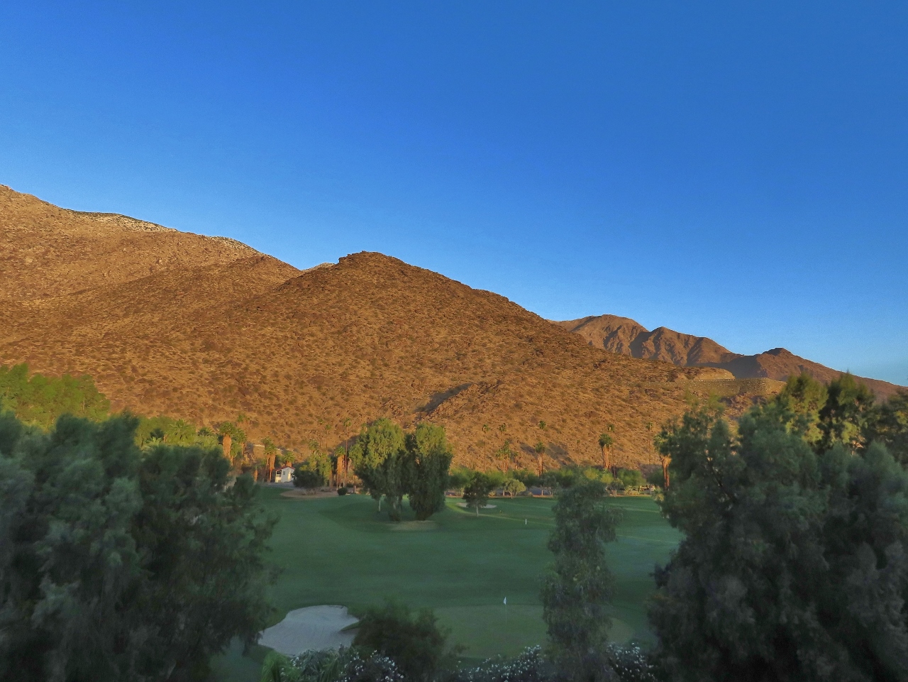 |
Morning Sun
Position: 33°49.55’N, -116°32.84’W
The morning sun lighting up the foothills of the San Jacinto mountains, viewed from the balcony of our Palm Springs hotel room.
|
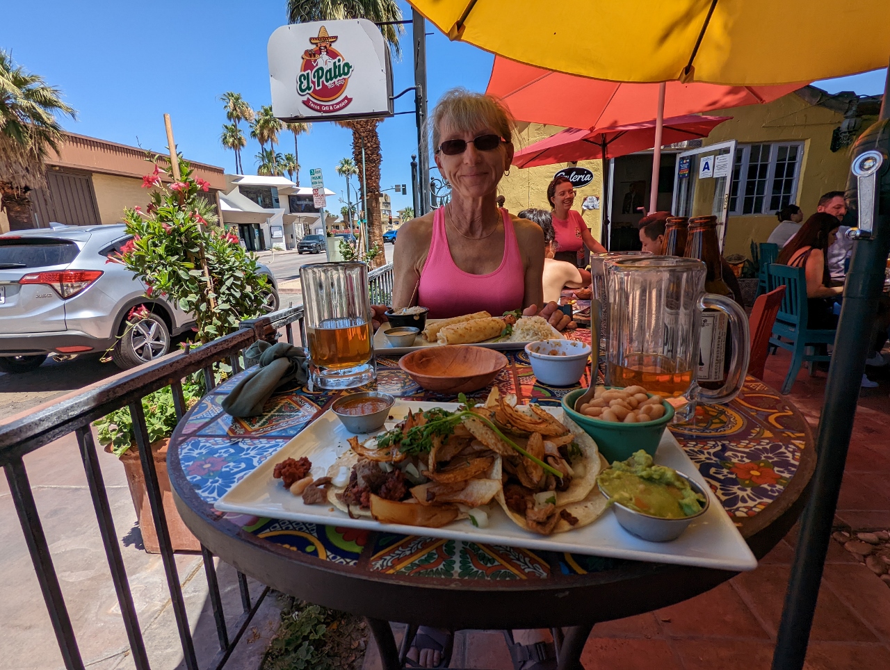 |
El Patio
Position: 33°49.49’N, -116°32.78’W
A yummy Mexican food lunch at El Patio in Palm Springs.
|
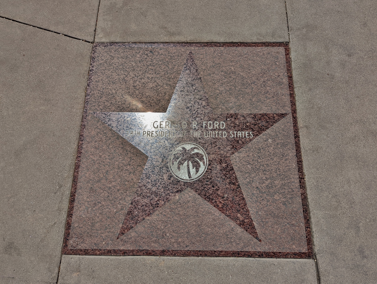 |
Walk of Stars
Position: 33°49.43’N, -116°32.90’W
The Palm Springs Walk of Stars, established in 1992, honors various past and current residents of the Palm Springs area. Some of those honored include artists, civic leaders, and US Presidents. Pictured here is the star for past US president Gerald Ford.
|
 |
Artificial Rock #131
Position: 33°49.43’N, -116°32.90’W
The sculpture Artificial Rock #131 by Chinese artist Zhan Wang outside the Palm Springs Art Museum. When founded in 1938, the museum focused on the desert and local Native American artists and evolved to include natural science, contemporary art and performing art. The permanent collection includes over 24,000 objects, about equally split between art and natural science.
|
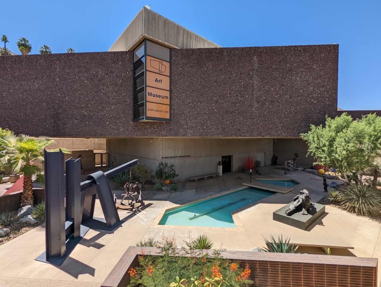 |
Sculpture Terrace
Position: 33°49.43’N, -116°32.88’W
Looking down into the art-packed sculpture terrace at the Palm Springs Art Museum. The museum was closed today, otherwise we would have visited as the displays looked quite interesting.
|
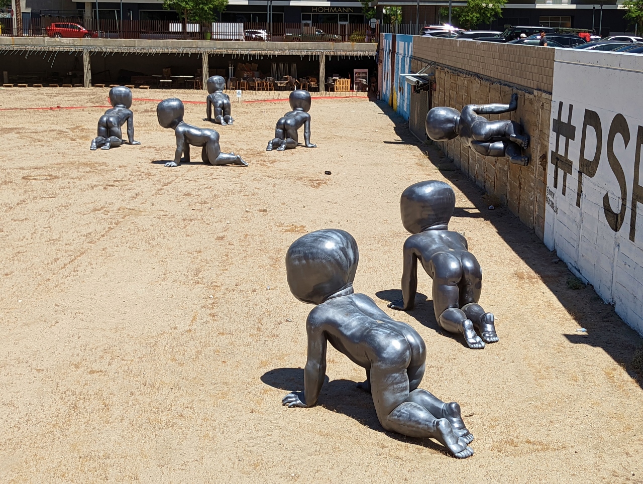 |
Babies
Position: 33°49.14’N, -116°32.70’W
The Babies by Czech artist David Cerny have appeared all over the world, including Australia, England, the Netherlands, Germany and Prague, and are temporarily installed in an empty lot near the Palm Springs Art Museum. The huge infant statues, with barcodes for faces, make a statement about dehumanization.
|
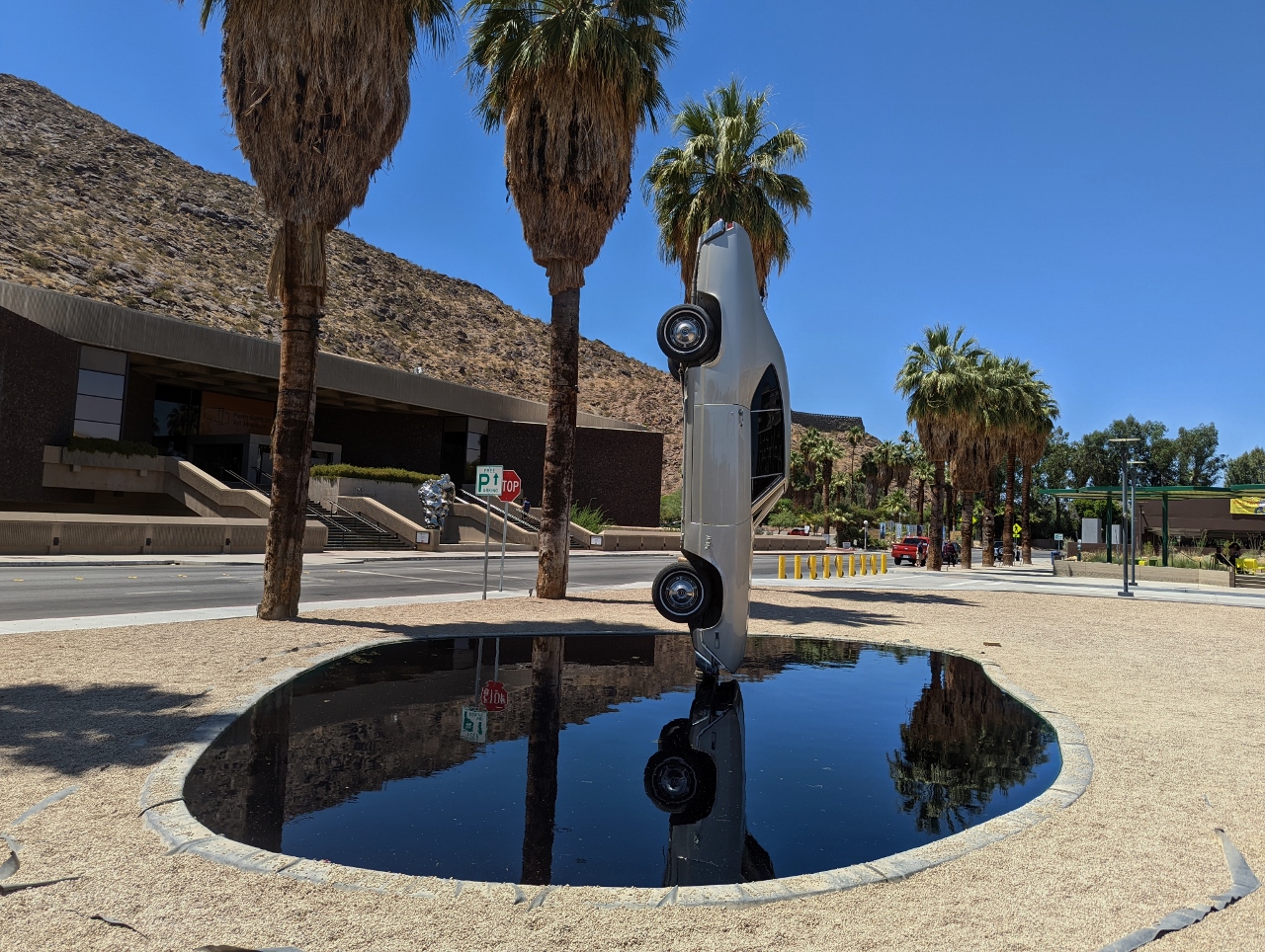 |
History of Suspended Time
Position: 33°49.14’N, -116°32.70’W
Gonzola Lebrija’s History of Suspended Time (A monument to the impossible) opposite the Palm Springs Art Museum. The car used in the exhibit is a 1968 Chevy Malibu that weighs about 2,500 lbs (1,113 kg) as installed (the engine and transmission have been removed).
|
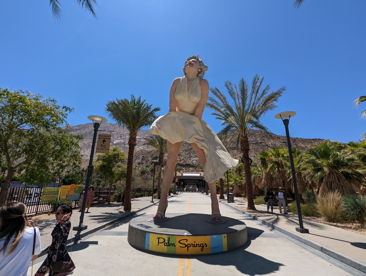 |
Forever Marilyn
Position: 33°49.44’N, -116°32.87’W
26 ft (7.9 m), 24,000 lb (10,866 kg) statue of Marilyn Monroe on Museum Way in Palm Springs. Sculpted by John Seward Johnson II in 2011, the statue has generated controversy in the city. Many residents feel the statue is good for tourism in the city, but a group who have raised $700,000 to remove it claim the statue blocks traffic access to the Palm Spring Art Museum beyond and provides an unappealing view of underpants when leaving the museum. Personally, we’re ok with walking around it and saving $700,000 :-).
|
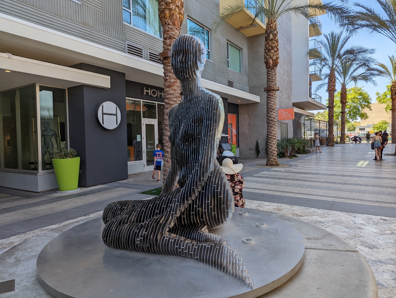 |
Isabelle
Position: 33°49.43’N, -116°32.85’W
The striking sculpture Isabelle by quantum physicist turned artist Julian Voss-Andreae is made of slices of polished stainless steel, making the statue see-through at certain angles.
|
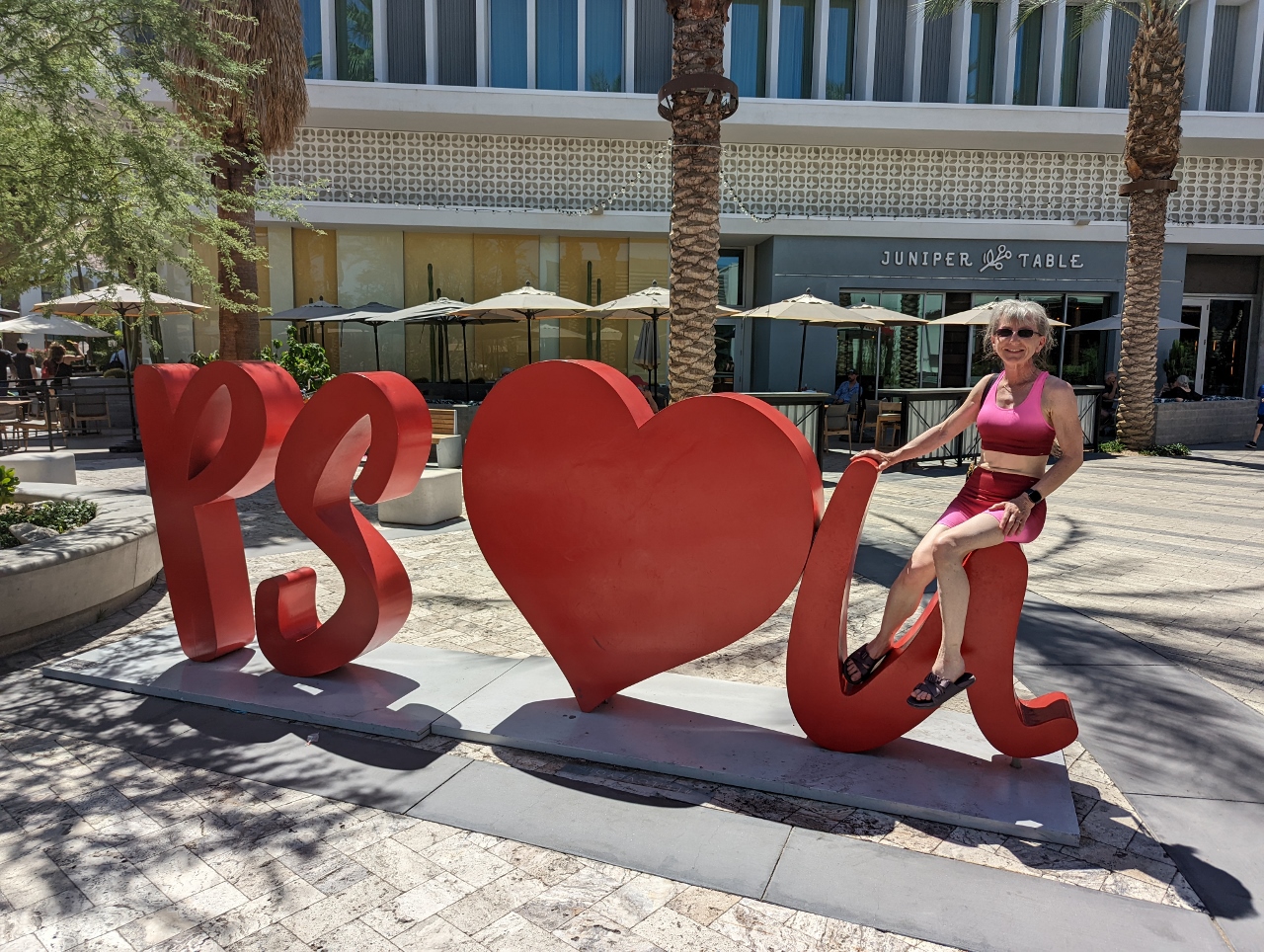 |
PS I Love U
Position: 33°49.42’N, -116°32.86’W
The PS I Love You sculpture was erected in 2020 and is hugely popular for photo-taking. Visible from our dinner table last night, it was rarely free of people posing for pictures.
|
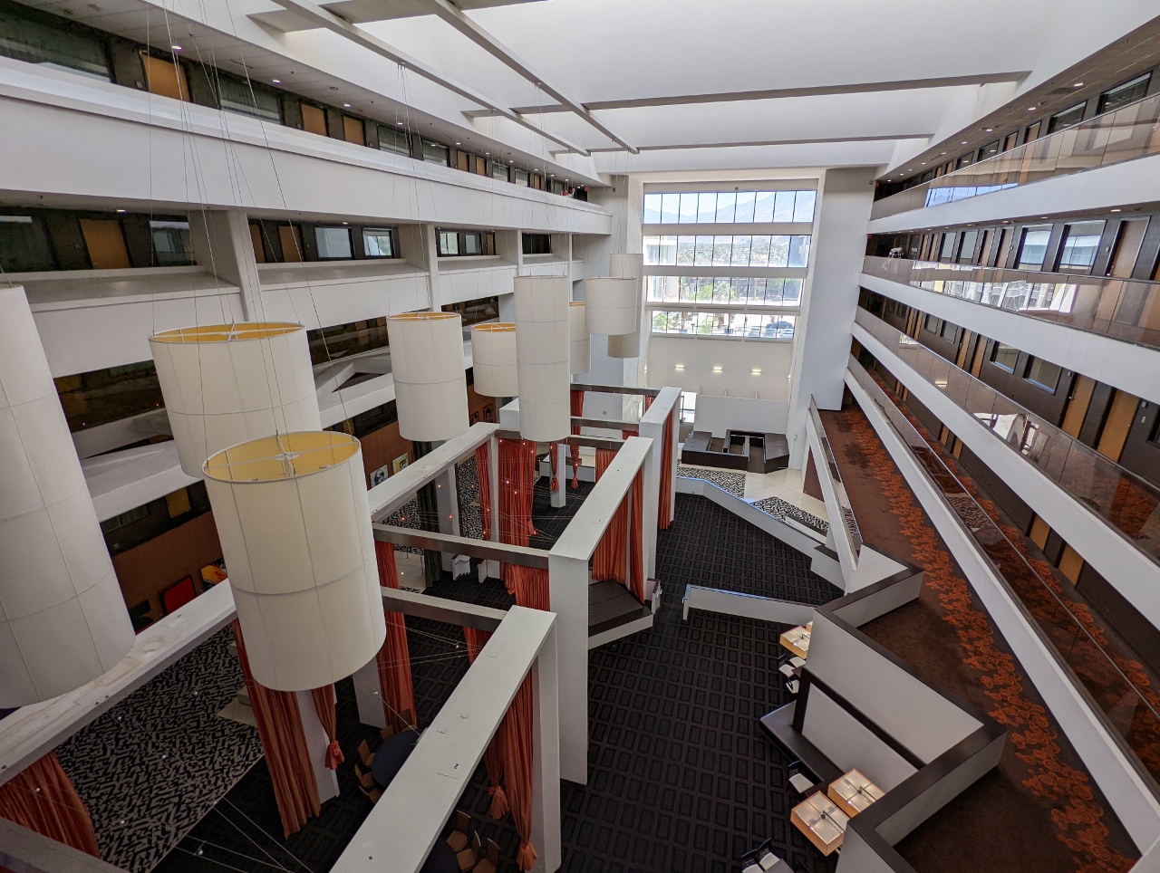 |
Hotel Atrium
Position: 33°49.51’N, -116°32.81’W
The airy and light-filled atrium of our hotel, the Hyatt Palm Springs.
|
 |
Tac/Quila
Position: 33°49.73’N, -116°32.83’W
A wonderful meal on the plant-filled terrace at Tac/Quila Mexican restaurant.
|
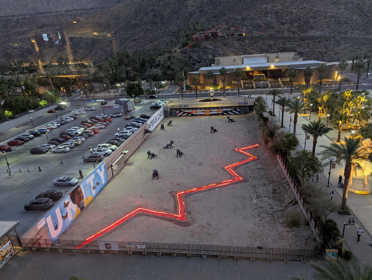 |
High Bar
Position: 33°49.44’N, -116°32.87’W
The view from the High Bar, the rooftop bar at the Kimpton Rowan Hotel. Below us is the Palm Springs Babies exhibit, with the Palm Springs Art Museum in the background. The jagged red line next to the Babies is the Fault Line Meditation exhibit in the shape of the San Andreas Fault, the source of many fierce California earthquakes.
|
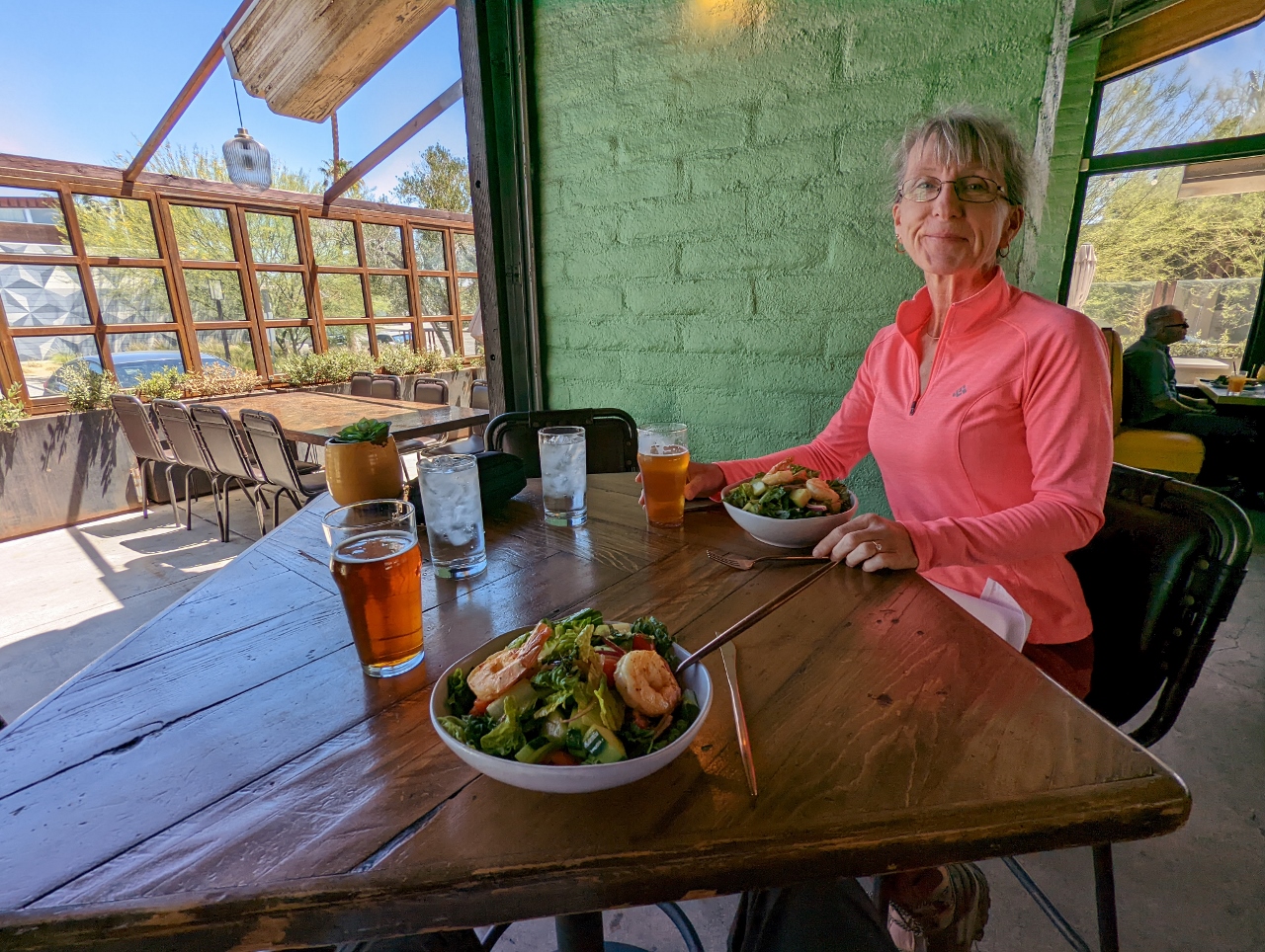 |
Uptown Gastropub
Position: 33°50.60’N, -116°32.83’W
A delicious lunch at the Uptown Gastropub in northern Palm Springs.
|
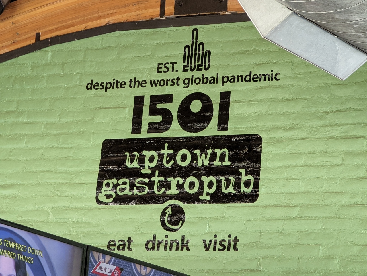 |
Est. 2020
Position: 33°50.60’N, -116°32.83’W
2020 was not a great year to establish a restaurant. But the Uptown Gastropub made it through.
|
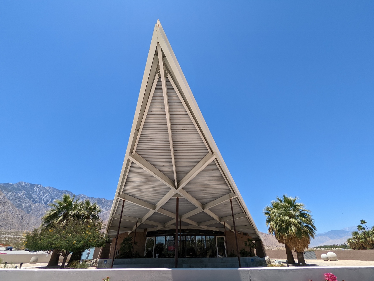 |
Visitor’s Center
Position: 33°51.50’N, -116°33.46’W
At the Palm Springs Visitor’s Center. The city is known for it’s mid-century modern architecture and the visitor’s center has some excellent displays and photographs.
The visitor center itself is housed in an old gas station, designed in the 1960s by Albert Frey, one of the earliest of Palm Spring’s modern style architects. Frey was the first to design a building in what became known as “desert modernism”, notable for its use of glass, clean lines, natural and manufactured resources and connection of indoor and outdoor spaces. The house we rented near Joshua Tree, Shelter: One, seemed a modern version of this style. |
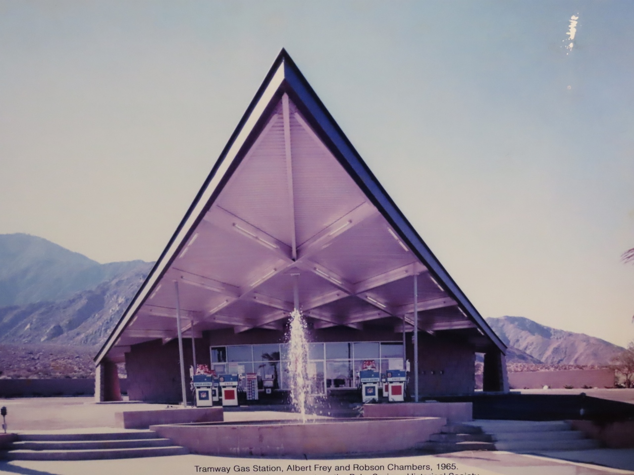 |
Tramway Gas Station
Position: 33°51.50’N, -116°33.49’W
A photograph at the Palm Springs Visitor’s Center showing the building’s original incarnation as the 1965 Tramway Gas Station.
|
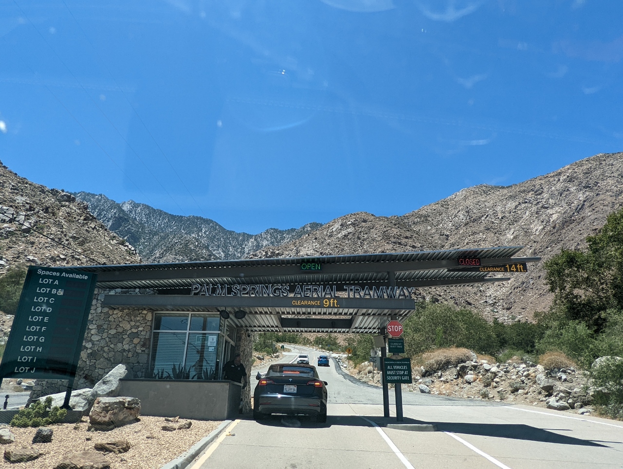 |
Aerial Tramway
Position: 33°50.59’N, -116°36.42’W
At the Palm Springs Aerial Tramway to ride up to Mount San Jacinto State Park. The tramway, originally built in 1963 and redesigned in 2000, is one of the area’s major tourist attractions. Over 20 million people have ridden the tram, and the pre-pandemic ridership was about a half-million per year.
|
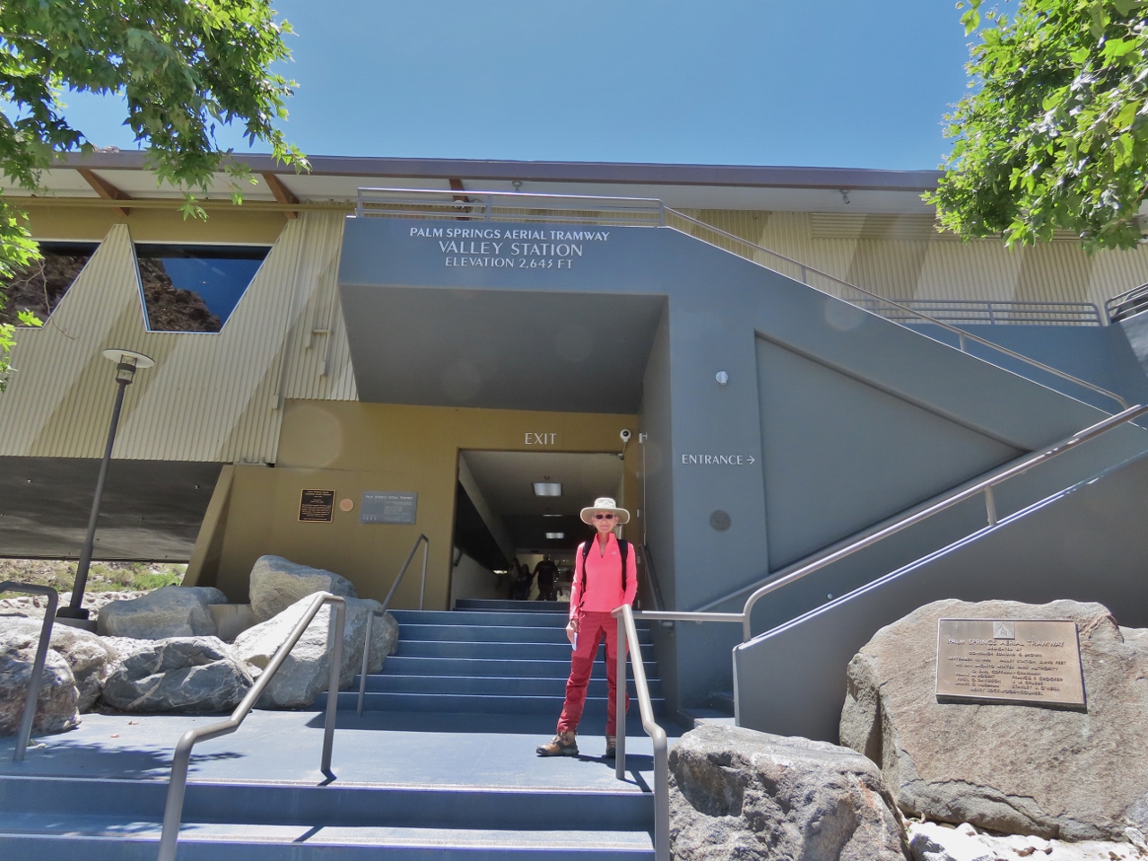 |
Valley Station
Position: 33°50.41’N, -116°36.74’W
Valley Station for the Palm Springs Aerial Tramway is at an altitude of 2,643 ft (805 m) in the Sonoran desert. We’ll be riding 2.5 miles (4 km) to the alpine wilderness of Mount San Jacinto State Park at elevation 8,516 ft (2,596 m).
|
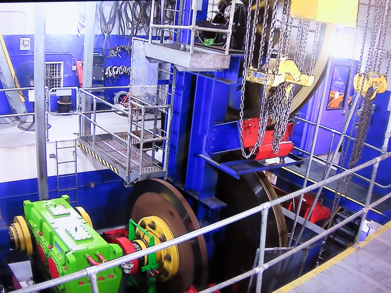 |
Main Drive Gear Box
Position: 33°50.22’N, -116°36.85’W
The the main drive gear box and the service brake rotor at the Palm Springs Aerial Tramway Valley Station.
|
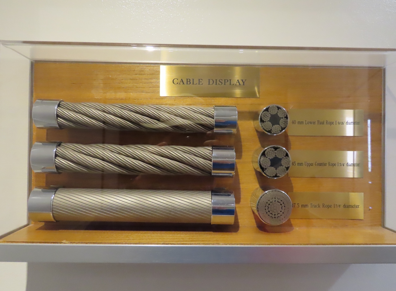 |
Cable Display
Position: 33°50.22’N, -116°36.85’W
Display at Valley Station showing, from top to bottom, the lower haul rope (diameter 1 9/16″; 40mm), the upper counter rope (diameter 1 3/4″; 45mm) and the track rope (diameter 1 7/8″; 47.5mm).
|
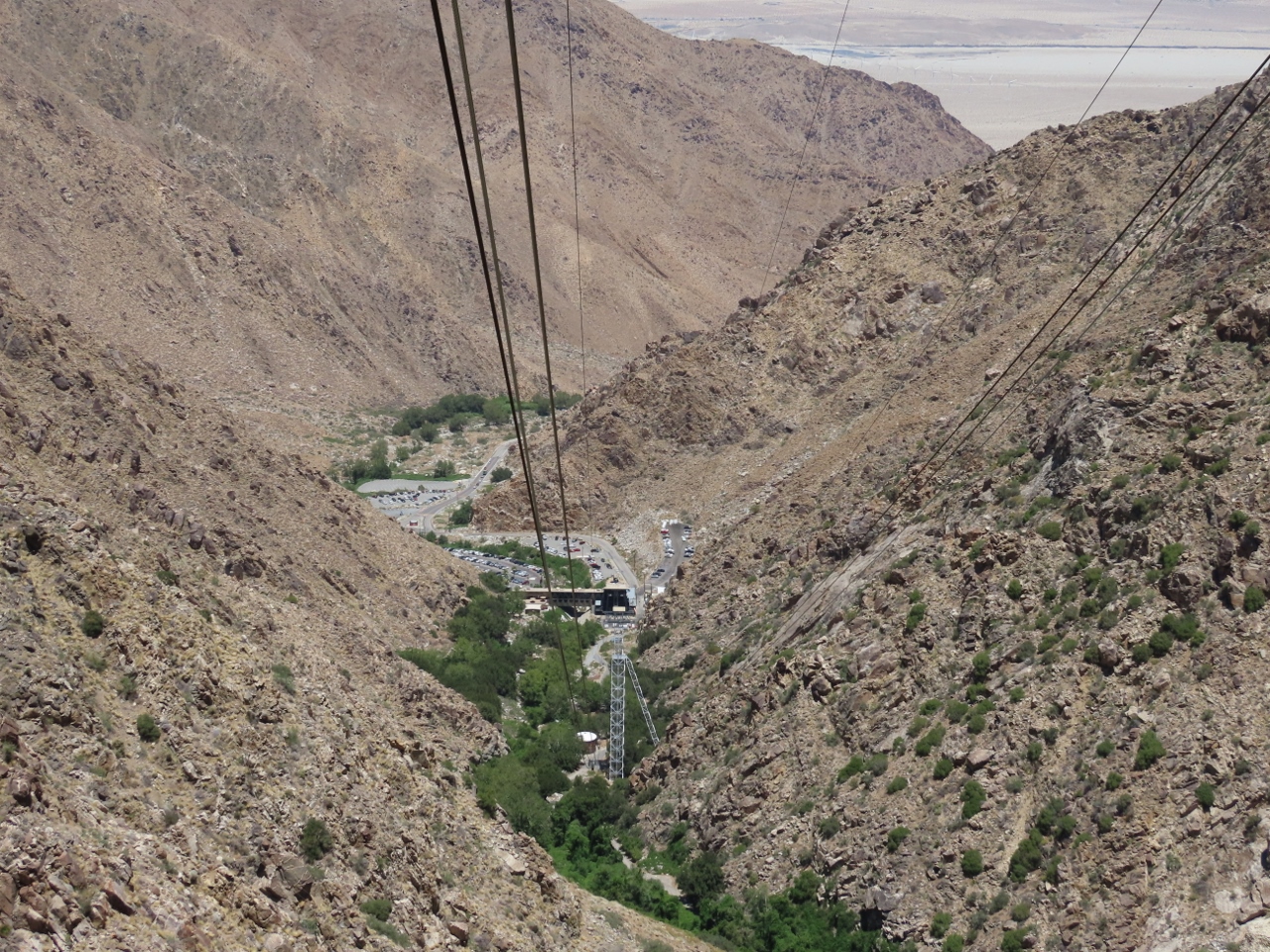 |
Tower 1
Position: 33°50.04’N, -116°37.03’W
Looking down from altitude 2,841 ft (866 m) past Tower 1 to Valley Station. Tower 1 is 227 ft (69 m), the tallest of the 5 support towers and the only one accessible by road.
|
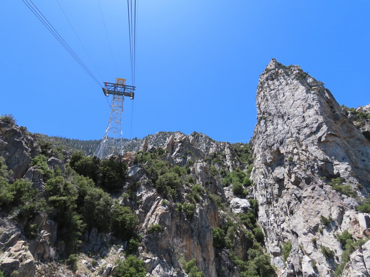 |
Chino Canyon
Position: 33°49.71’N, -116°37.37’W
Views to dramatic rock outcroppings Chino Canyon as we travel on the Palm Springs Aerial Tramway. The canyon is one of the steepest in North America, rising from 2,700 feet (820 m) to 8,500 feet (2,600 m) in less than a mile.
|
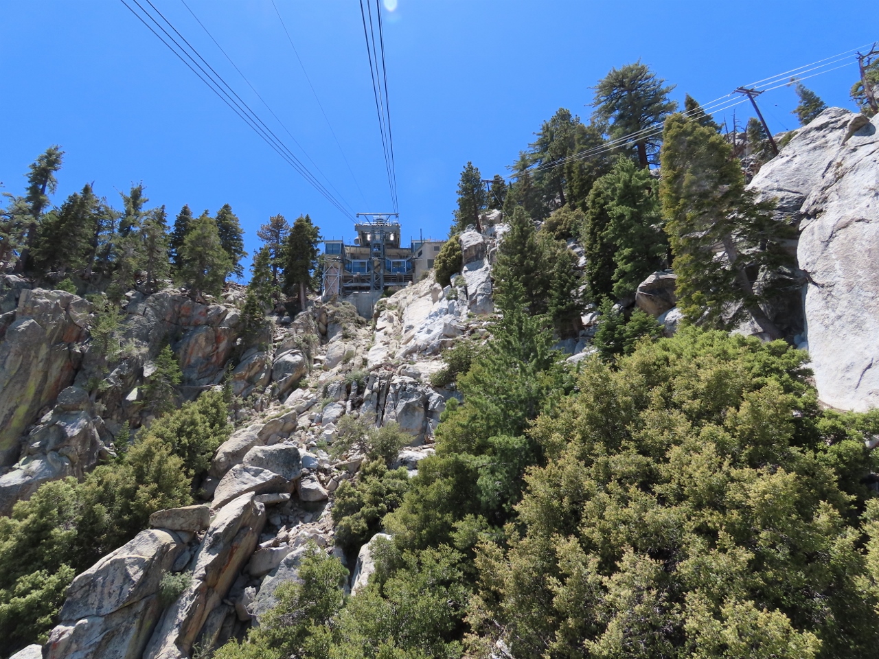 |
View to Mountain Station
Position: 33°49.08’N, -116°38.02’W
Looking up to Mountain Station as we near the top.
|
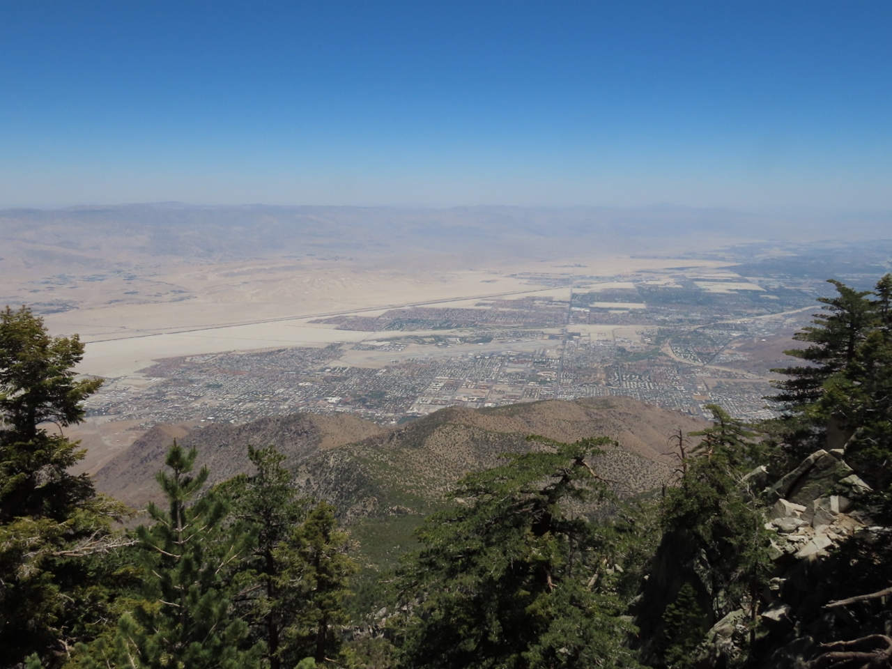 |
Grubb’s View
Position: 33°48.80’N, -116°38.32’W
The spectacular view east across Palm Springs from the Grubb’s View observation deck in Mountain Station at elevation 8,516 ft (2,596 m).
|
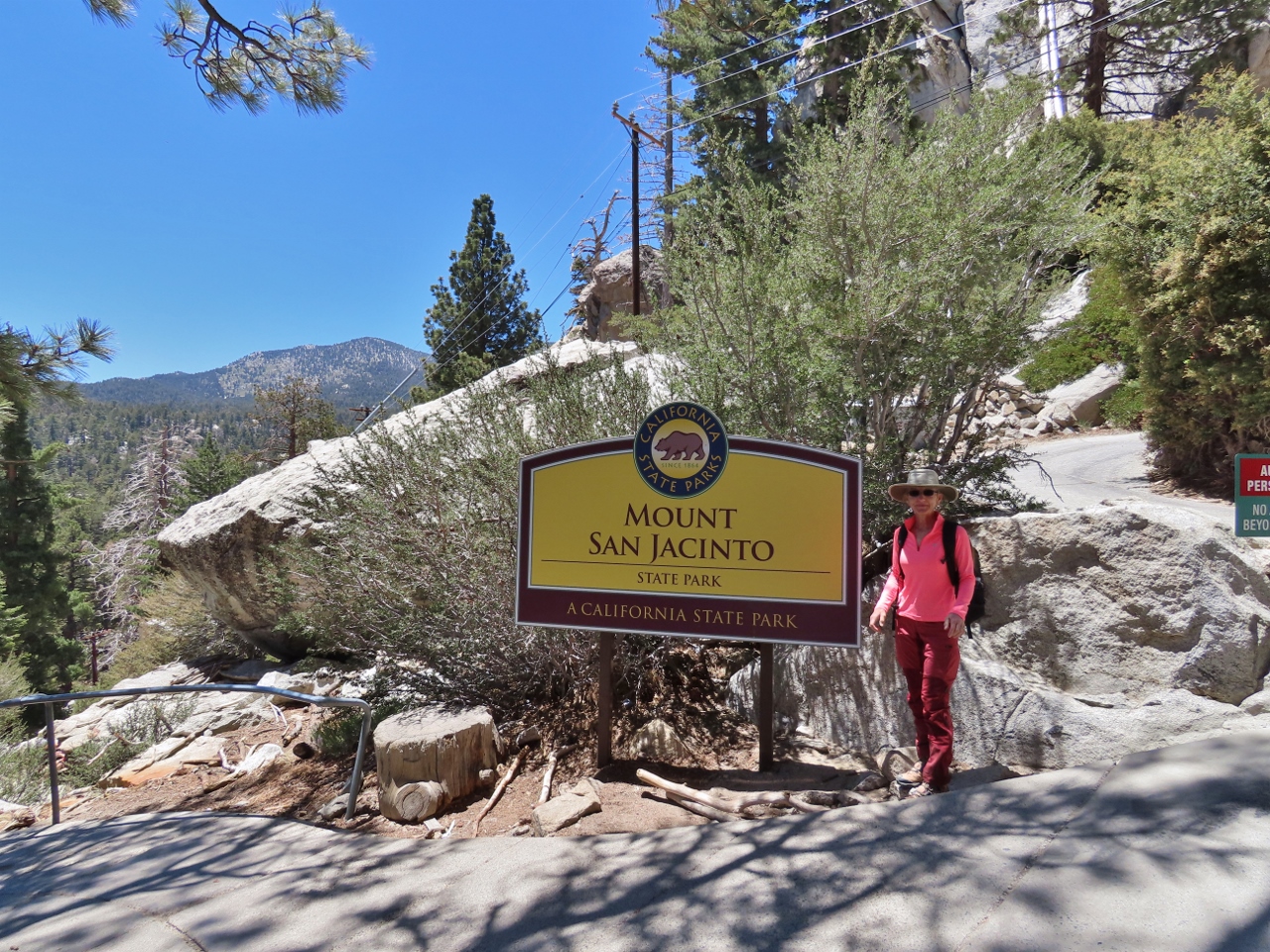 |
Mount San Jacinto
Position: 33°48.78’N, -116°38.28’W
Mountain Station is in Mount San Jacinto State Park, a 14,000-acre (21 sq mi; 57 sq km) wilderness that encompasses 10,384-ft (3,165 m) San Jacinto Peak.
|
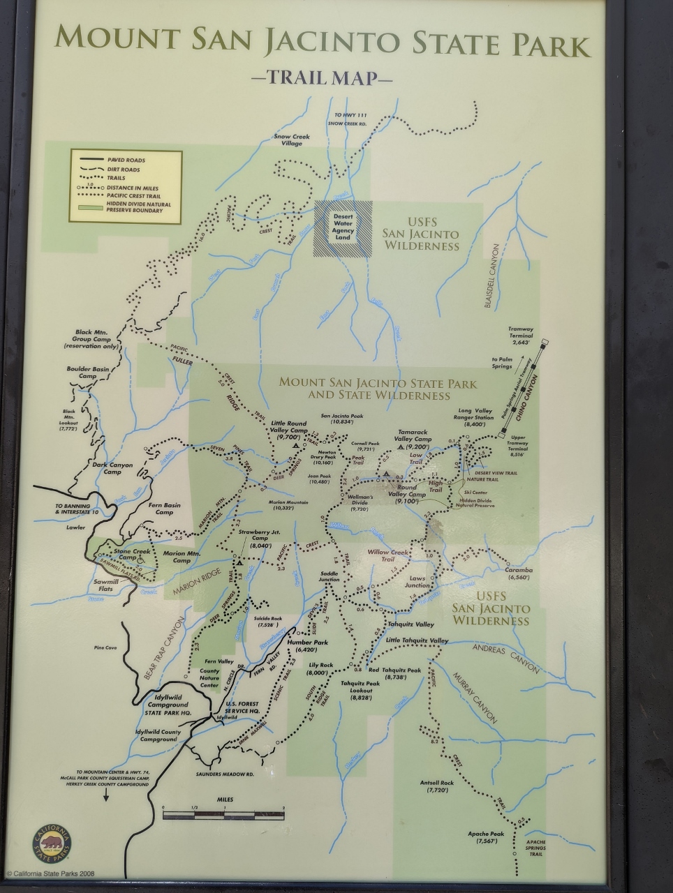 |
Trails
Position: 33°48.76’N, -116°38.53’W
Trail map outside the Long Valley ranger station in San Jacinto State Park showing the many hiking opportunities in the area. The Pacific Crest Trail, a 2,653 mi (4,270 km) long distance trail between the Mexican and Canadian borders, passes through the area from bottom right to top left.
The tramway is at upper right and 10,384-ft (3,165 m) San Jacinto Peak is at center directly below the “Mount San Jacinto State Park and State Wilderness” label. The 10-mile (16 km) round trip trail to the summit takes about 5.5 hours to complete, with an elevation gain of 2,555 ft (779 m). We’d likely hike it if we had a little more time. |
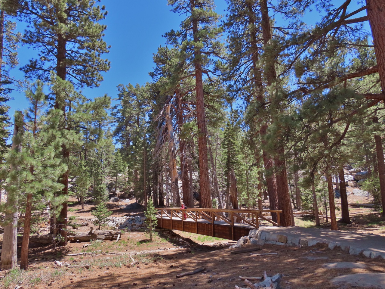 |
Long Valley Creek
Position: 33°48.71’N, -116°38.56’W
Passing over the currently dry Long Valley Creek on the Willow Creek Trail.
|
|
|
Notch 4
Position: 33°48.56’N, -116°38.17’W
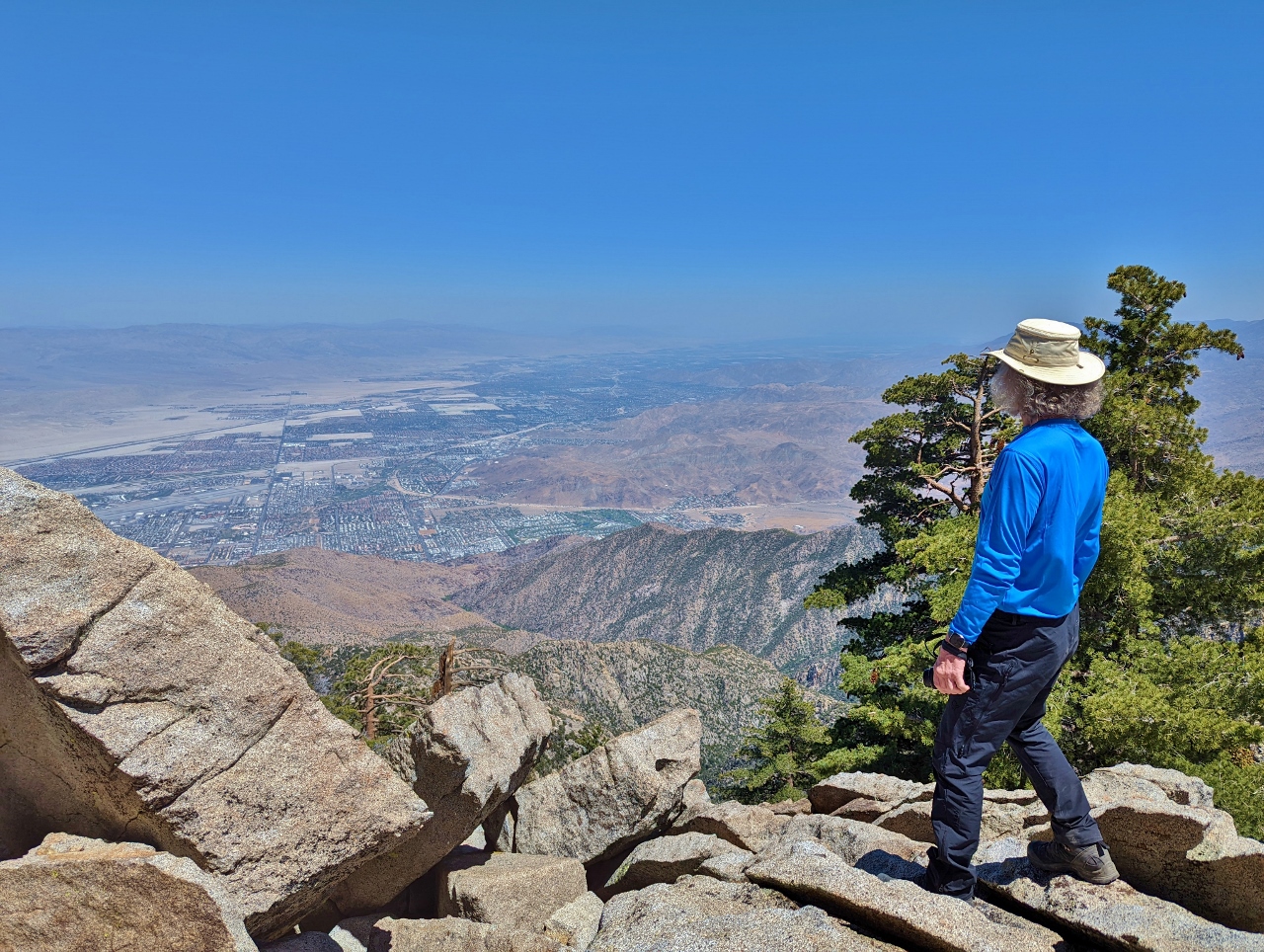
Enjoying the view to Palm Springs from Notch 4 of 5 on the 1.5-mile (2.4 km) Desert View Trail.
|
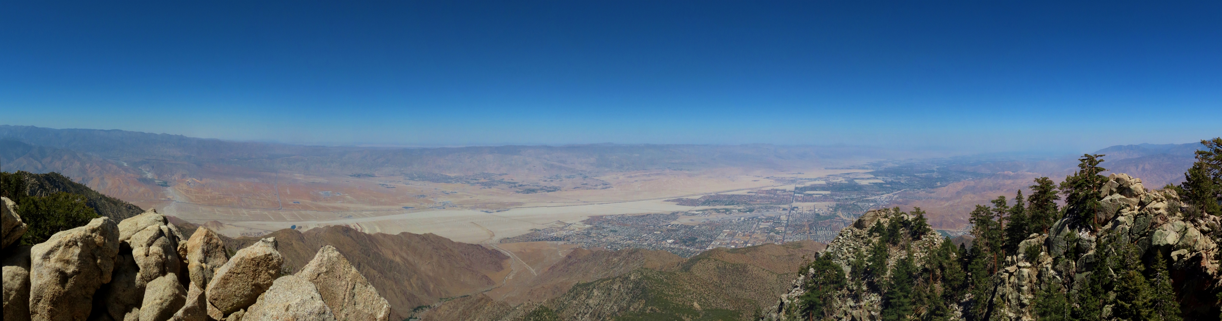 |
Notch 2
Position: 33°48.65’N, -116°38.15’W
Panoramic view across the Sonoran Desert and Palm Springs from Notch 2 on the Desert View Trail. Chino Canyon is at left, with a portion of the tramway parking lot just visible in the bottom slightly left of center (click image for a larger view).
|
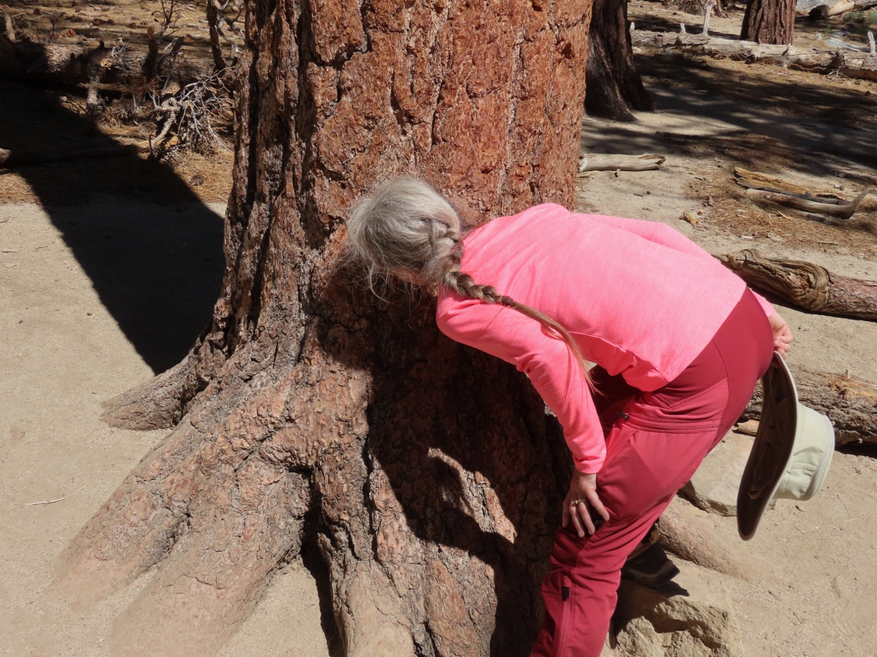 |
Jeffrey Pine
Position: 33°48.64’N, -116°38.34’W
The Jeffrey Pine, one of the most common in the area, has a surprising butterscotch scent that you can smell up close.
|
 |
Desert View Terrace
Position: 33°48.79’N, -116°38.31’W
Enjoying a cold pint with a view at Desert View Terrace in Mountain Station.
|
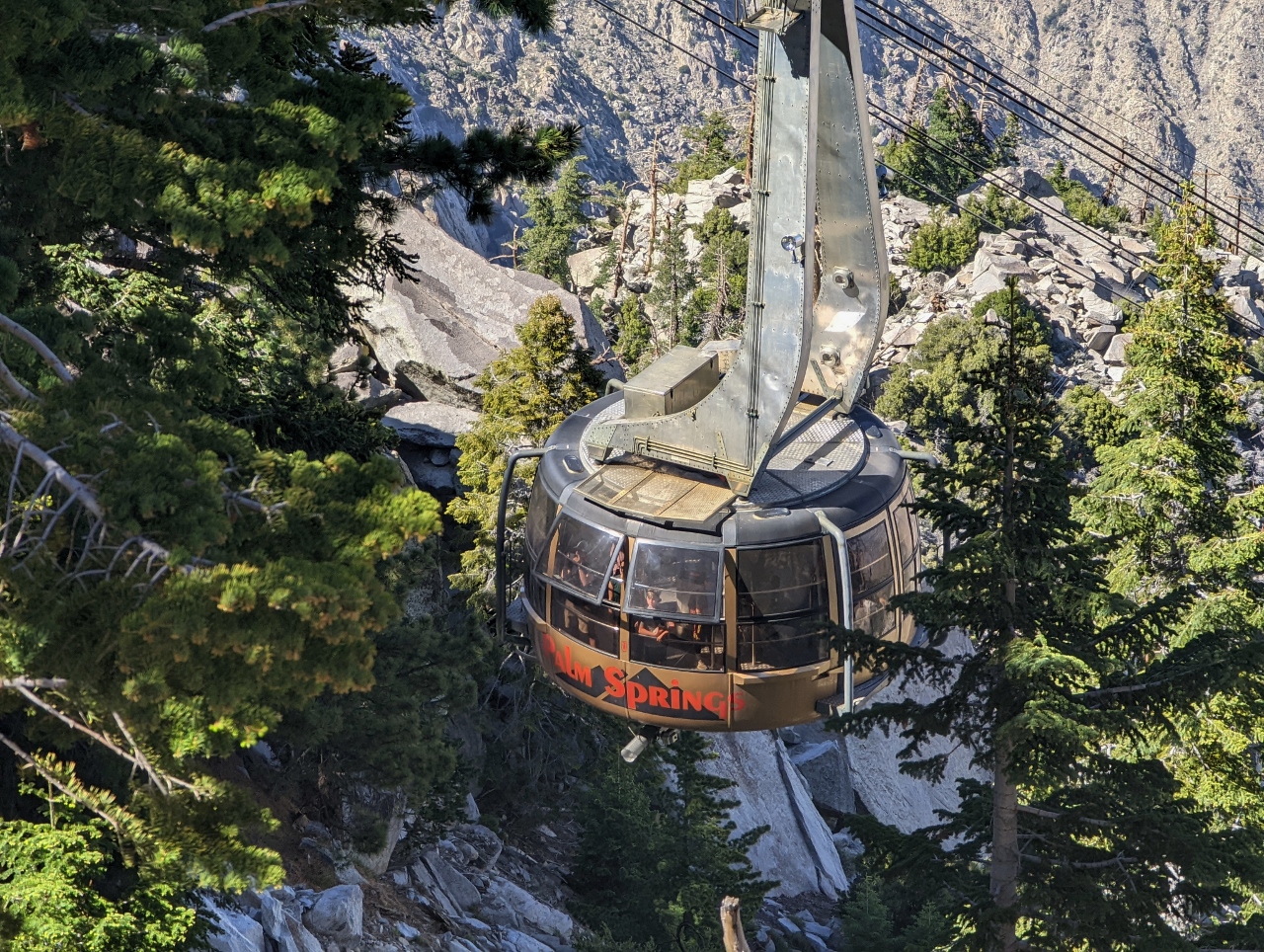 |
Tram Car
Position: 33°48.79’N, -116°38.29’W
Tram car arriving into Mountain Station. The cars rotate twice per journey and the tramway is the largest of the three rotating tramways in the world, and the only one in the Western Hemisphere. We’ve ridden one of the other two down from Table Mountain in Cape Town, South Africa. The third is in Titlis, Switzerland.
|
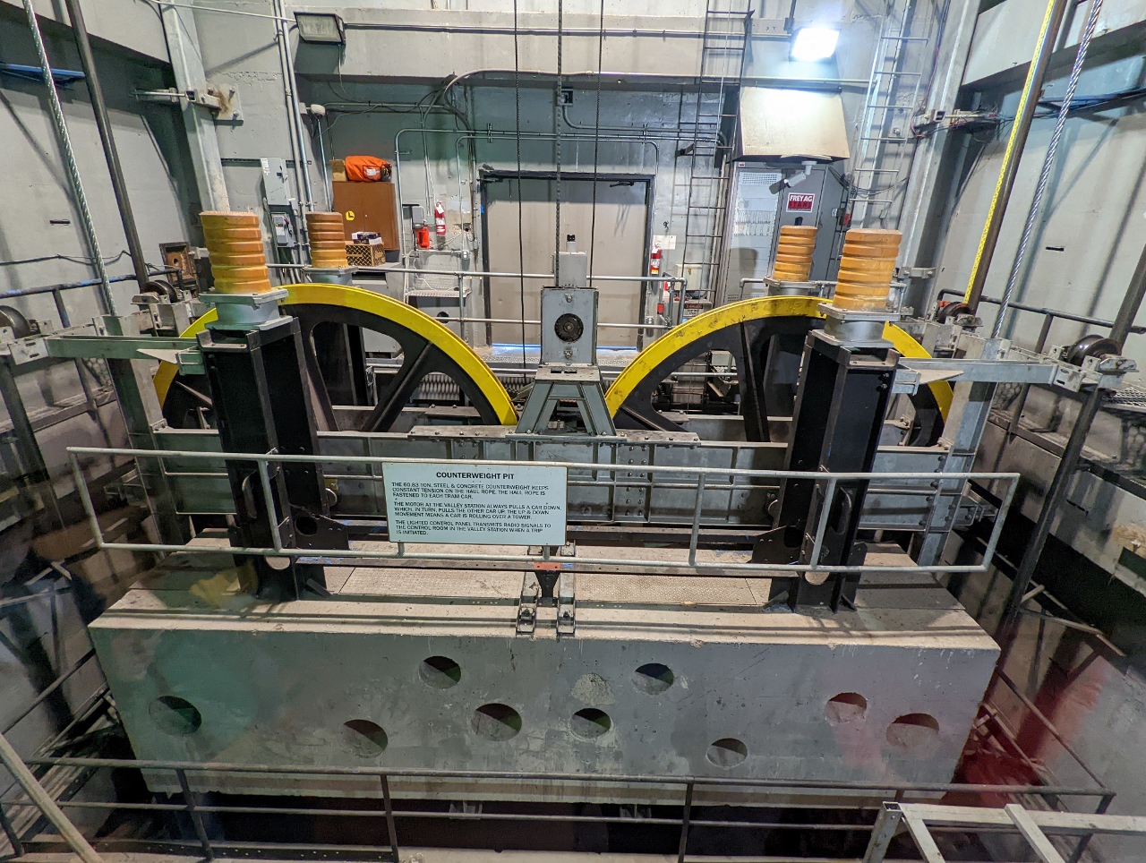 |
Counterweight Pit
Position: 33°48.79’N, -116°38.30’W
The 60.83-ton counterweight at Valley Station keeps constant tension on the haul rope.
|
 |
Original Car
Position: 33°50.24’N, -116°36.85’W
One of the original aerial tram cars from 1963 on permanent display near Valley Station.
|
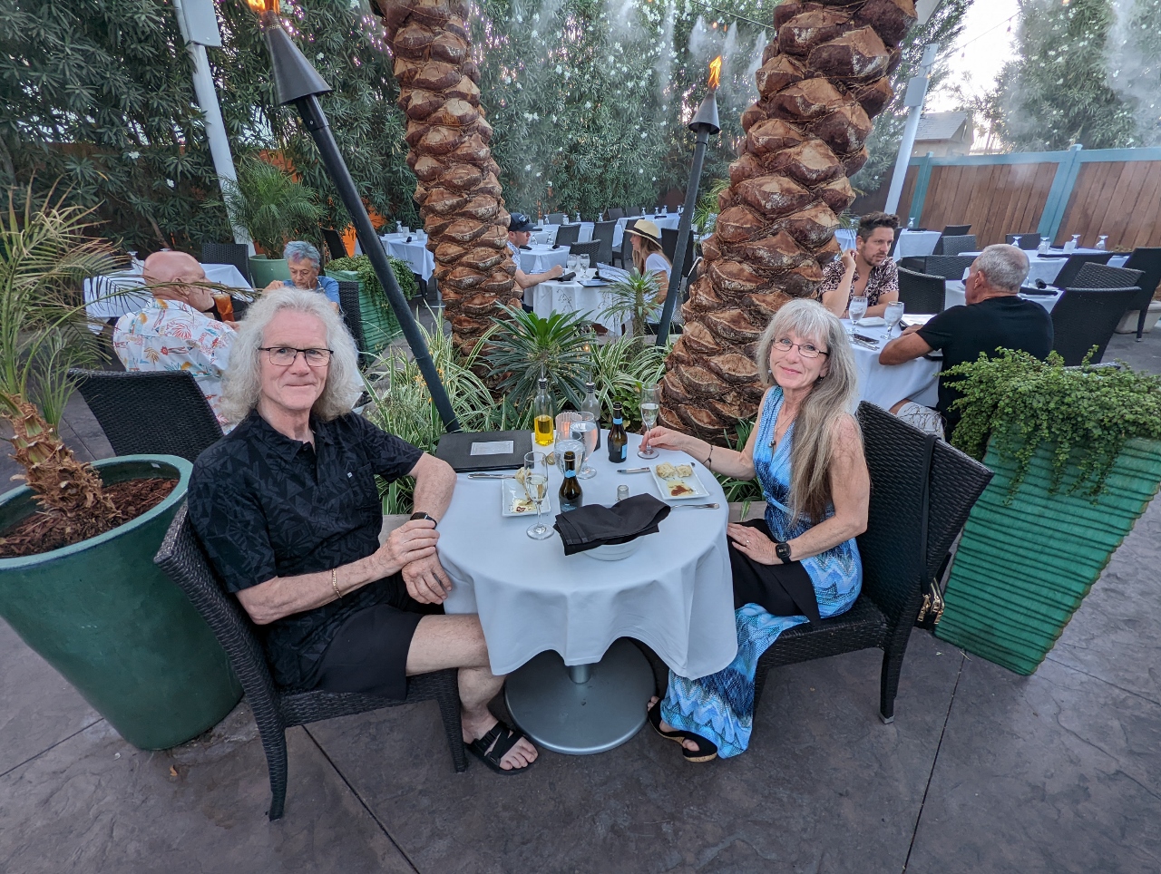 |
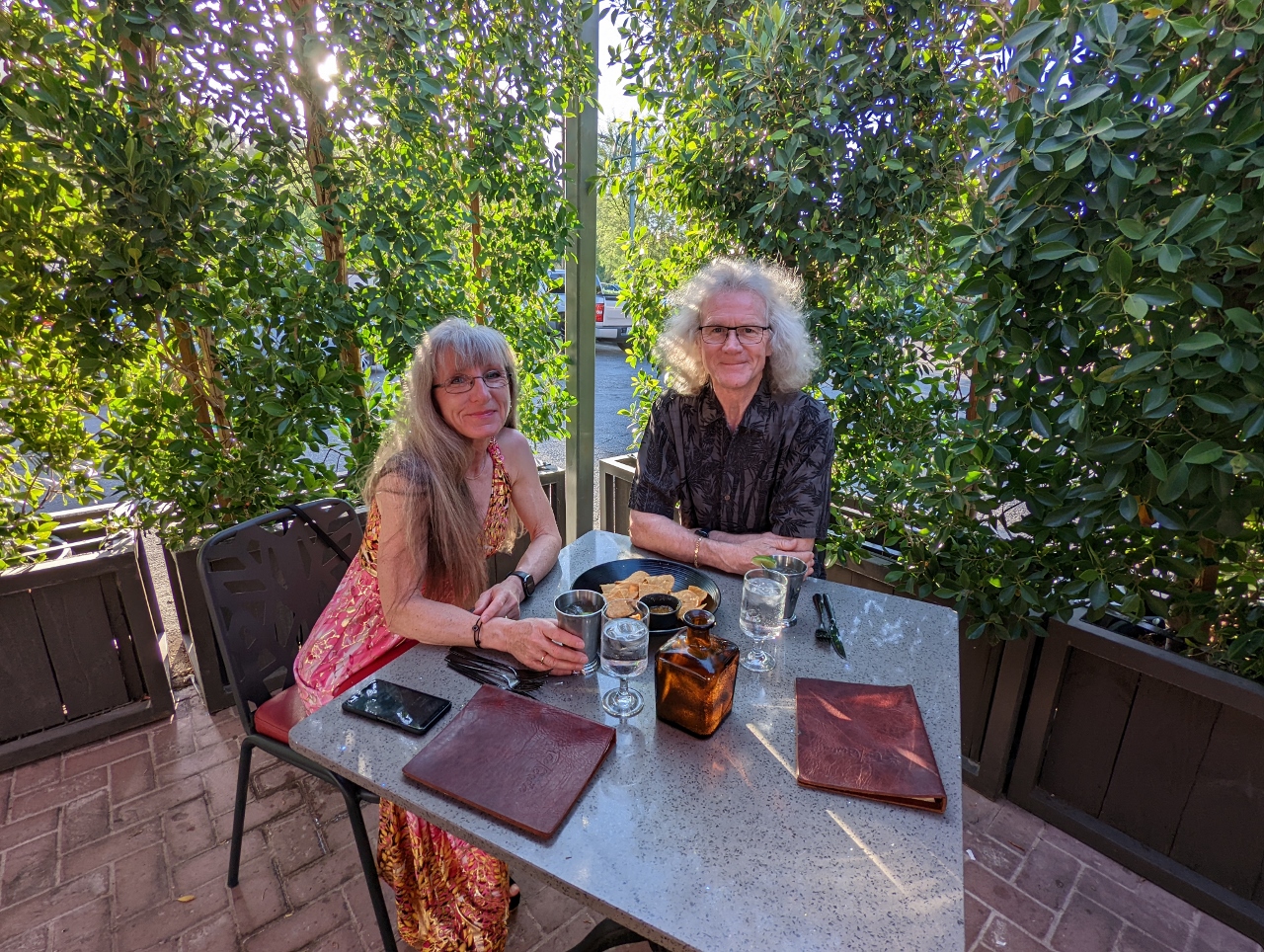
The Tropicale
Position: 33°49.63’N, -116°32.65’W
A memorable meal on the terrace at The Tropical for our final night in Palm Springs. The service was wonderful and the food was excellent.
|
 |
Click the travel log icon on the left to see these locations on a map. And a map of our most recent log entries always is available at mvdirona.com/maps. |
If your comment doesn't show up right away, send us email and we'll dredge it out of the spam filter.