Our first wilderness campsite was exactly what we were hoping for: secluded, with an interesting view and an opportunity for walking or hiking. After an initial test run of our camping gear at Bay View State Park, we went to look for a wilderness campsite at the Beckler River, near Stevens Pass in Mt. Baker-Snoqualmie National Forest, on the advice of the Skykomish District ranger.
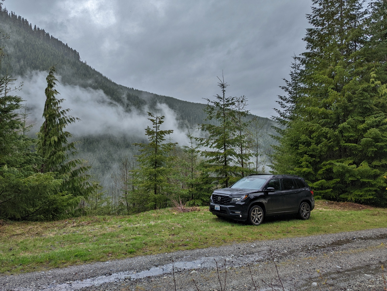
We did see many scenic spots along the river, but they appeared rather boggy and were a little close to other sites for our taste. So we continued on to higher elevations and found a wonderful spot along National Forest Development Road 6540. We had a mountain view with relatively dry land, and saw only one other vehicle pass the entire time we were there.
In general, camping is allowed along any National Forest road so long as no land is cleared and the camp doesn’t block any roads or gates. Additional restrictions apply for designated Wilderness areas. Many National Forest have unique extra rules, such as being a minimum distance away from developed trailheads, but the rules for Mt Baker-Snoqualmie National Forest are fairly standard.
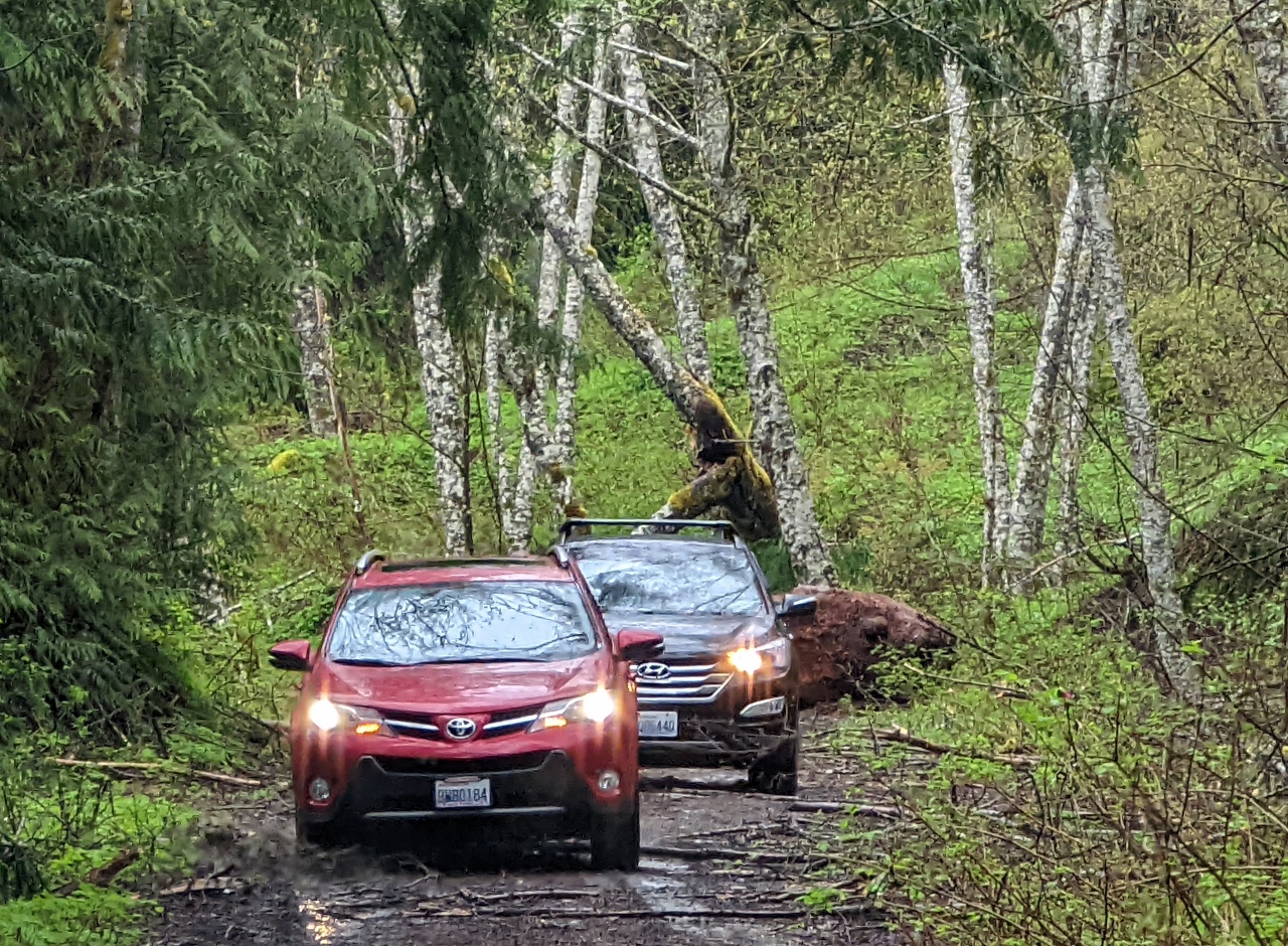
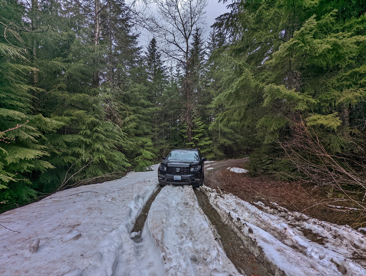
After a great weekend camping, we toured through the area scouting for additional spots and found several. While driving, we passed a few places where fallen trees were either blocking the road or had recently been cleared by the Forest Service, and numerous rock slides. And despite this being mid May, even as low as elevation 2,582 ft (787 m) we encountered snow along the road and eventually turned back when it got too deep. We really enjoyed driving through the forest and exploring, and are looking forward to returning later in the summer to see more of the area.
Below are highlights from May 14th and 15th, 2022. Click any image for a larger view, or click the position to view the location on a map. And a map with our most recent log entries always is available at mvdirona.com/maps.
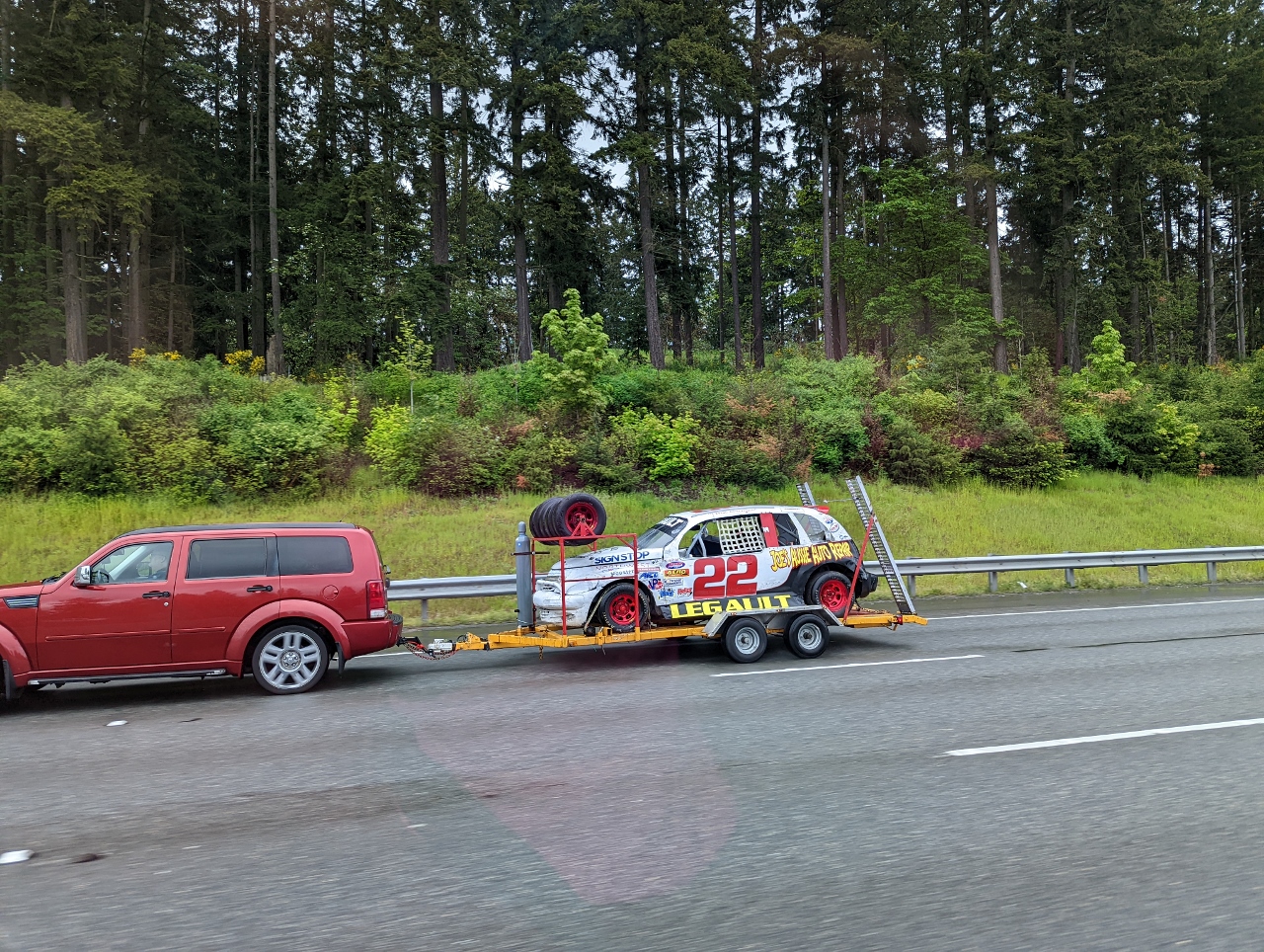 |
22 LeGault
Position: 47°43.88’N, -122°11.30’W
En route to the Beckler River, we passed the mini stock car #22 of Ken LeGault racing heading north on I-405 to Evergreen Speedway in Monroe for Saturday night racing. The team finished 7th overall in the main event.
|
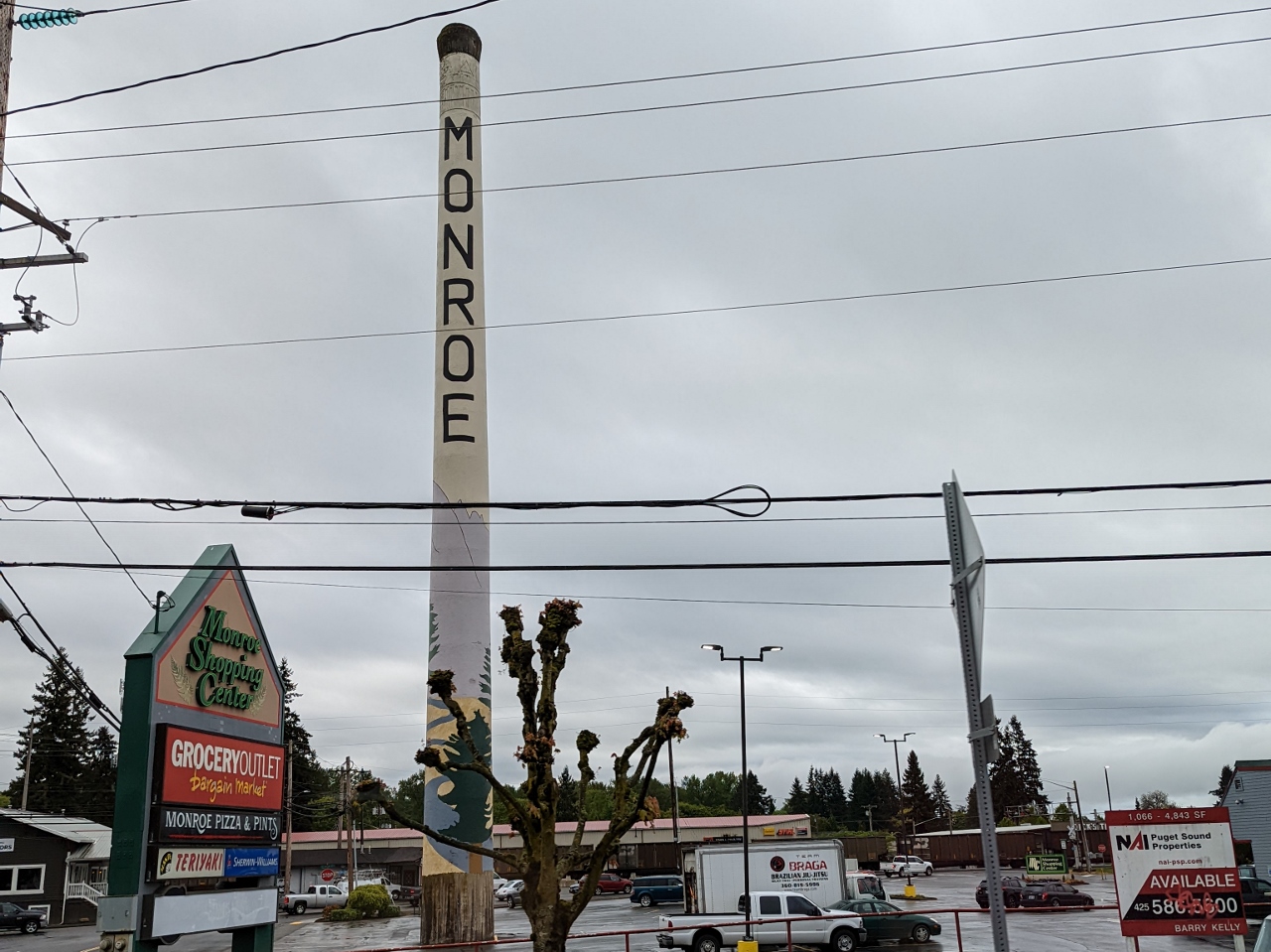 |
Monroe
Position: 47°51.53’N, -121°58.12’W
This 150 ft (45 m) smokestack, now a Monroe landmark, is all that remains of a 1908 milk condensing plant.
|
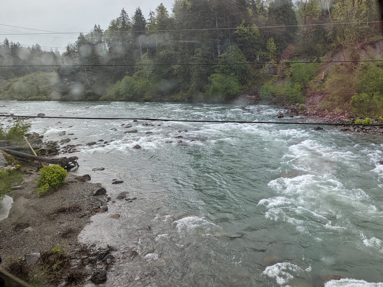 |
Skykomish River
Position: 47°48.76’N, -121°34.68’W
Crossing the Skykomish River just east of Monroe. The river is flowing hard after recent heavy rains.
|
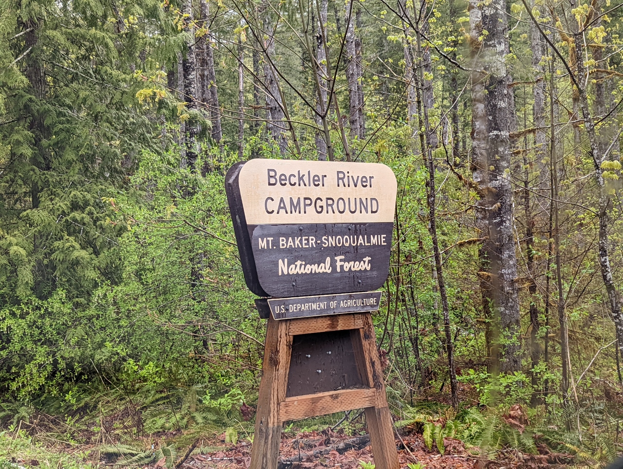 |
Beckler River
Position: 47°43.66’N, -121°20.30’W
Passing the Beckler River campground in Mt Baker-Snoqualmie National Forest. The campground is closed for the winter, but that’s not a problem for us. We’re looking for a wilderness campsite in the area.
|
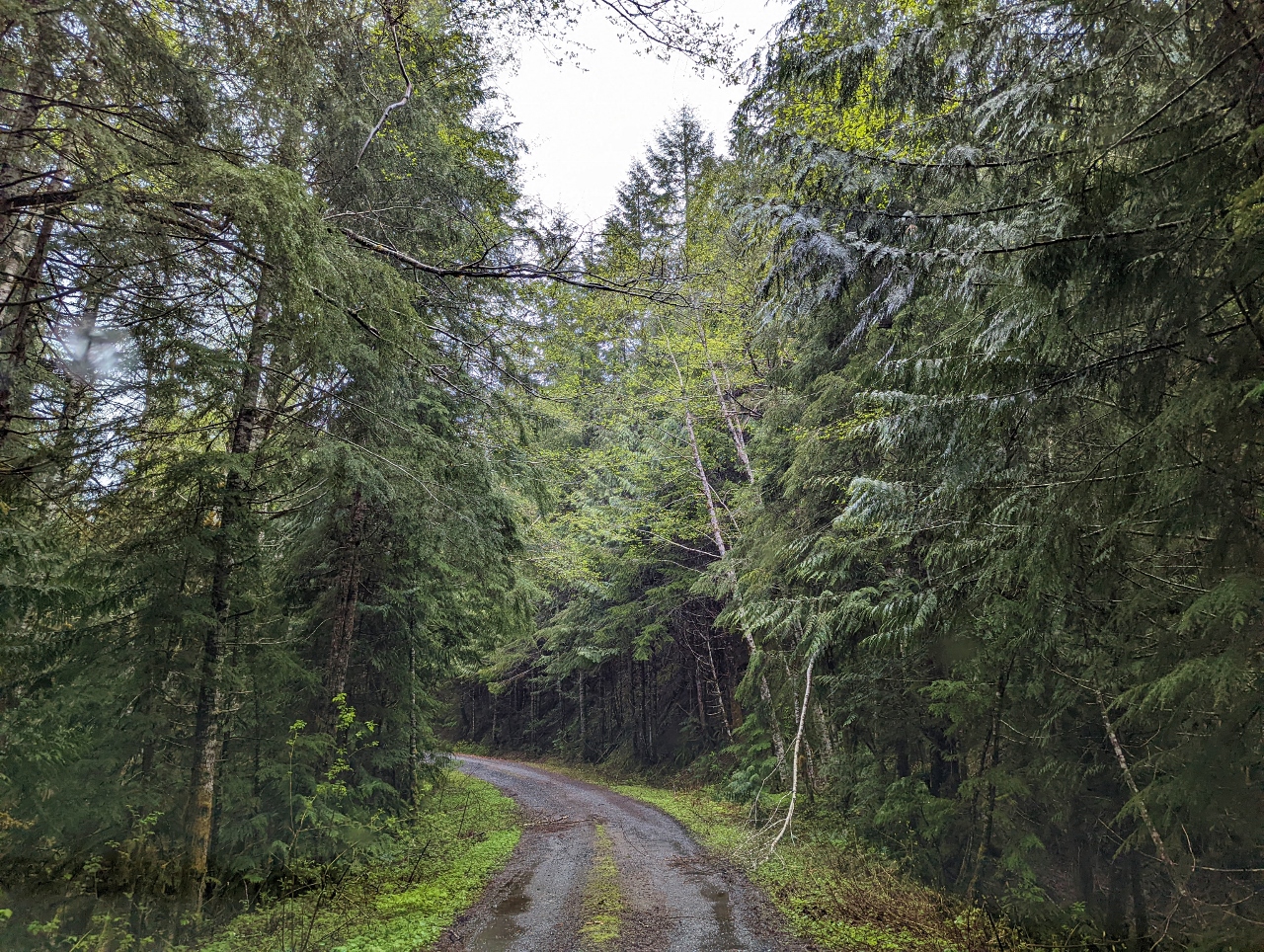 |
NF 6540
Position: 47°48.24’N, -121°17.70’W
Driving along National Forest Development Road 6540 in search of a wilderness campsite. We passed many spots along the Beckler River, but they appeared rather boggy and were a little close to other sites for our taste, so we continued on and up along NF 6540.
In general, camping is allowed along any Forest Service road so long as no land is cleared and the camp doesn’t block any roads or gates. Additional restrictions apply for designated Wilderness areas, and many National Forests have unique extra rules, such as being a minimum distance away from developed trailheads. The rules for Mt Baker-Snoqualmie National Forest are fairly standard. This forest does have several designated Wilderness areas, but we’re not in one at Beckler River. |
|
|
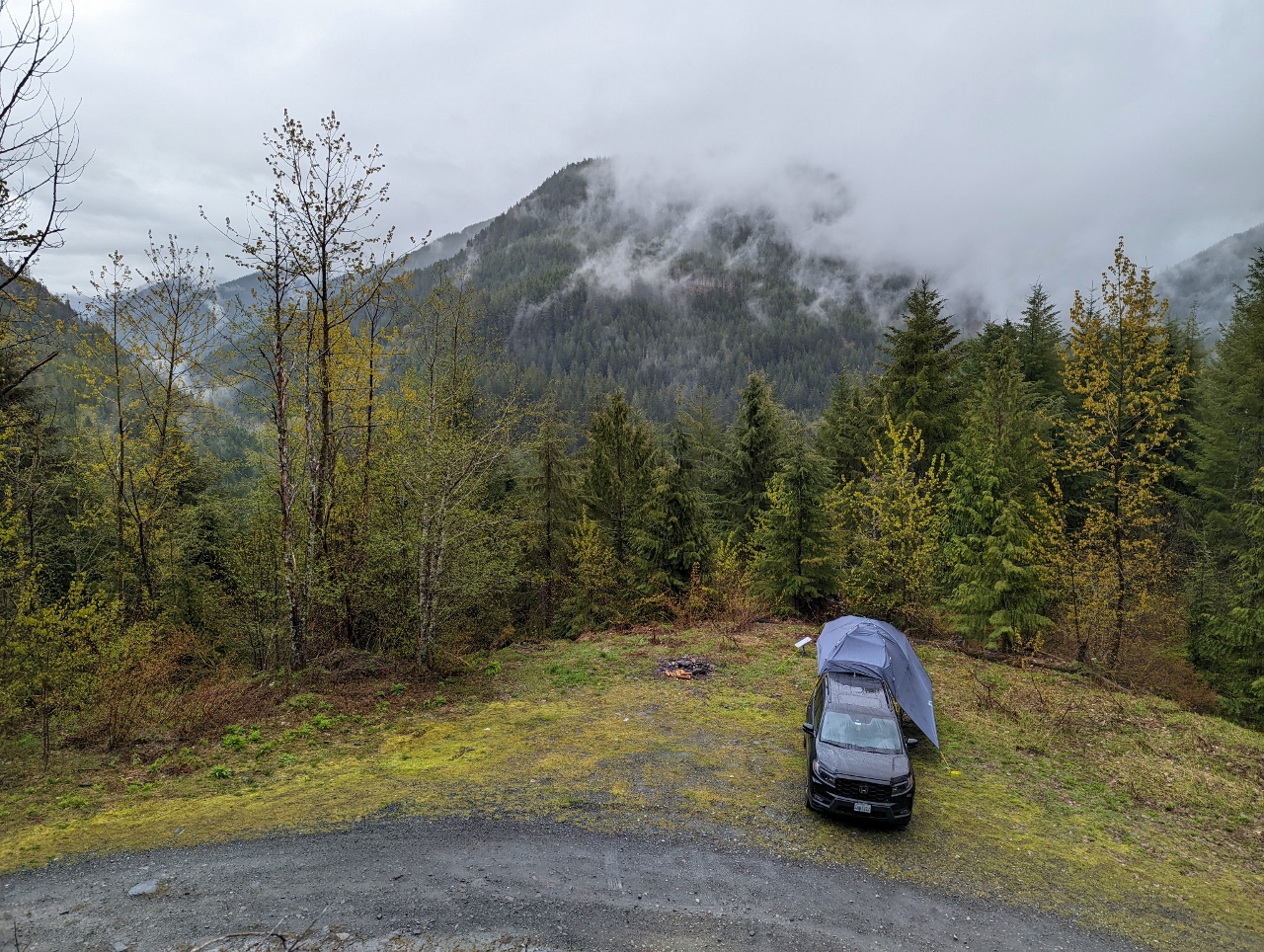
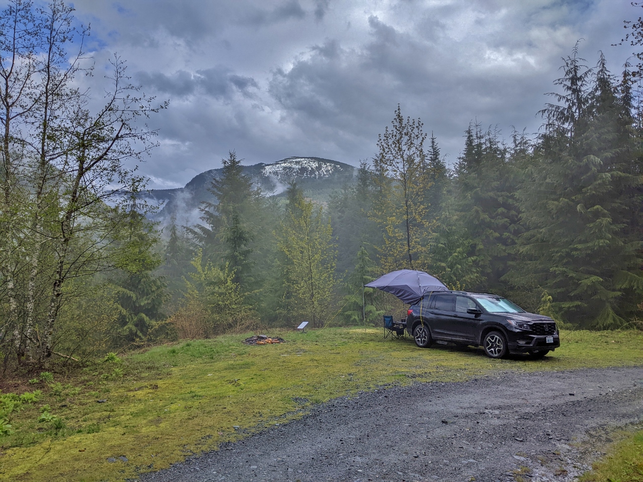
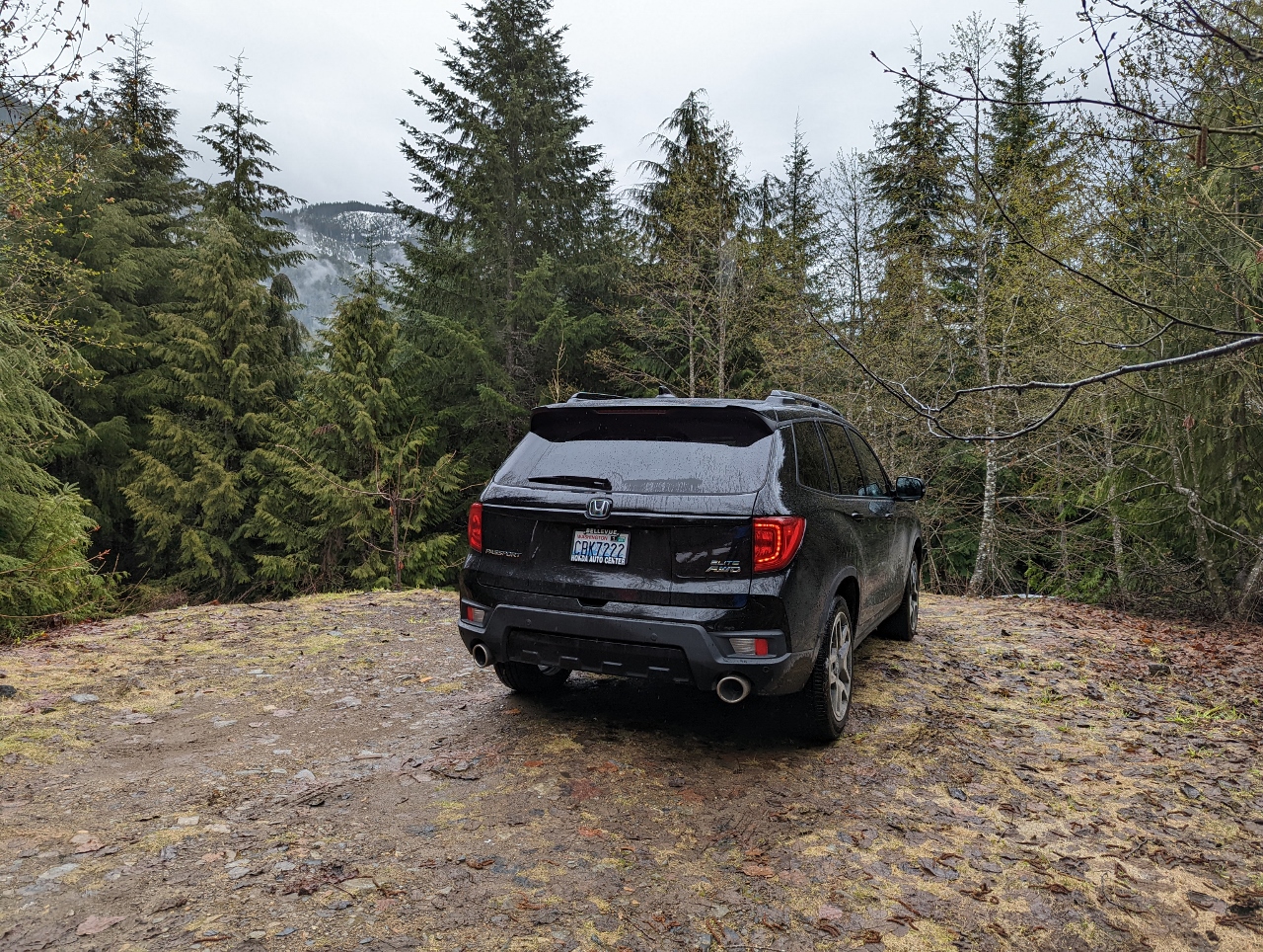
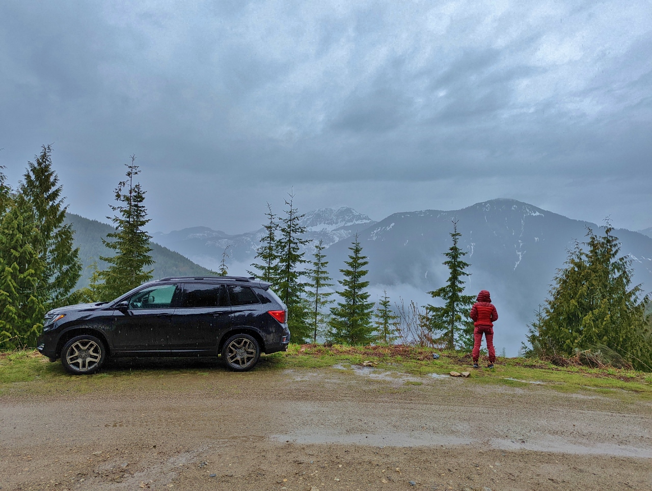
Campsite
Position: 47°48.18’N, -121°17.94’W
A short distance along NF 6540, we found this wonderfully secluded campsite with a mountain view to the west. We saw only one other vehicle pass the entire time we were here.
|
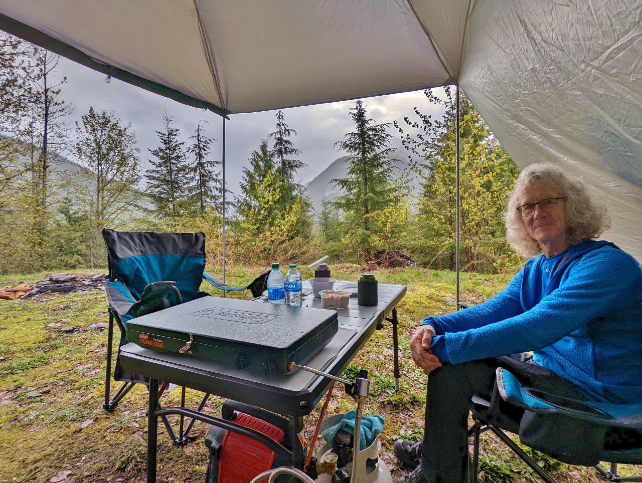 |
Lunch
Position: 47°48.17’N, -121°17.94’W
Enjoying lunch with a view from our wilderness campsite along NF 6540. Rain is falling, so an awning with side wings is critical for this adventure. This one by Hasika is a beautiful design, but not sufficiently durably built. After the ties tore off in the wind, we later replaced it with a stronger Redcamp awning.
|
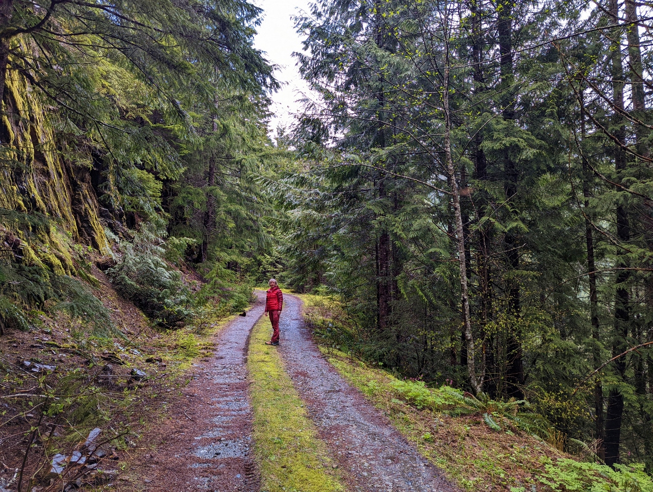 |
Walking
Position: 47°48.32’N, -121°18.04’W
Out for a walk through verdant woods along NF 6540. The road ends a short distance to our north.
|
 |
Clearing
Position: 47°48.18’N, -121°17.93’W
The skies cleared a bit later in the afternoon for some nice views to snow-dusted mountains to our west. We’re loving this campsite.
|
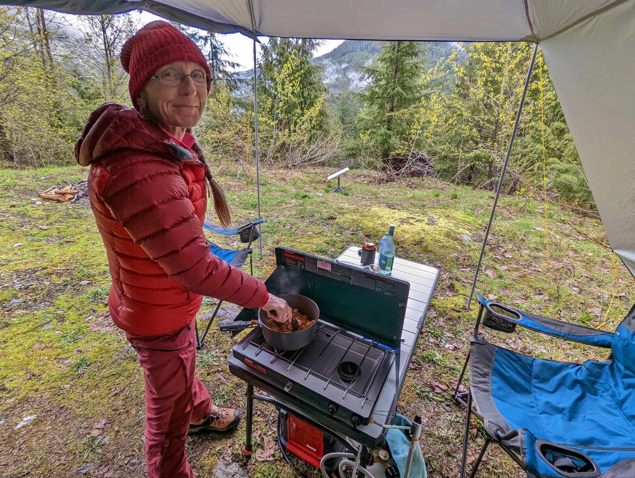 |
Dinner
Position: 47°48.17’N, -121°17.93’W
Making dinner on our Coleman Classic camp stove. The stove is basic, but performs well.
|
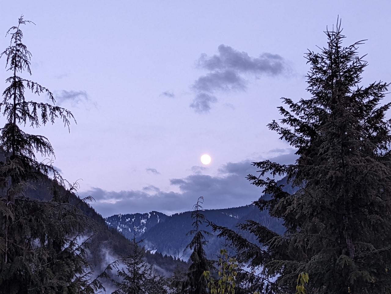 |
Moon
Position: 47°48.17’N, -121°17.93’W
The skies completely cleared in the evening and this near full moon lit up the sky as we enjoyed the evening at camp. The wilderness campsite above the Beckler River worked out really well and we’re looking forward to our next time out.
|
 |
Breaking Camp
Position: 47°48.17’N, -121°17.93’W
Our camp gear all packed up in the truck and ready to go after a great night’s sleep and an enjoyable morning. Rain has been falling most of the morning, and we took advantage of a quick break to pack up.
|
 |
Beckler River
Position: 47°48.39’N, -121°17.63’W
Crossing the Beckler River as we return down NF-6540 from our campsite. At upper right a truck is visible parked at a wonderful spot overlooking the river.
|
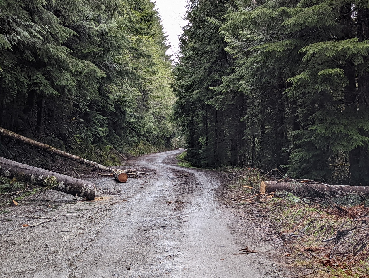 |
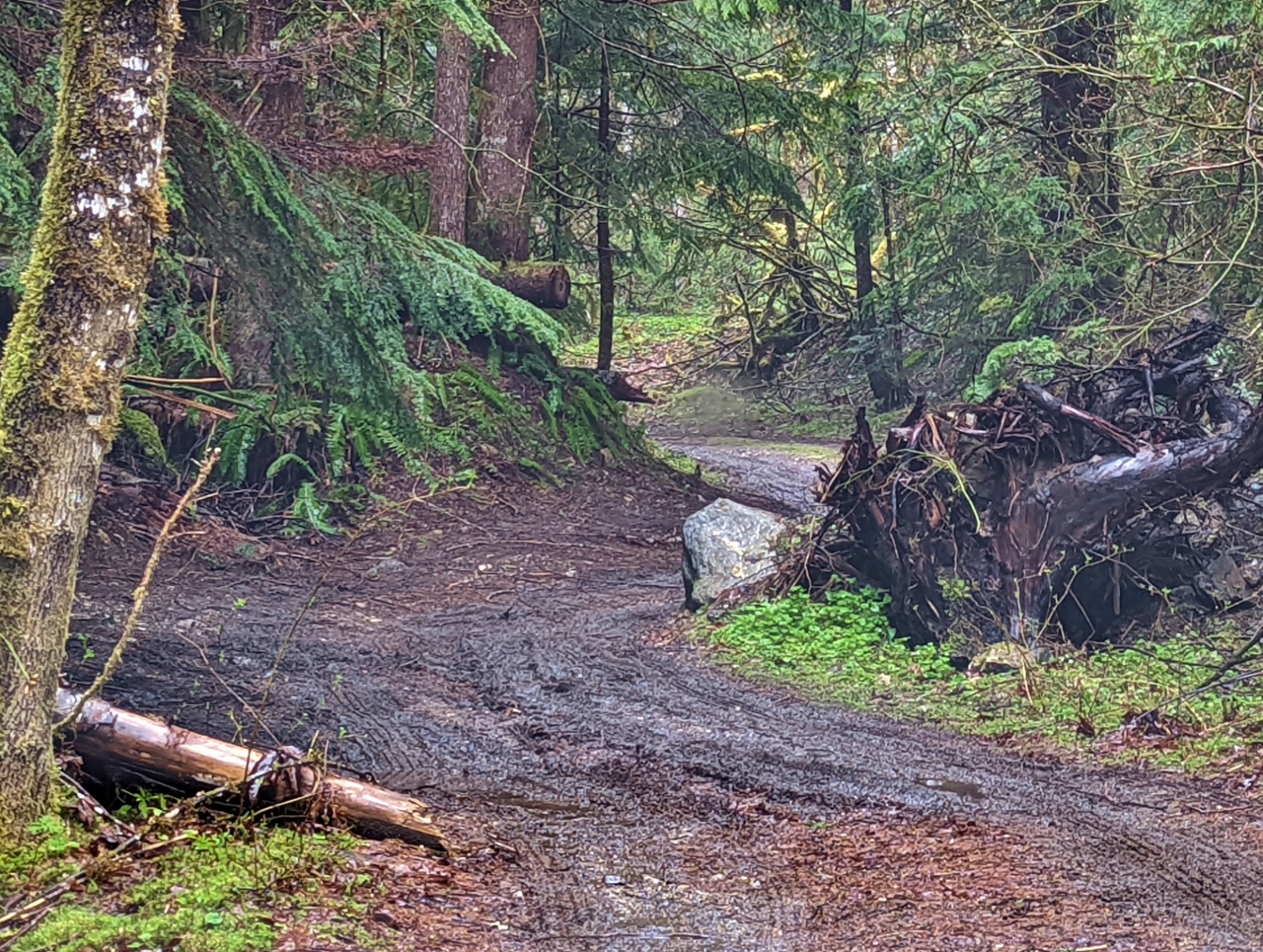
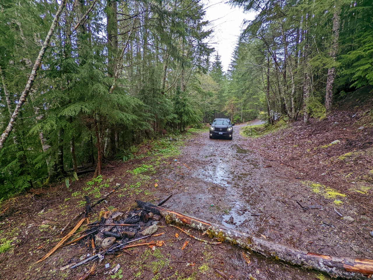
Fallen Trees
Position: 47°48.75’N, -121°17.74’W
Before heading back to Seattle, we spent the morning exploring the area to scout more campsites for a future visit. We passed several places, such as this one on NF-6550, where the Forest Service had cleared recently fallen trees that were blocking the road.
|
 |
Road Closed
Position: 47°49.04’N, -121°17.83’W
A short distance past the cleared trees, NF-6550 was temporarily closed due to more fallen trees.
|
 |
Campsite 1
Position: 47°51.35’N, -121°18.70’W
This elevated campsite off the main road, NF-65, doesn’t have the expansive view of last night’s spot, but we still like it and may return to it.
|
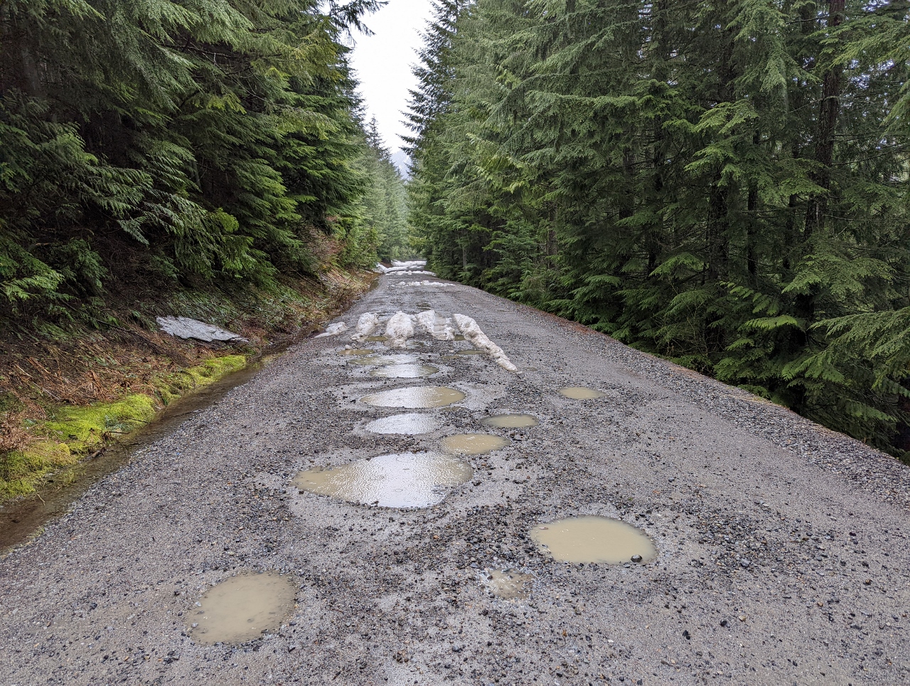 |
Potholes
Position: 47°52.46’N, -121°19.33’W
Potholes, some quite large, are common along the Forest Service roads. The puddles make it difficult to gauge depth, so we need to proceed slowly.
|
 |
Snow
Position: 47°52.58’N, -121°19.43’W
It’s mid-May, but even as low as elevation 2,582 ft (787 m) the road is snow-covered at Jack Pass. We have all-wheel drive and reasonable ground clearance, but the snow here is getting deep enough that we don’t want to take the chance of getting stuck.
|
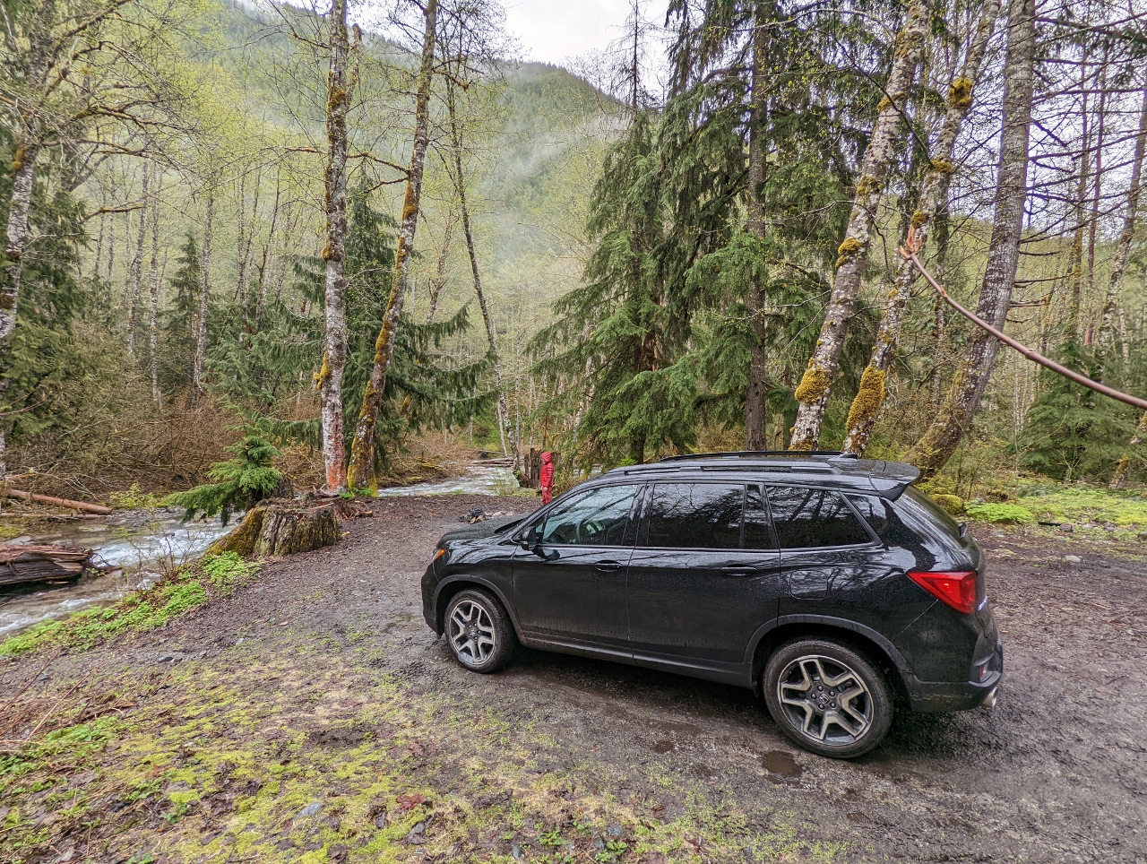 |
Campsite 2
Position: 47°48.70’N, -121°17.74’W
We returned back down NF-65 to explore in the other direction. The truck that was parked at the site we’d seen earlier along the Beckler River had departed, so we drove down to it. We generally prefer higher elevation sites that are drier with more expansive views, but this one with the river running alongside it was absolutely beautiful, and we hope to return.
|
 |
Campsite 3
Position: 47°48.77’N, -121°15.11’W
Another excellent secluded campsite, this one above the Rapid River and accessible down a short spur road off NF-6530. It’s a very nice spot with a good view of the river, but quite muddy.
|
 |
Rock
Position: 47°48.80’N, -121°15.16’W
Looking back along the spur road from the campsite along the Rapid River. That large rock extends into the road more than it appears, and we had to drive pretty close to it as we worked around the bend.
|
 |
Traffic
Position: 47°49.21’N, -121°14.17’W
A large group was camped along Rapid River just off NF-6530. We’d generally not seen much traffic in the area, but passed several cars heading to that site.
|
 |
Campsite 4
Position: 47°47.25’N, -121°15.75’W
A nice site along NF-6520 with a decent mountain view.
|
 |
More Snow
Position: 47°46.94’N, -121°15.04’W
Passing through snow at altitude 2,687 ft (819 m) along NF-6520. The road was clear beyond the corner, and the snow wasn’t too deep, so we proceeded.
|
 |
Campsite 5
Position: 47°47.50’N, -121°15.95’W
An awesome campsite along NF-6520 with an even better view than the previous one. At altitude 2,814 ft (858 m), snow blocked the road a short distance beyond, so we returned back down.
|
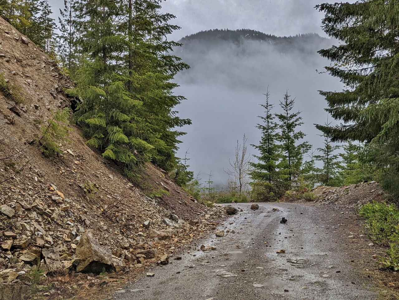 |
Rockslide
Position: 47°47.27’N, -121°15.51’W
Returning down NF-6520 past a rock slide area. These roads definitely require some care to navigate.
|
 |
Campsite 5
Position: 47°47.18’N, -121°16.90’W
Another potential campsite down a short spur road off NF-6520. It didn’t have a view, but was a nice secluded spot, tucked away from the main road.
|
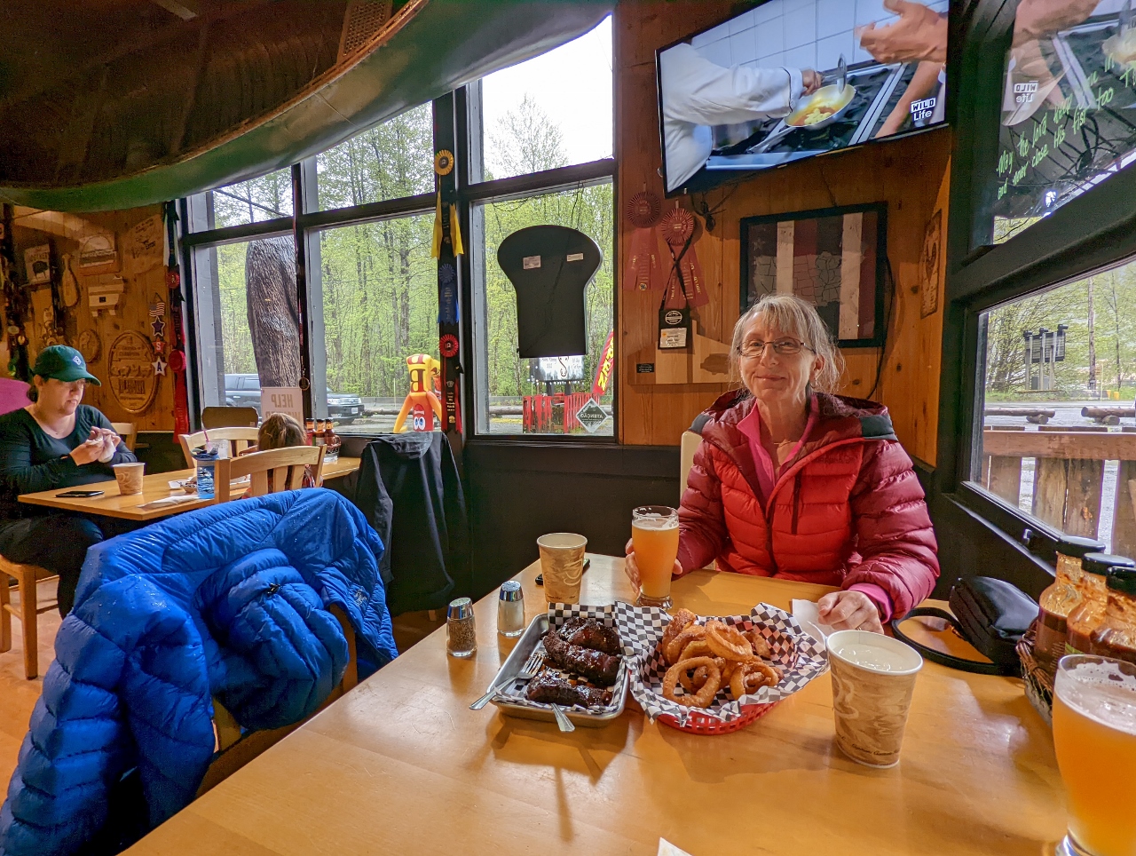 |
Smokey’s Restaurant and Brewery
Position: 47°42.72’N, -121°21.62’W
Back at Smokey’s Restaurant and Brewery for another good lunch, this time after a morning of scouting campsites rather than snowshoeing.
|
 |
Click the travel log icon on the left to see these locations on a map. And a map of our most recent log entries always is available at mvdirona.com/maps. |
I am doing some reading about camping on the river and came across your site. What a lovely travel log – both an inspiration for my future travels and for how to document them!
Our goal with blogging is to share some of the techniques and products we use to make travel more enjoyable and some of the locations we have particularly enjoyed. It’s a bit of work so there is nothing more rewarding for us than hearing from someone like yourself. Thanks for taking the time to leave a comment.