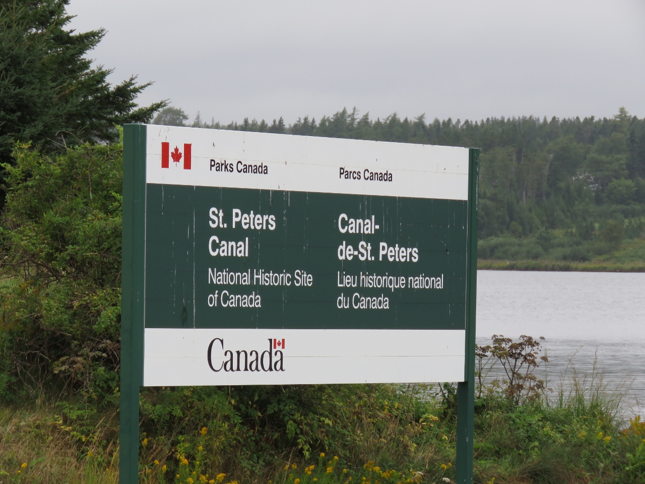
St. Peters Canal, built in 1869, connects the south end of Bras d’Or Lakes with the Atlantic Ocean. In most locks, the water flow is unidirectional, with one side always being higher than the other. The typical doors close into the shape of a ‘V’, with the point of the ‘V’ oriented upstream. But Bras d’Or Lake also connects to the Atlantic Ocean at the north end via Great Bras d’Or Channel where we entered and because the ocean tide levels are different at the two entrances, sometimes the lake is lower than the Atlantic and sometimes it is higher. As a result, St Peters Canal is the only one in North America to require double gates to handle the bidirectional water flow.
Trip highlights from September 8th and 9th, 2016 on Cape Breton Island, Nova Scotia follow. Click any image for a larger view, or click the position to view the location on a map. And a live map of our current route and most recent log entries always is available at http://mvdirona.com/maps
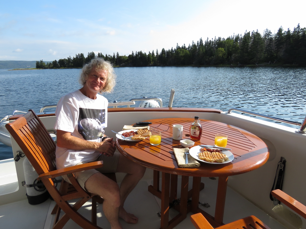 |
Breakfast
Position: -61 5.45, 45 45.21
Waffles and bacon for breakfast in the tranquil Crammond Islands. Real maple syrup is one of the few products we’ve either not been able to find outside North America, or was crazy expensive, so we’re enjoying having it again.
|
 |
Hydraulic Fluid Leak
Position: -61 5.44, 45 45.21
We found a small amount of water and what looked like hyraulic oil in the forward bilge. We chased down the hydrualic oil leak to a weeping O-ring at the forward isolation valve and replaced it.
|
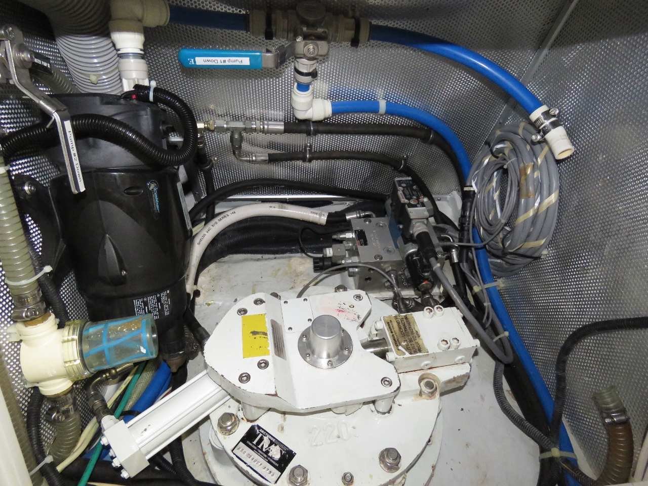 |
House Water Pump
Position: -61 5.44, 45 45.21
After fixing the hydrualic fluid leak, we traced the freshwater leak to a minor leak in the house water pump at the shaft seal. We carry two spares, one already installed that can be put in service by turning a valve and a second in storage. In the picture, we’ve switched over to the backup pump and the primary is out for warranty service.
|
 |
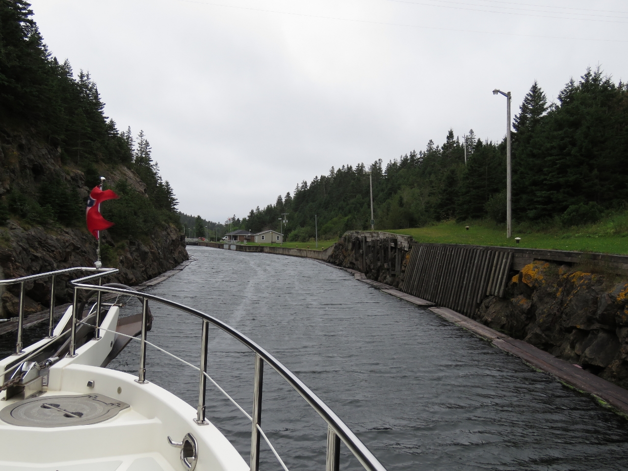
St. Peters Canal
Position: -60 51.99, 45 39.47
A video of us transiting the St. Peters Canal showing the bridge opening and the lock operating is at https://youtu.be/o463FzkpRPg. Both lock doors are swung closed in the video, but only the door with the ‘V’ facing the higher water is actually being used.
|
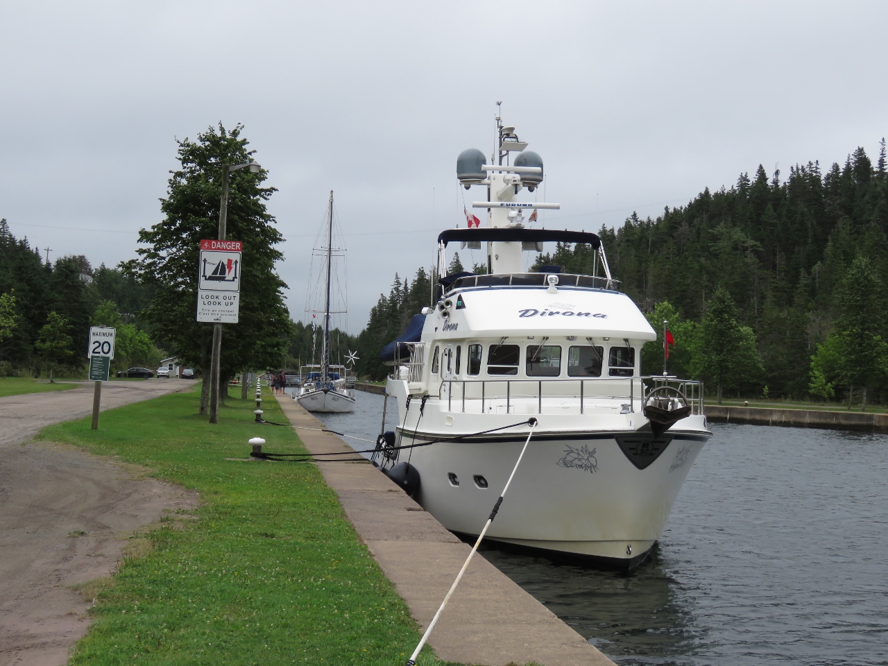 |
Moored
Position: -60 52.20, 45 39.15
Tied off for the night outside the locks. The bollards ashore are a good fifty feet apart, so we’re using our 75ft lines fore and aft. We don’t use those lines much, but they have come in very handy on a number of occasions, such as med-mooring to fuel in the Marquesas Islands.
|
 |
Tim Hortons
Position: -60 52.59, 45 39.33
We’ve not seen a Tim Hortons store for a long time. Canadian members of Jennifer’s team at Microsoft in Seattle often returned from a visit to Vancouver with several dozen Timbits to share with the other expatriates. Tim Hortons is popular in St. Peters too. We had dinner across the road and were amazed that the drive-through was almost always lined-up, no matter how quickly the cars were processed.
|
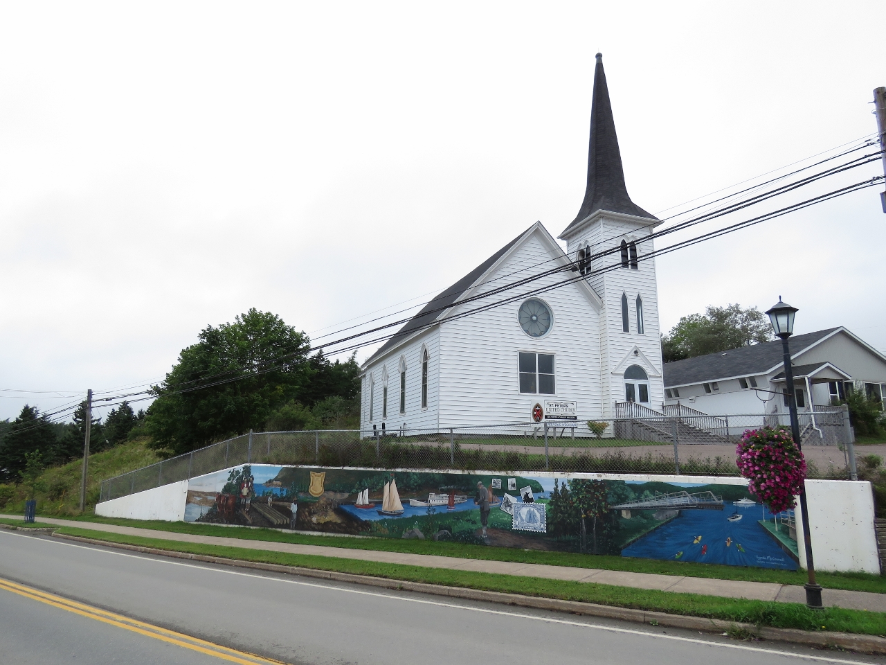 |
St. Peter’s Church
Position: -60 52.78, 45 39.32
How could the church here be called anything else? :) Below the church is a mural showing the canal through the ages from portage, through construction and modern times.
|
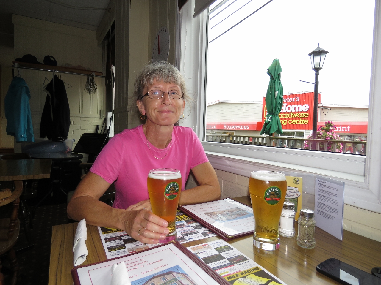 |
MacBouch
Position: -60 52.57, 45 39.34
Moosehead beer at MacBouch and a good pizza for dinner later. Moosehead isn’t exactly craft beer, but the company was founded in Halifax, Nova Scotia, so it’s at least local beer.
|
 |
New Bridge
Position: -60 52.02, 45 39.42
Overlooking the canal from the swing bridge on our walk back to Dirona. A new two-lane bridge is under construction to replace the current single-lane bridge.
|
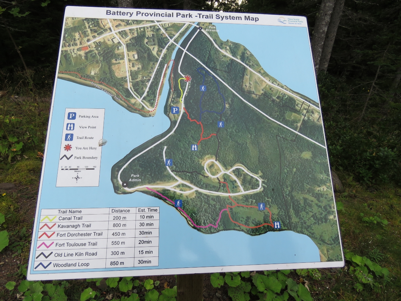 |
Battery Provincial Park
Position: -60 52.09, 45 39.23
Battery Provincial Park has a number of walking trails on the east side the canal. We took the Canal Trail back down to sea level.
|
 |
Timbits!
Position: -60 52.19, 45 39.17
Timbits for breakfast for tomorrow from Tim Hortons. They didn’t all make it to morning.
|
 |
Flybridge
Position: -60 52.19, 45 39.17
We entered the canal on an overcast and windy day. Later in the evening, the winds settled and the sun came out so we had evening coffee and drinks on the flybridge enjoying the canal view.
|

|
Click the travel log icon on the left to see these locations on a map, with the complete log of our cruise.
On the map page, clicking on a camera or text icon will display a picture and/or log entry for that location, and clicking on the smaller icons along the route will display latitude, longitude and other navigation data for that location. And a live map of our current route and most recent log entries always is available at http://mvdirona.com/maps. |
If your comment doesn't show up right away, send us email and we'll dredge it out of the spam filter.