
One of our reasons for stopping at Guysborough was to visit the award-winning Rare Bird Pub, one of Nova Scotia’s many excellent craft breweries. After passing through the narrow entrance channel, we found good anchorage in Guysborough Harbour just off the pub and the public dock. We of course stopped in at the Rare Bird for lunch, but also spent a good part of the day exploring the attractive town, including visiting their museum, walking the Shoreline Trail and taking a dinghy tour of the harbor.
Trip highlights from September 9th and 10th 2016 in Guysborough, Nova Scotia follow. Click any image for a larger view, or click the position to view the location on a map. And a live map of our current route and most recent log entries always is available at http://mvdirona.com/maps
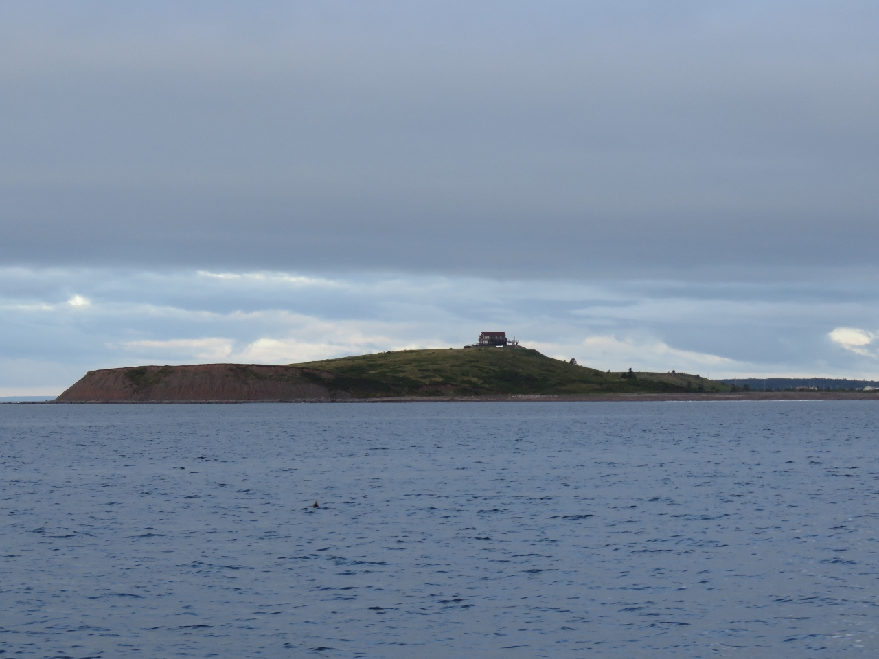 |
Petit de Grat Island
Position: -60 54.54, 45 29.36
This hilltop house on Petit de Grat Island was surrounded in deck and had an awesome 360-degree view.
|
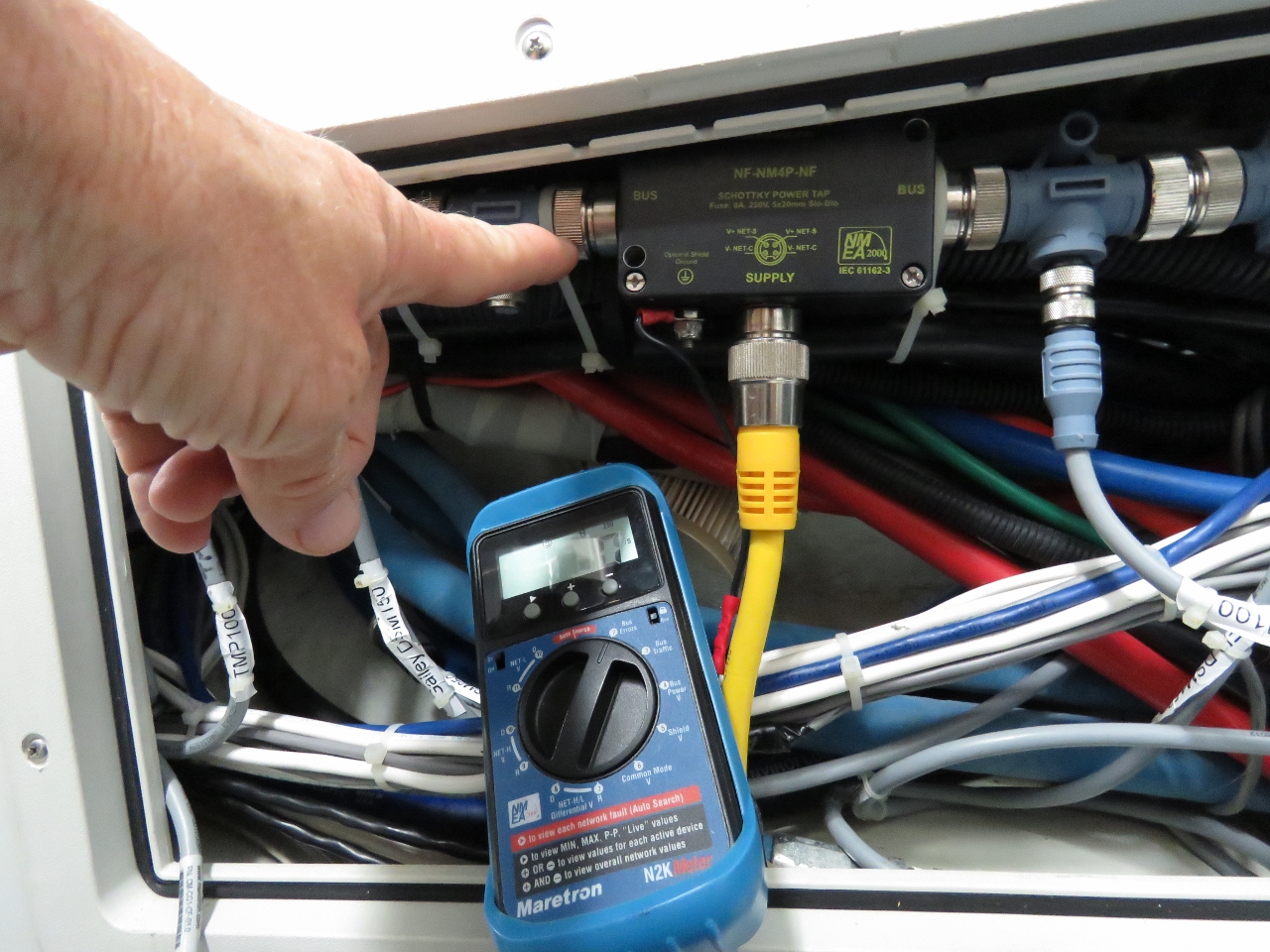 |
Loose Connection
Position: -60 58.45, 45 28.04
The fuel levels and start battery voltage disappeared from our Maretron N2KView display and the N2KMeter and showed a high number of NMEA errors. Interestingly, our Maretron DSM150 display in the engine room still was showing the fuel levels. We traced the problem down to a loose connection, where James is pointing, between a tee and the left side of the engine room N2k power inserter. After tightening it, we saw no errors for hours after so this problem appears resolved. We did retest the failed DSM250 display, as it plugs into the bus at the same area, and it still produced a large number of errors. So we just had two independent issues. Both problems were resolved quickly with the N2KMeter. For larger NMEA 2000 networks it’s a great way to save time.
Update: We later took out the “faulty” DSM250 that was producing all the bus errors and it tested out fine. The problem cause was a poorly fabricated field installable cable between the main bus and the DSM250 producing the errors. That is two connection problems in the last 6 months. One a loose knurled connection between a Tee fitting and the power lower inserter and the other was this bad drop cable. Good news across the board. |
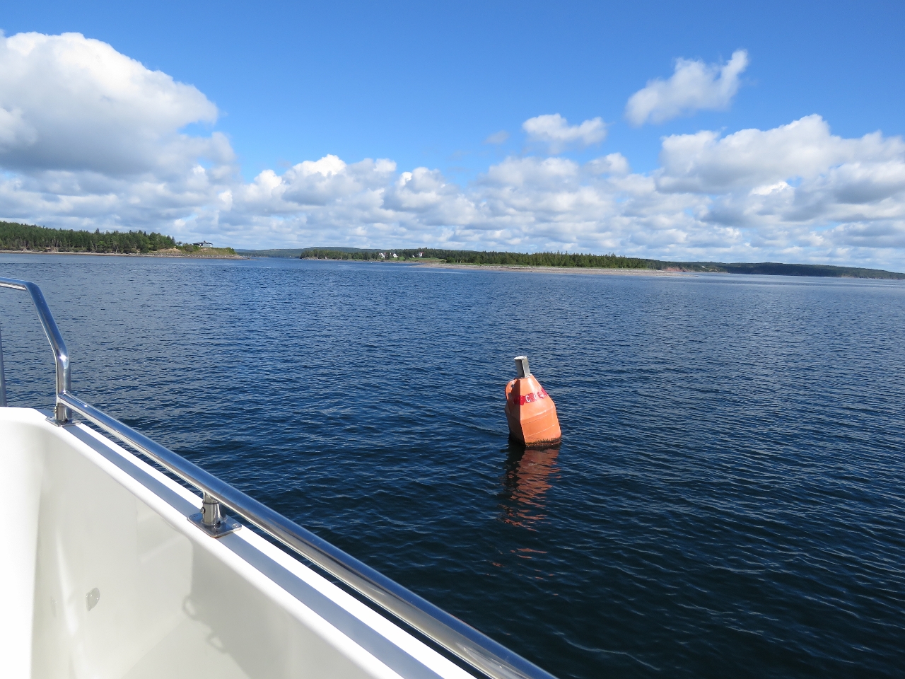 |
Entry Channel
Position: -61 29.38, 45 22.69
The entrance to Guysborough Harbour is a narrow channel that we’d read can run at two knots a couple of hours after high water. About a half-hour after low water at Guysborough on an exchange from 3.3ft down to 1.5ft the current was ebbing slightly, but was hardly noticeable.
|
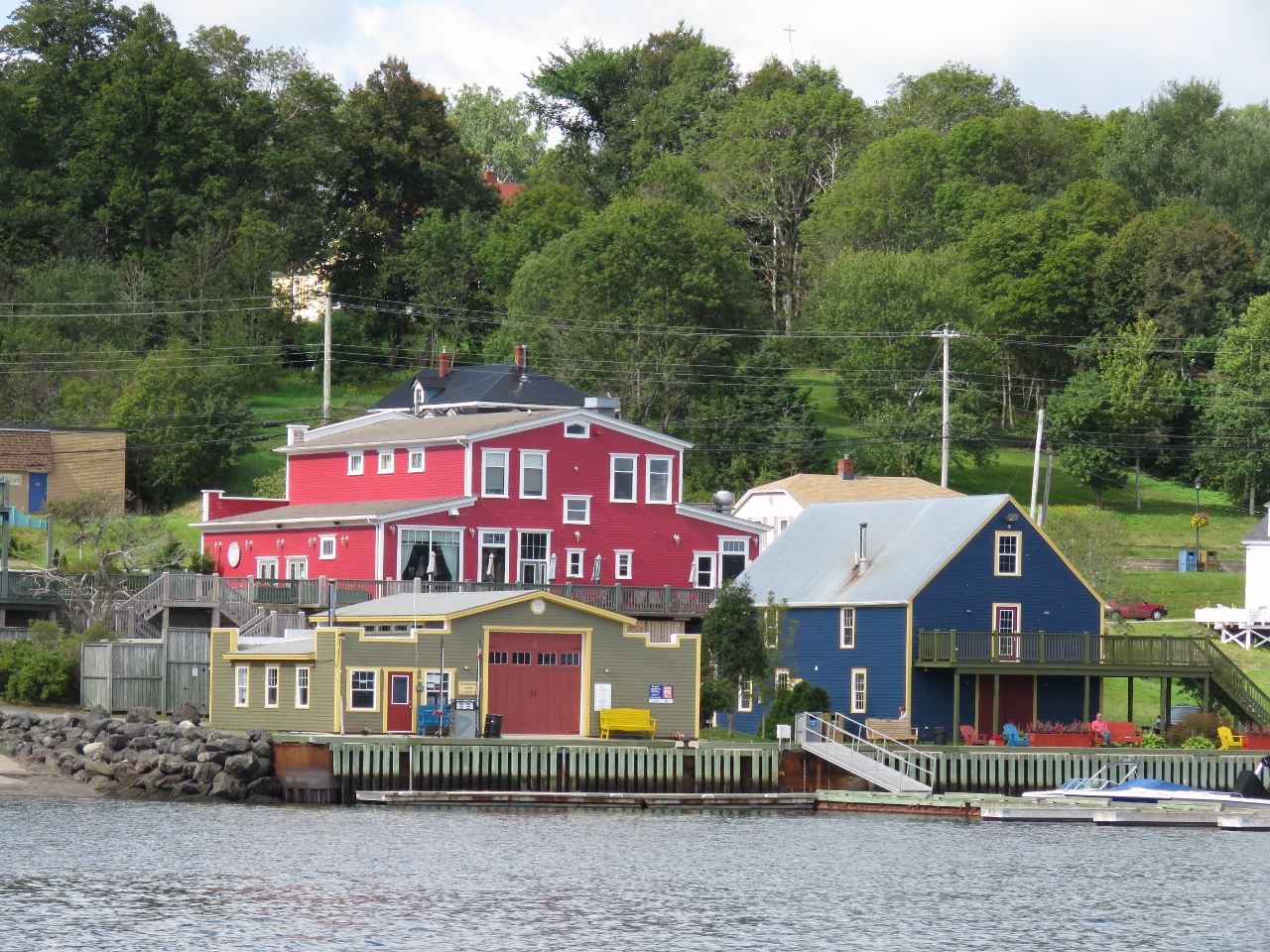 |
Guysborough
Position: -61 29.69, 45 23.57
Looking to the Guysborough waterfront as we approach. The large red building is the award-winning Rare Bird Pub, one of our reasons for visiting Guysborough.
|
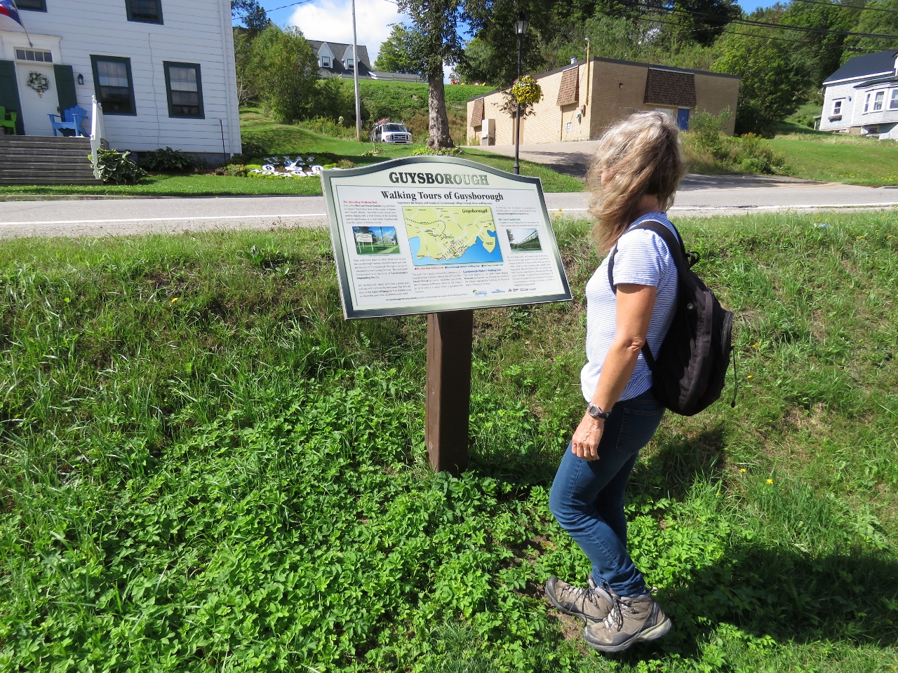 |
Walking
Position: -61 29.88, 45 23.48
Guysborough has lots of walking trails, including the 26km Guysborough Trail, part of the Trans Canada Trail between Victoria BC and St. John’s Newfoundland. We weren’t up for a huge hike, so we opted for a walking tour through town.
|
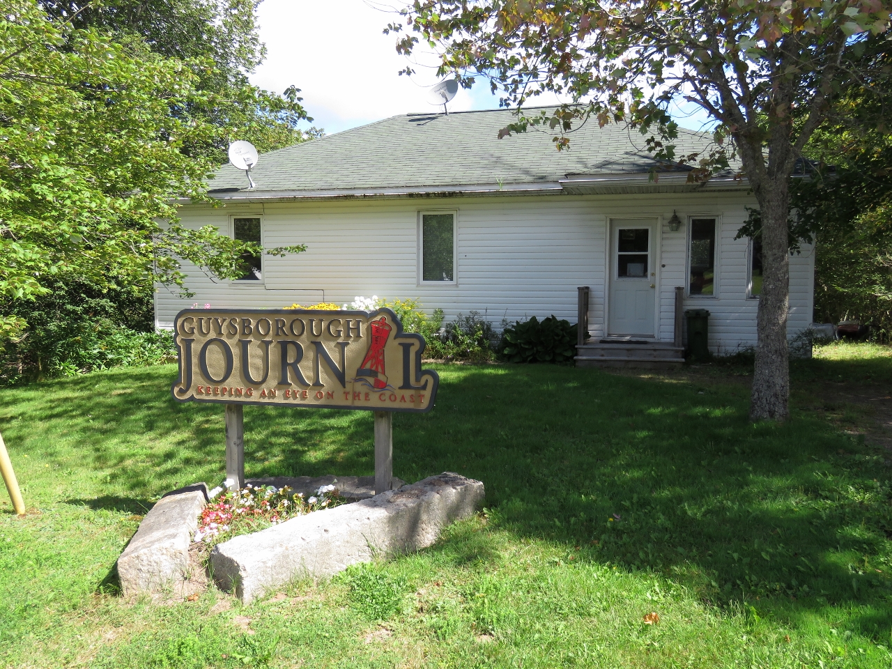 |
Guysborough Journal
Position: -61 29.83, 45 23.41
We liked the Guysborough Journal slogan: “Keeping an Eye on the Coast”.
|
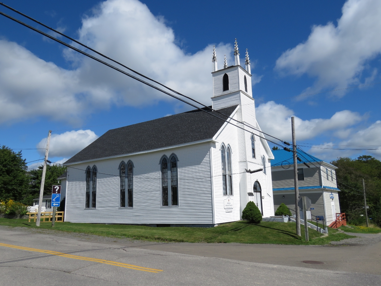 |
Wesley United Church
Position: -61 30.01, 45 23.42
Wesley United Church is one of perhaps six churches we passed while taking a short walk around Guysborough. That’s a lot of churches for one town. This is one of several located on appropriately named Church Street.
|
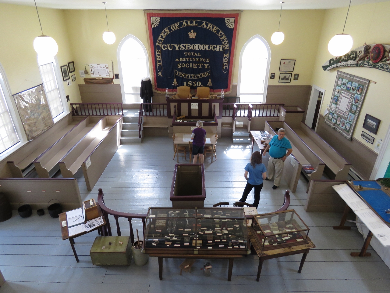 |
Court House
Position: -61 30.04, 45 23.44
The Guysborough Court House was built in 1842 and operated for 150 years. It has been restored as a museum and visitor information center.
|
|
|
Vats
Position: -61 29.87, 45 23.51
Beautiful copper vats in the brewery at the Rare Bird Pub.
|
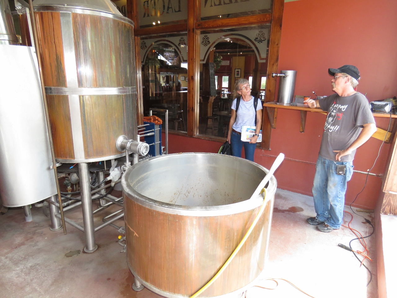 |
Brewmaster
Position: -61 29.89, 45 23.50
The brewmaster saw us with our noses pressed against the glass and invited us inside the brewing area to explain what was being brewed and how. He was making a stout in the foreground vat.
|
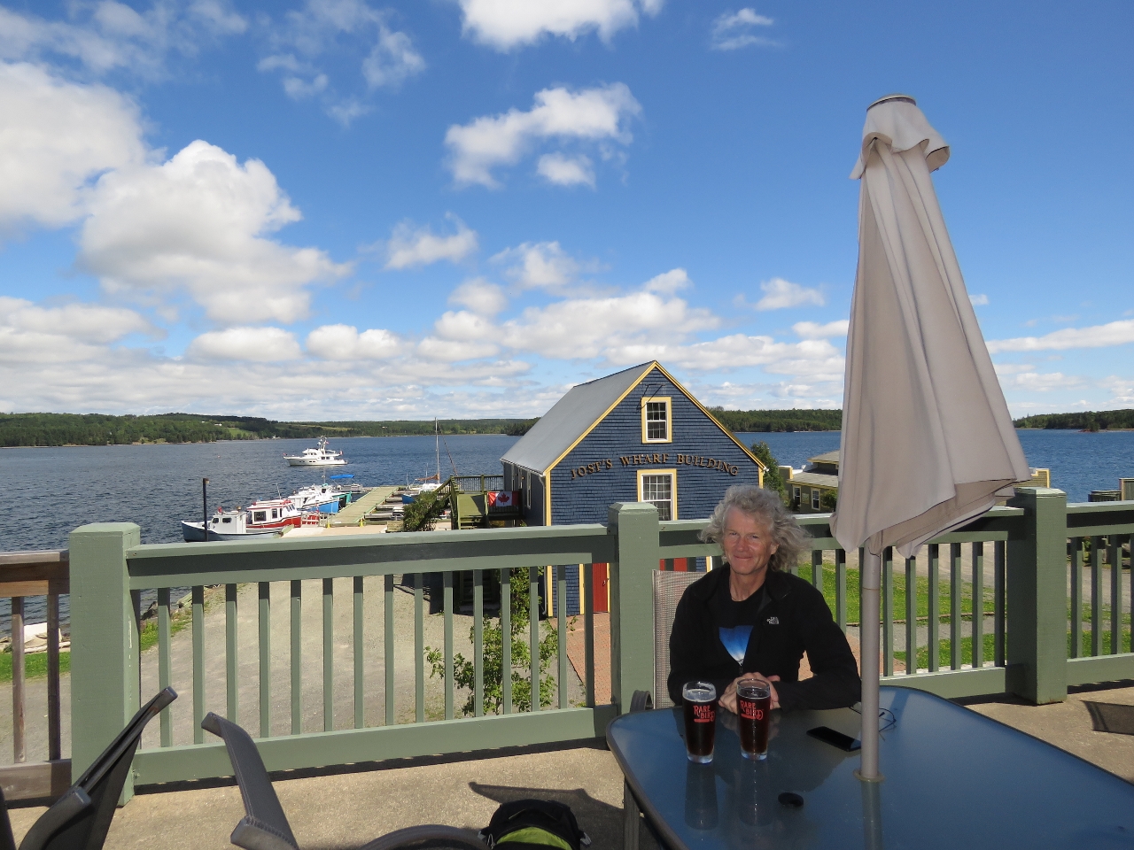 |
Lunch
Position: -61 29.87, 45 23.51
We had a delicious lunch on the deck at the Rare Bird Pub with their excellent craft beer.
|
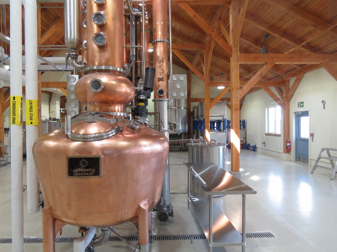 |
Distillery
Position: -61 30.22, 45 24.10
The owners of the Rare Bird Pub, Authentic Seacoast, recently opened a distillery and off-site brewery just north of Guysborough. We walked up to see if we any tours were available. Unfortunately we arrived 15 minutes late for the daily 2pm tour, but we did get a good look at some of the equipment.
|
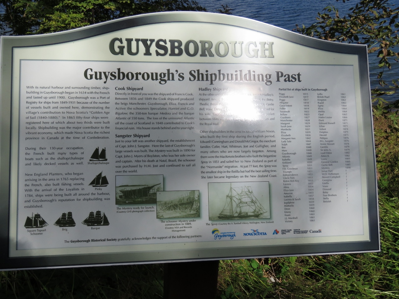 |
Shipbuilding
Position: -61 29.78, 45 23.38
Returning to town, we continued south to walk the Shoreline Trail along the water’s edge. Guysborough was a major shipbuilding center in the late 1800s and a port of registry. Two shipyards were located where we’re standing.
|
 |
Shoreline Trail
Position: -61 29.88, 45 23.29
Looking east to the water across the Shoreline Trail.
|
 |
Rare Bird
Position: -61 29.89, 45 23.51
All that walking is thirsty business, so we returned to the Rare Bird to sample another of their excellent craft beers. This one we had inside as the patio was a little colder and windier than earlier in the day.
|
 |
Guysborough Harbour
Position: -61 31.22, 45 26.44
Out on a dinghy tour to the northern end of Guysborough Harbour.
|
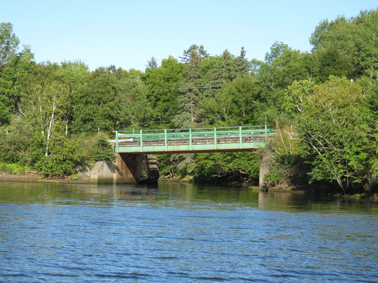 |
Broad Cove
Position: -61 30.40, 45 26.55
We really wanted to get under this bridge, but the water was too shallow.
|
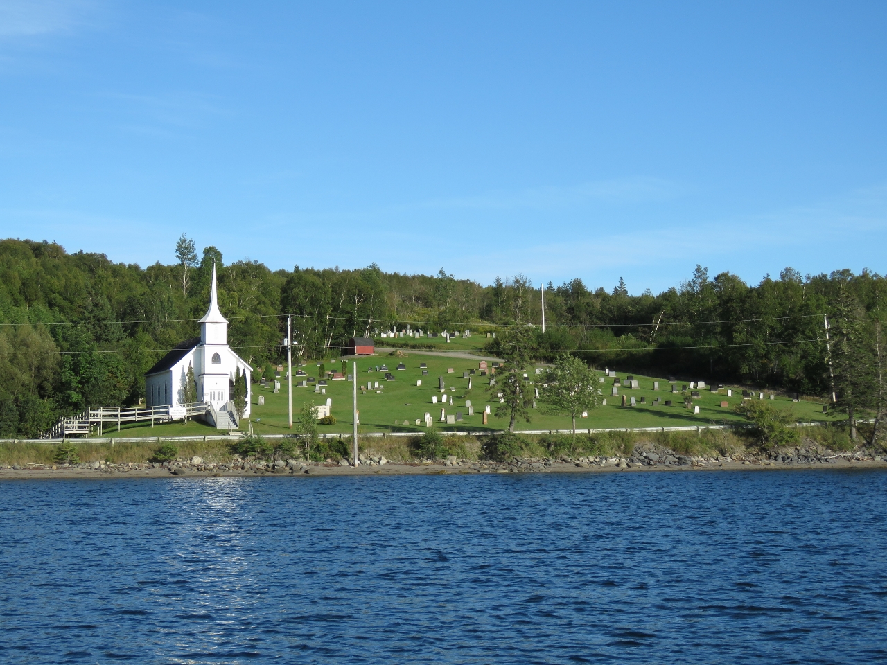 |
Church
Position: -61 30.27, 45 25.82
Another church in the area, with a very large graveyard.
|
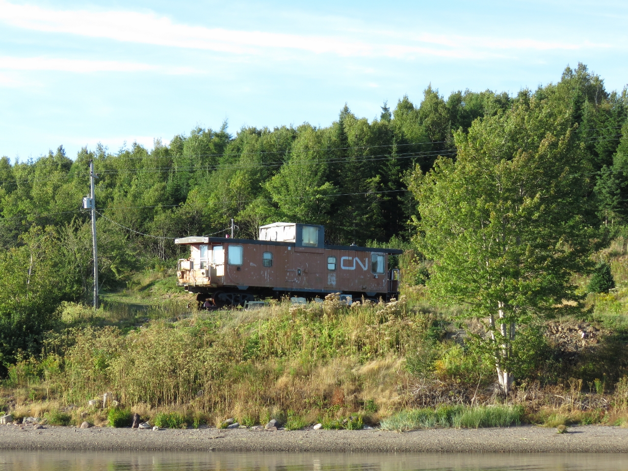 |
Caboose
Position: -61 29.89, 45 22.88
Someone had transported a caboose to Mill Cove, installed rail tracks to support it, and made a residence overlooking the water. It’s super-interesting trying to figure out how they got the caboose there. The caboose is sitting on tracks, but they don’t connect to anything and it’s too far for a crane reach from the water or the road.
|
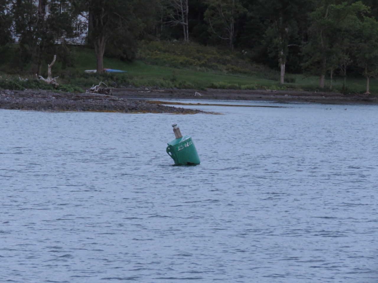 |
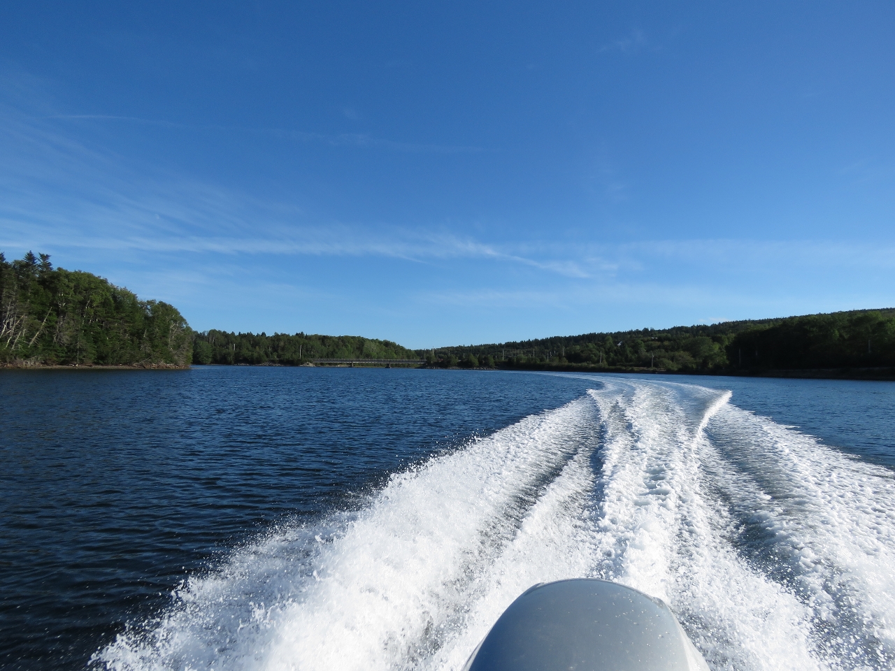
Current
Position: -61 29.33, 45 22.84
We exited Guysborough Harbour about a half-hour before low water on an exchange from 3.3ft to 1.5ft. The navigation buoys were leaning slightly in the current, but as with the entry, we hardly noticed the water motion.
|
 |
Tight
Position: -61 29.31, 45 22.57
You can see how tight the channel to Gusyborough Harbour is. We need to pass between shore and the red buoy on our port side.
|

|
Click the travel log icon on the left to see these locations on a map, with the complete log of our cruise.
On the map page, clicking on a camera or text icon will display a picture and/or log entry for that location, and clicking on the smaller icons along the route will display latitude, longitude and other navigation data for that location. And a live map of our current route and most recent log entries always is available at http://mvdirona.com/maps. |
If your comment doesn't show up right away, send us email and we'll dredge it out of the spam filter.