From Newfoundland we made a 150-nm, 24-hour passage to Bras d’Or Lake in Nova Scotia. In addition to looking for a good weather forecast for the run across Laurentian Channel between Newfoundland and Nova Scotia, we also needed to time our arrival at the entrance channel, Great Bras d’Or. The current at the narrow north end can flow up to 4.5 kts, and wind blowing against current there can generate rough waters. We didn’t see much current through the entry, but as we neared a constricted section farther south our speed picked up three knots to nearly ten knots with visible laminar flow on the water surface. And then we were through and into the calm and sheltered waters of the Bras d’Or Lakes.
Trip highlights from August 28th and 29th follow. Click any image for a larger view, or click the position to view the location on a map. And a live map of our current route and most recent log entries always is available at http://mvdirona.com/maps
 |
Leaving Newfoundland
Position: -57 46.98, 47 22.75
We initially were planning to spend a couple more days in Newfoundland, but the forecast for our planned departure deteriorated this morning so we decided to take today’s good weather instead. We expect 10-15kt westerly winds decreasing to light this afternoon and picking up to southerly 15 late overnight. The winds are forecast to be 25 knots from the south near noon tomorrow and 30 knots by evening, so we want to be through the entrance before then.
|
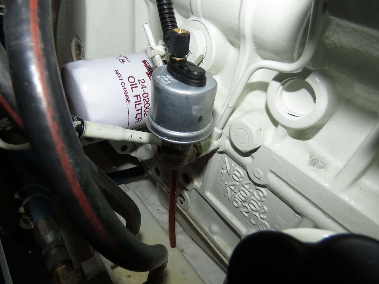 |
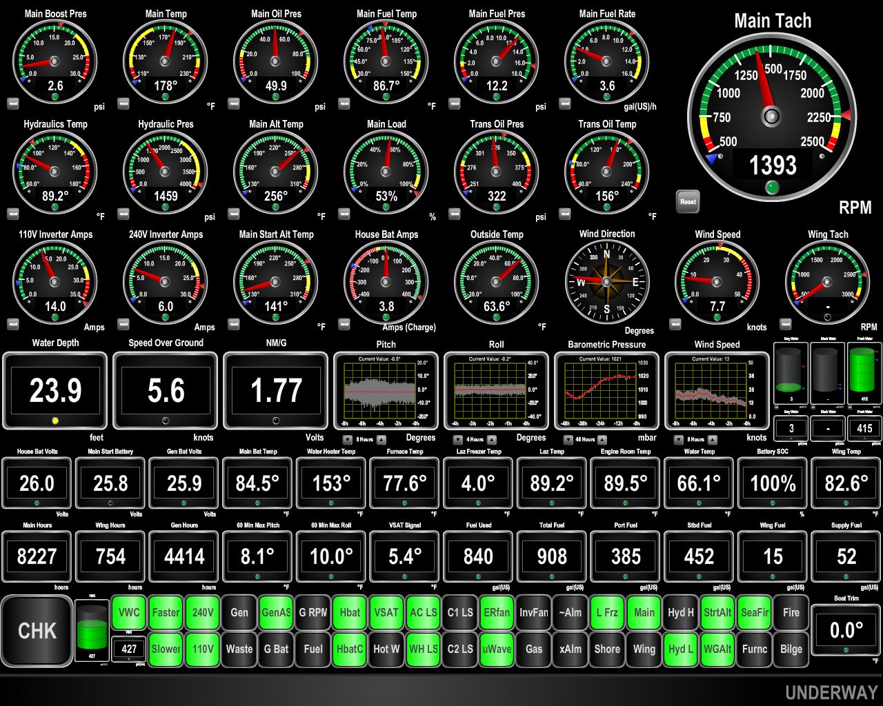
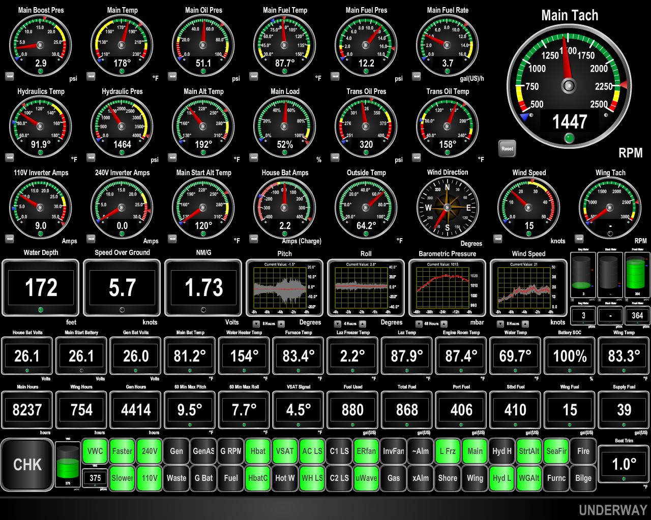
Oil pressure sender
Position: -58 11.92, 47 13.25
With the generator off the oil pressure was reading 32 PSI. It’s easy to test if the problem is the sending unit or the guage and wiring: get a known good ground and ground the oil pressure sending unit wire and the gauge should read 0 PSI. Disconnect that same line and it should read 82 PSI. It did so we know it’s a sending unit problem. Replacing the sending unit is quick and easy, and the oil pressure is now back to reading normally.
|
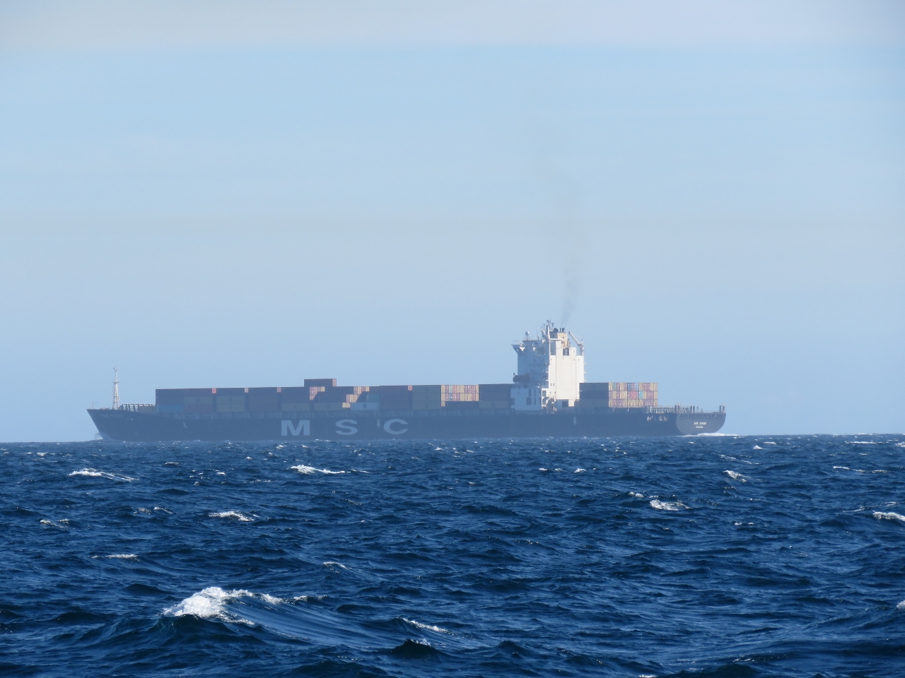 |
MSC Diego
Position: -58 26.65, 47 7.69
Mediterrean Shipping Company (MSC) Diego passing ahead as we enter Cabot Strait. MSC is the second largest shipping in the world measured by TEU (20ft equivalent unit) shipping capacity. As with our northbound crossing, we didn’t see much traffic in Cabot Strait.
|
 |
Conditions
Position: -59 3.35, 46 52.94
We saw steady 20 knot westerly winds for much of the afternoon and were pitching up to 14 degrees. The winds finally have started to settle down and boat motion is reducing.
|
 |
Southwesterly
Position: -60 15.75, 46 23.88
As predicted, the winds increased from the southwest about six hours ago. We’re taking waves pretty much on the bow and pitching motion has increased. Conditions should improve as we near the lee of Nova Scotia and the entry to Bras d’Or Lake.
|
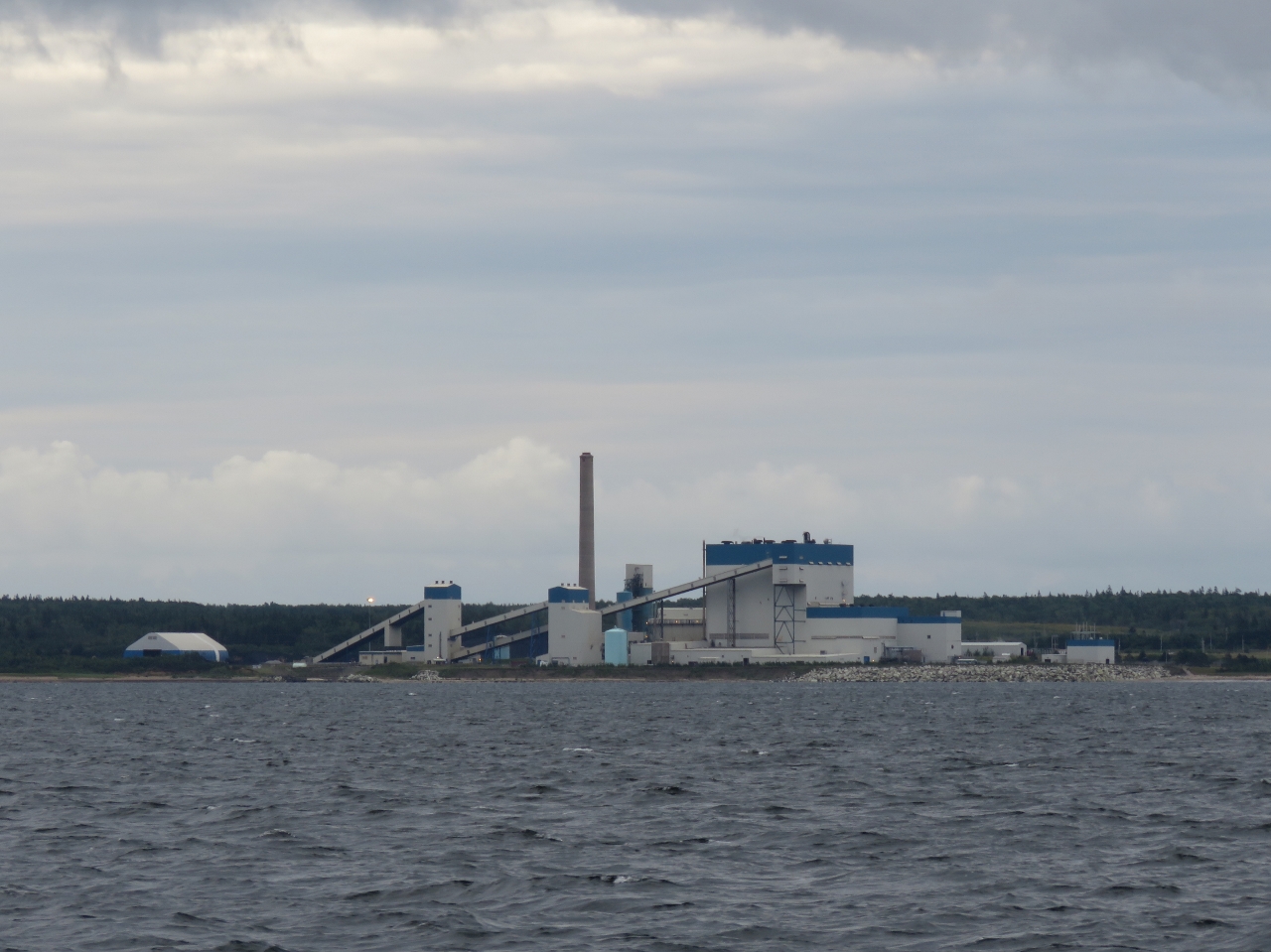 |
Point Aconi Power Plant
Position: -60 20.94, 46 21.31
The Point Aconi Power Plant is a 165MW coal plant operated by Nova Scotia Power Corporation. Seen in the background is a wind turbine. Also in the area is Sydney Mines, a large coal plant. Strobes are on every wind turbine, the two smoke stacks in Sydney Mines and the smoke stack on the power plant. We could see the strobes twenty miles out to sea— the sky was pulsing over quite a wide area.
|
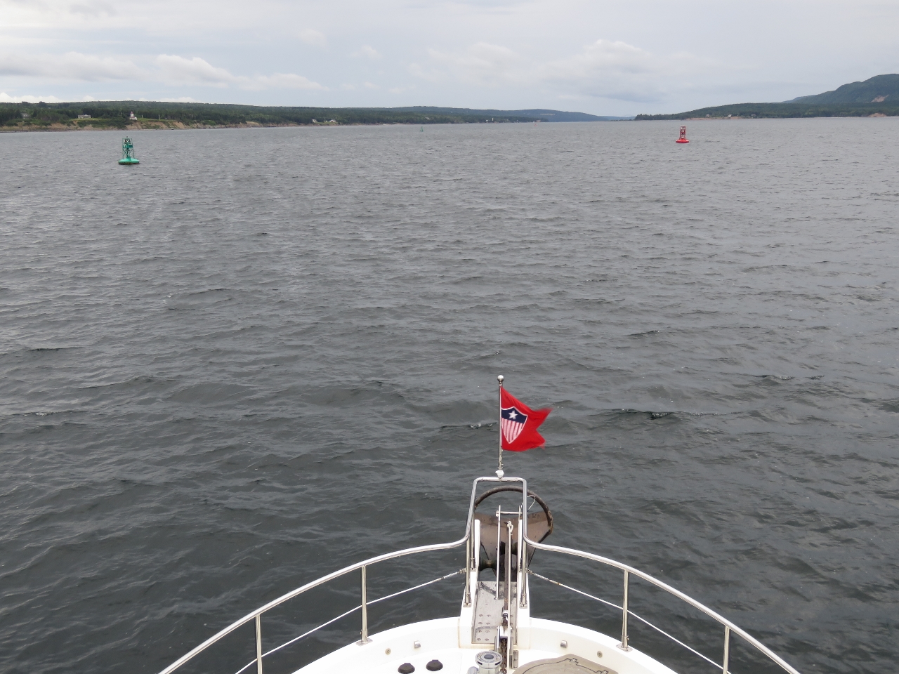 |
Great Bras d’Or
Position: -60 23.10, 46 19.28
We’d timed our arrival into the Great Bras d’Or channel in the last hour of the flood current to avoid fighting an ebb, but not be in so strong a flood current that we’d lose steerage. Also, a strong flood current against the predicted southerly winds can generate rough seas. The precautions seemed unnecessary, as conditions were excellent as we approached the outermost bouys of Great Bras d’Or.
|
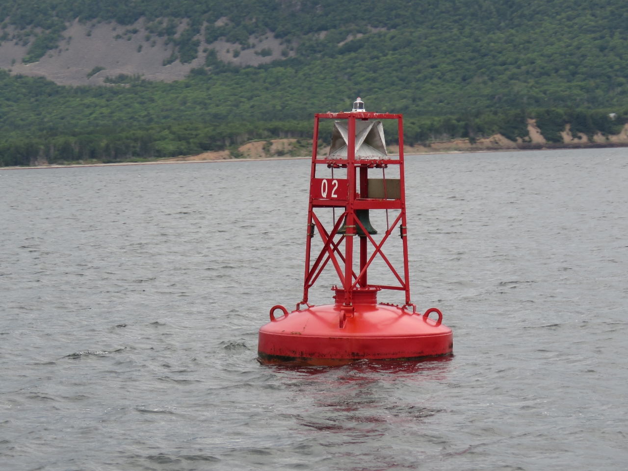 |
Buoys
Position: -60 23.18, 46 19.21
The massive ocean buoys marking the Great Bras d’Or outer entrance indicate that conditions can get pretty rough here.
|
 |
Black Rock Light
Position: -60 23.42, 46 18.95
The lighthouse at Black Rock Point to our southeast.
|
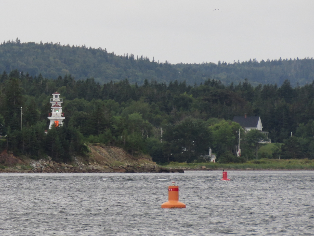 |
Range Markers
Position: -60 23.97, 46 18.36
Range markers where the channel narrows between Noir and Carey points. When the two towers are lined up, as they are in this picture, a boat is on the correct course. If the bottom tower is to the left of the top one, a boat is off course to starboard, and if the bottom tower is right of the top tower, a boat is off course to port. The channel buoys now are smaller inland-sized markers.
|
|
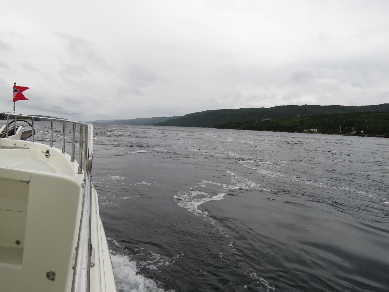
Current
Position: -60 24.82, 46 17.55
We’d not seen much current so far and were thinking that we might have been overly cautious in our planned arrival time. But as we neared the constricted section our speed picked up three knots to nearly ten knots with visible laminar flow on the water surface. The waters beyond were a little rougher with small wavelets, then the current dissipated as the waterway widened.
|
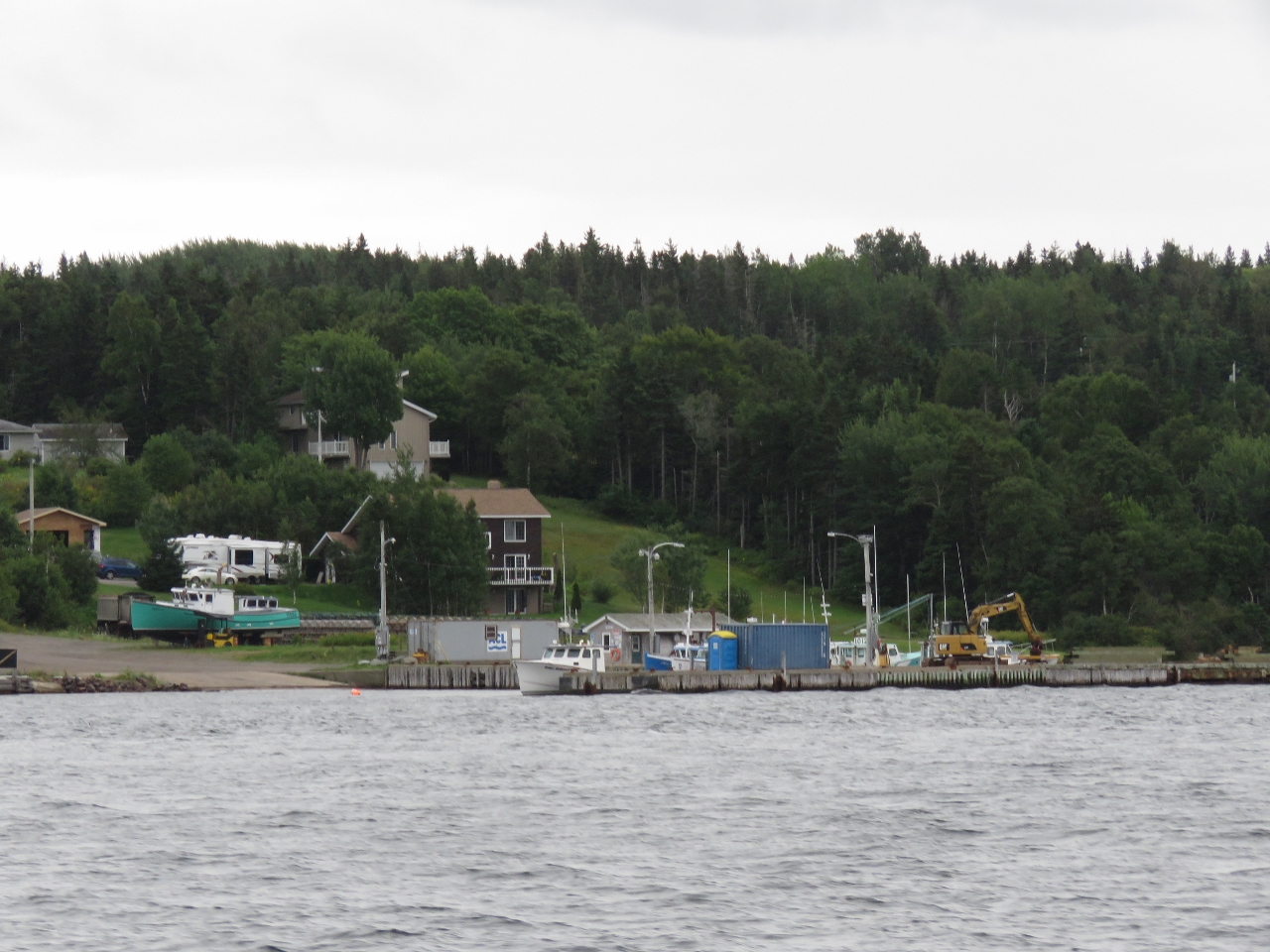 |
Fishboats
Position: -60 25.35, 46 17.24
Fishboats moored at a small marina along the south shore.
|
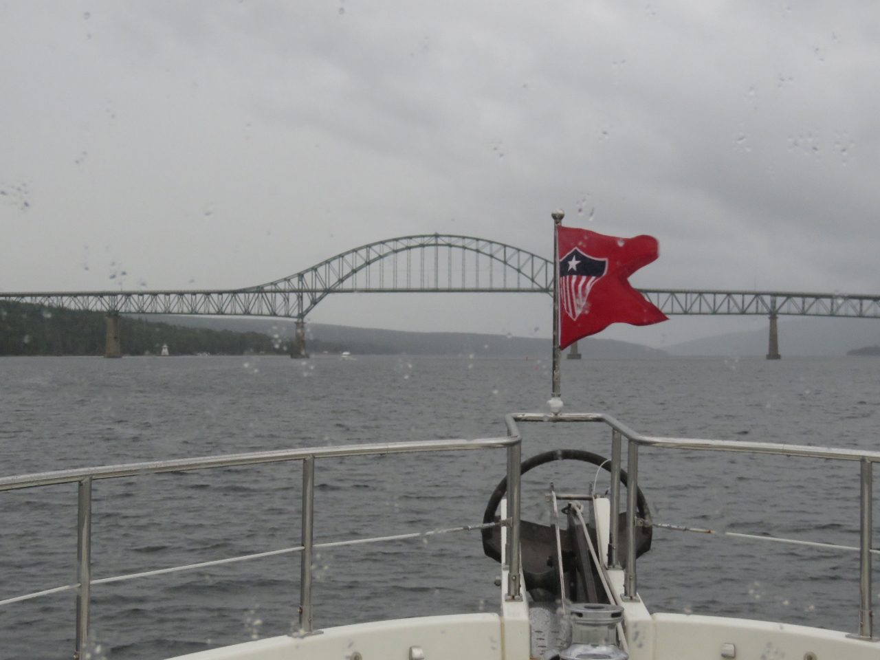 |
Seal Island Bridge
Position: -60 28.84, 46 14.52
Approaching the Seal Island Bridge with rain falling as we continue south through Great Bras d’Or.
|
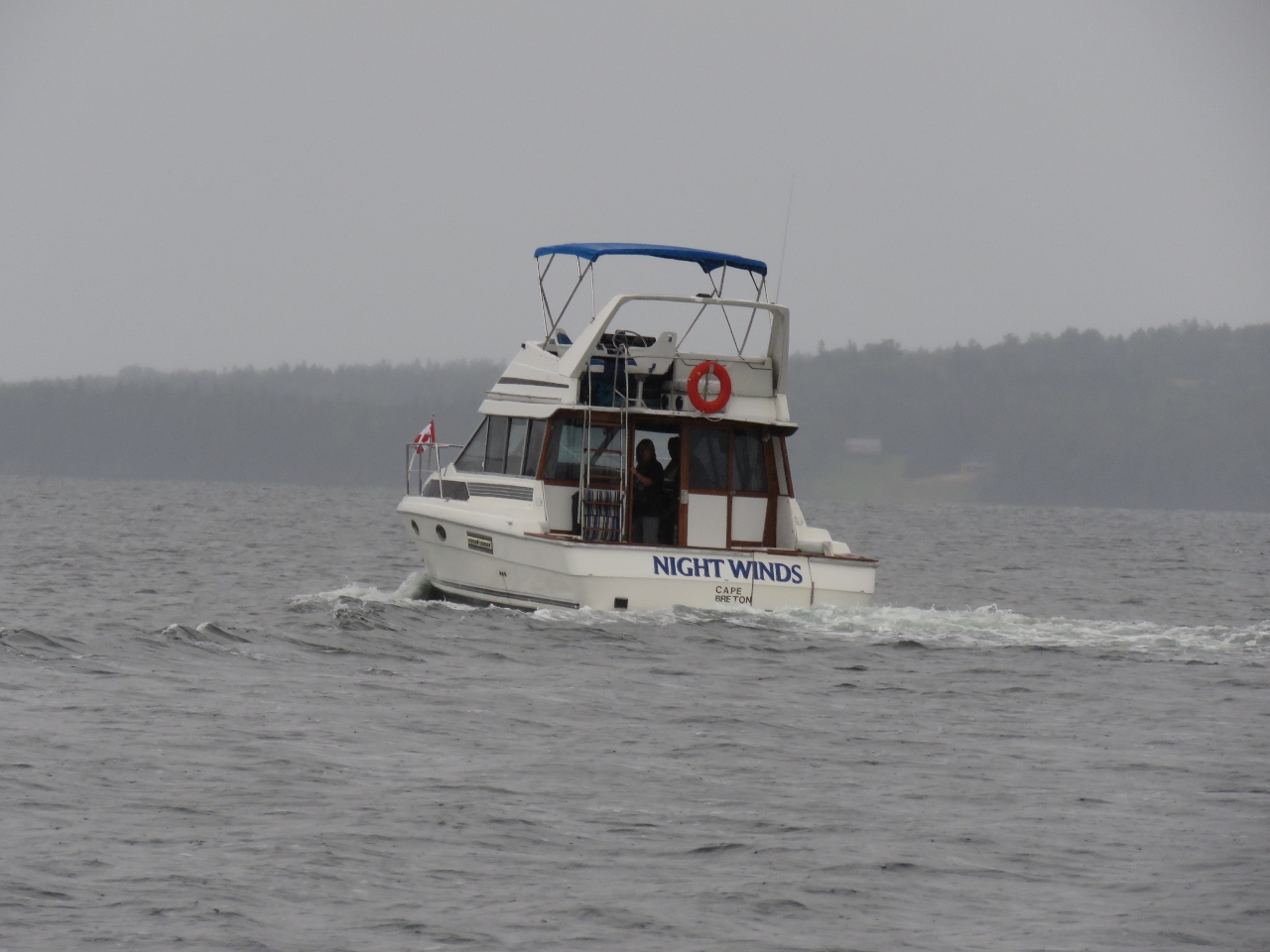 |
Night Winds
Position: -60 29.06, 46 14.29
Night Winds is the first power boat pleasure-craft we’ve seen underway since leaving the Boston area.
|
 |
Click the travel log icon on the left to see these locations on a map, with the complete log of our cruise.
On the map page, clicking on a camera or text icon will display a picture and/or log entry for that location, and clicking on the smaller icons along the route will display latitude, longitude and other navigation data for that location. And a live map of our current route and most recent log entries always is available at http://mvdirona.com/maps. |
If your comment doesn't show up right away, send us email and we'll dredge it out of the spam filter.