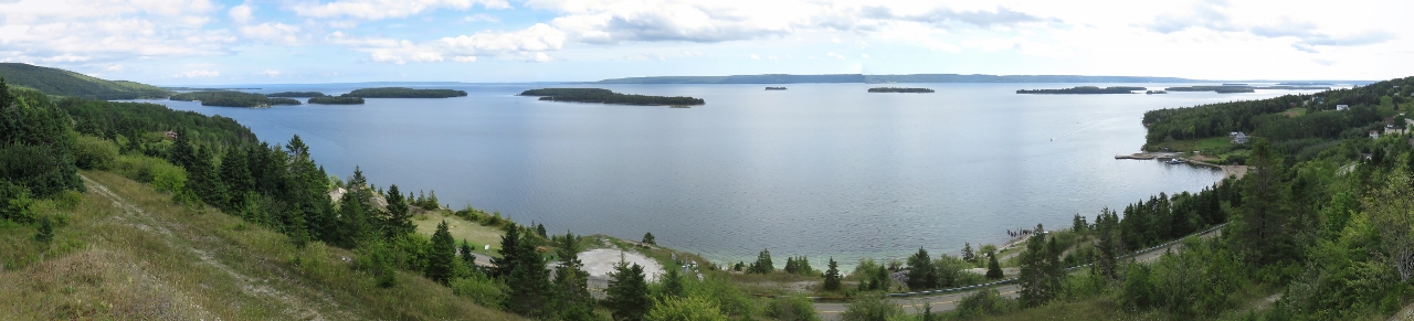
A marble quarry operated at Marble Mountain between 1888 and 1921. When the mine was in operation, several hundred people lived in the area and Marble Mountain was one of the most prosperous towns in Cape Breton. The old quarry dominates the scenery here and has several good viewpoints back into the bay.
Trip highlights from September 7th, 2016 in Cape Breton, Nova Scotia follow. Click any image for a larger view, or click the position to view the location on a map. And a live map of our current route and most recent log entries always is available at http://mvdirona.com/maps
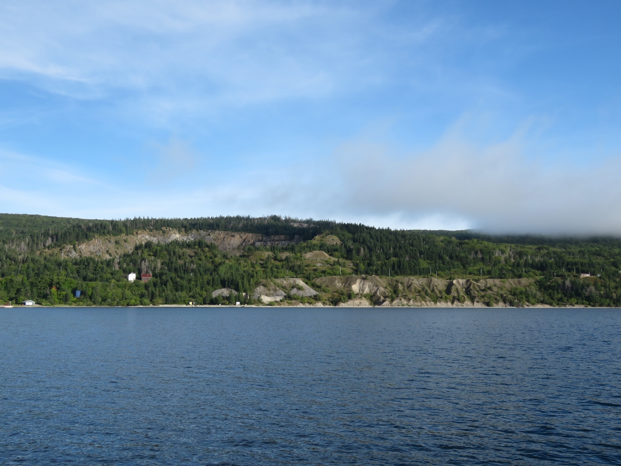 |
Quarry
Position: -61 2.00, 45 49.09
The old quarry is visible at the upper left of the photo. To the right along shore are massive piles of by-product from the crushing and screening process and the transfer of the material to loading wharf that was roughly at the center.
|
 |
Store
Position: -61 2.00, 45 49.09
The large building on the right is an original store from the early 1900s when mining operations were taking place. This is one of only five original buildings still standing.
|
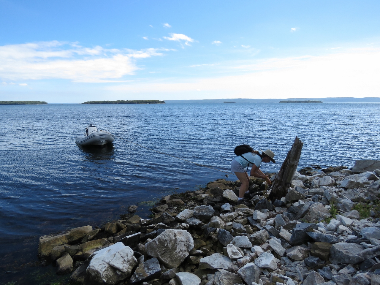 |
Landing
Position: -61 2.33, 45 49.33
We’d tried to land the tender a little farther to the east of this picture, but hadn’t dropped the stern anchor far enough out. When we tried to retrieve it to reset, it had wedged on something underwater and wouldn’t budge. After much back and forth and slackening and tugging, we finally freed it. We tried a different spot and this time the anchor dragged. On the third try, we switched from a Danforth-style anchor to a grapple. That held well and we finally could get ashore. Sometimes even simple tasks require more effort than they should.
|
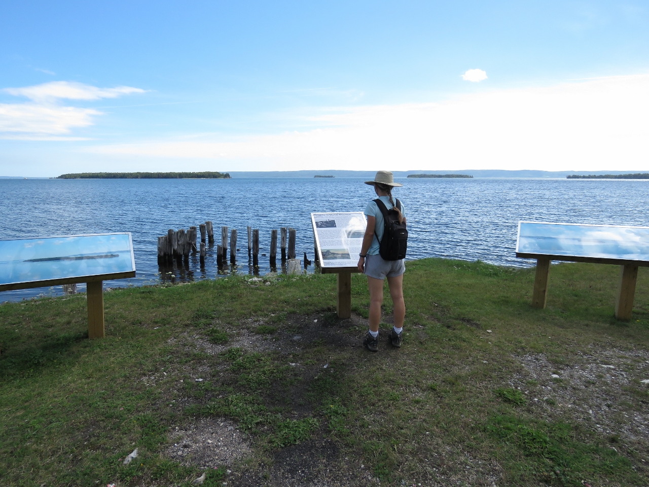 |
Clarke Cove
Position: -61 2.28, 45 49.35
Interpretive signs overlooking Clarke Cove give detail on the area’s history and geography. The pilings visible between the signs are the ruins of the wharf where ships loaded with marble. Dirona is barely visible as a small white speck off the island at the far left of the photo.
|
 |
Lookout
Position: -61 2.22, 45 49.43
We scrambled up the by-product piles to the road. This is the view north from a lookout a little farther along. The old wharf near the interpretive signs is about center of the photo.
|
|
|
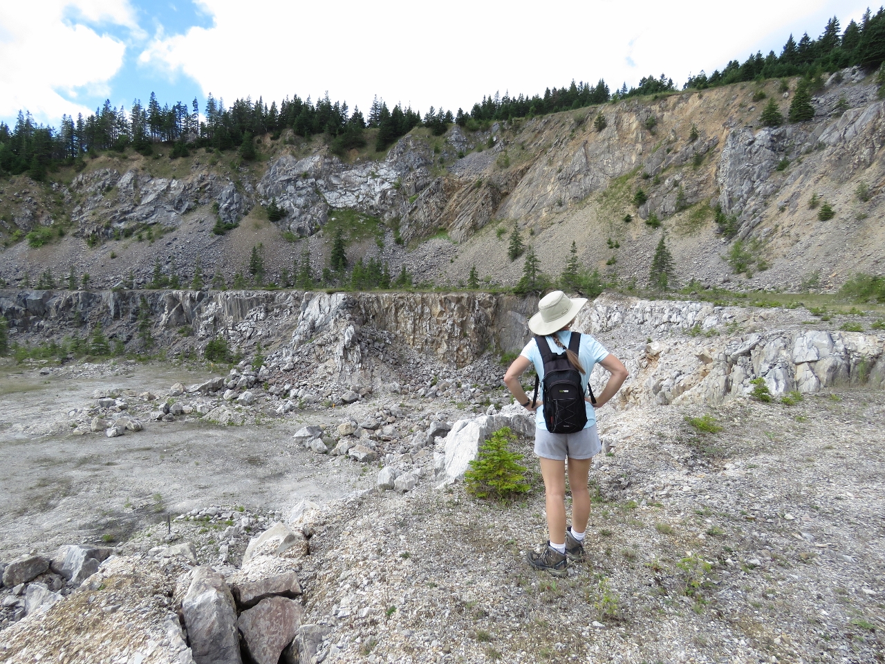
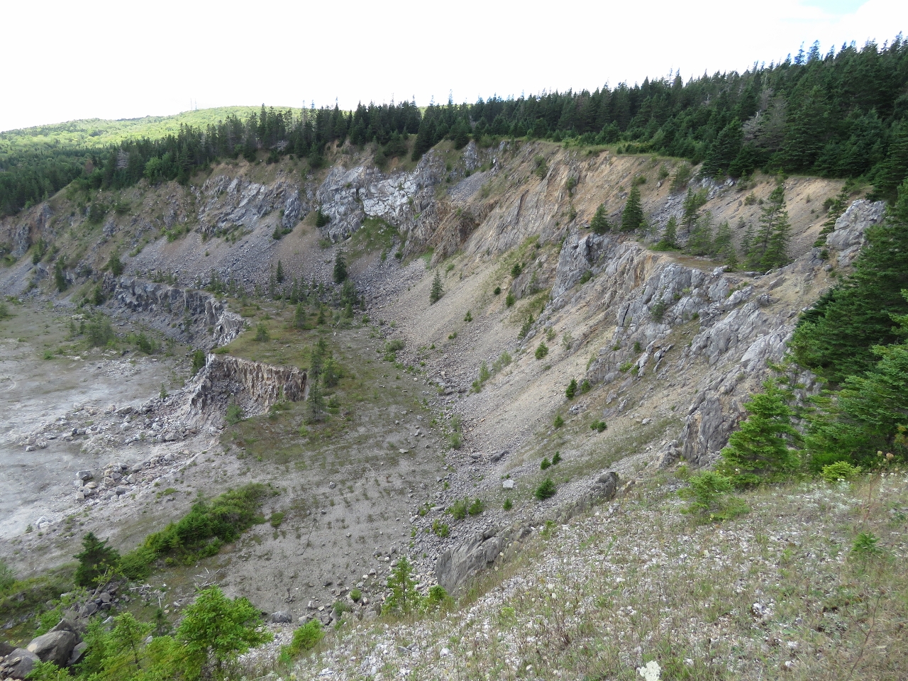
Quarry
Position: -61 2.37, 45 49.50
Standing on the edge of one section of the quarry. Mining seemed to have been done in at least four levels over varying periods. We’re standing at the 2nd level from the top, with a large level below us. The level above us and another level below aren’t visible in the picture. Notice Jennifer is wearing shorts—after a few mornings with temperatures in the 40s, we now are seeing afternoon temperatures in the 80s. Overall the weather has been excellent.
|
 |
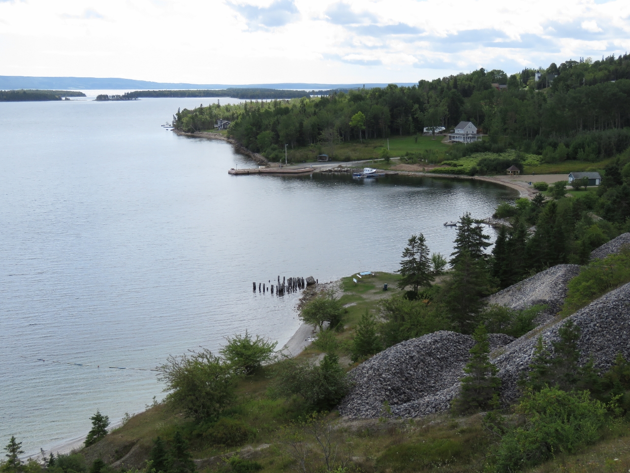
View
Position: -61 2.30, 45 49.46
We popped out to a clearing with sweeping views over Clarke Cove and the surrounding area. The old wharf is visible to the right of center and we’re anchored left of the large island that is slightly left of center. The white patch left of center at the bottom of the picture is the roadside lookout we were at earlier.
|
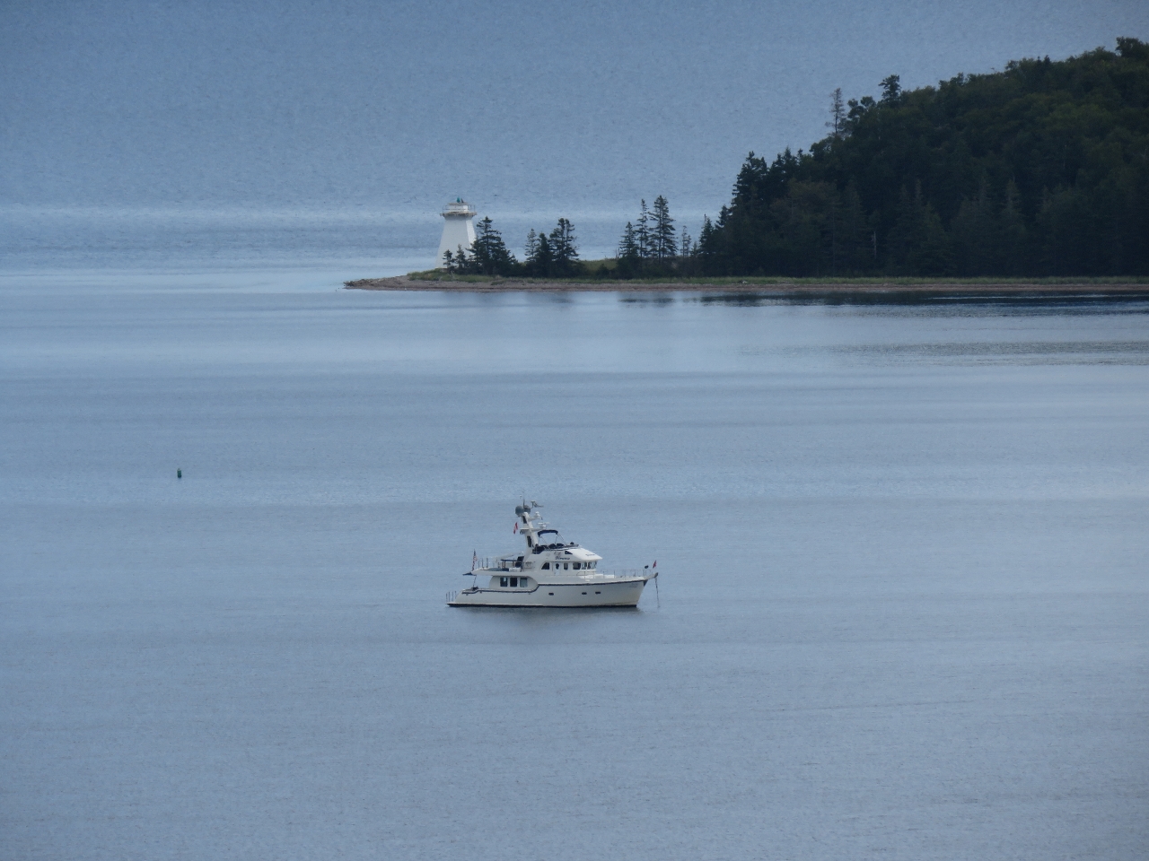 |
Anchorage
Position: -61 2.30, 45 49.46
Our anchorage with the light on Cameron Island in the background.
|
 |
Top Level
Position: -61 2.33, 45 49.55
A path led up to the topmost level of mining operations. This is looking north into the quarry. An impressively large amount of mountain is missing. We were hoping to get farther around to the east side of the edge, but the trail ended in thick woods that we didn’t feel like pushing through.
|
 |
Break
Position: -61 2.32, 45 49.53
Taking a break and enjoying the view to Clarke Cove from the topmost level.
|
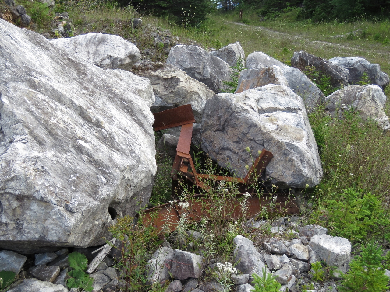 |
Metal
Position: -61 2.39, 45 49.46
We walked back down and into the large flat area that was below us when we first arrived. We were surprised at how little metal debris or anything mechanical was left in the area. This is one of the few pieces of scrap metal we found. A rock had crushed it, so probably it couldn’t be moved or wasn’t worth it.
|
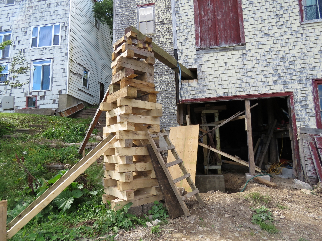 |
Support
Position: -61 2.48, 45 49.28
From the quarry we returned back on the road through the old town area. This is a seaward corner of the old store building that we’d seen from the water. We stopped to chat with the building owner who was deep into a multi-year project restoring the building to be a summer home for his family. Here he is solving a structural problem, where the wood beam supporting the rear south corner is beginning to fail. He’s installed temporary supports for the house, removed the bad beam, poured a new cement foundation and is just getting ready to install a permanent steel beam to support the corner.
|
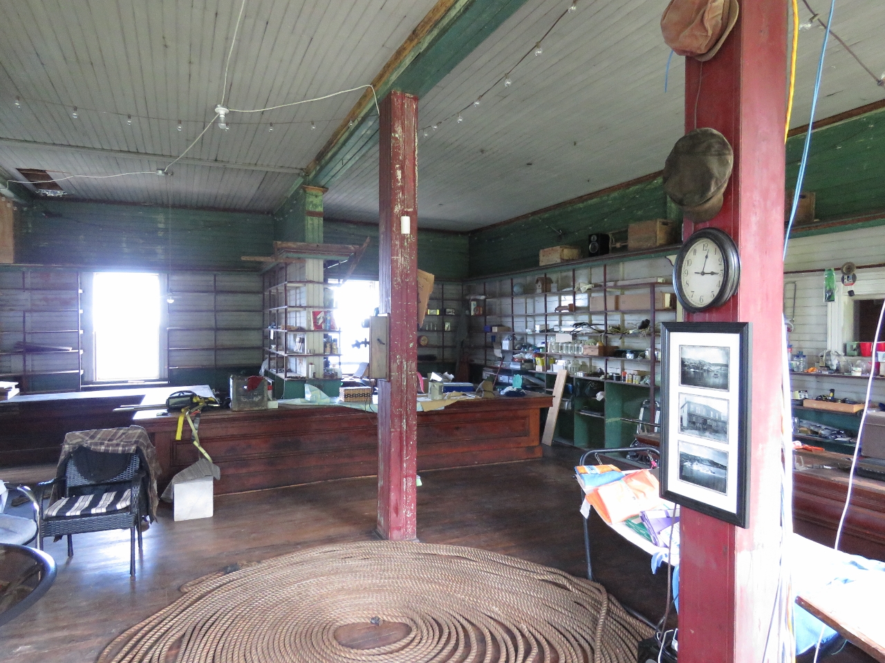 |
Interior
Position: -61 2.49, 45 49.28
Upstairs the store had been kept in much the same way as it likely looked at the turn of the 19th century.
|
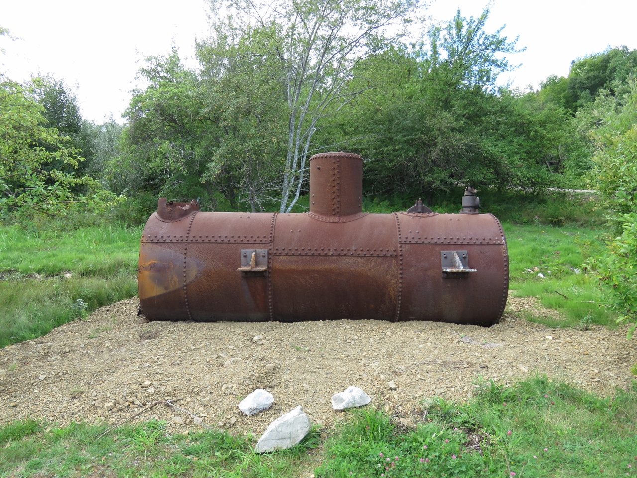 |
Steam Boiler
Position: -61 2.38, 45 49.29
This steam boiler on display near shore probably was used in the mining operations.
|

|
Click the travel log icon on the left to see these locations on a map, with the complete log of our cruise.
On the map page, clicking on a camera or text icon will display a picture and/or log entry for that location, and clicking on the smaller icons along the route will display latitude, longitude and other navigation data for that location. And a live map of our current route and most recent log entries always is available at http://mvdirona.com/maps. |
If your comment doesn't show up right away, send us email and we'll dredge it out of the spam filter.