A forest fire lookout has stood on 1,700 ft (518m) Heybrook Ridge near Steven’s Pass since 1925, starting with a simple tent platform. Successively taller towers were built, culminating with the current 67-ft (20 m) lookout completed in 1964. It’s one of only 106 remaining forest fire lookouts in the state, down from a peak of about 500-600 in the 1930s, and one of the few still in actual use as a lookout.
The lookout also is open to the public, providing wonderful views to the Cascade Mountains. A 90-minute drive from downtown Seattle and barely an hour from the suburbs of Redmond and Bellevue, the 1.3-mile (2 km) trail to the tower is a popular and easy day-hike. The small parking area was half-full when we arrived shortly before 9am, and overflowing by the time we returned just over an hour later.
The views from the top were fantastic, and after we continued east through Steven’s Pass to take in the beautiful winter scenery. We made it a loop drive, with lunch in Ellensburg and a side-trip to the huge Suncadia Resort complex near Cle Elum. And on our way home, we made a pass by the last house we owned, in the Somerset neighborhood of Bellevue.
Below are highlights from Feb 12, 2022. Click any image for a larger view, or click the position to view the location on a map. And a map with our most recent log entries always is available at mvdirona.com/maps.
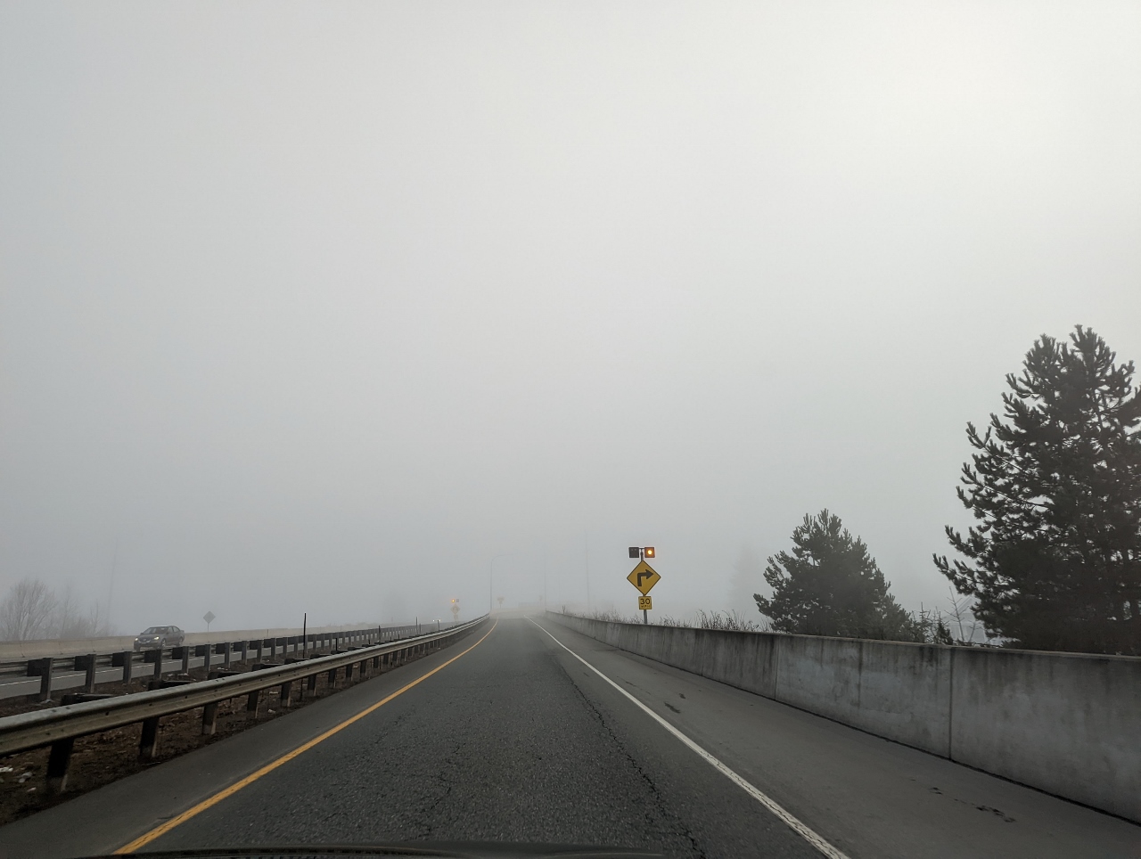 |
Fog
Position: 47°51.35’N, -121°59.60’W
Dense fog on highway 522 as we head east towards Stevens Pass for a hike to Heybrook Lookout. Hopefully the fog will clear before we arrive, or we won’t get much of a view.
|
 |
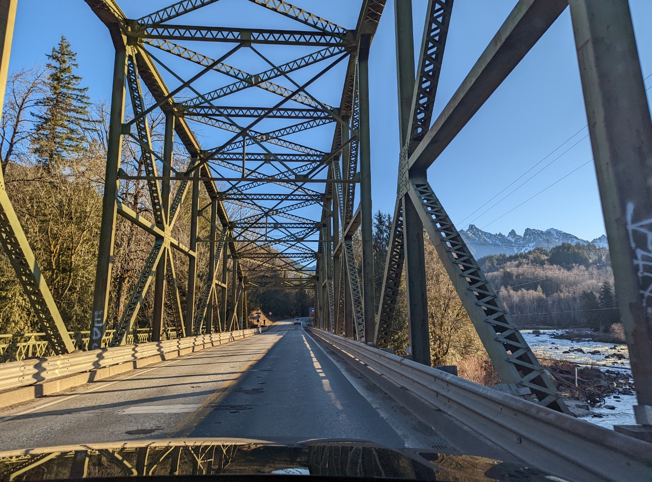
Wallace River Bridge
Position: 47°52.03’N, -121°44.14’W
The fog is clearing as we approach the Wallace River truss bridge, built in 1940. 6,244 ft (1,903 m) Gunn Peak is just visible in the distance.
|
 |
South Fork Skykomish River Bridge
Position: -121°34.69’S, 47°48.76’E
Passing over the South Fork Skykomish River Bridge, built in 1933 at the confluence of the North and South forks of the Skykomish River.
|
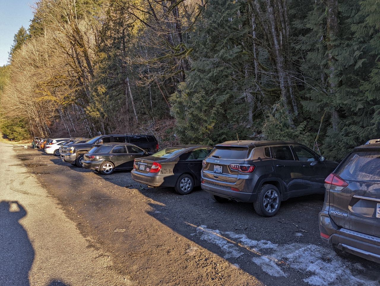 |
Parking
Position: 47°48.47’N, -121°32.05’W
The small parking lot for the Heybrook Lookout trail was nearly full by the time we arrived at 8:40. You have to get going pretty early to beat the crowds here, especially with nice weather.
|
 |
Trailhead
Position: 47°48.49’N, -121°32.10’W
Our traditional trailhead photo, as we start the hike up to Heybrook Lookout in Mt. Baker-Snoqualmie National Forest. It will be a short and easy walk with an elevation gain of 850 ft (260m) over 1.3 miles (2 km) one-way.
|
 |
Trail
Position: 47°48.49’N, -121°31.97’W
Beautiful green forest on the path to the lookout. The well-maintained trail is the work of the Washington Trails Association.
|
|
|
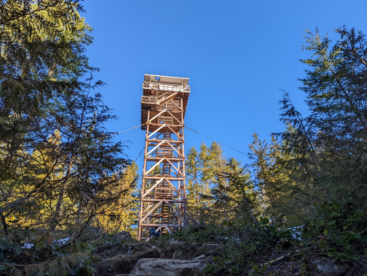
Heybrook Lookout
Position: 47°48.62’N, -121°31.54’W
A forest fire lookout has stood on 1,700 ft (518m) Heybrook Ridge since 1925, starting with a simple tent platform. Successively taller towers were built, culminating with the current 67-ft (20 m) lookout completed in 1964.
This is one of only 106 remaining forest fire lookouts in the state, down from a peak of about 500-600 in the 1930s, and one of the few still in actual use as a lookout. |
 |
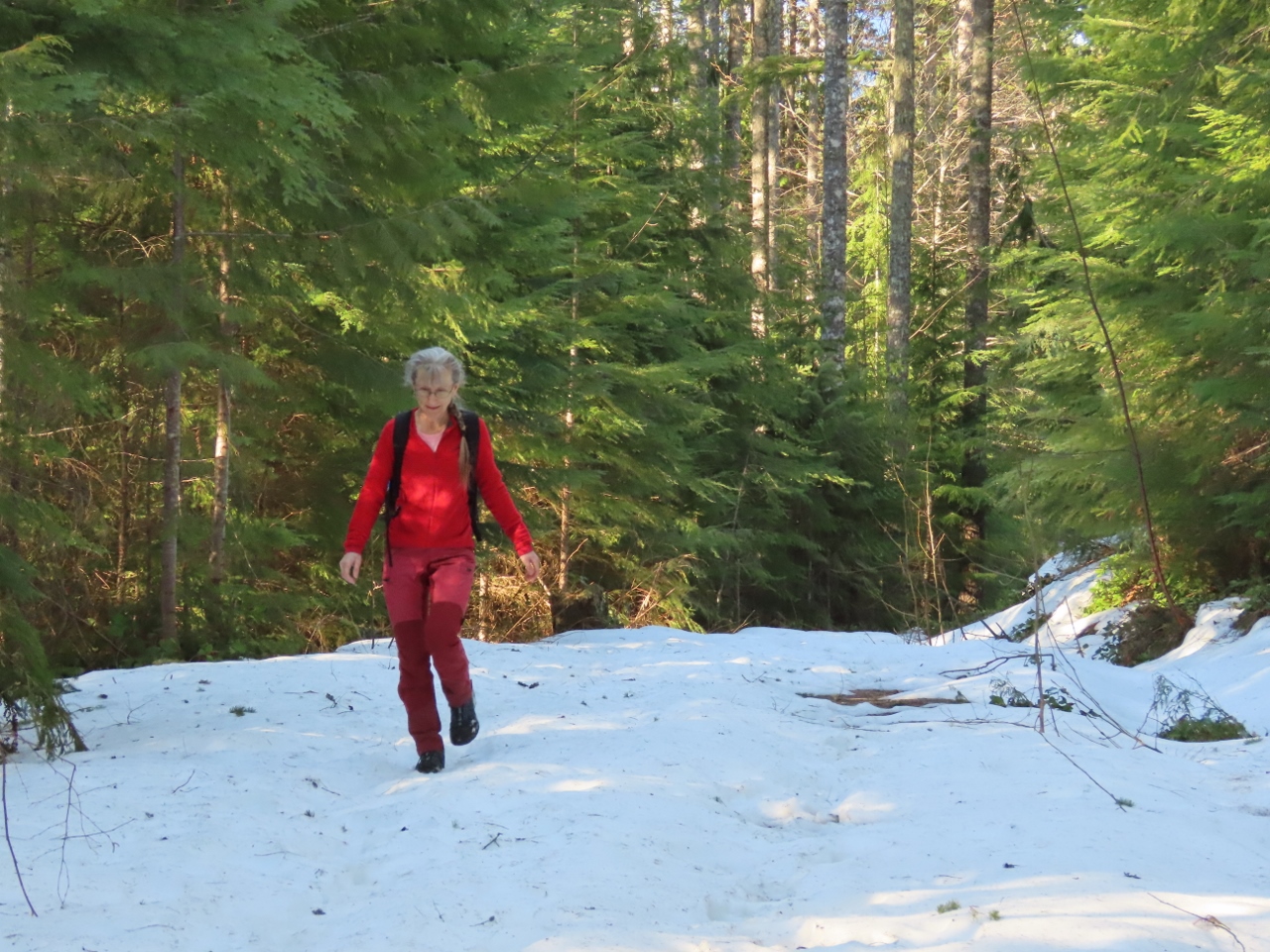
Partway Up
Position: 47°48.64’N, -121°31.52’W
Jennifer, wearing red, partway up the tower.
|
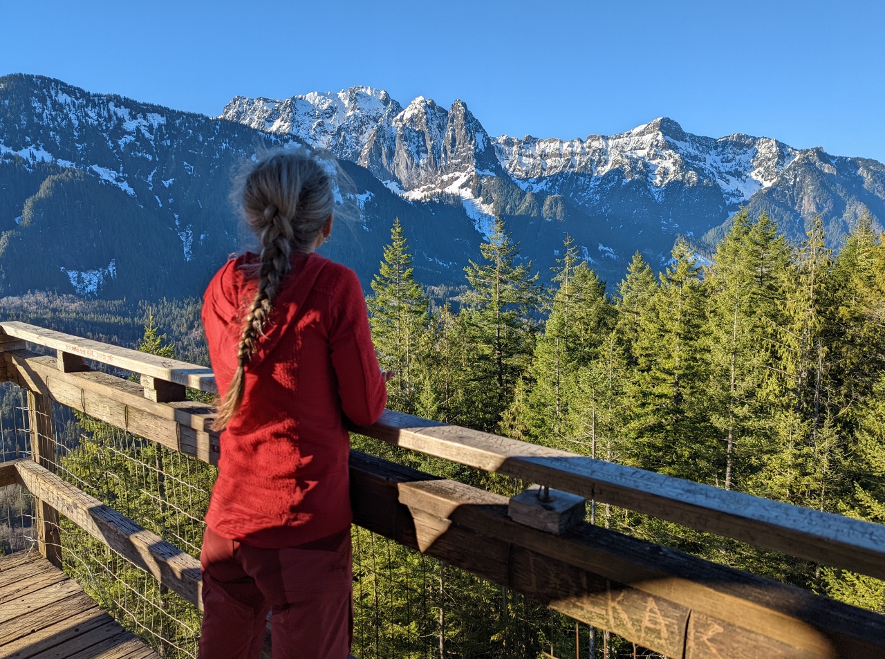 |
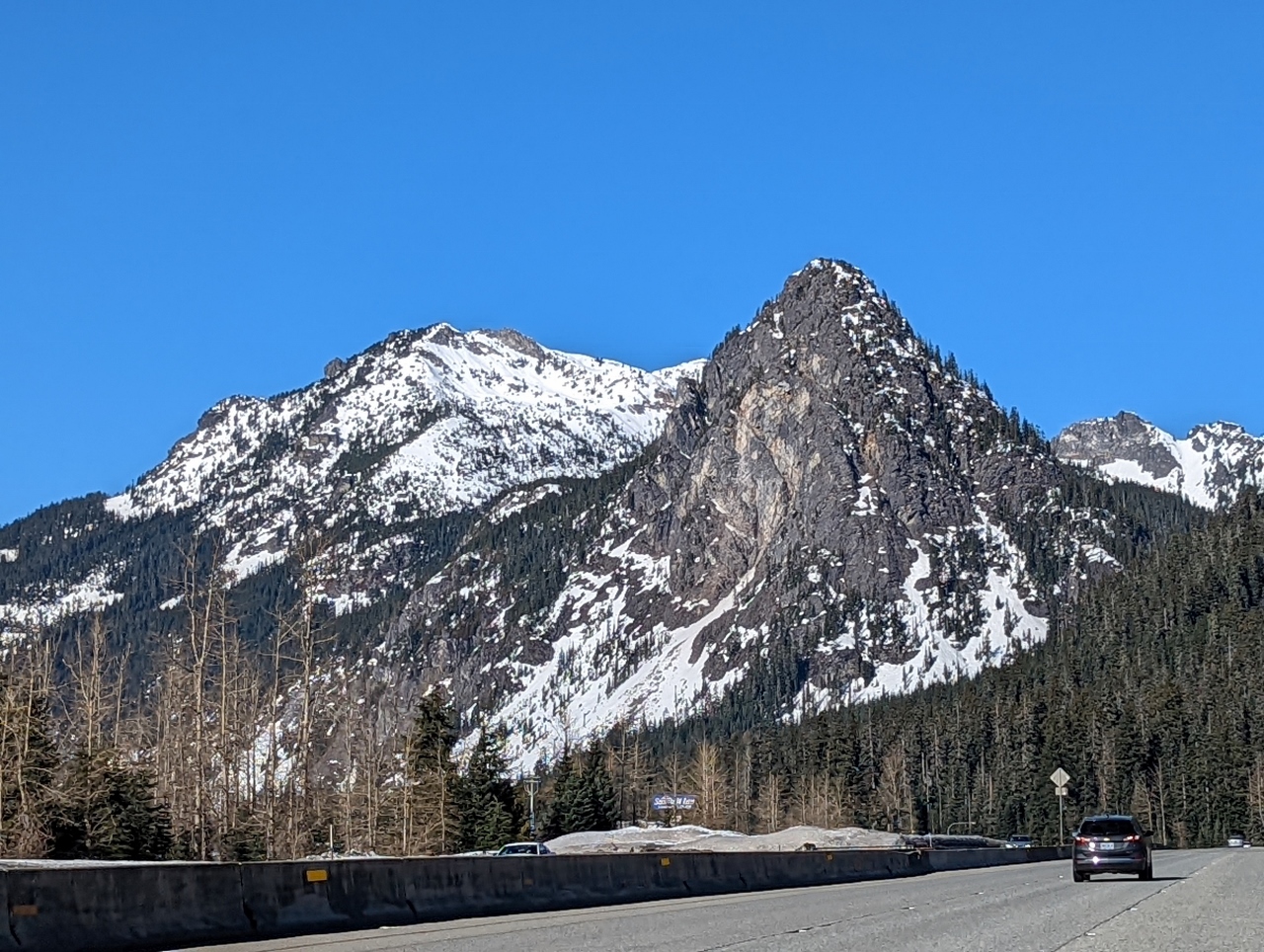
Top of the Tower
Position: 47°48.64’N, -121°31.52’W
Fantastic views to 5,979 ft (1,822 m) Mount Index, left, and 5,452 ft (1,661 m) Mount Persis in the Cascade Range from top of the Heybrook Lookout. We’re actually one level below the real top, closed to public access, where the fire rangers work.
|
 |
Snow
Position: 47°48.63’N, -121°31.52’W
There wasn’t any snow at the parking lot, but a fair bit up at the tower.
|
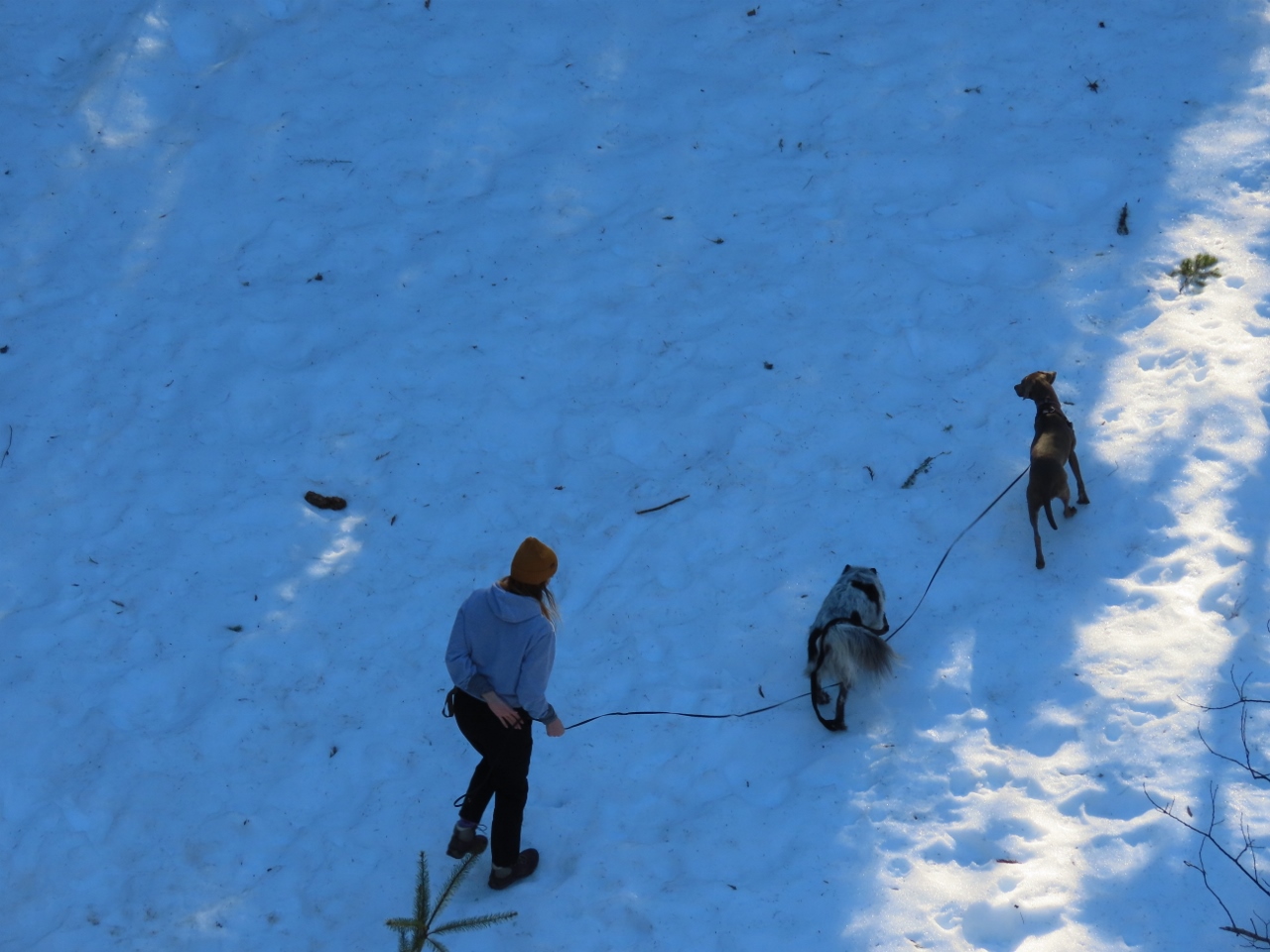 |
Dogs
Position: 47°48.64’N, -121°31.53’W
Dozens of people were making the hike as well, many with dogs, who seemed to love the snow.
|
 |
Deeper Snow
Position: 47°48.65’N, -121°31.33’W
We walked down a Forestry Service road for a bit, where the snow was even deeper away from the wind and sun. It was fun to walk in the snow again, reminding of us our many winter hikes in Norway.
|
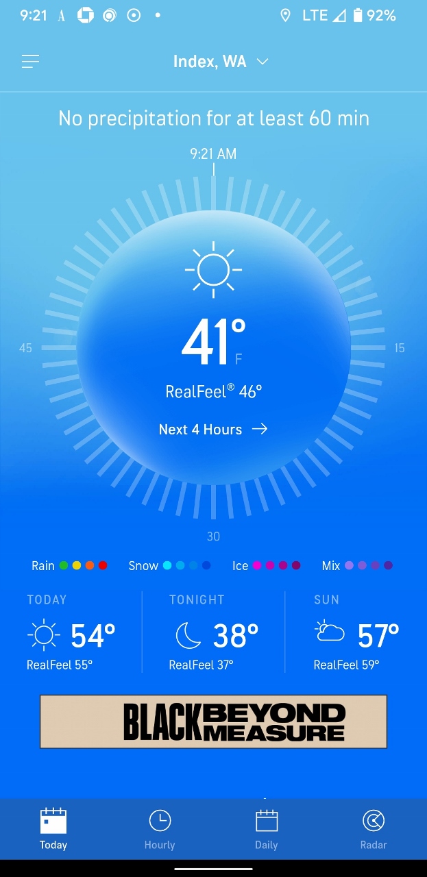 |
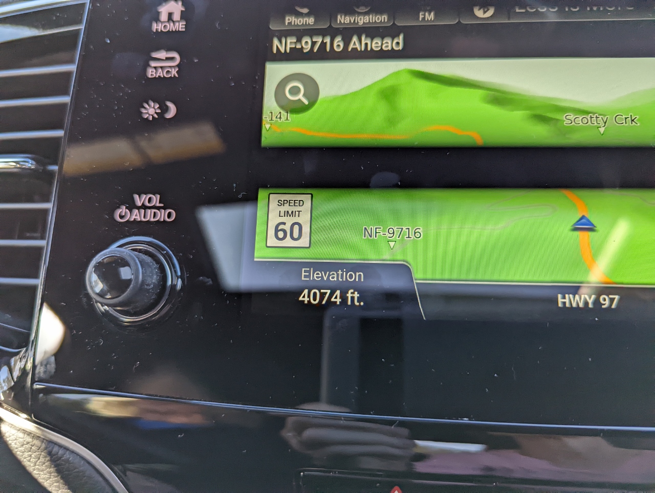
41 F
Position: 47°48.63’N, -121°31.52’W
The snow won’t last long at this temperature of 41°F (5°C).
|
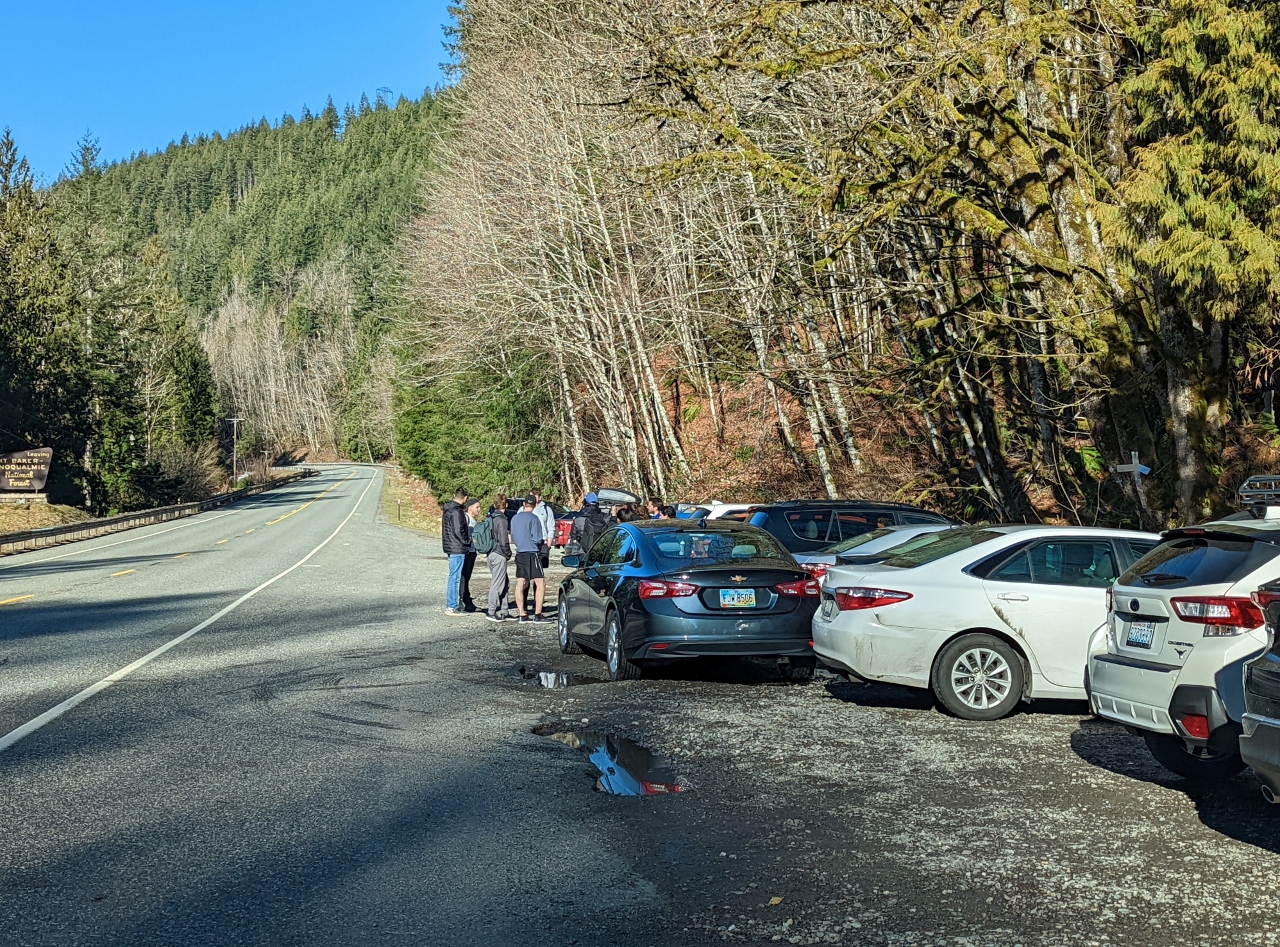 |
Parking Full
Position: 47°48.47’N, -121°32.06’W
The parking lot was full when we returned back down 90 minutes later. This group had brought multiple cars and parked one across the rear of the other two to fit.
|
 |
Eagle Falls
Position: 47°47.78’N, -121°30.85’W
Just east of the Heybrook Lookout trailhead, Eagle Falls on the Skykomish River were really gushing.
|
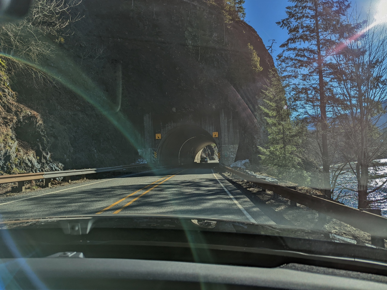 |
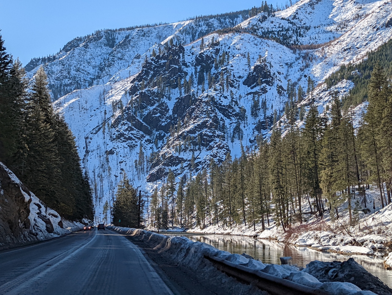
Tunnel
Position: 47°43.84’N, -121°24.46’W
Passing through a tunnel on Highway 2, with the South Fork Skykomish River close beside us.
|
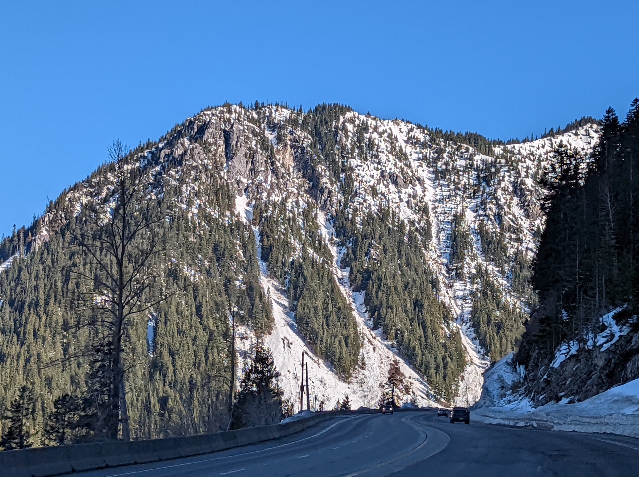 |
Sky Mountain
Position: 47°43.68’N, -121°8.22’W
5,482 ft (tk m) Sky Mountain soars above the road as we near the top of Stevens Pass.
|
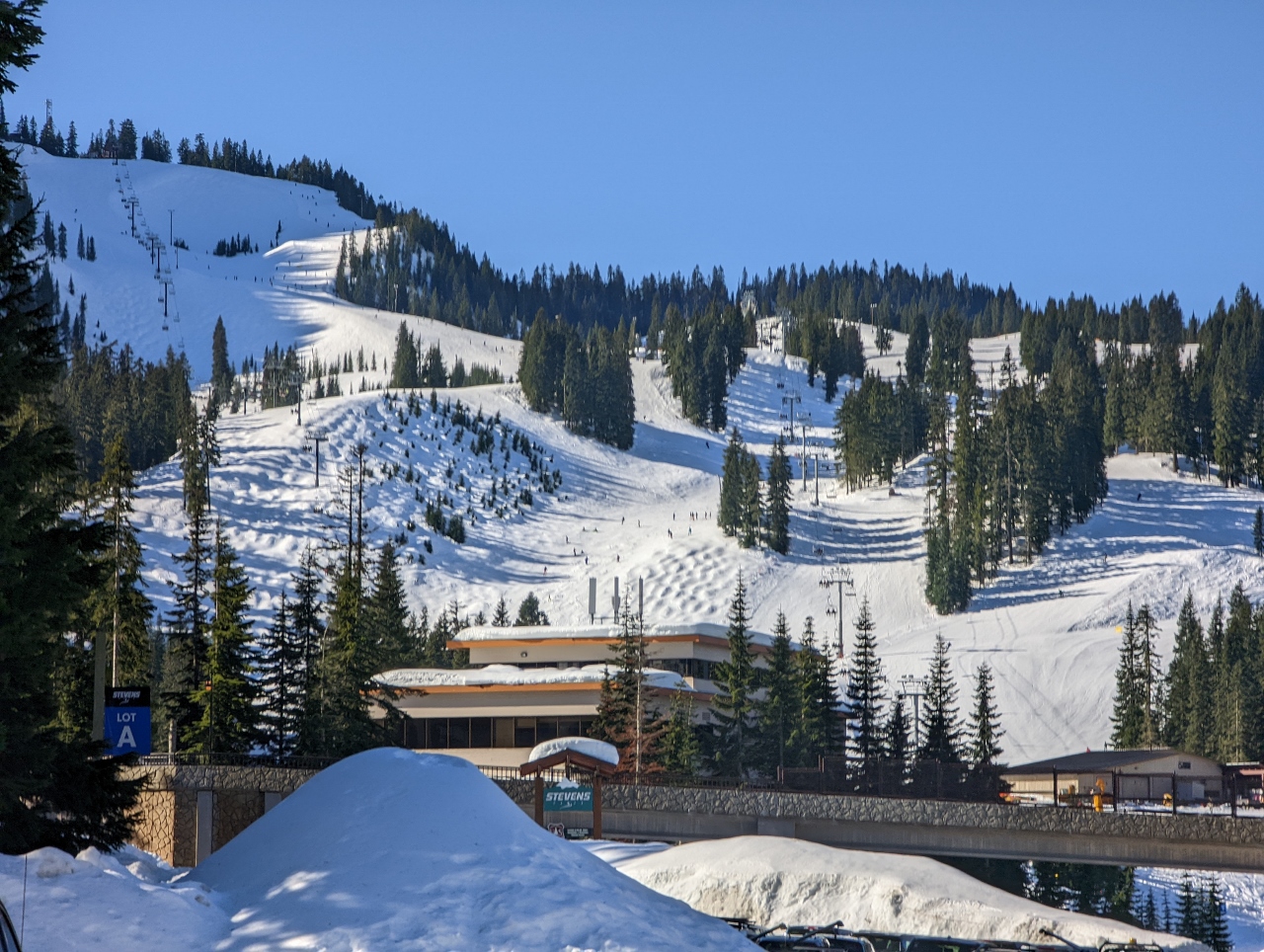 |
Stevens Pass Ski Area
Position: 47°44.77’N, -121°5.24’W
Stevens Pass is another popular ski area near Seattle. It’s about 82 miles (132 km) away, compared to only 52 miles (80 km) for Snoqualmie Pass, but still gets plenty busy on a nice weekend.
|
 |
Crowds
Position: 47°44.81’N, -121°5.18’W
We were planning to stop for lunch at Stevens Pass ski resort, but by 10:40 the only parking was excessively far away from the resort area so we kept exploring by car. Just driving out was slow with all the people flowing in by car and walking from their cars to the slopes.
|
 |
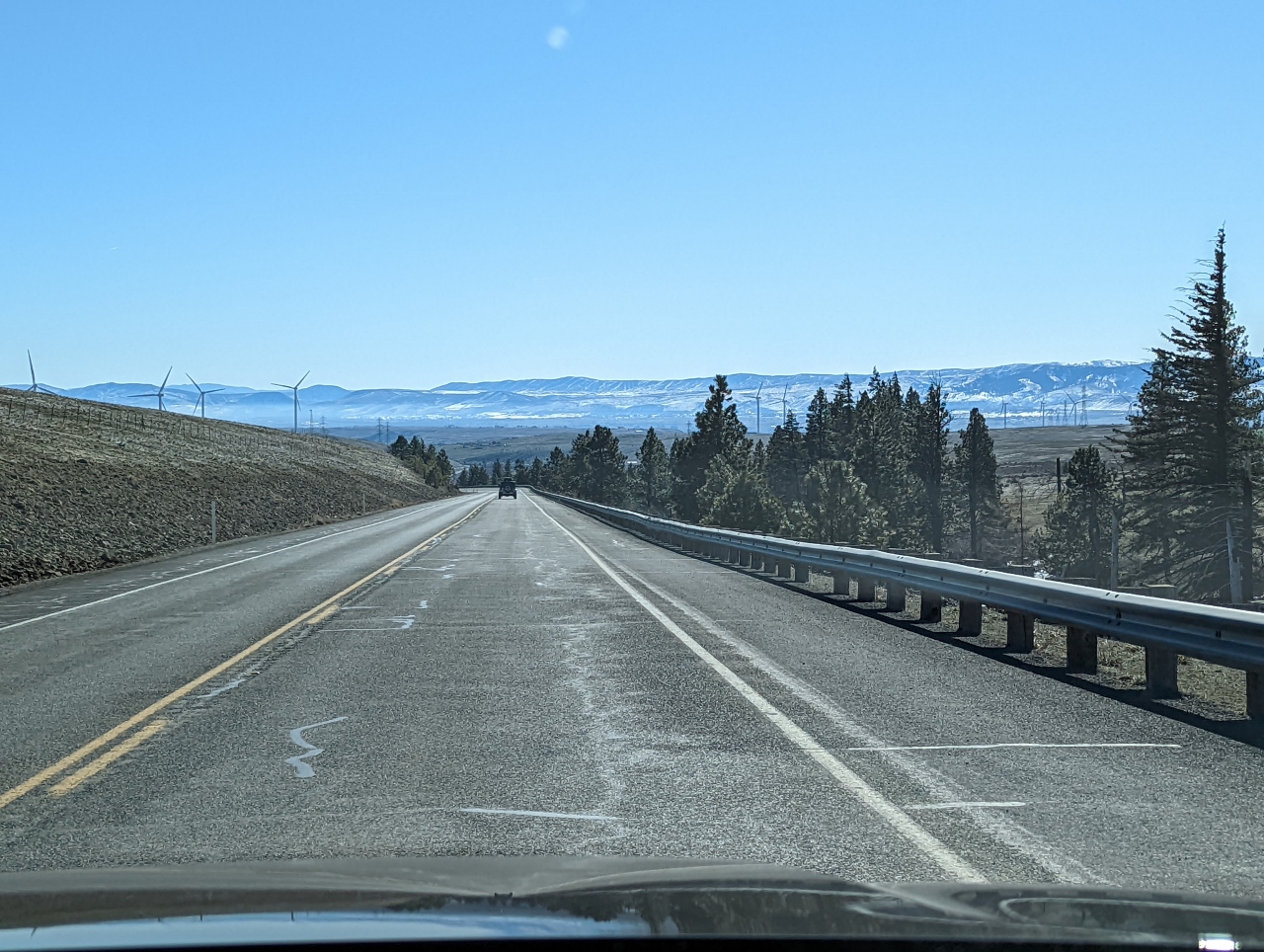
Big Chief Mountain
Position: 47°45.75’N, -121°4.59’W
Heading towards 5,858-ft (1,785 m) Big Chief Mountain on the east side of Stevens Pass. The winter scenery up here is spectacular.
|
 |
Icicle Ridge
Position: 47°40.82’N, -120°44.08’W
Driving alongside the Wenatchee River towards 7,000-ft (2,133 m) Icicle Ridge
|
 |
Reflections
Position: 47°37.34’N, -120°43.49’W
Near-perfect reflections in a still section of the Wenatchee River.
|
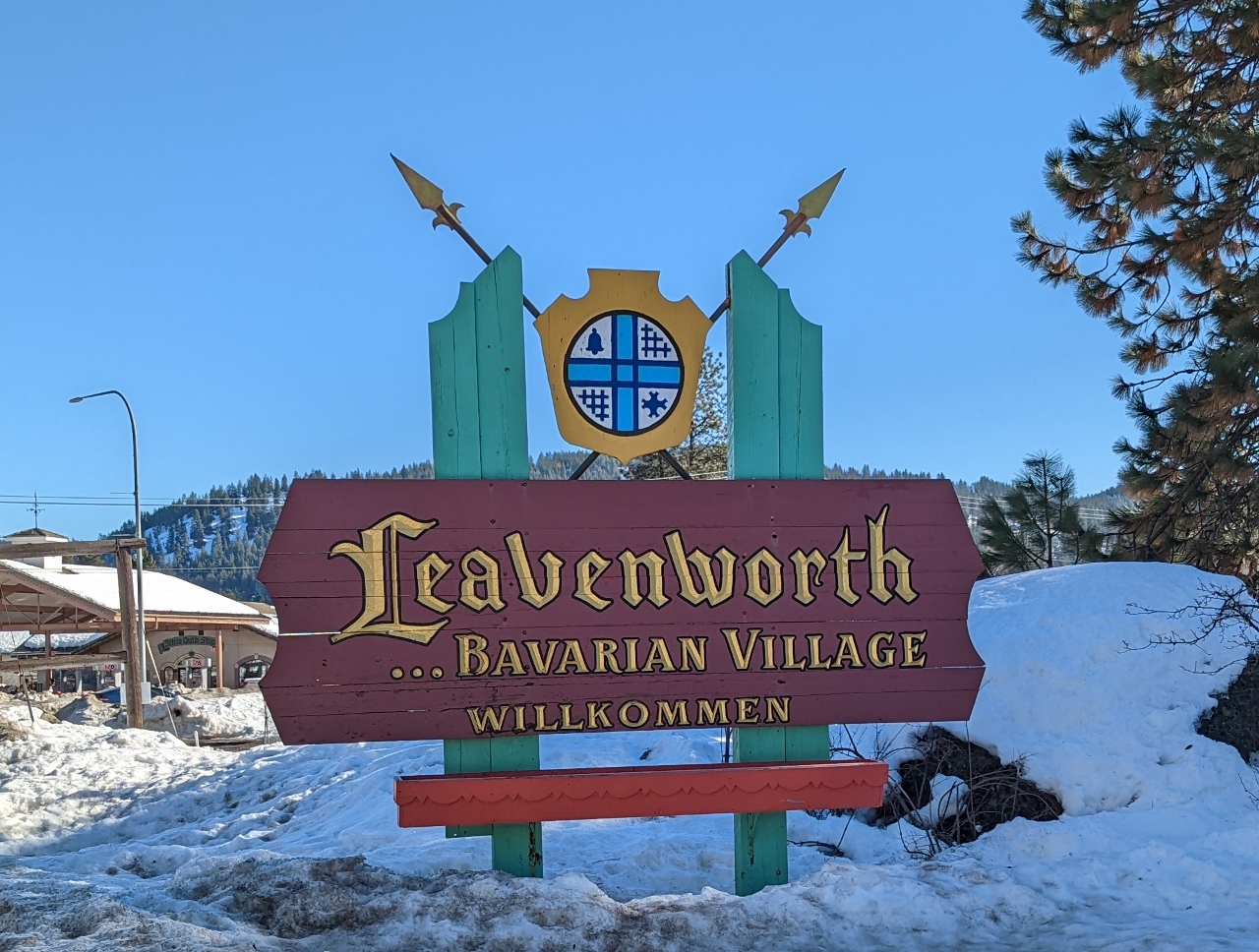 |
Leavenworth
Position: 47°35.20’N, -120°41.21’W
Entering Leavenworth east of Stevens Pass. The entire town is modeled after a German Bavarian village as part of a tourism initiative that began in the 1960s. It’s a bit touristy, so we didn’t stop on this trip. But many people we know love it, so we’ll likely be back to see it in more detail.
|
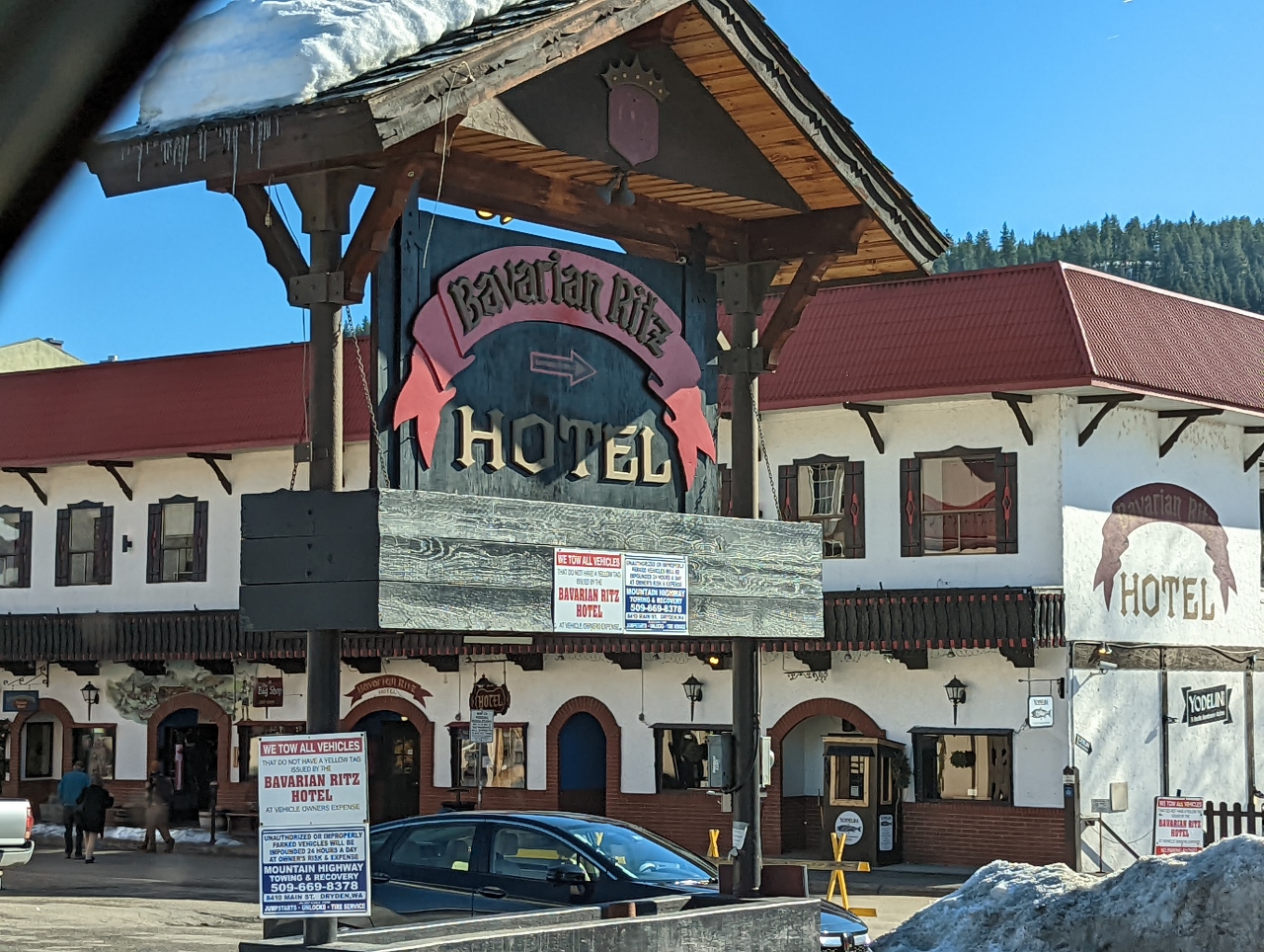 |
Bavarian Ritz
Position: 47°35.54’N, -120°40.09’W
The Bavarian Ritz Hotel in Leavenworth.
|
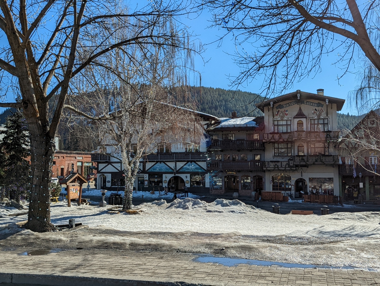 |
Hotel Europa
Position: 47°35.74’N, -120°39.73’W
Looking across Front Street Park to the Hotel Europa joining other Bavarian-styled buildings.
|
 |
McDonald’s
Position: 47°35.81’N, -120°39.60’W
Even the local McDonald’s in Leavenworth follows the Bavarian theme.
|
 |
Blewett Pass
Position: 47°20.07’N, -120°34.23’W
We just drove on US 97 through Blewett Pass at an elevation of 4,124 feet (1,257 m). Most passes in Washington State—such as Snoqualmie Pass, Stevens Pass and Whites Pass—run east-west along the spine of the Cascade Range. But Blewett Pass runs north-south, connecting Leavenworth on US 2 with Ellensburg on Interstate 90 (I-90).
|
 |
Columbia River Basin
Position: 47°10.65’N, -120°42.18’W
View to the Columbia River Basin, a major agriculture area, as we descend from Blewett Pass. The Columbia River is only 22 miles (35km) to our east.
|
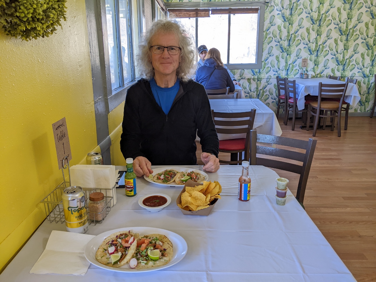 |
Lunch
Position: 46°59.30’N, -120°32.87’W
Delicious street tacos for lunch at Fidelina’s Taqueria in Ellensburg. With so much agriculture in the area attracting Mexican workers, the taquerias here are plentiful and excellent.
|
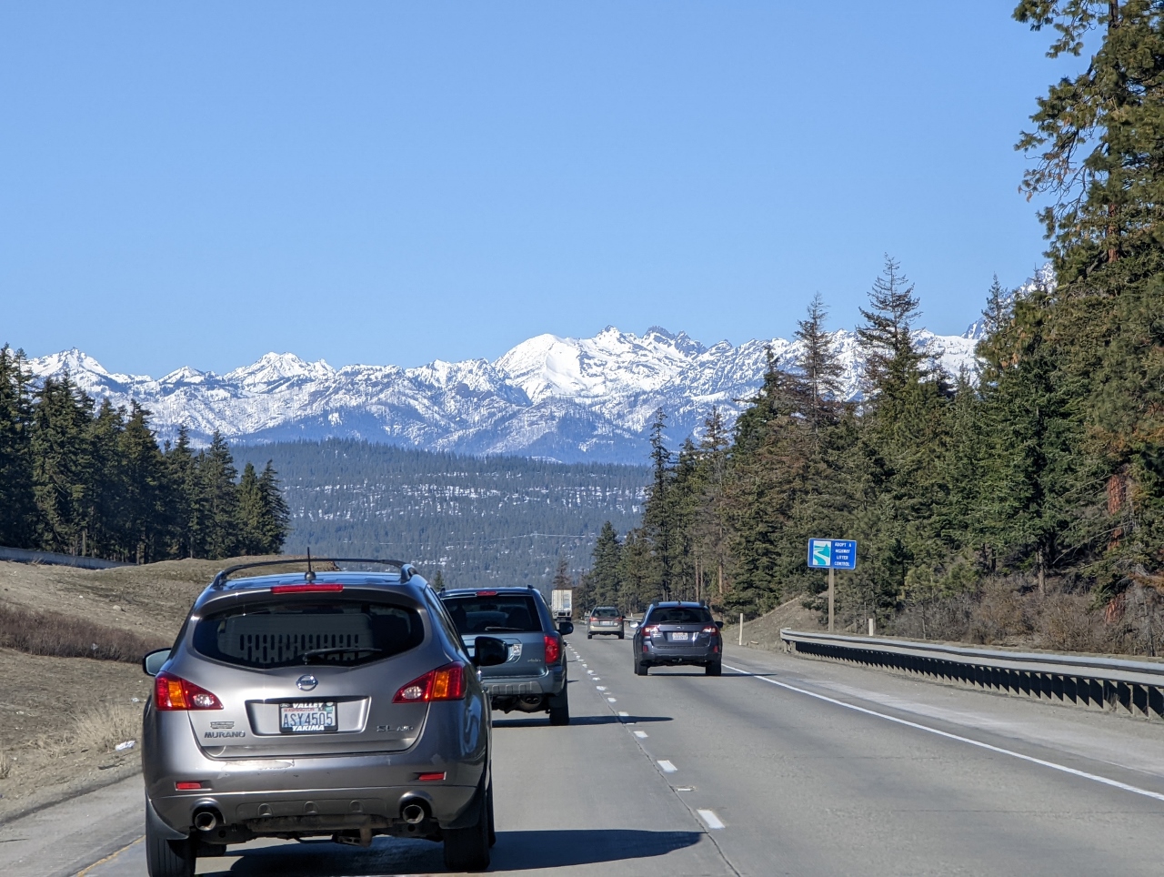 |
Cascade Mountains
Position: 47°7.72’N, -120°48.23’W
View to the Cascade mountains from the east as we return west towards Seattle via Snoqualmie Pass on I-90.
|
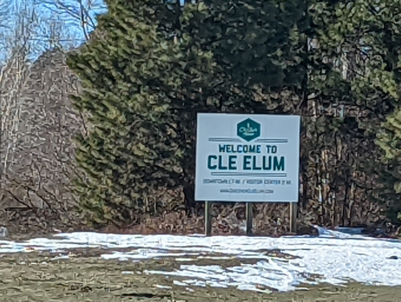 |
Cle Elum
Position: 47°11.04’N, -120°54.10’W
Cle Elum, similar to Bend in Oregon, is a popular area for camping and other outdoor activities.
|
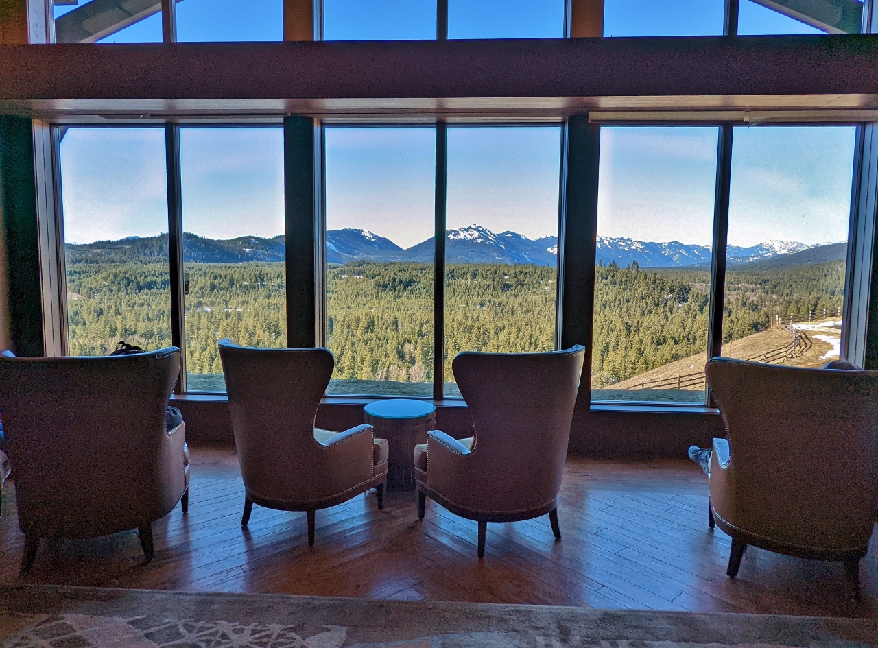 |
Suncadia Resort
Position: 47°12.52’N, -121°1.18’W
We stopped in to have a look around the luxury Suncadia Resort. This is the view looking from their lounge over the Cle Elum River to the Cascade Mountains.
|
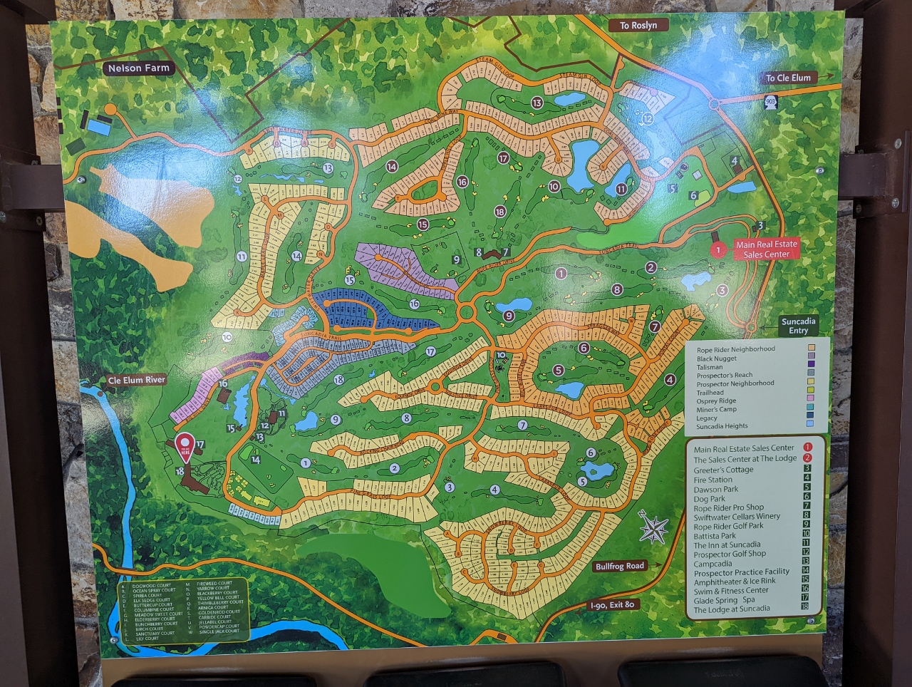 |
Resort Map
Position: 47°12.49’N, -121°1.18’W
Map of the huge property of Suncadia Resort. Besides several common buildings and areas, the resort also includes hundreds of single-family homesites, visible as the individual plots on this map.
|
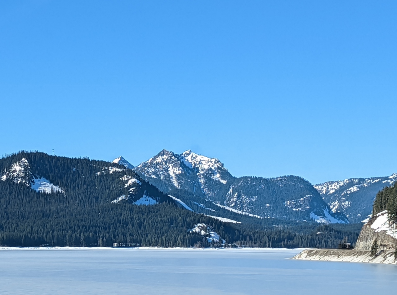 |
Keechelus Lake
Position: 47°20.47’N, -121°21.68’W
Frozen Keechelus Lake just east of Snoqualmie Pass.
|
 |
Kendall Peak
Position: 47°24.14’N, -121°24.24’W
5,784 ft (1,762 m) Kendall Peak rising above I-90 at Snoqualmie Pass.
|
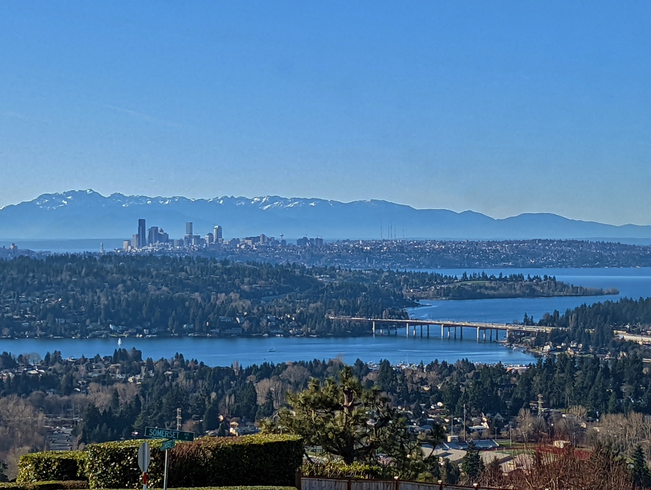 |
Somerset
Position: 47°33.75’N, -122°9.40’W
On the way back home to Seattle we took a detour through Somerset, our old neighborhood in Bellevue before we moved aboard our boat Dirona. This is the view from the top of the hill.
|
 |
Somerset Place
Position: 47°33.90’N, -122°9.57’W
Driving past the last house we owned, on Somerset Place in the Somerset neighborhood. We really enjoyed how private it was, with a great view across Lake Washington to Seattle.
|
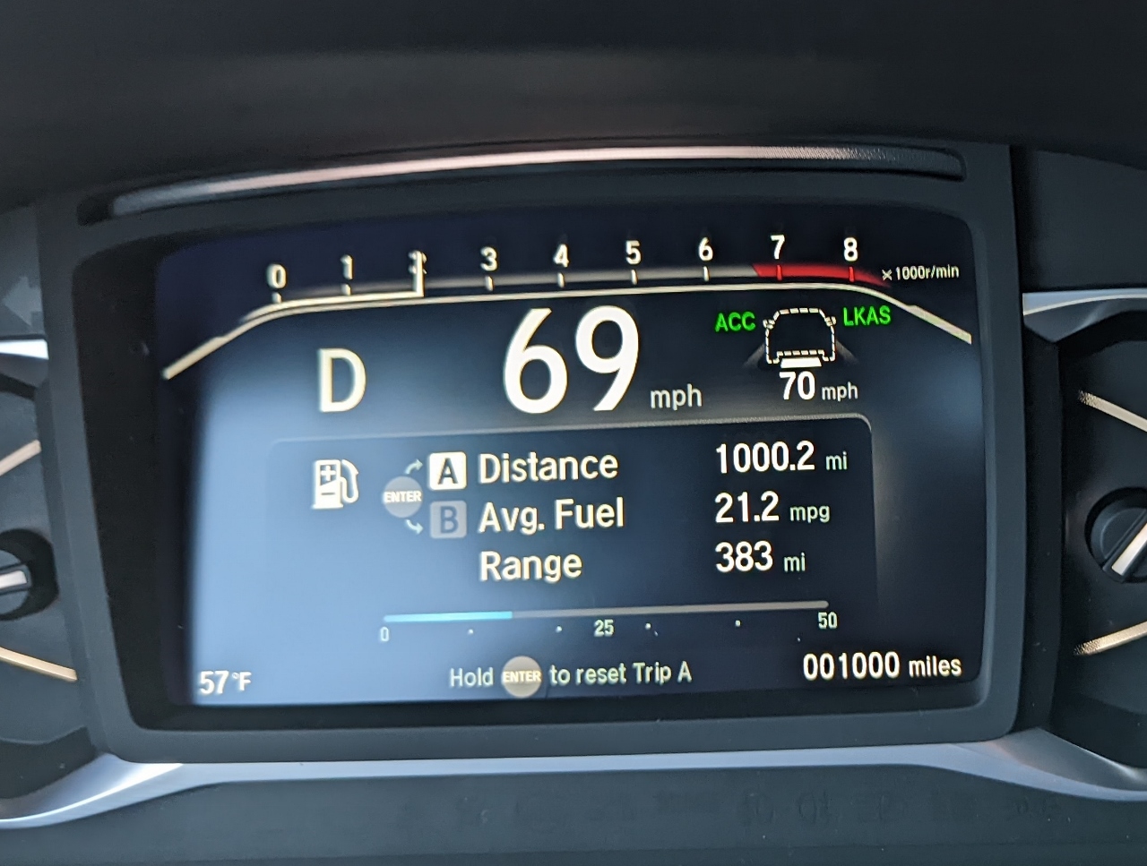 |
1,000 Miles
Position: 47°34.80’N, -122°11.61’W
We’ve already put 1,000 miles on our new car in just 17 days.
|
 |
Bicycle Police
Position: 47°37.10’N, -122°20.34’W
While we were having dinner at Thai Ginger in downtown Seattle, several police cars and two large groups of bicycle police sped past. We rarely see police on bikes, and never in these numbers.
|
 |
Click the travel log icon on the left to see these locations on a map. And a map of our most recent log entries always is available at mvdirona.com/maps. |
If your comment doesn't show up right away, send us email and we'll dredge it out of the spam filter.