Flåm is a small village at the head of Aurlandsfjrod, a branch off Sognefjord, the longest fjord in Norway. The village is the terminus of the Flåm Railway, considered one of the world’s most scenic railway trips. It’s also the main embarkation point for boat tours of UNESCO World Heritage site Nærøyfjord, and is home to the Ægir craft brewery. We spent three nights in Flåm, enjoying the fabulous natural beauty.
Below are trip highlights from May 5th through 7th in Flåm, Norway. Click any image for a larger view, or click the position to view the location on a map. And a live map of our current route and most recent log entries always is available at mvdirona.com/maps
 |
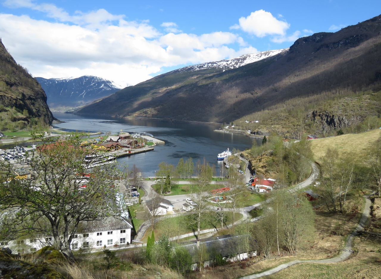
Flåm Arrival
Position: 7 7.19, 60 51.67
We left Indrefjord, but not the waterfalls and fabulous mountain scenery, as we cruised to the village of Flåm at the head of Aurlandsfjord. We lost count of the waterfalls en route, and pretty much ran out of superlatives to desribe the scenery. At Flåm we had their guest dock all to ourselves, with a spectacular view down Aurlandsfjord. Read more …
|
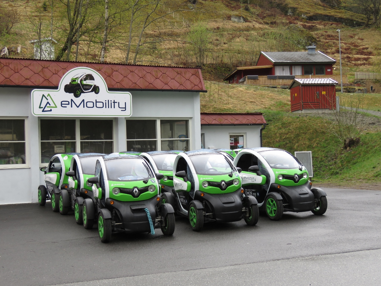 |
eMobility
Position: 7 6.90, 60 51.70
In a bid to minimize the environmental impact of tourism, the main form of rental car in Flåm are these cute electric cars from eMobility. These are Renault Twizys and we’ll likely rent one tomorrow.
|
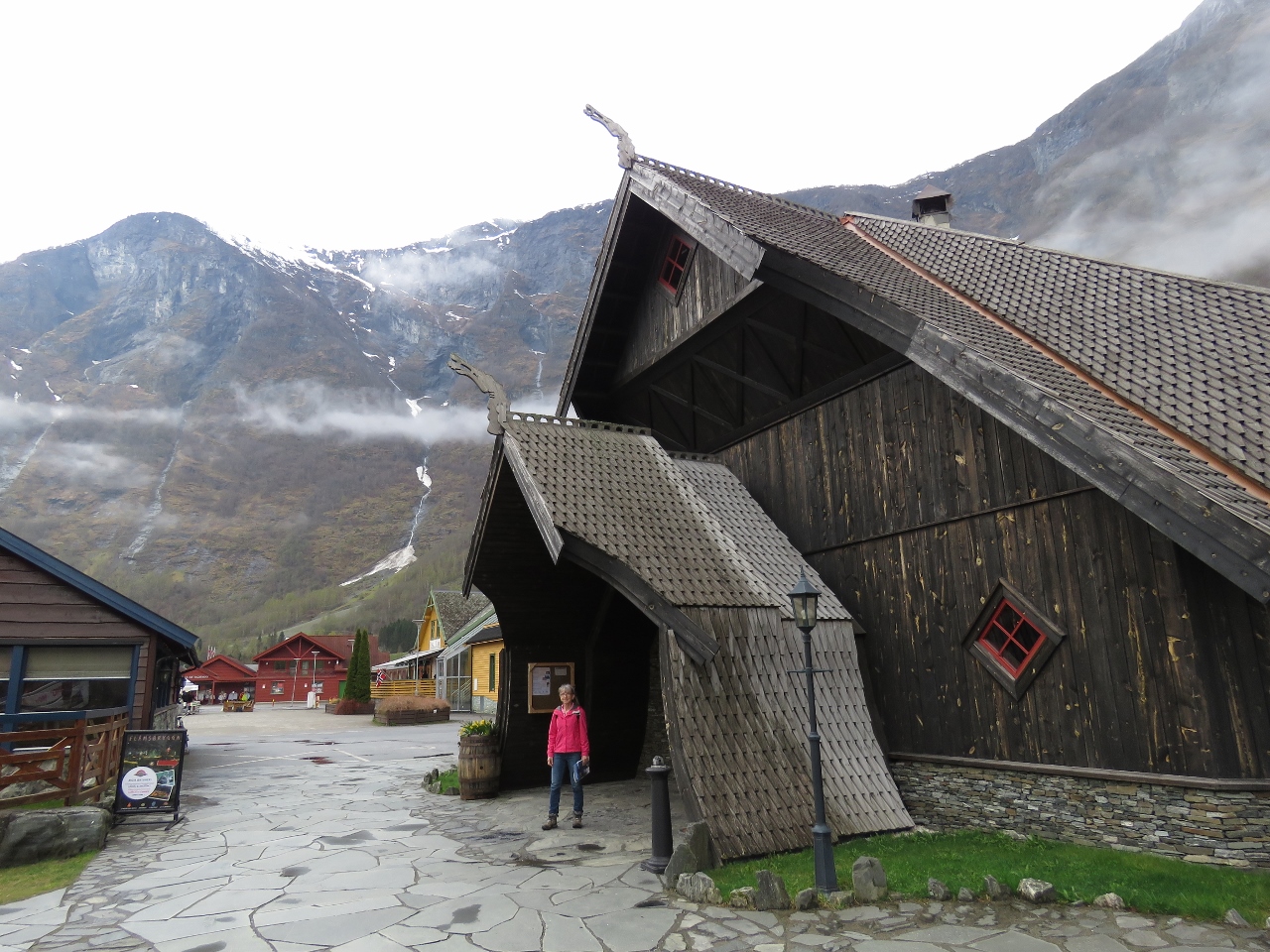 |
Ægir Brew Pub
Position: 7 7.03, 60 51.82
It didn’t take us long to find the local brew pub. Ægir has been brewing craft beer in Flåm since 2007 and their brew pub exterior is fashioned after a Stave church, a medieval wooden church common in northwest Europe.
|
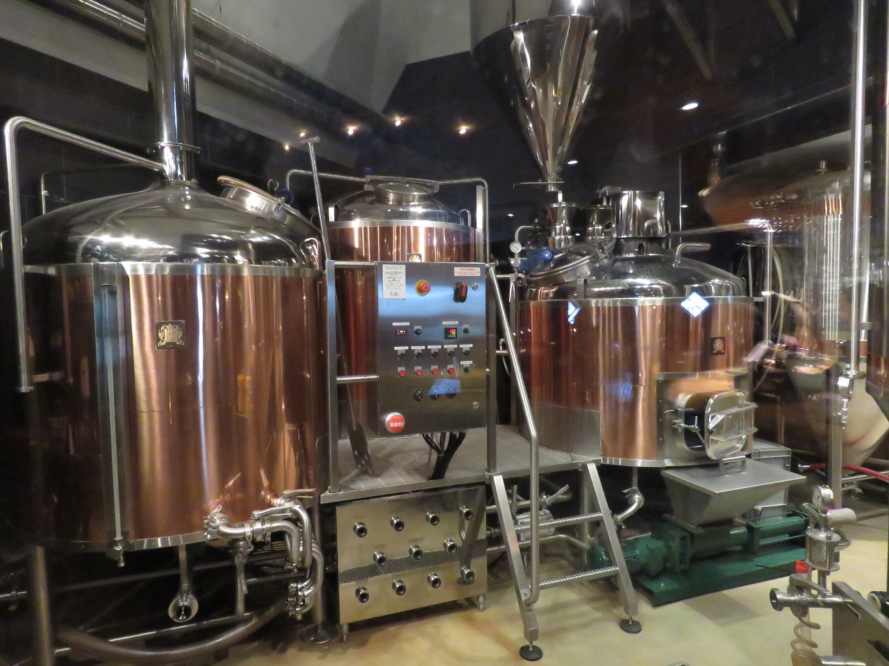 |
Brewery
Position: 7 7.03, 60 51.82
Copper brewing tanks at Ægir Brew Pub in Flåm.
|
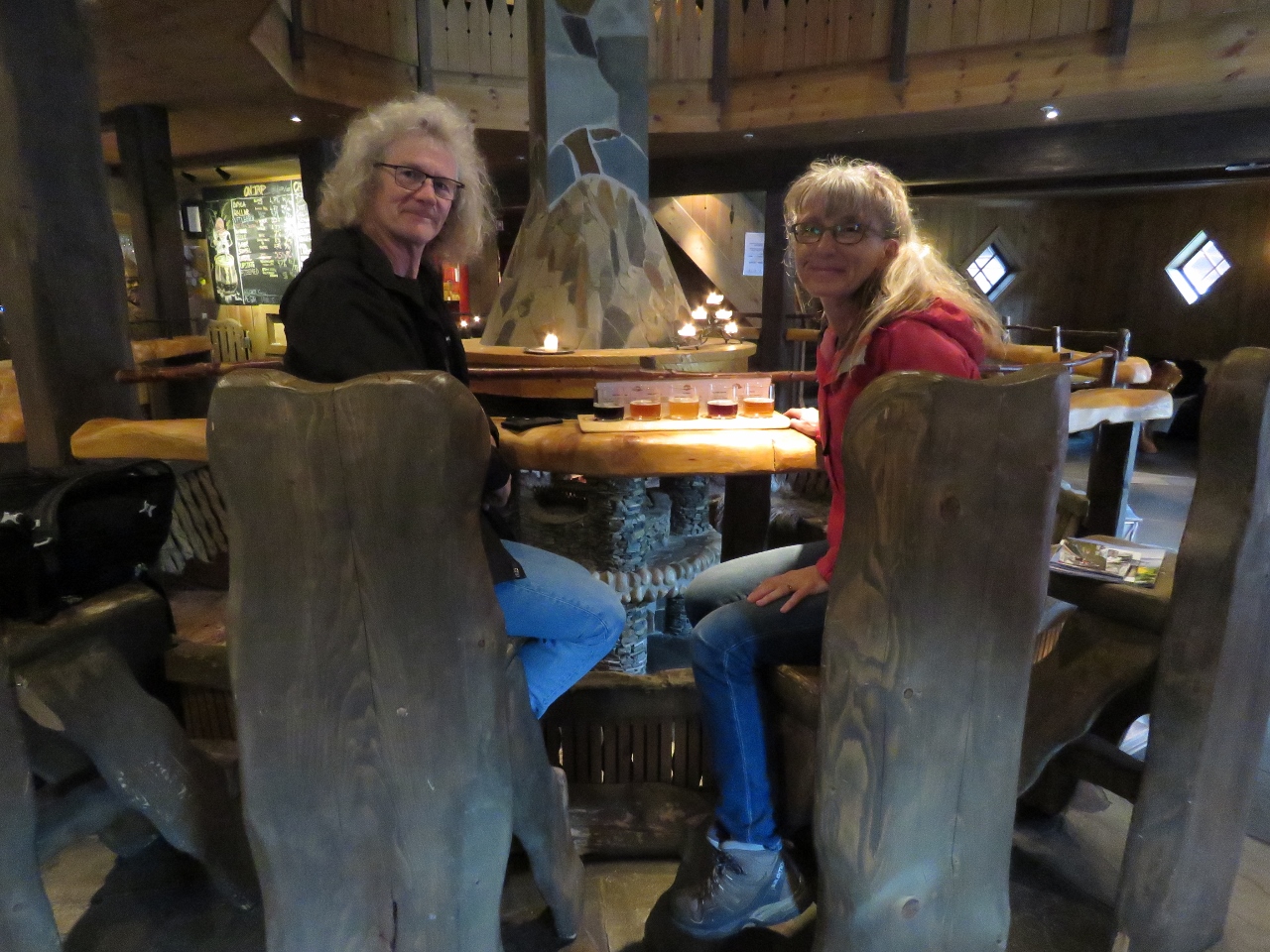 |
Tasting Flight
Position: 7 7.03, 60 51.82
A tasting flight before an exceptional lunch at Ægir Brew Pub in Flåm. The two-story interior is designed after a Viking ceremonial house with a large fireplace in the center, beautiful wood furniture and furs on the walls.
|
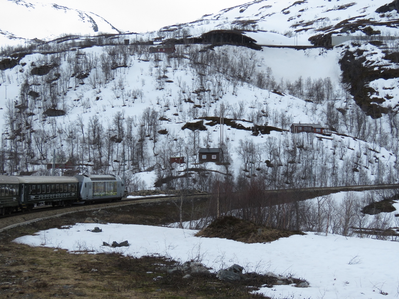 |
Flåmsbana
Position: 7 8.47, 60 44.54
As we’ve been travelling the world, longtime blog reader Jacques Vuye has been scouting ahead and recommending scenic and unique train trips. One of our favourites was the West Coast Wilderness Railway in Tasmania, Australia. Shortly after we arrived into Norway, Jacques encouraged us to take a trip on Flåmsbana (the Flåm Railway), considered one of the world’s most scenic railway trips. Read more …
|
 |
Viewpoint
Position: 7 6.71, 60 51.66
After our train ride, we walked a trail above Flåm harbour. Dirona is moored, but not visible, in front of the white and blue ferry at the right of the picture.
|
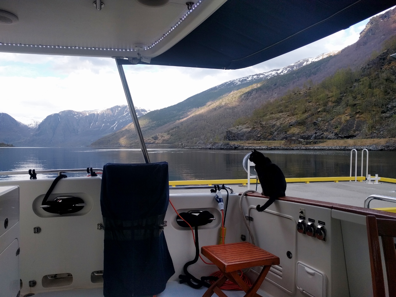 |
Spitfire
Position: 7 7.19, 60 51.67
Even Spitfire appreciates the fabulous scenery here in Aurlandsfjorden.
|
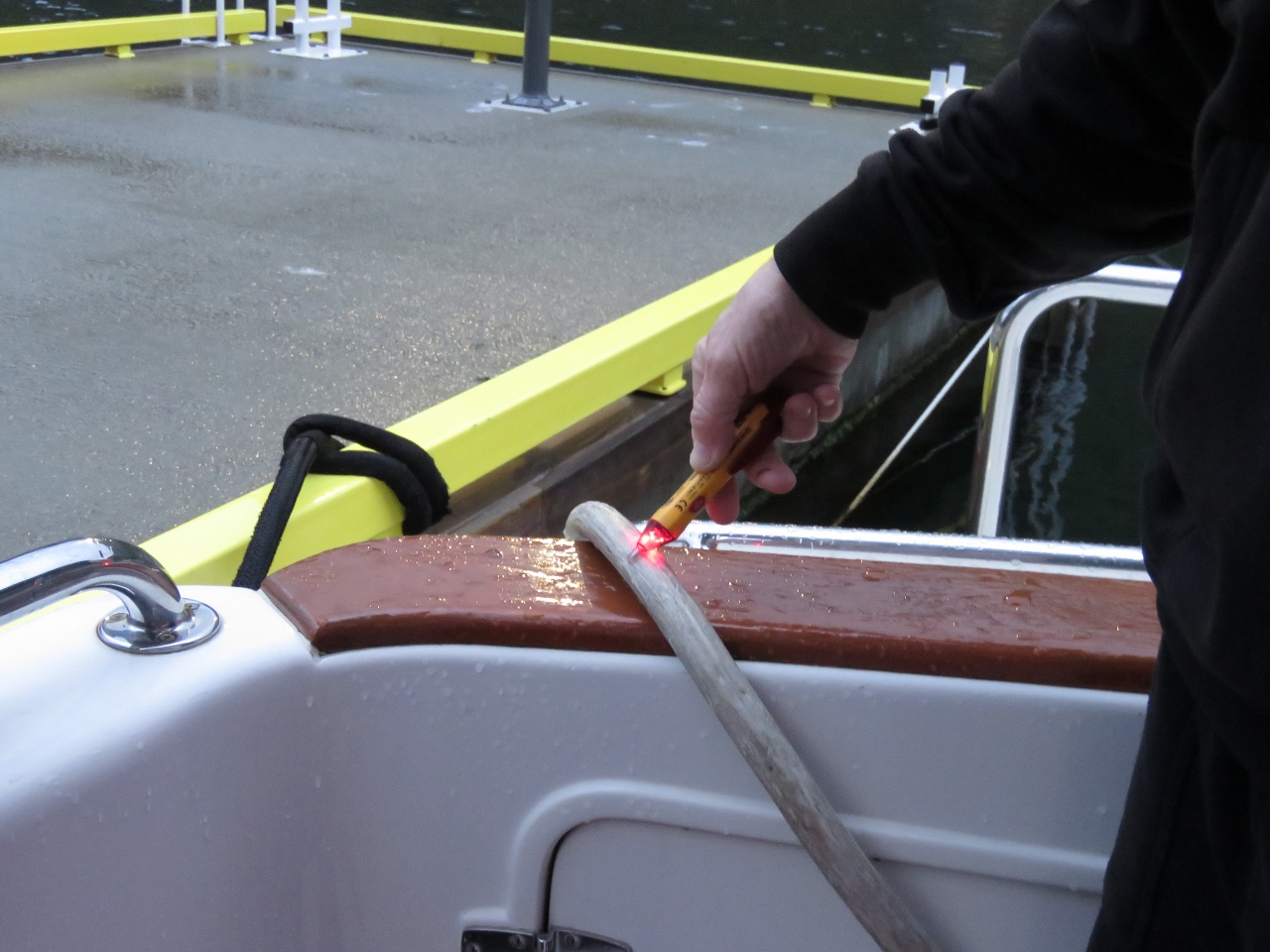 |
Voltage detector
Position: 7 7.19, 60 51.67
The shore power failed last night. New shore power systems include a super-sensitive Residual Current Device and these RCDs are frequently set as low as 30 milliamps so even tiny current leaks that in the past decade would never even be noticed, now cause a breaker to release. We now have a Fluke 1507 Megaohmeter that can find these tiny current leaks fast. In this case rain water last night had run down into our shore power plug and leaked just enough. Quick and easy to correct.
Here James is using our Klien NCVT-2. It’s a non-contact voltage detector. It’s great to have this small writing pen-sized device when plugging in the shore power. If it’s a live connection, the tool touched or even waved near the shore power cord anywhere will beep and show a light. This under $20 tool makes plugging in and ensuring that power is actually available at the shore pedestal super-easy. A wave of the tester show which sockets are live and which aren’t. A quick touch to the shore power cord confirms voltage is present. |
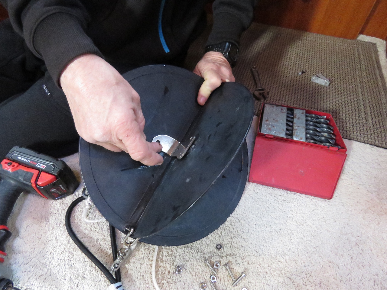 |
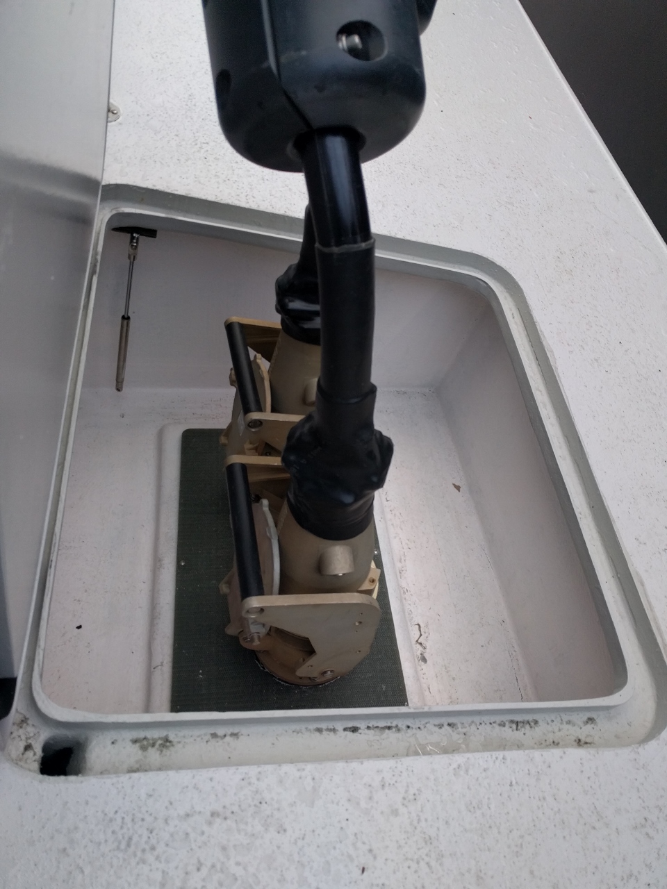
Anchor Ball
Position: 7 7.19, 60 51.67
We rigged an anchor ball back in 2013 while in French Polynesia and used 90-degree aluminum brackets to keep the ball from collapsing in higher winds. After five years the brackets flexed and broke, so we installed new stainless-steel ones today. These should outlast the anchor ball (and probably us and the boat as well).
|
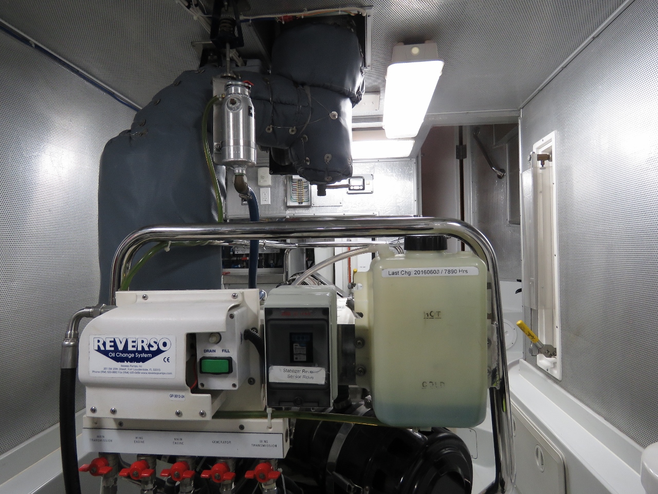 |
Cooling System
Position: 7 7.19, 60 51.67
When the main engine cooling system is running correctly the coolant reservoir bottle shows a specific level for hot and another for cold and these levels don’t change through multiple warm-up/cool-down cycles. On Dirona, we have a fairly large capacity cooling system so we adjust cold be about halfway between empty and the “cold” mark (pictured). Using that setting, hot is halfway between the top and the “hot” mark. Since fixing the problem with air entering the cooling system the system levels are now stable.
|
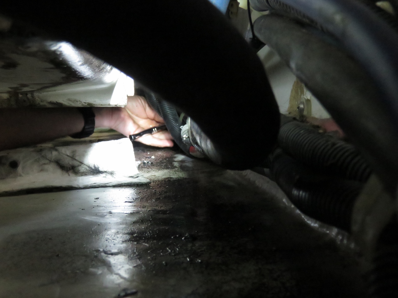 |
Hose Clamp
Position: 7 7.19, 60 51.67
We fixed the problem with air entering the cooling system, but the very next day noticed a minor coolant leak under the engine, possibly triggered by the pressure test the previous day. We tighten the hose clamps when the engine is a year old and again a year after any hoses are changed. New hoses settle in and the clamps loosen off. We probably could check them every couple of years, but it seems once they’ve settled in they don’t seem to change. A couple of days ago we’d tightened all the hose clamps on the engine. Well, all but the four that are in the near-impossible to access spot down near the keel cooler. We’ve never been able to get to these. On this engine you can tighten every hose clamp except these four in about five minutes. These four took more than four hours.
The location under the engine is at the extremes of James’ reach and can’t be seen, so all the work is done by feel. And for the most difficult one, only an open-end wrench will fit and there’s only sufficient clearance to get a 16th of a turn at a time. Between each 16th of a turn, Jennifer has to verbally guide James back to the right location to get reposition the wrench on the hose clamp nut. James’ chest and arms had bruises from stretching to reach. But the clamps are tightened and the engine coolant system is sealed up nicely and will hold a leak test at 20 PSI indefinately. |
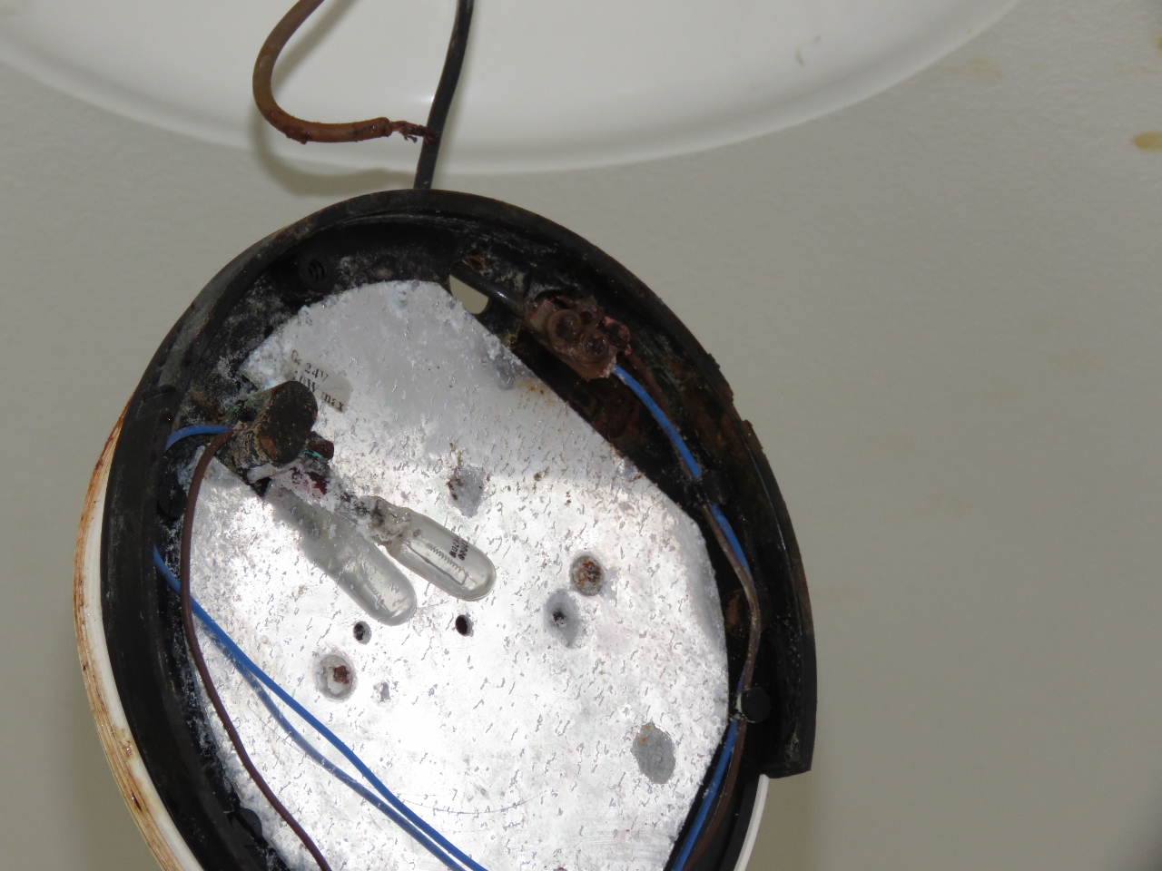 |
Deck Light
Position: 7 7.19, 60 51.67
One of our outside deck lights appears to have filled with seawater. It’s amazing that lights tucked away underneath the deck can get hammered so hard with waves that they will fill with water. There’s little to save on this one, so we just replaced it with a spare.
|
 |
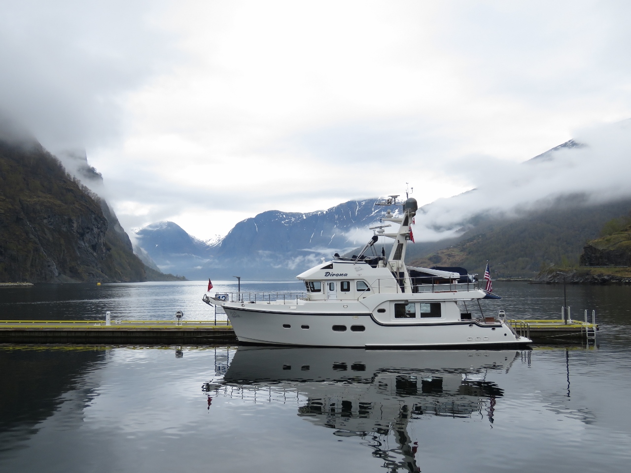
Aurlandsfjorden
Position: 7 7.19, 60 51.67
Even on a cloudy day the view down Aurlandsfjorden is spectacular.
|
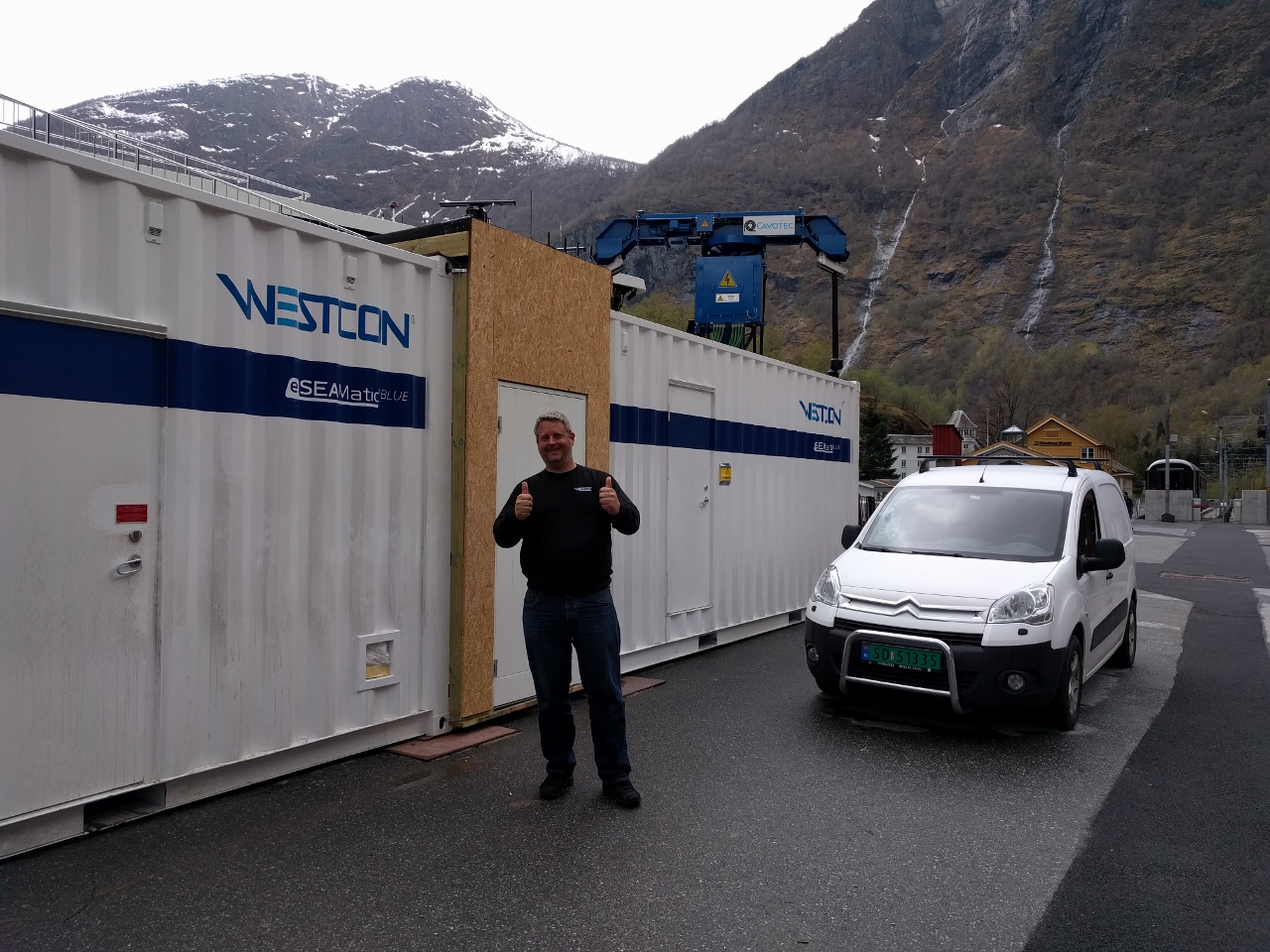 |
Westcon
Position: 7 6.90, 60 51.77
The Future of the Fjords is a super interesting large catamaran that is 100% electric. Its sister ship, hybrid Vision of the Fjords, has run well so they went with an all-electric propulsion system for the just-delivered Future of the Fjords.
We talked briefly with the Westcon engineer working on site to ensure the new system is working as designed. They faced an interesting problem here where local town Flam unsurprisingly doesn’t have the 2 million watts of power needed to quickly charge the on-board battery system in the Future of the Fjords. The solution they chose was an innovative one I’ve also seen used on short-run electric ferries. They trickle charge the large on-shore battery system stored in the container on the left and, when the boat arrives, quickly charge it’s batteries from the shore-side battery system. The shore-side facility is always charging at a low level in the background whether the boat is there or is off with a load of tourists. |
 |
Power Connection
Position: 7 6.88, 60 51.77
Now that’s a power connection. This is the 2 MW shore power supply for all-electric cruise ship Future of the Fjords
|
 |
Ægir Brew Pub
Position: 7 7.04, 60 51.82
We had another excellent meal at the Ægir Brew Pub in Flåm. This is looking down to their central fireplace and seating area from the dining room upstairs.
|
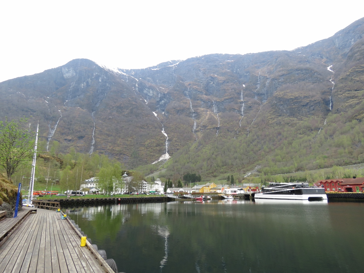 |
Flåm Harbour
Position: 7 7.08, 60 51.71
Flåm Harbour viewed from the commercial dock on the other side.
|
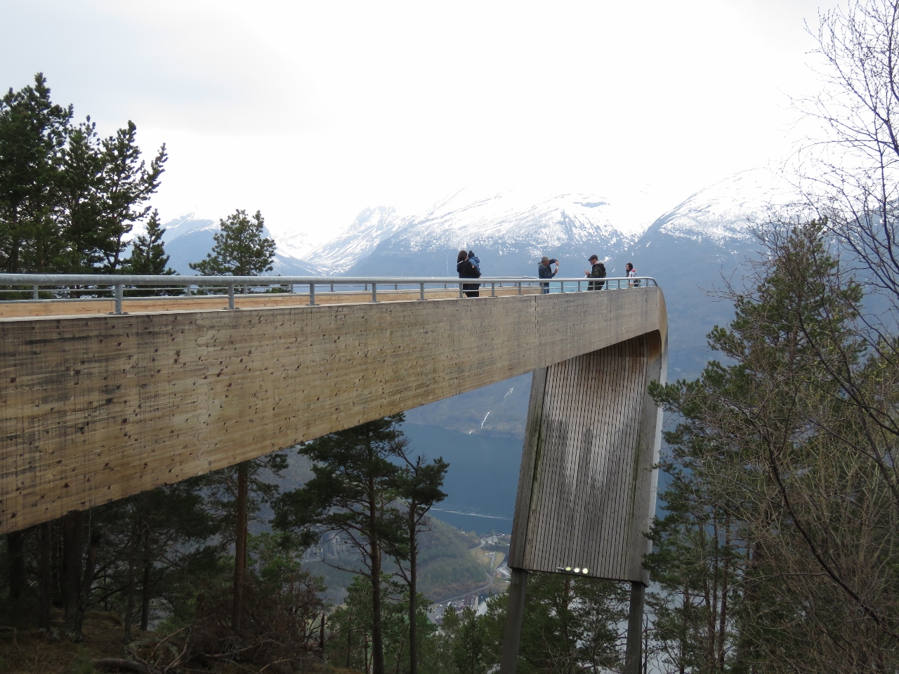 |
Stegastein Viewpoint
Position: 7 12.74, 60 54.52
The Stegastein Viewpoint juts 100ft (30m) out from the mountain 1,250ft (650m) above Aurlandsfjord. While in Flåm, we rented a car to visit the viewpoint and explore a few other attractions around Aurlandsfjord by road. Read more …
|
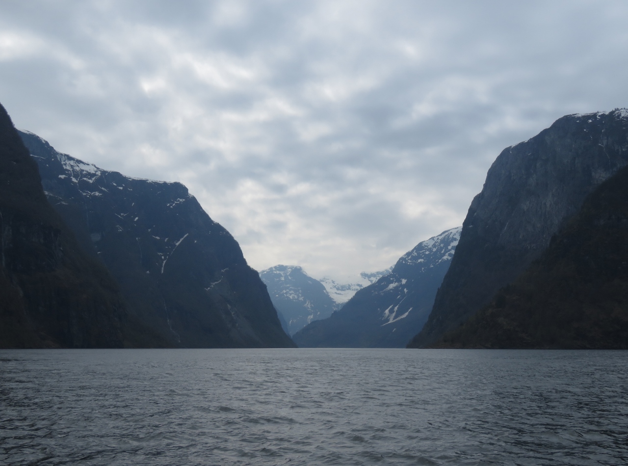 |
Nærøyfjord
Position: 7 2.71, 60 59.17
Nærøyfjord was named a UNESCO World Heritage site in 2005 for being among the most scenically outstanding in the world. At its narrowest the fjord is only 820ft (250m) across with sheer cliffs on either side. Dozens of dramatic waterfalls plunge down the steeply-sloped shores. A standout is Kjelsfossen, one of the highest waterfalls in Norway and the 18th tallest in the world, with a total fall height of 2,477 ft (755 m). After returning to Flåm and dropping off our rented Twizy, we set off for Nærøyfjord on a tender tour. Read more …
|
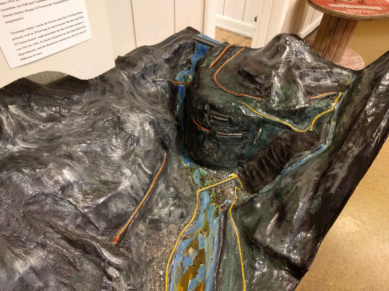 |
Museum
Position: 7 7.19, 60 51.67
Back at Flåm we stopped in at the railway museum, which has excellent displays detailing the history and construction of the Flåm Railway. This model shows in orange how the train tracks run up Myrdal Mountain. From bottom left the tracks climb steeply and turn right to emerge at Kjosfoss station where we stopped to view the waterfall Kjosfossen. The tracks turn right again and enter the Vatnahalsen tunnel, the bottom of two stacked tunnels, then makes a sharp horseshoe curve left and passes through Bali tunnel, the top of the stacked tunnels. From Bali the tracks extend away from the valley, paralleling the river that feeds Kjosfossen waterfall, then make another horseshoe curve to return toward the valley and make a final right turn and pass through a tunnel to reach Myrdal station.
The vehicle road is shown in yellow, with the switchbacks of Rallarvegen Road in black at the right of the model |
 |
Rune Bergkvam
Position: 7 7.19, 60 51.67
Rune Bergkvam, who runs the eMobility shop where we rented the Twizy, stopped by for a visit later in the evening. Rune travelled here in his boat that he keeps in the marina where we are moored, and lives in the hills above the marina with a view down Aurlandsfjord.
|

|
Click the travel log icon on the left to see these locations on a map, with the complete log of our cruise.
On the map page, clicking on a camera or text icon will display a picture and/or log entry for that location, and clicking on the smaller icons along the route will display latitude, longitude and other navigation data for that location. And a live map of our current route and most recent log entries always is available at mvdirona.com/maps. |
If your comment doesn't show up right away, send us email and we'll dredge it out of the spam filter.