This spring was a busy one, even by our standards. Together we made weekend trips to Los Angeles and in Washington State to Point Ruston, Alderbrook Lodge on Hood Canal, Bainbridge Island, Tacoma, Everett, Langley and Port Townsend. We also took a fabulous week-long cruise along the Danube River between Budapest and Bucharest. And James traveled for several business trips, including to Corning, NY; Boston; Dallas; Ojai, CA; Portland; San Francisco, Santa Clara and Nashville.
In between, we continued to enjoy our now-not-so-new downtown lifestyle, including attending two wine tastings hosted by our apartment complex and several hockey games, and enjoying many restaurant meals. We finished the season at a fantastic concert by Pearl Jam, one of our favourite bands, who were playing in their hometown for the first time in nearly six years.
Below are highlights from March 1st through May 30th, 2024. Click any image for a larger view, or click the position to view the location on a map. And a map with our most recent log entries always is available at mvdirona.com/maps.
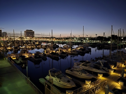 |
Marina del Rey
Position: 33°58.77’N, -118°26.77’W
Marina del Rey, in Los Angeles County, California, contains the largest artificial pleasure boat harbor in North America. Construction began in the 1950s and today the basin has a capacity for 5,000 vessels, supports five different yacht clubs and is lined with restaurants, shops, condos, and hotels. The first hotel built was the historic Marina del Rey Hotel, where we stayed for a long weekend in early spring. Opened in 1964, the hotel underwent a $25 million renovation in 2015 and is a modern and comfortable facility with great views in the marina basin.Read more …
|
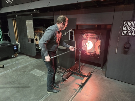 |
Corning Museum of Glass
Position: 42°9.00’N, -77°3.24’W
James was in Corning, New York this week to meet with the Corning Glass team. Corning is an incredible company founded in 1879, initially making incandescent light bulbs. Back in the beginning, many customers will have never heard of Corning glass and yet use their products every day. The same is true today with the bits you are reading today likely having flowed over Corning-supplied optical fibers and the phone sitting in front of you very likely using a Corning cover glass. Good companies produce widely-used products but only great ones do it consistently for nearly two centuries. In this picture, James is blowing a drinking glass with a lot of help from the Corning Museum of Glass team.
|
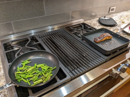 |
Cooking Dinner
Position: 47°36.99’N, -122°20.58’W
Jennifer sauteing asparagus and grilling salmon for dinner while James is away. We initially bought a grill pan to allow us to grill while camping without having to carry an entire barbecue. It worked so well that we bought one for the apartment as well, where we can’t have a gas grill on the patio. The apartment does have a very nice Miele range (seen here) with a built-in gas grill, but it’s a hassle to clean. The grill pan works just as well, if not better, and clean-up is a breeze.
|
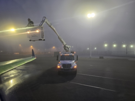 |
De-Icing at Elmira
Position: 42°9.86’N, -76°53.56’W
Workers de-icing the plane prior to James flight from Elmira, NY to return home to Seattle after visiting Corning. Little did he know this was to be only the first of two de-icings before successfully lifting off nearly 5 hours later.
|
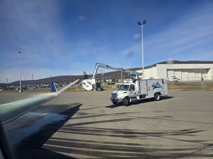 |
De-Icing Again at Elmira
Position: 42°9.86’N, -76°53.56’W
After the first de-icing, James’ plane sat at the end of the runway to wait for the fog to clear to the point where the plane had the 1,600′ of visibility required to safely take off. The wait continued and, after 10 min, the pilot shut down the engines to avoid needing to refuel. An hour later, the weather had cleared and the engines were restarted, but the entire place was vibrating and the engines were quickly shut down. While the engines were shut off at the end of the runway, the low-lying fog had been freezing on the jet engine blades and they were unbalanced. Jet engines are cleared of ice when underway by momentarily ramping up to full power, but this is an in-air recovery technique not typically used on the ground.The plane was disabled at the end of the runway and needed to be towed back to the gate for service by the maintenance staff. They were very slowly towed back to the gate and the maintenance team brought out to service the engines. Once the ice was clear, they wanted to spin the engines up to full speed on the ground for testing but, apparently, procedures don’t allow that with passengers on the plane so everyone was asked to step back off the plane. Once the engines were tested the plane again needed to be fueled, passengers reloaded, and then it was de-iced for the second time that morning before we got underway.
|
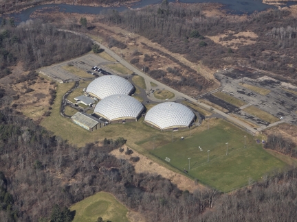 |
The Domes
Position: 42°12.42’N, -76°49.68’W
The three geocentric domes of Elmira College’s Murray Athletic Center. One dome contains a 3,200-seat hockey arena, another a 2,000-seat gymnasium with a basketball court, and the third houses four indoor tennis courts.
|
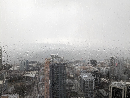 |
Squall
Position: 47°36.99’N, -122°20.58’W
The sky went dark this afternoon as a big squall passed through, bringing heavy rain and hail.
|
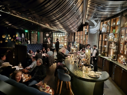 |
Deep Dive
Position: 47°36.93’N, -122°20.37’W
Enjoying an evening drink at Deep Dive, a speakeasy under the Seattle Spheres. The drinks are amazing and the Victorian-themed decorations always remind us of our visit to the Teyler’s Museum of Wonder in Haarlem, the Netherlands.
|
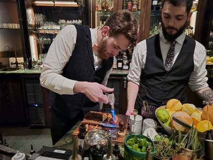 |
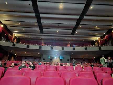
Flaming Orange Peel
Position: 47°36.93’N, -122°20.37’W
A bartender at Deep Dive flaming an orange peel. The drink menu is constantly evolving with new creations and we love sitting at the bar and watching the bartenders in action.
|
 |
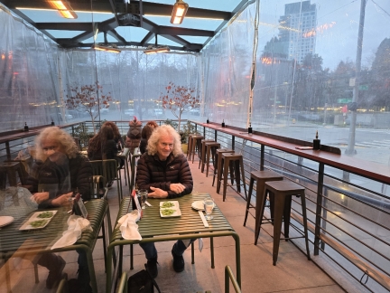
SIFF Cinema
Position: 47°36.85’N, -122°20.48’W
We returned to SIFF Cinema today to watch Dune 2. We’re big Frank Herbert fans and really enjoyed the movie. And the SIFF Cinema, with reserved seating and a bar, is a wonderful venue to take in a show.
|
 |
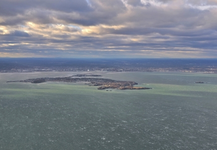
Momiji
Position: 47°37.11’N, -122°20.42’W
After watching Dune 2 at SIFF Cinema, we ended the evening with a fun dinner on the heated patio at Momiji Japanese restaurant near our apartment.
|
 |
High winds
Position: 42°22.80’N, -70°52.53’W
Wind-streaked waves off the Boston suburb Nahant as James flight arrives into the area for a business trip.
|
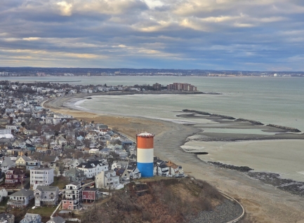 |
Winthrop Beach, Boston
Position: 42°21.85’N, -70°57.98’W
The distinctive red, white and blue striped water tower in the town of Winthrop Beach at the entrance to Boston Harbor. James is flying in on a business trip.
|
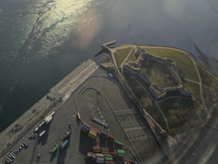 |
Fort Independence
Position: 42°22.35’N, -70°58.96’W
On his return flight back to Seattle, James flew over Fort Independence, the oldest fortified military site of British origin in North America. The first British fortification was built here in 1634, to fend off French Naval attacks, and the current star-shaped fort was constructed after the American Revolution. Today the fort is open to the public as part of Castle Island State Park.
|
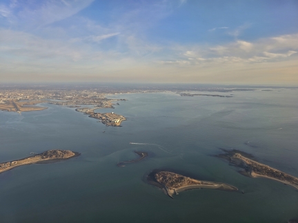 |
Boston Harbor Entrance
Position: 42°18.62’N, -70°56.54’W
The view northwest across the Boston Harbor entrance on James’ flight back to Seattle. Along the bottom, from left to right, are the tip of Long Island, tiny Nix’s Mate, Gallops Island, and the tip of Lovells Island. On the other side of the harbor is Deer Island, where in 2016 we toured its sewage treatment plant while living at Charlestown Marina.
|
 |
Spring Hockey
Position: 47°37.32’N, -122°21.24’W
On a rare weekend actually spent at home in Seattle, we managed to watch three live hockey games over four days. Two were Seattle Kraken NHL games, and the third was an infrequent return to Seattle by the Thunderbirds Junior A team for the “Battle of the Sound” against the Portland Winterhaks. We often attended Thunderbirds games when their home arena was at Seattle Center Ice Arena, but in 2009 they moved to Kent, 20 miles (32km) to the south.Read more …
|
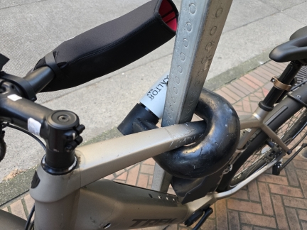 |
Altor SAF Lock
Position: 47°36.98’N, -122°20.45’W
An Altor SAF lock, designed to resist angle grinders and conventional attacks, on a bicycle in downtown Seattle. The lock is a beast and looks pretty challenging to overcome but, at 13.2 lbs (6 kg), you might rather lose the bike than have to lug it around.
|
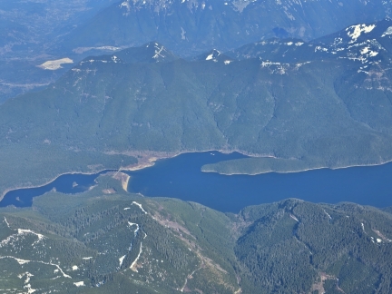 |
Chester Morse Lake
Position: 47°21.86’N, -121°47.08’W
The Chester Morse Lake/Masonry Pool reservoir complex, major contributors to Seattle’s water supply, viewed from James’ flight to Dallas on a business trip.
|
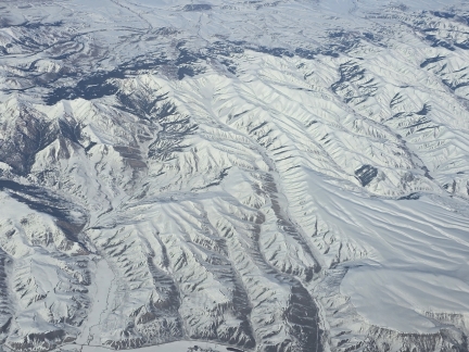 |
Idaho
Position: 44°27.10’N, -114°46.50’W
Snow-encrusted mountains in Idaho, seen from James’ flight to Dallas on a business trip.
|
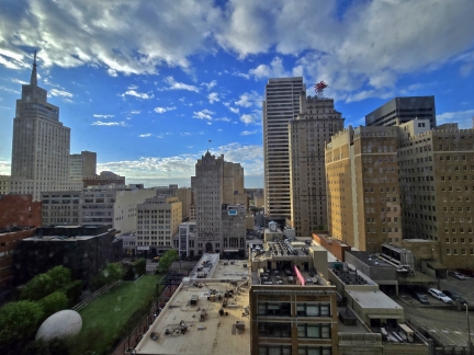 |
Downtown Dallas
Position: 32°46.86’N, -96°47.92’W
Looking south across downtown Dallas from James’ room at the Hilton Garden Inn. At bottom left is The Eye, a 30-foot (9 m) sculpture of a giant bloodshot blue eyeball, by Chicago-based artist Tony Tasset.
|
 |
The Joulle Dallas
Position: 32°46.86’N, -96°47.92’W
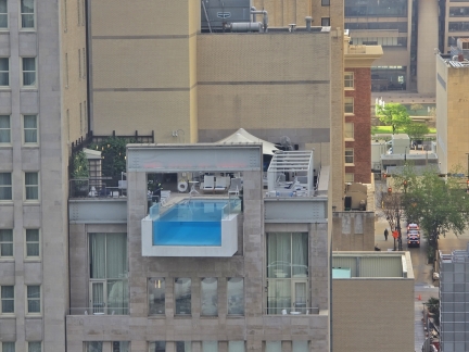
The spectacular cantilevered pool at luxury hotel, The Joulle, across from James’ room at the Hilton Garden Inn in Dallas.
|
 |
Fire Training
Position: 32°54.12’N, -97°2.52’W
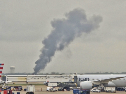
Smoke billowing from a aircraft mockup as part of fire training at the Dalls For Worth Airport’s Fire Training Research Center. Students from around the world attend the facility’s airport/aircraft fire fighting training.
|
 |
Window Washing
Position: 47°36.99’N, -122°20.58’W
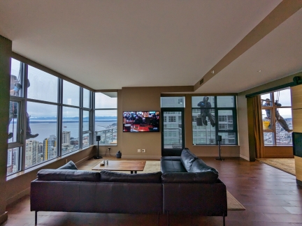
Three workers suspended from the roof of our apartment building as part of our biannual window-washing.
|
 |
Point Ruston Ferry
Position: 47°17.74’N, -122°29.99’W
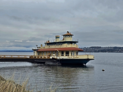
The historic Point Ruston ferry was built in Maine in 1936, and initially served as the navy ferry Aquidneck YFB-14 between Newport RI and Goat Island. The Pierce County Ferry System purchased the ship from the navy in 1971, and ran it as the M/V Steilacoom on the route between its namesake city and Anderson Island. The developers of the Point Ruston waterfront complex later purchased the ship for their sales office, and occasionally brought the vessel up to Bell Harbor Marina in Seattle to promote sales. We photographed it in May of 2009 while living aboard there, and got another look at the ferry on an overnight trip to Ruston Point. |
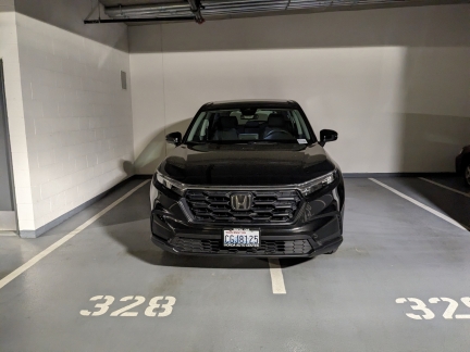 |
Honda CRV
Position: 47°37.05’N, -122°20.60’W
A rental Honda CRV while our Honda Passport is in for regular maintenance. The CRV has similar styling, features and controls as the Passport, so feels very familiar, but is a smaller vehicle that overall seems less capable and well-appointed.
|
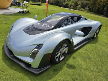 |
MARS Conference 2024
Position: 34°26.26’N, -119°15.62’W
The annual MARS conference, hosted by Amazon founder Jeff Bezos, is a cross-domain event aimed at sharing ideas across the rapidly growing fields of Machine Learning, Automation, Robotics, and Space. Hands-on learning and emerging technology demonstrations form the majority of the invitation-only event, with opportunities for attendees to meet and learn from each other. For James, a notable display at this year’s conference was the Czinger 21C, developed using 3D printing.Read more …
|
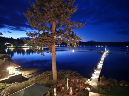 |
Alderbrook Resort
Position: 47°20.88’N, -123°4.07’W
Alderbrook Resort on Hood Canal has been a popular Pacific Northwest vacation destination since it first opened in 1913. Back then, no roads reached the resort and guests arrived by canoe. The resort has been through many owners and remodels since opening, and now is easily reachable by road on Washington State Route 106. But some guests still do arrive by boat, where they can overnight on the property’s extensive docks. Alderbrook has long been on our list of places to visit in the area, but their availability and our schedule never matched up. The two finally meshed earlier this year on a beautifully sunny weekend, and we made the two-hour drive from Seattle to spend a couple of nights there. |
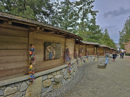 |
Bainbridge Island
Position: 47°36.90’N, -122°30.61’W
Bainbridge Island, across the Puget Sound from Seattle, has had a robust Japanese community since immigrants first arrived there in the late 1800s. Their world was shattered following the air attack on Pearl Harbor, when President Franklin D. Roosevelt signed an executive order for the nation-wide internment of over 125,000 US residents of Japanese descent, the majority US-born citizens. Due to their proximity to the Puget Sound naval bases, the first to be interned were the 267 Japanese-American Bainbridge Island residents, who were forcibly removed from their homes in 1942 and not allowed to return until 1945. In a tragedy that a 1970 presidential commission later concluded was based mostly on racism, most lost their homes, property, jobs, and invaluable personal items. The Bainbridge Island Japanese American Exclusion Memorial, opened in 2011, tells the story of the internees and the impact on their lives, with the motto of “Nidoto Nai Yoni (Let It Not Happen Again)”. We visited the sobering memorial, pictured above, during a weekend trip to Bainbridge Island this spring. Read more … |
 |
Egg Bites
Position: 47°36.99’N, -122°20.58’W
Freshly baked “Grab-and-Go Egg Bites” to freeze for quick lunches. They are delicious both fresh and reheated after freezing.
|
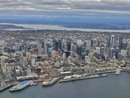 |
Downtown Seattle
Position: 47°36.51’N, -122°22.14’W
View to downtown Seattle from James’ return flight on a business trip to Portland. The twin towers of our apartment complex, Insignia, are visible slightly left of center, directly left of the powder blue building.
|
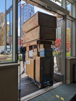 |
Tight Squeeze
Position: 47°36.99’N, -122°20.57’W
A package delivery to our apartment complex just barely fitting through the doors.
|
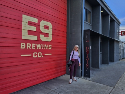 |
Tacoma
Position: 47°15.48’N, -122°26.46’W
The Puget Sound port city of Tacoma was founded in 1872 and experienced what author Rudyard Kipling described as “a boom of the boomiest” when the following year it was selected as the Pacific Northwest terminus of the transcontinental Northern Pacific Railway. These decades also saw the emergence of Tacoma as a brewing town, and by 1901 the population of 37,700 supported 95 bars.Tacoma’s days as a major brewing city ended with 1979 closure of the Heidelberg brewery, but a healthy craft beer industry quickly emerged in its place, resurrecting Tacoma’s Historic Brewing district. On a weekend visit to Tacoma, we got an opportunity to explore a sampling of the city’s industrial and brewery past and present.
|
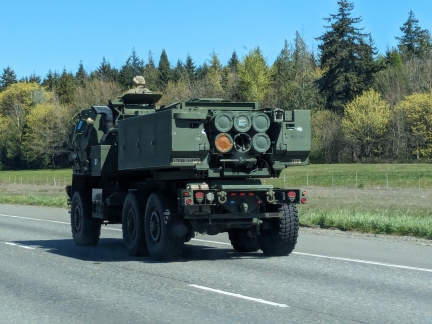 |
M142 HIMARS
Position: 47°18.23’N, -122°18.10’W
One of several M142 High Mobility Artillery Rocket System (HIMARS) we passed on I-5 while heading north from Tacoma to Seattle. The HIMARS have been in service since 2010 and can carry either six Guided Multiple Launch Rocket System (GMLRS) rockets or one Army Tactical Missile System (ATACMS) missile.
|
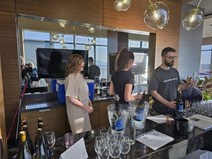 |
Structure Cellars
Position: 47°36.99’N, -122°20.58’W
Seattle-based Structure Cellars on-site our apartment complex, Insignia, for a wine tasting. Insignia has a very active social committee that arranges a variety of events. We particularly enjoy their pub crawls.
|
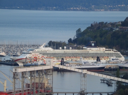 |
Norwegian Sun
Position: 47°36.99’N, -122°20.59’W
The Norwegian Sun, the third cruise ship departure of the 2024 season, moored at Pier 91. The ship was scheduled to dock at Pier 66, where the Norwegian ships almost always dock, but for some reason is at Pier 91 instead.
|
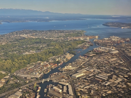 |
Ship Canal
Position: 47°31.64’N, -122°18.52’W
View to the Ship Canal between Elliott Bay and Lake Union, viewed from James’ flight on business to San Francisco.
|
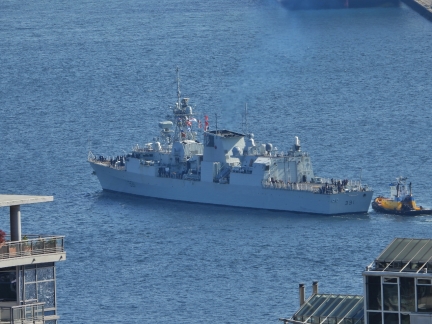 |
HMCS Vancouver
Position: 47°36.99’N, -122°20.59’W
The HMCS Vancouver, a Canadian Halifax-class frigate, arriving into the Port of Seattle.
|
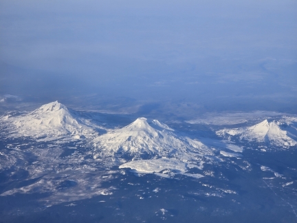 |
Three Sisters
Position: 44°5.28’N, -122°14.87’W
A spectacular view to Oregon’s Three Sisters mountains on James’ return flight home from a business trip to San Francisco.
|
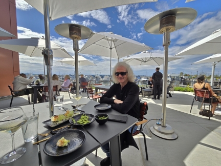 |
Everett
Position: 47°59.93’N, -122°12.95’W
We’d passed Everett many times by car on I-5 and by boat to and from Elliott Bay Marina, but had never visited. We finally did earlier this year with an overnight stay at the Hotel Indigo overlooking the large Port of Everett Marina. While there, we explored the city’s newly-completed Waterfront Place development that opened on the site of the some of the original sawmills, never straying far from the railroad tracks that continue to transport people and goods to and through the city.Read more …
|
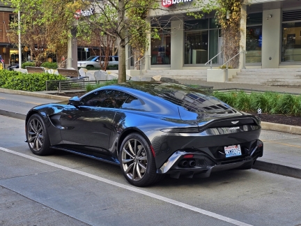 |
Aston Martin
Position: 47°36.98’N, -122°20.55’W
An Aston Martin Vantage parked outside our Seattle apartment building. As with the previous model, the new Vantage’s twin-turbo 4.0-liter V-8 has AMG DNA. But it’s been significantly reworked for increased output with new turbos, revised cam profiles, optimized compression ratios, and improved cooling. Output now sits at 656 horsepower and 590 pound-feet of torque, an increase of 128 horsepower and 85 pound-feet over the prior engine in the Vantage F1 edition, previously the most powerful Vantage variant. Power is transmitted to the rear axle via an eight-speed automatic transmission.
|
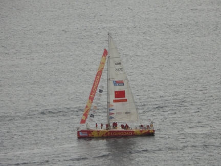 |
Clipper Round the World
Position: 47°36.99’N, -122°20.59’W
CV27 Qingdao, arriving from Zhuhai, China into Bell Harbor Marina, our old home port. Qingdao is one of 11 identical yachts competing in the Clipper Round the World Race, a 10-month competition that starts and ends in Portsmouth, UK. The fleet will stay in Seattle for about a week before embarking on the 7th leg of the race, down the Pacific Coast and through the Panama Canal to US east coast, before completing the final leg across the Atlantic and back to Portsmouth.
|
 |
TSMC Symposium
Position: 47°36.99’N, -122°20.59’W
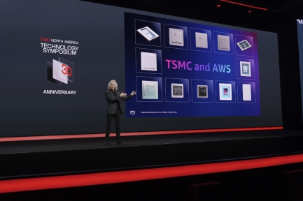
James presenting at the annual TSMC Symposium in Santa Clara, California. TSMC (Taiwan Semiconductor Manufacturing Company Limited) is the largest semiconductor maker in the world by revenue and also by market share, producing 61% of chips worldwide. Amazon is a close partner of TSMC for their custom silicon work designed by subsidiary Annapurna Labs.
|
 |
La Palmera, Seattle
Position: 47°37.46’N, -122°20.37’W
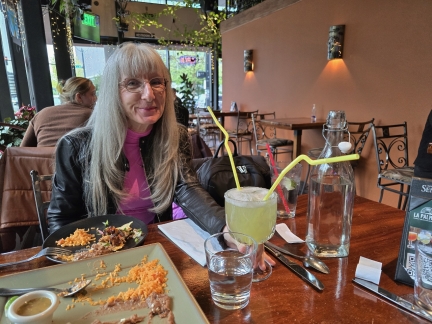
At La Palmera Mexican restaurant in South Lake Union for dinner. We ordered a Margarita to share, and the waiter brought it out with two crazy long straws.
|
 |
Nat Geo Venture
Position: 47°36.99’N, -122°20.59’W
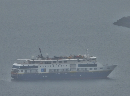
National Geographic Venture arriving into Seattle on a foggy day prior to embarking on a 14-day trip through the Inside Passage to Sitka, Alaska.
|
 |
Butcher’s Table
Position: 47°37.05’N, -122°20.30’W
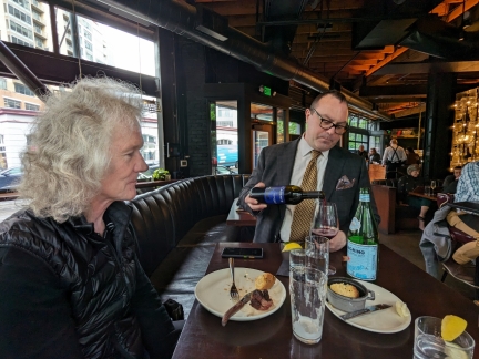
Dinner at Butcher’s Table, one of our favorite Seattle restaurants. Here we are trying a new red not yet on their menu by Washington-based Cadence Winery. We quite enjoyed it.
|
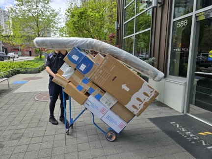 |
Packages
Position: 47°36.98’N, -122°20.54’W
Our apartment building has a constant flow of packages arriving, and the delivery people manage to bring in a huge amount in one load.
|
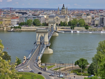 |
Budapest
Position: 47°29.86’N, 19°2.32’E
The cities of Buda and Pest became one in 1849 with the construction of the famous Szechenyi Chain Bridge, the first permanent bridge across the Danube River (pictured above). Despite centuries of European conflict dating back to the Middle Ages, multiple occupations by conquering forces, and decades of Communist rule, both sides are full of noteworthy buildings covering the gamut of that history. And while roads and bridges have eliminated the need for much water traffic, the Danube River remains a busy waterway for commercial shipping and pleasure traffic through the city. We joined that traffic with a week-long Danube River cruise aboard the AmaMagna that departed from Budapest. We arrived the day before boarding the ship and spent the evening and following day enjoying the river views and exploring this historic city, particularly its wide-ranging architecture and countless works of modern and historic art. |
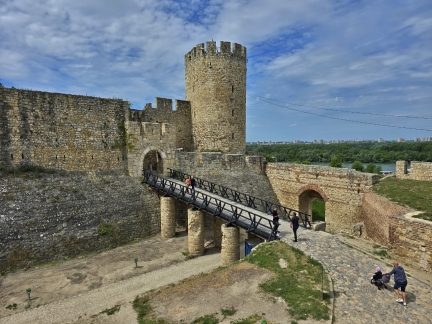 |
Danube River Cruise
Position: 44°49.51’N, 20°27.08’E
We had a fantastic time on our week-long Danube River cruise aboard the AmaMagna. Stops along the way included Pecs in Hungary, Vukovar in Croatia, Novi Sad and Belgrade in Serbia, Vidin and Ruse in Bulgaria, and Bucharest in Romania. As with Budapest, these cities all date back to the Middle Ages and have suffered through much conflict, plus the poverty of the Soviet Era. Some of the conflict is not so ancient, with Croatia only gaining independence from Yugoslavia in a bloody conflict that ended in 1995. Shell-pocked buildings in Vukovar are a vivid reminder of this recent war. Centuries-old castles and fortresses dot the landscape along the Danube, and each city has its own unique architecture and flavor. The weather was unseasonably warm during our trip, drawing residents and visitors in droves to the outdoor cafes and bars overlooking public squares beneath striking historical architecture. We particularly enjoyed spending a sunny day exploring Belgrade, with its ancient fortress (pictured ) and opulent Serbian Orthodox church that is the largest in the world. |
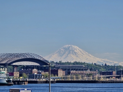 |
Mt. Rainier
Position: 47°36.65’N, -122°20.91’W
Mt. Rainier dominating the Seattle skyline on a warm and clear spring afternoon, viewed from our dinner table on the patio at Anthony’s Pier 66 restaurant.
|
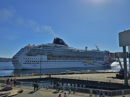 |
Norwegian Sun
Position: 47°36.64’N, -122°20.91’W
The Norwegian Sun departing Pier 66 in Seattle. With more unseasonably warm weather, we had an early dinner on the patio at Anthony’s Pier 66 restaurant to watch the ship depart.
|
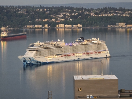 |
Norwegian Bliss
Position: 47°36.99’N, -122°20.58’W
The Norwegian Bliss arriving into Pier 66 shortly after 5am this morning. The Alaska cruise ship season isn’t yet in full swing, but we’re loving seeing the ships back again.
|
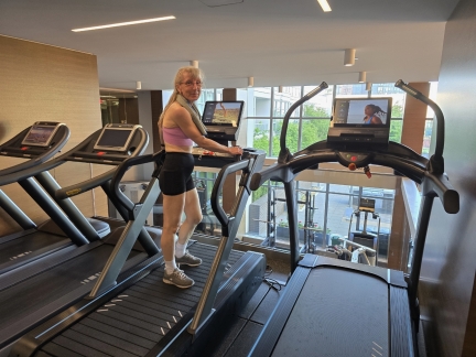 |
Fitness Center
Position: 47°37.01’N, -122°20.58’W
We’ve concluded that the HIIT (High Intensity Interval Training) program we were following provided an insufficient cardio workout and are trying out a new program using the well-equipped fitness center in our apartment complex. So far the new program has been quite effective, and we have had no trouble getting machines when we need them.
|
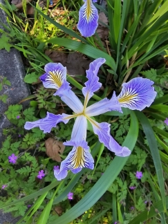 |
Iris, Seattle
Position: 47°37.55’N, -122°20.11’W
A spectacular iris blossom along south Lake Union.
|
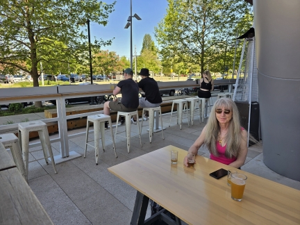 |
Tapster, Seattle
Position: 47°37.54’N, -122°20.21’W
Enjoying a drink on the patio at Tapster, a self-pour bar where you can serve yourself as little as an ounce to try different beverages.
|
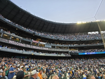 |
Seattle Mariners
Position: 47°35.45’N, -122°19.98’W
A near sellout crowd for a Saturday night Seattle Mariners MLB game on an unseasonably warm May afternoon.
|
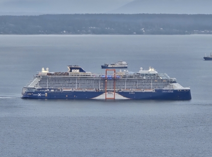 |
Celebrity Edge
Position: 47°37.00’N, -122°20.60’W
The Celebrity Edge arriving into Pier 91 for its inaugural Alaska cruise. The 1,004-ft (306 m) ship holds 2,900 passengers and was launched in 2018 at a cost of roughly US$1 billion. The distinctive orange rectangle on the side supports the “Magic Carpet”, a movable platform that facilitates tender embarkation and debarkation in port and otherwise functions as a restaurant or lounge.
|
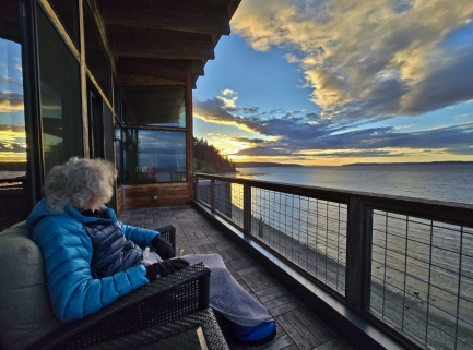 |
Langley
Position: 48°2.47’N, -122°24.58’W
Langley is a compact, restaurant-filled town perched on the cliffs above Saratoga Passage on Whidbey Island north of Seattle. We had visited by boat many times, but not for over a decade. We returned this year for a weekend in the Inn at Langley’s spectacular Saratoga Suite, with its large deck overlooking the water (pictured).Read more …
|
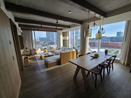 |
1 Hotel, Nashville
Position: 36°9.44’N, -86°46.85’W
James’ beautiful suite at the 1 Hotel on a business trip to Nashville.
|
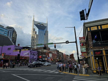 |
Nashville
Position: 36°9.61’N, -86°46.70’W
Looking down Broadway in Nashville at the intersection with Rep. John Lewis Way. Historic Tootsie’s Orchid Lounge, on the left, sponsors NASCAR drivers Daniel Saurez. The grey building behind it on the left is the Ryman Auditoriam, home of the famous Grand Ole Oprey. On the right is Honky Tonk Highway, a row of live music venues along Broadway.
|
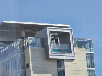 |
Westin Nashville
Position: 36°9.44’N, -86°46.84’W
The fantastic pool at the Westin Nashville, viewed from James’ room at the 1 Hotel.
|
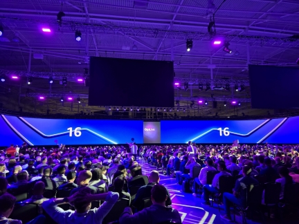 |
OpsLive, Nashville
Position: 36°9.45’N, -86°46.70’W
Countdown to the start of OpsLive 2024, a biennial Amazon-internal conference held this year in Nashville, where James will be presenting later today.
|
 |
Alexandria Nicole Cellars
Position: 47°37.03’N, -122°20.62’W
A wine tasting with local Alexandria Nicole Cellars, organized by our apartment complex.
|
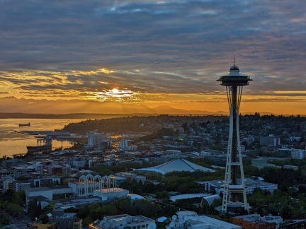 |
Sunset
Position: 47°37.02’N, -122°20.78’W
A spectacular sunset, viewed from the top floor of the north tower in our apartment complex during the wine tasting.
|
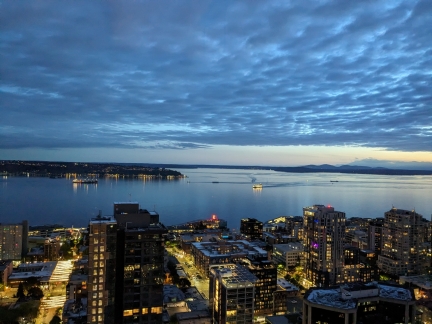 |
Dusk
Position: 47°36.99’N, -122°20.58’W
Ferry arriving into Seattle at dusk on an ultra-calm evening.
|
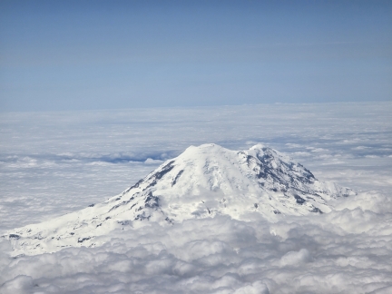 |
Mt. Rainier
Position: 46°58.05’N, -121°17.15’W
Snow-encrusted Mt. Rainier rising above the clouds, viewed from James’ flight home from a business trip to Nashville
|
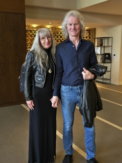 |
Heading out for dinner
Position: 47°36.99’N, -122°20.57’W
In the lobby of our apartment building before heading out for dinner.
|
 |
Port Townsend
Position: 48°6.61’N, -122°45.95’W
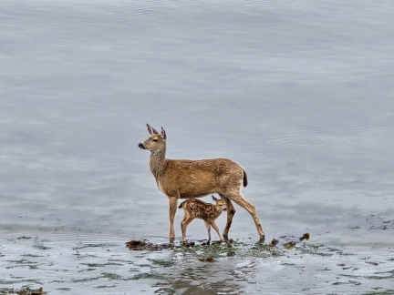
Port Townsend, WA is a Victorian-era waterfront city with a vibrant artist and maritime community. Its Wooden Boat Festival, held annually for nearly a half-century, is the largest in the continent and last year drew 10,000 attendees. We have anchored off Port Townsend many times in the past, enjoying the view to the city’s many 19th-century buildings. On our first time back in over a decade, our room at Tides Inn was so close to the water’s edge and the anchorage that we felt transported back to those times, as if we too were on a boat at anchor. A deer and her fawn, pictured above, were among the many creatures we saw foraging at low tide just outside our window.Read more …
|
 |
Liva O, Elliott Bay
Position: 47°36.99’N, -122°20.59’W
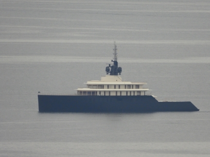
The superyacht Liva O moored off Elliott Bay Marina in Seattle. The 387-ft (118 m) yacht, launched in 2023 at an estimated cost of USD $250 million, is the largest and most luxurious ever constructed by German superyacht builder Abeking & Rasmussen.
|
 |
Raising Forms
Position: 47°36.99’N, -122°20.59’W
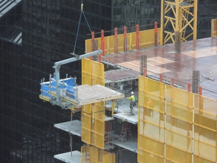
Modern construction techniques are incredibly efficient. We watched over lunch in our apartment as the forms for the next floor of a building under construction were craned up from the floor below. The crew is able to complete an entire floor in only a few days.
|
 |
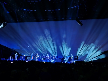
Deep Sea Diver
Position: 47°37.32’N, -122°21.25’W
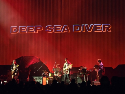
Local Seattle band Deep Sea Diver on stage at Climate Pledge Arena, as the opening act for Pearl Jam. We quite enjoyed their music and performance.
|
 |
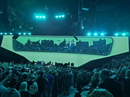
Pearl Jam
Position: 47°37.31’N, -122°21.23’W
We were super-excited to see live for the first time one of our favorite bands, Pearl Jam, on the second of a two-night appearance at Climate Pledge Arena. This is the first time they’ve played in their hometown for nearly six years and they put on a fantastic show.
|
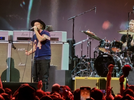 |
Eddie Vedder
Position: 47°37.33’N, -122°21.21’W
Eddie Vedder, the lead singer for Pearl Jam, performing on stage at Climate Pledge Arena. Born and raised in Illinois, Vedder is wearing the number 34 jersey of Chicago Bear’s running back Walter Payton, considered one of the best football players ever.
|
 |
Encore
Position: 47°37.31’N, -122°21.24’W
After their main set, Pearl Jam played several encores to complete their last hometown show for the foreseeable future. We had a fabulous evening and really enjoyed the concert.
|
 |
Click the travel log icon on the left to see these locations on a map. And a map of our most recent log entries always is available at mvdirona.com/maps. |

If your comment doesn't show up right away, send us email and we'll dredge it out of the spam filter.