The Commonwealth Basin snowshoe route starts at the Snoqualmie Pass ski resort and follows Commonwealth Creek northeast towards the base of Red Mountain. The winter scenery along the way is varied and spectacular, ranging from snow-covered foot bridges in an intimate forest setting to frozen waterfalls to wide-open mountain vistas. And the higher-altitude climb up the flank of Red Mountain, pictured in the distance above, yields even better views.
Portions of the route follow a section of the Pacific Crest Trail (PCT) Section J, between Snoqualmie Pass and Stevens Pass. (The PCT is a 2,653 mi (4,270 km) long-distance hiking trail extending from the southern to the nothern US border through the Cascade and Sierra Nevada mountain range.) We’d planned to park in the PCT trailhead lot to make the snowshoe hike, but the lot and road leading to it were snowed in. We instead parked with the skiers and walked a short distance before donning our snowshoes. Within feet, we left the busy and noisy ski area just off the I-90 highway for a hushed and tranquil woods covered with snow. We saw few other people the entire time, and really enjoyed the winter scenery and views.
Below are highlights from March 13, 2022. Click any image for a larger view, or click the position to view the location on a map. And a map with our most recent log entries always is available at mvdirona.com/maps.
 |
Breakfast Bowl
Position: 47°36.99’N, -122°20.57’W
A delicious Cinnamon Quinoa breakfast bowl to start the day.
|
 |
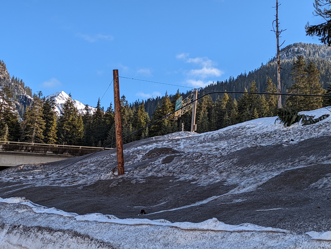
Less Snow
Position: 47°24.56’N, -121°26.36’W
The weather has warmed up considerably since our late-January trip up to Snoqualmie Pass and there’s much less snow on the mountains and beside the road at altitude 2,406ft (733m).
|
 |
Wires Buried
Position: 47°25.57’N, -121°24.94’W
At 2,908 ft (886 m) there is still plenty of snow to keep these power lines buried at left.
|
 |
Bathrooms
Position: 47°25.65’N, -121°24.83’W
We’re snowshoeing into Commonwealth Basin today from a summer trailhead for the Pacific Crest Trail. The summer bathrooms at the trailhead are closed for the winter and buried in snow, as is the entire parking lot and short entry road. We instead parked near the ski resort and walked a short distance over the snow to reach the trailhead.
|
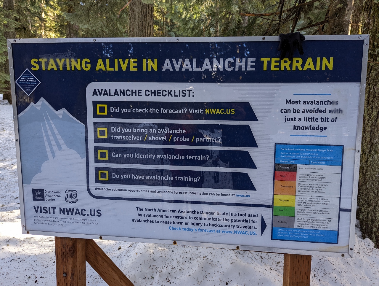 |
Avalanche Warning
Position: 47°25.65’N, -121°24.80’W
Sign warning of backcountry avalanche risks. The Northwest Avalanche Center produces daily forecast on avalanche risks and dangers, and today the forecast for the Snoqualmie Pass area is moderate.
|
 |
Alpine Lakes
Position: 47°26.04’N, -121°24.46’W
We’re just crossing into the the southern boundary of the Alpine Lakes Wilderness Area that encompasses over 400,000-acres (160,000 ha) roughly between Snoqualmie Pass and Steven’s Pass. Alpine Lakes contains some of the most rugged and beautiful topography in the Cascade Mountains, with steep mountains and over 700 lakes. With 47 trailheads and 615 miles (990 km) of trails, the area is very popular in the summer, particularly the Enchantment Lakes region where a lottery system is in place to obtain an overnight camping permit.
|
 |
Crossing Bridge
Position: 47°26.19’N, -121°24.14’W
Crossing over Commonwealth Creek on a bridge buried deep in snow.
|
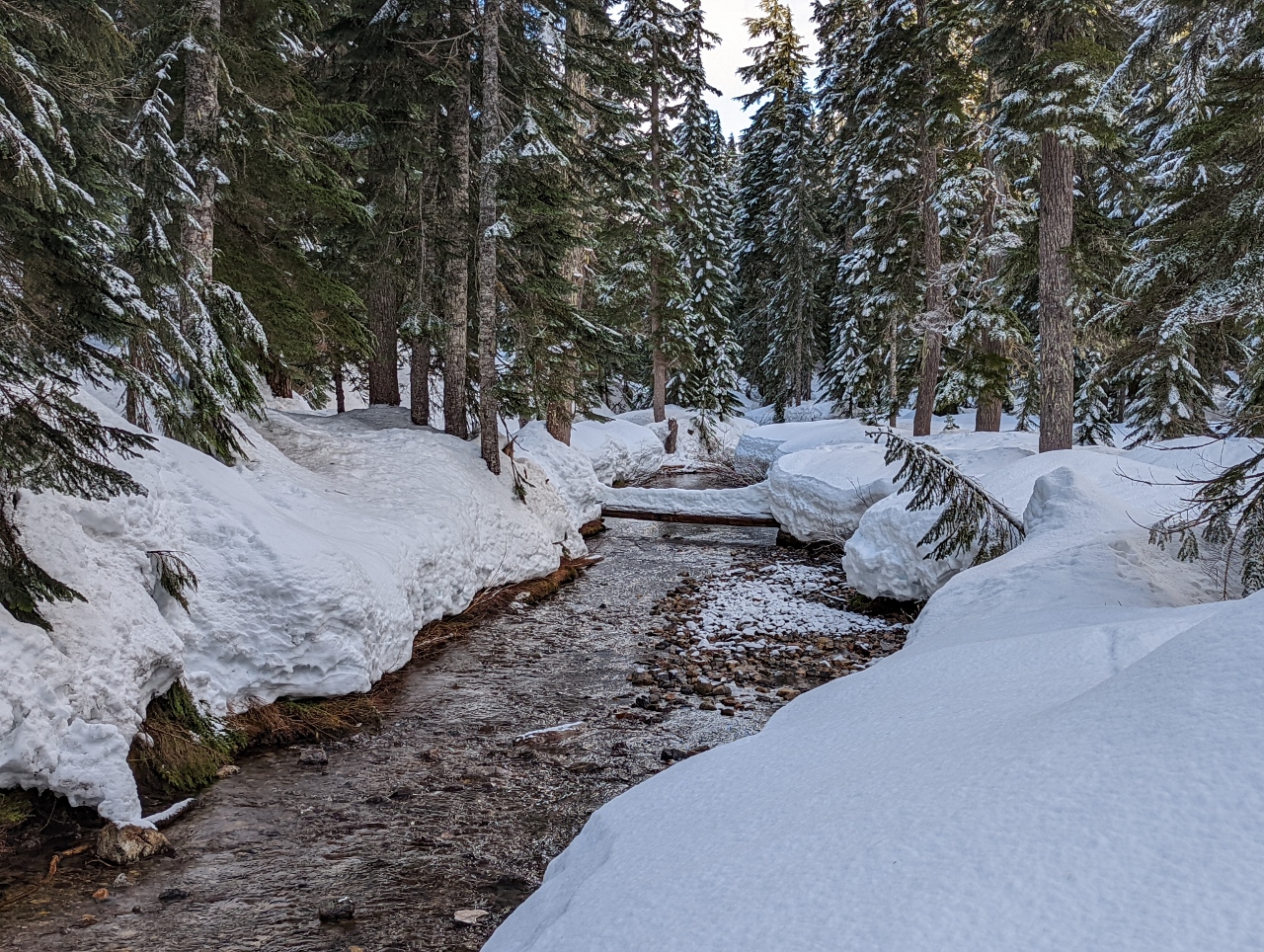 |
Commonwealth Creek
Position: 47°26.20’N, -121°24.15’W
The beautiful winter scene looking south along Commonwealth Creek from the bridge we just crossed.
|
|
|
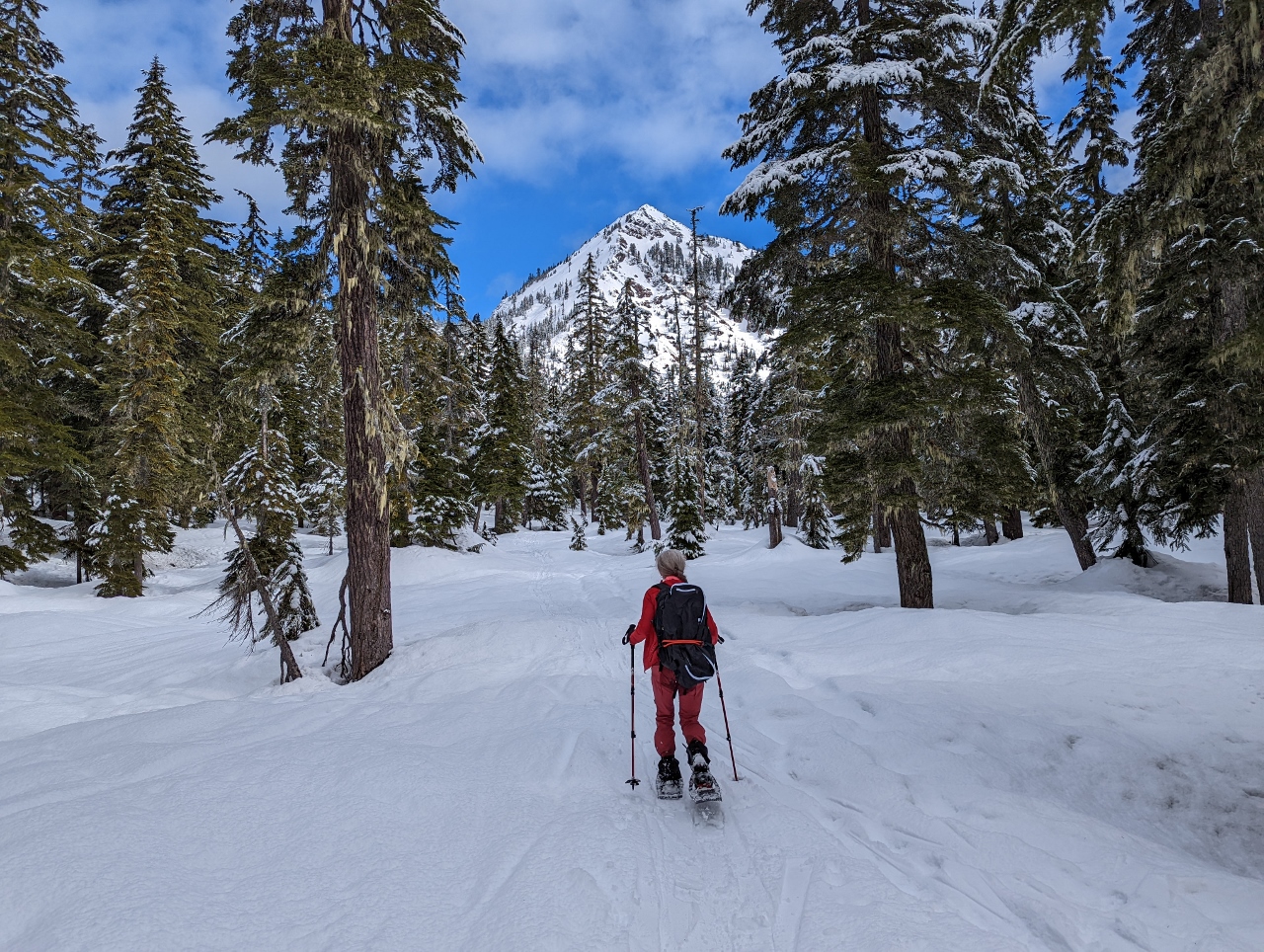
Red Mountain
Position: 47°26.67’N, -121°23.95’W
Heading north through Commonwealth Basin with 5,807-ft (1,770 m) Red Mountain visible in the distance.
|
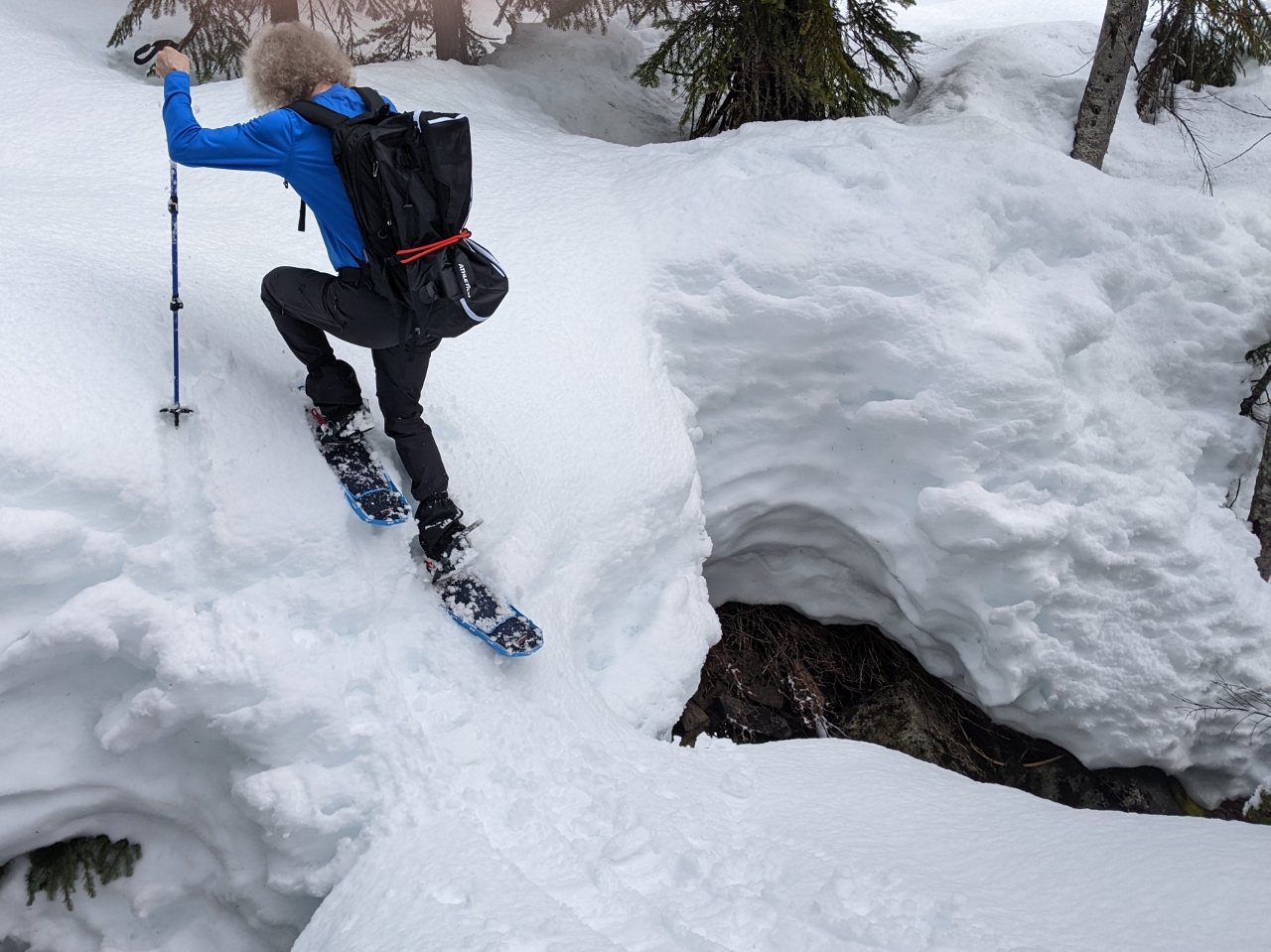 |
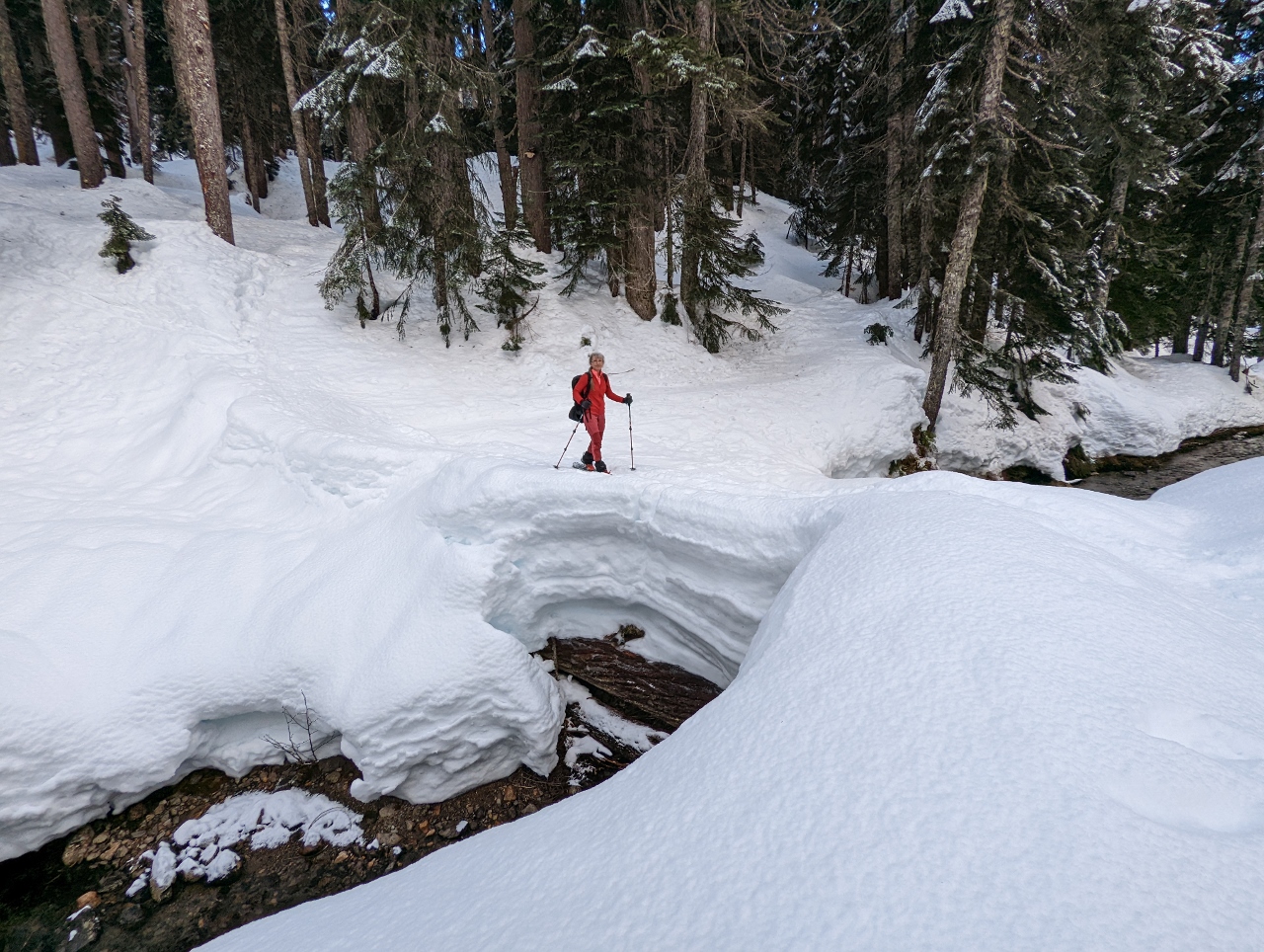
Snow Bridge
Position: 47°26.95’N, -121°23.86’W
We’d followed an ad-hoc trail north along the west side of Commonwealth Creek, but wanted to make a loop and return along the Commonwealth Basin Trail along the east side. Here James is crossing a snow bridge across the creek and climbing up the other shore to reach the trail.
|
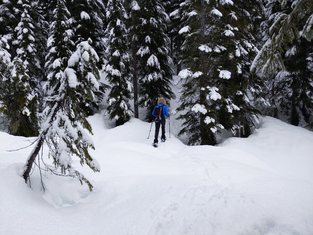 |
Woods
Position: 47°26.96’N, -121°23.85’W
Heading through the woods towards the Commonwealth Basin Trail east side of Commonwealth Creek.
|
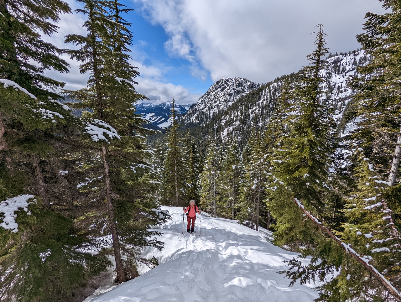 |
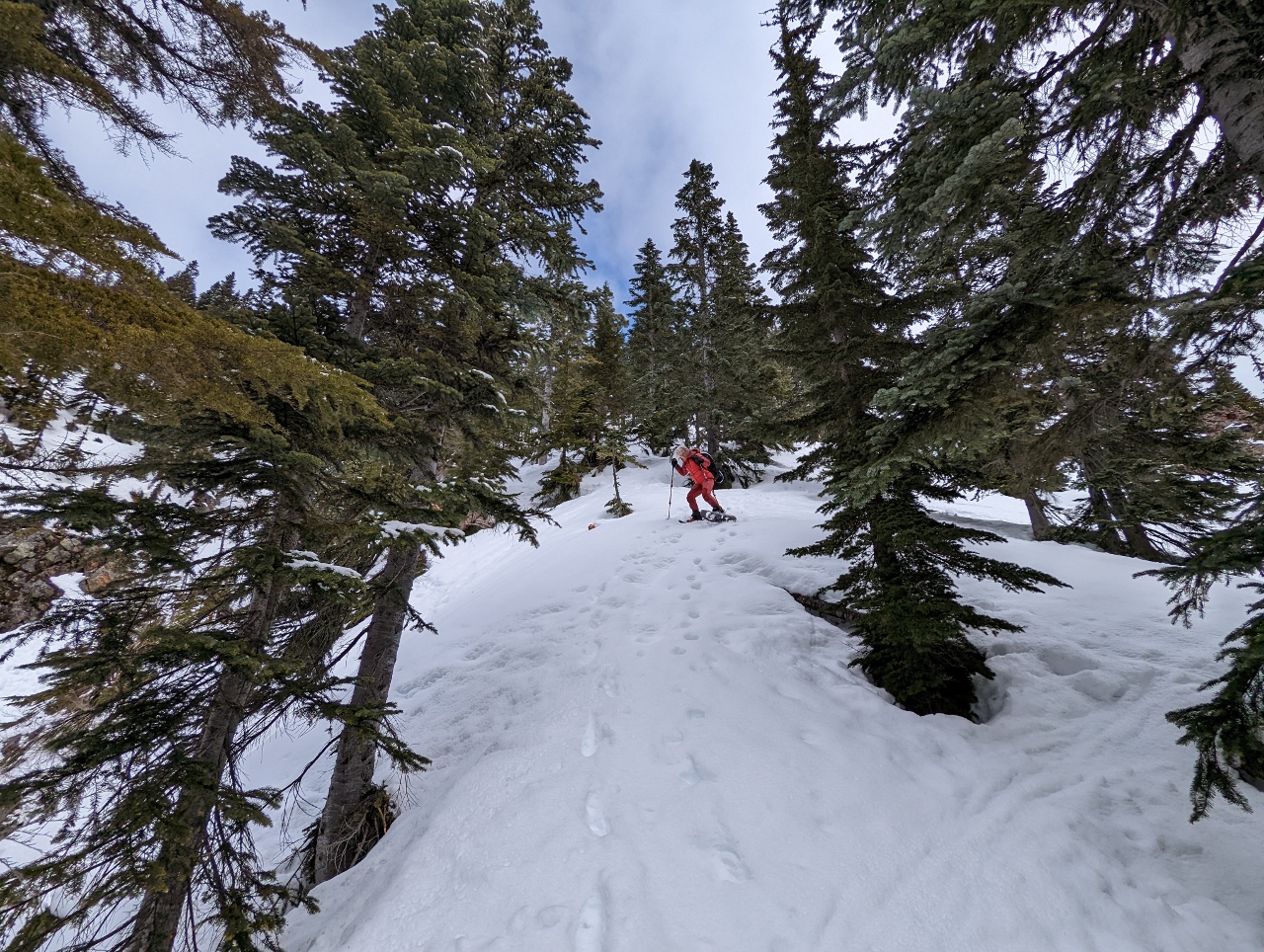
Commonwealth Basin Trail
Position: 47°27.13’N, -121°23.69’W
Climbing up the flank of Red Mountain along the Commonwealth Basin Trail.
|
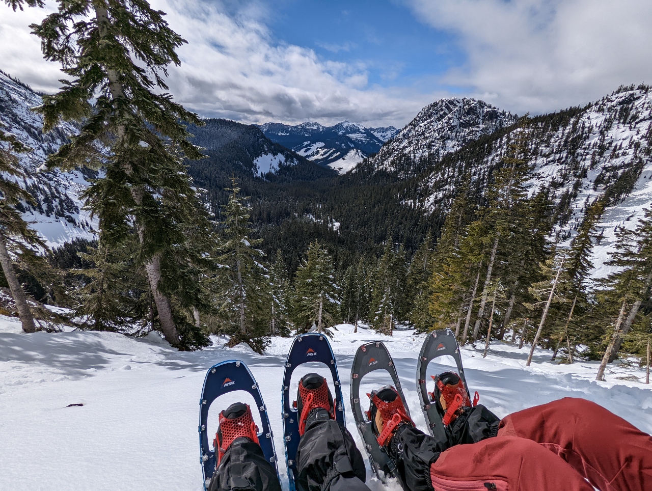 |
Snack
Position: 47°27.19’N, -121°23.63’W
Enjoying a snack with a view at altitude 4,620ft (1,408m), partway up Red Mountain, after a climb of 1,600 ft (488 m) from the trailhead. The Snoqualmie Pass Ski resort is the white patch in the distance slightly above center.
|
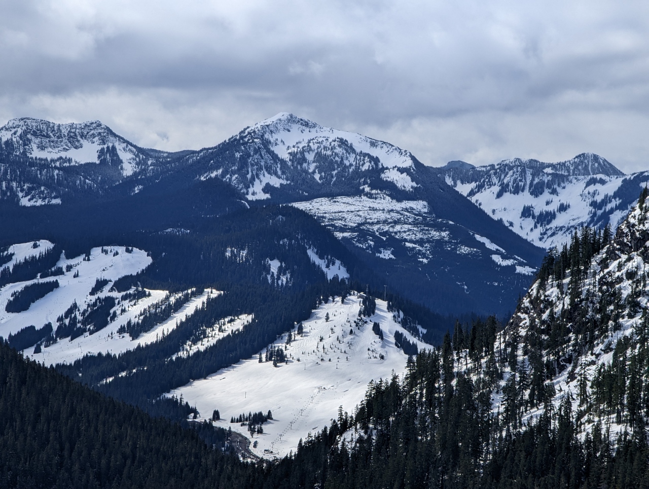 |
Granite Mountain
Position: 47°27.19’N, -121°23.63’W
Close-up to 5,600-ft (1,706m) Granite Mountain standing above the Summit at Snoqualmie ski area, viewed from our snack stop along the flank of Red Mountain.
|
 |
Descending
Position: 47°27.17’N, -121°23.65’W
Descending the steep slope of Red Mountain on our way back to the truck. We’re loving being able to navigate such steep and interesting terrain in the winter.
|
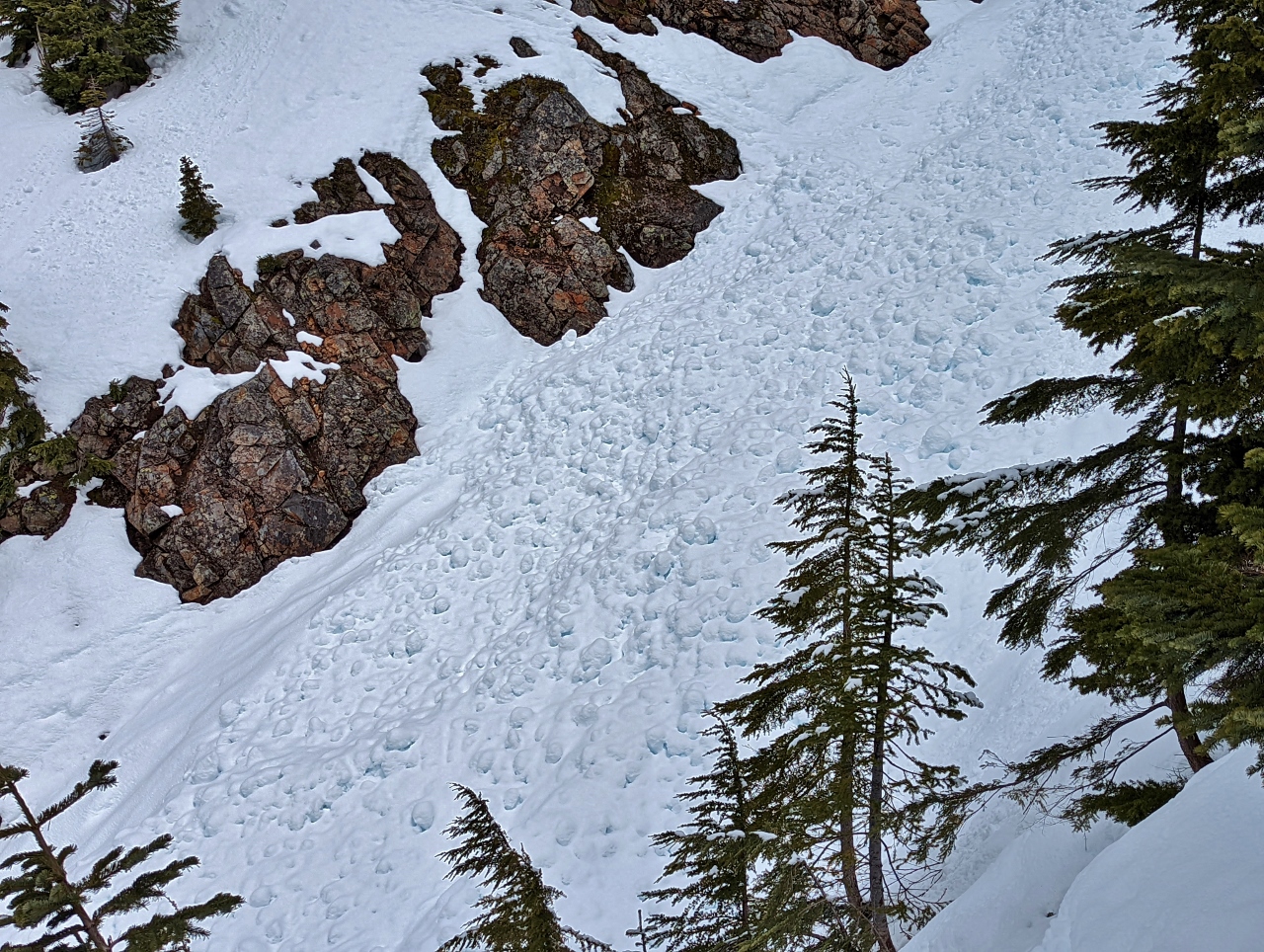 |
Avalanche
Position: 47°27.17’N, -121°23.66’W
Evidence of a recent avalanche in the drainage from Red Pond to our west as we descend Red Mountain.
|
 |
Falls
Position: 47°26.29’N, -121°23.95’W
Beautiful partially frozen falls flowing into Commonwealth Creek just off the trail.
|
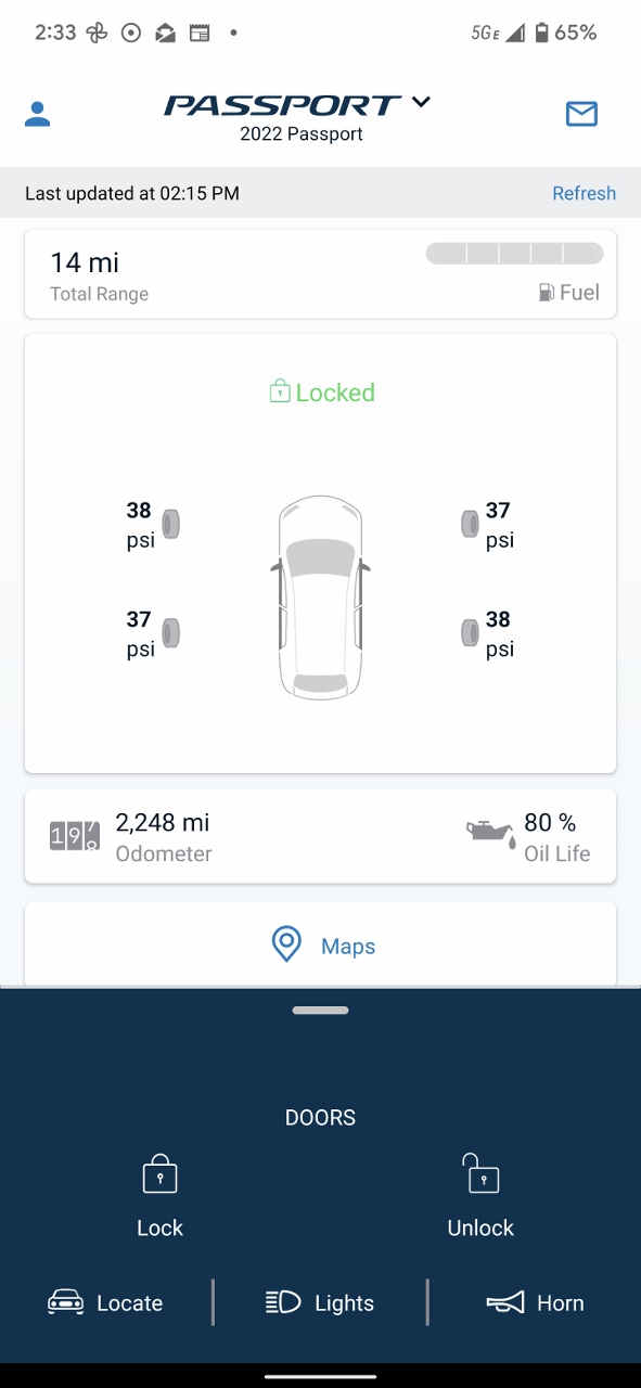 |
Low Fuel
Position: 47°29.66’N, -121°47.10’W
We’ve loving the remote telemetry available for our new truck. Here the HondaLink app indicates the doors are locked, the odometer reads 2,248 miles (3,617 km), and we have 14 miles (22 km) of range left on a near-empty tank. That’s by far the lowest we’ve ever let the fuel get. Fortunately we’re in North Bend and about to fuel.
|
 |
Click the travel log icon on the left to see these locations on a map. And a map of our most recent log entries always is available at mvdirona.com/maps. |
If your comment doesn't show up right away, send us email and we'll dredge it out of the spam filter.