MV Dirona travel digest for Loen to Bergen, Norway 2018

|
Click the travel log icon on the left to see these locations on a map,
with the complete log of our cruise. On the map page, clicking on a camera or text icon will display a picture and/or log entry for that location, and clicking on the smaller icons along the route will display latitude, longitude and other navigation data for that location. And a live map of our current route and most recent log entries always is available at //mvdirona.com/maps/LocationCurrent.html. |
 |
9/3/2018: Le Champlain
Position: 62°22.68'N, 6°18.03'E
The luxury cruise ship Le Champlain, that we'd seen in the shipyard before departing for Alesund, was out on sea trails just past 6am this morning.
|
 |
9/3/2018: Sunrise
Position: 62°22.20'N, 6°15.97'E
A beautiful pink sunrise behind us at 6:30am.
|
 |
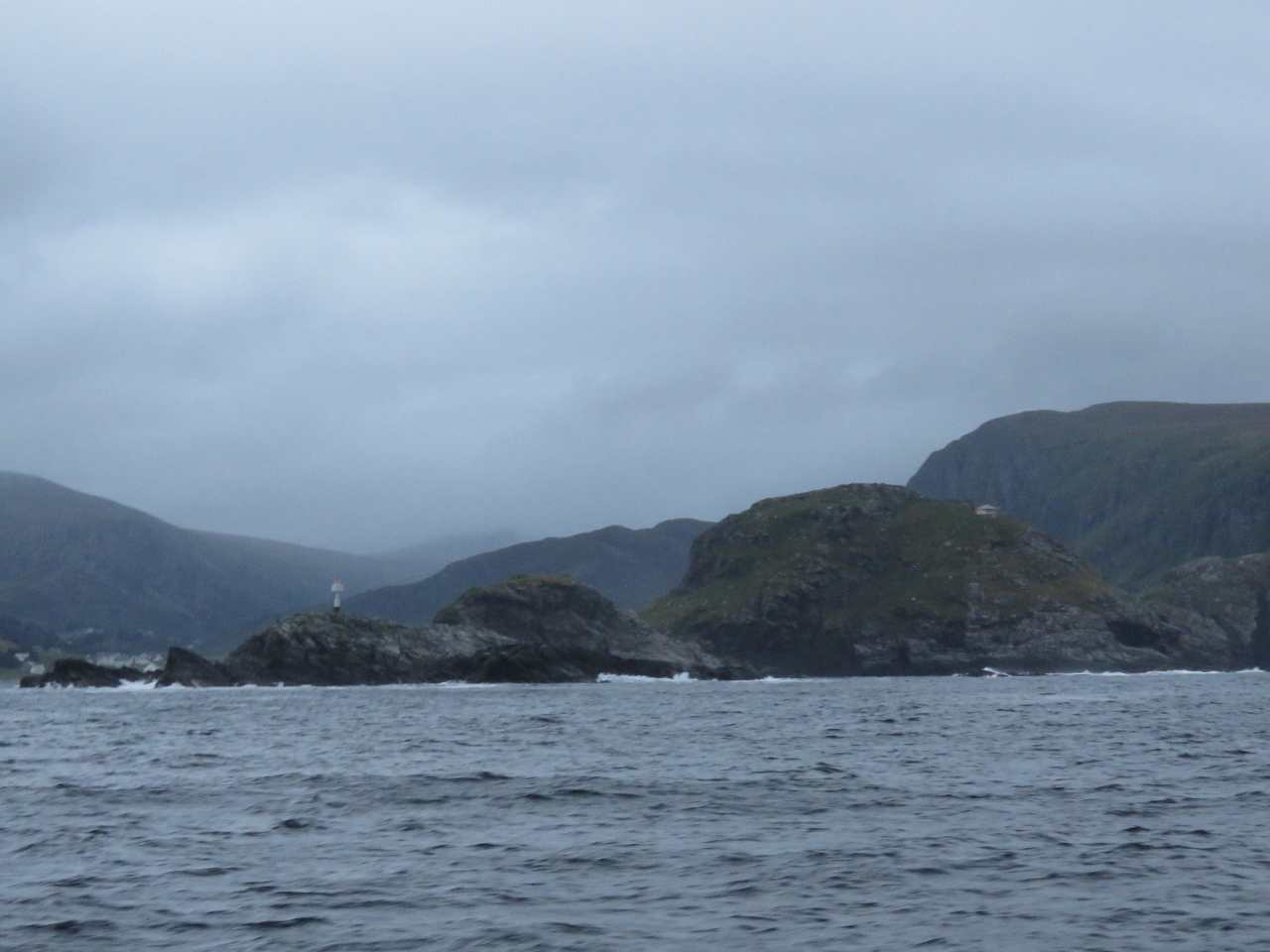
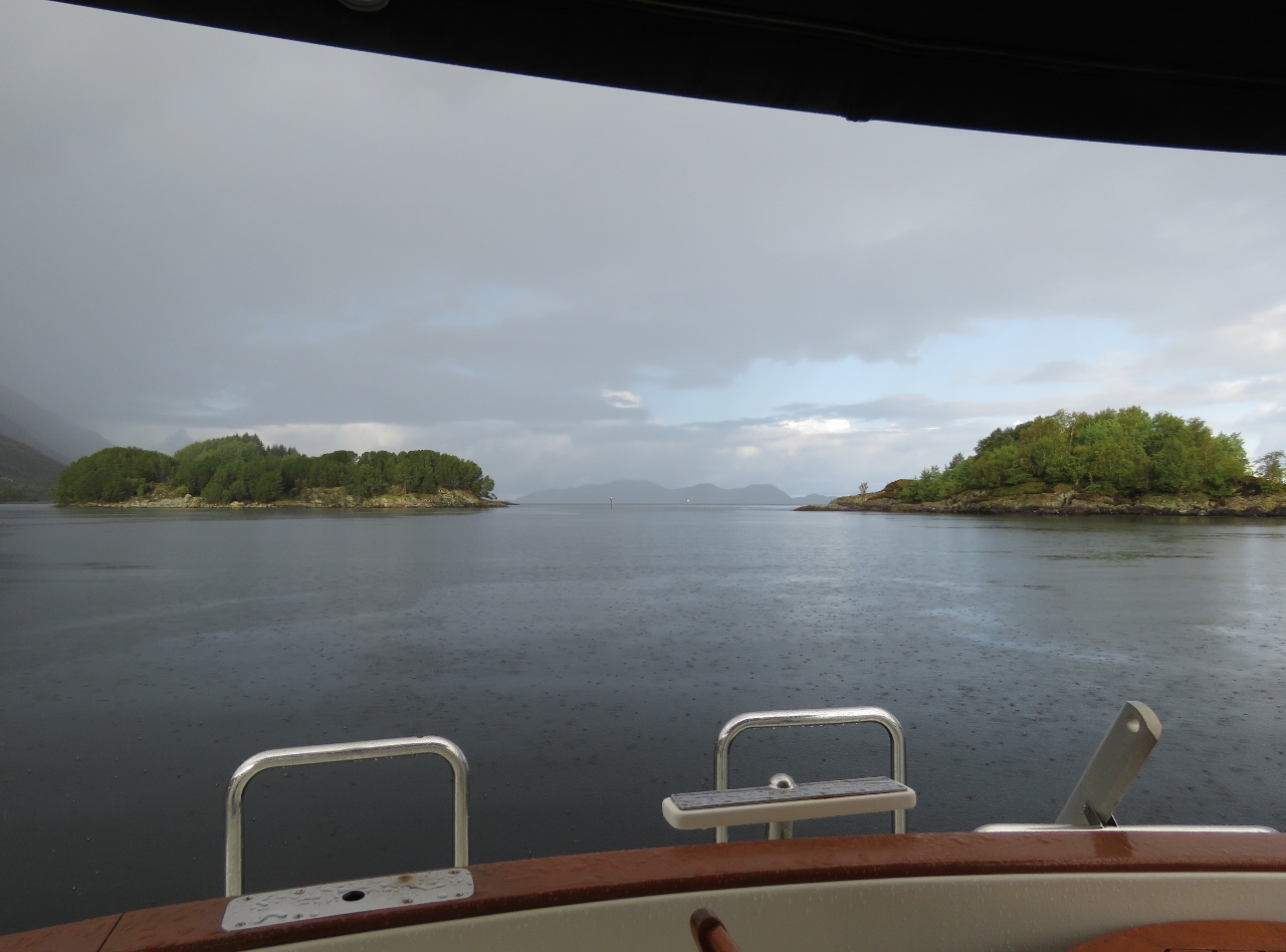
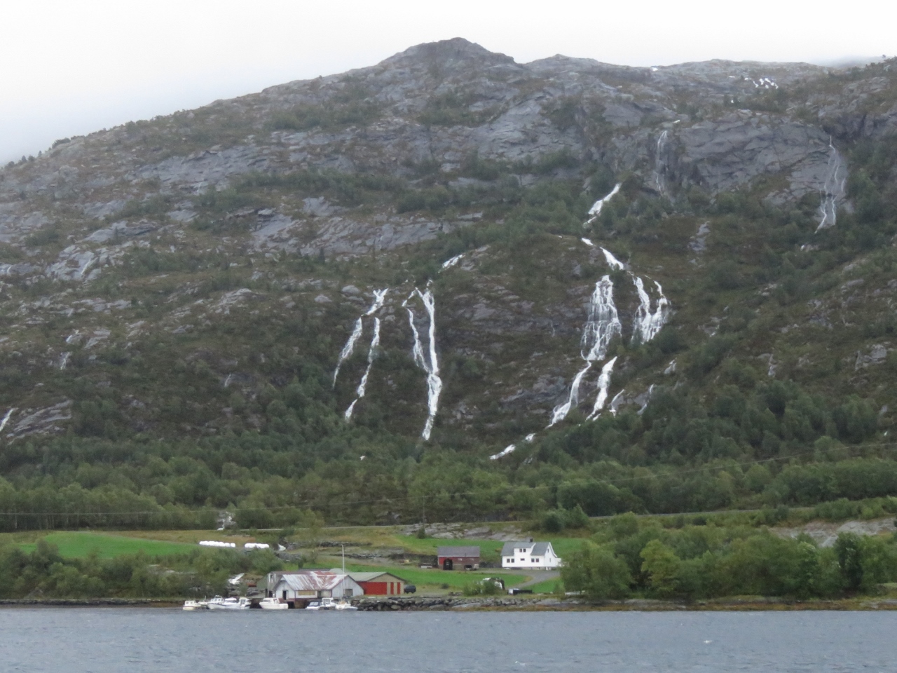
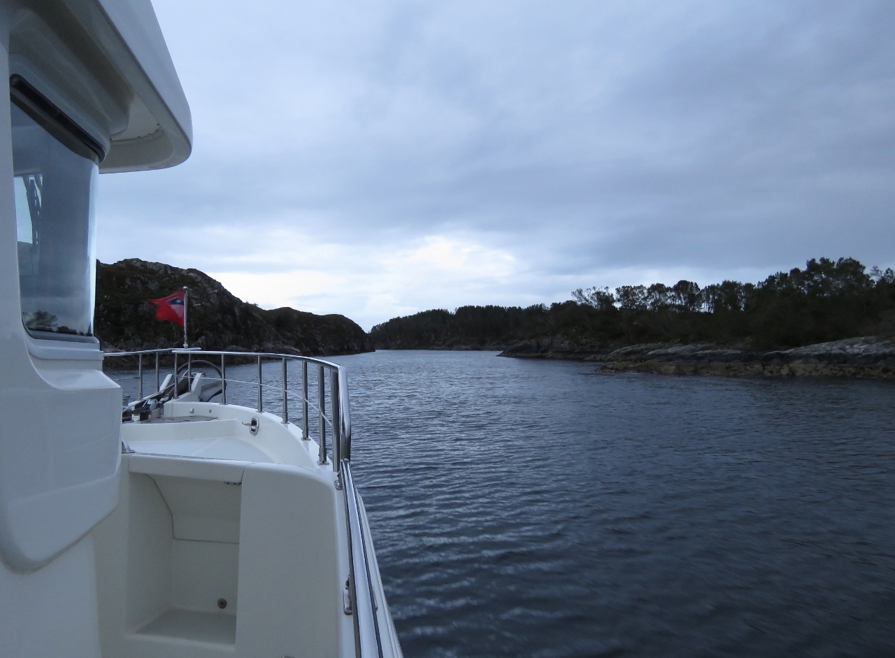
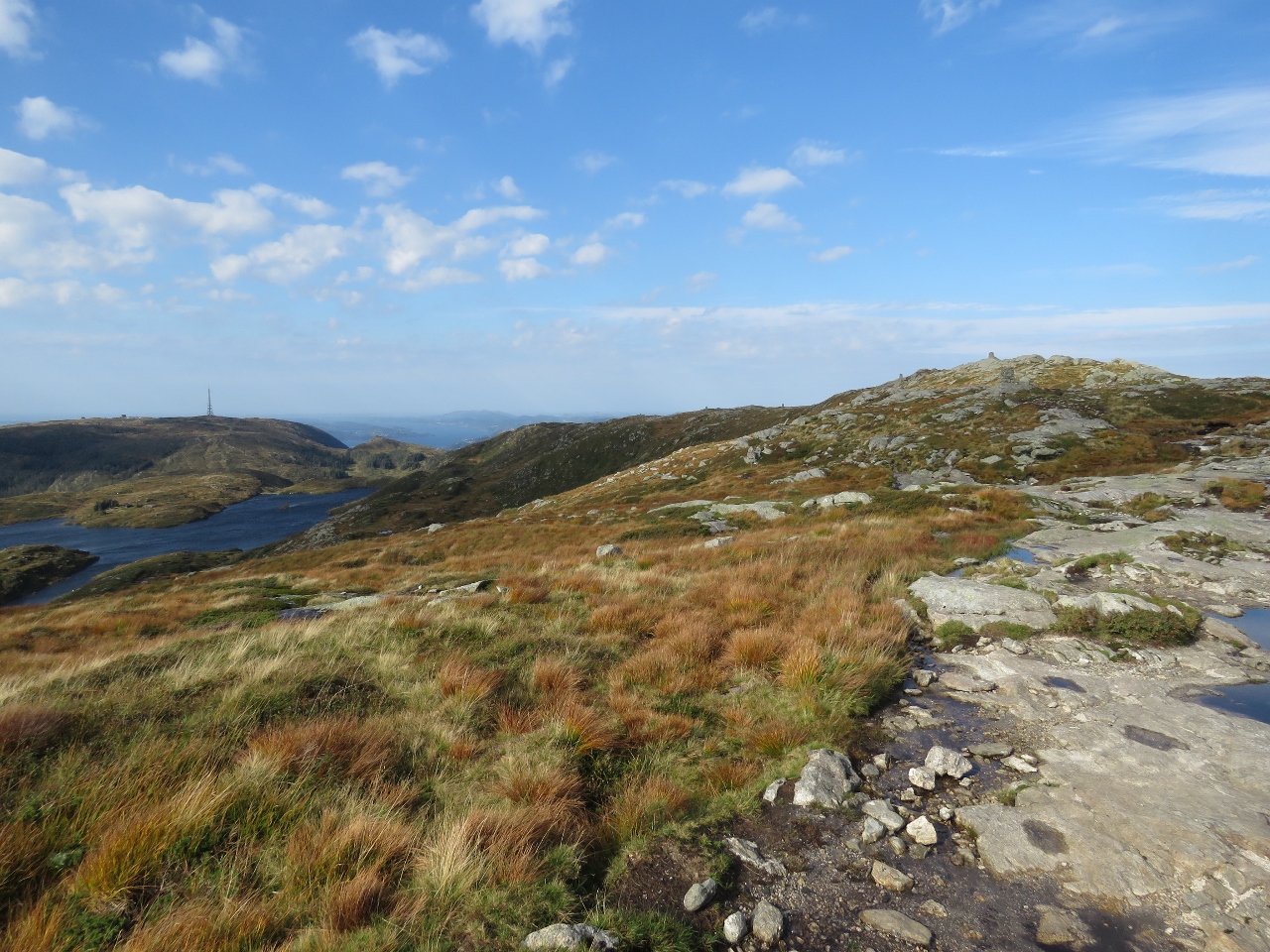
9/3/2018: Gursken
Position: 62°13.83'N, 5°36.67'E
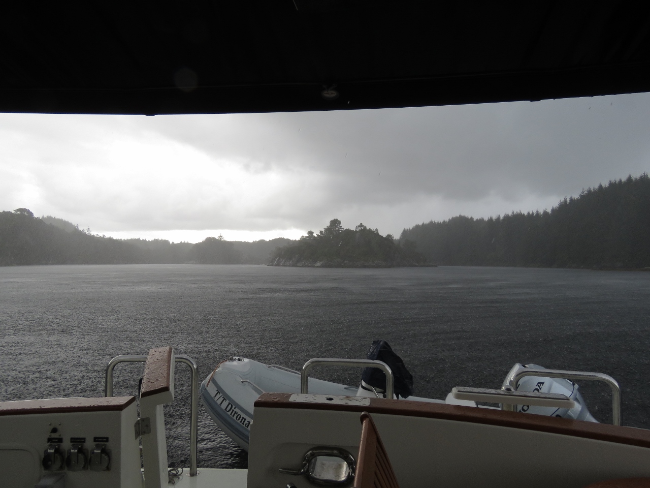
Calm conditions off the village of Gursken where we're anchored for the night before rounding Stad tomorrow. It's hard believe the winds are blowing over 20 knots off Stad right now, but we saw winds that high as we ran north through Hallefjorden before turning south toward the anchorage.
|
 |
9/3/2018: Dual 16A Control Box
Position: 62°13.81'N, 5°36.72'E
This control box is responsible for a wide variety of tasks including: 1) supporting a second up to 16A shore power connection with electrical interlocks making it easy to run the boat on shore power connections as low as 8A by using two of them and 2) load-shedding the dual 100A chargers when power consumption on the boat exceeds the load capacity of the supply (shore or generator). For future use the control box also implements: 3) support for a 4x20 character LCD panel, 4) support for a 4x4 matrix keyboard, 5) 1 channel of digital input, and 6) 8 channels of digital output.
The load-shedding functionality will replace the current system where wecontrol the chargers via the proprietary Masterbus interface through a CANbus adapter. We are replacing it because the CANbus adapter has occasional device driver issues where Windows mistakenly treats the OS driver as a mouse driver. This isn't hard to resolve, but is annoying. We now instead have a pair of rock-solid Schneider relays to control the chargers. |
 |
9/3/2018: Chargers
Position: 62°13.82'N, 5°36.65'E
In order to control the chargers via the dual 16A control box, we need to insert the control box between the chargers and their power feed. This isn't hard, but it means that everything needs to come out to give charger access. The control box also will be used to support the second up-to-16A shore power connection. This will allow us to run on the dual 8A or 10A power often found in smaller centers in Norway and specficially allows us to run on dual 16A connections when at Amsterdam City Marina which doesn't have 32A power connections.
|
 |
9/4/2018: Stad
Position: 62°13.44'N, 5°11.78'E
We departed the anchorage at 4am and are just nearing Stad at 6am. We're starting to pick up a bit of boat motion with a gentle westerly swell. Conditions are ideal for rounding Stad with with less than 15 knots of wind behind us and similar forecast for the next few hours. The winds will pick up around noon, but we'll be well around by then.
|
 |
9/4/2018: Spitfire
Position: 62°13.45'N, 5°11.52'E
Even though we have good conditions for rounding Stad, we are somewhat apprehensive as this is considered a dangerous area; so dangerous that funds have been approved to build a ship-sized tunnel through the headland. Spitfire, however, has no worries at all as we approach Stad.
|
 |
9/4/2018: Spitsbergen
Position: 62°12.46'N, 5°6.76'E
Passing the Hurtigruten Spitsbergen as we round West Cape on the tip of Stad.
|
 |
9/4/2018: Buholmen Light
Position: 62°9.95'N, 5°3.58'E
The Buholmen light on the bleak, exposed Stad coast just south of West Cape.
|
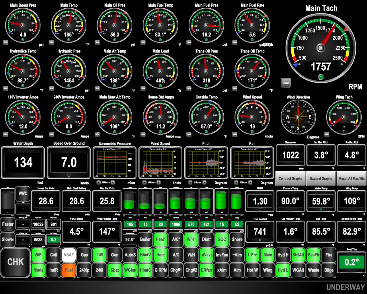 |
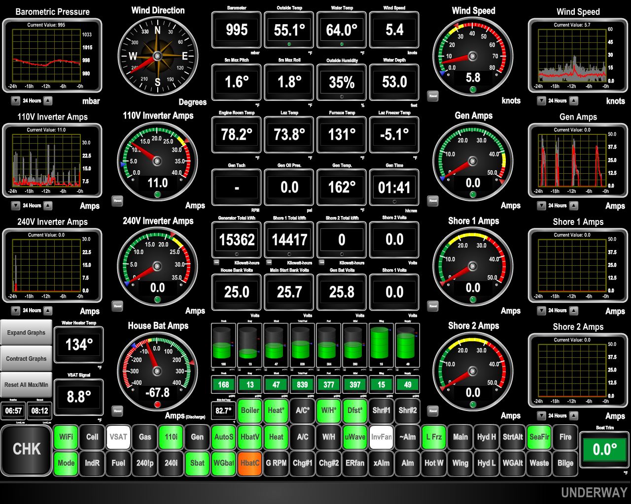
9/4/2018: Conditions
Position: 62°8.95'N, 5°4.13'E
The pitch and roll graphs at the center of the display (click image for a larger view) show pitch picking up about two hours ago as we got into the westerly swell off Stad. Then as we turned to run southward, pitch diminished and roll picked up as we took the swell more on the beam. Neither motion was particularly troublesome, as the swell period was large and the degree of pitch and roll was only around five.
|
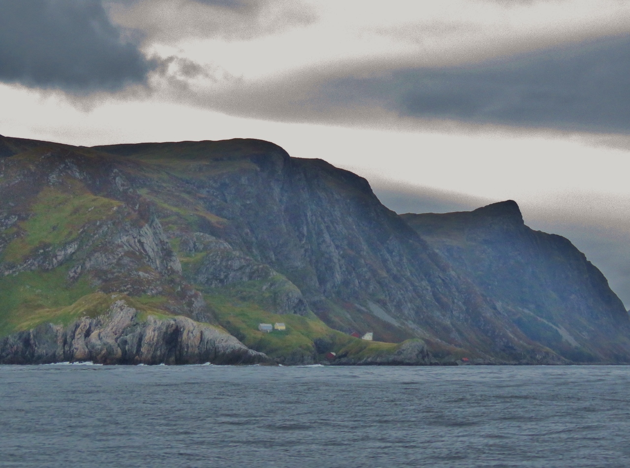 |
9/4/2018: Furuneset
Position: 62°5.52'N, 5°6.06'E
Steep cliffs along the rugged south coast of Stad as we round Furuneset at the southern tip of the headland.
|
 |
9/4/2018: Baatbygg
Position: 61°57.81'N, 5°9.16'E
The well-equipped Baatbygg Shipyard just north of Maløy has a dry dock that can handle ships up to 485 ft (148 m) long, a 4,000-ton slipway and a 95-ft-wide (29 m) by 91-ft-tall (21m) hall with a 50-ton crane.
|
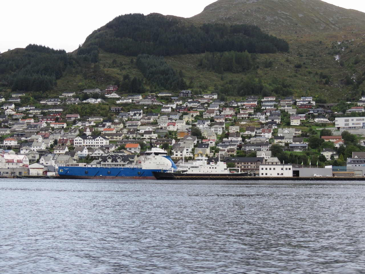 |
9/4/2018: Maløy
Position: 61°55.97'N, 5°7.46'E
The 273-ft (83m) offshore supply vessel Nao Fighter docked at Maløy with the ferry Sognefjord in the foreground.
|
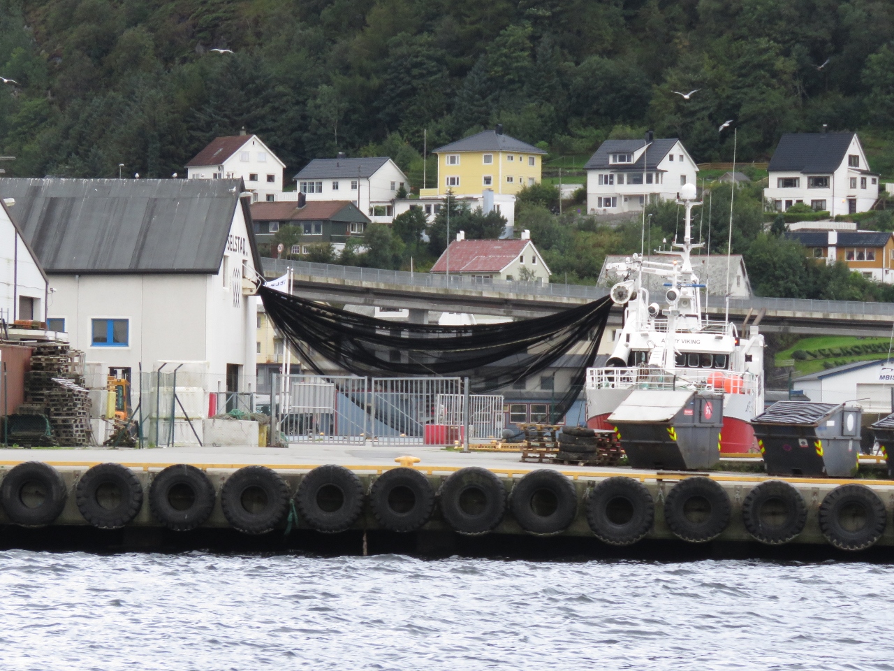 |
9/4/2018: Atløy Viking
Position: 61°55.48'N, 5°7.23'E
The fishing vessel Atløy Viking transferring a net between ship and shore at Maløy.
|
 |
9/4/2018: Kvitbjørn
Position: 61°54.13'N, 5°8.96'E
The LNG-powered cargo vessel Kvitbjørn (translated as "White Bear") that we saw in mid-May near Trondheim.
|
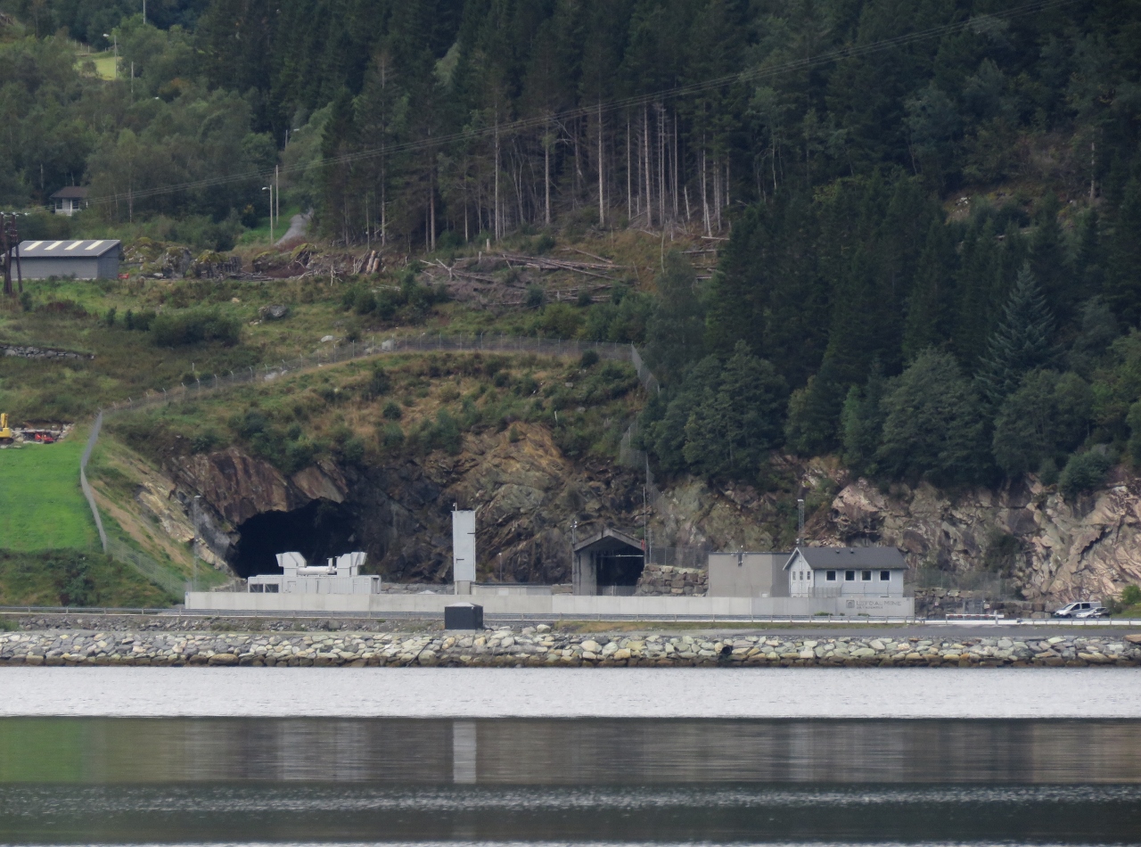 |
9/4/2018: Lefdal Mine Datacenter
Position: 61°54.88'N, 5°29.74'E
As we ran up Nordforden we noticed what appeared to be a mine on the north shore with a surprisingly large amount of security. It was the Lefdal Mine Datacenter, a former mine that has been converted into a datacenter. That would be a fun tour to take.
|
 |
9/4/2018: Davik
Position: 61°53.66'N, 5°32.83'E
Low clouds and calm waters at the village of Davik where we're anchored for the night.
|
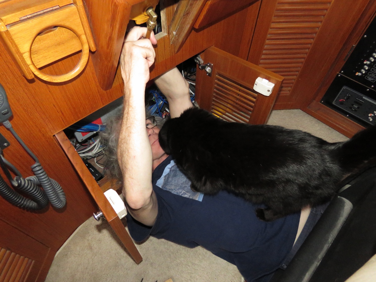 |
9/4/2018: Steering Pump Noise
Position: 61°53.66'N, 5°32.83'E
James investigating a steering pump noise with Spitfire supervising. The new steering pump produces slightly higher pressure and generates a vibration in the pipes at the helm. Some padding around the vibration points drastically reduced the noise.
|
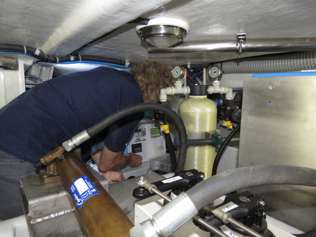 |
9/4/2018: Watermaker
Position: 61°53.66'N, 5°32.83'E
We initially were planning to run all the way to Loen at the head of Nordfjorden, but we stopped in Davik to investigate a problem with the watermaker that we wanted to have time to address before continuing on. We'd not used the watermaker for two months, since before arriving into Trondheim and it was making water, but discharging it overboard.
We suspected the dump valve was stuck open, but it turned out to be a super-easy problem to resolve. While replacing the steering pump in Trondheim, we must have accidentally closed the media filter valves. Opening it fixed the issue and we're operational again. Since it was still relatively early in the afternoon we decided to continue on to Loen. |
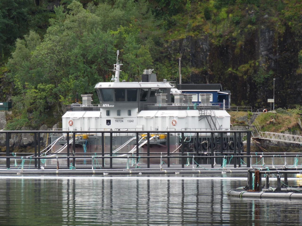 |
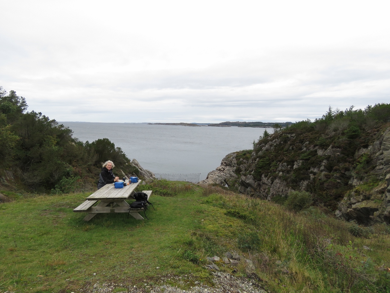
9/4/2018: Fishfarm
Position: 61°53.85'N, 5°38.69'E
Most of the Norwegian fish farms we've seen have these control-tower type work buildings that resemble ships from a distance.
|
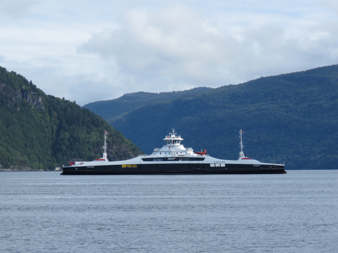 |
9/4/2018: Eidsjford
Position: 61°51.00'N, 6°4.80'E
The modern-looking ferry Eidsjford was built in 2017 and is battery electric, part of Norway's goal of zero-emission ferry operations.
|
 |
9/4/2018: Battery Electric
Position: 61°50.88'N, 6°5.90'E
The plug-in for battery electric Eidsjford and sister-ship Gloppefjord.
|
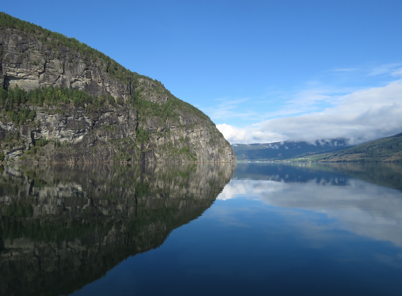 |
9/4/2018: Ulvedalsneset
Position: 61°49.76'N, 6°30.74'E
The bluff Ulvedalsneset reflected in still waters as we near the head of Nordfjorden.
|
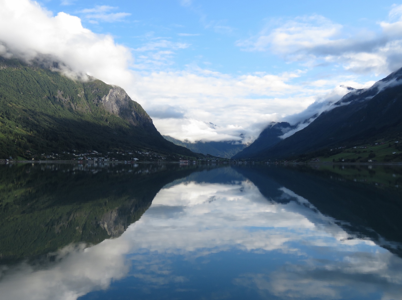 |
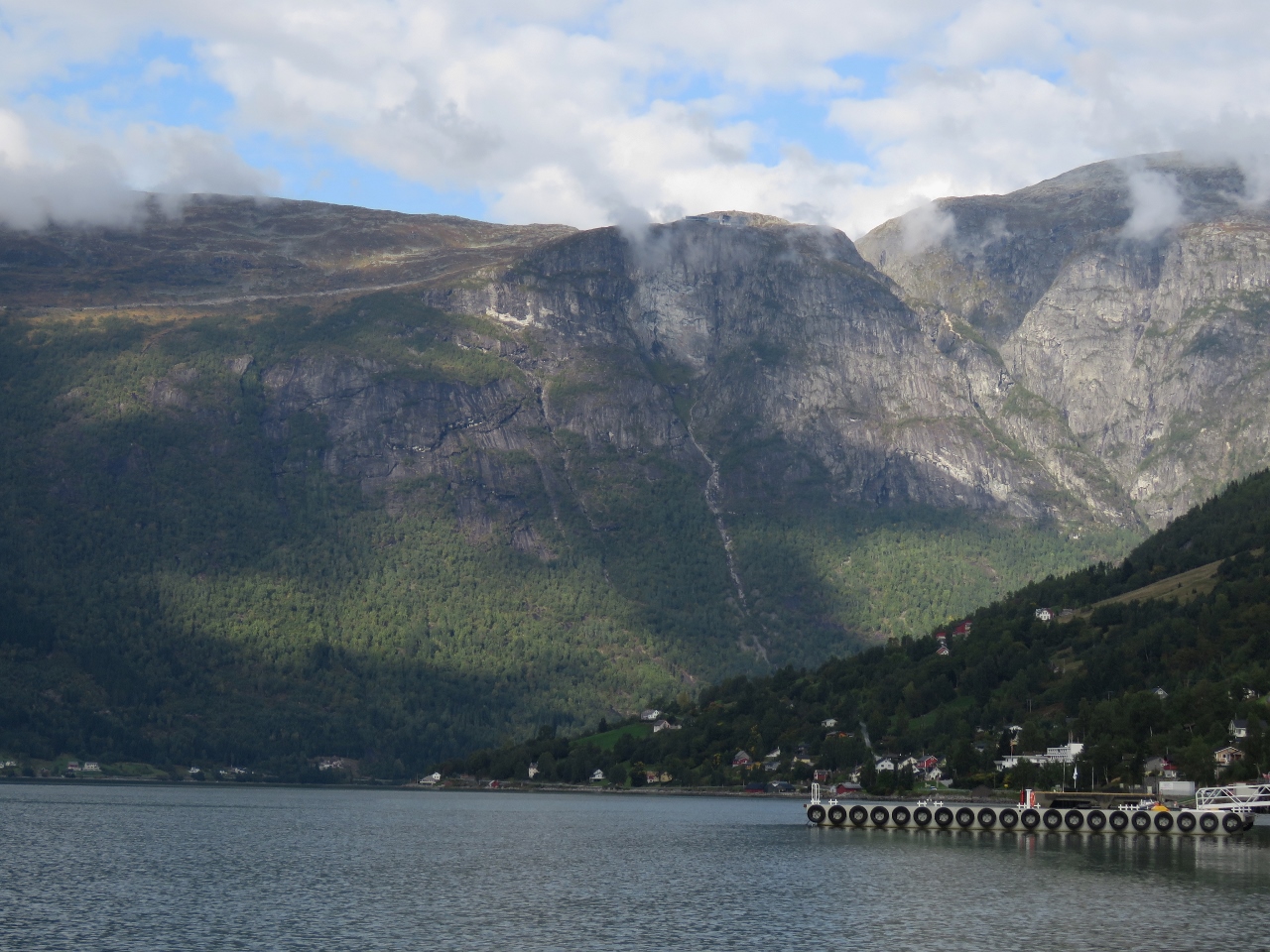
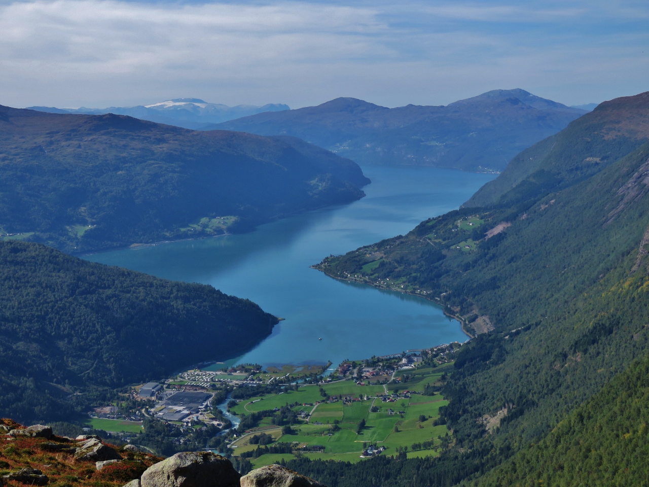
9/4/2018: Lodalen valley
Position: 61°52.17'N, 6°48.79'E
The view to Loen and the spectacular Lodalen valley beyond at the head of Nordfjorden.
|
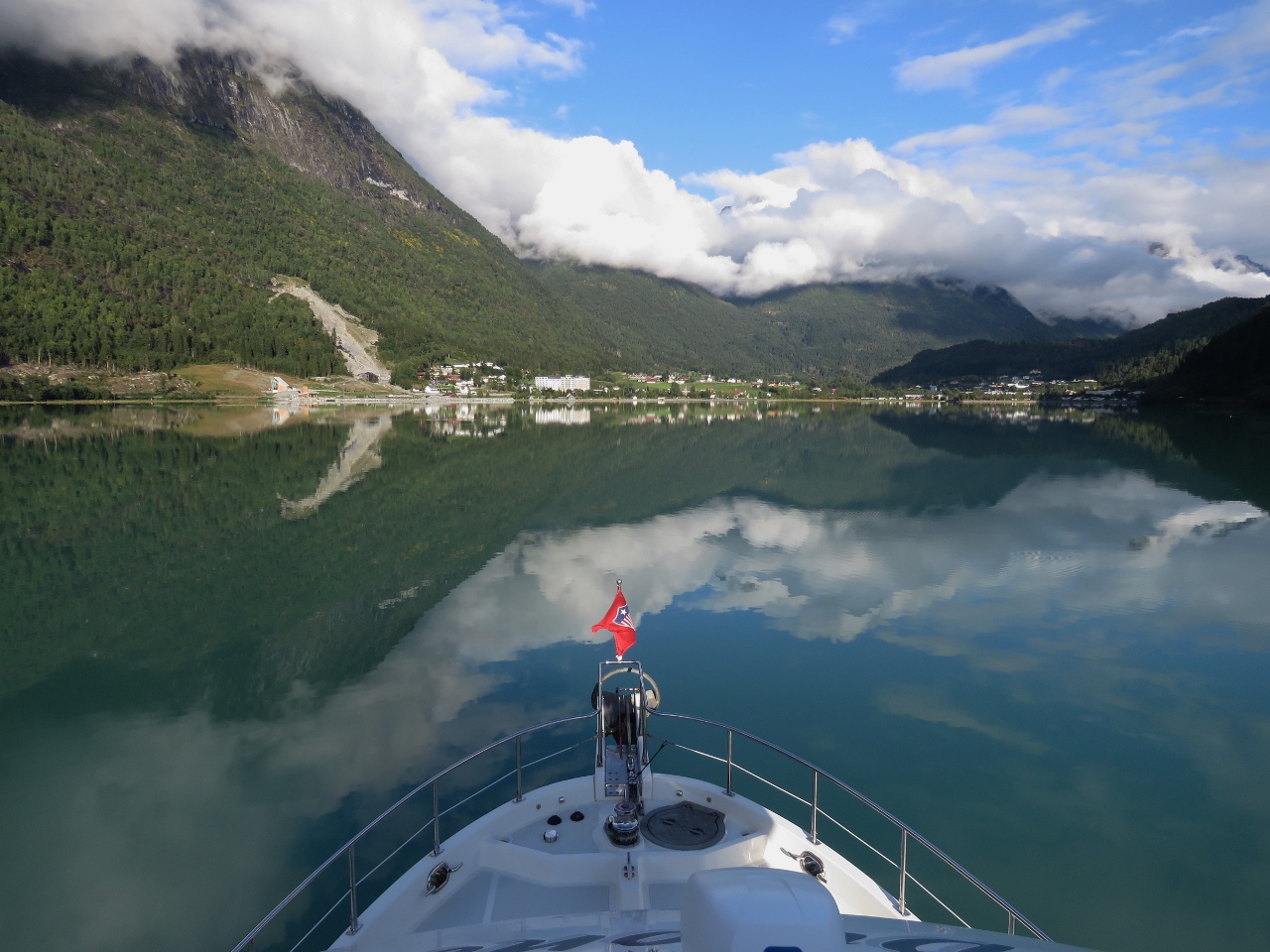 |
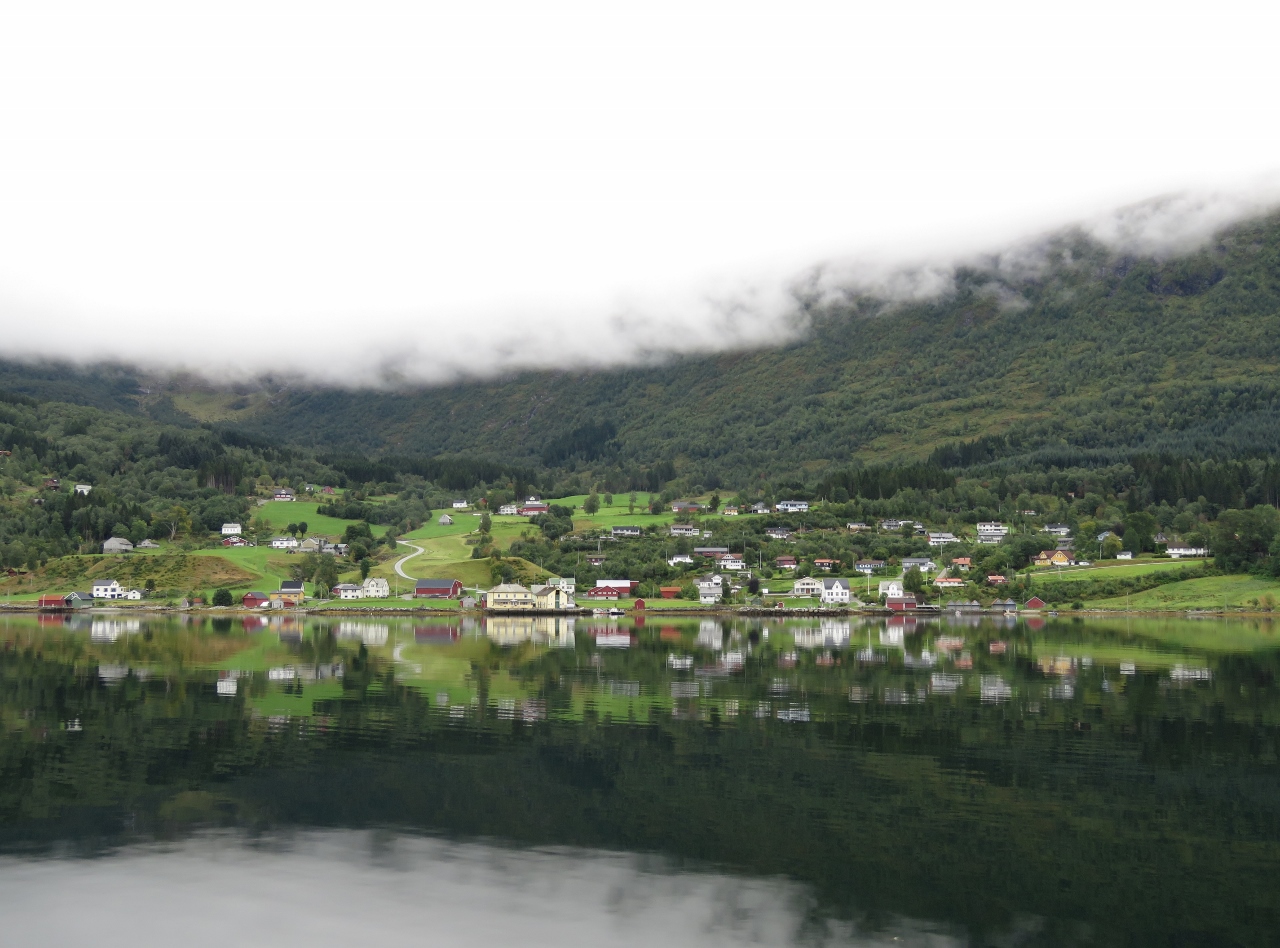
9/4/2018: Loen
Position: 61°52.23'N, 6°50.03'E
Wonderfully calm conditions as we approach the anchorage off Loen.
|
 |
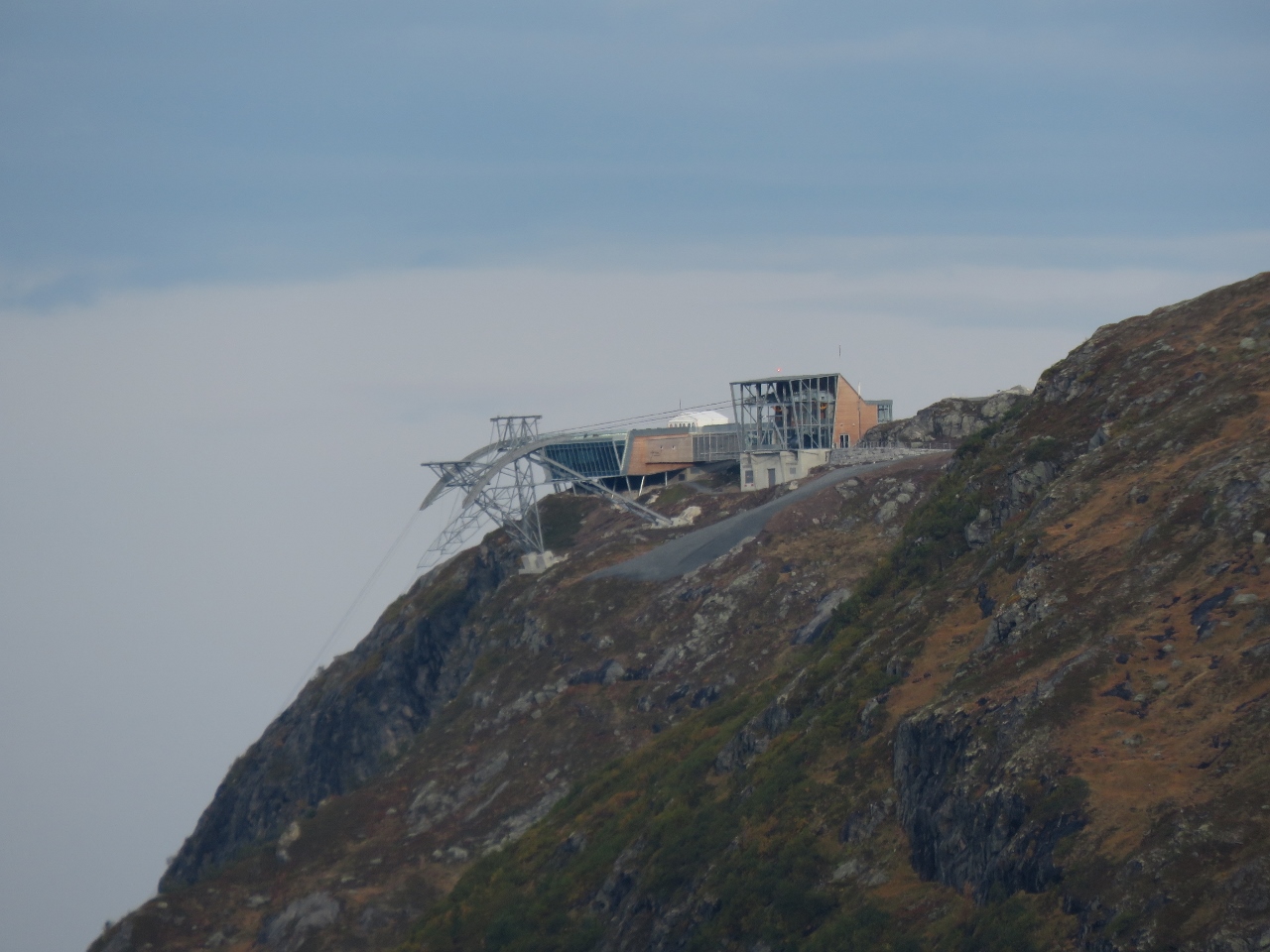
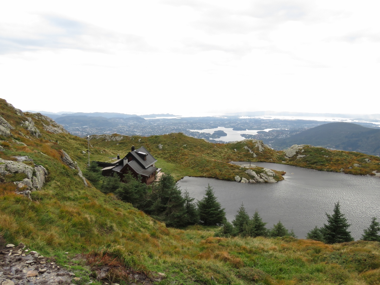
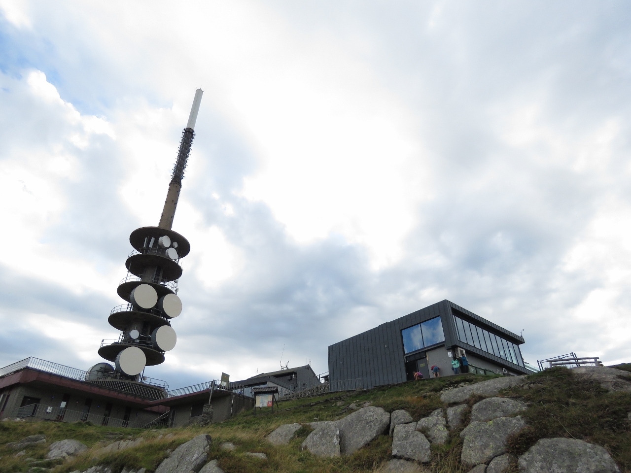
9/4/2018: Loen Skylift
Position: 61°52.45'N, 6°50.26'E
The modern Loen Skylift visitor center. The cable car opened only last May and whisks passengers up to the top of 3,316ft (1,011m) Mt. Hoven in minutes.
|
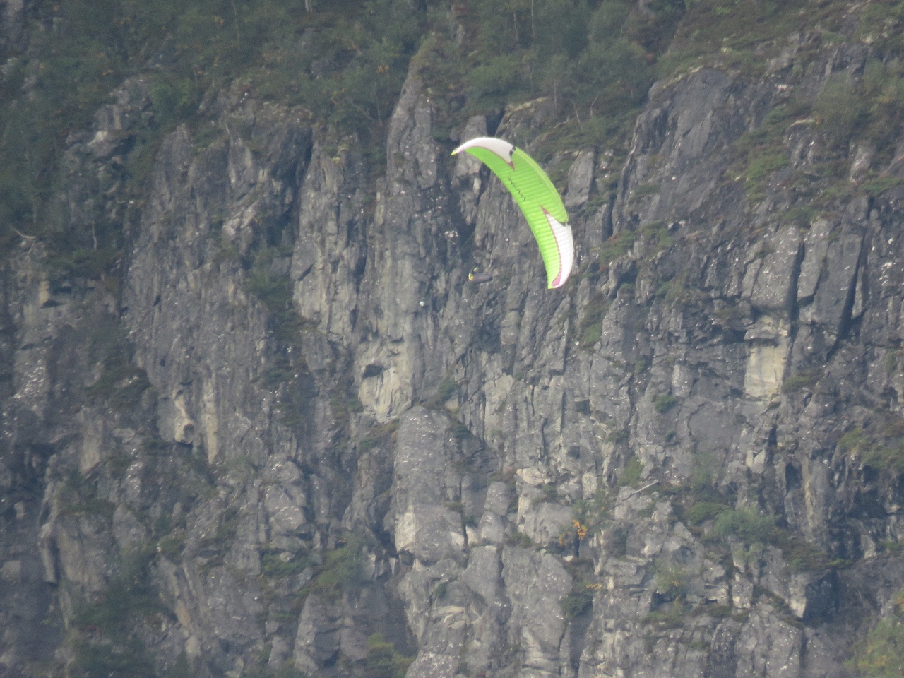 |
9/4/2018: Paraglider
Position: 61°52.20'N, 6°50.15'E
Paraglider flying down from the top of Mt. Hoven. We frequently saw them during our stay at Loen.
|
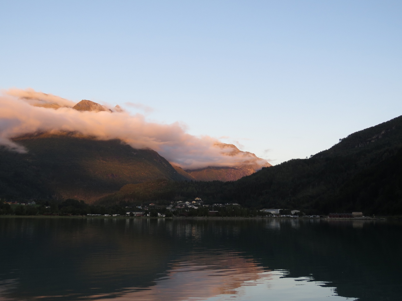 |
9/4/2018: Dusk
Position: 61°52.20'N, 6°50.15'E
A beautiful dusk scene looking toward the Lodalen valley from the anchorage off Loen.
|
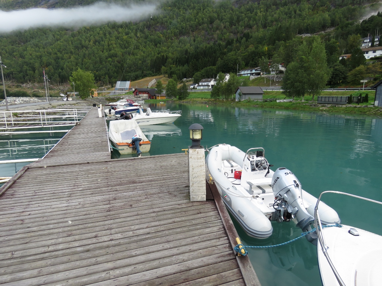 |
9/5/2018: Tender
Position: 61°52.41'N, 6°50.52'E
Our tender moored at the Hotel Alexandra marina for the day.
|
 |
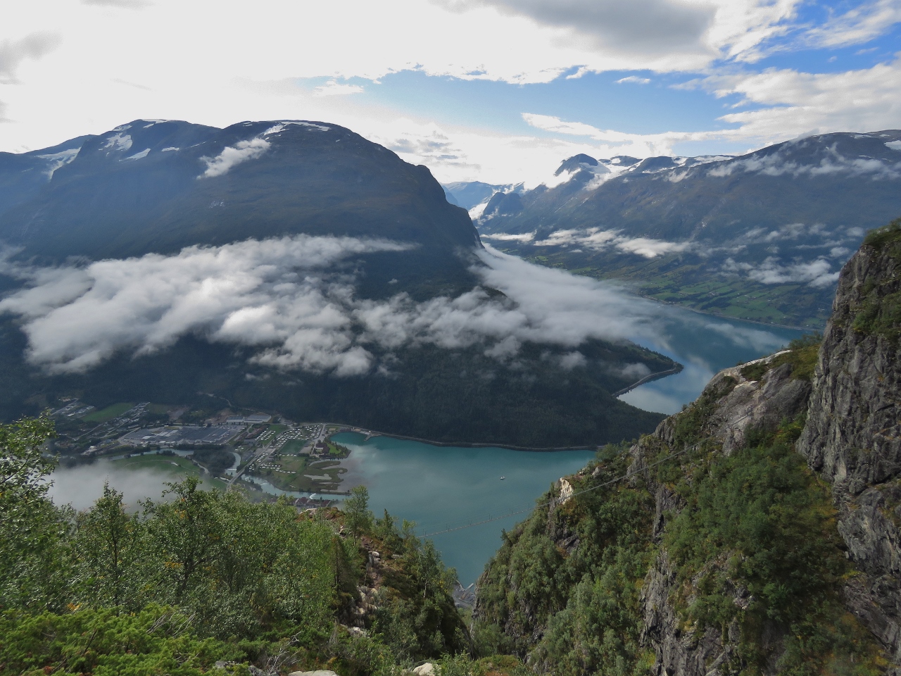
9/5/2018: Road Up
Position: 61°52.61'N, 6°50.62'E
Walking the steep road to reach the trailhead for our climb to the summit of 3,316ft (1,011m) Mt. Hoven on the Via Ferrata Loen.
|
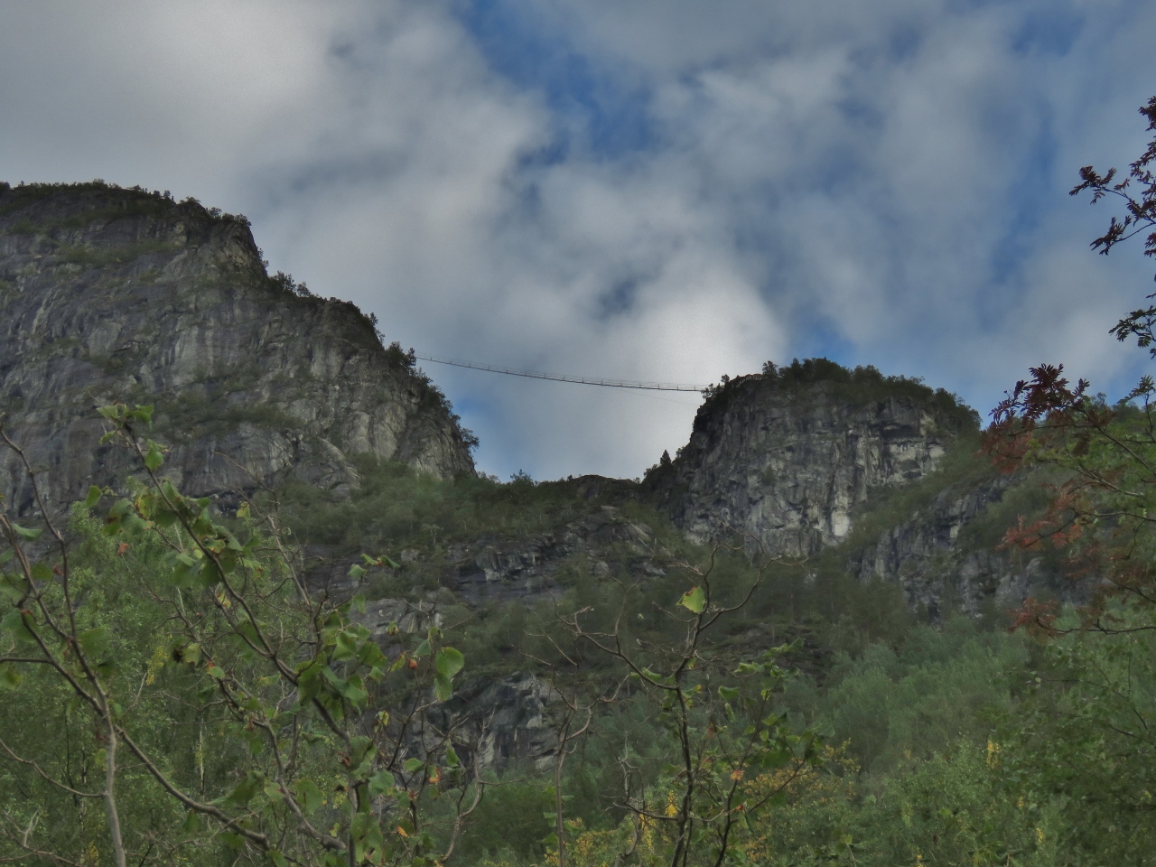 |
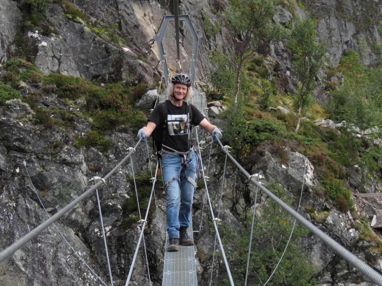
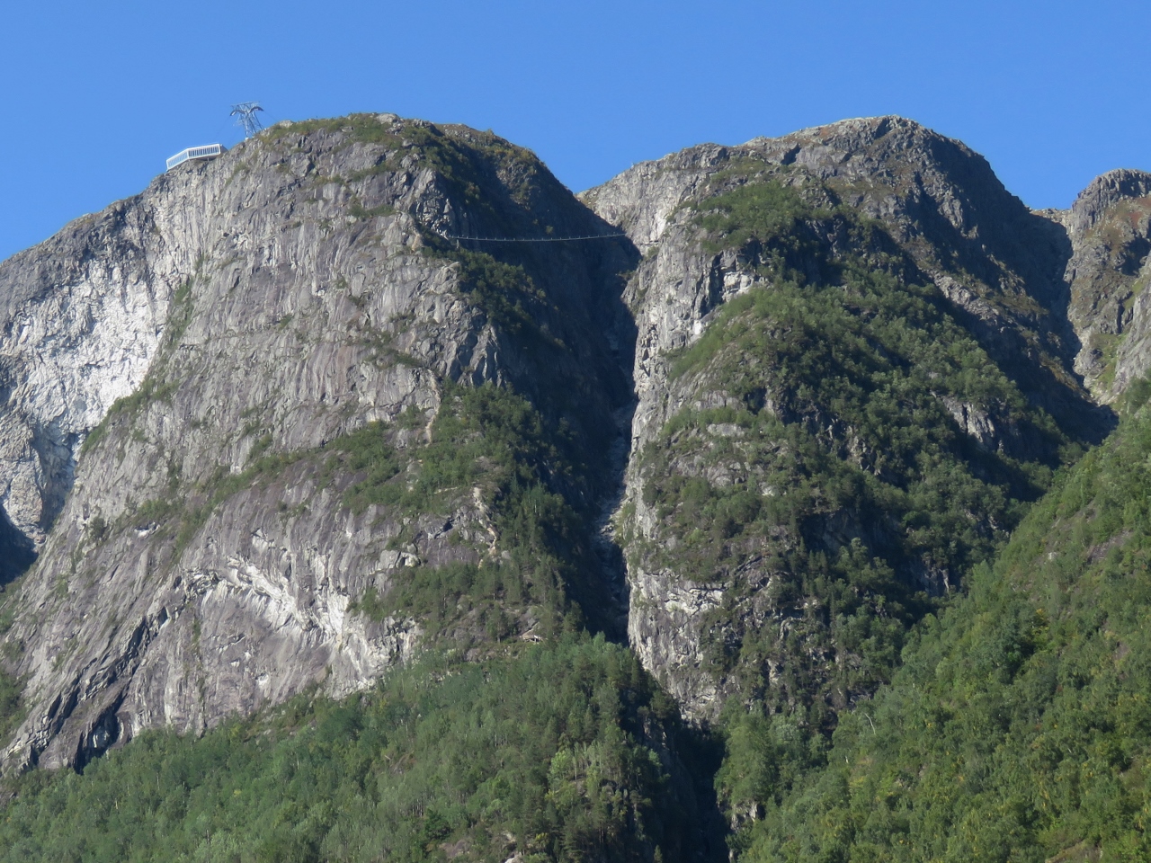
9/5/2018: Suspension Bridge
Position: 61°52.63'N, 6°50.79'E
That suspension bridge way up there is part of our route to the summit of Mt. Hoven.
|
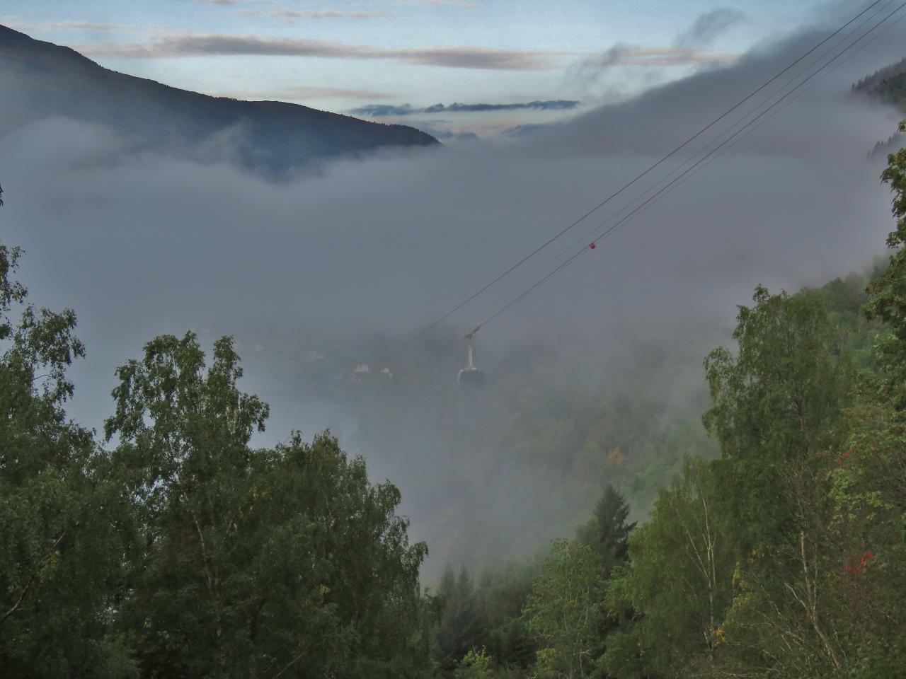 |
9/5/2018: Gondola
Position: 61°52.63'N, 6°50.79'E
One of the Loen Skylift gondolas rising up out of the mist behind us.
|
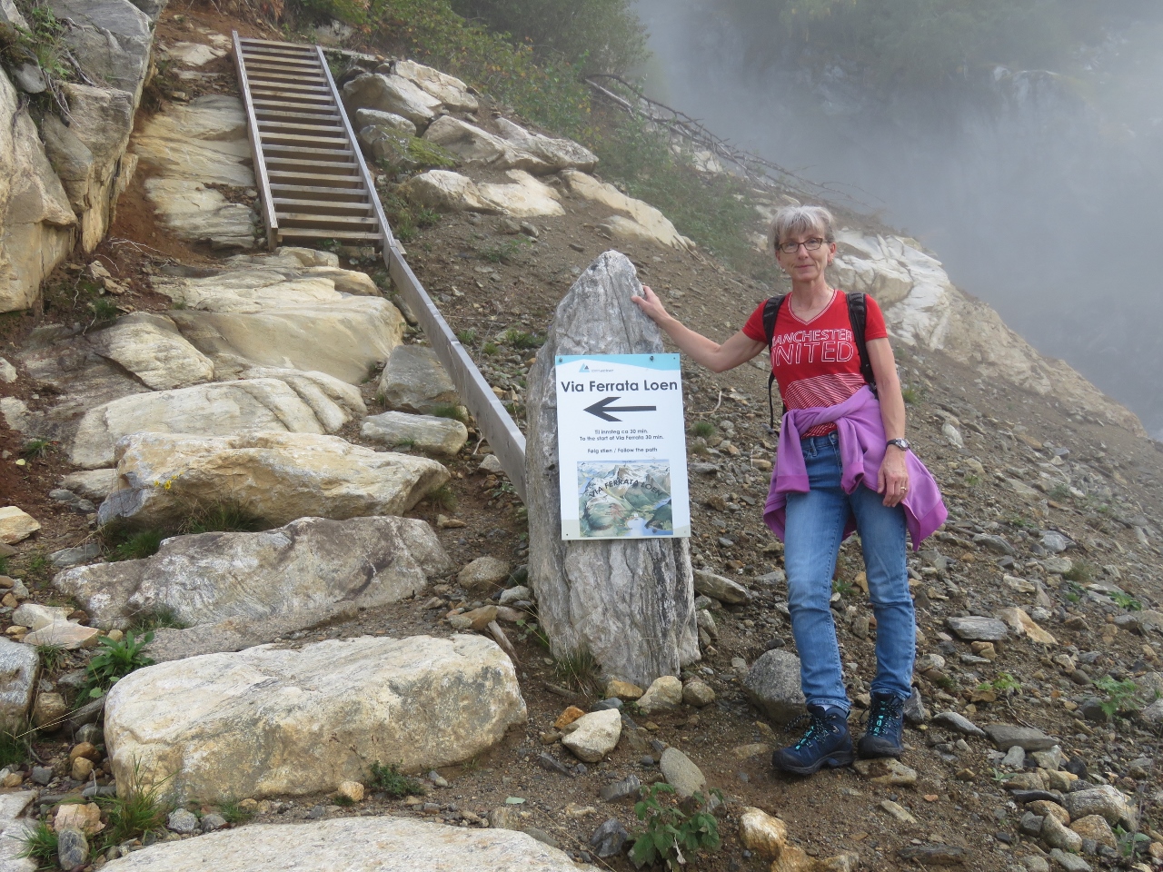 |
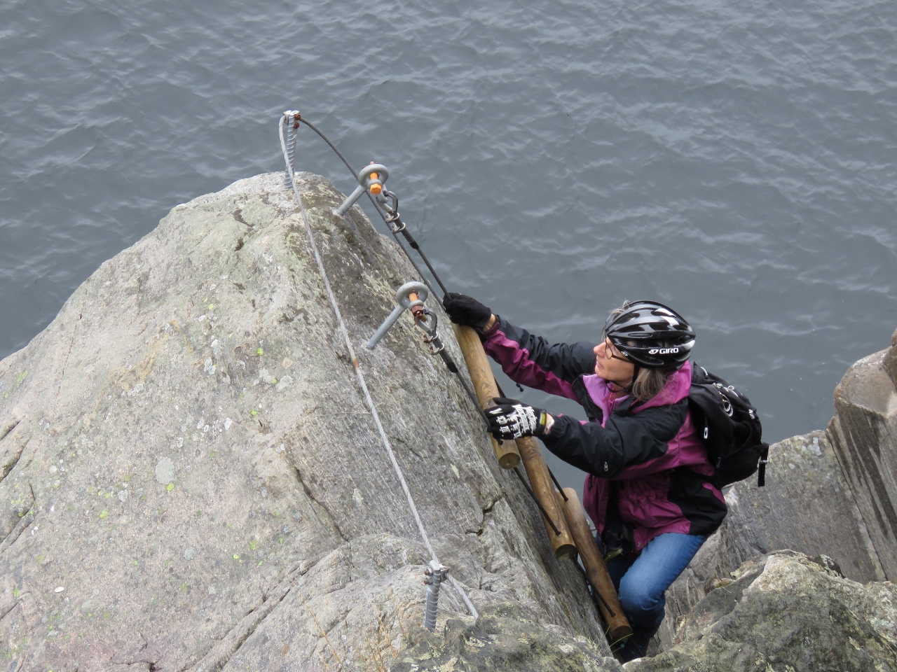
9/5/2018: Trailhead
Position: 61°52.65'N, 6°50.80'E
We reached the trailhead after walking up a steep roadway to 654 ft (199 m). We'll be taking the Via Ferrata Loen up. Via Ferrata means "iron path" in Italian and is an increasingly popular mix of protected climbing and alpine hiking where participants use climbing gear to safely ascend exposed routes with spectacular views while attached at all times to iron cables, runs, ladders and bridges.
|
 |
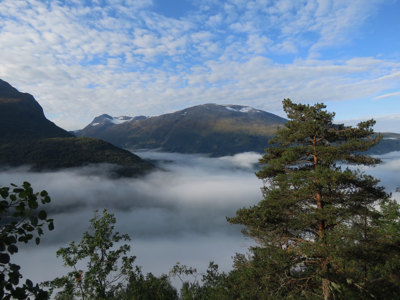
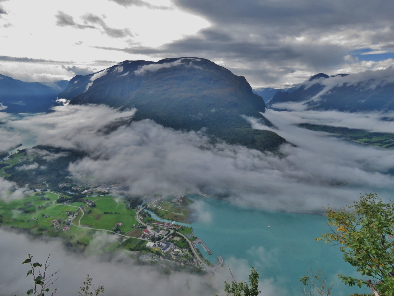
9/5/2018: Above Clouds
Position: 61°52.71'N, 6°50.78'E
We popped above the clouds at altitude 726 ft (221 m) for great views to the south.
|
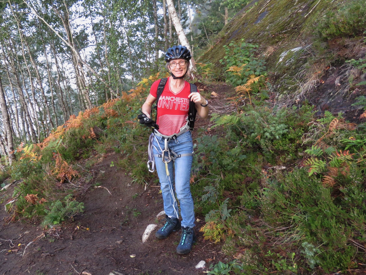 |
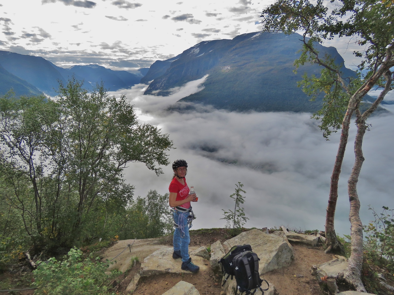
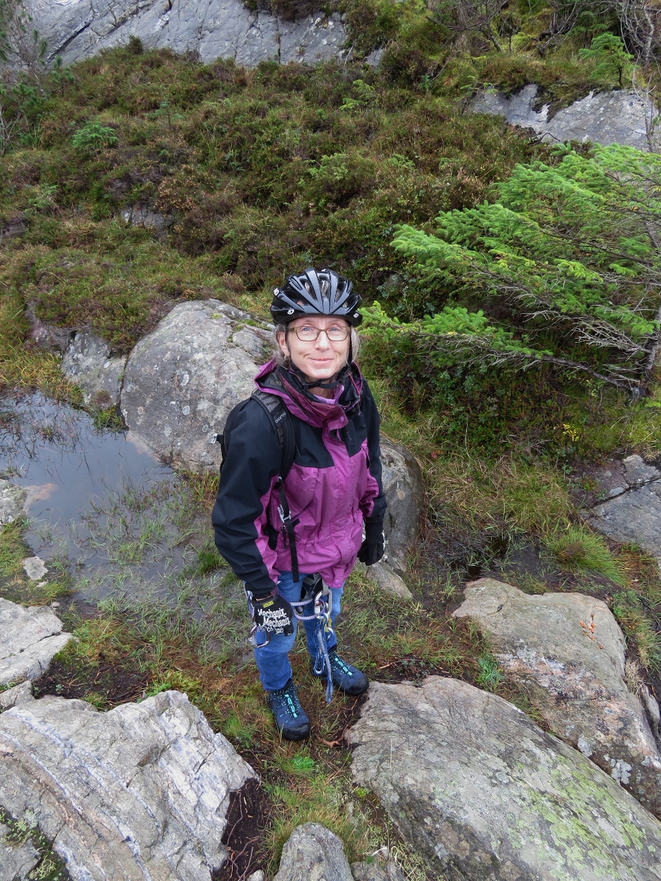
9/5/2018: Gearing Up
Position: 61°52.73'N, 6°50.74'E
We donned our climbing gear when we reached the first section where we could clip on at altitude 1021 ft (311 m). We carry climbing gear on the boat so we can safely work on the stack and other places where we might fall. This is the first time we've used the gear for sport.
|
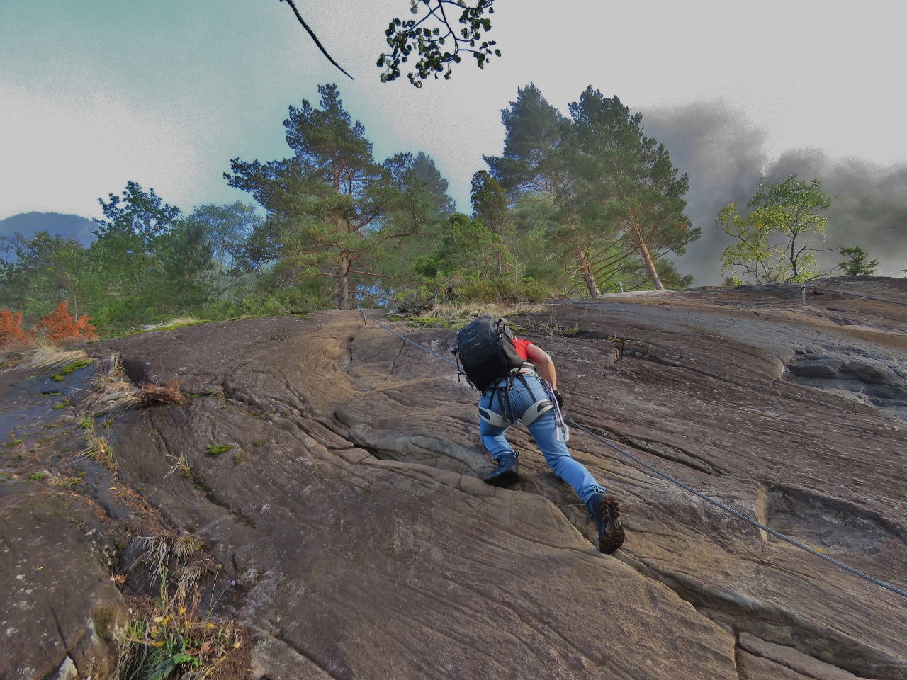 |
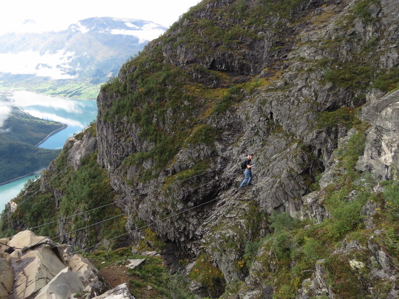
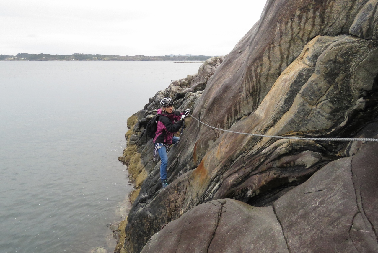
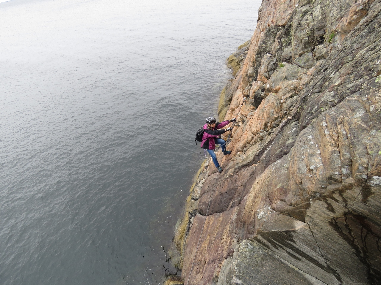
9/5/2018: Climbing
Position: 61°52.74'N, 6°50.74'E
Jennifer starting up the cliff, clipped onto the wire.
|
 |
9/5/2018: View
Position: 61°52.77'N, 6°50.71'E
Another great view at altitude 1169 ft (356 m).
|
 |
9/5/2018: James Climbing
Position: 61°52.85'N, 6°50.60'E
James ascending into the clouds at altitude 1595 ft (486 m).
|
 |
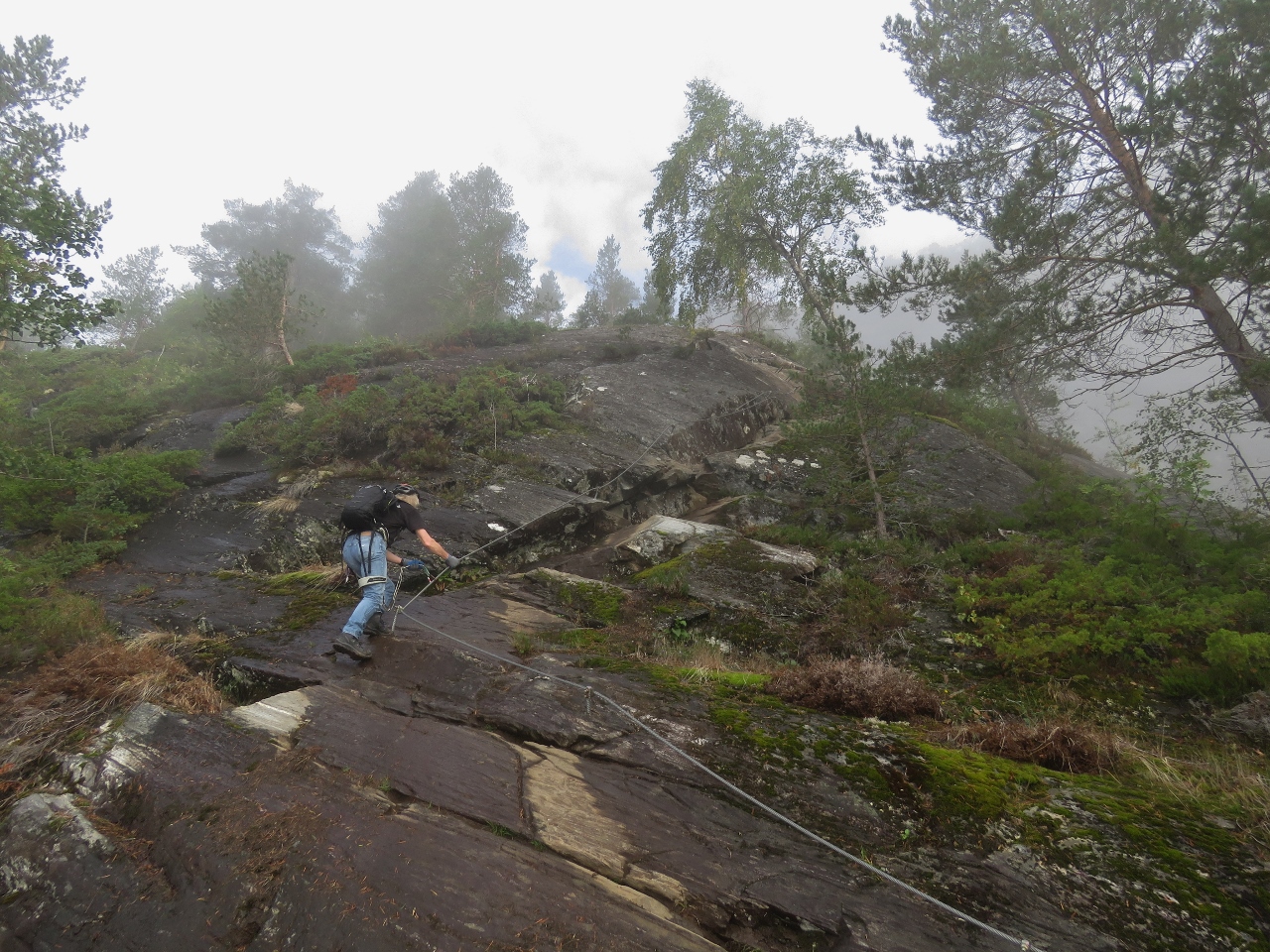
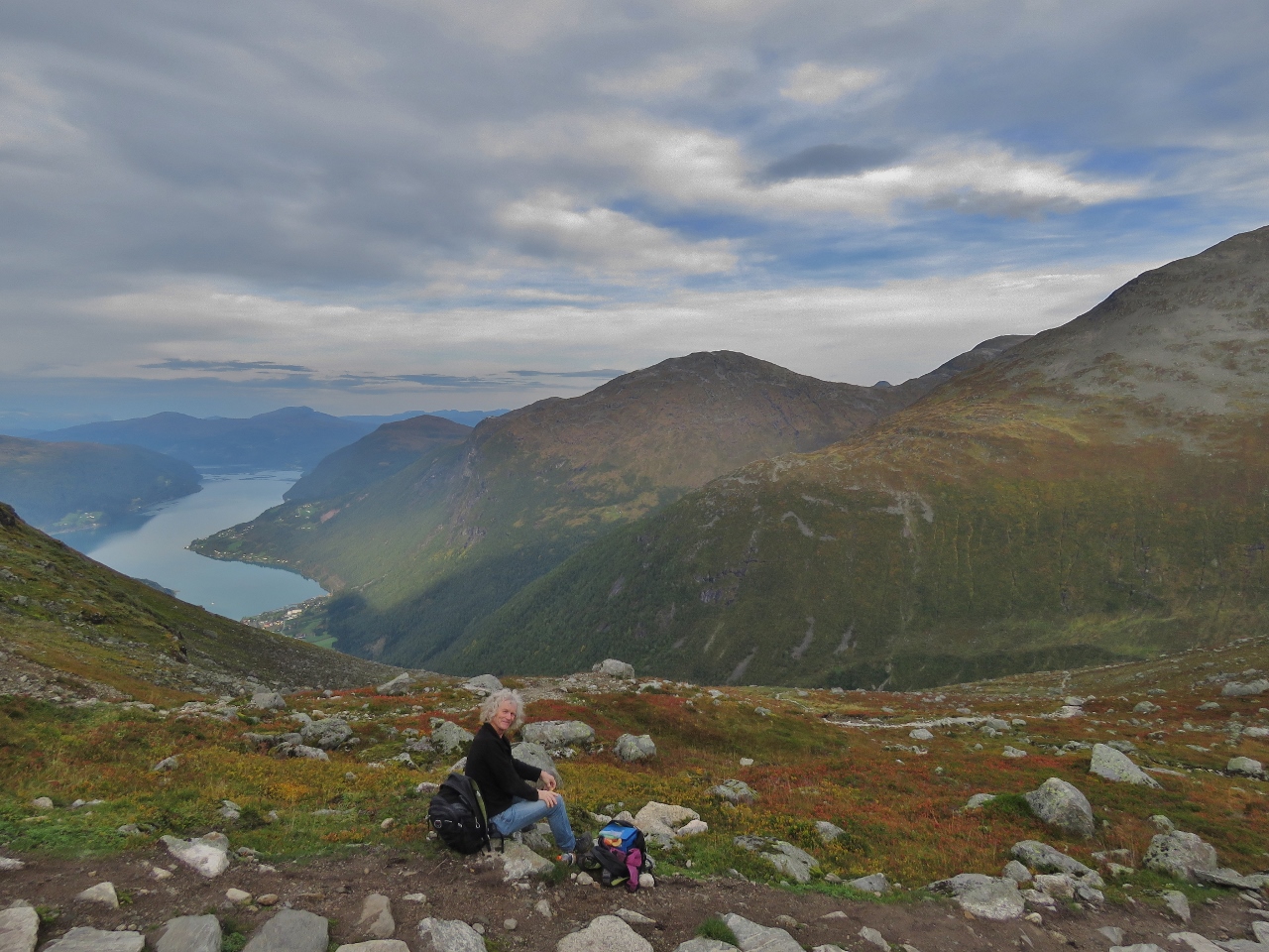
9/5/2018: Break
Position: 61°52.91'N, 6°50.45'E
Taking a break and enjoying the view across the Lodalen valley at altitude 1999 ft (609 m).
|
 |
9/5/2018: Climbing
Position: 61°52.95'N, 6°50.39'E
Ascending at altitude 2406 ft (733 m).
|
 |
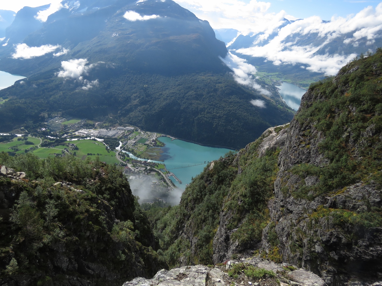
9/5/2018: Dirona
Position: 61°52.96'N, 6°50.37'E
Dirona moored far below us, viewed from an altitude of 2507 ft (764 m).
|
 |
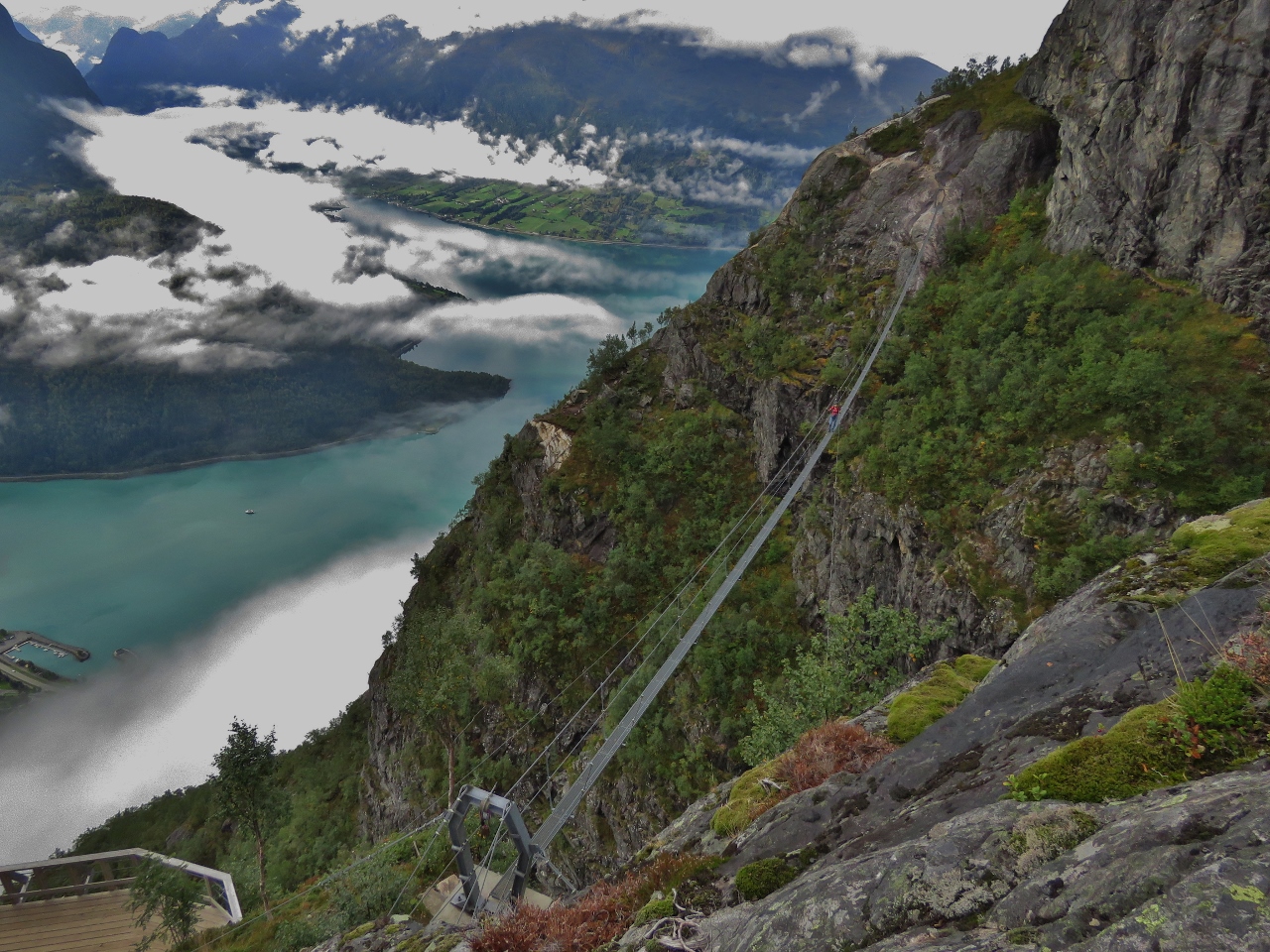
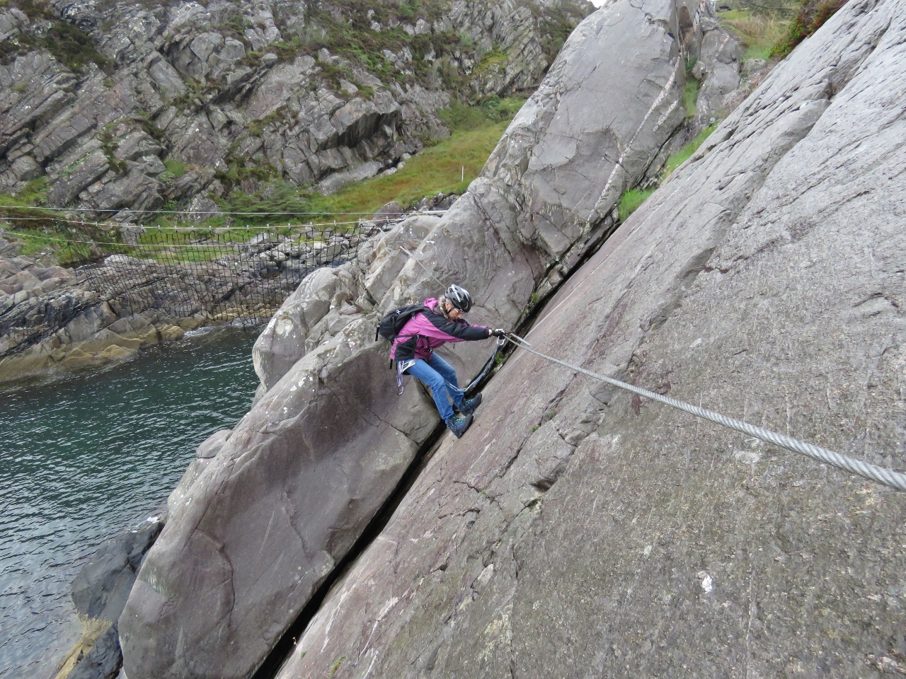
9/5/2018: Gjolmunne Suspension Bridge
Position: 61°53.01'N, 6°50.45'E
James crossing the Gjolmunne suspension bridge, 2,400 ft up (731m), clipped on behind him to the overhead cable above his head. The 120m bridge is the longest Via Ferrata bridge in Europe. It was pictures of this bridge, with a view to Nordfjorden beyond, that had first attracted us to the hike.
|
 |
9/5/2018: Gjolmunne From Above
Position: 61°53.02'N, 6°50.49'E
Jennifer crossing the Gjolmunne suspension bridge with Nordfjorden beyond. The marina where our tender is moored is visible at the far left.
|
 |
9/5/2018: Ringing Bell
Position: 61°53.02'N, 6°50.48'E
Jennifer ringing the bell after crossing the Gjolmunne suspension bridge.
|
 |
9/5/2018: View 2760 ft
Position: 61°53.06'N, 6°50.46'E
Another great view at altitude 2760 ft (841 m).
|
 |
9/5/2018: Gjolmunne Wire Bridge
Position: 61°53.07'N, 6°50.43'E
The 118ft (36m) Gjolmunne wire bridge was the part of the ascent we were most concerned about. It wasn't too bad close to the ends, but in the middle the wire rope moves quite a bit and it was a little, um, exciting. Here Jennifer is making her way across clipped to and holding onto the cables on either side.
|
 |
9/5/2018: Wire Bridge
Position: 61°53.07'N, 6°50.44'E
James crossing the Gjolmunne wire bridge.
|
 |
9/5/2018: Climbers Below
Position: 61°53.07'N, 6°50.43'E
At altitude 2842 ft (866 m) we could see another set of climbers crossing the Gjolmunne suspension bridge 442ft (135m) below.
|
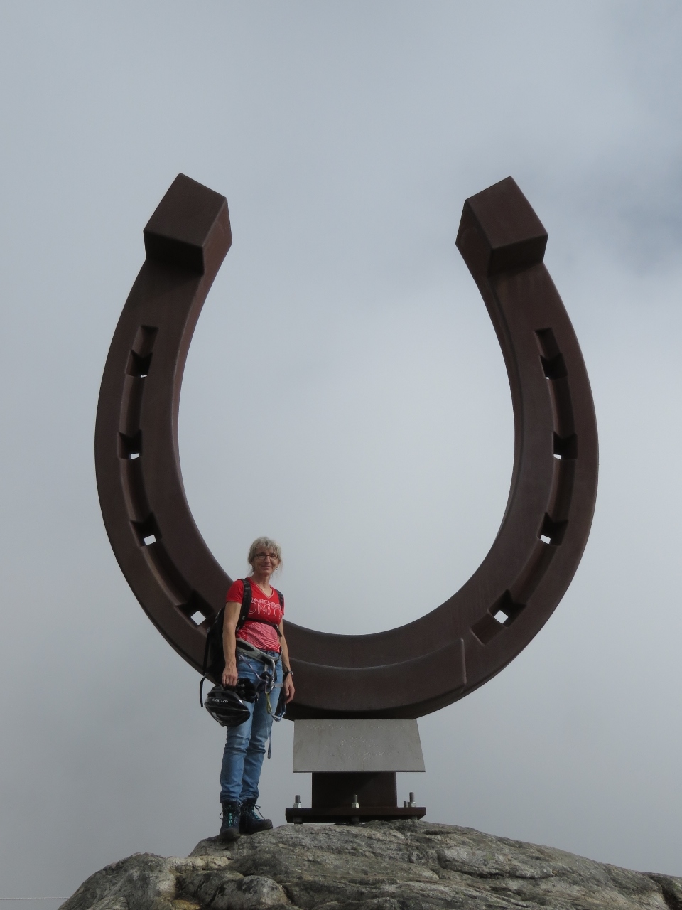 |
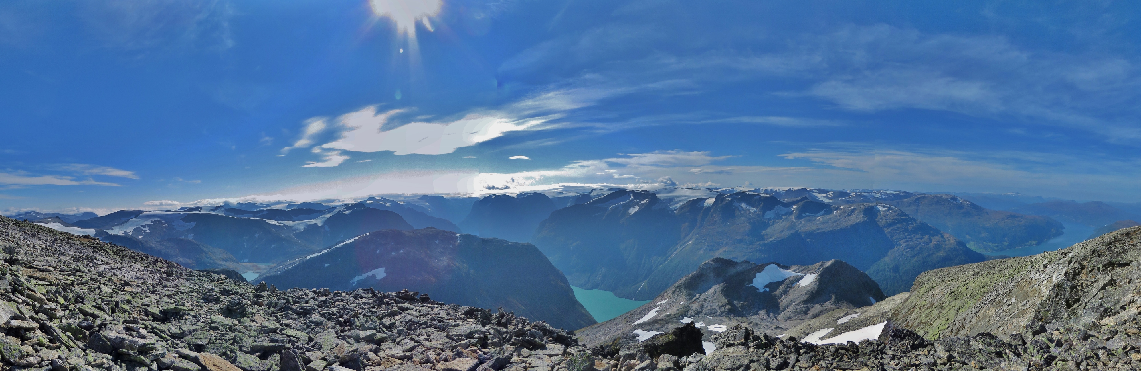
9/5/2018: Hoven Summit
Position: 61°53.12'N, 6°49.98'E
5m-high horseshoe on the Hoven summit at 3,316ft (1101m). Hoven means "hoof" in Norway—the mountain is named for the Sleipner, the horse of the god Odin in Norse mythology. This was the first time we'd taken a Via Ferrata. We had an awesome time and are looking forward to trying it again.
|
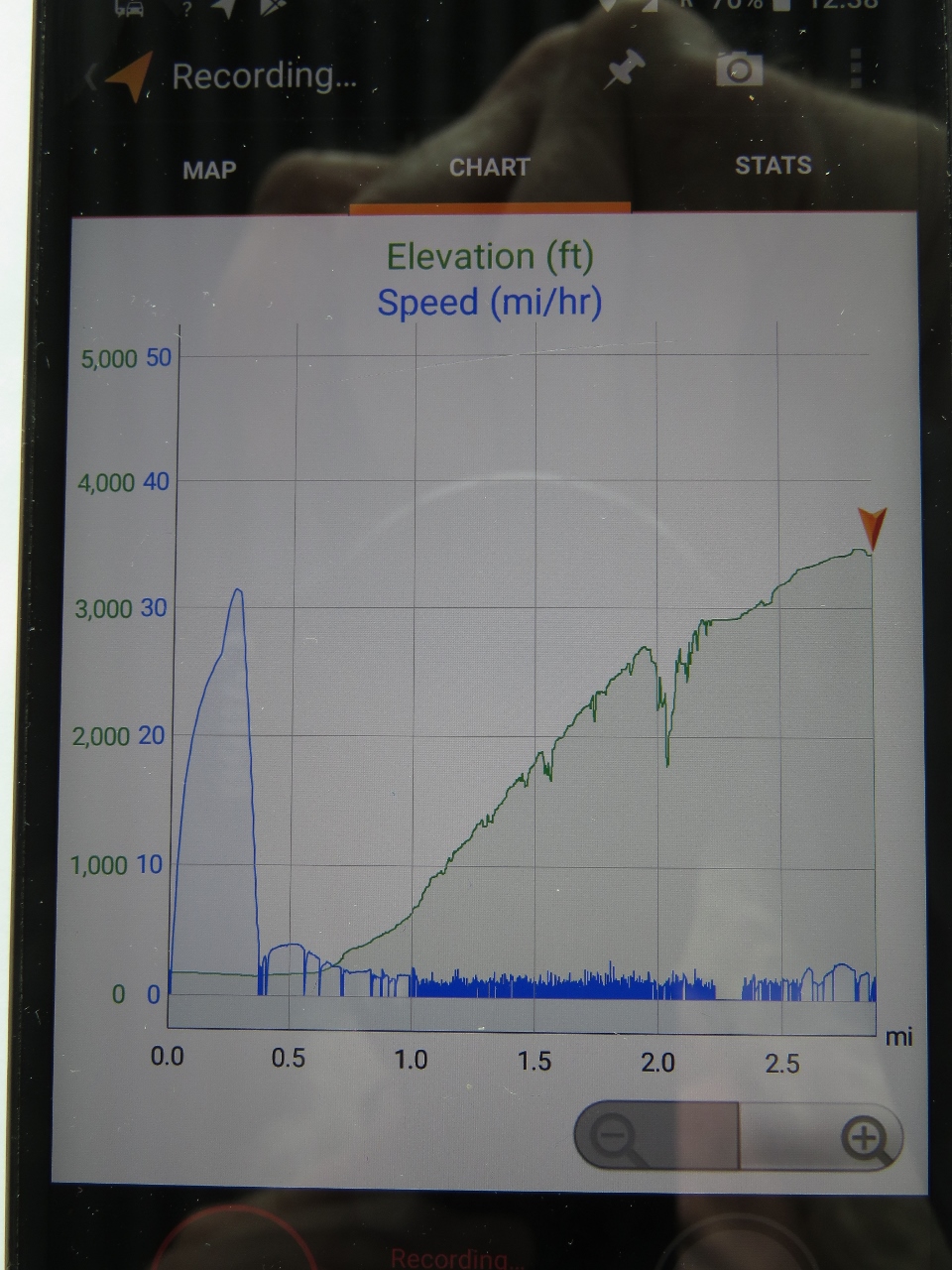 |
9/5/2018: Climb Profile
Position: 61°53.11'N, 6°49.97'E
Our climb profile for Via Ferrata Loen. The blue line represents speed and the green is altitude. You can see the quick blast to shore in the tender at just over 30mph at the far left and our ascent up Mt. Hoven at about 1mph.
|
 |
9/5/2018: Hoven
Position: 61°53.11'N, 6°49.97'E
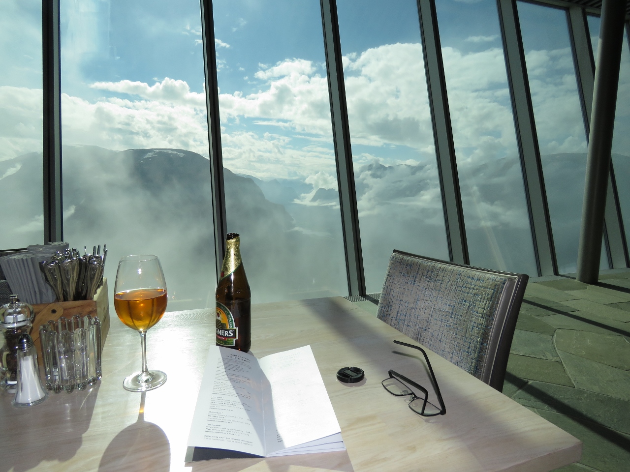
There aren't many places in the world where you can climb to over 3,000ft and have lunch at a high-end restaurant. We had an excellent, lazy lunch at Hoven restaurant with fabulous views to Nordfjorden. The clouds came and went frequently while we were there, giving us a constantly changing view.
|
 |
9/5/2018: Lodalen Valley
Position: 61°53.10'N, 6°49.96'E
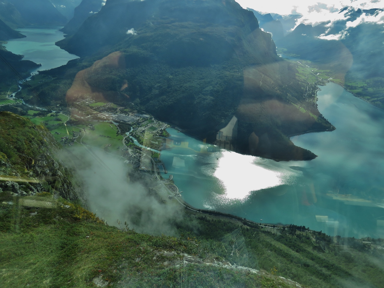
Sweeping view to the Lodalen valley from Hoven restaurant. Dirona is a small white speck at center, just left of the large sun reflection in the water (click image for a larger view).
|
 |
9/5/2018: Skylift
Position: 61°52.76'N, 6°50.21'E
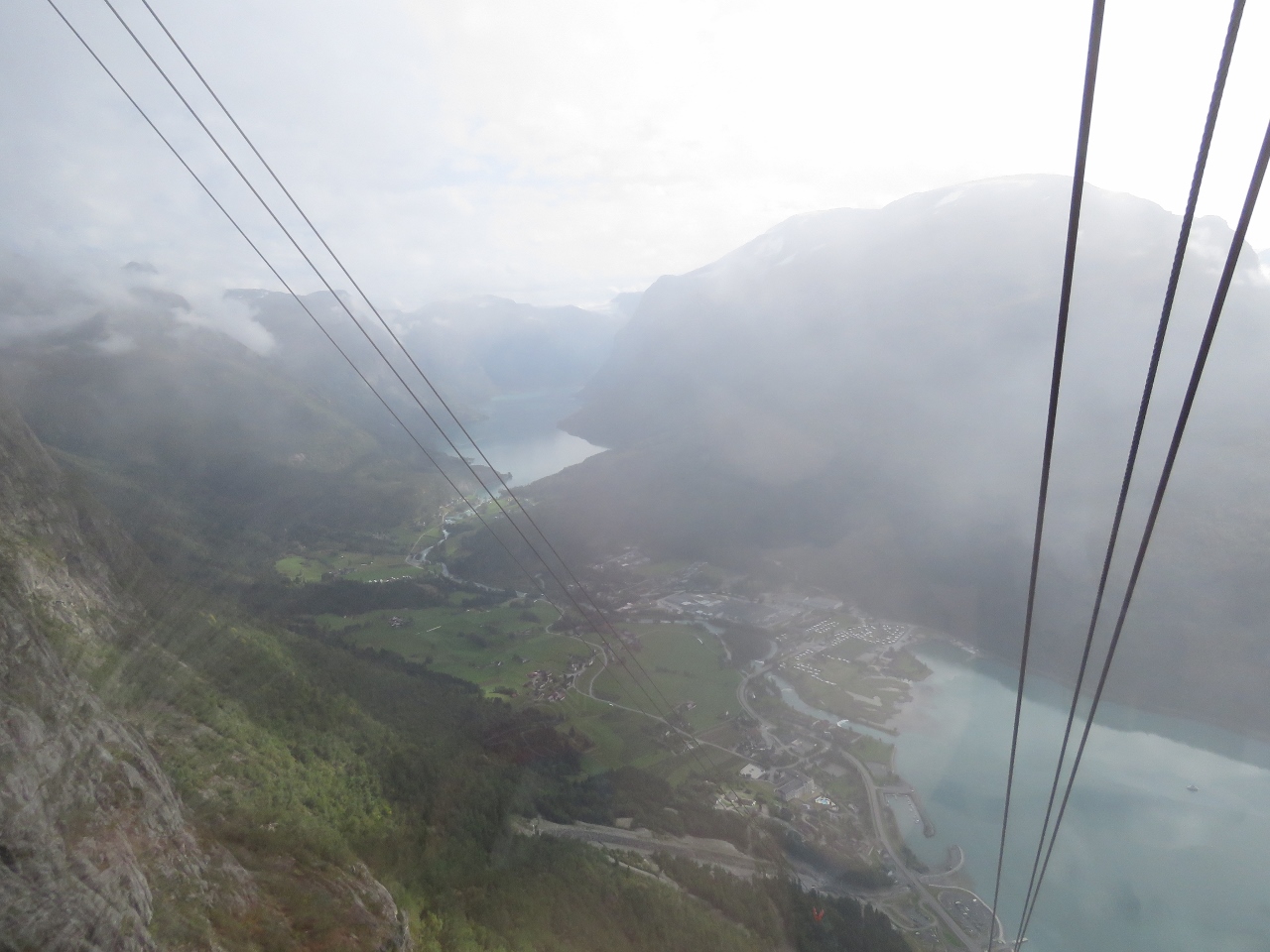
Looking down to Loen and the Lodalen valley from a Loen Skylift gondola as we descend. The Loen Skylift is one of the steepest in the world, with a maximum gradient of 60 degrees. And it's all on a single cable run with no supporting towers in between the top and bottom. Impressive engineering.
|
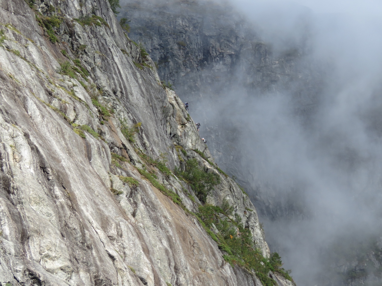 |
9/5/2018: Climbers
Position: 61°52.65'N, 6°50.27'E
Climbers making their way up Via Ferrata Loen on the route we just took. This is not a pastime for those afraid of heights.
|
 |
9/5/2018: Mt Hoven
Position: 61°50.34'N, 6°48.43'E
After returning back to sea level, we ran the tender over to the nearby town of Olden. This is looking back to Mt Hoven en route. Hoven restaurant and the Loen Skylift station are just visible at the top of the hill slightly right of center.
|
 |
9/5/2018: Olden
Position: 61°50.11'N, 6°48.30'E
Looking east to the hills above Olden. The town is quiet today, but that will change when the cruise ship Britannia arrives tomorrow.
|
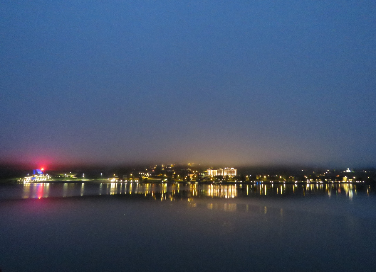 |
9/6/2018: Dawn
Position: 61°52.20'N, 6°50.14'E
The lights of Loen reflecting into still waters on a misty dawn at Loen.
|
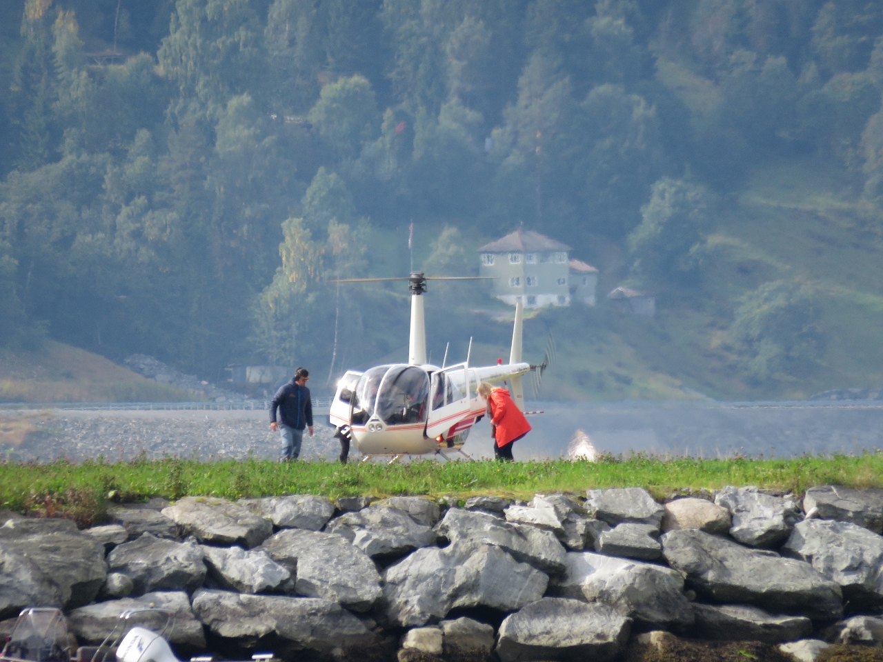 |
9/6/2018: Helicopter
Position: 61°52.20'N, 6°50.13'E
The cruise ship Britannia arrived into Olden this morning and we've seen a flurry of activity all day, including tour buses, high-speed adventure boats and helicopter rides.
|
 |
9/6/2018: Britannia
Position: 61°52.19'N, 6°50.14'E
The 1,083ft (330m) cruise ship Britannia filling the view to our south as the ship departs Olden.
|
 |
9/6/2018: Dusk
Position: 61°52.20'N, 6°50.13'E
Ending the day the same way we started—with reflections from the lights of Loen, this time with clear skies.
|
 |
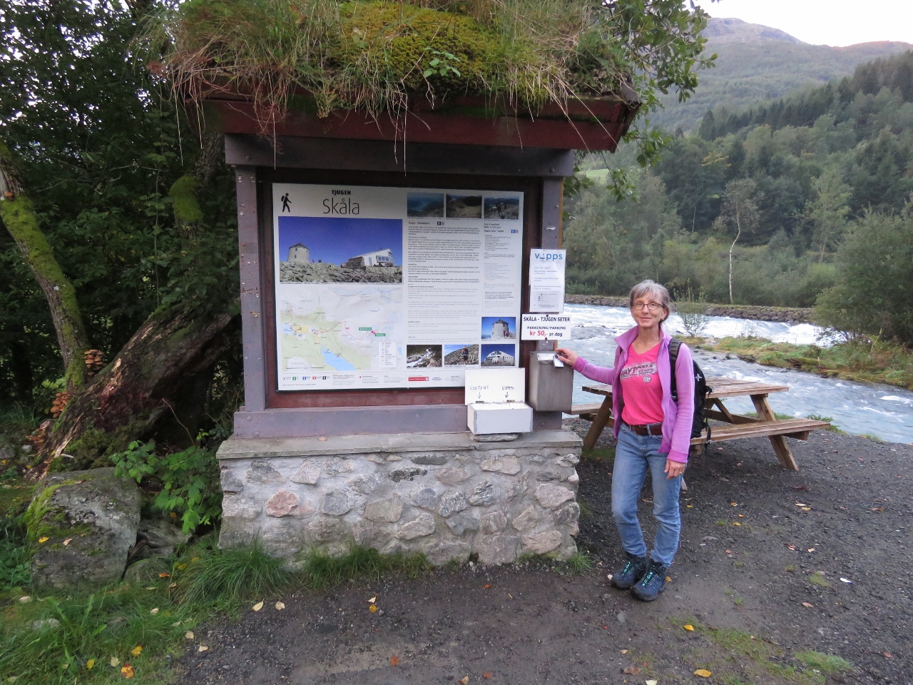
9/7/2018: Alexandra Marina
Position: 61°52.34'N, 6°50.73'E
The tender tied off at Alexandra Marina at 6:20am as we get an early start for the hike to 6,062ft (1,848m) Skala.
|
 |
9/7/2018: Dirona
Position: 61°52.21'N, 6°51.53'E
View back to the anchorage at the head of Nordfjorden on our way to the Skala trailhead.
|
 |
9/7/2018: Goal
Position: 61°52.15'N, 6°51.78'E
Our goal for the day is 6,062ft (1,848m) Skala, the flat-topped mountain left of center.
|
 |
9/7/2018: Trailhead
Position: 61°52.05'N, 6°53.03'E
A 2km walk from Loen brought us to the Skala trailhead.
|
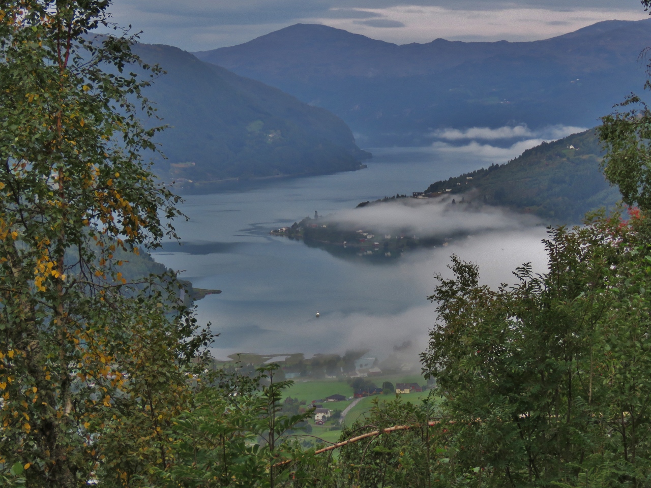 |
9/7/2018: Nordfjorden
Position: 61°52.19'N, 6°54.02'E
View to Nordfjorden at 1143 ft (348 m).
|
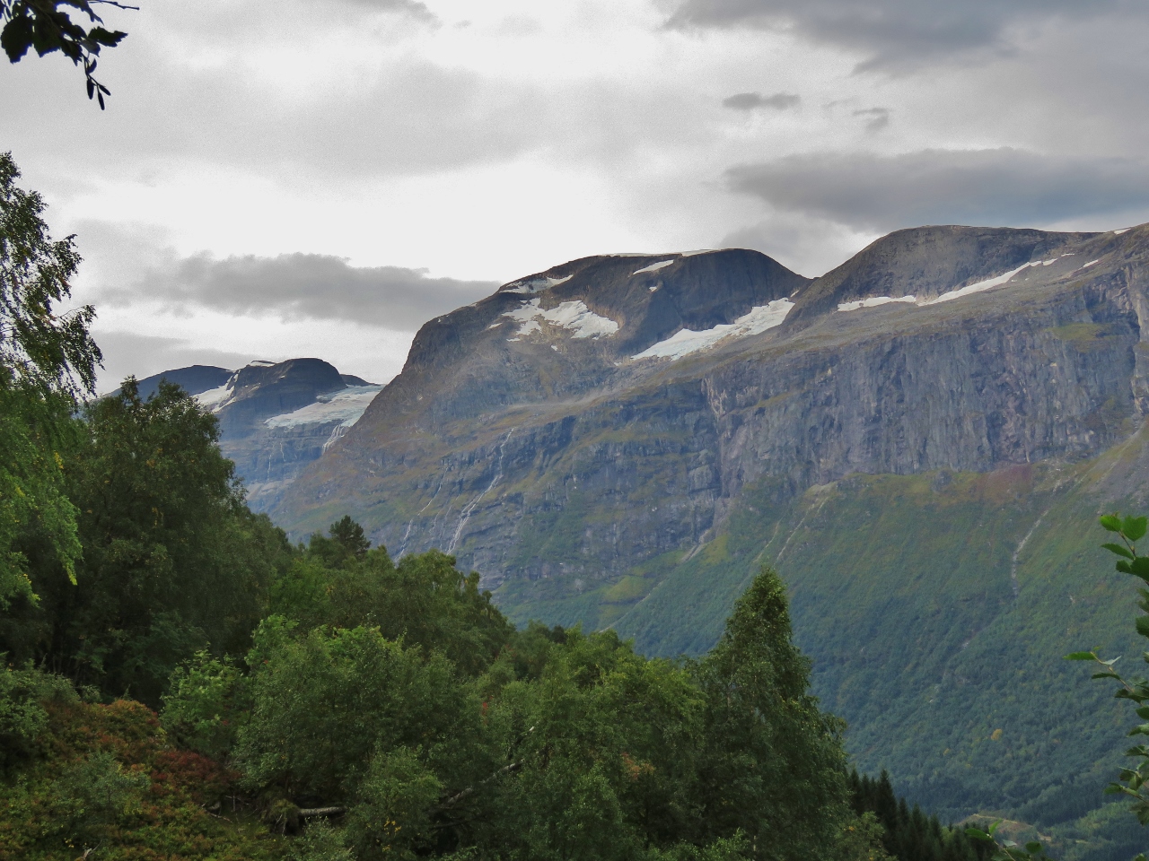 |
9/7/2018: Glacier Glimpse
Position: 61°52.26'N, 6°54.23'E
Our first glimpse south to Jostedalsbreen icecap at 1451 ft (442 m). This is the same icecap we saw from the south in May when we were in Fjaerland.
|
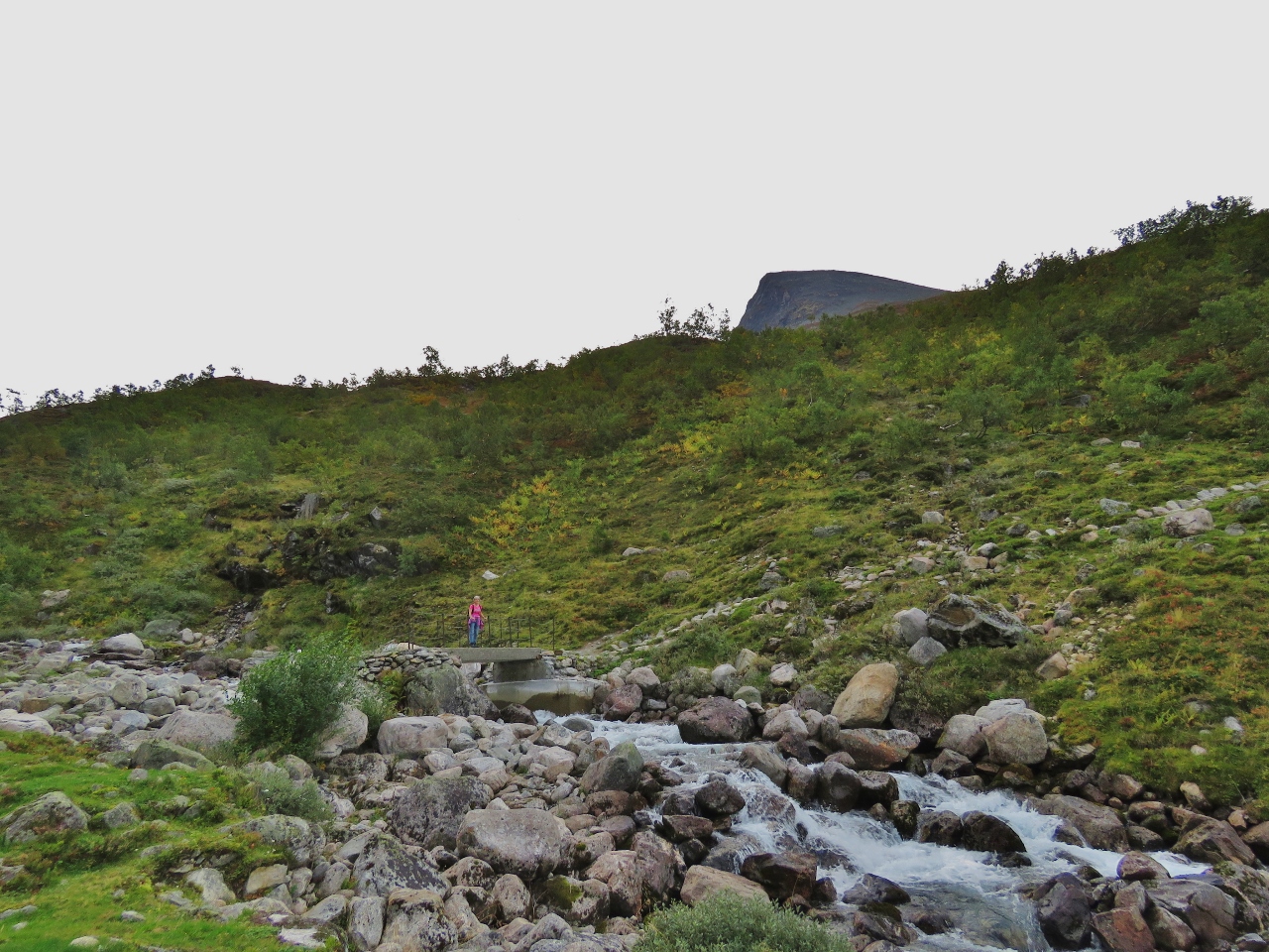 |
9/7/2018: Bridge
Position: 61°52.52'N, 6°55.01'E
Jennifer crossing a bridge across the river Fosdola with the tip of Skala visible behind.
|
 |
9/7/2018: Skylift
Position: 61°52.21'N, 6°55.52'E
At 3065 ft (934 m) up, we're just about at the same level as the Loen Skylift.
|
 |
9/7/2018: 3478 ft
Position: 61°52.07'N, 6°55.80'E
Taking a break at 3478 ft (1060 m). We're over halfway now—'only' 2584ft (788m) to go.
|
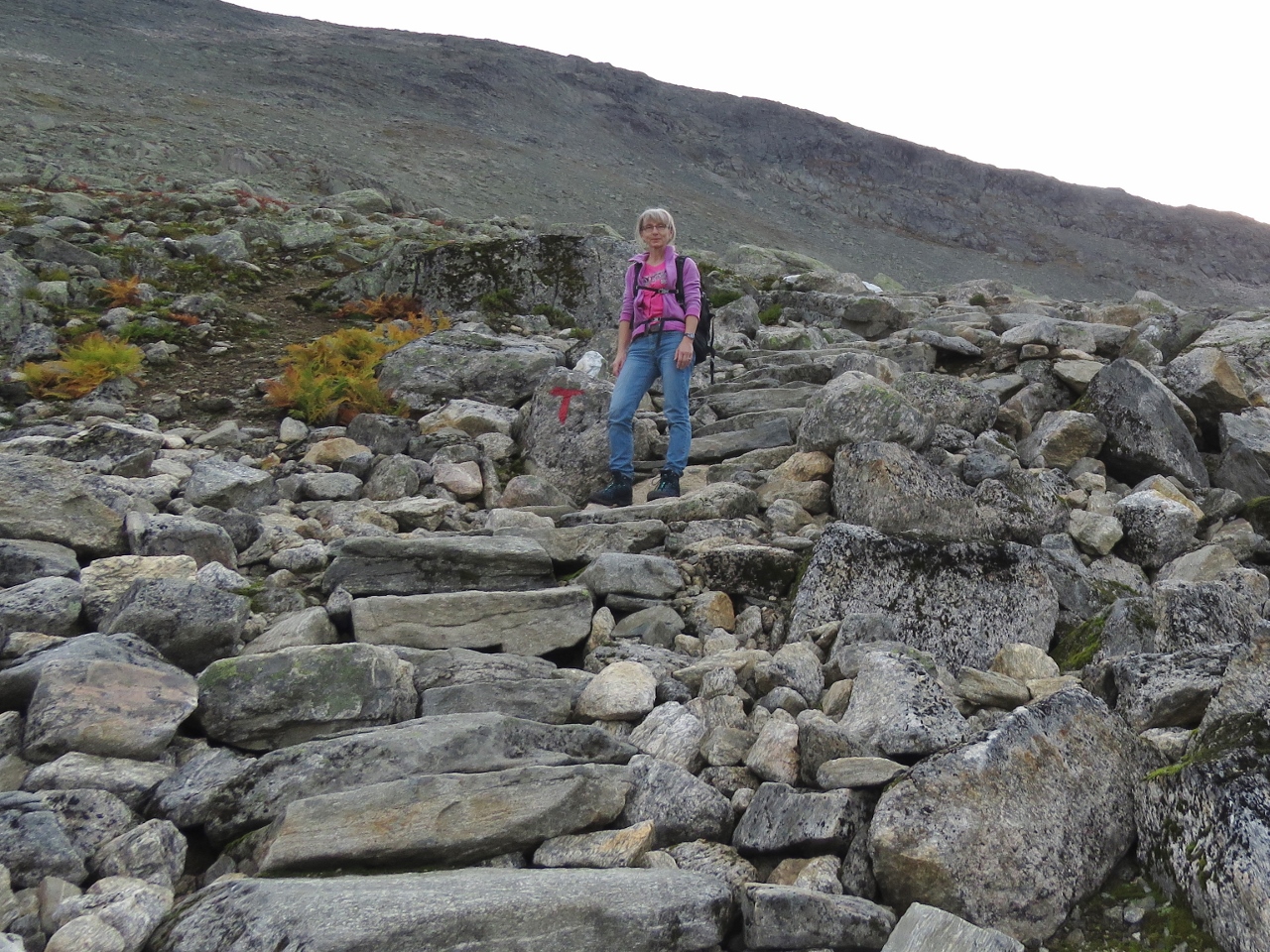 |
9/7/2018: Steps
Position: 61°51.88'N, 6°56.36'E
The trail to Skala is beautifully built and maintained by the Norwegian Trekking Association, with stone steps like these ones through much of the steeper sections.
|
 |
9/7/2018: Lake
Position: 61°51.79'N, 6°56.69'E
Taking a break at 4265 ft (1300 m). The sun is just starting to hit the small lake at the right of the picture.
|
 |
9/7/2018: 5889ft
Position: 61°52.08'N, 6°57.72'E
Enjoying the view south at 5889 ft (1795 m).
|
 |
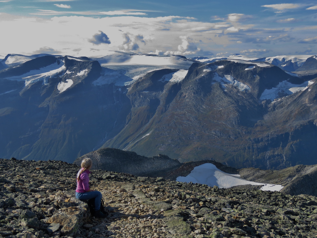
9/7/2018: Mile High
Position: 61°52.09'N, 6°57.85'E
The spectacular mile-high view south to Jostedalsbreen icecap from the 6,062 (1848m) summit. Skala is considered Norway's highest mountain peak that has a foot in a fjord.
|
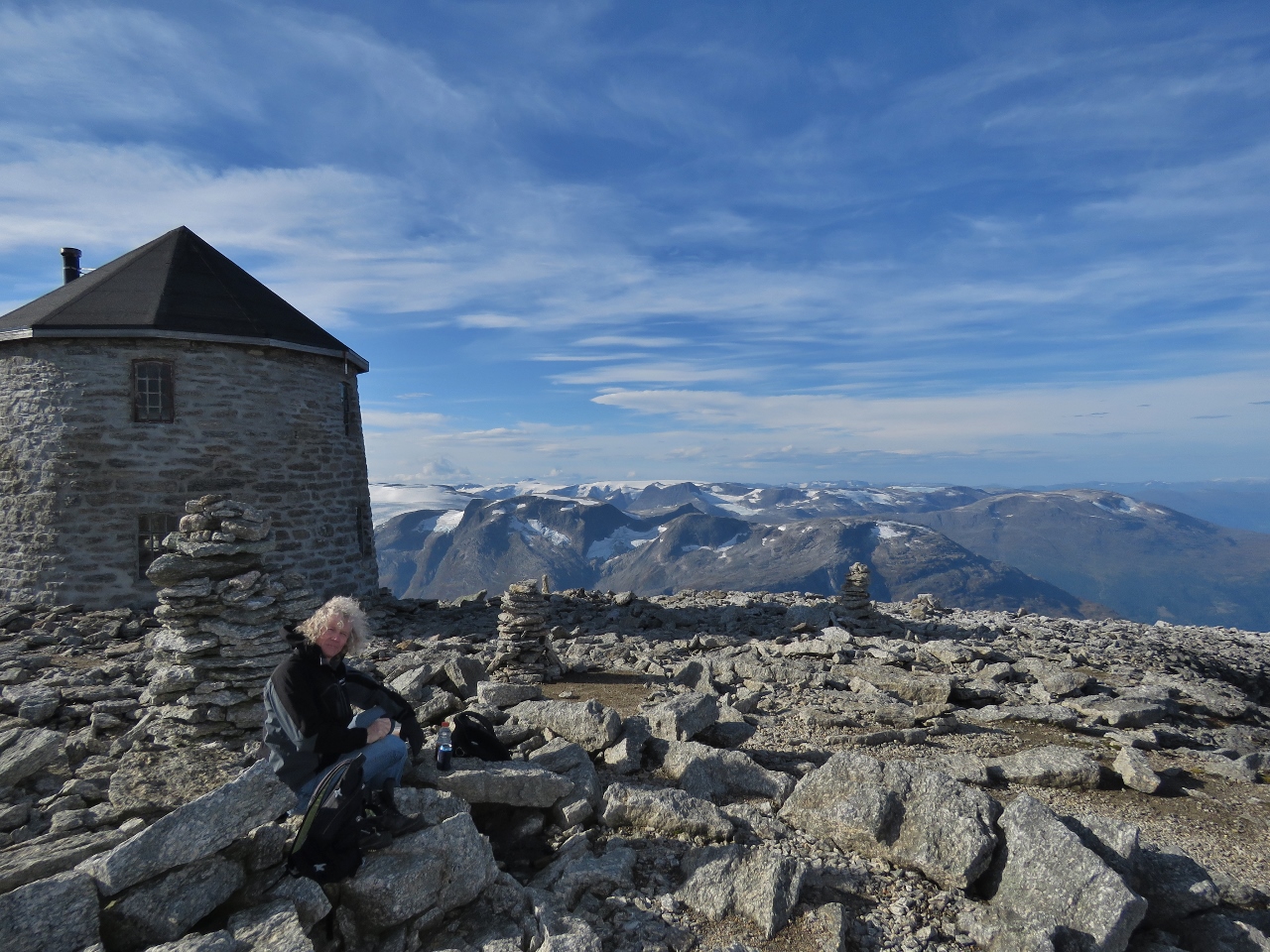 |
9/7/2018: Lunch
Position: 61°52.11'N, 6°57.94'E
Lunch with the cloister tower Skalatartnet in the background and the mountains of Jostedalsbreen glacier in the distance. The tower was built in 1891 to encourage hiking in the area and now is a Norwegian Trekking Association mountain cabin with 20 beds in three floors.
|
 |
9/7/2018: Skalatartnet
Position: 61°52.10'N, 6°57.96'E
Warming up inside Skalatartnet.
|
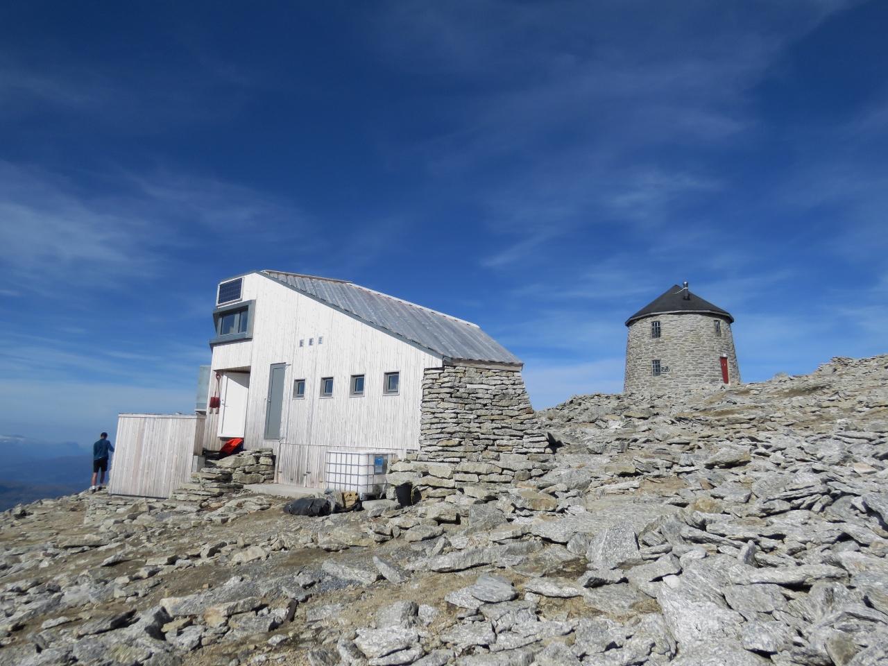 |
9/7/2018: Skalabu
Position: 61°52.09'N, 6°57.95'E
The modern Skalabu mountain hut was completed in 2016 and can sleep 20 people. Despite the effort of the climb, or perhaps because of it, the hike up Skala is incredibly popular with over 10,000 people visiting annually. We saw perhaps sixty people on the trail and at the summit and expect a majority will spend the night.
|
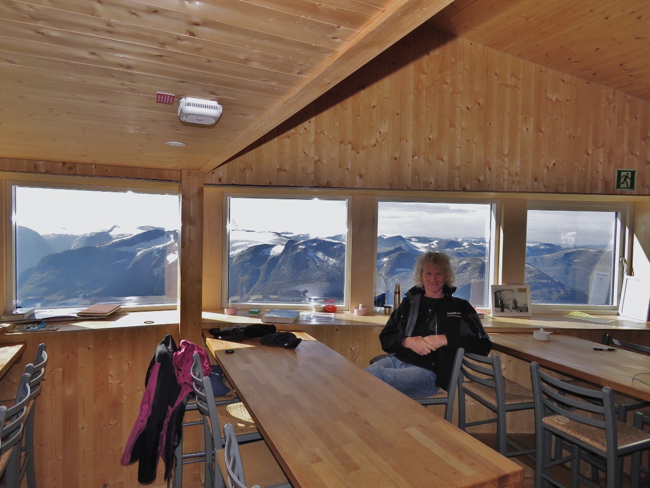 |
9/7/2018: Relaxing
Position: 61°52.09'N, 6°57.95'E
Relaxing and enjoying the view south in the beautiful Skalabu mountain cabin before heading returning back down. We'd reached the summit in just under four hours and were pretty tired. We found it hard to imagine running to the top in the annual Skala Opp race from Loen to the summit, which regularly draws over 1,500 participants. The record for reaching the top is 1 hour and 7 minutes. We'll stick to walking.
|
 |
9/7/2018: Nordfjorden
Position: 61°52.34'N, 6°55.48'E
The view to Nordfjorden from 2930 ft (893 m) as we descend.
|
 |
9/7/2018: Skala
Position: 61°52.20'N, 6°51.61'E
Looking back to 6,062ft (1,848m) Skala (left) from the road. It's hard to believe we were actually up there just a few hours earlier.
|
 |
9/7/2018: Mt. Hoven
Position: 61°52.32'N, 6°51.34'E
The Loen Skylift and Gjolmunne Suspension Bridge viewed from the road back to Loen.
|
 |
9/7/2018: Skala Hike Profile
Position: 61°52.20'N, 6°50.14'E
Our hike profile (blue is speed, green is altitude) to 6,062ft (1,848m) Skala isn't as steep as for 5,131 ft (1564m) Slogen, but is a lot higher and longer.
|
 |
9/8/2018: AIDAvita
Position: 61°52.20'N, 6°50.13'E
The 666ft (203m) AIDAvita arriving into Olden this morning.
|
 |
9/8/2018: Anchorage
Position: 61°52.38'N, 6°50.51'E
Our anchorage below Mt. Hoven. You can just make out the top of the Loen Skylift at roughly center of the picture (click image for a larger view).
|
 |
9/8/2018: Loen Active
Position: 61°52.31'N, 6°50.85'E
Several dozen climbers were getting ready for a guided tour on Via Ferrata Loen with Loen Active.
|
 |
9/8/2018: Paraglider
Position: 61°52.31'N, 6°50.87'E
We're in town to take the bus to Briksdal Glacier and the bust stop is near where the paragliders land after taking off from the top of Mt. Hoven.
|
 |
9/8/2018: Cruise Ship Day
Position: 61°49.35'N, 6°48.60'E
Lots of activity in Olden with the cruise ship AIDAvita in port. The public bus we're to Briksdal glacier runs daily until the end of August and after that only on days when the cruise ship is in town. We wondered why, as the cruise ships normally run their own buses for shore excursions. But at least a dozen passengers got on in Olden. Apparently nobody takes the bus from Loen on cruise ship day—the driver went right past both highway exits for our stop and had to back down the highway when he noticed us at the stop after he'd passed. We were lucky he stopped.
|
 |
9/8/2018: Oldevatnet
Position: 61°47.42'N, 6°49.82'E
The sunny morning reflecting in the still waters at the north end of the lake Oldevatnet.
|
 |
9/8/2018: Klovane
Position: 61°46.30'N, 6°50.03'E
Looking across the lake Oldevatnet to 3221 ft (982m) Klovane with a near-matching adjacent peak.
|
 |
9/8/2018: Campers
Position: 61°44.76'N, 6°47.39'E
It's easy to see why this campsite is so popular—the scenery is spectacular.
|
 |
9/8/2018: Waterfall
Position: 61°40.94'N, 6°48.60'E
Most of the descriptions of Briksdal glacier focused on the destination itself with little mention of the beautiful scenery en route. This is just one of many waterfalls we saw along the way.
|
 |
9/8/2018: Crowds
Position: 61°39.89'N, 6°49.76'E
We arrived at Briksdal behind a half-dozen tour buses from the cruise ship. This is looking back behind us as we start off on the 45-minute walk from the parking lot to the glacier.
|
 |
9/8/2018: Troll Car
Position: 61°39.93'N, 6°49.99'E
If you don't want to walk to the glacier you can ride one of these "Troll Cars" for a fee. The Troll Cars use the same reliable power as Dirona—nothing runs like a Deere.
|
 |
9/8/2018: Briksdalselva
Position: 61°39.91'N, 6°50.04'E
Looking back along the river Briksdalselva with the waterfall Volefossen in the distance. At this point we would have been happy enough with the trip and the scenery even if we didn't get to see the glacier.
|
 |
9/8/2018: Kleivafossen
Position: 61°39.84'N, 6°50.10'E
The waterfall Kleivafossen with Briksdal glacier visible in the distance above.
|
 |
9/8/2018: Pothole
Position: 61°39.88'N, 6°50.20'E
Jennifer sitting in a huge pothole. Melt water under high pressure from the glacier above put stones in motion below, forming round depressions and leaving behind smooth stones such as the ones Jennifer is sitting on.
|
 |
9/8/2018: Briksdal Glacier
Position: 61°39.89'N, 6°51.23'E
Briksdal Glacier on the left with the waterfall Tjotaelva on the right. Briksdal is another tongue of Jostedalsbreen icecap that we saw from the south in May when we were in Fjaerland.
|
 |
9/8/2018: Receding
Position: 61°39.86'N, 6°51.67'E
Briksdal glacier is not constantly receding— the size changes depending upon temperature and precipitation. Between 1935 and 1951, the glacier receded 800m and exposed the lake below, but from 1967 to 1997 it expanded and covered the whole lake and was the only glacier in Europe that was expanding while all others were receding. The glacier has mostly been receding since 2000, but grew again in 2010.
|
 |
9/8/2018: Calving
Position: 61°39.88'N, 6°51.72'E
We were lucky to witness a huge chunk of ice falling from the glacier shortly after we arrived. We watched carefully for more, but that was the only event while we were there.
|
 |
9/8/2018: Lunch
Position: 61°39.88'N, 6°51.72'E
Enjoying a picnic lunch with a view to Briksdal Glacier. We'd out-walked the cruise ship crowds, but they caught up while we were eating.
|
 |
9/8/2018: Volefossen
Position: 61°39.79'N, 6°49.33'E
Waiting for our bus at the Briksdal Glacier visitor center with the waterfall Volefossen tumbling down in the distance behind.
|
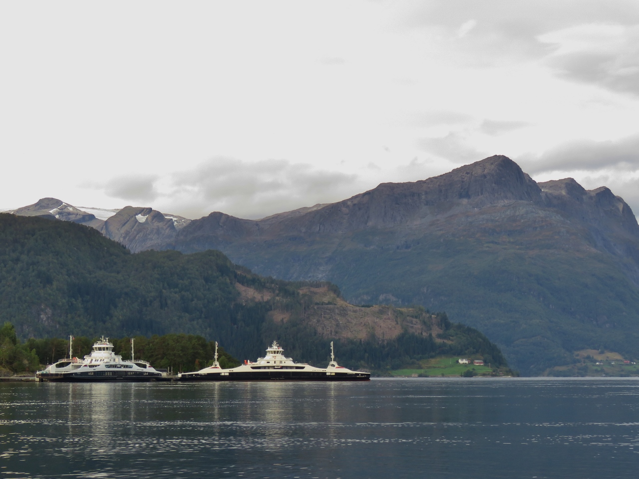 |
9/9/2018: Eidsjford and Gloppefjord
Position: 61°51.02'N, 6°5.05'E
The all-electric ferries Eidsjford and Gloppefjord that we passed en route to Loen.
|
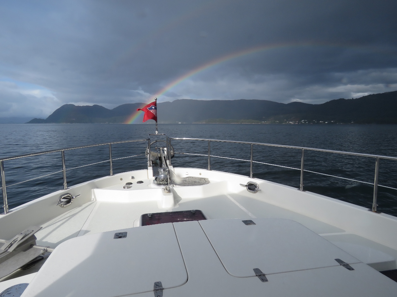 |
9/9/2018: Rainbow
Position: 61°55.22'N, 5°25.73'E
Rainbow in Nordfjorden.
|
 |
9/9/2018: Straumen Narrows
Position: 61°53.14'N, 5°20.05'E
Approaching the narrow and shallow Straumen Narrows. We had a little current to contend with as well, but the channel is well-marked and relatively easy to run.
|
 |
9/9/2018: Hornelen
Position: 61°52.57'N, 5°19.26'E
2821ft (860m) Hornelen, the highest sea cliff in Europe, burst into view as we cleared Straumen Narrows.
|
 |
9/9/2018: Below Hornelen
Position: 61°51.28'N, 5°17.11'E
Another view to 2821ft (860m) Hornelen as we pass.
|
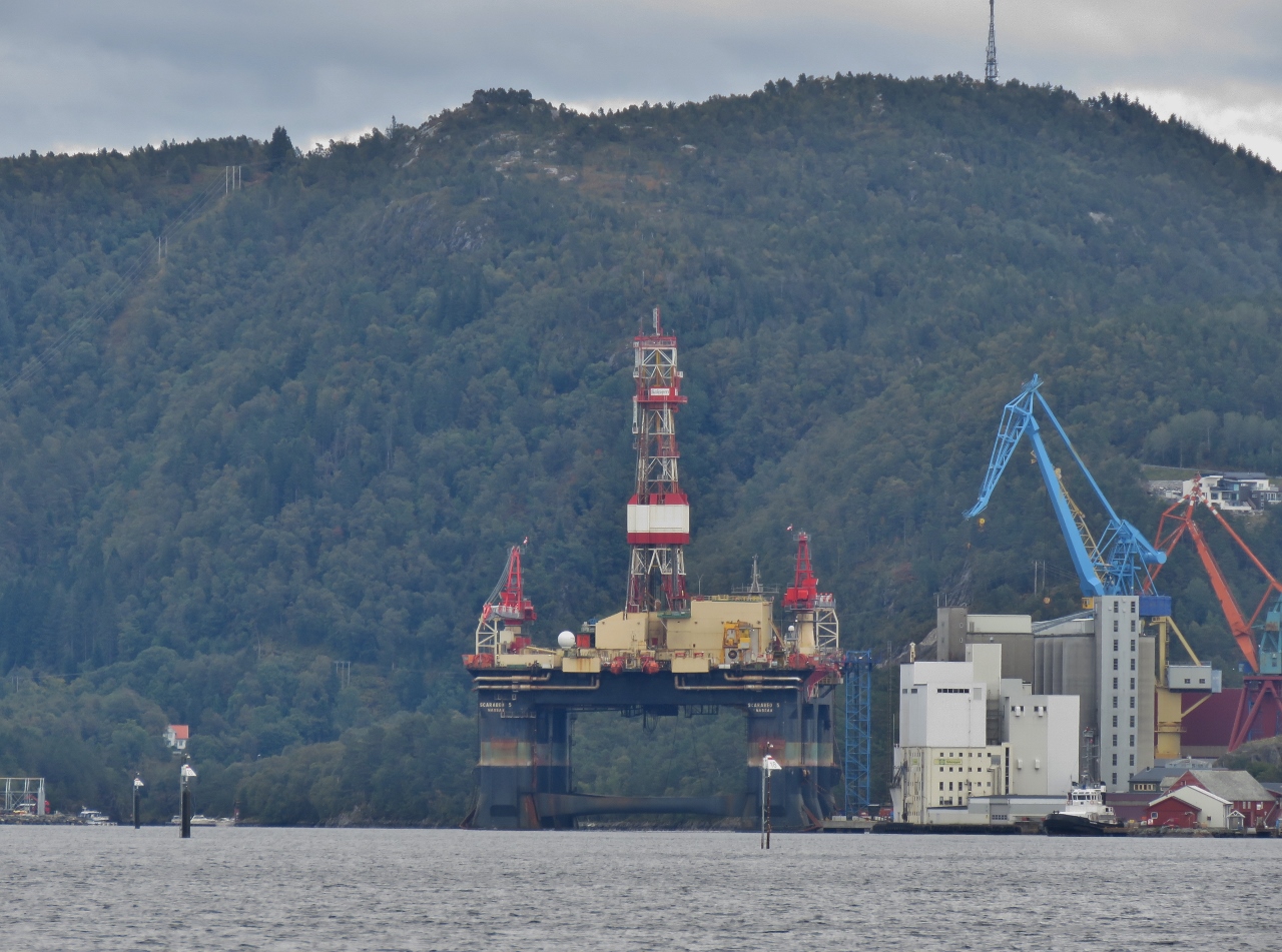 |
9/9/2018: Oil Rig
Position: 61°35.88'N, 4°59.06'E
Oil rig moored at Floro, likely for maintenance.
|
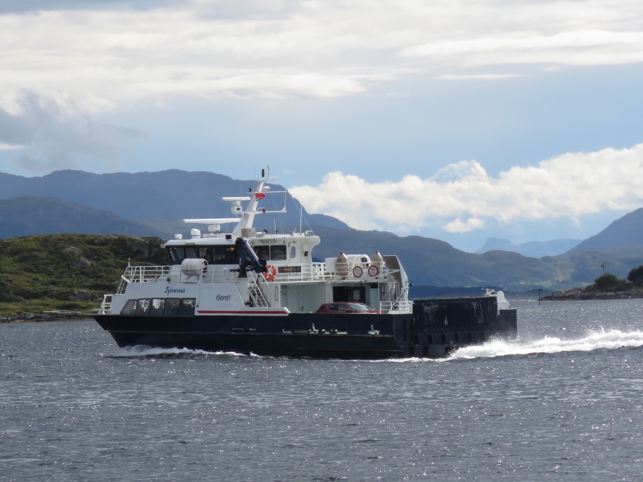 |
9/9/2018: Sylvarnes
Position: 61°35.01'N, 4°59.83'E
The fast ferry Sylvarnes off Floro.
|
 |
9/9/2018: EWOS
Position: 61°34.80'N, 5°0.11'E
Huge EWOS facility in Floro. Until purchased by Cargill in 2015, EWOS was one of the largest suppliers of feed and nutrition for farmed fish.
|
 |
9/9/2018: Insurance Limit
Position: 61°30.83'N, 5°7.65'E
The yellow line we're crossing is the standard limit for our Jackline insurance policy. We needed to purchase a special rider to travel north of 061°30' latitude.
|
 |
9/10/2018: Naervika
Position: 61°27.53'N, 5°13.73'E
The view north towards Floro from the anchorage at Naervika where we've stopped for a few nights while a weather system passes. Rain has been falling heavily since we arrived.
|
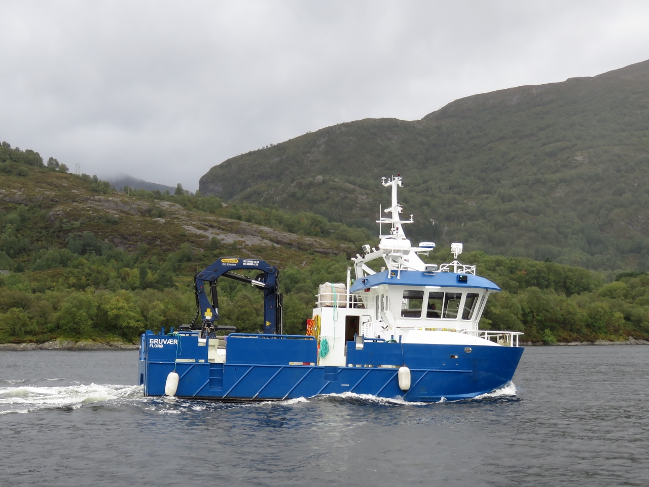 |
9/10/2018: Bruvaer
Position: 61°27.53'N, 5°13.69'E
The work boat Bruvaer departing from Naervika.
|
 |
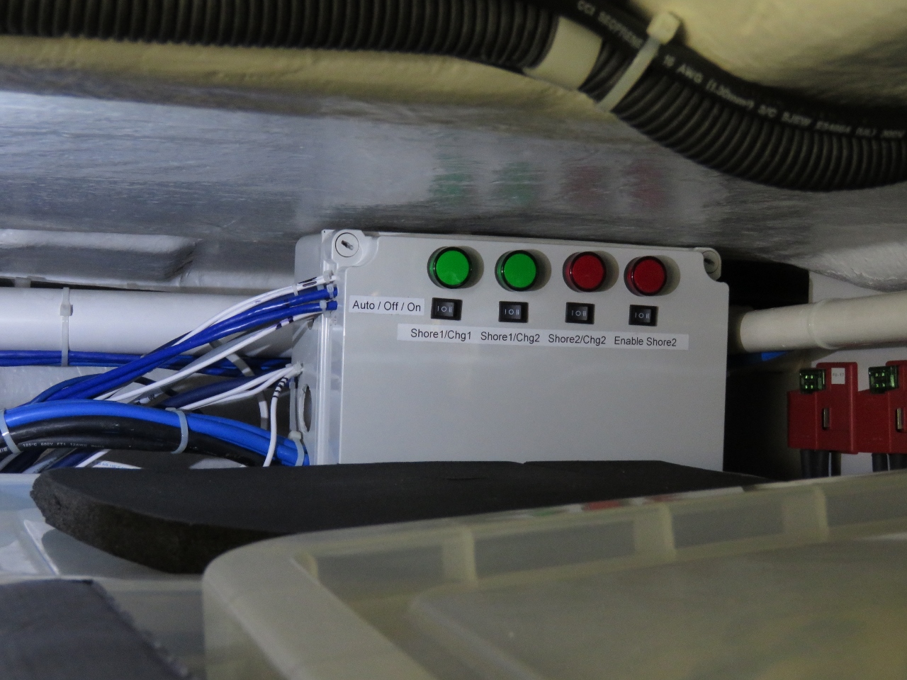
9/10/2018: Shore 2 Control Box
Position: 61°27.54'N, 5°13.71'E
The finished second shore power control box. This control box is used for a variety of functions including: 1) Manual control of the second shore power connection with electrical interlocks preventing two power sources to on the same charger, 2) automatic control of the second shore power connection with electrical interlocks, 3) load shedding support for both charger #1 and #2, 4) 8 channels of digital output (future use), 5) digital control for a 4x20 character LCD display (future use), 6) digital control for a 4x4 matrix keyboard (future use), and 7) a single digital input (future use).
The 4 lights indicate: 1) left green indicates charger 1 is powered by the house and is on, 2) right green indicates charger 2 is powered by the house and is on, 3) the left red light indicates the presence of power at the second shore power connection and it's selected (can't be on at the same time as the green light beside it), and 4) the far right red light is lit when shore power two is powering charger #2. The 4 rocker switches control, from left to right, charger #1, charger #2, shore #2, shore #2 enable. Each switch can be in auto control (switched left), forced off (switched centrally), or manually on (switched right). |
 |
9/10/2018: Laz View
Position: 61°27.54'N, 5°13.71'E
This is the finished product showing at a glance if the system is online in automatic mode, manual mode, or forced off. It also shows if the chargers are powered and, if so, whether it's from the house or from the second shore power connection. This is also remotely visible from the pilot house.
|
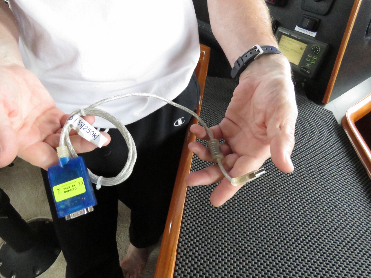 |
9/10/2018: CANbus Adapter
Position: 61°27.53'N, 5°13.73'E
Back in 2016, we figured out the proprietary Mastervolt Masterbus communications protocol and used a CANbus adapter to turn the chargers off and on programatically as loads changed on the boat. This has worked very well for years but there is a device driver problem with the CANbus adapter where Windows will rarely decide is a mouse. When this happens the cursor jumps all over the screen as CANbus messages arrive. It only happens once a month or two and a reboot always clears it but it's annoying.
We've been using the new second 16A shore power adapter control box which can switch in the second up to 16A shore power connection but it also has a contactor controlling the power sent to each charger. This control box implements the second shore power system with interlocks but also implements the load shedding system for the chargers. This load shed system is slightly faster than the direct control of Masterbus that we had been using and it doesn't suffer from the driver problem. Since it's working well, we removed the CANbus adapter today. |
 |
9/10/2018: Impeller
Position: 61°27.53'N, 5°13.70'E
We just changed the generator impeller five months back, but the generator is running at 196F at full load and it normally runs around 193F. Each time we see that temperature creep up, we open up the raw water pump and each time find the impeller needs changing. The advantage of finding the fault early is the impeller parts may not yet have fallen off so the changes is quick and easy. If we don't notice until later and the impellers parts are released into the system, it's a bigger job where the coolant needs to be drained from the generator and the heat exchangers needs to be opened up. That's where the parts end up falling.
Today, we found the impeller was 100% fine. We checked the temperature sensor accuracy and it appears to be reading correctly so the generator is just running about 3F warmer than usual. Not really a big deal at all but these things are usually an early warning that something is just starting to fail. We'll check the air filter to make sure its clear and, after that, the most likely culprit is the exhaust elbow carboning up and restricting flow. We'll keep an eye on it and, if we see any more evidence, we'll drop the exhaust elbow and clean it. Given our generator averages 45% to 50% load and spends 1/4 of the time at full load, we wouldn't really expect the exhaust elbow to carbon up. |
 |
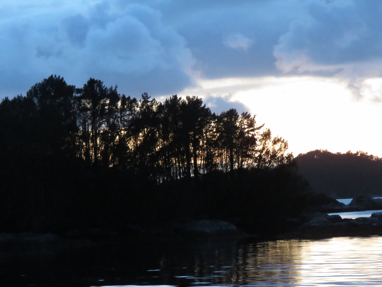
9/11/2018: Waterfalls
Position: 61°27.52'N, 5°13.83'E
The reward for a couple of days of steady rain is impressive waterfalls on the hills behind the anchorage.
|
 |
9/12/2018: Wind
Position: 61°27.53'N, 5°13.82'E
The winds peaked last night at just over 30 knots.
|
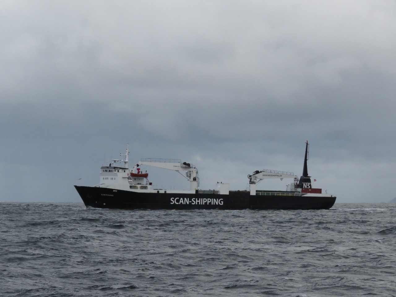 |
9/12/2018: Karmsund
Position: 61°25.17'N, 4°58.31'E
The coastal freighter Karmsund passing us as we both exit Stavjforden. The winds are steady in the 20s and the seas are quite large—the ship was rolling quite a bit in the beam seas.
|
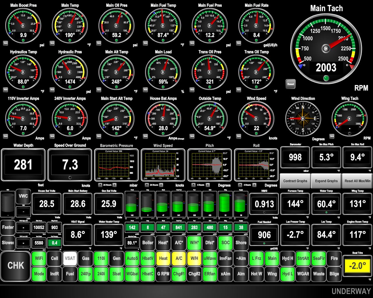 |
9/12/2018: Boat Motion
Position: 61°24.82'N, 4°58.29'E
Conditions were surprisingly rough in Stavjforden, with tight seas on the nose. We were pitching up to 15° at times. As we turned sideways to the seas, the pitch started to fall off and we rolled more (see graphs at center).
|
 |
9/12/2018: Njord
Position: 61°21.20'N, 5°2.15'E
The fast ferry Njord doing 31 knots en route to Bergen.
|
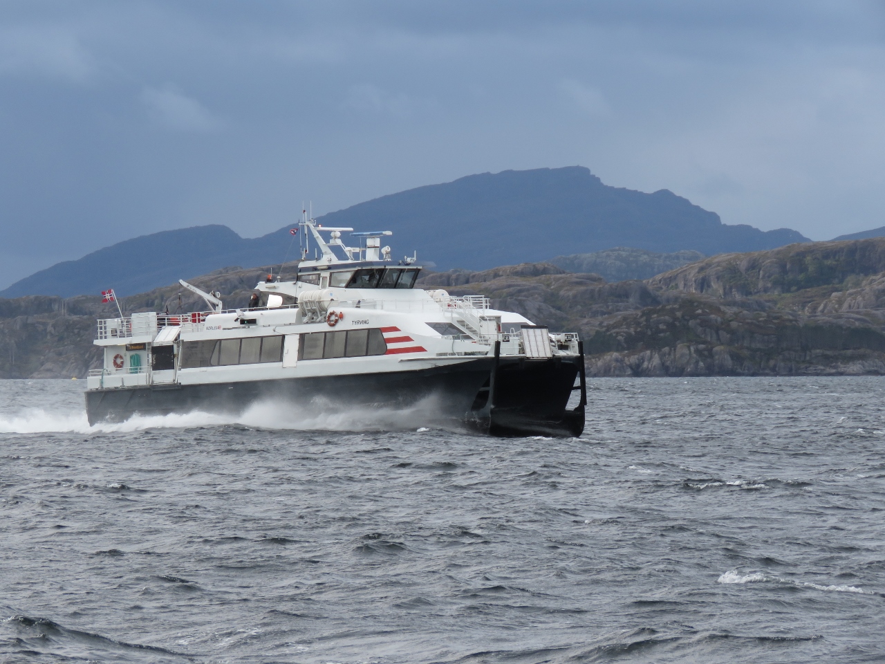 |
9/12/2018: Tyrving
Position: 61°13.41'N, 4°57.17'E
The fast ferry Tyrving heading north from Bergen.
|
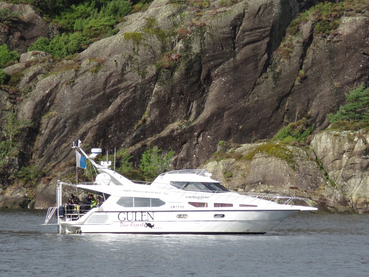 |
9/12/2018: Diving
Position: 61°8.66'N, 5°1.35'E
Divers on a Gulen Dive Resort boat in the channel Krakhellesundet. We're just about to pass the mouth of Sogneford—where we cruised our first Norwegian fjord in early May.
|
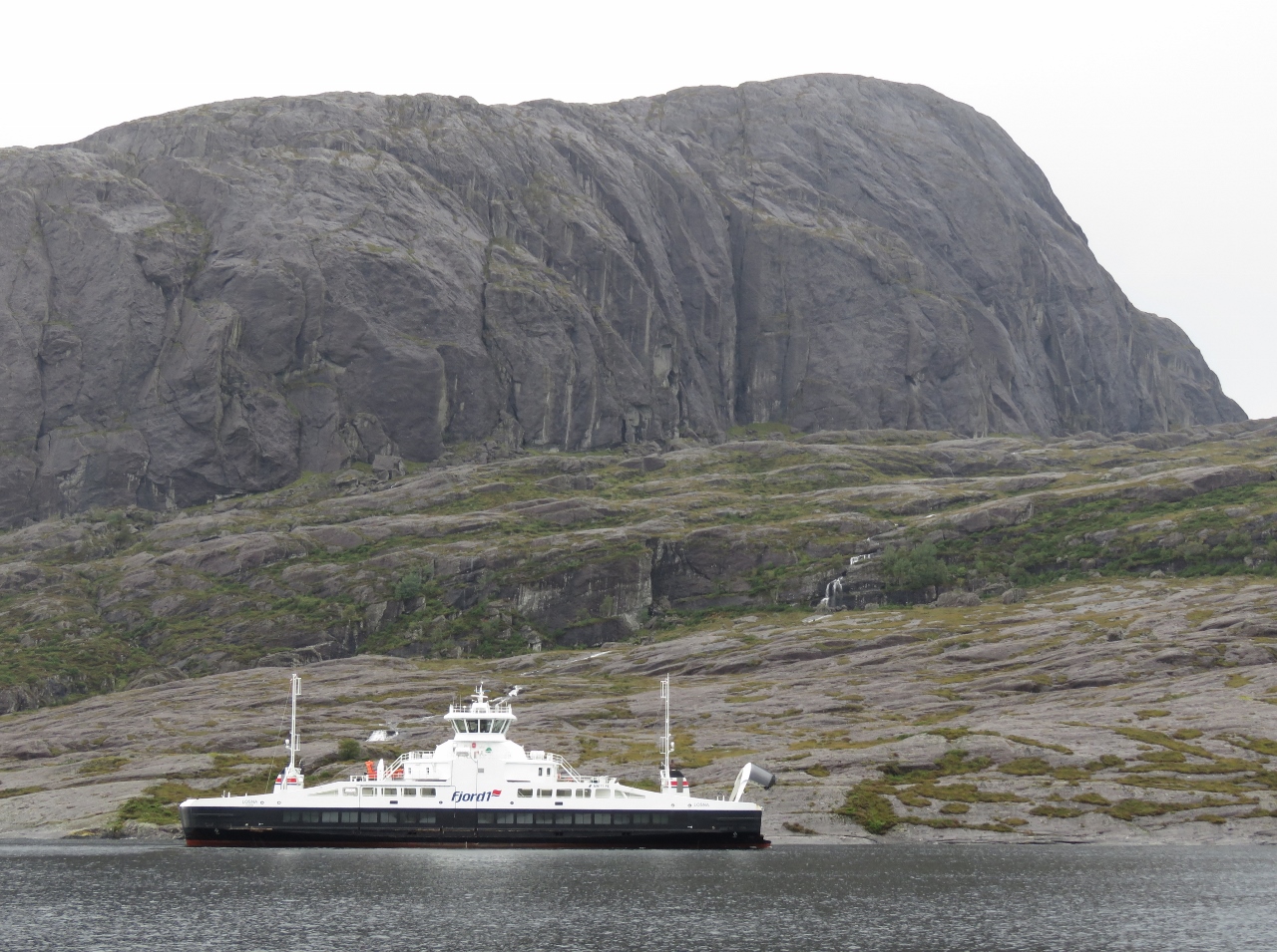 |
9/12/2018: Losna
Position: 61°7.27'N, 5°1.61'E
The ferry Losna arriving into Krakhella with bow lifted.
|
 |
9/12/2018: Vikingevagen
Position: 60°52.01'N, 4°54.92'E
The view north from the anchorage at Vikingevagen. The scenery is notably different from what we've had for the past few weeks: gentle hills instead of steep slopes and soaring mountains.
|
 |
9/12/2018: Mooring Bolt
Position: 60°52.01'N, 4°54.92'E
The anchorage at Vikingevagen is full of these mooring bolts. When swing room is restricted, it is common practice in Scandanavia to anchor off the stern and tie the bow to shore. This is common in the Pacific Northwest as well, except boats typically are anchored off the bow with the stern secured to shore. With the heavier Nordhavn, we generally prefer to swing free off the main anchor and haven't been stern-tying as much as we did in the previous boat.
|
 |
9/12/2018: Power Redundant Networking
Position: 60°52.01'N, 4°54.92'E
This is the last phase of a planned project to have the boat network and all control systems be able to survive a 120V network inverter outage without any negative impact. Most of the networking equipment is supported by the UPS that supports the nav computer and display systems, but there were a couple of networking switches that were still 120V-powered and two of the five Raspberry PIs run off wall warts (120V plug in transformers).
In this final stage of the project we brought 24V into the entertainment system area from the ER (through a proper breaker). This 24V DC power is independent of the 120V inverter and related systems, so now a 120V outage will leave all control systems powered and fully operational. The only equipment that goes down in a power outage is the Synology network file store and the IP-powered security cameras, neither of which are considered mission critical. With this final stage of this project complete, we shut off the 120V inverter and got no alarms or faults (other than "120V inverter failure"). |
 |
9/12/2018: Pipelines
Position: 60°52.01'N, 4°54.92'E
A mass of pipelines visible on the chart just south of our anchorage at Vikingevagen. The pipelines head to the Troll field, one of the biggest in the North Sea and holding 40% of Norway's natural gas.
|
 |
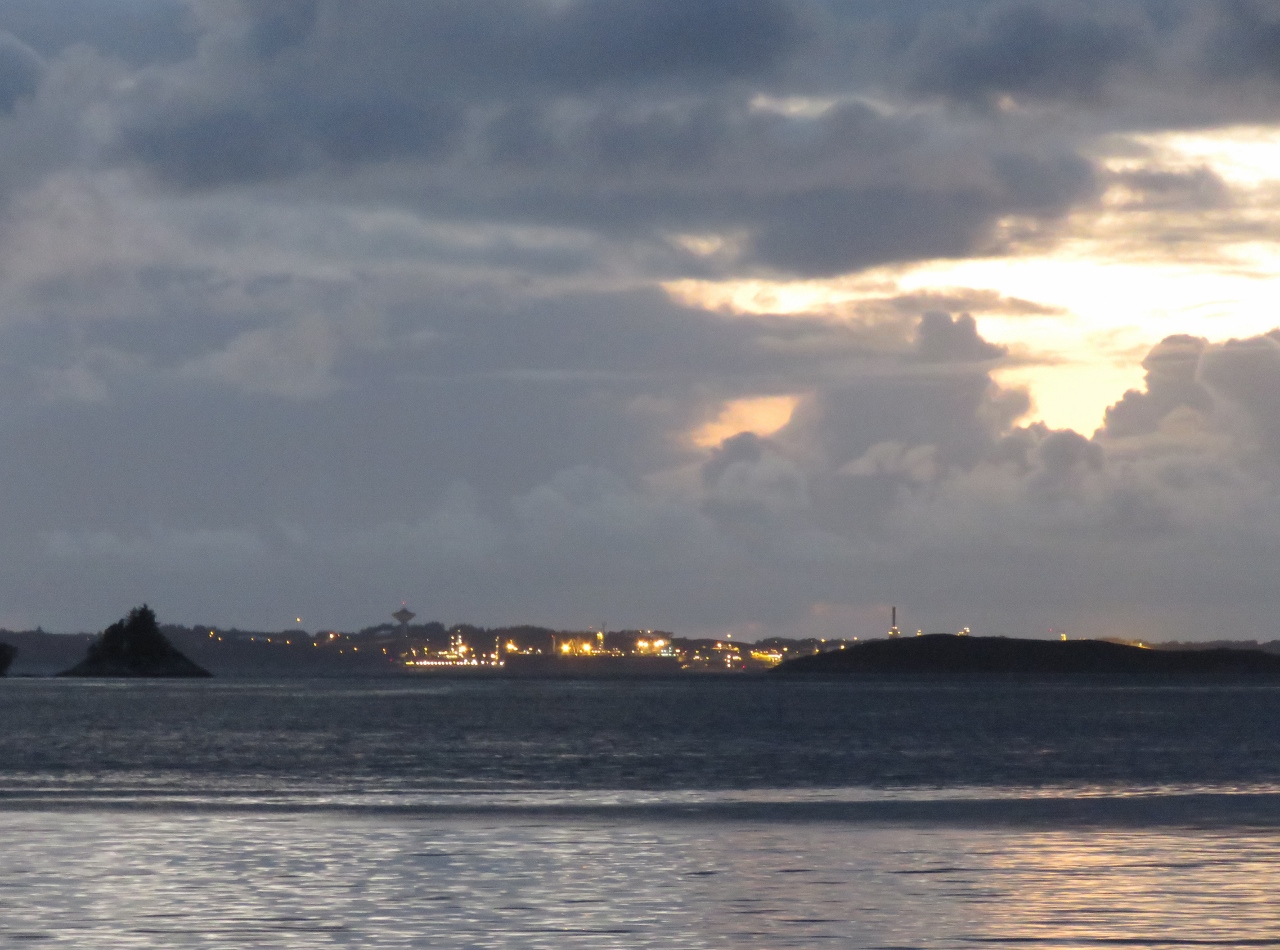
9/13/2018: Mongstad
Position: 60°50.27'N, 4°53.32'E
The blurred lights of the Statoil Mongstad industrial site visible in the distance as we're heading south before sunrise. The charted pipelines terminate here. Mongstad is the largest refinery in Norway, with a capacity of 12 million tonnes of crude oil per year (230,000 barrels per day).
|
 |
9/13/2018: Bukkholmsundet
Position: 60°46.79'N, 4°51.78'E
Passing under the bridge over narrow Bukkholmsundet. The clearance is 52ft (16m), so we have plenty of room to spare with our 30ft air draft.
|
 |
9/13/2018: Syltsundet
Position: 60°44.29'N, 4°52.46'E
Approaching the narrow channel between the islands of Rikstadoyni and Syltneset. We really enjoyed the day's cruise through this complex groups of islands and were reminded very much of our cruises through Queen Charlotte Sound in northern British Columbia, Canada.
|
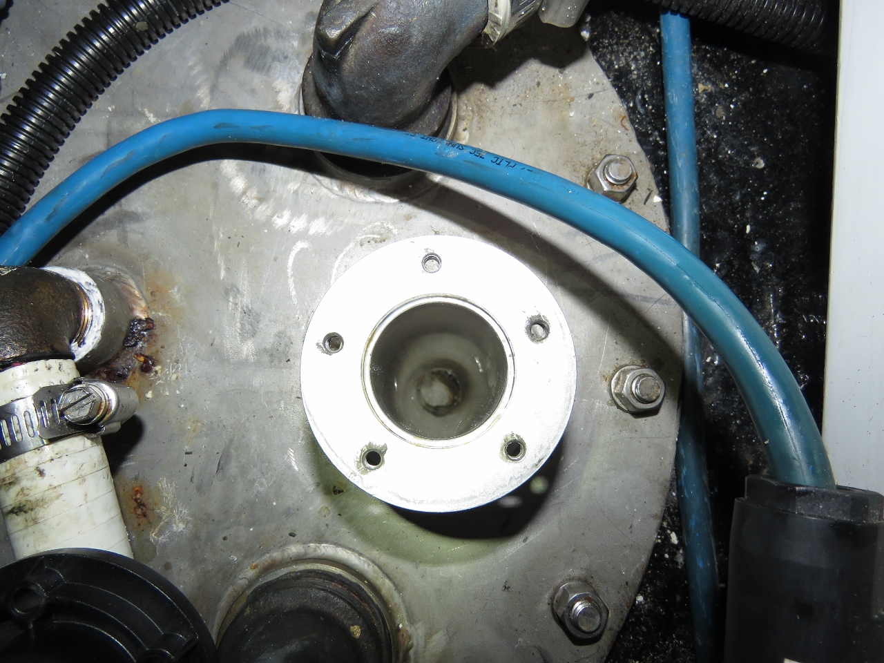 |
9/13/2018: Focus Tube
Position: 60°39.34'N, 4°56.47'E
The black water tank sensor started failing again after we'd installed the focus tube and has been reading at 47 gallons for a long time now. We took it apart today and found a plug floating in the focus tube.
|
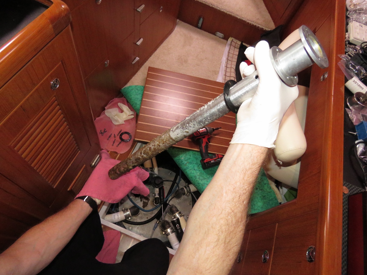 |
9/13/2018: Yes, that is ...
Position: 60°39.34'N, 4°56.47'E
James pulling the focus tube out of the black water tank to investigate the cause of the plug. We suspected the cap might have fallen off the end, but that wasn't the case.
|
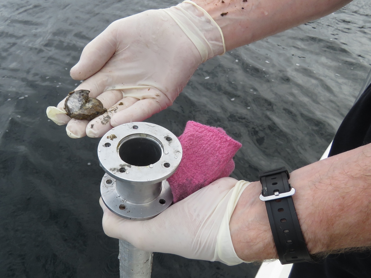 |
9/13/2018: Plug
Position: 60°39.34'N, 4°56.48'E
What appears to be happening with the black water tank focus tube is that each time the tank is pumped out, some debris collects in the bottom of the tube and dries. Each time it dries the plug becomes thicker. The plug is lighter than water so floats and it's soft and uneven so it won't allow a good reflection from the surface.
We’ll try it one more time. Failing that we'll try it without the end cap. The downside of running without the end cap is bigger debris can get it but the upside is it's far less likely to form a floating plug. If it fails every 6 months, we're fine. If it fails more frequently, we’ll try the cap off. If it continues to fail, we’ll look for a different solution. |
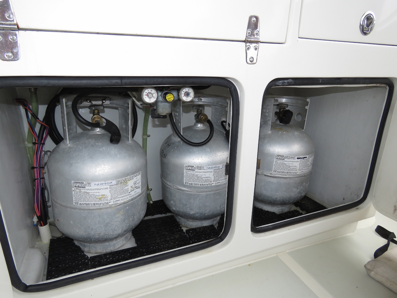 |
9/13/2018: Propane
Position: 60°39.34'N, 4°56.48'E
To supply our propane barbecue and cooktop we carry four 20lb propane tanks, three in the locker under the barbecue and a fourth in the aft port cockpit locker. Two are plumbed into the house system with a valve between so we can quickly switch the house from an empty to a full tank. Today we we ran out of propane on the main house tank, so switched over the next propane cylinder and exchanged the empty one with the last full one not connected.
We now have 2x 20lb full cylinders left. We filled all four in Florida in February of 2017 so we got 1 year and 7 months from 2 or roughly 9 months for each 20 lb container. At that rate, we’ll run out in April 2020. These nice aluminum containers were new in 2008 so they are now outside of their certification. Given they are US cylinders and will require a new inspection and new hardware to refill in Europe, we’ll instead try a new strategy. We'll get European hoses and buy disposable steel EU tanks and just use them and replace them when the next need filling. We went with propane because we didn't want to have to run the generator for a quick use of the stovetop. But from our subsequent experience with a 240V inverter, we'd likely go all electric if we were to do it again. Propane is one more thing to purchase, is a hassle without a car, and can be a real pain outside North America with different fill attachments. Those 4 20-lb tanks do take up space, and propane is a fire hazard. |
 |
9/13/2018: Wipers
Position: 60°39.34'N, 4°56.48'E
The windshield wipers were worn and needed replacing.
|
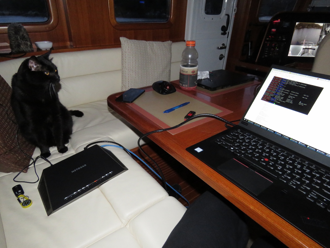 |
9/14/2018: Backup Router
Position: 60°39.32'N, 4°56.50'E
Today we completed an item that has been on our todo list since early 2017: create a backup of our router. We're highly-dependent on the functionality of our custom router and do have spare hardware. But it just has the base Netgear R7000 firmware—we needed to upgrade to DD-WRT and install all the changes we've made to implement our customizations. Most of our changes are in software that we can just copy over, but some of the configurations settings must be in non-volatile RAM (nvram). Spitfire is keeping a watchful eye for typos or slopping programming.
After loading DD-WRT on the backup router, we copied our source code changes over and modified a script to transfer the nvram configuration from one router to another. And we now have a fully-functional backup router. |
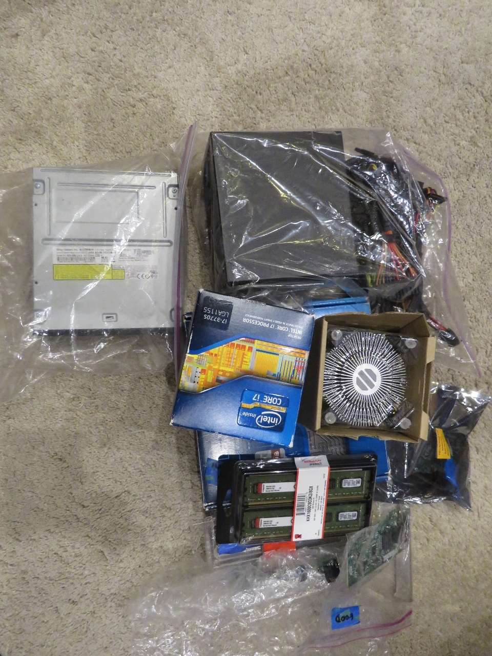 |
9/14/2018: Computer Parts
Position: 60°39.32'N, 4°56.50'E
Now that we have the new Lenovo P320 Tiny navigation computer up and running well for a few weeks, we can get rid of all the spares we had for the old navigation computer, including CD drive, processor, memory, and network cards. It seems wasteful to discard all this unused computer gear, but it dates back to 2012 so really isn't very useful.
|
 |
9/15/2018: Exiting Uttoskavagen
Position: 60°39.09'N, 4°56.08'E
Exiting the narrow channel that leads from the anchorage at Uttoskavagen. Blog reader and Bergen native Trond Saetre, who has been boating in this area since he was born, recommended the nearly land-locked anchorage and we really enjoyed it. We love getting advice from locals.
|
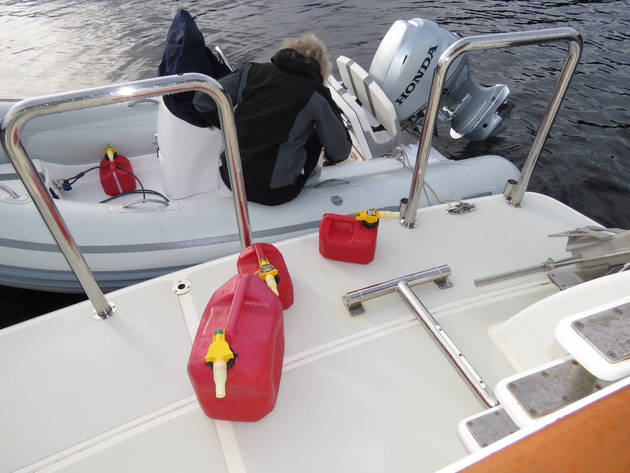 |
9/15/2018: Refueling
Position: 60°34.47'N, 5°0.78'E
Refuelling the tender. The new Maretron TLM150 fuel gauge readings was confirmed to be quite accurate as we filled the tank—we're quite happy with the Maretron system on the tender.
|
 |
9/15/2018: Squall
Position: 60°34.47'N, 5°0.80'E
The weather has been all over the place today. It was sunny earlier, but this is the third squall today and even has hail.
|
 |
9/15/2018: Kayakers
Position: 60°34.47'N, 5°0.80'E
Kayakers passing through our anchorage at Skurtveit. We quite like the spot here—we've got good protection from the forecast westerly and southerly winds and a great view to the ship channel north. Tomorrow we plan to run the tender over to Herdla to visit the museum there and perhaps do the Via Ferrata.
|
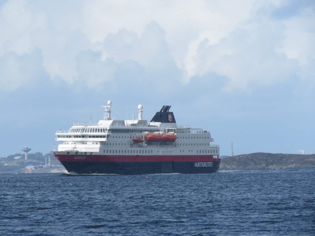 |
9/15/2018: Nordlys
Position: 60°34.47'N, 5°0.80'E
The Hurtigruten Nordlys heading south to Bergen, viewed from our anchorage at Skurtveit.
|
 |
9/15/2018: Racor CCV
Position: 60°34.47'N, 5°0.80'E
We change the Racor CCV filter every 1,000 hours and it's again due. This purpose of filter is to take the airborne oil out of the engine blow-by as it's sent through the turbo intake and back into the engine to be burnt. This filter helps keep the turbo and after-cooler from becoming gummed up with oil. If it's not changed fairly frequently, it can cause excess crankcase pressure and oil leaks.
|
 |
9/15/2018: Evening Sun
Position: 60°34.47'N, 5°0.76'E
The evening sun lighting up the hills to the east of our anchorage at Skurtveit.
|
 |
9/15/2018: Sture Terminal
Position: 60°34.48'N, 5°0.77'E
The lights of the Equinor (formerly Statoil) Sture terminal visible to our north. The facility is a major crude oil tanker port, handling roughly 120 ships a year.
|
 |
9/15/2018: Sunset
Position: 60°34.48'N, 5°0.77'E
Sunset from the anchorage at Skurtveit.
|
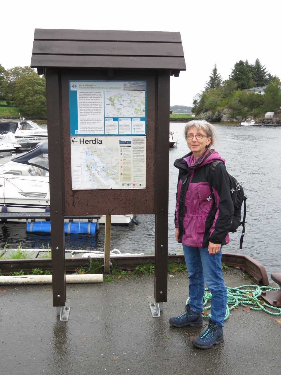 |
9/16/2018: Herdla
Position: 60°34.13'N, 4°57.18'E
Ashore at the island of Herdla just west of our anchorage.
|
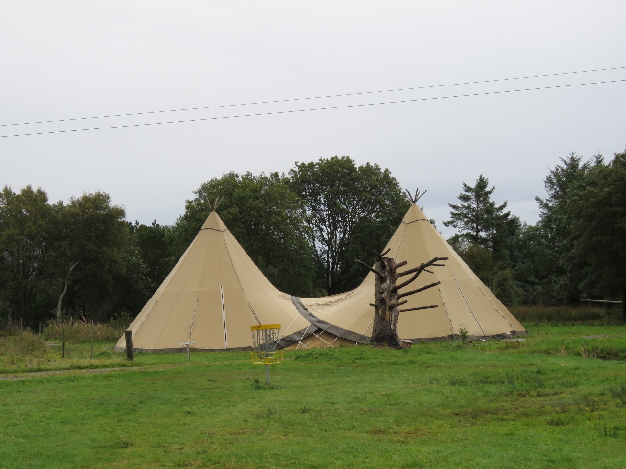 |
9/16/2018: Lavuu
Position: 60°34.55'N, 4°57.00'E
Lavuus are temporary dwellings the Sami indigenous people of Scandinavia used to follow their reindeer herds. They are similar in design to American Indian teepees, but are lower and more wind-resistant. We seem them everywhere in Norway.
|
 |
9/16/2018: Bunker
Position: 60°34.61'N, 4°56.94'E
During World War II, the occupying German forces turned most of Herdla into a military base and built an air strip on the plain in the background. The island is full of military ruins.
|
 |
9/16/2018: Geared Up
Position: 60°34.71'N, 4°56.86'E
Geared up and ready to tackle the Herdla via ferrata.
|
 |
9/16/2018: Rock Wall
Position: 60°34.71'N, 4°56.82'E
The via ferrata on Herdla is mostly stays near sea level compared to the one at Loen that climbs up 1,011ft. The first half runs along the shore, just above the waterline.
|
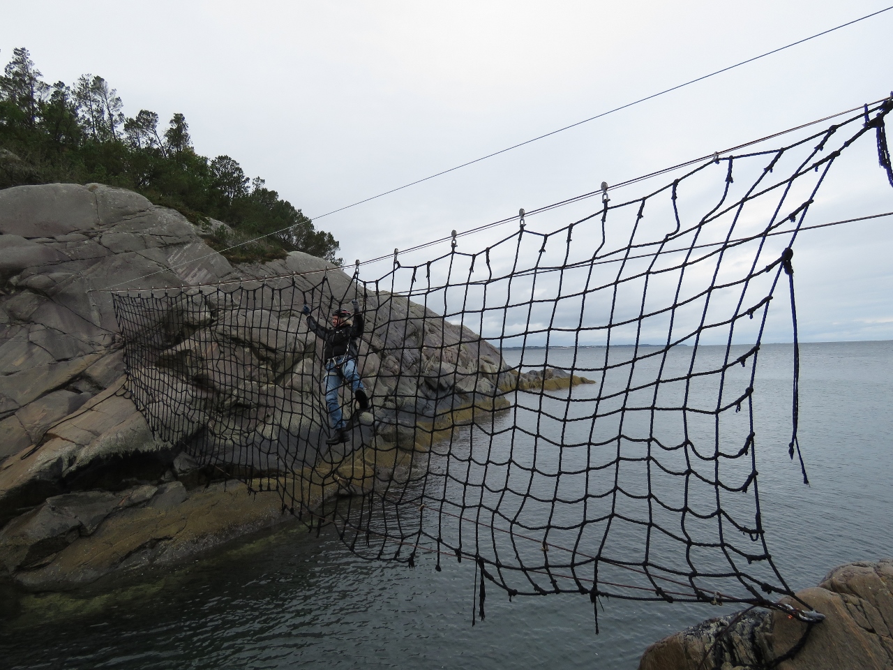 |
9/16/2018: Cargo Net
Position: 60°34.69'N, 4°56.79'E
The cargo net water crossing was what had attracted us to the Herdla via ferrata. It was fun to cross, but crossing even short distances on cargo net is surprisingly tiring.
|
 |
9/16/2018: Sheer Face
Position: 60°34.70'N, 4°56.77'E
Using foot friction to work across a face without footholds, with the cargo net crossing visible in the background.
|
 |
9/16/2018: Cliff
Position: 60°34.70'N, 4°56.70'E
The final section on the seashore portion of the via ferrata before we ascend inland.
|
 |
9/16/2018: Ladder
Position: 60°34.70'N, 4°56.70'E
Climbing a ladder up from the cliff.
|
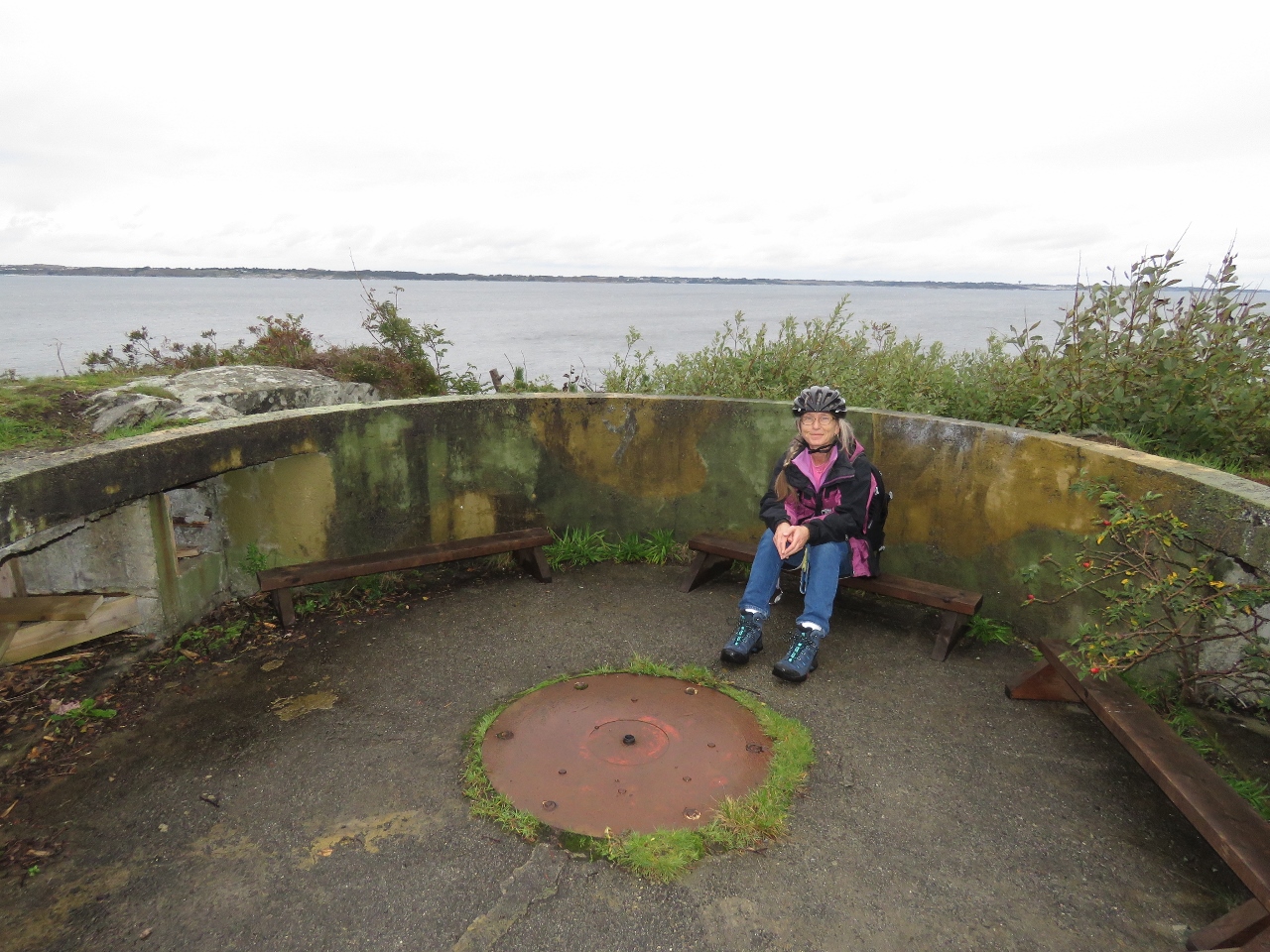 |
9/16/2018: Gun Mount
Position: 60°34.65'N, 4°56.78'E
A short trail brought us to this old gun mount. The second half of the via ferrata continues from here over three zip lines and two bridges. But we lack the gear for zip lines and the final platform is kept locked for safety reasons.
|
 |
9/16/2018: Fort Herdla
Position: 60°34.66'N, 4°56.75'E
Looking west to the Fort Herdla ruins from the gun mount.
|
 |
9/16/2018: Lunch
Position: 60°34.66'N, 4°56.81'E
A picnic lunch overlooking the cargo net crossing.
|
 |
9/16/2018: De Zee Ploeg
Position: 60°34.64'N, 4°56.79'E
Memorial to the 560 emigrants on board the Dutch cargo ship De Zee Ploeg that was blown onto the Norwegian coast near Herdla during a storm en route to America in 1817. 20-30 people on board died due to the storm and lack of medicine, but most eventually reached American on other ships.
|
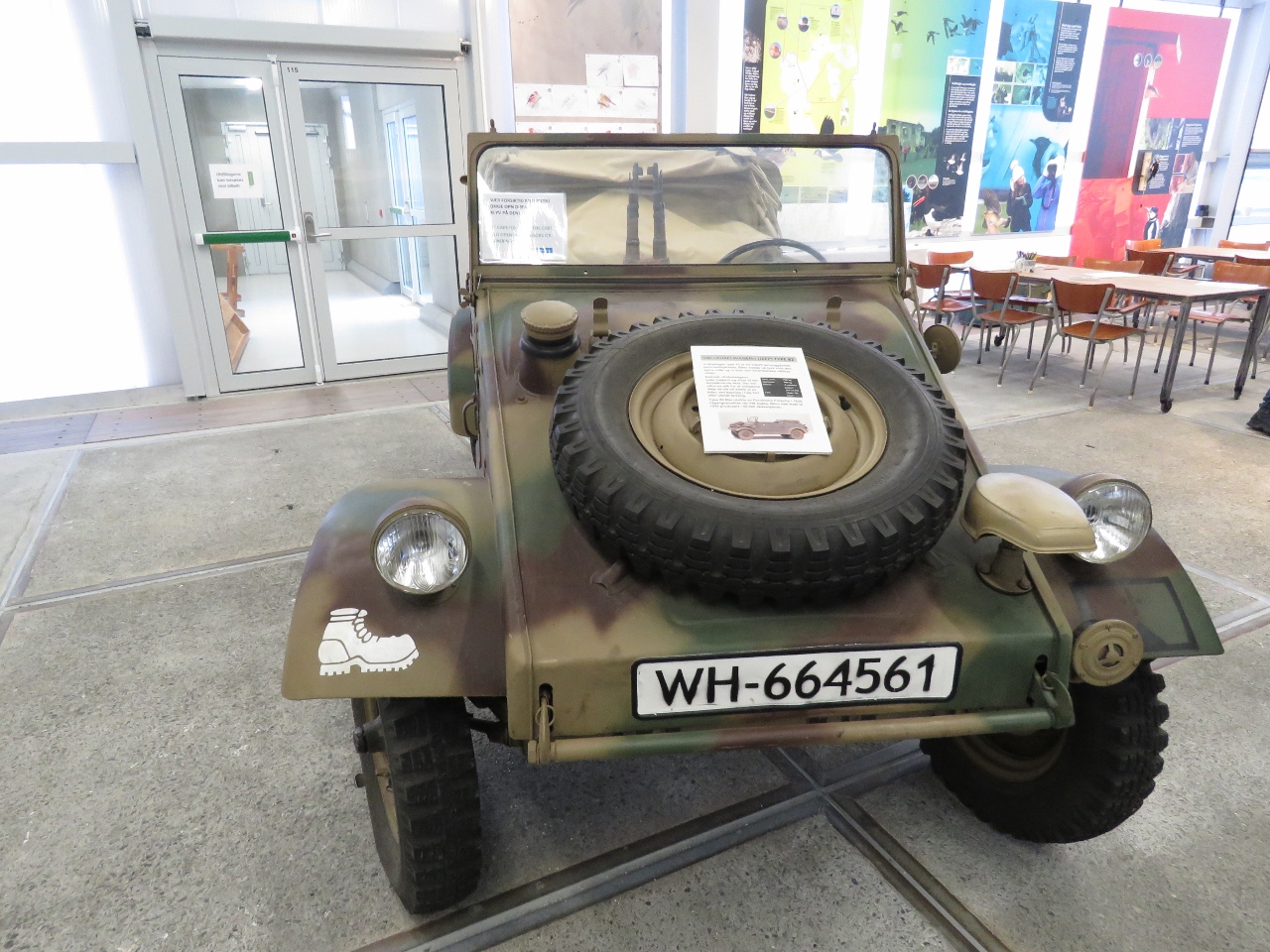 |
9/16/2018: Volkswagen Type 181
Position: 60°34.56'N, 4°56.96'E
A Volkswagen Type 181 at the Herdla Museum. The two-wheel drive, four-door, convertible vehicle was developed for the West German Army but sold later to the public under a variety of names, including the "Thing" in the US.
|
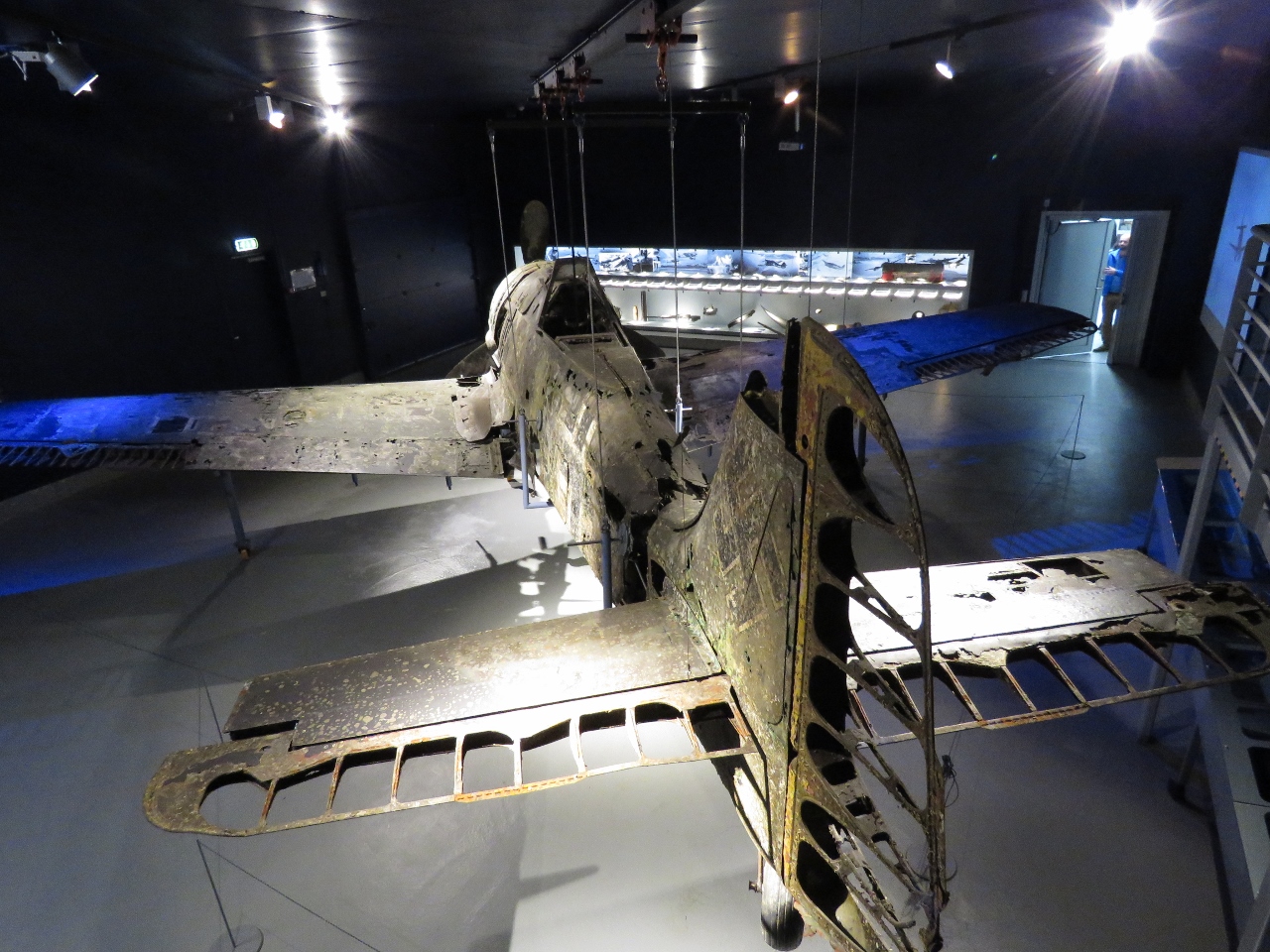 |
9/16/2018: Yellow-16
Position: 60°34.56'N, 4°56.96'E
The main display at the Herdla Museum is Yellow-16. The German plane took off from Herdla in 1943 and the pilot had to make a controlled water landing due to engine failure. Local fisherman rescued the pilot. In 2006 the plane was raised from 60m of water and was eventually put on display.
|
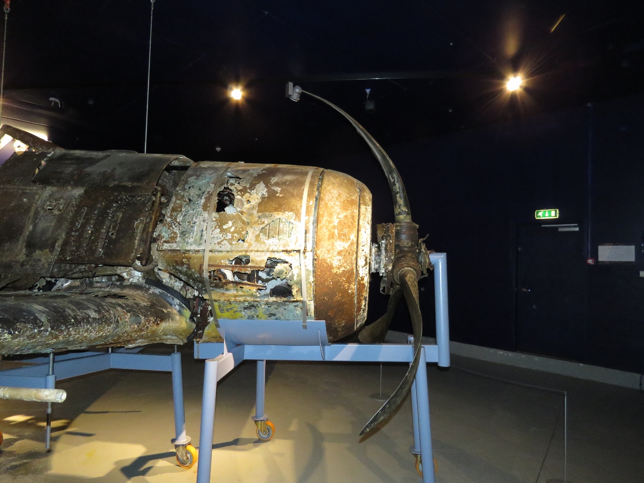 |
9/16/2018: Bent Props
Position: 60°34.56'N, 4°56.96'E
The propellers on Yellow-16 bent from the impact of the water landing.
|
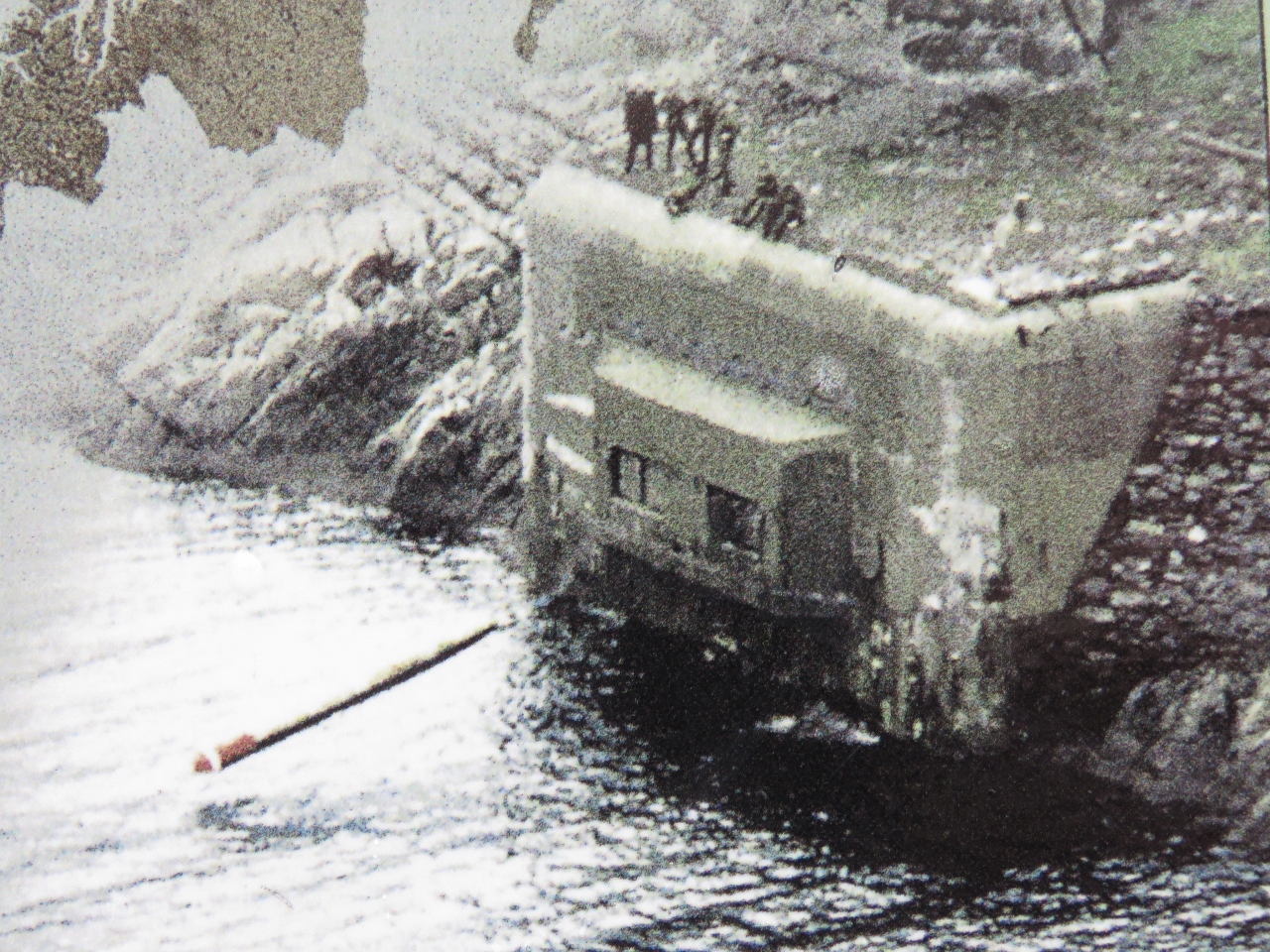 |
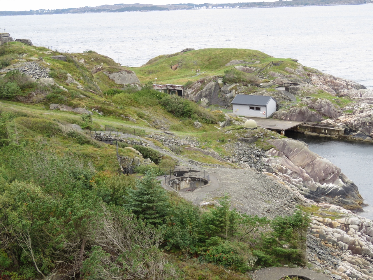
9/16/2018: Torpedo Battery
Position: 60°34.53'N, 4°56.73'E
Fort Herdla included a torpedo battery along the northwest shore where torpedoes were launched by compressed air and landed in the sea to continue on to their target. This photo shows a launch with several people standing above.
Norway kept the torpedo battery in operation during the Cold War, modernizing it several times. The battery was put on standby in 2000 and closed down in 2006. Our older charts show the a "no-anchoring" zone around the entire area that is absent on the newer charts. That would have been for the battery that now is no longer in operation. We were planning to take a tour of the still-intact battery this afternoon, but the tour guide couldn't make it to work that day. |
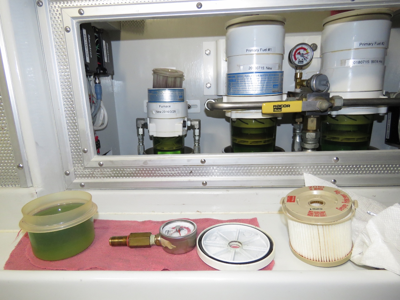 |
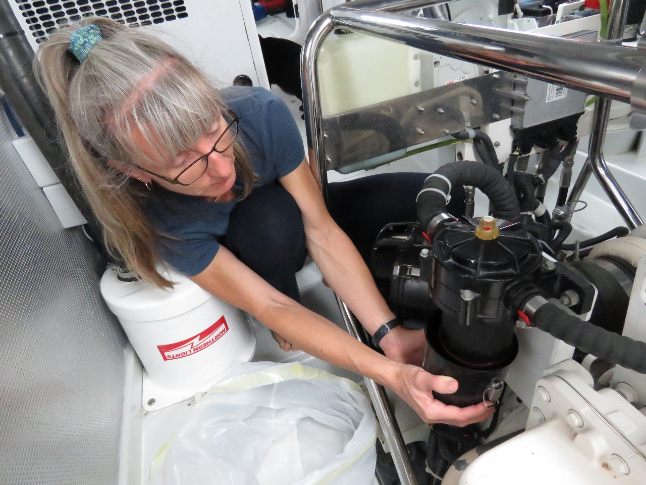
9/16/2018: Furnace Fuel Filter
Position: 60°34.51'N, 5°0.70'E
James is changing the furnace fuel filter. It's a RACOR 500 and we change it once a year. The fuel is still green from the three fills we did in Ireland. We have filled up twice since then but the bright green tinge remains. You can just see the old filter lifted up in the top of the filter housing to drain. It's quite clean which is nice to see.
|
 |
9/16/2018: Transfer Fuel Filter
Position: 60°34.51'N, 5°0.71'E
Once a year we drain off the fuel in the bottom of the transfer filter. All fuel that goes to any engine on Dirona first has to pass through this filter so, if there is any water, it'll get caught in this large RACOR FBO-10. We have captured tiny amount of water in the past but haven't seen any for years. You can see the fuel still has a green tinge remaining from the fuel we took on in Ireland. There is no water in the bottom but there is what looks to be rust flakes. On closer examination, the flakes are soft and tar-like. It appears we have some minor amounts of asphaltenes falling out of the fuel and getting captured by this filter. This is normal and, after 10 to 15 years, it's probably a good ideas to open up the tanks and clean them out. Not a job I'm looking forward to. We'll continue to keep an eye on it and take action if we start to see more evidence of asphaltene build up, usually seen as black fuel filters that plug quickly.
|
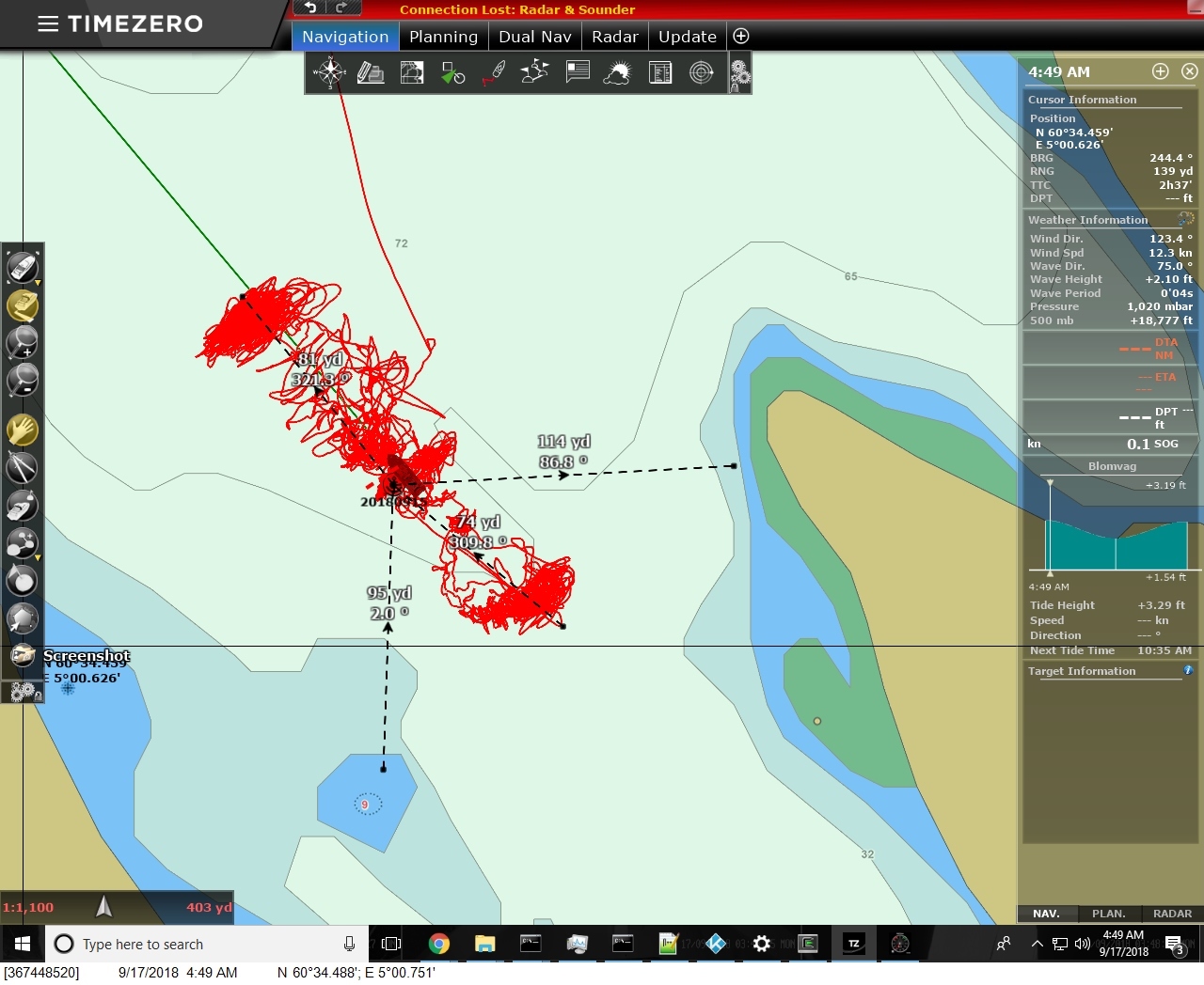 |
9/17/2018: Swing Circle
Position: 60°34.49'N, 5°0.75'E
Strong winds that shifted 180° graphically show how much swing room is required by a boat at anchor and is a good example that counting on the winds staying in a certain direction when anchoring is unwise. Here we're on 74 yards of rode and are 114 yards from shore, leaving 40 yards, which most people would regard as ample clearance. But the boat length consumes half of that 40 yards. 20 yards is plenty, but its about as close as we choose to get. And 20 yards from shore when the winds are blowing 40kts feels very close indeed.
|
 |
9/17/2018: Entering Bergen
Position: 60°24.05'N, 5°18.54'E
Coming into Bergen just over four months after we'd passed the city heading north on May 1st.
|
 |
9/17/2018: Normand Prosper
Position: 60°24.05'N, 5°18.54'E
The huge helicopter deck on the Normand Prosper moored at Bergen.
|
 |
9/17/2018: SAR
Position: 60°23.95'N, 5°18.87'E
Bergen Search and Rescue vessel.
|
 |
9/17/2018: Boxer
Position: 60°23.89'N, 5°19.01'E
Beautiful 6,800HP tractor tug Boxer moored at Bergen. If the design looks familiar to Puget Sound readers it's because the Crowley Response-class tug is based on Boxer's design.
|
 |
9/17/2018: Christina E
Position: 60°23.85'N, 5°19.14'E
The dual-purpose trawler Christina E was designed for both fishing and applications in the oil and gas industries.
|
 |
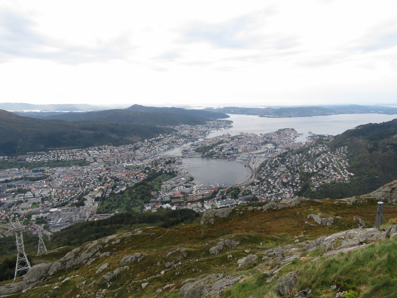
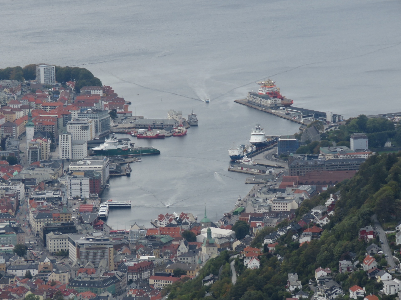
9/17/2018: Bergen Havn
Position: 60°23.85'N, 5°19.14'E
Looking towards Bergen Havn where we'll moor, with two of the city's seven surrounding mountains in the background. Slightly left of center is the top part of the funicular railway leading to viewing platform at the summit of 320m Mt Floyen. Right of center is the massive radio tower atop 642m Mt Ulriken.
|
 |
9/17/2018: 61 kts
Position: 60°23.81'N, 5°19.38'E
Winds are forecast to reach 61 kts in Bergen this Thursday, although we're told it's not likely to get nearly that high in the harbor.
|
 |
9/17/2018: We Have Power
Position: 60°23.81'N, 5°19.39'E
We've encountered a remarkable number of different ways of paying for power as we've travelled. In Bergen, you pay at a central kiosk where you enter the power pedastal that you chose to plug into. Unfortunately you can't tell it the outlet number and it chooses one of the unused plugs for you. So unless you are very lucky, you have to return to the boat and plug into the one it chose. We weren't lucky, so after moving our plug, we needed to confirm we actually had power. Rather than getting on the boat, we could just check on Maretron N2kView on our phone. And yes, we now have power.
|
 |
9/17/2018: Wallenberg
Position: 60°23.73'N, 5°19.47'E
The immaculate Wallenberg owned by Danish journalist Mikkel Beha, who has produced a number of documentaries covering his journeys across the Atlantic and Pacific in his previous yacht Havanna. Beha has spent the past 18 months refitting Wallenberg with plans to visit Svalbard. Blog reader Erik Andersen noticed the vessel was near us and gave us the background.
|
 |
9/17/2018: Fishmarket
Position: 60°23.70'N, 5°19.52'E
The fishmarket at the head of the harbour is just opening up for business. Several are combined cafes as well as fresh seafood sales.
|
 |
9/17/2018: Post Office
Position: 60°23.57'N, 5°19.58'E
At the Bergen post office to mail a package.
|
 |
9/17/2018: Sailor's Monument
Position: 60°23.58'N, 5°19.47'E
The Sailor's Monument in Torgallmenningen, Bergen's main square, honors Norway's seafaring achievements since the days of the Vikings.
|
 |
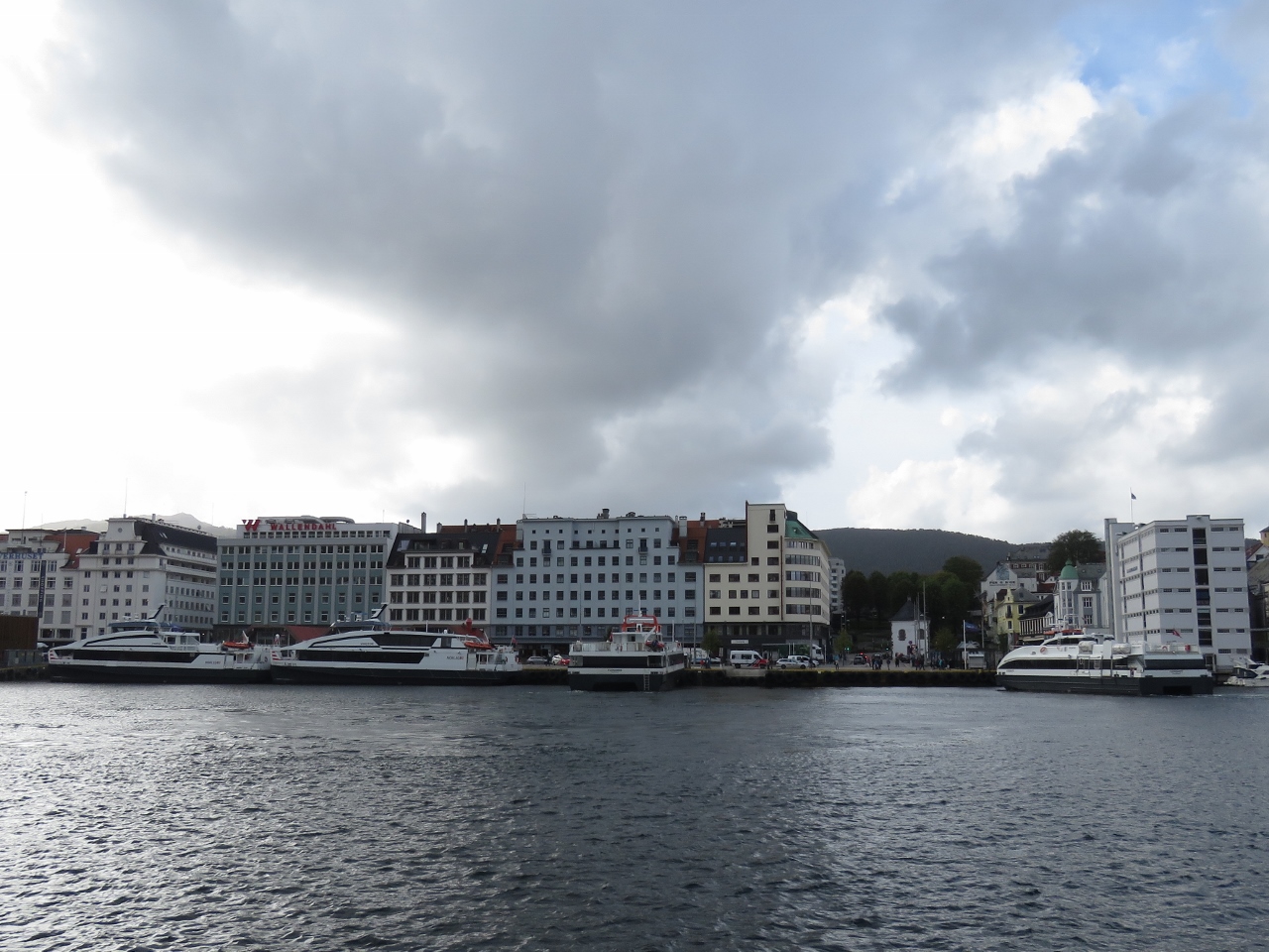
9/17/2018: Dirona
Position: 60°23.72'N, 5°19.22'E
View across the harbor to Dirona moored in front of Bryggen, Bergen's oldest quarter. The buildings date from the 18th century, but follow 12th-century designs.
|
 |
9/17/2018: AIDAvita
Position: 60°24.16'N, 5°19.05'E
The cruise ship AIDAvita, that we saw a week ago at Olden.
|
 |
9/17/2018: Skutevik
Position: 60°24.15'N, 5°19.11'E
Waterfront buildings in Skutevik behind the cruise ship dock.
|
 |
9/17/2018: Rothaugtunnelen
Position: 60°24.21'N, 5°19.29'E
Entering Rothaugtunnelen, a former bus tunnel that is now closed the motor vehicle traffic.
|
 |
9/17/2018: Sandvik Church
Position: 60°24.32'N, 5°19.48'E
Sandvik Church, dating from 1881.
|
 |
9/17/2018: Survival Drills
Position: 60°24.25'N, 5°19.27'E
A group doing abandon-ship drills in survival suits.
|
 |
9/17/2018: Bergenhus Castle
Position: 60°24.08'N, 5°19.25'E
The view west from the ruins of Bergenhus Castle, among the oldest and best-preserved fortresses in Norway.
|
 |
9/17/2018: Streets
Position: 60°23.97'N, 5°19.55'E
The residential area in the hills above Bergen is full of narrow cobblestone roads and footpaths winding through century-old buildings packed into every available scrap of land.
|
 |
9/17/2018: Skansen Fire Station
Position: 60°23.84'N, 5°19.78'E
The old Skansen Fire Station was built in 1903, following a disastrous 1901 fire, and was in operation until 1969. The station was built up on a hill with a watchtower to look for fires.
|
 |
9/17/2018: Skansen View
Position: 60°23.83'N, 5°19.79'E
Looking across Bergen from a viewpoint opposite the Skansen firestation.
|
 |
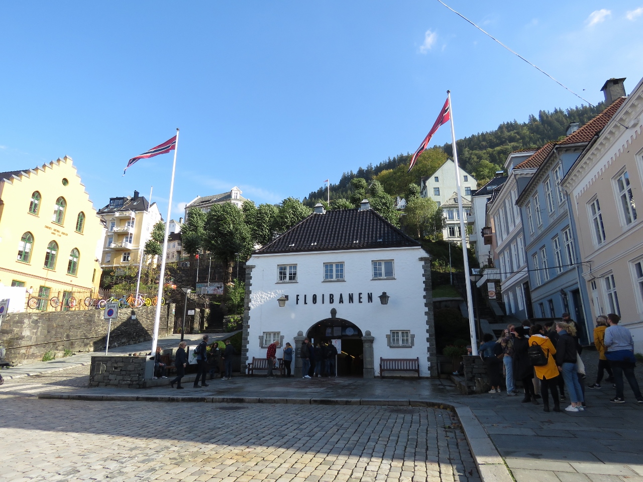
9/17/2018: Floibanen funicular
Position: 60°23.76'N, 5°19.99'E
A tram passing up tthe Floibanen funicular to the top of 320m Mt Floyen.
|
 |
9/17/2018: Antonio Stasi
Position: 60°23.78'N, 5°19.71'E
Antonio Stasi's Classic Camera store has an amazing collection of classic and antique cameras.
|
 |
9/17/2018: Finnmarken
Position: 60°23.53'N, 5°18.76'E
This is the last port we'll see a Hurtigruten—Bergen is their most southern port of call.
|
 |
9/17/2018: Fan Housings
Position: 60°23.48'N, 5°18.75'E
Huge fan housings in transit near the Hurtigruten terminal.
|
 |
9/17/2018: Johanneskirken
Position: 60°23.33'N, 5°19.19'E
Parish church Johanneskirken was consecrated in 1894 and seats 1,250 people.
|
 |
9/17/2018: Vestre Torgatten
Position: 60°23.35'N, 5°19.18'E
Looking northwest down the pedestrian mall Vestre Torgatten.
|
 |
9/17/2018: Waterfall
Position: 60°23.38'N, 5°19.25'E
Water cascades down channels in the steps of Vestre Torgatten, culminating in this beautiful waterfall, seen looking back up to Johanneskirken.
|
 |
9/17/2018: Scruffy Murphys
Position: 60°23.72'N, 5°19.57'E
Having a beer street-side at Bergen's only Irish pub, Scruffy Murphys. We like to tour a city by foot when we first arrive and covered over nine miles this afternoon.
|
 |
9/17/2018: Trond and Margareth
Position: 60°23.81'N, 5°19.38'E
Blog reader Trond Saetre has been following us since we left Hawaii and has been giving us lots of excellent advice and local knowledge since we first neared the Norwegian coast. He also picked up a few supplies for us in Bergen. After corresponding for months, it was wonderful to finally meet in person. We had an excellent evening with him and Margareth Baartvedt, first on Dirona and later over a dinner at the Harbor Cafe overlooking the waterfront.
|
 |
9/18/2018: Floibanen
Position: 60°23.77'N, 5°19.68'E
At the Floibanen station to ride the funicular to the top of Mt. Floyen.
|
 |
9/18/2018: 26 Degrees
Position: 60°23.72'N, 5°20.37'E
The funicular climbs at a steep 26 degrees from downtown Bergen to 320m Mt. Floyen.
|
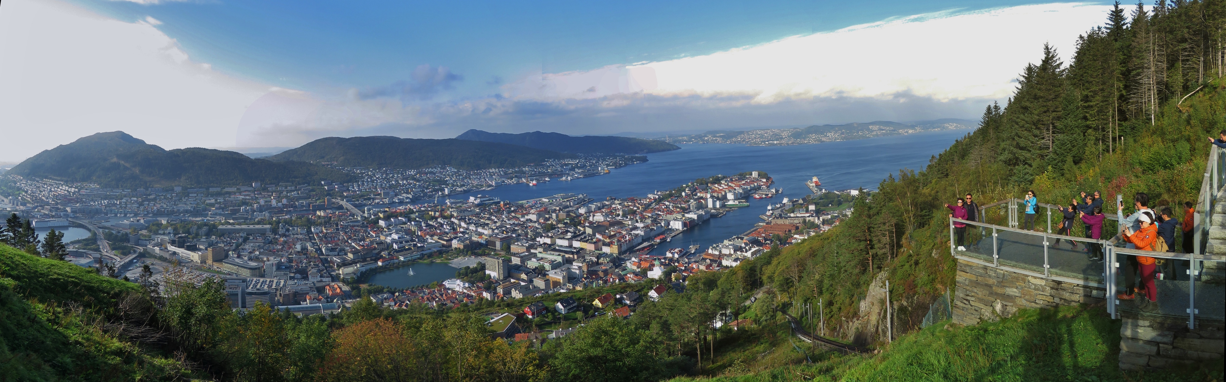 |
9/18/2018: Mt. Floyen
Position: 60°23.69'N, 5°20.56'E
The spectacular view to Bergen from the top of Mt. Floyen.
|
 |
9/18/2018: Storediket
Position: 60°24.43'N, 5°21.62'E
Looking west across the lake Storediket on the 8-mile (13km) hike from Mt. Floyen to Ulriken. The dam on the lake is just visible at the right of the photo.
|
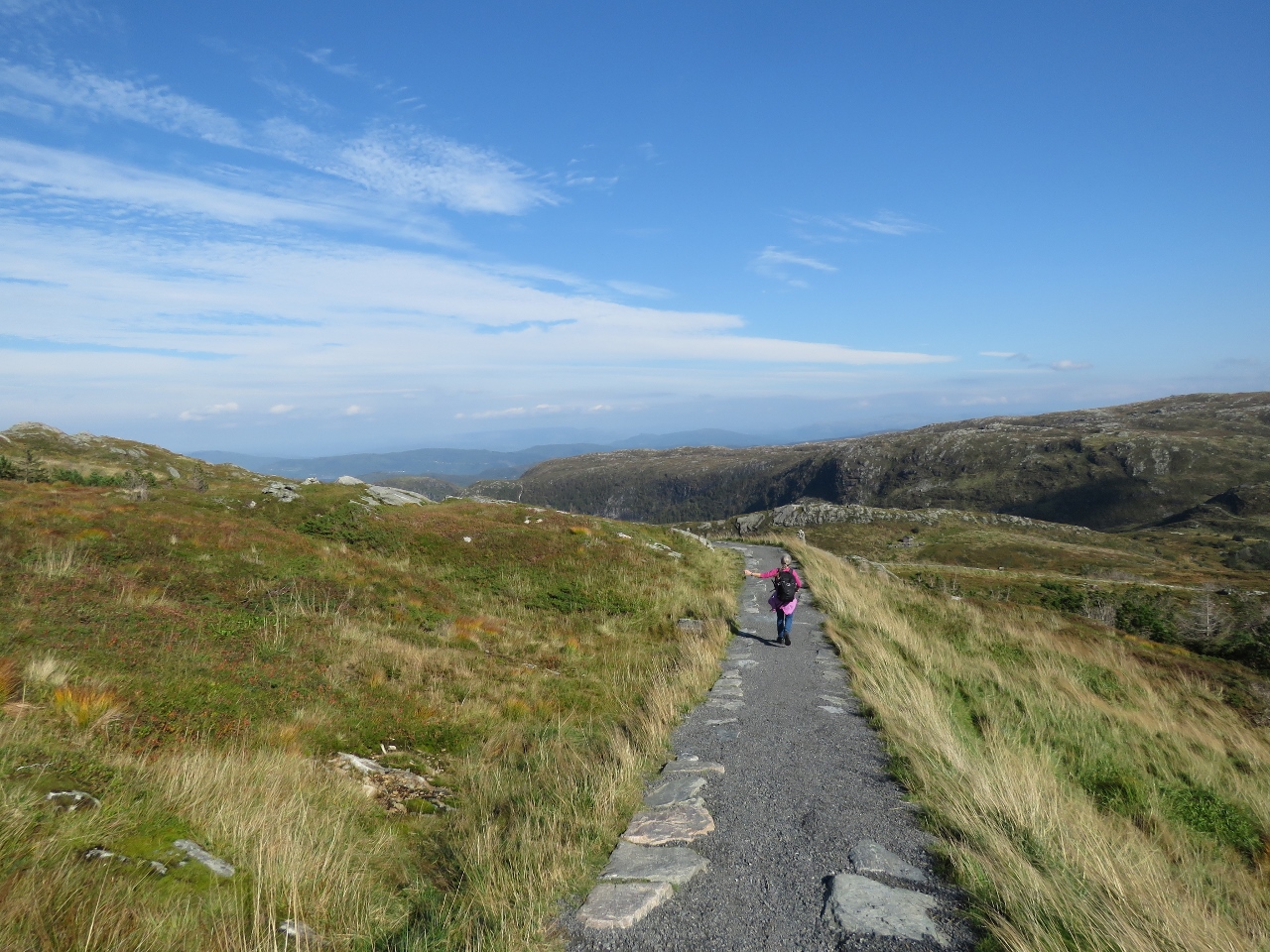 |
9/18/2018: Trail
Position: 60°24.72'N, 5°22.06'E
The trail we're taking is very popular and beautifully built.
|
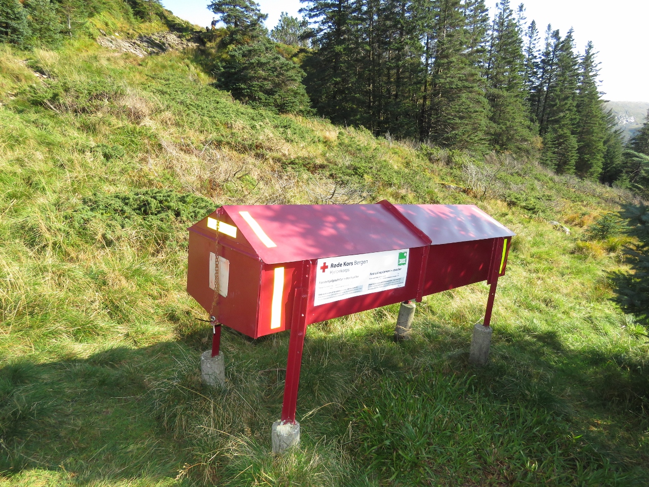 |
9/18/2018: Emergency Station
Position: 60°24.88'N, 5°22.53'E
One of several emergency stations, complete with stretcher, that we saw on our hike.
|
 |
9/18/2018: Tarlebovatnet
Position: 60°24.84'N, 5°23.71'E
The lake Tarlebovatnet with a nice waterfall feeding it at the right of the picture. A dam on this lake is just outside the photo on the left.
|
 |
9/18/2018: Cairns
Position: 60°24.60'N, 5°23.97'E
A series of cairns stretching away in the distance. They are built tall enough to be visible during the winter when snow covers the ground.
|
 |
9/18/2018: Fingerpost
Position: 60°24.37'N, 5°24.47'E
There are a lot of trails up here.
|
 |
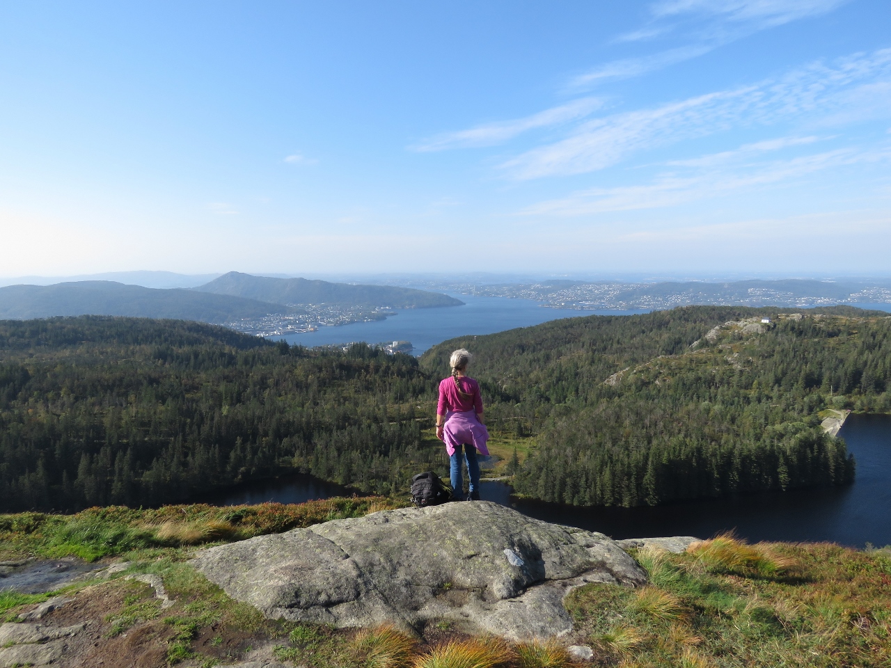
9/18/2018: Looking Back
Position: 60°24.01'N, 5°24.91'E
We're about six miles (9.5km) into our 8-mile (13km) hike from Mt. Floyen to Ulriken. The section of trail we photographed was beside the radio tower visible in the distance on the left.
|
 |
9/18/2018: Cabin
Position: 60°22.52'N, 5°23.22'E
Beautiful mountain cabin with a private lake along the trail. It's more of a house than a cabin.
|
 |
9/18/2018: Tower
Position: 60°22.67'N, 5°22.91'E
The huge communications tower at the summit of 642m Ulriken is visible for miles. We could see it coming into Bergen.
|
 |
9/18/2018: Ulriken
Position: 60°22.64'N, 5°22.85'E
Another great view to Bergen from 642m Ulriken.
|
 |
9/18/2018: Bergen Havn
Position: 60°22.64'N, 5°22.85'E
Bergen Haven from Ulriken. Dirona is visible moored along the wall slightly right of center (click image for a larger view).
|
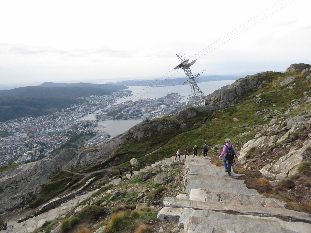 |
9/18/2018: Steps
Position: 60°22.60'N, 5°22.83'E
We were planning to take the cable car back down from Ulriken, but it was closed due to high winds. We instead took the a beautifully-built stone staircase down.
|
 |
9/18/2018: Crowds
Position: 60°22.21'N, 5°22.54'E
The walk up 642m Ulriken is steep, but huge crowds were heading up as we descended. We passed at least 100 people of all ages heading up.
|
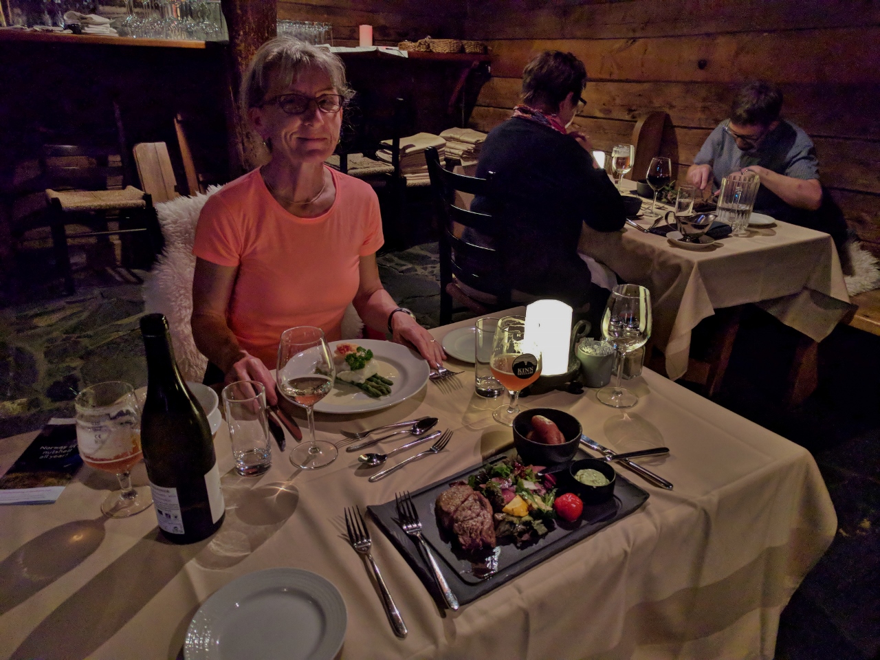 |
9/18/2018: Bryggen Tracteursted
Position: 60°23.85'N, 5°19.47'E
We had an excellent dinner at Bryggen Tracteursted in historic Bryggen. The restaurant is in a building dating back to 1708, with a sloped stone floor and hand-hewn wooden beams.
|
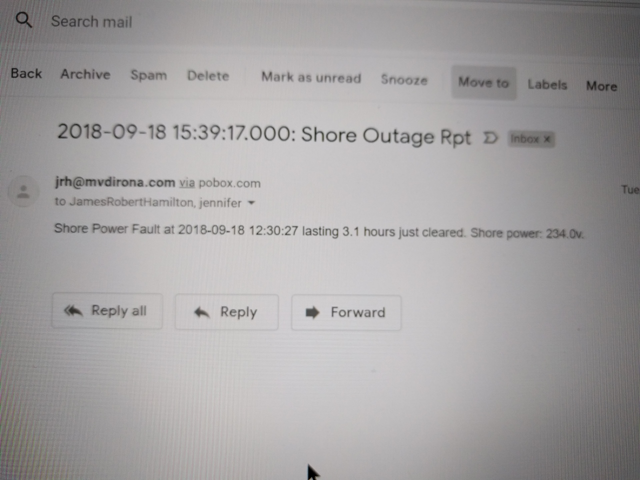 |
9/19/2018: Shore Power Outage
Position: 60°23.80'N, 5°19.38'E
The shore power went out at 2:30pm (12:30 UTC) while we hiking between Floyen and Ulriken. We returned to the boat and found a new boat was plugged into the same shore pedestal and the breaker had tripped. We reset it and were up and running again. It's hard to even speculate as to the cause, but we we've gone almost two decades with very few shorepower failures and then, in the last couple of years, we've come across several marinas with very sensitive residual current devices. An RCD is designed to reduce the risk of electrical shock from plugged-in boats and seem to work without problem in many marinas, but seem to be constantly tripping in others.
|
 |
9/19/2018: Fast Ferries
Position: 60°23.80'N, 5°19.38'E
From our berth we have a great view to the busy fast ferry terminal on the opposite side of the harbour.
|
 |
9/19/2018: AIDAsol
Position: 60°23.80'N, 5°19.38'E
The cruise ship AIDAsol departing with tug assist. The cruise ships usually don't require tugs, so perhaps they needed assistance due to the high winds we're seeing or possibly the maneuvering space is too tight.
|
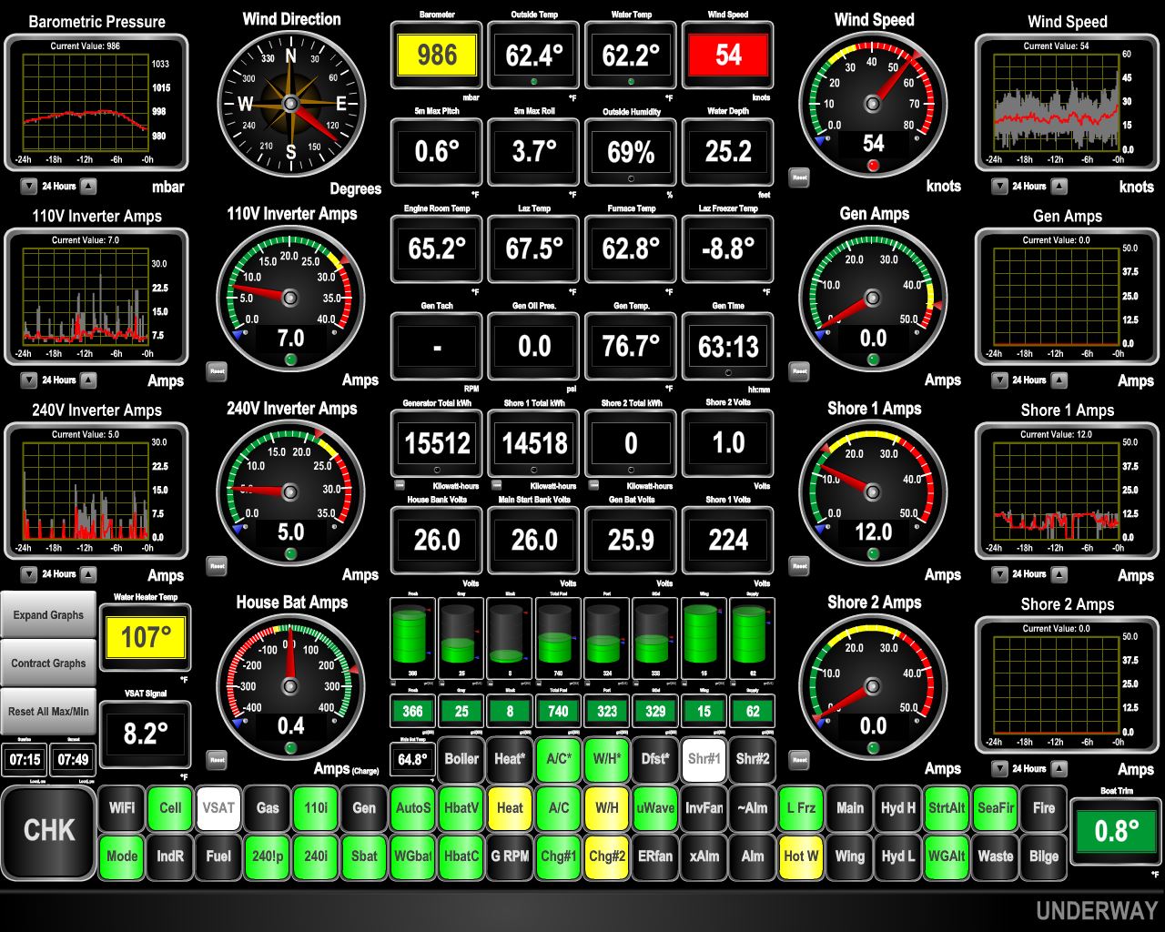 |
9/19/2018: 54 knots
Position: 60°23.81'N, 5°19.38'E
That forecast storm has arrived and the winds are gusting to 50 knots.
|
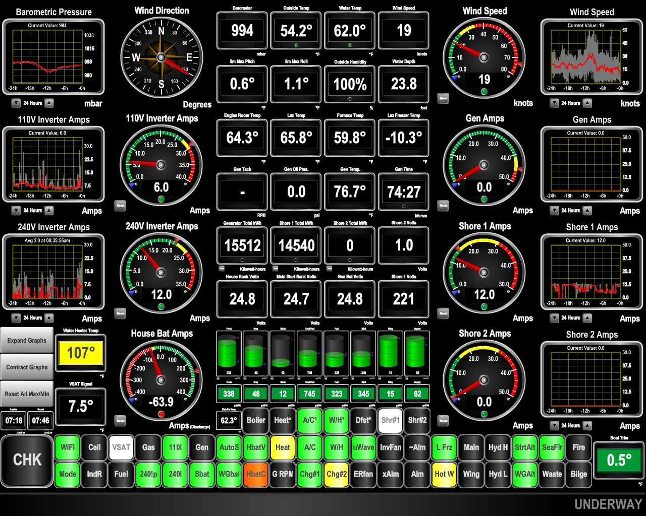 |
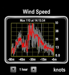
9/20/2018: 74 knots
Position: 60°23.81'N, 5°19.38'E
We recorded gusts to 74 knots last night in the storm. That's the second strongest we can recall experiencing on Dirona—the highest being 110 knots in Fiordland, New Zealand. The cruise ship Albatros, that was scheduled to depart at 3pm yesterday, was still here this morning. Likely passenger comfort and safety won over schedule integrity.
|
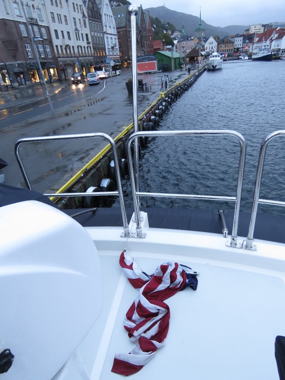 |
9/20/2018: Ensign
Position: 60°23.81'N, 5°19.38'E
The boat rattled a lot during the big gusts to 74 knots last night, but the only casualty was our US ensign, which parted from the flagstaff. The flag itself was undamaged, we just needed to re-attach the snap-clip holding it to the flagstaff.
|
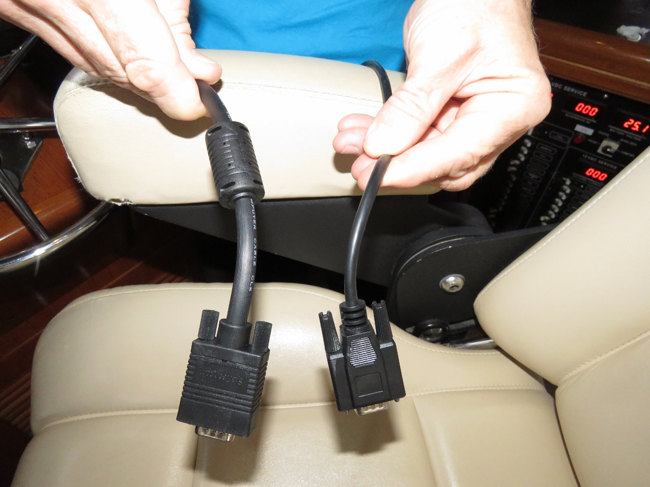 |
9/20/2018: Monitor Cable
Position: 60°23.81'N, 5°19.38'E
The new Lenovo P320 Tiny navigation computer is working well, and the only issue is the screen fluctuates or flashes when the gen starts and stops. It's not really much of a problem but we were pretty sure that the problem was caused by us using a low quality monitor cable (right). Trond Saetre, from Bergen, picked us up a new one (left) and the flicker is resolved. There are now no known issues with the new computer, and it hasn't had any issues since installed.
|
 |
9/20/2018: Shore Power 2
Position: 60°23.81'N, 5°19.38'E
The dual 16A shore power project is finally complete. Dirona can now accept two power connections with the primary connection allowing up to 50 amps and the secondary connection up to 16 amps. The primary usage model for the dual power connection is when in marinas with only low-amperage connections so we can now run two 8As, two 10As or even 2 16As to get a combined 16A 20, or 32A service. Both connections works equally well on 50 or 60 hertz.
|
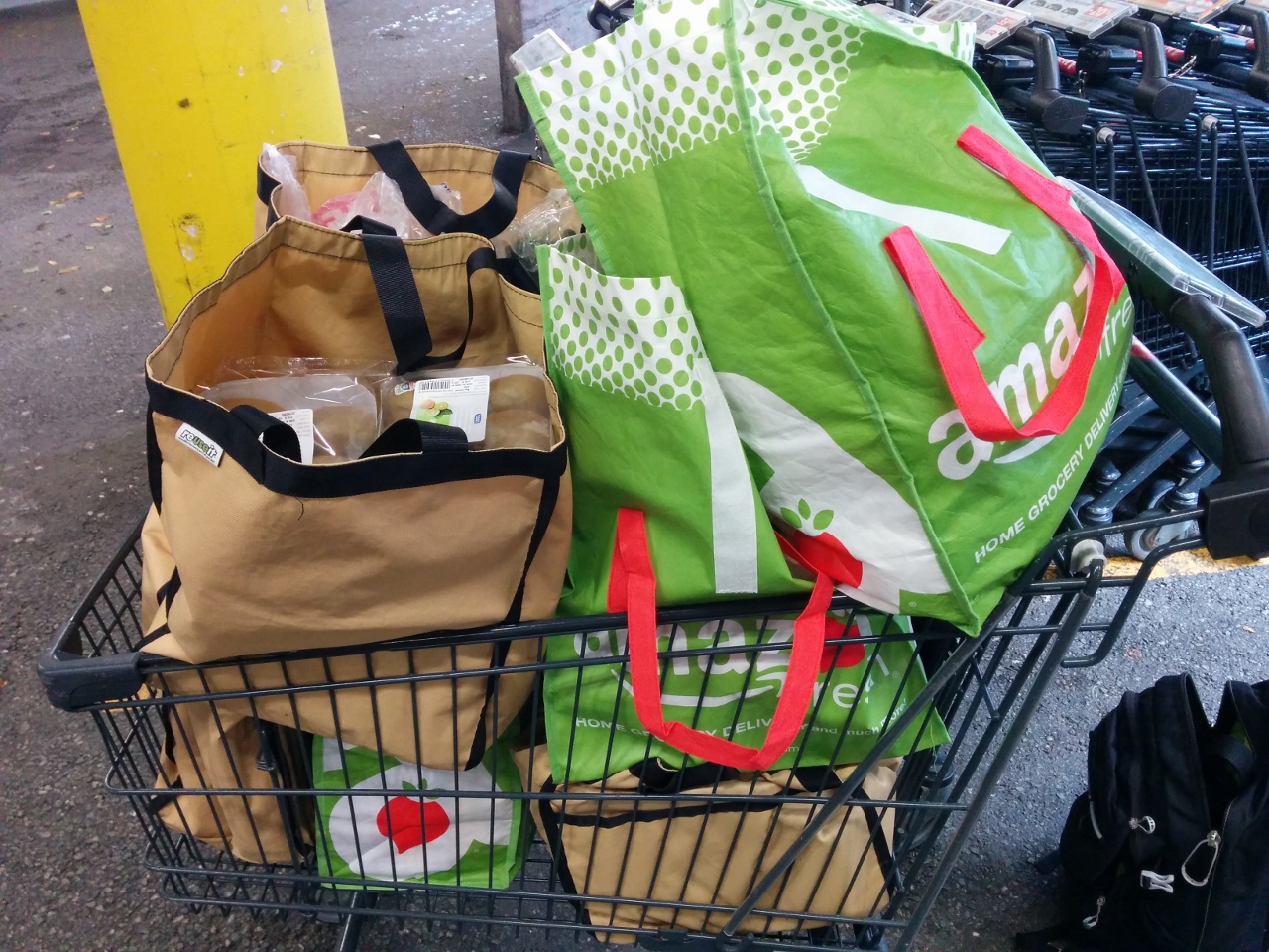 |
9/20/2018: Groceries
Position: 60°24.00'N, 5°19.55'E
Buying a load of groceries at the local Meny grocery store. The Meny produce and bread selection is particularly good.
|
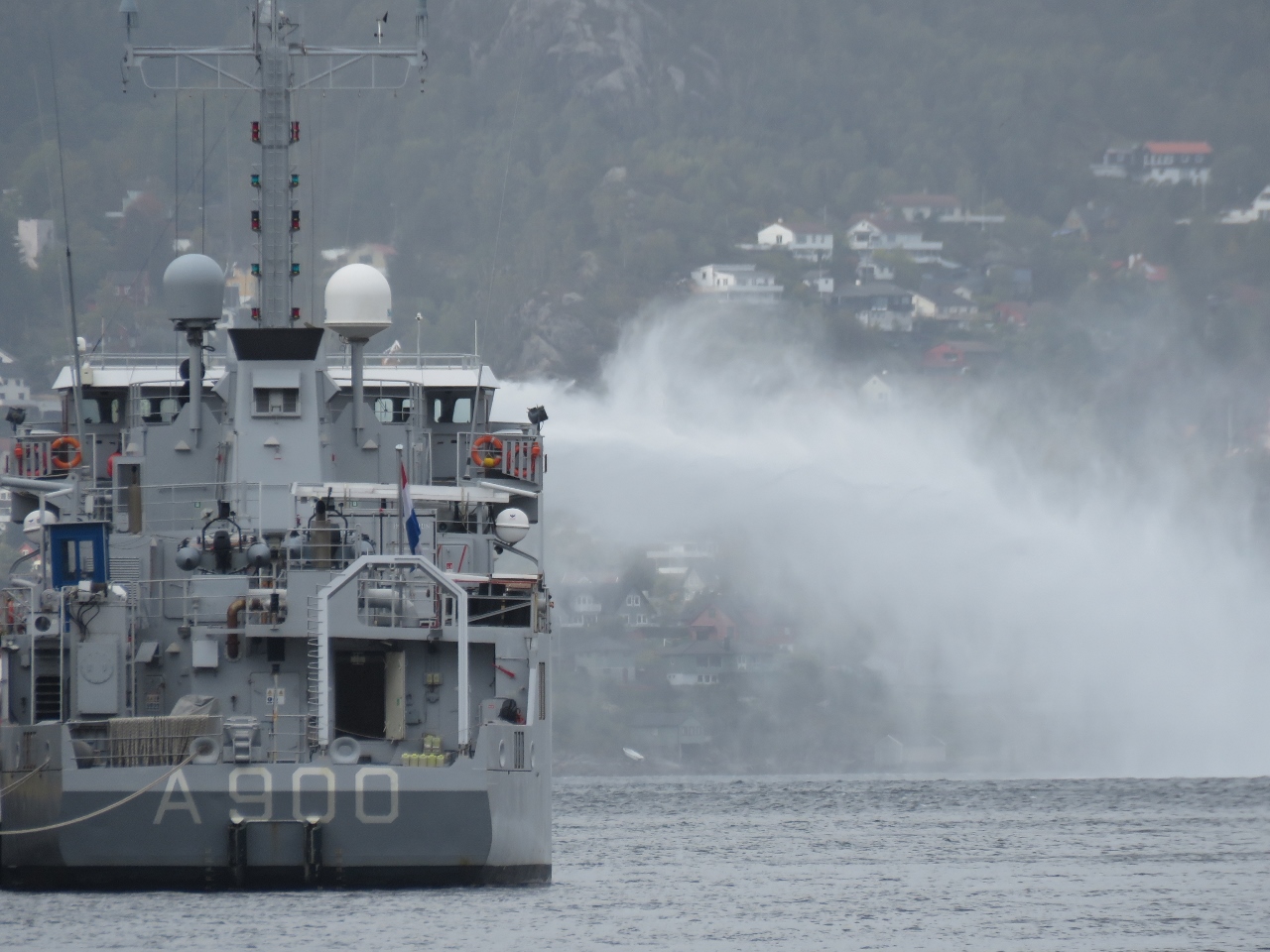 |
9/20/2018: Mercuur
Position: 60°23.81'N, 5°19.38'E
The submarine support ship HNLMS Mercuur testing their fire-fighting equipment while moored at the entrance to Bergen Havn.
|
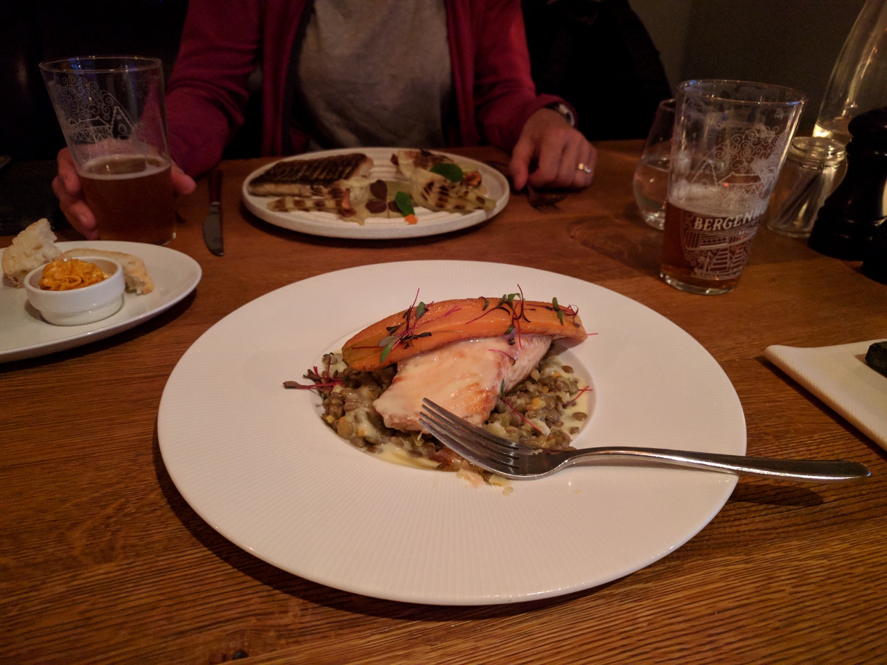 |
9/20/2018: Bergenhus Bryggeri
Position: 60°23.72'N, 5°19.49'E
A delicious and well-presented dinner, with in-house microbrews, at the Bergenhus Bryggeri (brewpub) on the Bergen waterfront. You can't beat dinner with a great view out over the entire Bergen harbor.
|
 |
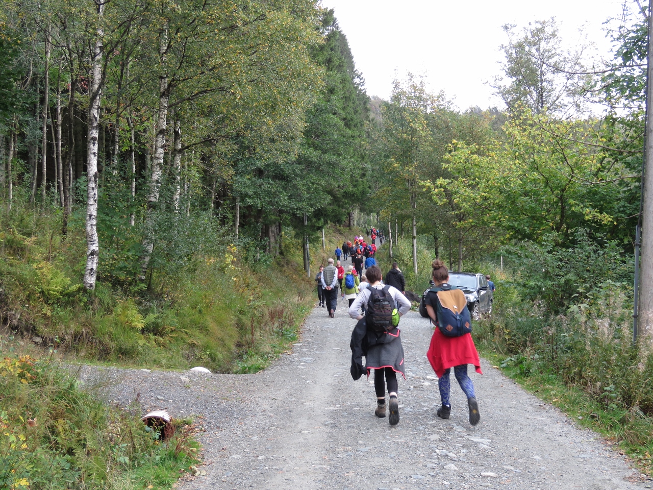
9/21/2018: Gloppen
Position: 60°18.05'N, 6°10.29'E
At Torvikbygd to catch the ferry Gloppen to Jondal for a road trip around Hardangerfjord. We'd picked up a rental car in Bergen the moment the agency opened at 7am and just made the 8:40am ferry. This was fortunate, as the next one wasn't for 90 minutes.
|
 |
9/21/2018: Our Ride
Position: 60°18.03'N, 6°10.39'E
Jennifer on the ferry Gloppen with our ride, an Audi A1 Sportback. Heavy rain has been falling all morning, but should clear this afternoon.
|
 |
9/21/2018: Jondal Tunnel
Position: 60°14.64'N, 6°12.45'E
Entering the 6.5 mi (10.4km) Jondal Tunnel, the 6th longest tunnel in Norway.
|
 |
9/21/2018: Narrow Road
Position: 60°9.13'N, 6°17.07'E
Norway has been gradually replacing all the old, narrow shore-hugging roads with wider ones, or tunnels. This old section along Nodrepollen is quite narrow, with the cliff-side overhanging the road. Fortunately we didn't have much oncoming traffic to contend with.
|
 |
9/21/2018: Nodrepollen
Position: 60°8.12'N, 6°16.95'E
The view down Nodrepollen through the mist.
|
 |
9/21/2018: Folgefonn Tunnel
Position: 60°8.05'N, 6°20.83'E
We'll be passing through a lot of tunnels today. This is exiting the 6.9-mi (11.15km) Folgefonn Tunnel, the fifth longest in Norway.
|
 |
9/21/2018: Odda
Position: 60°4.25'N, 6°32.83'E
The town of Odda at the head of Sorfjorden, a 20 nm branch off Hardangerfjord.
|
 |
9/21/2018: Norzink
Position: 60°5.02'N, 6°33.06'E
The Norzink Odda zinc smelter, founded in the 1920s. The raw materials are imported and the final product exported. What attracted the smelter to the Odda was the low-cost hydroelectric power in the area.
|
 |
9/21/2018: Wilson Mersin
Position: 60°7.17'N, 6°33.34'E
Wilson Mersin taking on cargo at Odda, with the spectacular backdrop of Sorfjorden.
|
 |
9/21/2018: Norwegian Museum of Hydropower and Industry
Position: 60°7.17'N, 6°33.36'E
Our first stop for the day is the Norwegian Museum of Hydropower and Industry, built around the Tyssedal reservoir power station (#1 at bottom left of the map— click image for a larger view). The dam for the power station reservoir, Ringedals Dam, (#31) is at the upper right, feeding via pipes to Lippetopp (#22 midway on the left) and down the slope via pipes to the power station.
|
 |
9/21/2018: Tyssedal Power Station
Position: 60°7.17'N, 6°33.36'E
The Tyssedal power station was built between 1906 and 1918 and operated until 1989. It was one of the largest pressure power plants in the world when it first came online in 1918 with a production capacity of 100MW. The building is considered one of the best of Norway's 20th-century architecture.
|
 |
9/21/2018: Museum Exhibits
Position: 60°7.16'N, 6°33.39'E
Exhibits in the museum detail the history of the area, with particular focus on hydroelectricity, the construction of Tyssedal Hydroelectric Power Station, and the industry it attracted to Odda.
|
 |
9/21/2018: Power Plant
Position: 60°7.25'N, 6°33.38'E
Looking across the generators and turbines in the power plant. The building was designed for a cathedral effect, with high ceilings and light-flooded floorspace. We're effectively looking forward in time, where newer generator generations are extending out into the distance.
|
 |
9/21/2018: Reservoir Power Plant
Position: 60°7.29'N, 6°33.36'E
A reservoir poower plant Turbine (right), generator (left) and governer (behind) that make up a reservoir power plant.
|
 |
9/21/2018: The Snobs
Position: 60°7.29'N, 6°33.36'E
The plant initially produced 25 hertz power, used by most Odda houses and the manufacturing plants. Two small machines converted 25hz to 50hz for some gear in the power plant. The machines were known as "the snobs" because the leaders of the company also had this "better" 50hz power delivered to their homes.
|
 |
9/21/2018: Open Generator
Position: 60°7.30'N, 6°33.33'E
The power plant has been well-preserved, with most of the original machinery intact and accessible. This is a cut-away of one of the generators, showing the stator and the rotor with an explanation of how it works.
|
 |
9/21/2018: Pelton Turbine
Position: 60°7.29'N, 6°33.34'E
A Pelton turbine used in the power plant.
|
 |
9/21/2018: Tools
Position: 60°7.33'N, 6°33.32'E
Tools supplied by the generator manufacturer mounted on the wall.
|
 |
9/21/2018: Control Room
Position: 60°7.27'N, 6°33.34'E
The jewel of the power plant is the control room, the best-preserved first-generation control panel in the world. The instruments are mounted on 1.7-inch (44mm) marble plates for aesthetic and practical reasons. We expected it to be sealed away behind glass windows and were delighted that we could walk through it.
|
 |
9/21/2018: Tyssedal
Position: 60°7.21'N, 6°34.51'E
Looking across Tyssedal to Sorfjorden from the road to the Ringedals Dam.
|
 |
9/21/2018: Ringedals Dam
Position: 60°7.90'N, 6°37.99'E
The Ringedals Dam, made from hand-carved granite, provides the reservoir for the Tyssedal Power Station and is the largest stone dam in Norway. With a reservoir capacity of 586 trillion gallons (222 million cubic meters), it was one of the largest gravity dams in Europe when completed in 1918.
|
 |
9/21/2018: RB
Position: 60°7.73'N, 6°38.22'E
Ringedals Dam was topped with medieval-style battlements and contain the initials of managing director Ragnvald Blakstad and the construction date.
|
 |
9/21/2018: Mosdalsbekken
Position: 60°7.63'N, 6°38.90'E
The river Mosdalsbekken flowing into Ringedal Lake.
|
 |
9/21/2018: Mogelielvi
Position: 60°8.04'N, 6°37.58'E
The river Mogelielvi gushing down the hill near the trailhead to famous Trolltunga. We were interested in making the hike, but we'd need to set off before 8am to make the 10-12-hour return trip.
|
 |
9/21/2018: Vetlevatn
Position: 60°7.96'N, 6°36.85'E
The dam on Vetlevatn lake was built between 1921 and 1924 to create an overflow reservoir for Ringedal Lake. The reinforced concrete dam was being renovated when we were there.
|
 |
9/21/2018: Bridge
Position: 60°7.72'N, 6°36.12'E
Jennifer taking in the view from a bridge over the river below Vetlevatn lake. Rain still is falling lightly, but we're starting to get a little sun now too.
|
 |
9/21/2018: Sorfjorden
Position: 60°8.33'N, 6°34.03'E
Great view down Sorfjorden just north of the power station.
|
 |
9/21/2018: Folgefonna
Position: 60°8.33'N, 6°34.03'E
A glimpse to the Folgefonna glacier at upper right as we continued north along the shore of Sorfjorden.
|
 |
9/21/2018: Waterfalls
Position: 60°17.11'N, 6°37.40'E
Waterfalls ribboning the cliffs along the west shore of Sorfjorden with blue skies above. The day is getting nicer.
|
 |
9/21/2018: Traffic Jam
Position: 60°23.22'N, 6°43.06'E
Traffic ground to a halt just north of the village of Kinsarvik. It appeared to be mostly due to the narrowness of the road and the difficulty for vehicles to pass. The truck on the left is as far over as it can get, as is the bus on the right. The truck driver had to fold in his mirrors to allow the bus to pass.
|
 |
9/21/2018: Hardanger Bridge
Position: 60°26.02'N, 6°45.42'E
The 4,530 ft (1,380 m) Hardanger Bridge, completed in 2013, is the longest suspension bridge in Norway and the longest tunnel-to-tunnel bridge in the world. The main span also is one of the longest suspension bridge spans in the world. We'll be taking it on our way back to Bergen. The maximum deck height of 180 ft (55 m) prevents large cruise ships from reaching the inner Hardangerfjord anymore.
|
 |
9/21/2018: Tunnel Roundabout
Position: 60°27.94'N, 6°49.71'E
In addition to some pretty impressive tunnels, Norway also has the first tunnel roundabouts we've been in. We'll pass through this roundabout again on our return.
|
 |
9/21/2018: Eidfjorden
Position: 60°26.75'N, 7°6.18'E
Dramatic cliffs and waterfalls along the north shore of Eidfjorden.
|
 |
9/21/2018: Goats
Position: 60°25.39'N, 7°8.04'E
We stopped in at the Hardangervidda Natursenter to watch their Lonely-Plant-recommended movie about the nature in the area, but the next showing was an hour away and we decided we'd rather see the Voringfossen waterfalls in good light. We were amused to see goats feeding on the roof of the nearby cafe.
|
 |
9/21/2018: Bjoreio River
Position: 60°25.34'N, 7°12.35'E
A bridge on the old road across the active river Bjoreio River in the valley Mabodalen.
|
 |
9/21/2018: Voringfossen
Position: 60°25.61'N, 7°14.65'E
The last stop on our road trip was Voringfossen, a group of spectacular waterfalls that plunge from the Hardangervida Plateau. The most dramatic is 600-ft (182m) Voringfoss Waterfall on the right, with a 475ft (145m) free fall. The Fossli Hotel is perched above the falls, along with a public viewing platform.
|
 |
9/21/2018: Hotel
Position: 60°25.71'N, 7°15.15'E
We continued up the hill to the extensive viewing platforms built above Voringfossen. The Fossli Hotel behind has a exceptional setting.
|
 |
9/21/2018: Voringfoss Waterfall
Position: 60°25.71'N, 7°15.17'E
Overlooking the Voringfoss Waterfall from the viewing platform above the falls.
|
 |
9/21/2018: Mabodalen Valley
Position: 60°25.68'N, 7°15.20'E
The spectacular view to the west through the Mabodalen Valley from above the Voringfossen waterfalls with Voringfoss Waterfall on the left.
|
 |
9/21/2018: Mercedes
Position: 60°25.63'N, 7°15.27'E
The Voringfossen were pretty much empty when we arrived, but a large groups was walking in, many wearing matching jackets, as we departed. This was surprising as we couldn't see a tour busy anywhere. It turned out to be a Mercedes owners group had just arrived in a dozen or so vehicles.
|
 |
9/21/2018: Crossing Hardanger Bridge
Position: 60°28.69'N, 6°49.85'E
Crossing Eidfjorden on the Hardanger Bridge, the longest tunnel-to-tunnel bridge in the world, on our way home. We're about to pass into a branch that connects to the 4.6-mile (7.5km) Vallavik Tunnel via another tunnel roundabout. The bridge is unusual where a tunnel opens onto the bridge at one end and then the bridge passes into a tunnel at the other end.
|