
Via Ferrata means “iron path” in Italian and is an increasingly popular mix of protected climbing and alpine hiking where participants use climbing gear to safely ascend exposed routes with spectacular views while attached at all times to iron cables, rungs, ladders and bridges. A number of Via Ferratas have opened in Norway in recent years, and the one at Loen is among the best. The route climbs up 3,316ft (1,011m) Mt Hoven and includes a 393ft (120m) suspension bridge (the longest Via Ferrata bridge in Europe), and an 118ft (36m) wire bridge that Jennifer is crossing in the picture above. This was the first time we’d taken a Via Ferrata—we had an awesome time and are looking forward to trying it again.
Below are trip highlights from September 5th and 6th at Loen, Norway. Click any image for a larger view, or click the position to view the location on a map. And a live map of our current route and most recent log entries always is available at mvdirona.com/maps
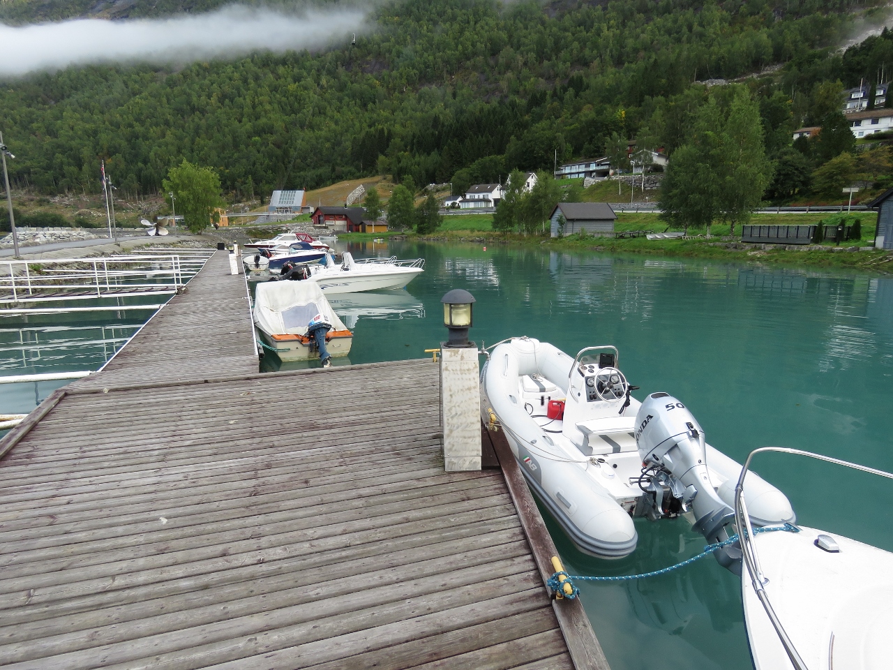 |
Tender
Position: 61°52.41’N, 6°50.52’E
Our tender moored at the Hotel Alexandra marina for the day.
|
 |
Road Up
Position: 61°52.61’N, 6°50.62’E
Walking the steep road to reach the trailhead for our climb to the summit of 3,316ft (1,011m) Mt. Hoven on the Via Ferrata Loen.
|
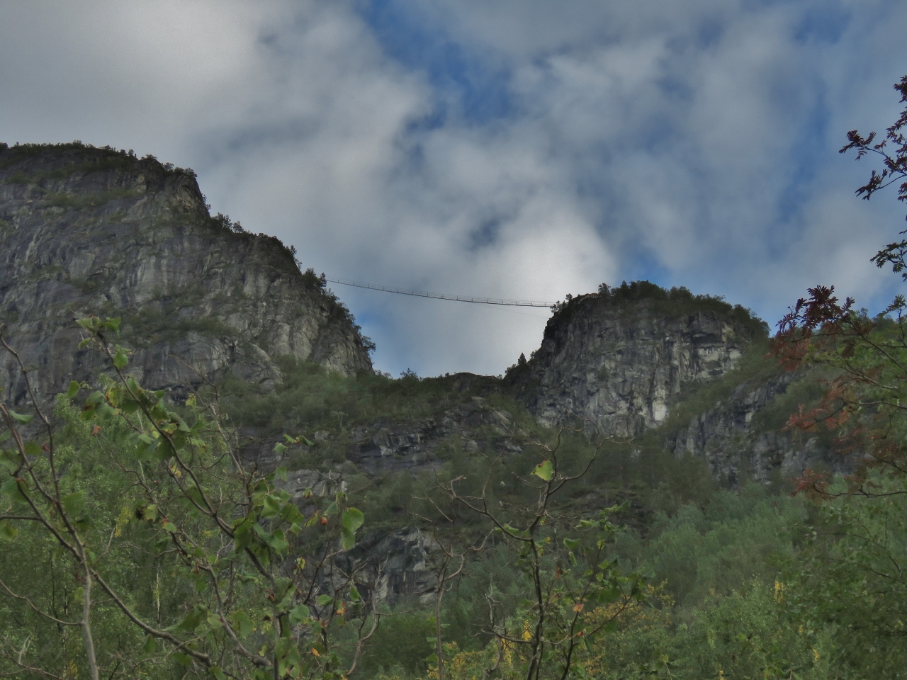 |
Suspension Bridge
Position: 61°52.63’N, 6°50.79’E
That suspension bridge way up there is part of our route to the summit of Mt. Hoven.
|
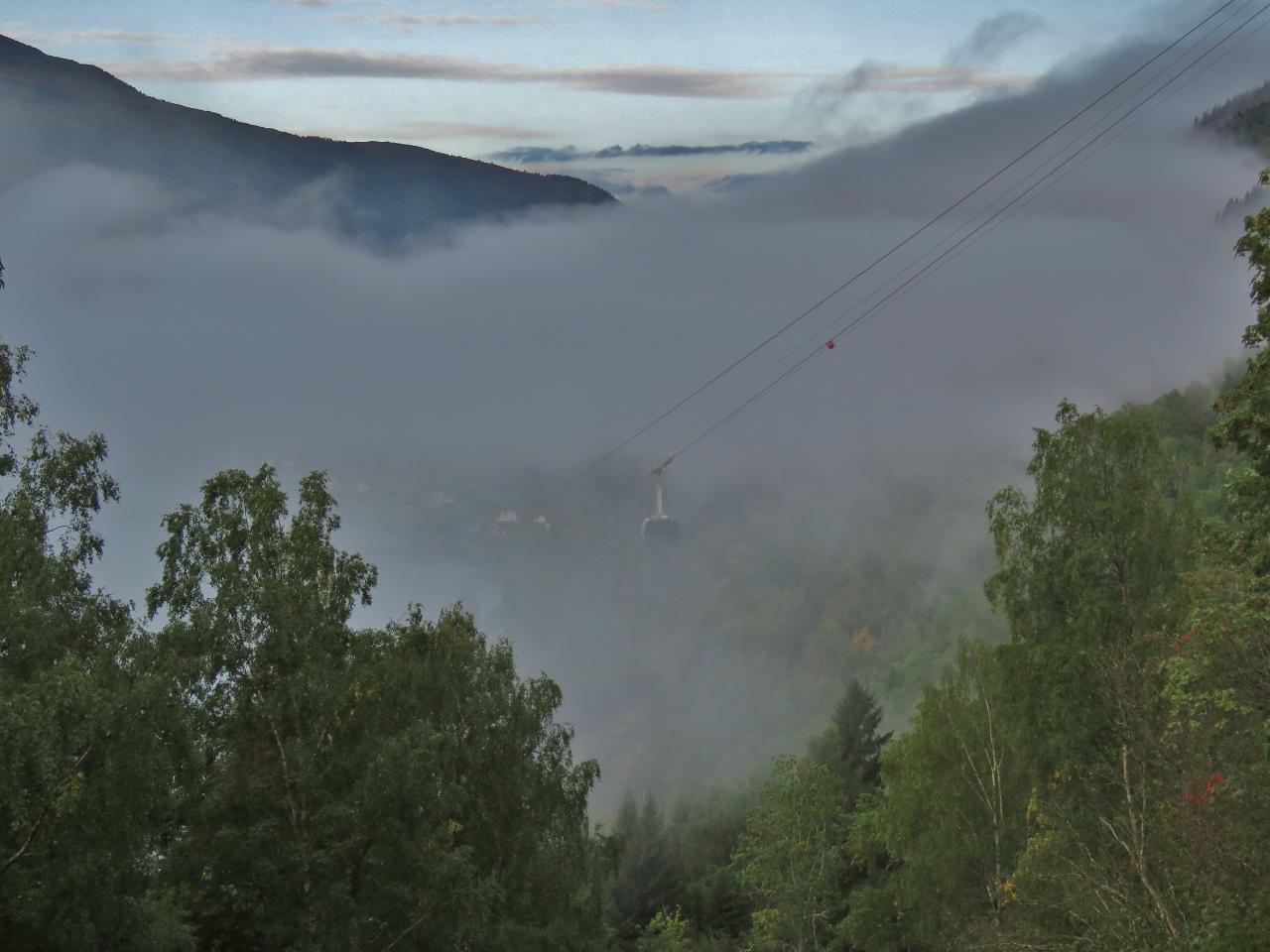 |
Gondola
Position: 61°52.63’N, 6°50.79’E
One of the Loen Skylift gondolas rising up out of the mist behind us.
|
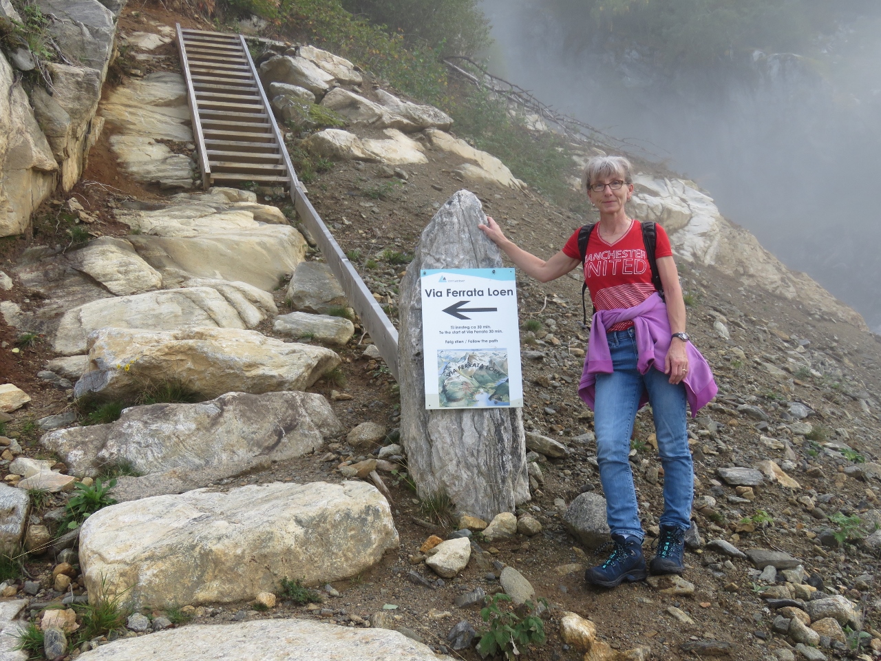 |
Trailhead
Position: 61°52.65’N, 6°50.80’E
We reached the trailhead after walking up a steep roadway to 654 ft (199 m). We’ll be taking the Via Ferrata Loen up. Via Ferrata means “iron path” in Italian and is an increasingly popular mix of protected climbing and alpine hiking where participants use climbing gear to safely ascend exposed routes with spectacular views while attached at all times to iron cables, rungs, ladders and bridges.
|
 |
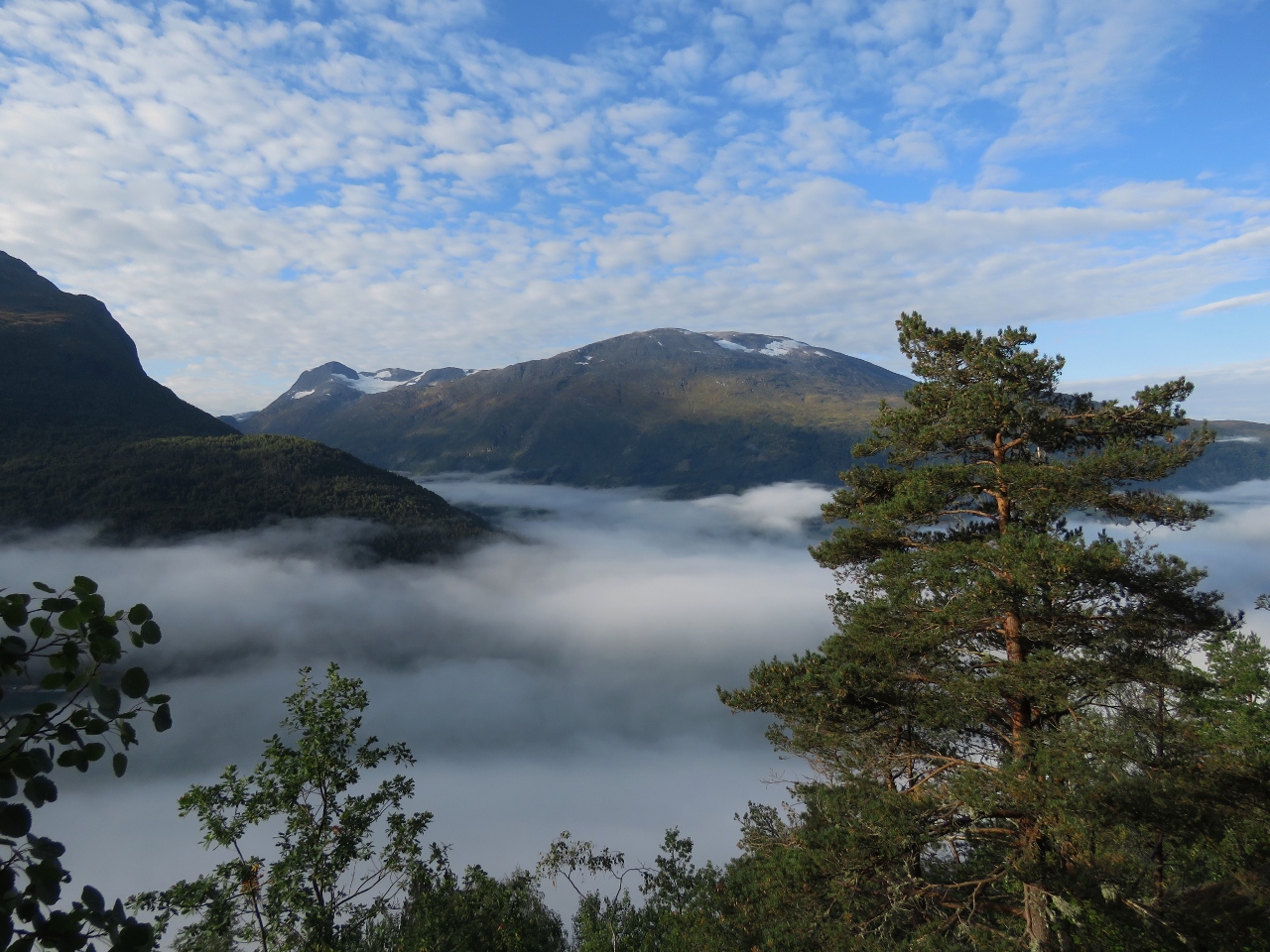
Above Clouds
Position: 61°52.71’N, 6°50.78’E
We popped above the clouds at altitude 726 ft (221 m) for great views to the south.
|
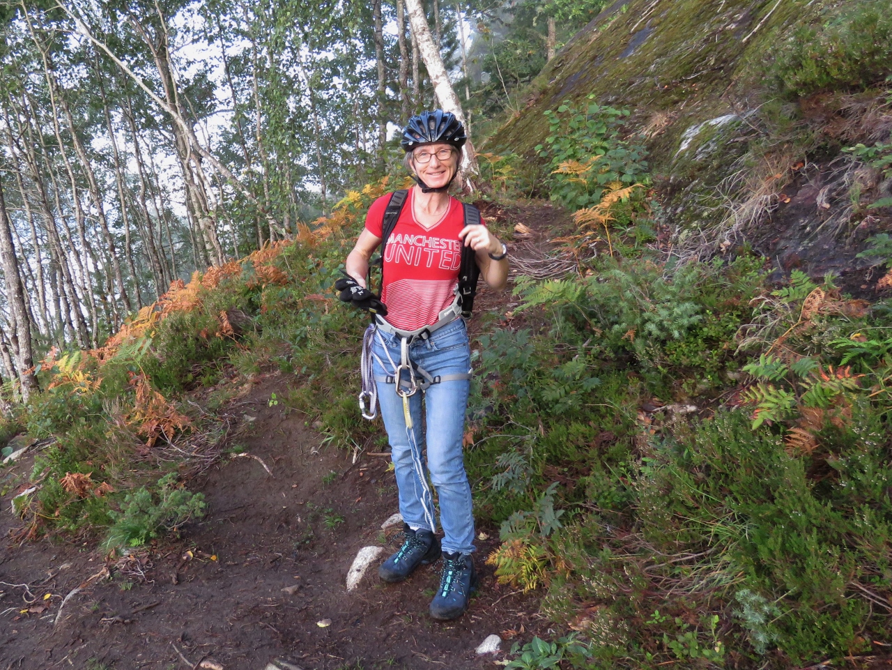 |
Gearing Up
Position: 61°52.73’N, 6°50.74’E
We donned our climbing gear when we reached the first section where we could clip on at altitude 1021 ft (311 m). We carry climbing gear on the boat so we can safely work on the stack and other places where we might fall. This is the first time we’ve used the gear for sport.
|
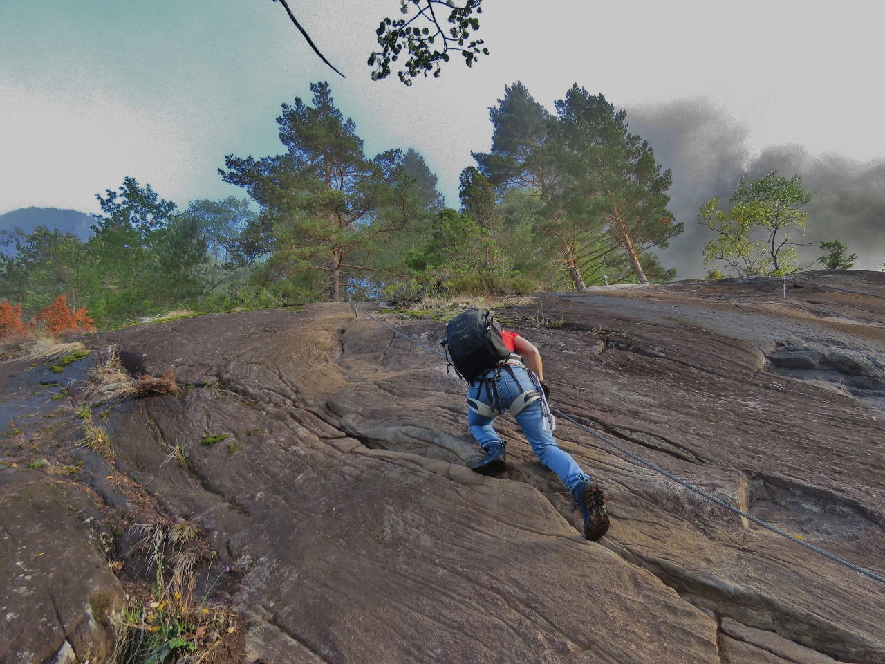 |
Climbing
Position: 61°52.74’N, 6°50.74’E
Jennifer starting up the cliff, clipped onto the wire.
|
 |
View
Position: 61°52.77’N, 6°50.71’E
Another great view at altitude 1169 ft (356 m).
|
 |
James Climbing
Position: 61°52.85’N, 6°50.60’E
James ascending into the clouds at altitude 1595 ft (486 m).
|
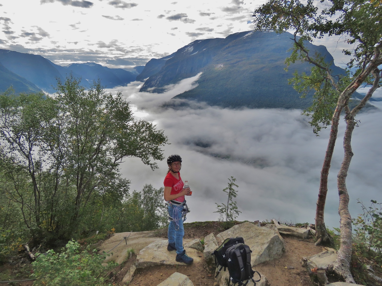 |
Break
Position: 61°52.91’N, 6°50.45’E
Taking a break and enjoying the view across the Lodalen valley at altitude 1999 ft (609 m).
|
 |
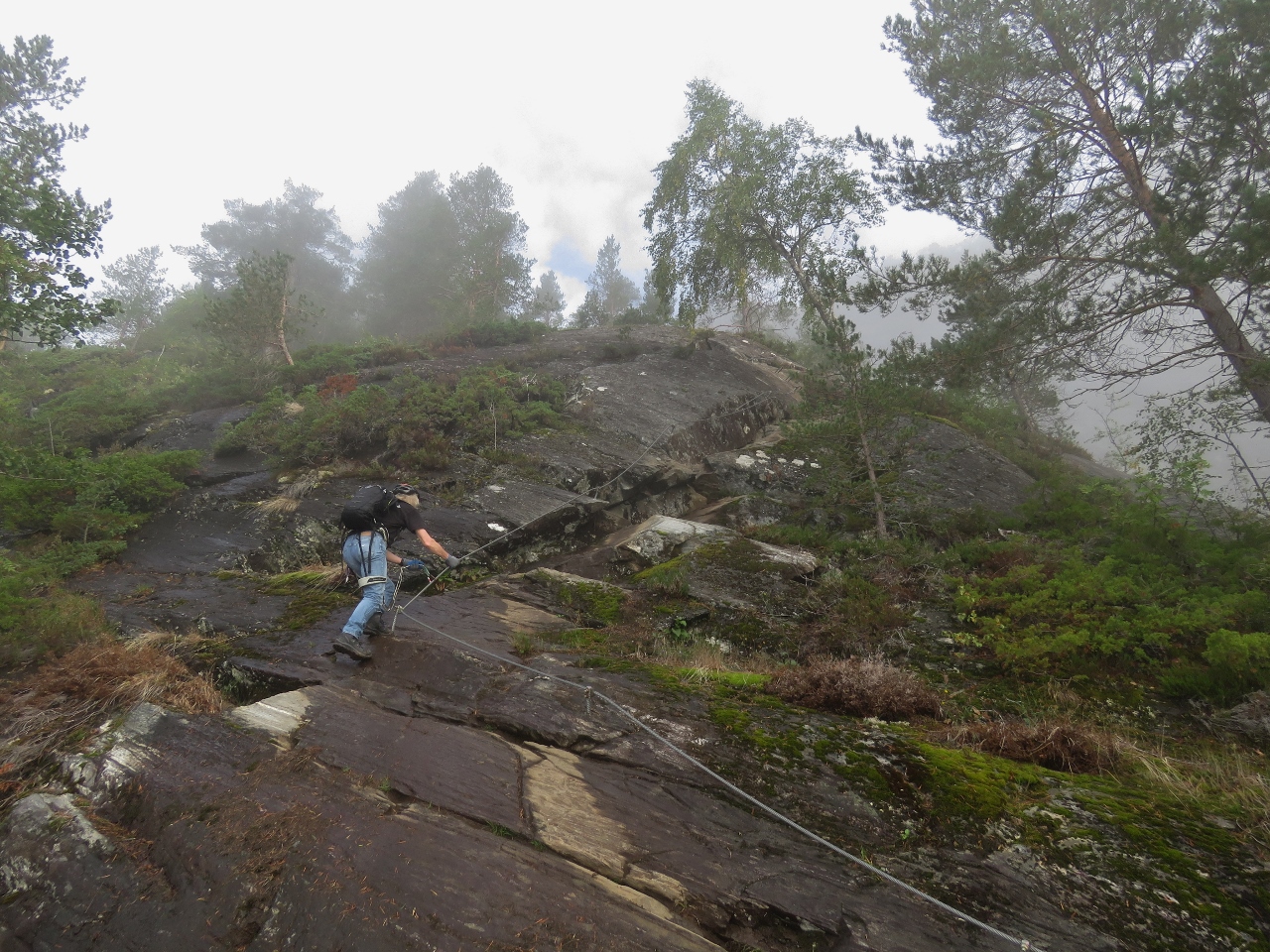
Climbing
Position: 61°52.95’N, 6°50.39’E
Ascending at altitude 2406 ft (733 m).
|
 |
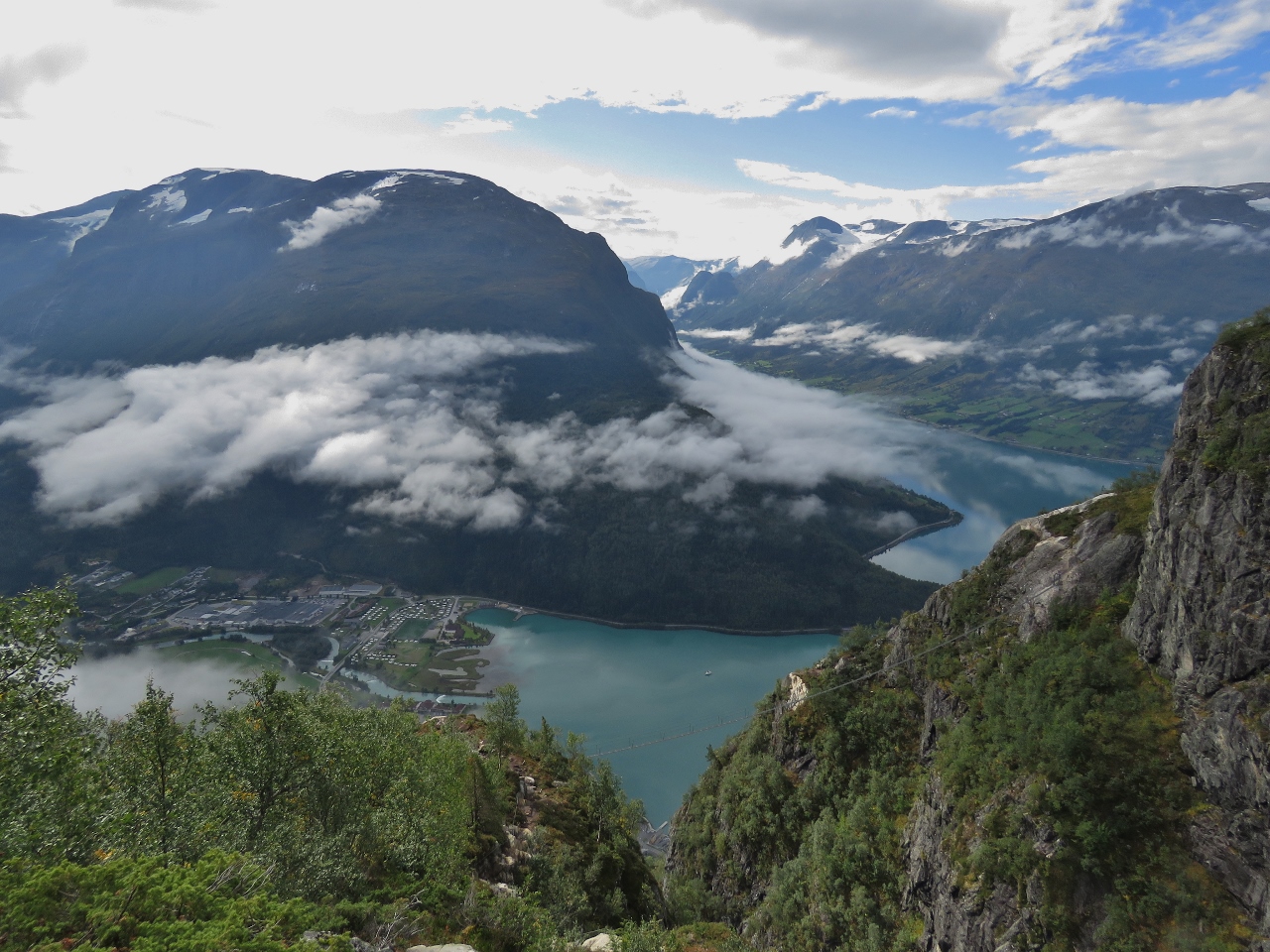
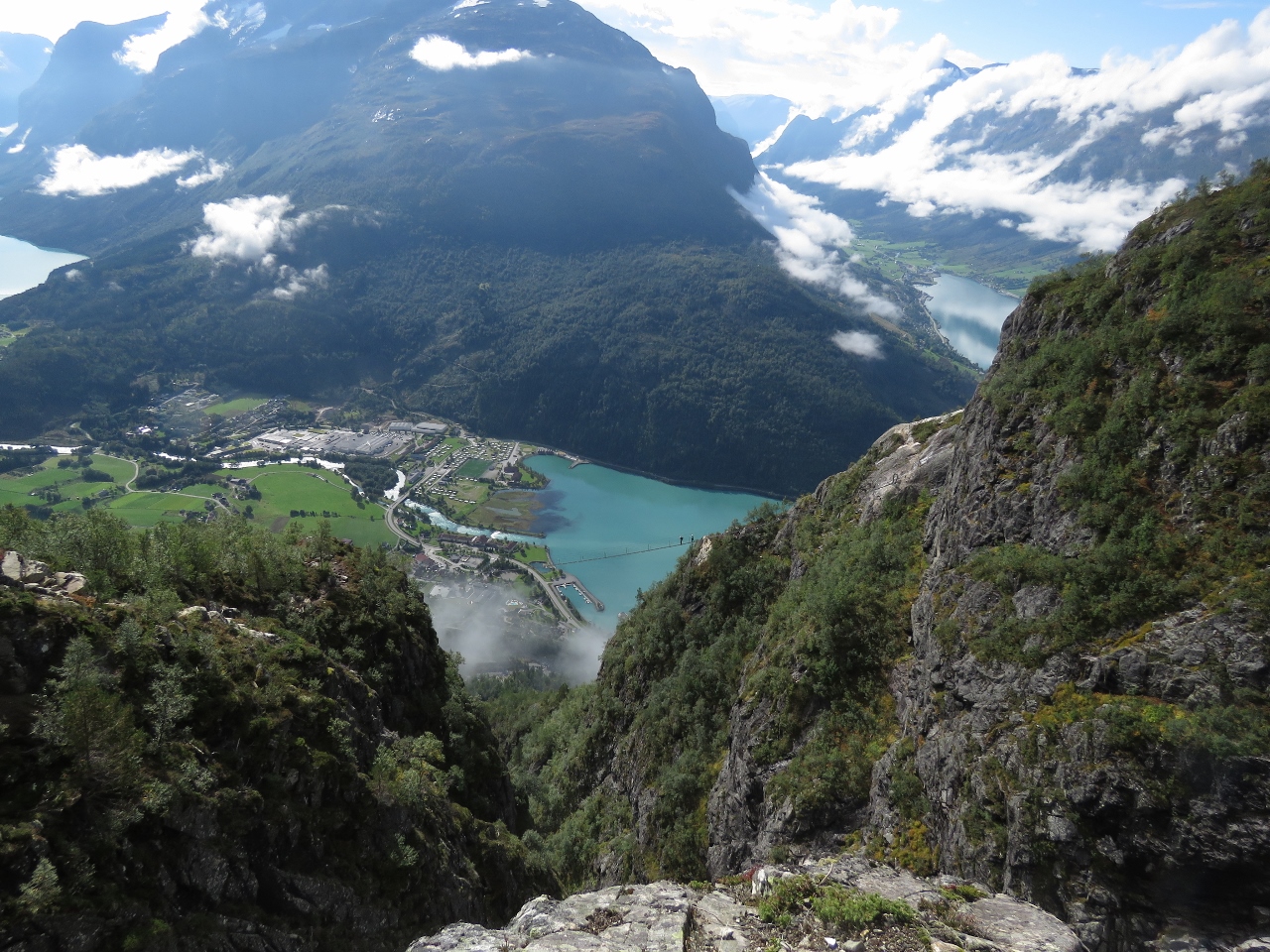
Dirona
Position: 61°52.96’N, 6°50.37’E
Dirona moored far below us, viewed from an altitude of 2507 ft (764 m).
|
 |
Gjolmunne Suspension Bridge
Position: 61°53.01’N, 6°50.45’E
James crossing the Gjolmunne suspension bridge, 2,400 ft up (731m), clipped on behind him to the overhead cable above his head. The 393ft (120m) bridge is the longest Via Ferrata bridge in Europe. It was pictures of this bridge, with a view to Nordfjorden beyond, that had first attracted us to the hike.
|
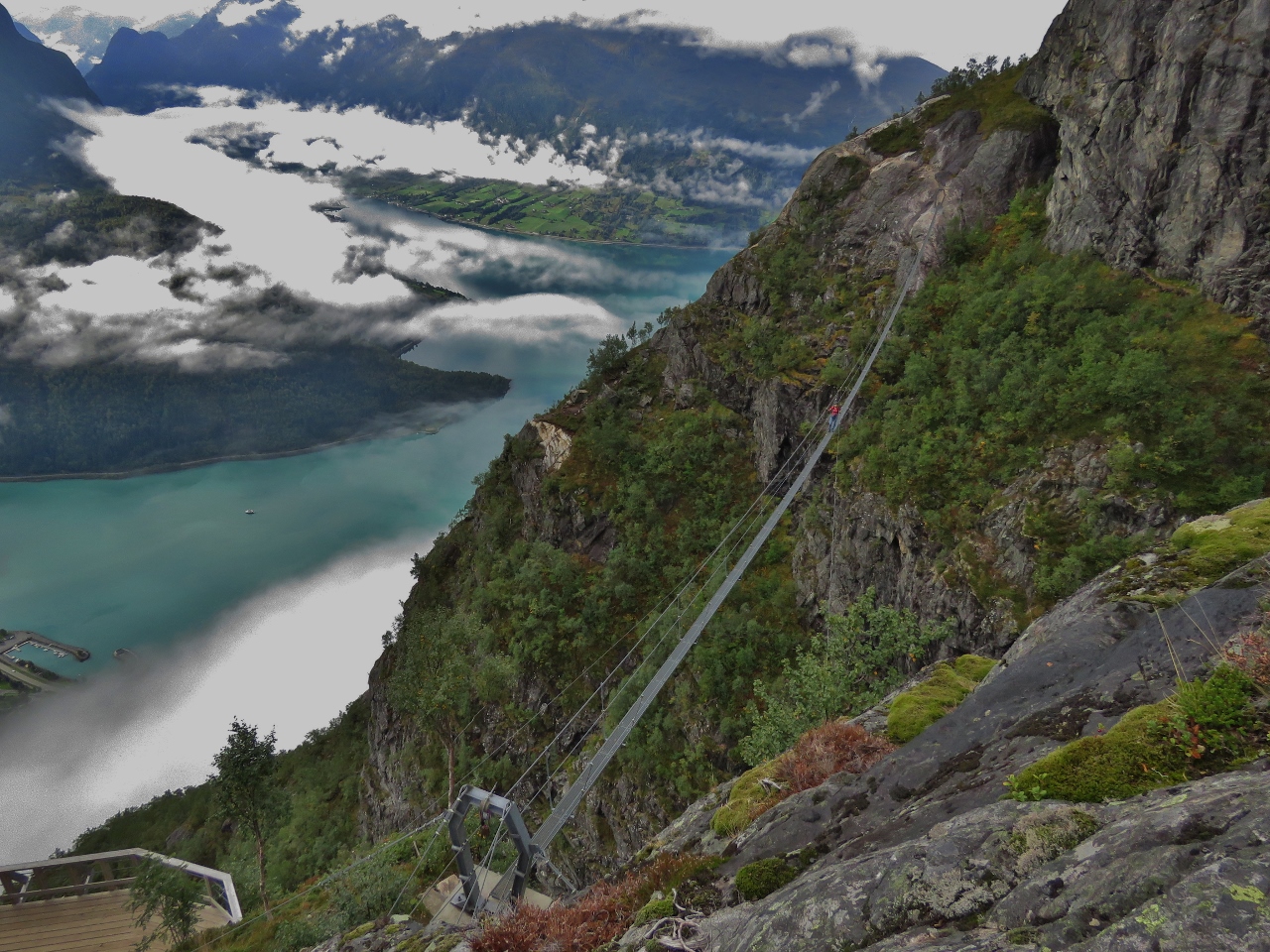 |
Gjolmunne From Above
Position: 61°53.02’N, 6°50.49’E
Jennifer crossing the Gjolmunne suspension bridge with Nordfjorden beyond. The marina where our tender is moored is visible at the far left.
|
 |
Ringing Bell
Position: 61°53.02’N, 6°50.48’E
Jennifer ringing the bell after crossing the Gjolmunne suspension bridge.
|
 |
View 2760 ft
Position: 61°53.06’N, 6°50.46’E
Another great view at altitude 2760 ft (841 m).
|
 |
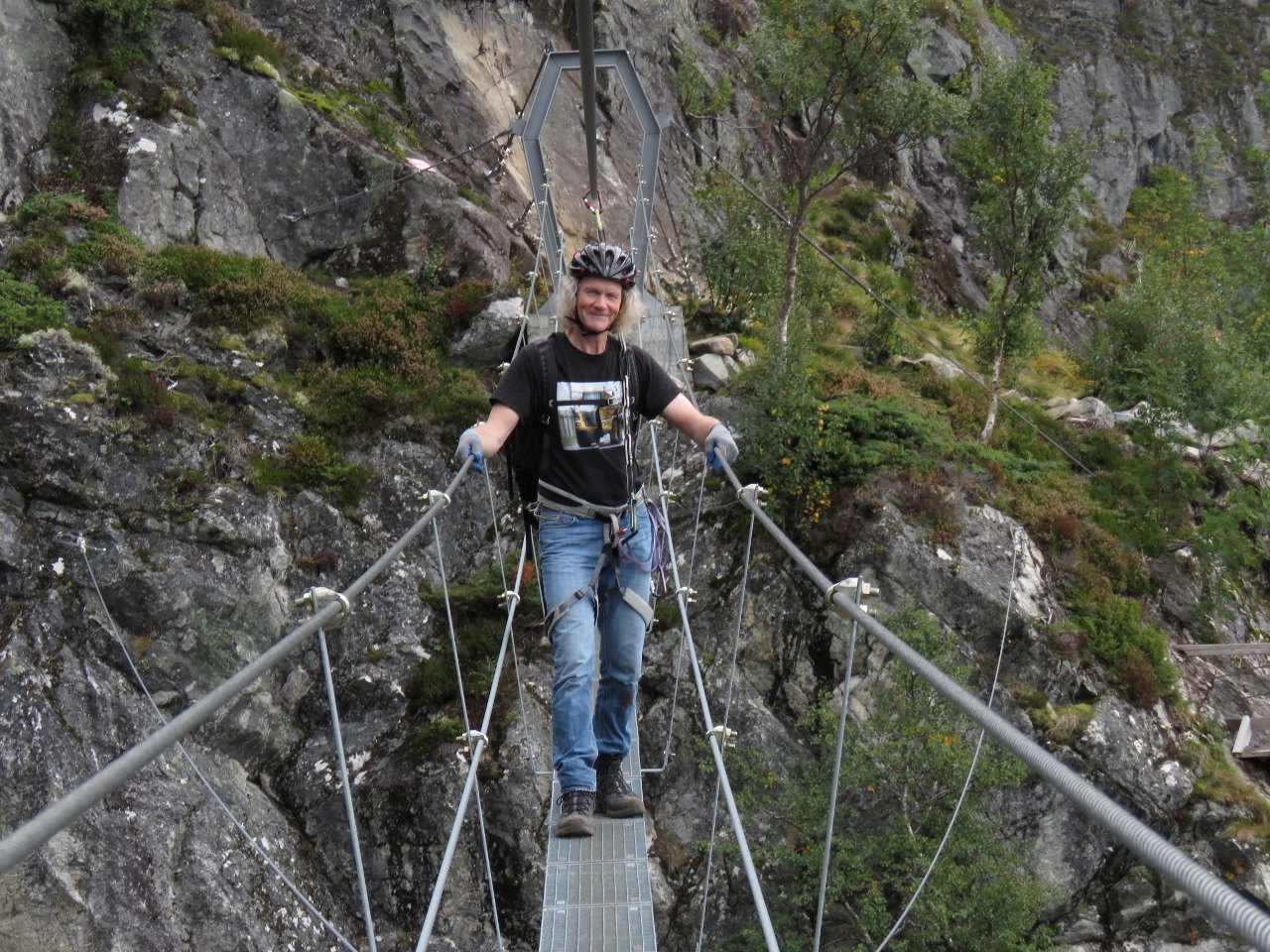
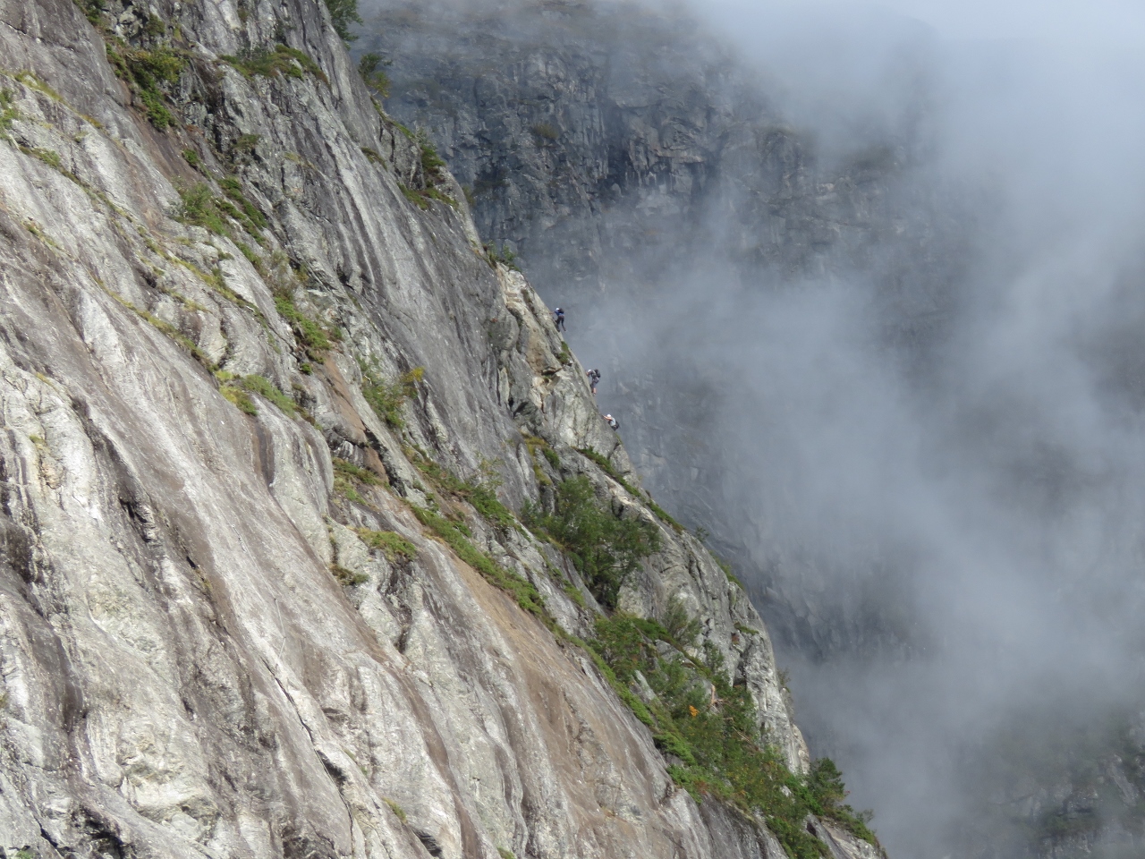
Gjolmunne Wire Bridge
Position: 61°53.07’N, 6°50.43’E
The 118ft (36m) Gjolmunne wire bridge was the part of the ascent we were most concerned about. It wasn’t too bad close to the ends, but in the middle the wire rope moves quite a bit and it was a little, um, exciting. Here Jennifer is making her way across clipped to and holding onto the cables on either side.
|
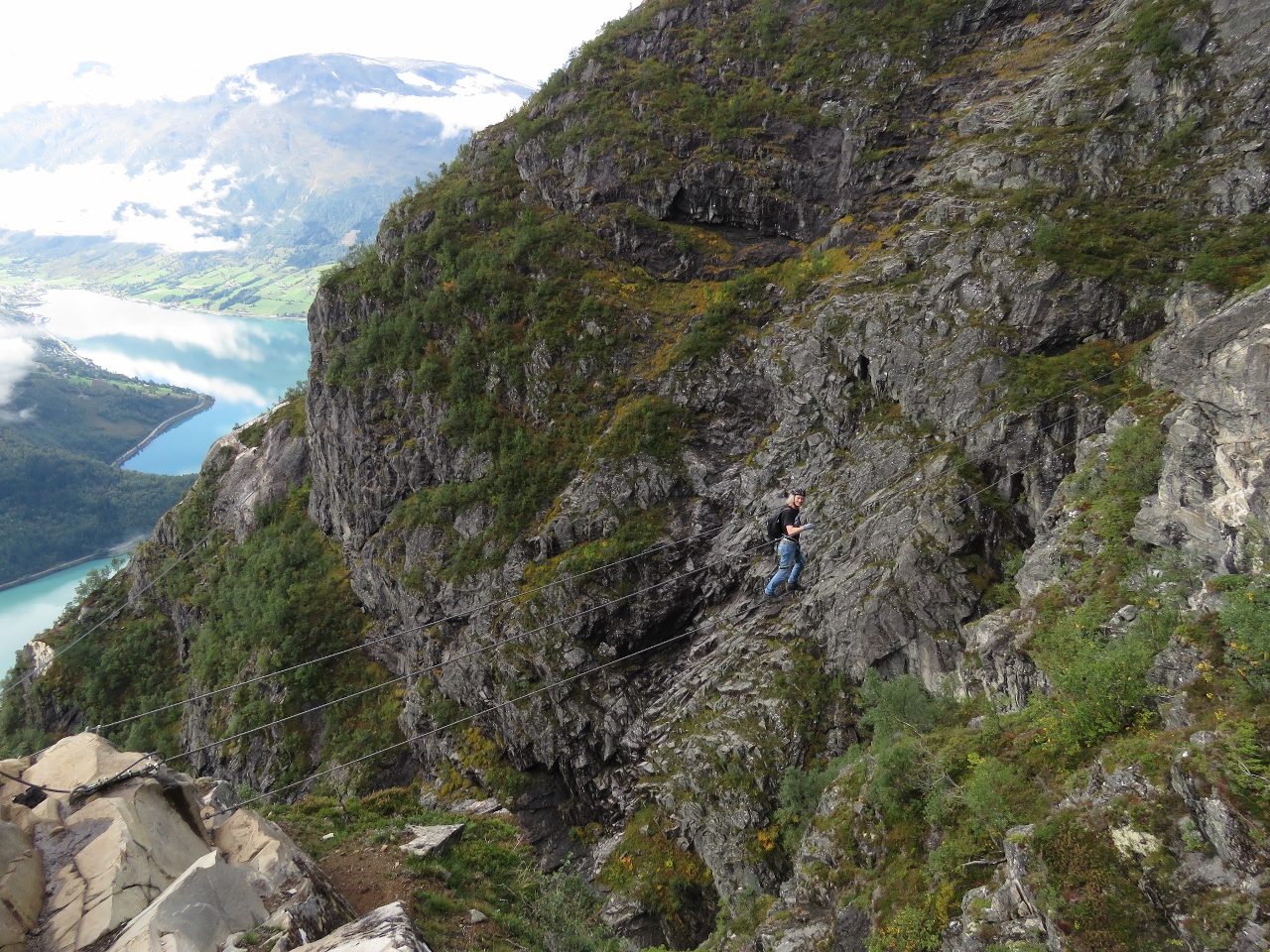 |
Wire Bridge
Position: 61°53.07’N, 6°50.44’E
James crossing the Gjolmunne wire bridge.
|
 |
Climbers Below
Position: 61°53.07’N, 6°50.43’E
At altitude 2842 ft (866 m) we could see another set of climbers crossing the Gjolmunne suspension bridge 442ft (135m) below.
|
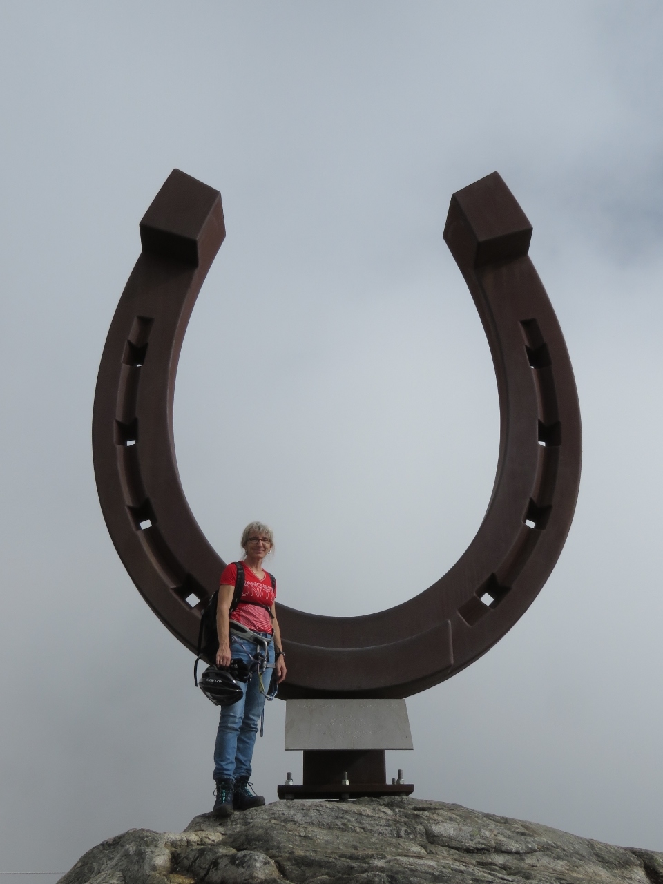 |
Hoven Summit
Position: 61°53.12’N, 6°49.98’E
5m-high horseshoe on the Hoven summit at 3,316ft (1101m). Hoven means “hoof” in Norway—the mountain is named for the Sleipner, the horse of the god Odin in Norse mythology. This was the first time we’d taken a Via Ferrata. We had an awesome time and are looking forward to trying it again.
|
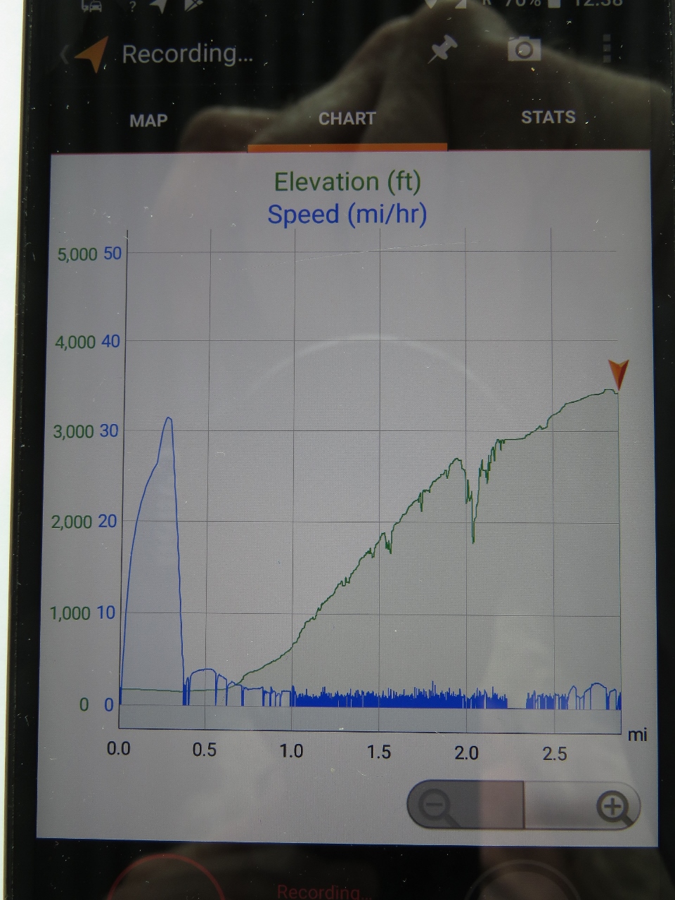 |
Climb Profile
Position: 61°53.11’N, 6°49.97’E
Our climb profile for Via Ferrata Loen. The blue line represents speed and the green is altitude. You can see the quick blast to shore in the tender at just over 30mph at the far left and our ascent up Mt. Hoven at about 1mph.
|
 |
Hoven
Position: 61°53.11’N, 6°49.97’E
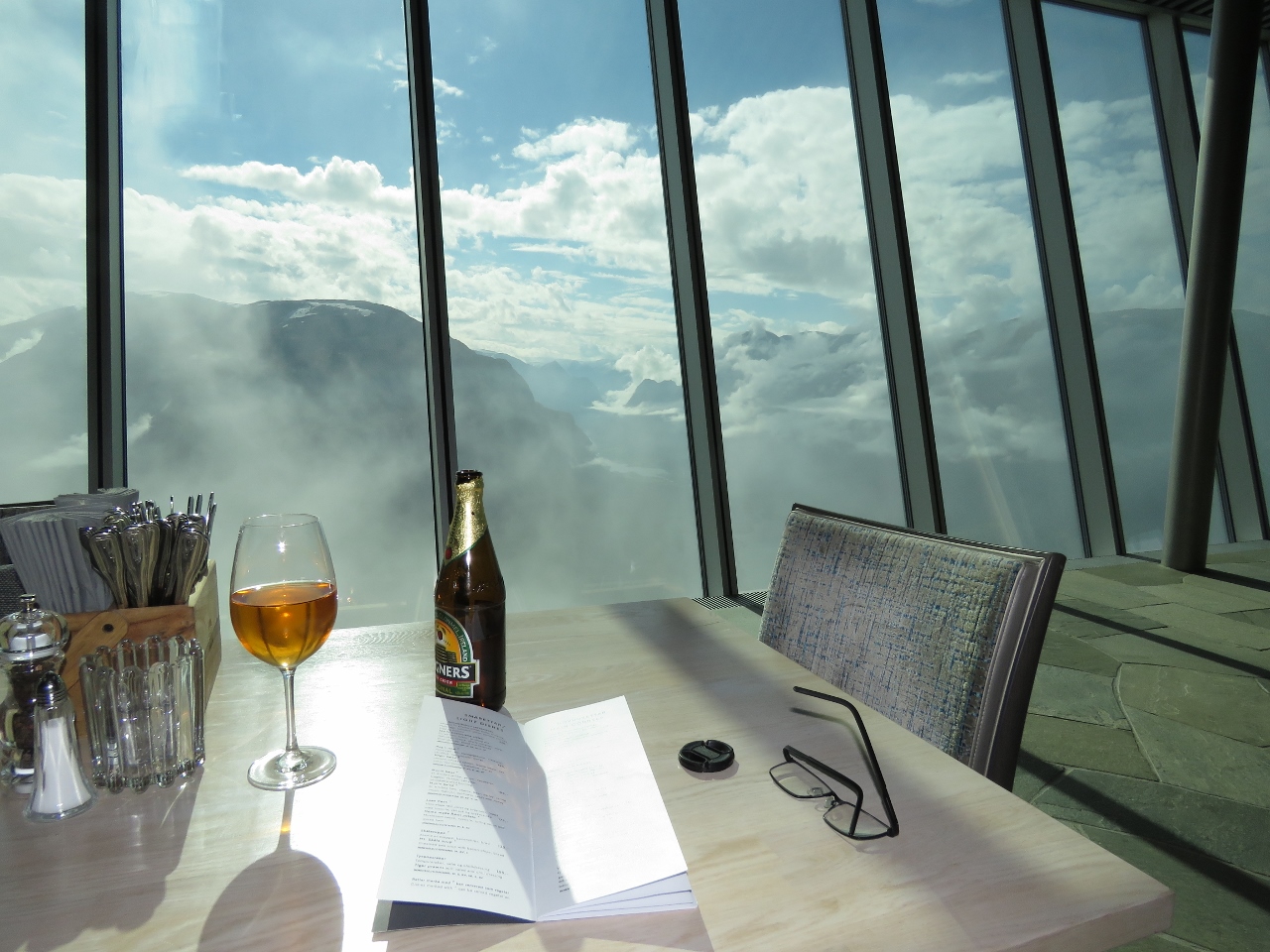
There aren’t many places in the world where you can climb to over 3,000ft and have lunch at a high-end restaurant. We had an excellent, lazy lunch at Hoven restaurant with fabulous views to Nordfjorden. The clouds came and went frequently while we were there, giving us a constantly changing view.
|
 |
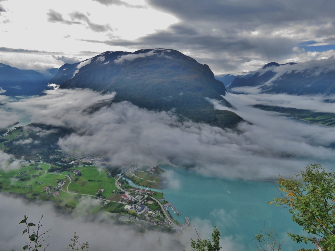
Lodalen Valley
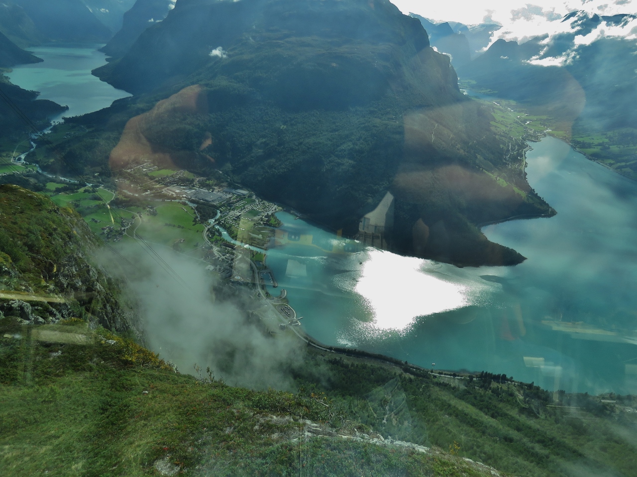
Position: 61°53.10’N, 6°49.96’E
Sweeping view to the Lodalen valley from Hoven restaurant. Dirona is a small white speck at center, just left of the large sun reflection in the water (click image for a larger view).
|
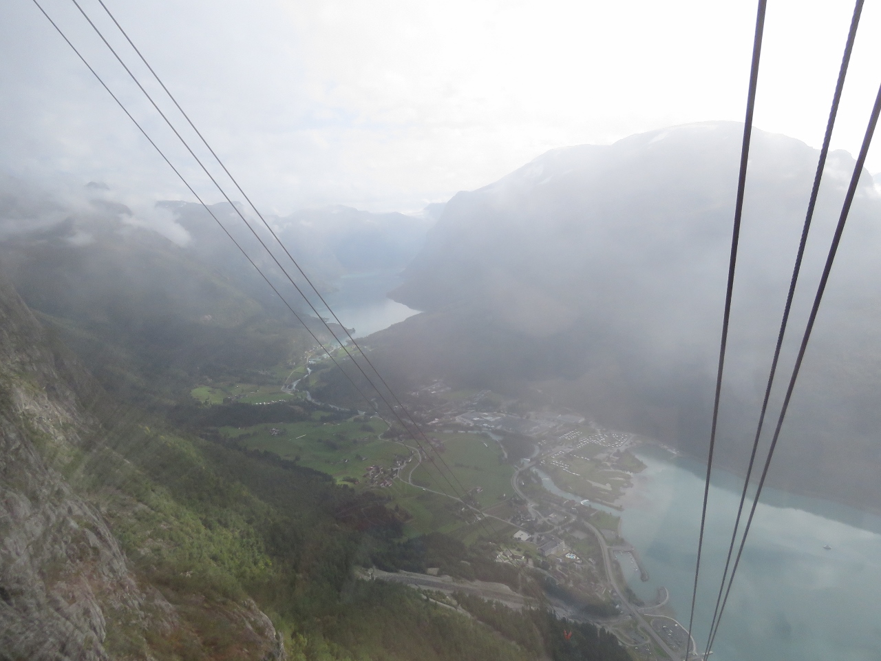 |
Skylift
Position: 61°52.76’N, 6°50.21’E
Looking down to Loen and the Lodalen valley from a Loen Skylift gondola as we descend. The Loen Skylift is one of the steepest in the world, with a maximum gradient of 60 degrees. And it’s all on a single cable run with no supporting towers in between the top and bottom. Impressive engineering.
|
 |
Climbers
Position: 61°52.65’N, 6°50.27’E
Climbers making their way up Via Ferrata Loen on the route we just took. This is not a pastime for those afraid of heights.
|
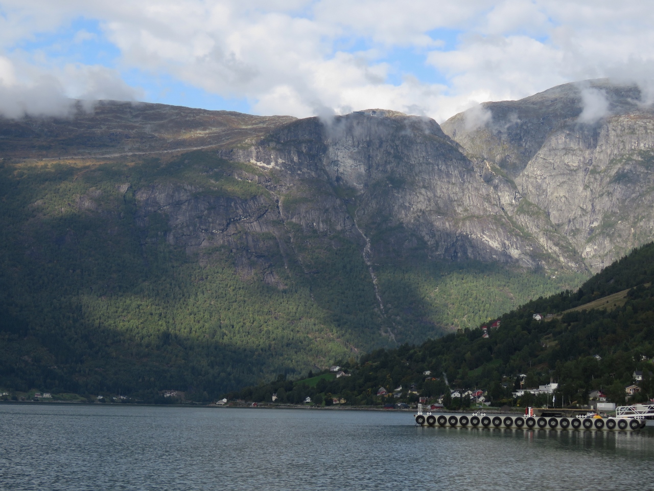 |
Mt Hoven
Position: 61°50.34’N, 6°48.43’E
After returning back to sea level, we ran the tender over to the nearby town of Olden. This is looking back to Mt Hoven en route. Hoven restaurant and the Loen Skylift station are just visible at the top of the hill slightly right of center.
|
 |
Olden
Position: 61°50.11’N, 6°48.30’E
Looking east to the hills above Olden. The town is quiet today, but that will change when the cruise ship Britannia arrives tomorrow.
|
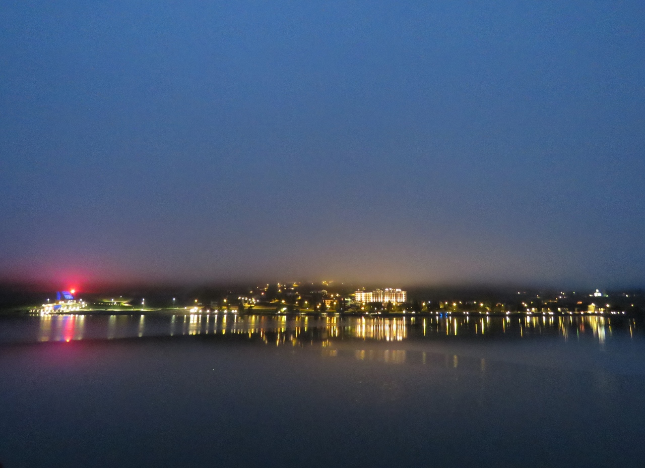 |
Dawn
Position: 61°52.20’N, 6°50.14’E
The lights of Loen reflecting into still waters on a misty dawn at Loen.
|
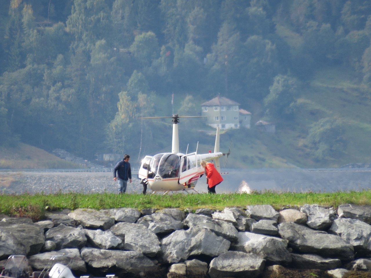 |
Helicopter
Position: 61°52.20’N, 6°50.13’E
The cruise ship Britannia arrived into Olden this morning and we’ve seen a flurry of activity all day, including tour buses, high-speed adventure boats and helicopter rides.
|
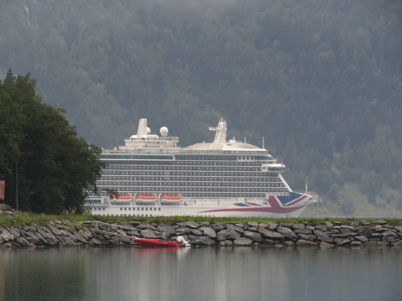 |
Britannia
Position: 61°52.19’N, 6°50.14’E
The 1,083ft (330m) cruise ship Britannia filling the view to our south as the ship departs Olden.
|
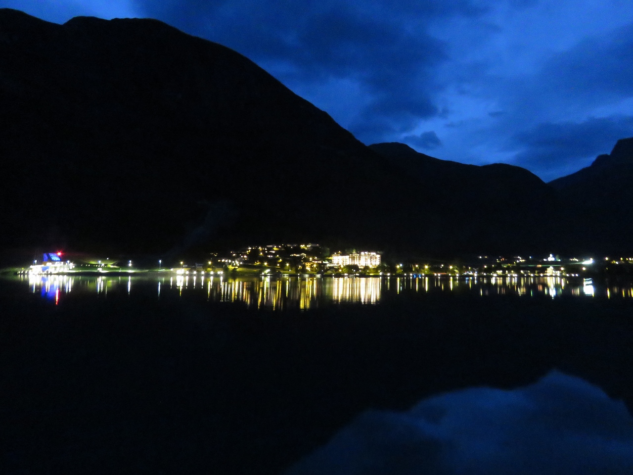 |
Dusk
Position: 61°52.20’N, 6°50.13’E
Ending the day the same way we started—with reflections from the lights of Loen, this time with clear skies.
|

|
Click the travel log icon on the left to see these locations on a map, with the complete log of our cruise.
On the map page, clicking on a camera or text icon will display a picture and/or log entry for that location, and clicking on the smaller icons along the route will display latitude, longitude and other navigation data for that location. And a live map of our current route and most recent log entries always is available at mvdirona.com/maps. |
The photo titled “Dirona” stood out to me as one of the most spectacular shots of many spectacular photos you’ve taken. Terrific.
Whew, the wire bridge looked nerve-wracking, even if you were clipped on.
We were lucky with really great weather. On the bridge, you are 100% right. I was having some serious doubts on the first 1/2 of the way across.
Awesome! One day I’ll do the Via Ferrara too!
Seems like you had a spectacular view and a great adventure.
We did have a great time on the climb. Our normal excuse for doing these big adventures is the view from the top and this one certainly had that. But with a cable car ride available to the top, there certainly are easier ways to do it so we have to admit the climb was part of the fun :-). Worth doing.