The annual Skala Opp race from Loen to the summit of 6,062ft (1,848m) Skala regularly draws over 1,500 participants, and the record for reaching the top is 1 hour and 7 minutes. After a hike of just under four hours, we were pretty tired and couldn’t imagine running up. Whatever pace you choose, the views are spectacular and the record for us of reaching a mile in the sky will likely stand for some time.
Below are trip highlights from September 7th, 2018 on the hike up Skala in Nordfjorden, Norway. Click any image for a larger view, or click the position to view the location on a map. And a live map of our current route and most recent log entries always is available at mvdirona.com/maps
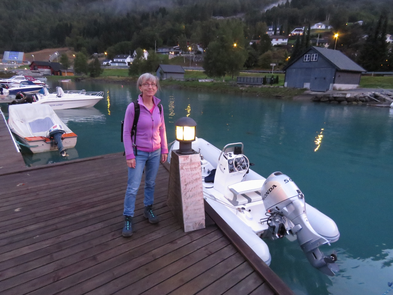 |
Alexandra Marina
Position: 61°52.34’N, 6°50.73’E
The tender tied off at Alexandra Marina at 6:20am as we get an early start for the hike to 6,062ft (1,848m) Skala.
|
 |
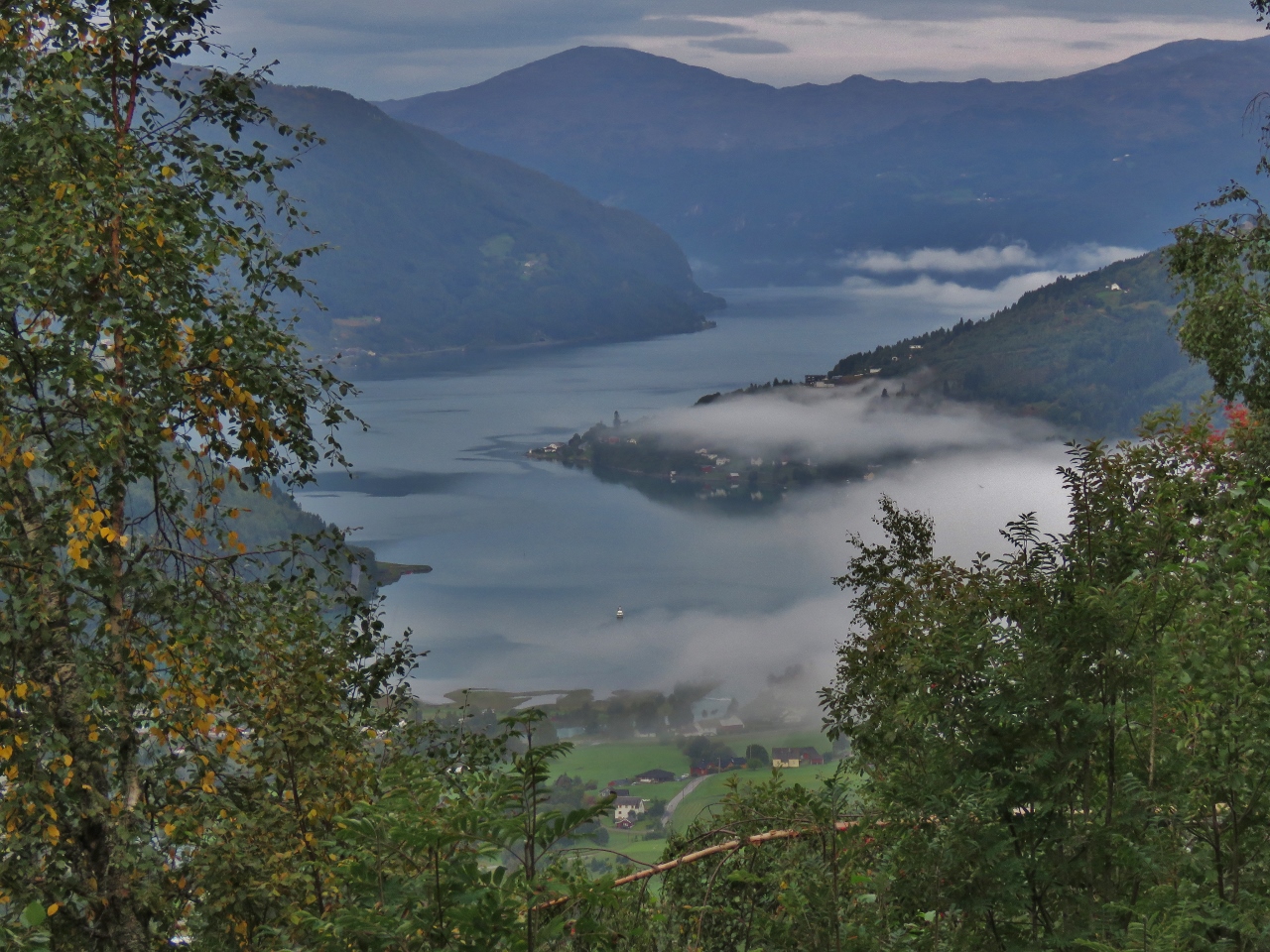
Dirona
Position: 61°52.21’N, 6°51.53’E
View back to the anchorage at the head of Nordfjorden on our way to the Skala trailhead.
|
 |
Goal
Position: 61°52.15’N, 6°51.78’E
Our goal for the day is 6,062ft (1,848m) Skala, the flat-topped mountain left of center.
|
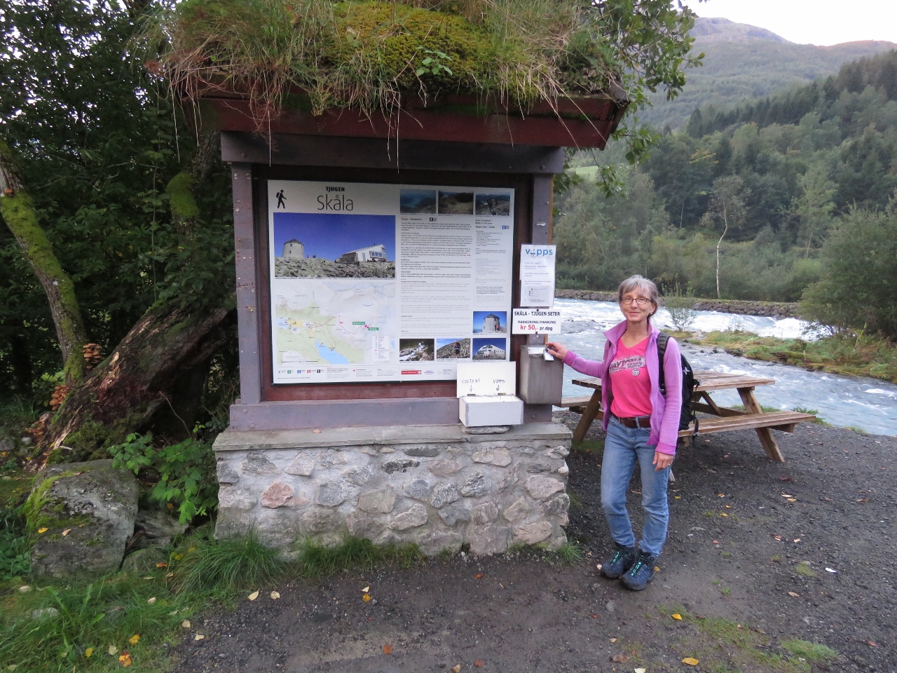 |
Trailhead
Position: 61°52.05’N, 6°53.03’E
A 2km walk from Loen brought us to the Skala trailhead.
|
 |
Nordfjorden
Position: 61°52.19’N, 6°54.02’E
View to Nordfjorden at 1143 ft (348 m).
|
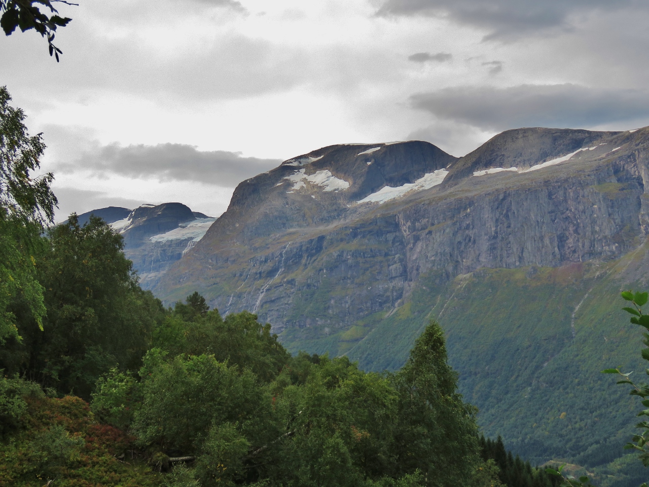 |
Glacier Glimpse
Position: 61°52.26’N, 6°54.23’E
Our first glimpse south to Jostedalsbreen icecap at 1451 ft (442 m). This is the same icecap we saw from the south in May when we were in Fjaerland.
|
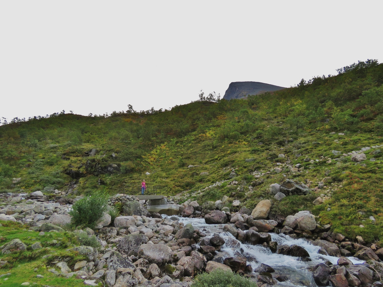 |
Bridge
Position: 61°52.52’N, 6°55.01’E
Jennifer crossing a bridge across the river Fosdola with the tip of Skala visible behind.
|
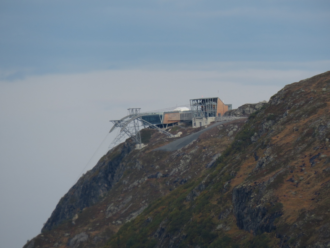 |
Skylift
Position: 61°52.21’N, 6°55.52’E
At 3065 ft (934 m) up, we’re just about at the same level as the Loen Skylift.
|
 |
3478 ft
Position: 61°52.07’N, 6°55.80’E
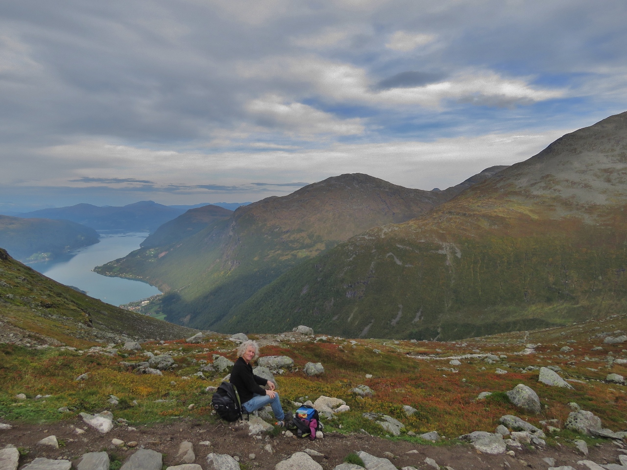
Taking a break at 3478 ft (1060 m). We’re over halfway now—’only’ 2584ft (788m) to go.
|
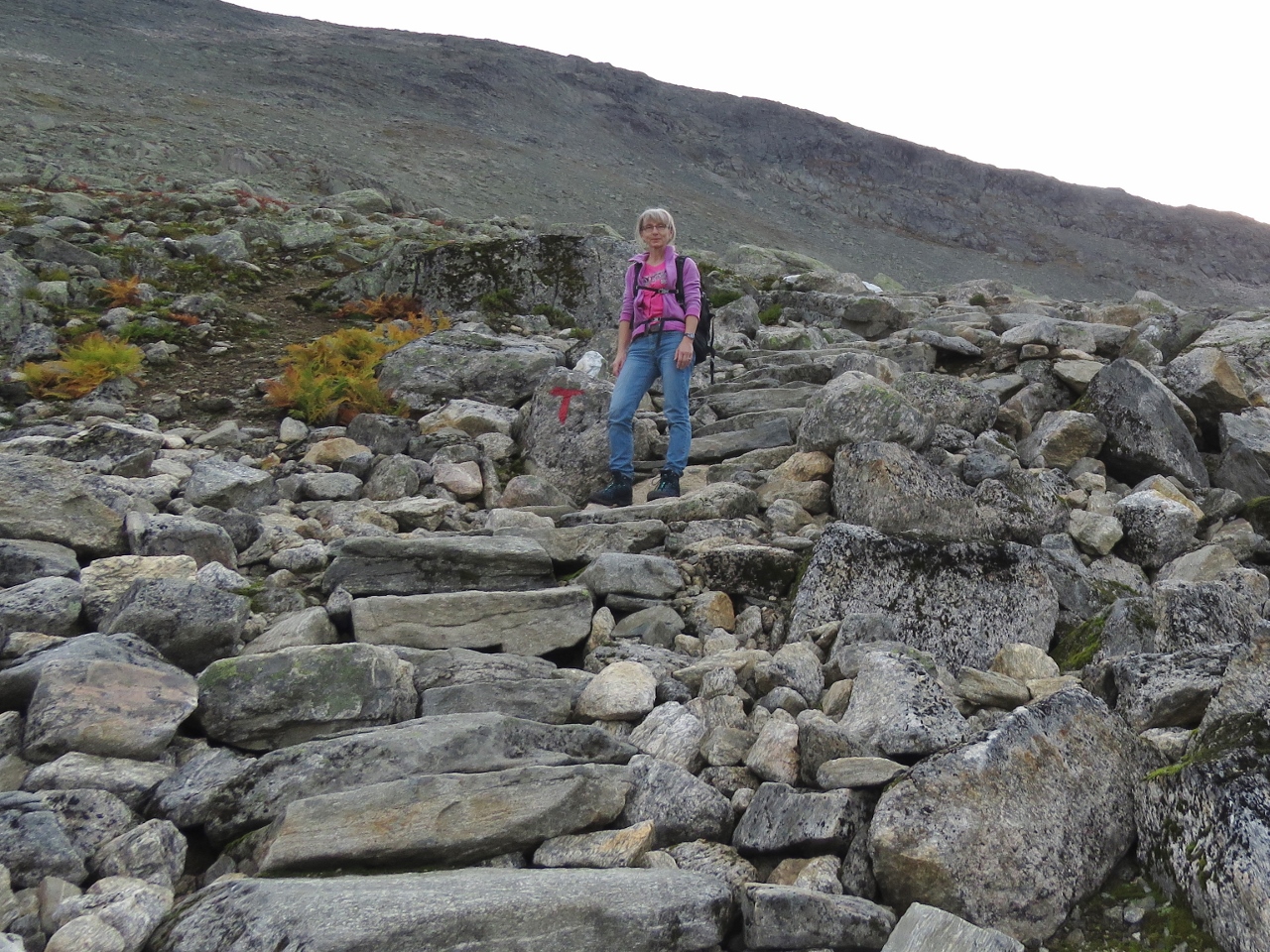 |
Steps
Position: 61°51.88’N, 6°56.36’E
The trail to Skala is beautifully built and maintained by the Norwegian Trekking Association, with stone steps like these ones through much of the steeper sections.
|
 |
Lake
Position: 61°51.79’N, 6°56.69’E
Taking a break at 4265 ft (1300 m). The sun is just starting to hit the small lake at the right of the picture.
|
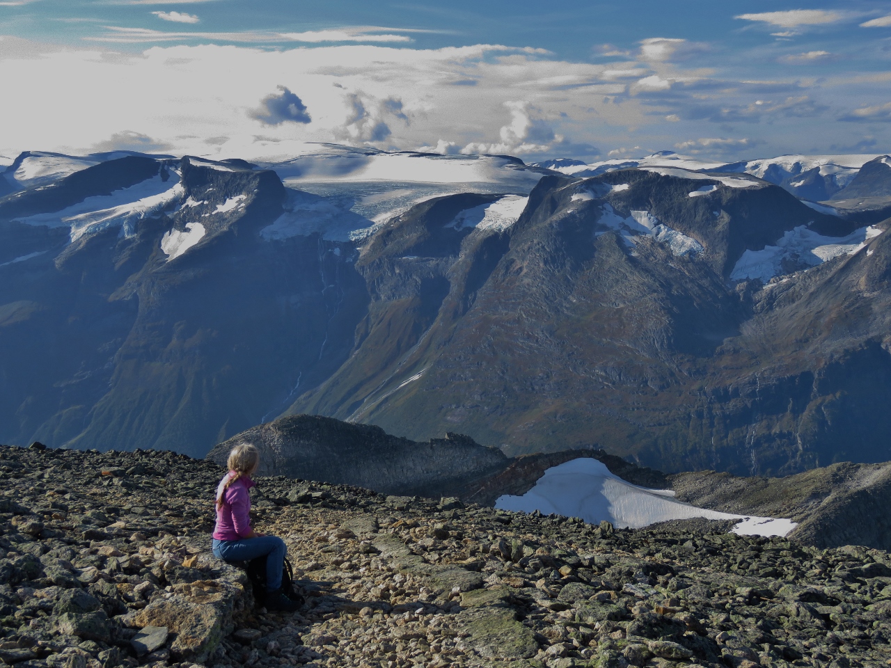 |
5889ft
Position: 61°52.08’N, 6°57.72’E
Enjoying the view south at 5889 ft (1795 m).
|
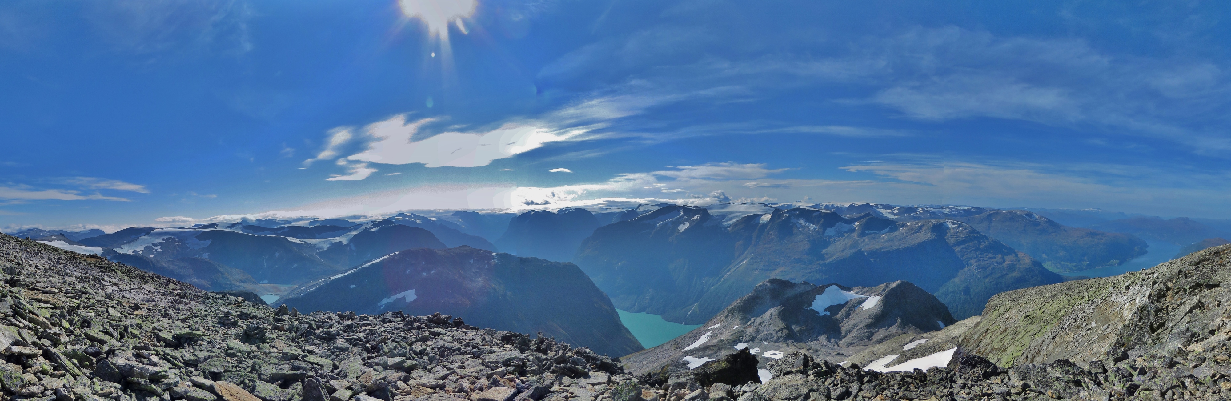 |
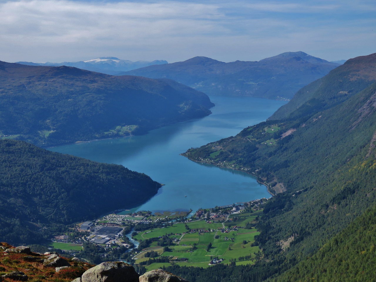
Mile High
Position: 61°52.09’N, 6°57.85’E
The spectacular mile-high view south to Jostedalsbreen icecap from the 6,062 (1848m) summit. Skala is considered Norway’s highest mountain peak that has a foot in a fjord.
|
 |
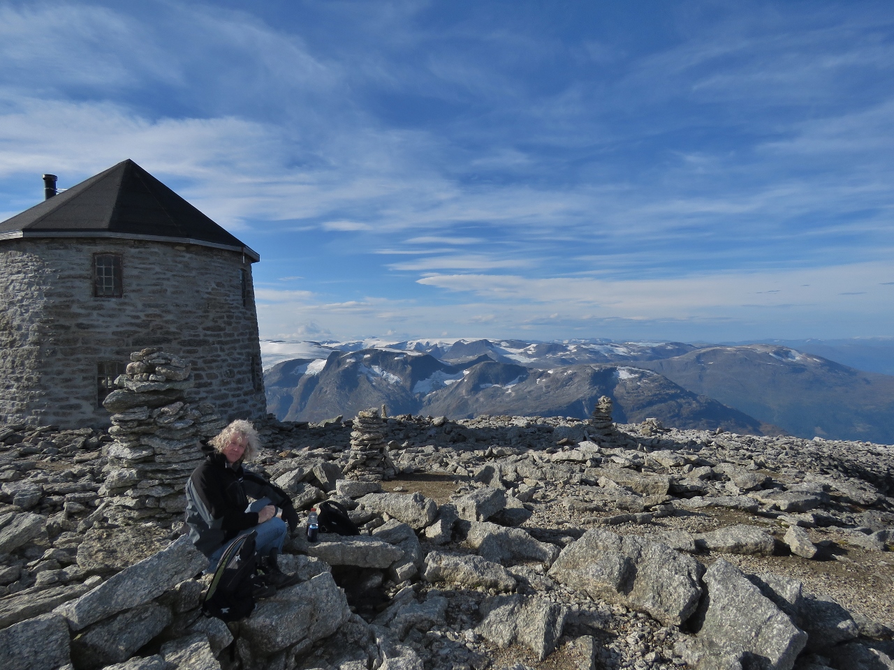
Lunch
Position: 61°52.11’N, 6°57.94’E
Lunch with the cloister tower Skalatartnet in the background and the mountains of Jostedalsbreen glacier in the distance. The tower was built in 1891 to encourage hiking in the area and now is a Norwegian Trekking Association mountain cabin with 20 beds in three floors.
|
 |
Skalatartnet
Position: 61°52.10’N, 6°57.96’E
Warming up inside Skalatartnet.
|
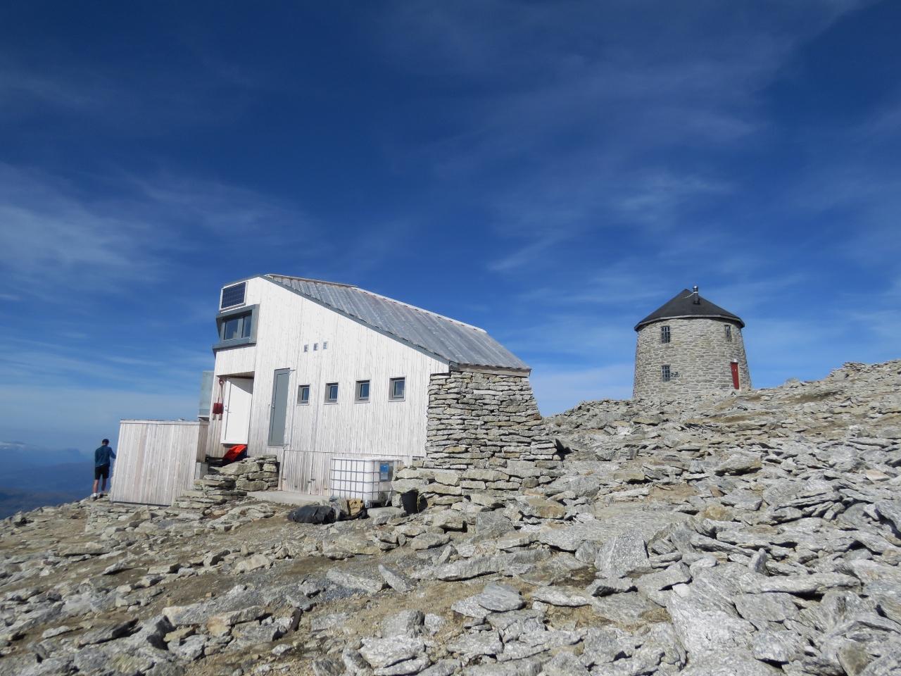 |
Skalabu
Position: 61°52.09’N, 6°57.95’E
The modern Skalabu mountain hut was completed in 2016 and can sleep 20 people. Despite the effort of the climb, or perhaps because of it, the hike up Skala is incredibly popular with over 10,000 people visiting annually. We saw perhaps sixty people on the trail and at the summit and expect a majority will spend the night.
|
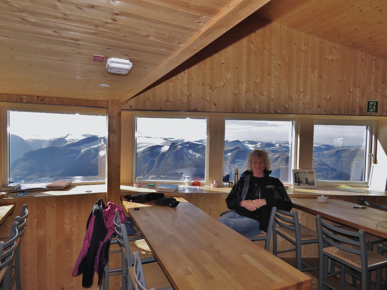 |
Relaxing
Position: 61°52.09’N, 6°57.95’E
Relaxing and enjoying the view south in the beautiful Skalabu mountain cabin before heading returning back down. We’d reached the summit in just under four hours and were pretty tired. We found it hard to imagine running to the top in the annual Skala Opp race from Loen to the summit, which regularly draws over 1,500 participants. The record for reaching the top is 1 hour and 7 minutes. We’ll stick to walking.
|
 |
Nordfjorden
Position: 61°52.34’N, 6°55.48’E
The view to Nordfjorden from 2930 ft (893 m) as we descend.
|
 |
Skala
Position: 61°52.20’N, 6°51.61’E
Looking back to 6,062ft (1,848m) Skala (left) from the road. It’s hard to believe we were actually up there just a few hours earlier.
|
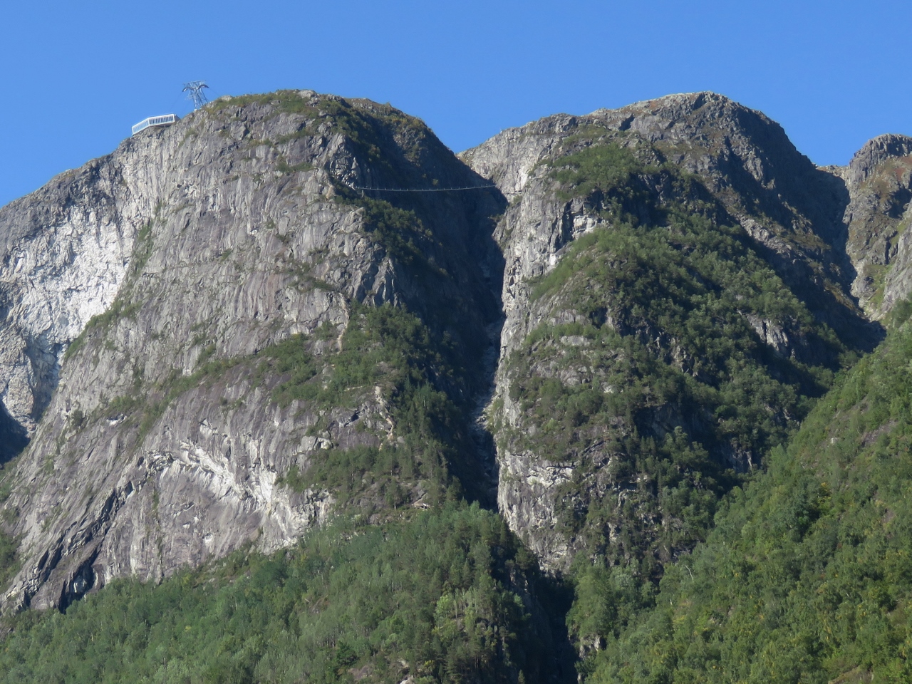 |
Mt. Hoven
Position: 61°52.32’N, 6°51.34’E
The Loen Skylift and Gjolmunne Suspension Bridge viewed from the road back to Loen.
|
 |
Skala Hike Profile
Position: 61°52.20’N, 6°50.14’E
Our hike profile (blue is speed, green is altitude) to 6,062ft (1,848m) Skala isn’t as steep as for 5,131 ft (1564m) Slogen, but is a lot higher and longer.
|

|
Click the travel log icon on the left to see these locations on a map, with the complete log of our cruise.
On the map page, clicking on a camera or text icon will display a picture and/or log entry for that location, and clicking on the smaller icons along the route will display latitude, longitude and other navigation data for that location. And a live map of our current route and most recent log entries always is available at mvdirona.com/maps. |
Wow, some views and lots of rugged terrain to climb. Thanks for sharing those beautiful photos James. It was especially nice to see you and Jennifer still had good weather, and visibility, at the summit as conditions really can change in a hurry at high elevations.
We’ve been very lucky on the weather for the big hikes but now that we’re starting to watch for some good weather for passage south to Denmark, you can definitely tell that winter is descending on the North Atlantic. Lots of weather systems out there.