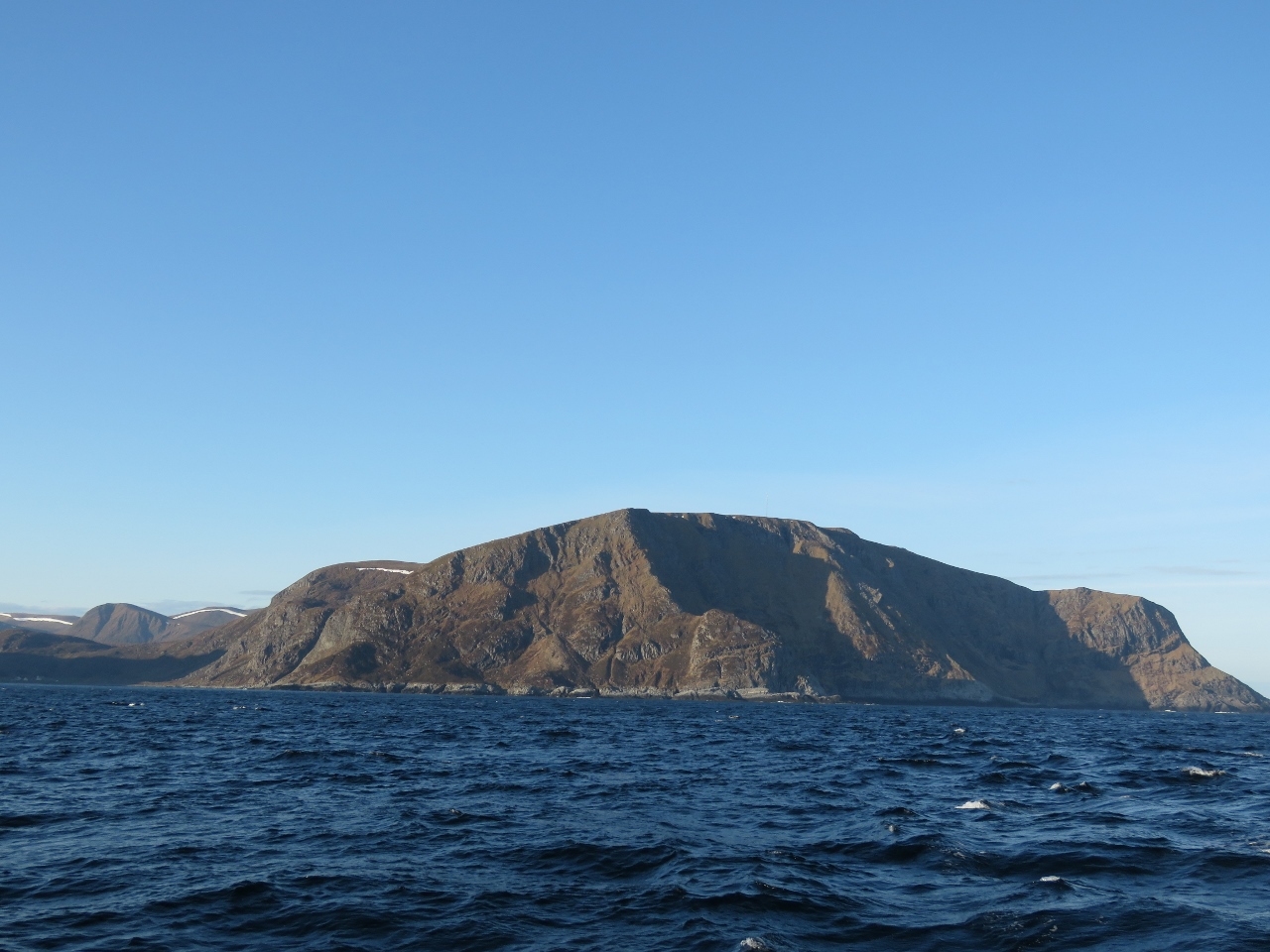
Stad, a headland on Norway’s southwest coast, is one of 24 areas listed in the Norwegian Coastal Pilot as likely to have rough seas in certain wind and tide conditions. Stad is considered the worst and is so notorious for dangerous conditions that an escort service is provided for small boats and funds have been approved to build the world’s first full-scale ship tunnel through the headland. The tunnel will be just under a mile long, 120ft (37m) high and 87ft (26.5m) wide, large enough for the Hurtigruten ferries the ply the coast. Too bad the tunnel hasn’t been built yet—that would certainly be a first for Dirona to pass through a tunnel for ships.
From Fjærland, we continued north along Norway’s sheltered inner lead to Stad, where we made our first offshore run since arriving in Norway two weeks earlier. Stad reminded us very much of Brooks Penninsula off the West Coast of British Columbia Canada, also famous for rough conditions. We made our first Hurtigruten spotting as we rounded the headland in calm seas and continued offshore before rejoining the inner lead at day’s end to follow it north to the island of Torget.
Below are trip highlights from through May 10th through 14th, 2018 in western Norway. Click any image for a larger view, or click the position to view the location on a map. And a live map of our current route and most recent log entries always is available at mvdirona.com/maps
 |
Fjærland
Position: 6 44.53, 61 24.25
A last look to Fjærland as we depart just before 5am. Another pleasure craft arrived overnight and was on the dock when we got up.
|
 |
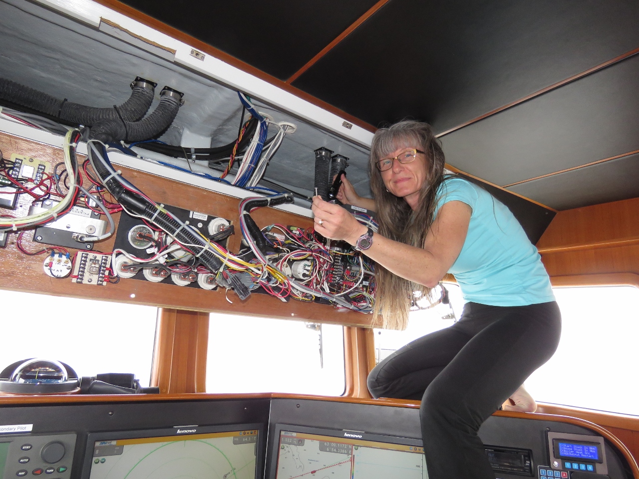
Raw Water Pump
Position: 5 37.88, 61 6.31
The generator raw water pump was dripping saltwater at the shaft seal so we replaced it with a spare (pictured).
|
 |
Overcast
Position: 5 4.31, 61 9.78
Even in overcast conditions, the Norway scenery is dramatic.
|
 |
Farthest North
Position: 4 55.72, 61 16.84
The green line in the chart represents the farthest north Dirona has ever been before arriving in Norway: 61°16′ while in Prince William Sound, Alaska. We crossed above that line when we were in Fjærland, then passed back south of it again this morning. We just crossed north of it again and it won’t be back south of the line for several months.
|
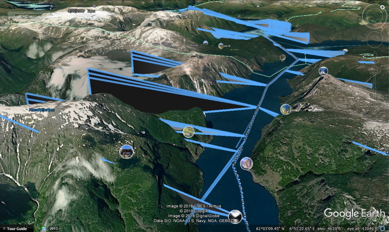 |
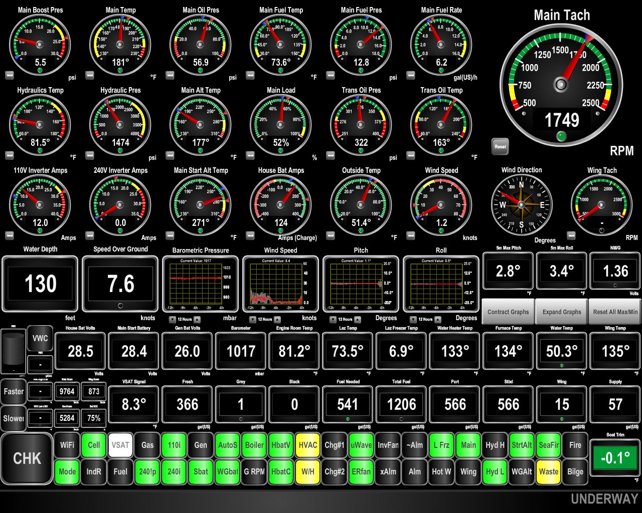
KVH Coverage
Position: 5 7.77, 61 18.32
As we near the Arctic Circle the angle of elevation to the geosynchronous satellites used by KVH to deliver us internet access gets lower and lower in the sky. Aurlandsfjord has high mountains right near the water and we saw several outages that seemed unusual. We asked KVH about it, and with our permission they investigated our exact boat locations and path and sent us a super-interesting Google Earth plot of Dirona moving through the Aurlandsfjord. The plot is annotated with the satellites we were contacting, showing when we had coverage and when we had blockage.
In the screenshot, the blue-edged black triangles represent the beam of our satellite antenna. When they intersect with a mountain, our signal is blocked. Looking closely, it’s amazing we were so frequently connected especially when you consider that the satellites are all directly above the earth’s equator. One of the strengths of the KVH V7hts mini-VSAT system is that, even this far north, there are often multiple satellites available in different parts of the sky. There is often coverage in even very unlikely places like a predominately east/west Norwegian fjord. |
 |
Strokehavet
Position: 5 7.74, 61 18.33
We awoke to a misty morning after a peaceful night anchored in Strokehavet, a sheltered cove across Vilnesfjord from Askvoll.
|
 |
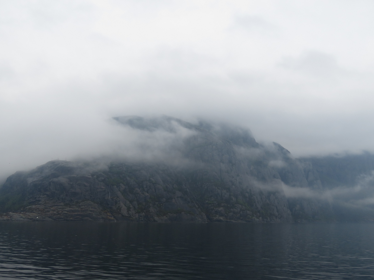
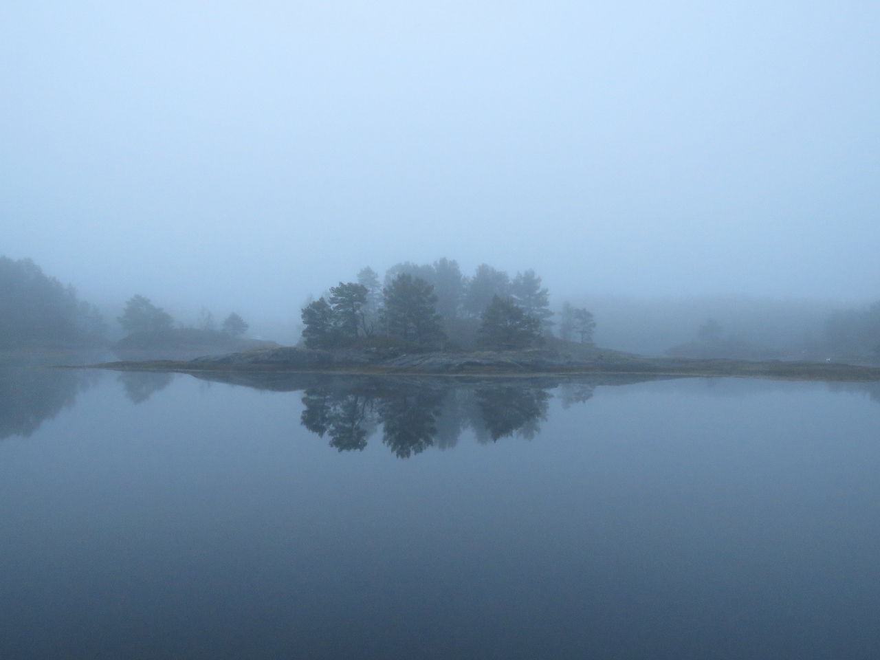
Fog
Position: 5 4.52, 61 19.24
The mist at Strokehavet gave way to a thick fog just outside in Vilnesfjord.
|
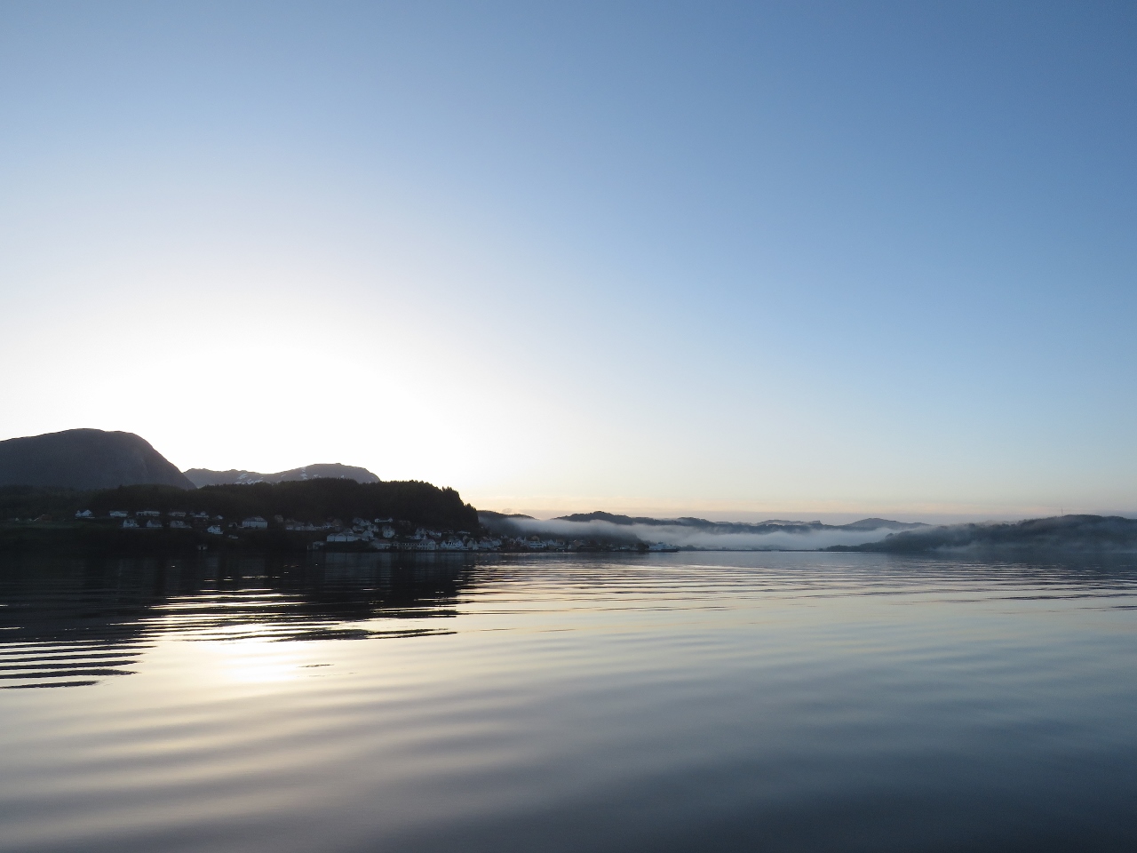 |
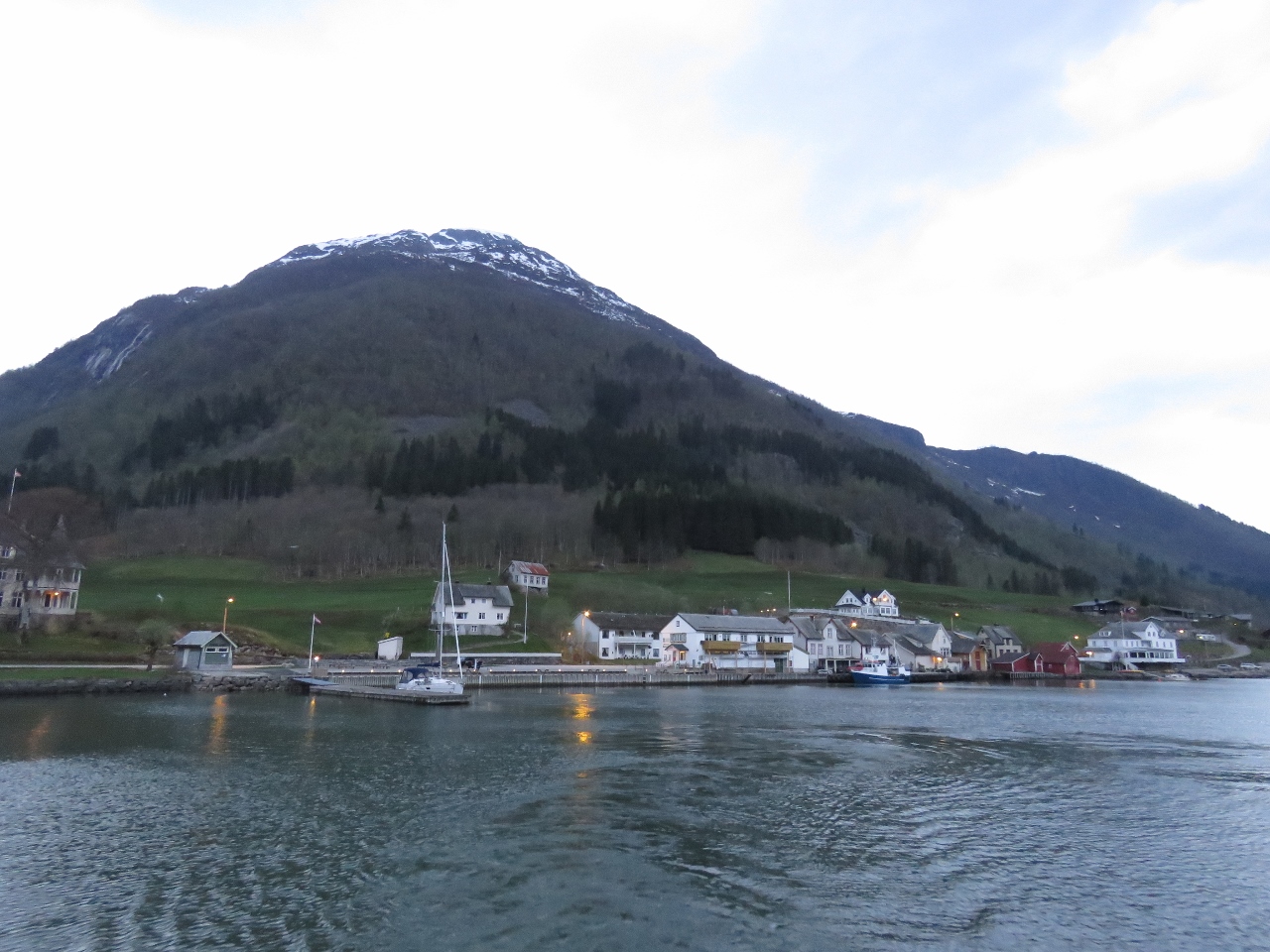
Askvoll
Position: 5 2.37, 61 20.71
The fog lifted once we left Vilnesfjord and we got a nice view to the town of Askvoll in the morning light.
|
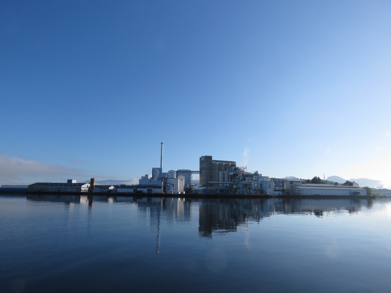 |
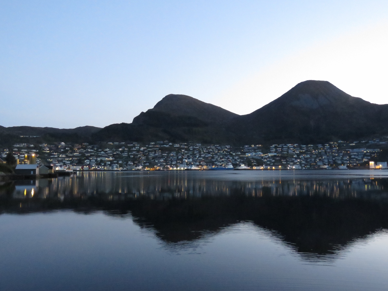
Florø
Position: 4 59.91, 61 34.97
We passed through a narrow channel off the end of Florø’s airport toward this large fish processing facility. Florø, with a population of 11,000, is Norway’s westernmost town.
|
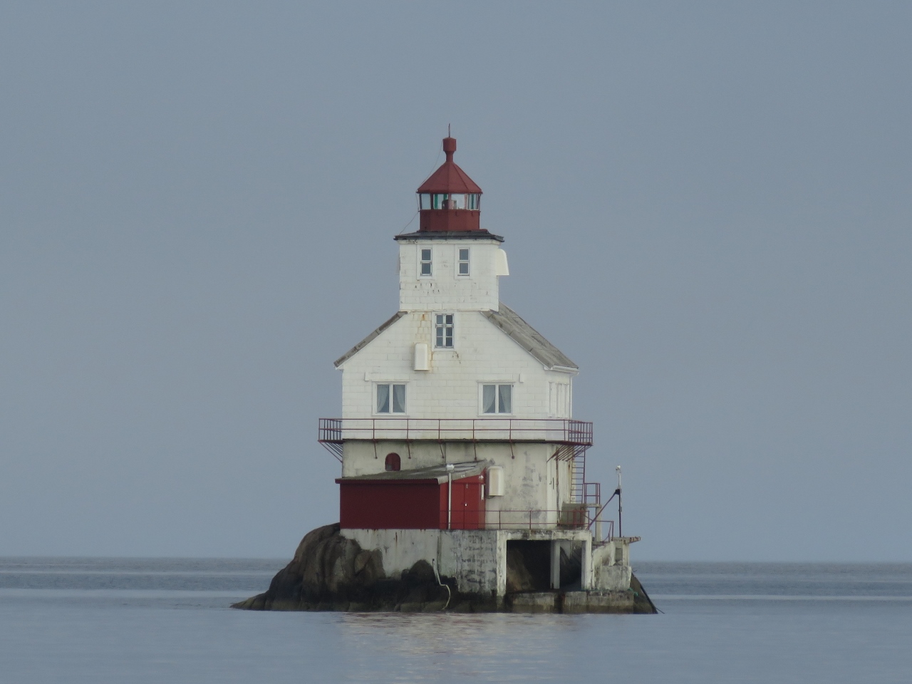 |
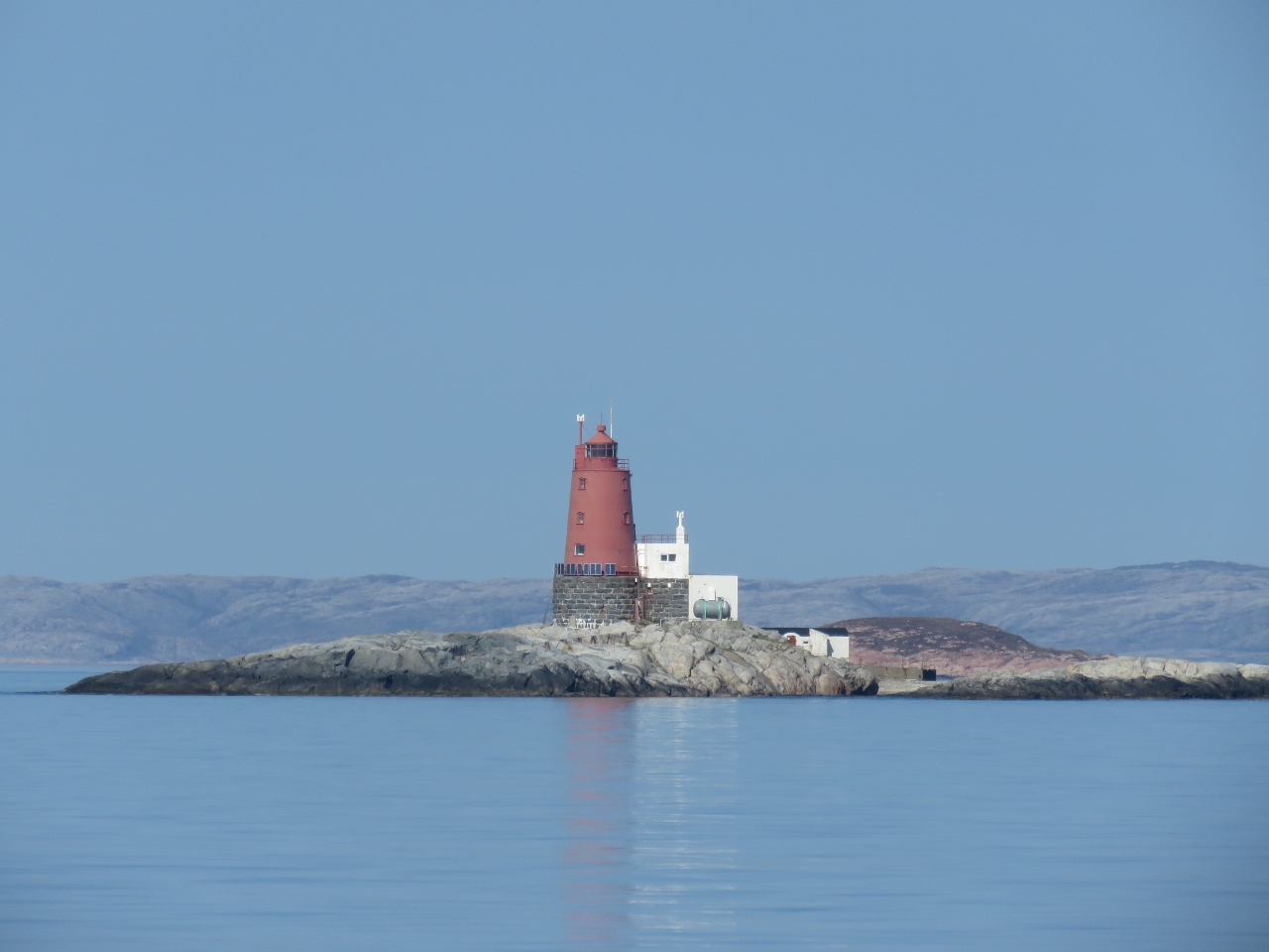
Stabben Lighthouse
Position: 4 57.72, 61 35.84
Stabben Lighthouse near Florø, established in 1867, perched almost impossibly upon a minuscule 3,200 sq ft (300 sq m) islet.
|
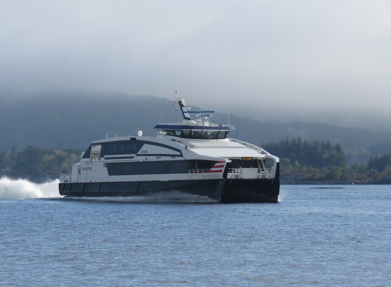 |
Njord
Position: 4 58.99, 61 38.04
The fast ferry Njord making 32.5 knots en route to Bergen.
|
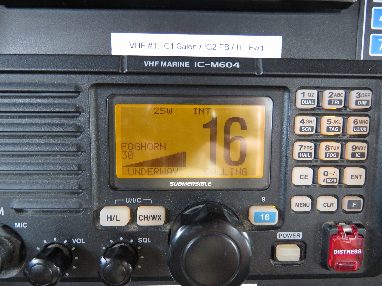 |
Foghorn
Position: 4 56.64, 61 42.70
We’re back in deep fog and are sounding the foghorn again. We replaced the foghorn loudhailer in Harlingen.
|
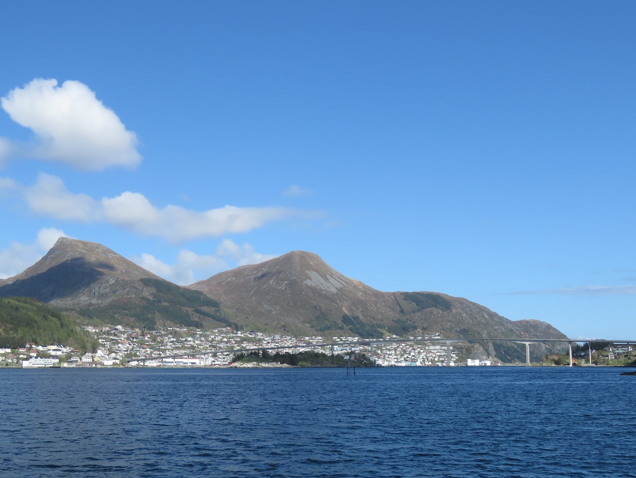 |
Måløy
Position: 5 7.23, 61 55.09
Approaching the town of Måløy. The winds are forecast to come up this afternoon, but settle down overnight. So we’ll anchor for the night in Deknepollen, with a view to Måløy, to stage for an offshore run past the Stad headland tomorrow morning. Stad is notorious for bad weather and rough conditions, so we want calm weather to round it.
|
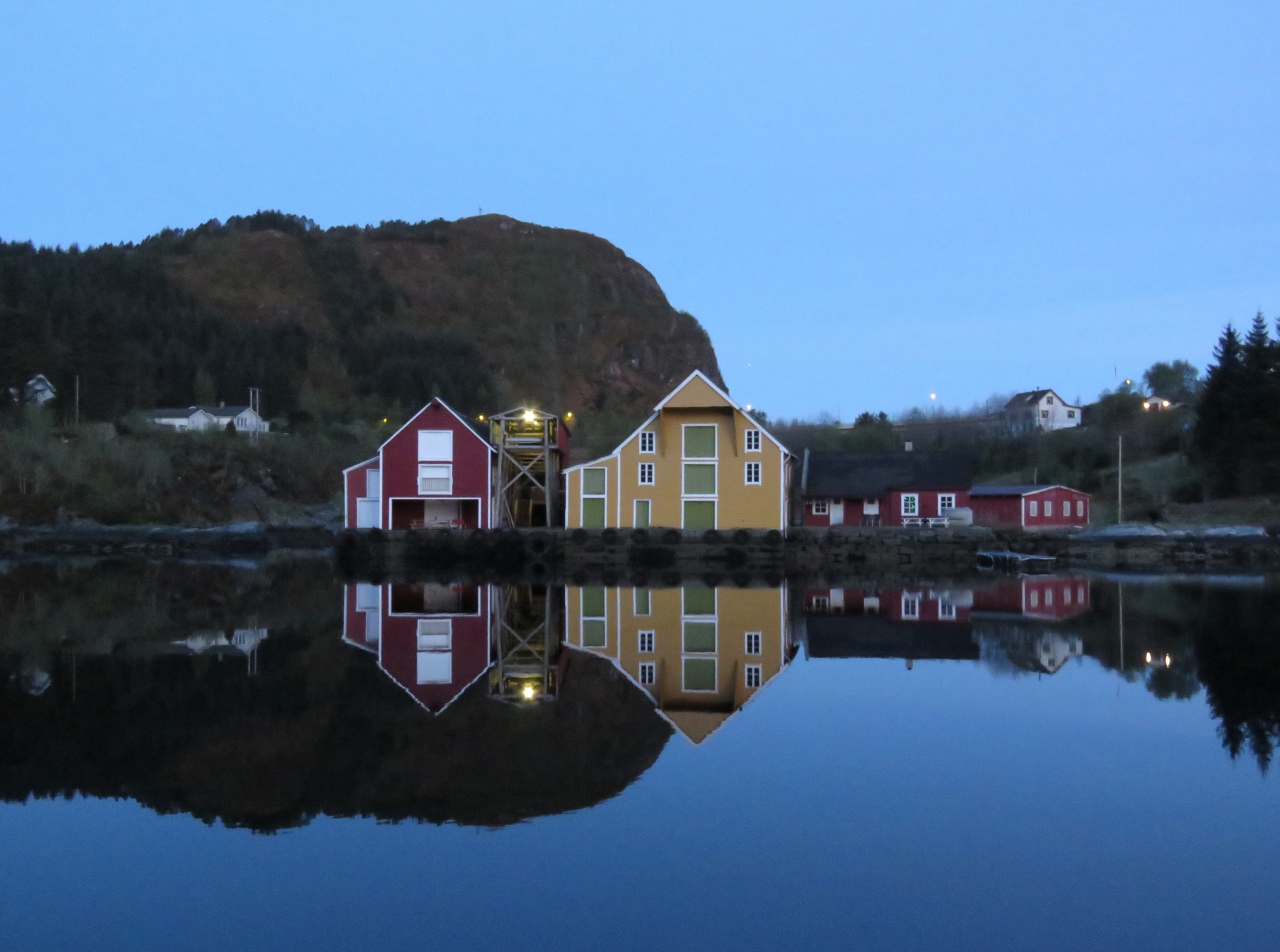 |
Dawn
Position: 5 8.11, 61 55.83
We’re up at 4am to take advantage of the calm weather to round Stad. It’s a lovely calm dawn here in Deknepollen. The sun is just cresting the horizon, so we’d have to get up a little earlier to actually see the sunrise.
|
 |
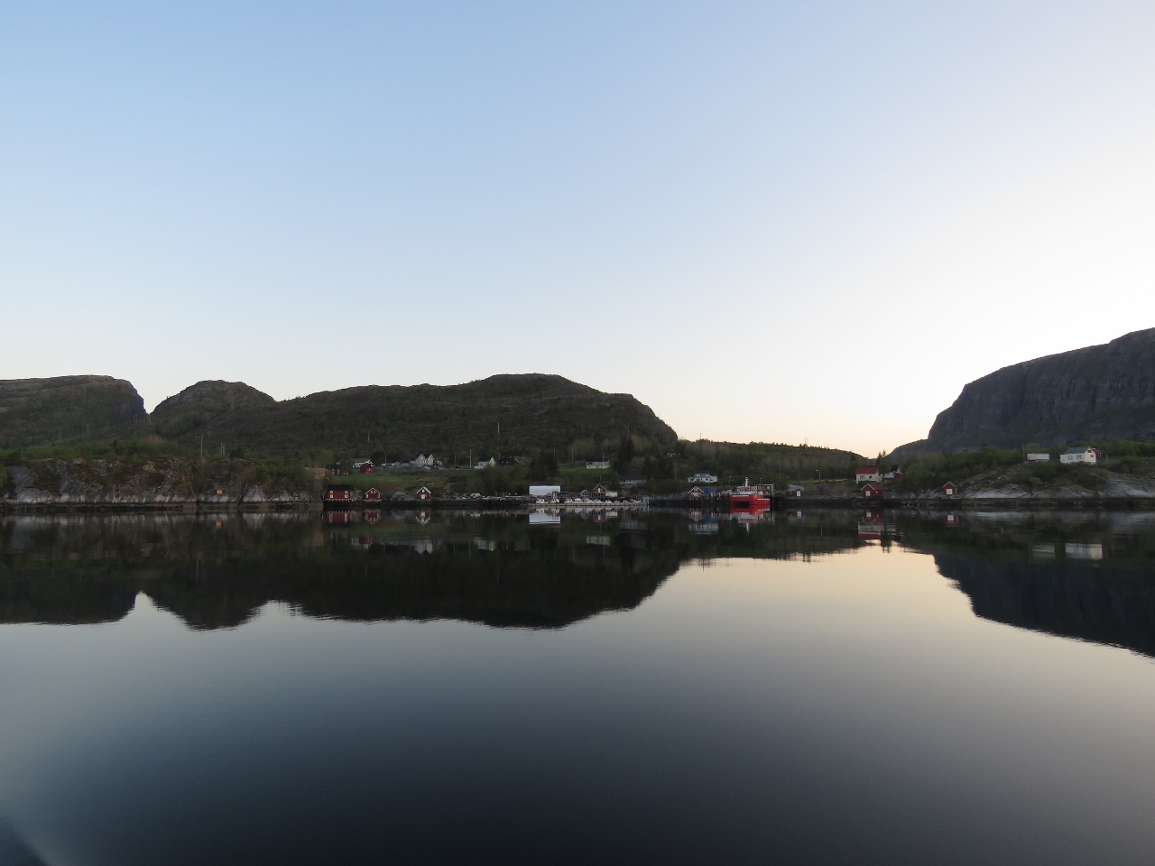
Måløy
Position: 5 8.11, 61 55.83
Måløy glowing in the early morning light as we get underway.
|
 |
Calm
Position: 5 9.17, 62 1.50
The wind is blowing 1.2 knots—perfect for rounding Stad.
|
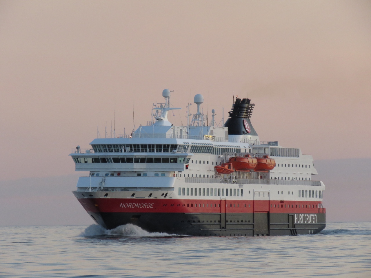 |
Hurtigruten
Position: 5 9.17, 62 1.50
The Hurtigruten (meaning ‘Express Route’) is a system of coastal ferries, founded in 1893, that run between Bergen and Kirkenes in far northeastern Norway. The Nordnorge Hurtigruten was rounding Stad heading south as we approached.
|
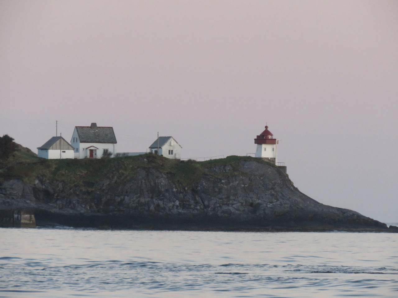 |
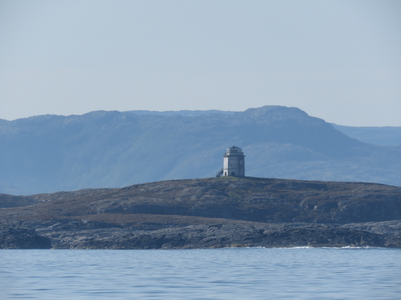
Skongsneset Lighthouse
Position: 5 9.06, 62 1.74
The Skongsneset Lighthouse to our west.
|
 |
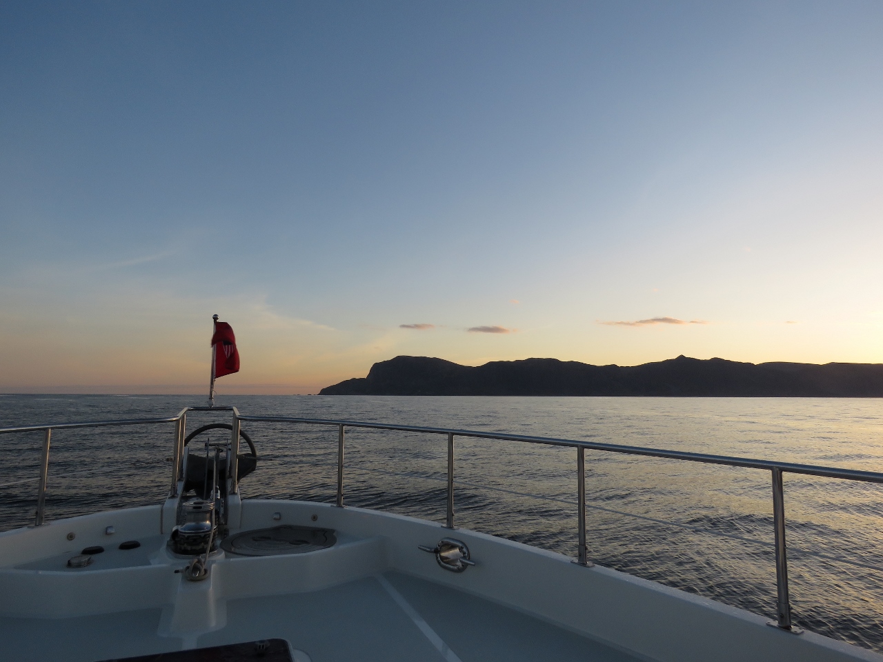
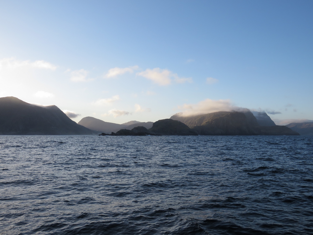
Stad
Position: 5 7.85, 62 3.28
Stad, visible in the distance, is one of 24 areas the Norwegian Coastal Pilot lists as likely to have rough seas in certain wind and tide conditions. Stad itself is so notorious for dangerous conditions that an escort service is provided for small boats and funds have been approved to build a ship tunnel through the headland that will be large enough for the Hurtigruten ferries. Too bad the tunnel hasn’t been built yet—that would certainly be a first for Dirona to pass through a tunnel.
|
 |
Sunbeams
Position: 5 3.75, 62 8.92
Sunbeams shining through the southwest tip of Stad.
|
 |
Partway
Position: 5 3.66, 62 10.32
Looking back to Stad partway around.
|
 |
Around
Position: 5 8.17, 62 13.59
We’re all the way around now. Conditions remained wonderfully calm the entire run.
|
 |
Screw
Position: 6 55.64, 62 59.35
Since Dirona was delivered, we’ve heard something rolling around above the helm and haven’t been able to find it. It’s usually noticeable only in rough conditions and we haven’t been motivated to open up the overhead panel to look for it then. Even though conditions are quite calm today, we could hear it, so we opened up the panel and finally found it: a large screw.
|
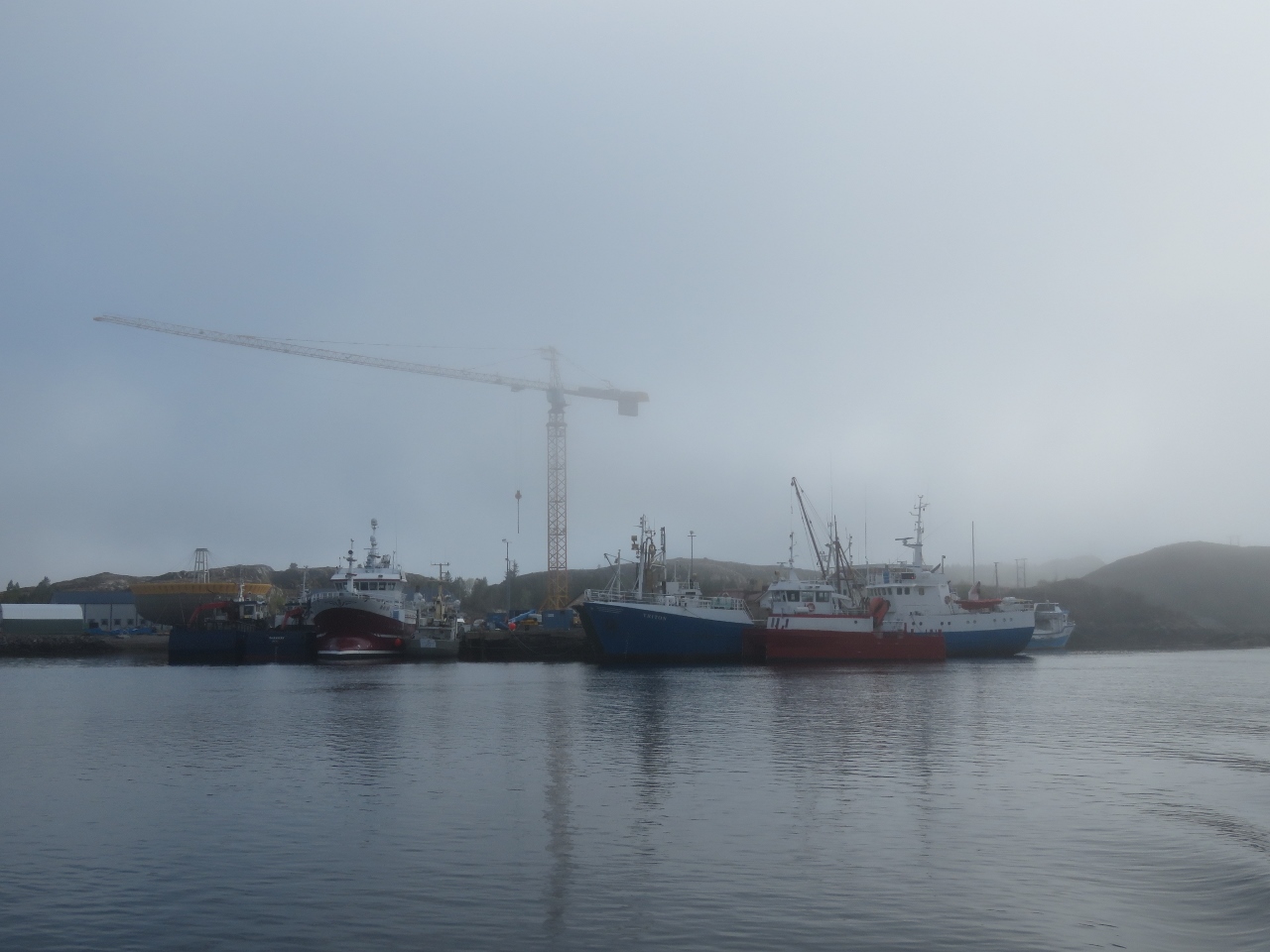 |
Langøysundet
Position: 7 26.63, 63 3.22
With a forecast for light winds the entire day, we continued offshore to pass another dangerous coastal area, Hustadivika. We returned inshore through Langøysundet in thick fog that just started to lift as we passed these fish boats.
|
 |
Ellingvåagen
Position: 7 28.70, 63 3.46
We anchored for the night in tranquil Ellingvåagen, where some locals came over to chat.
|
 |
Sunrise
Position: 7 28.68, 63 3.46
A beatuiful sunrise over the anchorage at Ellingvåagen. It’s great to be able to get underway early and not have to work in the dark.
|
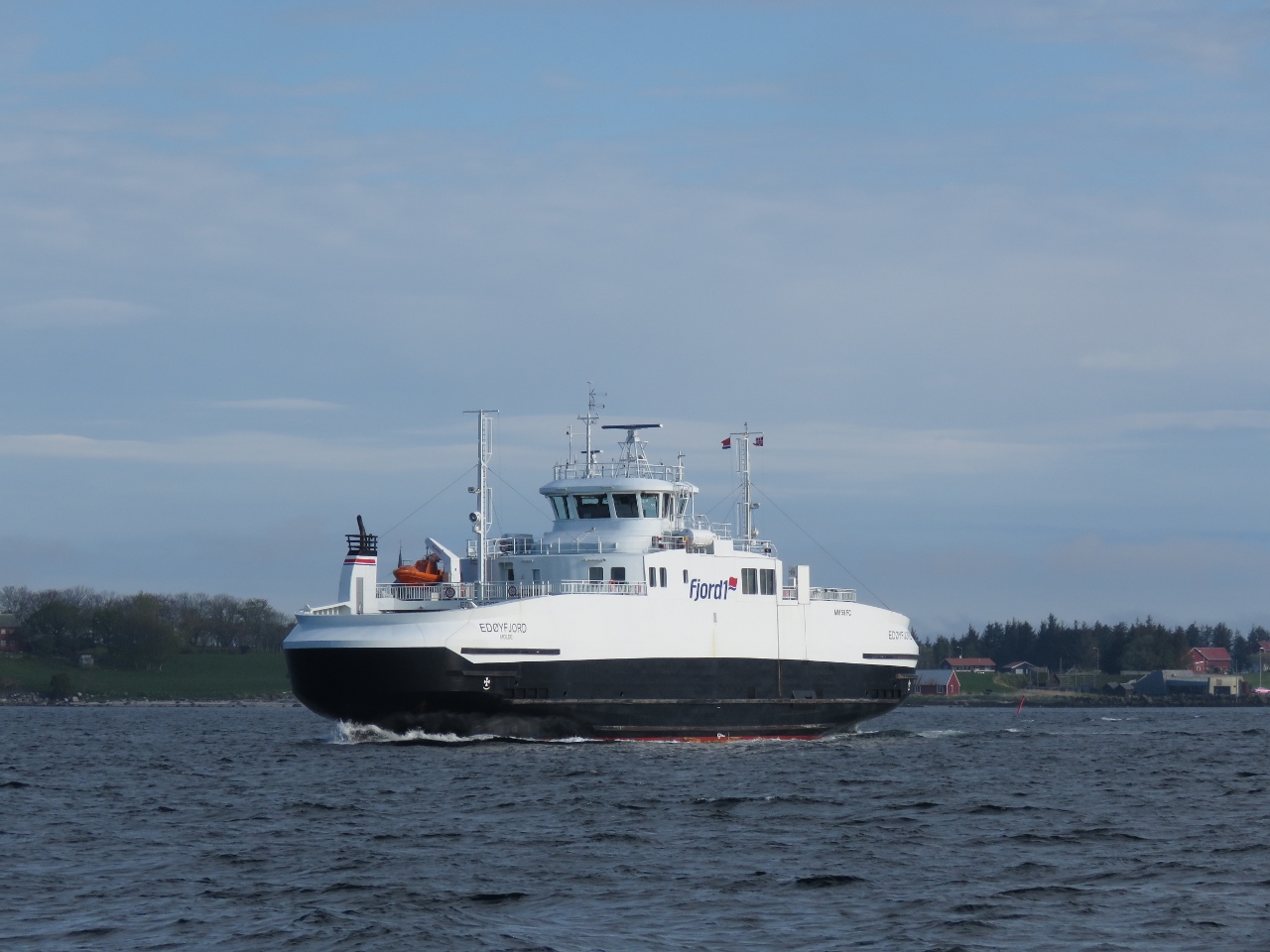 |
Edøyfjord
Position: 8 8.50, 63 16.48
This ferry Edøyfjord serves the route between Edøya-Sandvika and Smøla.
|
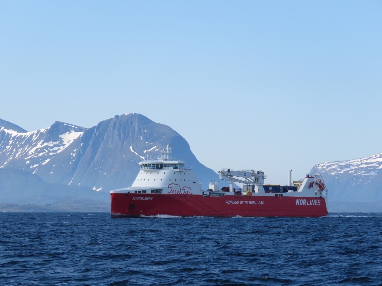 |
Kvitbjørn
Position: 8 16.57, 63 19.51
We’re seeing lots of traffic as we near Trondheim, Norway’s third-largest city. This is the LNG-powered cargo vessel Kvitbjørn (translated as “White Bear”), launched in 2015.
|
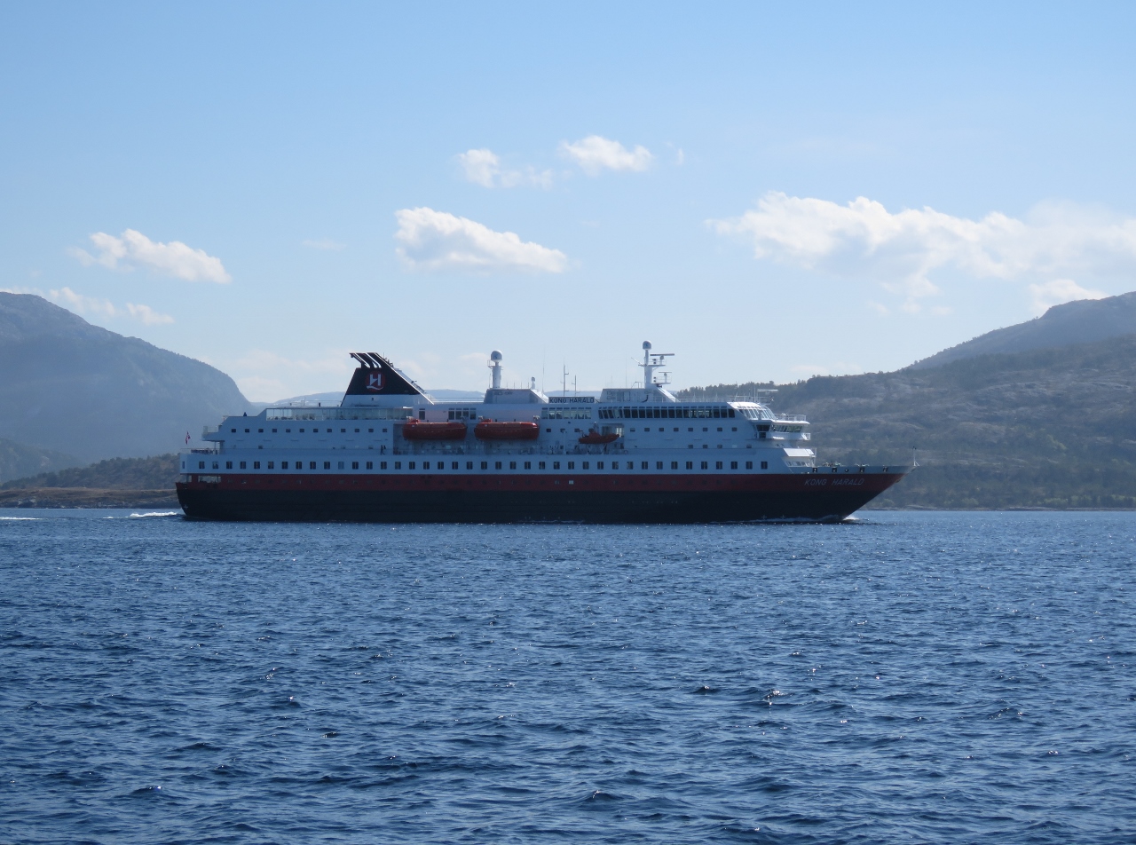 |
Kong Harald
Position: 8 30.35, 63 22.97
The Hurtigruten ferry Kong Harald running south.
|
 |
Tjeungskjær
Position: 9 32.11, 63 43.57
Tjeungskjær, built in 1880, near the approach to Trondheim. The light is not lit between May 16 and July 21 every year due to the midnight sun
|
 |
Linesøya
Position: 9 55.75, 64 0.11
We anchored for the night in calm conditions off the south end of the island of Linesøya.
|
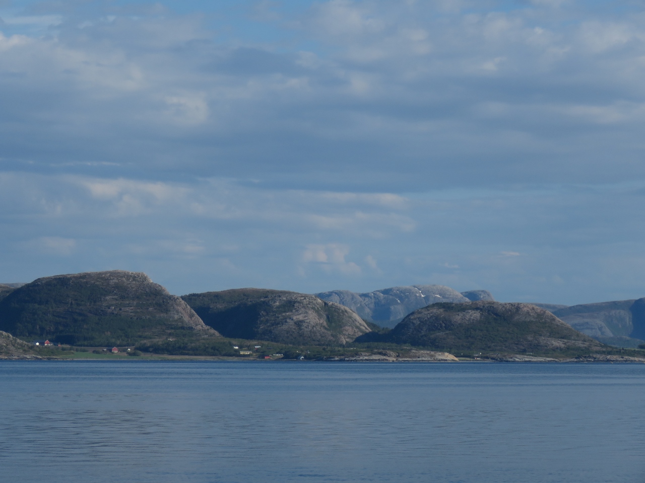 |
Mainland
Position: 9 55.75, 64 0.11
The view southeast to the mainland mountains from the anchorage at Linesøya.
|
 |
Sunrise
Position: 8 30.35, 63 22.97
A 4am sunrise from the anchorage at Linesøya.
|
 |
Stokknes
Position: 10 3.04, 64 2.90
The village of Stokknes reflected into still waters in the early morning light.
|
 |
Orca
Position: 10 18.53, 64 15.01
We were very excited to see a small pod of Orcas, including a baby, travelling north past the village of Bessaker.
|
 |
Villa Lighthouse
Position: 10 41.11, 64 34.38
The old coal-fired lighthouse on the island of Villa was in operation from 1839 to 1890.
|
 |
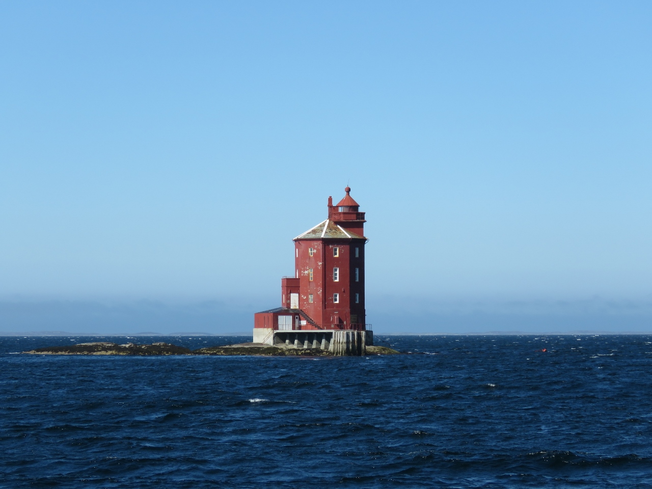
Gjeslingene Lighthouse
Position: 11 0.12, 64 44.59
The Gjeslingene Lighthouse south of Rørvik was established in 1877.
|
 |
Modern Houses
Position: 11 11.94, 64 50.48
The town of Rørvik has some beautiful modern houses perched above the water.
|
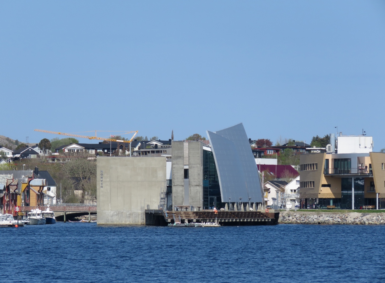 |
NORVEG
Position: 11 14.23, 64 51.35
The sail-form roof structure of NORVEG, a cultural center and museum of coastal life that opened in 2004.
|
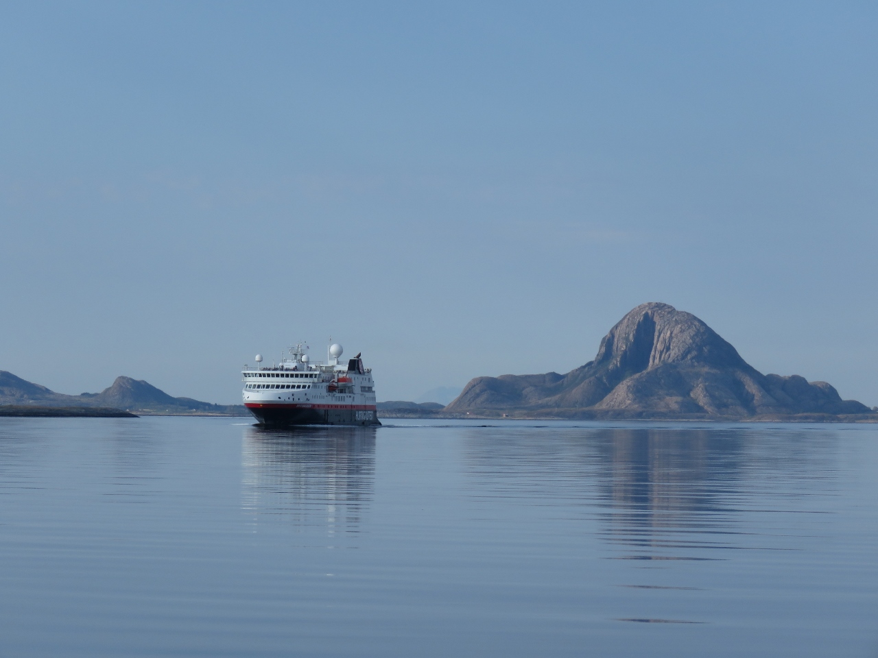 |
Spitsbergen
Position: 12 1.58, 65 19.90
The Hurtigruten ferry Spitsbergen south of the island of Torget.
|
 |
Torghatten
Position: 12 1.84, 65 22.46
Torghatten is a famous landmark in Norway due the hole through right through the mountain. We plan to hike through the hole tomorrow.
|
 |
Spitfire
Position: 12 1.75, 65 22.96
Spitfire enjoying the calm anchorage off the island of Torget with Torghatten visible in the distance.
|
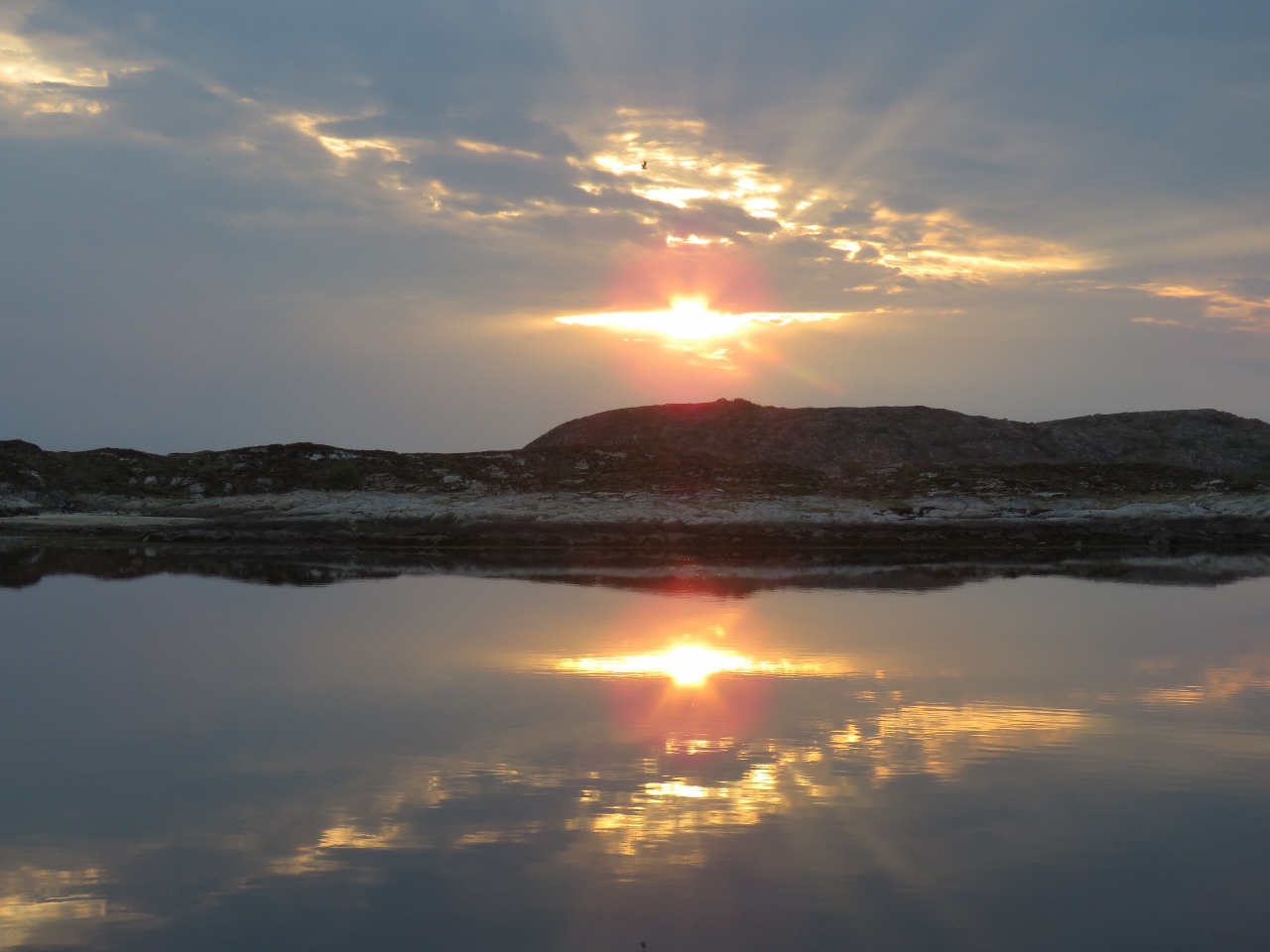 |
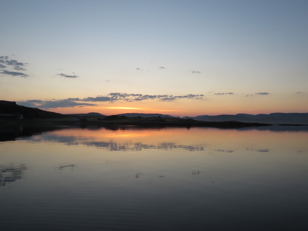
Sunset
Position: 12 1.75, 65 22.96
9:23pm sunset off the island of Torget.
|
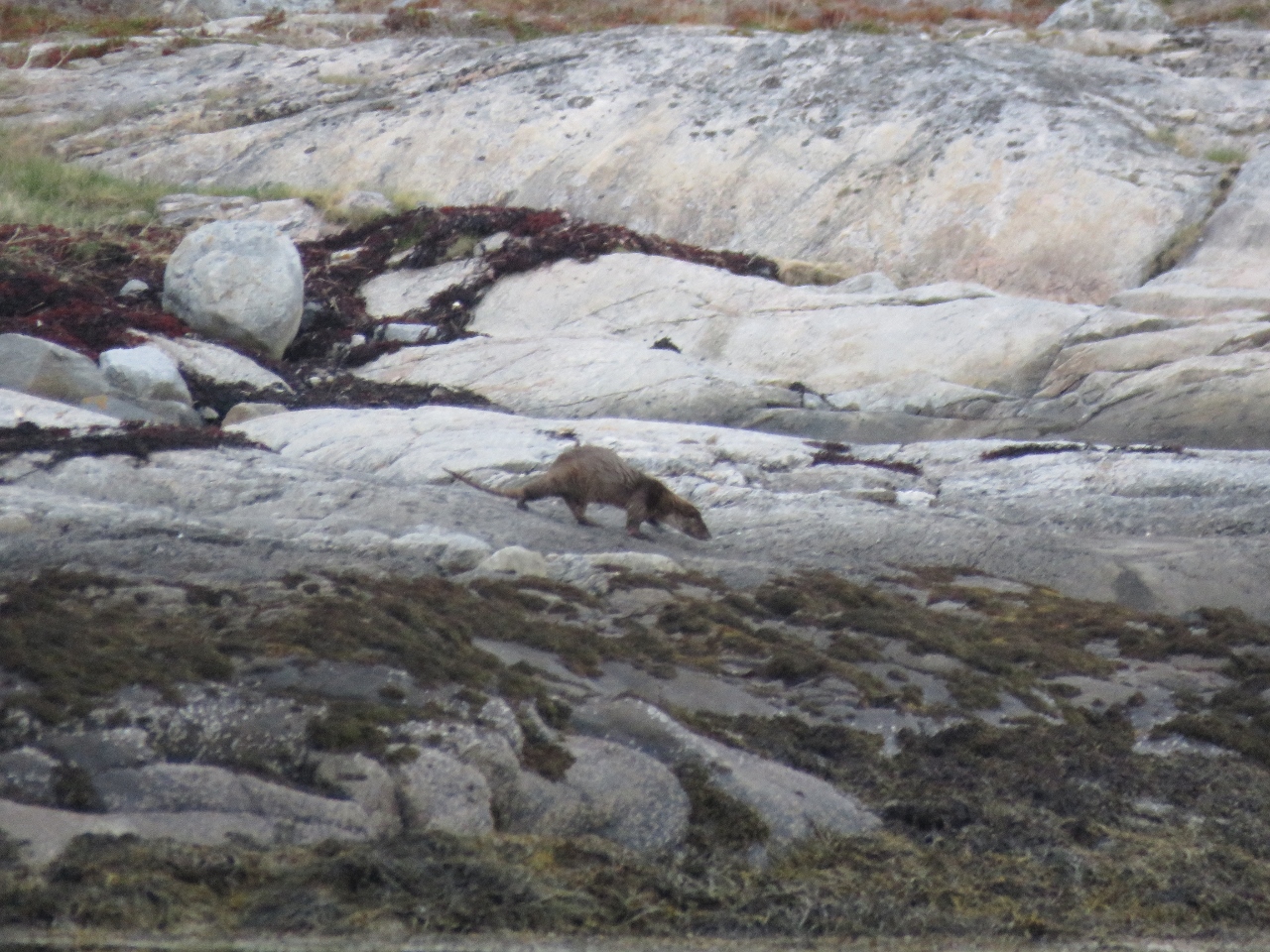 |
Otter
Position: 12 1.75, 65 22.96
We think this is a Eurasion otter that we spotted on shore near our anchorage.
|

|
Click the travel log icon on the left to see these locations on a map, with the complete log of our cruise.
On the map page, clicking on a camera or text icon will display a picture and/or log entry for that location, and clicking on the smaller icons along the route will display latitude, longitude and other navigation data for that location. And a live map of our current route and most recent log entries always is available at mvdirona.com/maps. |
Welcome to Bodø! Dirona is a wonderful sight. I have been following your journey on your way from US, and now you are here, in my little home-town. Fantastic. Safe journey, i hope you are well received in Norway.
Thanks for the welcome to Bodo Geir. We’ve not yet been here in Bodo for 24 hours and we’re already having a great time. We went to the Nordland Museum and then visited the Saltsraumen Rapids (recommended by Trond Saetre). The rapid were particularly good. The Aviation museum was recommended to us long ago by Steve Dashew and we’re looking forward to visiting it today. Especially the U2.
If you feel like dropping by to visit and have a look around Dirona, drop me a note at jrh@mvdirona.com. We’ll likely be moving on early Tuesday morning.