Before arriving in Fjærland, we had planned to hike up to the Flatbrehytta Mountain Cabin, 3,280 ft (1000 m) up at the head of Fjærlandsfjord. But the Fjærland information center said the trail wasn’t passable yet due to snow and suggested Nesahaugen instead for great views.
Below are trip highlights from May 9th, 2018 in Fjærland, Norway. Click any image for a larger view, or click the position to view the location on a map. And a live map of our current route and most recent log entries always is available at mvdirona.com/maps
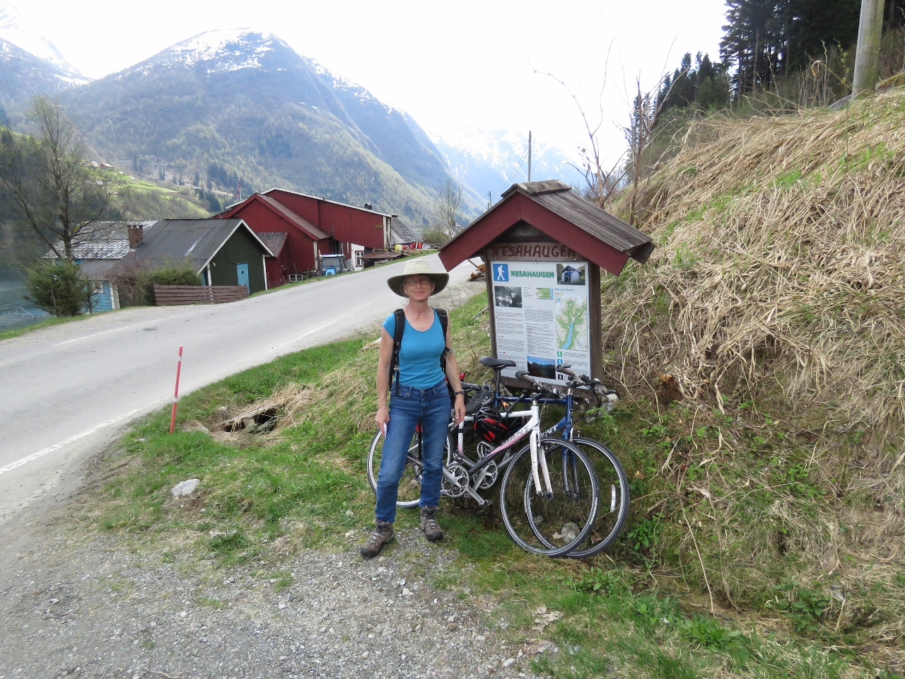 |
Trail Head
Position: 6 44.41, 61 23.34
At the the Nesahaugen trail head, 1.2 miles (2km) south of Fjærland. We could have easily walked there from the boat, but since we already had the bikes down we rode there instead.
|
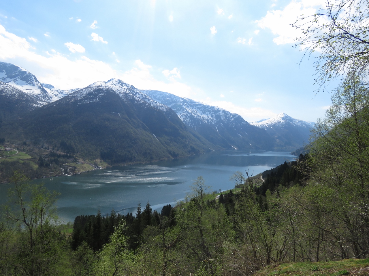 |
Fjærlandsfjord
Position: 6 43.93, 61 23.31
The view down Fjærlandsfjord at 790 ft (240 m).
|
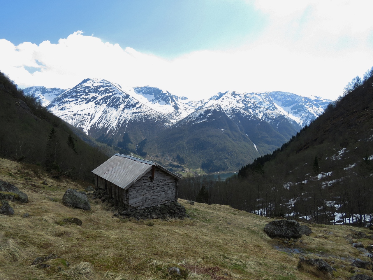 |
Summer Farm
Position: 6 43.20, 61 23.43
Old summer farm house at altitude 1560 ft (475 m)
|
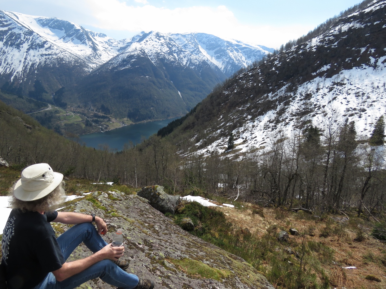 |
Break
Position: 6 43.04, 61 23.51
Taking a break at altitude 1825 ft (556 m).
|
 |
Snow
Position: 6 43.22, 61 23.63
We’d crossed a few snow patches to reach Nesahaugen, but near the top at 2217 ft (675 m) the snow was much thicker and deeper. In places we’d sink in well past our knees. The temperature was so warm though, and we were hot from hiking, that we were down to T-shirts as we walked across.
|
 |
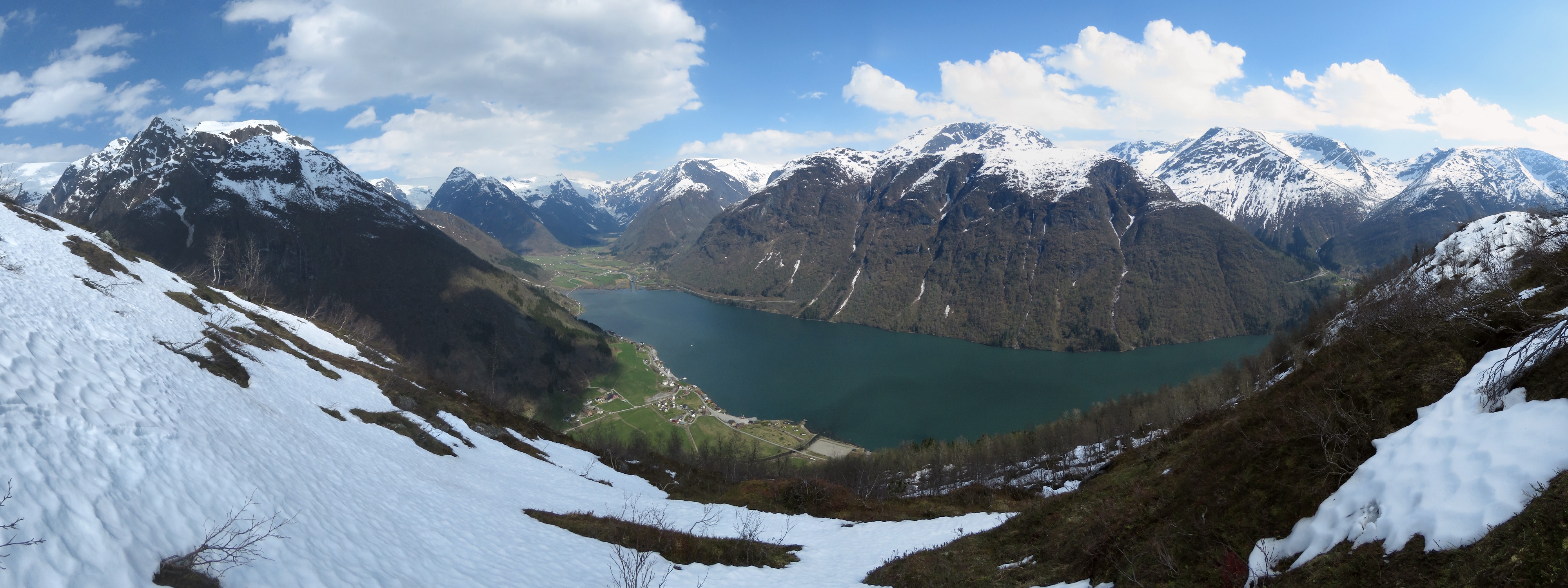
Nesahaugen
Position: 6 43.26, 61 23.69
The fabulous view from Nesahaugen to Fjærlandsfjord and the Jostedalsbreen icecap in the distance beyond the head.
|
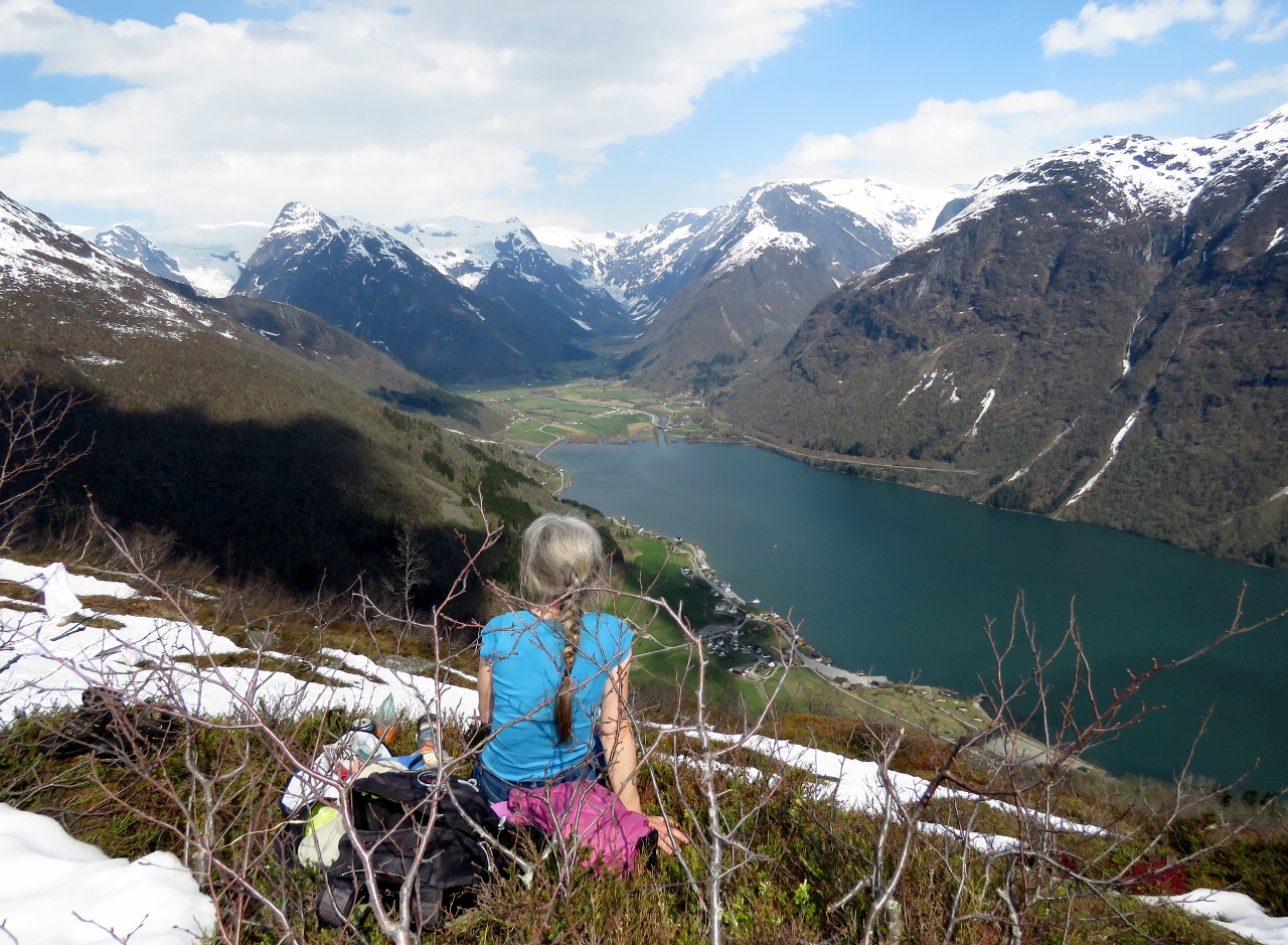 |
Lunch
Position: 6 43.26, 61 23.69
We found a reasonably dry spot to have a picnic lunch overlooking Fjærlandsfjord.
|
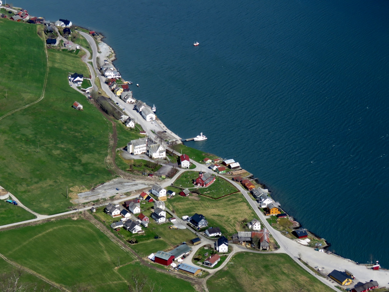 |
Fjærland
Position: 6 43.26, 61 23.69
Close-up to Fjærland from Nesahaugen. Dirona is on the dock at center.
|
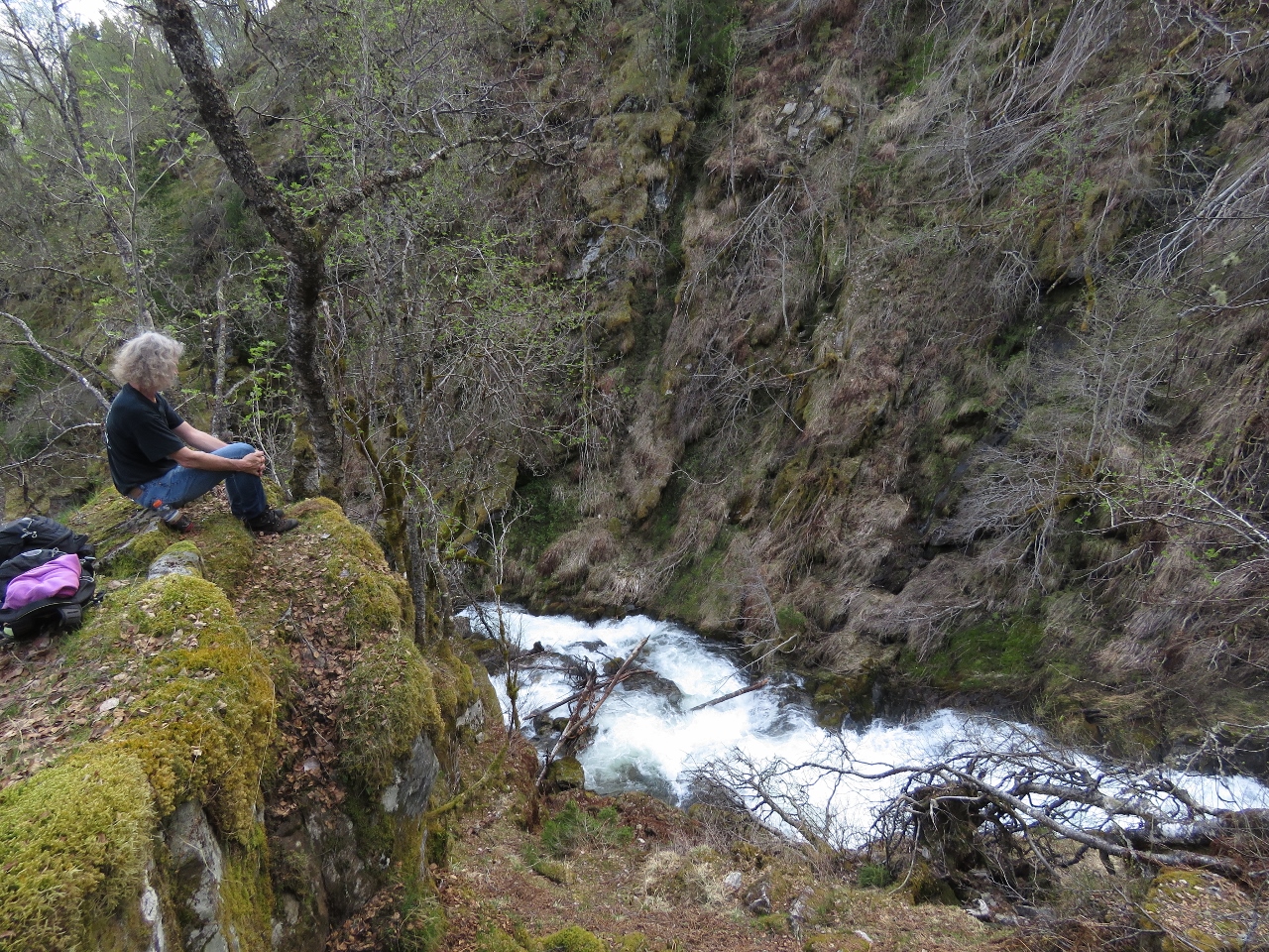 |
River
Position: 6 43.62, 61 23.24
Taking a break by a fast-flowing river on the descent.
|
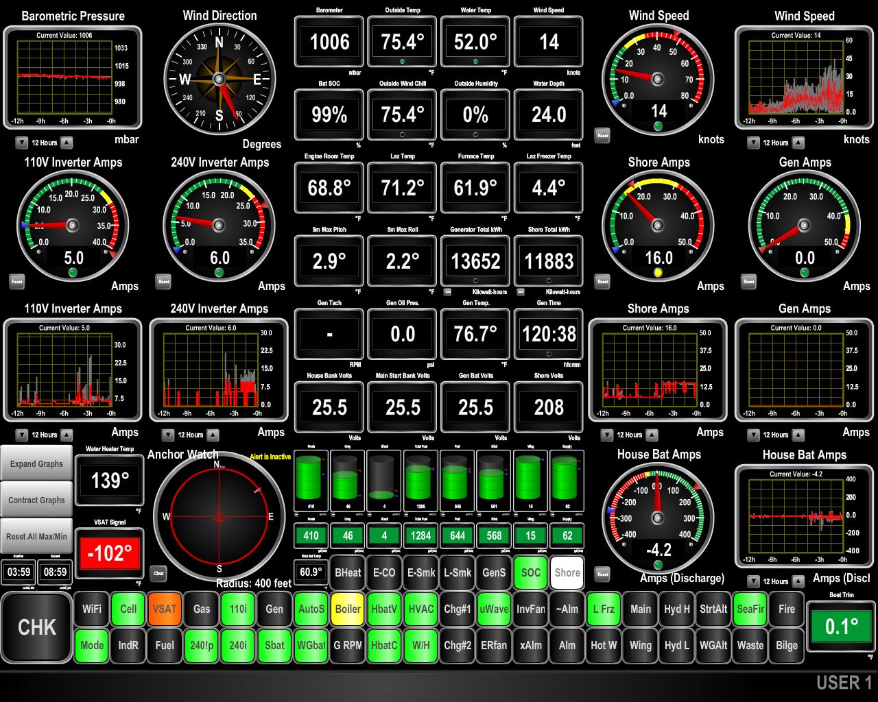 |
47 knots
Position: 6 44.48, 61 24.27
The winds came up this afternoon, gusting to 47 knots. The winds are predicted to be light most places in the area, so we expect the high winds we’re seeing are a sea breeze due to the heat of the day. At 9pm the outside temperature still is 75.4°F (24°C).
|

|
Click the travel log icon on the left to see these locations on a map, with the complete log of our cruise.
On the map page, clicking on a camera or text icon will display a picture and/or log entry for that location, and clicking on the smaller icons along the route will display latitude, longitude and other navigation data for that location. And a live map of our current route and most recent log entries always is available at mvdirona.com/maps. |
Hi, James, you should have stolen the gaiters from your shore power cord! Great blog!
It’s funny you should say that but it’s true. On this trip I was learning the trick of quickly shuffling my feet along on top of the snow. If I stop, I break through to the top of my legs and it’s actually a ton of work to get back out of the hole formed in the snow. Gaiters would have helped!