We turned south towards Germany after departing Aalborg and exiting the Limfjord, travelling 165 miles and making two stops before our final Danish anchorage at Thuro Bund. We were scheduled to arrive into Amsterdam by November 1st, so didn’t spend as much time exploring Denmark as we would have liked. But the town of Svendborg, a five-mile tender run from Thuro Bund, gave us an excellent last taste of the country.
Below are trip highlights from October 12th through 16th east of the Jutland Peninsula, Denmark. Click any image for a larger view, or click the position to view the location on a map. And a live map of our current route and most recent log entries always is available at mvdirona.com/maps
 |
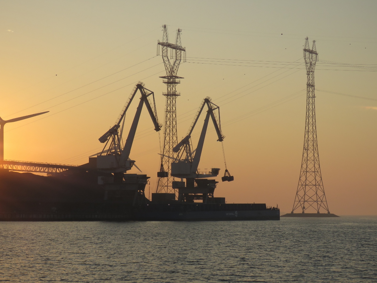
Sunrise
Position: 57°5.01’N, 10°0.05’E
A spectacular red sky at sunrise with a coal-power plant in the foreground and wind turbines in the background as we depart Aalborg.
|
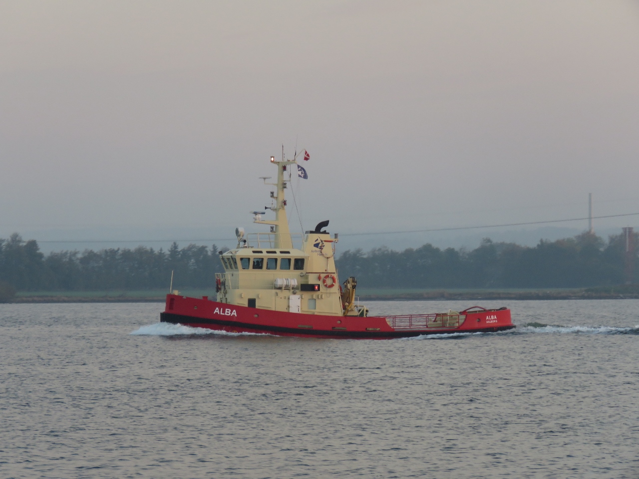 |
Alba
Position: 57°5.02’N, 10°0.25’E
The tug Alba heading east towards Aalborg.
|
 |
Shovels
Position: 57°4.28’N, 10°2.16’E
Dual shovels offloadin coal from a barge at the Nordjylland Power Station.
|
 |
Offshore Foundations
Position: 57°3.57’N, 10°3.03’E
Offshore foundations at Bladt Industries, specialists in large-scale and highly complex steel structures. We speculate these are wind turbine bases.
|
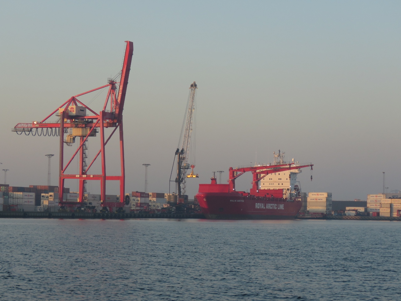 |
Malik Arctica
Position: 57°3.05’N, 10°3.95’E
The cargo ship Malik Arctica offloading at the Port of Aalborg.
|
 |
Magni-R
Position: 57°2.98’N, 10°4.14’E
The hopper dredger Magni-R clearing the channel into Aalborg.
|
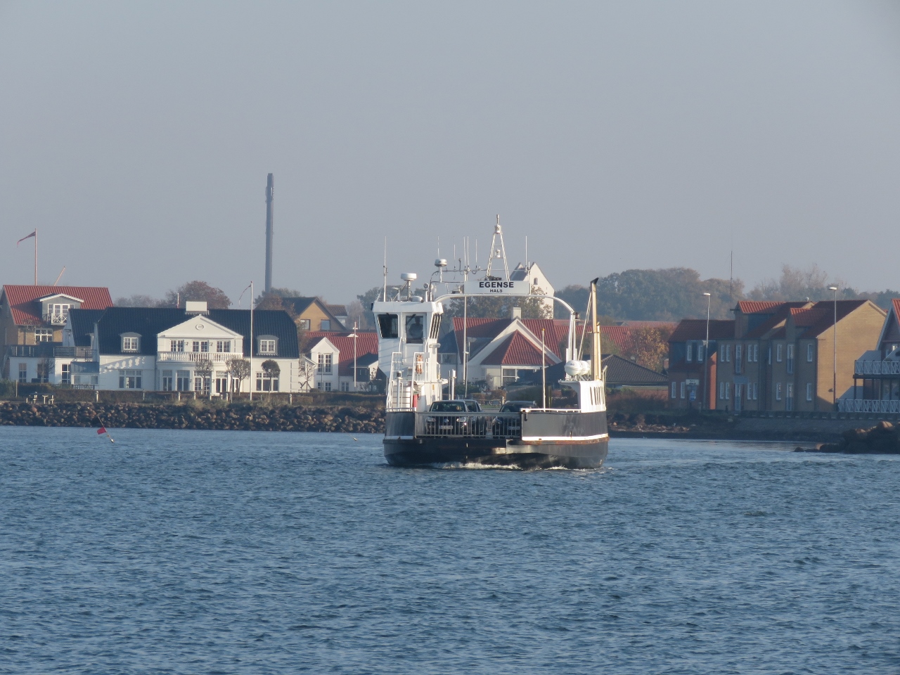 |
Egense
Position: 56°59.24’N, 10°18.28’E
The small ferry Egense crossing the Limfjord between Egense and Hals.
|
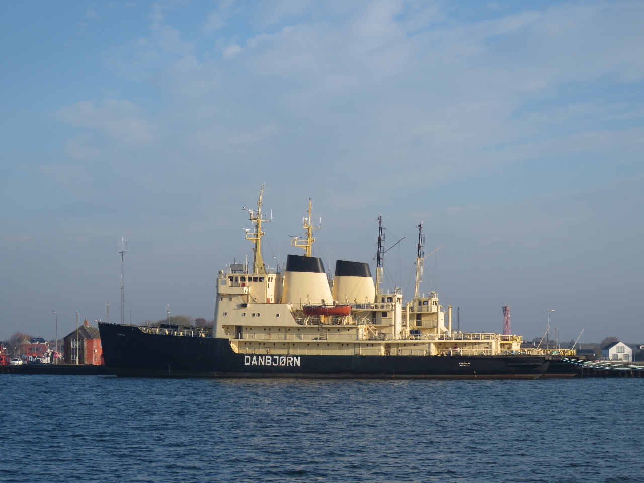 |
Danbjorn
Position: 56°59.19’N, 10°18.71’E
The Danish icebreaker Danbjorn moored against a sister ship at Hals. Its hard to believe we’re still far enough north that icebreakers are needed to clear the path to nearby ports.
|
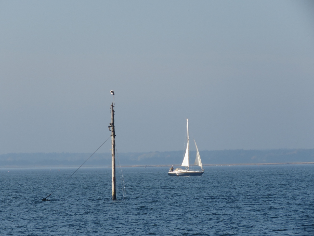 |
Wreck
Position: 56°58.66’N, 10°19.74’E
Sailboat passing a submerged wreck as we exit the Limfjord. It’s always makes us nervous seeing a sunken boat so close to the marked channel.
|
 |
Aalborg Bight
Position: 56°52.71’N, 10°26.76’E
A nice sunny day for cruising south through Aalborg Bight.
|
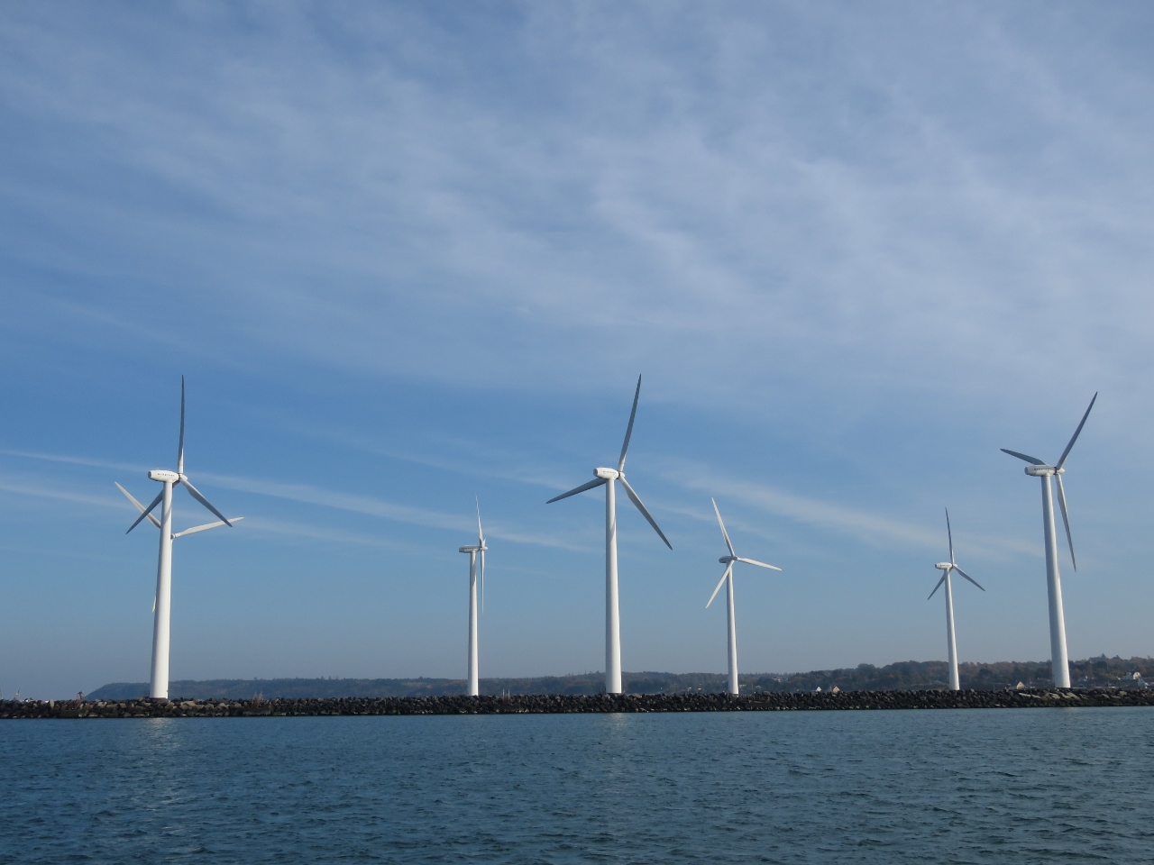 |
Glesborg
Position: 56°32.24’N, 10°42.47’E
The windmills at Glesborg made a great backdrop for our anchorage off the harbour. This would not be a great stop in northerly winds, but it was wonderfully calm in light southerlies.
|
 |
Sunrise
Position: 56°22.01’N, 10°59.45’E
Sunrise as we continue south from Glesborg for Samsoe Island.
|
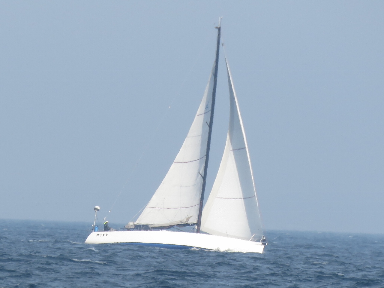 |
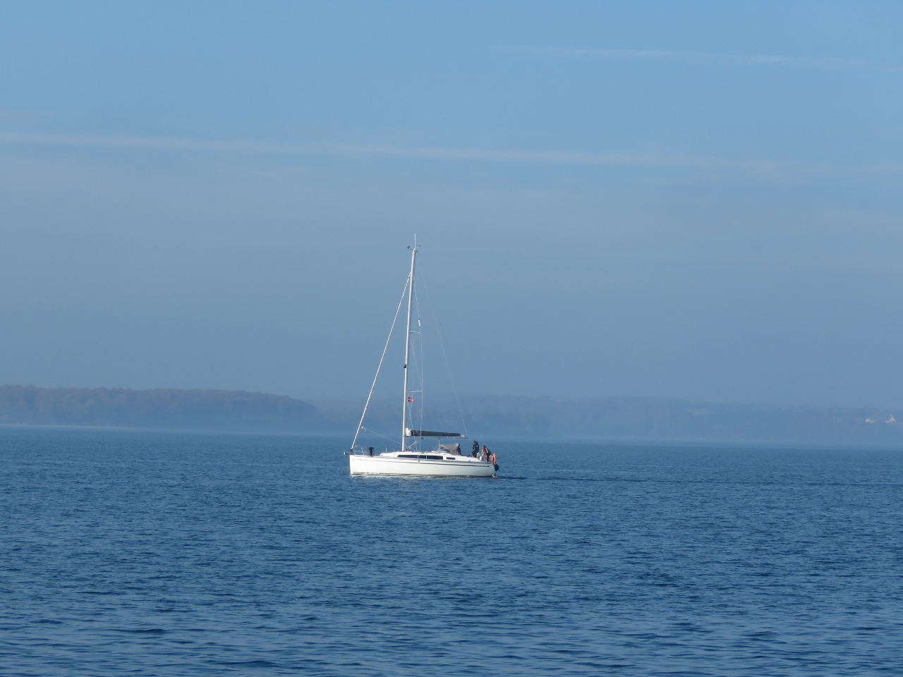
Roxy
Position: 56°3.84’N, 10°48.22’E
Roxy reaching in the strong southerly winds.
|
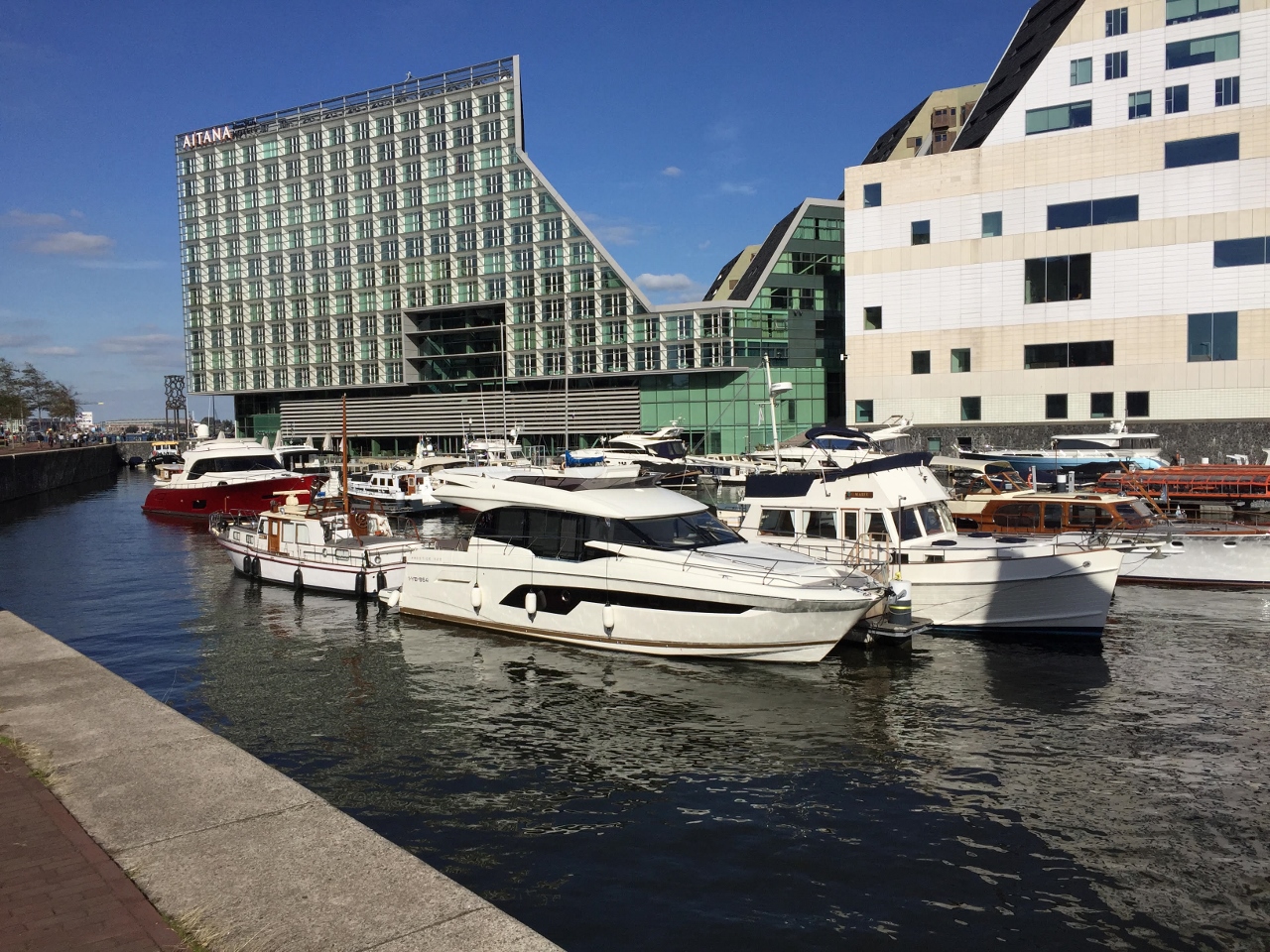 |
Amsterdam City Marina
Position: 52°23.03’N, 4°53.63’E
Peter Hayden, who is building Nordhavn 6837, sent is this photo he took today of Amsterdam City Marina where we’ll be spending the winter. We’re looking forward to it.
|
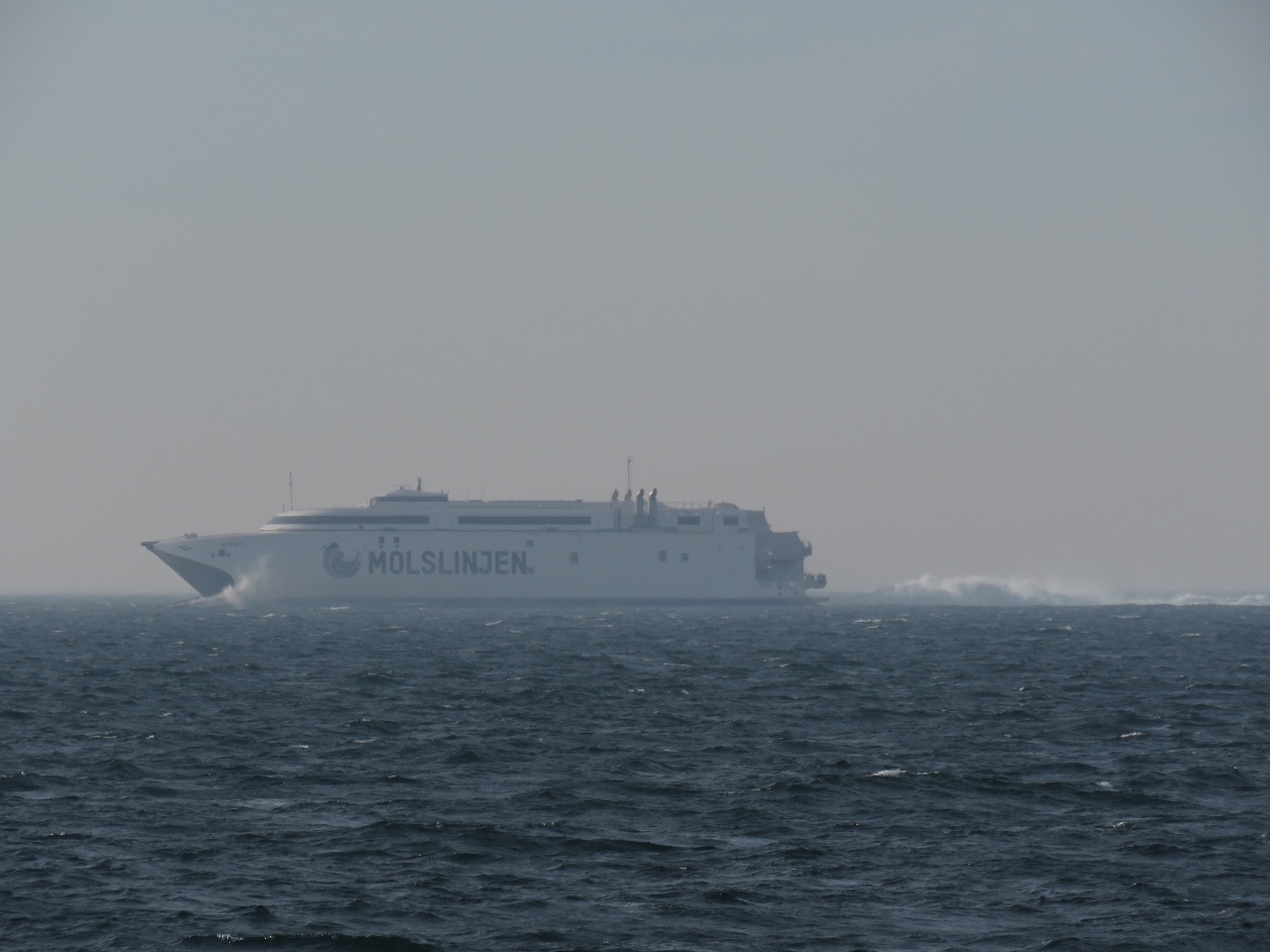 |
Express 3
Position: 56°2.88’N, 10°47.14’E
A high-speed target approaching from the east turned out to be the 359-ft (109.4m) catamaran Express 3 en route between the Danish ports of Aarhus and Odden. The ferry was built by Incat of Tasmania with 4 MAN V20 engines of 12,069HP each and four Wartsila LJX 1500SR waterjets giving a service speed of 40kts and a top speed of 47 knots. Our boat carries enough fuel to run that ship for about 42 minutes. :)
Express 3 sailed on its own bottom from Tasmania in April of 2017 and interestingly is registered in the Bahamas. |
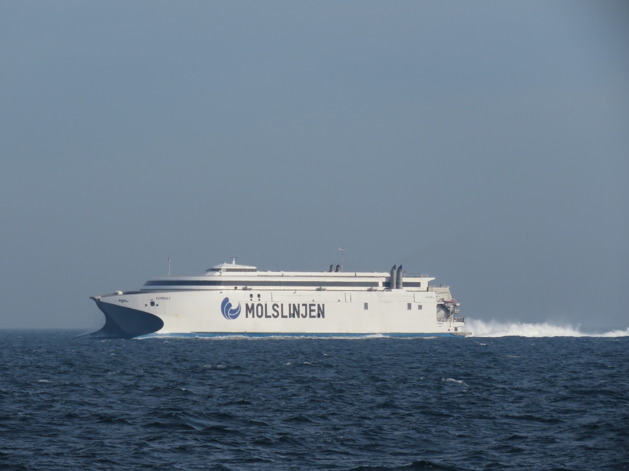 |
Express 2
Position: 56°1.16’N, 10°45.23’E
Shortly after Express 3 passed, Express 2 came from the other direction. The ship, built by Incat of Tasmania, is 369ft (112m) long and can carry 1,200 passengers and 417 cars on 2 car decks. Ferries of this class are largest diesel catamarans in the world.
|
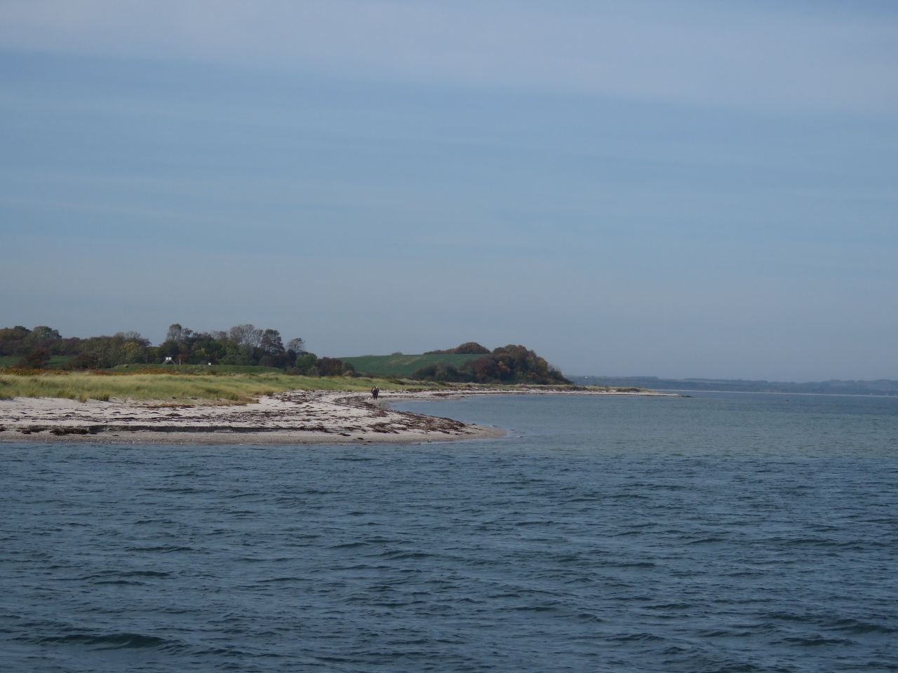 |
Samsoe Island
Position: 55°54.91’N, 10°39.25’E
The long sandy beach along the east shore of Samsoe Island.
|
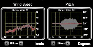 |
Pitch
Position: 55°54.82’N, 10°38.88’E
Most of today’s run was into short but tight head seas and we were pitching just over 10 degrees.
|
 |
Spares
Position: 55°54.82’N, 10°38.88’E
James pulling out the last of our two spare LED floodlights from underneath the pilothouse settee. It’s a rarely-accessed part and we had to dig a bunch of other spares out to reach it. We have four of these lights installed on the stack, two facing sideways and two aft. They’ve generally lasted well, but we seem to have hit their due date. We replaced one in February of this year and two more have just failed. We will replace the sidelight today and have a sea freight shipment waiting for us in Amsterdam with another new light that we’ll use to replace the failed boat deck light. And we’ll pick up two more on our next trip to Seattle for spares.
|
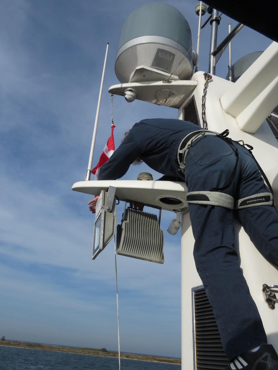 |
Sidelight
Position: 55°54.82’N, 10°38.87’E
James, secured to the stack in climbing gear, replacing a failed side floodlight that we use to help navigate at night when operating at night close to shore—they light up the area for a good two hundred feet on either side of the boat. The picture also shows one of the two aft-facing lights, identical to the side lights, that we to illuminate the boat deck for loading and unloading the tender or working on deck at night.
|
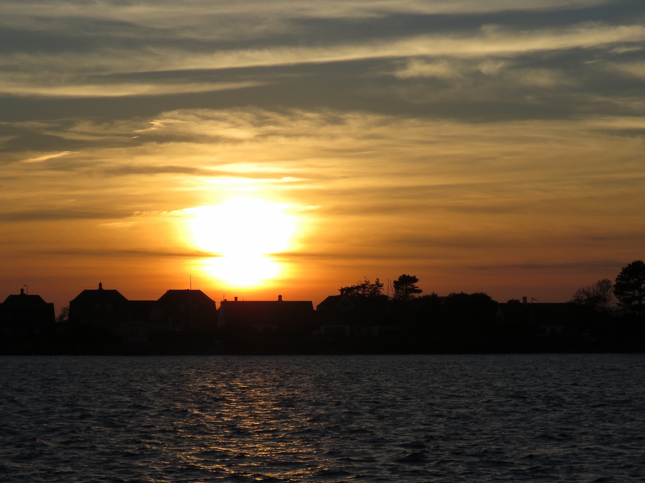 |
Sunset
Position: 55°54.82’N, 10°38.87’E
Sunset over Samsoe Island from our anchorage. We really like the spot here—secluded with plenty of swing room.
|
 |
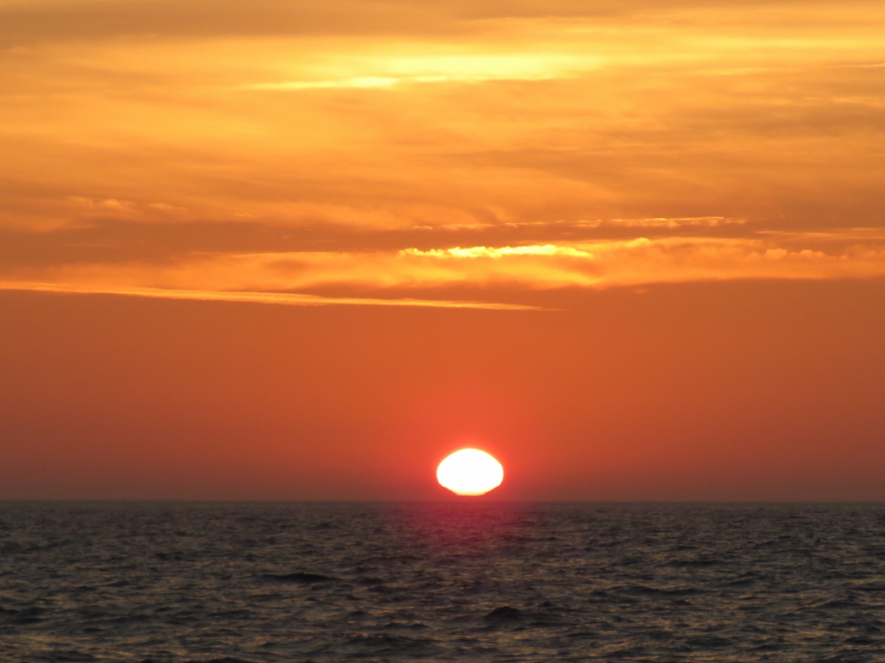
Sunrise
Position: 55°54.82’N, 10°38.88’E
A fabulous sunrise over Albuen island.
|
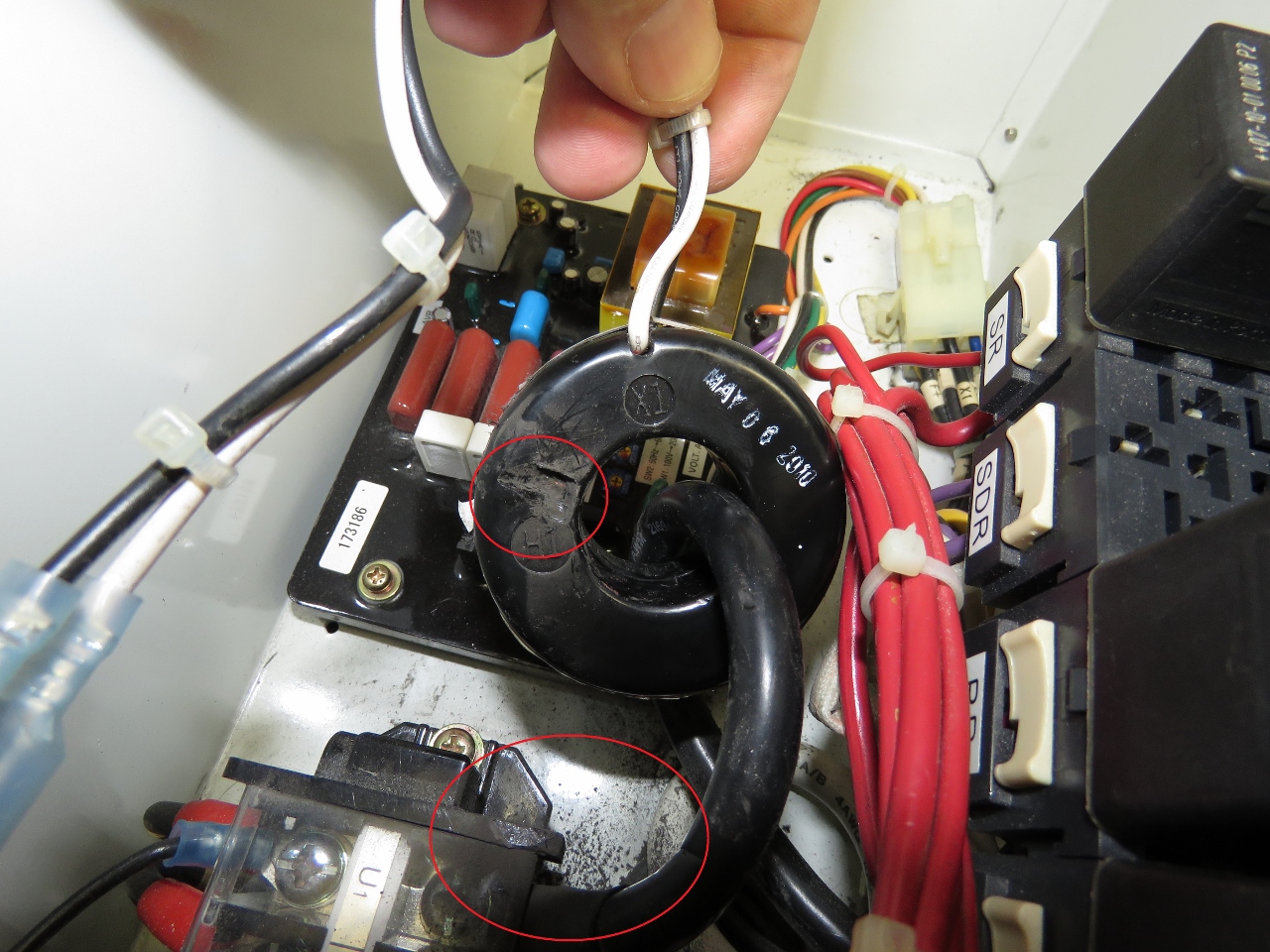 |
Current Transducer
Position: 55°54.81’N, 10°38.86’E
The generate Wavenet was reporting incorrect amperage produced. We traced it down to this current transducer that had worn away badly against a corner due to vibration. We secured the transducer with a couple of wire ties so it can’t rub against any solid parts, but it is worn into the windings and needs to be replaced. Because some of the windings are damaged, this transducer now reports less-than-actual current. James temporarily changed the configured winding ratio from 75:5 to 85:5. Even with the damaged part, it’s now reporting current accurate to +/-1 amp.
|
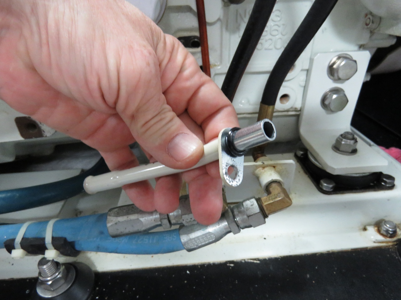 |
Dipstick Tube
Position: 55°54.82’N, 10°38.87’E
Our generator dipstick tube started to leak a small amount of oil in operation. You can see the o-ring is cracked. James replaced the o-ring and added a small amount of Permatex orange. It’s now sealed up tight again.
|
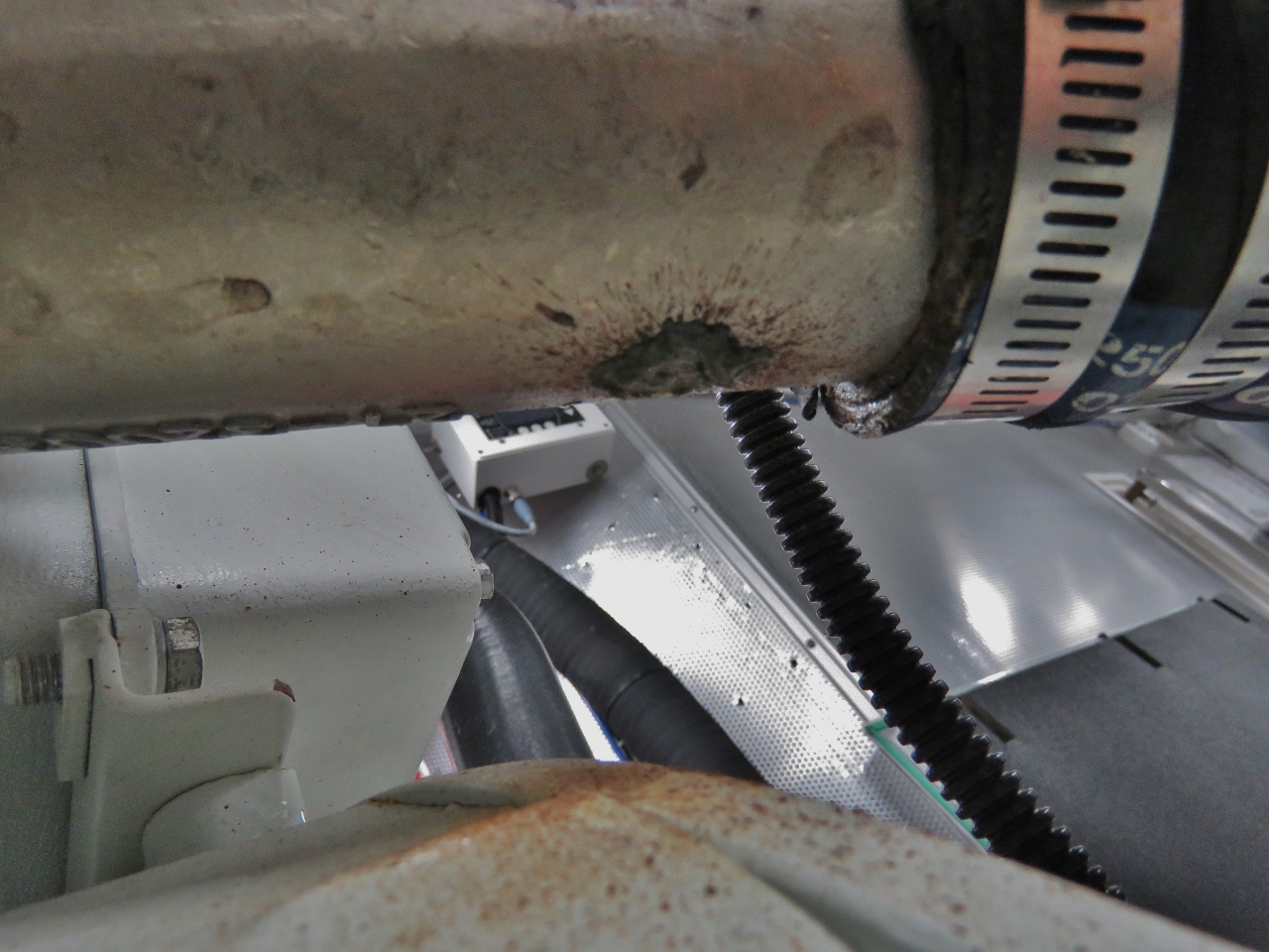 |
Exhaust Elbow
Position: 55°54.82’N, 10°38.87’E
Saltwater sprayed through a pinhole leak in the wing engine exhaust elbow. This part is expensive and doesn’t last as well as it should. Northern Lights offers two exhaust elbow options. The first is cast iron, which costs less, but doesn’t last very long. The second option, that we use, is a cast stainless steel part that is more expensive but usually lasts longer. These stainless steel elbows can actually last very well, but a surprisingly large number of them suffer from casting porocity and end up leaking quite early.
It’s a shame to replace an exhaust elbow only because its leaking water through a small pinhole and is otherwise perfect. The generator uses the same elbows and in 5,600 hours it’s used two elbows, which isn’t bad. We’ve been less lucky on the wing, and this is our third in 900 hours. |
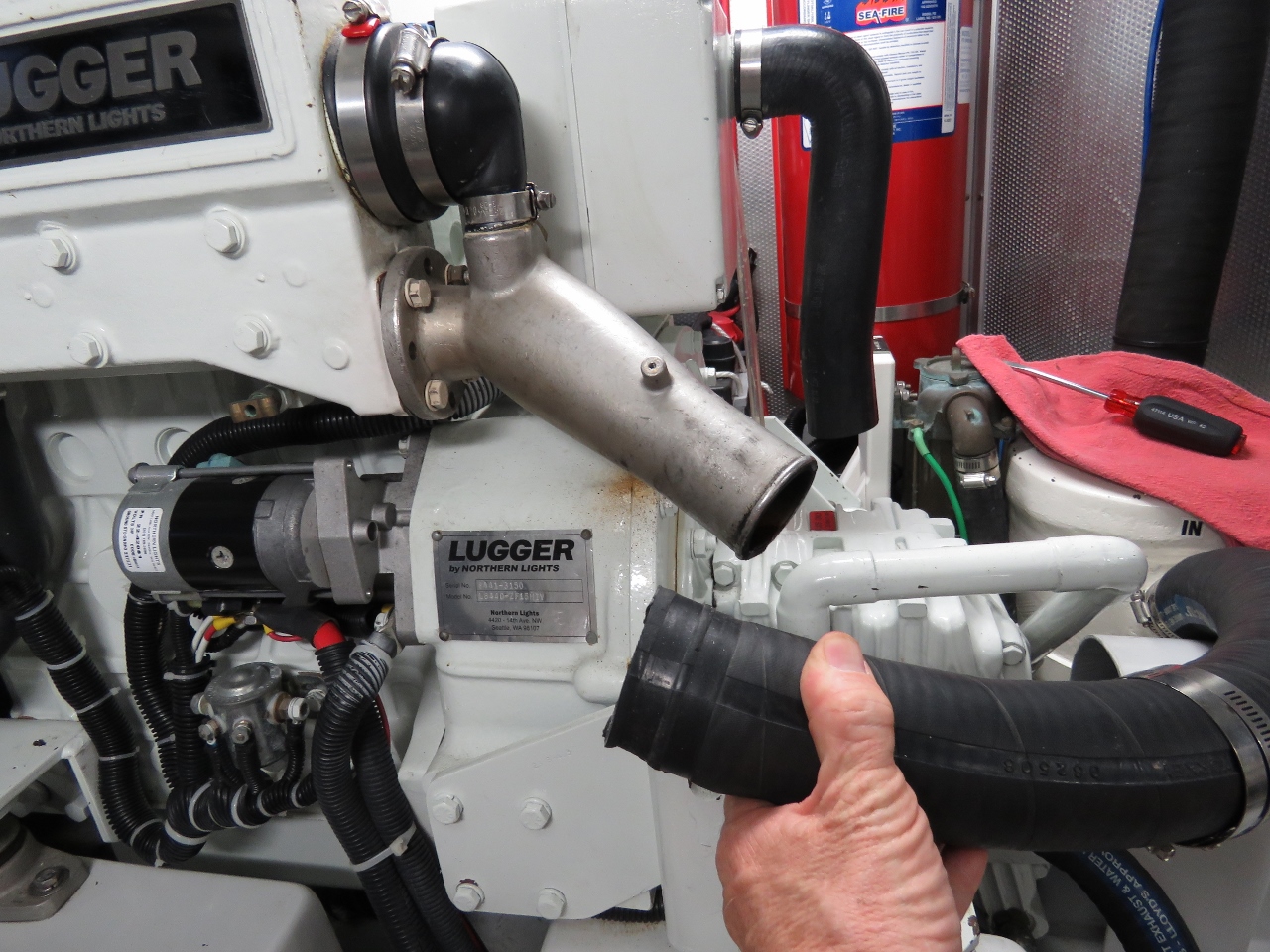 |
Exhaust Hose
Position: 55°54.82’N, 10°38.87’E
To replace the exhaust elbow, we need to remove the exhaust hose.
|
 |
Antifreeze
Position: 55°54.82’N, 10°38.87’E
The wing antifreeze, drained to replace the exhaust elbow.
|
 |
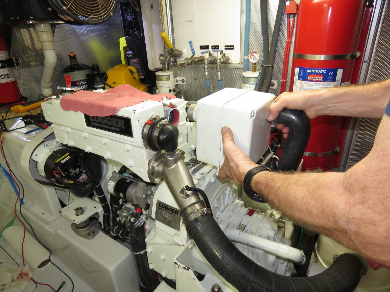
Elbow Removed
Position: 55°54.81’N, 10°38.86’E
We removed the heat exchanger end boot and air filter housing to facilite a quick change of the exhaust itself.
|
 |
Old and New
Position: 55°54.81’N, 10°38.86’E
The old and new exhaust elbows.
|
 |
Air Filter
Position: 55°54.81’N, 10°38.86’E
Reinstalling the air filter housing after replacing the exhaust elbow.
|
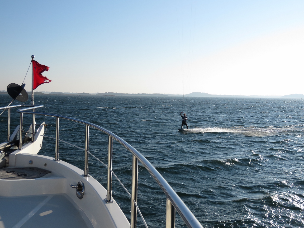 |
Kitesurfer
Position: 55°54.82’N, 10°38.87’E
A kitesurfer out enjoying today’s strong winds at Samsoe Island.
|
 |
Lights
Position: 55°54.82’N, 10°38.88’E
Testing our floodlights after replacing the sidelight. That forward spotlight really throws a beam.
|
 |
Traffic
Position: 55°55.41’N, 10°44.37’E
Lots of traffic in the lanes between Denmark and Sweden as we depart Samsoe Island around 6am. We’re running in an enjoyable combination of total darkness and thick fog. :(
|
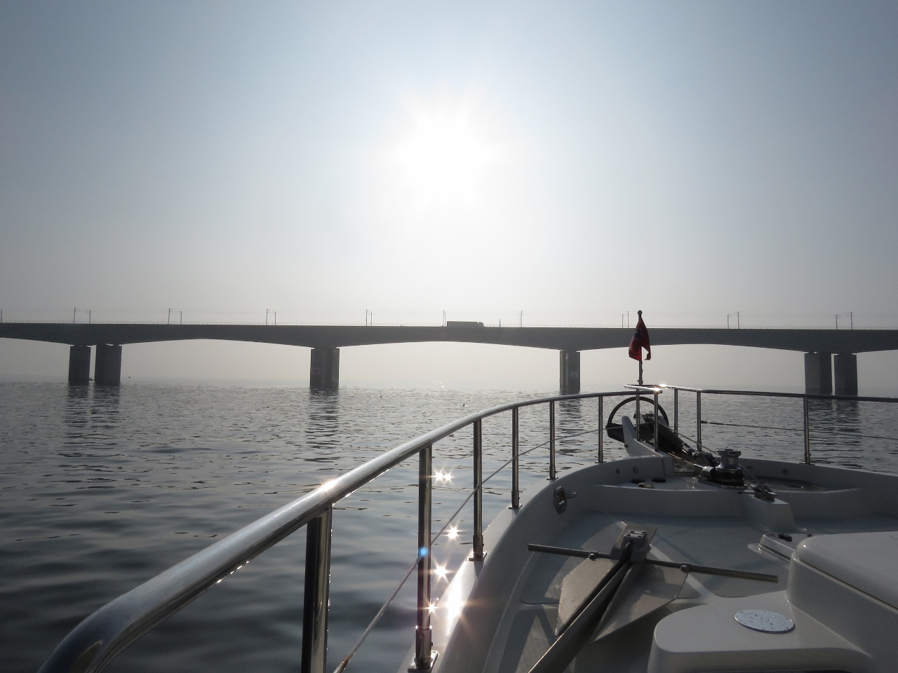 |
Storebaetsbroen
Position: 55°18.44’N, 10°53.68’E
Passing under the West Bridge portion of Storebaetsbroen (The Great Belt Bridge). The 11-mile (18km) bridge links eastern and western Denmark and consists of two bridges and a tunnel. The bridge we are passing is both a road and rail bridge. The road portion continues east on another bridge, while rail traffic goes through an two-way underground tunnel.
|
 |
Loop
Position: 55°1.42’N, 10°44.76’E
Sailing vessel Loop heading south on a wonderfully calm and sunny day.
|
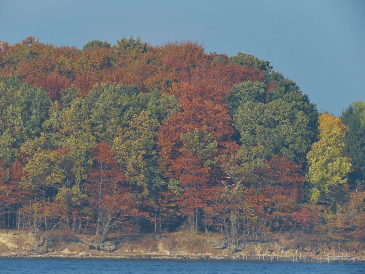 |
Fall Colors
Position: 55°1.49’N, 10°40.92’E
Fall colours on the south shore of Fyn Island.
|
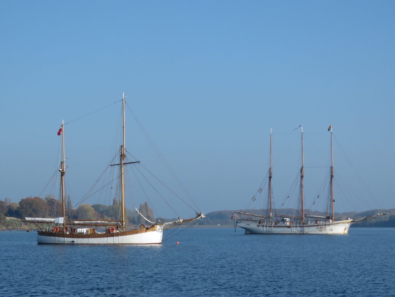 |
Sea Scouts
Position: 55°2.38’N, 10°40.78’E
Two Sea Scouts ships anchored at our destination, Thuro Bund. Blog readers Andre and Annemarie Verhoek had recommended the sheltered and quiet anchorage here, and we quite enjoyed it.
|
 |
Walsteds Shipyard
Position: 55°2.40’N, 10°39.69’E
Established in 1949, Walsteds Shipyard in internationally renowned for quality workmanship, particularly lacquered wood.
|
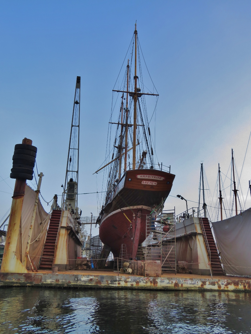 |
Amphitrite
Position: 55°3.63’N, 10°36.98’E
The three-masted schooner, Amphitrite was built in 1884-1887 and is among the oldest seagoing yachts in existence.
|
 |
Tender
Position: 55°3.68’N, 10°36.85’E
Our tender tied off the wall at Svendborg Havn.
|
 |
Klostergaarden
Position: 55°3.54’N, 10°36.71’E
The historic Klostergaarden building near the Svendborg waterfront.
|
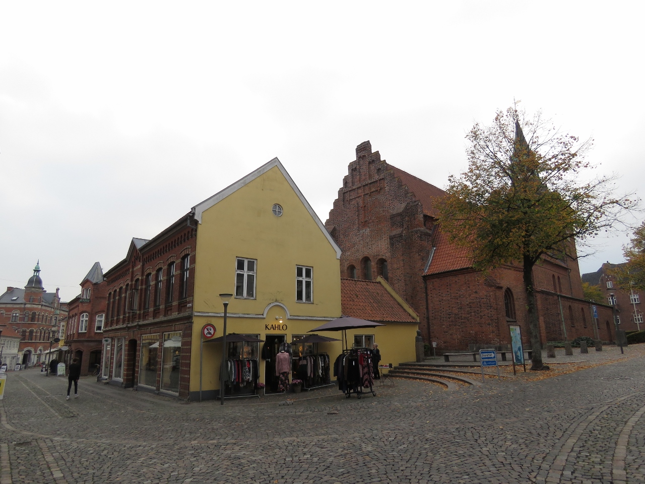 |
St. Nicolai
Position: 55°3.52’N, 10°36.64’E
St. Nicolai church (right) built in the early 1200s, is Svendborg’s oldest parish church.
|
 |
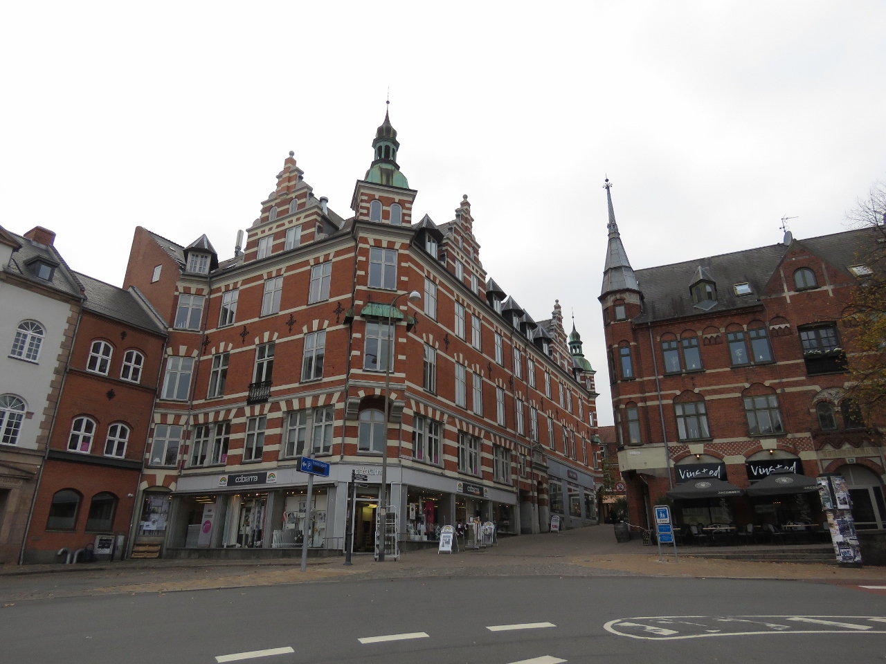
Torvet Svendborg
Position: 55°3.57’N, 10°36.61’E
Looking across Torvet Svendborg (the town square) to Vor Frue Kirke (church), completed in 1250.
|
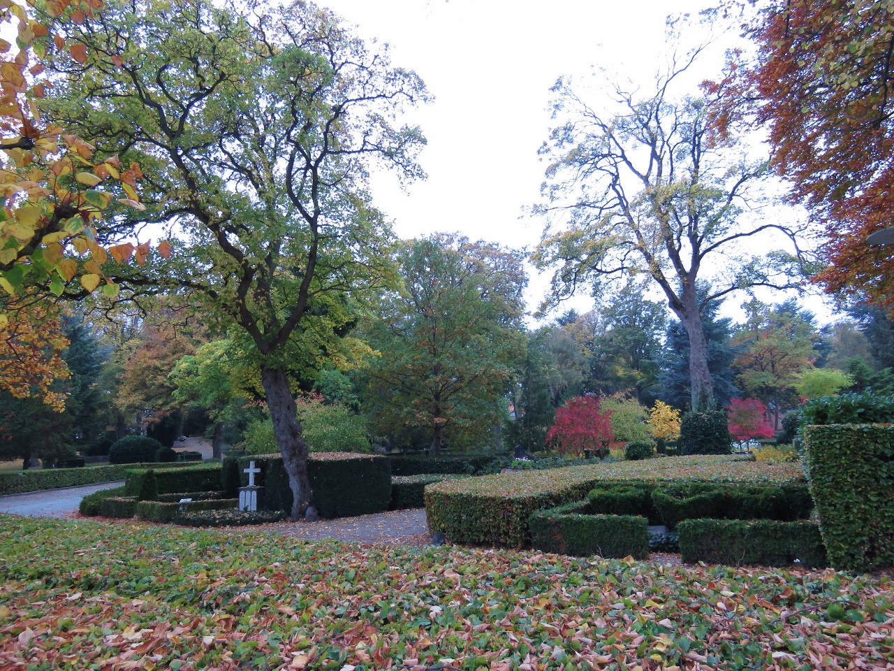 |
Assistens Churchyard
Position: 55°3.47’N, 10°36.44’E
Assistens Churchyard, another beautiful Danish cemetery and garden.
|
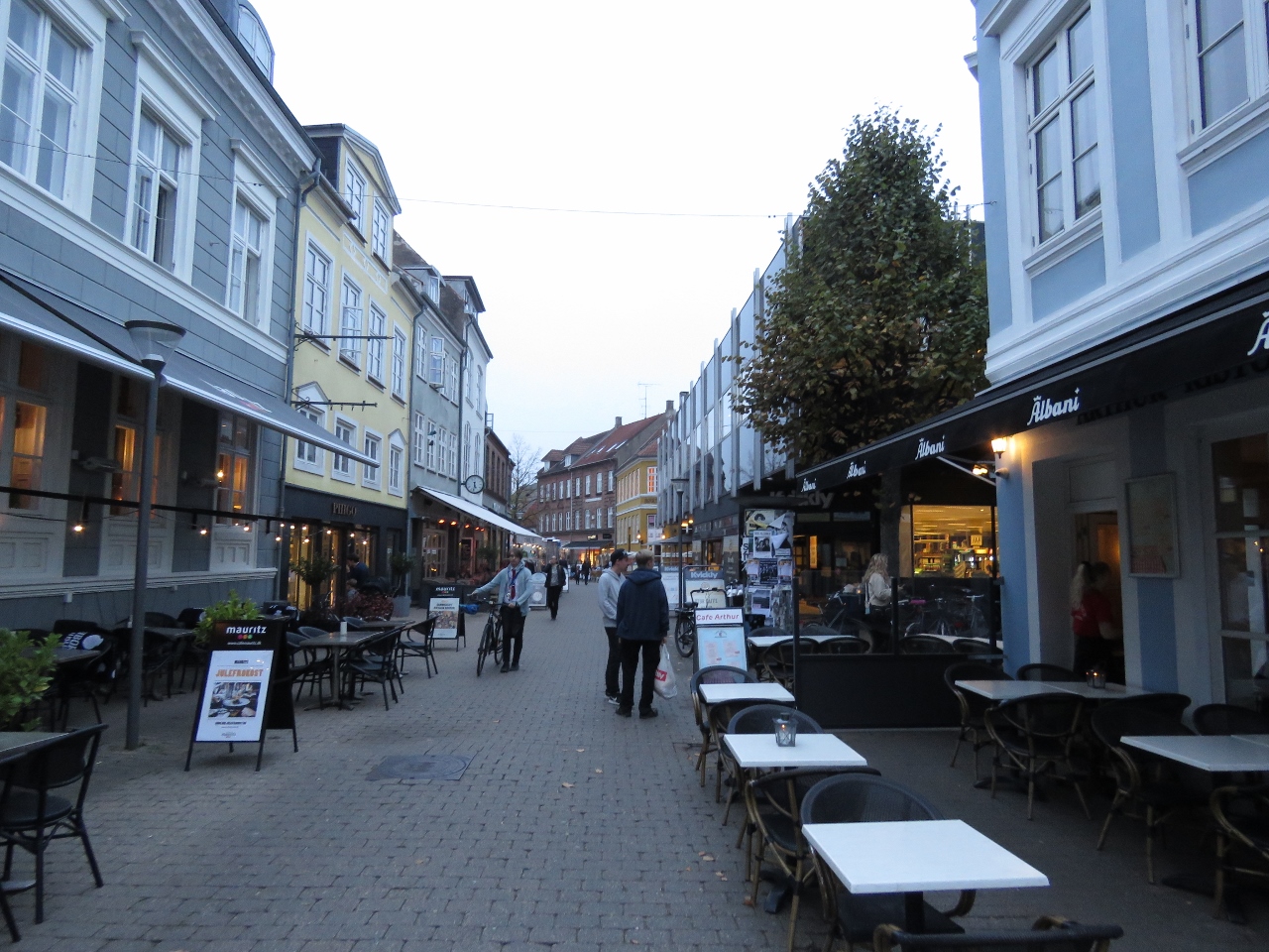 |
Restaurant Row
Position: 55°3.52’N, 10°36.40’E
Looking down restaurant-lined Gerritsgade in downtown Svendborg.
|
 |
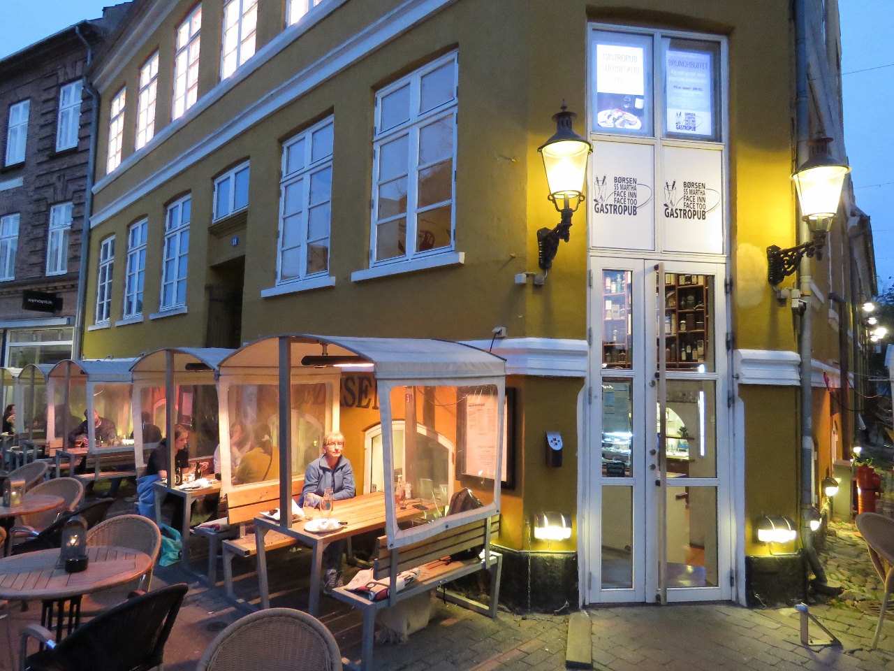
Borsen Gastropub
Position: 55°3.53’N, 10°36.42’E
We had a wonderful meal and evening under the heater in our own private covered table at the Borsen Gastropub.
|
 |
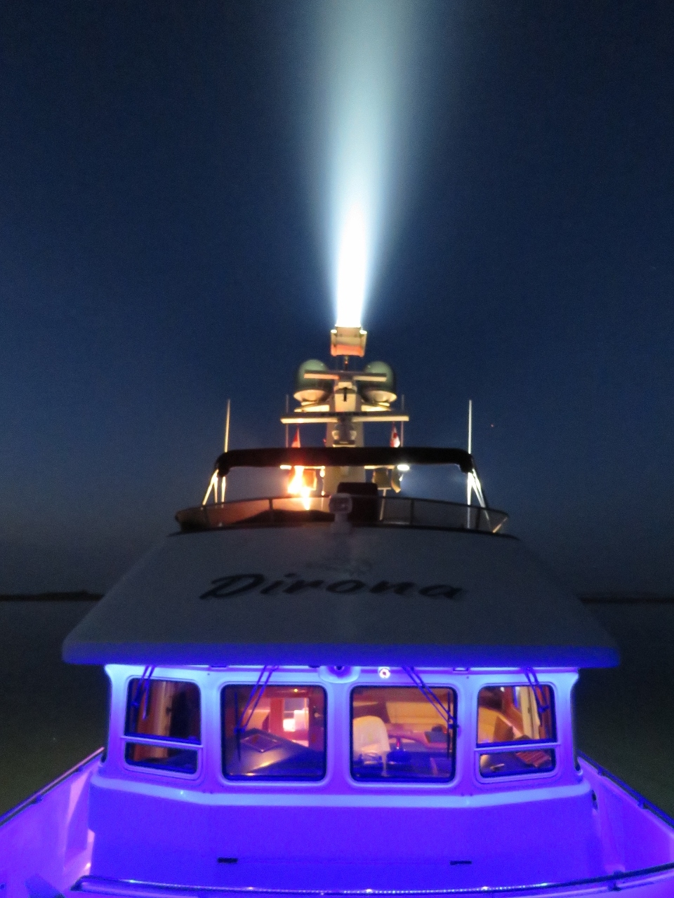
Forward Spotlight
Position: 55°2.36’N, 10°41.13’E
With the tender down, we took advantage of the calm, dark night to take a distance photo with the outdoor lights on. The forward spotlight can brightly illuminate the shore a quarter-mile away.
|
 |
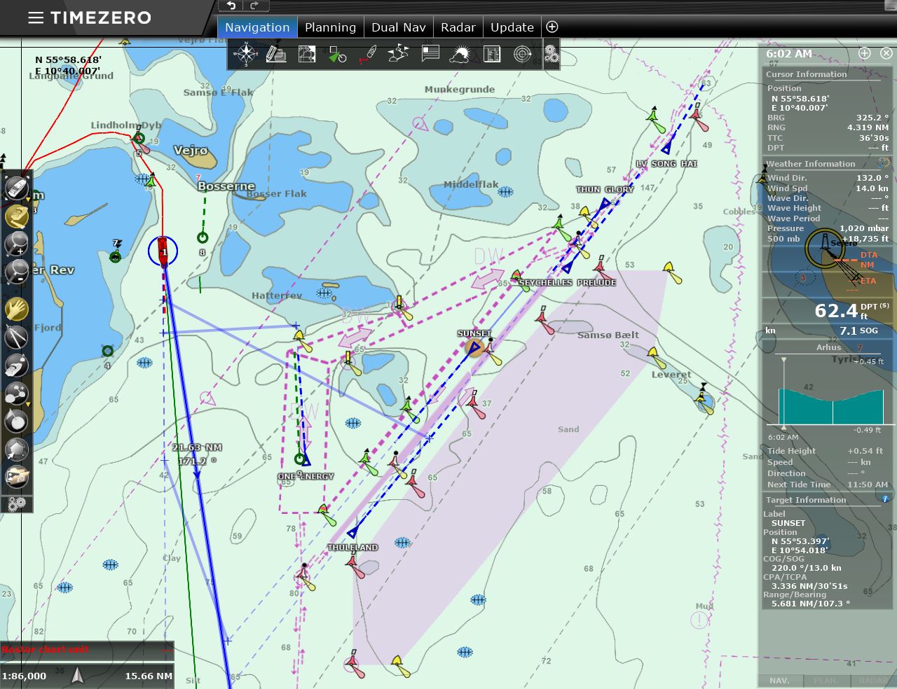
Click the travel log icon on the left to see these locations on a map, with the complete log of our cruise.
On the map page, clicking on a camera or text icon will display a picture and/or log entry for that location, and clicking on the smaller icons along the route will display latitude, longitude and other navigation data for that location. And a live map of our current route and most recent log entries always is available at mvdirona.com/maps. |
Hi Perhaps someone have made a comment – But I’ve noticed “Somas Island” I understand it the same Island I know as Samsoe ;-)
Thanks for pointing out that spelling mistake Lars-Henrik–we’ve fixed it.