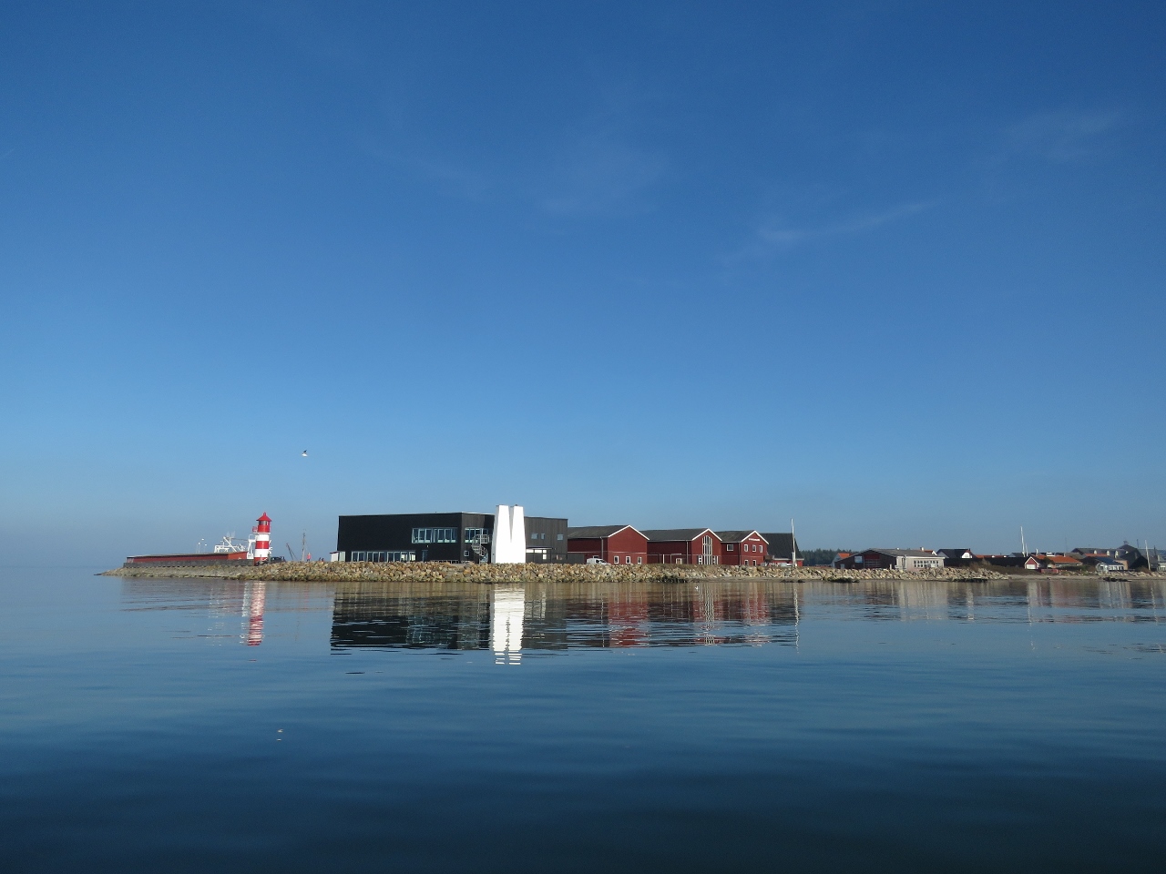
The Limfjord is a peaceful cruising ground that provides a sheltered passage across Denmark’s Jutland Peninsula between Thyboron and Aalborg. With a maximum depth of 4m in the main channel, the waterway is too shallow for large ships and sees only light commercial traffic. Although not a fjord in the geololigical sense, the Limfjord once was an inlet and has only been open from the west since 1825, when the North Sea broke through. We spent a few days cruising the area before continuing south along the Danish east coast to the Kiel Canal.
Below are trip highlights from October 8th through 10th in the Limfjord, Denmark. Click any image for a larger view, or click the position to view the location on a map. And a live map of our current route and most recent log entries always is available at mvdirona.com/maps
 |
The Limfjord
Position: 56°42.39’N, 8°13.35’E
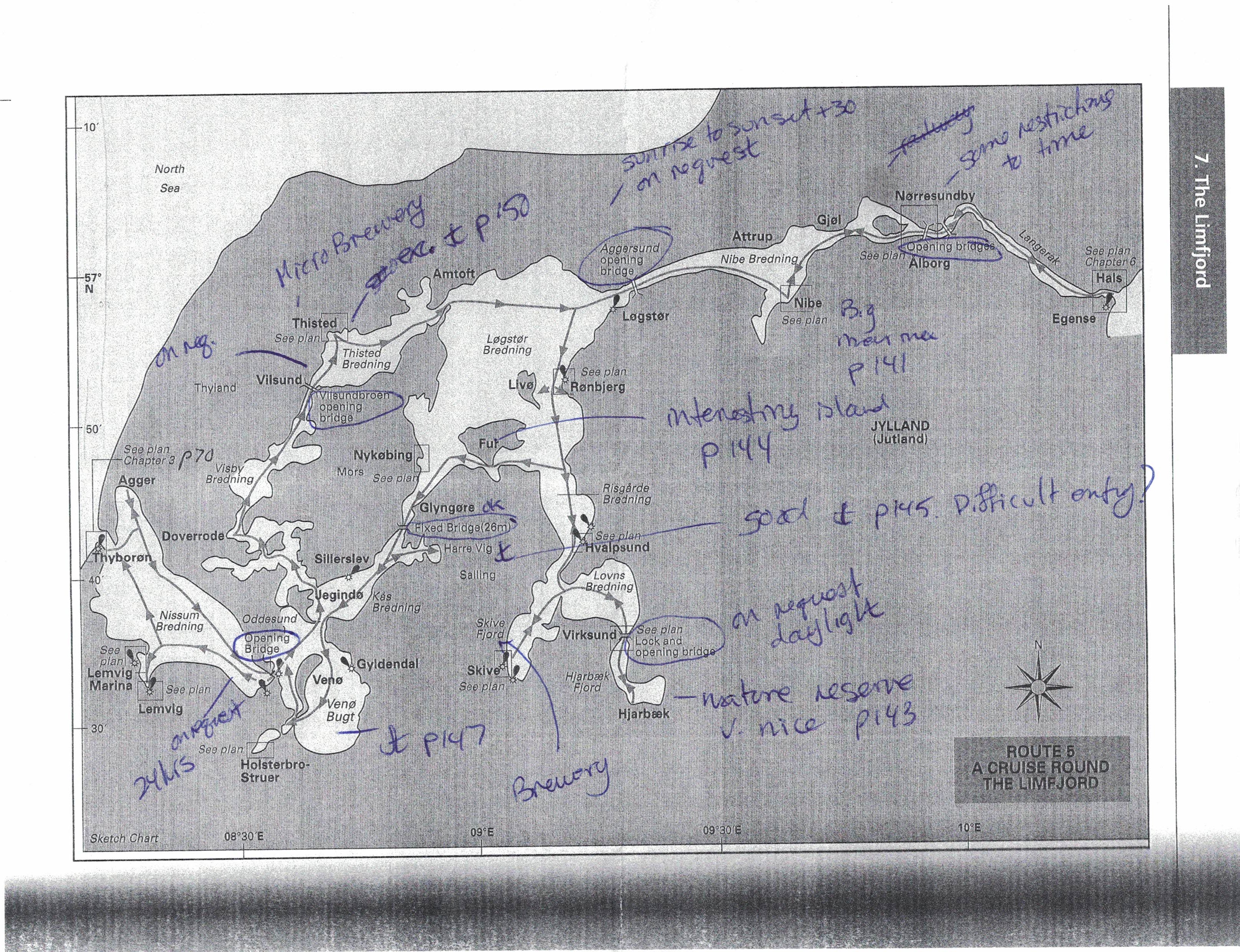
Our cruising map of the Limfjord, taken from Brian Navin’s excellent Cruising Guide to Germany and Denmark. We’ve annotated it with the locations of bridge we need to pass under, anchorage recommendations from the guide, and other information passed on by locals.
|
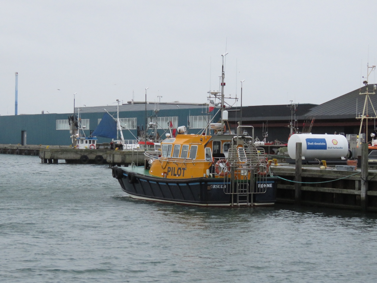 |
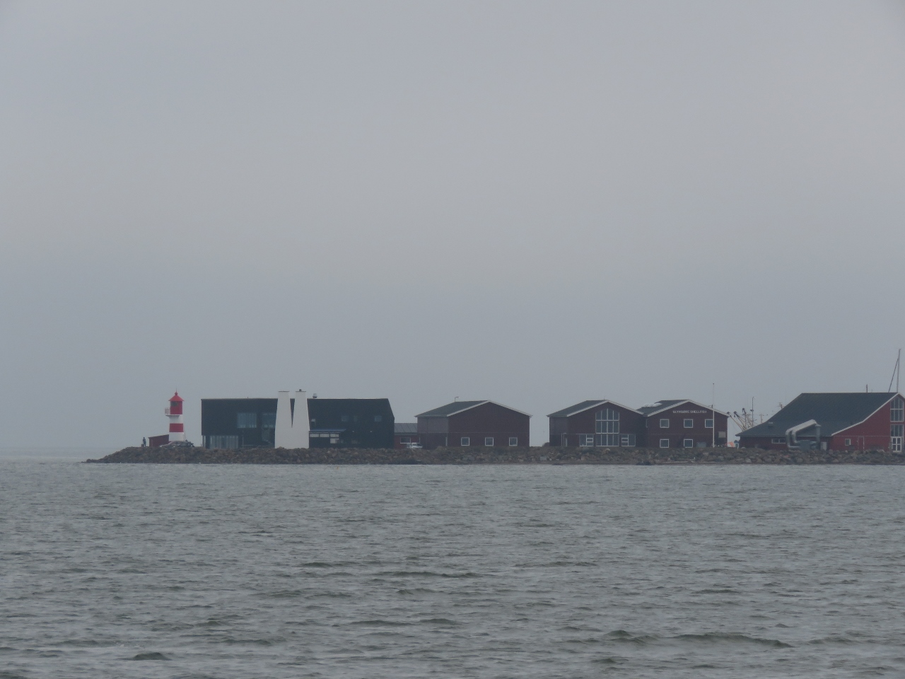
Pilot
Position: 56°42.30’N, 8°13.37’E
Pilot boat at Thyboron as we depart.
|
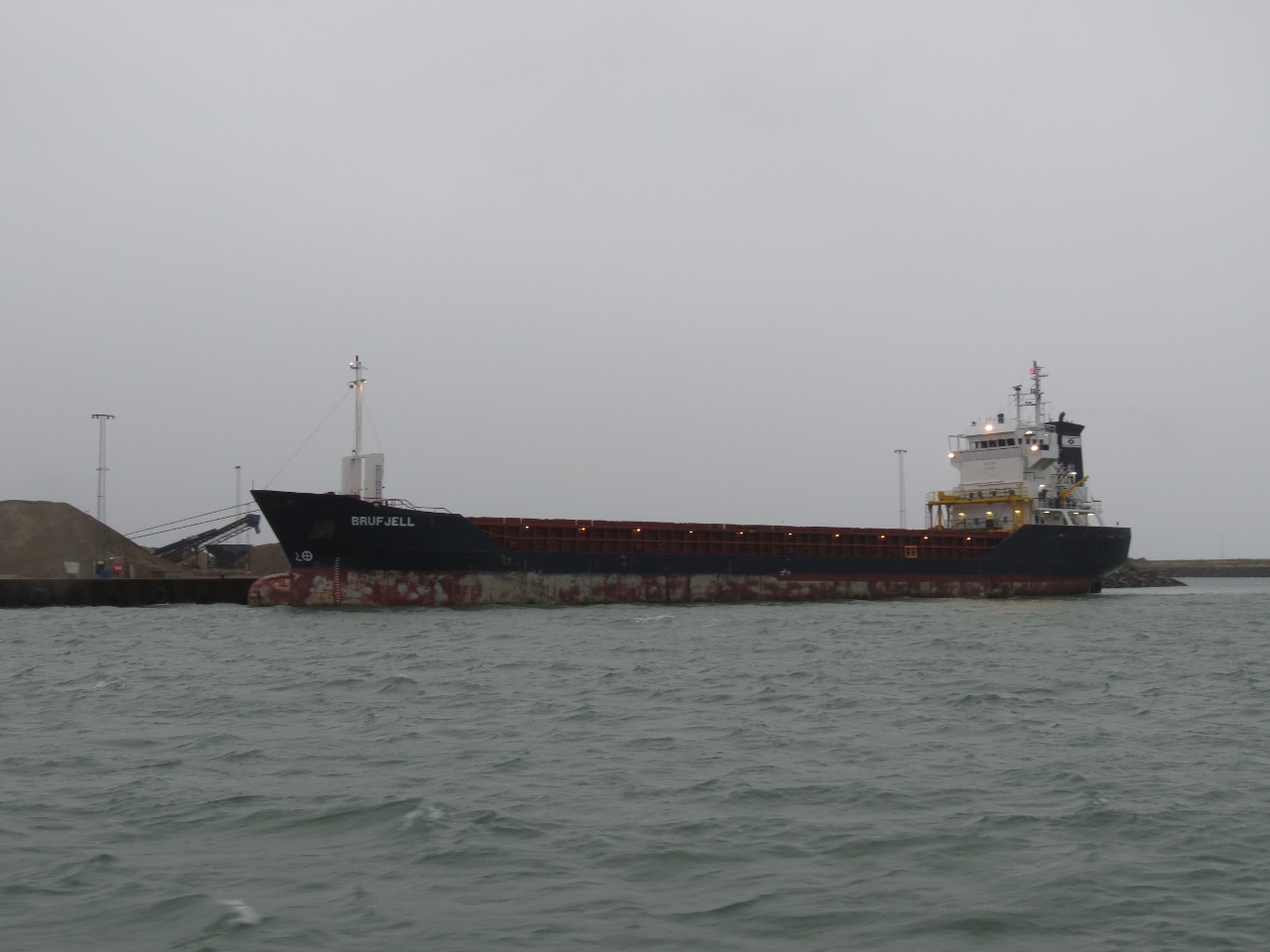 |
Brujfell
Position: 56°40.73’N, 8°13.84’E
We saw the mast and house of the cargo ship Brujfell entering from sea shortly before we left Thyboron, and we passed it just south of the port entry.
|
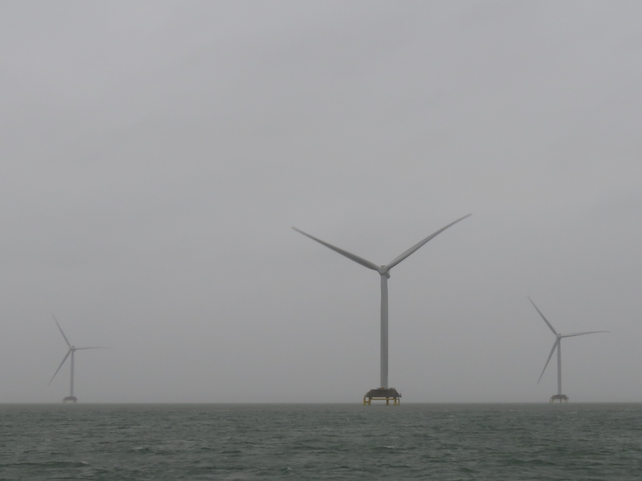 |
Wind Turbines
Position: 56°39.38’N, 8°13.94’E
Wind turbines standing in the shallows just north of the main channel.
|
 |
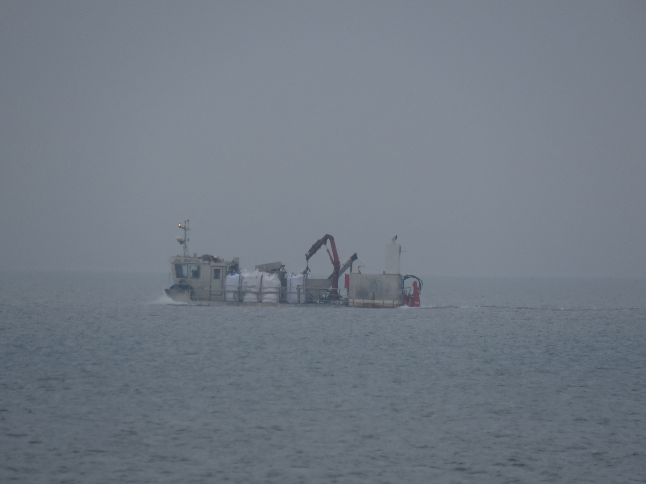
Avance
Position: 56°36.38’N, 8°23.07’E
The dredger Avance at work with waves breaking over the bow. The winds are blowing from the southwest steady in the high 20 kts with gusts above 30 and, despite the sheltered waters and short fetch, reasonable sized waves are forming.
|
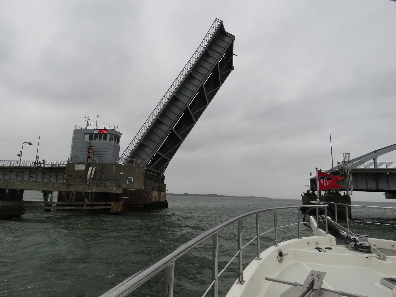 |
Oddesund Bridge
Position: 56°34.77’N, 8°33.53’E
Passing under the Oddesund Bridge. Blog reader Erik Andersen sent us routing information and details for the major bridges we’d pass en route from Thyboron and south through Denmark. The bridge data, difficult to find when you don’t speak Danish, was particularly helpful in providing opening times, communication signals, diagrams and aerial photographs. Thanks Erik!
If you look closely at the top of the bridge control tower (click image for a larger view), you can see the time 10:45 and three red lights vertically below. The operator posted 10:45 to indicate a train would be passing through just before we arrived and he wouldn’t be able to open for us until then (about a 15-minute wait). The three solid red lights indicate that we’re now permitted to pass through the bridge. |
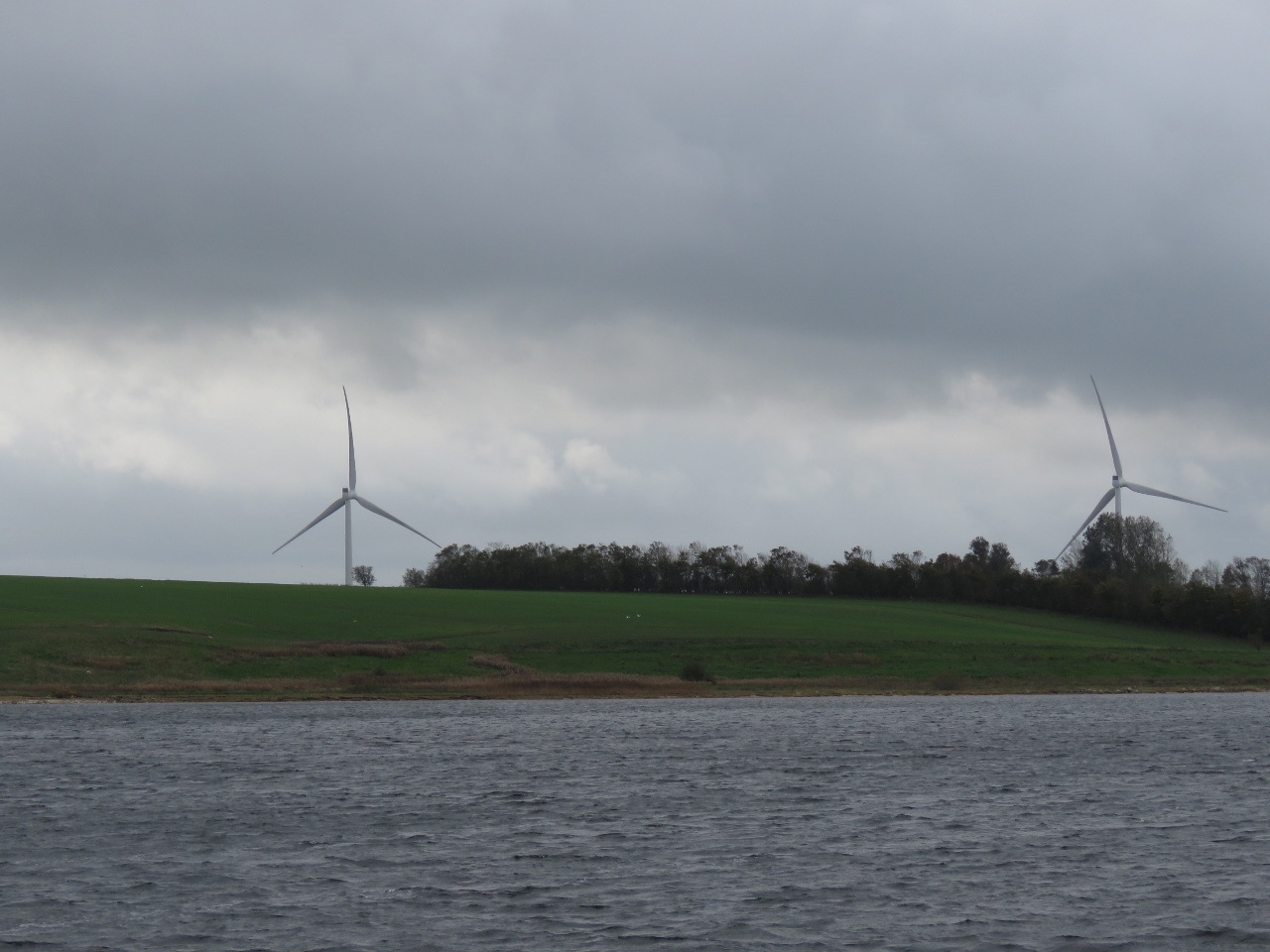 |
Wind Turbines
Position: 56°41.84’N, 8°53.87’E
Wind turbines visible over the southern shore of Harre Vig. After a busy few days in Stavnager, followed by the North Sea crossing to Denmark and a visit to Thyboron, we enjoyed a couple of relaxing nights in this secluded and peaceful anchorage while a weather system passed through.
|
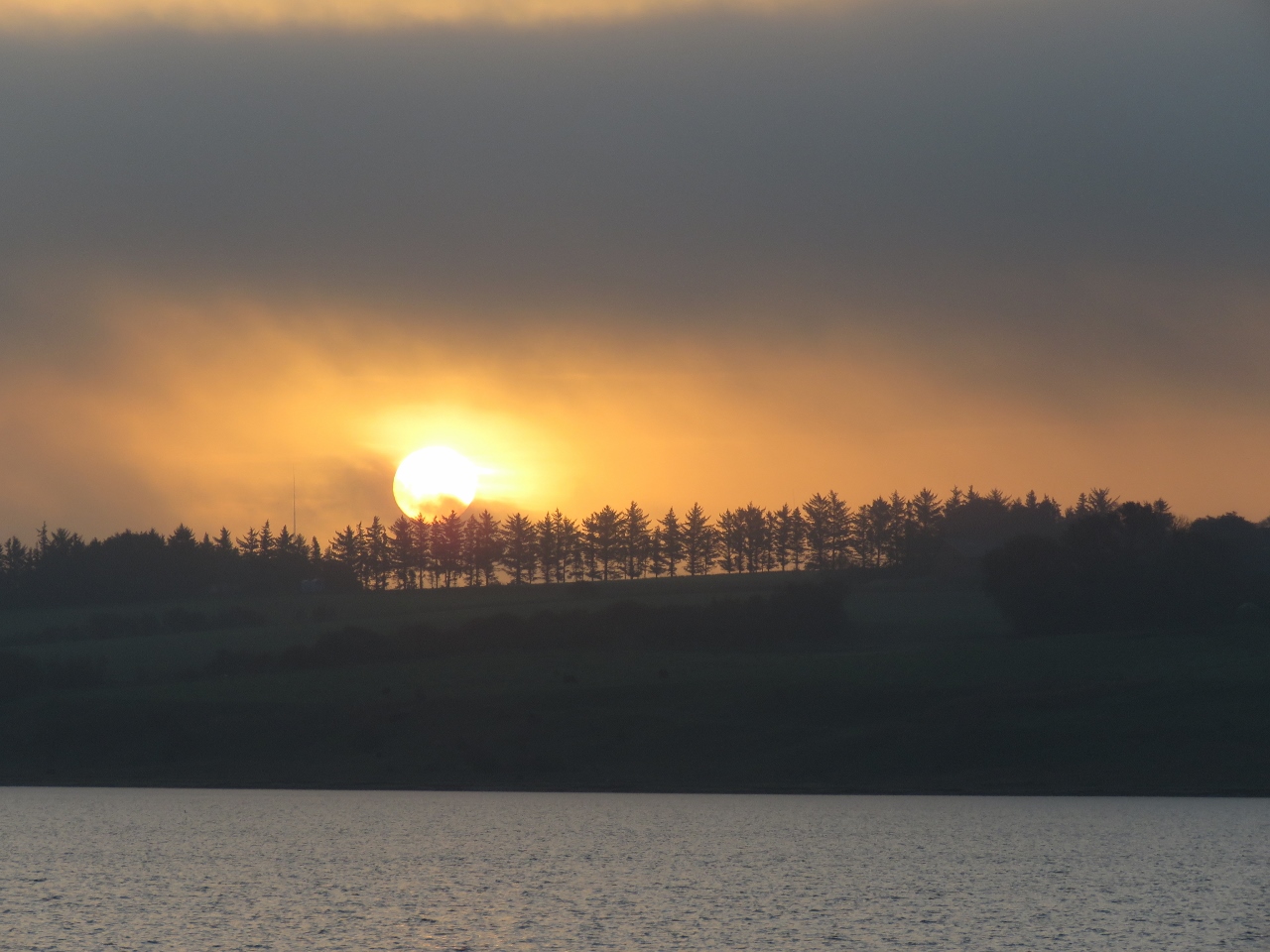 |
Sunrise
Position: 56°41.83’N, 8°53.84’E
Sunrise as we depart the anchorage at Harre Vig.
|
 |
Salling Sound Bridge
Position: 56°45.08’N, 8°51.05’E
Passing under the Salling Sound fixed bridge with a clearance of 85ft (26m). Navigation in each direction is through separate channels on either side of a central bridge footing.
|
 |
Glyngore
Position: 56°45.52’N, 8°51.38’E
The town of Glyngore extending to the tip of Glyngore Point.
|
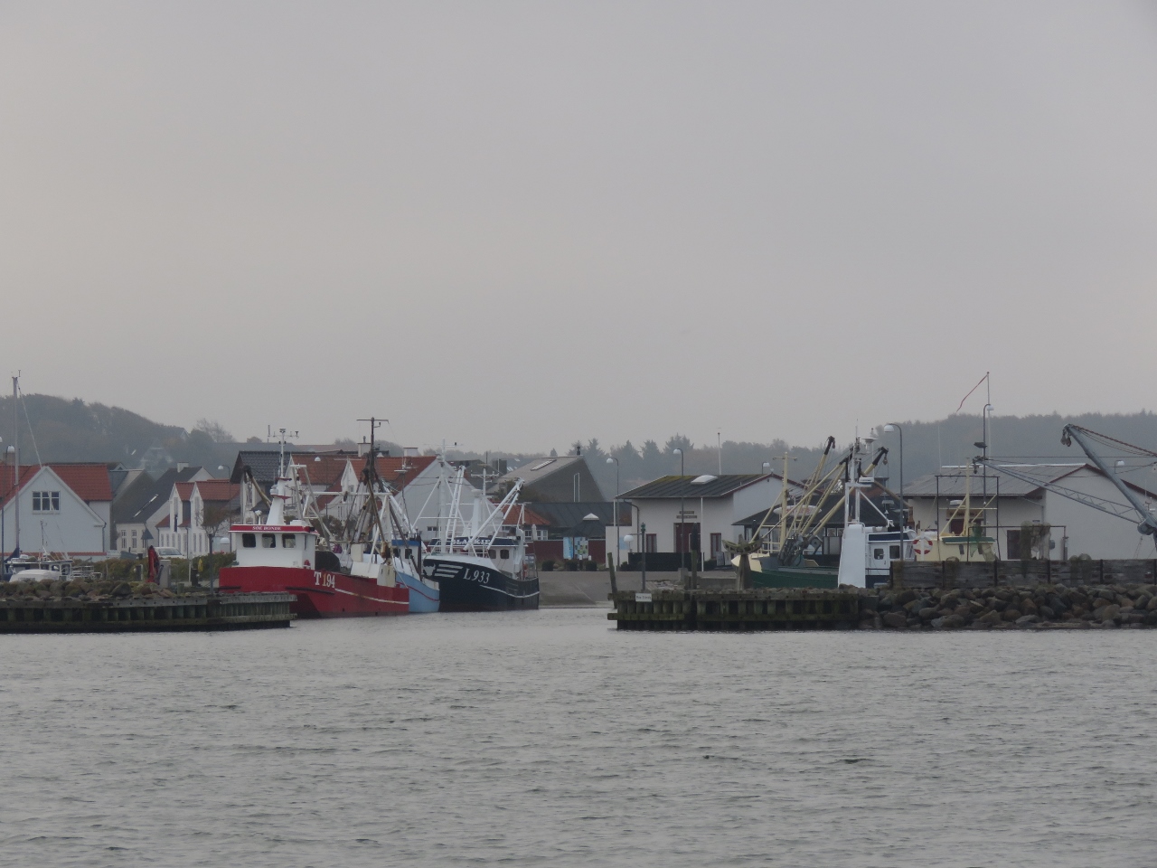 |
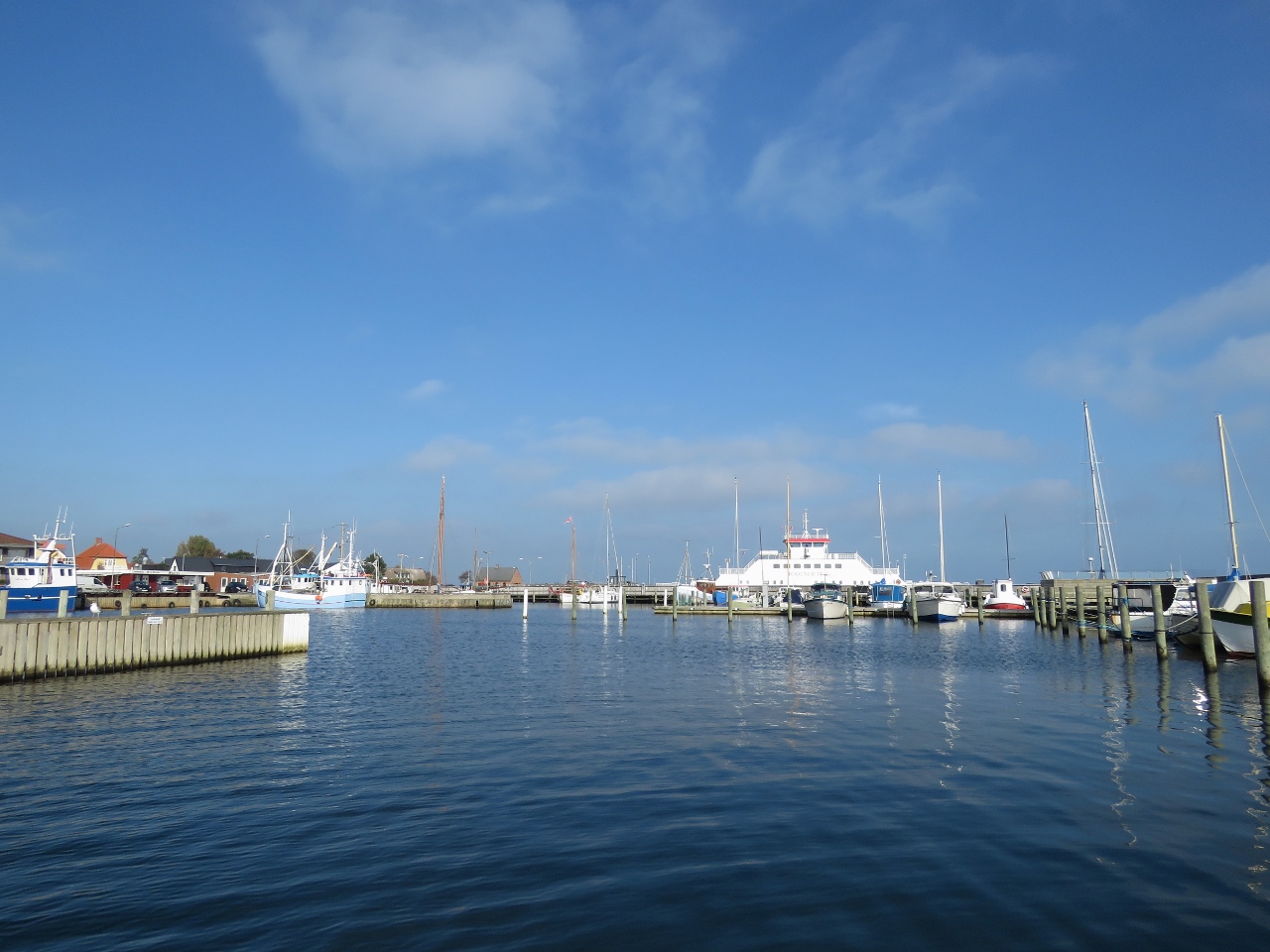
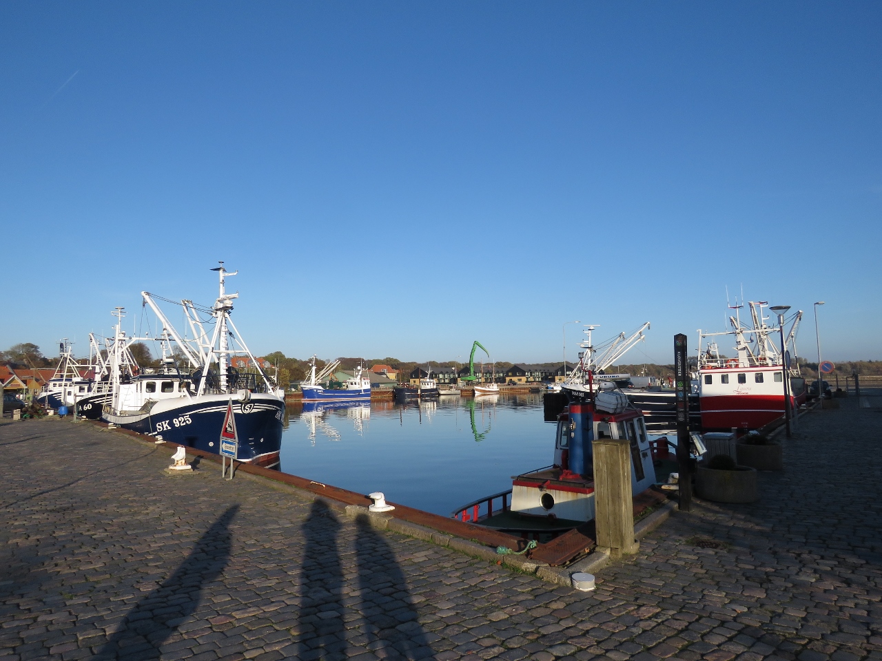
Fishboats
Position: 56°46.08’N, 8°51.78’E
Fishboats in the harbour at Glyngore.
|
 |
Low Freeboard
Position: 56°47.99’N, 8°55.67’E
This small cargo vessel has an incredibly low freeboard. Conditions mustn’t ever get very rough here, or working in this boat pays well. :)
|
 |
Pulling Nets
Position: 56°48.47’N, 8°57.82’E
Fisherman pulling a net off Fur Island. A pretty thick fog has settled in, but hopefully it will clear this afternoon.
|
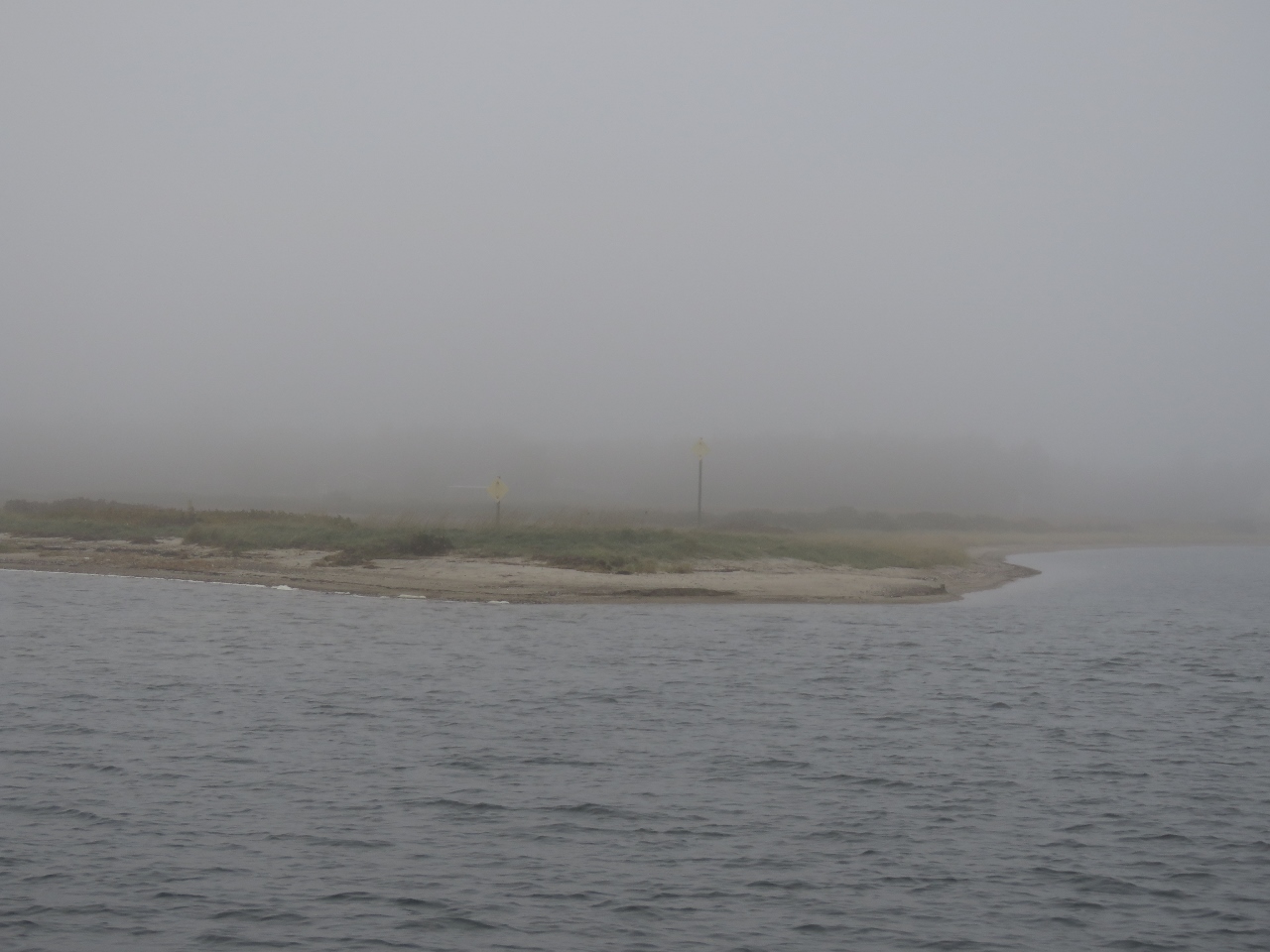 |
Spit
Position: 56°47.80’N, 9°0.77’E
Rounding the spit at the southern end, with Fur Island disappearing into the fog, as we come into the anchorage there.
|
 |
Fur Havn
Position: 56°48.08’N, 9°0.86’E
Looking east across Fur Havn on Fur Island with the ferry to the mainland in the background.
|
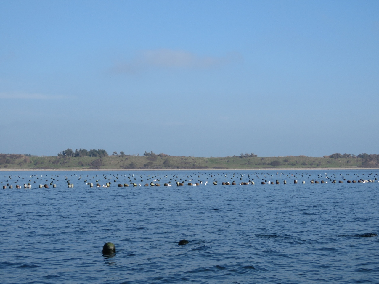 |
Aquaculture
Position: 56°49.00’N, 8°57.62’E
One of many aquaculture leases in the Limfjord.
|
 |
Cliffs
Position: 56°50.51’N, 8°59.32’E
Diatomite (fine-grained sedimentary rock) cliffs on the north side of Fur Island. The diatomite deposits on the island are famous for being full of 50-million-year-old fossils.
|
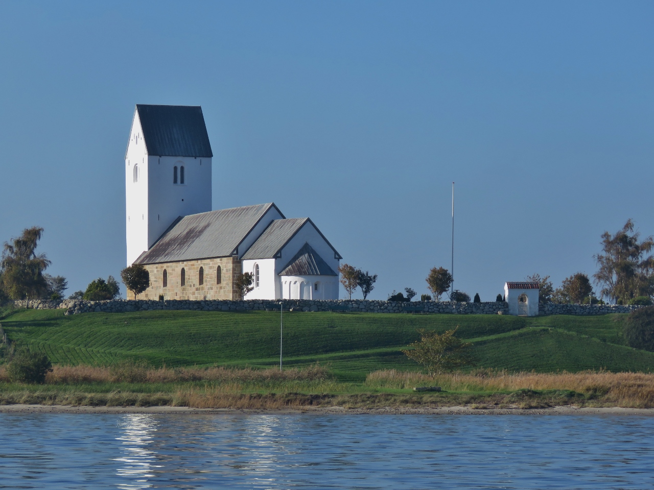 |
Fur Kirke
Position: 56°48.68’N, 9°1.56’E
Fur Kirke on Fur Island, was built in 1126.
|
 |
Tall Ship
Position: 56°48.21’N, 9°1.41’E
This tall ship arrived at Fur Havn as we were circling the island.
|
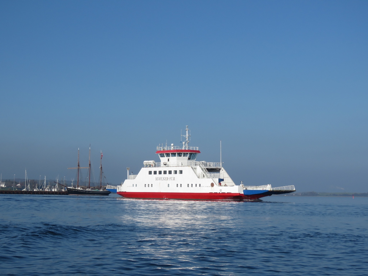 |
Mjolner-Fur
Position: 56°48.03’N, 9°1.39’E
The ferry Mjolner-Fur en route between Fur Island and the mainland.
|
 |
Dirona
Position: 56°48.01’N, 9°0.77’E
Dirona at anchor off Fur Island with the ferry Mjolner-Fur in the distance.
|
 |
Glyngore Point
Position: 56°45.79’N, 8°51.66’E
Looking north across Glyngore Point, that we passed earlier this morning, on a beautiful calm sunny afternoon.
|
 |
Crane
Position: 56°45.83’N, 8°51.89’E
We watched the crane operator gingerly lower this car onto the road. Both crane and car are branded the same—it appears the driver brings both to the job and then uses the car to move around locally. It’s the equivalent of a tender to the truck.
|
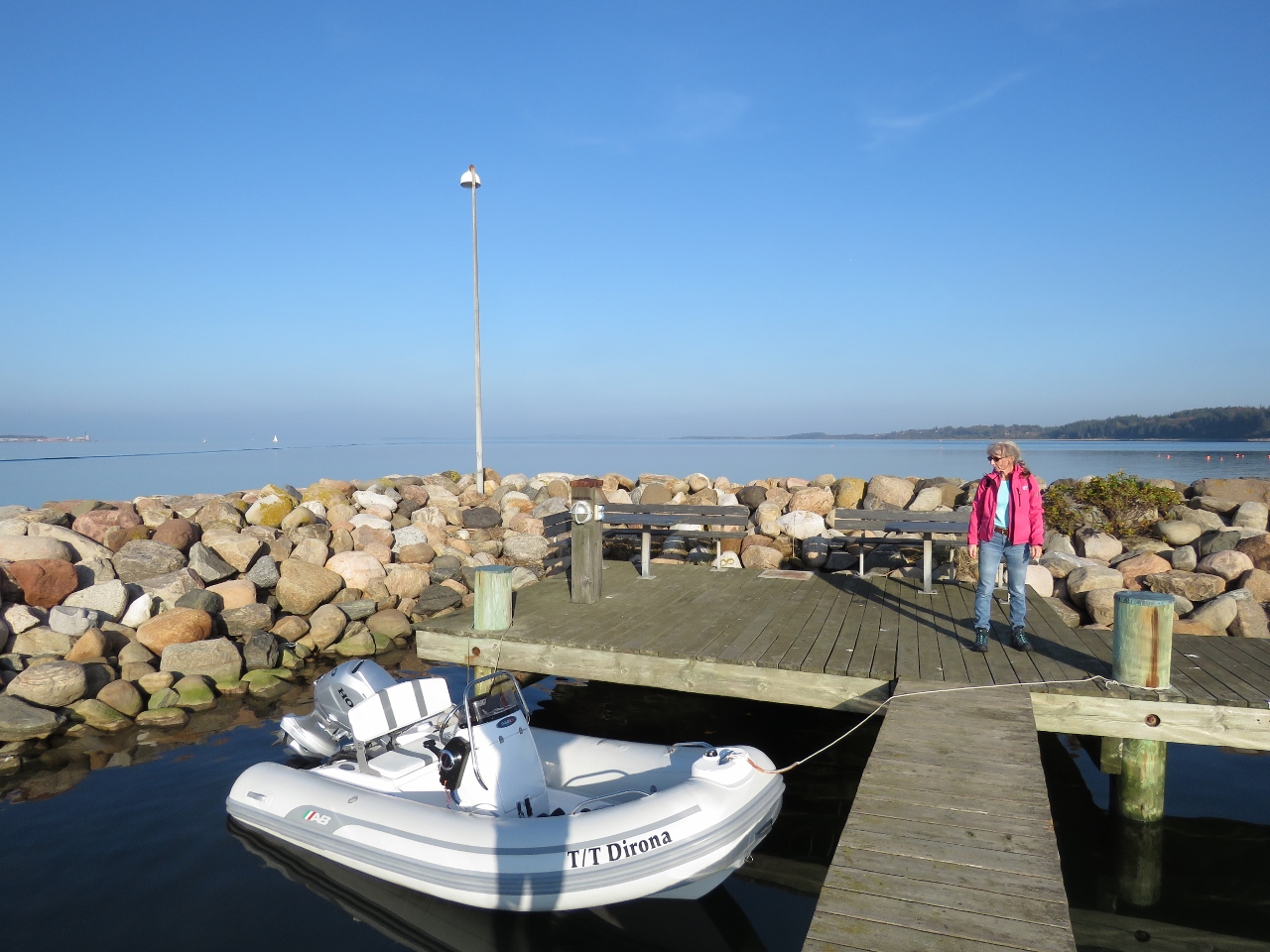 |
Tender Moored
Position: 56°45.88’N, 8°51.93’E
Our tender moored at Glyngore Harbour for a walk around.
|
 |
Glyngore Harbour
Position: 56°45.82’N, 8°51.89’E
Glyngore Harbour is full of sailboats, most without masts. Perhaps this is for travelling through the inland waterways, or their masts have been stepped for the winter.
Update 10/13/2014: Blog reader Lars-Henrik K. Arvedsen reported that the boats must be out of the water by November 11th for insurance reasons. |
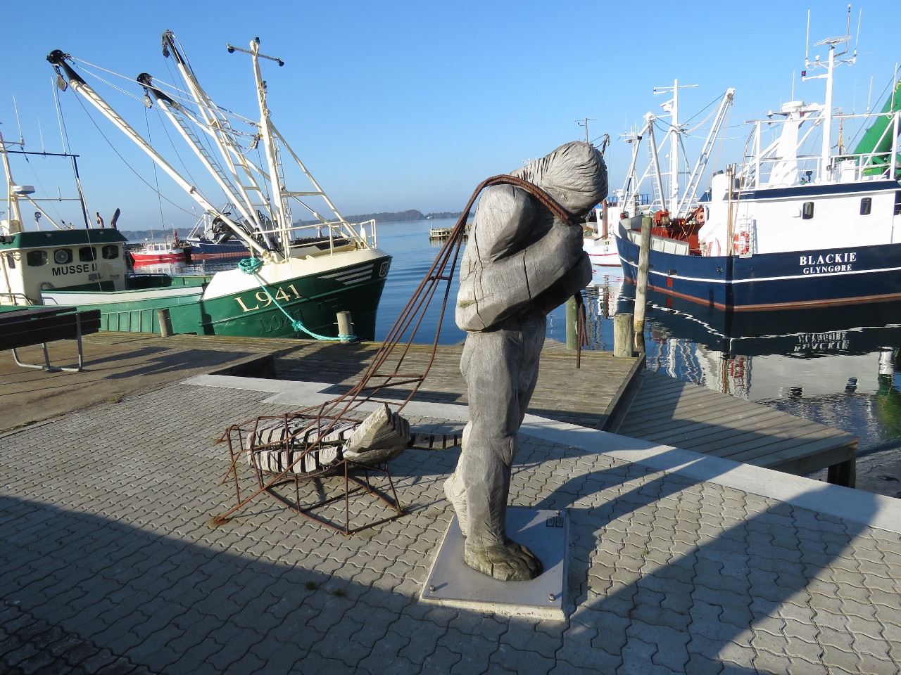 |
Fisher
Position: 56°45.82’N, 8°51.85’E
Carving at Glyngore of a fisher bringing back a catch.
|
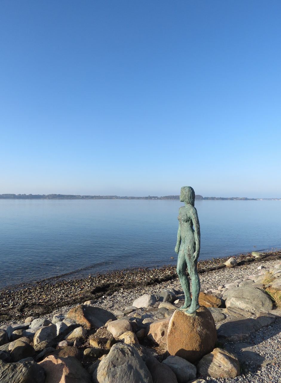 |
Statue
Position: 56°45.83’N, 8°51.75’E
Statue of a woman looking out onto the Limfjord from the Glyngore seashore.
|
 |
Museumsvej
Position: 56°45.71’N, 8°52.07’E
Looking north along Museumsvej in Glyngore.
|
 |
Nykobing Harbour
Position: 56°47.69’N, 8°51.80’E
The commercial harbour at Nykobing, opposite Glyngore across the Limfjord.
|
 |
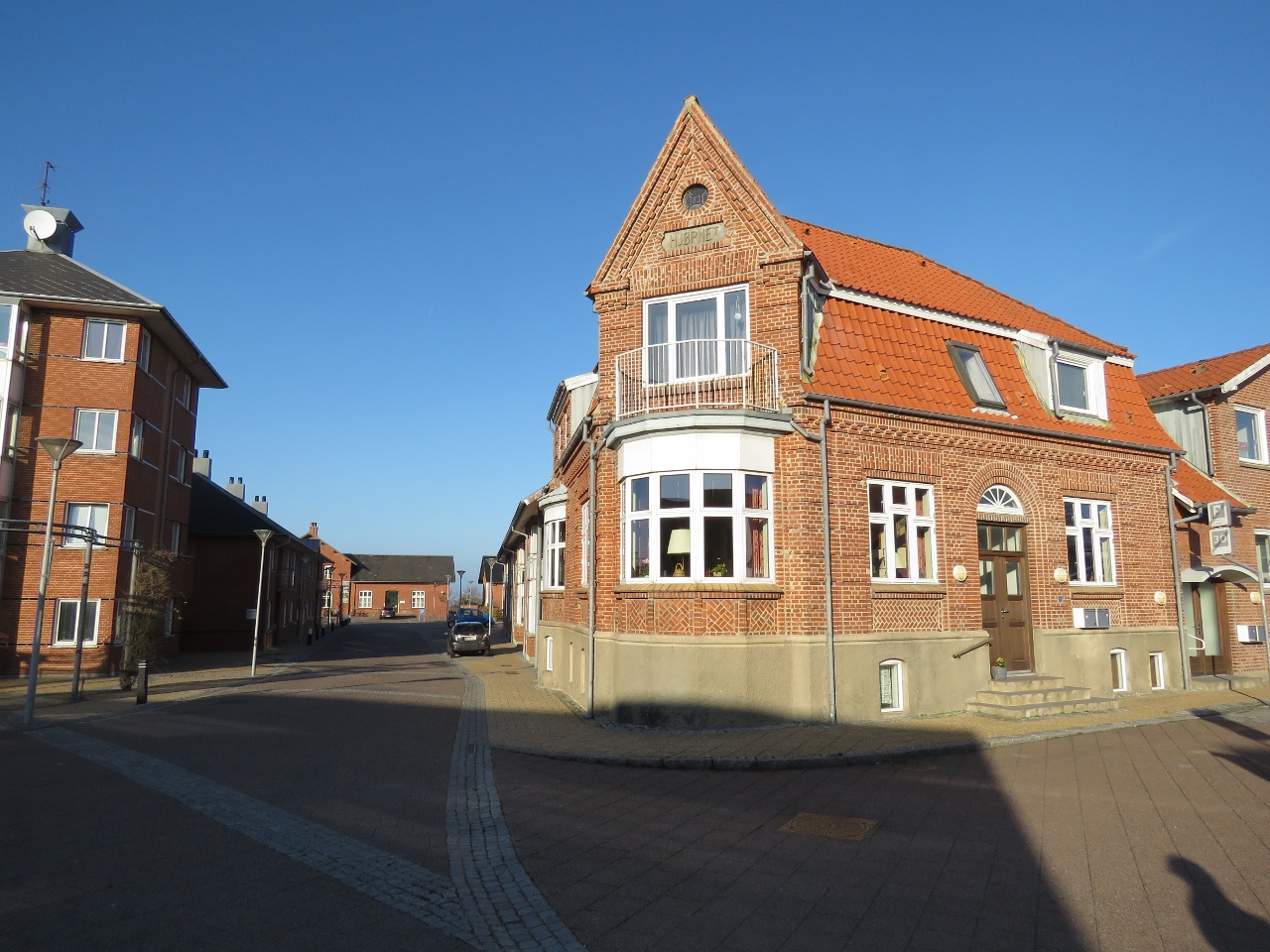
Plaza
Position: 56°47.77’N, 8°51.67’E
Brightly-painted 19th-century buildings overlooking a plaza in downtown Nykobing.
|
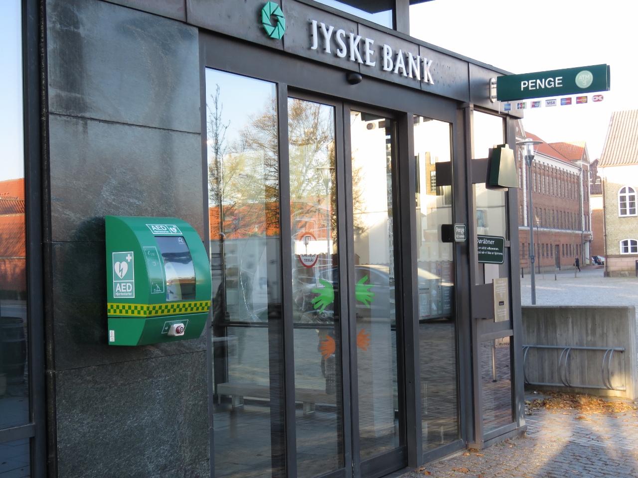 |
AED
Position: 56°47.75’N, 8°51.65’E
We were surprised to see an AED (Automated External Defibrillator) mounted outside on the street. Good idea.
Update 10/13/2014: Blog reader Lars-Henrik K. Arvedsen added that emergency services have locations of these AEDs and can direct a caller to one to use before help arrives. |
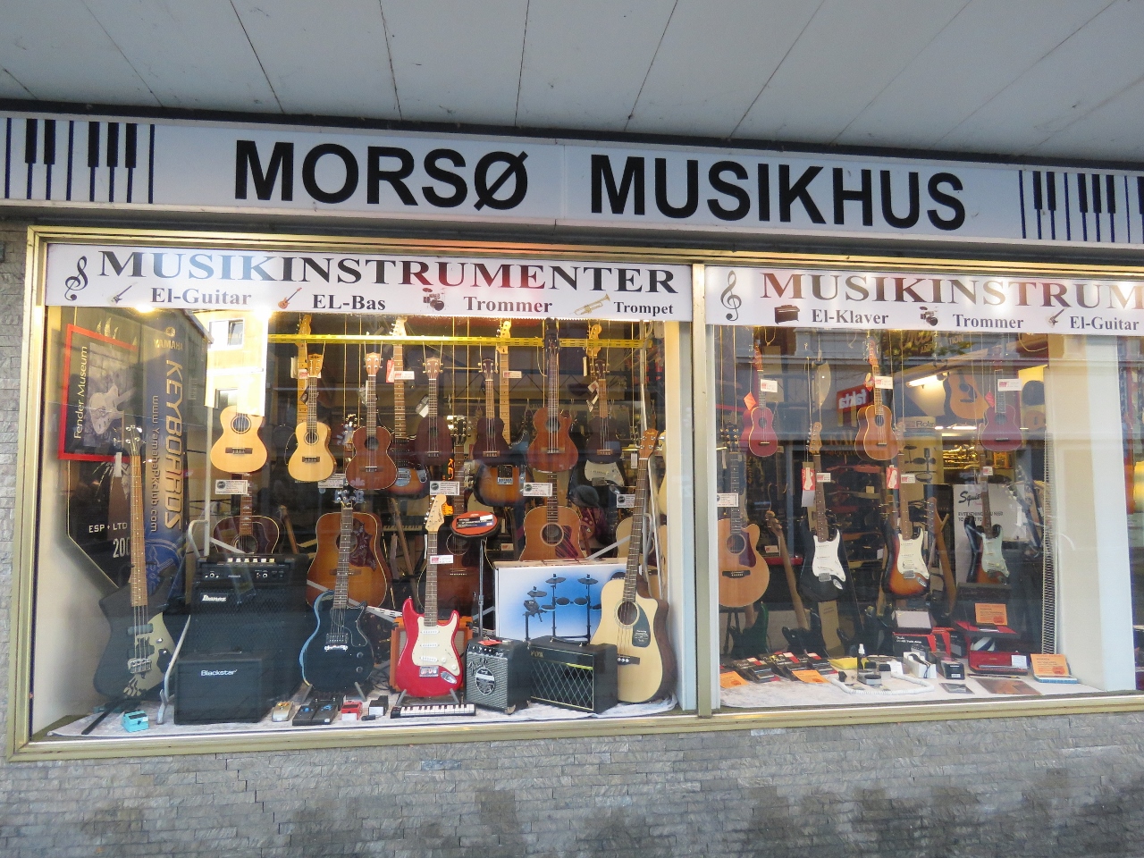 |
Guitars
Position: 56°47.73’N, 8°51.63’E
Lots of guitars and ukuleles for sale at this store in Nykobing.
|
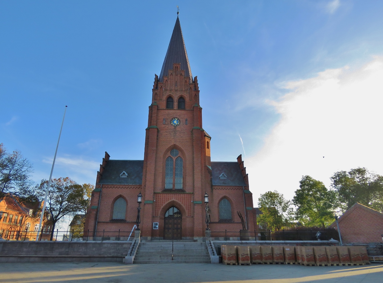 |
Nykobing Mors Kirke Mors Kirke
Position: 56°47.70’N, 8°51.59’E
Nykobing Mors Kirke Mors Kirke, built in 1891.
|
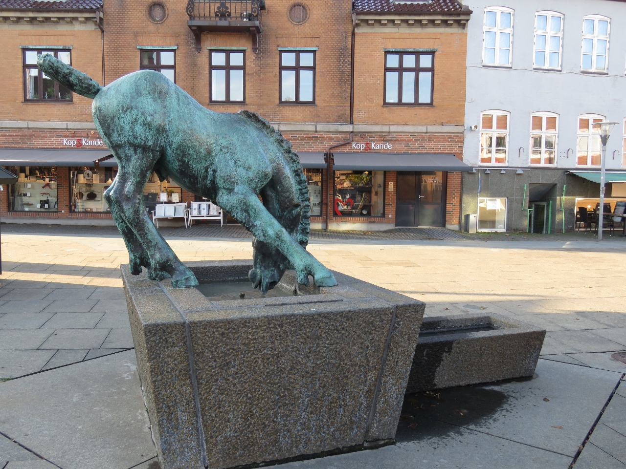 |
Horse
Position: 56°47.70’N, 8°51.59’E
Statue of a horse drinking water in front of Nykobing Mors Kirke Mors Kirke
|
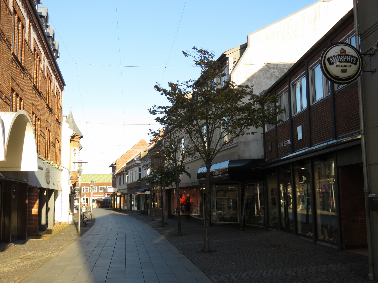 |
Pedestrian Mall
Position: 56°47.66’N, 8°51.46’E
Looking back on the pedestrian shopping mall we’d just walked through. We’d arrived into Nykobing around 5pm, just as the shops were closing for the night.
|
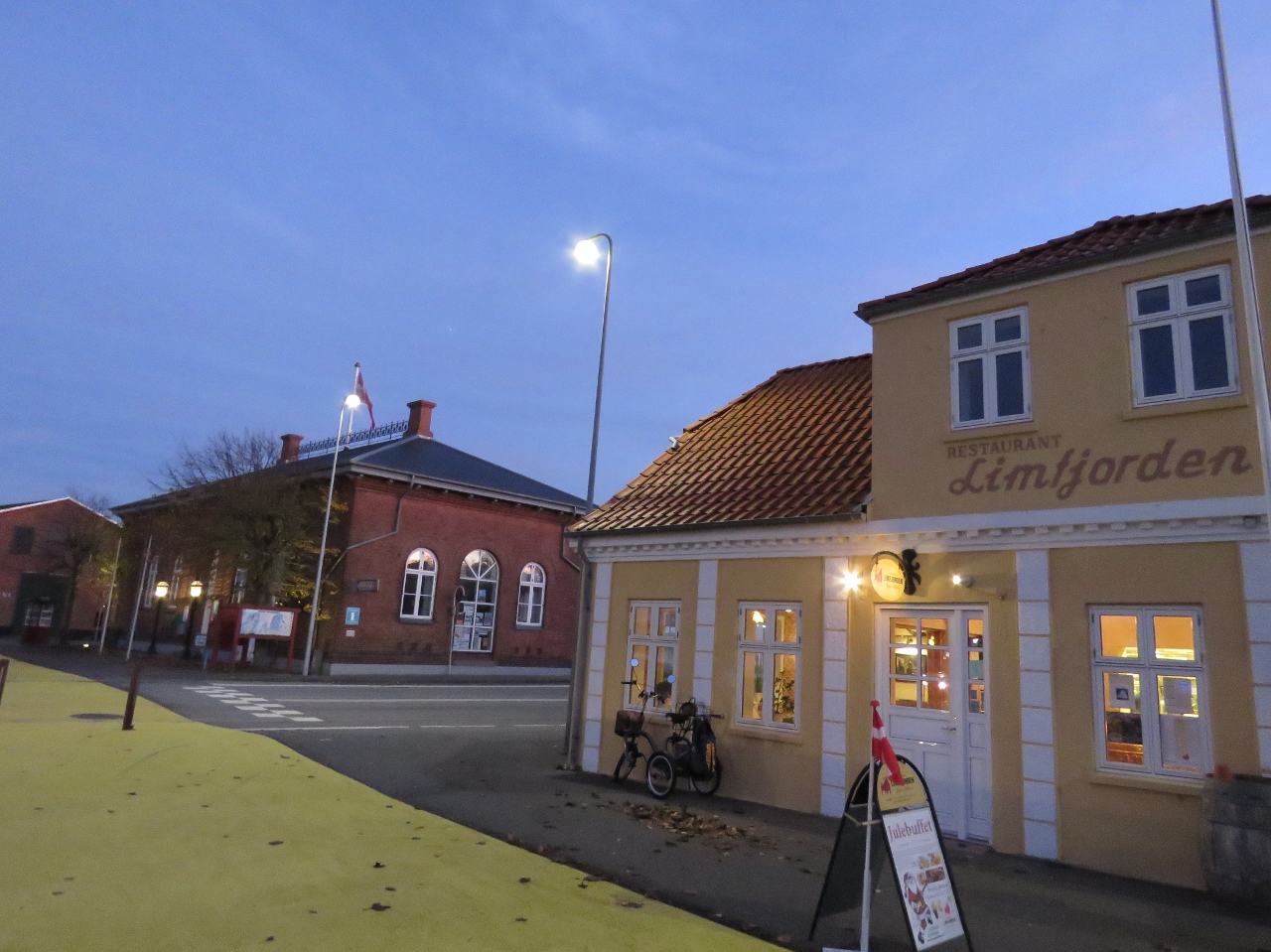 |
Limfjorden Restaurant
Position: 56°47.68’N, 8°51.80’E
We enjoyed steak and red wine at the Limfjorden Restaurant in Nykobing.
|

|
Click the travel log icon on the left to see these locations on a map, with the complete log of our cruise.
On the map page, clicking on a camera or text icon will display a picture and/or log entry for that location, and clicking on the smaller icons along the route will display latitude, longitude and other navigation data for that location. And a live map of our current route and most recent log entries always is available at mvdirona.com/maps. |
If your comment doesn't show up right away, send us email and we'll dredge it out of the spam filter.