We reached the halfway point of our 3,005nm Indian Ocean crossing after ten days at sea. By that time, we’d drained all three of our deck bladders and were back to close to full fuel tanks for the remaining 1,500 miles of the trip. The weather for this first half of the passage has been remarkably good, with winds often below ten knots and mostly calm seas. Around the time we left Australian territorial waters, we finally escaped the strong counter-currents experienced for the first part of the trip.
All systems have been operating perfectly, particularly the Deere 6068AFM75 main engine. Nothing encourages respect of mechanical systems more than being 1,500 miles away from shore and not having seen another boat for more than a week. Amazingly, our KVH mini-VSAT satellite data system stayed connected over 1,000 miles into the Indian Ocean from Dampier. Eventually we did pass outside of its coverage area, and switched over to Immarsat BGAN.
Trip highlights from August 27th through Sept 4th follow. Click any image for a larger view, or click the position to view the location on a map. And a live map of our current route and most recent log entries always is available at http://mvdirona.com/maps
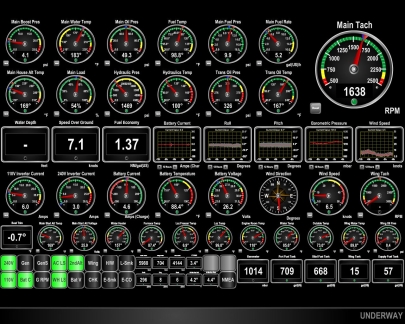 |
7.1 knots
Position: 109 22.65, -21 0.43
We escaped the clutches of that strong counter-current late last night and most of the day have been avereraging over 6 knots while well within our fuel economy goal. The negative current was a bit of a surprise. The recent GRIBs and OSCAR models indicated the current should be slightly with us. The pilot charts did show a 1/2-knot eastbound current to our south in the month of September–it’s possible that current was stronger and further north. Another possibility is that we were in a backeddy of the south-flowing Leeuwin current. Whatever the cause, we’re glad to be free of it and back to making close to the normal speed you’d expect at this fuel economy level in these conditions.
|
 |
Fried rice
Position: 108 41.94, -21 5.15
Korean barbecued beef fried rice for dinner, made with beef we’d cooked prior to the passage.
|
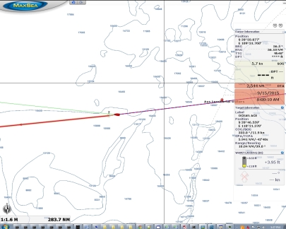 |
Cross-current
Position: 108 37.38, -21 5.67
We passed through a strong cross-current today and NAV mode had the boat angled at 15 degrees to our course to keep us on track. This likely is the West Australian Current that flows northbound several hundred miles offshore. This isn’t quite as bad as a direct counter-current, but it does reduce speed at a given fuel economy.
|
 |
Boat
Position: 108 37.27, -21 5.68
We saw what looked like a fishing boat about six miles away. This is only our third sighting of another boat in as many days.
|
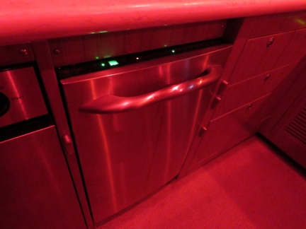 |
Dishwasher
Position: 108 12.12, -21 8.13
Our dishwasher is a standard household appliance and, like most houses, is designed to be on a level surface. If the boat is pitching and rolling substantially, water will slosh out. So we only use it in reasonably calm conditions.
|
 |
6,000 hours
Position: 108 7.07, -21 8.62
We just crossed 6,000 hours on our Deere main engine, and it’s nowhere close to getting a rest–we have 2,426nm remaining in our Indian Ocean crossing. Love that Deere. We put 4,100 hours on our previous boat’s Cummins engines. In total, we’ve now spent over 10,000 hours exploring, adventuring and having fun in boats.
|
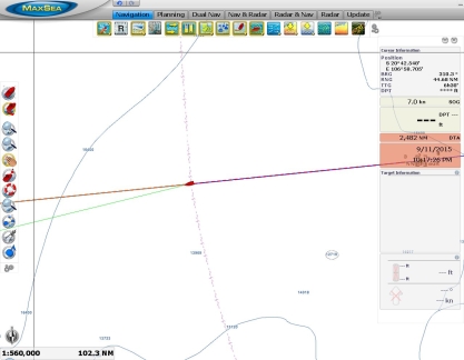 |
2,482 miles left
Position: 107 35.33, -21 11.65
We’ve covered 523 miles and have less than 2,500 remaining. It’s nice to know we still have 2,200 gallons of diesel on board.
|
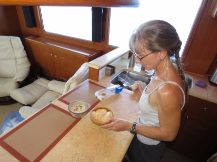 |
Salmon dip
Position: 106 28.84, -21 17.99
Smoked salmon dip for lunch.
|
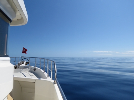 |
Looking forward
Position: 106 21.36, -21 18.69
We’ve been incredibly lucky with the conditions. Winds have generally been less than ten, if not less than five, with only a low, gentle swell. The boat is running perfectly and we’re really enjoying the trip. The only negative to the trip so far are the sometimes very strong counter-currents.
|
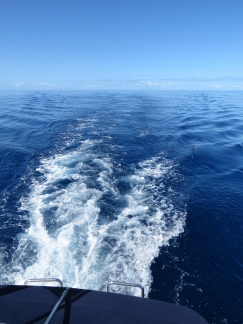 |
Looking back
Position: 106 21.25, -21 18.70
Our wake trailing behind us in the distance with no waves to wipe it away. It feels like we’re on a protected lake rather than 500 miles out into the Indian Ocean.
|
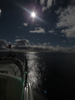 |
Moon
Position: 104 50.77, -21 27.01
Purring along at 7 knots under a moon almost as bright as the sun.
|
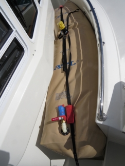 |
Forward bladder
Position: 104 11.64, -21 29.88
The forward bladder, made by ATL, sits securely in the portuguese bridge area and gives us an additional 360 gallons of fuel range. We still strap it down, but nothing short of turning the boat upside down will shift it. We tested this third bladder on the Tasman Sea crossing, but this is the first time we’ve needed it. And the first time we’ve had all three bladders deployed.
|
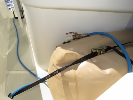 |
Draining forward bladder
Position: 104 7.01, -21 30.22
To transfer fuel from the bladder to the main fuel tanks, we use the same system as described in Fuel for the Crossing with a fuel hose that runs directly from the bladder to the cockpit bulkhead fuel fitting.
|
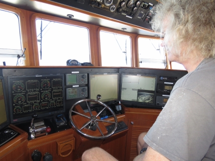 |
Fuel transfer
Position: 104 5.61, -21 30.33
James monitoring the fuel transfer from the forward bladder. Because the fuel bladder is plumbed directly into the cockpit bulkhead, which connects to our fuel transfer pump, the entire volume of fuel can be transfered from the bladder with nobody standing outside and no fuel tank openings exposed to weather and water.
|
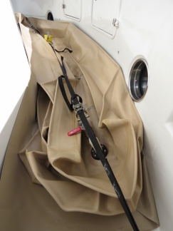 |
Empty bladder
Position: 103 53.46, -21 31.24
The forward bladder completely pumped down, but still secured on deck. We plan to fill it in Rodrigues, even though South Africa is only 1800 miles away, to give us the option to run much faster if we choose to since the weather is volatile and potentially dangerous in that area.
|
 |
Tank levels
Position: 103 51.33, -21 31.39
Nice to see the main tank fuel levels going up 725 miles from shore.
|
 |
Rain
Position: 103 49.03, -21 31.56
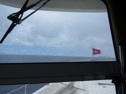
The first rain we’ve seen in months, since well before Cape York in May.
|
 |
Power wash
Position: 103 40.50, -21 32.20
Even though we just got some rain, it was just a small sprinkle and the boat still was crusted in salt from the run to Dampier. So James gave it a quick washdown with the power washer. It’s sooo much nicer to be able to go outside without getting covered in salt.
|
 |
Counter-current
Position: 103 30.63, -21 32.94
We’re back in a strong counter-current again and at times have had to reduce speed to four knots to maintain our fuel economy goal.
|
 |
Laundry
Position: 102 0.37, -21 39.65
We’ve been out for a week, so it’s time to change and launder the sheets.
|
 |
12ft seas
Position: 101 32.75, -21 41.61
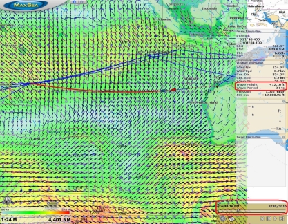
In this screenshot of yesterday’s GRIB data visualation, the red boat icon shows our current position and the blue boat icon our projected position for 4pm on Aug 30th. The slider along the bottom right visualizes the data for a given date and time. The model data indicated we’d be in 12-ft seas on a 14-second period right now and that’s pretty much what we’re seeing. The waves are big, but so far apart that the motion is gentle as we slowly rise up and down each one. And despite the wave height, our fuel-economy-limited speed is back over 6 knots.
|
 |
Still connected
Position: 101 24.99, -21 42.02
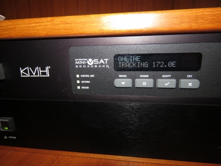
We love our KVH mini-VSAT satellite data system—the service is excellent and the data rates are very good. They cover most of the planet, but unfortunately not the central Indian Ocean, the South Pacific, or either pole. We weren’t expecting it to last much more than a few days out of Dampier, and amazingly, it still is connected nearly 900 miles out. We expect to be out of range in a day or so through. Then we’ll be using Immarsat BGAN and only connecting a few times a day instead of always on.
|
 |
Popcorn
Position: 100 20.13, -21 45.48
A midnight snack of air-popped popcorn.
|
 |
Berries
Position: 99 46.39, -21 47.27
The last of the strawberries and rasberries from Darwin. They lasted well, particularly the rasberries, with no losses. Our Sub-Zero fridge, with it’s excellent humidity control, is a major factor in that.
|
 |
Loose screw
Position: 99 16.18, -21 48.86
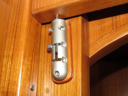
The screws holding the barrel bolt on the guest stateroom door all backed out and the door was almost free to move. It’s amazing what 6,000 hours and a lot of time at sea can do.
|
 |
Conditions
Position: 99 10.79, -21 49.17
The wind came up to around 20 kts overnight, kicking up the seas, and we’ve started to pitch and roll much more than the first few days. The maximum roll still is only around 13 degrees though. That orange indicator light at the bottom of the screen is our V7 (KVH Mini-VSAT) status. It shows green when the system is connected and orange when powered but not able to make a connection. Yesterday we were seeing more green than orange, today it’s more orange than green as we approach the coverage boundary. The bigger seas aren’t helping.
|
 |
Looking behind
Position: 99 5.50, -21 49.44
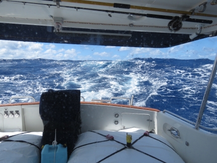
The view behind isn’t nearly as calm as a few days ago. The cockpit fuel bladders have been very stable throughout. Having them filled to capacity makes a big difference, as does securing them tightly to the deck.
|
 |
2,000 miles left
Position: 99 1.32, -21 49.66
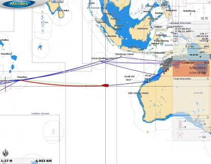
We’ve covered over 1,000 miles already and have 2,000 left to go. The orange line is our route from Dampier to Rodrigues. The other blue lines are various routes we’ve drawn to measure distances for planning and comparing alternatives. Right now we’re almost directly south of Cocos Keeling.
|
 |
Velcro
Position: 98 53.16, -21 50.10
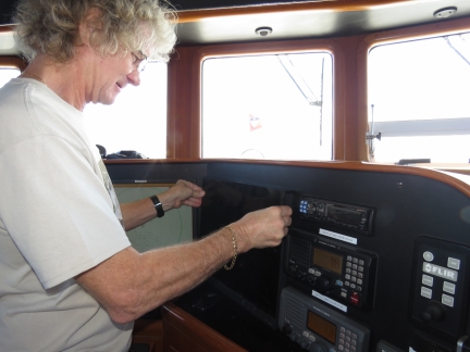
The velcro holding our night-running monitor covers in place was losing it’s grip, so we replaced it today.
|
 |
Spaghetti
Position: 98 30.71, -21 51.29
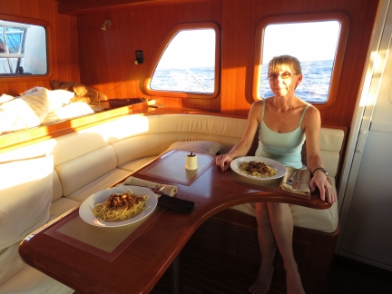
Spaghetti with meat sauce for dinner. Rodrigues is four hours ahead of Dampier so we’ve decided to move the clocks back in two increments so Jennifer can enjoy the sunset before she goes off watch.
|
 |
Stellar Ocean
Position: 96 40.06, -21 55.32
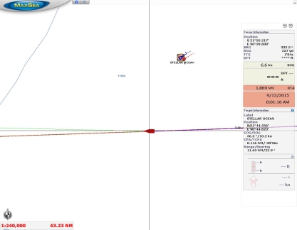
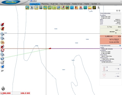
We saw our first ship today since since the unidentified boat we saw five days ago. This one, the 1085ft (331m) cargo ship Stellar Ocean, was displaying AIS. The ship passsed about ten miles ahead of us en route to the port with designation CNTAO, likely somewhere in Asia.
|
 |
Outside coverage
Position: 96 18.35, -21 56.01
We just passed outside the coverage area of our KVH mini-VSAT satellite data system. We had sporadic, brief connectivity until this morning, enough to push the route updates through, but it eventually stopped entirely. We’re amazed it lasted so far–over 1,000 miles into the Indian Ocean from Dampier. Today will be our first day using Immarsat BGAN since arriving in New Zealand.
|
 |
Conditions
Position: 94 37.99, -21 59.22
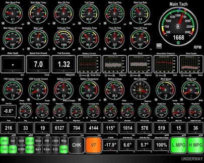
Conditions have calmed down again and the seas are more on the stern than the beam. Winds are below 15 knots, pitch and roll (third and fourth from right on third row) have greatly reduced, and we’re making excellent speed around 7 knots.
|
 |
Are we there yet?
Position: 93 13.04, -21 59.23
Spitfire scouting forward for land—it’s going to be a while little feller. Conditions have remained calm, with light winds and a low swell.
|
 |
Aft bladders
Position: 90 34.78, -21 59.26
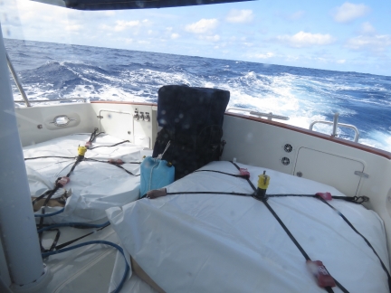
We drained the cockpit bladders today. The bladders have been super-stable on deck, even when the seas kicked up (and the seas are building again today as you can see behind us). Before this use, the bladders were in storage for over two years in the hot flybridge brow, with a small amount of residual diesel inside from their last use. We were a little worried about algae growth, but detected no obvious issues. This time we treated the bladders with a biocide after they were emptied to hopefully head off any potential future problems.
|
 |
Full tanks
Position: 90 9.70, -21 59.26
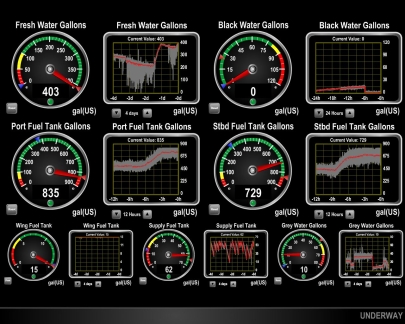
We’ve now got all the fuel off the deck and into the side tanks where it belongs. Nice to see nearly full tanks again.
|
 |
Halfway
Position: 89 41.09, -21 59.27
We’ve a little over halfway now, at 1480 miles remaining. All systems are operating perfectly, especially that Deere main engine.
|

|
Click the travel log icon on the left to see these locations on a map, with the complete log of our cruise.
On the map page, clicking on a camera or text icon will display a picture and/or log entry for that location, and clicking on the smaller icons along the route will display latitude, longitude and other navigation data for that location. And a live map of our current route and most recent log entries always is available at http://mvdirona.com/maps. |
If your comment doesn't show up right away, send us email and we'll dredge it out of the spam filter.

James:
Glad you arrived safely and rested.
What checks do you perform on fuel before filling your tamks?
Rod
Rod asked about fuel quality. The good news is that fuel quality is generally fairly good and, in our 10,000+ engine hours of boating we have received poor quality fuel 3 times.Twice we had high water content and once we had large amounts of rust. All were filtered out without trouble and didn’t cause any mechanical problems and didn’t burn through filters.
The first thing to keep in mind when traveling to secluded or out of the way locations is there is often only a single fuel supplier and it’s rare when we have the fuel to continue the trip without taking on fuel. For example, after 3,005 nm across the Indian Ocean, we are taking fuel from Fuellogic in Rodriques. It’s the only supplier and we don’t have the fuel to reach an alternative source. Fortunately the fuel at Fuellogic looks quite good so we are unlikely to have problem.
Many cruisers filter with a baja filter into the tanks. The problem with this approach is it is very slow. Gravity filtering fuel is a very slow process. We put the additional layer of filtration on the boat rather than between the supplier and the main tanks.
The filtration we use between the side tannks where new fuel is delivered and the main engine is to first filter through a large, high capacity Racor FPO-10 with a 25 micron element. These are large filters designed for fuel commercial fuel delivery pumps. All fuel that gets to our supply tank or wing day tank must go through these filters since we only tranfer through the filter (see: //mvdirona.com/2013/12/dirona-fuel-manifold/ for more detail on our fuel management systems). After the supply tank it passes through a Racor 900 with a 2 micron filter (the previous article discusses why we use a 2 micron element). Then the fuel passes through the first Deere on engine filter which is a 10 micron followed by the secodn Deere on-engine filter which is a 2 micron element. We stock a very large number of spare filter elements.
The short answer is we assume all fuel may be bad and always filter very agressively. Since we have 4 layers of filtration, we don’t see the Baja filter option as worth doing. Where we have a choice, we buy from high volume suppliers and we try not to purhcase fuel just after a delivery which will stir up sediment. However, the latter rule can’t always be followed since some small fuel distributors don’t keep enough fuel on hand so need to take delivery in order to be able to get us the fuel we need.
So far we have had pretty good luck with only 3 instances of poor fuel in over 10,000 operating hours. And, in these three cases the fuel quality wasn’t really all that bad and just cost us a filter element or two.
James
Did you run straight from Australia to Rodrigues? No stops?
James B Colter
N43 Genesis
Correct. We ran the direct great circle run from Dampier Australia to Rodriques. At 3,005 nm, it is a long run. Our previous longest between fueling was 2,600nm between Hawaii and Marquassas but we did stop in Palmyra and Fanning Island. The provious longest uninterupted run was was San Francisco to Hawaii at just over 2,000 nm.
This morning we will purchasing 6,900 liters of fuel
I think many of have breathed a sigh of relief when your posts announcing your arrival. Now you can change your oil without too much concern. ;)
Awesome passage and thank you for allowing us all to ride along.
Thanks Tim. The main engine oil is indeed changed and all other maintenance is caught back up. We still need to pick up a new load of fuel tomorrow but, other than that, we’re good to go. Yesterday we hiked up a hill with a view over the city and a 360 degree view of Rodrigues. The view from there strongly urged us to rent a car or a scooter and explore the island more.
Hi,
I’ve been following your exploits with enthusiasm. Congratulations on arriving in Rodriquez. Your posts and info along the way have been great.
Thanks HR. We had a good crossing with mostly favoravle weather but, after 20 days in open ocean, it is good to now be here in Rodrigues.
Thanks for sharing all those tips on running long distances; especially moving fuel and engine load. Glad to learn Rodrigues was so close on your last posting. You’re probably docked now reading this and happy to stretch those sea legs :)
James & Jennifer,
I have slept like that on 40ft boats wedged between stuff so thought that was funny as it seems that is just part of the boating life. :)
Virtual check again shows 194 degrees. I know still tolerable but is this caused by the current working against you or we just seeing some slight temp spikes due to the continuous run?
Thanks for the engine room check Tim. Engine temps vary acording to load and external water temp. Deere is rated continuous running up to 212F and alarms and derates at 231F so my general rule is don’t run more than 212F.
Hi James, Jennifer and Spitfire.
I am really enjoying your blog, i am glad you enjoyed your time in Darwin as i was fortunate enough to live there for 3 years in the 90’s, it is a lovely part of the world.
Excuse my question as i am new to this and so it is probably a bit basic. I notice on your display image the disparity between fuel levels in the Port and Starboard fuel tanks. Do you have a level where you change which tank you draw fuel from? or do you just wait till the boat is listing to one side? :-)
steve
Steve, that’s a good question on where to pump the fuel from and why the side tank levels end up being different. A common way to run these boats is to gravity feed the side tanks into supply tank. We chose to explicitely pump for two reasons: 1) if there was a leak in the fuel delivery and filtration system, we wouldn’t lose what is in the side tanks so would remain capably of completing the trip, and2) we like to run all fuel heading into our supply tank through filtration.
So we pump fuel explicitly. How do we decide which tank to pump from? I programed a dash guage to show the 15 min average boat roll. If it’s leaning port, I pump from port. If leaning stbd, we pump from that side. There will be differences in boat trim due to weight (whether the dinghy is on the boat deck or not) and wind and wave conditions can make a differnece as well. In fact, 25 kts of wind on the side of the boat can put more than a degree of list into the boat. So, we just consume fuel from whichever tank cancels any list.
Hi James and Jennifer.
We talked briefly at Bell Harbor before you left and it’s been fun following your adventures.
One question, what does the sky look like at night when you turn the lights off and you’re 1,000 miles from any artificial light?
Great question Bruce and on many a nice still night while the boat is gently swishing through the water, I shutdown the lights and go up top and enjoy. In fact, the boat produces a fairly small amount of ambeient light even with the lights on that you can still enjoy the nigth sky.
You asked what the skey was like. Two things jump out immeidately for a ex-city dweller like myself. The first is that intead of seeing “the stars” which of course are still there. What’s most striking is there are so many more. It feels like you can see layers deeper into the nightime star scape. Whent the light polution is gone, the small stars jump out. It’s amazing.
The second observation that is really quite striking is instead of seeing stars all over the sky, when the light polution is gone, you can distinctly see the band of high star density that makes up the Milky Way. It’s a much brighter band across the sky.
Not much beats cutting through the water in the middle of the night in light weather 100s or even a thousand miles from shore.
Hope all is well. I noticed on the environmental auto-updates that you have remarkable temperature consistency (above water temp). Guessing that is reading inside cabin temp and not outside air-temp? So…how has the outside air temp been? Humid?
Eric was asking about the environmental temp stability and if it was possible that we were reading internal temperature. No, it’s the external temperature but, remember, we are showing averages. The temps over the last week have ranged between 68F and 76F which isn’t much. But, since we report averages, it looks even more stable. We’ll consider impplmenting max and min temp readings for the next trip. I think that would give a better view of what we are seeing. Thanks for the question/suggestion.
James
My guess for the delta T variation is the wind direction/speed wrt to engine room exhaust location. Just a thought. Put tell tales on the exhaust grills and see how they react to different wind speeds/direction A good cross breeze over the griils should improve engine room exhast air flow thus reducing delta T
Rod
I’m sure you are correct that it’s the effect of different wind conditions at the vents. There is also a possibility that, under some conditions, we will take in some exhuast air at the intake.
I suppose it would be easy to place the vents to avoid this entirely but the first priority of vent placement is to get them high and away from water and wave action. I like those priorities first :-).
James
How is the engine room cooling situation on a long run with reasonably warm water temps?
Your post on the subject reminded me of the efforts we expended using different packing patterns to get uniform temp distribution in kilns, max temp 1300 deg C (firing vitrified grinding wheels)
Thx
Rod
Rod, the cooling solution seems to be working well. The ER is 104F right now which is really nice. It used to be 120F and higher down there. I almost love working in 104 :-).
The DeltaT ranges between 27 or so to a high of 33F. It seems to change a bit based upon wind conditions which seems weird and/or unlikely but it does seem to make a difference.
I have to say I am about as excited as a person can get without actually being out there with you both. I just had to write and let you know I caught myself going back thru your pics at the gauges and doing virtual engine room checks to compare the numbers. I am sure you already know but your main is running great. The water temp has stayed in the 180-189 degree range depending on your rpm’s. Looking absolutely wonderful and hope your weather continues to stay behaved till you get to land.
Nice blog and great boat and keeps me checking in everyday for the latest news.
Tim
Hi Tom and thanks for the virtual engine room checks :-). It is going well here although the storm we have been expecting appears to be arrivings. Winds are 25 gusting to 30 and the swell is right on the beam and tossing us around a bit. But, given what a good run it has been so far, it’s probably time we got some weather.
We have 870 gallons of diesel and only 669 nm remaining. All on track.
I have enjoyed reading your blog. Glad your having such a safe and trouble free voyage! I can not get your map to load at all. My browser is showing “Loading Map”. I have tried my android phone browser on my phone and google chrome and Internet explorer on my Laptop. I am not sure if this is an issue on my end or on the website. I look forward to reading about the rest of your trip! Thannks a bunch
Ed
Wichita, ks
Ed, I can’t find any issues with the web site and we didn’t get any other commments on it. It could have been a transient issue. Could you try it again and email me with whatever info you have or what you are seeing if there is a problem (jrh@mvdirona.com). Thanks for letting us know.