We often fly close to Mt. Rainier when travelling in and out of Sea Tac airport, and love getting a close-up look of the iconic volcano. For an even better view, Jennifer took James on a surprise helicopter tour of the three major mountains in the area: Mt. Rainier, Mt. Adams and Mt. St. Helens. The tour was initially scheduled for James’ birthday in August, but was postponed to the fall because because Canadian forest fire smoke impeded visibility back then.
Starting from the Atomic Helicopters’ office in Boeing Field, we boarded their Airbus H130 and flew southeast towards Mt. Rainier, over notable landmarks such as the Blue Origin headquarters building in Kent and the Mosby Farms corn maze. Then we made an exciting pass near water level along the winding path of the Green River.


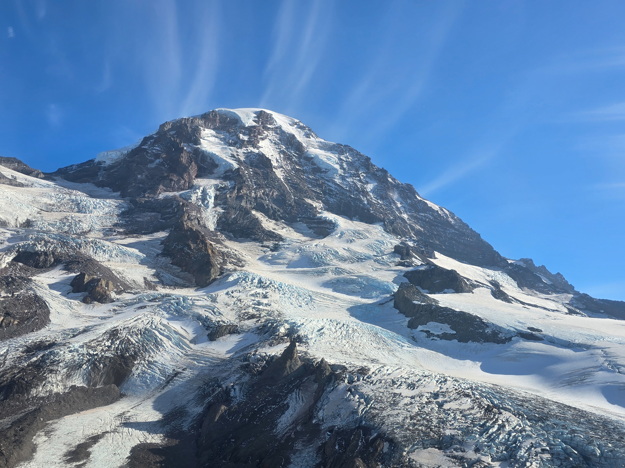
And then we were at Mt. Rainier, the highest mountain in Washington at 14,411 ft (4,392 m). The mountain is clearly visible at vantages throughout the state, including Seattle. The height makes it a popular, but difficult, mountaineering location—an average of two people die every year in attempting the summit. Seeing “the mountain” from a airplane is pretty exciting, but nothing compared to being a few hundred feet above the glacier-covered peak. The weather was crisp and clear, and the scenery was fabulous.


Mt Adams is the second-highest mountain in Washington at 12,276 ft (3,742 m). We rarely get a view to it, as few of our flight paths pass nearby and it’s not visible from Seattle. We swooped around the mountain, enjoying the herds of mountain goats and vistas beyond.
Mt. St. Helens was the third and final destination on what Atomic Helicopters calls “The Trifecta” tour. The mountain famously erupted in 1980, killing 57 people and destroying over 200 homes, 47 bridges and miles of railway and roads. The eruption reduced the mountain’s elevation from 9,677 to 8,363 ft (2,950 to 2,549 m), and produced a debris avalanche of 0.6 cubic miles (2.5 km3) in volume that dramatically altered the surrounding landscape. It was the largest-known landslide in recorded history.
As we approached, we could see the lingering effects of the eruption: sun-bleached, flattened trees oriented in the direction of the explosion, thousands of uprooted trees still clogging the surface of Spirit Lake, the horseshoe-shaped crater where there once was a peak, newly-created canyons where the debris avalanche had flowed, and Castle Lake that was formed when the avalanche dammed South Fork Castle Creek.


Returning back towards Seattle, we got a distant view to Mt. Rainier over Riffe Lake. The lake was created in 1968 by the Mossyrock Dam, the tallest dam in Washington at 606 feet (184 m). We then landed and alighted briefly at what would have been a wonderful wilderness camp site before returning to the air and passing over Joint Base Lewis-McChord, massive at 86,000 acres (35,000 ha).
From the Tacoma Narrows bridge, we flew over Point Ruston and nearby Quartermaster Harbor, both places we’ve frequented, and continued north over downtown Seattle, getting a close-up view to the patio of our apartment in the Insignia complex, before returning back to Boeing Field. We had a fabulous adventure and would love to do it again.


Our Trifecta route is shown on the interactive map below. Click here for a full-page map.
If your comment doesn't show up right away, send us email and we'll dredge it out of the spam filter.